List of streets and squares in Berlin-Westend

The list of streets and squares in Berlin-Westend describes the street system in Berlin 's Westend district with the corresponding historical references. At the same time, this compilation is part of the lists of all Berlin streets and places .
overview
Westend has 41,882 inhabitants (as of December 30, 2019) and includes the zip code areas 13597, 14050, 14052, 14053, 14055, 14057 and 14059th The district is north through the Charlottenburg Chaussee and the Spree, to the east by the circle line , by Bounded to the south by the Grunewald and to the west by the Stößensee and the Spandauer Vorortbahn .
Parts of the federal autobahn 115 and 100 run through the district, 11,260 meters of which are classified as large-scale (I) and 830 meters as superordinate (II) according to Berlin's road development plan, 2,670 meters are not classified. The federal highway B2 / B5 with 5060 meters in the district also belongs to the large-scale system. The main road system with large-scale importance consists of 9,480 meters of city streets (or parts of) Halenseestraße, Jafféstraße, Masurenallee , Messedamm, Neue Kantstraße , Reichsstraße and Spandauer Damm . In addition, there are 5,510 meters of main roads of regional (III) importance and 5,670 meters of city streets (IV) in the Berlin road system, which complement the main road system.
Westend was established on May 1, 1866 as a villa colony on the site of the Spandauer Berg and in 1878 was attached to the (then) independent city of Charlottenburg . The name refers to the Westend district of London . The street system is defined with the first streets around 1867 (compare the list , column 4), which were planned and created by the “Kommandit-Genossenschaft auf Aktien” under the leadership of the banker Heinrich Quistorp (≈ 1826–1902). The planning as a villa suburb can be found in the frequent use of the suffix "-allee" in the street names. The settlement and development was promoted by the Berlin Horse Railway, which was extended in 1879, and by the opening of the Charlottenburg-Westend railway station in 1877. In 1908, the transport company opened the Reichskanzlerplatz underground station (today: Theodor-Heuss-Platz underground station ). At the beginning of the 20th century, further development began, the area New West End was created with an extended road system. In connection with the preparations for the 1936 Olympic Games , the National Socialists had a large sports area built and the surrounding area provided with streets, squares and buildings. In this context, the transport infrastructure was also expanded.
The ten places in the Olympiapark marked with “(*)” are included in the official street directory under street numbers 16909–16019. They have the character of a private property, but are publicly accessible for pedestrians and are only subject to limited right of way. The system paths in the garden colonies are also private paths that belong to the residents and garden associations. These roads, which are under other responsibility, are not included in the list. Only through development plans at the end of the 1970s did the Charlottenburg district influence uses, for example parking spaces for residents (B-Plan VII-11) or driving rights on the paths in order to protect the surroundings.
Overview of streets and squares
The following table gives an overview of the streets and squares in the district as well as some related information.
- Name / location : current name of the street or square. Via the link Location , the street or the square can be displayed on various map services. The geoposition indicates the approximate center of the street length.
- Traffic routes not listed in the official street directory are marked with * .
- Former or no longer valid street names are in italics . A separate list may be available for important former streets or historical street names.
-
Length / dimensions in meters:
The length information contained in the overview are rounded overview values that were determined in Google Earth using the local scale. They are used for comparison purposes and, if official values are known, are exchanged and marked separately.
For squares, the dimensions are given in the form a × b for rectangular systems and for (approximately) triangular systems as a × b × c with a as the longest side.
If the street continues into neighboring districts, the addition ' in the district ' indicates how long the street section within the district of this article is. - Name origin : origin or reference of the name.
- Notes : further information on adjacent monuments or institutions, the history of the street and historical names.
- Image : Photo of the street or an adjacent object.
| Name / location | Length / dimensions (in meters) |
Origin of name | Date of designation | Remarks | image |
|---|---|---|---|---|---|
|
Maple Avenue
( Location ) |
940 | Maple , genus of plants | around 1867 | The street lies between the northeast corner of Theodor-Heuss-Platz / Kaiserdamm and Spandauer Damm and partly parallel to Soorstraße . The name was chosen after the first planting with a typical avenue tree when creating the street. Here it is the most easterly in a district around Branitzer Platz in which the streets on the western edge of the city of Charlottenburg are named as avenues after tree species. |

|
| Acacia avenue
( Location ) |
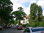
1000 | Acacia , genus of plants | around 1867 | The street lies between Bolivar- and Ahornallee. At the time it was named, the avenue only went as far as Kirschallee. Between 1912 and 1915, the route to Braunschweigallee (today: Bolivarallee ) was also named. It is located in a district around Branitzer Platz in which the streets on the western edge of the city of Charlottenburg are named as avenues after tree species. |
|
| Alemannenallee
( Location ) |
190 | Alemanni , ancient and early medieval population group, which is assigned to the West Germanic cultural area | Apr 13, 1909 | At first it was part of the street 2 of the development plan in Westend. It is located between the southern side lane of Heerstraße and Frankenallee on Karolingerplatz. |

|
| Old avenue
( Location ) |
700 | The name probably refers to the old trees along the former forest path through the Grunewald . | from 1924 | The previous name between 1922 and 1924 was Iltisallee . It is located between Eichkampstraße and Kühler Weg on the southern edge of the district in the locality of Eichkamp . |

|
| Altenburger Allee
( Location ) |
240 | Saxony-Altenburg , duchy and federal state of the German Empire | Apr 13, 1909 | In this quarter around Reichsstrasse , the streets are named after the countries of the German Empire , which was proclaimed on January 18, 1871 . The first name was street 34b of the development plan in Westend. Dei Strasse is located between Reichsstrasse and Bolivarallee (opposite Ulmenallee). |

|
| At the thorn bush
( Location ) |
60 | symbolic of a thorn bush planting | May 28, 1929 | The first name out of a corner street was Square D . The short street is between Waldschulallee and Cordesstraße, parallel to Eichkampstraße. It is located in the locality of Eichkamp . |

|
| At the lilac bush
( Location ) |
180 | Lilac , a genus of plants from the olive family | Aug 16, 1928 | The road lies between Lärchenweg and Waldschulallee (opposite Am Dornbusch). The first name was street G 17 . It is located in the locality of Eichkamp . |

|
| At the bell tower
( Location ) |
100 × 100 | near the bell tower of the Olympic Stadium | Apr 23, 1936 | The square is between Friedrich-Friesen-Allee , Passenheimer and Glockenturmstraße . The bell tower is the landmark of the Olympic Stadium . The entrance to the Waldbühne is on the square. |

|
| At the grove
( Location ) |
200 | Grove , derived from the term "Totenhain" (in relation to the Ruhleben cemetery ) | Jan. 28, 1966 | The road forms the entrance to the Ruhleben cemetery. Only the parking lot belongs to the district, the rest to Spandau . |

|
| At the Postfenn
( Location ) |
340 (in the district) |
nearby Postfenn nature reserve | May 17, 1930 | Part of the road runs in the Grunewald district . 240 meters of the road belong to class IV (supplementary road connection) in Berlin's main road network. |

|
| On the Rupenhorn
( Location ) |
700 | Rupenhorn , a peninsula (also called Horn) on the banks of the Havel , where eel caterpillars were caught by fishermen | Jan. 16, 1925 | The first name was street 30 in the manor district of Heerstraße. |

|
| At the Vogelherd
( Location ) |
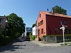
320 | Vogelherd , old name for an area where birds were lured with the help of decoys and then caught with nets | May 28, 1929 | The first names were Street G 16 and Extended Street G16 for the area between Lärchenweg and Maikäferpfad. |
|
| At the flow meadow
( Location ) |
490 | Nature reserve Fließwiese Ruhleben | July 26, 1927 | The first name was Straße 52 in the Ruhleben settlement . |

|
| Angerburger Allee
( Location ) |
880 | Angerburg, city in the province of East Prussia ; today Węgorzewo in Poland | June 27, 1927 | The first name was Straße 1 in the former manor district of Heerstraße. |

|
| Anneliese-and-Georg-Groscurth-Platz
( Location ) |
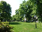
120 × 80 | Georg Groscurth (1904–1944), doctor and resistance fighter and his wife, the doctor and resistance fighter Anneliese Groscurth (1910–1996) | Aug 11, 2006 | From 1905/1906 until after 1982 the square was called Lindenplatz . |
|
| Arysallee
( Location ) |
240 | Arys, town in the province of East Prussia , today Orzysz in Poland | Dec 31, 1923 | The first name was Straße 16 in the former manor district of Heerstraße. |

|
| August Beer Square (*)
( Location ) |
155 × 135 | August Bier (1861–1949), surgeon, university professor and forester | rebuilt in 2002 | The square is a sports field and is located on the grounds of the Olympic Park, between Prinz-Friedrich-Karl-Weg and Friedrich-Friesen-Allee . To the southwest it borders on Georgiiplatz and lies between Hueppeplatz and Hindenburgplatz. The grass pitch is used by athletes for training or competitions. The surrounding squares were laid out as early as the 1936 Olympics. The square is included in Berlin's official street list under number 16917. |

|
|
Badenallee
( Location ) |
590 | Grand Duchy of Baden , a sovereign state from 1806 to 1871 and then a state within Germany until 1945 | May 19, 1908 | It is located between Oldenburgallee and the northern side lane of Heerstraße. The first name was Straße 2 of the development plan in Westend. In this quarter around and near Reichsstraße , as well as Länderallee , the streets are named after the countries of the German Empire that was proclaimed on January 18, 1871 . |

|
| Bayernallee
( Location ) |
1000 | Kingdom of Bavaria , today: Free State and German federal state | May 19, 1908 | The first name was Street 26 . It is located in the northern arch between Westendallee and Heerstraße (across from Frankenallee). In this quarter around and near Reichsstraße , as well as Länderallee , the streets are named after the countries of the German Empire that was proclaimed on January 18, 1871 . |

|
| Biedermannweg
( Location ) |
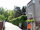
380 | August Biedermann (1878–1957), sponsor of the "Small settlement Ruhleben" | Nov. 26, 1959 | The previous name between 1928 and 1959 was Biedermeierweg . |
|
| Bläulingsweg
( Location ) |
90 | Bluebirds , butterfly family | May 13, 1929 | The first name was place G 4 . The path runs from Im Hornisgrund to Rottannenweg and is located in Eichkamp . |

|
| Bolivar avenue
( Location ) |
550 | Simón Bolívar (1783–1830), Latin American independence fighter and national hero | Jan. 27, 1931 | The avenue lies between Heerstrasse and Reichsstrasse (Steubenplatz). In 1931 the northern part of Preußenallee between Steubenplatz and today's Spandauer Damm was renamed Bolivarallee. Before 1925, this part was called Braunschweigallee . This older street name results from the fact that in this quarter around Reichsstraße and Länderallee the streets are named after the countries of the German Empire that was proclaimed on January 18, 1871 . 490 meters of the road belong to class IV (supplementary road connection) in Berlin's main road network. |

|
| Boyenallee
( Location ) |
210 | Hermann von Boyen (1771–1848), military and politician | March 9, 1925 | The name according to the development plan was Straße 51 in the former manor district Heerstraße and from 1922 Straße at the Heerstraße station . Łuczański Avenue Given the naming of the adjoining roads to the East Prussian places and regions and only a few meters away appears the designation after in Lötzen located Boyen plausible. But this is also named after Hermann von Boyen, who, as Prussian Minister of War, initiated its construction. It is located in the settlement Heerstraße. |

|
| Branitzer Platz
( Location ) |
85 (diameter) |
Branitz , district of Cottbus in the state of Brandenburg | Aug 20, 1897 | The Schmuckplatz is at the intersection of chestnut and oak avenues with a green roundabout in the middle. The previous name was Kirchplatz between 1867 and 1897 , which was used to designate the predecessor building of the Neu-Westend Church . It is the central square in a quarter in which the streets on the western edge of the city of Charlottenburg are named as avenues after tree species. Branitz is particularly known for its park. |

|
| Bredtschneiderstrasse
( Location ) |
440 | Friedrich August Bredtschneider (1855–1924), architect and local politician | 27 Sep 1920 | The first names were Street 20 and Street 32b, Section V of the development plan. In the mid-1920s, Bredtschneiderstrasse ran to what was then Westendallee, which was the northern boundary of what would later become the exhibition grounds . Between 1925 and 1930 the street was shortened. On June 11, 1974, it was announced that the remaining area of Bredtschneiderstraße between Masurenallee and Soorstraße was de-designated as road land and the name for this part was deleted in order to achieve a coherent development. |

|
|
Brixplatz
( Location ) |
190/100/140 (trapezoidal shape) |
Josef Brix (1859–1943), architect | July 31, 1947 | This green space is between Reichsstraße and Westendallee. The previous name between 1909 and 1947 was Sachsenplatz . This older name referred to the kingdom in the German Empire. In this quarter around and near Reichsstraße, as well as Länderallee , the streets are named after the countries of the German Empire that was proclaimed on January 18, 1871 . On its south side, a one-way street to Reichsstraße, lies a section of the Wannseeweg, which is marked as number 11 of Berlin's 20 green main routes . |

|
| Blackberry Trail
( Location ) |
470 | Blackberries , species of plant | Aug 16, 1928 | The first name was Straße 56 in the Ruhleben settlement. The path is right next to the sloping flank of the Teltow plateau below the Olympiastadion site . |

|
| Brontëweg
( Location ) |
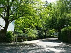
190 | Brontë siblings , three British sisters and writers | July 1, 1967 | The path goes south from Dickensweg as a dead end. It was created to provide traffic access to the residential buildings. |
|
| Byronweg
( Location ) |
80 | George Gordon Byron (1788-1824), British writer | Dec 17, 1959 | It runs from Heerstrasse to the height of Kranzallee. |

|
|
Charlottenburger Chaussee
( Location ) |
50 (in the district) |
Charlottenburg , former Berlin district, towards the street | from 1892 | At fifty meters, Charlottenburger Chaussee forms the suburb of Spandau , with properties 3–17 up to the Ruhleben underground station belonging to Westend. In 1822 the road between Charlottenburg and Spandau was completed. Initially not officially designated as Berliner Chaussee , it was named Charlottenburger Chaussee in 1882. The western parts of the street were later removed and named Grunewaldstrasse in 1892 and Ruhlebener Strasse in 1909 . Most of the street runs in the Ruhleben area of the Spandau district and in the Wilhelmstadt district . |

|
| Cordesstrasse
( Location ) |
230 (in the district) |
Heinrich Cordes (1852–1917), head of the local Reichsbahn repair shop in Grunewald | March 23, 1925 | Part of the road runs in the Grunewald district . The previous names were Werkstattstraße (around 1900–1906) and Werkstattweg (1906–1925), which indicated the direction to the workshops of the Reichsbahn repair shop . It is located in the locality of Eichkamp . |

|
| Coubertinplatz
( Location ) |
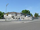
140 × 70 | Pierre de Coubertin (1863–1937), French educator, historian and sports official | Apr 23, 1936 | The oval square forms the northern end of Flatowallee via the Südtorweg . |
|
| Crusiusstrasse
( Location ) |
120 | Michael Crusius († 1709), preacher in Charlottenburg | Aug 9, 1929 | The first name was Straße 38, Section V of the development plan. |

|
|
Permanent forest path
( Location ) |
470 | Permanent forest , variant of a form of forest use | Aug 16, 1928 | The name for the route according to the development plan for road G 3 . The path forms the border to the Grunewald district and is located in Eichkamp . |

|
| Dickensweg
( Location ) |
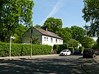
870 | Charles Dickens (1812-1870), British writer | Oct 25, 1955 | The first name was Street 42 in the British settlement established after World War II. This area was inhabited by British officer families until the Allies left . |
|
|
Ebereschenallee
( Location ) |
1000 | Mountain ash , species of plant | around 1867 | The avenue lies between Bolivar avenue and Ahorn avenue and is named after a typical avenue tree. It belongs to a district around Branitzer Platz in which the streets on the western edge of the city of Charlottenburg are named as avenues after tree species. |

|
| Oak alley
( Location ) |
1200 | Oak , genus of plants | around 1867 | The street is on Bolivarallee between Altenburger Allee and Ahornallee. The name may have been chosen after the initial planting. The avenue runs from Altenburger Allee over Branitzer Platz to Ahornallee. The Evangelical Church in Neu-Westend is located in numbers 47-53 . It is located in a district around Branitzer Platz in which the streets on the western edge of the city of Charlottenburg are named as avenues after tree species. | |
| Eichkampstrasse
( Location ) |
1650 | Eichkamp district forester in Grunewald, namesake of the settlement | July 7, 1936 | The previous names were Kronprinzessinnenweg (before 1892 until after 1918) and Königsweg (until 1936). Part of the street is in Grunewald . It is located on the north side of the AVUS. |

|
| Eichkatzweg
( Location ) |
570 | Squirrel , mammal in the squirrel family, popularly known as the squirrel | Oct 10, 1936 | The previous name was Im Eichkamp (around 1921 to 1936). It is located in Eichkamp . |

|
| Elsa-Rendschmidt-Weg | Elsa Rendschmidt (1886–1969), figure skater | Feb. 1, 2006 | The name was chosen with reference to the nearby home of the Berlin ice skating club . The previously unnamed route is the connection to the Berlin Pichelsberg S-Bahn station . |

|
|
| Epiphany Way
( Location ) |
130 | nearby Epiphany Church | July 13, 1934 | The first name was Straße 35 eV-4 . The street leads from Knobelsdorffstraße at the epiphany church that gives it its name to the headquarters of the Berlin-Brandenburg vocational support organization . |

|
| Eschenallee
( Location ) |
720 | Ash , genus of plants | around 1867 | It lies between Reichsstrasse and Spandauer Damm. The name after a typical avenue tree was possibly chosen after the first planting. It is located in a district around Branitzer Platz in which the streets on the western edge of the city of Charlottenburg are named as avenues after tree species. |

|
|
Falterweg
( Location ) |
240 | Moths or butterflies, the second-richest insect order in species | May 13, 1929 | The first name was street G 20 . It is located in Eichkamp . |

|
|
Flatowallee
( Location ) |
480 + 200 | Alfred Flatow (1869–1942) and his cousin Gustav Felix Flatow (1875–1945), two gymnasts who were persecuted as Jewish athletes in the Third Reich and murdered in the Theresienstadt concentration camp | Feb 21, 1997 | The previous names were Rennbahnstrasse (1914-1936) and Reichssportfeldstrasse (1936-1997). The entrance to the Corbusierhaus is also part of Flatowallee. The street lies between Heerstrasse and the south gate on Coubertinplatz. 500 meters of the road belong to class III (regional road connection) in the main road network of Berlin . |

|
| Frankenallee
( Location ) |
280 | Franconia , a West Germanic ethnic group | Apr. 24, 1908 | The first name was Street 23, Section V of the development plan. South of Heerstraße it belongs to a quarter in which the streets were named after Germanic tribes. It is located between the southern side lane of Heerstraße and Wandalenallee. |

|
| Frauenburger path
( Location ) |
320 | Frauenburg, today Frombork , a city in Poland on the Frischen Haff | Apr 13, 1970 | The path, actually just a footpath, runs in a west-east direction between Lötzener Allee and beyond Marienburger Allee. It is located in the settlement Heerstraße. |

|
| Frauenplatz (*)
( Location ) |
200 × 110 (slightly conical) |
Women , the name refers to the western grandstand of the Olympic swimming stadium , which housed the changing rooms for women for the 1936 Olympic Games | 1936 | The square is located on the grounds of the Olympic swimming stadium, behind the eastern grandstand is the anger on the grounds of the sports forum . The square is included in the official street directory under number 16913. | |
| Fredericiastrasse
( Location ) |
220 | Fredericia , port city in Jutland, Denmark | Aug 12, 1906 | The first name was Straße 33b, Section V of the development plan. |

|
| Friedrich-Friesen-Allee
( Location ) |
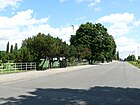
1000 | Friedrich Friesen (1784–1814), co-founder of German gymnastics, teacher and freedom fighter | Apr 23, 1936 | The street starts at the bell tower and ends on the site of the Olympic Stadium. Before it was named Graditzer Allee , which was laid out as street 9a in the former "estate district of Heerstraße" and was named on June 27, 1925. The Graditz Avenue took place in the route of the Friedrich-Friesen-Allee in the extension of that Rominter avenue for today's Rominter Avenue . The Grunewald racecourse was originally located on the site of the Olympic Stadium, Graditz is a district of Torgau where the Graditz Stud has been located since 1722 . On February 13, 1937, the southern section of Friedrich-Friesen-Allee, which was named in 1936, was renamed from Am Glockenturm square to An der Heerstraße to Passenheimer Straße . Between 1960 and 1963 a part of the route of Friedrich-Friesen-Allee was named Turnhallenallee , as an extension of Friedrich-Friesen-Allee over Gutsmuthsweg and Sportforumstraße as a dead end street to a little beyond Adlerplatz. The street is not yet named on the map from 1960. In the city map from 1964 it is marked by name along the “House of German Sports”, soon afterwards the Turnhallenallee in Friedrich-Friesen-Allee must have been renamed. There are no properties assigned to Friedrich-Friesen-Allee. Friedrich-Friesen-Allee is north around Maifeld and Olympiastadion between Am Glockenturm and Adlerplatz , the Waldbühne is on the west side. To the east is the west dam on the Maifeld. The further section to the northeast lies south of Georgii- and Hueppeplatz, then between August-Bier- (in the north) and Hanns-Braun-Platz (in the south). The Gutsmuthsweg is crossed further between Hindenburgplatz and Gebhardtplatz. On the north side is the building on Jahnplatz and to the south is Körerplatz, then it goes to Adlerplatz, which is surrounded by the Friesenhaus. |
|
|
Fürstenbrunn way
( Location ) |
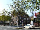
1630 | Here was the "Fürstenbrunn source" | Jan. 27, 1955 | The previous name was Neuer Fürstenbrunner Weg (1857–1955). 1630 meters of the road belong to class III (regional road connection) in the main road network of Berlin . The name Fürstenbrunner Weg is used in the address book in 1915 for both the street that is still named today to the Rohrdammbrücke and for the section of today's Ruhwaldweg leading further west. The Fürstenbrunner Weg already existed in 1907, with the Alte Fürstenbrunner Weg already interrupted by Sophie-Charlotten-Strasse and replaced by the Neue Fürstenbrunner Weg west of the Ringbahn . He changes around the Fürstenbrunn station on the north side of the railway line (here: Märkischer Steg as Siemenssteg and today: Rohrdammbrücke) and then changes over the course of today's Ruhwaldweg to the Spandauer Bock (brewery) and in the Spandauer area to the Spandauer Damm . |
|
|
Fürstenplatz
( Location ) |
100 × 80 | Prince , title of nobility | Apr. 24, 1908 | In this quarter the streets are named after the countries of the German Empire , which was proclaimed on January 18, 1871 . Of Fürstenplatz is bordered by the countries Allee (NW), the Bayernallee (NO), the road Fürstenplatz (SO) and the Württembergallee (SW). |

|
| Gebhardtplatz (*)
( Location ) |
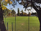
100 × 75 | Willibald Gebhardt (1861–1921), scientist, sports functionary and founder of the German Olympic movement | 1936 | The square is on the site of the Olympic Park, between Friedrich-Friesen-Allee and Hanns-Baun-Straße. The grass pitch is part of the German Sports Forum and is used by athletes for training or competitions. The square is included in the official street directory under number 16912. |
|
| Georgiiplatz (*)
( Location ) |
175 × 60 | Theodor Georgii (1826-1892), protagonist of the German gymnastics movement | 1936 | The square is on the grounds of the Olympic Park, between Prinz-Friedrich-Karl-Weg and Friedrich-Friesen-Allee. There are several tennis courts in its area, which are used by the tennis club for training or competitions. The square is included in the official street directory under number 16911. | |
|
Bell Tower Street
( Location ) |
1000 | the bell tower of the Olympic Stadium standing here | Apr 23, 1936 | The first names were Street 4 and Street 4a . |

|
| Gotha Allee
( Location ) |
760 | Duchy of Saxe-Coburg and Gotha | Apr 13, 1909 | It is located between Spandauer Damm (turning south) and Bolivarallee (across from Akazienallee). The first names were street 35b and street 35c of the development plan. In this quarter around and near Reichsstraße , as well as Länderallee , the streets are named after the countries of the German Empire that was proclaimed on January 18, 1871 . |

|
| Gottfried-Keller-Strasse
( Location ) |
80 | Gottfried Keller (1819–1890), Swiss poet and politician | May 2, 1902 | This traffic route connects the Ahornallee with the Soorstrasse in a north-west-south-east route. It was probably laid out in 1901, but was only named a year later. |

|
| Grethe-Weiser-Weg
( Location ) |
230 | Grete Weiser (1903–1970), actress | Feb. 28, 1972 | The first name was 219 street . |

|
| Gutsmuthsweg
( Location ) |
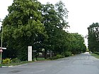
600 | Johann Christoph Friedrich GutsMuths (1759–1839), educator and co-founder of the gymnastics movement | Apr 23, 1936 | The path is almost entirely on the site of the Olympic Stadium . |
|
|
Haeselerstrasse
( Location ) |
220 | Gottlieb von Haeseler (1836–1919), Prussian Field Marshal General | Jan. 1, 1907 | The first name was Street 35, Section V of the development plan |

|
| Halenseestrasse
( Location ) |
460 - western part and 280 - eastern part (each in the district) |
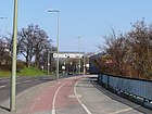
Halensee , Berlin lake in the small chain of Grunewald lakes | July 7, 1936 | The street begins at Rathenauplatz, ends north of it at Messedamm and runs parallel to the city ring . Part of the street is in Grunewald . 460 meters of the road belong to class II (superordinate road connection) in the main road network of Berlin . |
|
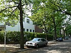
| Halmstrasse
( Location ) |
200 | Friedrich Halm (1806–1871), Austrian poet, novelist and playwright | Dec 8, 1906 | The first name was Straße 11a of the development plan in Westend. |
|
|
Hammarskjold Square
( Location ) |
360 × 90 | Dag Hammarskjöld (1905–1961), Swedish politician, second UN Secretary General | Oct 14, 1961 | One of the entrances to the exhibition grounds is located at Hammarskjöldplatz . |

|
| Hanns-Braun-Platz (*)
( Location ) |
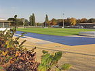
360 × 80 | Hanns Braun (1886–1918), athlete | Apr 23, 1936 | The course is located north of Hanns-Braun-Straße and is part of the German Sports Forum . It is equipped with a running oval and an inner lawn and is used for training or competitions. The square is included in the official street directory under number 16910. |
|
| Hanns-Braun-Strasse
( Location ) |
1100 | Hanns Braun (1886–1918), athlete | Apr 23, 1936 | Most of the road runs on the fenced-in area of the sports forum . |

|
| Harbigstrasse
( Location ) |
1000 | Rudolf Harbig (1913–1944), track and field athlete | March 21, 1958 | The first name was street 58 . In the north-west it limits the locality of Eichkamp . |

|
| Hardyweg
( Location ) |
180 | Thomas Hardy (1840–1928), English writer | May 16, 1956 | The road, laid out after 1945, was first a private road in the British settlement. |

|
|
Havelchaussee
( Location ) |
1400 (in the district) |
Havel , river through Berlin | until 1925 | Parts of the street run through Wilhelmstadt , Grunewald and Nikolassee . The historical film studio shown in the picture is worth mentioning here. The street belongs to class IV (supplementary road connection) in the main road network of Berlin . | |
|
Heerstrasse
( Location ) |
3800 (in the district) |
Traditional name for overland connecting roads used by the military. | from 1908 | Part of the street runs in the Spandau district . The previous names were Döberitzer Heerstrasse (before 1908–1928), An der Heerstrasse (1921–1950) and Kaiserdamm (1906–1950). It is the central east-west street leading through the district. 3860 meters of the road are federal roads (B 2 and B 5) and belong to class I (large-scale road connection) in Berlin's road network . |

|
| Heilsberger Allee
( Location ) |
770 | Heilsberg, town in the province of East Prussia , today Lidzbark Warmiński in Poland | Dec 31, 1923 | The first name was Straße 21 in the manor district of Heerstraße. During or after the First World War , streets in this area were named after places in East Prussia. |

|
| Hempelsteig
( Location ) |
960 | Carl Hempel (1833–1903), city councilor in Charlottenburg | Feb 13, 1937 | The first name was Street 1 . On September 30, 1966, the path was extended to Rominter Allee. |

|
| Hessenallee
( Location ) |
350 | Grand Duchy of Hesse , federal state of the German Empire | Apr 13, 1909 | It lies between Reichsstrasse and Württembergallee. The first name was Street 28 of the zoning plan. In this quarter around and near Reichsstraße , as well as Länderallee , the streets are named after the countries of the German Empire that was proclaimed on January 18, 1871 . |

|
| Hindenburgplatz (*)
( Location ) |
120 × 90 (with jumping facility and embankment) |
Paul von Hindenburg (1847–1934), Field Marshal General and President | 1936 | The square is on the grounds of the Olympic Park, between Prinz-Friedrich-Karl-Weg and Friedrich-Friesen-Allee. The grass pitch is part of the German Sports Forum and is used by athletes for training or competitions. The square is included in the official street directory under the number 16909. |

|
| Hohensteinallee
( Location ) |
90 | Hohenstein, town in the province of East Prussia , today Olsztynek in Poland | Dec 31, 1923 | The first name was street 46 of the development plan in the manor district of Heerstraße. Heavy street fights took place in Hohenstein during the second Tannenberg Battle from August 27 to 29, 1914. |

|
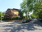
| Hölderlinstrasse
( Location ) |
360 | Friedrich Hölderlin (1770–1843), poet | May 19, 1908 | The first names were Straße 9 and Straße 10 of the development plan in Westend. |
|
|
In the Hornisgrund
( Location ) |
310 | Hornet , the largest social wasp in Central Europe | May 13, 1929 | The first name was street G 6 . It connects the permanent forest path and the Alte Allee. It is located in the locality of Eichkamp . |

|
| Hueppeplatz (*)
( Location ) |
150 × 130 | Ferdinand Hueppe (1852–1938), scientist and 1900–1904 first President of the German Football Association | 1936 | The square is on the grounds of the Olympic Park, between Prinz-Friedrich-Karl-Weg and Friedrich-Friesen-Allee. To the southwest it borders on tennis courts, which were given the name Georgiiplatz. The square is part of the German Sports Forum and is used by ball athletes for training or competitions. It has a surface made of the most modern artificial turf . The square is included in the official street directory under number 16916. |

|
| Insterburgallee
( Location ) |
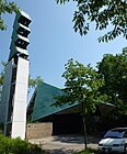
720 | Insterburg, a city in the East Prussia province , today Chernyakhovsk in the Russian exclave of Kaliningrad | around 1915 | The avenue runs from Tannenbergallee and Teufelsseestrasse over Sensburger Allee. The Catholic Sacred Heart School is located here (see picture). |

|
|
Jaffé Street
( Location ) |
1410 | Benno Jaffé (1840–1923), local politician and honorary citizen of the city of Charlottenburg | Nov 10, 1958 | The southern part of the road was panned in the 1990s. Originally the street led north past the Deutschlandhalle . 1410 meters of the street belong to class II (superordinate road connection) in the main road network of Berlin . |

|
| Jahnplatz (*)
( Location ) |
70 × 65 | Friedrich Ludwig Jahn (1778–1852), initiator of the German gymnastics movement | 1936 | Jahnplatz is located on the grounds of the Olympic Park and forms the inner courtyard of the sports museum. The square is included in the official street directory under number 16915. |

|
| Jasmine Path
( Location ) |
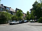
220 | Jasmine , common jasmine or real jasmine, belongs to the genus Jasminum in the olive family | Feb. 18, 1927 | The first name was Straße 21 according to the development plan. Between 1925 and 1927, was the way Suhlenweg because near two pig wallow were. The Jasminweg branches off southwards from the Murellenweg and makes a snail-shaped bend after the intersection with the Wacholderweg. |
|
| Jesse Owens Avenue
( Location ) |
640 | Jesse Owens (1913–1980), American athlete, most successful participant in the 1936 Summer Olympics | March 10, 1984 | The previous name between 1928 and 1984 was Stadionallee . The street belongs to class IV (supplementary road connection) in the main road network of Berlin . |

|
| Johannisburger Allee
( Location ) |
340 | Johannisburg, town in the province of East Prussia , today Pisz , district town of the Powiat Piski in the Polish Warmian-Masurian Voivodeship | Jan. 16, 1925 | The first name was street 45a in the manor district of Heerstraße. |

|
|
Kaiserdamm
( Location ) |
740 (in the district) |
Wilhelm II. (1859–1941), German Emperor | Dec 8, 1906 | Part of the street runs in the district of Charlottenburg . Previous parts were Straße 7b and Straße 33, Section V of the development plan. Part of the Kaiserdamm, which led from Ahornallee to Preußenallee (previously Straße 7b ), was incorporated into Heerstraße on March 30, 1950 . On April 26, 1967, the Kaiserdamm was renamed Adenauerdamm , but was given back its original name on January 15, 1968 following public protests. 740 meters of the road are federal roads (to the B 2 and B 5) and belong to class I (large-scale road connection) in Berlin's road network . |

|
|
Karolingerplatz
( Location ) |
100 × 70 | Carolingians , name of the ruling family of the West Germanic Franks | Apr. 27, 1908 | The first name was place E, section V of the development plan. |

|
| Kastanienallee
( Location ) |
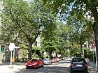
1060 | Chestnuts , beeches | around 1867 | The name was probably chosen after the first planting. It is located in a district around Branitzer Platz in which the streets on the western edge of the city of Charlottenburg are named as avenues after tree species. The street lies between Spandauer Damm and Bayernallee and leads over Branitzer Platz. |
|
| Pine path
( Location ) |
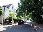
340 | Pine , a genus of coniferous trees (Pinophyta) in the pine family | Jan. 7, 1920 | The Kiefernweg runs between Eichkampstraße and Zikadenweg, as a footpath to Kühler Weg. It is located in Eichkamp . |
|
| Kiplingweg
( Location ) |
280 | Rudyard Kipling (1865-1936), British writer and poet, 1907 Nobel Prize in Literature was awarded | Aug 21, 1958 | The street has a U-shaped course from and to Kranzallee. |

|
| Avenue of cherries
( Location ) |
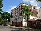
600 | Cherry , fruit tree, a species of plant in the genus Prunus in the rose family (Rosaceae). | around 1867 | The street lies between Spandauer Damm and Reichsstraße, at the confluence of Platenenallee across from Hessenallee. It is located in a district around Branitzer Platz in which the streets on the western edge of the city of Charlottenburg are named as avenues after tree species. |
|
| Klaus-Groth-Strasse
( Location ) |
140 | Klaus Groth (1819–1899), poet and writer | Dec 8, 1906 | The first name was Straße 11, Section V of the development plan. The part between Ahornstrasse and Soorstrasse ceased to exist between 1960 and 1963. |

|
| Knobelsdorffstrasse
( Location ) |
570 (in the district) |
Georg Wenzeslaus von Knobelsdorff (1699–1753), builder, painter and architect in Prussia | around 1877 | Part of the street runs in the district of Charlottenburg . At first it was Street 28, Section V of the development plan. On December 8, 1906, the extension, street 27, was given the same name. Plots 1-9 were rededicated on December 13, 1977. 270 meters of the road belong to class I (large-scale road connection) in Berlin's road network and other parts to class III (regional road connection). |

|
| Koburgallee
( Location ) |
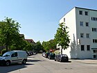
90 | Duchy of Saxony-Coburg and Gotha (according to the old spelling with "K") | Apr 13, 1909 | The short connection is between Gotha-Allee and Reichsstraße. The first name according to the development plan was Straße 37 . In this quarter around and near Reichsstraße , as well as Länderallee , the streets are named after the countries of the German Empire that was proclaimed on January 18, 1871 . |
|
|
Queen Elisabeth Street
( Location ) |
850 | Elisabeth Ludovika of Bavaria (1801–1873), Queen of Prussia | Aug 20, 1897 | The first name was Street 32 . Until 1897 the street only went as far as the intersection of today's Neue Kantstraße and Königsweg. In 1918 its extension, Straße 14 , was named in the same way up to the then course of Westendallee. The part of Königin-Elisabeth-Straße from Kaiserdamm to the AVUS junction was renamed Messedamm on July 7, 1936. 320 meters of the road belong to class I (large-scale road connection) in Berlin's road network , the remaining parts to class III (regional road connection). |

|
| Kollatzstrasse
( Location ) |
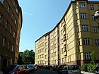
110 | Karl Wilhelm Eduard Kollatz (1820–1891), pastor at the Luisenkirche and city councilor | Aug 9, 1929 | The first name was street 35-V-4 of the zoning plan. |
|
| Körnerplatz (*)
( Location ) |
165 × 120 | Theodor Körner (1791–1813), writer and member of the irregulars | 1936 | The course is on the site of the Olympic Park, between Gutsmuthsweg, Prinz-Friedrich-Karl-Weg and Friedrich-Friesen-Allee. The place is included in the official street directory under number 16914. The name given to the square refers to Körner's death in the Lützow Freikorps in the Wars of Liberation in 1813/1814 and his resulting role as a patriotic figure of identification. In 1993 a horticultural company redesigned the site. The natural grass pitch was used by BCK cricket athletes for training or competitions until 2011 . In 2012 the sports festival for deaf children and young people took place on the well-tended lawn, organized by the Deaf Sports Association Berlin-Brandenburg e. V. In August 2013, the entire sports grounds were used for a large family sports and culture festival, which was also the 19th children's and youth sports festival. The police were represented on the Körnerplatz with a rollover simulator . |

|
| Kranzallee
( Location ) |
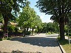
1000 | Cranz, a seaside resort in East Prussia , today Selenogradsk in the Russian exclave of Kaliningrad | Dec 31, 1923 | The first name was Straße 41 in the manor district of Heerstraße. |
|
|
Cool way
( Location ) |
380 | Location at the "cool forest" | May 13, 1929 | The first name was street G 19 in the development plan. Here is the sports facility used by Tennis Borussia , which has been called "Hans-Rosenthal-Sportanlage (am Kühler Weg)" since April 29, 2007. It is located in Eichkamp . |

|
| Kurländer Allee
( Location ) |
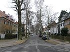
410 | Courland , one of the four historical landscapes of Latvia | March 23, 1925 | The first name was Straße 38 in the development plan of the manor district of Heerstraße . It is the extension of Boyenallee and ends at the Willemburger path with a turning area. It is located in the settlement Heerstraße. |
|
|
Länderallee
( Location ) |
610 | States of the Federal Republic of Germany | July 31, 1950 | It lies between the northern side lane of Heerstraße and Reichsstraße. The previous name was Bundesallee (around 1909–1950). In this quarter the streets are named after the countries of the German Empire , which was proclaimed on January 18, 1871 . By renaming the new political situation was taken into account. |

|
| Langobardenallee
( Location ) |
90 | Longobards , part of the Suebi tribe who originally settled on the lower Elbe | Apr 13, 1909 | The street south of Heerstraße is between Thüringer- and Pommernallee. The Langobardenallee was previously a street belonging to Section V of the development plan. In this quarter the streets are named after Germanic tribes. |

|
|
Lärchenweg
( Location ) |
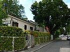
220 | Larch , a genus of plants in the pine family | Jan. 7, 1920 | The path runs from Eichkampstraße (southeast) to Zikadenweg (northwest) and beyond as a driveway. It is located in Eichkamp . |
|
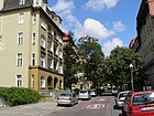
| Leistikowstrasse
( Location ) |
180 | Walter Leistikow (1865–1908), painter and graphic artist | Apr 13, 1909 | The tracked name was Straße 25 of the development plan Westend. |
|
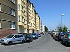
| Lerschpfad
( Location ) |
200 | Heinrich Lersch (1889–1936), worker poet and boilermaker | March 11, 1937 | From 1906 to 1937 the Lerschpfad was part of Rognitzstrasse . For better allocation, the street is also called Lerschpfad on the city ring. To protect against the traffic noise of the federal motorway 100 , which is guided in a trough , all windows were equipped with soundproofing. The Lerschpfad is only separated from the A 100 by a metal railing. |
|
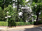
| Avenue of lime trees
( Location ) |
720 + 100 + 90 + 60 |
Linden , genus of trees belonging to the linden family | around 1867 | The name could have been chosen after the first planting with a street tree typical of Berlin. The street leads from Theodor-Heuss-Platz to Ulmenallee, divides here into two lanes around Anneliese-und-Georg-Groscurth-Platz to Nussbaumallee and leads from Akazienallee to Spandauer Damm . |
|
|
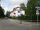
Lötzener Allee
( Location ) |
750 | Lötzen, town in East Prussia , today Giżycko , Warmian-Masurian Voivodeship in Poland | Aug 8, 1921 | The avenue leads from Soldauer Platz to Waldschulallee in a north-south direction. |
|
| Lyckallee
( Location ) |
1000 | Lyck, city in East Prussia , today Ełk , Warmian-Masurian Voivodeship in Poland | around 1915 | It runs from Kranzallee to Teufelsseestrasse. |

|
|
Machandelweg
( Location ) |
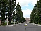
1000 | Machandel , Low German name for juniper | Dec 31, 1923 | The first name was street 22 in the manor district of Heerstraße. The Grunewald workshop of the Berlin subway , which opened in 1913, is located on Machandelweg (bottom picture). |

|
| Cockchafer trail
( Location ) |
640 | Cockchafer , genus of beetles | March 30, 1950 | The previous name was Buchenweg between around 1920 and 1950, probably after the first planting of the roadsides, whereby the renaming by the Senate is in connection with a large number of streets whose names were present several times due to the formation of Greater Berlin from the suburbs. It is located in Eichkamp . |

|
| Marathon avenue
( Location ) |
500 | Marathon running, Olympic running discipline | March 30, 1950 | The previous name was Mecklenburgallee (1909-1950). In this quarter around the Reichsstraße and near it, as well as the Länderallee , the streets are named after the countries of the German Empire , which was proclaimed on January 18, 1871 , which corresponds to the early name. The street is south of the Olympische Straße between Westendallee and Reichsstraße. |

|
| Marienburger Allee
( Location ) |
500 | Marienburg, today Malbork , district town in the Pomeranian Voivodeship in northern Poland | March 23, 1925 | The previous name was Willenburger path (1935-1936). It is located in the settlement Heerstraße. |

|
| Martha Jacob Square
( Location ) |
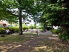
50 × 25 | Martha Jacob (1911–1976), track and field athlete | 7 Aug 2014 | The square, unnamed until 2014, is encompassed by Soldauer Allee , Teufelsseestrasse and Boyenallee . It is located on the Heerstraße bridge and at the Heerstraße train station on the Heerstraße settlement. |
|
|
Masurenallee
( Location ) |
560 | Masuria , landscape in the south of the East Prussian Lake District, Poland | 1918 | Until 1930, Masurenallee ran from Reichskanzlerplatz to what was then Scholzplatz (today roughly on the site of Hall 18 of the exhibition grounds ). The first name of this street was Straße 5a, Section V of the development plan. For an extension of the exhibition grounds, the street was led further north in 1930 along the newly built house of the radio to today's Messedamm. The short, formerly East Prussia avenue called, connection to East Prussia Bridge in 1934 Masurenallee, 1966 then the new Kantstrasse slammed shut. 560 meters of the road belong to class II (superordinate road connection) in Berlin's main road network. |

|
| Meerscheidtstrasse
( Location ) |
240 | Oskar von Meerscheidt-Hüllessem (1825–1895), Prussian infantry general | around 1908 | The first name was Street 32a, Section V of the development plan. The street once ran from Haeselerstrasse to the former Jafféstrasse and crossed Knobelsdorffstrasse, Fredericiastrasse, Kaiserdamm and Bredtschneiderstrasse. On January 23, 1931, part of Haeselerstrasse and Knobelsdorffstrasse was renamed Haeselerstrasse. |

|
| Meiningenallee
( Location ) |
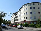
580 | Saxony-Meiningen , former duchy | Apr 13, 1909 | In this quarter the streets are named after the countries of the German Empire , which was proclaimed on January 18, 1871 . Before street no. 36 of the development plan for Westend. The street lies between Reichsstraße and Spandauer Damm. Meiningenallee led a section of the Wannseeweg , which is marked as number 11 of the 20 green main paths in Berlin. |
|
| Merovingian way
( Location ) |
120 | Merovingians , the oldest known royal family of the Franks from the early 5th to the middle of the 8th century | March 6, 1936 | The previous name was Markomannenweg (1909-1936), after the Germanic tribe of Markomannen . |

|
|
Messedamm
( Location ) |
1500 | Exhibition grounds located here | July 7, 1936 | The previous names were Queen Elisabeth Street (1897-1936) and Königsweg (before 1898-1936). 40 meters of the street belong to class I (large-scale road connection) in the main road network of Berlin , the other parts of the street belong to class II (higher-level road connection). As an extension of the Königin-Elisabeth-Straße it leads to the Eichkampstraße. The bus station , the exhibition halls with the radio tower , the ICC and, after the entrance to the AVUS, the CityCube Berlin , which was built in place of the Germany hall, which was demolished in 2011, are located on the Messedamm . |

|
| Miltonweg
( Location ) |
140 | John Milton (1608–1674), English poet | Aug 21, 1958 | Many streets in this residential area for British officer's families, built after 1945 , bear the names of English poets. |

|
| Mohrunger Allee
( Location ) |
320 | Mohrungen, town in East Prussia , today Morąg in Poland | Jan. 16, 1925 | The first name was Straße 12 in the manor district of Heerstraße . It runs from Sensburger Allee to Heerstrasse and to Ortelsburger Allee. The Georg-Kolbe-Hain lies between Mohrunger Allee and Pillkaller Alle. |

|
| Murellenweg
( Location ) |
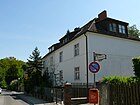
680 | Murellenberge located here | July 26, 1927 | The first name was Straße 55 in the Ruhleben settlement. |
|
|
Neidenburger Allee
( Location ) |
500 | Neidenburg, town in East Prussia , today Nidzica in the Warmian-Masurian Voivodeship , Poland | Aug 8, 1921 | The traffic route leads from Soldauer Platz exactly south to Waldschulallee. It is located in the settlement Heerstraße. |

|
| Walnut avenue
( Location ) |
370 + 540 | Walnut tree | around 1867 | The street lies between Bolivar- and Ahornallee, on the latter with separate lanes on a green (unnamed) square to elm and acacia avenue. It was marked as Nuss Allee on the parceling plan of the Westend villa colony . It was interrupted at the end of the 1970s when the new psychiatric clinic was built on Eschenallee. It is located in a district around Branitzer Platz in which the streets on the western edge of the city of Charlottenburg are named as avenues after tree species. |

|
|
Oldenburgallee
( Location ) |
840 | Grand Duchy of Oldenburg | Apr 13, 1909 | It lies between Schaumburg- and Westendallee, to which it leads parallel in the district. The first name was Street 32 of the development plan in Westend. In this quarter the streets are named after the countries of the German Empire , which was proclaimed on January 18, 1871 . |

|
| Olympic place
( Location ) |
460 × 110 | 1936 Summer Olympics | Apr 23, 1936 | The square closes the Olympic Road to the northwest and at the same time forms a generously dimensioned driveway to the Olympic Stadium. It emerged from the square in front of the stadium's Olympic gate and the unnamed square at the junction of Straße 21 with Olympische Straße. |

|
| Olympic road
( Location ) |
750 | 1936 Summer Olympics | Apr 23, 1936 | The part east of the Olympic Bridge was called Schwarzburgallee after the Thuringian principalities of Schwarzburg-Rudolstadt and Schwarzburg-Sondershausen since 1909 . The street runs in a west-east direction between Olympischer Platz and Steubenplatz. The road belongs to class III (regional road connection) in the main road network of Berlin . |

|
| Ortelsburger Allee
( Location ) |
250 | Ortelsburg, town in East Prussia , today Szczytno , in the Warmian-Masurian Voivodeship , Poland | until 1915 | It runs from Heerstraße and Mohrunger Allee to Tannenbergallee. |

|
|
Passenheimer Strasse
( Location ) |
700 | Passenheim, town in East Prussia , today Pasym in the Warmian-Masurian Voivodeship , Poland | Feb 5, 1937 | The previous names were Rominter Allee (1925-1936) and Friedrich-Friesen-Allee (1936-1937). Part of Friedrich-Friesen-Allee was renamed Passenheimer Straße in 1937. 350 meters of the road, including the Passenheimer Bridge, belong to class IV (supplementary road connection) in Berlin's main road network. |

|
| Pillkaller Allee
( Location ) |
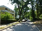
270 | Pillkallen, a city in the East Prussian province , today Dobrowolsk in the Russian exclave of Kaliningrad | Jan. 16, 1925 | The first name was Straße 13 in the manor district of Heerstraße. Here is a section of the Wannseeweg , which is marked as number 11 of the 20 green main routes in Berlin, along the Georg-Kolbe-Hain. It is located between Sensburger Allee and the northern side lane of Heerstraße. |
|
| Plane tree avenue
( Location ) |
950 | Plane trees , genus of plants | around 1867 | It is located between Reichsstraße (Kirschenallee) and Soorstraße. The name was possibly chosen after an initial planting with a typical street tree. It is located in a district around Branitzer Platz in which the streets on the western edge of the city of Charlottenburg are named as avenues after tree species. The street belongs to class III (regional road connection) in the main road network of Berlin . |

|
| Pommernallee
( Location ) |
100 | Pomerania , a former Slavic tribe in the Prussian province | Apr. 24, 1908 | It is located between Ubierstrasse / Langobardenallee and Heerstrasse. South of the Heerstraße it belongs to a quarter in which the streets were named after tribes (in the area of the German Empire). It is located between the southern side lane of Heerstraße and Wandalenallee. The first name was Straße 22, Abbot V / 1 of the development plan for Charlottenburg. |

|
| Preußenallee
( Location ) |
830 | Prussia , an existing state from the Middle Ages to the end of the Second World War | Apr 13, 1909 | It was previously the southern section of Straße 30 of the development plan in Westend. In 1909, Preußenallee only ran from Kaiserdamm to Steubenplatz, which was then unnamed. On June 27, 1925, Braunschweigallee was incorporated into Preußenallee. On January 27, 1931, its northern part between Steubenplatz and Spandauer Chaussee (today: Spandauer Damm) was renamed Bolivarallee. The street belongs to class IV (supplementary road connection) in the main road network of Berlin .
In this quarter around Reichsstraße and Länderallee , the streets are named after the countries of the German Empire , which was proclaimed on January 18, 1871 . On this street (corner of Westend- and Oldenburgallee) a lyceum opened in April 1929 , also called Westendschule because of its location . The plan dates back to before 1914, but implementation was always postponed due to a lack of finance. However, because the number of female students had almost tripled, a new school building had become unavoidable. It was built in a short time according to plans by the municipal building officer Josef Reuters. The cost of construction and equipment was 1.6 million marks. |

|
| Prince Friedrich Karl Way
( Location ) |
760 | Friedrich Karl von Prussia (1893–1917), Prussian prince and rider, medalist at the 1912 Olympic Games | Apr 23, 1936 | The road runs along the northern edge on the site of the sports forum . |

|
|
Ragniter Allee
( Location ) |
150 | Ragnit, a city in the East Prussian province , today Neman in the Russian exclave of Kaliningrad | June 27, 1925 | The first name was Straße 43 in the manor district of Heerstraße . |

|
| Ratzeburger Allee
( Location ) |
100 | County of Ratzeburg , part of the Duchy of Saxony-Lauenburg | May 17, 1930 | In this quarter the streets are named after the countries of the German Empire , which was proclaimed on January 18, 1871 . |

|
| Rauschener Allee
( Location ) |
150 | Rauschen, a city in the East Prussian province , today Swetlogorsk in the Russian exclave of Kaliningrad | Jan. 16, 1925 | First laid out as road 46 according to the development plan. It connects Heerstraße with Lyckallee in a north-south route. |

|
| Raußendorffplatz
( Location ) |
70 × 30 | Hugo Raussendorff (1832–1908), merchant and patron | June 27, 1925 | The square is between Heerstraße , Länder- and Preußenallee. With a donation of several million marks , Raussendorff and his wife Antonie did a lot for Charlottenburg. |

|
|
Reichsstrasse
( Location ) |
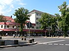
2210 | German Empire , which was founded on January 18, 1871 as a constitutional monarchical federal state | Dec 8, 1906 | The street lies between Spandauer Damm and the northwest corner of Theodor-Heuss-Platz. The first name was Straße 7a of the development plan Westend. The entire length of the street belongs to class II (superordinate road connection) in Berlin's main road network. |
|
| Reussallee
( Location ) |
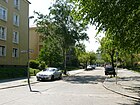
140 | Reuss younger line and Reuss older line , two former German principalities and federal states | April 19, 1918 | The short street is between Gotha and Altenburger Allee. The first name was street 35g of the development plan in Westend. In this quarter the streets are named after the countries of the German Empire , which was proclaimed on January 18, 1871 . |
|
| Rognitzstrasse
( Location ) |
350 | Alt-Rognitz, a place in Bohemia in the former Trautenau district , today Starý Rokytník in the Czech Republic | Dec 8, 1906 | The first names were streets 37, 34, 34a and 34b, Section V of the development plan. The traffic route was named 40 years after the battle near Alt-Rognitz. In 1912, Rognitzstrasse ran from cemetery II of the Luisen community only to Kaiserdamm. In 1915 it was already marked as far as Neue Kantstrasse . In 1918, its extension, Straße 15 , to over Neue Kantstraße to what was then Westendallee was also named. It led to the Wilmersdorf district border. On March 11, 1937, the northern section of Rognitzstrasse from Spandauer Berg to Luisenkirchhof II was renamed Lerschpfad . |

|
| Rominter Allee
( Location ) |
1130 | Rominten, a city in the East Prussian province , today Krasnolessje in the Russian exclave of Kaliningrad | Apr 23, 1936 | The first name was Street 21 of the zoning plan. Today's Rominter Allee is a new name, because today's Passenheimer Straße had this name until April 23, 1936. The street belongs to class IV (supplementary road connection) in the main road network of Berlin . |

|
| Rossitter place
( Location ) |
60 × 50 | Rossitten, a town on the Curonian Spit in the province of East Prussia, today Rybatschi in the Russian exclave of Kaliningrad | Apr 23, 1936 | The square forms the entrance to the Olympia-Stadion underground station . |

|
| Rossitter way
( Location ) |
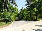
170 | Rossitten, a town on the Curonian Spit in the province of East Prussia, today Rybatschi in the Russian exclave of Kaliningrad | Apr 23, 1936 | The path runs from Rossitter Platz and Rominter Allee to Olympic Square. |
|
| Rottannenweg
( Location ) |
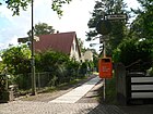
240 | Red fir , species of plant | Aug 16, 1928 | The first name was street G 5 of the development plan. It is located in Eichkamp . |
|
|
Rusternallee
( Location ) |
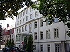
960 | Armorer , genus of plants | around 1867 | The street lies in a short curve to the north between Reichsstraße / Ratzeburger Allee and Ahornallee. It is located in a district around Branitzer Platz in which the streets on the western edge of the city of Charlottenburg are named as avenues after tree species. |
|
| Ruhwaldweg
( Location ) |
1520 | to the Ruhwald area | Jan. 27, 1955 | The previous name was (old) Fürstenbrunner Weg (after 1912–1955) after access to the Fürstenquelle. The Ruhwaldweg opens up on the northern edge below the edge of the Teltow-Platte the garden colonies on the Ruhwald, which are level with the Spree . The route of the Ruhwaldweg led through the railway line near the Siemensstadt-Fürstenbrunn train station . With the shutdown of the S-Bahn traffic and the new construction of the high-speed line as part of the Hamburg Railway , the road layout was interrupted without replacement. For example, a western section from Spandauer Damm / near Wiesendamm between Ruhwald-Kolonien / Ruhwald-Park and the allotment garden colonies along the railway line leads to the railway line and, on the other hand, an eastern section from Fürstenbrunner Weg (Rohrdammbrücke) westwards. The latter is north of the railway line and reaches, for example, the district association of allotment gardeners in Charlottenburg. A (unpaved) lane ('Quellenweg') continues to the south of the railway line as a connection to the KGA 'Spreegrund Süd' and 'Westend', but ends after 350 meters at a railway property for public use. A little higher on the slope, parallel to this, is the 'Höhenweg', a private path run by the Ruhwald colonies associations, which leads to the Fürstenbrunner Weg and is only suitable for pedestrians because of the stairs. According to the map in the address book in 1915, from the height of Siemenssteg (today: Rohrdammbrücke) at Fürstenbrunn train station, the Fürstenbrunner Weg continued along the route of today's Ruhwaldweg to the Spandauer Berg. |

|
|
Sarkauer Allee
( Location ) |
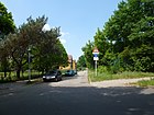
130 | Sarkau, a town on the Curonian Spit in the East Prussian province, today Lesnoi in the Russian exclave of Kaliningrad | July 26, 1927 | The first name was street 3 in the manor district of Heerstraße. |
|
| Schaumburgallee
( Location ) |
250 | Principality of Schaumburg-Lippe , a federal state in the German Empire 1871–1918 | Apr 13, 1909 | In this quarter the streets are named after the countries of the German Empire , which was proclaimed on January 18, 1871 . It is located between Westendallee and Reichsstraße. Before street 33c of the development plan for Westend. |

|
| Schenckendorffplatz (*)
( Location ) |
200 × 165 | Emil von Schenckendorff (1837–1915), reform pedagogue, politician and promoter of the sports movement | around 2001 | The square is located on the site of the Sportforum , between Hanns-Braun-Straße and the Olympic Hockey Stadium . The multi-section turf and artificial turf pitch is used by the professional Hertha BSC team for training. The sports areas were completely renovated in 2001 and some even received turf heating. The square is included in the official street directory under number 16919. |

|
| Schirwindter Allee
( Location ) |
600 | Schirwindt, a city in the East Prussian province , today Kutusowo in the Russian exclave of Kaliningrad | June 27, 1925 | The first name was Straße 7 in the manor district of Heerstraße. On 26 July 1927, the spelling of was Schirwinder Avenue in Schirwindter Avenue corrected. |

|
| Scholzplatz
( Location ) |
180 × 130 (oval shape) |
Ernst Scholz (1874–1932), lawyer, politician, Lord Mayor of Charlottenburg | Jan. 23, 1932 | The square is limited by the streets Am Postfenn, Heerstraße and Schirwindter Allee. The Scholzplatz transmitter mast is nearby . At 40 meters in the main road network of Berlin, the street on the square belongs to class IV (supplementary road connection). |

|
| Scottweg
( Location ) |
840 | Walter Scott (1771-1832), British writer | Oct 25, 1955 | The first name was Street 42a in the British settlement. |

|
| Sensburger Allee
( Location ) |
720 | Sensburg, town in the province of East Prussia , today Mrągowo in Poland | Jan. 16, 1925 | The first name was Straße 17 of the development plan in the manor district of Heerstraße . The Georg-Kolbe-Museum has its domicile at Sensburger Allee 25 . |

|
| Shawweg
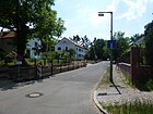
( Location ) |
80 | George Bernard Shaw (1856–1950), Irish playwright | Dec 15, 1959 | The path starts from Heerstrasse . |
|
| Silingenweg
( Location ) |
80 | Silingen , East Germanic branch of the Vandals | March 6, 1936 | The first name was Street 23f . The way is a dead end . |

|
| Skirenweg
( Location ) |
100 | Skiren , East Germanic tribe | March 6, 1936 | The first name was Street 23g . |

|
| Soldauer Allee
( Location ) |
400 | Soldau, town in East Prussia , today Działdowo in the Warmian-Masurian Voivodeship , Poland | Jan. 16, 1925 | The first name was Straße 36 in the manor district of Heerstraße . On March 23, 1925, the extension, Straße 37 , was named as well. The reason for the naming was the sponsorship between Charlottenburg and Soldau, which was badly destroyed during the First World War. It is located in the settlement Heerstraße. |

|
| Soldauer Platz
( Location ) |
70 × 50 (trapezoidal shape) |
Soldau, town in East Prussia , today Działdowo in the Warmian-Masurian Voivodeship , Poland | Aug 8, 1921 | Soldauer Platz forms a branching point in the middle area of Soldauer Allee. From here Lötzener Allee and Neidenburger Allee go southwards, while Soldauer Allee forms the north-eastern boundary of the square . It is located in the settlement Heerstraße. |

|
| Sonnenhof
( Location ) |
30 × 20 | Sun | Aug 16, 1928 | The first name was Place B . It is located in the Eichkamp settlement between Bläulingsweg and Rottannenweg . |

|
| Thrush Street
( Location ) |
1290 | Thrush, place in Bohemia in the Trautenau district , today Hajnice in the Czech Republic | July 30, 1897 | It was created as street 36 of the development plan. The street was named after the battle at Soor and Alt-Rognitz in the German-Austrian War in 1866.
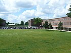
On the map from 1915, the Soorstraße was drawn from Spandauer Damm to over Masurenallee. Their extension, the streets 32 o and 17 a to the former Scholzplatz on today's exhibition grounds to the course of the Westendallee at that time , was named in the same way in 1918. At its southern end was the thrush square . Already on the map from the summer of 1930 it was shown abbreviated in its current course. The barracks between Soorstrasse and Königin-Elisabeth-Strasse were built in 1896 for the Queen Elisabeth Guard Grenadier Regiment No. 3 , which was stationed here until 1918. After it was dissolved, it became a police station. One building has been used by the technical relief organization since 1952 (see picture). |

|
|
Spandauer dam
( Location ) |
2510 (in the district) |
Spandau district , direction | March 30, 1950 | The previous names were Weg nach Spandau (before 1767 to after 1777), Straße von Spandau (after 1777 to after 1893), Am Spandauer Berg and Spandauer Berg (before 1859–1950) and Spandauer Chaussee (around 1900–1950). Part of the street runs in the district of Charlottenburg . In the district, 2510 meters of the street in Berlin's main road network belong to class II (superordinate road connection). |

|
| Sportforumstrasse
( Location ) |
230 + 240 | German sports forum on the Olympic site | Apr 23, 1936 | Part of the street is on the Olympic Square, another part on the site of the Sportforum. |

|
| Spreetalallee
( Location ) |
540 | Spree , to which the road runs downhill | around 1898 | This road, running in north-south direction, with a slight bend about halfway along, lies between Spandauer Damm and Ruhwaldweg on the eastern edge of the park 'Ruhwald'. The paving of the 10-meter-wide street is made up of small cobblestone paving and on the east side is a 1.50-meter-wide sidewalk with stepped surfaces (two meters long), between the two a rain drainage channel and the sewer in the middle of the street. The western plots 1–3b (continuous), as well as 5 and 4–12 (straight on the east side) belong to Spreetallallee. 1 (also Spandauer Damm 212), 1e, 2 are built on, 3 and 3a is a playground. Building 3b is in Ruhwald Park and the other properties (5 and 4, 6, 8, 10, 12) belong to the 'Ruhwald' KGA. Due to its location on the northern flank of the Teltowplatte, the road has a gradient over its length from Spandauer Damm ( 58.2 m above sea level ) to Ruhwaldweg ( 41 m above sea level ) of 17 meters to 540 meters and is not open to traffic ( Sign 250) (residents free: signs 1020-30) permitted, also designated as a dead end and a 10 zone and marked with the sign 101 (danger point) and additional sign for road damage. From the Ruhwaldweg, in addition to the traffic prohibition sign (residents free), a barrier (600) and two barrier posts are set up. |

|
|
Stallupöner Allee
( Location ) |
650 | Stallupönen, a town in the East Prussian province , today Nesterow in the Russian exclave of Kaliningrad | Dec 31, 1923 | The first name was Straße 41a of the development plan in the manor district of Heerstraße . |

|
| Stendelweg
( Location ) |
560 | Karl Stendel (1851–1938), Charlottenburg local politician | Aug 16, 1928 | The first name was Straße 53 in the Ruhleben settlement . |

|
|
Steubenplatz
( Location ) |
100 × 40 | Baron Friedrich Wilhelm von Steuben (1730–1794), German- American general | Aug 13, 1930 | The square is in the course of the Reichsstraße at the intersection with the (northern) Bolivar- and (southern) Preußenallee, to the west is the Olympic Street. The first name was RV-5 . The square with the adjacent 260 meters of main streets belongs to class IV in the main street network of Berlin (supplementary street connection). |

|
| Stormstrasse
( Location ) |
180 | Theodor Storm (1817–1888), writer and poet | Dec 8, 1906 | The first name was Straße 24 of the development plan in Westend. |

|
|
Stülpnagelstrasse
( Location ) |
220 | Wolf Louis Anton Ferdinand von Stülpnagel (1813–1885), Prussian general | Jan. 1, 1907 | Before it was part of the street 35a, Section V / 1 of the development plan. |

|
| Stuhmer Allee
( Location ) |
320 | Stuhm, town in East Prussia , today Sztum in the Pomeranian Voivodeship , Poland | Dec 31, 1923 | The street runs from Mohrunger Allee to Heilsberger Allee. |

|
| Südtorweg
( Location ) |
440 | Access to the south gate of the Olympic Stadium | Apr 23, 1936 | The path leaves Gutsmutsweg in a westerly direction and runs on the site of the Olympic facility. |

|
|
Tannenbergallee
( Location ) |
740 | Battle of Tannenberg (1914) , today Stębark in Masuria, Warmian-Masurian Voivodeship , Poland | until December 1914 | It connects Johannisburger Allee with the intersection Insterburgallee / Teufelsseestrasse in a west-east direction. |

|
| Tapiauer Allee
( Location ) |
260 | Tapiau, a city in the East Prussian province , today Gwardeisk in the Russian exclave of Kaliningrad | July 26, 1921 | The first name was street 45a in the former manor district of Heerstraße . |

|
| Teufelsseestrasse
( Location ) |
480 | nearby Teufelssee | after 1914 | It goes from the Heerstraße (northeast) and leads to the Waldschulallee. There it continues as Teufelsseechaussee in the Berlin-Grunewald district . |

|
| Tharauer Allee
( Location ) |
450 | Tharau, city in the province of East Prussia , today Vladimirovo in the Russian exclave of Kaliningrad | Aug 21, 1958 | The first names were Street 2 and Street 2a in the development plan. |

|
|
Theodor-Heuss-Platz
( Location ) |
200 × 160 (oval shape) |
Theodor Heuss (1884–1963), German Federal President | Dec 18, 1963 | The previous names were Reichskanzlerplatz (around 1906–1933 and 1947–1963) and Adolf-Hitler-Platz (1933–1945). 460 meters of the streets on the square are federal roads (to the B 2 and B 5) and belong to class I (large-scale road connection) in Berlin's road network . |

|
|
Thüringerallee
( Location ) |
290 | Thuringian , West Germanic tribe | Apr 13, 1909 | The first name was Straße 3, Section V of the development plan. The street lies between Masuren- and Langobardenallee and leads indirectly via the exhibition center to Wandalenallee. South of Heerstraße it belongs to a quarter in which the streets were named after Germanic tribes. It is located between the southern side lane of Heerstraße and Wandalenallee. |

|
| Trakehner avenue
( Location ) |
730 | Trakehnen, a village in the province of East Prussia , known for its horse breeding; today Yasnaya Polyana in the Russian exclave of Kaliningrad | from 1923 | The first name was street 18 of the development plan in the manor district of Heerstraße . The main stud Trakehnen was north of Trakehnen . The street belongs to class III (regional road connection) in the main road network of Berlin . |

|
|
Ubierstrasse
( Location ) |
130 | Ubier , West Germanic people | March 6, 1936 | The previous name was Salierallee (1918-1936) after the East Franconian noble family of Salier . The street runs slightly northeast from Wandalenallee and turns into Karolingerplatz. South of Heerstraße it belongs to a quarter in which the streets were named after Germanic tribes. It is located between the southern side lane of Heerstraße and Wandalenallee. |

|
| Elm Avenue
( Location ) |
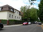
1000 | Elms , genus of plants in the elm family | around 1867 | The name comes from a typical street tree that may have served as the first planting with elms. The street is between Ahorn- and Bolivarallee, opposite Altenburger Allee. It belongs to a district around Branitzer Platz in which the streets on the western edge of the city of Charlottenburg are named as avenues after tree species. |
|
|
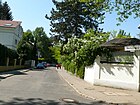
Juniper Trail
( Location ) |
150 | Juniper , a genus of plants belonging to the cypress family | Dec 31, 1923 | The first name was street 25 in manor district Heerstraße . |
|
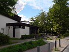
| Waldschulallee
( Location ) |
1270 (in the district) |
forest school located here | Jan. 16, 1925 | The first name was Straße 30 in the former civil servants' settlement at Heerstraße station . On July 13, 1934, part of the Eichkatzweg was included. The street runs from Eichkampstraße to Teufelsseestraße. It is located in the locality of Eichkamp . |
|
| Wandalenallee
( Location ) |
650 | Vandals , Germanic people | March 6, 1936 | It is located between Silingenweg and across Ubierstraße to the exhibition center. The first name was street 23d of the zoning plan. On August 7, 1998, the section between Jafféstrasse and Silingenweg was included. South of Heerstraße it belongs to a quarter in which the streets were named after Germanic tribes. |

|
| Warning way
( Location ) |
230 | Warn , Germanic tribe | March 6, 1936 | The first name was Street 23e of the zoning plan. |

|
| Westendallee
( Location ) |
1350 | Berlin-Westend | May 6, 1909 | The first name was Street 16 of the development plan in Westend. Originally, Westendallee ran from Reichsstraße over Kaiserdamm (today: Heerstraße ) to the southern end of Rognitzstraße. Between 1925 and 1930 it was replaced by construction work, u. a. at the exhibition center, considerably shortened. Between Brixplatz and Olympischer Straße there is a section of the Wannseeweg , which is marked as number 11 of Berlin's 20 main green routes . |

|
| Wiesendamm
( Location ) |
360 (in the district) |
Ruhleben meadow area | from 1911 | The road forms the border to the Spandau district , in which the larger part is located. |

|
| Willenberger Path
( Location ) |
180 | Willenberg, town in East Prussia , today Wielbark , in the Warmian-Masurian Voivodeship , Poland | 28 Sep 1935 | In the development plan, this street is laid out as street 42 and street 57 of the "Siedlung An der Heerstraße". This locality settlement Heerstraße was built on the estate district Heerstraße . |

|
| Throwing ground
( Location ) |
125 × 110 (with grandstands) |
Spear , hammer or discus throwing | 1936 | The throwing ground with the “stadium on the throwing ground” is located south of Hanns-Braun-Strasse and west of Hanns-Braun-Platz. It is part of the German Sports Forum . | |
| Württembergallee
( Location ) |
610 | Kingdom of Württemberg | Apr. 24, 1908 | The avenue lies between Preußenallee and the northern side lane of Heerstrasse. The first name was street 27a of the zoning plan. In this quarter streets are named after the countries of the German Empire . |

|
|
Cicada path
( Location ) |
700 | Cicadas , species of insect | May 13, 1929 | The first name was street G 7 . It is located in Eichkamp . |

|
Former streets and squares
Information on previous street names or deleted streets embedded in the overview is only listed here if relevant. This table contains further explanations and additions to withdrawn or renamed streets. The streets according to the development plan and numbered streets are not included in this list and are only mentioned in the notes for better orientation.
The villa colony in the west of Charlottenburg was founded on May 1, 1866 by the limited partnership cooperative for the wealthy Charlottenburg bourgeoisie on the site of the Spandauer Berg, based on the model of the elegant London district of Westend. In 1878 Westend was attached to the city of Charlottenburg . The Berlin horse-drawn railway , which was extended to the Gasthaus Spandauer Bock in 1879, was conducive to development . The streets, mainly named with the addition of "* -allee", are initially named in the address books under the overall entry "Westend", as in 1870, for Charlottenburg under the combined indication "Westend", which is followed by the streets. from 1899 Westend is run as a district of the city of Charlottenburg. The planned alignment of the avenues of the villa colony ("Alt-Westend") south of Spandauer Chaussee was not completed. In the south, the new street layout of Neu-Westend was created , for which street names were chosen based on the federal states of the empire founded in 1871 out of national sentiments . The manor district An der Heerstraße came to the administrative district of Charlottenburg and it is (partly) with its streets in today's district Westend.
According to the development plan, the following squares with letters for Westend were planned: Platz A (→ Fürstenplatz ), Platz B (→ Theodor-Heuss-Platz ), Platz D (→ moved in Scholzplatz ), Platz E (→ Theodor-Heuss-Platz ), Platz F. (→ Brixplatz ), Platz J (→ Luisenkirchhof II).
On a map from 1946 there are street names marked as provisional. In connection with the renaming of street names during the Nazi era (as of 1943), Spandauer Chaussee is registered as Graf-Kessler-Straße . The proposal refers to Harry Graf Kessler but was not implemented in March 1950. The entire street was named Spandauer Damm . For Adolf-Hitler-Platz the name from the pre-war period was proposed: Reichskanzlerplatz , which was officially confirmed before this square was named Theodor-Heuss-Platz in 1963 .
| Formerly | from | to | renamed to (current name) |
Origin of name | Remarks |
|---|---|---|---|---|---|
| Ahornplatz | before 1874 | 1995 | → not applicable | Maple with reference to Ahornallee | In 1874 it was marked by name on the map of the city of Charlottenburg, the square was named with Ahornallee at its intersection with Nussbaumallee around 1867. In the Westend villa colony , several spaces were planned at the “avenue” crossings. As late as 1961, the Ahornplatz was marked with a green roundabout on the map . The triangular square with a length of 90 meters along the Ahornallee and 60 meters across has a southern and a northern driveway to the Nussbaumallee. The square lost its (probably never dedicated ) name around 1995 . Entries in the address book are missing because no properties were assigned. |
| Albert-Berner-Strasse | Apr 21, 1933 | May 1945 | → not carried out | Albert Friedrich Berner (1818–1907), German criminal law scholar | It was a dead end from Riehlstrasse. In 1913 it was recorded for the first time in Berlin's address book, but was no longer shown for 1914. |
| Allensteinallee | 1925 | before 1932 | → deleted | Allenstein . Two battles raged in that area during the First World War. | The street was entered in the city map between Tannenbergallee and An der Heerstraße (parallel to Ortelsburger Allee ), the extension is Pillkaller Allee. On the map from January 1925, their route was entered without a designation and the street was shown in the record for the Berlin streets from September 1925. The name was deleted between the summer of 1930 and August 1932. Today there are residential buildings on the (then planned) route opposite a parking area, the properties of which are assigned to the cross streets. |
| Old Fürstenbrunn way | after 1912 | January 27, 1955 | → Fürstenbrunner Weg , west of the Rohrdammbrücke → Ruhwaldweg | Fürstenbrunn an der Spree (location around the mineral spring south of the street) | The Fürstenbrunner Weg connected the local situation “Fürstenbrunn an der Spree” to the city of Spandau am Spandauer Bock (on the corner of Spandauer / Wiesendamm) and to the city of Charlottenburg through the Charlottenburg freight yard, initially to Sophie-Charlotten-Straße. In addition to the Alten Fürstenbrunner Weg , the Neue Fürstenbrunner Weg was built to the west of the railway ring (as a continuation of the Rohrdamm from Siemensstadt) ; the bridging of the freight station was omitted. The Fürstenbrunner Weg between Spandauer Berg via Hamburger and the Lehrter Railway and to Spandauer Berg is recorded in the 1912 address book . Obviously, however, the division of the Fürstenbrunner Weg into the east-west branch (“old”) and the north-south branch (new) was not consistently handled throughout. |
| Biedermeier way | August 16, 1928 | November 26, 1959 | → Biedermannweg | Biedermeier period from 1815 (Vienna Congress) to 1848 (bourgeois revolution) | In the Ruhleben settlement , road 54 was named in 1928; in 1926, the route was already entered on the map without being named. Street 54 is still listed in the 1929 address book, but with the note: “Renamed to Biedermeierweg at the time of going to press”. In 1943 the street was built on. The Biedermeier period stands for withdrawn, bourgeois behavior, the name change in 1959 honored Gustav Biedermann (1878–1957) one of the patrons of the small settlement in Ruhleben. |
| Birch avenue | around 1867 | around 1910 | → moved in | Birch , deciduous tree like the surrounding "avenues" | The birch avenue was drawn on the map from 1884 parallel to the plane tree avenue from Eschen to Ahornallee. According to the map from 1893, it is the southernmost named west-east road of Neu-Westend . The street was withdrawn in favor of several small streets in the corner of Linden- / Ahornallee with the Reichsstraße (which was not routed here in 1893). The Berlin address books 1900 to 1910 do not name the Westend “avenues”. |
| Braunschweigallee | around 1909 | Jun 27, 1925 | → Bolivar avenue | Duchy of Brunswick | The street 30 of the development plan for Neu-Westend is shown for the first time in the address book of Berlin from 1910. In 1909 it ran from the then unnamed Steubenplatz to what was then Spandauer Chaussee . In the quarter south of the Reichsstrasse and around its north, the street names are represented by countries of the German Empire, which was proclaimed in Versailles on January 18, 1871. In 1925 the undeveloped Braunschweigallee at the Neu-Westend underground station (Steubenplatz) was connected to the Preußenallee and in 1931 was named Bolivarallee on this route. |
| Buchenweg | around 1920 | March 30, 1950 | → Cockchafer path | Beech, deciduous tree | The path originated with the Eichkamp settlement in the west of the district. The route was not yet shown in the city map of Berlin from 1920 and it is shown in the Berlin address book from 1921. Eichkamp initially belonged to the Grunewald Forst estate and came to the Wilmersdorf administrative district in 1920 until the district reform of 1938. The name was changed to Maikäferpfad in Charlottenburg in 1950, but the name Buchenweg was retained in Spandau. The adjacent garden colony still bears the name "KGA Buchenweg". |
| Bundesallee | "around" 1909 | July 31, 1950 | → Länderallee | North German Confederation | The streets south of Reichsstraße (as a later construction phase) were named after the federal states of the German Empire that was proclaimed in Versailles. The street 6a of the development plan in Neu-Westend is the eastern end of the district in its direction and was first mentioned in Berlin's address book from 1910. The renaming in 1950 is connected with the establishment of the Federal Republic in 1949 , on July 18 in the Wilmersdorf district the Kaiser- in Bundesallee was named. |
| Burgundy avenue | 1909 | after 1932 | omitted | Burgundy , historical province | As street 23b, section V of the development plan, the short street ran close to the Heerstraße train station in the angle from Kaiserdamm to the (no longer existing) southern section of Westendallee. In 1910 it was designated for the first time in Neu-Westend , the street was dropped between August 1932 and July 1934 with the redesign of the terrain east of the S-Bahn station. |
|
Döberitzer Heerstraße On Heerstraße |
before 1908 | around 1934 | → Heerstrasse | Döberitz , since 1964 part of the community Dallgow-Döberitz | From 1903 to 1911, Heerstraße was built for the Berlin garrison as a direct connection between Berlin and the military training area in Döberitz to the west, which was laid out in 1897, by Pichelsdorf, bypassing Spandau. Allegedly, the straight course is due to the fact that Kaiser Wilhelm II connected the starting point in Berlin and the destination in Döberitz on a map with the ruler when planning the street. On the map from 1893, the continuation of Bismarckstrasse runs west of Sophie-Charlotte-Platz in a route past the Schützenhaus through the not yet drained south of the Westend villa colony . To distinguish it from other military roads around Berlin, the addition to the name was probably necessary. Between 1914 and 1920 the manor district, which had been separated from the manor district of Grunewald-Forst in 1914, was called Heerstraße. Döberitzer Heerstrasse is shown on the map published in 1912 as a continuation of Kaiserdamm from the height of Insterburgallee , in 1921 in Neu-Westend from the Heerstrasse train station ( Raussendorffplatz , Westendallee). In the Charlottenburg area it is also called An der Heerstrasse . The choice of name was probably ambiguous in some maps it is drawn as Döberitzer Heerstraße until around 1934, it is called An der Heerstraße in evidence for Berlin and the surrounding area . In 1915, Heerstrasse was not mentioned under any name in the address book. On a map from 1947, An der Heerstraße between Pichelsberg (Havelchaussee – Glockenturmstraße) via Scholzplatz to Westendallee, S-Bahn station Heerstraße is drawn, the location of Heerstraße is on the south side opposite the Reichssportfeld. 1954 then continuously in Charlottenburg (Westend) and Spandau (Staaken) as Heerstraße west of Reichskanzlerplatz (→ Theodor-Heuss-Platz ). |
| Feldstrasse | before 1824 | before 1893 | → Knobelsdorffstrasse | led to the "Charlottenburger Feld" | According to the map from 1874, the "Charlottenburger Feld" was between today's Seelingstrasse and Königsweg ( Wundtstrasse ). The field road is particularly marked on a map of 1824 parallel to the Potsdamer Straße, this short street was between (today) Danckelmann- and the Castle Road. Before the course was taken up as a “road”, the term field path was used since 1750 and also after 1824 . |
| Graditzer Allee | Jun 27, 1925 | April 23, 1936 | → Friedrich-Friesen-Allee | Graditz, district of Torgau, since 1686: Electoral Saxon Stuttgart Graditz | Street 9a was in the former manor district of Heerstraße . The Graditz Avenue ran north of the highway in the extension of that Rominter avenue for today's Rominter Avenue . The street was in the area of the (horse) racetrack Grunewald , which is why the name is derived from the Saxon stud. |
| Iltisallee | 1924 | → Alte Allee | Polecats , nocturnal martens | The Iltisallee was not yet recorded in the record for the Berlin streets from 1922. It was located in the southwest of the Eichkamp settlement , which arose in the forest south of the former exercise area. With the construction of the street, the residents chose a "natural" name that matched the surrounding paths. Obviously, however, the settlement path leading off the Kronprinzessinenweg in the route on the southwest edge of the forestry department (Landjägerei), which was then in the Grunewald district of the Wilmersdorf administrative district, was officially named differently. However, the indication Alte Allee is included on the 1926 card, but not yet in the 1930 address book. | |
| In the Bucheneck | August 1925 | around 1952 | → not applicable | Beech, deciduous tree | The way later than Platz was in the Eichkamp settlement and initially belonged to the Grunewald district (Wilmersdorf). It was not yet drawn on the map from January 1925. It was shown in the record for the Berlin streets of September 1925. on the street Im Eichkamp ( Eichkatzweg ). It was from the street Im Eichkamp on the corner of Lärchenweg, but the information on maps is not entirely uniform, so the location is indicated in 1943 southwest of Lärchenweg to Buchenweg. In the address book from 1943 Im Bucheneck in the administrative district of Charlottenburg is noted with three properties. It was recorded as a dead end in 1946 and is still included in the city map of Berlin from 1951. It is missing in 1954. It ceased to exist between 1951 and 1952 and the properties were reorganized with the renaming of Buchenweg . |
| In Eichkamp | around 1921 | October 10, 1936 | → Eichkatzweg | District forester in the Grunewald forest | The path ran on the edge of the Eichkamp settlement at the "Eichkamp sub-forestry". On the map from 1920 no road was drawn in this area. In the record for the Berlin streets from 1921, the street that belonged to the district of Grunewald in the Wilmersdorf administrative district is already shown. According to the map from 1921 Im Eichkamp is the “central” street of the settlement from Kiefern- , across Buchen- and Lärchenweg . The route is identical to the Eichkatzweg, the settlement expanded to the north and south-west. The settlement route is not entered in the address book in 1935. Before the change in the district boundaries in 1938, neither the new nor the old street name was listed in the address book in 1937. 1938 is registered for Charlottenburg Im Eichkamp with the reference to the Eichkatzweg, whereby the 79 properties of the small house settlement are built on and inhabited here. |
| church Square | around 1867 | August 20, 1897 | → Branitzer Platz | Reserved for a west end church | Several spaces were planned in the Westend street grid . Centrally at the intersection of Kastanien- / Eichenallee the building of a church was probably planned, which led to the place name. In the 1895 address book, the "Kirch Platz" with the Becker villa is mentioned. In 1898 the Branitzer Platz with the Becker'schen Villa was already registered (but bordering on the Lindenallee). |
| Koenigsplatz | around 1867 | before 1915 | → not applicable | King , bearer of monarchical dignity | The King Square in the villa colony Westend was at the crossroads of maple and plane trees and was one of several places on the Maple Avenue, which demarcated the villa colony in the east. A connection from Platanenallee to Knobelsdorffstrasse via a square on Ahornallee, as had been the case since the 1920s, was not initially planned. It was marked by name on the map from 1874 and also in 1893. On the 1960 city map it is entered as a round square, but unnamed. The naming of the square was dropped after 1914, the round shape is still recognizable in 2015 on the property boundaries at the intersection. In the 1905 address book and still in 1914, Königsplatz is listed (without any property allocation), but no longer in 1915. |
| Lindenplatz | 69061234 | 69822345 | → Anneliese-and-Georg-Großcurth-Platz | Linden tree , with reference to Lindenallee | In the city plans of Berlin from 1874 and 1884, this place between the elm, walnut and linden avenue was designed as a playground. Not yet in the record for the Berlin streets of October 1905, it is shown in June 1906. However, this term was probably not a pronounced one; the 1926 map does not show him. As late as 1961 in the train of Lindenallee as a green central island, Lindenplatz is marked with a name, it is still unnamed on the map from 1985 and later plans. In 2006 the green square was given its current name as the center island of the two lanes of the Lindenallee. |
| Markomannenallee | around 1909 | March 6, 1936 | → Merovingian way | Marcomanni , Elbe Germanic people | The streets of the estate district of Heerstraße south of Heerstraße are named after Germanic tribes, street 23a of Dept. V of the development plan was laid out and named around 1909. It was located between Allemannenallee and Westendallee, which ran in the 1910s / 1920s along the route of Jafféstraße along the route of the "Berlin Hamburg Connection Railway". It is also listed as undeveloped in the 1935 address book. The previously adjoining Westendallee was not implemented with the expansion of the exhibition grounds ( exhibition grounds at the radio tower ) and the Markomannenallee was initially on the side, before the streets to the southwest of the housing estate were (also) renamed Merowingerweg and the expansion took place. |
| Mecklenburgallee | 1909 | March 30, 1950 | → Marathon avenue | Grand Duchies of Mecklenburg-Schwerin and Mecklenburg-Strelitz | The street 29 of the development plan of Neu-Westend , like others in the quarter to the west of the Reichsstraße, was named with the names of countries of the German Empire, which was proclaimed in Versailles in 1871. It was parallel between Bayern- and Schwarzburallee. Due to the location adjacent to the Olympic site from 1936 and the northern parallel street renamed Olympische Straße , the new name resulted from the renaming in 1950. |
| Oldenburgplatz | 1918 | around 1930 | → deleted | Grand Duchy of Oldenburg (1814–1918) , based on Oldenburgallee | The square was at the southern end of Oldenburgallee and the corner of Westendallee. On the map from 1915 the place was entered without a name and then in 1918 Oldenburgplatz was drawn. The designation was deleted around 1930. |
| Ostpreußenallee | 1918 | July 13, 1934 | → Masurenallee | East Prussia , | The East Prussia Allee put the Masurenallee over the space D (Scholzplatz) away proceeds to Royal. It was named in the undeveloped area of the Witzleben estate. The street 9g of the development plan is marked by name on the map from 1918 as Ostpreußenallee . With the construction of the exhibition area at the radio tower , the street situation will be changed. 1932/5900 Ostpreußenallee was incorporated into Masurenallee on July 13, 1934 and forms the transition to Neue Kantstrasse . |
| Parkstrasse | 68970421 | 68980500 | → not applicable | Park , here projected recreational area | In the city map of Berlin from 1884, Parkstraße was marked by name on the southwest edge of the Westend villa colony . It ran parallel to the Birkenallee over the Lindenallee and led to the Ahornallee on the then place B , the later named Reichskanzlerplatz . The street ceased to exist before 1898, in 1895/3069 / because the settlement of the villa colony went worse than planned. New Westend was planned in the street area from 1900 . |
| Reichskanzlerplatz | December 8, 1906 | April 21, 1933 | → Theodor-Heuss-Platz | Reich Chancellor, official title of the head of government of the German Reich | The planning of the villa colony already provided for a place B, Section V / 1 . It was created as Reich Chancellor Square with the project planning of Neu-Westend and is shown for the first time in the record for the Berlin streets from November 1907. The name takes on the surrounding references to the empire around Reichsstrasse and the Kaiserdamm that runs through it . In April 1933, the name was changed to Adolf-Hitler-Platz after the incumbent Chancellor . With the denazification in 1947, the renaming took place before the first Federal President Theodor Heuss was named after 1963 . |
| Reichssportfeldstrasse | April 23, 1936 | February 21, 1997 | → Flatowallee | Reichssportfeld , Berlin Olympic site, 1936 | The Rennbahnstraße from the highway to the station Stadium Racetrack Grunewald in the Trakehner Allee was to the Olympic Games in Berlin was renamed in 1936 to the new purpose accordingly. It is the direct access from Heerstraße to the south gate of the Olympic Stadium (Coubertin gate). Due to protests by residents, the renaming to Flatowallee from 1995 only became effective in 1997. |
| Racetrack Street | 1914 | April 23, 1936 | → Flatowallee | In 1909 the Grunewald racecourse was opened | The street 10 of the development plan in the former estate district of Heerstraße was not yet shown in the “Proof of the streets of Berlin” June 1914, but it was already shown on the map in 1915. The Rennbahnstraße led from on the highway to the entrance of the racecourse . The “German Stadium” was completed in 1913 as Berlin's fourth major race track, so that the access from Berlin via the Kaiserdamm was expanded. The planning for the trotting track probably previously provided for the area west of the later Reichsstraße. The German University for Physical Education , founded in 1920, moved into a new building next to the stadium in 1922. In 1936 with the renovation of the racetrack due to unprofitable racetrack operations (inflation and global economic crisis) for the Olympic Games , the unchanged route, which still exists today, was renamed Reichssportfeldstraße to reflect the new situation . |
| Romintenerallee (before) | June 27, 1925 | April 23, 1936 | → Passenheimer Strasse | Rominten | The road 8 in the manor district of Heerstraße led from An der Heerstraße (today: Heerstraße) in the route of today's Passenheimer Straße west / north around the grounds of the Grunewald racecourse . The surrounding streets were named after cities and towns in East Prussia and were named after it during the First World War and in the first few years. The Romintenerallee was rewritten in Rominter Avenue and the Olympic Games in 1936 renamed Passenheimer Straße.
As Rominterallee the route was instead Straße 21 named the development plan. This planned street is in today's tour between Olympische Straße and Murellenweg (with a connection to Charlottenburger Chaussee in Spandau). This (new) route was already planned in the development plan in the 1920s, but not named. |
| Sachsenplatz | 1909 | July 31, 1947 | → Brixplatz | Kingdom of Saxony , part of the German Empire | Sachsenplatz is located in the north of Neu-Westend and was named accordingly after a federal state of the German Empire. Projected as space F in the development plan , it is shown for the first time in the Berlin address book from 1910. It was expanded and in 1940 there are 14 residential buildings and other undeveloped lots (known as construction sites) on the site. In 1947 it was renamed after the architect Josef Brix , who was the prorector at the Technical University of Charlottenburg and who held the chair for urban planning. |
| Salierallee | 1918 | March 6, 1936 | → Ubierstrasse | Salier , East Franconian noble family in the Roman-German Empire | The 22, Div. V of the development plan was on the map of 1915 in its route with the designation no. 22 entered for the settlement south of the highway. In 1918 it was named Salierallee and extended Pommernallee parallel to Frankenallee on Karolinger Platz. Both traffic routes connected Kaiserdamm and Westendallee, which is longer to the south. The settlement project remained unfinished due to the subsequent inflation . With the construction of the exhibition area at the radio tower , the alignment in the southwest of the settlement planning changed and so in 1936 the renaming of the undeveloped streets, including the Salierallee northwards from the (now) Wandalenallee, followed. In Alt-Glienicke there was also a (built-up) Salierstrasse in 1935, and street names that had repeatedly existed were dismantled through the formation of Greater Berlin in the unified municipality. |
| Schwarzburgallee | 1909 | April 23, 1936 | → Olympic Road | Principalities of Schwarzburg-Rudolstadt and Schwarzburg-Sondershausen | The road 31 in the development plan was part of the projected system for New West End and was awarded the surrounding streets between West End Avenue and Empire Road 1910 / / 1909 5363 by province of the Empire named after a designated here before trotting as a racetrack Grunewald further west in Gutsbezirk highway plans and was built. When it was rebuilt for the 1936 Olympics , Schwarzburgallee, with the subway to Ruhleben and the S-Bahn bridge, became an essential gateway to the Reichssportfeld and the Olympic Square , which explains the renaming in 1936. |
| Scholzplatz (previous location) | 1920 | 1930 | → moved in | Ernst Scholz (1874–1932), lawyer and politician (DVP), in 1920 the last Lord Mayor of Charlottenburg | The space D, Div. V of the development plan to Neu-Westend was between Masuren- and East Prussia Avenue , crossed by the Soorer road . The Scholzplatz is included in the verifier for the streets of Berlin in 1921, but not in September 1925. In Borchert 1930, the remark is "pulled in because of the building of the exhibition center".
1931 was on the high road one (other) Square in height On Postfenn the vacant name Scholzplatz . |
| Soldauer Strasse | 1918 | after 1930 | → built over | Soldau, town in the province of East Prussia , today Działdowo in Poland | In 1915 still as street 20a , it is marked on the map from 1918 by name between Platz D and Westendallee (the section planned at that time roughly along the course of Wandalenallee ). on an area that previously belonged to Grunewald . The Soldau street is listed in the address book in 1919 (not in 1918). It is mentioned in the address book from 1920 from the (planned) Westendallee (south of Heerstraße) to the Charlottenburg district (Westend district) and it is undeveloped at this time. This entry "undeveloped" still exists in 1930. Soldauer Strasse belongs to the east of the railway line from Westkreuz to Neu-Westend ("Berlin Hamburger Anschlussbahn"), while Soldauer Allee and Soldauplatz belong to the Heerstraße settlement (west of the Berlin-Hamburger Anschlussbahn). The entire area between the Ringbahn and Westkreuz-Spandau was built over when the exhibition center was set up, and Borchert (1930) still explains Soldaustraße . In addition to Soldauer Strasse , the streets around Ostpreußenallee named here were named after places that Germany had to give up as a result of the Treaty of Versailles . |
| Thrush place | 1918 | after 1932 | → moved in | Battle of Thrush and Alt-Rognitz in the German-Austrian War of 1866. | The Soorplatz was at the southern end of Straße 17 . The connection to the converted section of Soorstraße was planned via the square D and street 32d , which were also not carried out . The soorplatz is marked by name on the map from 1918 and was located on what was then the southern section of Westendallee, which roughly corresponded to the course of Wandalenallee . The streets planned here around Ostpreußenallee were named after places that Germany had to surrender as a result of the Treaty of Versailles . Ultimately, the previously undeveloped area was used for the Great German Radio Exhibition, which has been taking place since 1924, and the exhibition area at the radio tower on Masurenallee . |
| Spandauer Berg | before 1859 | March 30, 1950 | → Spandauer Damm | Elevation Spandauer Berg (1932 as a locality) lies on the Spandau / Charlottenburg border (east of Wiesendamm (railway bridge)): 35 m above sea level. NN , Gothallee: 48.1 m above sea level NN , Kirschenallee: 59.5 m above sea level NN ; Increase in road running that was regulated during the construction of the Ringbahn and Westend train station (from 1877) (Dankelmannstrasse: 33.5 m above sea level , Fürstenbrunner path: 49.8 m above sea level ) | The street Am Spandauer Berg was already mentioned as a postal address in the Charlottenburg address book from 1859. The street Spandauer Berg was drawn on the map from 1884 from the then street from Spandau (later Spandauer Chaussee ) to Spandauer Straße (section to the castle). As a result, this section of road was located in what is now the district of Charlottenburg and Westend. A section of the Chaussee “Charlottenburg – Spandau” between Spandauer Chaussee and Spandauer Strasse (Soorstrasse, Königin-Elisabeth-Allee, Sophie-Charlotten-Strasse) was drawn in the 1901 map of Berlin under the name Spandauer Berg , also on the map from 1906 and 1926. The 1895 address book names the street between Sophie-Charlotten-Straße and Spandauer Bock . In the 1905 address book, Sophie-Charlotten-Straße up to Neuer Fürstenbrunner Weg / Königin-Elisabeth-Straße is mentioned, after Spandau follows Spandauer Chaussee from the corner of Ahornallee. On the map of 1943 Spandau Hill added to this route, the map in 1946 called for the west route subsequent Graf-Kessler-Straße , Spandau Quiddestraße and (Eastern) for the Charlottenburg Spandau road to Luisenplatz Wehbergstraße . However, in March 1947 these three names were not officially confirmed. |
| Spandauer Bock | before 1890 | before 1929 | → Spandauer Damm | eponymous was the Spandauer Bock excursion restaurant between the cities of Spandau and Charlottenburg | On the map from 1893, Spandauer Bock is the destination of the Spandauer Berg road . The name stands less for a street section than for the property on the western edge of Westend with the brewery. The Spandauer Bock is also noted in the 1890 address book. In 1921 the Spandauer Bergbrauerei is between Spandauer Chaussee and Altes Fürstenbrunner Weg and in 1926 the Spandauer Bock tavern and the Schultheiß-Patzenhofer a. G. drawn. However, in 1922 Spandauer Bock was run between Spandauer Chaussee and the Ruhleben district. The 1929 address book contains the information on the Spandauer Bock , but with the reference to Spandauer Chaussee 50/56 and 1930, the address book only contains the note: “Spandauer Bock s. Spandauer Chaussee 50/56 ”, so that there is no longer a separate address with this name. |
| Spandauer Chaussee | around 1900 | March 30, 1950 | → Spandauer Damm | Developed as a road towards Spandau | The Spandau-Hamburg art street was built between 1820 and 1822. On the map of Charlottenburg from 1857, the street was still marked with the name "Straße von Spandau". This name was initially valid for the entire street from Charlottenburg Castle to Spandau, in 1884 this name is only drawn in from Spandau up to Soorstraße, where the Spandauer Berg began . In the 1895 address book, Spandauer Berg is named up to the city limits of Charlottenburg and Spandauer Chaussee is also missing in 1900 , but property numbers are only listed in the eastern part. In the 1901 Berlin address book, the Spandauer Berg ends at Westend / Spandauer Chaussee and the Spandauer Chaussee lies from Spandauer Berg to Spandauer Bock . This breakdown from 1900 is probably due to the increasing independence of the Westend villa colony . On the 1943 map, Spandauer Chaussee is indicated as far as the border of the administrative district of Spandau. In 1946 the street was entered on the map as Graf-Kessler-Straße, this name was not officially confirmed. |
| Stadionallee | August 16, 1928 | March 10, 1984 | → Jesse-Owens-Allee | German stadium, which was demolished in 1934 and was replaced by the Olympic Stadium, | The Stadionallee was on the north side of the railway road between Rennbahnstraße ( Flatowallee ) and the former Rominten Avenue ( Passenheimer Straße ) in the (former) Gutsbezirk highway. The "German Reich Committee for Physical Exercise" had the "German Stadium" built in 1913 in the Grunewaldrennbahn . When Berlin applied as a venue for the 1936 Olympic Games , it was demolished after tests in 1934 and an expanded sports facility began with the Reichssportfeld (based on plans by Werner March), which was inaugurated in 1936. The Stadionallee was now south of the Maifeld. As a section of the main street train from Trakehner Allee to Olympische Strasse, it was finally named in 1984 after Jesse Owens , who died in March 1980 and was of particular importance for the Berlin Olympics . |
| Suhlenweg | January 16, 1925 | February 18, 1927 | → Jasmine path | near the two pools of water that were muddy at the time: called Sausuhlen | The choice of name as Suhlenweg for street 21 (H) in the development plan was made due to the local situation in the Ruhleben settlement. At the urging of the settlers, however, it was renamed to Jasmin after a short time , which "stands out for its decorative white and fragrant flowers". |
| Töbelmannweg | March 30, 1950 | 3rd December 1959 | → deleted | Georg Toebelmann (1835–1909), architect and Charlottenburg local politician | The Töbelmannweg was newly laid out. It went from Messedamm and led north of the Deutschlandhalle through south of the exhibition halls, continued over the S-Bahn line from Straße 58 ( Harbigstraße ), the route led to Waldschulallee. The Jafféstraße along the railway was established and named in 1958, it opened up the exhibition grounds from the west side and the main south entrance which led into Töbelmannweg. Its route therefore belonged to the exhibition grounds. The Töbelmannweg was therefore deleted from the street register in 1959 . |
| Gym avenue | after 1963 | after 1965 | → Friedrich-Friesen-Allee | Located on the site of the Olympic Stadium, it was named after a facility of the sports forum. | Turnhallenallee was the name given to the “green” section of Friedrich-Friesen-Allee across Gutsmuthsweg and Sportforumstraße as a cul-de-sac to just beyond Adlerplatz . Still on the 1961 city map, Friedrich-Friesen-Allee (to which no properties are assigned) leads in its entire length through the (named) sports fields to the “House of German Sports” on Sportforumstrasse. In the city map from 1964, this eastern section is indicated by name as a gym alley. Soon after, the renaming in Turnhallenallee was probably waived and this name was withdrawn again in favor of Friedrich-Friesen-Allee. |
| Extended Ahornallee | around 1903 | around 1907 | → canceled | Maple , here based on the Ahornallee | The streets of the Westend villa colony, running in a north-south direction, were initially intended to face south across Birkenallee and Parkstrasse . So does the extended Ahornallee . On the map from 1901, Ahornallee was drawn from Spandauer Chaussee (today Spandauer Damm) to Kaiserdamm (street 7b), which was not yet in existence at the time . An extension in the non-implemented area to the local border of Grunewald on the Westkreuz – Heerstraße railway line was probably laid out as an extended Ahornallee . This section was also implemented in Neu-Westend up to Reichskanzlerplatz . The route of the extended Ahornallee ceased to exist between 1903 and 1904 when smaller streets were finally laid out, which are already marked with numbers on the map from 1904. In Berlin's 1903 address book, an extended Ahornallee was shown for the only time; in 1904 this entry is missing. |
| Extended Eschenallee | around 1906 | around 1909 | → Länderallee | Ash , deciduous tree, named with reference to the Eschenallee | The route of Eschenallee went from what was then Spandauer Chaussee to Strasse 7b , but in 1901 it was only named as far as today's Reichsstrasse , which at that time only existed as a route on the southwest edge of the villa colony . In 1904 the extension of Eschenallee was laid out as Straße 6a . The address book of Berlin from 1906 shows the extended Eschenallee for the first time and it is also shown on the map from 1907. At this point in time, it forms the western edge of the planning area of the "Neue Westend Aktien Gesellschaft für Grundstücks Verwertung" for the planned trotting track. It is also the connection from the villa colony via Döberitzer Heerstraße ( Raußendorffplatz ) to Teufelssee ( Teufelsseestraße and -chaussee) with the Charlottenburg waterworks. With the naming of the Neu-Westender Strasse around 1909, it was named Bundesallee . A slightly different location on Raussendorfplatz brought the connection to Kaiserdamm / Döberitzer Heerstraße . In 1950 it was renamed Länderallee. |
| Extended avenue of lime trees | before 1901 | before 1908 | → Lindenallee | Linden tree , with reference to the Lindenallee | The Extended Lindenallee was drawn on the map from 1901 south of the Birkenallee as a continuation of the Lindenallee. It continued over the place B on the road 7b ( Heerstraße ), which was not yet laid out at the time, through the planning area to the Westkreuz – Heerstraße railway line. In the city map of Berlin from 1904 this route was drawn in its current length as Lindenallee, in the city map 1907 it was still listed as Extended Lindenallee. Over the Kaiserdamm (later this is Heerstraße) and what was then Reichskanzlerplatz , the route was limited and projected as Pommern- and Salierallee. In 1908 the Verl. Lindenallee is no longer listed in the address book, instead the Lindenallee to Kaiserdamm (then further west). |
| Waldeckallee | 1918 | around 1930 | → deleted | Waldeck , independent county in the Holy Roman Empire, member of the German Confederation since 1815 and then a member state of the German Empire | The street 24 (like others in Neu-Westend ) was named after a country of the German Empire . It ran between today's Länderallee and the intersection of Oldenburgplatz / Oldenburgallee. The name was deleted by resolution of February 28, 1923 between Preußenallee and Bundesallee ( Länderallee ), but it is still marked by name on the map in January 1925 and registered in the record of September 1925. Compared to the 1926 address book, the entry for 1927 and 1930 has been added. It is shown on the 1926 map, but the area is only built on along Badenallee . The area around Waldeckallee was ultimately changed by pivoting Westendallee directly onto Preußenallee compared to the original route. Borchert listed them in his paper, which was published in 1930. The avenue was no longer included in the city map of Berlin from the summer of 1930. |
| Werkstattstrasse | June 13, 1906 | March 23, 1925 | → Cordesstrasse | Workshops of the Reichsbahn repair shop, which were managed by Heinrich Cordes | The workshop section was from the Bahnhofstrasse in Grunewald (now Werkstättenweg ) over the railway lines across the Kronprinzessinweg in Eichkamp at the station Eichkamp. In the 1901 city map of Berlin, Werkstattstraße was marked by name and still under this name in 1926. In 1925 the area was still part of the Wilmersdorf administrative district (Grunewald district). With the expansion of the Kleinhaussiedlung Eichkamp and the expansion of the Kronprinzessinenweg to Automobil-Verkehrs-Straße (AVUS), the name was changed to Cordesstraße, from which Eichkamp became a western section through the district reform of 1938. |
More locations from Westend
Allotment gardens
The district association of allotment gardeners Charlottenburg divided the garden associations into regions, three of which are in the district.
- The 'Ruhwald' region with 21 allotment gardens located between Spandauer Damm in the south and Ruhwaldweg in the north on the northern edge of the Teltowplatte . On the western edge is the former Lankerspitze with 62 m above sea level. NN drawn. The region also includes the allotment gardens on the Spree north of the railway line. As a result, the allotment gardens are partly located on the north-sloping slope and east and west of the Ruhwaldpark . The district already had a development plan draft VII-131-1, which has been revoked so that the facilities in the Ruhwald area are permanently secured. Some areas were also for sale and were secured by the colonists as joint ownership, others have consolidated their form of ownership as a registered association. The KGA 'Gesundheitspflege' was founded in 1885 and is the oldest in the district. The allotment garden movement led to the establishment of associations for garden friends. The years of inflation following the First World War brought another wave of startups. In 1919 the first Reich allotment garden law was passed, which among other things protected the rights of the settlers against general tenants and introduced protection against dismissal for the first time . This was followed by the loss of accommodation for the bomb victims of the Second World War , which means that there are still residential gazebos with permanent residents. But the shortage years of the post-war period also resulted in the establishment of further colonies for growing food. On the map from 1946 there is an overview of the area between Graf-Kessler-Straße (today: Spandauer Damm) and the Alten Fürstenbrunner Weg (today: Ruhwaldweg) west of the Spreetalallee the "Wirtshaus Spandauer Bock" ( Schultheiss brewery ) and the Park Ruhwald (Ruhwald Castle), in the east the Golf- und Landclub Berlin and on the eastern half the arbor colonies at the sports field and the Bad Westend. There are established development plans for the area east of the Ruhwaldpark.
- Colony ‚Birkenwäldchen e. V. ' (4003) was founded in 1911. It owns 122 parcels on 37,025 m² of state-owned leased land. The colony is located in the east of the KGA area with Spandauer Damm 152 ( location , street code 6208) and is permanently secured as a green (allotment garden) in the land use plan (FNP) and as an allotment garden in the development plan VII-273. In the north it borders on the sports field and the cemetery grounds in the east.
- Colony 'Bismarksruh e. V. ' (4005) was founded in 1906. It is located between KGA 'Gesundheitspflege' and 'Roßtrappe' with the address Spandauer Damm 162 ( location ). In the street directory named as 6212, the 151 plots of the permanently secured allotment gardens are distributed over 68,151 m² of state-owned leased land, and the area is included in the development plan VII-131. There are still twelve permanent users in the colony from the post-war period, when victims of bombs moved into the gardens and the arbors were converted into accommodation. In the north it borders on the cemetery grounds in the east.
- Colony 'Braunsfelde e. V. ' (4008). The colony was founded in 1905 opposite the water tower on land that the Braun family gave for settlement. The facility on the Spandauer Damm 172 site is located between the KGA 'Sonntagsfrieden' and 'Westend'. Today the plant has the status permanently secured. The complex (in the street directory: 6224, ( location )) with 95 parcels on 37,190 m² of state-owned leased land is entered in the FPN as allotment gardens and also in the development plan VII-131 GB. The housing shortage was great in the post-war period , so there are still some residential gazebos today, the 14 previous owners of which have the right to use the complex. Allotment garden colonies are building land reserves. The Ruhwald area should be "concreted over", so in 1973 the tenants of the colonies joined together to form the "Citizens' Initiative Ruhwald - BI". With the opening of the colony, security had to be ensured. It has been a registered association since July 16, 1982 and recognized as a non-profit organization .
- Colony 'Dahlemer Wiese (North)' was founded in 1925 and is located at Wiesendamm 16 directly on the banks of the Spree. The 22 permanently secured parcels are located with the street code 5944 on 9496 m² of state-owned leased land ( location ).
- Colony 'Dahlemer Wiese Süd' (4014) lies east of Wiesendamm (Wiesendamm 16, street number of the facility: 5945) north along the railway line in the west of the district ( Lage ). The 24 parcels are located on 11,101 m² of state-owned leased land and are permanently secured by being entered in the FNP.
- Colony 'Freiland' (4019): The allotment garden colony founded in 1928 is located with 66 plots on 22,368 m² of state-owned leased land on Ruhwaldweg 26. The facility is permanently secured by the entry in the FNP as grassland (allotment garden) according to § 35 BauGB. The key in the Berlin street directory is 6331 ( location ). The facility is located between the Ruhwaldweg and the railway line in the west of the Ruhwald region, bounded by KGA 'Fürstenbrunn' and 'Spreeblick'.
- Colony 'Fürstenbrunn e. V. ' (4022) was founded in 1932 and has been expanded in several stages. It is located between KGA 'Ruhwald' and 'Freiland' north of the Ruhwaldweg to the railway line (6362, location ). The 85 parcels on 30,943 m² of state-owned leased land are permanently secured after irritations in the early 1970s through the entry in the zoning plan.Entrance of the permanent colony 'Golf Course e. V. ' from Spandauerdamm from
- The colony 'golf course e. V. ' was founded in 1945 to which today 328 parcels belong. At Spandauer Damm 178–184 (Spreetalallee, Lage , 6390) the 90 parcels listed as 4027a in the allotment garden development plan are located on 44,305 m² of state-owned leased land, these are permanently secured by the entry in the FNP. It is named after the site of the former golf course, the colony lies between the allotment garden colonies 'Westend' in the east and the 'Ruhwald-Kolonie' in the west. In the south, bounded by the Spandauer Damm, in the north bounded by the Höhenweg. In the middle lies the so-called “dry valley”. Two deep cuts in the area were created in earlier times by springs and watercourses in the Spree. So the colony area is uneven. In 1985 it turned out that 90% of the Ruhwald area was owned by the state, but some small areas (approx. 10%) belong to the post office . The new allotment garden law was enacted in 1983 and was due to come into force at the end of 1987, and the 1984 zoning plan was drawn up. So it was planned to divide the gardens over 250 m², to create open spaces that could be used by the public (extension of the passageways and the dry valley) and the construction of a swimming pool in the Ruhwald was planned. With the purchase of the controversial site 'Golf Course B' (Spreetalallee 10/12, Spandauer Damm 180/184, development plan VII-131 GB), a community of owners 4027b with 234 parcels was created on 106,040 m², the existence of which is a highly secured allotment garden based on the entry in the land use plan , especially since three permanent users still have the right to live here.
- Colony ‚Naturgememe Gesundheitspflege e. V. ' (4026) was founded in 1885, making it the oldest garden in the Charlottenburg-Wilmersdorf district. The location in the Ruhwald on Spandauer Damm 164 ( location ) between KGA 'Bismarcksruh' and 'Wasserturm' from Spandauer Damm in the south to the railway line in the north forms a narrow strip of 21,789 m² of state-owned leased land with 99 parcels, which are permanently secured by representation in the zoning plan , especially since the development according to the draft plan WA VII-131-1 is canceled. Listed as 6237 in the street directory. The Berlin allotment garden colonies emerged as makeshift accommodation, especially between 1880 and the turn of the century, due to the housing shortage. Gardening was also in second place due to the inadequate soil quality. Construction companies used their land, which was intended to increase value (land speculation), profitably by setting up and leasing allotment gardens in the meantime.
- Colony 'Roßtrappe e. V. ' (4053): on the property at Spandauer Damm 158 between KGA 'Birkenwäldchen' and 'Bismarksruh' ( Lage ) lies the facility, which was founded in the famine years after the First World War in 1921 . The permanently secured 105 parcels with a permanent resident are located on 37.205 m² of state property and are shown in the FNP as green areas (allotments). In the north it borders on the cemetery grounds in the east.
- Colony 'Sunday Peace' (4059): This complex also forms a narrow strip that extends as property Spandauer Damm 170 in the north to the KGA 'Spreegrund Süd'. The facility in the Ruhwald, founded in 1910, offers 84 parcels of land on 33,893 m² of land for this location, which is permanently secured by the representation in the FNP. For the area listed as number 6716 in the street directory, there is a development plan VII-131 GB, which also describes the use as an allotment garden ( ). The system is located on the Kolonieweg between the KGA 'Braunsfelde' and 'Wasserturm' and extends in front of the railway line to 'Spreegrund Süd'. The colony is located in the middle of the Ruhwald colonies, diagonally across from the striking water tower on Spandauer Damm and extends to the Höhenweg.
- Colony 'Spandauer Berg' (4060) lies west of the Ruhwaldpark between Spandauer Damm and Ruhwaldweg on the property Spandauer Damm 230 in the west the KGA 'Wochenend'. The allotment garden colony founded in 1919 today has 38 permanently secured parcels on 16,884 m² of state property. It is included in the Berlin street directory as number 6720 ( location ).
- The permanent garden colony 'Spandauer Bock' (4061) was founded in 1958 between Spandauer Damm 232 and Ruhwaldweg (6243, Lage ). 42 parcels of land are permanently secured on 19,323 m² of land. This area was already in the second half of the 19th century with the two garden bars on both sides of the Spandauer Damm, the " Spandauer Bock " and the - popularly known - "Zibbe", a destination for Berliners, both bars are almost disappeared without a trace. The allotment garden colony 'Spandauer Bock' is located on the border between Charlottenburg and Spandau in the corner formed by Spandauer Damm and Ruhwaldweg, on a hill. In 1958/1959 a model allotment garden colony with 36 plots and uniform arbors and a small green area with a children's playground was created on the two-level site of the former “Zibbe” and was named “Spandauer Bock” in memory of the excursion tradition. Since the green area with the children's playground was not used, six new plots were created in 1989.
- The permanent allotment garden colony 'Spreeblick' (4062) was founded in 1953 in the Ruhwald. At Wiesendamm 4–12 / Ruhwaldweg 32 (street number 6724) there are a total of 131 parcels on 55,379 m² of state property, which are permanently secured by the entry in the FNP according to § 35 BauGB. The facility ( location ) is in the west of the Ruhwald area on the district border with Spandau between the railway line and Ruhwaldweg.
- Colony 'Spreegrund' (north, in the allotment garden development plan as 4063) was founded in 1919 and is located on the banks of the Spree ( location ), to which the Ruhwaldweg leads through the railway line and is separated from the separately listed facility 'Spreegrund Süd' by the latter. The addresses are Ruhwaldweg 8, 10 and 12. The 82 parcels are located on an allotment garden area of 29,853 m² of state property, 491 m² of which is railway area. It is permanently secured through the representation in the FNP.
- The colony 'Spreegrund Süd' (4064) is the independently managed facility (Ruhwaldweg 9, Lage ) of the allotment gardeners association founded in 1919, south of the railway line . It borders the sports area to the east. The 25 parcels are located on 12,765 m² of land and are also permanently secured by the development plan VII-131.
- Colony 'Wasserturm e. V. ' (4074) is the garden complex named after the water tower on Spandauer Damm and founded in 1929. At Spandauer Damm 168 ( Lage , 6806) there are 87 plots on 23,238 m², these are shown as permanently secured in the Senate's allotment garden development plan through the representation in the land use plan and the development plan VII-131 GB with status Vb. The facility is located on Kolonieweg as a narrow strip from Spandauer Damm to KGA 'Spreegrund Süd' between 'Health Care' and 'Sunday Peace'.
- Colony 'Westend 1905 e. V. ' (4076) was founded in 1905 on a strip of land to the west of the Braunsfelde facility; the 'golf course' facility borders to the west. At Spandauer Damm 174/176 there are 152 parcels on 58,810 m² of state property, 13 of which are used by permanent residents ( Lage , 6822). The allotment garden is permanently secured by the representation in the land use plan and the development plan 'VII-131 GB'.
- The colony 'Wochenend' (4079) lies between 'Spandauer Berg' and 'Spandauer Bock' from Spandauer Damm 228 to the Ruhwaldweg ( location ). It was founded in 1927 and today has 148 parcels on 49,994 m² of land, of which eight are permanent residents. Organizationally, the two departments I (6864) existed, extended as weekend II (5975 of the street directory), the colony is permanently secured by the representation in the zoning plan as a green area / allotment garden.
- The colony 'Ruhwald e. V '. (4055) was founded in 1913 and some of the space is owned by the post office. The allotment garden association Ruhwald e. V. currently consists of 214 allotment gardens with a large clubhouse and outdoor area as well as smaller squares and paths. The entire garden colony is located on Spreetalallee 4–12 (straight) and 5, and Ruhwaldweg 13 and 15 (north side of the path) and on the south side 14–20 (straight). ( Location , 9141) The garden colony is located in the "Spreetal" (former tributary to the Spree) and, with 81,000 m², is directly east of the Ruhwald Park (west side), on the east side is the KGA golf course, with the property at Ruhwaldweg 9, 11 the KGA Spreegrund Süd and north of Ruhwaldweg joins the KGA 'Fürstenbrunn' with plot 22. The association is traversed by the Spreetalallee with old chestnut trees and the Ruhwaldweg, in the south is the Spandauer Damm and in the north near the railway is part of the colony on the site of the "old Robertpark". The Ruhwald area lies on the slope of the glacial valley through Ruhleben to the Spree. The result is height differences within the colony with visual axes on different levels. The height of the terrain at Spandauer Damm is 58.2 m above sea level. NN and on the Ruhwaldweg 41 m above sea level. NN , the northern part between Ruhwaldweg and the railway line is flatter. The colony paths are part of the official network of hiking trails in the Ruhwald area, which connects the Charlottenburg bank of the Spree with the “Ruhleben moraine landscape”. The gardens in the association have different ownership relationships, which nevertheless led to secure allotment gardens after irritations in the early 1970s and mid-1980s. In 2007 part of the colony was sold to investors as building land, but it was jointly acquired by a group of allotment gardeners from our and the neighboring 'Braunsfelde' (co-owners' association) and maintained as an allotment garden. Under 'Ruhwald I' (Spandauer Damm 186) there are 63 parcels with three permanent users on 37,340 land owned by the community of owners, which are highly secured by the representation in the FNP and B-Plan VII-131 GB. Another 8,770 m² of this department with the same designation are state property and are used by 55 tenants of the parcels. The department 'Ruhwald II' at Ruhwaldweg 9, 11 and 14/16 (also called 'Ruhwald B', location ), listed in the allotment garden development plan as 4054, is located with 91 (93) parcels on 35,393 m² of land and is also permanently secured by the plans.
- 'Eichkamp'
region This region is located in the south of the district and belongs to the Eichkamp settlement , southwest of the exhibition center and is surrounded by sports fields. Here are three KGA of the district association Charlottenburg.- Colony 'Waldschulallee' (4072), this facility with the address Harbigstraße 35 (street number of the facility 6262, location ) has plots along Harbigstraße 34 on 11,232 m², which are designated as green space (sport) in the zoning plan and are listed as permanently secured.
- The 'Waldschule-Eichkamp' colony (4073) was created in 1946 at Harbigstrasse 36/38. On the site of an old tree nursery, there are 97 parcels on an area of 36,488 m² of state property, which are shown in the zoning plan as grassland (sport) and are therefore only considered to be temporarily (with a protection period until 2020) secured with status IIIa (sport). The system is included in the street directory as 6263 ( location ).
- The 'Buchenweg' colony (4009) was founded in 1947 and is located on the Maikäferpfad 32/34. The 53 parcels are laid out on 15,546 m² of state property and are listed in the zoning plan as green areas, but in the category as sports areas. As a reserve area for the surrounding sports facilities, the protection period is until 2020. The allotment garden ( location ) is located on the Maikäferpfad and borders the school for speech-impaired and deaf people, the sports fields at the Mommsenstadion (Wally-Wittmann-Sportanlage), the area of the VFK 1901 and above the street is the Hans-Rosenthal-Sportanlage. The allotment garden is included in the Berlin street directory as 6260.
The 'Schleuse' region This association region was given its name by the Charlottenburg lock , with the associated KGA located downstream on the banks of the Spree, including the KGA 'Schleusenland II' in the neighboring district. To the south, bounded by the Hamburg railway line , the Grüne Hauptweg 1 ( Spreeweg / Berliner Urstromtal ) and the Europawanderweg run along the banks of the Spree . The allotment gardens (KGA) are located on the northern edge of the Teltow on former wet meadows .- The 'Schleusenland' colony was founded in 1915. The KGA 'Schleusenland I' ( location ), listed in the allotment garden development plan as 4057b, is located in the district with 15 parcels on 5,986 m² of private land, while 'Schleusenland II' belongs to Charlottenburg. The colony (Fürstenbrunner Weg 92-96) lies to the west and under the Rudolf-Wissell-Brücke with the A 100 , this location is highly secured as it is shown in the zoning plan as an allotment area.
- Colony 'Spreewiesen' (4065) The allotment garden complex ( Lage , 6728), founded in 1960 on Fürstenbrunner Weg 92–94 ( Lage , 6728), is located with 54 plots on 18,690 m² of state-owned leased land. These allotments are permanently secured by the representation in the land use plan and in the development plan VII-104 traffic. The KGA is located on and under the disused and partially dismantled S-Bahn line to Gartenstadt and Siemens-Wernerwerk, on the Spree between 'Schleusenland I' and 'Tiefer Grund II'.
- Colony 'Tiefer Grund I' (4067) was founded in 1908. The facility is located in the arc from the Ringbahn to the Hamburger Bahn and borders on Fürstenbrunner Weg 74/80 and the city nursery to the south (6762, location ). With an entry in the zoning plan, it is a permanently secured KGA. On the property, 56 parcels are divided into 22,960 m² of state-owned leased land.
- The colony 'Tiefer Grund II' (4068) was founded in 1930 between Hamburger Bahn and Spree on Quellenweg (source Fürstenbrunn). Two permanent residents still live in the 48 permanently secured parcels on 17,299 m² of land. The address is Fürstenbrunner Weg 82/96 (plant number in street directory 6763, location ).
- Railway farming. On April 1, 1918, the "Berlin Westend local office" was founded as part of the small railway farmers' association in the Berlin district. The association initially consisted of the Gleisdreieck group (later Westkreuz) with 20 lots and the Lerschpfad group (at the old Luisenfriedhof II) with 13 lots. Later the other groups joined them. - The subdistrict Moabit was dissolved and two plants belong to Charlottenburg.
- FOAG - sub-district Moabit 'Fürstenbrunn Group' is located on Fürstenbrunner Weg 93 ( location ) with five parcels on 2,546 m² next to the FOAG 'Drain Mountain' (development plan as 4221, road code 5886).
- FOAG - sub-district Moabit 'Gruppe Moabit-Spree' (4220) is located with 26 parcels on 7,268 m² railway site at Wiesendamm 16 (street number 9530, location )
- BLW - Westend subdistrict, group run mountain '(4223) has the address Fürstenbrunner Weg and is located west of the Rudolf-Wissell-Brücke in the district (street number 6102). The 51 parcels ( location ) on 18,490 m² have developed with the railway agriculture 'Schlackenloch' in Charlottenburg.
- BLW sub-district Charlottenburg 'Gruppe Gda Grunewald' (4206 in the allotment garden development plan, 9504 as an attachment in the street directory) is located between AVUS and the track system in the district (KGA 'An der AVUS') with the address Eichkampstraße 153a / 155, these 41 plots extend over 18,570 m² on the district boundary to Grunewald. ( Location ).
- BLW sub-district Charlottenburg 'Gruppe Heilsberger Allee' (4201) has an area of 5,175 m² with 14 parcels ( location ) In the street directory under 9500 the complex has the address Heilsberger Allee 32/34.
- BLW sub-district Charlottenburg group 'Olympische Brücke-Brückenweg' (4216) is located with 27 parcels on 7,977 m² next to Westendallee 95a (9508, location )
- BLW sub-district Charlottenburg group 'Olympische Brücke-Reichsstrasse' (4217, location 9509) is a facility with 27 parcels on 8,564 m² railway area at the Olympische Brücke next to the property at Olympische Strasse 33.
- BLW - sub-district Charlottenburg 'Gruppe Reichssportfeld' (4200) lies along the tracks at Flatowallee 26 / Scottweg (street number 6636). The facility includes nine parcels on 3,513 m² of railway area ( location ).
- BLW sub-district Charlottenburg 'Gruppe Reichsstraße' (4202) is a little off the eponymous Reichsstraße next to Olympische Straße 32 at the railway facilities ( location , street number of the facility 9501). The 53 plots are laid out on an area of 18,019 m².
- BLW - sub-district Charlottenburg 'Gruppe Sensburger Straße' (4218) is located on Sensburger Allee (street number 6696, location ) on the railway site in front of the S-Bahn station Olympia-Stadion . Nine allotments are located on 2,611 m² of the railway area.
- The allotment garden 'Blumenpflege-Bolivarallee' (listed under Other, street number: 6295) was located on the Eichenallee 44 and Ebereschenallee 47 plots with 13 plots on 2,812 m². The complex, which was founded in 1947 (in the post-war years), was located on an area between residential buildings and is designated as residential building area according to the zoning plan. So it was sold by the real estate fund and in 2012 the demolition of the gardens began.
Parks and sports facilities
- Olympiapark Berlin , consisting of the Olympic stadium , sports forum , Olympic swimming stadium , forest stage , Maifeld , bell tower as well as a hockey and equestrian stadium .
- Sports facilities in Eichkamp
- Mommsen Stadium
- Ruhwaldpark
Other facilities
- Exhibition grounds with radio tower and summer garden
- International Congress Center Berlin
- Underground main and operating workshop
See also
- List of cultural monuments in Berlin-Westend
- List of cinemas in Berlin-Westend
- List of stumbling blocks in Berlin-Westend
Web links
- Map of Berlin 1: 5000 with district boundaries. Senate Department for Urban Development Berlin, 2009, accessed on May 27, 2010 .
- Street directory Westend. kaupert media gmbh, accessed on October 30, 2010 .
- Berlin-Brandenburg Statistics Office: Directory of streets and squares in the Charlottenburg-Wilmersdorf district (as of February 2015); pdf
- Lexicon: Charlottenburg-Wilmersdorf from A to Z - streets
- Terrain and property offers . In: Berliner Adreßbuch , 1904. “Street situation of the plans of the New West End Society for Real Estate Utilization. Area between Spandauer Chaussee / Berg, Berlier Ringbahn and Berlin-Hamburg connecting railway ”.
Individual evidence
- ↑ Printed matter 551/02 of the District Assembly of Charlottenburg-Wilmersdorf. Archived from the original on May 20, 2006 ; Retrieved June 13, 2008 . The demarcation should run here in the south along the border with the old district of Wilmersdorf , in the west and north along the border with Spandau and the Spree , in the east along the city motorway and the Ringbahn .
- ↑ Clarification of the situation on map 1: 5000, produced by the district surveying offices (Senate Department for Urban Development and Environment) , accessed on January 15, 2013.
- ↑ FIS Broker Detail Network (regional reference system)
- ↑ a b c d e f g h i j k l Olympiastadion Berlin: Plan of the Olympiapark ( Memento from September 24, 2015 in the Internet Archive )
- ↑ District Office Charlottenburg-Wilmersdorf-Urban Planning and Surveying Office-, Fehrbelliner Platz 4, 10707 Berlin, [email protected]
- ↑ Development plan VII-11 justification
- ↑ Lindenplatz with Luise
- ↑ Berlin address books 1922 and 1925
- ↑ G. Scholtze: Charlottenburg und seine Straßen , Edition Hentrich, 1993, ISBN 978-3-89468-040-4 , p. 27. Scholtze, for his part, is wrong about the date of the designation 1915.
- ^ Kauperts: Bredtschneiderstrasse
- ↑ a b c d 20 green main routes: Wannseeweg
- ^ Kauperts: Charlottenburger Chaussee
- ^ BFW Berlin-Brandenburg ( Memento from April 25, 2012 in the Internet Archive )
- ↑ Graditzer Allee . In: Berliner Adreßbuch , 1930, IV. Part, p. 1232. "(Post office 9) / way to the stadium / right side: Sportforum (E: German Reichsausschuß f. Physical exercises e.V. Berlin), forest restaurant / left side: Racecourse Grunewald / Romintener Allee ”.
- ↑ a b Rominterallee . In: Berliner Adreßbuch , 1930, IV. Part, p. 1297. “Rominter Allee: On Heerstraße / Graditzer Allee: unbuilt”.
- ↑ a b c d e f g h i j k l m n o p q Sanwald Plan Berlin. Verlag Karl Sanwald / Pasing in front of Munich. Charlottenburg around 1926 ( page no longer available , search in web archives ) Info: The link was automatically marked as defective. Please check the link according to the instructions and then remove this notice. - Sanwald Plan Berlin. by: Karl Sanwald / Pasing before Munich: Charlottenburg around 1926 ( page no longer available , search in web archives ) Info: The link was automatically marked as defective. Please check the link according to the instructions and then remove this notice. - Sanwald Plan Berlin. Verlag Karl Sanwald / Pasing in front of Munich, Charlottenburg around 1926 ( page no longer available , search in web archives ) Info: The link was automatically marked as defective. Please check the link according to the instructions and then remove this notice. ( Page no longer available , search in web archives ) Info: The link was automatically marked as defective. Please check the link according to the instructions and then remove this notice. ( Page no longer available , search in web archives ) Info: The link was automatically marked as defective. Please check the link according to the instructions and then remove this notice. ( Page no longer available , search in web archives ) Info: The link was automatically marked as defective. Please check the link according to the instructions and then remove this notice.
- ↑ kauperts.de: Turnhallenallee
- ↑ a b Landeskartenwerk Berlin: Address search
- ↑ a b Fürstenbrunner Weg . In: Berliner Adreßbuch , 1915, part V., p. 634. “Left (south) side ← Spandauer Berg → / 1 (nine tenants), 2 (15 tenants), 3 (33 tenants), 4 (Steinmetzplatz, Kfm . Schwarzlose), 5/6 (Steinmetzplatz, Arch. Dieckmann), gardening (railway treasury), building sites, stone cutting area (Schleicher & Co.), building sites, nursery (city of Charlottenburg), building sites, gardening (city of Charlottenburg), recreation area of Rothen Kreuz, Stätteplatz (railway treasury), gardening (railway treasury), construction sites, recreation site of the Rothen Kreuz, 24 (gardening, railway treasury), 25 (city of Charlottenburg, innkeeper, invalid, gardener), 26–29 (tree nursery , City of Charlottenburg), construction sites / ← Hamburger Eisenbahn → / ← Lehrter Eisenbahn → / Ruder-Klub Charlotte, Beamtenhaus d. Hamb.Bahn (railway treasury, inhabited by two switchmen, four railway attendants), construction sites, property of Fürstenbrunn GmbH (belongs to Fürstenbrunn a. D. Spree), property of the rowing club v. 1893 // ← Fürstenbrunn → // right (north) side ← Lehrter Railway → ← Hamburg Railway → / Construction sites, cemetery of the Kaiser Wilhelm Memorial Community, cemetery of the Luisen Community, Städt. Hospital (go to Spandauer Berg 15.16.) / ← Spandauer Berg → “.
- ↑ History Suhelnweg on berlingeschichte.de
- ^ Kauperts: Kaiserdamm
- ^ Kauperts: Queen Elisabeth Street
- ↑ References to www.rasenspezialist.de , accessed on October 23, 2013
- ↑ Information on www.berlin.de ( Memento from October 29, 2013 in the Internet Archive )
- ↑ Sören Mannschitz: The Troubles of the Plain. In Der Tagesspiegel , April 13, 2011; accessed October 23, 2013; Good bye Kornerplatz - Information on www.cricket.de ( Memento from October 29, 2013 in the Internet Archive ) (English), accessed on October 23, 2013
- ↑ Games without Frontiers , accessed October 23, 2013.
- ↑ Frank Wecker: Family sports festival on August 31 in the Olympic Park. ( Memento from October 29, 2013 in the Internet Archive ) In: Berliner Woche , August 26, 2013, accessed on October 23, 2013
- ^ BA Charlottenburg-Wilmersdorf: Press release of April 25, 2007
- ↑ Peter Brock (ed.): Berlin streets rediscovered. 33 forays through the capital. Jaron Verlag Berlin, 2003, ISBN 3-89773-114-2 ; Lerschpfad on the city ring road. Sound of the sea ; Pp. 111-114
- ↑ An overlay of the old street course with the planned later course can be found on p. 40 below in Berliner Messearchitektur , 1995, ISSN 0940-774X
- ^ Kauperts: Meerscheidtstrasse
- ^ History of the Olympic Square at www.kauperts.de
- ^ Kauperts: Preußenallee
- ↑ The beautiful lyceum . In: Vossische Zeitung , April 9, 1929, p.
- ↑ Kauperts: Rognitzstraße
- ^ S-Bahn line Fürstenbrunn-Siemensstadt
- ↑ Fürstenbrunner Weg . In: Berliner Adreßbuch , 1915, part V., p. 589. “Overview map of Charlottenburg with Westend”.
- ↑ Schenkendorffplatz at www.herthabsc.de
- ^ Kauperts: Scholzplatz
- ^ Kauperts: Soldauer Allee
- ^ Kauperts: Soorstrasse
- ^ Kauperts: Waldschulallee
- ^ Kauperts: Westendallee
- ↑ berlingeschichte.de/strassen Charlottenburgs streets on berlingeschichte.de
- ↑ a b c d e f g h i supplement to the Berlin address book 1893. Julius Straube publishing house: Charlottenburg around 1893 ( page no longer available , search in web archives ) Info: The link was automatically marked as defective. Please check the link according to the instructions and then remove this notice.
- ^ Line network publisher: Berliner Verkehrs Betriebe (BVG). Charlottenburg around 1939 ( page no longer available , search in web archives ) Info: The link was automatically marked as defective. Please check the link according to the instructions and then remove this notice.
- ↑ a b City map 1955: Book plan Berlin . VEB map publisher Berlin. Berlin C2, Neue Grünstraße 17
- ↑ a b City map of Berlin 1961 Street overview plan of Berlin
- ↑ Large Berlin city map . Verlag Richard Schwarz Nachf. / Berlin W 30 / Lützowstraße 32: Charlottenburg around 1961 ( page no longer available , search in web archives ) Info: The link was automatically marked as defective. Please check the link according to the instructions and then remove this notice.
- ↑ a b Westend . In: Allgemeiner Wohnungs-Anzeiger together with address and business handbook for Berlin , 1870. “Westend is noted as the overall address with the individual details: Akazienallee: two villas, Ahornallee: nine villas, one restaurant, Eichenallee: three villas, Lindenallee: three villas, Nussbaumallee : a mansion".
- ^ Streets in Westend . In: Berliner Adreßbuch , 1880. "Westend: a.Spandauer Berg → Ahornallee / plots 1: post office, 3: construction site, 2, 4, 6: pavilions, 5, 7–15: residential buildings, 9: office of Ges. Germania Westend , 17–33 (odd), 36–42 (even): houses on numbered lots / → Akazienallee: one villa, eleven houses (21, 23, 25): go. Kastanienallee / → Ebereschenallee: one residential building / → Eichenallee: 2–6 (consecutive): Residential buildings on numbered properties / → Kastanienallee: eight residential buildings on numbered properties: in 1 office of Westend-Ges. Quistorp & Co. in Liquid, in 4 Bureau d.Charlottenb. Wasserwerke / → Lindenallee: 16 residential buildings on numbered lots, for 15: owner Central-Bauverein in Liquid. / → Nussbaumallee: eleven residential buildings on numbered lots on 14: Villa Maria, for 20: owner Central-Bauverein in Liquid. / → Platanenallee: 4–6, 8: residential houses / → Rüsternallee: 4, 6, 18: residential houses, 20–24: waterworks (property owner: Quistorp), 27, 31: residential houses / → Ulmenallee: 3, 4–6, 11 , 13, 17, 38, 46: residential buildings ”.
- ↑ -allee in Westend . In: Berlin address book , 1890.
- ↑ Birch avenue . In: Berlin address book , 1910.
- ↑ Westend . In: Address book for Berlin and its suburbs , 1899. "Maple, acacia, birch, mountain ash, oak, ash, chestnut, cherry, linden, Verl. Linden, walnut, plane tree, Rüstern-, Ulmenallee and Branitzer Platz ”.
- ↑ a b c Berlin and the surrounding area. Verlag FA Brockhaus' Geogr.-artist. Institution, Leipzig. Spandau around 1899 ( page no longer available , search in web archives ) Info: The link was automatically marked as defective. Please check the link according to the instructions and then remove this notice. - Berlin and the surrounding area. Verlag FA Brockhaus' Geogr.-artist. Institution, Leipzig: Charlottenburg around 1899 ( page no longer available , search in web archives ) Info: The link was automatically marked as defective. Please check the link according to the instructions and then remove this notice.
- ↑ a b c d e f g h i City map 1907 Large traffic plan of Berlin and its suburbs, designed and drawn by Alfred Mende in Berlin
- ↑ a b c d e f g h i j k l m n o p Pharus Plan Berlin (large edition with suburbs) . Pharus Verlag GmbH / Berlin SW 68 / Linden-Strasse 3. Charlottenburg around 1921 ( page no longer available , search in web archives ) Info: The link was automatically marked as defective. Please check the link according to the instructions and then remove this notice. - Pharus Plan Berlin (large edition with suburbs) . Pharus Verlag GmbH / Berlin SW 68 / Linden-Strasse 3, Siemensstadt around 1921 ( page no longer available , search in web archives ) Info: The link was automatically marked as defective. Please check the link according to the instructions and then remove this notice.
- ↑ On Heerstrasse . In: Berliner Adreßbuch , 1925. "On Heerstraße, Arysallee, Crantzallee, Hohensteinallee, Insterburg-, Kurland-, Lötzen-, Lyck-, Neidenburg-, Neufert-, Ortelsburg-, Ragnit-, Rauschenallee, Rennbahnstraße, Sensburgallee, Soldauallee, -platz, street at the station Heerstraße, Stuhm-, Tannenbergallee, Teufelseestraße, way to the forest school ”.
- ↑ a b c d city map of Berlin . Richard Schwarz, map dealer u. Geogr. Verlag, Berlin W.35. Charlottenburg around 1946 ( page no longer available , search in web archives ) Info: The link was automatically marked as defective. Please check the link according to the instructions and then remove this notice.
- ↑ a b c d e f g h i j Pharus-Plan BERLIN. PHARUS-PLAN publishing house, Berlin N 54, Schwedter Strasse 263. Charlottenburg around 1943
- ↑ a b c Pharus city map Berlin large edition. Pharus-Plan-Verlag in Treuhand / Berlin N54 / Schwedter Strasse 263. Westend around 1954 ( page no longer available , search in web archives ) Info: The link was automatically marked as defective. Please check the link according to the instructions and then remove this notice.
- ^ Albert-Berner-Strasse . In: Berliner Adreßbuch , 1913. "Riehlstrasse / (construction sites) / Stadtbahn / property of the property company a.Bahnhof Witzleben, construction sites of the Neu-Westend Akt.-Ges.f. Real estate utilization ".
- ^ Albert-Berner-Strasse . In: Berliner Adreßbuch , 1914. “Alemannenallee follows Akazienallee”.
- ↑ a b c d e f g h i j Westermann's plan of Berlin . Publisher Georg Westermann / Berlin W 40 / Braunschweig. Charlottenburg around 1932 ( page no longer available , search in web archives ) Info: The link was automatically marked as defective. Please check the link according to the instructions and then remove this notice. - Westermann's plan of Berlin . Verlag Georg Westermann, Berlin W 40 / Braunschweig: Charlottenburg around 1932 ( page no longer available , search in web archives ) Info: The link was automatically marked as defective. Please check the link according to the instructions and then remove this notice.
- ↑ FIS-Broker: Address search in the regional map of Berlin (Berlin 1: 5000 color edition)
- ↑ Schropp's Great Berlin Transport Plan . Verlag Kartographisches Institut K. Schaffmann, Berlin SW 68: Siemensstadt around 1947 ( page no longer available , search in web archives ) Info: The link was automatically marked as defective. Please check the link according to the instructions and then remove this notice.
- ↑ Fürstenbrunner Weg . In: Berlin address book , 1928. "Fürstenbrunner Weg, Alter and Fürstenbrunner Weg, Neuer".
- ↑ Fürstenbrunner Weg . In: Berliner Adreßbuch , 1912, part V., p. 79. "← Spandauer Berg → / 1, 2, 3 (residential houses), 4, 5 (stonemasonry), nursery from the railway treasury, nursery of the city of Charlottenburg, building sites Nursery of the city of Charlottenburg, recreation center d. Rothen Kreuz, Stätteplatz des Fiskus, 24: Huebners Gärtnerei, 25: City of Charlottenburg, 26–29: Tree nursery, construction sites / ← Hamburg Railway → / ← Lehrter Railway → / Rowing Club Charlotte, official building of the Hamburg Railway, construction sites, property of the rowing club from 1893 / ← Fürstenbrunn → / ← Lehrter Eisenbahn → / ← Hamburger Eisenbahn → / Construction sites, cemetery of the Kaiser Wilhelm Memorial Community, churchyard of the Luisen Community, Städt. Hospital (zu Spandauer Berg 15,16) / ← Spandauer Berg → “.
- ↑ Street 54 . In: Berliner Adreßbuch , 1929. “(Renamed Biedermeierweg when going to press). (Ruhleben settlement) (Post Bln.-Spandau) / ← Street 53 → / 88: residential building / ← Place A → / 95: single-family house / ← Street 53 → “.
- ↑ Biedermeierweg . In: Berliner Adreßbuch , 1943. "(Postamt 9) / ← Stendelweg → / Left page: 1–15 (odd): One- and two-family houses / ← Murellenweg → / 17-21: Single-family houses / ← Stendelweg → // Right page: 2: go to Stendelweg 23, 4: four-family house, 6: residential building, 8–12: do not exist, 14: go to z. Murellenweg 5 / ← Murellenweg → / 16: go to Murellenweg 42, 18 and 20: single-family houses / ← Brombeerweg → / “.
- ↑ On the person of Biedermann
- ↑ Braunschweigallee . In: Berliner Adreßbuch , 1910. "← Spandauer Chaussee → / (undeveloped)".
- ↑ Braunschweigallee . In: Berliner Adreßbuch , 1925. "← Reichsstraße → / (unbuilt)".
- ↑ Braunschweigallee . In: Berliner Adreßbuch , 1926. “No entry for Braunschweigallee >> but for Preußenallee: ← Reichsstraße → / ← Schwarzburgallee → / ← Mecklenburgallee → / ← Bayernallee → / ← Badenallee → / ← Strasse 21 → // ← Kaiserdamm → // ← Street 21 → / ← Badenallee → / ← Württembergallee → / ← Hessenallee → / ← Bayernallee → / ← Mecklenburgallee → / ← Reichsstraße → “.
- ↑ Street directory of Berlin . In: Berliner Adreßbuch , 1931. “eder Bolivar- nor Braunschweigallee, only Preußenallee”.
- ↑ Preußenallee . In: Berliner Adreßbuch , 1931. “Left page: Kaiserdamm> Westendallee> Badenallee> Bayernallee> Mecklenburgallee> Schwarzburgallee> Reichsstraße> Eichenallee // Right page: Kaiserdamm> Badenallee> Württembergallee> Hessenallee> Bayerallee> Mecklenburgallee> Reichsstraße> Untergrundbahnhof Neu-Westend> (Construction sites)> Eichenallee> (Construction sites)> Gothaallee “.
- ↑ Bolivarllee . In: Berliner Adreßbuch , 1932. "← Steubenplatz → / Left page: 1, 3, 5: building sites, 7: ten-party residential building / ← Eichenallee → / 9: multi-party residential building, 11–25: building sites / right side: 2–26 (straight) : Laubengelände / ← Spandauer Chaussee → “.
- ↑ Alphabetical index of all streets listed in Part IV. ... In: Berliner Adreßbuch , 1925. "Buchenweg (Eichkamp)".
- ↑ Burgunderallee . In: Berliner Adreßbuch , 1934. “← Kaiserdamm → (undeveloped)”.
- ↑ The planned course of Döberitzer Heerstrasse on the 1907 city map
- ↑ Berlin street directory . In: Berliner Adreßbuch , 1930. "On Heerstrasse (Charlottenburg) on part IV. P. 1238 / Döberitzer Heerstrasse (Staaken) on part IV. P. 1402 / Heerstrasse (Kaulsdorf), Heerstrasse (Spandau)".
- ↑ Heerstrasse . In: Berliner Adreßbuch , 1915. "neither under An der Heerstraße, Döberitzer Heerstraße nor Heerstraße without further additions."
- ↑ Schropp's Great Berlin Transport Plan. (1947) Kartographisches Institut K. Schaffmann, Berlin SW 68 ( page no longer available , search in web archives ) Info: The link was automatically marked as defective. Please check the link according to the instructions and then remove this notice.
- ↑ Graditzer Allee . In: Berliner Adreßbuch , 1927. “(undeveloped) ← Weg n. D. → / ← Romintener Allee → “.
- ^ Wilmersdorf administrative district includes the places Grunewald, Schmargendorf, Wilmersdorf / Grunewald with forest and Eichkamp settlement . In: Berlin address book , 1925.
- ↑ Grunewald with Grunewald forest including. Eichkamp settlement . In: Berlin address book , 1930.
- ↑ Im Bucheneck . In: Berliner Adreßbuch , 1943. “(Post Bln-Grunewald) ← Buchenweg → / 1: Widow M. Weiher, 2: Teacher Dr. M. Schmidt, welfare worker G. Lietz, 3: Mrs. A. Scholtz / ← Buchenweg → “.
- ↑ Grunewald, including the Eichkamp settlement . In: Berlin address book , 1935.
- ↑ In Eichkamp . In: Berliner Adreßbuch , 1938. “Eichkatzweg: (Post Berlin-Grunewald) Left side ← Lärchenweg → / 2–20 (even) / ← Buchenweg → / 22–48 (even) / ← Kiefernweg → / 48a – 70 / ← Alte Allee → / right side: 1–19b (odd) / ← Buchenweg → / 21–49 / ← Kiefernweg → / 51–79 / ← Alte Allee → “.
- ↑ Kirch Platz . In: Berliner Adreßbuch , 1895. “Becker'sche Villa des Farbk-Bes. Becker with the resident Reichsbahnbeamt. C. Zamojski ”.
- ↑ Branitzer Platz . In: Address book for Berlin and its suburbs , 1898.
- ↑ Berlin with sector boundaries . Verlag Richard Schwarz Nachf .: Charlottenburg around 1960 ( page no longer available , search in web archives ) Info: The link was automatically marked as defective. Please check the link according to the instructions and then remove this notice.
- ↑ King's Square . In: Berliner Adreßbuch , 1905. "/ ← Platanen-Allee → /".
- ↑ Königsplatz . In: Berliner Adreßbuch , 1914. "/ ← Platanen-Allee → /".
- ↑ Markomannenallee . In: Berliner Adreßbuch , 1910. "(undeveloped) / ← Westendallee → /".
- ↑ Markomannenallee . In: Berliner Adreßbuch , 1935. "(Postamt 9) / ← Allemannenallee → / (vacant)".
- ↑ Merowingrweg . In: Berliner Adreßbuch , 1938. “(Post Office 9) / ← Warnenweg → / Left page: 1: new building, 3: Dipl.-Ing. F. Werske, 5: does not exist, 7: Mrs. H. v. Bernicke, 9: construction site / right side: 2: to Warnenweg 14, 4: owner E. Krüger-rödiger and administrator K. Krüger, 6: does not exist, 8 construction site, 10: to Alemannenallee 3 / ← Alemannenallee → “.
- ↑ Mecklenburgallee . In: Berliner Adreßbuch , 1910. "/ ← Reichsstraße → / (undeveloped)".
- ↑ Oldenburgplatz . In: Berliner Adreßbuch , 1920. "Oldenburgallee / ← Westendallee → / (undeveloped) and Oldenburgplatz / ← Westendallee → / (undeveloped)".
- ↑ Ostpreußenallee . In: Berliner Adreßbuch , 1920. "/ ← Rognitzstrasse → (undeveloped)".
- ↑ Ostpreußenallee . In: Berliner Adreßbuch , 1932. “(Postamt 9) / ← Rognitzstr. → / Large exhibition halls on Kaiserdamm: go to Königin-Elisabeth-Str. 3 / ← Königin-Elisabeth-Str. → / ← Masurenallee → / Construction sites / ← Neue Kantstrasse → “.
- ↑ Westend . In: Berliner Adreßbuch , 1895. "Under the overall entry Westend, Parkstrasse is not to be found among the streets marked with developed properties, obviously not yet developed".
- ^ Reichskanzlerplatz . In: Berliner Adreßbuch , 1915. “← Kaiserdamm → / ← Ahornallee → / 1: residential building, 2: construction site, 3 u. 4: Residential buildings / ← Lindenallee → / ← Reichsstraße → / 5,6: Residential buildings / ← Kaiserdamm → / ← Pommernallee → / 7, 8, 9: construction sites, 10: residential buildings of the Hausverwertungsges. / ← Thüringerallee → / 11: does not export, 12: go. Kaiserdamm 77 / ← Kaiserdamm → “.
- ↑ Rennbahnstrasse . In: Berliner Adreßbuch , 1936. "(Post Office 9) Right page: ← An der Heerstraße → / ← Heilsberger Allee → / Forst, 2, 4, 6, 10: construction sites, 8, 12, 14, 18, 20: residential buildings, 16: Forst, 22: Police building, Reichssportfeld S-Bahn station / ← Trakehner Allee → / Left side: 1,3 to An der Heerstraße 18, 5, 7/9: Residential buildings / ← Straße 42 → / 11: new buildings, 13, 19 / 21, 23: residential buildings, 15–17: construction sites / ← railway bridge → / ← Stadionallee → “.
- ^ Reichssportfeldstrasse . In: Berliner Adreßbuch , 1937. “Rennbahnstraße: s. Reichssportfeldstraße: Plots as in the previous year, the forest on Heerstraße was replaced by green spaces and the north end led to ← Straße 41 → / ← Reichssportfeldbrücke → / ← Stadionallee → / ← Coubertinplatz → / “.
- ↑ Rennbahnstrasse . In: Berliner Adreßbuch , 1937. “Rennbahnstraße: s. Reichssportfeldstrasse ”.
- ↑ From February 4, 1915 to February 22, 1915, a winter battle raged in this region of East Prussia in which the German imperial armies achieved a victory.
- ↑ To Rominterallee
- ↑ Sachsenplatz . In: Berliner Adreßbuch , 1910. "← Westendallee → (undeveloped)".
- ↑ Sachsenplatz . In: Berliner Adreßbuch , 1940. “(Post Office 9) ← Reichsstraße → / 1–7 (odd, left side) Residential building of the Bauges. Bingerstraße GmbH / right side: 2, 4, 6: construction sites, 8–14: residential buildings of the Grundstücks-Verwertungsges. Cassandra GmbH (Potsdam) / ← Westendallee → “.
- ↑ Salierallee . In: Berliner Adreßbuch , 1935. "← Westendallee → / (undeveloped)".
- ↑ Lemma . In: Berlin address book , 1910.
- ^ Soldauer Strasse . In: Berliner Adreßbuch , 1919. "← Westendallee → / (undeveloped)".
- ^ Soldauer Strasse . In: Berlin address book , 1920. “Stadtbez. Westend, Waisenrathsbez .: 1, Armmen-Kom: 1a, Schiedsm-Bez .: 1, Pol-Rev .: 4, registry office: 3, Medicinal-Bezirk: 1, Postamt: Wstd “.
- ↑ Street directory for Berlin . In: Berliner Adreßbuch , 1930. "Soldauer Strasse (Post Office 5) is listed next to Soldauer Allee and Soldauer Platz (Post Office 9)."
- ↑ Street directory of Berlin . In: Berliner Adreßbuch , 1925. "Soldauer Allee (Heerstraße) p. 1283, Soldauplatz (Heerstraße) p. 1283, Soldauer Str. (Charlottenburg) p. 1252".
- ↑ Pharus Plan Berlin Pharus Verlag GmbH / Berlin SW 68 / Linden-Strasse 3: Charlottenburg around 1906 ( page no longer available , search in web archives ) Info: The link was automatically marked as defective. Please check the link according to the instructions and then remove this notice.
- ↑ Spandauer Berg . In: Berliner Adreßbuch , 1895. “← Sophie-Charlottenstrasse → / Bahnhof der Stadt- und Ringbahn, 1–9 (consecutive) residential buildings, 10–12 construction sites / ← Strasse 36 → / 13, 14 garden to Ahornallee, >> Westend < <14a (E: Gastwirt Rau), construction sites // ← Spandauer Bock → // construction sites, Bechmann'sches Haus, Schloss Ruhwald (E: Levinstein-Schlegel, healing and care facility Schloß Ruhwald) / ← Spreethalallee → / Nastellen, Mindler ' sches house, construction site, property of the Berliner Wasserwerke, Rietze'sches Haus (E: Gastwirt Rietze), 15, 16 (V: Gastwirt Vierl), 17 construction site / ← Neuer Fürstenbrunner Weg → / 18 apartment building, 19 residential building, 20–22 ( E: Kfm. Mirnschow, V: innkeeper Klanetzky), new building, 24–26 construction sites, civil servants' house (E: Railway Treasury), 27–32 (go to Sophie-Charlottenstrasse 19) / ← Sophie-Charlottenstrasse → “.
- ↑ Spandauer Berg . In: Berliner Adreßbuch , 1905. “← Sophie-Charlottenstraße → / ← at Westend station → / station of the city and ring railway / ← way to the old Luisenkirchhof → / 1–9 apartment buildings / ← Königin-Elisabethstraße → / 10–12 apartment building / ← Soorstraße → / 13, 14 Garden to Ahornallee / <<Westend>> / ← Spandauer Chaussee → / 15, 16 Städt. hospital (E: City of Charlottenburg), 17 Luisenkapelle / ← Neuer Fürstenbrunner Weg → / 18 Westend post office with apartment building, 19–23 apartment buildings, 24 wood yard, 25 construction site, 26 stonemason area, civil servants' house from the railway treasury / ← city and ring railway → / 27–31 apartment buildings, 32 belongs to Sophie-Charlotten-Straße / ← Sophie-Charlottenstraße → “.
- ↑ Spandauer Bock . In: Address book for Berlin and its suburbs , 1901. "← Spandauer Chaussee → / Spandauer Berg-Brauerei (formerly C. Bechmann Act. Ges.) As residents are named director, Hofinspect., A brewer, a maltster, gendarme, Futtermstr. , Porter, Braumstrasse, Maschinenmstrasse, three accountants, two inspectors, procurist, Böttcher, Schmiedemstrasse, two innkeepers, a brewery chef ”.
- ↑ Spandauer Bock . In: Berliner Adreßbuch , 1890. "Spandauer Berg-Brauerei and as a resident: Director, Kellermstrasse, Maschinenmstrasse, Futtermstrasse, porter, three accountants, authorized signatory, court administrator, inspector, Braumstrasse, two innkeepers".
- ↑ Spandauer Bock . In: Berliner Adreßbuch , 1922. “Spandauer Chaussee / Owner Schultheiss-Patzenhofer Brewery Act. Ges. / District Ruhleben ”.
- ↑ Spandauer Bock . In: Berlin address book , 1929.
- ↑ Spandauer Bock . In: Berliner Adreßbuch , 1930. “(Postamt 9), s. Spandauer Chaissee 50, 56 ".
- ↑ Spandauer Chaussee . In: Address book for Berlin and its suburbs , 1901. "← Spandauer Berg → / Wirtshaus zur Roßtrappe (also Westend, Akazienallee 27), Fürstensaal restaurant, construction sites (E: City of Charlottenburg), construction site (E: Geschw. Schröder), construction sites ( E: Graf v. Wartensleben), construction sites (E: Geschw. Schröder, construction sites (E: Dräger & Sorge), construction sites (E: Meyersche Erben), depot of the Berl. Charlottenburg tram // ← Spandauer Bock → // construction sites Spandauer Berg -Brauerei, construction sites (E: City of Charlottenburg), Bechmann'sches Haus, Ruhwald Castle (E: Banquier A. Abrahamson) / ← Spreethal-Allee → / Construction sites E: Kfm. Epstein); Building sites (Walter'sche Erben), building sites (Ackerbürger Lietzmann), building sites (Braun'sche Erben), Nastellen (Meyer'sche Erben), Mündler'sches Haus, building sites (Charlottenb. Wasserwerke), building sites (Widow Pauli), building sites ( Walter'sche Erben), building sites (Dr. Jaffé), building sites (E: Graf v. Wartensleben), property d. Berlin waterworks, construction sites (E: City of Charlottenburg) / ← Spandauer Berg → “.
- ↑ Suhlenweg . In: Berliner Adreßbuch , 1927. “(Post Office 9) ← Spandauer Chaussee → / construction sites, 4.5: new building / 6–10 (continuous): single-family houses / ← Wacholderweg → / >> / Spandauer Chaussee (undeveloped)”.
- ↑ Jasminweg . In: Berliner Adreßbuch , 1928. “(Post Office 9) ← Spandauerchaussee → / ← Machandelweg → / 1–7 (consecutive): Residential building / ← Wacholderweg → / right side undeveloped”.
- ↑ Location of Turnhallenallee on the 1961 map
- ↑ Verl. Ahornallee . In: Berliner Adreßbuch , 1903. "← Ahornallee → / construction sites / ← Grunewald → / Garrison-Lazareth ← Ahornallee → /".
- ↑ Verl. Ahornallee . In: Berlin address book , 1904.
- ↑ Verl. Eschenallee . In: Berliner Adreßbuch , 1906. “← Eschenallee → / Neue Trabrennbahn (E: Trabrennbahn-Gesellsch. Berlin-Westend), Schiller's Restaurant z. Forest hall, construction site / ← Grunewald → “.
- ↑ Extended lime tree avenue . In: Berliner Adreßbuch , 1906. "← Lindenallee → / (undeveloped)".
- ↑ Lindenallee . In: Berliner Adreßbuch , 1908. “← Akazienallee → / 1–4 ← Nussbaumallee → / 5–11 ← Ulmenallee → / 12–18 ← Eichenallee → / 19–24 ← Ebereschenallee → / 25–30 ← Rusternallee → / 31–33 ← Platanenallee → / construction sites ← Helmstrasse → / new building ← Klaus-Groth-Strasse → / construction sites ← Strasse 9 → / construction sites ← Kaiserdamm → “.
- ↑ Waldeckallee . In: Berliner Adreßbuch , 1926. "(Postamt 9) ← Bundesallee → / (undeveloped)".
- ↑ Waldeckallee . In: Berliner Adreßbuch , 1930. "(Post Office 9) ← Bundesallee → / ← Oldenburger Platz → (vacant)".
- ↑ Werkstattstrasse . In: Berliner Adreßbuch , 1925. "(go to Guts Bezirk Grunewald-Forst, Post Halensee) sports restaurant, Eichkamp station, 1–5: workshop administration building, 6: overnight building for locomotive personnel, 7: water station building ← Bahnhofstrasse →".
- ↑ charlottenburger allotment garden association
- ^ Senate Department for Urban Development: History of Berlin's Urban Green
- ↑ a b map of the country initially Berlin. Publishing house d. Royal Prussia. Land recording (around 1869) ( Memento of the original from December 18, 2015 in the Internet Archive ) Info: The archive link was inserted automatically and has not yet been checked. Please check the original and archive link according to the instructions and then remove this notice.
- ^ Allotment garden colonies in the Lexicon on Luise-Berlin
- ^ Charlottenburg around 1946 on the city map of Berlin. Richard Schwarz, map dealer u. Geogr. Verlag ( page no longer available , search in web archives ) Info: The link was automatically marked as defective. Please check the link according to the instructions and then remove this notice.
- ↑ Established development plan VII-131
- ↑ Established development plan VII-273
- ^ In the allotment garden development plan as Va: Stipulated as permanent allotment gardens within a B plan. Status: Permanently secured
- ↑ a b c d e f g h i j k l m n o p q r s t u v w x Vb: Property of the State of Berlin, shown in the FNP as a green allotment area, status: permanently secured
- ↑ a b history of the association
- ↑ a b c Status IV: Private property leased as an allotment garden and shown in the FNP as "Green, allotment garden area", highly secured allotment garden area
- ↑ Colony Spandauer Bock - description
- ↑ a b IIIa owned by the State of Berlin, not shown in the FNP as a green allotment area, but with a protection period until 2020. Secured on time.
- ↑ Railway farms are listed in the allotment garden development plan as Ib and are assigned as private leasehold land by Deutsche Bahn AG , but are therefore not shown as allotment garden areas in the land use plan. In the development plan confirmed by the Senate, these plants are identified as KGA, but have the status of unsecured, as protection by the state is not possible. These allotments are mostly located next to the tracks on the railroad territory, on the other hand on disused railroad systems.
- ↑ Railway Agriculture Group Westend ( Memento from August 21, 2014 in the Internet Archive )

