List of streets and squares in Berlin-Buckow

The list of streets and squares in Berlin-Buckow describes the street system in the Berlin district of Buckow with the corresponding historical references. At the same time, this compilation is part of the lists of all Berlin streets and places .
overview
The Buckow district has 40,703 inhabitants (as of December 30, 2019) and includes the zip code areas 12107, 12305, 12349, 12351, 12353, 12357 and 12359. There are 143 dedicated streets with a total length of 63.8 kilometers. Of these 145 streets, 33 continue in the neighboring district or some of them belong to this.
The separation of Gropiusstadt divided the area into two parts. Buckow 1 , the Buckow-West around the old town center and south of the Britzer Garten, is bounded in the east by the Kölner Damm (whose road area is in Gropiusstadt). Buckow 2 , the former Buckow-Ost, is located on Ortolanweg and is demarcated from Gropiusstadt in the southwest by Fritz-Erler-Allee. The district boundaries in the other directions are in the south the city limits to the community Großziethen in Brandenburg , near the Ringslebenstrasse and Gerlinger Strasse, in the west (outside the district) the Lichtenrader Damm and the Ankogelweg, in the northwest the Quarzweg . Buckow 2 is the northeastern part of the former Buckower Feldmark and was an unpopulated area until 1900. Because of the high groundwater level, the wet meadows (on the later Teltow Canal ) could only be used as pastures. Only the construction and operation of the Johannisthal waterworks and the Teltow Canal ensured urban use. From 1972 onwards, residential buildings of up to eight storeys could be built on Ortolan and Grüner Weg, which, according to the evidence, could either belong to the Britzer Hufeisensiedlung or - in architectural style - to Parchimer Allee.
This subdivision of the district is followed by the naming of the streets and squares according to people, local situations or nature, for example streets and paths around the hospital are mainly named after bird species. Interesting is the naming after Alsatian places in the years 1938/1939, when, under the influence of National Socialism, the streets of the Reich capital were emphasized in the propaganda “ruin by the Versailles (compulsory) treaty ”. The associated settlement is located around Drusenheimer Weg south of Marienfelder Chaussee. As the development continued, new streets were given local names from the Karlsruhe area to match the Alsatian towns . The streets in the west of Buckow 1, named after stones and minerals, should also be mentioned separately. The “Neue Heimstatt” settlement here and also the “Neue Scholle” were built on a 1918 bought by the Jewish community of Berlin from the Buckow farmers Rohrbeck and Ziedrich Terrain. A second Jewish cemetery was to be created here to complement the cemetery in Berlin-Weißensee . Since the plan did not materialize for various reasons, the Jewish community sold the area in 1939 to the magistrate of Berlin . The Nazi government was on that site in 1944, as in other districts of Berlin, a Behelfsheimsiedlung for accommodation "air war affected" people building whose existence was a five-year experience. In 1950 the magistrate transferred the entire property to the Neukölln district office. After the temporary housing was torn down, a new settlement with the corresponding traffic routes was built between 1951 and 1955. Initially designed as cinder tracks, they were paved from 1967. The naming of the streets was based on the existing quartz , mica and feldspar path after rocks and minerals. On March 12, 2013, the Neukölln District Office approved the development plan 8–66, which provides for residential development on the eastern part of the “Buckower Fields” between Gerlinger Strasse and Buckower Damm. The development should primarily take place via private traffic areas .
Roads to or from Buckow around 1900 were the east-west connection Marienfelde-Rudow (Marienfelder Chaussee and Bahnhofstraße ) and the Chausseestraße as the north-south route Britz-Großziethen (Buckower Damm). On the western edge of the village, Britzer Strasse led to the north (since 1950 Rufacher Weg) and opposite to the southwest, Buckower Strasse with its destination Lichtenrade . The Mariendorfer Strasse ran to the northwest (since 1950, Breitener Weg). From the eastern edge of the village, the Green Way leads almost north to Buschkrugallee. The Johannisthaler Chaussee was already there; the Trift and Henkelsweg branched off from it, which, in addition to its village origins , gained in importance as a route to the municipal hospital . The neighboring towns are listed in the Berlin address book from 1920, but not Buckow, which was only recorded in the Neukölln administrative district in 1922.
At 450 meters, Buckower Damm is part of Berlin's higher-level road network . Due to the boundaries in the south of Berlin during the time of the Wall up to 1990, the Johannisthaler Chaussee – Alt-Buckow – Marienfelder Chaussee as well as the Rudower Straße belong to the higher-level road system. The main road network in the district with An den Achterhöfen , Fritz-Erler-Allee , Gerlinger Straße , Rufacher Weg , Töpchiner Weg and Warmensteinacher Straße belongs to the regional road system of Berlin (Category III) and is supplemented by the main streets Drusenheimer Weg and Quarzweg .
Overview of the streets
The following table gives an overview of the streets and squares in the district as well as some related information.
- Name / location : current name of the street or square. Via the link Location , the street or the square can be displayed on various map services. The geoposition indicates the approximate center of the street length.
- Traffic routes not listed in the official street directory are marked with * .
- Former or no longer valid street names are in italics . A separate list may be available for important former streets or historical street names.
-
Length / dimensions in meters:
The length information contained in the overview are rounded overview values that were determined in Google Earth using the local scale. They are used for comparison purposes and, if official values are known, are exchanged and marked separately.
For squares, the dimensions are given in the form a × b for rectangular systems and for (approximately) triangular systems as a × b × c with a as the longest side.
If the street continues into neighboring districts, the addition ' in the district ' indicates how long the street section within the district of this article is. - Name origin : origin or reference of the name.
- Notes : further information on adjacent monuments or institutions, the history of the street and historical names.
- Image : Photo of the street or an adjacent object.
| Name / location | Length / dimensions (in meters) |
Origin of name | Date of designation | Remarks | image |
|---|---|---|---|---|---|
|
Albersweilerweg
( Location ) |
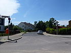
220 | Albersweiler , town in the district of Südliche Weinstrasse, Rhineland-Palatinate | Feb. 17, 1967 | Projected as road 496 of the development plan, it lies between Breitener Weg and Bienwaldring. The quiet residential street is built on with two-storey terraced houses, some of which are perpendicular to the street axis, it has three lanes, one of which is used as a parking lane, with wide, paved sidewalks on both sides. The spelling of the street name follows the Duden rules. |
|
| Old Buckow
( Location ) |
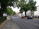
680 | old village center of Buckow | March 29, 1939 | The traditional name Dorfstraße was used several times after the formation of Greater Berlin and it was renamed to the place name, as in other districts, with the prefix "Alt-". The street is between Buckower Damm and Rufacher Weg around the old town center. While the southern street layout has been expanded and belongs to the higher-level street system of Berlin with class II , the northern section of the former street on the Anger around the village pond is of local importance. "From 1893 the Buckow children visited the Alt-Buckow 17 schoolhouse, which is still in use today." |
|
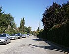
| At the Appelhorst
( Location ) |
450 | Appelhorst, old field name | Sep 1 1969 | The road 83 of the development plan was named in 1969 and is located between Landreiterweg and Ringslebenstrasse. |
|
| At the bush field
( Location ) |
220 | Bush field, old field name | Sep 1 1969 | Previously planned as road 85 in the development plan, it is located on the outskirts of the city and district between Wildhüterweg and Ringslebenstraße |

|
| On the oak tassel
( Location ) |
700 | Oak tassel, old field name | Sep 1 1969 | The road lies between Ringslebenstrasse and Landreiterstrasse as a dead end . Initially only a section of road 113 was named in 1969 , on May 1, 1977 the remaining part was included. The street 113 is recorded in the address book 1943 between Wildmeisterdamm (formerly: Bahnhofstraße ) and Straße 81 (today the eastern section of the Ringslebenstraße) with nine single-family houses, three summer houses and undeveloped land listed as a construction site. The northern part east from Fichtenpfuhl to the railway line was built over with the buildings Wildmeisterdamm 253 and 249, so the counting for Am Eichenquast on the cul-de-sac begins with 5 in the east and with 6 and 6a in the south to the south. |

|
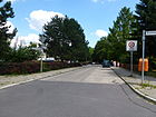
| At the Rötepfuhl
( Location ) |
360 | Rötepfuhl, old field name | March 19, 1938 | The street is between Salmbacher Straße and Drusenheimer Weg. This was laid out as road 68 of the development plan and named in 1938, on January 1, 1974 road 543 was included. The field name is drawn on a map from 1851 south-east outside the village center and probably goes back to a swampy pond that was previously here. |
|
| At the back yards
( Location ) |
810 | Back yards, backside of rural courtyards | Aug 1, 1966 | The road 45 and road 46 that had already been laid out were combined with the development and named as a unit in 1966. The road lies between Marienfelder Chaussee / Alt-Buckow and Buckower Damm and opens up properties south of Alt-Buckow, with Landschöppenpfad and Pfarrer-Vogelsang-Weg opening up and connecting. The Buckow cemetery is located here to the north. The construction of a new school for Buckow, which became necessary due to increasing settlement in the 1950s, began on June 8, 1964 on the street An den Achterhöfen - at that time it was still called Straße 46 . Classes began on October 10, 1966. For the southern area of Buckow 1 between Alt-Buckow and the city limits, a development plan was drawn up in 1968, which leads the street An den Achterhöfen as the central and expanded route in this area. |

|
| In the fields
( Location ) |
180 | Outskirts and reference to previous agricultural use | Apr 1, 2010 | The residential street is located between Christian-Henkel-Straße and Buckower Weg and, as Mittelstraße, opens up the single-family houses built in 2010 on the properties to the north of Buckower Weg. Before the development, there was grassland between the Leonardo da Vinci grammar school and the Heinrich Mann comprehensive school. In the south, it is protected from the noise of an industrial site opposite on Christian-Henkel-Strasse with a noise protection wall. |

|
| Angelikaweg
( Location ) |
150 (in the district) |
Angelica , umbelliferous plant in damp meadows | Aug 16, 1928 | The Angelikaweg lies on both sides of the Distelfinkweg in the district with a connection to Rudower Damm and continues to the northeast in Britz . It was laid out before it was named Road 8 in the development plan. | |
| Ankogelweg
( Location ) |
0 (only plot No. 97 in the district) |
Ankogel , summit of the Hohe Tauern | Aug 4, 1930 | Ankogelweg is located in Mariendorf , property 97 (school, leisure center, sports field) is not included in the district extension like the Ankogelweg indoor and outdoor swimming pool, so this property off this street belongs to the district, access is via Buckower Straße. | |
| Arnikaweg
( Location ) |
170 (in the district) |
Arnica , medicinal plant | Aug 28, 1928 | Most of the Arnikaweg is in Britz . In Buckow, the plots 44-56 are on the northwest edge of the road between Rudower Strasse and the district boundary (halfway Distelfinkweg and Windenweg). It is marked as road 106 in the development plan . |

|
| Asbestos route
( Location ) |
610 | Asbestos , fine-fiber silicate material | March 19, 1938 | The street is located in a settlement with streets named after the types of rock between the Quartz and Limestone Paths. On December 12, 1965, road 459 was included and the asbestos route was extended. |

|
| On the plan pasture
( Location ) |
330 | Plan willow, old field name | Sep 1 1969 | Like the other 80s streets in the local development plan, local field names gave the street 82 in the development plan its name, it is located between Wildhüterweg and Ringslebenstraße. |

|
|
Baldersheimer way
( Location ) |
1210 | Baldersheim , commune in the Haut-Rhin department, Alsace, France | March 19, 1938 | The street lies between Töpchiner Weg and Lichtenrader Damm and is laid out as street 38 of the development plan. In this quarter streets were named after place names from Alsace , which belonged to the German Empire between 1871 and 1918 and which came to France as a result of the Treaty of Versailles . |

|
| Basalt path
( Location ) |
310 | Basalt , type of rock | Oct 31, 1953 | Located between Feldspar and Muschelkalkweg, it belongs to the Neue Heimstatt small settlement founded in 1951, in which the streets are named after minerals and rocks. |

|
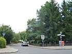
| Battenheimer way
( Location ) |
410 | Battenheim , place in Upper Alsace, Mulhouse arrondissement, France | March 19, 1938 | The street is between Salmbacher Straße and Drusenheimer Weg. Initially laid out as street 70 in the development plan, it is located in a district named with street names from Alsace , which belonged to the German Empire between 1871 and 1918 and which came to France as a result of the Versailles Treaty . |
|
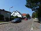
| Treecreeper Path
( Location ) |
620 (in the district) |
Treecreeper , songbird | Aug 16, 1928 | The Baumläuferweg lies between Zadekstrasse and the suburbs. The small south-eastern section belongs to Gropiusstadt . Initially laid out as street 13 of the development plan, the path ran between Triftweg (since 1967 Zadekstraße) and Heroldweg until 1967 . The latter ceased to exist in 1968 when Lipschitzallee was built. The part between Goldammerstrasse and Heroldweg was not built on. On October 1, 1967, the section of road 519 leading west from Lipschitzallee was included. On December 1, 1967, the part between Hirtsieferzeile and Goldammerstraße of Straße 519 was included. In 1970 the route was shortened to the present day tour. The Windmühlenweg still has the reference "Jetzt Baumläuferweg" in the 1930 address book. |
|
| Amber ring
( Location ) |
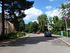
530 | Amber , fossil resin | Oct 21, 1965 | The Bernsteinweg leads as a U-shaped access road to the east from and to the Quarzweg. First the street was named 494 and on November 15, 1970 the extension was included in today's course. It belongs to a settlement where the streets are named after mineral names. |
|
| Berntweg
( Location ) |
340 | Bernt, old Buckow peasant family | Sep 1 1969 | First, the northward section of road 107 was named with a length of 140 meters. On September 1, 1980, another section of road 107 was included. The paved road with sidewalks on both sides lies between Hasenheger- and Dröpkeweg and is built on with residential buildings with front gardens and garden plots. |

|
| Bienwaldring
( Location ) |
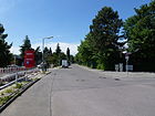
720 | Bienwald , Palatinate forest area (LSG) on the border with Alsace, near Karlsruhe | Feb. 17, 1967 | The road 495 in 1967 partially named and the remaining portion was included on 1 June 1974th The path curves to the west from and to the Breitener Weg. |
|
| Pumice stone path
( Location ) |
90 | Pumice stone , large-pored rock of volcanic origin | March 6, 1957 | The road 135 of the development plan in 1957 as Bimssteinweg with the home settlement (settlement warriors) created in the streets of minerals and rocks were named. As an access road, it opens up properties east of Grünsteinweg. |

|
| Black Grouse Trail
( Location ) |
430 | Black grouse , part of the grouse family | Aug 16, 1928 | The street, initially street 28 of the development plan, lies between Laubsängerweg and Johannisthaler Chaussee in a settlement with street names according to bird species. |

|
| Broad way
( Location ) |
530 (in the district) |
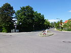
Breitungen , place in the southern Harz, state Saxony-Anhalt | Feb 14, 1950 | The street is on the Bienwaldring (southern connection) and the district boundary, which is 50 meters northwest of Bienwaldring (northern end) and Heimsbrunner Straße. The street continues Britz between the allotments. Already before 1911 the Mariendorfer Straße existed as a path with the destination Mariendorf . The length of the street lies between Rufacher Weg and Heimsbrunner Straße, as an uninhabited footpath it continues through the Britzer Garten to Sangerhauser Weg . The northern part of the street opens up the allotment gardens Kurt Poethig and Heimaterde. From the Sangerhauser Weg, the Breitener Weg ends as a dead end for cars. A section of the Britz-Buckower Weg, number 15 of the 20 green main routes in Berlin, is located on Breitener Weg . |
|
| Buchfinkweg
( Location ) |
690 | Chaffinch , songbird | Aug 16, 1928 | The path previously laid out as street 12 of the development plan is located between Zadekstraße and Goldammerstraße in a settlement area in which paths and streets are named after bird species. |

|
| Buckower Dam
( Location ) |
1370 (in the district) |
Buckow , part of the Berlin district of Neukölln | Jan. 4, 1955 | Buckower Damm is located between the northern district and the city limits in the south in the district and continues north in Britz . Up to the border of the district at the plots 187 and 190 belong 230 meters north of the Rohrlegerweg. The historic land route in Buckow was already called Chausseestrasse before 1899 as a continuation of the so-called “Buckower Chaussee” in Britz, since the Mariendorf-Lichtenrader Chaussee ran along the western edge of the Teltowdorf and the Chaussee between Berlin and Saxony on the eastern edge. Because the Teltowort had belonged to Greater Berlin since 1920 , the entire street up to the city limits of Großziethen was renamed Buckower Damm when the road was expanded in 1955 to avoid duplicate street names. In 1846 the Buckower Chaussee was laid out as an important link between Berlin and Saxony and Lusatia. |

|
| Buckower way
( Location ) |
210 | Buckow , part of the Berlin district of Neukölln | April 1, 2010 | The newly built residential street is located in a settlement on the southern outskirts of Berlin, east of the Leonardo da Vinci School and north of Christian-Henkel-Straße and develops this jointly with An den Feldern . It was built together with the street An den Feldern on a former allotment garden. The Töpchiner Weg landscape park is nearby. |

|
| Bühler way
( Location ) |
640 | Bühl , town in the Rastatt district, Baden-Wuerttemberg state | March 19, 1938 | Routed as road 71 of the development plan, it lies between Marienfelder Chaussee and Battenheimer Weg in a residential area. It is a three-lane asphalt road with a sidewalk on both sides. |

|
|
Christian-Henkel-Strasse
( Location ) |
390 | Christian Henkel, farmer in Buckow. Christian Henkel the Elder founded the farming family that lived in Buckow between 1670 and 1865. | July 1, 1986 | The street is a dead end from Warmensteinacher Straße and was laid out as Straße 570 . The street surrounds a small industrial area on the southern outskirts of Berlin. A noise protection wall was built on the north side to protect the residential area An den Feldern and Buckower Weg from truck noise. |

|
| Christoph-Ruden-Strasse
( Location ) |
510 | Christoph Ruden (1763–1839), educator | Nov. 1, 1974 | The traffic route laid out as road 506 of the development plan lies between An den Achterhöfen and Gerlinger Strasse. In the mid-1970s, an extensive new building area, the Hans-Martin-Helbich-Siedlung, was built on Christoph-Ruden-Strasse, Kestenzeile and on the site south of the middle-tier center on Buckower Damm, on a previously undeveloped area on the outskirts. It is owned by the Protestant parishes Alt-Buckow and Neu-Buckow. The eponymous Ruden, who was born in Glasow, attended the "Mathematical-Economic Realschule" founded by Johann Julius Hecker in Berlin for a year and a half and the associated seminar for teachers. On October 2, 1788 he was introduced to the office of schoolmaster von Buckow and in 1813 Ruden took over the office of sexton. |

|
|
Roofer path
( Location ) |
80 (in the district) |
Roofing , construction profession | Jan. 30, 1933 | Most of the Dachdeckerweg runs through the Britz settlement Neuland I. In the district, a seven-meter-wide road leads from the Rohrlegerweg to the district boundary, whose turning hammer already belongs to Britz . Before private road 3 of the development plan, it was laid out for the settlement located here, on March 29, 1939 the previous road 77 was also given the name Dachdeckerweg. |

|
| Delmer Steig
( Location ) |
230 | Delme , French commune in the Moselle department, Lorraine region | March 19, 1938 | This residential street is between Warmensteinacher and Salmbacher Straße, across the latter as a dead end . Previously laid out as street 44 of the development plan, it is located in a district whose streets are named after places from the area that was formerly part of the German Empire and which came to France in 1918 as a result of the Versailles Treaty . |

|
| Dessenheimer way
( Location ) |
130 | Dessenheim , an Upper Alsatian town southeast of Colmar, Haut-Rhin department, France | March 19, 1938 | The street, previously street 67 of the development plan, lies between Salmbacher and Trimbacher Straße, in a district whose streets are named in 1938 after places from Alsace, which came to France in 1918 as a result of the Versailles Treaty . |

|
| Distelfinkweg
( Location ) |
570 | Goldfinch , species of bird | June 9, 1933 | The traffic routes previously laid out as Straße 34 and Straße 66 in the development plan were laid out and named together in 1933. The Diestelfinkweg lies between Girlitz- and Arnikaweg in the residential estate parallel to Rudower Straße. |

|
| Doevelweg
( Location ) |
230 | Doevel, Windmüller in Buckow, the windmill is proven as early as 1375 | Sep 1 1969 | The street lies between Ringslebenstrasse and Stuthirtenweg on the city limits. It was laid out on the route from road 107 of the development plan. Beyond the city limits, which was formed here by the Berlin Wall until 1990, Jahnstrasse continues in the garden city of Großziethen (Brandenburg). |

|
| Dröpkeweg
( Location ) |
640 | Dröpke old Buckower Kossätengeschlecht | Nov 15, 1970 | Initially, the section of road 551 was named from Heideläuferweg to Hogenestweg and on February 1, 1974 the part of road 551 between Hogenestweg and Am Eichenquast was included, so that the road between Heideläuferweg and Am Eichenquast delimits the residential estate to the south. |

|
| Drusenheimer way
( Location ) |
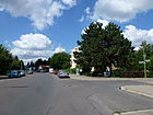
900 | Drusenheim , Lower Alsace town east of Haguenau, Bas-Rhin department, France | March 19, 1938 | The street lies between Marienfelder Chaussee and Gerlinger Straße, further as a dead end street to the Wall Trail at the city limits. It belongs to a quarter east of Drusenheimer Straße with street names after places from Alsace , which came to France in 1918 as a result of the Versailles Treaty . First, the road 69 of the development plan was laid out and named. On June 1, 1975, it was extended by the route from Straße 542 to Rötepfuhl, and on May 15, 1976 the connecting road was also included on the 586 train . On June 1, 1978, the section of road 542 south of Am Rötepfuhl to the Berlin city limits (at that time the Berlin Wall stood here ) was included. The "Töpchiner Dreieck" west of the Drusenheimer to the Töpchiner Weg is a row and semi-detached house settlement. The KGA Buckower Feldmark is located east between Gerlinger Straße and the city limits. A bus line operated by the Berliner Verkehrsbetriebe runs through the street to the terminus on the southern edge. A footpath continues across the city limits into a dog run area on Großziethener Flur. In the north, the street continues on Marienfelder Chaussee in Quarzweg . As a connection between the northern Alt-Buckow – Marienfelder Chaussee and the southern Gerlinger Strasse / Malchiner Weg, these 680 meters are part of the supplementary main road system (Category IV). |
|
| Egisheimer way
( Location ) |
100 | Eguisheim , German Egisheim , Upper Alsatian wine-growing community, France | March 27, 1939 | The road 89 of the development plan was already created previously and was named in 1939 in a district with the surrounding road to Alsatian town. This area, which had belonged to the German Empire as the Reichsland Alsace-Lorraine since the Franco-Prussian War in 1870/71 , came to France in 1918 as a result of the Versailles Treaty . The residential street branches off from the Breiter Weg to the east as an asphalt road and opens up the residential buildings located here. |

|
| Ernst-Arndt-Weg
( Location ) |
150 | Ernst Arndt (1895–1980), headmaster in Buckow, local researcher | June 26, 1995 | As road 619 of the development plan traced out, it goes from the Druze Weg to the east, north of the priest-Wenke way. With the aforementioned route, it opens up the four-storey multi-family new buildings of the 1990s. Arndt was citizen's deputy in the committee for construction and published, for example, the history of the Buckow village church . |

|
|
Feldsparweg
( Location ) |
920 | Feldspar , a large group of rock-forming minerals | Aug 8, 1935 | The street was laid out in 1933 as a Ballodweg between Feldmark and Vorländerweg and built with single-family houses by the “Neue Scholle” cooperative, named after the economist and statistician Carl Ballod (1864–1931), since 1914 appointed full professor at the University of Berlin. The street in a district banned for rocks and minerals lies between Quarz- and Muschelkalkweg, whereby the extension from Straße 96 to Muschelkalkweg was included on October 31, 1953. |

|
| Fennel trail
( Location ) |
120 (in the district) |
Fennel , umbelliferae | Aug 16, 1928 | In the district, the path lies between Diestelfinkweg and exclusively property 36 of the Glockenweg, which, like the rest of the Fennelweg to Teltow Canal and Johannisthaler Chaussee at the Ernst-Keller-Brücke, belongs to Rudow . In 1928, the routes of streets no. 5, 6, 101 and 104 of the development plan were summarized and named. On March 29, 1939, street 35 was also named Fennelweg in a settlement in which the streets are named after medicinal and garden plants. |

|
| Fläzstein Path
( Location ) |
180 | Fläzstein, boulder on the Buckower Dorfaue | Sep 1 1968 | The road 552 of the development plan is a walk (officially reported so) between Rufacher way and Alt-Buckow. The access to the adjacent properties on Rufacher Weg is provided with paving slabs and cordoned off with traffic posts and leads to the western stump of the northern part of the street from Alt-Buckow and there to the bus stop. The developed property is Fläzsteinpfad 3, a day care center for the disabled. The Ice Age “Fläzstein” was consecrated in 1897 on the Buckower Dorfaue as a memorial to Kaiser Wilhelm I. In 1945 the Buckower Fläzstein on the village green was destroyed. | |
| Försterweg
( Location ) |
140 | Forester , general generic term for forest professions | June 1, 1975 | The road lies between Wildmeisterdamm and Landreiterweg in a 30-meter zone and was named appropriately for the surrounding streets. Plots 1–5 (continuous) are on the west side and the Eichenpfuhl on the east side, traced out as road 112 in the development plan. |

|
| Fritz-Erler-Allee
( Location ) |
630 + 440 (in the district) |
Fritz Erler (1913–1967), politician, resistance fighter against the Nazi regime | Feb 22, 1968 | Fritz-Erler-Allee belongs to the district between Grüner and Goldammerweg, but only the northern properties in the district lie between Juchaczek- and Grünem Weg. In the Zadekstraße and Johannisthaler Chaussee section, the avenue lies entirely in Gropiusstadt , while the northern properties in the district are between Johannisthaler Chaussee and Goldammerweg. The street and the southern side is mainly in Gropiusstadt , the eastern section borders on Rudow on the north side . In the development plan it was laid out as road 484 . It is located in the district as a regional main road with a connection to Neuköllner Straße in the east and Lipschitzallee and Johannisthaler Chaussee in the west. |

|
| Futhzeile
( Location ) |
140 | Peter Futh, wind miller in Buckow | Sep 1 1969 | The narrow, paved and asphalted residential street on the southern outskirts of the city, laid out as road 116 of the development plan, opens up plots 1–9 (odd) on the south side and 2–8 (even) on the north side between Buckower Damm and Heideläuferweg . In the middle part of the street there is a space (12 × 20 square meters) with parking. |

|
|
Gaudacher Strasse
( Location ) |
100 | Gaudach, German name of the place Jouy-aux-Arches in Lorraine, Moselle department, France , used in 1915–1918 and 1940–1944 | March 19, 1938 | It was laid out as road 43 in the development plan and is located between Baldersheimer and Rademeierweg . In this quarter there are streets with place names from Alsace and Lorraine , the area became part of France in 1918 as a result of the Treaty of Versailles . Plots 1–7a and 2a – 6 on Gaudacher Strasse will continue to the south across the district boundary on the northern edge of Rademeierweg with Oranienburger Strasse in Lichtenrade . |

|
| Gerlinger Strasse
( Location ) |
1290 | Gerlingen , town near Ludwigsburg, Baden-Wuerttemberg | Nov 1, 1972 | The outskirts road is between Buckower Damm and Drusenheimer Weg. In the early 1990s, a city settlement was built on a corn field on Gerlinger Strasse on the state border with Brandenburg. The road was laid out on previously undeveloped land. The 540 road laid out in the development plan was included on September 24, 1996. From the street there is 340 meters as a regional main street on the southern outskirts of Berlin , this continues westward in Töpchiner Weg to the district border to Lichterfelde . In the south, the road borders the Töpchiner Weg landscape park and the Buckower Feldmark allotment garden. In the north there is industrial development after a residential area and residential development again after the Heinrich Mann School. The plot numbers 2–22 and 50–66 (even) as well as 25–29 and 49–51 (odd) indicate their unequal distribution. A section of the “Britz-Buckower Weg”, number 15 of the 20 green main routes in Berlin, is located on this street . At the end of the 1990s, the Buckower Feldmark allotment garden was built south of Gerlinger Strasse as a replacement area for those arboric colonies that fell victim to the 14th section of the A 100 federal motorway in the north of Neukölln. On the eastern section of the street, on a previously undeveloped area on the outskirts to the north along Christoph-Ruden-Straße, the Hans-Martin-Helbich settlement with residential buildings from the 1970s (1974) is located. It belongs to the Protestant parishes of Alt-Buckow and Neu-Buckow. |

|
| Girlitzweg
( Location ) |
320 | Girlitz , finch bird | June 9, 1933 | The road laid out as road 36 of the development plan is located between Distelfink- and Glockenblumenweg, the road area in Rudow with lots 1 and 7-13 (odd) and 6-10 (even). As a two-meter-wide footpath with 1.5-meter-wide green strips on both sides without any property allocation, it leads under its name to Rudower Straße . Most of the settlement here with streets named after bird species is in Rudow. |

|
| Glimmerweg
( Location ) |
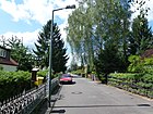
770 | Mica , silicate mineral | Aug 8, 1935 | The street lies between Basaltweg and In den Gärten . In 1933 the first private road 1 according to the development plan was laid out as Dietzgenweg and renamed in 1935, on October 31, 1953 it was extended to Basaltweg and on February 1, 1986 it was extended beyond Quarzweg. The private road 98 according to the development plan was included on March 25, 1999. The residential street ends in front of the street in the gardens for cars as a dead end . On this street is part of the Britz-Bucker Weg, number 15 of the 20 green main routes in Berlin. The renaming of the street named after the socialist philosopher Josef Dietzgen in 1935 took place like other streets in the area (after ideologically neutral) minerals and rocks in this settlement area. To the east of Quarzweg is the Neue Scholle settlement, which was inaugurated in 1932 as the “Neue Scholle” settlement for the unemployed. |
|
| Bellflower Path
( Location ) |
370 (in the district) |
Bluebells, ornamental plant | Aug 16, 1928 | The Glockenblumenweg belongs between Johannisthaler Chaussee and Stubenrauchstraße to Rudow , in the district there are plots 2–36 (straight) on the south side of the path between Johannisthaler Chaussee and Fennelweg. The path is laid out as road 5 of the development plan for the settlement named after ornamental and medicinal plants between Teltow Canal , Stubenrauchstrasse, Rudower Strasse and Johannisthaler Chaussee, the smaller south-western part of which is in the district in Buckow-Ost. For 1934 this street is all assigned to Rudow in the address book. |

|
| Goldammerstrasse
( Location ) |
260 (in the district) |
Goldenhammer , songbird | June 9, 1933 | The Goldammerweg is located in Gropiusstadt , the district includes plots 38-64 (straight) between Fritz-Erler-Allee and the district boundary halfway between Buchfink- and Baumläuferweg. Before road no. 17 of the development plan, the Gärtnereiweg ran along part of the route; the name was not renamed. Until 1967 the street ran between Stieglitzweg and Rudower Straße. In 1968 it was extended westward to Fritz-Erler-Allee, which was laid out and named in the same year. In 1969 the (presumably undeveloped part) between Baumläuferweg and Rudower Straße fell away, and the street only ran between Fritz-Erler-Allee and Baumläuferweg. In 1970 the existing arched course between Baumläuferweg and Lipschitzallee arose with the development. The streets in the area across the district boundaries are named after bird species. |

|
| Goldchickchenweg
( Location ) |
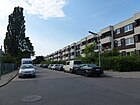
340 | Golden cockerel , songbird | June 9, 1933 | Routed as road 53 of the development plan, the road lies in a settlement area in which the roads in the area are named after species of birds across the district boundaries to Gropiusstadt , Britz and Rudow , between Grüner and Möwenweg, north-east parallel to Rudower Straße. |
|
| Graphite path
( Location ) |
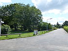
350 | Graphite , a naturally occurring form of carbon | Oct 31, 1953 | The settlement road with the plots 1–39 (odd) and 2–40 (even) was laid out between feldspar and muschelkalkweg during the densification of the buildings here, parallel to the western feldspar and the eastern basalt path. It was named according to the type of rock and mineral that already existed in the surrounding streets in 1953 in the settlement area. In half the length of the street there is a footpath that connects the elementary school on Sandsteinweg to the west with the childcare facility in the east (formerly daycare center, currently after-school care center, in the future again daycare center). In a northerly direction the drivable graphite path ends in a footpath that leads to the park settlement Spruch . |
|
| Warbler Trail
( Location ) |
170 | Warbler , songbird | Aug 16, 1928 | The residential street, which is laid out as street 29 of the development plan, leads as a paved cul-de-sac (residents free) south of Birkhuhnweg and ends at a turning hammer 50 meters before Rudower Straße, to which a footpath leads. Plots 1–7 (even) and 4–12 (even) are assigned. |

|
| Grauwackeweg
( Location ) |
280 | Grauwacke , sedimentary rock | Jan. 4, 1955 | Previously laid out as street 129 in the development plan, it was appropriately named in the settlement in 1955 with street names after rocks and minerals and laid out in undeveloped terrain. The wide residential street lies between Marienfelder Chaussee and Sandsteinweg and forms the entrance to the settlement here. The development plan around the Grauwackeweg was drawn up in October 1957, the residential buildings were determined, the sandstone path was extended and the Hornblendeweg was created in the north arch and the Schlierbacher Weg in the south arch. |

|
| Großcreutzweg
( Location ) |
360 | Großcreutz, long-established Buckow farming family | Sep 1 1969 | The street with lots 1–7a (odd) and 2–8a (even) lies between Hasenheger- and Am Eichenquast Dröpkeweg. In 1969, the section of road 110 between road 104 and road 551 of the development plan was laid out under this name and named after a Buckower personality as in the adjacent streets. |

|
| Green way
( Location ) |
1050 (in the district) |
(once) way to the Britzer Wiesen | before 1911 | The Green Way lies between Gutschmidtstraße and Kielingerstraße over Buschkrugallee and at the northern end of Ortolanweg and forms the border to the neighboring district of Britz , whereby the road land and the western properties belong to Britz. In the district, lots 5–15 are located at Kielingerstraße 33–87 on Kolibriweg. The Green Way is marked by name on a map from 1911 in Buckow and Britz and ran in the development plan as street 230 from Johannisthaler Chaussee to Rudower Straße / Buschkrugallee. In the 1925 address book it is recorded from Johannisthaler Chaussee to the Britz district with two developed and other undeveloped properties. For 1934 it is recorded for Buckow with the eastward outgoing streets Feld-, Rotschwanz-, Zaunkönigs- and Kolibriweg between Rudower Straße and Johannisthaler Chaussee with four built-up lots (without numbering), several construction sites and to Johannisthaler Chaussee a nursery and farmland, the opposite one Street side belongs to Britz and is noted as arable land. In 1972, on Ortolanweg, immediately bordering the “Britzer Wiesen”, building work began to change the townscape. Eight-story houses were built from the Grüner Weg into Ortolanweg. Kielinger Strasse, located on the Britz site, was created as an extension of Ortolanweg to connect it to Parchimer Allee, and a closed development was created at the northern end of Grüner Weg. |

|
| Grünlingweg
( Location ) |
150 (in the district) |
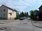
Greenling , songbird species | Nov 17, 1955 | The eastern section of the path is a traffic-calmed cul-de-sac in the district; it continues as a dead-end street in Britz via the Grüner Weg to the west . The street, previously laid out as street 1 in the development plan, was named Grünlingstraße on June 9, 1933. On November 18, 1955, it was given the name Grünlingweg along with street 271 . |
|
| Grünsteinweg
( Location ) |
270 | Greenstone , a mineral | March 6, 1957 | As Straße 134 traced out in the development plan, he was laid out on undeveloped land in 1957 and was named to match the existing, named after rocks and minerals streets of lying here in home settlement (settlement warrior "new homeland"). It is located on the site of an area bought by the Jewish community for a second cemetery, on which a makeshift housing estate for bombed-out citizens was built in 1944. It lies between the quartz and stalactite path, parallel to the slate path to the west. |

|
|
Haewererweg
( Location ) |
480 | Karl Ludwig Haewerer, owned a Vierhüfnergut ( an estate of four hooves ) in Buckow | Aug 1, 1966 | The quiet residential street between An den Achterhöfen and Warmensteiner Straße is located on the southern outskirts of Berlin and is laid out as Straße 46 according to the development plan . The Töpchiner Weg landscape park is nearby, and the Leonardo da Vinci high school is at the southern end. Here the street on the corner of Lindholzweg is closed to cars and only pedestrians and cyclists can pass. |

|
| Hasenhegerweg
( Location ) |
620 | electoral rabbit keeper | Sep 1 1969 | The road lies between Heideläuferweg and Am Eichenquast, on Landreiterweg it turns from east-west to south-east. This course corresponds to the course of road 79 and then diagonally to the southeast of road 104 , which were named as streets numbered according to the development plan in 1969. The street got its name after the electoral rabbit keeper, who supervised the game population in the Hasenheide , the Buckower Hasenheger had control of the rabbit enclosure set up here in the 17th century. At the western end of the street, Heideläuferweg, is the Neukölln youth traffic school; in the following course to the east, the street is built on with one- and two-story homes. |

|
| Heather path
( Location ) |
1030 | Heideläufer, old job title for a forester or forester working on behalf of the Berlin magistrate | Sep 1 1969 | The road that was laid out and laid out as road 106 in the development plan was called Feldstrasse in the middle course. The road, which was then continuously named in 1969, lies east of Buckower Damm and parallel to it between Johannisthaler Chaussee and Stuthirtenweg, since this is designed as a footpath as part of the Wall Trail , the southern end of the road to the city limits to Großziethen from Futhzeile forms a dead end with a turning hammer and a pedestrian passage to Brandenburg and the Wall Trail. In the southern part of the street there are single-family houses, especially to the north of Ringslenestraße there is development with multi-storey houses from the 1970s, some of which are far from the street behind green areas with deciduous trees. To the north of Dröpkeweg there are single-family homes (especially on the east side), and multi-family houses on the west side. |

|
| Heimsbrunner Strasse
( Location ) |
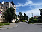
460 | Heimsbrunn , Upper Alsatian municipality in the Haut-Rhin department, France | March 27, 1939 | As road 88 of the development plan traced out, it is in Buckow 1 in a neighborhood where streets in the era of National Socialism for places in Alsace-Lorraine were named that as a result of the Treaty of Versailles to France came. The road lies along the district boundary to Britz between Breitener Weg and Leonberger Ring, continued to the west in the Bienwaldring to the east through the Rufacher Weg. |
|
| High voltage path
( Location ) |
240 | former power line between Adlershof and Lichtenrade | June 9, 1933 | The high-voltage route is located in the route of a former high-voltage line from Adlershof to the industrial park in Mariendorf . The path is a cul-de-sac from Laubsängerweg to the northeast, the western edge of the KGA Fliedergrund is on the east side of the road. Other passable and drivable sections along the former route officially give the same name to footpaths and access routes in Britz and Gropiusstadt without assigned land . Up until the 1990s in the Second World War , there were bunkers built for civilian air defense at Ortolanweg . The bunker next to the high-voltage route was used at times as a depot for pyrotechnic articles, it was blown up and removed and now the daycare center is built on. In the 1934 address book it is between Laubsängerweg and Grenzweg mt the built-up lots 1–11 (consecutive) on the western side and parcels (today: KGA Fliedergrund) on the eastern side. 1943 between Laubsänger- and Wiedehopfweg (which goes over the Schirmvogelweg) on the east side with owner names indicated single-family properties, some with summer house and on the west side the properties 2–20 (straight) with single-family houses. In the current directory, plots 1–29 (odd) and on the west side 2–22 (even) for the high-voltage path in the district are listed in the KGA Fliedergrund. The high-voltage line determined the road routes until the 1960s, next to which built-up areas were later kept free, the high-voltage route remained. Such a cleared area is north of the development plan around the Grauwackeweg , which was set up in October 1957. |

|
| Hogenestweg
( Location ) |
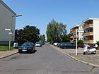
280 | Hogenest, Buckow manor family in the 15th and 16th centuries | Sep 1 1969 | The residential street in the private home area east of Buckower Damm lies parallel to other streets named after Buckower peasant families between Hasenheger- and Dröpkeweg . In the development plan it is routed as street 108 to the city limits on Grenzweg and was laid out and named between street 104 and street 114 , it is built on with one and two-storey single and multi-family houses. |
|
| Hornblendeweg
( Location ) |
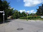
450 | Hornblende , silicate mineral | Jan. 4, 1955 | Routed as road 132 of the development plan, it lies from and to the sandstone path northwards in an arch in the eastern part of the "Neue Heimstatt" settlement. The site was bought in 1918 by the Jewish community for a second Jewish cemetery from the Buckow farmers Rohrbeck and Ziedrich. The site was taken over by the Reich capital in 1939 during the National Socialist era and in 1944 the Nazi government built a makeshift housing estate on this site to accommodate people affected by the air war , which should have a lifespan of five years. In 1950 the property became the property of the City of Berlin and the Neukölln District Office took care of the temporary homes that were still in existence. In the years 1951–1955, the settlement was built with newly laid roads, which were initially designed as cinder tracks and paved from 1967 onwards. The naming of the streets was mostly based on the quartz path after rocks and minerals. |
|
|
Ibisweg
( Location ) |
390 | Ibis , species of walking bird | May 1, 1977 | The Ibisweg is a dead end street south of Ortolanweg , at the southern end a footpath leads to Laubsängerweg. From 1972, a generous redesign with multi-storey residential development was planned for Ortolanweg, then an unpaved field path on the southern edge of the Britzer Wiesen, from which the Ibisweg and its parallel streets, partly leading to Rudower Straße, went off. The Ibisweg was inserted between Tränke- and Wendehalsweg on the route of the road 567 of the development plan and is built as a six-meter-wide asphalt residential street with sidewalks on both sides and with one- and two-story single and multi-family houses. |

|
| In the bailiff's garden
( Location ) |
230 | with local reference, it is probably on the site where the Buckow bailiff had his garden | August 1, 1966 | The access dead-end street , laid out as road 128 in the development plan, opens up three-storey residential buildings south of Alt-Buckow; it starts as a driveway to the north from An den Achterhöfen. 90 meters to the north, the road turns west and continues (eastern kink) to the north on Landschöppenweg as a footpath to Alt-Buckow. The continuation at the west end in front of the Buckow cemetery as a footpath and cycle path to the Alt-Buckow street was named Pfarrer-Vogelsang-Weg on December 1, 2004 . |

|
| Imbuschweg
( Location ) |
140 (in the district) |
Heinrich Imbusch (1878–1945), miner, resistance fighter against the Nazi regime | Aug 1, 1965 | The Imbuschweg between Zadekstraße and Otto-Wels-Ring belongs to the district with properties 23–31a, the south side of the street and the continuation to the east via Johannisthaler Chaussee were separated from Buckow-West when the district Gropiusstadt was formed. The street was laid out in 1928 as Auerhahnweg, on February 1, 1966, street 486 was included in the development plan. The Auerhahnweg was named on August 16, 1928 after the species of bird on the route of road 68 between Triftweg and an initially unnamed road. In the 1934 address book this is indicated between Grüner Weg and Triftweg across Henkelsweg on the north side with properties 23–33 (odd) and south with 24–34 (even). With the development of Gropiusstadt near the Otto-Wels-Ring, the routing changed and the name was changed. On the north side in Buckow it is built on with single-family houses, on the Gropiusstädter southwest side there is the parking garage and across the Johannisthaler Chaussee it borders north on the Gropius Passagen . With the development plan XIV / 102 for BBR-Trabtenstadt (today Gropiusstadt ), the western sections of the Uhu- and Auerhahnweg (street 22 and 23) and the southern continuation of the Kormoranweg to Johannisthaler Chaussee were built over by the buildings of the Otto-Wels-Ring . |

|
| In the gardens
( Location ) |
430 | Marketing concept with the concept of the gardens of the village Buckow that were previously located here | Dec. 1, 2000 | The street lies between Marienfelder Chaussee and over the Glimmerweg as a dead end. Until it was renamed, it was called Straße 100 . Since the 1950s, Straße 100 had been kept free as a reserved area for the federal motorway. The route would have had six lanes in the Buckow town center, but was replaced with the Britz Federal Garden Show in the early 1980s. The remaining open space around the street in the gardens was used again. At the beginning of the 1990s, concepts for residential buildings within the green corridor that remained free were planned for Berlin as the federal capital. With the help of the Hamburg architect Ina Ingrid Hassenstein, GAGFAH created designs for three to five-storey residential buildings for condominiums, which were marketed as “In the Gardens”. |

|
|
Johannisthaler Chaussee
( Location ) |
1210 + 800 (in the district) |
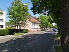
Johannisthal , neighboring town to the west, today part of the Berlin district of Treptow-Köpenick | before 1911 | The street is divided into a northeastern section and the lots 164-210 (even) and 183-213, 221-263 (odd) between Fritz-Erler-Allee and Ortolanweg in Buckow 2 and a western one between Buckower Damm and Kölner Damm with the Land and 387–443 (odd) 392–440 (even) (except on both sides of the railway site on the north side) in Buckow 1 in the district. Other sections of the road are in Baumschulenweg , Britz , Rudow , and between the Buckower parts in Gropiusstadt , and the respective district boundary is partly parallel along the roadside. In the district, the Chaussee is usually two-lane in two lanes with a green median and parking lane or parking pockets. Johannisthaler Chaussee is shown on the maps from 1911 and 1920 between Bahnhofstrasse (today Wildmeisterdamm, Buckow) and Rudower Strasse (Rudow). In 1929 the extension in Treptow (Johannisthal) was also named Johannisthaler Chaussee. On June 1, 1975, the part of the Wildmeisterdamm was included as an extension of the Johannisthaler Chaussee to Buckower Damm. In the address book from 1934 the road for Buckow is between Teltower Canal / Ernst-Keller-Brücke and Bahnhofstrasse and in this direction it crosses Ortolan, Birkhuhnweg, Rudower Strasse, Baumläufer-, Buchfinken-, Trift-, Henkels-, Grüner Weg, Tischlerzeile and Neukölln-Mittenwalder Railway , with arable land indicated from Triftweg. The developed plots are not numbered, but named after the owner. |
|
| Juchaczweg
( Location ) |
220 | Marie Juchacz (1879–1956), politician, resistance fighter against the Nazi regime | Feb. 1, 1965 | After Marie Juchacz's death on January 28, 1956, part of the Henkelsweg, which was laid out in 1919, was named after her. The street goes from Fritz-Erler-Allee opposite Otto-Wels-Ring to the north. The Henkelsweg was named between 1918 and 1920. The name Henkelsweg (initially Henkels Weg ) goes back to a Buckow farming family, who probably owned the land here; it is marked by name on the map from 1920. The built-up lots 10–22 (even) and 1, 11, 21 (odd) are on the street, 1, 10 and 12 belong to the Vivantes Klinikum Neukölln , in front of whose premises the street ends northeast at an entrance with a turning hammer There is a daycare center at 11 and the Ida Wolff Geriatric Center at 21. On April 15, 1966, the Henkelsweg was deleted from the road register, as the road area of the remaining part was on hospital grounds and was partly built over by the settlement to the south. At the southern end of the street at the intersection of Fritz-Erler-Allee, the district boundary to Gropiusstadt meets from the southwest , the Juchaczweg lies completely in northeast Buckow 2 . In the 1934 address book for Henkelsweg between Johannisthaler Chaussee and Rudower Strasse eleven unnumbered residential buildings named after the owner and the Neukölln hospital at Rudower Strasse 56 as well as several vacant lots designated as construction sites are named. At this time, the field, eagle owl and capercaillie trail end on the eastern side of the road . In 1943, the 20 single-family houses labeled with the owner's name were not yet numbered, between Johannisthaler Chaussee and Einsiedlerweg there was arable land and there were several summer houses that crossed Uhu- and Auerhahnweg. On the east side, between Rudower Strasse and Einsiedlerweg, is the municipal hospital and, to the south, undeveloped construction site. For 1954, the Henkelsweg is limited to the Einsiedlerweg (Fritz-Erler-Allee) in the south, the "Städtische Krankenhaus Neukölln" is located on the eastern edge in the north of the road to Triftweg (today Zadekstraße). With the development plan XIV / 102 for BBR-Trabtenstadt (today Gropiusstadt ), the western sections of the Uhu- and Auerhahnweg ( street 22 and 23 ) and the southern continuation of the Kormoranweg to Johannisthaler Chaussee were built over by the buildings of the Otto-Wels-Ring . |

|
|
Limestone path
( Location ) |
660 | Limestone , type of rock | Nov 12, 1965 | Many streets in this settlement are named after minerals. On the quiet residential street, which lies between Schieferweg and a dead end street over Asbestweg, there are mostly single-family houses. There are several access roads that end on the south side at the park settlement Spruch . This street is named after the limestone that is extensively quarried in Rüdersdorf in the Berlin area. The road 457 of the development plan was created during its development in 1965 and named. On September 1, 1972, side streets street 118 branching south were included with the spur streets 118b, 118c and 118d . On September 1, 1985, the 118a access road was also given this name. The street is located in the settlement north of the "Neue Heimstatt" along the park settlement Spruch , which is separated from the properties of the four 50-meter-long side streets of the limestone path, which end with turning areas, by rows of hedges. |

|
| Grosbeak Trail
( Location ) |
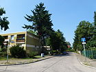
90 | Grosbeak , songbird, species of finch | Sep 1 1969 | The street with lots 4–12 (straight) is a cul-de-sac from Girlitzweg to the northwest ending in a turning area. It was laid out as cul-de-sac 476 in the development plan . In 1954, the Distelfinkweg is marked as continuous and, together with the Girlitzweg, forms a place with the approximate location of today's grosbeak path, which was named in 1969 after a species of songbird to match the surrounding streets. On the large Berlin city map, the Distelfinkweg is indicated as planned leading to Johannisthaler Chaussee. The houses on the north side of the street belonging to the street have already been partially replaced by newer multi-storey exclusive houses. To Johannisthaler Chaussee there are associated homes that block the passage. |
|
| Kestenzeile
( Location ) |
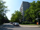
460 | Wilhelm Kesten (1869–1952), Buckower farmer and local politician | Aug 1, 1968 | The Kestenzeile, Straße 45 of the development plan, lies between Haewererweg ( An den Achterhöfen ) and Christoph-Ruden-Straße . In the mid-1970s, an extensive new building area was built on Christoph-Ruden-Strasse, Kestenzeile and on the site south of the middle-tier center on Buckower Damm. The western section of the road to Lindholzweg is in a residential area. This part of the street south of the village center was laid out as far as street 48 (today Lindholzweg) around 1954. On May 1st, 1977 the street 576 was also named Kerstenzeile and is built on with eight-story houses. In 1974, on the section to Christoph-Ruden-Straße, an extensive new building area was built, the Hans-Martin-Helbich-Siedlung on a previously undeveloped area on the outskirts, it belongs to the Protestant parishes of Alt-Buckow and Neu-Buckow. |
|
| Keuperweg
( Location ) |
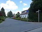
150 | Keuper, a type of sandy clay rock from the Keuper geological period | Oct 31, 1953 | The access road to the houses is parallel to the Grauwacken and Feldspatweg between the sandstone and shell limestone paths. It belongs to the "Neue Heimstatt" settlement and was created with it in the area of the temporary home settlement for bombed-out Berliners that used to stand here. |
|
| Great Tit Trail
( Location ) |
120 | Great tit , songbird | Aug 16, 1928 | It was laid out as street 30 of the development plan and laid out in 1928. It goes off as a cul-de-sac from the black grouse trail to the south. In 1943 it is listed in the address book between Birkhuhnweg and Feldmark, on the right side with single-family houses 6–12 (straight) built (today 2–14 and 1–15c are shown), the other plots are undeveloped and on the left side is arable land. |

|
| Kolibriweg
( Location ) |
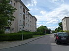
250 | Hummingbird , bird family | Aug 28, 1928 | Routed as street 8 of the development plan, it goes as a dead end from the Kormoranweg to the west. It is built with both single-family and multi-family houses and ends in a turning hammer . From this a 40-meter-long walkway paved with paving slabs goes to the district boundary at the intersection of Grüner Weg / Fritz-Erler Allee. In the 1943 address book, plots 7 and 17–25 (left) and 10–20 and 24 between the still undeveloped Kormoranweg and Grüner Weg are built on with single-family houses; between plot 8 and Kormoranweg there is still arable land. |
|
| Kolkrabenweg
( Location ) |
330 | Common raven , passerine bird | June 9, 1933 | The street with lots 7–37 and 8–40 goes as a dead end from Laubsängerweg northeast and does not lead through to Ortolanweg. It ends in an unpaved turning area in front of the daycare center (Ortolanweg 94), for which a bunker from the Second World War was demolished. The entire bunker on Ortolanweg was part of the Britzer Wiesen. The Kolkrabenweg is parallel between Wendehals- and Hochspannungsweg . |

|
| Cologne dam
( Location ) |
820 (in the district) |
Cologne , independent city in North Rhine-Westphalia | Sep 1 1969 | The Kölner Damm delimits the district of Gropiusstadt , in which the road area is located. In the district are the plots 65-83 (odd) and the southern edge of the road between Johannisthaler Chaussee at the level of Hugo-Heinemann-Weg along the Mittenwald railway line . Cologne is a twin city of the Neukölln district . It was previously the section of road 513 of the development plan leading from Wildmeisterdamm to road 489 . On May 15, 1971, the further section of Straße 489 between Hugo-Heimann-Straße and Straße 409 was included. On May 1, 1977, the other road 489 was also given this name. |

|
| Cormorant path
( Location ) |
680 | Cormorant , species of bird | June 9, 1933 | The road 9 of the development plan lies in the route of the road where the mountain path once ran, for which no official renaming or deletion took place. However, both names are not recorded in the address book in 1940, for 1943 Kormoranweg between Rudower Straße and Einsiedlerweg (today roughly Fritz-Erler-Allee) is named vacant. The street is located between Rudower Straße (opposite Möwenweg) and Fritz-Erler-Allee, along the east side of which is the Vivantes hospital area, in the north there are two large parking lots. The former parallel Henkelsweg and the transverse Kanarienweg are overbuilt by the new Vivantes Clinic Neukölln . In the 1950s there was still a strip of buildings to the west along the Kormoranweg. With the development plan XIV / 102 for BBR-Trabtenstadt (today Gropiusstadt ), the western sections of the Uhu- and Auerhahnweg ( streets 22 and 23 ) and the southern continuation of the Kormoranweg to Johannisthaler Chaussee were built over by the buildings of the Otto-Wels-Ring . |

|
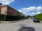
| Kreideweg
( Location ) |
150 | Chalk , limestone type | March 6, 1957 | The road between Schiefer- and Grünsteinweg is located in the area north of the Eigenheimsiedlung (Kriegersiedlung), where the roads along the Quarzweg, which is extended to the north, are also named after minerals and rocks. The street is laid out on the route of street 133 of the development plan and built on with two-story row houses with flat roofs. The chalk pond is located in the interior of the terraced houses south of the street. |
|
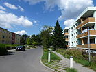
| Künheimer way
( Location ) |
370 | Künheim , wine-growing town in Lower Alsace (Haut-Rhin department), France | March 19, 1938 | The street 42 according to the development plan was named in 1938, like the other streets in this quarter, after a place from Alsace and Lorraine that came to France in 1919 according to the provisions of the Versailles Treaty . The road lies between Marienfelder Chaussee and Rademeierweg, it continues to Lichtenrade into Bernauer Straße . The 1940 address book lists lots 1–25 (odd) on the east (left) side, 5 is built on with a single-family house, and 2–26 (even) on the west (right) side, 4 and 8 of which are built up. The location is between Marienfelder Chaussee and the district of Lichtenrade with Weitbrucher Straße from the left and the crossing Baldersheimer Weg. |
|
|
Landreiterweg
( Location ) |
910 | Land riders, mounted messengers to whom Joachim Friedrich assigned the areas designated in 1599 | Sep 1 1969 | The street lies between Wildhüterweg and Hasenhegerweg on the route of Straße 79 between Straße 104 and Straße 80 , which was partially built up in 1940. It initially continues the western course of the Hasenhegerweg at a triangular unnamed place and in the eastern course it is pushed to the south-east by the course of the Mittenwald Railway . On the south side there are mainly three-storey residential buildings from “town and country” in different designs, on the north side mostly single-family houses with a garden, the section east of Am Eichenquast is a paved residential street. The route of road 79 was originally drawn between today's Heideläuferweg in the east along the railway line to the city limits. This eastern corner was built over with the Janusz Korczak primary school, which is now located in Gropiusstadt . |

|
| Landschöppenpfad
( Location ) |
900 | Landschöppe, old official title for the lay judge | Aug 1, 1966 | The officially registered footpath and connection path is between the east bend of Im Amtmanngarten and Alt-Buckow. According to the development plan, it is routed as path 493 . No properties are assigned to him. | |
| Laubsängerweg
( Location ) |
560 | Warbler , genus of songbird | June 9, 1933 | The road lies between the Möwen- and Hochspannungsweg, where the Black Grouse Trail continues to the east. It is street 56 of the development plan. The street is parallel to Rudower Straße and catches the streets coming from Ortolanweg, accordingly on the northeast side there is the residential estate and opposite are three-story residential buildings. It is not yet listed in the address book in 1940, in 1943 there is a coal field on plot 1/3, as well as eight built-up home lots, a summer house and several undeveloped lots on the odd, northern side and an apartment building (36/38) and several undeveloped lots on the opposite side of the street. With the expansion of Rudower Straße, the Laubsängerweg running parallel to it was also adapted in 1963. The Rudower Straße as the main street was connected with the Laubsängerweg as a residential collecting street to the residential street on Wendehalweg. |

|
| Leonberger Ring
( Location ) |
500 (in the district) |
Leonberg , town in the Boeblingen district, Baden-Wuerttemberg state. | Oct 1, 1965 | The Leonberger Ring lies in the arch to and from Rufacher Weg in the district, the plots 66a-72d on the west side are in Britz and belong to the local KGA Heimaterde, the district boundary is on the western edge of the road. The road area belongs entirely to the district. The street includes twelve buildings with several (partially staggered) three-story apartment buildings, and opens up the ten buildings, some of which are perpendicular to the street. In each of these row buildings there are three to five apartment buildings in the style of the 1960s. In 1961 the Rufacher Weg extended to the Neukölln cemetery in Britz and the area is undeveloped. The Leonberger Ring thus complements the access to the northern residential buildings of this residential area, while the southern ones are assigned to the Rufacher Weg, which now turns eastwards. |

|
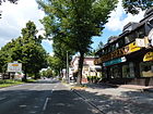
| Lichtenrader dam
( Location ) |
220 (in the district) |
Lichtenrade , south-western neighboring town, since 2001 part of the Berlin district of Tempelhof-Schöneberg | Aug 1, 1949 | In the district, the plots 3–17a (odd) are on the east side of Lichtenrader Damm between Marienfelder Chaussee and Baldersheimer Weg, with the district boundary extending 50 meters above the latter. Incidentally, the street belongs to Lichtenrade. The houses on the Buckower properties (east side) belong to the settlement from the late 1930s with roads to Alsatian towns. The still existing petrol station on the corner of Marienfelder Chaussee is already recorded in the address book in 1934, the land payment at that time was continuous , today the reciprocal numbering is available, Buckow belongs 3-15 (odd), the petrol station (then 28) had 1, but has the address Marienfelder Chaussee 171. |
|
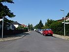
| Lindholzweg
( Location ) |
560 | Peter Lindholz the Elder J. (died March 24, 1578) | Aug 1, 1966 | The residential street was laid out in 1966 on the route laid out as street 48 in the development plan from An den Achterhöfen to street 44. Road 44 itself is still listed in the official RBS directory with a length of 120 meters, but on the official map 1: 5000, produced by the district surveying offices, the southern transverse section of the Lindholzweg is drawn under this name for the course of road 44 , but interrupted by the northern property boundary of Buckower Weg 8-20 (straight) and 23 and the southern (directly adjoining) property boundary of Michael-Klinitz-Weg 14a, 14b, 14c, 16a, 24a, 24b, 24c, which are built on The area can be reached via drivable paths with a barrier system on Michael-Klinitz-Weg. The partially unpaved residential street on the southern outskirts of Berlin has a north-south section from An den Achterhöfen as a dead end and an east-west section from Haewererweg as a dead end. At the western end it is only passable for residents and leads to a footpath on the newly created Buckower Weg, so there are two pedestrian passages to Michel-Klinitz-Weg. Lindholz d. J. came from an old peasant family who lived here in the 16th century and who were already mentioned as citizens of Berlin around 1450. Mentioned by name is Peter Lindholz, who was Mayor of Cölln from 1512 to 1536 and owned the Buckow and Rudow estates. In 1536 he joined the electoral fiefdom to his son Peter Lindholz the Elder. J. from. In 1649 Andreas Lindholz was mayor. The Lindholz family was one of the financiers of the Brandenburg electors. |
|
|
Mariendorfer Damm
( Location ) |
390 (in the district) |
Mariendorf , neighboring town to the west, since 2001 part of the Berlin district of Tempelhof-Schöneberg | Aug 31, 1949 | In the district, the plots 417-447 (odd) are on the east side of Mariendorfer Damm between Marienfelder Chaussee and 120 meters north of Sandsteinweg. The road land belongs to Lichtenrade . The road to the north also belongs to Mariendorf and in the lower numbered properties to Tempelhof . Before 1901 the street was called Chausseestraße and around 1921 part of it was laid out as Lichtenrader Chaussee. Only a small part of Chausseestrasse , which led from Mariendorf to Lichtenrade, belonged to Buckow. Lichtenrader Chaussee for Buckow is not shown in the city map of January 1925, but the evidence from September 1925 showed it. On August 31, 1949, part of Lichtenrader Chaussee was renamed Lichtenrader Damm, and another section was renamed Mariendorfer Damm on the same day. On August 31, 1949, Chausseestrasse and Lichtenrader Chaussee (also in the Buckow area) were renamed Mariendorfer Damm. The Mariendorfer Damm (today: Bundesstrasse 96 ) is the historic street between Berlin and Zossen. It was once a trade route west of today's route between the former villages of Tempelhof and Mariendorf. Most of the houses on the Buckower properties date from the 1970s and are located to the west of the "New Home Settlement" with houses from the mid-1950s. |

|
| Marienfelder Chaussee
( Location ) |
1920 | Marienfelde, south-west neighboring town, since 2001 part of the Berlin district of Tempelhof-Schöneberg | before 1912 | It is located in the old connection from Marienfelde to Rudow as an east-west road through Buckow, the Chausseehaus stood at the northeast corner of the intersection with Lichtenrader Chaussee on the outskirts of Buckow. It was already marked by name in the city map of 1912. It lies between Mariendorfer / Lichtenrader Damm and Rufacher Weg and extends Alt-Buckow as a main street of regional importance . For 1922 the street is listed as one of the 16 Buckower streets, between Dorfstraße (today Alt-Buckow) and Lichtenrader Chaussee. Cross streets are Britzer Straße, Feld- and Mühlenweg, five pieces of land are built on with residential buildings, including the Chausseehaus of the city of Neukölln is inhabited by the district road master. In 1943 there were 27 inhabited properties on the properties numbered 1–171 (consecutively). The petrol station, which still exists today, is located on 171, plus twelve plots with gardens or summer houses, the rest of which are undeveloped. On Marienfelder Chaussee in the address book 1935 between Vorländerweg , the horticultural company on property 76–96 and property 98–136 with the owner Jewish community and managed by haulier B. Kayser, the entrance to the Jewish cemetery is indicated at 115 street . |

|
| Maurerweg
( Location ) |
180 (in the district) |
Bricklayer , construction profession | Jan. 30, 1933 | In the district lies the southern section between Rohrlegerweg and Wendehammer on the district boundary with the plots 95-109 (odd) and 94-106 (even). The road continues to the north in Britz . The name was given by the “Neuland II suburb” in Britz, in which the streets are named after building trades. Before that, it was named Privatstrasse 1 , laid out according to the development plan, and on March 29, 1939, Strasse 75 was included in Maurerweg. |

|
| Michel-Klinitz-Weg
( Location ) |
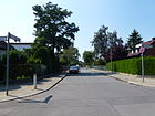
350 | Michel Klinitz, Buckower Landreiter in the 17th century | Aug 1, 1966 | The street lies between Haewererweg and Lindholzweg, over which it continues as a dead end . It lies on the route of the previous road 51 according to the development plan. The street was not extended into the Hans-Martin-Helbich-Siedlung , which was built in 1974 on the previously undeveloped area to the east on the outskirts. In the 1970s, the residential buildings were no longer necessarily built along and parallel to streets, so the extension, as with the Kestenzeile, was not made. |
|
| Mollnerweg
( Location ) |
530 | Mollner, old job title for the miller | Sep 1 1969 | The street lies between Buckower Damm and Stuthirtenweg, it goes from the first westward and about half of the street has an arc to the south to the city limits to Brandenburg. First the western part of the road 114 was named, on November 15, 1970 (today's southern section) of the road 108 and also the road 549 was included in the Mollnerweg. The street name takes up the naming in the area south of Alt-Buckow with regional and local references. |

|
| Moonstone path
( Location ) |
90 | Moonstone , type of feldspar | May 1, 1972 | Like many streets in this settlement, this small street is named after minerals, as is the case in the Neue Heimstatt settlement to the south. The quiet residential street is only passable for pedestrians and cyclists and connects the limestone path with the stalactite path. The development consists of single and multi-family houses. |

|
| Seagull path
( Location ) |
370 | Seagull , type of plover bird | June 9, 1933 | The road goes from Rudower Straße to the northeast and ends in a footpath that leads to Ortolanweg. On the north-west side there are multi-storey residential buildings that were built here with the project on Ortolanweg in the 1970s. The opposite side of the street belongs to the south-east facing residential estate and is accordingly built on with single-family houses. According to the development plan, it is laid out as street 24 . |

|
| Muschelkalkweg
( Location ) |
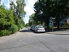
530 | Shell limestone , a type of rock | Oct 31, 1953 | It is located between Mariendorfer Damm and Grauwackeweg in the eastern part of the "Neue Heimstatt" settlement. The site was bought in 1918 by the Jewish community for a second Jewish cemetery from the Buckow farmers Rohrbeck and Ziedrich. The area was taken over by the capital of the Reich in 1939 during the National Socialist era and in 1944 the Nazi government built a makeshift housing estate on this site to accommodate people affected by the air war , which should have a lifespan of five years. In 1950 the property became the property of the City of Berlin and the Neukölln District Office took care of the temporary homes that were still in existence. In the years 1951–1955, the settlement was built with newly laid roads, which were initially designed as cinder tracks and paved from 1967 onwards. The naming of the streets was mostly based on the quartz path after rocks and minerals. On May 1, 1963, road 466 was included in the development plan between Marienfelder Chaussee and the private road previously known as Muschelkalkweg. The road 482 extends as a cul-de-sac to the east over the bend to the south. |
|
|
Ortolanweg
( Location ) |
1270 (in the district) |
Ortolan , songbird from the Ammern family | Aug 16, 1928 | Ortolanweg is between Kielingerstraße and Johannisthaler Chaussee, with the northern properties and the road between Kielinger Straße and Hochspannungsweg in Britz . In 1972, a large-scale development on Ortolanweg with a new route was planned, with bunker systems built for civilian air protection being partially removed. Eight-story houses were built (Ortolanweg 2-48) between Grüner Weg and Trappenpfad, an eight-story retirement home, a six-story wing between the Trappenpfad and Tränkeweg, and a four-story building up to Wendehalsweg. To connect to Parchimer Allee, Kielinger Straße was created as an extension of Ortolanweg and a closed development on the properties Kielinger Straße 1 and Ortolanweg 3 to 17 was created in three- and four-story construction. In 1992 the construction of the Ortolanweg was completed with the building called " Ortolan-Schnecke ", here the bunker system was integrated into the building as a high cellar. |

|
| Ostheimer Strasse
( Location ) |
160 | Ostheim , Upper Alsace town north of Colmar, Haute Rhin department, France. | March 19, 1938 | The street traced as street 40 lies between Marienfelder Chaussee and Baldersheimer Weg in the settlement in which the streets were named after places in Alsace-Lorraine in 1938/1939 . |

|
| Otto-Wels-Ring
( Location ) |
250 (in the district) |
Otto Wels (1873–1939), politician, resistance fighter against the Nazi regime. | 16 Sep 1964 | The district includes the road land and the properties of the eastern ring section between Fritz-Erler-Allee and Imbuschweg without the properties on the west side within the ring, these also belong to Gropiusstadt . The eight-storey residential buildings are also located in the neighboring district, the Buckower development largely existed at this time. |

|
|
Park settlement saying
( Location ) |
590 | converted allotment garden saying | Jan. 1, 1999 | The "allotment garden Spruch" was converted into a housing estate and gave the name to the traffic-calmed residential street with city villas as multi-family houses. The individual houses are connected by a car-free path in a park-like area. The road leads around the actual settlement in the western section on the edge of the district between Schieferweg and Straße 455 and is north of the elementary school on Sandsteinweg. The settlement is touched in the north by the limestone roads. The residential complex itself has some green open spaces. The combined swimming pool Mariendorf and a children's farm are within walking distance. “The Spruch settlement with its city villas was awarded the Architecture Prize of the Association of German Architects.” The previous name in connection with the Spruch allotment garden colony was Street 621 . |

|
| Pfarrer-Vogelsang-Weg
( Location ) |
130 | Ulrich Vogelsang (1935–1999), pastor in the village church of Alt-Buckow since 1966 | Dec. 1, 2004 | The western footpath and connecting path from Im Amtmannsgarten to Alt-Buckow from the area south of Alt-Buckow was named in 2004 after a person with local reference, adapted to the surrounding street names. | |
| Pastor-Wenke-Weg
( Location ) |
150 | Bernhard Wenke (1910–1985), theologian. | Aug 16, 1995 | The street goes from Drusenheimer Weg and was named in 1995 from the previous street 620 . The eponym Pastor Wenke was a pastor in the Catholic parish “St. Theresa of the Child Jesus ”in Buckow. |
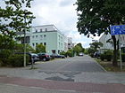
|
|
Quartz way
( Location ) |
1320 (in the district) |
Quartz , mineral | Aug 8, 1935 | The Quarzweg lies between Tauernallee and Marienfelder Chaussee, the short section west of the Sangerhausen Weg beyond the district border belongs to Mariendorf . The north side of the street between the district border and the high voltage path, with KGA Kurt Pöthig, belongs to Britz . To the east of Quarzweg (then: Vorländerweg ), on the southern section, there is a housing estate (Kriegersiedlung) that was inaugurated in 1932 as the “Neue Scholle” settlement for the unemployed. Previously a private road in the development plan, it was initially laid out and built on January 30, 1933 as Vorländerstraße , named after the old field name "Vorländer". The Vorländerweg is listed in the 1934 address book between Marienfelder Chaussee and Ballodweg with ten pieces of land, nine of which are already built on . It crosses Dietzgenweg, the eastern corner of Marienfelder Chaussee is named as Feldmark. On August 8, 1960, the road 458 was included up to the district border, so that the connection to Tauernallee is made through the also included road 142 in Mariendorf . |

|
|
Rademeierweg
( Location ) |
320 (in the district) |
Rademeier, the old Buckower family | Feb 9, 1957 | The road area itself is in Lichtenrade, in the district the plots 4–22 (straight) are on the north side parallel to Baldersheimer Weg. It is located on the route of road 13 of the development plan, which was laid out in 1954. |

|
| Reinowzeile
( Location ) |
150 | Reinow, wind miller in Buckow | Sep 1 1969 | Previously laid out as road 109 in the development plan, it was named in the section between Grenzweg and road 550 (today Ringslebenstrasse) with the development ( during the Walling Period) . Since then it has been located between Ringslebenstrasse and Stuthirtenweg with the built-up settlement houses 1–7a (odd) and 2–12b (even, west) |

|
| Renschweg
( Location ) |
220 | Rensch, long-established Buckow blacksmith family | Sep 1 1969 | This residential road lies between Hasenheger- and Dröpkeweg and is laid out on the northern section of the route of road 109 according to the development plan. It was named after a local personality in 1969 with the development of the settlement area on the outskirts east of Buckower Damm on the section between Straße 104 and Straße 551 (later inserted in the development plan). The area of Straße 109 that remained between it and Reinowzeile was compacted in the 1970s with eight-story residential buildings and the course of the street built over. |

|
| Ringslebenstrasse
( Location ) |
1360 (in the district) |
Martin Gottlieb Ringsleben (died after March 1822), manor owner, court painter | Sep 1 1969 | The street is located between Buckower and Kölner Damm in the settlement area near the outskirts to the east of Buckower Damm, but the section east of Am Buschfeld with the property of the Janusz Korczak School belongs to Gropiusstadt . First of all, the section of the extended road 105 leading to the east from road 113 of the development plan (today Am Eichenquast) was named with a length of 600 meters. The extension on both sides between Buckower Damm and Mollnerweg on the one hand and between Am Buschfeld and Kölner Damm ( Straße 105 and Straße 550 ) were named in the same way on June 1, 1974 and on May 1, 1978 the remaining part of Straße 550 between Mollnerweg and Included on the oak tassel. To the east of Am Eichenquast, the road runs along the city limits, the course of the city limits is indicated on the (theoretical) middle of the street and takes up the Wall Trail . The road between An der Planweide and Am Eichenquast is interrupted for motor traffic. The road condition on the eastern section (plots 22-60b, straight) corresponds to the situation 20 years after the fall of the Berlin Wall and the immediate road layout on the state border with Brandenburg: narrow asphalt road with unpaved, but existing sidewalks in the front gardens and unpaved roadside, partly overgrown with bushes in the south. Westward from Buckower Damm, Gerlinger Strasse continues its course as a regional main road (Category III) near the outskirts. Today, the eastern section of Ringslebenstrasse is a roadway, partly expanded on the Berlin side, partly separated by a narrow strip of green, the street immediately next to it (partly unpaved, partly asphalted, mostly single-lane) in Brandenburg ( municipality of Groß-Ziethen ) is called Grenzstraße. |

|
| Rohrlegerweg
( Location ) |
630 (in the district) |
Pipelayer, construction profession | March 27, 1939 | The road is in the district between Buckower Damm and Töpferweg, to which the passage to the north (Britz) is blocked by bollards. Plots 2–10 (even) on the northern edge of the eastern part belong to Britz . The name of the street is based, like most of the streets in the Britz "Neuland I" settlement, on a building trade. The Rohrlegerweg lies completely in the district due to the east-west course and is better developed as a three-lane, concrete-paved, quiet residential street with sidewalks on both sides than the Britzer Straße, which belongs to the settlement. The road lies west of the Mittenwald railway line, which prevented it from running further east and was probably not necessary due to its location parallel to the southern Johannisthaler Chaussee. |
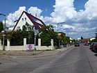
|
| Rotkehlchenweg
( Location ) |
190 | European robin , a songbird from the flycatcher family | June 9, 1933 | The Rotkehlchenweg is a traffic-calmed cul-de-sac from the Grüner Weg to the east opposite the Bruno-Taut-Ring, which, like the streets of the Grüner Weg, belongs to the neighboring district of Britz . The street is built with two-story row houses. In 1936 three single-family houses are noted, the path is marked continuously up to the Kormoranweg, in 1943 there are six settlement houses and one summer house. Today there are five-storey residential buildings from the 1960s on a 90-meter-wide strip, with which the continuous guided tour (in contrast to the leading Rotschwanzweg ) is built over. In the 1950s there was still a cleared strip west of the Kormoranweg. In the development plan of the settlement located here, it is listed as street 2 . |
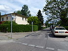
|
| Rotschwanzweg
( Location ) |
300 | Redstart , songbird from the Schmätzer family | Aug 16, 1928 | The street was laid out as street 3 of the development plan for this settlement. It lies between the Britz border on the Green Way and the Kormoranweg. In the 1937 address book, the route leads to Henkelsweg and is indicated with built-up lots 11–23 on the left (northern and odd) side and two residential buildings on the south side. Currently, the built-up lots 2–24 (even) and 7–21 (odd) are listed, of which 13 there are also 13 buildings that are on divided lots (background lots with driveway). The four-storey residential buildings 2, 4, 6 from the 1960s are on the cleared strip next to the Kormoranweg, whereby the Rotschwanzweg, unlike the parallel streets of the area of the residential estate, is not a dead end from the Grüner Weg. |

|
| Rudower Strasse
( Location ) |
2020 (in the district) |
Rudow , southern neighboring town in the Teltow district, today part of the Neukölln district of Berlin | before 1899 | Rudower Straße is in the street of Buschkrugallee in Britz and Neuköllner Straße in Rudow. For 1922, the Rudower Straße between the Britz district (Grüner Weg) and the Rudow district with plots 1–17 ( continuously ) is recorded as built-up plots, and there are undeveloped plots in between (noted as construction sites). The Buckow Municipal Hospital is listed under number 4. Since the formation of Gropiusstadt , the plots 156 (Kaufhalle), 172, 176, 176a (to Dreieinigkeitskirche, Lipschitzallee 7) and 184 (Lise-Meitner-Schule) on the southwest side on both sides of Lipschitzallee no longer belong to Buckow. With the expansion of Rudower Strasse in 1963, the Laubsängerweg running parallel to it was also adapted as a residential street. At that time, tram line 47 was running in Rudower Strasse. |

|
| Rufacher way
( Location ) |
860 | Rouffach , German Rufach , Upper Alsatian town in the Haut-Rhin department, France | Feb 14, 1950 | Since before 1911, Britzer Strasse had been located here from the western end of Dorfstrasse (today: Alt-Buckow) to the northeast , and it continued beyond the local border as Lichtenrader Weg. In 1954 Rufacher Strasse still leads in a straight line to Hüfnerstrasse in Britz (which was renamed at two different times). The renaming to Rufacher Weg, matching the street names after places in Alsace, took place in 1950 in direct street traffic. On October 1, 1965, the street 457 was included in the Rufacher Weg, the northern section of which was renamed Leonberger Ring on July 1, 1965 because of the new housing estate to the west . Since then, a new route has led the Rufacher Weg west to Buckower Damm opposite the Rohrlegerweg . On Britzer Strasse (as the predecessor of Rufacher Weg) in 1922 between Dorfstrasse / Marienfelder Strasse and the Britz district, the built-up plots 1–6 are listed on the right, eastern side in horseshoe numbering, the opposite side of the street is undeveloped land (referred to as construction sites) specified. |

|
|
Salmbacher Strasse
( Location ) |
900 | Salmbach is located in Lower Alsace on the border with Germany and France, in the southern edge of the Bienwald | March 19, 1938 | The street 72 of the development plan was named 1938 1938 in a newly built district, in which the streets are named after places in Alsace , which came to France in 1919 as a result of the Versailles Treaty . On the same day , nine other streets in this quarter were also named after places in Alsace-Lorraine. The street is parallel to Marienfelder Chaussee between Delmer Steig and Bühler Weg with properties with horseshoe numbering . The street is built on with residential buildings, in some cases extensions with two-storey apartment buildings have been carried out, at both ends of the street there are dead ends with turning hammers and five residential buildings on both sides of the street. |

|
| Sandstone path
( Location ) |
420 | Sandstone , a type of rock | Oct 31, 1953 | It lies between Mariendorfer Damm and Feldspatweg in the eastern part of the "Neue Heimstatt" settlement. The site was bought in 1918 by the Jewish community for a second Jewish cemetery from the Buckow farmers Rohrbeck and Ziedrich. The site was taken over by the Reich capital in 1939 during the National Socialist era and in 1944 the Nazi government built a makeshift housing estate on this site to accommodate people affected by the air war , which should have a lifespan of five years. In 1950 the property became the property of the City of Berlin and the Neukölln District Office took care of the temporary homes that were still in existence. In the years 1951–1955, the settlement was built with newly laid roads, which were initially designed as cinder tracks and paved from 1967 onwards. The naming of the streets was mostly based on the quartz path after rocks and minerals. On January 4, 1955, the road 130 was included. The development plan around the Grauwackeweg was drawn up in October 1957, the residential buildings were determined and the sandstone path extended and the Hornblendeweg in the north arch and the Schlierbacher Weg in the south arch. |

|
| Slate path
( Location ) |
570 | Slate , type of rock | March 19, 1956 | On the quiet residential street between Quarzweg and Parkiedlung Spruch there are mostly row houses and single-family houses. Many streets in this settlement are named after minerals, it is street 117 of the development plan. A footpath continues to the Sontagsfreude arbor colony, which is already part of Britz . The district boundary is accordingly further to the northeast from Ortolanweg. |

|
| Umbrella bird path
( Location ) |
350 | Umbrella bird , genus in the tropical ornamental bird family | Aug 16, 1928 | The road lies between Birkhuhnweg and Ortolanweg, continues over the latter 60 meters to the northeast as a dead end with a turning hammer. There follows a footpath to the Sontagsfreude arbor colony, which already belongs to Britz , the district boundary is accordingly further north-east from Ortolanweg, as there are residential and terraced houses on its north-east side. |
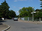
|
| Schlierbacher way
( Location ) |
360 | Schlierbach , Upper Alsatian municipality in the Haut-Rhin department, France, on the south-eastern outskirts of Mulhouse (Mulhouse) | March 19, 1938 | The road lies between the Grauwacke- and Sandsteinweg . The route between Marienfelder and Lichtenrader Chaussee, initially routed as road 115 according to the development plan , in 1935 with eight vacant lots listed as construction sites, a single-family house of a police officer, two lots with unknown owners and a new building, was recorded in 1938 in the west of the district along with nine other streets south of Marienfelder Chaussee named after the Alsatian town that came to France in 1919 as a result of the Treaty of Versailles . On March 25, 1955, an extension of the Schlierbacher Weg through road 131 was also named that way. The development plan around the Grauwackeweg was drawn up in October 1957, the residential buildings were determined and the sandstone path extended and the Hornblendeweg in the north arch and the Schlierbacher Weg in the south arch. Today the street leads to the sandstone path, to Mariendorfer Damm a wide paved footpath leads through a small park. From 1991 the Schlierbacher Weg settlement was modernized and repaired. |

|
| Sprosserweg
( Location ) |
140 | Sprout , songbird from the flycatcher family | Aug 16, 1928 | The road goes south of Johannisthaler Chaussee from Baumläuferweg to the north, plots 3–15 (odd) and 10 and 14 (even) are assigned. It ends with bollards blocked off at a turning point directly on Johannisthaler Chaussee near Rudower Straße. According to the development plan, it is routed as street 198 , in the address book from 1935 it is recorded with the built-up, odd, eastern plots 1–15, plot 10 on the opposite street is also built on, and 2–8 are undeveloped towards Rudower Straße, as are the following plots on the Treecreeper, Chaffinch, Stieglitz and Einsidlerweg, which are indicated as cross streets for Sprosserweg. However, around 1954 it has the shortened route between Baumläuferweg and Rudower Straße. |

|
| Steinträgerweg
( Location ) |
290 (in the district) |
Stone girders, activity on a construction site | Jan. 30, 1933 | In the district, the road lies between Johannisthaler Chaussee and the Wendehammer on the district boundary, it continues as a road to Britz through the "Neuland I settlement". Previously private road 2 of the development plan, in Britz on March 27, 1939, road 76 was also named Steinträgerweg. |

|
| Stieglitzweg
( Location ) |
380 | Goldfinch , a finch bird | Aug 16, 1928 | It is located between Johannisthaler Chaussee and Goldammerweg in the Buckow 2 district . The north-western section to Zadekstraße is due to the formation of the new district in the 1960s in Gropiusstadt . In 1935 (as Post Bln. = Britz) it is listed with orientation numbering in the location between Triftweg (today Zadekstraße), Johannisthaler Chaussee, Sprosserweg, Heroldsweg, at that time with 23 developed and 52 undeveloped (especially south side east of today's Goldammerweg) and a garden. The former continuation of the street over Goldammerweg to the east is now overbuilt with multi-storey Gropiusstadt residential buildings on Eugen-Bolz-Kehre, these houses are also on the western section of the street in the neighboring district. The name in the development plan was Straße 11 |

|
| Storchenweg
( Location ) |
280 | Stork , family of the wading birds | Aug 16, 1928 | The road 14 of the development plan was named in 1928 and ran until the 1960s by Stieglitzweg / Johannisthaler Chaussee to Rudower Straße. Due to the new buildings in the 1960s / 1970s on Stieglitzweg in the Gropiusstadt section , the street on Rudower Straße was shortened to Buchfinkenweg. |

|
| Street 44
( Location ) |
120 | Street number according to the development plan | 1935 | The street itself is without an assigned property, but is still listed under this name in the official street directory. It is located at the southern end of the Lindholzweg to the west to Haewererweg. On the official map 1: 5000, produced by the district surveying offices, the name Lindholzweg is given for the course of road 44. It has obviously been interrupted since the construction of the Buckower Weg residential estate, as the northern property line of Buckower Weg 8-20 (straight) and 23 and the southern (directly adjoining) property line of Michael-Klinitz-Weg 14a, 14b, 14c, 16a, Touch 24a, 24b, 24c. The latter city villas and three-storey residential buildings on this built-up area can be reached via a drivable ring road with a barrier system from Michael-Klinitz-Weg. In the 1935 address book, street 44 is recorded with two developed properties (99 and 113) with the unofficial name Mimosenring . It lies between Lichtenrader Weg and Marienfelder Chaussee and crosses the Kornblumenweg (the latter, however, is not entered). In the meantime (as of July 2014) the street has been included in Lindholzstraße. |

|
| Street 96
( Location ) |
200 | Street number according to the development plan | 1935 | The street itself has no assigned property. It lies between the mica and the rear property line on Feldspatweg. To the south of Glimmerweg, road 482 continues to the corner at Muschelkalkweg, to the north the Kalksteinweg continues. |

|
| Street 455
( Location ) |
20th | Street number according to the development plan | 1950 | The street itself has no assigned property and is located a little north across the Asbestweg from the Kalksteinweg to the west to the property boundary of the park settlement Spruch, the access to which it represents. It is signposted as “Zur Straße Parksiedlung Spruch”, but is listed as Straße 455 in the FIS Broker. |

|
| Road 482
( Location ) |
80 | Street number according to the development plan | 1950 | The street itself has no assigned property. It is obviously a remnant of the plan road between the Muschelkalk- and Kalksteinweg. The street is recorded in the official register as a street with a length of 90 meters and further north as a footpath to Glimmerweg (between property 71 and 73). The part of the street forms the access to the houses Muschelkalkweg 1/3 (west) and 4/6 and 8/10 (east). |
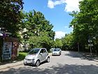
|
| Stuthirtenweg
( Location ) |
320 | Mare shepherd, old peasant term for horse shepherd | Sep 1 1969 | This street on the city limits of Großziethen was called Grenzweg from 1914 until the new name was chosen in 1969 , at which time the Berlin Wall extended over Brandenburg grounds and blocked movement to the south. Today a section of the Berlin Wall Trail extends here . The street lies between Buckower Damm and Ringslebenstrasse. A cul-de-sac leads from Buckower Damm to lots 38-44, followed by a footpath and roads to lots 18-36 west and 6-16 east of Reinowzeile. Due to the location on the city limits, the opposite odd numbered (newly built) homes belong to Brandenburg. The road, previously known as the Grenzweg , was named between January and September 1925. Grenzstraße is recorded in the 1922 address book between Chausseestraße and the Rudow district. On the north side with two developed and other undeveloped properties, in the south the Groß-Ziethen colony. Today, the Stuthirtenstrasse is a roadway, partly expanded on the Berlin side, partly separated by a narrow strip of green, the street immediately next to it (partly unpaved, partly asphalted, mostly single-lane) in Brandenburg ( Groß-Ziethen municipality ) is called Grenzstraße. |

|
|
Toepchiner way
( Location ) |
300 (in the district) |
Töpchin , place in today's district of Dahme-Spreewald, state of Brandenburg | Feb 14, 1950 | The northern section is in the district between Drusenheimer Weg and the district boundary, which is halfway between Baldersheimer Weg and Rathenower Straße. The road continues south in Lichtenrade to Alt-Lichtenrade. The "Töpchiner Dreieck" west of the Drusenheimer to the Töpchiner Weg is a row and semi-detached housing estate. The Lichtenrader way was named in 1950 between the county line and the Gerlinger street in Töpchiner way and on July 21 In 1960 the Buckower road in the neighboring district of Tempelhof called Töpchiner way. On June 15, 1973, the Töpchiner Weg in the section from road 539 and the property to Töpchiner Weg No. 8 was renamed Warmensteinacher Strasse. On the same day, the Töpchiner Weg between Marienfelder Chaussee and Warmensteinacher Strasse was renamed to Zum kleine Pfuhl . The Töpchiner Strasse was previously in a direct line over the Marienfelder Chaussee to the Rufacher Strasse. On September 1, 1980, the extension, the section of road 540 between Töpchiner Weg and Drusenheimer Weg, was also named Töpchiner Weg. The previous name Buckower Straße was already drawn on the map from 1911 by name from Dorfstraße in Buckow (today: Alt-Buckow) to Lichtenrader Dorfstraße. In the city map of 1920, the section of Buckower Strasse from Dorfstrasse (today: Alt-Buckow) to the district of Lichtenrade was called Lichtenrader Strasse. The continuation in Lichtenrade was initially still called Buckower Straße . |

|
| Pottery Path
( Location ) |
100 (in the district) |
Potters , craftsmen | Jan. 30, 1933 | In the district, the Töpferweg is a road between Johannisthaler Chaussee and Rohrlegerweg, it continues as a road after Britz to Bauhüttenweg , but is blocked off for vehicle traffic at the district boundary on Rohrlegerweg with traffic posts. The Töpferweg was built in 1933 on the route from street 253 of the development plan with the “Neuland I” settlement on Britzer Flur, which is divided by the “Neuland II”, which is exclusively in Britz, by the former railway line along which the Töpferweg runs to the west. The streets of these settlements are named after crafts, preferably building trades. |

|
| Tränkeweg
( Location ) |
470 | Cattle trough on the "Britzer Wiesen" | June 9, 1933 | The road 58 of the development plan was laid out in 1933 between Ortolan and Laubsängerweg with orientation numbering . At that time, a crossing street parallel to Ortolanweg was planned for this residential estate in Buckow-Ost. In 1937 there were 34 lots with residential buildings, three lots with summer houses and four undeveloped lots. |

|
| Bustard Path
( Location ) |
460 | Bustards , a family from the order of the crane birds | June 9, 1933 | The road 57 of the development plan was laid out in 1933 in the settlement between Ortolan and Laubsängerweg with orientation numbering . At that time a crossing street was planned parallel to Ortolanweg for this residential area. In 1937 there were 24 plots of land built with residential houses, ten plots with summer houses, two garden plots and the still undeveloped plot of land 21. |

|
| Trimbacher Strasse
( Location ) |
250 | Trimbach , Lower Alsace Municipality, France | March 19, 1938 | The road 73 of the development plan in 1938 in this quarter with nine other roads to places in Alsace named the 1918 as a result of the Versailles Treaty came to France. In 1943 the street between Delmer Steig and Bühler Weg and on to the high-voltage line is indicated, it crosses Dessenheimer Weg, Am Röthepfuhl, Drusenheimer and Battenheimer Weg, built on with three single-family houses and otherwise a summer house and undeveloped land. Today the street is shortened and lies between Am Rötepfuhl and Delmer Steig. On May 1, 1977, the route from Straße 73 in the development plan was then renamed to Am Rötepfuhl (southern branch at the east end) and south of Drusenheimer Weg to a section of Bühler Weg. The cross section of the Weitbrucher Weg, now separated by the KGA Am Töpchiner Weg, was renamed before the early 1950s. |

|
| Stalactite path
( Location ) |
660 | Dripstone Stones that are sintered by dripping water | March 6, 1957 | The street between Schiefer- and Quarzweg in orientation numbering (straight on the right, odd on the left) lies on the route of street 136 of the development plan, it was laid out on undeveloped land in Buckow-West. It lies across the home estate (warrior settlement), north of the park settlement Spruch in the northern tip of the district (between Quarzweg to the Britz allotment gardens and northwest to Mariendorfer Ankogelweg). The street is built on with two-storey terraced houses, some of which are perpendicular to the street axis on the north side and have garages in front of them. At the east end of the street, the chalk pond lies between the properties of the Grünstein- and Schieferweg. |

|
| Turfweg
( Location ) |
140 | Turf , for equestrian sports, according to English turf or peat | June 1, 1982 | The road lies between Wildmeisterdamm and Landreiterweg to the west, parallel to Försterweg. The quiet residential street is built on ten lots with homes. It was laid out as Straße 111 in 1943 and has four residential properties and gardens near the Mittenwalder Bahn station . In 1937 there was no entry in the address book. |

|
|
Eagle owl path
( Location ) |
150 | Eagle owl , largest European owl | Aug 16, 1928 | The street lies between Otto-Wels-Ring and Zadekstraße , in a corner of Buckow towards Gropiusstadt, whereby the road area of the delimiting street belongs to Buckow. For 1930 summer houses, vacant lots, farmland and a new building are given. In 1943 eight developed and one vacant lot, 1–11 and 2–12 are arable land and these plots are still missing on the Uhuweg, to which 13–23 (odd) and 18–26 (even) are assigned and which is divided up by the division of land (mostly in the depth of the property) is built on with 20 (mostly) multi-family houses. The Uhuweg lies in the route of Straße 22 of the development plan. The name is probably related to the Eulenweg between Johannisthaler Chaussee and Rudower Straße / Feldmark, which was recorded for 1928. |
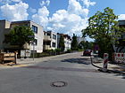
|
|
Warmensteinacher Strasse
( Location ) |
860 | Warmensteinach , a resort in the Bayreuth district, Free State of Bavaria | June 1, 1973 | When naming, the routes of street 539 and street 573 of the development plan were merged. On June 15, 1973, part of the Töpchiner Weg was included, so it is between An den Achterhöfen and Gerlinger Strasse. On this street is part of the Britz-Buckower Weg, number 15 of the 20 green main routes in Berlin. Larger parts of Warmensteiner Strasse are located on the historic connecting route between Britz and Lichtenrade through Buckow (Lichtenrader Strasse) , which was named Töpchiner Weg in 1950, but was later built over and rededicated between Warmensteinacher Strasse (on Westbogen) and Gerlinger Strasse. |
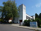
|
| Weitbrucher Straße
( Location ) |
780 + 240 | Weitbruch , municipality in the canton of Haguenau, Lower Rhine region, France | March 19, 1938 | The road 87 of the development plan was named with nine other roads in this quarter after places in Alsace, these places had come to France in 1918 as a result of the Versailles Treaty . The longer section of the street is east of Wingerter Straße, parallel to Baldersheimer Weg and behind the northern properties at KGA Am Töpchiner Weg across Kühnheimer Weg. In addition, there is a transverse section at the eastern end of the road, in the route of road 73 , which lies between Weitbrucher Straße and Baldersheimer Weg and also as a three-lane asphalt road with developed sidewalks to the south as a dead end with a turning hammer and to the north (unmarked with traffic sign) to the limit of the KGA is enough. |

|
| Wendehalsweg
( Location ) |
520 | Wendehneck , subfamily of woodpeckers | June 9, 1933 | Previously laid out as street 60 in the development plan, it was laid out in the settlement on Ortolanweg in Buckow-Ost in 1933. It is the only one of the parallel streets that leads over Laubsängerweg and is therefore between Ortolanweg and Rudower Straße . From the projected crossroad through the settlement parallel to Ortolanweg mentioned in the old address book, no connection has remained, although it is shown on the official map 1: 5000 between plot 19a to 21 and 20 to 22. The numbering has been from horseshoe numbering 1 on Rudower Straße to 15 on Ortolanweg and back 16-29 and undeveloped land to the current orientation numbering from Ortolanweg to Rudower Straße 2–36 (straight, from Buchfinkweg to Rudower Chaussee 30 and 30a) and 1-41 (odd). Zadekstraße (formerly Triftweg) is located across Rudower Straße. |

|
| Hoopoe Way
( Location ) |
180 | Hoopoe , species of the hoopoe bird family | Aug 16, 1928 | The Wiedehopfweg is a cross street on both sides of the Schirmvogelweg and borders on the KGA Fliedergrund in the northwest. It is the remaining section of the parallel road projected between Ortolan and Laubsänger- / Birkhuhnweg through this settlement between “Britzer Wiesen” and Rudower Straße in Buckow-Ost, Straße 31 of the development plan. The rest of the route is still partly drawn in 1954 as a footpath between the parallel streets and is also indicated in the official map of Berlin 1: 5000, but is no longer found as a break between the properties of the streets to the west. Plots 1 (KGA), 5, 5a and 11–21 (odd) as well as 4, 6, 12–20 (4 to 6 west of Schirmvogelweg) are assigned to the path and both parts of the street are marked as dead ends. At the intersection there is an unnamed space of 20 meters square due to sloping property corners. In the 1937 address book, the Wiedhopfweg (Post Bln. = Britz) between Hochspannungsweg and an unnamed dead-end street to the east with the built-up lots 1, 3, 5, 9 (north) and 4, 6, 10 and the others (numbered up to 22) is undeveloped Plots recorded. |

|
| Gamekeeper Trail
( Location ) |
560 (in the district) |
Gamekeeper , person responsible for caring for and guarding the game population | Sep 1 1969 | The gamekeeper trail is located between Oak Quast and 100 meters from the Kölner Damm in the district. Plots 1, 2 (children's club) and 5 at the eastern end are in Gropiusstadt . The day care center in No. 8 and the annex building No. 6 belong to Buckow. The four-lane asphalt road forms a straight stretch in the district that forms a left-hand curve at the east end in Gropiusstadt, which leads over the railway line . Up until the 1960s, the expanded road 80 led to Landreiterweg (then: Road 79 ), which continued at an acute angle (now at right angles), and to the east, the railway line ran across the Heroldsweg. The street 80 was laid out and built on in the early 1930s. |

|
| Wildmeister dam
( Location ) |
540 (in the district) |
Game master, control of the game population and the maintenance of the sovereign forest (superior of the gamekeeper) | March 29, 1939 | In the district, the Wildmeisterdamm is now between Johannisthaler Chaussee and Kölner Damm, across this parallel to the Wermutweg it continues to Gropiusstadt . South of the Wildmeister dam is a densely vegetated depression with a belt of trees made of oak and willow trees. The route of the Wildmeisterdamm already existed before 1900 on the east-west crossing Chaussee (Marienfelde – Rudow) connecting the Teltowdörfer. With the construction of the Buckow station on the Mittenwalder Bahn , Bahnhofstrasse was expanded and is available in the development plan as Road 2 in 1911 and this continues the Bahnhofstrasse that begins on Chausseestrasse (today Buckower Damm) in the east to Neuköllner Strasse in Rudow . In 1925 Buckower Chaussee (between Buckow and Rudow) was expanded into a street and part of the street was renamed Rudower Straße 2 before 1935 , shortly afterwards Rudower Straße 2 was renamed Buckower Chaussee again . In 1939 Buckower Chaussee and Bahnhofstrasse were renamed Wildmeisterdamm. The entire course from Bahnhofstraße, Rudower Straße 2 (within Buckows) and Buckower Chaussee (in Rudow) was renamed Wildmeisterdamm in 1939 and the connecting road Straße 484 was extended. On February 27, 1967, the district office announced that the name Wildmeisterdamm between the street 484 and Neuköllner Allee would no longer exist , as this route had meanwhile been built over in Gropiusstadt. On July 1, 1975, the part of the Wildmeisterdamm between Johannisthaler Chaussee and Buckower Damm was renamed Johannisthaler Chaussee, whereby the continuous road course was changed in favor of the Johannisthaler Chaussee through road construction, so that the Wildmeisterdamm flows at right angles from the south. |
|
| Wingerter Strasse
( Location ) |
190 | Vigny (Moselle) , 1915-1918 and 1940_44 translated into German as Wingert village in Lorraine | March 19, 1938 | The road 41 of the development plan was named in 1938 and parallel to Ostheimer Straße and Kühnheimer Weg. The street is between Marienfelder Chaussee and Baldersheimer Straße . In the 1938 address book, street 41 from Marienfelder Chaussee to street 38 is listed, with the Rothkehl'schen house, a summer house and lots. In 1939 there is a reference to the renaming of 40er Strasse, so Wingerter Strasse is named with five single-family houses, the summer house and parcels. The naming took place on the same day as that of numerous other streets in the district that were named after places in Alsace-Lorraine, see for example Delmer Steig, Drusenheimer Weg, Gaudacher Straße and many others
|
|
|
Zadekstrasse
( Location ) |
810 (in the district) |
Ignaz Zadek (1887–1959), physician | Feb. 1, 1966 | The course of the road is the Triftweg , which already existed in 1911 , which probably owes its name to the cattle drift of the cattle of the Buckow farmers between stable and pasture to the Britzer Wiesen. The Zadekstraße lies between Imbuschweg and Rudower Straße with the street in the district. On the eastern edge of the road in the southern part between Imbuschweg and Stieglitzweg, the properties belong to Gropiusstadt . Zadek was the son of the Jewish doctor and social democratic city councilor Ignaz Zadek senior and until 1933 medical director of the 2nd internal department at the Neukölln hospital. Dismissed from this office by the NS authorities, he practiced privately and after 1945 was again director of the municipal district hospital in Neukölln. |

|
| Wren Walk
( Location ) |
200 | Wren , bird family from the order of the passerine birds | Aug 16, 1928 | The settlement and residential road goes from the Grüner Weg as a dead end to the east, the route near the development plan is road 4 . Like the other parallel streets up to the Kormoranweg, it was registered until the 1960s. However, a 90 meter wide strip to the west of the Kormoranweg was kept free for another use, but today it is built over with five to eight-story buildings of the type south of Parchimer Allee in Britz Süd by the IDEAL building cooperative . |

|
| Zeißpfad
( Location ) |
70 (in the district) |
Carl Zeiß (1816–1888), optician, entrepreneur | July 13, 1934 | The northernmost section between Baldersheimer Weg and the suburbs before Reichnerweg with lots 1–7 (odd) and 4a – 6b (even) is located in the district, the largest section of the road continues south in Lichtenrade to Griembergweg. The residential street , which is parallel to Lichtenrader Damm, is built on with one and two-family houses and has been designated as a two-lane asphalted traffic-calmed area ; its length is on the routes of street 2 and street 39 of the development plan. |
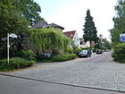
|
| To the Biesenwerder
( Location ) |
250 | Biesenwerder, old field name meaning rush, reed island | Sep 1 1969 | The road between Wildhüterweg and Ringslebenstraße was laid out in the 1930s and has been built on since then. Before it was named, it was called Straße 84 according to the numbering in the development plan. |

|
| To the little lake
( Location ) |
110 | Kleiner Pfuhl, was on Marienfelder Chaussee until 1943 | June 15, 1973 | The paved cul-de-sac with summer path and tree-lined green strips on the west and unpaved sidewalk on the east, goes from the north of the Warmensteiner Straße to the northeast. It ends in front of Marienfelder Chaussee at the Rufacher Weg bus stop. The road to the Kleinen Pfuhl (which lay to the west of this road) is a remnant of the Töpchiner Weg to the Rufacher Weg over the Marienfelder Damm, and historically the connecting road to Lichtenrade at the western end of the village, whose village character the road still has. |

|
Planned and former streets
Due to the formation of the district Gropiusstadt, some of the former Buckower streets have been outside the area of the district since the mid-1960s. East of the Teltow Canal, several numbered streets (90-103) on Johannisthaler Allee have been listed in the Späthsfelde settlement since 1936 and are already largely built on. This settlement belonged to the Neukölln administrative district and the Buckow district until 1938, as did the Königsheideweg until 1938, they came to Treptow as a result of the territorial reform in that year and were "renamed at the time of going to press" in 1937: Straße 90 in Alpenrosenweg, Straße 91 in Mahonienweg, Street 92 in Agavensteig, street 93 in Berberitzenweg, street 94 in Späthsfelder Weg, street 95 in Thujaweg.
Lenaustraße with the house of the fruit grower Vortanz is briefly found in the address books without further information. In 1925, the Lerchenweg is listed between Johannisthaler Chaussee and Feldmark, with the Lerchenweg connecting to road 161 on the Grüner Weg . There is a plot of land on both sides, but it is no longer registered in 1926. However, in 1933 there was a reference to Einsiedlerweg under Lerchenweg . In 1923, street C with a built-up property (Skorjever's house) and street D are noted, the latter lies between Johannisthaler Chaussee and Windmühlenweg (in 1923 this is still called street 185 ) with eight new buildings. In 1928, street D is still listed and street C is missing; from 1931 to 1938, no more properties are listed for street D , neither developed nor undeveloped. In the address book of 1925, street 160 and street 161 between Grüner and Lerchenweg are mentioned with built-up properties ; in 1930 they are no longer listed. From 1925 onwards, the street 181 and street 182 can be found in the address book , both of which lead off from Grüner Weg in Feldmark. From 1926 the street 185 is still registered between Rudower Straße and Johannisthaler Chaussee. In 1929 their renaming is referred to Straße 181 with “Jetzt Zaunkönigsweg ” Straße 182 with “Jetzt Rotschwanzweg ”. In 1928 and 1929 this includes the undeveloped street 29 on Rudower Straße and in 1929 street 5 from Grüner Weg in Feldmark.
A larger number of the streets numbered according to the development plan were laid out from 1934, especially from 1936. There was more building in Buckow and from 1936 roads were laid out and the areas were extensively built on
- south of Marienfelder Chaussee on Lichtenrader Weg to Lichtenrader Chaussee in the Lichtenrade district: Straße 38, Straße 39, Straße 40 , later (1943) also Straße 45 and Straße 46 . The following streets were laid out here from 1935: Strasse 70, Strasse 71, Strasse 72, Strasse 88, Strasse 89, Strasse 115
- north of Marienfelder Chaussee and across it between Lichtenrader Weg and along Mariendorfer Chaussee: Straße 44 as Mimosenring, Straße 69 as Nelkenring, Kornblumenweg. The following streets were laid out here from 1935: Rosenring, Strasse 68, Tulpenring, Strasse 70, Strasse 71, Strasse 72, Strasse 88, Strasse 89, Strasse 115 and others are listed as planned (cross) streets in 1936.
- In particular, the areas east of Chausseestrasse between Bahnhofstrasse and Groß-Ziethen (on the outskirts of the town) are being developed: Strasse 74, Strasse 75, Strasse 76, Strasse 79, Strasse 80, Strasse 81, Strasse 82, Strasse 83, Strasse 84, Strasse 85 ( Margeritenweg), Strasse 104, Strasse 106, Strasse 107, Strasse 108, Strasse 109, Strasse 110, Strasse 112, Strasse 113 .
Some of these roads are on or through arable land, lead into the Feldmark , and the names in different sources do not always seem to be secure. The streets were probably numbered around the town center. 70er streets are north of Marienfelder Chaussee (west of the town center), on the other hand the renaming of Straße 74 in Rohrlegerweg , Straße 75 in Mauererweg , Straße 76 in Steinträgerweg is mentioned in the address book 1939 , whereby these are east of the town center north of Johannisthaler Chaussee and Bahnhofstraße. The renaming took place in 1939 with other streets, such as the name Straße 89 in Egisheimer Weg, this street 89 is built in 1934 as a dead end from Mariendorfer Straße with lots 6 and 7, but is missing in the address book in 1935 and 1936. In 1939, the location of Straße 96 and Straße 100 (today roughly on the route In den Gärten ) between Marienfelder Chaussee and Glimmerweg (which was already mentioned in the section at that time) is given. The streets and paths remained partially undeveloped and probably also unsurfaced, until the 1960s there was still arable land, which was ultimately used for building on the site of what is now Gropiusstadt.
| Surname | from | to | named in | Remarks |
|---|---|---|---|---|
| Amtsmannweg | before 1930 | before 1937 | → Landreiterweg → Hasenhegerweg (western section) |
The bailiff was in front of the Buckow district in the Teltow district to which Lichtenrade and Groß-Ziethen also belonged. The Amtsmannweg with the note "Naming not officially" is specified in the 1930 address book between Feldstrasse and the railway with five developed and undeveloped properties on the south side and arable land on the north side. The address book 1937 contains a reference to street 79 for the unofficial route . |
| On the mountain path | before 1925 | around 1933 | → Sprosserweg | The street is indicated in the 1925 address book between Johannisthaler Chaussee, Bergweg and Windmühlenweg with two developed properties. In 1930 the reference: "Now Sprosserweg" is included. |
| Auerhahnweg | before 1930 | August 1, 1965 | → Imbuschweg | In the 1930 address book, the street between Henkelsweg and Triftweg is named with buildings. The street is named in the address book 1938 between the district Britz am Grünen Weg over the Henkelsweg to Triftweg, the plots 23–31 and 24–34 on Triftweg are built up. For 1954 the road is listed again between Komoran- and Triftweg, although at that time the Green Way still has a connection to Johannisthaler Chaussee |
| Bahnhofstrasse | before 1911 | March 29, 1939 | → Wildmeisterdamm → Johannisthaler Chaussee (west) |
With the Neukölln-Mittenwalder Kleinbahn , the Buckow station on the connecting road (Marienfelde-) Buckow-Rudow became 1903. In the address book 1922 between Dorf- / Chausseestrasse and the district of Rudow, it is stated on the corner of Johannisthaler Chaussee, the Feldstrasse , then south of the street follows Buckow train station and the further street to the boundary of Rudow. The plots 1–7 west of Feldstrasse and 16–18 on Johannisthaler Chaussee are built on with residential houses, all other plots are undeveloped. On July 1, 1975 the western part was renamed after Alt-Buckow / Buckower Damm in Johannisthaler Chaussee. |
| Ballodweg | Jan. 30, 1933 | Aug 8, 1935 | → Feldspar path | Carl Ballod (1864–1931), Latvian economist and statistician, was at times close to the USPD . The road was laid out in 1933 in the “Neue Scholle” unemployment settlement between Vorländerweg and the Feldmark. In the 1934 address book, plots 3–35 and 4–32 are owned by the city of Berlin and built on and already inhabited by the “Neue Scholle” cooperative. During the Nazi regime , all three streets here, named after socialist personalities, were renamed according to the type of rock. |
| Mountain path | before 1925 | before 1929 | → renumbered open |
The name may be based on the slope between the east and west end of five meters over a length of 500 meters or a field name. The street is indicated in the 1925 address book roughly parallel to Johannisthaler Chaussee between Windmühlenweg , Am Bergweg , Meisenweg and via Stieglitzweg into Feldmark with a built-up plot on each side. This course, given in 1925, is repeated until 1928 and is missing from 1929, in contrast to, for example, Am Bergweg, a renaming cannot be found in the following address books and probably did not take place. The mountain path was perpendicular to today's (winding) road. |
| Britzer Strasse | before 1911 | Feb 14, 1950 | → Rufacher Weg → Leonberger Ring (western section) |
The direct connection between Buckow and Britz is given in 1922 between Dorfstraße / Mariendorfer Straße and the Britz district. Residential houses are noted on plots 1–6, number 1 is owned by the farmer Haewerer and Spruch manages it. The continuation of the street in Britz with connection to the Buckower Chaussee a little south of the railway crossing was called Lichtenrader Weg (today Hüfnerweg ). |
| Buckower Street | before 1911 | before 1922 | → Lichtenrader Weg | Under this name, Buckower Strasse was located between Lichtenrade Dorfstrasse / Berliner Strasse and Buckow Dorfstrasse / Marienfelder Chaussee in the 1920s . and runs under this name across the boundary. Today parts of the Töpchiner Weg, the Warmensteinacher Straße and the connection to the Marienfelder Chaussee are located on this route as Am kleine Pfuhl , other sections are built over today. The street name Lichtenrader Weg has been recorded in Buckow address books since 1922, which led from Marienfelder Chaussee / Dorfstrasse through “Ackergelände” and across the field path to the Lichtenrade district. For 1922, three developed plots are named here. In 1937 there is a coal field on the corner of Feldweg , 19 developed plots and three summer houses, and Street 44 and Street 71 cross. In 1943, the Kohlenplatz and the three summer houses still existed and built-up land was added, the crossed streets are now called between the district boundary and Alt-Buckow: Baldersheimer, Bühler Weg and Delmer Steig. |
| Chausseestrasse (from Britz) | before 1912 | Jan. 4, 1955 | → Buckower Dam | In 1922, Chausseestrasse was located between the Britz suburbs and Grenzstrasse on the Groß-Ziethen colony, and lots 1–54 (continuously) were almost completely built on. It crosses a dirt road south of the village center and that leads over the intersection with Dorfstrasse / Bahnhofstrasse . In the 1920s, at the intersection with the Feldweg, there was a playground belonging to the municipality of Buckow, which later address books referred to as a sports field owned by the city of Berlin. The name applies in Buckow, in Britz up to the boundary Britz / Buckow the street was called Buckower Chaussee. |
| Chaussee Straße (from Mariendorf) | before 1901 | Aug 31, 1949 | → Mariendorfer Damm | Only a small part of the Chaussee Straße from Mariendorf to Lichtenrade belonged to Buckow, it was a historic street between Berlin and Zossen. The road route ran from Mariendorf to Marienfelder Chaussee and led into Lichtenrade as Berliner Straße. Compared to the map in the address book from 1922, the border of the administrative district rises at an acute angle over the intersection of Chaussee Straße / Marienfelder Chaussee, but the district boundary of Buckow is, as it is today, on Mariendorfer Damm (lots 417-447 odd) on the eastern edge of the street. It is not listed in the text as a street with lots. |
| Dietzgenweg | Jan. 30, 1933 | Aug 8, 1935 | → Glimmerweg | The path laid out as private path 1 of the development plan in the unemployed settlement "Neue Scholle" was named after the socialist theorist and journalist of the German labor movement Josef Dietzgen (1828–1888). During the Nazi regime , all three streets here, named after socialist personalities, were renamed according to the type of rock. |
| Village street | before 1350 | March 27, 1939 | → Alt-Buckow | The street is indicated for 1922 between Chausseestraße past the village pond and Britzer Straße, Lichtenrader Weg and continues as Marienfelder Chaussee to the west. Plots 1–40 are all built on. House number 39 is the elementary school. |
| Einsiedlerweg | Aug 16, 1928 | after 1967 | ~ → Fritz-Erler-Allee | The name probably goes back to the hermit , in the 1930s and 1932s address books it was entered as vacant from the Grüner Weg, the route crosses Johannisthaler Chaussee and also leads through arable land. Until the formation of Gropiusstadt when a main road was set up on the route through Buckow-Ost, the Einsiedlerweg ran largely through arable land. |
| Owl Way | before 1927 | before 1934 | → Laubsängerweg | It was named after the owls , an order of birds , matching the neighboring streets. In the 1927 address book on the street between Johannisthaler Chaussee and Feldmark zur Rudower Straße, the Bergström house of the pensioner Bergström is already noted, in 1929 the carpenter Ch. Bergström owned this house and another house belonging to the mechanic M. Barmgau is listed. For 1932 there is an indication of a storage area on Rudower Straße via Haupt-, Weiden- and Johannisweg (left) with a total of three lots and the Birkhuhnweg joins on the undeveloped right side, the more wheat lots are still undeveloped and the Bergström'sche house has been dropped. In the 1933 address book Eulenweg is in the following book is the note “s. Laubsängerweg ". |
| Feldammerweg | Jun 9, 1933 | around 1958 | → deleted | The street 18 of the development plan was named in 1933 after the Feldammer with other streets after well-known bird species. The path ran in Buckow-Ost from Goldammer- to Heroldweg as the first street parallel to Rudower Straße. In 1943 it is still listed in the address book as undeveloped. His name was still marked on the map from 1957, but in 1958 he was no longer there. The route is now in Gropiusstadt . |
| Feldstrasse | before 1911 | around 1958 | → Heideläuferweg | The field road is so named after its location between the fields. In 1922 it lies east parallel to Chausseestrasse between Bahnhofstrasse / Johannisthaler Chaussee and the Groß-Ziethen colony, on the field path to the west is the "Feldweg Colony", a nursery and the new building of the nursery owner Bliek as Chausseestrasse 41. Located near Groß-Ziethen In 1922 the Seydel'sche, Schenz'sche and Gericke'sche houses, the first two nursery owners, the latter a farmer. The street is still listed in the 1935 address book. On the 1954 map, it is also named Feldstrasse in the course of road 106 . |
| Dirt road | before 1920 | before 1925 | → not applicable | According to the 1923 address book, the (named) dirt road was between Feldstrasse , Amtmannsweg and Feldmark south of the village. The dirt road was named before 1920. He went from Feldstraße in a south-westerly direction in an arch back to Chausseestraße (today Buckower Damm) around the village. However, are probably in the address books for marking rural roads with dirt road called because its route structure like this. There are several intersection / crossing points around the village center. |
| Finkenweg | before 1927 | before 1929 | → Storchenweg | Finches are a family of songbirds with around 130 species. Previously part of road 12 of the development plan, Finkenweg was first identified in the address book from 1927 in the route Rudower Straße, Meisenweg, Windmühlenweg. The name must have been deleted between 1928 and 1929. In the 1931 address book, he referred to the Storchenweg. |
| Nursery Path | before 1925 | around 1933 | → not applicable | The Gärtnereiweg was close to the Neukölln municipal nursery. The name was probably unsafe in use because, according to the address book, it was re-named as Street 17 in 1933 . The path ran between Stieglitzweg and Rudower Straße and was named between 1925 and 1929. Goldammerstrasse ran along part of this route from 1933 onwards, but no official renaming took place. |
| Firefly Trail | after 1928 | around 1933 | → Golden Chicken Path | The glowworm path was named after 1932 and was probably laid out between the Grünes and Möwenweg. It ran along the route of today's Goldhähnchenweg, which was named on June 9, 1933. Fireflies , also are a family of beetles of the soft beetle superfamily with around 2000 species worldwide. |
|
Grenzstrasse Grenzweg |
1925 | Sep 1 1969 | → Stuthirtenweg | In 1922, the Grenzstrasse lies between Chausseestrasse and the Rudow district, with the Thiemann's house (municipal secretary) and the Mudrack's house (upper town secretary). In the 1938 address book, the route is indicated as a Grenzweg from Chausseestrasse on the left as follows: undeveloped, Girra's house, undeveloped, street 106, undeveloped, two Mudrack's houses (Haus Hanna) separated by undeveloped land, undeveloped, street 107 , undeveloped, street 108, undeveloped, street 109, undeveloped, street 113, arbor area, street 82, undeveloped, industrial railway, undeveloped, street 83, Springer'sches and Wagner'sches Haus as well as No. 5, street 84, undeveloped, Brenner ' sches, Engel'sches, Zietzmann'sches Haus, Straße 85, Bläsing'sches Haus, undeveloped and Straße 79 to the Rudow district. Furthermore, “go right side. Large = Ziethen "noted. The eastern part of the Grenzstrasse has merged into the Ringslenestrasse. |
| Henkelsweg | around 1919 | Apr 15, 1966 | → Juchaczweg , built over to the north |
It is in 1922 between Johannisthaler Chaussee and Rudower Strasse with two new buildings and vacant lots, as well as the Panzer'schen (Berlin gardener) and the Milling'schen Haus (Neukölln gardener), on the east side is the Neukölln hospital and on both sides of the dirt road undeveloped land. |
| Heroldweg | Aug 16, 1928 | around 1968 | → moved in | The path is probably symbolically named after the herald , a medieval manorial messenger and preacher, without any local reference . The road 19 of the development plan ran from today Wildmeister dam to Rudower Straße and 1,954 still listed ago. On the map from 1967 the name of the path is marked as an extension of Lipschitzallee, it was moved in around 1968. His route is now in Gropiusstadt partly in the area of Lipschitzallee but is built over. |
| Canary path | Jun 9, 1933 | Apr 15, 1966 | → deleted | The canary is a cultivated form of the Canarian race of the girlitze . The street 10 of the development plan lay between the Kormoran- and Henkelsweg and was named next to other streets on the same day as the Girlitzweg. On April 15, 1966, the name was deleted from the street register, as the street area was no longer needed, it was overbuilt by the new building of the Neukölln hospital. |
| Königsheideweg | Jun 9, 1933 | Apr 15, 1966 | → deleted | The path on the Königsheide , which today belongs to Baumschulenweg and Niederschöneweide, is also given for Buckow in the address books from 1933 to 1938, before the district reform of 1938 brought the areas northeast of the Teltow Canal to the Treptow administrative district . In particular, the left-hand (northern) properties 1–7 belong to Treptow ( Baumschulenweg ), 9–39 to Niederschöneweide and 41–199 do not exist (forest). On the right side of the street are the properties in Buckow from Späthstraße to 2–59 belonging to Späthschen Baumschule, 60 built-up, 62–64 undeveloped, 66 built-up, 68-70 open space, 72 built-up, 74 parcel, Späthsfelder Weg, 76-96 built-up , 98–100 undeveloped, 102–114a as developed, summer house and construction sites, Johannisthaler Chaussee. The plots 116–220 to the east belong to Rudow and 222–296 to Johannisthal. |
| Lawendelweg | before 1937 | March 27, 1939 | → Heimsbrunner Strasse | In the 1937 address book, Lawendelweg is marked with “s. Street 88 ”. In 1934, 1935 and 1936, with the simultaneous naming of street 88 , the Lavendelweg is listed with a v and it is located between Britzer Straße and Mariendorfer Straße, on the left with properties 1–23, four of which are built on, and (not listed ) undeveloped land on the right. In the 1939 address book, street 88 is already listed with the reference “s. Heimsbrunner Straße ”. |
| Mariendorfer Strasse | before 1911 | Feb 14, 1950 | → Wide path (in parts) |
The historical connecting route in Mariendorf was called Buckower Weg up to the boundary of the district. It was located between the exit of Mariendorf (today Grüntenstrasse) in the east at the intersection of Britzer and Rixdorfer Strasse and the western exit of Buckow on Marienfelder Chaussee. Already marked as a tree-lined road on the map of the land survey from the middle of the 19th century. In the address book from 1922 to 1932, Mariendorfer Strasse is listed as undeveloped, in 1933 the first building on the street was the Zibulski'sche Haus between Feldweg and Strasse 88 , in 1936 the Glashoff'sche and Krüger'sche Haus between Strasse 88 were added and street 89 . In 1943 only the right side of the street was built on six pieces of land between Marienfelder Chaussee, Egisheimer and Heimsbrunner Weg, with arable land as far as the boundary. |
| Titmouse | after 1925 | before 1930 | → Buchfinkweg | The Meisenweg from Feldmark via Finkenweg to Johannisthaler Chaussee can be found for the first time in the 1926 address book ; in 1930, undeveloped from Storchenweg and the corner of Am Bergweg, three plots are built on. The renaming is recorded in the 1930 address book. |
| Mühlenweg | after 1914 | March 19, 1939 | → Wingerter Strasse | In the 1922 address book, Mühlenweg was named as the path going south from Marienfelder Chaussee into Feldmark. The designation is listed as unofficial. In 1934 there was a built-up plot of land here. In 1939 the reference to the new street name is included in the address book. A mill here could not be identified, and it was probably a symbolic name, in the address book this is noted as "not officially named". |
| Snow bunting path | Jun 9, 1933 | around 1965 | → not applicable | Street 16 of the development plan was dedicated to the snow bunting , a Nordic finch bird, on the same day with other streets named after finch species. The road between Einsiedler- and Stieglitzweg was still undeveloped in 1943; it lies in the area south of the Johannisthaler Chaussee and parallel to it. In 1954 it was still facing Ackergekände and was vacant and was probably not used when Fritz-Erler-Allee was built. |
| Triftweg | before 1911 | Feb. 1, 1966 | → Zadekstrasse | The name of the path goes back to the Viehtrift , where the Buckow farmers probably drove their cattle to the Britz meadows. The path runs parallel to Henkelsweg and is called from Johannisthaler Chaussee to Rudower Straße. Even before 1922, the Neukölln Municipal Hospital was built here in Buckow , halfway between Britz and Rudow. |
| Vorländerweg | Jan. 30, 1933 | Aug 8, 1935 | → Partly
quartz path |
Karl Vorländer (1860–1928) with his work History of the Philosophy of Leipzig 1903 is the namesake of this street in the 1932 “Neue Scholle” settlement for the unemployed. During the Nazi regime , all three streets here, named after socialist personalities, were renamed according to the type of rock. The path lies between Marienfelder Chaussee and Feldmark and crosses the Dietzgen and Ballodweg . Plots 1–10 on the left were built on in 1933 with single-family houses. |
| Windmühlenweg | after 1914 | after 1930 | → Treecreeper Path | In 1869 the (today's) Jungfernmühle Windmühle on Rudower Straße south of Johannisthaler Chaussee is already listed. There is the southeastern end point of the Windmulenweg. The 1930 address book contains the new name of the path with the reference "Previously Windmühlenweg". |
Further locations in Buckow
Allotment gardens
- KGA Am Töpchiner Weg (Kühnheimer Weg 7, Lage , No. 08080), permanent allotment garden with 124 plots on 39,899 m² of state-owned leased land.
- KGA Fliedergrund (Wiedehopfweg 1, Lage ), allotment garden with 23 plots on 7,956 m² of state-owned leased land, but the area is intended as a single-family home area.
- KGA Grüner Stern (Wildhüterweg 41–43, Lage ), permanent allotment garden with 29 plots on 15,205 m² of state-owned land and 16 plots on 20,136 m² of private leased land.
- KGA Buckower Feldmark (Gerlinger Straße, Lage , number 08013). The permanent allotment garden with 76 plots on 27,012 square meters of state-owned leased land is located between Gerlinger Straße and the city limits east of the Töpchiner Weg nature park and the cul-de-sac of Drusenheimer Weg. The area was created as a replacement area for parcels that were omitted when the A 100 was built.
Housing estates
- "Neue Heimstatt" settlement: The current settlement area once belonged to the Jewish community in Berlin, which bought it in 1918 from the Buckow farm owners Rohrbeck and Ziedrich. The plan was to create a second cemetery here - in addition to the Weißenseer Friedhof - for the then growing Jewish community in Berlin .
- Marienwerder settlement (Bläsing colony) ( location ) is officially named in the street directory for Buckow and is located between Marienfelder Chaussee and Bienwaldring. In addition, the urban planning concept " In the gardens " was created on a site that was kept free for road construction to the southwest of the rededicated allotment garden "Kolonie Bläsing", which in 2010 is no longer included in the Senate Administration's allotment development plan.
- Park settlement Spruch: car-free settlement with city villas on the site of the former KGA Spruch.
- Töpchiner Dreieck is a row and semi-detached housing estate between Töpchiner and Drusenheimer Weg.
- The Hans-Martin-Helbich-Siedlung dates back to the 1970s and is located in Buckow 1, between Alt-Buckow and Gerlinger Straße. There are meadows and fields, its own toboggan hill and a small shopping center.
- Neue Scholle settlement: east of Drusenheimer Weg, it was built on the area of the "makeshift home colony for bombed Berliners" in the 1950s when the area was transferred from the city of Berlin back to the Neukölln district.
- Neuland I settlement: The settlement is in Britz, only the southernmost part around Rohrlegerweg is in the district.
Parks and green spaces
See also
Web links
- Map of Berlin 1: 5000 with district boundaries. Senate Department for Urban Development Berlin, 2012, accessed on October 19, 2012 .
- Street directory Buckow. kaupert media gmbh, accessed on October 30, 2012 .
- Office for Statistics Berlin-Brandenburg: Directory of streets and places in the Neukölln district (as of February 2015); pdf
- Buckow on neukoelln-online. Retrieved August 13, 2013 .
- Hermann Jansen (1869–1945) Competition Greater Berlin 1910. Type of a small settlement Buckow-Rudow (1908)
Individual evidence
- ↑ a b c d Berlin-Buckow-Ost landowner association 1919 e. V.
- ↑ a b c d e f g h i j k l m n o How was it once - and how is it today - history of the Ortolanweg
- ↑ a b c d e f g h i j k l History of the Neue Heimstatt settlement
- ↑ Zoning plan for Buckower fields
- ↑ a b Berlin and the surrounding area (FA Brockhaus' Geogr.-artist. Anstalt, Leipzig): Buckow around 1899 ( page no longer available , search in web archives ) Info: The link was automatically marked as defective. Please check the link according to the instructions and then remove this notice.
- ↑ Duden - street names : "Rule 162: [...] 2. However, one writes separately if there is a derivation on" -er "from a place or country name <§ 38 and 49 E>. Leipziger Straße, Am Saarbrücker Tor, [...] (But, since there are no derivations, but place, people or family names ending in "-er": Drusweilerweg, [...]) "
- ^ Local history of Alt-Buckow
- ↑ a b c d e Chronicle - The Christoph Ruden School ( Memento of the original from October 26, 2013 in the Internet Archive ) Info: The archive link was inserted automatically and has not yet been checked. Please check the original and archive link according to the instructions and then remove this notice.
- ↑ a b c d e f Statistics Berlin-Brandenburg: Products / Directories - Strassenumbenennungen.pdf , accessed on October 19, 2012.
- ↑ a b The Eichenpfuhl natural monument
- ↑ a b c d e f g h i j k l m n o p q r s t u v w x y z aa ab ac ad ae af ag Pharus city map Berlin large edition: Buckow around 1954 ( memento of the original from 9. January 2016 in the Internet Archive ) Info: The archive link was inserted automatically and has not yet been checked. Please check the original and archive link according to the instructions and then remove this notice.
- ↑ The Buckower Pfuhle Rötepfuhl
- ↑ B-Plan - Foundation XIV 56a ( Memento of the original from May 13, 2014 in the Internet Archive ) Info: The archive link has been inserted automatically and has not yet been checked. Please check the original and archive link according to the instructions and then remove this notice. (PDF; 585 kB)
- ↑ a b c d e f g h i j k l m n o p map of Berlin 1: 5000 with district boundaries, produced by the district surveying offices, clarifications of the situation as of October 2012
- ↑ a b c d e Reasons for the development plan XIV 36.pdf ( Memento of the original from May 12, 2014 in the Internet Archive ) Info: The archive link was inserted automatically and has not yet been checked. Please check the original and archive link according to the instructions and then remove this notice.
- ↑ a b c d 20 green main paths: Britz-Buckower-Weg marked with "015"
- ↑ a b c d e f Buckow Chronicle
- ↑ a b c d Buckow on berlinonline.de
- ↑ New buildings and projects: Gerlinger Straße
- ↑ a b Buckower Feldmark at neukoelln-online.de
- ↑ a b c d Explanation of the development plan XIV 14.pdf ( Memento of the original from May 12, 2014 in the Internet Archive ) Info: The archive link was inserted automatically and has not yet been checked. Please check the original and archive link according to the instructions and then remove this notice.
- ↑ a b c plan drawing for the development plan XIV / 102 from January 23, 1964 ( memento of the original from September 27, 2013 in the Internet Archive ) Info: The archive link was inserted automatically and has not yet been checked. Please check the original and archive link according to the instructions and then remove this notice. (PDF; 1.9 MB)
- ↑ a b New buildings and projects: In the gardens / youth traffic school
- ↑ a b c d Address search for the RBS database: Map 1: 5000, produced by the district surveying offices
- ↑ Kalksteinweg, Berlin-Buckow
- ↑ a b c Large Berlin city map published by Richard Schwarz Nachf .: Britz around 1961 ( page no longer available , search in web archives ) Info: The link was automatically marked as defective. Please check the link according to the instructions and then remove this notice.
- ↑ Information on the Kesten family
- ↑ a b B-Plan: Foundation XIV 41 ( Memento of the original from May 12, 2014 in the Internet Archive ) Info: The archive link was automatically inserted and not yet checked. Please check the original and archive link according to the instructions and then remove this notice. (PDF; 382 kB)
- ↑ Map of the state initially Berlin (Verlag d.Königl.Preuß.Landes -aufnahme): Lichtenrade around 1876 ( Memento of the original from December 18, 2015 in the Internet Archive ) Info: The archive link was inserted automatically and not yet checked. Please check the original and archive link according to the instructions and then remove this notice.
- ↑ www.berlin.de/special: Buckow
- ↑ History of the park settlement Spruch ( Memento of the original from February 27, 2016 in the Internet Archive ) Info: The archive link was inserted automatically and has not yet been checked. Please check the original and archive link according to the instructions and then remove this notice.
- ↑ To the Rademeier family
- ↑ On the person of Ringsleben at kauperts.de
- ↑ cf. to kauperts.de/Strassen/Wildmeisterdamm and recorded there links.
- ↑ a b compare Google Earth map from 1953.
- ^ Berlingeschichte.de: District / 14. Keyword Buckow
- ↑ Adressbuch.zlb.de: 1922 Tempelfhof administrative district, part IV, p. 1462. ( Page no longer available , search in web archives ) Info: The link was automatically marked as defective. Please check the link according to the instructions and then remove this notice.
- ↑ Verlag d.Königl.Preuß.Landes -aufnahme: Map of the country initially Berlin-Mariendorf around 1876 ( Memento of the original from December 18, 2015 in the Internet Archive ) Info: The archive link was inserted automatically and not yet checked. Please check the original and archive link according to the instructions and then remove this notice.
- ↑ Map of the state initially Berlin, Verlag d.Königl.Preuß.Landes recording: Buckow around 1876 ( Memento of the original from December 18, 2015 in the Internet Archive ) Info: The archive link was automatically inserted and not yet checked. Please check the original and archive link according to the instructions and then remove this notice.
- ↑ Fictitious permanent allotment gardens according to §§ 16 and 20 a BKleingG are protected as green space and also as allotment gardens by being shown in the land use plan.
- ↑ a b Fictional permanent allotment gardens, the areas of which are intended for other projects.
- ↑ Level IV is allotment garden areas which, according to the presentation of the zoning plan, should be preserved. Allotment gardens on state-owned areas were established after the BKleingG came into force .
- ↑ Reasons for the development plan XIV 248.pdf ( page no longer available , search in web archives ) Info: The link was automatically marked as defective. Please check the link according to the instructions and then remove this notice.
- ^ Berlin.de: Special Buckow
Address books
- ↑ Buckow . In: Berliner Adreßbuch , 1920, V. Vororte von Berlin, p. 1 (Buckow missing).
- ↑ a b c d e f g h i j k l m Buckow . In: Berliner Adreßbuch , 1922, IV. Streets and houses of Berlin> Neukölln administrative district> Britz, Buckow, p. 1507 ff.
- ↑ a b c d e f g h i j k l m n Buckow . In: Berliner Adreßbuch , 1943, Part IV. Heads of household, companies and businesses registered by the commercial court, sorted by street> Administrative district Neukölln> Buckow, pp. 1885 ff.
- ↑ a b c d e f g Buckow . In: Berliner Adreßbuch , 1930, IV. Streets and houses of Groß = Berlin> Administrative District Neukölln> Buckow, p. 1791 ff.
- ↑ a b c d e Buckow . In: Berliner Adreßbuch , 1939, Part IV. Heads of household, companies and commercial enterprises registered by the commercial court, sorted by street> Administrative district Neukölln> Buckow, pp. 1874 ff.
- ↑ a b c d e f g h i Buckow . In: Berliner Adreßbuch , 1934, Part IV. Inhabitants and companies sorted by street> Administrative district Neukölln> Buckow, p. 1721 ff.
- ↑ a b c Buckow . In: Berliner Adreßbuch , 1925, IV. Streets and houses from Groß = Berlin> Administrative District Neukölln> Buckow, p. 1678 ff.
- ↑ a b c Buckow . In: Berliner Adreßbuch , 1940, Part IV. Heads of household, companies and commercial enterprises registered by the commercial court sorted by street> Neukölln District> Buckow, p. 1874 ff.
- ↑ a b c d Buckow . In: Berliner Adreßbuch , 1935, Part IV. Inhabitants and companies sorted by street> Administrative district Neukölln> Buckow, p. 1727 ff.
- ↑ a b c d e f g h i Buckow . In: Berliner Adreßbuch , 1937, Part IV. Inhabitants and companies sorted by street> Administrative district Neukölln> Buckow, p. 1788 ff.
- ↑ a b Map in the address book 1922 . In: Berliner Adreßbuch , 1922, IV. Streets and houses of Berlin> Neukölln administrative district> Britz, Buckow, p. 1499 ff.
- ↑ a b Buckow . In: Berliner Adreßbuch , 1928, IV. Streets and houses from Groß = Berlin> Administrative District Neukölln> Buckow, p. 1771 ff.
- ↑ Buckow . In: Berliner Adreßbuch , 1938, Part IV. Heads of household, companies and businesses registered by the commercial court sorted by street> Neukölln District> Buckow, p. 1842 ff.
- ↑ Buckow . In: Berliner Adreßbuch , 1923, IV. Streets and houses of Berlin> Neukölln administrative district> Britz, Buckow, p. 1574 ff.
- ↑ Buckow . In: Berliner Adreßbuch , 1933, Part IV. Inhabitants and companies sorted by street> Administrative district Neukölln> Buckow, p. 1746 ff.
- ↑ a b Buckow . In: Berliner Adreßbuch , 1929, IV. Streets and houses from Groß = Berlin> Administrative District Neukölln> Buckow, p. 1779 ff.
- ↑ Buckow . In: Berliner Adreßbuch , 1932, Part IV. Inhabitants and companies sorted by street> Administrative district Neukölln> Buckow, p. 1751 ff.
- ↑ Buckow . In: Berliner Adreßbuch , 1927, IV. Streets and houses from Groß = Berlin> Administrative District Neukölln> Buckow, p. 1743 ff.
- ↑ Buckow . In: Berliner Adreßbuch , 1931, Part IV. Inhabitants and companies sorted by street> Administrative district Neukölln> Buckow, p. 1817 ff.
- ↑ Buckow . In: Berliner Adreßbuch , 1936, Part IV. Inhabitants and companies sorted by street> Administrative district Neukölln> Buckow, p. 1766 ff.
- ↑ Buckow . In: Berliner Adreßbuch , 1926, IV. Streets and houses from Groß = Berlin> Administrative District Neukölln> Buckow, p. 1732 ff.

