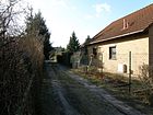
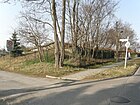
List of streets and squares in Berlin-Kaulsdorf

The list of streets and squares in Berlin-Kaulsdorf describes the street system of the district Kaulsdorf in the district of Marzahn-Hellersdorf with the corresponding historical references. At the same time, this compilation is one of the lists of all Berlin streets and squares .
overview
The municipality of Kaulsdorf belonged to the Niederbarnim district in the Prussian province of Brandenburg until 1920 . Kaulsdorf and its streets are only listed in the Berlin address book after the rural community became part of Greater Berlin and the Lichtenberg administrative district there.
The district is divided into three basic areas, which are the old village to the village green north of the former Frankfurter Chaussee (since 1990 on a common route out federal highways B 1 / B 5 ), which from the 1920s on both sides of the railway line settlements incurred north of Main road and the residential areas to the south between the B 1 / B 5, Wuhle and Dammheide in the direction of Köpenick . The first names of ten streets in the southern area were often based on native tree species or animals. In the north, male first names or place names were preferred. A total of 19 streets in the district were named after people who significantly influenced the development of Kaulsdorf. Twenty street names honor artists, writers or musicians. Finally, there are 34 streets that were named after former German locations that now belong to other states as a result of the First or Second World War .
Kaulsdorf has 19,408 inhabitants (as of December 30, 2019) and includes the postcode area 12621 (some streets in the outskirts to Hellersdorf also 12619 and to Mahlsdorf 12623).
Overview of streets and squares
The following table gives an overview of the streets and squares in the district as well as some related information.
- Name / location : current name of the street or square. Via the link Location , the street or the square can be displayed on various map services. The geoposition indicates the approximate center of the street length.
- Traffic routes not listed in the official street directory are marked with * .
- Former or no longer valid street names are in italics . A separate list may be available for important former streets or historical street names.
-
Length / dimensions in meters:
The length information contained in the overview are rounded overview values that were determined in Google Earth using the local scale. They are used for comparison purposes and, if official values are known, are exchanged and marked separately.
For squares, the dimensions are given in the form a × b for rectangular systems and for (approximately) triangular systems as a × b × c with a as the longest side.
If the street continues into neighboring districts, the addition ' in the district ' indicates how long the street section within the district of this article is. - Name origin : origin or reference of the name.
- Notes : further information on adjacent monuments or institutions, the history of the street and historical names.
- Image : Photo of the street or an adjacent object.
| Name / location | Length / dimensions (in meters) |
Origin of name | Date of designation | Remarks | image |
|---|---|---|---|---|---|
|
Achardstrasse
( Location ) |
500 | Franz Carl Achard (1753–1821), chemist, inventor of industrial sugar production from beet | Apr 5, 1934 | Between 1910 and 1920 it was listed on plans as Straße 37 , around 1920 it was also unofficially called Liebknechtstraße . From 1926 to 1934 it was Brakestrasse , named after the city of Brake . The street runs (as a continuation of Lenbachstraße) from Chemnitzer to Lassaner Straße in a west-east direction in the Kaulsdorf-Süd area. |
 |
| Adolf-Menzel-Strasse
( Location ) |
770 | Adolph von Menzel (1815–1905), painter and graphic artist | around 1920 | The street was named when it was first built. However, the course was changed several times. About halfway along the north-south route, it runs jagged first to the east and then back to the south. It connects Anton-von-Werner-Strasse with Heerstrasse. |

|
| Adolfstrasse
( Location ) |
530 | Adolf , male first name | July 17, 1909 | It runs from Brodauer Straße to the southeast to Alt-Kaulsdorf, where it bends slightly southwards at the confluence with Georgstraße. In this street (house number 25) is the 'Achard-Grundschule', a school building built between 1911 and 1913. The structured three-and-a-half- storey clinker and plaster structure was damaged at the end of the Second World War . Repaired in the following years, the school was again used for teaching purposes from 1949. In 1978 the then high school was named after the German writer Ludwig Turek and kept it until after the fall of the Wall. In 1994 the school management together with the then Hellersdorf District Office, which was responsible for Kaulsdorf until the 2001 district reform, determined the new name 'Franz Carl Achard School'. The primary school was attended by 360 students by the beginning of the 2015/2016 school year. Although the house had been in need of renovation for a long time, only important work was done due to tight finances: Renewal of the roof, the sanitary facilities and the installation of condensing boilers . Finally, the infestation bearing wooden parts had with dry rot daztu that in early September 2015, the supervision was to lock because of possible risk of collapse of the building. For a short time, the students were now taken every day to a school in Marzahn and back from there. The school building in Kaulsdorf was to be demolished because a quick, lightweight new building, a so-called 'Modular Supplementary Building' (MEB), would be more cost-effective than renovation, the Marzahn-Hellersdorf District Office had decided. In contrast, the public relations work group of the Achard School's parent representatives was able to prevent the demolition and achieve a renovation by collecting signatures. The cost of the renovation is estimated at seven million euros . In 2016, important maintenance work took place, so that at the beginning of the 2016/2017 school year, all students could return to their traditional school building. The necessary total renovation (renovation and upgrading of the old building, conversion of a small gym in the building into classrooms, new construction of a sports hall, construction of an MEB on the site to expand the student capacity, conversion of the existing after-school care building, smaller craftsmen's work) can be carried out in the year according to the project schedule Beginning in 2022 and is expected to last five years. |

|
| Ahornstrasse
( Location ) |
200 | Maple , deciduous tree, probably the first planting | July 17, 1909 | Ahornstrasse is a short west-east street between Waldstrasse and Birkenstrasse in the Kaulsdorf-Süd area. |

|
|
Alt-Kaulsdorf
( Location ) |
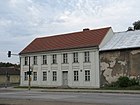
1350 | Alt-Kaulsdorf , historic village center | July 26, 1927 | The street created in the 13th century bore the historical names Chaussee nach Frankfurt , also Chaussee nach Berlin and Frankfurter Strasse (1922–1927). The trunk road was relocated a little further south of the old village center in the late 1920s. The current name refers to the history of the village. There are numerous architectural monuments here and in the cross village street; see cultural monuments in Berlin-Kaulsdorf . Franz Carl Achard had set up his "syrup boiling plant" on the site of the former estate (Alt-Kaulsdorf 1) . The location of the Schilkin spirits manufacturer has been here since 1932 . There are two memorial plaques for Achard on the site. The text of one reads: "On the 'Caulsdorfer Gut' worked in the period between 1784 and 1796 F. C. Achard, the founder of beet sugar production." |
|
| At the Bachrain
( Location ) |
550 | Description of the location from Bach and Rain | after 1943 | The name refers to the proximity to a nameless stream. The Kaulsdorfer Rohrpfuhlgraben has been running here since 1990. The streets Am Bachrain, Im Augarten and Am Wiesenhang, which were laid out in the 1940s, adapt to its course by means of a semicircular junction from Hamannweg. |

|
| At the Baltenring
( Location ) |
850 | Baltic ethnic groups native to the Baltic States | Nov 9, 1926 | The traffic route, initially designated road 127 , begins at Grottkauer Strasse, crosses the suburb of Hellersdorf about 60 meters west of the intersection with Uckermarkstrasse and ends there at Lily-Braun-Strasse. It initially runs in a north-south direction, but then swings after an arcuate course in an east-west direction. Its alignment has been changed several times. Before the official name it was also called Baltenring, without "Am". |

|
| At the Birkenwerder
( Location ) |
700 | Description of the location from Birch and Werder ; here a traditional hallway name | July 17, 1909 | The traffic route connects the Bergedorfer with the Ulmenstraße in a north-south route. To the south it continues as Nordheimer Straße. |

|
| On the Feldberg
( Location ) |
250 | Feldberg, old field name of the Barnim hill | July 6, 1927 | First it was the street 43 , unofficially named after the windmill on the hilltop, also called Mühlberg . It leads northeast-southwest from Alt-Kaulsdorf to Am Niederfeld. At Feldberg 3 there is a memorial plaque for Erich Knauf and Erich Ohser . |

|
| At the lupine field
( Location ) |
1070 (in the district) |
Description of the location from lupins and field | June 27, 1925 | The streets 138 , 113 and 140 , which were built around 1910, became the specific street name from 1925, which probably describes the forage plants grown in the fields. It is a west-east street between Heinrich-Grüber-Straße and Briesener Weg, which continues in Mahlsdorf to Melanchthonstraße. |

|
| At the Moosbruch
( Location ) |
160 | Description of the location from moss and quarry ; here: a traditional field name near the Wuhle | after 1910 | On the north side of the West-Ost-Straße between An der Wuhle and Karlsburger Weg there is a small green area. |

|
| At Niederfeld
( Location ) |
1130 | Description of the location from field and geographic height; here: a traditional field name (in contrast to Oberfeld as the basis for the name of Oberfeldstrasse in Biesdorf ) | Nov 9, 1926 | At first it was Strasse 41 , unofficially also Richard-Wagner-Strasse . The traffic route runs in a west-east direction between Chemnitzer Strasse and Kressenweg. Elsenstrasse in Mahlsdorf forms its eastern continuation. On the south side, the road touches the Butzer See, a part of the Kaulsdorfer Seen landscape protection area . On the north side there is some commercial space, partly fallow, partly newly built. |

|
| On the meadow slope
( Location ) |
260 | Description of the location from meadow and slope | after 1943 | The road that was laid out in the 1940s follows a nearby stream as a junction from Hamannweg in its semicircular course (together with Am Bachrain and Im Augarten). The Kaulsdorfer Rohrpfuhlgraben has been running here since 1990. |

|
| At the Wuhlebogen
( Location ) |
500 | curved road on the Wuhleufer | Dec 7, 2013 | The street runs from Straße 19 in the north to Bismarcksfelder Straße in the south. There is a driveway to Kaulsdorfer Straße at house numbers 14 and 16. The street runs through a residential area built between 2014 and 2015 with single and two-family houses. | |
| Amelieweg
( Location ) |
250 | Amelie , female name | Nov 9, 2010 | It is a private road for the development of 18 newly built single-family houses on the former property at Bauerwitzer Weg 25; it is guided in a U-shape. In the summer of 2012, the road was paved with double-T concrete paving . |

|
| At the Wuhle
( Location ) |
1610 | Description of the location of the Wuhle River | Apr 5, 1934 | The traffic route begins on Heerstraße and runs to Damerauer Allee in a north-south route. To the north it continues as Lammersdorfer Weg. |

|
| Anton-von-Werner-Strasse
( Location ) |
230 | Anton von Werner (1843–1915), painter | before 1920 | The traffic route is a street laid out between 1910 and 1920 that connects Büllinger Strasse with Chemnitzer Strasse in a west-east route and continues as Wernitzer Strasse. There is only residential development on the south side; to the north is an industrial wasteland (as of February 2012). |

|
| Arndtstrasse
( Location ) |
100 (in the district) |
Ernst Moritz Arndt (1769–1860), poet | Nov 23, 1907 | The full length of the street runs in the Mahlsdorf district in a northeast-southwest direction between Roedernstrasse and Hirschpfad. Only house number 21a on the corner of Hirschpfad belongs to Kaulsdorf (see picture). |

|
|
On the heights
( Location ) |
120 | Height , location description | Nov 9, 1926 | The small cul-de-sac goes west of Am Feldberg and runs towards an industrial park. During the project planning it was referred to as Straße 42 , from around 1920 already with its later officially assigned name. |

|
| Auguststrasse
( Location ) |
400 | August , male first name | before 1909 | The street runs in a west-east direction between Adolfstrasse and Planitzstrasse. |

|
|
Bauerwitzer Weg
( Location ) |
260 | Bauerwitz, place in Upper Silesia , since 1945 Baborów in Poland | May 11, 1938 | When it was first built around 1910, the street was named Röntgenstraße after the physicist Wilhelm Conrad Röntgen . Its expansion lasted until the 1920s. It bends at right angles in a northeast-southeast direction from Hellersdorfer to Heinrich-Grüber-Straße. |

|
| Bausdorfstrasse
( Location ) |
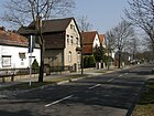
990 | Bausendorf, long-established Kossäten - and farmer's family who has rendered outstanding services in the 19th century to the development of the area Kaulsdorf / Mahlsdorf | before 1910 | Bausdorfstrasse runs north of the embankment between Heinrich-Grüber-Strasse and Lohengrinstrasse and continues in Mahlsdorf as Wodanstrasse. In Mahlsdorf there is a street of the same name that runs east of Hultschiner Damm to Pilgramer Straße in southern Mahlsdorf. |
|
| Bergedorfer Strasse
( Location ) |
2530 (in the district) |
Bergedorf, district of Hamburg | May 16, 1938 | The street was built in two sections and was first named Fasanenstraße (July 1909–1938) and Heinrich-Heine-Straße (1920–1938). It runs in a slightly curved west-east route, begins at An der Wuhle, crosses the border to the Mahlsdorf district on Seebadstrasse and ends there at Hultschiner Damm . The house number range 94–124 belongs to Kaulsdorf. |

|
| Birkenstrasse
( Location ) |
800 | Birch , native deciduous tree | July 17, 1909 | Birkenstrasse is a north-east-south-west route between Eschenstrasse and Sadowastrasse in the Kaulsdorf-Süd area. |

|
| Bismarcksfelder Strasse
( Location ) |
90 (in the district) |
Bismarcksfelde, place in the province of Posen , since 1920 Wiktorowo, district of Buk in Poland | Jan. 7, 1928 | It was first called Straße 10 and belonged to Köpenick. In 1938 she came to the Lichtenberg district and around 1975 to the then Berlin-Marzahn district . The main part of this street is on the west bank of the Wuhle in the district of Biesdorf . The short stretch in Kaulsdorf runs from the bridge of the same name to Kaulsdorfer Straße in a west-east direction. |

|
| Bredereckstrasse
( Location ) |
420 | Bredereck, long-established farming family, who are on record in Kaulsdorf until 1796 and who have made a contribution to the development of the village | July 17, 1909 | The street connects Giesestraße (northeast) with Bausdorfstraße (southwest) and is located in the Kaulsdorf-Nord area. |

|
| Briesener way
( Location ) |
2070 (in the district) |
Briesen, town in West Prussia , since 1920 Wąbrzeźno in Poland | May 11, 1938 | When it was first built around 1906, the route was called Friedrichstrasse after Friedrich II. , King of Prussia, and was in the village of Mahlsdorf. The property boundaries on the western side of the street form the district boundary between Kaulsdorf and Mahlsdorf. The path connects the Hönower with the Wodanstraße. Its northern beginning runs about 80 meters in an east-west direction and then bends southwest. The lots with the odd lot numbers 1 to 177 belong to Kaulsdorf. |

|
| Brodauer Strasse
( Location ) |
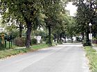
490 | Brodau, a place in East Prussia , since 1920 Brodowo in the rural municipality of Iłowo-Osada in Poland | May 11, 1938 | Created at the end of the 19th century, it was first called Bahnhofstrasse . It leads from the southern area of the Kaulsdorf train station (Heinrich-Grüber-Platz) in a south-westerly direction to Dorfstraße. Along this street on the north side is the district center of the Association for the Integration of the Disabled ( Mittendrin eV ) and on the corner of Münsterberger Weg the Park-Hotel Schloss Kaulsdorf. A house from 1890 (house number 32) is a listed building. |
|
| Buchenstrasse
( Location ) |
350 | Beech , native deciduous tree | July 17, 1909 | It runs in a northeast-southwest direction between Bergedorfer and Jägerstrasse in the Kaulsdorf-Süd area. |

|
|
Büllinger Strasse
( Location ) |
180 | Büllingen , German-speaking municipality in Belgium | March 11, 1937 | First it was Street 21 . It connects Anton-von-Werner-Strasse (northeast) with Honsfelder Strasse (southwest). There is a larger nursery here. |

|
| Burggrafenstrasse
( Location ) |
370 (in the district) |
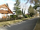
Burgrave , office in the feudal system of the Middle Ages | July 27, 1906 | Burggrafenstrasse runs between Ernst-Haeckel-Strasse and Briesener Weg and continues to Florastrasse in the Berlin-Mahlsdorf district . |
|
|
Chemnitzer Strasse
( Location ) |
3620 | Chemnitz , city in Saxony | Aug 8, 1935 | It was laid out at the beginning of the 19th century as Cöpenicker Straße . The road connecting Kaulsdorf and Köpenick is in the Kaulsdorf-Süd area. It runs in a straight line north-south from Alt-Kaulsdorf to Scharnauer Straße and continues as Kaulsdorfer Straße. |

|
|
Damerauer Allee
( Location ) |
420 | Damerau, place in West Prussia , since 1945 Dąbrowa, part of Elbląg in Poland | Jan. 7, 1928 | Around 1920 the avenue was first laid out as street 18a . Your route has been changed several times. It runs from An der Wuhle to Kaulsdorfer Straße in a north-west-south-east direction. |

|
| Deutschhofer Allee
( Location ) |
680 | Deutschhof, town in the province of Poznan , Namysłaki in Poland since 1920 | Apr 5, 1934 | First it was Straße 21 in the settlement area Köpenick-Nord. The avenue leads from An der Wuhle in a south-easterly direction to Feuersteiner Straße. From there it continues about 60 meters to the edge of the forest on the Dammheide. |

|
| Village street
( Location ) |
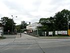
800 | Street in the center of the village of Kaulsdorf | Apr 5, 1934 | It forms the connection between the Münsterberger Weg at the Kaulsdorf cemetery and the Alt-Kaulsdorf street . To the south it continues as Chemnitzer Straße . In the southern third it forms the former village green , in the center of which stands the Kaulsdorf village church . The Johannische Kirche has been located in the same street since the 2000s on the site of the only three-sided courtyard that has been preserved here . There are numerous architectural monuments along the road. |
|
|
Doßstrasse
( Location ) |
160 | Max Doß (1857–1916), local politician and court assistant in Kaulsdorf | from 1910 (1922) | It connects Heinrich-Grüber-Strasse with Stöwestrasse in a north-west-south-east route. |

|
| Drausnitzer Strasse
( Location ) |
300 | Drausnitz, a place in West Prussia , since 1920 Drożdzienica in the rural municipality of Kęsowo in Poland | Apr 5, 1934 | Between 1910 and 1922 a section was laid out as a meadow road. It was later extended to include Straße 22 and both were combined to form Drausnitzer Straße. It leads from Lindenstrasse (northwest) to Falkstätter Strasse (southeast). |

|
| Druschiner Strasse
( Location ) |
230 (in the district) |
Druzyny, a place in West Prussia , since 1920 Drużyny, part of the rural community Bobrowo in Poland | Aug 16, 1928 | The traffic route laid out as street 18 was to lead from Kaulsdorfer Straße south-east. The later Druschiner Straße begins as a dead end in a settlement south of the Dammheide, crosses Feuersteiner Straße and about 60 meters southeast of the district boundary to Köpenick . There it ends at Egersfelder Allee. |

|
|
Oak Street
( Location ) |
850 | Oak , native deciduous tree | July 17, 1909 | It connects Eschenstrasse (northeast) with Seebadstrasse (southwest) in the Kaulsdorf-Süd area. |

|
| Eichhornstrasse
( Location ) |
160 | Hermann von Eichhorn (1848–1918), Prussian field marshal | July 17, 1909 | The street, which was named during Eichhorn's lifetime, runs between Eschenstraße (north) and Birkenstraße (south). |

|
| Elsenborn way
( Location ) |
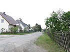
210 | Elsenborn, part of the German-speaking community of Bütgenbach in Belgium | March 8, 1935 | At first the traffic route was called Dürerstraße after the painter Albrecht Dürer and was laid out around 1920. The path runs in a north-south direction between Habsheimer Strasse and Hirsinger Strasse. |
|
| Elsenstrasse
( Location ) |
260 | Else, old name for alder , deciduous tree species | July 17, 1909 | This Elsenstraße is located in Kaulsdorf-Süd and connects Eichenstraße with Seebadstraße in a straight line. |

|
| Ernst-Haeckel-Strasse
( Location ) |
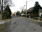
1190 | Ernst Haeckel (1834-1919), zoologist | July 17, 1909 | The street was named during the scholar's lifetime. It is located in the Kaulsdorf-Nord area, begins in the northeast as an extension of the Randweg and ends in the southwest on Wernerstraße. Ernst-Haeckel-Straße touches the Werner-Bad, which was closed in 1991. |
|
| Eschelberger Weg
( Location ) |
430 | Eschelberg , municipality in Upper Austria | March 8, 1935 | The traffic route was created by merging the former Lerchenstrasse (after 1910–1935) and Schützenstrasse (1909–1935). It connects An der Wuhle eastwards with Chemnitzer Straße . |

|
| Eschenstrasse
( Location ) |
610 (in the district) |
Ash , deciduous tree | Jan. 1, 1922 | The Eschenstrasse was planned in 1922, finished by 1926, and connects the Heerstrasse with the Roedernstrasse in Mahlsdorf . It begins on Birkenstraße and ends in Kaulsdorf at the district boundary at the height of Seebadstraße. It is only built on on the south side. |

|
|
Falkstätter Strasse
( Location ) |
620 | Falkstätt, town in the province of Posen , since 1920 Chocicza, part of the rural community Nowe Miasto nad Wartą in Poland | Jan. 7, 1928 | When it was first installed, it was called Straße 28 . It leads in a quarter circle west of Kaulsdorfer Straße around the foothills of the Dammheide and ends at Damerauer Allee. |

|
| After work
( Location ) |
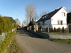
140 | end of working day | Dec 13, 1934 | Around 1925 it was laid out as route D. It was later given the name because it was the "last way" in the suburban small settlement (suburban settlement) Hellersdorf . It runs south of the Roßweiner Ring in the district of Hellersdorf (northeast) to Schleipfuhlweg (southwest) in the Kaulsdorf-Nord area. |
|
| Ferdinandstrasse
( Location ) |
540 | Ferdinand , male first name | July 17, 1909 | Ferdinandstrasse was - like other streets in this area - preferably named after male German first names. It runs from Planitzstrasse eastwards to Franzburger Strasse. |

|
| Feuersteiner Strasse
( Location ) |
290 | Feuerstein, place in the province of Poznan , since 1920 Krzemieniewo in Poland | Jan. 7, 1928 | At first it was street 27 . It leads in a north-east-south-west direction from Deutschhofer Allee to Kaulsdorfer Straße. |

|
| Fichtenstrasse
( Location ) |
300 | Spruce , native conifer | after 1910 | In the first spelling also called Fichtestrasse (without "n"). It starts as a dead end north of Bergedorfer Straße and ends at Ulmenstraße. |

|
| Finkelsteinstrasse
( Location ) |
150 | Heinrich Finkelstein (1865–1942), pediatrician, persecuted by the Nazi regime | March 13, 1992 | The street is located in a new building area north of Wernerstraße and connects Heinrich-Grüber-Straße with Ohserring. It was given its name in November 1989, it was officially recorded three years later. |

|
| Finkenstrasse
( Location ) |
360 | Finch , songbird | July 17, 1909 | As a southern continuation of Adolf-Menzel-Straße, it connects Heerstraße with Jägerstraße in the Kaulsdorf-Süd area. |

|
| Finkenwalder Weg
( Location ) |
470 | Finkenwalde, place in Pomerania , since 1945 Zdroje in Poland | June 9, 1933 | First (around 1925) it was Street 25 . The path leads from a roundabout north of Hamsterstrasse southwest to Alt-Kaulsdorf . To the north it continues as an undesignated footpath through a green area to Wilhelmsmühlenweg. |

|
| Finsterberger Strasse
( Location ) |
210 | Finsterbergen , part of the city of Friedrichroda in Thuringia | Jan. 1, 1922 | The street was given its specific name when it was laid out. It connects Schmidtstrasse with Heinrich-Grüber-Strasse and in its northern section consists of two separate routes with a ditch running in the middle. |

|
| Franzburger Strasse
( Location ) |
220 | Franzburg , town in Mecklenburg-Western Pomerania | June 9, 1933 | At first it was Straße 23 that was planned to run between Wilhelmsmühlenweg and Alt-Kaulsdorf . On an undeveloped area an auxiliary was 1942 first hospital created, which was after the war the hospital Kaulsdorf (2016: Vivantes Kaulsdorf ). A continuous road was therefore not planned, so that the road, renamed in 1933, runs from Wilhelmsmühlenweg to just past Hamsterstraße. |

|
|
Georgstrasse
( Location ) |
190 | Georg , male first name | July 17, 1909 | The cross street of the Mädewalder Weg was - like other cross streets - preferably given a male first name. It runs westwards to Adolfstrasse. |

|
| Gerdastrasse
( Location ) |
250 | Gerda , female name | Nov 9, 1926 | The traffic route in the Kaulsdorf-Süd area was initially called Straße 32 . It connects Chemnitzer Strasse with Waldenburger Strasse. |

|
| Giesestrasse
( Location ) |
720 (in the district) |
Giese, long-established farming family in Kaulsdorf | July 17, 1909 | It runs in a west-east direction between Zanderstraße and Briesener Weg and ends in the Mahlsdorf district on Jacques-Offenbach-Platz. The St. Martin's Church is located on it . |

|
| Glauchauer Strasse
( Location ) |
60 (in the district) |
Glauchau , city in Saxony | June 9, 1987 | Only a small part (house numbers 19-22) of this previously unnamed street, starting in the south on Grottkauer Straße, belongs to Kaulsdorf. The northern section is in the Berlin-Hellersdorf district and ends at Nossener Strasse. |

|
| Graubündener Strasse
( Location ) |
160 | Graubünden , canton in Switzerland | Nov 9, 1926 | At first it was Straße 34 , not officially called Engelsstraße (after Friedrich Engels ). It connects Lassallestrasse with Striegauer Strasse in a gentle curve. |

|
| Grottkauer Strasse
( Location ) |
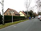
880 | Grottkau, town in Upper Silesia , since 1945 Grodków in Poland | Nov 9, 1926 | At first it was 134 . It continues on Neue Grottkauer Strasse in Hellersdorf (west), begins at Carola-Neher-Strasse and ends at Heinrich-Grüber-Strasse (east). There it continues as Ingolstädter Straße towards the east. |
|
|
Gülzower Strasse
( Location ) |
400 (in the district) |
Gülzow, town in Pomerania , since 1945 Golczewo in Poland | June 9, 1933 | It was laid out as road 90 . The Gülzower Straße continues the Altentreptower Straße from Biesdorf . It reaches the Kaulsdorf area at the level of the Rügenwalder Weg and ends at Heinrich-Grüber-Straße. The property boundaries on the south side form the district boundary to Berlin-Hellersdorf . House numbers 2–36 and 74 are in the Kaulsdorf area. |

|
|
Güstrower Strasse
( Location ) |
540 | Güstrow , town in Mecklenburg-Western Pomerania | Nov 9, 1926 | This west-east street begins at Schönherrstraße, crosses Ridbacher Straße and then ends after about 200 meters as a dead end in a small settlement that was initially still arable land. The street was created by merging streets 112 and 131 . Unofficially, around 1920, the name Lilientalstraße was used after Otto Lilienthal , the aviation pioneer. |

|
| Gutenbergstrasse
( Location ) |
380 | Johannes Gutenberg (around 1400–1468), inventor of the printing press | before 1920 | The street begins northwest at Gülzower Strasse and flows southeast, directly at the Kaulsdorf S-Bahn station , into Heinrich-Grüber-Strasse. |

|
|
Habsheimer Strasse
( Location ) |
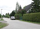
440 | Habsheim , place in France | March 11, 1937 | At first it was called Street 23 . It runs in a west-east direction between Wuhle and Adolf-Menzel-Straße. |
|
| Hamannweg
( Location ) |
380 | Emil Hamann (1868–1931), community representative in Kaulsdorf | after 1942 | Around 1920 the route was planned as Road 22 ; it was given its specific name upon completion. (The new name is not yet included in the 1943 online address book.) Hamannweg connects Stöwestraße in west-east direction with Hosemannstraße and forms the southern boundary of the KGA Oberfeld. To the west there is a walking connection to Heinrich-Grüber-Straße. |

|
| Hamster street
( Location ) |
570 (in the district) |
Hamster , rodent | June 27, 1925 | It was laid out as Straße 80 and after it was renamed in 1933, it was extended by the former Straße 29 to Franzburger Straße. The straight path, for the most part only for pedestrians, leads slightly to the south-east, lies between Franzburger Straße and Am Kornfeld and continues in the Mahlsdorf district to the Frettchenweg. |

|
| Hannsdorfer Strasse
( Location ) |
480 | Hannsdorf, German name of the city of Hanušovice in the Czech Republic | July 31, 1947 | First it was named Bülowstrasse (1909–1938) after the politician Bernhard von Bülow and Billungstrasse (1938–1947) after Hermann Billung , Duke of Saxony. It is located in Kaulsdorf-Nord and connects Hamannweg in a north-east-south-west route with Bausdorfstraße. |

|
| Main way
( Location ) |
170 + 170 (parallel) |
after 1943 | This path is the 'main access path' in north-south direction in the KGA Oberfeld, to which the previously laid streets Am Bachrain, Am Wiesenhang and Im Augarten belong. |

|
|
| Heerstrasse
( Location ) |
820 | Heerstraße , part of an unrealized strategic road of the German Empire | between 1910 and 1920 | It runs in a west-east direction as a continuation of Heesestrasse in Biesdorf between An der Wuhle and Waldstrasse. It continues as Eschenstrasse. |

|
|
Heinrich-Grüber-Platz
( Location ) |
110 × 30 | Heinrich Grüber (1891–1975), pastor, resistance fighter | May 21, 2008 | Heinrich-Grüber-Straße, Wilhelmsmühlenweg, Planitzstraße, Mädewalder Weg and Brodauer Straße flow into the square south of the Kaulsdorf S-Bahn station . At the beginning of the 20th century it was a goods loading area. In 2008 a roundabout was created and the square was named afterwards. |

|
|
Heinrich-Grüber-Strasse
( Location ) |
2350 | Heinrich Grüber (1891–1975), pastor, resistance fighter | June 24, 1991 | Since it was first built in the 19th century, it was Hönower Straße in its direction to the then village of Hönow . The street begins at Heinrich-Grüber-Platz south of the Kaulsdorf S-Bahn station , initially runs in a north-west direction and is led by a U-shaped bridge over the railroad tracks, which is popularly known as the “gallows”. Then it continues in a north-easterly direction until just behind Ingolstädter Strasse and continues in the Hellersdorf district as Jenaer Strasse. The street was renamed on the occasion of Heinrich Grüber's 100th birthday. Here in the district, the pastor worked from 1934 to 1945 at the Kaulsdorf village church . With his office Grüber he supported the anti-fascist resistance and helped the persecuted. Police section 63 of Directorate 6 is located at Heinrich-Grüber-Straße 35 and is responsible for the districts of Kaulsdorf, Mahlsdorf and Hellersdorf. |

|
| Hellersdorfer Strasse
( Location ) |
490 (in the district) |
Direction to the former Gut Hellersdorf | Aug 1910 | The street begins in the south on Heinrich-Grüber-Straße, reaches the district boundary on Gülzower Straße and continues north in Hellersdorf . House numbers 1–35 (odd) and 8–26 (even) belong to Kaulsdorf. At the beginning of the 20th century, the Berliner Schützengesellschaft set up the 'Schützenhaus' under the house number range 25–35, which is still there. There is also an area for children and young people with the 'Villa Pelikan' and a playground. At the corner of Heinrich-Grüber-Straße there is a multi-part building complex of two-storey low-rise buildings that was laid out in the depth of the property and housed the ' Higher School of the People's Police of the GDR' from 1955 . In the 1980s, the mission protection watch command was stationed here and was responsible for guarding the diplomatic missions in East Berlin. After 1990 the area became the property of the Berlin police, who set up their police section 63 for Hellersdorf, Kaulsdorf and Mahlsdorf here. (see Heinrich-Grüber-Straße ). |

|
| Hertwigswalder Steig
( Location ) |
320 | Hertwigswalde, a town in Lower Silesia , since 1945 Doboszowice in Poland | Oct 18, 1937 | When it was first installed around 1910, it was Zeppelinstrasse . The Steig is the connection between Gutenbergstrasse (southwest) and Hellersdorfer Strasse (northeast). |

|
| Deer path
( Location ) |
400 | Stag , native species of red deer | May 31, 1951 | From July 17, 1909 to 1951, it was Moltkestrasse after Helmuth von Moltke (1800-1891). This street, located in the very south of the district, runs from Dammheide in the west to Arndtstraße in the east. |

|
| Hirsinger Strasse
( Location ) |
310 | Hirsingen , German name of the community Hirsingue in France | March 11, 1937 | First it was the street 35 in Kaulsdorf-Süd. It begins as a kinked continuation of Lenbachstraße, crosses Lammersdorfer Weg and ends at Adolf-Menzel-Straße. |

|
| Hirtschulzstrasse
( Location ) |
520 | Franz Hirtschulz (1852–1924), entrepreneur and local politician | July 17, 1909 | This is the first name of the street, the course of which was planned somewhat differently. A renaming was also considered temporarily. The traffic route begins about 100 meters west of Nentwigstrasse and ends at Ridbacher Strasse. |

|
| Hohenseeweg
( Location ) |
170 | Hohensee , part of the municipality of Zemitz in Mecklenburg-Western Pomerania | Feb. 1, 2001 | The Hohenseeweg is located north of Am Niederfeld and connects Steffenshagener Strasse with Rosenhagener Strasse in a west-east direction. It opens up the south side of terraced houses. |

|
| Holbeinstrasse
( Location ) |
280 |
The painter family Hans Holbein the Elder Hans Holbein the Younger |
Feb 12, 1920 | The street is in Kaulsdorf-Süd. It begins about 100 meters north of Honsfelder Strasse as a dead end and ends in the south at Habsheimer Strasse. First the extended Holbeinstraße was built on, which was later included in the Holbeinstraße. |

|
| Honsfelder Strasse
( Location ) |
290 | Honsfeld, part of the municipality of Büllingen in Belgium | March 8, 1935 | First - from around 1920 - it was Kaulbachstrasse after the painter Wilhelm von Kaulbach . It begins at the Honsfeld bridge over the Wuhle and ends at Büllinger Straße. The pedestrian bridge connects Kaulsdorf with Dramburger Strasse in the Biesdorf district . |

|
| Hornsteiner way
( Location ) |
290 | Hornstein , municipality in Burgenland in Austria | June 9, 1933 | In the 1920s the path was laid out as road 31 . It is located in Kaulsdorf-Nord and runs from the east side of the Vivantes Klinikum Kaulsdorf in a west-east direction to the street Am Kornfeld. |

|
| Hosemannstrasse
( Location ) |
440 | Adalbert Hosemann (1840–1906), pastor in Biesdorf , whose parish also included the Kaulsdorf church | July 17, 1909 | Hosemannstraße connects Hamannweg with Bausdorfstraße in the Kaulsdorf-Nord area. It continues as Am Bachrain. |

|
| Hugo-Distler-Strasse
( Location ) |
420 | Hugo Distler (1908–1942), composer | March 13, 1992 | It is a street in Kaulsdorf-Nord that was laid out after the fall of the Wall . Between Heinrich-Grüber-Straße (west) and Kraetkestraße (east) it takes a repeatedly bent course and opens up an extended residential area. |

|
|
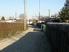
In the Augarten
( Location ) |
400 | Aue , garden | after 1943 | The road, which was laid out as a semi-arch in the 1940s, follows the Kaulsdorfer Rohrpfuhlgraben along with Am Bachrain and Am Wiesenhang. |
|
|
Ingolstädter Strasse
( Location ) |
660 | Ingolstadt , city in Bavaria | Nov 9, 1926 | Around 1905 the traffic route was laid out as road 115 . When it was renamed, it was initially spelled Ingolstadter Straße (without ä). It runs in a west-east direction. It continues on Grottkauer Strasse on Heinrich-Grüber-Strasse and ends about 50 meters east of Ernst-Haeckel-Strasse. From there on it is called Am Rosenhag. |

|
| Iselbergplatz
( Location ) |
120 × 60 | after the street of the same name | May 11, 1938 | The rectangular town square , first called Hansaplatz , was laid out in the 1920s. Over the years it has been made smaller and smaller by building on the edge in the western area up to Uckermarkstraße. Its actual green area in the east is only about 120 × 40 meters in size and is occupied by a bombed air raid shelter from the Second World War. In addition, the area was parceled out and combined as an 'allotment garden on Iselbergplatz' . A boundary of the square designed as a street is also called Iselbergplatz. |

|
| Iselbergstrasse
( Location ) |
450 | Bergisel , mountain in Austria | May 11, 1938 | When the road system was laid out around 1920, it was given the name Hansastraße , reminding of the history of the Hanseatic League . It was officially registered in 1926. It is the eastern continuation of Peter-Huchel-Straße (Hellersdorf) and runs from the suburbs to Schönherrstraße. |

|
|
Jaegerstrasse
( Location ) |
1160 | Hunter | July 17, 1909 | The road runs between the lowland road and the deer path in a slightly bent west-east alignment. About 50 meters after the junction with the Hirschpfad, it ends as a dead end on the Dammheide. The street section leading to the southeast from the intersection with Buchenstrasse was unofficially called Bismarckstrasse until 1920 after Chancellor Otto von Bismarck . In May 1926 the Kaulsdorf volunteer fire brigade formed a second fire-fighting team for the Kaulsdorf-Süd area and set up a secondary depot at Jägerstrasse 55-58 on the premises of the 'Jägerheim' restaurant. The site was given up again in 1935. |

|
| Jurek-Becker-Strasse
( Location ) |
150 | Jurek Becker (1937–1997), writer, GDR dissident | Dec 2, 2007 | The street in a newly developed residential area is U-shaped. It begins in the north on Büllinger Straße and ends in a dead end in the south. |

|
|
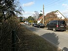
Kainzstrasse
( Location ) |
170 | Josef Kainz (1858–1910), Austrian actor | around 1920 | It connects Tolkmittstrasse with Sudermannstrasse in a north-south route. |
|
| Karlsburger Weg
( Location ) |
430 | Karlsburg , municipality in Mecklenburg-Western Pomerania | May 11, 1938 | It runs between Oybinweg and Lindenstraße in a straight north-south route and was laid out in the year it was named. |

|
| Karlshafener Strasse
( Location ) |
140 (in the district) |
Bad Karlshafen , city in Hesse | May 10, 1951 | From its first installation in 1909 until it was renamed, it was Viktoriastraße after the German Empress Victoria . The street begins as a dead end west of the Briesener Weg and continues after crossing the district boundary in Berlin-Mahlsdorf . |

|
| Karlstrasse
( Location ) |
400 | Karl , male first name | July 17, 1909 | Karlstrasse runs in a west-east direction parallel to Alt-Kaulsdorf between Adolfstrasse and Myslowitzer Strasse. |

|
| Kaulsdorf Gardens
( Location ) |
90 | Berlin-Kaulsdorf | June 14, 2003 | The street is a dead end street that branches off to the north of Heerstraße. It was laid out as a private road after 2003. It roughly follows the course of Rubensstrasse , which was laid out around 1930, but which was withdrawn due to a lack of buildings and used as arable land. |

|
| Kaulsdorfer Strasse
( Location ) |
1130 (in the district) |
Berlin-Kaulsdorf | before 1838 | It is a north-south street that continues as Chemnitzer Straße in the north and connects to the Berlin-Köpenick district in the south . The Kaulsdorf section begins between Lindenstrasse and Scharnauer Strasse and ends at the suburb south of Bismarcksfelder Strasse. |

|
| Kohlisstrasse
( Location ) |
190 (in the district) |
Carl Kohlis-Kyffhausen (1857–1910), Berlin hotel owner, writer | Nov 23, 1907 | By naming the street, the municipality of Mahlsdorf honored Kohlis' commitment as chairman of the Mahlsdorf-Süd landowner association. The street continues the Ulmenstraße in a south-easterly direction, starts shortly after the confluence with Sadowastraße and ends at Hultschiner Damm. Its full length is in the Mahlsdorf district . Only house numbers 48-54 belong to Kaulsdorf, the property boundaries between Sadowa- and Arndtstraße form the district boundary between Kaulsdorf and Mahlsdorf. |

|
|
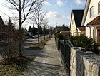
Koenigshütte way
( Location ) |
410 | Königshütte, a town in Upper Silesia , since 1922 Chorzów in Poland | Apr 5, 1934 | The path was planned as Road 20 around 1920 , but it was not built on until the late 1930s. It lies between Am Niederfeld (north) and Achardstraße (south) and continues as Rogauer Weg. |
|
| Kraetkestrasse
( Location ) |
600 | Reinhold Kraetke (1845–1934), State Secretary of the Reich Post Office | around 1910 | The route runs in a north-south direction between Heinrich-Grüberstrasse and Wernerstrasse. At first the name was written with "ä", ie Krätkestrasse. |

|
| Kranoldstrasse
( Location ) |
500 |
Viktor von Kranold (1838–1922), President of the Royal Railway Directorate Berlin ; Among other things, responsible for the construction of a Mahlsdorf stop on the Berlin-Küstriner Railway |
July 17, 1909 | Kranoldstrasse runs in a west-east direction between Heinrich-Grüberstrasse and Hosemannstrasse. |

|
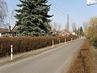
| Krepppfuhlweg
( Location ) |
130 | Krepppfuhl , shallow water in the district | Dec 13, 1934 | There is an access road in the former Suburban small settlement (Stadtrandsiedlung) Heller village , which was built around 1925 and initially path B said. It runs between Randweg and Schleipfuhlweg. |
|
|
Lammersdorfer Weg
( Location ) |
350 | Lammersdorf , part of the municipality of Simmerath in North Rhine-Westphalia | March 8, 1935 | First named around 1910 as Rembrandtstrasse after the painter Rembrandt van Rijn , which according to the Berlin address book was still undeveloped in 1930. The Lammersdorfer Weg runs between Habsheimer Straße (north) and Heerstraße (south). There he continues as An der Wuhle. |

|
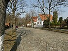
| Landréstrasse
( Location ) |
280 | Landré brothers (Charles Adolphe, 1828–1892 and Jean Charles, 1833–1892), Berlin brewery owners | July 17, 1909 | The traffic route connects Giese and Bausdorfstrasse in a north-east-south-west route. |
|
| Lassallestrasse
( Location ) |
530 | Ferdinand Lassalle (1825–1864), President of the General German Workers' Association | Nov. 9, 1926 and again in 1947 | It was already called Lassallestrasse when it was first installed in the 1920s. On October 25, 1933, the street was named after Erich Thimm († 1934), a National Socialist active in what was then the Lichtenberg district , in Thimmstraße . On July 30, 1947, it got its original name back. The street runs between Achardstrasse and Mieltschiner Strasse. |

|
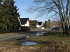
| Lassaner Strasse
( Location ) |
490 | Lassan , town in Mecklenburg-Western Pomerania | June 9, 1933 | It was planned as Straße 22 after 1920, but was not laid out until 1930 and gradually built on on the western side. On the east side there is a green area and outdoor sports facilities that are used by SG Stern Kaulsdorf . Lassaner Strasse runs north-south between Am Niederfeld and Achardstrasse; there it continues as Striegauer Strasse. |
|
| Lehnestrasse
( Location ) |
520 | Lehne, Kaulsdorf farming family | Oct 18, 1937 | When it was first installed in 1909, the traffic route was named Buddestrasse after the general and entrepreneur Hermann von Budde . The inclusion of Buddestraße in the already existing Lehnestraße led to its extension. The street is located in Kaulsdorf-Nord and connects the Hirtschulz- with Bausdorfstraße in a north-south route. |

|
| Lenbachstrasse
( Location ) |
1100 | Franz von Lenbach (1836–1904), painter | July 17, 1909 | The road runs in a gentle curve and thus follows the course of the Wuhle . It connects Chemnitzer Strasse with Hirsinger Strasse. In Mahlsdorf there is also a Lenbachstraße after the same namesake, but both are not connected. |

|
| Leopoldstrasse
( Location ) |
240 | Leopold , male first name | July 17, 1909 | As a west-east route, it connects Planitz and Myslowitzer Strasse in the Kaulsdorf-Nord area. |

|
| Lindenstrasse
( Location ) |
1000 (in the district) |
Linden , native deciduous tree | Apr 5, 1934 | It runs west-east from the Zimmermannstrasse bridge over the Wuhle (in continuation of Zimmermannstrasse in Berlin-Biesdorf ) over Chemnitzer Strasse and leads to Birkenstrasse. |

|
| Lohengrinstrasse
( Location ) |
70 (in the district) |
Lohengrin , opera by Richard Wagner | around 1910 | Lohengrinstraße is a dead end road south of Bausdorfstraße to the S-Bahn line . The street is in Berlin-Mahlsdorf , property no. 1 on the west side belongs to Kaulsdorf. |

|
| Ludwig-Turek-Strasse
( Location ) |
90 | Ludwig Turek (1898–1975), writer and resistance fighter | March 29, 2005 | Ludwig-Turek-Straße is a short connecting road between Tolstoi and Reissigerstraße in the Kaulsdorf-Nord area. When the road system was laid out around 1930, this was Place V , which in 2004 was named Ludwig-Turek-Platz . A year later the street running north of the square was named that way. There is no longer any reference to the place name, although it is still there. |

|
|
Madewalder way
( Location ) |
690 | Mädewald, a place in East Prussia , Usėnai in Lithuania since 1920 | May 11, 1938 | When it was first built in 1909, the route was called Wilhelmstrasse after the male first name. It runs in a north-south direction between Heinrich-Grüber-Platz and Alt-Kaulsdorf . In its northern area is the post office, which was built in the 1930s and closed in February 2011.
Since 1965 , the volunteer fire brigade has had its service building with attached service apartments in Mädewalder Weg 21–23 (lower picture). After it was founded on October 18, 1907, the fire brigade initially had its first tool shed in Dorfstraße am Anger. |

|
| Markgrafenstrasse
( Location ) |
60 (in the district) |
Margrave , title of nobility in the Middle Ages | July 27, 1906 | The Markgrafenstraße begins about 60 meters west of the Briesener Weg as a continuation of the Wernerstraße, crosses the district boundary to Mahlsdorf on the Briesener Weg and ends there on the Florastraße. Only house numbers 1 and 24 belong to Kaulsdorf. |

|
| Mieltschiner Strasse
( Location ) |
880 | Mieltschin, town in the province of Poznan , since 1920 Mielżyn in Poland | Nov 9, 1926 | The west-east street runs between Adolf-Menzel- and Waldenburger Strasse and continues to property no. 67. There is the listed Kaulsdorf waterworks from 1916 (see picture). At the facility, the traffic route was called Straße 33 . Only the western section was named Mieltschiner Straße in 1926. The eastern section, unofficially referred to as Marxstrasse after Karl Marx , was added on March 10, 1937 as an extension to Mieltschiner Strasse. |

|
| middle way
( Location ) |
180 | Middle , description of the location of the access route in the KGA Oberfeld | after 1942 | It runs between Am Bachrain and Hamannweg. |

|
| Mosbacher Strasse
( Location ) |
740 | Mosbach , town in Baden-Württemberg | Nov 9, 1926 | The Mosbacher Straße runs as an extension of the Möwenweg (district Biesdorf ) from the Mosbacher Brücke over the Wuhle eastwards over the Chemnitzer to Lassaner Straße. When it was first built, it was Street 39 , not officially known as Forckenbeckstraße . The eastern extension, beginning with a small offset on Reetzer Weg, was incorporated into Mosbacher Straße on June 9, 1933. |

|
|
Mühltaler Strasse
( Location ) |
30 (in the district) |
Mühltal, town in the province of Poznan , since 1920 Bydgoszcz -Smukała in Poland | Jan. 7, 1928 | It was initially called Straße 17 and runs in a north-west-south-east direction between Feuersteiner and Semliner Straße (and thus mostly in the Köpenick district ). Only house numbers 1 and 2 at the north-western end belong to Kaulsdorf. |

|
|
Munsterberger way
( Location ) |
1600 (in the district) |
Munsterberg, town in Lower Silesia , since 1945 Ziębice in Poland | June 9, 1933 | One section was first called Breite Strasse , another Joachimstrasse and a third Marienburger Strasse . After the expansion in both directions in 1926, the new traffic route was given its name in 1933. It runs from Dorfstraße in the northwest over the suburb of Berlin-Mahlsdorf on the street Am Kornfeld to Neuenhagener Straße. In some parts the street is only a pedestrian and cycle path, for example between Brodauer Straße and Mädewalder Weg, between Planitz and Myslowitzer Straße and between Gielsdorfer and Neuenhagener Straße. The Park-Hotel Schloss Kaulsdorf is on the corner of Brodauer Strasse (lower picture). The Vivantes Klinikum Kaulsdorf is located in the Karree Myslowitzer Straße, Münsterberger Weg, Finkenwalder Weg and Alt- Kaulsdorf . |
 |
|
Munsterwalder Strasse
( Location ) |
130 | Münsterwalde, town in West Prussia , since 1920 opalenie in Poland | Jan. 7, 1928 | It was laid out around 1925 as Straße 23 and is located in the Kaulsdorf-Süd area. It connects the Scharnauer with the Falkstätter Straße in a north-west-south-east route. |

|
| Myslowitzer Strasse
( Location ) |
730 | Myslowitz, a town in Upper Silesia , since 1922 Mysłowice in Poland | June 9, 1933 | When it was first built in 1909, it was part of Friedrichstrasse (named after the male first name Friedrich ). It leads from Wilhelmsmühlenweg once slightly bent to Alt-Kaulsdorf in a north-south direction. The Vivantes Klinikum Kaulsdorf is located on the east side . |

|
|
Nentwigstrasse
( Location ) |
440 | Paul Nentwig († 1935), entrepreneur, significantly influenced the parceling and development of Kaulsdorf-Nord, ran the garden restaurant 'Zum wilden Eber' in Giesestrasse | July 17, 1909 | The street runs between Wernerstraße and Giesestraße in a straight north-east-south-west direction. When it was built, it was shorter; in the 1920s, the extended Nentwigstrasse was built , which was later incorporated. |

|
| Norastrasse
( Location ) |
170 | Nora , female name | Nov 9, 1926 | When it was first built, it was called Straße 31 , which was not officially listed as Caprivistraße . It runs from Chemnitzer to Waldenburger Straße. Their first development up to around 1945 initially comprised a few summer houses. |

|
| Nordheimer Strasse
( Location ) |
250 | Nordheim , municipality in France | Jan. 7, 1928 | Around 1920 it was planned as Straße 20 and laid out until 1922. It has only been entered on the official plans since 1926. It forms the southern extension of Am Birkenwerder and connects Lindenstrasse with Falkstätter Strasse in a north-south direction. |

|
|
Ohserring
( Location ) |
310 | Erich Ohser (1903–1944), cartoonist, resistance fighter against the Nazi regime | March 13, 1992 | Ohserring is a semicircular street in a newly built residential area that branches off north of Wernerstraße. At its center is a school complex. |

|
| Oybinweg
( Location ) |
130 | Oybin , municipality in Saxony | March 11, 1937 | The short west-east street was planned around 1930 as street 33 , it runs between An der Wuhle and Am Birkenwerder. |

|
|
Penkuner way
( Location ) |
420 | Penkun , town in Mecklenburg-Western Pomerania | June 9, 1933 | It runs between Am Niederfeld and Achardstraße in Kaulsdorf-Süd. It was laid out as Straße 21 from 1931 and was originally intended to lead to Striegauer Straße. |

|
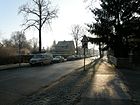
| Planitzstrasse
( Location ) |
510 | Ernst Edler von der Planitz (1857–1935), writer | July 25, 1927 | When it was first installed in 1909, it was Hermannstrasse . It is the connecting road between Heinrich-Grüber-Platz south of the Kaulsdorf S-Bahn station and Myslowitzer Straße. |
|
|
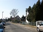
Pölitzer Strasse
( Location ) |
380 | Pölitz, a town in the Pomerania province , has been a police force in Poland since 1945 | June 9, 1933 | Planned from 1931 as Straße 24 and named in Pölitzstraße when construction began. It connects the Wilhelmsmühlenweg with the Münsterberger Weg in a north-south direction. |
|
|
Rahnestrasse
( Location ) |
290 | Rahne, long-established Kaulsdorf farming family | July 17, 1909 | It runs between Hosemannstrasse and Lehnestrasse in west-east direction in Kaulsdorf-Nord. |

|
| Randweg
( Location ) |
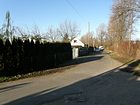
240 | Outskirts , location description | Dec 13, 1934 | The road, initially laid out as path C , forms the border between the districts of Hellersdorf with the prefabricated buildings there (north) and Kaulsdorf with single-family houses (south). With its layout it was the limiting path in the suburban small settlement (suburban settlement) Hellersdorf . |
|
| Reetzer way
( Location ) |
390 + 4 × 110 |
Reetz, town in the province of Pomerania, since 1945 Recz in Poland | Aug 9, 1929 | When it was first built around 1926, the traffic route was called Naumannstrasse . It connects Am Niederfeld with Achardstrasse. Between it and the parallel Königshütter Weg there are four cross streets that belong to the Reetzer Weg and have the odd house numbers 3-67. The even house numbers of this path are on the western side of the street. |

|
| Reissigerstrasse
( Location ) |
360 | Carl Gottlieb Reissiger (1798–1859), conductor and composer | May 16, 1938 | It was laid out after 1930 as a southern continuation of the Krepppfuhlweg and connects the Schleipfuhlweg with the Sudermannstraße. It is interrupted between Am Lupinenfeld and Tolkmittstrasse by a residential area built in the 2010s. - Your first spelling was Reissigerstraße (with "ss"). |

|
| Ridbacher Strasse
( Location ) |
1670 | Ridbach, place in East Prussia ; since 1945 Rzeck in Poland | Oct 18, 1937 | First there were Mahlsdorfer Strasse in Kaulsdorf (before 1838-1937) and Hellersdorfer Strasse in Mahlsdorf (1902-1937).
Ridbacher Strasse begins in the north on Grottkauer Strasse. At the confluence with Slabystrasse, it swings slightly to the southeast. At Briesener Weg, the road crosses the suburb of Mahlsdorf and ends there at Jacques-Offenbach-Platz. |

|
| Ring road
( Location ) |
340 | Ringstrasse , type of street layout | between 1911 and 1920 | The road runs in a north-east-south-west route, slightly curved between Wallstrasse and Waplitzer Strasse and ends as a dead end. |

|
| Robert-Koch-Strasse
( Location ) |
460 | Robert Koch (1843–1910), doctor | between 1910 and 1920 | It is located in Kaulsdorf-Nord and connects Kraetkestrasse with Ernst-Haeckel-Strasse in a west-east route. |

|
| Rogauer way
( Location ) |
170 | Rogau, place in Upper Silesia , since 1945 Rogi in Poland | March 8, 1935 | The route was planned as early as 1910 and later entered in the plans as road 34 . It branches off south-west from Achardstrasse, makes a slight swivel to the south-east and opens into Striegauer Strasse. |

|
| Rosenhagener Strasse
( Location ) |
250 (NS) +160 (WO) |
Rosenhagen, part of the municipality of Bugewitz in Mecklenburg-Western Pomerania | Feb. 1, 2001 | The road branches off as a dead end from Am Niederfeld northwards. |

|
| Rudolf-Virchow-Strasse
( Location ) |
230 | Rudolf Virchow (1821–1902), doctor | between 1910 and 1920 | Rudolf-Virchow-Straße is a straight street between Kraetkestraße (west) and Ridbacher Straße (east). |

|
| Rügenwalder Weg
( Location ) |
460 | Rügenwalde, a town in the Pomerania province , has been Darłowo in Poland since 1945 | June 9, 1933 | The traffic route was planned as road 6 after 1926 and runs from the north side of the railway line in a west-east direction to Gutenbergstrasse through a small settlement area. He has several north and south-facing development arms. | |
|
Sadowastrasse
( Location ) |
650 | Sadowa , a place in the Czech Republic, known from the battle of Königgrätz in 1866 | July 17, 1909 | The street was named after its direction to the former colony (allotment garden) "Neu-Sadowa" in Biesdorf-Süd, which derives its name from the battle site.
Sadowastraße is located in the very south of Kaulsdorf and leads from Waldstraße northeast to Ulmenstraße. |

|
| Scharnauer Strasse
( Location ) |
400 | Scharnau, a place in West Prussia , since 1920 Czarnowo, part of the rural community Zławieś Wielka in Poland | Aug 16, 1928 | The road was planned in 1922, and in 1926 it was given the name Straße 26 . It leads from Drausnitzer Strasse (W) to over Kaulsdorfer Strasse, where it bends south. It continues eastward as a seaside resort road. |

|
| Schleipfuhlweg
( Location ) |
400 (in the district) |
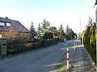
Schleipfuhl , body of water to which the path leads | Dec 13, 1934 | The Schleipfuhlweg, first referred to as path A , is an access path in what was then the suburban settlement (suburban settlement) Hellersdorf east of Schleipfuhl. It begins as a dead end west of the Krepppfuhlweg and runs in a west-east direction to over Ernst-Haeckel-Straße. After a bend to the north, he leads as Feierabendweg on. |
|
| Schmidtstrasse
( Location ) |
410 | Schmidt, long-established Kaulsdorf farming family | between 1911 and 1920 | It forms the west-east connection from Hellersdorfer Straße to Stöwestraße. The street consists of three earlier sections. Between the later Heinrich-Grüber-Straße and Stöwestraße, the street initially had the unofficial name Bismarckstraße , from around 1920 it became Schmidtstraße. The unnamed section between Finsterberger and Heinrich-Grüber-Strasse was included in Schmidtstrasse in 1922. The extension to Hellersdorfer Strasse took place later. |

|
| Schönherrstrasse
( Location ) |
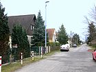
430 | Karl Schönherr (1867–1943), Austrian writer | Nov 9, 1926 | It connects the Grottkauer with the Heinrich-Grüber-Straße in a straight north-south route. It was laid out around 1910 and from around 1920 as Road 125 . |
|
| Seebadstrasse
( Location ) |
1140 (in the district) |
Former 'Seebad Königstal' (preserved as KGA 'Werbellinbecken' on Werbellinstrasse in Mahlsdorf) | July 17, 1909 | It is a west-east street as a continuation of Scharnauer Strasse. It begins a little west of Waldstraße, leads with two slight swings to the northeast to Eschenstraße and north of Ulmenstraße forms a section of the district boundary to Berlin-Mahlsdorf . |

|
| Senziger Strasse
( Location ) |
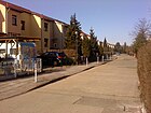
200 | Senzig , district of Königs Wusterhausen in Brandenburg | Oct 23, 1986 | The street was created in connection with the construction of 14 new terraced houses and their transport links. It connects the northern part of Dorfstrasse with Zernsdorfer Strasse. |
|
| Slabystrasse
( Location ) |
350 | Adolf Slaby (1849–1913), electrical engineer | between 1911 and 1920 | It is located in the Kaulsdorf-Nord area and connects the Ridbacher with Ernst-Haeckel-Straße. |

|
| Steffenshagener Strasse
( Location ) |
170 | Steffenshagen , municipality in Mecklenburg-Western Pomerania | Feb. 1, 2001 | Steffenshagener Strasse branches off north of Am Niederfeld, then bends in an easterly direction and ends at Rosenhagener Strasse. Around 1995, three row houses were newly built between Steffenshagener Straße and Hohenseeweg. |

|
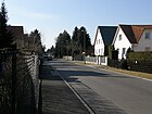
| Stepenitzer way
( Location ) |
420 | Stepenitz, town in the Pomerania province , Stepnica in Poland since 1945 | June 9, 1933 | It runs between Wilhelmsmühlen- and Münsterberger Weg in a north-south direction. When it was planned from 1926 onwards, it was called Straße 26 . |
|
|
Stöwestraße
( Location ) |
540 | Stöwe, long-established Kaulsdorf landowner family | July 17, 1909 | The Stöwestraße connects the Hamannweg with the Bausdorfstraße in a straight line. |

|
| Street 19
( Location ) |
170 | Numbering from the initial installation time of the road network | around 1907 | It is located in the very south of the district and leads from Damerauer Allee in a north-east-south-west direction to the Buchenhainer Bridge over the Wuhle . The pedestrian bridge connects Kaulsdorf with Buchenhainer Straße in the Biesdorf district . |

|
| Street 122
( Location ) |
120 | Numbering from the initial installation time of the road network | around 1907 | It connects Ingolstädter Straße to the south with Uslarer Straße. |

|
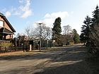
| Strehlener Strasse
( Location ) |
270 | Strehlen, town in Lower Silesia , since 1945 Strzelin in Poland | Nov 9, 1926 | It runs between Lassalle Strasse and Striegauer Strasse. First it was Straße 36 , which was laid out between 1910 and 1920, and was not officially referred to as Rosa-Luxemburg-Straße around 1920 . |
|
| Striegauer Strasse
( Location ) |
880 | Striegau, town in Lower Silesia , since 1945 Strzegom in Poland | Nov 9, 1926 | It runs in a slight curve as an extension of Lassaner Straße from Achardstraße southwest to Chemnitzer Straße. First it was Straße 49 , which was laid out between 1910 and 1920, and was not officially referred to as August-Bebel-Straße around 1920 . |

|
| Strindbergstrasse
( Location ) |
330 | August Strindberg (1849–1912), Swedish writer | Nov 9, 1926 | In the planning phase around 1910, it was Straße 133 , which was already called Strindbergstraße. It connects Schönherrstrasse (west) with Heinrich-Grüber-Strasse (east). |

|
| Sudermannstrasse
( Location ) |
900 (in the district) |
Hermann Sudermann (1857–1928), writer | after 1910 | The street was laid out in the village of Mahlsdorf around 1906 and was called Buddestraße there until 1937 . The extension to Kaulsdorf did not take place until 1910 and was given its own name Sudermannstraße. The house number range 1–52 belongs to Kaulsdorf, the numbers 53–150 to the district Mahlsdorf. It begins on Kraetkestrasse in the east, crosses the district boundary on Briesener Weg and ends in Mahlsdorf on Landsberger Strasse. |

|
|
Telemannweg
( Location ) |
660 | Georg Philipp Telemann (1681–1767), composer | May 16, 1938 | It was 126 at first . On November 9, 1926, it was officially given the previously used name Gustav-Mahler-Straße after the Austrian composer Gustav Mahler , but was then renamed again. It connects Grottkauer Strasse to the southwest with Heinrich-Grüber-Strasse. |

|
| Lowland road
( Location ) |
780 | Lowland, historical land name | Apr 5, 1934 | It runs between Heerstraße and Lindenstraße, in the area of Bergedorfer Straße slightly to the east. |

|
| Tolkmittstrasse
( Location ) |
500 +190 | Gustav Tolkmitt (1848–1900), hydraulic engineer | May 16, 1938 | When it was first built around 1920, the traffic route was called Heinrich-Heine-Straße . As a special feature, there is a smaller sign on the northernmost street sign that refers to the renaming during the Nazi era (lower picture).
Tolkmittstrasse is a west-east connection between Ridbacher Strasse and Ernst-Haeckel-Strasse. About halfway there is a north arm that is connected to Am Lupinenfeld. From here it forms an extensive, multi-armed network of trails northwards. This area was only developed after 1990 and row houses were built on. |

|
| Tolstoistrasse
( Location ) |
260 | Lev Tolstoy (1828-1910), Russian writer | around 1920 | It leads from Tolkmittstrasse to Slabystrasse. Tolstoistraße was named after the Russian writer, but initially in the Tolstoy spelling (with y). |

|
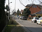
| Tschudistraße
( Location ) |
540 | Hugo von Tschudi (1851–1911), director of the National Gallery in Berlin | Nov 9, 1926 | The west-east road runs between Uckermark and Ridbacher Strasse. In the cadastral map after 1910 it was entered as street 132 , unofficially it was already called Tschudistraße. |
|
|
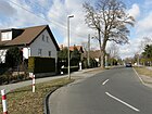
Uckermarkstrasse
( Location ) |
1150 | Uckermark , region in Brandenburg | Nov 9, 1926 | It was laid out between 1911 and 1920 and named Street 128 . Even before it was officially named, it was named Uckermarkstrasse. It runs as a continuation of Carola-Neher Strasse in Hellersdorf from the suburbs slightly north of Grottkauer Strasse to the confluence with Heinrich-Grüber-Strasse in the south. |
|
| Ulmenstrasse
( Location ) |
1370 (in the district) |
Elm , native deciduous tree | July 17, 1909 | It begins at An der Wuhle in the west, ends shortly after Sadowastraße in the east and continues as Kohlisstraße. To the east of Seebadstrasse, the property boundaries on the south side form the district boundary to Mahlsdorf . On the corner of Eichenstrasse is the monument complex 'Ulmen-Grundschule' (see picture). |

|
| Uslarer Strasse
( Location ) |
840 (in the district) |
Uslar , city in Lower Saxony | Nov 9, 1926 | It was laid out around 1911 in parts of Straße 114 and Straße 139 . Due to its rising course from the Krepppfuhl, it was also known as the mountain road . With the official name, both streets were brought together, which now begins at Am Lupinenfeld and after a short northern course makes a bend to the east. The Kaulsdorf section ends at Briesener Weg. The eastern house numbers (71–81) belong to the Mahlsdorf district, where Uslarer Strasse ends at Hönower Strasse . |

|
|
Waldenburger Strasse
( Location ) |
980 | Waldenburg, town in Lower Silesia , since 1945 Wałbrzych in Poland | Nov 9, 1926 | Between 1911 and 1922 it was laid out as Straße 50 , not officially called Steinstraße . In the year of the official naming, extensions were planned and effective.
It connects Striegauer Strasse with Norastrasse in a north-east-south-west route. Then it forms a small access road to the southwest as a dead end. |

|
| Forest road
( Location ) |
1200 | Oak forest, historical field name | July 17, 1909 | It leads from Heerstraße (north) to Sadowastraße (south) and ends as a cul-de-sac on Dammheide, a closed wooded area on the border with Köpenick . |

|
| Wallstrasse
( Location ) |
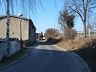
280 | Wall, on the north side of the road there was earthfill during the construction of the road bridge over the railway line | between 1911 and 1920 | It runs immediately south of the embankment in a west-east direction between the Ringstrasse and Heinrich-Grüber-Platz. |
|
| Waplitzer Strasse
( Location ) |
400 | Waplitz, place in East Prussia , since 1945 Waplewo in Poland | May 11, 1938 | When it was first installed around 1911, it was Schulstrasse . It connects the Ringstrasse with the Adolfstrasse.
At the corner of Brodauer Straße, a memorial for the soldiers of the Red Army was erected between 1946 and 1950 , which is protected as a garden monument along with its small park. |

|
| Weidenstrasse
( Location ) |
180 (in the district) |
Willow , native deciduous tree | July 17, 1909 | The Kaulsdorf section connects Buchenstrasse with Seebadstrasse (house numbers 1–6), the following area (numbers 7–14) belongs to the Mahlsdorf district , where it continues as Winklerstrasse. |

|
| Werner Street
( Location ) |
1040 | Wilhelm Werner (1877–1915), founder of the Wernerbad | between 1911 and 1920 | It leads from Heinrich-Grüber-Straße (west) in a slight north curve eastwards to Briesener Weg, where it continues as Markgrafenstraße in the Mahlsdorf district.
In the area of Ridbacher Strasse / Wernerstrasse, the Wernerbad was opened in 1905 as the oldest open-air swimming pool in Berlin, but slowly fell into disrepair over the decades. The bathroom was not revived until the late 1950s. After the fall of the Wall in 2002, it was closed and left to nature. Multiple attempts at renovation and reopening failed (as of March 2019). |

|
| Wernitzer Strasse
( Location ) |
480 | Wernitz, part of the municipality of Wustermark in Brandenburg | Nov 9, 1926 | It was laid out as Straße 35 around 1911 and is not officially called Singerstraße . It connects Chemnitzer Strasse with Waldenburger Strasse in a west-east direction. |

|
| Wilhelmplatz
( Location ) |
260 × 150 × 150 (isosceles triangle) |
Wilhelm , male first name | Aug 1910 | The triangular square lies between Mädewalder Weg, Münsterberger Weg and Planitzstrasse. When it was officially named, only the northern part up to Ferdinandstrasse was laid out. |

|
|
Wilhelmsmühlenweg
( Location ) |
1040 (in the district) |
Wilhelmsmühle , steam mill that was in operation until after the First World War | June 9, 1933 | When the street was first constructed around 1902, it was called Straße 27 , also Schneidemühlenweg or unofficially Wilhelmsmühlenweg, and Friedrichstraße (named after the male first name Friedrich ). The route was later extended to include Voigtstrasse (at that time in Mahlsdorf). The long traffic route south parallel to the Ostbahn extends from Heinrich-Grüber-Platz to Hönower Straße in Berlin-Mahlsdorf. The Kaulsdorf section ends at the Kornfeld. |

|
| Windbergweg
( Location ) |
90 | Windberg, historical hallway name | March 11, 1937 | The path forms a short connection between Am Baltenring and Heinrich-Grüber-Straße. It was laid out as road 159 and led in both directions to heights of around 60 meters, from which the road certainly owes its name. In 1943 there were no buildings here. The street has six house numbers. |

|
| Windthorststrasse
( Location ) |
530 | Ludwig Windthorst (1812–1891), chairman of the German Center Party | Nov 9, 1926 | It runs between Am Niederfeld and Achardstraße in a north-south direction.
When it was built around 1911, it was Straße 47 , but it was already called Windthorststraße. |

|
| Wodanstrasse
( Location ) |
70 (in the district) |
Wodan , Nordic god | around 1910 | It runs as a continuation of Bausdorfstrasse in full length in the Mahlsdorf district . Only house numbers 26 and 27 at the western end of the street between Lohengrinstraße and Briesener Weg belong to Kaulsdorf. |

|
|
Zanderstrasse
( Location ) |
600 | Hugo Zander (1837–1899), member of the municipal council in Kaulsdorf | July 17, 1909 | It begins at the intersection with Heinrich-Grüberstrasse and Kranoldstrasse and runs northeastwards to Hamannweg. |

|
| Zernsdorfer Strasse
( Location ) |
250 | Zernsdorf , district of Königs Wusterhausen in Brandenburg | Oct 23, 1986 | The street was created in connection with the construction of 14 new terraced houses and their transport links. It runs between Münsterberger Weg and Dorfstraße in a north-east-south-west direction. |

|
Planned streets or streets that were later assigned to other parts of Berlin
- Blumauer Strasse
- Eugen-Richter-Straße after the German politician and publicist Eugen Richter (1838–1906); 1933 still undeveloped; unrealized
- Gorkistraße after the Russian poet Maxim Gorky ; unrealized
- Graubündner Strasse
- Joachimstrasse; unrealized
- Lilienthalstrasse after the German aviation pioneer Otto Lilienthal ; unrealized
- Reyherstrasse probably still undeveloped after the Prussian War Minister Karl von Reyher 1930; unrealized
- Meadow road
Allotment gardens (KGA) or colonies
Almost all gardens in the Kaulsdorf district were created long after the Second World War . Most of the time remaining areas were given to interested allotment gardeners after the residential development had been completed, who reclaimed the land and formed garden associations.
| Surname | founding | designation | Remarks | image |
|---|---|---|---|---|
| KGA 'recovery'
( Location ) |
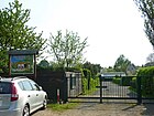
1979 | recreation | The KGA was created on the initiative of VEB Elektrokohle Lichtenberg , especially for its workers and employees on previous fallow land. Those interested in the garden prepared it themselves and it covers an area of around 2.2 hectares . The 43 parcels with an average size of 390 m² are located in the southeast of Kaulsdorf between the An der Wuhle, Drausnitzer and Falkstätter Strasse. |
|
| KGA 'gold grain'
( Location ) |
1983 | Brandy type Goldkorn (anecdotal) | This KGA was created between 1982 and 1983 instead of a wild garbage dump and a usable agricultural area and was called 'Kolonie Wilhelmsmühlenweg' when it opened. It comprises 23 parcels to the right and left of the hamster pit or between the Wilhelmsmühlenpfuhl (north) and the Hamsterpfuhl (south), a total of 13,324 m². It is bordered to the west by Pölitzer Strasse, east by Stepenitzer Weg and south by Hamsterweg. The new name came into being after the fall of the Wall , when a new name was sought for entry in the register of associations. It supposedly came about over a glass of gold grain . |

|
| KGA 'Am Iselbergplatz'
( Location ) |
1984 | Location on the square of the same name | The small allotment garden encompasses twelve parcels that were created in the vicinity of an earlier bunker. It is bounded by Uckermarkstrasse (west), Iselbergstrasse (north), Am Baltenring (east) and the street area Iselbergplatz (south). The KGA association Iselbergplatz was founded in 1984. |

|
| KGA 'Kaulsdorfer Busch'
( Location ) |
1939 | after the field name and its vegetation | It consists of two parts, which lie between Waldenburger Strasse, Achardstrasse, Kaulsdorfer Busch and Mieltschiner Strasse ('KB I') and between Waldenburger Strasse, Mieltschiner Strasse, Kaulsdorfer Busch and Heerstrasse ('KB II') . It concerns a total area of 218,500 m², which is divided into 513 plots. It was built from 1936 on the former marsh meadow area and was officially inaugurated in 1939. A nature trail was laid out in the outer ring at the end of the 20th century . |

|
| KGA 'On Mosbacher Strasse'
( Location ) |
Aug 19, 1988 | Location on the street of the same name | When it was founded on August 19, 1988, the KGA comprised 20 parcels. In the following year, another 20 parcels were added, so that an area of around 1.7 hectares is now occupied. It extends along the Wuhle, between Bundesstrasse 1 , Chemnitzer Strasse and Lenbachstrasse . |

|
| Allotment garden division 'Oberfeld'
( Location ) |
unknown | historical field name Oberfeld | The garden is located between Wernerstraße, Am Bachrain and Hamannweg, east of Heinrich-Grüber-Straße. As of December 2011 it had 44 members. |

|
| KGA 'Wallstrasse'
( Location ) |
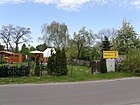
unknown | Location on the street of the same name | The KGA comprises eleven parcels and stretches south of the embankment between the Wuhletal U and S-Bahn station, Münsterberger Weg and Wallstrasse. There is no central access route. |
|
| KGA 'Am Wuhlesee'
( Location ) |
1976 | Location to the Wuhlesee | The garden colony 'Am Wuhlesee' was created near the southeastern bank of the Wuhlesees instead of a former garbage dump and is bordered by Damerauer Allee, Kaulsdorfer Straße and Straße 19. It comprises around 14 plots on eight hectares of land and was officially founded in 1976. |

|
| KGA 'Wuhleblick'
( Location ) |
March 29, 1984 | Wuhle , river through the Marzahn-Hellersdorf district | It is located south of Alt-Kaulsdorf in the Wuhle floodplain on its east bank and is bordered to the east by Lenbachstrasse and to the south by Honsfelder Strasse. On March 29, 1984, the first twelve parcels were given to tenants. In 1987 and 1988 further parcels were added. The KG-Verein Wuhleblick has been officially registered since 2001. It covers around 1.33 hectares with 28 parcels with an average of 470 square meters of floor space. |
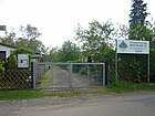
|
Further locations in Kaulsdorf
- Dammheide
- Kaulsdorfer Busch
- Kaulsdorf lakes with Butzer See; Fishing waters (No. DAV B04-101)
- Crepe chair
-
Landscape protection area Barnimhang :
It is located between Alt-Kaulsdorf - Alt-Mahlsdorf (north), Lassaner Straße (west), Butzer and Elsensee (south) as well as the grounds of the Alba waste disposal company and the Freie Schule am Elsengrund (east; already in the district Berlin-Mahlsdorf ). - Wuhleblase
- Wuhlesee
See also
Web links
- Map of Berlin 1: 5000 with district boundaries. Senate Department for Urban Development Berlin, 2009, accessed on September 6, 2011 .
- Official street directory of the Marzahn-Hellersdorf district; pdf (as of January 2015)
- Street directory Kaulsdorf. kaupert media gmbh, accessed on September 6, 2011 . , Details tw. corrected (incomplete, also wrong district allocation)
Individual evidence
- ^ Berlin-Kaulsdorf . In: Berliner Adreßbuch , 1922, IV, p. 1711.
- ^ History of Fasanenstrasse in Luise-Berlin , accessed on September 8, 2011
- ↑ History Achardstraße on Kauperts.de
- ↑ Berlin history on Luise Berlin
- ↑ Martin Klesmann: Parents collect signatures against demolition. In: Berliner Zeitung , December 8, 2015, p. 13.
- ↑ Public Relations Working Group of the General Parents' Representation (GEV) sei-keine-birne.de ; Retrieved December 9, 2015.
- ↑ Update: renovation and conversion plans for the Franz-Carl-Achard-Grundschule on www.mario-czaja.de; accessed on November 23, 2018.
- ↑ Monument ensemble Alt-Kaulsdorf 1–23, Angerdorf Kaulsdorf with village church and open spaces, front gardens with fences, rear gardens and courtyards; Brodauer Strasse 1–3 Dorfstrasse 2–8, 10–15, 17–20, 29–44
- ↑ Memorial plaques in Berlin: Franz Carl Achard
- ↑ a b Biotopes in Kaulsdorf: Rohrpfuhl and Rohrpfuhlgraben ( Memento from April 3, 2015 in the Internet Archive )
- ↑ a b c d e f g Lichtenberg administrative district> Kaulsdorf district . In: Berliner Adreßbuch , 1922, Part IV, pp. 1711–1716.
- ↑ Two critical minds. In: Berliner Woche , Hellersdorf, Kaulsdorf and Mahlsdorf edition, March 20, 2019, p. 3.
- ^ History of the street Am Niederfeld on Kauperts.de
- ↑ Draft of the development plan 10-70 of the Marzahn-Hellersdorf district office ( Memento of the original from March 4, 2016 in the Internet Archive ) Info: The archive link has been inserted automatically and has not yet been checked. Please check the original and archive link according to the instructions and then remove this notice.
- ↑ Official street directory of the Marzahn-Hellersdorf district; pdf (July 2015) , (PDF; 350 kB)
- ↑ BD Brodauer Straße 32, residential building, around 1890
- ^ History of Graubündener Straße on Kauperts.de
- ↑ Kaulsdorf district . In: Berliner Adreßbuch , 1943, Part IV, pp. 2249 ff.
- ^ Name declarations from Berlin A to Z with Luise-Berlin
- ↑ Berlin city map from 1954: Kaulsdorf. The main route is not yet listed. ( Page no longer available , search in web archives ) Info: The link was automatically marked as defective. Please check the link according to the instructions and then remove this notice.
- ↑ Detail on H.-Grüber-Str. on Kauperts.de
- ^ Website of Police Section 63 , accessed on March 27, 2015
- ↑ a b c d e f g h Lichtenberg administrative district> Kaulsdorf district . In: Berliner Adreßbuch , 1930, Part IV, pp. 2040-2046.
- ↑ a b c d e f g h Kaulsdorf district . In: Berliner Adreßbuch , 1943, Part IV, pp. 2249–2261.
- ^ Jägerstrasse on Kauperts.de
- ↑ a b Chronicle of the Kaulsdorf Voluntary Fire Brigade , accessed on March 29, 2015
- ^ Karlsburger Weg in Kaulsdorf . In: Berliner Adreßbuch , 1939, Part IV, p. 2233.
- ↑ Private street now "Kaulsdorfer Gardens" . In: Berliner Zeitung , May 13, 2003
- ↑ City map of Berlin 1943 ( Memento of the original from January 7, 2016 in the Internet Archive ) Info: The archive link was inserted automatically and has not yet been checked. Please check the original and archive link according to the instructions and then remove this notice.
- ^ History of Lassalle - / Thimmstrasse on Luise-Berlin
- ↑ Thimmstrasse in the Berlin city map from 1943 ( memento of the original from January 7, 2016 in the Internet Archive ) Info: The archive link was automatically inserted and not yet checked. Please check the original and archive link according to the instructions and then remove this notice.
- ↑ Buddestrasse on Luise-Berlin
- ↑ According to the official assignment, a section should belong to Mahlsdorf. Here: Official street directory of the Marzahn-Hellersdorf district; pdf (July 2015) , (PDF; 350 kB) Given the location in the Kaulsdorf-Southwest area, this is considered unlikely.
- ^ Information on the homepage of the Member of Parliament Sven Kohlmeier , accessed on October 10, 2011
- ↑ Mieltschiner Strasse 67, Kaulsdorf waterworks, 1916
- ^ History of Mosbacher Strasse on Kauperts.de
- ^ History of Mosbacher Straße on Kauperts.de
- ↑ History of Nora road on Kauperts.de
- ^ Gustav-Mahler-Strasse on Luise-berlin
- ^ History of Waldenburger Strasse on Kauperts.de
- ↑ Brodauer Straße 10 / Waplitzer Straße: Soviet memorial with open space, around 1950
- ^ History of Wernitzer Strasse on Kauperts.de
- ^ History of the Wilhelmsmühlenweg on Kauperts.de
- ↑ a b c d General information on the KGA in the Marzahn-Hellersdorf district
- ^ Website for KGA recovery
- ^ Website KGA Gold Grains
- ↑ Website for KGA Iselbergplatz
- ^ Website of the garden association Kaulsdorfer Busch
- ↑ Nature trail 'Kaulsdorfer Busch' according to an information board at the entrance to Heerstraße.
- ^ Website KGA Wallstrasse
- ^ Website KGA am Wuhlesee
- ↑ site KGA Wuhleblick
- ↑ Barnimhang landscape protection area
