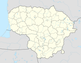
Usėnai
| Usėnai | ||
|
||
| State : |
|
|
| District : | Klaipeda | |
| Rajong municipality : | Šilutė | |
| Office : | Usėnai | |
| Coordinates : | 55 ° 14 ' N , 21 ° 43' E | |
| Inhabitants (place) : | 632 (2011) | |
| Time zone : | EET (UTC + 2) | |
| Status: | Village | |
|
|
||
Usėnai ( German Mädewald ) is a village in the Lithuanian district of Klaipėda . The place is the center of the administrative district (Seniūnija) Usėnai and belongs to the Rajongemeinde Šilutė .
Geographical location
Usėnai is located in the southwest of Lithuania , in the former Memelland , about 20 kilometers southeast of the Šilutė municipality . National road 141 , which connects Kaunas with Klaipėda , passes on the southwestern outskirts . Usėnai has a stop on the Sovetsk – Klaipėda railway line , although passenger traffic has been suspended since 2011. The Veižas flows through the village and flows into the Memel .
history
In 1874, Mädewald was (apparently) incorporated into the administrative district of Szameitkehmen in the (rural) district of Tilsit . In 1920 it was incorporated into the Pogegen district (lit. Pagėgių apskritis). In 1939, Mädewald itself became the seat of an administrative district that was now part of the Heydekrug district . In mid-October 1944 fierce fighting between German and Soviet troops took place near Mädewald.
After the incorporation into the Lithuanian Soviet Socialist Republic , Usėnai became the seat of a district (lit. apylinkė) in 1950 and has been the seat of an administrative district since 1995. As such, the place got a coat of arms in 2012.
Usėnai tragedy
On December 6, 1965, seven boys from Usėnai, ages ten to fifteen, were killed while handling explosives in a forest.
Population development
| year | Residents |
|---|---|
| 1910 | 80 |
| 1959 | 252 |
| 1970 | 379 |
| 1979 | 604 |
| 1989 | 795 |
| 2001 | 731 |
| 2011 | 632 |
school
There is a secondary school in Usėnai.
Usėnai District
The Usėnų seniūnija, which belongs to the Rajongemeinde Šilutė , has existed since 1995 . In the district there are 18 villages with a total of 1,210 inhabitants on an area of 77.9 km² (as of 2011). The administrative district has been divided into the two subdistricts (lit. Seniūnaitija) Usėnų seniūnaitija and Žemaitkiemio seniūnaitija since 2009. The district includes:
| Place name | German name | Subdistrict | Place name | German name | Subdistrict | |
|---|---|---|---|---|---|---|
| Antleičiai | Great guidance | Usėnai | Irritgiai | Passon rice gen | Usėnai | |
| Aužkykiai | Augskieken | Usėnai | Stremeniai | Alt Strehmenen | Usėnai | |
| Dėkintėliai | New Dekinten | Usėnai | Svaraitkiemis | Swarreitkehmen | Žemaitkiemis | |
| Galzdonai | Galsdon-Joneiten | Žemaitkiemis | Uostiškiai | Ostishken | Usėnai | |
| Karceviškiai | Klein Karzewischken | Žemaitkiemis | Usėnai | Maiden forest | Usėnai and Žemaitkiemis | |
| Kavoliai | Kawohlen | Usėnai | Užpelkiai | Uszpelken | Žemaitkiemis | |
| Meišlaukiai | Meischlauken | Usėnai | Veržininkai | Werszenhof | Žemaitkiemis | |
| Naujapieviai | to Pleine | Žemaitkiemis | Žardviečiai | Weitkus-Szardwethen | Usėnai | |
| Naustremeniai | New Stremehnen | Usėnai | Žemaitkiemis | Szameitkehmen | Žemaitkiemis |
References
Web links
Individual evidence
- ↑ census data


