List of streets and squares in Berlin-Schöneberg
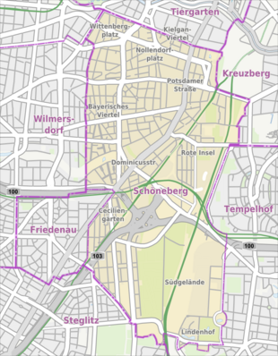
The list of streets and squares in Berlin-Schöneberg describes the street system in the Berlin district of Schöneberg with the corresponding historical references. At the same time, this compilation is part of the lists of all Berlin streets and places .
overview
General
The village, which was formerly part of the Berlin area, has been included in a supplement to the Berlin address book since 1874. At that time there were nine named streets (from Akazienweg to Wilmersdorfer Weg ), in 1875 there were already eleven streets listed.
With the expansion of Berlin, the suburbs also grew and new settlement areas emerged and accordingly many new streets and squares. The area northwest of the Geisbergstrasse - Motzstrasse - Else-Lasker-Schüler-Strasse line formed the eastern quarter of the city of Charlottenburg until the formation of Greater Berlin in 1920 , was then part of the Charlottenburg district and was added to Schöneberg with the Berlin regional reform in 1938 . The area northeast of the line Zietenstraße - Gleditschstraße - Grunewaldstraße - Großgörschenstraße belonged to the city of Berlin before 1920 and to the Tiergarten district from 1920 to 1938 .
In 2014, the multi-territorial newly tailored district 206 dedicated on roads and 21 appointed seats. The courses of 29 streets also belong to neighboring districts. The total length of the streets in the district is around 99 kilometers.
Significant traffic axes of the district are
- the " general train ": Tauentzienstrasse - Kleiststrasse - Bülowstrasse ,
- the street on the Urania - Martin-Luther-Straße - Dominicusstraße - Sachsendamm ,
- the Federal Highway 1 on the road train Potsdamer Straße - Main Street (- Dominicusstraße - A 103 ) and
- the A 100 city ring with the Schöneberg motorway junction to the Westtangente .
From the federal motorways through the district, 8,770 meters belong to the large-scale and 1,470 meters to the higher-level road system . There are also 3,010 meters of federal highway 1 to the extensive road system in Berlin and 15,020 meters of city streets to the higher-level system. The main road system is further defined by 9,070 meters of main roads of regional importance and 3,610 meters of city streets. These streets are classified for through traffic and for traffic to and between neighboring districts or districts according to the road development plan of the State of Berlin; the affected streets are not necessarily recorded in the main street system over their entire length. Schöneberg has 123,075 inhabitants (as of December 30, 2019) and includes the postcode areas 10777, 10779, 10781, 10783, 10787, 10789, 10823, 10825, 10827, 10829, 10965, 12103, 12105, 12157 and 12159.
Details of selected streets
The Hobrecht plan originally provided for a straight continuation of Bülowstrasse to the east. The railway facilities on the Gleisdreieck site expanded so quickly, however, that the general train had to be moved south to cross the railway site under the Yorck bridges . The resulting curve of Bülowstrasse, the “Bülowbogen”, gave the ARD television series Praxis Bülowbogen its name.
The widening and the extra-wide green strip in the intersection area at the Urania / Lietzenburger Strasse intersection go back to plans for a motorway-like elevated road that have since been abandoned. As part of the inner city plan, there are considerations to redesign this area. Other remnants of traffic planning from the post-war period concern Hohenstaufenstrasse and Pallasstrasse . This street was to be expanded to consist of multiple lanes, the house at Hohenstaufenstraße 22 was intended for demolition. It is still on the planned route of Hohenstaufenstrasse and must be avoided on a relatively narrow curve. The northern underpass of the Pallasseum, which is not used by road traffic, testifies to the unfinished expansion plans for Pallasstrasse .
Overview of streets and squares
The following table gives an overview of the streets and squares in the district as well as some related information.
- Name / location : current name of the street or square. Via the link Location , the street or the square can be displayed on various map services. The geoposition indicates the approximate center of the street length.
- Traffic routes not listed in the official street directory are marked with * .
- Former or no longer valid street names are in italics . A separate list may be available for important former streets or historical street names.
-
Length / dimensions in meters:
The length information contained in the overview are rounded overview values that were determined in Google Earth using the local scale. They are used for comparison purposes and, if official values are known, are exchanged and marked separately.
For squares, the dimensions are given in the form a × b for rectangular systems and for (approximately) triangular systems as a × b × c with a as the longest side.
If the street continues into neighboring districts, the addition ' in the district ' indicates how long the street section within the district of this article is. - Name origin : origin or reference of the name.
- Notes : further information on adjacent monuments or institutions, the history of the street and historical names.
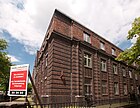
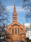
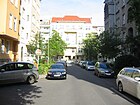
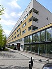
- Image : Photo of the street or an adjacent object.
| Name / location | Length / dimensions (in meters) |
Origin of name | Date of designation | Remarks | image |
|---|---|---|---|---|---|
|
Ahornstrasse
( Location ) |
120 | First planting with maple trees | July 6, 1870 | The street branches off from Karl-Heinrich-Ulrichs-Straße as a cul-de-sac and belongs to the Kielgan district . The Villa Geisberg at Ahornstraße 4 is an architectural monument. |

|
| Akazienstrasse | 440 | Acacia grove that the road passed at the time it was named | around 1840 | As a southern extension of Goltzstraße, the street leads from Grunewaldstraße to Hauptstraße . Several tenement houses on Akazienstraße and the Apostle-Paulus-Kirche are listed . |

|
|
Albertstrasse
( Location ) |
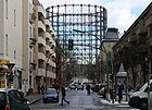
230 | Albert Grix (1838–1913), master blacksmith and local politician | 1888 | Albertstraße leads from Hauptstraße to Ebersstraße. The first name according to the development plan was Straße 63 . There are mostly old buildings on the quiet inner-city residential street. The Inner Parkring runs through the neighboring parks . |
|
|
Alboinplatz
( Location ) |
250 (diameter) |
Alboin (526–572 or 573), King of the Longobards | Jan. 23, 1931 | The east side of the square belongs to Tempelhof . The first name of the development plan to 1931 was space Q . Alboinplatz is included in the Berlin road system with 390 meters as a regional road connection (Category III), and 290 meters of lane are also listed as a square (Category V). |

|
| Alboinstrasse | 1320 (1050 + 270) |
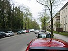
Alboin (526–572 or 573), King of the Longobards | Jan. 23, 1931 | The busy cobblestone residential and commercial street is divided into two areas by Alboinplatz and delimits the Schöneberg industrial area to the west of it. The former Schwarzkopf factory (Alboinstrasse 36–42) is belowMonument protection . The most striking building is the administration high-rise at Alboinstrasse 56, in which TÜV Rheinland maintains one of several Berlin branches. The most striking building is the Alboin-Kontor - a former warehouse. There are large commercial settlements on the western side of the Schöneberg street. The east side of Alboinstrasse belongs to Tempelhof and is built on with residential buildings. Until 1964 a line of the Berlin tram ran through the street. |
|
| Alvenslebenstrasse
( Location ) |
320 | Constantin von Alvensleben (1809-1892), Prussian general | Nov. 24, 1874 | Alvenslebenstrasse leads from Potsdamer Strasse to Dennewitzplatz. The apartment houses No. 2 and 4 are historical buildings. The first name according to construction plan was road north . |

|
| At the locomotive depot
( Location ) |
90 | After the former locomotive depot located here | Dec 15, 2013 | The street was built on a former fallow site to develop a new building complex by the Robertneun architects' office. The striking bright red house is a landmark on the street leading down from Monumentenstrasse. The eponymous railway sheds are used by the German Museum of Technology in Berlin as a depot. |

|
| At the Mühlenberg | 280 | Hill with a former windmill on which the Schöneberg Town Hall was built | 1913 | The three branches of the street form a closed rectangle with Meraner Straße. The senior leisure center “Club am Mühlenberg” is located in the building at Am Mühlenberg 12 at the corner of Sterzinger Straße. There are some old buildings and apartment buildings from the 1970s on the narrow and quiet residential street. The northern branch of the road ends as a dead end for cars . There is a footpath between Steinacher Strasse and Sterzinger Strasse, the southern part of the street is a one-way street to the west. |

|
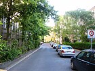
| At the city Hall | 170 | Schöneberg Town Hall | 1912 | The street was laid out when the town hall was being built and runs along its back between Badenschen Straße and Freiherr-vom-Stein-Straße. The town hall with its farm roads is on the east side of the street. The west side consists of apartment buildings from the 1960s. |
|
| At the Apostle Church | 200 | Twelve Apostles Church | Oct 25, 1875 | The centrally located small street is U-shaped. It was part of the former Straße 10a, Section IV of the Berlin development plan. Several tenement houses in the street as well as the Twelve Apostles Church are listed . Besides the church and the parish hall, there are only a few residential buildings on the street. Like Else-Lasker-Schüler-Strasse, the road to Kurfürstenstrasse is only passable for pedestrians and cyclists. Car traffic on Kurmärkische Strasse is also blocked by a traffic regulation measure. | |
| At the Urania
( Location ) |
280 | Berlin Urania | Nov 1, 1962 | Until 1938 the street belonged to Charlottenburg . From 1862 to 1885 it was Straße 21 and Straße 21a , which were combined and named as Nettelbeckstraße from 1885 . The street lies with two multi-lane lanes between Kleiststraße and the district border to Mitte on the southern edge of Kurfürstenstraße . The lanes are separated by a 30 to 40 meter wide green strip. This served as preliminary construction work for the A 106 planned in the 1960s . A state authority is located on property 2–12 (even), 13–17 (odd) is the Urania building , 1–7 (odd) are on the east side of Kurfürstenstrasse, with Courbièrestrasse in between . Hotels 12, 14, 16-18, 20/22 are preferably located on the west side of the street. |

|
| Ansbacher Strasse
( Location ) |
1140 | Ansbach , city in Bavaria | 1887 | The centrally located inner-city street begins on Kurfürstenstraße , is then interrupted by Wittenbergplatz , crosses Lietzenburger Straße and continues to Motzstraße . Until November 1, 1962, the section between Geisbergstrasse and Motzstrasse was called Neue Ansbacher Strasse . The KaDeWe is right on the street and Tauentzienstrasse starts here. From Kurfürstenstrasse and Lietzenburger Strasse, the road ends at Wittenbergplatz as a dead end for cars. Between Lietzenburger Strasse and Hohenstaufenstrasse it is almost a purely residential street with old and post-war buildings. Some of the stately old buildings have been extensively renovated and are in great demand. |

|
| Apostel-Paulus-Strasse | 250 + 450 | Apostle Paul Church | June 14, 1893 | The street begins on Salzburger Straße, is interrupted by Wartburgplatz and continues to Akazienstraße. Her first plan name was Street 54 . The tenement houses No. 7, 18, 32, 33 and 35 are architectural monuments. The Wartburgplatz itself does not belong to the street. |

|
| Arnulfstrasse |
760 (in the district) |
Arnulf von Kärnten (around 850–899), Roman-German emperor |
around 1911 | Arnulfstraße is the eastern continuation of the Prellerweg . The eastern section of the street runs in Tempelhof to Attilaplatz. The previous name around 1919 to 1925 was Gartenstrasse , but at that time it only extended to the street at the cemetery, today Domnauer Strasse. There are many residential buildings in the Lindenhof estate on Arnulfstrasse . Arnulfstraße is a busy connecting road. At the western end there is the Lindenhof settlement on both sides, to the north the Eythstraße cemetery and some apartment blocks. South of the road the landscape rises to the Marienhöhe . To the north there is a pedestrian connection through the settlement to Eythstraße and to the south there are footpaths to Marienhöhe. |

|
| Aschaffenburger Strasse |
220 (in the district) |
Aschaffenburg , city in Bavaria | 1887 | The street begins at Bayerischer Platz , crosses Bamberger Straße and from there runs in Wilmersdorf to Prager Platz . A first summary in 1887 led to Aschaffenburger Strasse, which was later expanded. The first names were Preussische Strasse , Victoriastrasse and Sadowastrasse . |

|
| Augsburger Strasse |
170 (in the district) |
Augsburg , city in Bavaria | March 11, 1886 | The first parts of the traffic route were Straße 29 , Straße 29a and Straße 30, Section IV of the Berlin development plan. Sections of the street run through Charlottenburg and Wilmersdorf . In Schöneberg, the section runs between Nürnberger Strasse and Passauer Strasse. Fuggerstrasse, which was separated by the construction of Lietzenburger Strasse, was also part of Augsburger Strasse until 1957. |

|
| Badensche Strasse |
540 (in the district) |
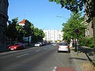
Grand Duchy of Baden , the scene of the revolutionary unrest in 1848/1849 | 1912 | The previous names were Schöneberger Weg , Mühlenweg and Schleswiger Straß ' . Badensche Strasse was the continuation of the street of the same name in Wilmersdorf , which was named on March 16, 1888. Road works on the Mühlenberg began in 1909/1910.
The street begins in Wilmersdorf an der Berliner Straße and runs from Kufsteiner Straße in Schöneberg to Martin-Luther-Straße . The Nordsternhaus is located at Badenschen Straße 2 and the Schöneberg Campus of the University of Economics and Law is located at Badenschen Straße 52 . |
|
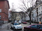
| Bahnhofstrasse | 70 | Friedenau station on the Wannseebahn | 1874 | The station, which opened on November 1, 1874 and located in Schöneberg, was named after the Friedenau country house colony at the time . The centrally located inner-city residential street with well-preserved old buildings lies between Wielandstrasse and Baumeisterstrasse . Several apartment buildings as well as the train station are listed . From Bahnhofstraße there is an underpass under the railway and the A 103 to Rembrandtstraße and Dürerplatz. |
|
| Balloon path |
90 (in the district) |
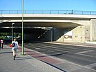
here was the barracks of the II. Railway Regiment and the airship dept. | July 24, 2006 | The connecting road from Sachsendamm to the east entrance of the Südkreuz station was created in connection with the construction of the station. It branches off from Sachsendamm, crosses under the Ringbahn and runs from there in Tempelhof to Werner-Voss-Damm . The road was opened to traffic on December 1, 2006 and officially opened on December 8, 2006. Between 1895 and 1901 the airmen who carried out military and scientific experiments with their balloons were housed on Werner-Voss-Damm. From the airship station with the test area, a manned balloon was flown to an altitude of 10,500 meters. |
|
| Bamberger Strasse
( Location ) |
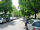
1060 | Bamberg , city in Bavaria | around 1900 | The street lies between Geisbergstraße and Grunewaldstraße, whereby the western side of the street and the road area belong to Wilmersdorf ( Charlottenburg-Wilmersdorf district ). The first name was Street 51 . The apartment building no. 52 is listed . At the intersection with Geisbergstraße, Ettaler Straße (northwards) continues the traffic road. In the district there are plots 31-61 (continuous). In Lichtenrade lying Bamberger Straße is the same name, contributes but the official cadastral road number 408, in the district is the street 407th |
|
| Barbarossaplatz | 90 × 90 | adjacent Barbarossastraße | 1903 | The square was completed in 1906 as a jewelry square. Six streets lead into the rectangular square, but it is spared from through traffic. The Barbarossastraße is in the west-east direction, the Eisenacher Straße in the north-south direction, from the north-west the Schwäbische Straße flows, which initially leads as a park path through the Alice-Salomon-Park in the south-east. The fountain from 1913 with several bronze figures of children on the central island and the school building Barbarossaplatz 5 by Paul Egeling are architectural monuments. |
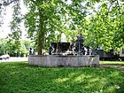
|
| Barbarossastrasse | 1170 (in the district) |
Frederick Barbarossa (around 1122-1190), Emperor of the Holy Roman Empire |
June 15, 1892 | The street runs in Schöneberg from Gleditschstraße over Barbarossaplatz to the district border on Bamberger Straße and then continues in Wilmersdorf to Aschaffenburger Straße. The previous name from before 1876 to around 1890 was Buschstraße ( Busch as a generalization of Hopfenbruch , an area between Charlottenburg and Wilmersdorf mentioned in 1774). The apartment buildings No. 62 and 63 are listed . The long residential street with a mixture of old buildings and social housing is relatively low-traffic due to traffic regulations. |

|
| Baumeisterstrasse | 510 |
Reinhard Baumeister (1833–1917), civil engineer |
1912 | Baumeisterstraße leads from the Friedenau train station along the Wannseebahn line to the Otzenstraße . The first name was Street 43 . The clarinetist and Berlin chamber virtuoso Alfred Bürkner (1905–1981) worked at Baumeisterstraße 8 . House numbers 4–16 are part of the Ceciliengärten housing estate and are a listed building . Most of the houses date from the 1920s and the spacious inner courtyards make the area quiet despite the A 103 and the Ringbahn. |

|
| Bautzener Platz
( Location ) |
90 × 20 | adjacent Bautzner Strasse | 1912 | Bautzener Platz, with residential buildings on its northern and southern course, connects Hochkirchstrasse via a footpath with Bautzener Strasse on its eastern side. In its center there is an ornamental fountain. There are some trees and a fountain in the square. There are old buildings on the edge. |

|
| Bautzener Strasse
( Location ) |
500 | Bautzen , city in Saxony , the scene of a battle in the Wars of Liberation | Aug 4, 1897 | The street leads from Yorckstraße to Monumentenstraße. At first the traffic route was called Straße 20a, Section III of the Berlin development plan. The street C 1 , which at the time belonged to Schöneberg , was renamed Bautzener Straße in 1912 as an extension of it. The inner-city residential street, mostly with old buildings, is located on the southern edge of the Berlin glacial valley and has a slight incline. The street is only built on on the west side and borders on the Anhalter Bahn railway line in the east. Between the railway and the road there is a wasteland on which small businesses are located. |
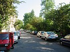
|
|
Bayerischer Platz
( Location ) |
190 × 100 | Kingdom of Bavaria , federal state of the German Empire | May 10, 1907 | The square is in the center of the Bavarian Quarter . According to the development plan, it was created as Y place . The subway station of the same name , the lion monument and houses No. 1 and 9 are listed . | |
| Bayreuther Strasse
( Location ) |
450 | Bayreuth , city in Bavaria | March 11, 1887 | Bayreuther Straße branches off from Kurfürstenstraße and leads past Wittenbergplatz to Lietzenburger Straße . Until 1958, Welserstraße, which was separated by the construction of Lietzenburger Straße, also bore the name Bayreuther Straße. The first plan name was Street 36 . |

|
| Beckerstrasse | 370 | Karl Becker (1820–1900), painter | Jan. 12, 1892 | The residential street with its splendid old buildings from the imperial era is part of the Schöneberg painter's quarter and leads from Knausstrasse to Rubensstrasse . The apartment buildings No. 6, 6a and 8 are listed .
The plan name was Street 7 . A tram drove through Beckerstrasse before 1907, but the route was abandoned between 1925 and 1936. |
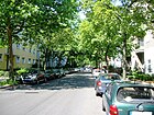
|
| Begasstrasse | 200 | Reinhold Begas (1831–1911), sculptor | Jan. 12, 1892 | The inner-city residential street with well-preserved old buildings is part of the “Malerviertel”. It leads from Dürerplatz to Rubensstraße and continues as a footpath to Pöppelmannstraße. The first plan name was Street 6 . At the Friedenau S-Bahn station there is a pedestrian crossing under the A 103 and the Wannseebahn that runs parallel to it . In addition, a footpath connects Begasstrasse with Grazer Damm and the allotment gardens on Priesterweg, where Begasstrasse continues as Begasweg. |

|
| Belziger Strasse | 950 | Bad Belzig , city in Brandenburg | Apr 29, 1884 | The inner-city residential street mainly consists of good old buildings and is located between Dominicusstrasse and Vorbergstrasse . The section from Akazienstraße to Vorbergstraße was called Extended Belziger Straße until 1910 . Several buildings in the street are listed , including a former tram depot that was shut down along with the tram route in 1964. In 2013 the first green wave for cyclists in Berlin was set up in the street . At the eastern end there is a large playground with a pedestrian passage to Gleditschstraße. A section of the inner parking ring runs in the street . |

|
| Berchtesgadener Strasse | 600 | Berchtesgaden , city in Bavaria | 1903 | The street lies in the Bavarian Quarter and leads from Barbarossastraße to Wartburgstraße. The apartment buildings No. 8 and 9 are listed . |

|
| Bessemerstrasse
( Location ) |
810 |
Henry Bessemer (1813–1898), engineer |
Jan. 14, 1911 | Except for a small area with residential houses in the southern part, the street is characterized by industrial buildings, some of which are listed. It is located between Eresburgstrasse and Eythstrasse. The previous name was Street 12b . Several industrial buildings, including the former Schultheiss malt house, are listed as historical monuments . An old railway repair shop was turned into a hardware store (Bauhaus), Deutsche Post operates a letter distribution center, the printing company Heenemann has had its headquarters in the street since the beginning of the 20th century, as has Adam Opel AG (now Kadea). A cultural and commercial center has developed in a former malt factory. Parallel to Eythstraße, a footpath leads from Bessemerstraße past the apartment blocks to Röblingstraße. |

|
| Blumenthalstrasse
( Location ) |
200 | Leonhard von Blumenthal (1810–1900), Prussian field marshal | Nov 18, 1874 | The street leads from Kurfürstenstraße to Bülowstraße . The previous name was street G . Numerous tenement houses from the 1870s are listed . |
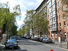
|
| Bozener Strasse |
240 (140 + 100) |
Bolzano , city in South Tyrol | 1908 | The road is T-shaped. Its three branches connect to the Kufsteiner to the west, to the Meraner to the east and to the north to the Grunewaldstrasse. After 1933, the painter and writer Hans Baluscheck lived in Bozener Straße 13/14 . The social democratic theorist Eduard Bernstein lived in No. 18 and the doctor and poet Gottfried Benn lived in No. 20 . |

|
| Brüggemannstrasse | 100 |
Hans Brüggemann (around 1480 to around 1540), sculptor and carver |
March 27, 1939 | The street is located in the listed settlement on Grazer Damm and leads to the Riemenschneiderweg. The name of the development plan was road D . The quiet residential street is part of the listed settlement on Grazer Damm. The former communal apartments from the 1930s have been converted into condominiums. The road meets a large allotment garden via Riemenschneiderweg. |

|
| Brunhildstrasse
( Location ) |
160 | Brunhild , female name | June 14, 1893 | The street leads from Czeminskistraße to Hohenfriedbergstraße . The first plan name was Street 76 . The tenement house No. 10 is listed . The quiet inner-city residential street consists of old and post-war buildings. |

|
|
Bülowstrasse
( Location ) |
1180 | Friedrich Wilhelm Bülow von Dennewitz (1755–1816), Prussian general | Oct. 31, 1864 | The street is part of the “ general train ”. The previous name between 1862 and 1864 was Gürtelstraße (as part of a traffic route surrounding Berlin's inner city). The underground viaduct section running through the street , the Bülowstraße underground station and several other buildings are historical monuments. Until 1961 the Bülowstraße was used by the Berlin tram . The road lies between Nollendorfplatz and Dennewitzplatz (Luther Church) as a higher-level (700 m) and regional road connection (750 m). The further route to the south to Yorckstraße (200 m) is a dead end street without categorization where the houses 48-59 are (continuously), Bülowstraße 45 / Kulmer Straße 37, Yorckstraße 17. Another Bülowstraße is in the triangle towards Kulmer Straße in Zehlendorf (street number: 791) |

|
| Canovastrasse | 110 | Antonio Canova (1757–1822), Italian sculptor | Jan. 12, 1892 | The street, initially referred to as Straße 9 according to the development plan, leads from Thorwaldsenstraße to Rubensstraße . In 1960 the streets were shortened. |

|
|
Cecilien Gardens
( Location ) |
600 |
Cecilie (1886–1954), Crown Princess of Prussia |
1912 | The first name was Street 39 . In the middle, the street forms a central square measuring approx. 200 m × 40 m, which is designated as a garden monument . Access is possible from Traegerstraße in the north, in the south the studio tower with its gatehouse between plots 26 and 27 leads the traffic to Semperstraße. Plots 1–26 are on the west side and 27–53 on the east side. It also has two side entrances, each around 50 meters long, from Rubensstrasse and Sponholzstrasse.
In the “studio tower” of the The listed complex was the work of the painter Hans Baluschek at the end of the 1920s . The literary historian and writer Heinrich Spiero lived in Ceciliengärten 20 . |

|
| Cheruskerstrasse
( Location ) |
700 | Cherusci , tribal association in ancient Germania | June 14, 1893 | The Cheruskerstraße consists mainly of old buildings with good living substance and runs on the western edge of the Schöneberger Insel . It was laid out between 1882 and 1895 and gradually built up with up to four and five-story apartment buildings. The first plan name was 77 Street . The apartment building No. 4 is a listed building. The residential street borders the Cheruskerpark and the railway line on the west side and runs in sections along the north-south path and the inner park ring . |

|
| Courbièrestrasse
( Location ) |
180 | Wilhelm René de l'Homme de Courbière (1733–1811), Prussian Field Marshal General | Apr 25, 1885 | Courbièrestrasse branches off as a dead end from Kleiststrasse. The first plan name was Street 21a . The tenement house no. 6 is a monument. |

|
| Cranachstrasse | 660 | Lucas Cranach the Elder (1472–1553), painter and graphic artist | Jan. 12, 1892 | The residential street with magnificent old buildings from the imperial era and post-war buildings is part of the 'Malerviertel' and leads from Dürerplatz to Thorwaldsenstrasse . The name in the development plan was Straße 9 , the Friedenauer Terraingesellschaft developed the area and named numerous streets in the area after painters. The apartment house # 2 islisted . Rosa Luxemburg lived at Cranachstrasse 58 from 1902 to 1911, a memorial plaque in front of the house. |

|
| Crellestrasse | 800 | August Crelle (1780–1855), mathematician, architect and engineer | March 28, 1958 | The central inner-city residential street with good old buildings, street cafes and a few shops leads from Großgörschenstraße to Kaiser-Wilhelm-Platz . Its northern end is used as a marketplace for the "Crellemarkt". The first name from around 1849 to 1958 was Bahnstrasse . Several tenement houses in the street are listed. The street is part of the Schöneberger scene district, there is a pedestrian connection with a playground and sports field to the Julius-Leber-Brücke S-Bahn station . The steel sculpture Bahndamm by the sculptor Georg Seibert is located on the corner of the Langenscheidt Bridge . |

|
| Czeminskistrasse
( Location ) |
290 |
Franz Czeminski (1876–1945), local politician |
Oct. 1, 1961 | The street connects Monumentenstrasse with Kolonnenstrasse. Its previous name between 1893 and 1961 was Siegfriedstrasse . The nomination was based on Czeminski's longstanding membership in the city council of Schöneberg and in Berlin as well as his work as a city councilor of Berlin. |

|
|
Dennewitzplatz
( Location ) |
180 × 160 × 90 | Dennewitz , town in Brandenburg , scene of a battle in the Wars of Liberation | Oct. 31, 1864 | The Dennewitzplatz is enclosed by the Bülowstraße in the shape of an arch, which is how the name 'Bülowbogen' came about. The Luther Church is on the square . The name between 1862 and 1864 was Gürtelstraße , which according to the Hobrecht plan was to completely surround the inner city area of Berlin. The square with the Luther Church is surrounded by Kulmer Strasse and Dennewitzstrasse , and both streets are congested and, as one-way streets, connect the city center with the districts of Neukölln and Kreuzberg . |

|
| Dennewitzstrasse
( Location ) |
100 (in the district) |
Dennewitz , town in Brandenburg , scene of a battle in the Wars of Liberation | Oct. 31, 1864 | The previous name was Street 22 . The street is divided by the Nelly Sachs Park . The part of the street north of Kurfürstenstrasse is in Tiergarten and Kreuzberg . The Schöneberg section of the street branches off from Bülowstraße and is partially built over with the Nelly Sachs Park. The tenement house No. 24a is a listed building monument. The street consists predominantly of new buildings that have a view of the Nelly-Sachs-Park to the west and an unobstructed view of the newly designed park at Gleisdreieck to the east. Part of the street was added to the Nelly Sachs Park. The road ends for cars as a dead end at the park and continues in the Mitte district (Tiergarten) as a driveway under the same name. | |
| Dominicus Street | 780 |
Alexander Dominicus (1873–1945), politician |
July 31, 1947 | Dominicusstrasse is an inner-city main thoroughfare with a variety of buildings and serves as a feeder to the city motorway . The street lies between Martin-Luther-Straße at the Schöneberg town hall and Sachsendamm . The section between the Sachsendamm and the main road is part of the federal highway 1 , this 390 m belongs to the large-scale road network and the remaining section to the higher-level road network . The previous names were Mühlenweg (handed down to the middle of the 19th century), Mühlenstraße (middle of the 19th century to 1937), Tempelhofer Straße (1884–1947) and Reppichstraße (1937–1947). The St. Norbert Church and the office building No. 2–10, known as the OLEX house , are architectural monuments. Until 1962 a line of the Berlin tram ran through the street. |

|
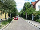
| Domnauer Strasse | 430 | Domnau , city in East Prussia | Sep 1 1926 | The street leads from Eythstraße to Arnulfstraße. On the eastern side of the street is the cemetery on Eythstraße and on the western side of the street there are many listed residential buildings of the Lindenhof estate . The previous name was Straße am Friedhof . The quiet residential street closes the Lindenhof estate to the east. Apartment buildings from the 1920s and 1960s stand on the street. On the east side is the Eythstraße cemetery with the Klarenpfuhl and an area of the district nature and green spaces office. With the Lindenhofweiher, a small park and spacious green spaces between the individual houses, the residential area is in great demand. The street ends just before Eythstraße as a dead end for cars, only pedestrians and cyclists can continue here. |
|
| Dürerplatz | 40 × 40 | Albrecht Dürer (1471–1528), painter, graphic artist and mathematician | Jan. 12, 1892 | The square, located on Straße 5 , later Rembrandtstraße, was laid out by the Schöneberg-Friedenauer Terraingesellschaft. Numerous streets in the area bear the names of painters, which is why the area is known as the "painters' quarter". The square, which is free from car traffic, is located on the A 103 and at the Friedenau S-Bahn station , the S-Bahn route and the motorway run right next to the square. The space is reserved for pedestrians. |

|
| Ebersstrasse | 1240 | Georg Ebers (1837–1898), Egyptologist and writer | June 14, 1893 | The quiet residential street along the Ringbahntrasse, mostly with large old buildings, is located between Herbertstrasse and Innsbrucker Platz . The first plan names were Street 60 and Street 62 . Several buildings, including the Schöneberg S-Bahn station , are listed. A huge apartment block from the 1970s from Prinz-Georg-Straße to Dominicusstraße is on the street. At the Teltow elementary school, the road is open to traffic. A playground was set up on the area with a pedestrian crossing to the Cherusker Park opposite the railway line. The Drachenburg playground is at Prinz-Georg-Straße. At the corner of the main street the street ends at the driveway to the A 100 for cars as a dead end, pedestrians can continue to Innsbrucker Platz. |

|
| Egeling line | 195 | Paul Egeling (1856–1937), architect | March 28, 1958 | The street is in the Schöneberg industrial area. It leads from Bessemerstraße to Alboinstraße and then turns into Bosestraße in the Tempelhof area . Until 1958, the section in Schöneberg was also called Bosestrasse . The short street has TÜV-Rheinland on the north side and a press sales office on the south side. |

|
| Ehrwalder Strasse | 90 | Ehrwald , place in Tyrol | 1913 | The short traffic route leads in a west-east route from Kufsteiner to Meraner Straße. Only the south side of the street is built on with a block of houses, which closes off a uniform square of apartments around a green inner courtyard. |

|
| Eisackstrasse | 200 | Eisack , river in South Tyrol | Sep 14 1927 | The quiet residential street consists of listed apartment blocks from the 1920s, east of Rubensstrasse and is characterized by a listed residential complex by Hans Lassen from the 1920s. To the east of the street is the Eisackstrasse cemetery . There is a no longer used subway tunnel under the street . Until 1927 Eisackstrasse was part of Innsbrucker Strasse. Only the west side of the street is built on. There is a wide median that is used for parking. The east side of the street borders the Eisackstraße cemetery, which is located between Eisackstraße and the A 100. The cemetery protects the residents from the noise of the nearby motorway. In the south the street ends as a dead end. Before the construction of the city autobahn, Eisackstrasse went straight through to Innsbrucker Platz, and since then there has been pedestrian access from the square to Eisackstrasse. |

|
| Eisenacher Strasse | 1800 | Eisenach , city in Thuringia | March 11, 1887 | Eisenacher Strasse leads from Kleiststrasse to Hauptstrasse . Several tenement houses in the street are listed buildings. Until 1962, a line of the Berlin tram ran through the section between Hauptstrasse and Belziger Strasse. The inner-city residential and commercial street has a good infrastructure and there are many small shops, galleries, restaurants and pubs between Hauptstrasse and Grunewaldstrasse. It is a quiet residential street between Grunewaldstrasse and Winterfeldtstrasse and a trendy area for gays and lesbians as far as Kleiststrasse. |

|
| Else-Lasker-Schüler-Strasse
( Location ) |
230 |
Else Lasker-Schüler (1869–1945), poet |
July 3, 1998 | Else-Lasker-Schüler-Straße leads from Kurfürstenstraße to Nollendorfplatz . The tunnel of the underground line U1 runs under the street . The previous names were Motzstrasse and Mackensenstrasse . The centrally located, relatively quiet residential street has good transport links. There are some commercial units on the corner of Nollendorfplatz. The road ends for cars on Kurfürstenstraße and An der Apostelkirche for cars as a dead end street , pedestrians and cyclists can pass. A wasteland is right next to a children's playground. |

|
|
Elßholzstrasse
( Location ) |
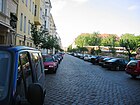
470 | Johann Sigismund Elsholtz (1623–1688), natural scientist | May 12, 1893 | The street leads from Pallasstraße to Grunewaldstraße. The High Court and the Sophie-Scholl-Schule building are historical monuments. There is access to Kleistpark from the street . A quiet residential street with old buildings on the western side of the street and opposite public buildings and entrances to Kleistpark, there is a pedestrian passage to Gleditschstraße. |
|
| Erdmannstrasse | 160 |
Gustav Erdmann (1853–1923), building advisor |
Apr 25, 1890 | The central inner-city residential street with good old buildings in the middle of Schöneberg's trendy neighborhood is between Langenscheidtstrasse and Helmstrasse. The first plan name was Street 13 . The tenement house # 5 islisted . |

|
| Eresburgstrasse |
205 (in the district) |
Eresburg, people's castle of the Saxons in Westphalia | June 12, 1913 | The street is in the Schöneberg industrial area. It leads from Bessemerstrasse to Alboinstrasse and continues in the Tempelhof district to Schöneberger Strasse. Several industrial buildings in the street are listed. In the western part with industrial architecture from the beginning of the 20th century, trade and industry dominate the Schöneberg part of Eresburgstrasse, sometimes with a different use. An old engine shed was converted into Berlin's largest Bauhaus. To the east of Alboinstrasse, in the Tempelhof district, Eresburgstrasse becomes a quiet residential street with no heavy traffic. |

|
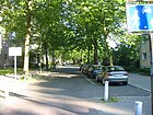
| Erfurter Strasse | 340 | Erfurt , capital of Thuringia | 1912 | The street leads from Fritz-Elsas-Straße to Wexstraße. It is part of a road system running radially from Innsbrucker Platz and built on its northeast side with a continuous row of houses. At the southeast end of Erfurter Straße there is a high-rise in which the social psychiatric service of the district office is located. |
|
| Erika-Gräfin-von-Brockdorff-Platz
( Location ) |
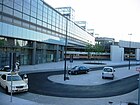
90 × 60 × 40 | Erika Countess von Brockdorff (1911–1943), resistance fighter | April 29, 2011 | The "gray" square (10638) forms the eastern forecourt of the Berlin Südkreuz station at the intersection that was rebuilt in the 2000s. The district boundary between Tempelhof and Schöneberg runs across the square (along the driveway and diagonally across the ring road) and only the part of the station forecourt to General-Pape-Straße belonging to Tempelhof bears the name. The place has priority for taxis and short-term parking. This is where the history trail begins on the former site of the railway regiment. |
|
| Ettaler Strasse
( Location ) |
180 | Ettal , place in Bavaria | March 20, 1957 | As the northern continuation of Bamberger Strasse, the street leads from Geisbergstrasse to Lietzenburger Strasse . Until it was separated by the construction of Lietzenburger Strasse in 1957, Ettaler Strasse was part of Passauer Strasse . The western side of the road and the road area are in Wilmersdorf . |

|
| Eythstrasse
( Location ) |
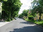
400 | Max Eyth (1836–1906), engineer and writer | Jan. 14, 1911 | The quiet residential street on the edge of the industrial area around Bessemerstraße is between Röblingstraße and Alboinplatz. The name in the development plan was Straße 51 . On the south side of the street there are several listed residential buildings of the Lindenhof estate and the Eythstraße cemetery . On the north side there are apartment blocks from the 1920s. The street ends as a dead end for cars on Röblingstraße, where the turning loop of bus line 106 is located. From here a small footpath leads parallel to Eythstraße behind the apartment block to Bessemer Straße. Until 1962 a line of the Berlin tram ended in Eythstraße. |
|
| Fiery Road | 900 | Adolph Feurig (1830–1890), mayor of Schöneberg | Feb 9, 1895 | The part from Herbertstrasse to Albertstrasse and its extension, designated as Strasse 61 in the development plan, to Tempelhofer Strasse were renamed Feurigstrasse in 1895. This road was formerly known as the path behind the village gardens . The continuation of Feurigstraße to Kolonnenstraße did not take place until 1910. The neighboring buildings of the Brandenburg and Teltow elementary school, the fire brigade and a commercial area (No. 57, 58 and 59) are architectural monuments. On the quiet inner-city residential street there are old buildings and a large apartment block from the 1970s that extends from Prinz-Georg-Straße to Dominicusstraße. At the level of the Baptist Church there is a pedestrian passage with a playground to the main street. There is another passage through the Kaiser-Wilhelm-Passage during business hours. The Teltow elementary school is on the street. The Inner Parkring is on the street . |

|
| Frankenstrasse | 270 | Franconia , West Germanic ethnic group | June 24, 1893 | The street leads from Eisenacher Straße to Goltzstraße. A section between Eisenacher Strasse and Kyffhäuserstrasse is not accessible for motor vehicles. The first plan name was road north . The tenement house No. 14 from the 1890s islisted . |

|
| Fregestrasse |
640 (in the district) |
Ferdinand Ludwig Frege (1804–1883), theologian and historian and pastor in Schöneberg between 1846 and 1883.
The great-great-grandson Freges is Campino , the singer and front man of the music group Die Toten Hosen . |
Apr 29, 1884 | In the district, the plots 57-81 are (continuously) on the west side between Hauptstrasse and Holsteinische Strasse across Saarstrasse. South of the confluence with Holsteinische Strasse, the street is a dead end to Feuerbachstrasse in Steglitz . The road area and the land opposite Schöneberg belong to Friedenau . The first Federal President of the Federal Republic of Germany , Theodor Heuss (memorial plaque on the house) lived in house number 80 from 1918 to 1930 . The three residential buildings No. 57, 58 and 70 are listed. |

|
| Freiherr-vom-Stein-Strasse | 580 | Heinrich Friedrich Karl vom und zum Stein (1757–1831), statesman and reformer | 1910 | The inner-city residential street consists mainly of post-war buildings and a few old buildings and is located on the northern edge of Rudolph-Wilde-Park between Kufsteiner Straße and Martin-Luther-Straße . From 1884 to 1910 the street was part of Erfurter Straße . The three houses No. 11, 11a and 12 are historical buildings. |

|
| Freisinger Strasse | 260 | Freising , city in Bavaria | March 11, 1904 | The street connects the Eisenacher with the Martin-Luther-Straße in west-east guidance. In the western section of the road, the traffic route divides and leads around a wide green strip. There are numerous commercial establishments and small restaurants along the street. |

|
| Fritz-Elsas-Strasse | 720 | Fritz Elsas (1890–1945), politician and resistance fighter | July 20, 1954 | The street lies on the southern edge of the Rudolph-Wilde-Park between Kufsteiner Straße and Dominicusstraße . From 1910 to 1954 the street was called Am Park . The office building from 1938 (No. 9/10) islisted . |

|
| Fritz-Reuter-Strasse | 150 | Fritz Reuter (1810–1874), poet | June 14, 1893 | The street leads from Kärntener Straße to Gustav-Freytag-Straße. On the quiet inner-city residential street in a central location, there are mostly spacious old buildings. The street is very narrow and cobblestone. Gutzkowstraße is the complementary one-way street in a westerly direction.
Worth mentioning in this street are the neighborhood office of the Bündnis 90 / Die Grünen party for Tempelhof-Schöneberg (number 1), a children's shop (number 8) and a neighborhood bookstore (number 12). |

|
| Frobenstrasse
( Location ) |
440 |
Emanuel Froben (1640–1675), stable master in Brandenburg |
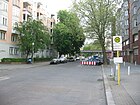
13 Aug 1873 | The street in a good inner city residential area with old buildings and social housing is between Kurfürstenstrasse and Winterfeldtstrasse . The tenement house number 10 from the 1870s islisted . |
|
| Fuggerstrasse
( Location ) |
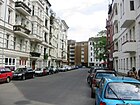
600 | Fugger , Swabian noble family of the nobility , which in 1367 Augsburg was resident | Oct 29, 1957 | The central and quiet residential street with many cafes and restaurants, some of them in magnificent old buildings, has been a center of Berlin's gay scene for decades. It is located between Ansbacher Strasse and Eisenacher Strasse . Fuggerstrasse was part of Augsburger Strasse until it was separated when Lietzenburger Strasse was built in the 1950s . Several tenement houses and the former Hygieia sanatorium in Fuggerstrasse 23 are listed as historical monuments. |
|
|
Geisbergstrasse
( Location ) |
500 (in the district) |
Berg near Wissembourg in Alsace , scene of a battle in the Franco-German War | before 1893 | The street leads from Spichernstrasse in Wilmersdorf to Motzstrasse . The former post office as well as the tenement house No. 40 are architectural monuments. |

|
|
General-Pape-Strasse
( Location ) |
350 (in the district) |
Alexander von Pape (1813–1895), Prussian general | Feb. 2, 1897 | The road land and the eastern side of the road belong to Tempelhof . In Schöneberg, the property at General-Pape-Strasse 1 is located, on which the Südkreuz train station is located, and 40 meters north on Alfred-Lion-Steig is property 25, the west side of the street in the district is essentially formed by the green strip on the railway site. |

|
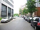
| Geneststrasse | 110 | Werner Genest (1850–1920), engineer and entrepreneur ( Mix & Genest ) | March 27, 1907 | The street branches off as a dead end from Reichartstraße and is a commercial street between the A 100 and several railway lines. The Mix & Genest factory building built at the beginning of the 20th century islisted . For a long time the street was a pure dead end , which ended at the autobahn and could only be reached via the Friedrich-Haak-Brücke. After the construction of the Swedish furniture store on Sachsendamm, IKEA subsidized a pedestrian underpass under the railway so that customers can get to Südkreuz station more quickly . |
|
| Geßlerstrasse
( Location ) |
210 | Friedrich Leopold von Geßler (1688–1762), Prussian Field Marshal General | Aug 3, 1898 | The street leads from Hohenfriedbergstraße to Kesselsdorfstraße . The tenement house No. 14 from the 1890s islisted . The quiet inner-city residential street consists of old and post-war buildings; at the eastern end there is a large sports facility with pedestrian passage across Kesseldorfstrasse to Monumentenstrasse. |

|
| Gleditschstrasse
( Location ) |
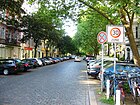
930 | Johann Gottlieb Gleditsch (1714–1786), botanist and doctor | May 12, 1893 | The quiet residential street (cobblestones) with old and post-war buildings leads from Pallasstrasse to Vorbergstrasse and continues as a dead end . The two tenement houses No. 79 and 80 are listed. There is a pedestrian passage across a playground that connects Gleditschstrasse with Belziger Strasse . At the level of Barbarossastraße , a pedestrian path leads under a residential building to Elßholzstraße . |
|
| Goebenstrasse | 400 | August Karl von Goeben (1816–1880), Prussian general | Nov 18, 1874 | Goebenstrasse leads from Potsdamer Strasse to Yorckstrasse . Until 1963 the street was used by the Berlin tram . Goebenstrasse is a busy residential street with a few commercial units and is the superordinate main street in the Berlin road network . On the south side of the street there are many old buildings, while on the north side there are buildings from the 1960s and 1970s. |

|
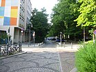
| Goltzstrasse | 800 | Friedrich Goltz (1825–1888), Prussian senior government councilor , advisor to the Schöneberg community in matters of local politics | Apr 29, 1884 | Goltzstraße leads from Winterfeldtstraße to Grunewaldstraße and follows an old cattle drift. The St. Franziskus School building, the former pharmacy on the corner of Pallasstrasse and the two apartment buildings No. 24 and 32 are listed. Until 1963 a line of the Berlin tram ran through the street. The good inner-city residential area with a lot of old buildings and connections to the West-City has a mixture of pubs, cafes and unusual shops. The most striking building is the St. Matthias Church on Winterfeldtplatz. |
|
| Gossowstrasse
( Location ) |
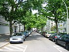
150 | Albert von Levetzow-Gossow (1827–1903), lawyer and member of the Prussian State Council | June 4, 1893 | Gossowstraße is a connecting road from Motzstraße to Winterfeldtstraße . As early as 1900 it was built on with several residential buildings and included house numbers 1–11. |
|
| Gotenstrasse
( Location ) |
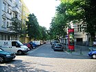
1080 | Goths , East Germanic tribe | June 14, 1893 | Gotenstraße begins on Cheruskerstraße, then runs through the " Schöneberger Insel " and on to Sachsendamm . The ring railway bridge over Gotenstrasse is a listed building. Until 1964 a line of the Berlin tram ran through the street. |
|
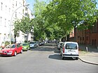
| Gothaer Strasse | 420 | Gotha , city in Thuringia | around 1895 | Gothaer Strasse leads from Grunewaldstrasse to Belziger Strasse . In addition to residential buildings, there is police section 41, the Schöneberg district court and a large vehicle hall to store seized vehicles. The building of the state police headquarters from the 1910s at Gothaer Strasse 19 islisted . |
|
|
Graz dam
( Location ) |
1350 | Graz , city in Austria , capital of Styria | March 27, 1939 | The Grazer Damm leads from Vorarlberger Damm to Prellerweg . On both sides of the street is the one built between 1938 and 1940Listed settlement on Grazer Damm. The naming was typical of the time after the second largest, particularly National Socialist city ( history of Graz # time of National Socialism , city honorary title of the Nazi era # overview of honorary titles and other designations ) in Austria "affiliated" in the year construction began . The former communal apartments have been converted into condominiums. The wide residential street is heavily loaded with traffic, north of Vorarlberger Damm, Grazer Damm continues as the entrance to the Schöneberg interchange . The ensemble of houses has large, quiet inner courtyards with playgrounds and relaxation areas. The superordinate road system of Berlin includes 1370 meters of the road. The Auguste Viktoria Clinic is located at the southwest end of the Grazer Damm. |

|
|
Grazer Platz
( Location ) |
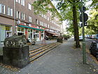
360 × 80 | Graz , city in Austria , capital of Styria | March 27, 1939 | The square forms the center of the settlement on Grazer Damm , around the square there is a one-way street regulation. The Grazer Damm divides the square into a western and an eastern part, the development north and south of the square took place between 1938 and 1940 and the entire ensemble around the Grazer Damm is a listed building. The most striking building is the Nathanael Church. On the eastern part of the square there is a skater facility and a playground, the western part consists of a large lawn for sunbathing. The former GSW apartments have been converted into condominiums. From 1928 to 1939 it was called Nathanaelplatz after the listed Nathanael Church that existed here . The renaming was not simply to adapt the location to the street of the same name, but also because the apostle Nathanael , of Jewish origin, was not wanted as the namesake of a square in the large National Socialist settlement. |
|
|
Großgörschenstrasse
( Location ) |
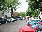
680 | Großgörschen , place in Saxony-Anhalt , scene of a battle in the Wars of Liberation | Sep 20 1865 | The Großgörschenstraße is divided by the S-Bahn line S1. A pedestrian underpass connects the two parts of the street. The western branch of the street runs from Potsdamer Strasse to Mansteinstrasse . To the west of the railway, the street is a relatively quiet residential street with a large number of old buildings. East of the Wannseebahn , it continues to Bautzener Straße. The St. Matthew Cemetery and several tenement houses are listed . During his time as a member of the Reichstag , August Bebel lived temporarily at Großgörschenstrasse 22. There is a weekly market on the corner between Crellestrasse and Mansteinstrasse. At the level of Kulmer Strasse, a road block prevents through traffic. However, pedestrians and cyclists can pass. There is a large playground on Neue Steinmetzstraße. The parish hall of the Silas Church is on the road. In February 2019, the parliamentary group of the Greens in the Friedrichshain-Kreuzberg district called on the local district office to “initiate a public discourse and participation process” in order to rename Großgörschenstrasse, among other things, even though it is not in Friedrichshain-Kreuzberg at all. |
|
| Grunewaldstrasse | 1590 | Grunewald , forest in Berlin | Jan. 21, 1877 | Grunewaldstrasse is the eastern continuation of Berliner Strasse coming from Wilmersdorf and leads to Potsdamer Strasse . The Apostle-Paulus-Kirche , the former Royal Art School (No. 6–7), the former Botanical Museum (No. 2–5) as well as numerous tenement houses are listed. The tunnel of the underground line U7 with the three underground stations Bayerischer Platz , Eisenacher Straße and Kleistpark runs under the street . The road follows the old connection between the villages of Schöneberg and Wilmersdorf and was called Wilmersdorfer Weg until 1877 . Until 1963 a line of the Berlin tram ran through the street. |

|
| Gustav-Freytag-Strasse | 160 | Gustav Freytag (1816–1895), writer | June 14, 1893 | On the quiet inner-city residential street in a central location, there are mostly spacious old buildings. The street is very narrow and cobblestone. The street is between Dominicusstraße and Ebersstraße. The 1900s apartment building No. 3 islisted . |

|
| Gustav-Müller-Platz
( Location ) |
65 × 65 | according to the location on the street of the same name | May 31, 1907 | The square, laid out as a rhombus , divides the street of the same name, which runs in a north-south direction. In a west-east direction there is a road connection between Leberstrasse and the square as well as the square and Naumannstrasse.
The Queen Luise Memorial Church in the middle of the square takes up almost its entire area and is a listed building. |
|
| Gustav-Müller-Strasse
( Location ) |
730 |
Gustav Adolph Müller (1846–1904), mayor of Schöneberg |
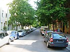
June 30, 1905 | The street runs through the " Schöneberger Insel " from Kolonnenstraße to Torgauer Straße, it is a quiet residential street with beautiful old buildings and some commercial space. Its course is interrupted by the square of the same name with the dominant Queen Luise Memorial Church.
The 1900s apartment building number 45 is listed . |
|
| Gutzkowstrasse | 150 | Karl Gutzkow (1811–1878), writer | June 14, 1893 | The traffic route leads from Kärntener Strasse (originally Maxstrasse ) to Gustav-Freytag-Strasse. On the quiet inner-city residential street in a central location, there are mostly spacious old buildings. The street is very narrow and cobblestone. Gutzkowstraße is a one-way street in an easterly direction in addition to Fritz-Reuter-Straße. The 1900s apartment building No. 5 islisted . |

|
| Haberlandstrasse | 120 |
Salomon Haberland (1836–1914), entrepreneur |
around 1900
|
The street is located in the Bavarian Quarter and leads from Aschaffenburger to Landshuter Straße. From 1938 to 1996 the northern section of the traffic route was called Nördlinger Straße . Haberlandstrasse already existed around 1900 and was divided into 13 parcels. It consisted of Haberlandstrasse, which was renamed in 1996 (going south from Barbarossastrasse) and the transverse southern section of the street between Aschaffenburger and Landshuter Strasse (since 1938 Treuchtlinger Strasse ).
Albert Einstein lived in the house at Haberlandstrasse 5, which was destroyed in the Second World War, from 1918 to 1933 . |

|
| Habsburgerstrasse
( Location ) |
210 | Habsburg , European dynasty whose name from their ancestral castle of Habsburg in the canton of Aargau derives | 3rd Sep 1896 | The road leads from Winterfeldtstrasse to Hohenstaufenstrasse. It was first written on Habsburgstrasse . The apartment houses from the 1890s are No. 6/7listed .
During his time as a member of the Reichstag , August Bebel temporarily lived at Habsburger Strasse 5. |

|
| Harkortplatz * |
45 × 40 × 40 (triangular) |
Friedrich Harkort (1793–1880), businessman and politician |
not clear | The longest side of the square is on the undeveloped north side of Harkortstrasse and is enclosed to the northwest and northeast by the row houses on Röblingstrasse and Arnulfstrasse. Since it is not listed in the register of the Federal Statistical Office (no postal address), the residents probably introduced it that way. This space does not exist in the address books from 1932 on either.
Not the square, but the entire Lindenhof settlement is a garden monument. |

|
| Harkortstrasse | 130 |
Friedrich Harkort (1793–1880), businessman and politician |
Sep 9 1931 | The street lies between Röblingstrasse and Arnulfstrasse. There are several listed residential buildings of the Lindenhof estate along the street . Until 1931 the street was called Marienstraße and comprised 8 parcels. The new name is listed in the 1932 address book. |

|
|
Main road ( Location ) |
2430 (in the district) |
Function as the most important thoroughfare in Schöneberg | 27 Aug 1881 | The main street leads through the old village center of Schöneberg and widens to the old village meadow. It is a busy shopping and thoroughfare with two lanes in each direction and a sometimes very wide median. The section north of Dominicusstrasse is part of Bundesstrasse 1 . In the district lies the street between Innsbrucker Platz and Grunewald- / Langenscheidtstraße. South of Innsbrucker Platz, the eastern side of the street (83-95) belongs to the district, the road between Innsbrucker and Breslauer Platz ( Rheinstraße ) and the west side (64-82, continuous) runs in Friedenau . The traffic route previously had three different names. A route known as the Botanical Garden Street in the 1870s merged with Hauptstrasse in the 1890s. Many buildings on the main street, including the Schöneberg village church , are listed buildings. Until 1964 a line of the Berlin tram ran through the street. During his time as a member of the Reichstag , August Bebel lived temporarily at Hauptstrasse 84 and most recently at Hauptstrasse 97. The Schöneberg village church and the Schöneberg Museum as well as the Alt-Schöneberg cemetery are on the street. Access to the cemetery is on Belziger Strasse. There is a pedestrian passage with a playground to Feurigstrasse and via Heinrich-Lassen-Park to Belziger Strasse. Schöneberger Hauptstrasse (1861) is one of seven main streets in Berlin in ten districts. |

|
| Hedwig-Dohm-Strasse | 180 | Hedwig Dohm (1831-1919), writer and women's rights activist | July 24, 2007 | The street was laid out in connection with the construction of the Südkreuz train station in the 2000s on a former allotment garden. Together with part of Naumannstraße and the newly built Wilhelm-Kabus-Straße, it forms a cross-connection between Sachsendamm and Kolonnenstraße. |

|
| Hedwigstrasse |
180 (in the district) |
Hedwig Neumann, daughter of the Schöneberg pastor Ferdinand Ludwig Frege | Apr 29, 1884 | Hedwigstraße leads from the main street in Friedenau to Sponholzstraße in Schöneberg. The country house built in 1888 at number 8 islisted . The Friedenau Kinderhaus is located at Hedwigstrasse 13 as an integrative day-care center. |

|
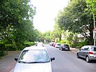
| Heilbronner Strasse | 500 | Heilbronn , city in Baden-Württemberg | 1902 | The street is located in the Bavarian Quarter and leads from Hohenstaufenstrasse to Rosenheimer Strasse. The first plan name was Street 17b . TheChurch to Heilsbronnen and parts of the rental house No. 3 / 3a from 1904 arelisted . |
|
| Helmstrasse | 140 | "Zum Helm", a former restaurant in the street area | March 1, 1881 | The street is between Hauptstraße and Crellestraße . It was laid out by Gustav Erdmann's construction company in 1892 at its own expense in order to open up further construction areas in Neu-Schöneberg . It is a centrally located inner-city residential street with good old buildings. The street ends at Crellestrasse for cars as a dead end with a pedestrian connection to the Julius-Leber-Brücke S-Bahn station . |

|
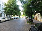
| Herbertstrasse | 140 | Herbert Baumann, son of bank director Robert Baumann | March 1, 1888 | Herbertstrasse leads from Kolonnenstrasse over Feurigstrasse and becomes Ebersstrasse after approx. 100 meters. Previously it was the planned streets Straße 61 and Straße 62 as well as the path behind the village gardens . They were re- routed several times , with individual sections coming to other roads.
The name was given at the request of the landowner Baumann, who made the area for the street available to the community of Schöneberg free of charge, he wanted to remember his son who died early. There are mostly old buildings on the quiet inner-city residential street. There is a playground on the corner of Feurigstraße, a pedestrian crossing over the railway line on Ebersstraße leads to Cheruskerpark. |
|
| Hertha Block Promenade | 180 | Hertha Block, librarian and resistance fighter against the Nazi regime, who was imprisoned in the nearby SA prison in Papestrasse | Nov 8, 2012 | The Hertha-Block-Promenade connects the districts of Tempelhof and Schöneberg, it is divided into three sections: from Gontermannstraße to Alfred-Lion-Steg over the railway line and from there to Schöneberger Insel to Leuthener Platz . It is part of the newly created east-west green corridor , which was opened to the public on November 8, 2012 in the presence of the then Senator for Urban Development and the Environment, Michael Müller , and the District Mayor of Tempelhof-Schöneberg, Angelika Schöttler . The promenade created a green pedestrian connection over the Parkring to Tempelhofer Freiheit . |

|
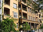
| Hewaldstrasse | 180 | Hewald, name of an old farming family from Schöneberg | Feb. 17, 1911 | Hewaldstrasse leads from Fritz-Elsas-Strasse to Heylstrasse. The first plan name was W Street . The tenement ensemble No. 2–10 is a listed building monument. |
|
| Heylstrasse | 390 | Fritz Heyl (1833–1908), local politician in Schöneberg | Dec 28, 1899 | Heylstraße leads from Erfurter Straße to Koburger Straße. According to the Hobrecht plan , it was initially street 92 . Several tenement houses from the 1910s are listed. The actress Inge Meysel lived in the house at Heylstrasse 29 for a few years . The Berlin administration had a commemorative plaque put up on July 10, 2014. On the quiet inner-city residential street, there are predominantly old and post-war buildings. |

|
| Hildegard-Knef-Platz
( Location ) |
140 × 90 ( pentagonal shape ) |
Hildegard Knef (1925–2002), actress and singer | Dec 17, 2007 | The square forms the western forecourt of the Südkreuz station , which was newly built in the 2000s . The unadorned western forecourt serves as a bus and taxi stop for rail travelers, here the north-south path connects . |

|
| Hochkirchstrasse
( Location ) |
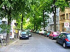
290 | Hochkirch , a town in Saxony , the scene of a battle in the Seven Years' War | 1912 | Hochkirchstraße leads from Großgörschenstraße to Monumentenstraße in a north-south direction. The residential street, which is densely built with mostly historical buildings, has a pedestrian connection to Bautzener Straße via Bautzener Platz. |
|
| Hohenfriedbergstrasse
( Location ) |
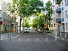
340 | Hohenfried (e) berg , place in Silesia , scene of a battle in the Second Silesian War | June 14, 1893 | The street leads from Monumentenstraße to Kolonnenstraße. The quiet inner-city residential street has old and post-war buildings on both sides as well as some new buildings. To keep the street free from through traffic, some bollards have been set up at Brunhildstrasse. There is a playground on the corner of Monumentenstrasse. |
|
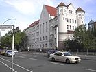
| Hohenstaufenstrasse | 1340 | Hohenstaufen , German noble family whose name from the castle Hohenstaufen derives | June 15, 1892 | The road is part of the important traffic axis and is listed in the Berlin system as Category II: superordinate road connection. Nachodstraße in Wilmersdorf connects to the west and Pallasstraße to the east . The previous name in the zoning plan was Straße 18 . The tenement houses No. 5, 7 and 62 are architectural monuments. |
|
|
Innsbrucker Platz
( Location ) |
110 (diameter) |
Innsbruck , city in Austria , capital of Tyrol | Sep 14 1927 | The Innsbrucker Platz is crossed by a bridge of the Ringbahn and a tunnel of the city motorway . The S-Bahn station Innsbrucker Platz is on the south side of the square . The square was completely redesigned as part of the north-south route of the main road during the construction of the city motorway . Innsbrucker Platz is the exit of the city autobahn, with 50 m of road land as the superordinate and the other 110 meters as regional roads of the Berlin system . |

|
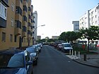
| Innsbrucker Strasse | 1100 | Innsbruck , city in Austria , capital of Tyrol | Oct 25, 1907 | The street lies between Bayerischer Platz and Innsbrucker Platz . Eisackstrasse was part of Innsbrucker Strasse until 1927. The tunnel of the underground line U4 runs under the street . The street section through Rudolph-Wilde-Park is not accessible by motor vehicles, this is where the Rathaus Schöneberg underground station is located . The street without the unnamed part of the park is 940 meters long, 500 meters north and 370 meters south of the park. The rest of the route to Innsbrucker Platz is designed as a parking area and 70 meters as a footpath to the pedestrian zone around Innsbrucker Platz. The office building No. 26/27 as well as several tenement houses are listed. House number 24 is the house where Helmut Newton was born . |
|
| John F. Kennedy Square | 140 × 60 |
John F. Kennedy (1917–1963), President of the United States , gave his speech on this square from the balcony of the City Hall with the famous sentence: " I am a Berliner ". |
Nov 25, 1963 | The square is on Martin-Luther-Straße and forms the forecourt of the Schöneberg town hall . The previous name from 1911 to 1963 was Rudolf-Wilde-Platz . The only adjacent to the square is the Schöneberg Town Hall , seat of the Tempelhof-Schöneberg District Council . In the days of West Berlin , the Senate directed the city's fortunes here. | |
|
Kaiser-Wilhelm-Platz
( Location ) |
90 × 80 × 40 | Wilhelm I (1797–1888), German Emperor | around 1905 | At the busy town square, Kolonnenstrasse , Crellestrasse and Akazienstrasse merge into Hauptstrasse . The old Schöneberg Town Hall stood here between 1874 and 1914 . The apartment buildings no. 4 and 5 are listed . on Schöneberger Hauptstrasse. The shopping and nightlife options are excellent, as is the connection to public transport. There are a few street cafes and the Kaiser-Wilhelm-Passage around the square. In addition to a fountain, a memorial on the square commemorates the former concentration camps. Another Kaiser-Wilhelm-Platz is located at the Podbielskiallee underground station in Dahlem. | |
| Kalckreuthstrasse
( Location ) |
300 | Friedrich Adolf von Kalckreuth (1737-1818), Prussian Field Marshal General | before 1900 | The street leads from Kleiststraße to Motzstraße . The apartment buildings No. 7 and 16 are listed. Part of the Berlin State Archive has been located here since 1976 (Kalckreuthstrasse 1/2). |

|
| Karl-Heinrich-Ulrichs-Strasse
( Location ) |
260 (in the district) |
Karl Heinrich Ulrichs (1825–1895), champion of the legal equality of homosexuals | Dec 17, 2013 | Karl-Heinrich-Ulrichs-Straße leads from Lützowplatz in Tiergarten to Nollendorfplatz . Until 1934 it was part of Maaßenstrasse. From 1934 to 2013 it was called Einestrasse . |

|
| Karl-Schrader-Strasse | 160 | Karl Schrader (1834–1913), founder of numerous social institutions | Oct 28, 1913 | Karl-Schrader-Straße in a good residential area with excellent infrastructure is the southern continuation of Kyffhäuserstraße and leads from Barbarossastraße to Schwäbische Straße . Until 1913, the street was part of Kyffhäuserstraße. The Pestalozzi-Froebel-Haus, the former 'Henriettenheim', islisted . Another is the technical college for health and social affairs. |

|
| Kärntener Strasse | 420 | Carinthia , federal state in Austria | Feb. 1, 1963 | The road branches off from the main road , crosses under the Ringbahn and then ends as a dead end . On the quiet inner-city residential street in a central location, there are mostly spacious old buildings in the northern part. The street name from 1899 to 1963 was Maxstraße . The tenement houses No. 3, 4 and 8 are architectural monuments. |

|
| Katzlerstrasse
( Location ) |
220 | Friedrich Georg Andreas von Katzler (also: Katzeler , 1765–1834), Prussian military | Apr 2, 1891 | The street leads from Yorckstraße to Großgörschenstraße. The first name was Street 20 of the zoning plan. |

|
| Kauschstrasse | 210 | Walther Kausch (1867–1928), surgeon | Aug 16, 1928 | Kauschstraße is located in the settlement on Grazer Damm and leads from Grazer Platz to Peter-Vischer-Straße. The traffic route is dominated by residential ensembles from the 1920s and 1930s. |

|
| Keithstrasse
( Location ) |
280 (in the district) |
James Keith (1696–1758), Prussian general | March 26, 1872 | Keithstrasse leads from Lützowufer in Tiergarten to Kleiststrasse . The Schöneberg section south of Kurfürstenstraße was called Lutherstraße until March 1939 and was the straight continuation of Martin-Luther-Straße until the 1950s . The tenement houses No. 12 and 19 are architectural monuments. |

|
| Kesselsdorfstrasse
( Location ) |
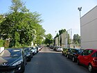
110 | Kesselsdorf , place in Saxony , scene of a battle in the Second Silesian War | Oct 10, 1936 | The street leads from Kolonnenstrasse to Geßlerstrasse. From 1920 to 1936 it was called Immelmannstrasse . On the east side, Kesselsdorfstrasse borders the sports grounds of the BSC Kickers 1900. The west side consists of a fallow area. The street used to run from Monumentenstraße to Dudenstraße, since then a public footpath from Gellertstraße connects both streets. The path leads past an asbestos ruin that opened as a school in 1973. |
|
| Kielganstrasse
( Location ) |
110 |
Georg Friedrich Kielgan (1807–1876), landowner in the north of Schöneberg |
July 6, 1870 | The street is in the Kielgan district and branches off from Kurfürstenstraße as a cul-de-sac . The country house no. 5 is listed. |

|
| Kirchbachstrasse
( Location ) |
160 |
Hugo von Kirchbach (1809–1887), Prussian infantry general |
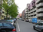
Nov 18, 1874 | According to the development plan laid out as street L, section III , the street leads from Alvenslebenstraße to Goebenstraße. A separate city car park was built on the parcel Kirchbachstrasse 1/2 in 2013 . |
|
| Kleiststrasse
( Location ) |
580 |
Friedrich von Kleist (1762–1823), Prussian field marshal |
Oct. 31, 1864 | The street is part of the “ general train ” and lies between Wittenbergplatz and Nollendorfplatz . The lanes of Kleiststrasse are categorized in Berlin's transport network : 650 meters as a superordinate and 180 meters as a regional road connection. The tunnel for the underground lines U1 , U2 and U3 runs under Kleiststraße . At the eastern end of Kleiststrasse, the U2 line leaves the tunnel and continues on an elevated viaduct. Until 1964 a line of the Berlin tram also ran through the street. The commercial building No. 23-26 from the 1950s is a listed building monument. |

|
| Klixstrasse | 120 |
Gustav Adolf Klix , (1822–1891), Provincial School Council |
July 26, 1897 | According to the development plan laid out as street 4 , the street leads from Grunewaldstraße to Apostel-Paulus-Straße. The apartment buildings No. 2 and 3 are under monument protection. |

|
| Knausstrasse |
170 (in the district) |
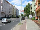
Ludwig Knaus (1829–1910), painter | Jan. 12, 1892 | Knausstraße connects Saarstraße coming from Friedenau with Thorwaldsenstraße. The road area and the western side of the road are in Steglitz . |
|
| Koburger Strasse | 210 | Coburg , city in Bavaria | Apr 21, 1894 | The street leads from Fritz-Elsas-Straße to the main street . On the quiet inner-city residential street in a central location, there are predominantly old buildings whose war gaps were filled with a few post-war and new buildings. At Fritz-Elsas-Straße, Koburger Straße ends as a dead end for cars, pedestrians and cyclists can continue.
The street name goes back to a historical spelling for the city in Bavaria that was often used before 1920. Only a decree of the government of Upper Franconia on October 30, 1920 made the Coburg spelling binding for the city . |

|
| Kolonnenstrasse
( Location ) |
960 | Approach of the Prussian military to Tempelhofer Feld | around 1860 | A wide, busy thoroughfare in a central location with residential and commercial buildings. The Kolonnenstrasse branches off from the Hauptstrasse at Kaiser-Wilhelm-Platz , crosses two railway lines at the Julius-Leber-Brücke and the Kolonnenbrücke and then merges into Dudenstrasse in Kreuzberg . Architectural monuments include the Old Twelve Apostles Churchyard , St. Elisabeth Church , the former Lesser department store (No. 10/11) and the Robert-Blum-Gymnasium (No. 21-23). In 2008 the new Julius-Leber-Brücke S-Bahn station was opened on Kolonnenstrasse . Until 1964 a line of the Berlin tram ran through Kolonnenstrasse. | |
| Kufsteiner Strasse | 820 | Kufstein , city in Tyrol | June 15, 1906 | The street lies between Grunewald and Freiherr-vom-Stein-Straße (across Badensche Straße ) and to the south by Rudolph-Wilde-Park between Wexstraße and Fritz-Elsas-Straße ( Hans-Rosenthal-Platz ). The western properties and the road area belong to Wilmersdorf , all the intersections, including Hans-Rosenthal-Platz, are not in Schöneberg. Numerous tenement houses on the Schöneberg side are listed. Properties 1–19 and 39–59 (residential buildings, 11/13 leads to Bozener Straße), 21/25 and 27/33 (University of Economics and Law), 71 / belong to Schöneberg (odd numbered and addressed with Kufsteiner Straße), 79 (customs office). Likewise, the Parkweg in the course of the traffic-calmed zone of Kufsteiner Straße is the Tempelhof-Schöneberg / Charlottenburg-Wilmersdorf district border, Schöneberg is only east of the path (Rudolf-Wilde-Park). The street with both sidewalks in Wilmersdorf is planted with trees throughout. |

|
|
Kulmer Strasse
( Location ) |
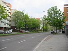
430 | Kulm , city in Bohemia , the scene of a battle in the Wars of Liberation | Nov. 27, 1864 | Kulmer Straße leads from Dennewitzplatz to Großgörschenstraße. Most of its tenement houses, most of which date from the 1880s, are listed . |
|
|
Kurfürstenstrasse
( Location ) |
2000 | Electors , imperial princes who were entitled to elect the Roman-German king | Sep 1 1863 | The street lies along the northern boundary of the district between Nürnberger Straße and Dennewitzstraße. The northern side of the street and the street land belong to Tiergarten and lie beyond the district boundary to Mitte . The building of the University of Technology , the Landhaus No. 132 and the apartment buildings No. 153, 154 and 167 are historical monuments. Between Goebenstrasse and Großgörschenstrasse, Kulmer Strasse is a quiet residential street that is predominantly built with residential buildings from the Wilhelminian era. To the north of Goebenstrasse are buildings from the 1960s and 1970s. In this area the traffic load on the road is very high. The street ends at Dennewitzplatz and the Luther Church. In the southern road area, the car traffic is diverted to Großgörschenstrasse, so that you can only continue to Mansteinstrasse. Through this traffic management, through traffic is kept away. |

|
| Kurmärkische Strasse
( Location ) |
130 | Kurmark , historical part of the Mark Brandenburg west of the Oder | Sep 18 1934 | The street leads from the street An der Apostelkirche to Frobenstraße. Due to the renaming, the NSDAP district administration “Kurmark”, which previously resided at “An der Apostelkirche 8”, was given the representative address “Kurmärkische Straße 1”, which may have motivated the change. The tenement houses No. 11 and 13 are listed. |

|
| Kyffhäuserstraße | 310 | Kyffhäuser , low mountain range southeast of the Harz | June 15, 1892 | Kyffhäuserstraße leads from Hohenstaufenstraße to Barbarossastraße. The later Karl-Schrader-Strasse was also part of Kyffhäuserstrasse until 1913. The tenement houses No. 9, 10 and 11 as well as the former school building No. 23 are under monument protection . A quiet inner-city residential street with good old buildings and infrastructure. |

|
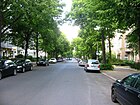
| Landshuter Strasse | 510 | Landshut , city in Bavaria | 1902 | Landshuter Strasse is located in the Bavarian Quarter and leads from Hohenstaufenstrasse to Bayerischer Platz . The tenement house No. 15 is listed. |
|
| Langenscheidtstrasse | 310 |
Gustav Langenscheidt (1832–1895), publisher |
Sep 9 1931 | The road branches off from the main road and leads to the Langenscheidt bridge, which leads over the ring railway . The street then continues in Monumentenstraße. The Langenscheidt publishing house had very close in the Crellestraße his publishing house. Until 1931 the street was called Stubenrauchstraße . The apartment buildings No. 1 and 12 are listed . The central inner-city residential street has good old buildings. The steel sculpture "Bahndamm" by Georg-Seibert is at the intersection with Crellestrasse. |

|
| Leberstrasse |
730 | Julius Leber (1891–1945), politician and resistance fighter | July 31, 1947 | The Leberstrasse leads from the Kolonnenstrasse through the Schöneberger Insel to Torgauer Strasse. From 1871 to 1937 it was called Sedanstrasse and from 1937 to 1947 Franz-Kopp-Strasse . Marlene Dietrich was born on Leberstrasse and Hildegard Knef lived on the street for a while. The apartment buildings No. 1, 3, 13, 18 and 32 are listed architectural monuments. Marlene Dietrich was born in Leberstrasse and Hildegard Knef spent the first five years of her life here. Until 1964 a line of the Berlin tram ran through the street. In the quiet residential street there are old buildings and a few businesses and cafés that offer various freshly roasted coffees. The north-south path and the inner park ring are on the street . |

|
|
Leuthener Platz
( Location ) |
50 × 50 | Leuthen , place in Silesia , scene of a battle in the Seven Years War | Apr 3, 1930 | Leuthener Platz is located on Schöneberger Insel at the eastern end of Leuthener Straße between Gustav-Müller-Straße and Naumannstraße. There is a listed public lavatory (“ Café Achteck ”) on the square . |
|
| Leuthener Strasse
( Location ) |
300 | Leuthen , place in Silesia , scene of a battle in the Seven Years War | June 14, 1893 | Leuthener Straße (first spelling according to the address book Leuthenstraße ) is a quiet residential street with old buildings on the Schöneberger Insel from Cheruskerstraße to Gustav-Müller-Straße. To the east, the Hertha-Block-Promenade continues over the Alfons-Lion-Steg to Tempelhof on Gontermannstraße. With the demolition of commercial barracks for the promenade, the eastern 100 meters were replaced. The lane narrows at Leuthener Platz and is a one-way street in an easterly direction. The street leads the north-south path and the inner park ring . |
|
|
Lietzenburger Strasse
( Location ) |
550 (in the district) |
"Lietzenburg", the original name of Charlottenburg Palace | Sep 1 1963 | The Lietzenburger Strasse was expanded as a bypass of City West and relieves the Kurfürstendamm - Tauentzienstrasse --Kleiststrasse running parallel street . The two-lane section between Passauer and the confluence of Martin-Luther- / Kleiststraße with the north-south route belongs to Schöneberg. The Schöneberg section was laid out in the 1950s on war-torn terrain across the historic road grid and was called the Südtangente until 1963 . The western section of the street has existed since the 19th century and is located in Wilmersdorf and Charlottenburg . The road has two lanes with up to five lanes each and a green median strip 3 to 30 meters wide. |

|
| Lindauer Strasse | 160 | Lindau , city in Bavaria | 1903 | Lindauer Strasse leads from Hohenstaufenstrasse to Eisenacher Strasse.
On April 15, 2013 , the district mayor Angelika Schöttler inaugurated a memorial plaque for the writer Franz Hessel , who lived here, at Lindauer Strasse 8 . Hessel mainly wrote feature articles about Berlin and was a victim of National Socialism in 1941 . |

|
| Lotte-Laserstein-Strasse | 160 | Lotte Laserstein (1898–1993), painter | July 24, 2007 | The street is uninhabited and branches off from Sachsendamm and is the entrance to the parking garage at Südkreuz station . The southern end of Naumannstrasse ran here until the station was built. Rail travelers can change trains in the Wendeschleife and there is direct access, which is part of the north-south path , from the street to Hans-Baluschek-Park, which leads over the pedestrian bridge on Sachsendamm and the A 100 . |
|
| Luitpoldstrasse |
630 (400 + 230) |
Luitpold von Bayern (1821–1912), Prince Regent of the Kingdom of Bavaria |
June 10, 1897 | Luitpoldstrasse originally ran from Münchener Strasse all the way to Habsburgerstrasse. The site of the Werbellinsee primary school now divides the road into two separate branches. The apartment houses No. 3, 5, 6, 26 and 47 are listed architectural monuments. The writer Hans Fallada spent his childhood in the house on Luitpoldstrasse 11, which was destroyed in World War II . |

|
| Maassenstrasse | 200 |
Karl Georg Maaßen (1769–1834), Prussian politician |
July 6, 1870 | Maaßenstraße leads from Nollendorfplatz to Winterfeldtplatz , a busy street with many pubs in a good downtown location. Einestrasse was also part of Maaßenstrasse until 1934 . The apartment building No. 7 is listed. According to the will of the Berlin Senate Department for Transport, this street was a test field for mixed traffic in 2014: Here all participants, i.e. pedestrians, cyclists and motorists, have equal rights. |

|
| Magirusstrasse | 200 | Magirus , former vehicle manufacturer | Apr 10, 1931 | According to the development plan, it was laid out as Straße 4 in the Schöneberg industrial area. It connects Bessemerstraße with Alboinstraße. Until 1943 the address books show them as "undeveloped". The TÜV Rheinland buildings border the southern side of the short street. while on the north side there are some old industrial buildings. |

|
| Maienstraße
( Location ) |
120 | May , old term for twigs or trees | July 6, 1870 | Maienstraße is a spur road from Karl-Heinrich-Ulrichs-Straße and is part of the Kielgan district . The two villas at Maienstraße 3 and 4 ( Friedrich Luft's villa ) are architectural monuments. |
|
| Mansteinstrasse
( Location ) |
190 | Gustav von Manstein (1805–1877), Prussian general | Nov 18, 1874 | The street is between Goebenstrasse and Großgörschenstrasse. The apartment building No. 4, in which the traditional Leydicke restaurant is located, is listed . On the quiet residential street there are mainly residential buildings from the Wilhelminian era with a few commercial units. There is a weekly market on the corner between Crellestrasse and Großgörschenstrasse. The north-south path is on the road |

|
| Martin-Luther-Strasse | 2470 | Martin Luther (1483–1546), theologian and church reformer | Dec 28, 1899 | The street is an important inner-city north-south connection and lies Lietzenburger Straße / Kleiststraße and Hauptstraße just before Innsbrucker Platz . The section south of Motzstrasse was called Rostocker Strasse from 1884 to 1893 and Heinrich-Kiepert-Strasse from 1893 to 1899 . The section north of Motzstraße belonged to Charlottenburg until 1938 and was called Lutherstraße until 1963 . Several buildings are listed . Until 1964 a line of the Berlin tram ran through the street. 1870 meters of the street belong to the superordinate street system in the street An der Urania (northwards) and Dominicusstraße (south to the city motorway ), another 550 meters are regional roads and ultimately 50 meters are uncategorized (local) streets. The lively inner-city street runs through the district from north to south. The development is very diverse: residential and commercial buildings, old and new buildings as well as various administrative buildings alternate. | |
| Matthäifriedhofsweg | 360 | Adjacent former second cemetery of the St. Matthew parish , now 'Friedhof Priesterweg'. | around 1900 | The path is officially run as a private road for 150 meters , the further route (initially through allotments) to the north-south path and the pedestrian crossing to the Schöneberg southern area is not dedicated. After the cemetery was laid out, the name Matthäifriedhofsweg became established , sometimes referred to as the Matthäuskirchhofweg . In its course, a road 26 was planned in a development plan from 1909 , and road 144 was planned in a similar course at the end of the 1950s . At the end of the 1920s, the area of the road was laid out for settlement construction. |

|
| Meininger Strasse | 150 | Meiningen , city in Thuringia | after 1899 | The street leads from Martin-Luther-Straße to Gothaer Straße. It was first listed in the Berlin address book in 1901, still without house numbers, but four owners with new buildings were entered.
Meininger Strasse 10 used to house a hostel and was the founding seat of the "Meininger Hotel Group", which has now expanded. After the main building was closed, the building was renovated and converted into a residential building; the former lobby is rented out as office space. |
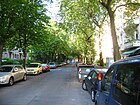
|
| Menzelstrasse | 390 |
Adolph von Menzel (1815–1905), painter |
Jan. 12, 1892 | The street is located in the Schöneberg 'Malerviertel' and leads from Rembrandtstrasse to Peter-Vischer-Strasse . The apartment buildings No. 1–3, 29/30 are listed . The residential street is built on with old buildings from the imperial era. |

|
| Meraner Strasse | 620 | Meran , city in South Tyrol | 1908 | The street leads from Bayerischer Platz to Freiherr-vom-Stein-Straße. |

|
| Merseburger Strasse | 200 | Merseburg , city in Saxony-Anhalt | June 14, 1893 | The street leads from Apostel-Paulus-Straße to Belziger Straße. This is where the school building , built in the 1890s and then called Prinz-Heinrich-Gymnasium , stands (address: Grunewaldstrasse). Bricklayers, carpenters and innkeepers were the first property owners and had houses built. |

|
| Mettestrasse | 100 | Mette, name of a Schöneberg farming family, including the Schöneberg city councilor Gustav Mette (1840–1915) | 17 Sep 1915 | Mettestrasse branches off as a dead end from Hans-Rosenthal-Platz . From 1911 to 1915 it was called Sternberger Straße . The school building at Mettestrasse 8 by Paul Egeling from 1908 is a listed building . In the street is only the broadcast home of Germany radio , from here sent earlier the RIAS . |

|
| Monument Street
( Location ) |
640 (in the district) |
National monument (" Monument ") on the Kreuzberg | Jan. 9, 1901 | The street continues the Langenscheidtstraße in an easterly direction. It crosses a railway area on the Monumentenbrücke and runs from there in Kreuzberg to Katzbachstraße. In the 19th century the street was called Ziegeleiweg . The monument bridge and the tenement house No. 35 are listed. Despite many measures to calm traffic, the road is heavily used by through traffic. In addition to residential buildings (mostly good old buildings) there are a few commercial yards and a recycling yard as well as a large sports facility. There is a pedestrian passage to Kesseldorfstrasse . |

|
|
Motzstrasse
( Location ) |
1140 (in the district) |
Friedrich von Motz (1775–1830), Prussian statesman |
July 6, 1870 | Motzstraße leads from Nollendorfplatz to Prager Platz . Until 1934 Else-Lasker-Schüler-Strasse was also part of Motzstrasse. The section between Nollendorfplatz and Martin-Luther-Straße was initially called Straße 20 according to the development plan and was included in Motzstraße in 1889. The section between Viktoria-Luise-Platz and Prager Platz was called Königshofer Straße from 1890 to 1901 . The section west of Bamberger Straße runs in Wilmersdorf . Several tenement houses are architectural monuments . The tunnel of the underground line U4 runs under the street between Nollendorfplatz and Viktoria-Luise-Platz . Until the end of the Second World War , a tram line ran in part of Motzstrasse . The different sections of Motzstraße have different characters. Between Nollendorfplatz and Martin-Luther-Straße is the center of gay and lesbian life in Berlin, there is an annual street festival. In the central residential and commercial street there are pubs and restaurants, as well as hotels and hostels and flashy shops. To the west of Martin-Luther-Straße there are fewer shops and spacious old buildings are more often interspersed with new buildings. |

|
| Munchener Strasse | 850 | Munich , capital of Bavaria | 1902 | The street begins at Viktoria-Luise-Platz and leads through the Bavarian Quarter to Apostel-Paulus-Straße. The apartment buildings No. 26, 27, 48 and 54 are listed. The tunnel of the underground line U4 runs under the street between Viktoria-Luise-Platz and Rosenheimer Straße. |

|
| Munsterdamm |
220 (in the district) |
Munster , city in Lower Saxony | 1902 | Most of the street is located in Steglitz between Schöneberger Prellerweg and Steglitzer Damm. In Schöneberg is the Munsterdamm 90 property on the northwest corner of the Prellerweg am Insulaner with the Planetarium am Insulaner and the Wilhelm Foerster Observatory (Munsterdamm 86-88). |

|
|
Naumannstrasse
( Location ) |
1150 |
Friedrich Naumann (1860–1919), theologian and politician |
Aug 9, 1929 | Naumannstrasse is a quiet residential street with beautiful old buildings and is located on the Schöneberger Insel between Kolonnenstrasse and Torgauer Strasse. An originally existing southern continuation to Sachsendamm was built over in the 2000s during the expansion of the Südkreuz crossing station with Hildegard-Knef-Platz and Lotte-Laserstein-Straße and (partially) incorporated into Wilhelm-Kabus-Straße. Until 1929 the section north of Kolonnenstrasse was called Kriemhildstrasse and the section south of Kolonnenstrasse was called Königsweg . The cemetery of the Twelve Apostles is on the road. In 1828 the large field was an area east of Naumannstrasse where farmers from Schöneberg grew potatoes and grain. On the eastern side of the street there are some commercial yards and the old twelve apostles churchyard, halfway up the private museum West-Allied in Berlin in a passage that connects Naumannstrasse with Wilhelm-Kabus-Strasse. To the north of Leuthener Platz there is a playground and a pedestrian passage to Gustav-Müller-Straße. |

|
| New Kulmer Strasse
( Location ) |
120 | to the older Kulmer Straße to the north | June 9, 1891 | The traffic-calmed residential street with old buildings connects Großgörschenstraße with Willmanndamm. It is the continuation of Kulmer Strasse south of the former border between Berlin and Schöneberg, which ran along Großgörschenstrasse. The apartment building No. 1 is a monument. There is a weekly market on the corner between Crellestrasse and Großgörschenstrasse. |

|
| New Steinmetzstrasse
( Location ) |
100 | the older Steinmetzstraße to the north | June 9, 1891 | The street leads from Großgörschenstraße to Willmanndamm. It is the continuation of Kulmer Strasse south of the former border between old Berlin and Schöneberg, which ran along Großgörschenstrasse. The quiet residential street cannot be used continuously by cars, there are only a few entrances to the residential buildings. Most of the street has been converted into a playground. |

|
|
Nollendorfplatz
( Location ) |
160 (diameter) |
Nollendorf , scene of a battle in the Wars of Liberation | Oct. 31, 1864 | The square into which Bülowstrasse , Maaßenstrasse, Motzstrasse , Kleiststrasse, Karl-Heinrich-Ulrichs-Strasse and Else-Lasker-Schüler-Strasse flow into is part of the “ general train ”. In the middle of the square is the Nollendorfplatz high and underground station . The south side of the square is dominated by the monument of the former New Playhouse . |

|
|
Nollendorfstrasse
( Location ) |
480 | Nollendorf , scene of a battle in the Wars of Liberation | Nov. 27, 1864 | Nollendorfstrasse leads from Eisenacher Strasse to Zietenstrasse. Its eastern section between Maaßenstrasse and Zietenstrasse is a pedestrian zone . The apartment buildings No. 24, 28 and 37 are listed. |

|
| Nordmannzeile | 150 | Otto Nordmann (1876–1946), physician and director of the Auguste Viktoria Hospital in Schöneberg | July 27, 1957 | The street branches off as a dead end from the Vorarlberger Damm. The first plan name was cul-B . The residential street is close to the Schöneberg motorway junction with audible background noise. The development consists of multi-family houses from the 1970s. The road ends as a dead end for cars , a footpath leads to the allotment gardens 'Vorarlberg' and the pedestrian bridge over the A 100 to Sachsendamm. |
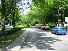
|
| Nordsternplatz * |
35 (diameter) |
Nordsternhaus , administrative headquarters of the former Nordstern insurance | after 1927 | The square is located at the confluence of Salzburger Strasse and Badensche Strasse. In the address book of 1928, it is not the building, but the property of "Nordstern Allgemeine Versicherungs-GmbH" that is given as the namesake. In addition, the place was not an official postal address, but he “go. zu Badensche Str. 2 and Salzburger Str. 20-25 “On the map from 1926, Nordsternplatz is at the intersection of Martin-Luther-Strasse with Badenschen / Meininger Strasse (west-east) and Salzburger / Mühlenstrasse (northwest-southeast) . This square at Schöneberg Town Hall is complemented in the south by Rudolph-Wilde-Platz and both roughly coincide with John-F.-Kennedy-Platz . The square is still marked on the map from 1954 north of Rudolph-Wilde-Platz, in 1960 the name for the northern part no longer exists. |

|
| Nordsternstrasse | 80 | Nordsternhaus , administrative headquarters of the former Nordstern insurance | Sep 30 1927 | The street leads from Salzburger Strasse to Badenschen Strasse.
The traffic route was laid out as a private road, and the address book expressly states: “No official name”. Parcels 1–3 were initially owned by the “German Society for the Promotion of Housing” from Charlottenburg. |
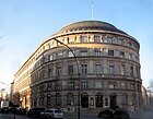
|
| Nürnberger Strasse |
550 (in the district) |
Nuremberg , city in Bavaria | May 18, 1876 | The street connects the Kurfürstenstraße (Olof-Palme-Platz) belonging to Mitte with the Schaper- / Geisbergstraße and goes south into the Spichernstraße. The western side of the street between Kurfürstenstrasse and Augsburger Strasse belongs to the district. The remaining parts of the street are in Charlottenburg and Wilmersdorf . The building complex of the Tauentzienpalast (No. 50–56) and the Adult Education College (No. 63) are architectural monuments. In 1906 Nürnberger Strasse led to Kurfürstendamm, and the design of Breitscheidplatz led to the same route as Budapester Strasse. |

|
| Nymphenburger Strasse | 190 | Nymphenburg , palace in Munich | 1912 | The street leads from Fritz-Elsas-Straße to Heylstraße. The tenement ensemble No. 2, 3, 4, 7, 8 and 9 is a listed building. |

|
| Otzenstrasse | 260 |
Johannes Otzen (1839–1911), architect |
Sep 30 1927 | The quiet residential street leads in an L-shape from Traegerstraße to Rubensstraße . All of the tenement houses on the street date from the 1920s and are listed buildings. |
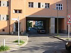
|
| Overbeckstrasse | 110 |
Friedrich Overbeck (1789–1869), painter |
March 27, 1939 | The street, laid out as street E of the development plan, is located in the “Siedlung am Grazer Damm” and leads from Grazer Damm to Riemenschneiderweg. |

|
| Pallasstrasse | 480 |
Peter Simon Pallas (1741–1811), naturalist and geographer |
March 17, 1891 | The road train coming from the east Gneisenaustraße - Yorckstraße - Goebenstraße is from the intersection Potsdamer Straße for Pallas road to behind the Matthias Church on Winterfeldtplatz leads where they at the intersection Goltzstraße in the Hohenstaufenstraße passes. The tenement ensemble Pallasstrasse 8–12 is listed. Until 1963 a line of trams ran through the street. The most striking building is the Pallasseum , a complex of more than 500 social housing from the 1970s, the former on the grounds of the Sports Palace was built and in the vernacular therefore "Social Palace" is called. As the demolition of the Pallasstrasse bunker , which was built in the Second World War , was too expensive, a twelve-storey block was built across the street and the bunker. |
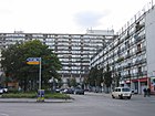
|
|
Passauer Strasse
( Location ) |
320 | Passau , city in Bavaria | June 24, 1892 | The street runs from Tauentzienstrasse to Lietzenburger Strasse . One side of the KaDeWe building is located here . The residential and commercial building No. 4 is a monument. Until it was separated by the construction of Lietzenburger Straße in 1957, Ettaler Straße was also part of Passauer Straße. |
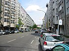
|
| Penzberger Strasse | 110 | Penzberg , city in Bavaria | Oct 3, 1958 | The street is in the Bavarian Quarter and leads from Munich to Berchtesgadener Straße. It was created during the reconstruction in the 1950s on war-torn land. |
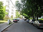
|
| Peter-Vischer-Strasse | 620 | Peter Vischer the Elder (1455–1529), sculptor and ore caster | Jan. 12, 1892 | The quiet residential street with good old buildings leads from Thorwaldsenstraße through the 'Malerviertel' and ends on Riemenschneiderweg in the settlement on Grazer Damm . Numerous tenement houses in the street are listed as the entire settlement. Houses from the imperial era still stand between Knausplatz and Rubensstrasse, and the listed ensemble with spacious courtyards from the 1920s and 1930s extends to the allotment gardens. The street borders on the Auguste Viktoria Clinic . |
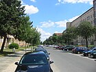
|
| Pöppelmannstrasse | 200 | Matthäus Daniel Pöppelmann (1662–1736), master builder | March 27, 1939 | The quiet residential street, first street F according to the development plan , runs in the settlement on Grazer Damm in a north-south direction from Begasstraße to Grazer Platz . The former communal apartments have been converted into condominiums. The Peter Paul Rubens School is on the west side. The Prignitz School, a special educational support center and center for promoting inclusive education, is located at Pöppelmannstraße 2 . At the school gymnasium on the corner of Rubensstrasse, students from this facility created a graffito that shows four different students. |

|
|
Potsdamer Strasse
( Location ) |
950 (in the district) |
Potsdam , the state capital of Brandenburg , in the direction of which the road runs | July 8, 1831 | Potsdamer Strasse is part of Bundesstrasse 1 , which reaches the Schöneberg district on Kurfürstenstrasse . At Grunewaldstrasse, it turns into Hauptstrasse . The first name was Potsdamer Chaussee . Numerous buildings, including the King Colonnades and the Kathreiner House , are architectural monuments. Until 1963 a line of the Berlin tram ran through the street. The administration building shown in the photo was constructed on behalf of the Reichsautobahn construction management in 1938/1939. In 1945 the headquarters of the BVG moved here. Since 2008, however, the BVG's administrative headquarters have been located in the Trias complex near the Spree. Between Heinrich-von-Kleist-Park and Kurfürstenstrasse, it is a shopping street with a colorful mix of commercial units, pubs, sex shops, old buildings and social housing. |

|
| Prellerweg | 850 | Friedrich Preller the Elder (1804–1878), painter | March 27, 1939 | The Prellerweg continues as a continuation of the Steglitzer Bergstrasse from Grazer Damm to Röblingstrasse, where it turns into Arnulfstrasse. To the south of the western section of the road lies the rubble mountain Insulaner . To the north of the eastern section of the road, the nature park Südgelände extends on the former railway site . The Prellerweg is spanned by numerous railway bridges, some of which are listed. |

|
| Priest path | 2020 | Path used by the Schöneberg pastors to the branch church in Lankwitz | before 1800 | The Priesterweg is straight in a north-south direction between Sachsendamm and Prellerweg. In the north as a driveway in the sports and commercial area near Sachsendamm, a footpath and bike path on the pedestrian bridge crosses the city motorway and from Vorarlberger Straße (corner of Matthäifriedhofsweg) as a dead end and as a two-lane street with sidewalks through the allotment area to Prellerweg. Due to a traffic construction measure in the street, the route from Prellerweg is also a dead end. At the southern end of the Priesterweg is the Priesterweg S-Bahn station . Until 1957, the Sembritzkistraße adjoining to the south (further to the south end) was part of the Priesterweg. 1540 are dedicated as a road that officially runs 160 meters from Sachsendamm as an access road. Shortly before the Priesterweg S-Bahn station, a barrier blocks the passage for cars, they can only enter Priesterweg from the north or south and have to turn back at the barrier so that Priesterweg remains free from through traffic. The barrier does not constitute an obstacle for pedestrians and cyclists. At the S-Bahn station there is direct access to the Schöneberger Südgelände Nature Park. Between the Schöneberg sports hall and a furniture store, a judges' tower recalls the location of the former cycling track. |
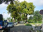
|
| Prinz-Georg-Strasse | 120 |
George of Saxony (1832–1904), prince and later King of Saxony |
March 24, 1899 | The road connects Feurigstrasse with Ebersstrasse. In 1904 it already comprised ten parcels of multi-family houses. On the quiet inner-city residential street there are old buildings and a large block of flats up to Dominicusstraße from the 1970s. |

|
| Regensburger Strasse |
250 (in the district) |
Regensburg , city in Bavaria | 1902 | The street leads from Bundesallee in Wilmersdorf to Viktoria-Luise-Platz . Until 1931 it was called Lindengasse . The apartment building No. 1 is a monument. |
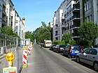
|
| Reglinstrasse | 290 | Hermann Reglin (1864–1925), teacher and director of the Schöneberg Lindenhof School | Sep 9 1931 | The quiet residential street leads through the middle of the Lindenhof housing estate from Röblingstraße to Domnauer Straße. Numerous settlement houses in the street are listed . the Lindenhof settlement. Apartment buildings from the 1920s stand on the street. At the Ostend lies the Eythstrasse cemetery with the Klarenpfuhl and an area of the district nature and green space office. With the Lindenhofweiher, a small park and spacious green spaces between the individual houses, the residential area is in great demand. |

|
| Reichartstrasse | 110 | Max Reichart († 1922), building officer and government councilor in the Berlin Railway Directorate | March 27, 1907 | The Gewerbestrasse on the A 100 can only be reached via the Friedrich-Haak-Brücke. Immediately behind the bridge there is access to an allotment garden that is part of the railroad farm and is not open to the public. Pedestrians can continue to Alboinstraße through an underpass on Geneststraße. The road branches off to the east of the railway line from Sachsendamm , crosses the city motorway at Friedrich-Haak-Brücke and leads to Geneststrasse, which turns at right angles and ends at the turning hammer. Since they were built, the two streets open up the corner on the Sachsendamm (formerly Tempelhofer connecting road ), which is formed by the north-south railway line and the junction from the south into the ring line. Only 60 meters through the bridge are officially designated as a road. Only plot 2 with a commercial building belongs to Reichartstrasse. |

|
| Rembrandtstrasse | 600 |
Rembrandt van Rijn (1606–1669), Dutch painter |
Jan. 12, 1892 | The street is in the 'Malerviertel' and leads from Rubensstrasse to Knausstrasse. The apartment building no. 8 is listed . Rembrandtstrasse is only built on on the south side and the houses offer a panorama over the west bypass ( A 103 ). Directly behind the motorway is the route of the S-Bahn line S1 . |

|
| Riemenschneiderweg | 1170 | Tilman Riemenschneider (1460–1531), picture carver and sculptor | March 27, 1939 | The road runs on the eastern edge of the settlement on Grazer Damm from Vorarlberger Damm to Prellerweg. The quiet residential street opens up the listed estate on Grazer Damm from the rear. The former communal apartments have been converted into condominiums. The eastern side of the street borders on a large area with several allotment gardens. There is a retirement home on the corner with Vorarlberger Damm. |

|
| Röblingstrasse |
590 (in the district) |
John August Roebling (1806–1869), engineer and bridge builder |
June 12, 1913 | The road runs from Eythstraße past the Lindenhof housing estate to Attilastraße in Tempelhof . Numerous settlement houses in the street are listed . To the north of Arnulfstraße , Röblingstraße belongs to the Lindenhof settlement. In addition to a block of flats from the 1970s, there are houses on the east side of the estate. There is no through traffic, the west side borders on a busy railway line. The road ends as a dead end for cars on Eythstrasse. South of Arnulfstrasse, the road leads over a mountain, the Marienhöhe . The Marienhöhe used to belong to the Rough Mountains, after which the nearby Bergstrasse is named. There is heavy through traffic in this stretch of road. On the west side there are mostly businesses and some allotments. On the eastern side of the street is the St. Matthias cemetery and residential buildings of the Marienhöhe settlement. |

|
| Rosenheimer Strasse | 790 | Rosenheim , city in Bavaria | Nov 13, 1904 | The road connects the Landshuter with the Schwäbische Strasse. The tenement houses No. 37 and 40 are listed . |

|
|
Rossbachstrasse
( Location ) |
70 | Roßbach , town in Saxony-Anhalt , the scene of a battle in the Seven Years' War | June 14, 1893 | The traffic route on Schöneberger Insel leads from Gotenstrasse to Cheruskerstrasse. In the beginning there were only six residential buildings, in the 21st century the street will have 20 numbers in horseshoe shape . |

|
|
Rubensstrasse
( Location ) |
1770 + 130 |
Peter Paul Rubens (1577–1640), painter |
before 1897 | Rubensstrasse lies between the main and the suburbs on the northern edge of Thorwaldsenstrasse . The plots on the west side are even numbered, on the east side odd numbers. The underpass through the Wannseebahn and the parallel west bypass ( A 103 ) is located on the course . By adapting the course to the traffic flow, it has a bend to the west to the route of the Ringbahn at the district boundary to Friedenau, the confluence on the main road . Here is a section of 130 meters as a one-way street from the main street to the east to Eisackstraße and as a stump to the city motorway in front of Innsbrucker Platz . Before the construction of the city motorway, this guided tour was the access to the (continuous) Eisackstrasse and the 1st municipal cemetery. The first name of the development plan was Straße 1 , which explains the almost straight north-south course and the length of the street. The route can already be found on the map. The northern section to Rembrandtstrasse was called Holbeinstrasse until 1911 . Many buildings in the street, including the apartment buildings in the Ceciliengärten estate and the Auguste-Viktoria-Klinikum , are listed . In Berlin's transport network , it is listed as a supplementary main street with Category IV, the side street in the north is uncategorized. Until 1963 a line of the Berlin tram ran through the street. Between Vorarlberger Damm and Grazer Platz there are several schools (63–83) on the east side, such as the Peter-Paul-Rubens-Schule. The Auguste Viktoria Clinic is located south of the street (111–123, odd). The Nathanael Church is on Grazer Platz, and St. Konrad Church on the west side on 47/78. Access to the Friedenau train station is via Begasstraße to Dürerplatz . The plot 2/12 at the north end is undeveloped. South of the A 103, the busy road separates the listed residential area, which was built in the 1920s, from Wilhelminian-style houses on the west side. The Pharus-Plan publishing house is located in house 107. To the north of the railway underpass, the street divides two listed residential areas that were built in the 1920s: the Ceciliengärten on the west side and the housing estate planned by the architects Mebes and Emmerich on the east side. |

|
| Sachsendamm | 1600 | Saxony , West Germanic tribe | March 27, 1907 | The Sachsendamm forms the eastern continuation of Dominicusstraße and continues behind the border to Tempelhof as Schöneberger Straße. The western section between Dominicusstraße and the junction of the city motorway is part of Bundesstraße 1 . The Schöneberg sports center is located on the street . Until 1962 a line of the Berlin tram ran through the street. The noisy and busy main road acts as a feeder road. There are mainly office buildings and only a few residential buildings. The Schöneberg swimming pool is located right next to the motorway entrance to the Schöneberg interchange. Shortly before that, the road leads over the Friedrich-Gerlach-Brücke, which marks a large hole where the A 103 was originally supposed to continue to the former wall at Potsdamer Platz , which was prevented by citizens' initiatives in the 1970s. |

|
| Salzburger Strasse | 370 | Salzburg , city in Austria , capital of the federal state of the same name | Oct 25, 1907 | The street leads from Bayerischer Platz to Badenschen Straße. The tenement ensemble No. 1–6 as well as the tenement houses No. 9 and 13 are listed . |
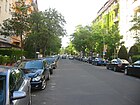
|
| Swabian Street |
360 (260 + 100) |
Swabians , Germanic tribe | 1902 | The formerly continuous road now consists of two sections. The northern section leads from Hohenstaufenstrasse to Barbarossaplatz and the southern section from Rosenheimer Strasse to Grunewaldstrasse. The section between Barbarossaplatz and Rosenheimer Straße is built over with Alice-Salomon-Park . The tenement house No. 12 is a monument. The quiet inner-city residential street has old buildings on Grunewaldstrasse and social housing on Hohenstaufenstrasse. The street runs as a pedestrian path through Alice-Salomon-Park and has a footpath connection to Hohenstaufenstraße. |
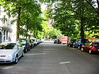
|
| Schwerinstrasse
( Location ) |
180 | Kurt Christoph von Schwerin (1684–1757), Prussian field marshal | Feb. 11, 1874 | Schwerinstrasse leads - as an extension of Nollendorfstrasse - from Zietenstrasse to Frobenstrasse and is a pedestrian zone along its entire length . |

|
| Sembritzkistraße |
200 (in the district) |
Martin Sembritzki , mayor of Lichterfelde in the 1920s | July 11, 1957 | The road branches off from Prellerweg and leads past the Insulaner . The following part of the street to the south runs in Steglitz and is built on. Until 1957, the Schöneberg section of Sembritzkistraße was part of the Priesterweg. |

|
| Semperstrasse | 100 |
Gottfried Semper (1803–1879), architect |
1914 | Semperstrasse leads from Sponholzstrasse to Baumeisterstrasse. The apartment buildings No. 1/2 are listed . |
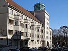
|
| Speyerer Strasse | 150 | Speyer , city in Rhineland-Palatinate | 1902 | The street leads from Martin-Luther-Straße to Barbarossastraße. Until the reconstruction of the Bavarian Quarter in the 1950s, it continued to Bayerischer Platz . |

|
| Sponholzstrasse | 570 | Johann Christian August Sponholz (1827–1907), entrepreneur | Apr 29, 1884 | Sponholzstraße leads from Hauptstraße to Bahnhofstraße. Numerous tenement houses in the street are architectural monuments. |

|
| Starnberger Strasse | 140 | Starnberg , city in Bavaria | before 1904 | The traffic route leads from the bend in Lindauer Strasse to the bend in Traunsteiner Strasse. At both ends of the street, a round tree in the middle of the street forms the boundary. On the area next to the Starnberger Straße 1 building there is a communal toddler playground. |

|
| Steinacher Strasse | 100 | Steinach am Brenner , place in Tyrol | 1911 | Steinacher Straße goes westward from Innsbrucker Straße as a one-way street in a loop shape. The quiet residential street, mostly with post-war buildings, is a 30s zone for road traffic . At the western arch there is a connection to the street Am Mühlenberg, which can only be used by pedestrians and cyclists. |

|
| Steinmetzstrasse
( Location ) |
910 | Karl Friedrich von Steinmetz (1796–1877), Prussian field marshal | Nov 18, 1874 | The quiet, partly traffic-calmed residential street leads from Kurfürstenstraße to Großgörschenstraße. Numerous tenement houses in the street from the 1870s and 1880s are listed . |
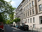
|
| Sterzinger Strasse | 60 | Sterzing , city in South Tyrol | before 1911 | Sterzinger Straße, already included in the address book in 1911 (planned to start from Innsbrucker Straße), was vacant for more than forty years. Since 1912 it was supposed to leave Freiherr-vom-Stein-Straße; its final route northwest from Freiherr-vom-Stein-Straße was probably not made until after the Second World War , when development began on the north side. The northwest end of the street is reached at the fork with Steinacher Straße and Am Mühlenberg.
In 2014 10 house numbers were assigned in this street. |
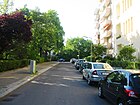
|
| Street 17 | 230 | Numbering according to the development plan | before 1920 | The street was first recorded in the address book in 1920; it branched off as a spur road from Sachsendamm and comprised 11 house numbers. The cemetery areas were called "Stätteplatz" here.
Since the 1990s, Straße 17 has been branching off the Matthäifriedhofsweg as a dead end. |

|
| Stübbenstrasse |
240 (130 + 110) |
Josef Stübben (1845–1936), architect | Nov. 26, 1906 | The road is T-shaped. Its three branches lead to Aschaffenburger Strasse, Bamberger Strasse and Grunewaldstrasse. The playwright Arno Holz lived in Stübbenstrasse 5 . |

|
| Suadicanistrasse | 80 |
Waldemar Suadicani (1847–1926), architect |
March 27, 1907 | The Suadicanistrasse branches off as a small cul-de-sac from the Sachsendamm . From here there is access to the Südkreuz train station . There is only one house on the short street and the street ends as a dead end at the train station. |

|
| Suttnerstrasse | 180 |
Berta von Suttner (1843–1914), Austrian pacifist and writer |
Sep 9 1931 | The traffic-calmed residential street is located in the Lindenhof housing estate and branches off from Reglinstraße as a cul-de-sac . Apartment buildings from the 1920s and 1960s stand on the street, and with the linden pond, a small park and spacious green areas between the individual houses, the residential area is in great demand. Before 1931 it was called Krumme Straße . Numerous settlement houses in the street are listed . |

|
|
Tauentzienstrasse
( Location ) |
200 (in the district) |
Bogislav Friedrich Emanuel von Tauentzien (1760–1824), Prussian general | Oct. 31, 1864 | Tauentzienstrasse is part of the “ general train ” and one of Berlin's most important shopping streets. It forms the eastern continuation of Kurfürstendamm and leads from Breitscheidplatz in Charlottenburg to Wittenbergplatz . The most famous building is the Kaufhaus des Westens (KadeWe). The tunnel of the underground lines U1 , U2 and U3 runs under the street . Until 1964 a line of the Berlin tram ran through the street. |
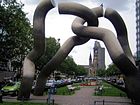
|
| Tempelhofer Weg | 680 | Tempelhof , a district of Berlin, was an independent rural community until 1920 | before 1879 | The Tempelhofer Weg leads from Sachsendamm to Naumannstrasse. The former BEWAG administration and production building (no. 39–47) and Paul Egeling's school building (no. 62) are listed .
Until the Sachsendamm was built, Tempelhofer Weg was the main road connecting Schöneberg and Tempelhof. |

|
| Thorwaldsenstrasse | 900 |
Bertel Thorvaldsen (1770–1844), Danish sculptor |
Nov 15, 1901 | The street lies between Knausstraße and Grazer Damm . The north side 1–16a (continuous) belongs to the district. The southwest side of the road and the road area are in Steglitz . Until 1963 a line of the Berlin tram ran through the street. The busy thoroughfare has a wide median and two lanes on each side, one of which is used as a bus lane. The development consists of a mixture of old, post-war and new buildings. |

|
| Torgauer Strasse
( Location ) |
730 | Torgau , town in Saxony , scene of a battle in the Seven Years' War | June 14, 1893 | Torgauer Strasse runs in an arc to the north, parallel to the Ringbahn between Sachsendamm and Wilhelm-Kabus-Strasse . North of the street is the former Schöneberg gasworks with the gasometer and other architectural monuments, on which the EUREF campus is located.
The building of the former coal shop of Julius Leber and Annedore Leber , which was only partially preserved in its original form and was a place of resistance against National Socialism until 1944, is located on property No. 25 . The district office plans to set up the historic site as a memorial. The entire south side of the street was mainly used by car repair shops until 2012. From 2013 the Annedore Leber Park was built here, which was named on September 13, 2016. In this area the street is reserved for cyclists and pedestrians. The north side borders on the former gas storage facility with the gasometer and the Cherusker Park. The north-eastern side of the street consists of old buildings with a view of the Ringbahn. |

|
| Traegerstrasse | 250 | Albert Traeger (1830–1912), member of the Reichstag | Apr 29, 1912 | The street leads from the main street to Eisackstraße. The music writer Arnold Ebel lived in Traegerstraße 2 . Several tenement houses from the 1920s belong to the Ceciliengärten estate and are listed . The quiet residential street consists of apartment blocks from the 1920s. |

|
| Traunsteiner Strasse | 160 | Traunstein , city in Bavaria | 1904 | The street leads from Martin-Luther-Straße to Barbarossastraße. The apartment building No. 2 is a monument. |
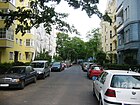
|
| Treuchtlinger Strasse | 140 | Treuchtlingen , city in Bavaria | 17 Sep 1938 | The street is located in the Bavarian Quarter and leads from Barbarossastraße to Aschaffenburger Straße. Until 1938, the traffic route was the transverse section of Haberlandstrasse to the south. |
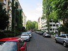
|
|
Viktoria-Luise-Platz
( Location ) |
100 × 80 | Viktoria Luise (1892–1980), Prussian princess | Nov 11, 1899 | The circular and centrally located square is mostly lined with grand old buildings. The square was created as square Z of the development plan and was named Victoria-Luisen-Platz on the day the princess started school . As early as 1902 it was listed as Victoria-Luise-Platz (with “c”) and from 1904 as Viktoria-Luise-Platz (with “k”) in the Berlin address book. Even in the 21st century, Motzstrasse , Winterfeldtstrasse , Münchener Strasse, Regensburger Strasse and Welserstrasse meet at Viktoria-Luise-Platz . The gardens in the middle of the square including the underground station of the same name and several houses on the edge of the square are cultural monuments. The Lette Association has been here since 1902 . There are restaurants in the front gardens of the townhouses. The apartments are in great demand. From the front buildings you have a view over the square with its large fountain. |
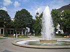
|
| Vorarlberger dam | 1330 | Vorarlberg , Austrian state | March 27, 1939 | The street leads from Rubensstraße to Sachsendamm . Several tenement houses in the street belong to the settlement on Grazer Damm . |
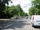
|
| Vorbergstrasse | 340 | Max Vorberg (1838–1900), pastor in Schöneberg | Oct 31, 1902 | The street leads from Akazienstrasse to Hauptstrasse . The apartment buildings No. 8, 9b, 10 and 10a are listed . |

|
| Vossbergstrasse | 100 | Walter Voßberg (1880–1910), Schöneberg local politician | Feb. 17, 1911 | The street leads from Innsbrucker Straße to Martin-Luther-Straße . The apartment buildings No. 5, 6 and 7, dating from the 1920s, are listed. On the north side of the quiet inner-city residential street there are predominantly spacious old buildings, while on the south side there is a block of flats from the 1920s. |

|
|
Wartburgplatz ( Location ) |
120 × 100 | Wartburg , castle in Thuringia | around 1899 | The Wartburgplatz is designed as a park. It is enclosed by Martin-Luther- , Wartburg- and Gothaer Straße and on the northern part it interrupts the passage for Apostel-Paulus-Straße . |

|
| Wartburgstrasse | 910 | Wartburg , castle in Thuringia | around 1899 | The traffic route leads from Meraner Strasse to Merseburger Strasse. The building ensemble No. 32–37 as well as the apartment buildings No. 3, 4 and 52 are listed . |

|
| Welserstrasse
( Location ) |
430 | Welser , Augsburg and Nuremberg patrician families | March 28, 1958 | The street leads from Lietzenburger Straße to Viktoria-Luise-Platz . The apartment buildings No. 5 and 7 are listed. Until it was separated by the construction of Lietzenburger Strasse in the 1950s, the section north of Geisbergstrasse was part of Bayreuther Strasse. The section between Geisbergstrasse and Viktoria-Luise-Platz was called Neue Bayreuther Strasse until 1958 because it extended Bayreuther Strasse. The centrally located residential street has partly good old buildings. At Lietzenburger Straße the street for cars ends as a dead end, in this area there are numerous pubs where the Berlin gay scene meets. There is a school and day care centers. At the corner of Geisbergstrasse is the building of a music school (former post office 30) with the figure of the last postilion from 1925. |

|
| Wendland line | 160 | Erich Wendland (1888–1950), local politician | July 27, 1957 | The Wendlandzeile branches off the Vorarlberger Damm as a spur road. It is located in the settlement of the non-profit settlement and housing association.
There is a radio relay on house Wendlandzeile 12. |

|
| Were duration way | 1400 (950 + 450) | Werdau , city in Saxony | Apr 18, 1952 | With two branches, the Werdar Weg opens up an industrial area south of the Sachsendamm near Schöneberg train station and lies to the southwest parallel to the railway . The first plan name was Straße 105 (already included in the Berlin address book around 1935). The Ebersstrasse S-Bahn switchgear at Werlänge Weg 5, built according to plans by Richard Brademann , and the chapel of the New Twelve Apostles Cemetery on Werführung Weg 8 are listed monuments. The commercial areas are connected by the Werlänge-Weg bridge over the city motorway and its exits; the siding for the southern industrial area also runs over the bridge. Officially marked as a street are only 120 meters on Sachsendamm 2-6 (straight) and 3, and 5 (Twelve Apostles Cemetery), the rest of the section has the character of a commercial and access road to the buildings on the properties Werlänge Weg 8-30 (even) and 7–39 (odd) (as of 2013).
The road forks at the New Twelve Apostles Cemetery and ends at the left fork as a dead end at a fence. The right branch leads through the industrial landscape. The Wer Dauer Weg opened up the site of the now closed Schöneberg freight yard. |

|
| Westarpstrasse | 120 |
Kuno von Westarp (1864–1945), administrator and politician |
July 27, 1908 | The traffic route, according to the development plan as Straße 91 , Straße is located in the Bavarian Quarter and leads from Bayerischer Platz to Münchener Straße . |
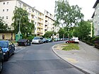
|
| Wexstrasse |
480 (in the district) |
Eduard Wex (1827–1902), civil engineer | Dec 22, 1911 | The Wexstraße leads from Bundesplatz in Wilmersdorf to Innsbrucker Platz . Part of the south side of the street is in Friedenau . Around 1911 the Wexstrasse was called the Ringbahnstrasse . The Schöneberg part of Wexstrasse acts as a feeder road for the A 100 , which is directly adjacent to the road. The northern part is built on with office buildings and a hostel . |

|
| Wielandstrasse | 590 | Christoph Martin Wieland (1733–1813), poet | Apr 29, 1884 | The street leads from Hauptstraße to Wilhelm-Hauff-Straße. In front of house number 30/31 (as of November 2010) there are 20 stumbling blocks that remind of the Jewish roommates of the apartment building. Marianne Pousset, a hobby historian of the house, compiled the biographies of the people deported under National Socialism and arranged for the memorial stones to be moved. The tenement ensemble No. 8-14 is a listed building.
Rosa Luxemburg lived at Wielandstrasse 23 from 1900 to 1902. Alfred Lion was born at Wielandstrasse 22. A quiet inner-city residential street with stately villas. |
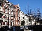
|
| Wilhelm-Hauff-Strasse |
100 (in the district) |
Wilhelm Hauff (1802–1827), writer | Apr 29, 1884 | The road leads from Dickhardtstrasse in Friedenau to Wielandstrasse. At first the traffic route was called Hauffstraße , which was changed to Wilhelm-Hauff-Straße in 1909. On September 1, 1926, Moselstrasse in Friedenau was also given the name Wilhelm-Hauff-Strasse.
The Villa Wilhelm-Hauff-Straße 10 on the corner of Wielandstraße, owned by a merchant Potter in 1891, is a listed building. |
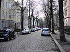
|
| Wilhelm-Kabus-Strasse
( Location ) |
1140 | Wilhelm Kabus (1918–1996), Mayor of the Schöneberg district | May 11, 2010 | The road was laid out in 2010 to relieve the almost parallel Naumannstrasse and classified as a regional road link. It runs along the Anhalter Bahn and begins in the north on Kolonnenstraße , crosses an industrial park, passes the junction of Torgauer Straße and ends in the south on Tempelhofer Weg at Hildegard-Knef-Platz , the western forecourt of the Südkreuz train station . The Hedwig-Dohm-Strasse , the further connection to Sachsendamm ago. The section between Torgauer Straße and Tempelhofer Weg originally belonged to Naumannstraße, it was incorporated into Wilhelm-Kabus-Straße on November 1, 2012.
Plots 1–91 (odd) and 4–92 (even) belong to Wilhelm-Kabus-Straße. The German Institute for Construction Technology (No. 1–5 / Kolonnenstraße 30b) and the Havelland Elementary School (No. 4 / Kolonnenstraße 30–30a) are located on the corner of Kolonnenstraße . The road bridges the Hertha-Block-Promenade and crosses under the Ringbahn northwest of Südkreuz station. There is only one older, multi-storey house in the street, the rest consists of former and new warehouses, in which mostly wholesalers operate. A new hiking trail ( Innerer Parkring and Nord-Süd-Weg ) has been set up between the Alfred-Lion-Steg and the Südkreuz train station , which will be expanded to the north to form a column bridge , creating a footpath parallel to the busy street. |

|
| Willmanndamm
( Location ) |
310 | Willmann, name of a farming family in Schöneberg | Oct 18, 1937 | The street leads from Langenscheidtstraße to Neue Kulmer Straße . From 1891 to 1937 it was called Kaiser-Friedrich-Straße . The tunnel of the underground line U7 runs under Willmanndamm . The tenement ensemble No. 6–8 is a monument complex. Willmanndamm is a relatively quiet residential street with a large number of old buildings; there is a weekly market on the corner between Crellestrasse and Mansteinstrasse. In house number 3, a plaque commemorates the botanist and Africa researcher Georg Schweinfurth , who lived in this place. |
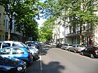
|
|
Winterfeldtplatz
( Location ) |
220 × 70 | corresponds to the existing street | before 1891 | The square is enclosed by Winterfeldtstrasse , Gleditschstrasse , Pallasstrasse and Goltzstrasse . On the south side of the square is the St. Matthias Church , on which a connecting road runs parallel to Pallasstrasse. In the year it was named, there are three houses in the address book, two of which were not yet completed. The weekly market and flea market take place on the northern part of the square. The good inner-city residential area around the square and the surrounding area, with some good old buildings, makes the space desirable. There are good cafes and antique shops in the area. There is a green area with a large playground and a puppet theater on the square. The Berlin architect Baller created many Buzen around the square and on the square . |

|
| Winterfeldtstrasse
( Location ) |
1270 | Hans Karl von Winterfeldt (1707–1757), Prussian general | 5th Sep 1885 | The street leads from Viktoria-Luise-Platz to Potsdamer Straße . The section west of Maaßenstrasse was called Neue Winterfeldtstrasse from 1889 to 1962 . The eastern part was laid out as Street 19, Section IV of the development plan from 1888 . The address book initially stated “between Maaßenstraße and Schöneberger Feldmark”, the following year then “from Maaßenstraße to Goltzstraße”.
The street has an inner-city residential area with a connection to the West-City, the good old building fabric offers a mixture of pubs, street cafes, second-hand bookshops and unusual shops. Several tenement houses as well as the Fernamt Berlin (today Telekom Innovation Arena ) built by the Reichspost in the 1920s are listed monuments. |
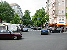
|
|
Wittenbergplatz
( Location ) |
180 × 100 | Wittenberg , town in Saxony-Anhalt , storming by Count Tauentzien during the Wars of Liberation | Oct. 31, 1864 | The square is part of the “ general train ” and connects Tauentzienstrasse with Kleiststrasse. In the middle of the square is the Wittenbergplatz underground station . |

|
| Wormser Strasse
( Location ) |
60 | Worms , city in Rhineland-Palatinate | March 11, 1887 | Wormser Strasse branches off from Bayreuther Strasse as a short strait. Until Lietzenburger Strasse was built in the 1950s, it led to Martin-Luther-Strasse . The apartment building No. 4 is listed. |
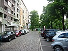
|
|
Yorckstrasse
( Location ) |
660 (in the district) |
Ludwig Yorck von Wartenburg (1759–1830), Prussian field marshal | Oct. 31, 1864 | Yorckstrasse is part of the “ general train ”. The Schöneberger section of the street crosses under the Yorckbrücken . The Yorckstraße underground station , the two S-Bahn stations Yorckstraße and Yorckstraße (Großgörschenstraße) as well as two stairways to the Park am Gleisdreieck are located here . The eastern section of Yorckstraße runs in Kreuzberg to Mehringdamm . Until 1963 a line of the Berlin tram ran through the street. Yorckstraße is a loud and busy main road. On the western side of the street there are some old buildings, on the ground floor of these houses there are mostly restaurants. |

|
|
Zietenstrasse
( Location ) |
350 | Hans Ernst Karl von Zieten (1770–1848), Prussian general | May 1, 1883 | The Zietenstraße leads from the street An der Apostelkirche to Winterfeldtstraße . The first name according to the development plan was Straße 10a . The apartment houses No. 1/2 are architectural monuments. The largely preserved Wilhelminian style development from the years 1874 to 1888 in the area around the southern Zietenstrasse was protected by a conservation ordinance in 2010. The house at Zietenstrasse 22 at the intersection of Nollendorfstrasse served from 1987 to 2004 as a film set for the television series Praxis Bülowbogen and Dr. Sommerfeld - News from the Bülowbogen . |

|
Former streets and squares
In the older address books there are several streets under the entry of Schöneberg with a reference to the entry under Berlin-W.
| Surname | Origin of name | when named | when renamed | renamed to | Remarks |
|---|---|---|---|---|---|
| Schöneberg (Alt) , since 1878 also Alt-Schöneberg | (probably) the historic village center | around 1875 | before 1880 | This street name is shown in the address books from 1875, whereby according to the address book it was more an area of the former town center. Initially, no property numbers are given, but four apartment buildings named after the owners. Later on, there is a note on the location “First of Colonnenstrasse” (address book 1878). | |
| At the park | Schöneberg City Park | 1910 | July 19, 1954 | → Fritz-Elsas-Strasse | From the 1870s the traffic route was under development plan Straße 58 , then road R . |
| Bahnstrasse | Street along the Berlin-Potsdam Railway | around 1840 | March 27, 1958 | → Crellestrasse | The road running in a south-north direction forked at its northern end into Calmstrasse and Mansteinstrasse . |
| Botanical Garden Street | Botanical Garden Berlin | before 1874 | → included | Parts in the main street included | It formed the southern continuation of Potsdamer Strasse and was later incorporated into Hauptstrasse . In 1875, the address book showed 14 developed properties here. It is worth mentioning the plot area 11-14 owned by the medical council Dr. Levinstein, on which the "Maison de Santé" was located, a private medical institution . |
| One street | Karl von Eine (1853–1934), Prussian-German military and politician; politically controversial | June 13, 1934 | Dec 16, 2013 | → Karl-Heinrich-Ulrichs-Strasse | The part of the street in the Schöneberg district was named between 1934 and 2013. It was previously called Maaßenstraße . A reintegration in Maaßenstrasse was rejected by the office. After actions by the gay and lesbian association from 2010 against the street name named after a Nazi war minister, the district office made the decision to rename it. |
| Franz-Kopp-Strasse | Franz Kopp (1909–1933), SA man | May 20, 1937 | July 30, 1947 | → Leberstrasse | Franz Kopp was gunned down by strangers while on a night patrol at the intersection of Torgauer Strasse and Gotenstrasse on the Red Island and died a short time later. During the Nazi era , streets across Berlin were named after supporters of National Socialism who perished during the Weimar Republic. Immediately after the war in 1945, such street names were denazified . The namesake Kopp was replaced by the renaming in Sedanstrasse . At the same time the renaming to Schuppertstrasse was sought, as in other cases Schuppert was probably a (local) victim of National Socialism. This naming situation in the immediate post-war period was resolved by the Berlin magistrate in 1947, rather Julius Leber was named after. |
| Heinrich-Kiepert-Strasse | Heinrich Kiepert (1818–1899), geographer | June 14, 1893 | Dec 28, 1899 | → Martin-Luther-Strasse | From 1884 to 1893 it was Rostocker Straße . In 1894, the renamed traffic route can be found in the address book with the following details: Location “on Mühlenstrasse” and there is only one apartment building here on plot 8, which is owned by the Berlin reindeer brothers Krüger. The house was number 1 in later years (around 1896).
In 1900 the route of this traffic route between Mühlenstrasse / Belziger Strasse and Wartburgstrasse / Wartburgplatz is given. The one concrete house now bears the number 48/49, further construction sites at the intersection with Apostel-Paulus-Strasse, Grunewaldstrasse and Belziger Strasse are noted. |
| Holbeinstrasse | Holbein , family of painters | Dec. 1, 1892 | Feb 16, 1911 | → Rubensstrasse , northern part | The traffic route opened up the construction area of the Schöneberger-Friedenauer Terraingesellschaft and connected it to Friedenauer Strasse south of the Ringbahn. Because other streets in the area were named after painters at the same time, the new residential area was soon called the “Malerviertel”. |
| Nettelbeckstrasse | Joachim Nettelbeck (1738–1824), seaman, writer, merchant and folk hero | Apr. 24, 1885 | Oct 30, 1962 | → At the Urania | According to the development plan, it was Straße 21 and Straße 21a that were located in the Charlottenburg administrative district before the 1938 regional reform . |
| Immelmannstrasse | Max Immelmann (1890–1916), pilot in the First World War | Aug 3, 1920 | Oct 10, 1936 | → Kesselsdorfstrasse | In the year the street was named, the Berlin address book contains three non-numbered parcels that are owned by the tax authorities and on which are identified: the former railroad barracks, a fleet of vehicles and a fleet of a motor vehicle fleet and a storage shed. The street ran between Monumentstrasse and Kolonnenstrasse. |
| Kaiser-Friedrich-Strasse | Friedrich III. (1831–1888), German Emperor and King of Prussia | 26 Sep 1891 | Oct 7, 1937 | → Willmanndamm | Initially Planstrasse E , the traffic route was given the name of the German ruler, as were numerous streets in other Berlin suburbs. |
| Royal road | King , title of ruler or name of the landowner (unclear) | handed down | Aug 8, 1929 | → Naumannstrasse , south of Kolonnenstrasse | This route is already noted on old land maps as the royal route, it is assumed that “king” did not refer to a specific person.
In the 19th century, the soldiers of the railway company used this route to their training area. Around 1900 the "Bahnhof-Schöneberg-Bodengesellschaft" bought the site and had new railway systems built here. |
| Kriemhildstrasse | Kriemhild , figure of the Nibelung saga | June 20, 1902 | Aug 8, 1929 | → Naumannstrasse , north of Kolonnenstrasse | First street 74 according to the development plan; it connected Kolonnenstrasse with Brunhildstrasse in the neighboring district. |
| Crooked road | Shape of the route | around 1919 | 8 Sep 1931 | → Suttnerstrasse | The street, which is not officially designated, was part of the road network for the Lindenhof settlement . |
| Lindengasse | Linden , Bam genus in the mallow family | around 1919 | 8 Sep 1931 | → Reglinstrasse | The narrow street was part of a new street network to develop the Lindenhof settlement built in the 1920s . |
| Mackensenstrasse | August von Mackensen (1849–1945), farmer, officer in the Franco-German War | Feb. 24, 1934 | Jul 2, 1998 | → Else-Lasker-Schüler-Strasse | In 1934, the section of Motzstraße between Nollendorfplatz and Kurfürstenstraße was given a new name because one side of the street belonged to Charlottenburg. However, the Berlin magistrate ruled out a re-naming in Motzstrasse, which was planned for 1945 . |
| Mariendorfer Weg | Mariendorf , direction |
reported (14th century) |
1945 | repealed and overbuilt | Historic route connection from Schöneberg to Mariendorf, first marked on maps at the beginning of the 18th century. It led from Tempelhofer Weg to the site of the military railway and the Dresden and Anhalter Railway. |
| Marienstrasse | Maria , female first name | around 1919 | 8 Sep 1931 | → Harkortstrasse | (This street does not exist in Schöneberg in the publications of the Luisenstädtischer Bildungsverein.) As a historical forerunner of Harkortstraße, Marienstraße is included in the Berlin address book from 1932: “Changed to Harkortstraße at the time of printing.” It was part of the street network of the Lindenhof estate. |
| Maxstrasse | Max, male first name | before 1892 | Feb. 1963 | → Kärntner Strasse | The origin of the name is not known precisely. In 1932, Maxstraße ran between Hauptstraße and Schöneberger Friedhof on the Wannseebahn. |
| Mühlenweg Mühlenstraße |
Windmill from a Wilmersdorf miller |
handed down (Mühlenweg) after 1760 (Mühlenstraße) |
Jul 30, 1937 | Reppichstrasse | The mill that gave it its name, located roughly along the later Kolonnenstrasse, burned down in 1760 and was rebuilt on the Mühlenberg. The road from the village of Schöneberg to the mill was then called Mühlenstraße. The route was changed several times. The Mühlenweg is drawn on a map from 1893, and it ran as a continuation of the already named Badenschen Straße (west) to the main road (east), the route then continues as Tempelhofer Straße. |
| Noerdlinger Strasse | Nördlingen , city in Bavaria | 17 Sep 1938 | Sep 1 1996 | → Haberlandstrasse | This traffic route, which was the northern section before 1938 and was already named Haberlandstrasse, was renamed during the Nazi era because of Haberland's Jewish origins. It wasn't until more than 50 years after the end of World War II that the street got its historic name back. |
| Prussian street | Prussia , state | around 1875 | around 1876 | Viktoriastrasse | The street that previously only ran in Wilmersdorf was given a new name after just under a year. |
| Reppichstrasse | Kurt Reppich (1886–1932), SA man | May 20, 1937 | Jul 30, 1947 | in the Dominicusstraße included | The street, previously Mühlenstraße , got its name during the Nazi era when Reppich was shot dead in a dispute with the police during the BVG strike in 1932. |
| Ringbahnstrasse | Ringbahn | around 1911 | after 1911 | → Wexstrasse | First of all, the station of the Ringbahn on Mariendorfer Weg was added to the address book as a postal address (1879).
According to the address book, the name Ringbahnstraße was first given in Schöneberg in 1912, at that time the street was divided into five property plots and further new buildings were being built on one side of the street. It ran between Innsbrucker Strasse and Hauptstrasse . According to research by the Luisenstädtischer Bildungsverein , all streets parallel to the Ringbahn in the Berlin suburbs were given the uniform name Ringbahnstraße in 1888. In 1911 the street was split up and individual sections renamed, here in Schöneberg it became Wexstraße. Only the north-western section in Tempelhof retained its original name. There are other ring railways in Halensee and Neukölln . |
| Rostocker Strasse | Rostock , city in Mecklenburg, direction of the road | Apr 29, 1884 | 1893 | Heinrich-Kiepert-Strasse | Before the name was given, the path was unofficially known as the Triftweg because the cattle of the Schöneberg farmers were herded to pasture on it. In the year 1891 it is stated in the address book that the street goes off “on Mühlenstraße”. There are three buildings identified, only one of which has a house number (number 8).
According to a city map, the street led from the intersection of Erfurter / Belziger Strasse in a south-north direction to Motzstrasse around 1893. From here, where the Schöneberg gas works was also located, the traffic route was named Lutherstrasse. |
| Rudolph-Wilde-Platz | Rudolph Wilde (1857–1910), First Mayor of Schöneberg | Jan. 20, 1911 | Nov 24, 1963 | → John F. Kennedy Square | During the period in office (1888–1910) von Wilde decided to build a new town hall and began. Because after John F. Kennedy 's visit to Berlin with his legendary saying “Isch bin ein Bärliner” the square in front of the town hall was renamed, the district administration decided to give the former city park the name Rudolph-Wilde-Park . |
| Sadowastrasse | Sadowa , site of a battle in 1866 | March 16, 1888 | Aug 19, 1906 | included in Aschaffenburger Strasse together with Viktoriastrasse | The street name is not included in the address books available between 1889 and 1906 (checked in 1891, 1894, 1896, 1900, 1906). |
| Schleswiger Strasse | Schleswig , city in the Schleswig-Holstein region | around 1875 | around 1888 | → Badensche Strasse | At first it was the Schöneberger Weg . |
| Schöneberger Weg | Schöneberg , direction from Berlin | 1856 | around 1875 | Schleswiger Strasse | The course of the route can be seen on a city map from 1893: It led from Königsweg past the Tempelhof marshalling and workshop yard to the southeast, crossing the Ringbahnstraße and Manteuffelstraße. |
| Sedanstrasse | Sedan , battle site in the Franco-German War 1870/1871 | around 1871 | May 19, 1937 | Franz-Kopp-Strasse | The Schöneberg merchant Lenz designated a piece of land for real estate use. To do this, he had the road laid out on a strip of land in the independent town of Schöneberg in 1872 (parallel to Königsweg ) and thus had a say in the name of the street. The route determined the later road layout on the Red Island . In the 1880 address book, Sedanstrasse is listed with 35 residential buildings on the consecutively numbered plots 1–100. 1 and 100 are on Colonnenstrasse . Since there were several streets of the same name with the formation of Greater Berlin , the street was named in 1937 after the supporter of the Nazi movement Franz Kopp. As part of the replacement of street names polluted by the Nazis , renaming was used in 1945. Probably at the same time the proposed name after Schuppert was planned, probably (according to the handling in other districts) a (local) opponent or victim of the Nazi movement. These two proposals were not confirmed by the municipal authorities in 1947, rather the street was named after Julius Leber . |
| Sternberger Strasse | Sternberg , small town in Mecklenburg | 1911 | 17 Sep 1915 | → Mettestrasse | Referred to as street aa according to the development plan . |
| Stubenrauchstrasse | Ernst von Stubenrauch (1853–1909), district administrator in the Teltow district | around 1894 | 8 Sep 1931 | → Langenscheidtstrasse | During his tenure, Stubenrauch took care of the expansion of the infrastructure of his rural communities (roads, waterways). He lived on Viktoriastrasse in 1892. |
| Viktoriastrasse | Viktoria Luise (1892–1980), Prussian princess | around 1860 | around 1896 | in the Aschaffenburg road together with the Sadowastraße included | The square, also named after Victoria, kept its name. |
| Wilmersdorfer Weg | Wilmersdorf , connection between the neighboring villages | before 1874 | Jan. 20, 1877 | → Grunewaldstrasse | In 1874 the address book for the Berlin suburbs contains the following note: "Property of the Actien-Gesellschaft für public haulage". |
| Ziegeleiweg | Brick factory , which was located near the Kreuzberg clay pits | 19th century | Jan. 9, 1901 | → Monumentenstrasse | The route used by the peasants and workers in the brickworks was roughly the same as Monumentenstrasse; it was later incorporated into this street. |
Other locations in Schöneberg
Parks
| Surname | Length / dimensions (in meters) |
Origin of name |
designation |
Remarks | image |
|---|---|---|---|---|---|
|
I. Eisackstrasse municipal cemetery
( Location ) |
230 × 120 (triangular shape) | adjacent Eisackstrasse | 1888 | The cemetery has been reduced in size several times over the years. a. through the planned expansion of Berlin to become the " World Capital Germania " and through the construction of the A 100 city motorway . |
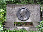
|
|
II. Eythstrasse municipal cemetery
( Location ) |
400 x 340 | adjacent Eythstrasse | 1908 | The cemetery is located in the southeast of the district on the border with Tempelhof . In the 110,342 square meter park cemetery there is a chapel from 1910-1912, as monument is under protection. The Krumme Pfuhl natural monument , a rare dead ice hole, is also worth seeing . |

|
|
Alice Salomon Park
( Location ) |
140 × 70 | Social reformer in the German women's movement , pioneer of social work Alice Salomon (1872–1948) | after 2003 | The small park was laid out on a section of Schwäbische Strasse between Barbarossaplatz and Rosenheimer Strasse, the development of which was destroyed during the Second World War and not rebuilt. |

|
|
Old St. Matthew Cemetery
( Location ) |
320 × 180 | St. Matthew Congregation in the Privy Council district | March 25, 1856 | The cemetery contains many culturally and historically significant tombs that have been under monument protection since the 1990s . The churchyard is located between Großgörschenstrasse and Monumentenstrasse on Schöneberger Insel . |
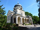
|
|
Old Twelve Apostles Cemetery
( Location ) |
230 × 200 | Twelve Apostles Congregation | 1846 | The churchyard is located between Kolonnenstrasse and Naumannstrasse on the Schöneberger Insel . |

|
|
Cherusker Park
( Location ) |
230 × 220 × 100 (triangular shape) | adjacent Cheruskerstraße | circa 1948 | The park was created after the end of the Second World War by not rebuilding the hairpin to the Potsdam Ringbahnhof. |

|
| Priesterweg cemetery | 300 × 100 | adjacent priest path | after 1967 | The cemetery, which is located in the vicinity of the Schöneberg allotment gardens in the southern area, was created in 1896 as the second cemetery of the St. Matthew Parish . Later it became the state-owned Schöneberg IV cemetery and the Priesterweg cemetery . On January 1, 2005 it was closed to new burials. |
|
|
Hans Baluschek Park
( Location ) |
1500 × 50 | Hans Baluschek (1870–1935), painter , graphic artist and writer | 2004 | The park was created as a compensatory measure for the construction of the A 100 . It is divided into four subject areas: picnics , sunbathing , games and sports. |
|
|
Heinrich Lassen Park
( Location ) |
210 × 180 | Heinrich Lassen (1864–1953), architect , construction clerk and local politician | 1953 | Heinrich Lassen Park emerged from the gardens of several Schöneberg country houses that belonged to the so-called “ million farmers ”. |

|
|
Heinrich-von-Kleist-Park
( Location ) |
360 × 200 | Heinrich von Kleist (1777–1811), German playwright , storyteller , poet and publicist . | Nov 21, 1911 | The park is located in the north of the Schöneberg district of Berlin between Potsdamer and Elßholzstraße. |

|
|
Kurt Hiller Park
( Location ) |
90 × 40 | Kurt Hiller (1885–1972), German writer and pacifist publicist from a Jewish family | 2000 | The park is located on Grunewaldstrasse at the Kleistpark underground station . |

|
|
Nelly Sachs Park
( Location ) |
190 × 150 | Nelly Sachs (1891–1970), Jewish- German writer and poet | 1990 | The park is on Dennewitzstrasse with a pedestrian passage to Blumenthalstrasse. Before 1990 it was called Dennewitzpark . |
|
|
Rudolph Wilde Park
( Location ) |
650 × 150 | Rudolph Wilde (1857–1910), German local politician | 1963 | The park is located between Martin-Luther-Straße and the district border at Volkspark Wilmersdorf on Kufsteiner Straße. |

|
|
Nature park south area
( Location ) |
1950 × 270 (irregular shape) | after the Schöneberger Südgelände | 1999 | The 18 hectare park extends over the former route of the Anhalter and Dresdener Bahn , the western part of the former Tempelhof marshalling yard and the former Tempelhof marshalling yard . |

|
Other selected locations in Schöneberg
There are numerous neighborhoods and locations in Schöneberg, including
- Bavarian Quarter ,
- Kielgan Quarter ,
- "Malerviertel",
- Red Island ,
- Ceciliengärten and settlement
- Lindenhof settlement .
See also
literature
- Stefan Eggert: Walks in Schöneberg. Berlin reminiscences. Volume 78. Haude & Spener, Berlin 1997. ISBN 3-7759-0419-0
- Herbert Mayer: Guide to Berlin's street names. Schöneberg , Edition Luisenstadt Berlin, 1994, ISBN 3-89542-050-6 .
- Sabine Wortmann: Lifestyle conflicts of social minorities in the Berlin neighborhood management area Schöneberger Norden . Dissertation online . Explanations of the building history in Schöneberg within the Berlin Weichbild.
Web links
- Street directory Schöneberg. kaupert media gmbh, accessed on October 30, 2010 .
- Office for Statistics Berlin-Brandenburg: Directory of streets and squares in the Tempelhof-Schöneberg district (as of February 2015); pdf
- Hermann Jansen: Development plan Schöneberger Südgelände, Berlin
Individual evidence
- ^ Suburbs> Schöneberg . In: Berliner Adreßbuch , 1874, V, p. 214 ff.
- ↑ a b suburbs> Schöneberg . In: Berliner Adreßbuch , 1875, V, p. 220 ff.
- ↑ Clarification of the situation on map 1: 5000, produced by the district surveying offices (Senate Department for Urban Development and the Environment)
- ↑ a b FIS Broker Detail Network (regional reference system)
- ^ Homepage TÜV Rheinland with details of branch test centers ; Retrieved October 18, 2014.
- ↑ a b c d e f g h i j k l m n o p q r s t u v History of the Berlin tram
- ↑ Falk Jaeger: My hut, my castle. Architecture in Berlin. Der Tagesspiegel, accessed on May 8, 2015 .
- ↑ Information from the Tempelhof Schöneberg district office on the senior citizens' club ; accessed on October 23, 2014.
- ↑ Am Muehlenberg in Berlin-Schoeneberg (Rudolph-Wilde-Park, Volkspark-Wilmersdorf)
- ↑ An-der-Apostelkirche in Berlin-Schöneberg
- ↑ Ansbacher-Strasse-Berlin-Schoeneberg-KdW-Tauentzienstrasse
- ↑ Address search Apostel-Paulus-Straße on FIS Broker Map display Map of Berlin 1: 5000 (K5 color edition)
- ^ Aerial photo from 1928 Senate Department for Urban Development and the Environment, Berlin
- ^ Arnulfstrasse and the Lindenhof housing estate
- ^ Kauperts: Badensche Strasse
- ↑ Supplement to the Berlin address book 1893. Julius Straube publishing house: Schöneberg around 1893 ( page no longer available , search in web archives ) Info: The link was automatically marked as defective. Please check the link according to the instructions and then remove this notice.
- ↑ Buschstraße on www.berlingeschichte.de
- ↑ Illustration of the fountain on Bautzener Platz on berliner-stadtplan.com.
- ↑ Network plans 1925 and 1936 at www.berliner-verkehrsseiten.de
- ↑ First green wave for cyclists in Berlin. In: Berliner Zeitung , April 1, 2014
- ^ Bessemerstrasse in Berlin-Schöneberg: Commercial and old industrial buildings
- ^ Kauperts: Czeminskistraße
- ^ Eisackstrasse-Berlin-Schoeneberg-Friedhof-Eisackstrasse
- ↑ berliner-stadtplan.com: POI Eisenacher Strasse
- ↑ Address Lookup Erika Countess von Brockdorff Square
- ^ Kauperts: Feurigstrasse
- ↑ A short info film on youtube.com about the Freisinger Straße.
- ↑ Website B90 / Grüne von Tempelhof-Schöneberg ( Memento of the original from October 27, 2014 in the Internet Archive ) Info: The archive link was inserted automatically and has not yet been checked. Please check the original and archive link according to the instructions and then remove this notice.
- ↑ Geneststraße-city highway-Ikea-Südkreuz
- ^ Hans-Jürgen Mende (Ed.): All Berlin streets and squares . New Life, Berlin 1998, ISBN 3-355-01491-5 .
- ^ Kaupert's street guide through Berlin: Goltzstrasse
- ↑ a b c d streets in Berlin and the suburbs> Schöneberg . In: Address book for Berlin and its suburbs , 1900, III (often with a sketch of the streets).
- ^ Wording of the application on berlin.de
- ^ Berlin address book 1909: Haberlandstrasse
- ↑ Harkortplatz on OpenStreetmap
- ↑ Garden monument Siedlung Lindenhof I, 1918–1921 by Martin Wagner, 1953–1954 reconstruction and new construction by Sobotka & Müller: Arnulfstrasse 1–38; Domnauer Strasse 1a – 4, 12–39; Eythstrasse 45, 51/63; Harkortstrasse 1-8; Reglinstrasse 2/22, 25, 26-26e, 27; Röblingstrasse 1/23, 27, 29, 37/79; Suttnerstrasse 1-24
- ↑ Marienstrasse . In: Berliner Adreßbuch , 1930, IV, p. 1600. “Marienstraße (Post Bln.-Tempelhof) / (Röblingstraße) / right side: properties of the small housing estate on Lindenhof / left side: parks / (Arnulfstraße)”.
- ↑ Harkortstrasse . In: Berliner Adreßbuch , 1932, IV, p. 1508 (Süd 68). "Harkortstraße - see Marienstraße".
- ^ Kauperts: Hauptstrasse
- ↑ Gasthof Zum Helm , further information from Kauperts
- ↑ Robert Baumann: Banquier in the "Deutsche Finanz-Comptoir", residing at Markgrafenstrasse in Berlin-Mitte
- ^ History of Herbertstrasse at www.berlingeschichte.de
- ^ Building a bridge in Schöneberg north of the Südkreuz train station Senate Department for Urban Development and the Environment.
- ↑ Memorial plaque for Inge Meysel . In: Berliner Zeitung , July 8, 2014, p. 15.
- ^ Kauperts: Hohenstaufenstrasse
- ↑ Innsbrucker Platz around 1954 on the Pharus city map Berlin large edition. Pharus-Plan-Verlag in Treuhand / Berlin N54 / Schwedter Strasse 263 ( page no longer available , search in web archives ) Info: The link was automatically marked as defective. Please check the link according to the instructions and then remove this notice.
- ↑ a b c see filtering of the RBS data on VWEG in the Schöneberg district
- ↑ Central Archive of the Berlin Libraries ( Memento of the original from October 23, 2014 in the Internet Archive ) Info: The archive link was inserted automatically and has not yet been checked. Please check the original and archive link according to the instructions and then remove this notice.
- ↑ Einestrasse becomes Karl-Heinrich-Ulrichs-Strasse on www.qiez.de ; Retrieved December 20, 2013
- ^ Kauperts: Keithstrasse
- ↑ Exposé Kirchbachstraße 1/2 on gewobag.de ( Memento of the original from December 9th, 2014 in the Internet Archive ) Info: The archive link was inserted automatically and not yet checked. Please check the original and archive link according to the instructions and then remove this notice. ; accessed on November 1, 2014.
- ↑ Address search on the FIS Broker map display Map of Berlin 1: 5000 (K5 color edition)
- ↑ Coburg economic area. Facts and figures. Edition 2009/2010 (PDF; 625 kB). Retrieved July 24, 2018 .
- ↑ Map of Berlin 1: 5000 (K5 - color edition): district boundary on Kufsteiner Strasse
- ↑ FIS Broker address search Kufsteiner road
- ↑ POI: Kulmer Strasse, Luther Church, Park am Gleisdreieck
- ↑ We and the world! The world and us! First home, then far away! First the earth, then the stars Berlin [W 57, An d. Apostle Church 8: Gau Propaganda Office Kurmark, 1934], hit 3
- ^ Michael Rademacher: German administrative history from the unification of the empire in 1871 to reunification in 1990. Gau Kurmark: Gau leadership Kurmark (Mark Brandenburg), seat of the Gauleitung in Berlin W 35, Kurmärkische Str. 1. (online material for the dissertation, Osnabrück 2006).
- ↑ The marbles of Marlene. In: Der Tagesspiegel , December 9, 2010.
- ↑ In the RBS detailed network, the street length of Leuthener Straße is listed as 400.32 meters.
- ↑ Press release from the Tempelhof-Schöneberg district office on the memorial plaque for Franz Hessel , accessed on November 1, 2014.
- ↑ Markus Falkner: Who Owns the Road? In: Berliner Morgenpost , free weekend edition 26./27. October 2013, p. 6
- ↑ Magirusstrasse on geschichteberlin.de
- ↑ Then an adult beer. In: Der Tagesspiegel , July 30, 2010.
- ↑ a b c Pharus Plan Berlin. Pharus Verlag: Friedenau around 1906 ( page no longer available , search in web archives ) Info: The link was automatically marked as defective. Please check the link according to the instructions and then remove this notice.
- ↑ a b Pharus city map Berlin large edition. Pharus-Plan-Verlag. Schöneberg around 1954 ( page no longer available , search in web archives ) Info: The link was automatically marked as defective. Please check the link according to the instructions and then remove this notice.
- ↑ Berlin with sector boundaries. Verlag Richard Schwarz Nachf. Charlottenburg around 1960 ( page no longer available , search in web archives ) Info: The link was automatically marked as defective. Please check the link according to the instructions and then remove this notice.
- ↑ Sanwald Plan Berlin. Verlag Karl Sanwald / Pasing in front of Munich. Friedenau around 1926 ( page no longer available , search in web archives ) Info: The link was automatically marked as defective. Please check the link according to the instructions and then remove this notice.
- ^ Suburbs> Schöneberg> Meiningerstraße . In: Address book for Berlin and its suburbs , 1901, V, p. 216.
- ↑ The MEININGER company: How it all began
- ^ Merseburgerstrasse in the Berlin address book 1895
- ↑ Emil and the writers. In: Der Tagesspiegel , July 30, 2010.
- ↑ Surroundings Bahnhof Papestrasse in 1954 on Pharus city map Berlin large edition ( page no longer available , search in web archives ) Info: The link was automatically marked as defective. Please check the link according to the instructions and then remove this notice.
- ↑ a b Berlin with sector boundaries. Verlag Richard Schwarz Nachf., Schöneberg around 1960 ( page no longer available , search in web archives ) Info: The link was automatically marked as defective. Please check the link according to the instructions and then remove this notice.
- ↑ a b c Schöneberg> Nordsternplatz, Nordsternstrasse . In: Berliner Adreßbuch , 1928, Part IV, p. 1596.
- ↑ Sanwald Plan Berlin. Verlag Karl Sanwald / Pasing in front of Munich, Schöneberg around 1926 ( page no longer available , search in web archives ) Info: The link was automatically marked as defective. Please check the link according to the instructions and then remove this notice.
- ^ A b Westermann's plan of Berlin. Verlag Georg Westermann / Berlin W 40 / Braunschweig: Tiergarten around 1932 ( page no longer available , search in web archives ) Info: The link was automatically marked as defective. Please check the link according to the instructions and then remove this notice.
- ↑ Prignitz-Schule website ( Memento of the original from November 5, 2014 in the Internet Archive ) Info: The archive link has been inserted automatically and has not yet been checked. Please check the original and archive link according to the instructions and then remove this notice. , accessed October 23, 2014.
- ^ Kauperts: Potsdamer Strasse
- ↑ Pharus city map Berlin large edition: Schöneberg around 1954 (at the Priesterweg S-Bahn station) ( page no longer available , search in web archives ) Info: The link was automatically marked as defective. Please check the link according to the instructions and then remove this notice.
- ↑ Reference to the year Reichart died
- ↑ Large traffic plan for Berlin and its suburbs from 1907. Alfred Mende, Geogr.-Lithogr.-Institut
- ^ Rubensstrasse for the first time in the address book in 1897
- ↑ Map of the state initially Berlin, Verlag d.Königl.Preuß.Landes -aufnahme (Friedenau around 1870) ( Memento of the original from December 18, 2015 in the Internet Archive ) Info: The archive link was inserted automatically and has not yet been checked. Please check the original and archive link according to the instructions and then remove this notice.
- ↑ Supplement to the Berlin address book 1893. Julius Straube publishing house: Friedenau um 1893 ( page no longer available , search in web archives ) Info: The link was automatically marked as defective. Please check the link according to the instructions and then remove this notice.
- ^ Rubensstrasse in Berlin-Schoeneberg
- ^ Sembritzki, Martin in the Berlin address book 1930
- ↑ Starnberger Strasse (with the note “belongs to Berlin”) is shown in the address book for the first time in 1904.
- ^ Berlin address book 1911> Sterzinger Strasse
- ↑ Berlin address book 1943: Schöneberg> Sterzinger Straße "unbuilt"
- ^ [Berlin address book 1920> Schöneberg> Strasse 17]
- ^ Berlin address book 1920> Schöneberg> Strasse 17
- ^ Art competition Denkzeichen Kohlenhandlung Annedore and Julius Leber, press release of the district office of September 14, 2012
- ↑ Julius Leber and the resistance cellar. In: Berliner Morgenpost , July 31, 2012
- ↑ Official renaming to Annedore Leber Park. In: berlin.de. September 13, 2016, accessed August 25, 2020 .
- ↑ Viktoria-Luise-Platz with a sketch of the location . In: Berliner Adreßbuch , 1904, III, p. 719 (At that time 6 streets led into the square.).
- ^ Berlin address book 1913: Wexstrasse
- ↑ I just wanted to know. Marianne Pousset researched the fate of the former Jewish residents of her apartment building. In: Berliner Zeitung , November 9, 2010; P. 17. Mentioned are Wolfgang Wilde, Margarete Gross, Curt and Rosa Hirschweh, Wilhelm Ehrenreich
- ↑ Schöneberg> Hauffstrasse . In: Berliner Adreßbuch , 1891, V, p. 135.
- ^ History of Hauffstrasse on geschichteberlin.de
- ↑ Winterfeldtplatz in the Berlin address book 1891 ; Kauperts, on the other hand, gives the designation date for the place as 1893.
- ↑ Schöneberg . In: Berliner Adreßbuch , 1889, V, p. 116.
- ^ Before five in the jungle . In: Der Tagesspiegel , August 20, 2010.
- ↑ Ordinance on the preservation of structures and urban design in the area east of Maaßenstrasse in the Tempelhof-Schöneberg district, Schöneberg district of Berlin, dated October 5, 2010 ( Memento of the original dated September 21, 2013 in the Internet Archive ) Info: The archive link became automatic used and not yet tested. Please check the original and archive link according to the instructions and then remove this notice.
- ↑ a b Address book of Charlottenburg> Schöneberg . In: Berliner Adreßbuch , 1876, I, p. 47 (at the bottom, pages of the address book end here.).
- ↑ Botanischegarten Straße on a city map from 1875 (bottom left) ( page no longer available , search in web archives ) Info: The link was automatically marked as defective. Please check the link according to the instructions and then remove this notice.
- ↑ Schöneberg> Botanical Garden Street . In: Berliner Adreßbuch , 1875, V, p. 221.
- ↑ War Minister gives way to Ulrichs in: Neues Deutschland from December 19, 2013.
- ↑ on the person of Franz Kopp
- ↑ Official map series “City Map of Berlin” ( Memento of the original from November 9th, 2015 in the Internet Archive ) Info: The archive link was inserted automatically and has not yet been checked. Please check the original and archive link according to the instructions and then remove this notice.
- ↑ a b Schöneberg 1946 on a map of Berlin . Richard Schwarz, map dealer u. Geogr. Verlag, Berlin W.35 ( page no longer available , search in web archives ) Info: The link was automatically marked as defective. Please check the link according to the instructions and then remove this notice.
- ^ Franz-Kopp-Strasse on www.geschichteberlin.de
- ^ Berlin address book 1894> Heinrich-Kiepert-Strasse
- ^ Berlin address book 1900> Heinrich-Kiepert-Strasse
- ^ Address book 1921> Immelmannstrasse
- ↑ Königsweg on geschichteberlin.de
- ^ Krumme Straße on geschichteberlin.de
- ↑ Lindengasse on geschichteberlin.de
- ↑ Mackensenstrasse on geschichteberlin.de
- ↑ Mariendorfer Weg on geschichteberlin.de
- ^ Berlin address book 1900: Mariendorfer Weg
- ^ Berlin address book 1932 for Marienstraße
- ^ Mühlenweg on geschichteberlin.de
- ↑ Mühlenweg on Berlin map 1893 ( page no longer available , search in web archives ) Info: The link was automatically marked as defective. Please check the link according to the instructions and then remove this notice.
- ↑ Reppichstraße on www.geschichteberlin.de
- ^ Berlin address book 1912 : the Ringbahnstraße is registered for the first time in Schöneberg; According to kauperts.de, the name Ringbahnstraße in Schöneberg is said to have been established as early as March 1888 Ringbahnstraße - berlingeschichte.de . It is hardly credible that the employees of the address book publisher should have forgotten this street for more than 20 years.
- ↑ Ringbahnstraße on www.geschichteberlin.de
- ↑ Berlin address book 1891> Schöneberg> Rostocker Str.
- ↑ City map Berlin 1893: Course of Rostocker Straße ( page no longer available , search in web archives ) Info: The link was automatically marked as defective. Please check the link according to the instructions and then remove this notice.
- ↑ Note: The Schöneberger Weg was renamed after Kauperts.de/Luise around 1875, but it is still entered by name on a city map almost twenty years later.
- ↑ Schöneberger Weg on map 1893 ( page no longer available , search in web archives ) Info: The link was automatically marked as defective. Please check the link according to the instructions and then remove this notice.
- ↑ Supplement to the Berlin address book 1893 from Verlag Julius Straube ( page no longer available , search in web archives ) Info: The link was automatically marked as defective. Please check the link according to the instructions and then remove this notice.
- ^ History of Sedanstrasse at www.geschichteberlin.de
- ↑ Sedanstrasse . In: Berliner Adreßbuch , 1880, p. 103 (In the southern area, parcels 41-78 are designated as undeveloped -building sites-, a further 22 undeveloped parcels are located between developed plots. 5/6: Privat-Irren-Anstalt for women of the Gebr. Hasselmeyer. 7: garden, 98a: lumber yard, some residential buildings are multi-party houses).
- ↑ Stubenrauchstrasse au geschichteberlin.de
- ^ Berlin address book 1874> suburbs> Schöneberg> directory of all houses> Wilmersdorfer Weg
