List of streets and squares in Berlin-Neu-Hohenschönhausen

This list of streets and places in Berlin-Neu-Hohenschönhausen gives a complete summary of all existing streets and places in the district of Neu-Hohenschönhausen in the Lichtenberg district listed in the Berlin street directory . At the same time, this compilation is part of the lists of all Berlin streets and places .
overview
The district mainly includes the new development areas Hohenschönhausen III to VII and has its border near the edge of these settlements. A total of 51 streets and one square are completely or partially in the Neu-Hohenschönhausen area. The Falkenberger Chaussee, which runs in a west-east direction, also forms the main traffic axis of Neu-Hohenschönhausen and, at around 2400 meters, is the longest street within the district. The longest streets exclusively located in the district are Ahrenshooper Straße with about 1750 meters and Pablo-Picasso-Straße with 1470 meters. In the case of Ahrenshooper Strasse, this number results from the fact that, in addition to the approx. 740 meter long main axis, various secondary branches with a total length of over one kilometer also flow into it. The shortest and at the end of 2011 the youngest street with a length of around 175 meters is the street Zu den Krugwiesen in the business park northwest of Pablo-Picasso-Straße.
Neu-Hohenschönhausen has 56,918 inhabitants (as of December 30, 2019) and includes the postcode areas 13051, 13053, 13057 and 13059.
Neu-Hohenschönhausen is divided into six quarters, the construction of which began in 1982 with the exception of the Niles settlement built in the 1930s and was completed in 1989. The district and the district as a whole have a central main street and a forum on which various facilities such as pharmacies or shops are located. For the district, these are the Falk Chaussee and the southwest of the S-Bahn station Hohenschonhausen located Prerower place . In addition to the streets running through the districts, there are several independent connections to the neighboring districts. Many of the street names given were based on the place of origin of the construction companies from the northern districts of the GDR.
The new development area Hohenschönhausen III is located south of the Hohenschönhausen S-Bahn station. It was built between 1982 and 1987 and has a small center, the Mühlengrund. The street names are mainly related to parcels of land on the Wartenberger district. Rüdickenstraße and Am Breiten Luch are the most important connections to the other areas of the district.
The new development area Hohenschönhausen IV, sometimes also referred to as "Ostseeviertel", is located west of the Hohenschönhausen S-Bahn station and was built between 1984 and 1988. The streets were named mainly after places on the Fischland-Darß-Zingst peninsula . The Zingster Straße leading from Prerower Platz in a north-westerly direction and the transverse Ribnitzer Straße form the central access roads. The RiZ shopping center as a forum is located at the intersection of both streets. The Niles settlement adjoins the quarter immediately to the northwest.
Hohenschönhausen V and VI are located north of the Hohenschönhausen S-Bahn station and are sometimes considered to be a quarter. The quarters were built between 1984 and 1989. The streets are mainly named after towns in what is now Mecklenburg-Western Pomerania . Central streets are Grevesmühlener Strasse in Hohenschönhausen VI and Ernst-Barlach-Strasse in Hohenschönhausen V, as well as Egon-Erwin-Kisch-Strasse to the west and Prendener Strasse to the east. The forums have been inserted between Grevesmühlener Strasse and Falkenberger Chaussee in Falkenberger Bögen and south of Ernst-Barlach-Strasse. The quarter along Ernst-Barlach-Straße is sometimes referred to as the 'Krummer Pfuhl settlement' after the striking waters of the Krummen Pfuhl.
Hohenschönhausen VII was built between 1986 and 1988 and extends east of the Hohenschönhausen S-Bahn station. The streets, named after Uckermark waters and places, are arched from Falkenberger Chaussee and cross Vincent-van-Gogh-Straße as the central main street. At the intersection of this with Welsestrasse, the Welse-Galerie 2 shopping center is a forum. The south-west tangent Pablo-Picasso-Straße is another main street of the district and part of the connection from Neu-Hohenschönhausen to the neighboring district of Marzahn .
Overview of streets and squares
The following table gives an overview of the streets and squares in the district as well as some related information.
- Name / location : current name of the street or square. Via the link Location , the street or the square can be displayed on various map services. The geoposition indicates the approximate center of the street length.
- Traffic routes not listed in the official street directory are marked with * .
- Former or no longer valid street names are in italics . A separate list may be available for important former streets or historical street names.
-
Length / dimensions in meters:
The length information contained in the overview are rounded overview values that were determined in Google Earth using the local scale. They are used for comparison purposes and, if official values are known, are exchanged and marked separately.
For squares, the dimensions are given in the form a × b for rectangular systems and for (approximately) triangular systems as a × b × c with a as the longest side.
If the street continues into neighboring districts, the addition ' in the district ' indicates how long the street section within the district of this article is. - Name origin : origin or reference of the name.
- Notes : further information on adjacent monuments or institutions, the history of the street and historical names.
- Image : Photo of the street or an adjacent object.
| Name / location | Length / dimensions (in meters) |
Origin of name | Date of designation | Remarks | image |
|---|---|---|---|---|---|
|
Ahrenshooper Strasse
( Location ) |
1750 | Ahrenshoop , municipality in Mecklenburg-Western Pomerania | March 28, 1984 | The street is located in the area enclosed by Zingster, Ribnitzer and Wustrower Straße and its main axis runs parallel to Zingster Straße. Taking into account its six side branches leading to Zingster and Wustrower Straße, it is the longest street exclusively located in the district. |

|
| At the Berl
( Location ) |
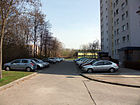
920 | Berl, waters in Hohenschönhausen | March 28, 1984 | The street leads from Zingster Strasse to Ribnitzer Strasse and bypasses Berl, which gives it its name. The term Berl (swamp) is possibly eponymous for the city of Berlin. |
|
| At the Breiten Luch
( Location ) |
740 | Wide Luch, former wetland near the road | Oct 6, 1982 | The street leads in a north-west-south-east direction through the district on Mühlengrund. In addition to six to eleven-storey residential buildings, there are various schools and the Am Breiten Luch sports field on the street. |

|
|
Barther Strasse
( Location ) |
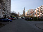
1015 | Barth , town in Mecklenburg-Western Pomerania | March 28, 1984 | The street leads from Zingster Strasse first to Darßer Strasse and then in the immediate vicinity of this to Ribnitzer Strasse. A memorial plaque on house number 3 reminds that the foundation stone for the large housing estate Hohenschönhausen was laid here in 1984. |
|
| Biesenbrower Strasse
( Location ) |
1390 | Biesenbrow , part of the city of Angermünde in Brandenburg | Dec. 19, 1986 | The street is located in the district on both sides of Vincent-van-Gogh-Straße and runs in an arc from Welsestraße over Vincent-van-Gogh-Straße to Randowstraße. |

|
| Borner Strasse
( Location ) |
390 | Born a. Darß , municipality in Mecklenburg-Western Pomerania | March 28, 1984 | The street leads from Dierhagener Straße to Barther Pfuhl, where it bends and ends at Barther Straße. |

|
|
Crivitzer Strasse
( Location ) |
350 | Crivitz , town in Mecklenburg-Western Pomerania | May 21, 1986 | The street runs from Grevesmühlener Strasse over Demminer Strasse to Neubrandenburger Strasse. |

|
|
Dargun Street
( Location ) |
105 | Dargun , an unofficial country town in the north of the Mecklenburg Lake District | Jan. 2, 2015 | “The road connecting Neubrandenburger Strasse and Woldegker Strasse, which has already been dedicated to the public, will be named Darguner Strasse. This was decided by the district assembly on the recommendation of the culture committee. The godmother is the town of Dargun, which is located in the north of the Mecklenburg Lake District because a corresponding family of names from the state of Mecklenburg-Western Pomerania already exists in the vicinity of the street in Neu-Hohenschönhausen. "Darguner Straße delimits the previously undeveloped area of Neubrandenburger (# 31, 33), Rostocker, Woldegker Straße between the green area and the daycare site. After 2015, 23 white terraced houses with anthracite accents were erected here in three rows on 0.66 hectares, which together form a property community: Woldecker Straße 31–45 (odd), Darguner Straße 4–16, 18–30 (even). |

|
|
Darßer Strasse
( Location ) |
1145 (in the district) |
Darß , part of the Fischland-Darß-Zingst peninsula in Mecklenburg-Western Pomerania | Jan. 18, 1990 | The street originally only ran from Falkenberger Chaussee to Ribnitzer Straße and was extended in 1992 over the Darßer Bridge to Roelckestraße in Weißensee. A short distance at the beginning is in Alt-Hohenschönhausen, the section west of the footpath to Perler Straße is in Weißensee. |

|
| Demminer Strasse
( Location ) |
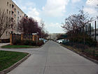
520 | Demmin , town in Mecklenburg-Western Pomerania | Apr 10, 1985 | The street leads from Egon-Erwin-Kisch-Strasse over Crivitzer Strasse and ends at Neubrandenburger Strasse. The youth art school Lichtenberg is located in this street (house number 4) . |
|
| Dierhagener Strasse
( Location ) |
420 | Dierhagen , municipality in Mecklenburg-Western Pomerania | March 28, 1984 | The street in the Ostseeviertel leads from Zingster Strasse to Barther Strasse. |

|
| Doberan Street
( Location ) |
680 | Bad Doberan , town in Mecklenburg-Western Pomerania | March 28, 1984 | The street is located in the northwest of the district and runs from Zingster Straße in an arc to Ribnitzer Straße. The middle section of the road runs through the Niles settlement. Based on the course of the street, the originally planned horseshoe-shaped floor plan of the settlement can be clearly seen. It was previously known as 10 Street . |

|
|
Egon-Erwin-Kisch-Strasse
( Location ) |
1335 | Egon Erwin Kisch (1885–1948), Austro-Hungarian and Czechoslovakian writer, journalist and reporter. | Apr 10, 1985 | The street leads from Falkenberger Chaussee east of the Hohenschönhausen S-Bahn station along the Berlin outer ring and ends at the corner of Ernst-Barlach-Straße and Wartenberger Weg. |

|
| Ernst-Barlach-Strasse
( Location ) |
610 (in the district) |
Ernst Barlach (1870–1938), German sculptor, writer and draftsman | Aug 31, 1992 | The road begins on the Fennpfuhlweg shortly after the border with Wartenberg as an extension of the Dorfstraße and leads from there to the Egon-Erwin-Kisch-Straße intersection, where it becomes the Wartenberger Weg. Until 1992 it was called Fritz-Große-Straße , before that until 1985 it had the traditional name Malchower Weg . |

|
|
Falkenberger Chaussee
( Location ) |
2375 (in the district) |
Falkenberg , part of the Lichtenberg district | Beginning 19th century | The street is part of the historical connection between Berlin and Bad Freienwalde (Oder) . At the beginning of the 19th century it was expanded into a road. The Chaussee has been expanded to four lanes including the median for the tram up to Welsestrasse and then continues in two lanes to Falkenberg. With the exception of a short section at the beginning, the street is completely in Neu-Hohenschönhausen. |

|
|
Gehrenseestrasse
( Location ) |
250 (in the district) |
Gehrensee , waters in the district of Falkenberg | Jan. 11, 1980 | The road runs from Wartenberger Strasse in Alt-Hohenschönhausen to Falkenberg. From the Gehrenseestrasse S-Bahn station of the same name, it runs along the border between Neu-Hohenschönhausen and Marzahn and ends a few meters behind it at the intersection with Pablo-Picasso-Strasse and Bitterfelde Strasse, where it turns into Hohenschönhauser Strasse. It was previously called Falkenberger Strasse . |

|
| Graaler way
( Location ) |
310 | Graal-Müritz , municipality in Mecklenburg-Western Pomerania | Feb 21, 2000 | The road runs from Darßer Strasse near the border to the suburb of Malchow first to the south and then parallel to it. It ends at a branch of Darßer Straße, which is an extension of Ribnitzer Straße. The street is to serve to develop an industrial area south of Darßer Straße. |

|
| Grevesmühlener Strasse
( Location ) |
595 | Grevesmühlen , town in Mecklenburg-Western Pomerania | May 21, 1986 | The street runs north parallel to Falkenberger Chaussee from Egon-Erwin-Kisch-Strasse to Prendener Strasse. The Falkenbogen shopping arcade is located in the middle. |

|
|
Hagenower Ring
( Location ) |
600 | Hagenow , town in Mecklenburg-Western Pomerania | Apr 10, 1985 | The street goes north from the intersection of Ernst-Barlach-Straße / Egon-Erwin-Kisch-Straße / Wartenberger Weg and ends after two arcs again at Ernst-Barlach-Straße. |

|
| Main way
( Location ) |
105 (in the district) |
according to its importance as the central street of the KGA Falkenhöhe 1932 | after 1932 | The street is the central street of the Falkenhöhe settlement in Wartenberg . Apart from a short stretch north of Falkenberger Chaussee, the street is in Wartenberg. |

|
| Hohenschönhauser Strasse
( Location ) |
1410 (in the district) |
Alt-Hohenschönhausen , part of the district of Lichtenberg | around 1900 | As an extension of Gehrenseestrasse, the road runs along the border to Marzahn in the direction of Falkenberg and ends on the eastern edge of the Falkenberg village center at the intersection of Dorfstrasse / Ahrensfelder Chaussee. |

|
| Hohenschönhauser Weg
( Location ) |
795 (in the district) |
Alt-Hohenschönhausen , part of the district of Lichtenberg | handed down | The street forms the historical connection between Alt-Hohenschönhausen and Malchow. With the construction of the housing estate, the street became a footpath and the southern end was given up in favor of an expansion of Darßer Straße. |

|
|
Klützer Street
( Location ) |
395 | Klütz , town in Mecklenburg-Western Pomerania | May 21, 1986 | The road leads from Grevesmühlener Strasse over an arch to the north and ends at Neubrandenburger Strasse immediately in front of the Wartenberger Gutshof and the district boundary. |

|
| Kröpeliner Strasse
( Location ) |
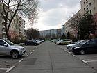
295 | Kröpelin , town in Mecklenburg-Western Pomerania | May 21, 1986 | The street leads from Grevesmühlener Straße to Neubrandenburger Straße. Another branch of the road continues to a branch of Grevesmühlener Straße and ends in front of it as a dead end. |
|
| Kühlungsborner Strasse
( Location ) |
315 | Kühlungsborn , town in Mecklenburg-Western Pomerania | March 28, 1984 | The road leads from Doberaner Strasse first through the Niles settlement and then through the edge of the new development area to Zingster Strasse. It was previously referred to as Street 12 . |

|
|
Data line
( Location ) |
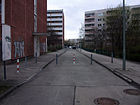
510 | Mate: field name and length or area measure | Oct 6, 1982 | The street is located in the Mühlengrund district and leads as a dead end near Falkenberger Chaussee starting to Röttkenring. The last section between Rüdickenstraße and Röttkenring is closed to through traffic. At the same time, the Hohenschönhausen District Office was located there until 2001. |
|
|
Neubrandenburger Strasse
( Location ) |
1115 | Neubrandenburg , town in Mecklenburg-Western Pomerania | Apr 10, 1985 | The street forms the border between the new development areas Hohenschönhausen V and VI and runs approximately in an east-west direction from Prendener Strasse to Egon-Erwin-Kisch-Strasse. The district boundary to Wartenberg runs north of the eastern section. |

|
| Nienhagener Strasse
( Location ) |
200 | Nienhagen , municipality in Mecklenburg-Western Pomerania | March 28, 1984 | The street runs parallel to Ribnitzer Straße at the back of the RiZ shopping center and runs between Zingster Straße and Zum Hechtgraben. |

|
|
Pablo Picasso Street
( Location ) |
1470 | Pablo Picasso (1881–1973), Spanish painter, printmaker and sculptor | Dec. 19, 1986 | The street leads from Falkenberger Chaussee from the intersection of Egon-Erwin-Kisch-Straße along the Berlin outer ring to the southeast. The street forms the southern end of the district along Vincent-van-Gogh-Straße, the south-eastern section also serves to develop an industrial area that is being developed. The street ends at the intersection of Gehrenseestrasse and Hohenschönhauser Strasse and turns into Bitterfelder Strasse, which is already in Marzahn. |

|
| Passower Strasse
( Location ) |
495 | Passow , municipality in Brandenburg | Dec. 19, 1986 | The street is located in the east of the district, right on the edge of the new development area and runs in an arc to the south-east parallel to Wartiner Straße. |

|
| Prendener Street
( Location ) |
395 | Prenden , part of the community Wandlitz in Brandenburg | May 21, 1986 | The street forms the direct connection between Falkenberger Chaussee and Wartenberger Dorfstraße, into which it changes after passing the suburb of Wartenberg. The course of the street largely corresponds to the original continuation of Wartenberger Straße , whose name it bore from 1906. Before that, the street had the traditional name Wartenberger Weg . |

|
| Prerower place
( Location ) |
280 × 160 | Prerow , municipality in Mecklenburg-Western Pomerania | March 28, 1984 | The square is the center of the Neu-Hohenschönhausen district and also the center of the former Hohenschönhausen district . The area known as Prerower Platz includes the rectangular area north of the intersection of Falkenberger Chaussee at the corner of Zingster and Rüdickenstraße, which includes the Linden Center with the Anna Seghers Library, a polyclinic and various residential buildings. |

|
|
Randowstrasse
( Location ) |
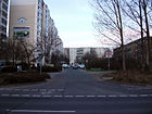
910 | Randow , rivers in Brandenburg and Mecklenburg-Western Pomerania | Dec. 19, 1986 | The street leads across Vincent-van-Gogh-Straße from Welsestraße to Pablo-Picasso-Straße. |
|
| Reriker Street
( Location ) |
410 | Rerik , town in Mecklenburg-Western Pomerania | March 28, 1984 | The street leads from Doberaner Straße in an arch to Nienhagener Straße. It runs through both the Niles settlement and the new development area on Zingster Strasse. It was previously known as Straße 11 . |

|
| Ribnitzer Strasse
( Location ) |
1200 | Ribnitz-Damgarten , town in Mecklenburg-Western Pomerania | March 28, 1984 | The street begins southwest of the Wartenberg S-Bahn station in the northern part of the district on Zingster Straße. From there it leads over Zingster Straße, turns south at Doberaner Straße and ends at Darßer Straße.
As a special feature, it is worth mentioning that the “Monte Balcony” was built here, a climbing rock made of precast concrete, operated by the AlpinClub Berlin . In house Ribnitzer Straße 1B there is the “Kiezlüt 'neighborhood house”, which is used as a cultural meeting point. |

|
| Rostocker Strasse
( Location ) |
695 | Hanseatic City of Rostock , city in Mecklenburg-Western Pomerania | Apr 10, 1985 | In the new development area at Krummen Pfuhl, the street leads from Ernst-Barlach-Strasse in a winding form to Egon-Erwin-Kisch-Strasse. |

|
| Rotkamp
( Location ) |
635 | Rotkamp, old field name in the Wartenberg district | Oct 6, 1982 | The street is located in the new development area Hohenschönhausen III and leads from a side street of Falkenberger Chaussee to Wartenberger Straße. A cul-de-sac leads towards Falkenberger Chaussee and ends in front of it as a dead end. The mill wheel fountain built here at the small shopping center in the 1980s based on plans by the metal artist Achim Kühn is remarkable . |

|
| Röttkenring
( Location ) |
435 | Röttken, old field name on the Wartenberg district | Oct 6, 1982 | The road in the Mühlengrund development area leads in a semicircle from the Breiten Luch. |

|
| Rudickenstrasse
( Location ) |
825 | Rüdicken, old field name on the Malchow district | Oct 6, 1982 | The road leads from Falkenberger Chaussee first along the tram route in the direction of Gehrenseestrasse and after crossing it to the Breiten Luch. |

|
|
Schwerin Ring
( Location ) |
770 | Schwerin , capital of Mecklenburg-Western Pomerania | Apr 10, 1985 | According to its name, the street leads in an arch north of Ernst-Barlach-Straße and bypasses the L-shaped block it encloses. The northernmost point of the district is located on the Seelgraben near the road. |

|
| Seehausener Strasse
( Location ) |
665 | Seehausen , part of the municipality of Oberuckersee in Brandenburg | Dec. 19, 1986 | The street is located in the south of the district on Vincent-van-Gogh-Straße and leads from this with two branches to Pablo-Picasso-Straße. It forms the border between the new development area and the industrial area north of Pablo-Picasso-Straße and serves primarily as a connection between the two main streets. |

|
|
Vincent van Gogh Street
( Location ) |
860 | Vincent van Gogh (1853–1890), Dutch painter | Sep 30 1992 | The street forms the central main thoroughfare of the Hohenschönhausen VII area and leads from Falkenberger Chaussee out of Prendender Straße to the southeast. The road ends at the edge of the new development area and continues in a footpath to the Falkenberger Krugwiesen nature reserve. |

|
|
Warnemünder Strasse
( Location ) |
550 | Warnemünde , part of the Hanseatic city of Rostock in Mecklenburg-Western Pomerania | Apr 10, 1985 | The street is located in the new development area Krummer Pfuhl and leads from Ernst-Barlach-Straße parallel to Egon-Erwin-Kisch-Straße along to Rostocker Straße. |

|
| Warnitzer Strasse
( Location ) |
920 | Warnitz , part of the municipality of Oberuckersee in Brandenburg | Dec. 19, 1986 | The street leads from Pablo-Picasso-Straße into the quarter on Vincent-van-Gogh-Straße and shortly afterwards splits into two branches. The southern one leads to Randowstrasse, the northern one to Vincent-van-Gogh-Strasse. The northern side facing Falkenberger Chaussee houses a small shopping mall with the Warnitz arches. |

|
| Wartenberger Strasse
( Location ) |
1285 (in the district) |
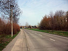
Wartenberg , part of the Lichtenberg district | before 1906 | The road leads from the main road in Alt-Hohenschönhausen to the northeast and is located from Arnimstrasse in Neu-Hohenschönhausen. The originally direct route over the Berlin outer ring to Prendener Straße and the Wartenberg village center was changed in 1983. Since then, the street has run parallel to the outer ring and ends after crossing under Falkenberger Chaussee on Wustrower Straße. |
|
| Wartenberger way
( Location ) |
275 (in the district) |
Wartenberg , part of the Lichtenberg district | handed down | The street is the historical connection between Wartenberg and Malchow. It begins in Malchow on Dorfstraße, from there to the east. A short section between the Berlin outer ring and the Seelgraben lies in the district of Wartenberg. The street ends at the Egon-Erwin-Kisch-Straße intersection and turns into Ernst-Barlach-Straße. |

|
| Wartiner Strasse
( Location ) |
930 | Wartin , part of the Casekow community in Brandenburg | Dec. 19, 1986 | The road begins near the Falkenberger village center on Falkenberger Chaussee and leads from this at the edge of the new development area in an arc to Biesenbrower Straße. |

|
| Welsestrasse
( Location ) |
1160 | Catfish , river in Brandenburg | Dec. 19, 1986 | The street leads from Falkenberger Chaussee near Wendeschleife Falkenberg in an arch over Vincent-van-Gogh-Straße to Randowstraße. The local shopping centers Welse-Galleries 1 and 2 can be found on the street. |

|
| Wiecker Strasse
( Location ) |
415 | Wieck a. Darß , municipality in Mecklenburg-Western Pomerania | March 28, 1984 | The street is located in the new development area on Zingster Straße and runs parallel to it from Ribnitzer to Dierhagener Straße. |

|
| Woldegker Strasse
( Location ) |
440 | Woldegk , town in Mecklenburg-Western Pomerania | Apr 10, 1985 | The street forms the western edge of the new development area on the border with the Wartenberg village center and leads from Ernst-Barlach-Straße to Neubrandenburger Straße. West of the street is the Krumme Pfuhl, under which the new building area in this area is also known. |

|
| Wustrower Strasse
( Location ) |
1090 | Wustrow , municipality in Mecklenburg-Western Pomerania | March 28, 1984 | The street leads from Falkenberger Chaussee a short distance along the Berlin outer ring and ends at Ribnitzer Strasse. It forms the north-western end of the district on Zingster Strasse. |

|
|
Zingster Street
( Location ) |
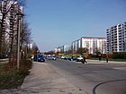
1305 | Zingst , municipality in Mecklenburg-Western Pomerania | March 28, 1984 | The street forms the central axis of the new development area Hohenschönhausen III, the 'Ostseeviertel'. It runs from Falkenberger Chaussee near Prerower Platz in a north-westerly direction. Up to Ribnitzer Straße it is developed as a main road, then as an access road. The street ends at the edge of the new development area on Doberaner Straße or Am Berl. |
|
| To the Krugwiesen
( Location ) |
175 | Falkenberger Krugwiesen , landscape protection area in the Lichtenberg district | 4th July 2005 | The road, which was created during the development of a commercial area in the affected area, leads in a north-westerly direction from Pablo-Picasso-Straße. In 2012, on the initiative and with the financial commitment of the Howoge housing company, the renovation of a recreational sports facility was tackled. A stadium called 'Daisy' is being built on a previous industrial wasteland for around 7,000 euros . |

|
| To the Hechtgraben
( Location ) |
460 (in the district) |
Hechtgraben, flowing water in the Lichtenberg district | March 28, 1984 | The street begins on Wartenberger Weg in Malchow. At the beginning of the Niles settlement it runs in Neu-Hohenschönhausen and ends at Ribnitzer Straße. It was previously referred to as Strasse 14 . |

|
See also
literature
- Anke Huschner: Hohenschönhausen . In: Wolfgang Ribbe (Ed.): History of the Berlin administrative districts . tape 15 . Stapp Verlag, 1995, ISBN 3-86134-532-3 .
- Hans-Jürgen Mende (Ed.): Lexicon of all Berlin streets and squares. From the foundation to the present . 2nd volume. New Life / Edition Luisenstadt, Berlin 1998, ISBN 3-355-01491-5 .
- Walter Püschel : Walks in Hohenschönhausen . Haude & Spener, Berlin 1995, ISBN 3-7759-0398-4 .
Web links
- Office for Statistics Berlin-Brandenburg: Directory of streets and squares in the Lichtenberg district (as of January 2015) (PDF)
- Streets in Neu-Hohenschönhausen. kaupert media gmbh, accessed on April 9, 2010 .
- Mirko Tamkus: Old Berlin City Map Archive. Retrieved March 18, 2010 .
Individual evidence
- ↑ Some additional information can be found at www.berliner-stadtplan.com [1]
- ^ Map of Berlin 1: 5000: Darguner Strasse
- ^ Road named after Dargun . In: Berliner Woche , December 31, 2014
- ↑ The price of the condominium was named 320,000 euros in spring 2017.
- ↑ homepage JuKSL
- ↑ Local leisure tips. In: Berliner Woche , January 27, 2016, p. 4.
- ↑ Colorful league. Stadium for recreational football. In: Berliner Morgenpost , Wochenend-Extra, Lichtenberg edition from 8./9. September 2012
