List of streets and squares in Berlin-Köpenick

The list of streets and squares in Berlin-Köpenick describes the street system in the Berlin district of Köpenick with the corresponding historical references. At the same time, this compilation is part of the lists of all Berlin streets and places .
overview
The road system and principles of its naming
Köpenick has 66,765 inhabitants (as of December 30, 2019) and includes the postcode areas 12459, 12555, 12557, 12559 and 12587. There are 227 dedicated streets and 14 named places in the district, plus unnamed places along the street and private streets, such as the five in the industrial area of the Wuhlheide innovation park. Of the streets listed, 12 lead to the neighboring districts with the same name (including Berlin street number). The total length of the (listed) streets in the district is 119.3 kilometers.
As was customary at the beginning, the first streets were named according to the direction in which they went, here Kaulsdorfer, Biesdorfer, Mahlsdorfer, Dahlwitzer, Müggelheimer or Berliner Straße or Chaussee. Painters, well-known writers such as Slevogt, Goethe, Schiller, and terms from nature such as trees and flowers also played an essential role in the choice of names for the streets and squares. Nine streets are named after fairy tale characters and are part of the fairy tale district. There are 22 streets in the district, which were named in 1928 and in the 1930s after places that came to Poland as a result of the Treaty of Versailles . Another 56 streets bear the names of people who played a role in the history of the former town of Köpenick (fishermen, manufacturers, landowners, castle residents, mayors, politicians).
After their further expansion, some streets were initially called "Extended ...", about half of which were later integrated into the actual street. Three such designations are still preserved (as of July 2017). In the period after the Second World War , street names that honored previous rulers were renamed; instead, victims or persecuted persons from the time of National Socialism were named after Werner Seelenbinder , Ernst Grube or Bruno Hämmerling.
Borders to the neighboring districts
The forest, the adjacent water bodies of the rivers Dahme , Spree and Wuhle as well as the historical center of the former fishing village Köpenick, the localities Spindlersfeld and Wendenschloß as well as the Allende quarters I and II structure the course and the area of the district and thus the road system. The district of Köpenick borders on Grünau to the south , starting approximately at the level of the Großer Rohrwall island in the Langen See through which the Dahme flows . The district boundary runs further northwest or northwards to the mouth of the Teltow Canal , from there on the south bank of the canal to the west to about 100 meters before the bridge of the Berlin railway ring . Now the border changes its direction: north and east of Adlershof on the eastern edge of the railway system. From the Köllnische Brücke via the Schöneweide – Spindlersfeld S-Bahn line , Köpenick borders on Niederschöneweide as far as the Wilhelm-Spindler-Brücke . From here on, the border (now to Oberschöneweide ) runs eastwards on the south bank of the Spree. It crosses the Spree at the mouth of the Wuhle, runs along the west bank of the Wuhle to the pyramid bridge that crosses the An der Wuhlheide street, and then turns northwest. Along the Rudolf-Rühl-Allee it crosses the Wuhlheide, reaches the border with the Lichtenberg district of Karlshorst via the Wuhlheide S-Bahn station at the northern end of the Rudolf-Rühl-Allee . Here she turns to the east. Other neighboring districts of the Marzahn-Hellersdorf district to the north are Biesdorf , Kaulsdorf and Mahlsdorf . In the northeast, the Berlin city limit to the Brandenburg municipality of Hoppegarten (part of the Waldesruh municipality) is also the border of Köpenick. Now the border to Friedrichshagen begins in a south-westerly direction, first on the eastern edge of the Mittelheide to the S-Bahn line to Erkner (near the Hirschgarten S-Bahn station), then south along Hirschgartenstraße. The Green Fließer transition, the east bank of the Neuenhagen Mill little river and the south bank of the Müggelspree (eastwards from about Salvador Allende Bridge ) determine the further boundary line before the Spreetunnel to the settlement Mueggelhort the Great Müggelsee is crossed. The border to Rahnsdorf begins directly on the lake . Finally, the edge of the settlement of Müggelheim forms the district boundary of Köpenick in a southwestern direction. Between Jagen 192 in Müggelheim and Jagen 401 in the Köpenick city forest, the Lange See is reached again.
Overview of streets and squares
The following table gives an overview of the streets and squares in the district as well as some related information.
- Name / location : current name of the street or square. Via the link Location , the street or the square can be displayed on various map services. The geoposition indicates the approximate center of the street length.
- Traffic routes not listed in the official street directory are marked with * .
- Former or no longer valid street names are in italics . A separate list may be available for important former streets or historical street names.
-
Length / dimensions in meters:
The length information contained in the overview are rounded overview values that were determined in Google Earth using the local scale. They are used for comparison purposes and, if official values are known, are exchanged and marked separately.
For squares, the dimensions are given in the form a × b for rectangular systems and for (approximately) triangular systems as a × b × c with a as the longest side.
If the street continues into neighboring districts, the addition ' in the district ' indicates how long the street section within the district of this article is. - Name origin : origin or reference of the name.
- Notes : further information on adjacent monuments or institutions, the history of the street and historical names.
- Image : Photo of the street or an adjacent object.
| Name / location | Length / dimensions (in meters) |
Origin of name | Date of designation | Remarks | image |
|---|---|---|---|---|---|
|
Adlershofer Strasse
( Location ) |
410 | Adlershof , neighboring district | Early 19th century | The street is located between Rudower and Glienicker Straße in the local area of Köllnische Vorstadt . It is said to have been created in its course around 1812, so that the name is based on the former direct connection between Köpenick and Adlershof. On the eastern side it was built on with houses; opposite is the cemetery of the Laurentius parish . |

|
| Maple Avenue
( Location ) |
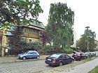
400 | Maple , deciduous tree | before 1925 | The street in the local area of Berlin-Spindlersfeld was laid out according to the development plan around 1891 as a path to the Spindlersfeld recreation house , consisting of the parts street 157 and street 158 . It leads from Daheimstrasse in a south-easterly direction and joins Mentzelstrasse. |
|
| Alfred-Randt-Strasse
( Location ) |
1030 | Alfred Randt (1899–1945), resistance fighter against the Nazi regime | 16 Sep 1981 | It meanders like a staircase between Erwin-Bock-Straße (west) and Müggelschlösschenweg through a newly built residential area in the 1980s. There are three social institutions in their vicinity: the Berliner Stadtmission, the Kita 'Rappelkiste' and the Diakoniewerk Bethel eV The Strandschloßweg that used to run here has been integrated into the route.
In 2014 the Berlin Senate built a home for 400 refugees on the previously undeveloped side of this street from colorful living containers. |

|
| Allendeweg (*)
( Location ) |
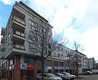
230 | Salvador Allende (1908–1973), Chilean President 1970–1973 | March 16, 1998 | The path starts on both sides from Wendenschloßstraße at number 45. It is not listed in the official directory, it includes ten house numbers. The district office of the Die Linke party is located in Allendeweg 1 . |
|
| Old Kaulsdorfer Strasse
( Location ) |
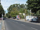
220 | Kaulsdorf , northern neighbor | May 5, 1961 | The traffic route is part of an earlier connecting road between Köpenick and the village of Kaulsdorf. Until 1961 it was continuously called Kaulsdorfer Straße . With the development of the area, the southern course of the road was redrawn. It now ends on Mahlsdorfer Straße instead of Am Bahndamm. The original route between Kaulsdorfer Straße and Am Bahndamm was given the addition "Old" to distinguish it. |
|
| old market
( Location ) |
180 | Market square of Köpenick |
Traditionally (17th century) |
The street consists of two parts - one forms a connection between Lüdersstraße (north) and Landjägerstraße (south). The other runs in a west-east direction from Schüßlerplatz to (m) Katzengraben. The residential buildings (numbers 2, 4 and 7) are under monument protection. The primary school, built in 1876/77, is also located here, a three-storey clinker facing building that was used as a language therapy school until 1990. In the 21st century, the building served as a district library. It will be expanded with a structurally adapted transverse new building to form a learning and exhibition complex (central library) . The library administration is housed in the historic school building. | |
| Altgrabauer Strasse
( Location ) |
200 | "Altgrabau" or "Alt Grabau", place in West Prussia , since 1920 Grabowo Kościerskie, part of Nowa Karczma in Poland | Jan. 7, 1928 | When the road system was laid out, it was called road 5a . It runs in a north-south direction from Bahrendorfer Strasse to Bachwitzer Strasse. |

|
|
Alt-Köpenick
( Location ) |
320 | Center of the settlement of Köpenick | July 31, 1947 | The street or individual sections have had the following names since the construction of the street: Schloßstraße , Breite Straße , Marktplatz , Schloßplatz , Schloßstraße , Litzmanndamm , Litzmannplatz , Max-Betcke-Straße and Max-Betcke-Platz . It is the oldest street in Köpenick, it connects Schloßplatz (in the south) with Lindenstrasse (in the north). The oldest residential buildings in the town have been preserved and placed under monument protection on this street , as are the Köpenick town hall and the St. Laurentius town church . The street runs parallel to the Dahme , from the Köpenicker Castle to the dam bridge. |

|
| Am Amtsgraben (*)
( Location ) |
360 | Amtgraben, neighboring river | March 16, 1998 | The path goes from Am Berg to the southeast, crosses the Allendeweg and Am Schlossberg. Then it makes a 90-degree bend and leads northwest as a footpath onto Wendenschloßstraße . It is not included in the official register. |

|
| On the embankment
( Location ) |
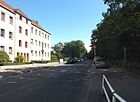
500 | Dam along the railway line | before 1925 | The road runs parallel to the railway line to the north. It connects Hämmerlingstrasse (west) with Mahlsdorfer Strasse (east). It continues to the west as Schubertstrasse and to the east as Stellingdamm. |
|
| At the Wuhlheide train station
( Location ) |
105 (in the district) |
Wuhlheide S-Bahn station | 23 Dec 1983 | The street runs from Rudolf-Rühl-Allee to below the eastern edge of the road bridge. The next section is in Oberschöneweide. A previous street name is not known. |

|
| On the mountain
( Location ) |
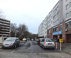
80 | located on the former "Schwefelberg" | March 16, 1998 | The street goes from Wendenschloßstraße on both sides , its northwest area is a dead end . The Nitritfabrik AG, Chemische Fabrik , had disposed of their waste here from 1830, which had slowly grown into a dump. The access road there was initially called Straße 10 . In the 1960s, a small park was created on the heap. Because of its origin, the facility was popularly known as the “ Sulfur Mountain ”. In 2005 the dump was cleared, the name of the street remained. |
|
| At the Ernst-Grube-Park
( Location ) |
120 | Neighboring park , named after Ernst Grube (1890–1945), politician and resistance fighter against the Nazi regime | Apr 1, 2009 | The path is on the northern edge of the eponymous park between Angersteinweg and Ernst-Grube-Straße. It is not a highway. |

|
| At the Generalshof
( Location ) |
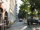
180 | adjoining former manor ; until 1806 served as an apartment for the commanders of the mounted Feldjägerkorps stationed in Köpenick (casually called generals) | Apr 21, 1932 | The street had existed as Alte Fürstenwalder Straße since the 19th century . During the development, the street layout was changed in such a way that part of the previous street disappeared and the rest was named Am Generalshof. At Generalshof 1a is the Protestant parish hall , built in 1927/1928 according to plans by Otto Firle in the style of New Building . At Generalshof, Friedrichshagener Straße goes south-west and is a dead end . The sculpture The Washerwoman by Hans-Peter Göttsche (picture) is a reminder of the history of the district. |
|
| At the Kietzer field
( Location ) |
240 | 'Kietzer Feld', the name of a historic parcel | June 24, 1960 | The road runs between the banks of the Dahme and Grüne Trift in a west-east direction. It comprises 24 house numbers and was only created when a new residential area was built. |

|
| At the Krusenick
( Location ) |
390 | Krusenick peninsula, which is accessed from the road | March 16, 1998 | The street goes exactly south from Friedrichshagener Straße and leads to the Müggelspree. On its way it forms two western branches that connect to a footpath. In the southern area, it runs as a one-way street system in an arch and encloses a larger area. The name Krusenick is said to come from Slavic and means "pear place" ('kruscha' or 'kruschka' = the pear). From this it is concluded that pear trees used to grow or were planted here. |

|
| At Maria-Jankowski-Park
( Location ) |
110 | neighboring park, named after Maria Jankowski (1887–1946); Resistance fighter against the Nazi regime | July 23, 2007 | The street branches off from Bahnhofstraße in a north-west direction as a cul-de-sac and touches the green area. The road D7 and the adjacent park were named in honor of the politician's 120th birthday . On one side of the street is a post office that was completed in 1954 (on the right edge of the picture; pink; address Bahnhofstrasse 61/62). |

|
| At Marienhain
( Location ) |
160 | The green space between Dahme-Ufer and Wendenschloßstraße , Marien 'could refer to Princess Marie, who lived at Köpenick Castle. |
Oct. 1, 2009 | The previous street 241 was renamed in 2009. The area was developed and used agriculturally by the dairy owner Carl Bolle in the 19th century , later changing hands several times. The road goes south from Segewaldweg to Marienhain. |

|
| At the Müggelsee (*)
( Location ) |
2170 | Great Müggelsee |
Traditionally (17th century) |
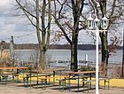
This promenade along the west bank of the Müggelsee runs from Müggelschlößchenweg (northwest) to the street at Müggelhort (east). It is a not officially designated hiking and cycling route. |
|
| On the Schlossberg
( Location ) |
120 | In contrast to the “Schwefelberg” and based on the Köpenick Castle | after 1998 | On the Schloßberg there is a private road to the south-east of Wendenschloßstraße. It leads to the street Am Amtsgraben. |

|
| At the playground
( Location ) |
210 | playground | around 1927 | The street in west-east direction divides roughly in the middle and encloses a larger playground on a green area. It runs from Fliederstraße to Erlenstraße, beyond that it continues as Cedernstraße in an easterly direction. |

|
| At the factory garden
( Location ) |
100 | Film factory (factory) | Sep 11 2012 | The short street goes eastwards from Am Krusenick and leads to the former premises of the film factory (Friedrichshagener Straße), where both historical buildings have been restored and new buildings have been erected. They are used as commercial and residential buildings. The traffic route bends south on the surface. It seems that the street should first be called Am Filmlager , as the search on Google Earth shows (as of September 2014). |

|
| At the Wiesengraben
( Location ) |
300 | Wiesengraben or Kuhgraben, which drains the area into the Long Lake | June 24, 1960 | The small road goes north-northwest from Am Kietzer Feld and opens up the settlement area. |

|
| At the Wuhleufer
( Location ) |
730 | Wuhle , tributary of the Spree | after 2000 | The street in the Wuhlheide Innovation Park is a private street for residents and extends Hämmerlingstraße to the north to the Wuhlebrücke in the course of Hoppendorfer Straße. Access to the site is closed at night and on weekends. |

|
| Ambacher Strasse
( Location ) |
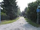
80 | 'Ambach', town in the province of Posen , since 1945 Kozia Góra, district of Wyrzysk in Poland | Jan. 7, 1928 | When the road system was laid out, the traffic route was called Straße 3 . Ambacher Straße branches off southwards from Argenauer Straße and ends as a dead end. |
|
| Amtsstrasse
( Location ) |
240 | Location of the former office building , the administrative seat of the Köpenicker rule | before 1812 | The Amtsstraße branches off from the northern lane of Müggelheimer Straße in an east-northeast direction, crosses Landjägerstraße and ends at the meadows of the Amtsgraben (formerly also known as Kietzgraben). |

|
| At the film factory
( Location ) |
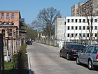
300 | On the site of the historic film factory | Sep 11 2012 | The street runs from Friedrichshagener Straße (north) to Am Krusenick (south) and provides access to residential and commercial buildings. It includes house numbers 1–21. |
|
| At the Wuhlheide
( Location ) |
240 (in the district) |
Wuhlheide , neighboring forest area | Jan. 7, 1928 | The main part of the street is in Oberschöneweide . When the eastern section was widened, part of the northern lane came from the pyramid bridge and the old course of Köpenicker Allee (since 2011: Rudolf-Rühl-Allee) with lots 263 and 265 (odd) in front of the sports grounds of the Alte Försterei to the district. |

|
| Anemone Street
( Location ) |
580 | Anemone , ornamental plant from the buttercup family | around 1927 | Anemonenstraße runs between Salvador-Allende-Straße and Birkenstraße in the shape of a segment of a circle in an east-northeast direction. It was created at the beginning of the 1920s. |

|
| Angersteinweg
( Location ) |
130 | Eduard Angerstein (1830–1896), teacher and first chairman of the German gymnastics teachers association | Nov 5, 1942 | The Angersteinweg, originally laid out as road 153 , connects the Eiselenweg via the Harnischweg to Ernst-Grube-Park. It runs in a north-south direction. |

|
| Annenallee
( Location ) |
340 | Anna Oetting, landowner and daughter of the local politician Friedrich Oetting | before 1893 | Annenallee runs from Cardinalplatz in an east-south-east direction via Joachimstraße, Hämmerlingstraße to Bahnhofstraße. |

|
| Argenauer Strasse
( Location ) |
300 | 'Argenau', town in the province of Posen , since 1945 Gniewkowo in Poland | Jan. 7, 1928 | The street in the north-west of Köpenick was first called (around 1923) Straße 4 . It begins on Kaulsdorfer Straße as a continuation of the Wongrowitzer Steig in a westerly direction. At the confluence with Görsdorfer Straße it turns to the northwest and later continues to the northeast as Piepertswinkel. From here a footbridge connects to the west over the Wuhle with the street Am Wuhleufer. |

|
| Cinderella Street
( Location ) |
130 | Cinderella , Grimm's fairy tale | July 26, 1927 | The street was named street B I after its layout at the beginning of the 20th century . It connects Mahlsdorfer Straße (northwest) with Rotkäppchenstraße (southeast) and continues about 100 meters southeast of Rotkäppchenstraße as Rautendeleinweg. |

|
| Asseburg path
( Location ) |
340 | Karl Otto Asseburg (1836–1915), businessman and manufacturer from Cöpenick; arranged for the Luisenhain to be built on the property inherited from the city of Köpenick |
June 13, 1936 | When the road system was laid out, the name Asseburgpfad Strasse 271 . It is located in the settlement area of Kietzer Feld and connects the Köpenzeile (west) in a slightly curved course with the sand chute path (east). |

|
| Azalea Street
( Location ) |
780 | Azaleas , ornamental plant of the genus Rhododendron | July 1, 2008 | The street was called Street 299 until a proper name was given . It lies between Salvador-Allende-Strasse and Birkenstrasse, over which it leads northwards, almost to the Müggelspree. In this area it forms three access branches and a square around the official pond. |

|
|
Bachstrasse
( Location ) |
160 | Bach (1685–1750), composer | around 1929 | It is located between Mozartstrasse and Hämmerlingstrasse in the north-west of Köpenick. |

|
| Bachwitzer Strasse
( Location ) |
260 | 'Bachwitz', town in the province of Posen , since 1945 Łukowiec, district of Sicienko in Poland | Jan. 7, 1928 | When the road system was laid out in 1923, it was called Straße 5 . Bachwitzer Straße connects Argenauer Straße (west) with Kaulsdorfer Straße (east) and is located in the north-west of Köpenick. |

|
| Bahnhofstrasse
( Location ) |
1040 | Koepenick train station | after 1840 | Bahnhofstrasse is the main street in Dammvorstadt and connects Elcknerplatz at the Köpenick S-Bahn station with Lindenstrasse. The entire length of the tram will go through it. The first post-war residential building was built from recycled bricks in 1948 (house number 40, top picture). Most of the houses on the east side of the street were built around the turn of the 19th and 20th centuries. Century, two are protected as architectural monuments. The western side of the street south of Seelenbinderstrasse was built on in the 1920s; Most of these buildings are also listed. The Forum Köpenick was opened directly at the train station in 1997 . | |
| Bahrendorfer Strasse
( Location ) |
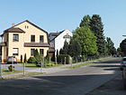
410 | 'Bahrendorf', place in West Prussia , since 1945 Niedźwiedź, part of Dębowa Łąka in Poland | Jan. 7, 1928 | Bahrendorfer Strasse was called Strasse 5b when it was built around 1922 . It runs from the north (Hoppendorfer Straße) in two guides that curve slightly eastwards to the south (Kaulsdorfer Straße). |
|
| Barbenweg
( Location ) |
400 | Barbel , a representative of the carp fish | June 24, 1960 | The Barbenweg connects the Asseburg Path with Dregerhoffstraße in a north-west-south-east route. It is located in the Wendenschloss area. |

|
| Bellevuestrasse
( Location ) |
330 | "Bellevue" = beautiful view, should refer to the view of the surroundings from a vineyard laid out here |
before 1912 | At first the traffic route was named Lebendorfer Straße after the place Lebendorf in West Prussia . Bellevuestraße is a short north-south connection between Brandenburgplatz and the intersection of Fürstenwalder Damm / Salvador-Allende-Straße. |

|
| Bendigstrasse
( Location ) |
280 | Adolf Bendig (1876–1943), City Councilor in Köpenick until 1933, Social Democrat | July 31, 1947 | The street is located in the Wendenschloss settlement area. When the residential area was developed, it was called Fontanestraße (until 1937), then Günther-Roß-Straße .
The Bendigstraße runs in a north-west-south-east direction between Lienhardweg and Logauweg. Smaller villas were built along the street. A villa on this street (plot 11) was used in the 1960s for the administration of an institute for electronic components that was being established. Their task was to prepare a large-scale microelectronics research center, which was abandoned with the decision of a party congress in 1970. Some areas of this institute then moved to Friedrichshain . The villa is now privately owned again and was extensively restored in 2007 (see picture below). |

|
| Berlewitzweg
( Location ) |
720 | Jürgen Berlewitz (14th / 15th century), councilor | Nov 23, 1933 | The name given to part of the street in 1933 is reminiscent of a little-known person in Köpenick's history: Berlewitz had given the owner of the pledged castle and town of Köpenick, Burgrave Friedrich VI. of Nuremberg on September 26, 1413 brought the news that the deposit has now been released. With the contract that followed, Köpenick came into the possession of the Hohenzollern Margraves.
The street in the Wendenschloss settlement area was named Hoher Weg after its location around 1930 . The southern section kept this name until 1961. The Berlewitzweg runs from Charlottenstraße to Lossowweg, beyond that it forms a dead end. |

|
| Biesdorf way
( Location ) |
190 (in the district) |
Biesdorf , direction to the neighboring Marzahn-Hellersdorf district | around 1929 | The path runs between Hadubrandstrasse in the Biesdorf district and Am Wuhleufer. The district boundary is crossed between Bismarcksfelder and Bischofstaler Straße. In 1969, Biesdorfer Weg was extended southwards from Bischofstaler Straße in order to re-establish the connection between the Wuhlheide S-Bahn station and Hoppendorfer Straße via Tiergartenstraße . The direct connection via road 26 was interrupted by the construction of the (now demolished) Academy for Marxist-Leninist Organizational Science (AMLO). The path is undeveloped in the Köpenick area. |

|
| Birkenstrasse
( Location ) |
110 | Birches , widespread European deciduous trees | December 1924 | It runs from Azaleenstrasse to Dahlienstrasse and is located east of the Allende district in the former Kämmereiheide. Birkenstrasse was probably laid out around 1920. |

|
| Birnbaumer Strasse
( Location ) |
490 | 'Pear tree', town in the province of Poznan , since 1945 Międzychód in Poland | 28 Sep 1935 | When the road system was laid out around 1910, the traffic route was given the name Beethovenstraße .
Birnbaumer Straße begins in the northwest, initially running up to Schubertstraße. Then it turns east, crosses Hämmerlingstrasse and leads as a dead end street to the west bank of the Wuhle. From there it runs as a footpath over a bridge over the Wuhle, crosses an unnamed path (the southern extension of Görsdorfer Straße) to a new drivable section of Birnbaumer Straße. It then crosses Kaulsdorfer Straße and ends east at the bend in Hoernlestraße. |

|
| Bischofstaler Strasse
( Location ) |
200 (in the district) |
, Bischofsthal ', until 1892 and again since 1945 in Polish Tuszkowo, part of the municipality of Sośno Ort in the former West Prussian district of Wirsitz, since 1945 in Poland | Jan. 7, 1928 | The street, laid out around 1922 as Straße 9 , goes west of Kaulsdorfer Straße and leads to the turning hammer in front of the district boundary on the east bank of the Wuhle. It continues without connection via the Wuhle with properties 20-26 in the Marzahn-Hellersdorf district. Here the western edge of the road forms the border to Biesdorfer Weg. A footpath and bike path along the east bank of the Wuhle connects Bischofstaler Strasse with Hoppendorfer Strasse in a north-south direction. |

|
| Bockmühlenweg
( Location ) |
150 | Post mill | Oct. 1, 2009 | The path was created from Street 234 and Street 239 . It forms a "T" and lies between Marienhütter Weg and (as a junction) Zum Dahmeufer. The Bockmühlenweg is located in the area west of Wendenschloßstraße . The road network reaching here as far as the Dahme initially received a number system between 230 and 241, which is only gradually being replaced by proper names. |

|
| Borgmannstrasse
( Location ) |
300 | Gustav Borgmann (1838–1908), Mayor of Köpenick 1871–1904 | 1908 | Borgmannstrasse connects Elcknerplatz (north) with Mandrellaplatz (south). It runs east of Bahnhofstrasse. It is located in the Dammvorstadt area. The school building complex (number 3 and Kiekebuschstrasse 6), which was built in 1902/1903 as the 6th and 9th community school, is particularly noteworthy. |

|
|
Böttcherstrasse
( Location ) |
90 | Böttcher , historical name for a wooden vessel manufacturer | 17th century | The Böttcherstraße in Köpenick's old town is reminiscent of two of the tradesmen who lived here in the employers' estate. It runs between Rosenstraße (north) and Grünstraße (south), although it is not continuous for motor vehicles. |

|
| Brandenburgplatz
( Location ) |
60 × 70 (irregular) |
Brandenburg an der Havel , city | around 1900 | Brandenburgplatz forms the northern area of the fork in the street Seelenbinderstraße, Bellevuestraße, Zur Güterbahn. It is hardly noticeable as an urban space, its south-western part is cut through by Seelenbinderstraße, while on its north-eastern part there are some track sections of the former freight railway. The associated green area is neglected (status August 2014). |

|
| Bream Path
( Location ) |
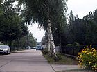
550 | Bream , Low German name for the lead fish species | June 13, 1936 | The bream path was called Straße 63 when it was built around 1900 . It is located in the northwest area of the Wendenschloss settlement towards the Müggelforst. It runs from Mayschweg to Pritstabelstraße. Its northern continuation is the Green Trift. |
|
| Wide alley
( Location ) |
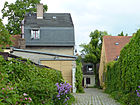
60 | Street width at the facility | Feb. 18, 1927 | It runs from the east bank of the Dahme, Frauentog Bay, to Kietz. Unofficially, it was previously referred to as Wassergasse because it had been created for the fire brigade to access the water. It is open to the public from 9 a.m. until the street lights turn on. |
|
| Bukesweg
( Location ) |
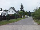
350 | Michael Bukes, member of a fishing family that has lived in Köpenick since the 17th century | June 13, 1936 | The Bukesweg connects the Asseburg path (north) across Dregerhoffstraße (south) with an unmarked west-east footpath. The traffic route also continues to the south, but is not officially named. Around 1922 it was laid out as Straße 7 .
The name Bukes is mentioned in 1936 by a citizen of Köpenick: Alfred Bukes, city inspector . |
|
|
Cardinal place
( Location ) |
30 × 30 | Georg Friedrich Cardinal of rams (1721-1804), Mayor of Koepenick 1756-1785, on the St. Lawrence Cemetery buried | Oct 10, 1936 | The square in the north of Köpenick in the direction of Wuhlheide was named Bismarckplatz after the German Chancellor Otto von Bismarck . Cardinalplatz forms the northern tip at the junction of Cardinalstrasse (previously: Kurfürstenallee ) with Annenallee. |

|
| Cardinalstrasse
( Location ) |
260 | Georg Friedrich Cardinal von Widdern (1721–1804), Mayor of the City of Köpenick 1756–1785 | Oct 10, 1936 | The street was laid out at the same time as Bismarckplatz around 1885 and was named Kurfürstenallee after Friedrich Wilhelm, Elector of the Holy Roman Empire . |

|
| Cedernstrasse
( Location ) |
280 | Cedars (Cedrus), plant genus of the pine family | around 1926 | Cedernstrasse, laid out around 1920, opens up the Kämmereiheide. It runs in a slight curve from Birkenstrasse (northeast) to Erlenstrasse (southwest). |

|
| Charlottenstrasse
( Location ) |
580 | Princess Charlotte of Prussia (1798–1860), later as Alexandra Fyodorovna Empress of Russia | before 1893 | The Charlottenstraße is a pure west-east street, which leads as an extension of the Gartenstraße to Grüne Trift. It is located in the Wendenschloss Nord villa colony. The Arthur Becker Club Drachenbootsportverein has set up directly on the bank, under parcel number 1 . |

|
| Claus-Dieter-Sprink-Weg |
100 length is estimated; in October 2015 the way is still being worked on |
Claus-Dieter Sprink (1954–2006), long-time director of the Köpenicker Heimatmuseum | Nov 27, 2014 | The newly designated footpath leads from the Alter Markt behind the central library and forms the continuation of the Katzengraben. By giving the name, the Treptow-Köpenick district office honors Sprink's services in maintaining the historical and cultural heritage in the Treptow-Köpenick merged district. |

|
|
Home Street
( Location ) |
150 | Private villa "at home" in the local area Spindlersfeld | June 13, 1936 | First, around 1922, it was C Street . In 1937, road D was included. It originally ran (1937) between Gloriastraße and the siding. Three houses, named after their owners, were built at that time. From this it can be concluded that the southern piece was spun off later. Daheimstrasse is a dead end street and a small northward corner of Ahornallee. |

|
| Dahlienstrasse
( Location ) |
270 | Dahlias , sunflower plant genus, autumn flower | around 1926 | Dahlienstraße, laid out around 1920, connects Birkenstraße via Schmale Gasse with Heimgartenstraße in the Kämmereiheide area. |

|
| Dammheidestrasse
( Location ) |
300 | Dammheide , forest area between Köpenick and Kaulsdorf | July 13, 1934 | The street was created by renaming Eschenstraße and merging it with a section of Eichenallee (now Pflanzgartenstraße), both of which were laid out around 1913.
It is located in Uhlenhorst and runs in a west-east direction from Filehner Straße to Pflanzgartenstraße. |

|
|
Däumlingsweg
( Location ) |
220 | Thumbnail , Grimm's fairy tale | Feb. 18, 1927 | The path, initially referred to as Straße H , connects Genovevastraße in north-south direction with Straße Mittelheide. It is unpaved, only built on one side and on its west side is the Köpenicker Forest. |

|
| Sleeping Beauty Street
( Location ) |
780 | Sleeping Beauty , Grimm's fairy tale | July 6, 1927 | The Dornröschenstrasse runs in a gentle curve between Mahlsdorfer Strasse and Genovevastrasse in the fairytale district. It was laid out as Street C around 1920.
This street is part of a Berlin-wide tree-planting campaign that will provide a total of 10,000 new trees in the urban space by 2017. It is financed through donations and state funds. From November 19, 2012, 198 young street trees were planted along Dornröschenstrasse. |

|
| Dorotheenstrasse
( Location ) |
300 | Dorothea, Electress of Brandenburg , wife of Elector Friedrich Wilhelm | 1886 | Dorotheenstrasse connects Wendenschloßstrasse (west) with Müggelheimer Damm. However, the eastern end is only a footpath. The residential development took place around 1850, the houses number 3 and 4 date from this time. |

|
| Dregerhoffstrasse
( Location ) |
1270 | Dregerhoff, long-established fishing family from Köpenick. A representative is said to have been a lay judge in Köpenick in 1773. | Nov 23, 1933 | Dregerhoffstraße is located in the eastern settlement area of Kietzer Feld and runs between Wendenschloßstraße (west) and Sandschurrepfad (east). It leads a little further to the east. The road system was created around 1930. |

|
| Druschiner Strasse
( Location ) |
350 (in the district) |
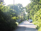
"Druzhin", town in West Prussia , since 1945 Drużyny, part of Bobrowo in Poland | Aug 16, 1928 | The street lies between Egersfelder Allee and the suburbs on the Graben zur Wuhle . It was laid out between 1910 and 1920 and was first called Straße 18 . A part is located in Kaulsdorf-Süd. To the north of the street is the Dammheide, the south side (built-up plots 24–52) belongs to Köpenick. |
|
|
Egersfelder Allee
( Location ) |
530 | 'Egersfeld', town in Upper Silesia , since 1920 Kamien , district of Rybnik in Poland | Jan. 7, 1928 | Egersfelder Allee was laid out as Straße 25 around 1920. It extends from Hohenkircher Allee (west) with a break shortly before the intersection with Kaulsdorfer Straße to Druschiner Straße (northeast). |

|
| Eiselenweg
( Location ) |
230 | Ernst Wilhelm Bernhard Eiselen (1793–1846), gymnastics and fencing instructor in Berlin | Nov 5, 1942 | Eiselenweg, laid out as road 155 , is located in the north of the Spindlersfeld location. It runs in a west-east direction from Angersteinweg over Ernst-Grube-Straße. At its eastern end, a footpath leads directly to the western bank of the Dahme, which is part of a nameless green area. |

|
| Eitelsdorfer Strasse
( Location ) |
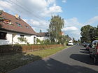
610 | Eitelsdorf, place in the province of Posen , since 1945 Nowawieś Pałucka, district of Gąsawa in Poland | May 17, 1930 | Until it was named, it was called Street D30 . Eitelsdorfer Straße in the Uhlenhorst area connects Semliner Straße with Mahlsdorfer Straße in a roughly west-east route. The eastern continuation of the street is Rautendeleinstrasse. |
|
| Ekhofplatz
( Location ) |
60 (round) |
Konrad Ekhof (1720–1778), actor, called the "father of German acting" because of his realistic style of representation | March 15, 1939 | Ekhofplatz, laid out as Schillerplatz in the southern area of the Wendenschloß villa colony around 1892 , forms a roundabout at the intersection of Ekhofstrasse (west-east) and Ostendorfstrasse (north-south). The street of the same name continues across the square as a footpath. |

|
| Ekhofstrasse
( Location ) |
410 | Konrad Ekhof (1720–1778), actor, called the "father of German acting" because of his realistic style of representation | March 15, 1939 | Ekhofstrasse, laid out as Schillerstrasse in the southern area of the Wendenschloß villa colony around 1892 , runs in a west-east direction from Niebergallstrasse to Slevogtweg. It is interrupted by the square of the same name. At the level of the Slevogtweg, it continues as a field path in the adjacent landscape protection area (see picture). |

|
| Elcknerplatz
( Location ) |
120 × 110 × 40 (triangular) |
Johann Friedrich Wilhelm Elckner (1746–1812), cartographer, mechanic of the Royal Prussian Academy of Sciences , created the field cadastre of the Cöpenick area in 1815 . |
July 25, 1935 | The square was created after 1870 from a section of the road to the freight yard . Elcknerplatz is the southern forecourt of the Köpenick S-Bahn station . It lies between Bahnhofstrasse and Borgmannstrasse and continues to the east as a dead-end street for about 100 meters. The actual space is very small, so that the character as an urban space is hardly noticed. |

|
| Elseneck
( Location ) |
90 | Small settlement 'Elsengrund', which was built here at the beginning of the 1920s by a non-profit settlement company. | Nov 9, 1926 | The Elseneck is a short spur road leading north from Waldburgweg in the Mittelheide area. |

|
| Erlenstrasse
( Location ) |
370 | Alders , European deciduous trees that love moisture | around 1926 | Erlenstrasse, laid out around 1920, connects Müggelschlößchenweg with Anemonenstrasse in the south-north direction. The southern section up to Heimgartenstrasse was only added after 1927. A short north section is a dead end street, which continues as a nameless footpath in the adjacent forest area. |

|
| Ernst-Grube-Strasse
( Location ) |
780 | Ernst Grube (1890–1945), carpenter and victim of the Nazi regime | May 4th 1962 | The traffic route was built in the Spindlersfeld settlement in the 1930s and was named Spindlersfelder Straße on June 13, 1936 . Ernst-Grube-Strasse runs from Eiselenweg (north) with a few turns to Ottomar-Geschke-Strasse just before its intersection with Oberspreestrasse. The Spindlersfeld S-Bahn station is right next to it . To the south of Ernst-Grube-Park there is an access branch to the west. Between Ernst-Grube-Strasse, Oberspreestrasse and Ottomar-Geschke-Strasse there is a spacious but unnamed park that has been maintained by the Green Spaces Office. (lower picture) |

|
| Erpetaler way
( Location ) |
170 | Erpetal, a valley of the Erpe , which gave its name to the allotment garden 'Erpetaler Weg' | around 1944 | The path with lots 1–14 is in the Mittelheide and leads south in the district as a forest path over the former shooting range Mittelheide. It borders Hoppegarten in the north and is accessed through the access via Mahlsdorf-Süd. The former Gestellweg is most likely after the KGA 'Erpetal', which was built during the Second World War as a makeshift housing estate for bombed out people. | |
| Erwin-Bock-Strasse
( Location ) |
540 | Erwin Bock (1908–1939), plumber and victim of National Socialism | 19 Sep 1981 | Erwin-Bock-Strasse was created when the Salvador-Allende district was being expanded. It goes south from the Müggelschlößchenweg and after a slight swivel southwest reaches the Müggelheimer Damm. |

|
| Eating place
( Location ) |
40 × 40 (trapezoidal) |
Paul von Essen (1886–1933), locksmith and victim of National Socialism | July 31, 1947 | The square essentially consists of the intersection area Schmausstraße (from the north), Waldburgweg (from the east) and Stellingdamm (from the west). When the small house settlement Elsengrund was built (around 1920), the complex, then called Dahlwitzer Platz , formed the center. During the Nazi era , it was renamed Gleuelplatz after Ronald Gleuel, a member of the SA storm from Köpenick. On the side of the square, in a small green area, there is a memorial stone for the victims of the Köpenick Blood Week honored here with street names . |

|
|
Falkendamm
( Location ) |
250 | Field name Falkenhain, certainly derived from the falcons observed here | Oct 10, 1936 | The traffic route was laid out in the 19th century and was initially called Falkendammer Strasse . The Falkendamm lies in the Wendenschloß Süd area and connects Bendigstrasse with the Hirtengarten street. It also leads eastwards as a cul-de-sac. From here a footpath goes through the forest to the Neue Wiesen road. |

|
|
Färberstrasse
( Location ) |
460 | Dyer , craftsman who dyes textiles permanently | after 1887 | The Färberstrasse runs from the Mentzelpark west-southwest to Oberspreestrasse. The street name refers to the master silk dyer and laundry entrepreneur Carl Spindler , who founded the Spindlersfeld location. The former factory settlement for the Spindler factories is located in this street and the parallel Mentzelstraße . It is considered the first workers' settlement in Berlin. A model house for the “Central Association for the Welfare of the Working Class” was built in Färberstrasse 17/19 in 1887 as a three-storey clinker cladding building with an economical structure. The villa (Färberstraße 26), which was built around 1890 in historicizing forms (lower picture), is a somewhat more elaborate building . |

|
| Wrong way
( Location ) |
60 | Barthel Fehle, fisherman in Köpenick (17th century) | Nov 23, 1933 | The Fehleweg is an access road (cul-de-sac) in the Wendenschloß villa colony going east from the Finkeldeweg. |

|
| Field flower path
( Location ) |
390 | Field flowers , collective name for wild flowers that were previously observed in large numbers on the Kietzer field | June 24, 1960 | The path was laid out as road 287 . It starts off eastwards from Grüne Trift and is thus in the Kietzer Feld area. After about 80 meters it bends south and leads over the Lienhardweg, which is located in the Wendenschloß villa colony.
Around 2014 new residential buildings will be built on the east side of the road, which will be marketed as the 'Feldblume villa colony'. |

|
| Filehner Strasse
( Location ) |
640 | 'Filehne', town in the province of Poznan , since 1945 Wieleń in Poland | June 9, 1933 | Filehner Strasse begins at Gehsener Strasse and then runs in a north-east direction to Dammheidestrasse. On Gehsener Straße it forms an access branch running south-west. When the traffic route was laid out, it was called road D11 . |

|
| Finkeldeweg
( Location ) |
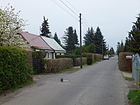
1040 | Finkelde, also Finkeldey; Fisher family in Köpenick (16th century) | Nov 23, 1933 | The Finkeldeweg begins north of the Kürißweg and then runs almost in a straight line southwards to Dregerhoffstrasse. It opens up the middle section of the Wendenschloß villa colony. |
|
| Flansweg
( Location ) |
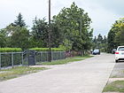
380 | Georg von Flanß, also von Flans , (16th century), castle captain of Köpenick | Nov 23, 1933 | The path was named Street F on its layout . When assigning the proper name, the previous street 264 was also included. The Flansweg, located in the south of the Kietzer Feld, connects the Riebekeweg with the Brassenpfad. |
|
| Flemmingstrasse
( Location ) |
390 | Clara Mathilde Adelheid von Flemming (1832–1907), owner of an estate in Köpenick, which was sold in 1871 to Carl Spindler. Her manor house remained there until 1929. | around 1900 | Flemmingstrasse, which was initially written without a double m, is located in Spindlersfeld. It runs from the south-west bank of the Dahme in a straight line west-south-west to Oberspreestrasse. The district library is located at this junction. Opposite the confluence of the bend in Gutenbergstrasse there is a foot and cycle path that connects to Mentzelstrasse. |

|
| Lilac Street
( Location ) |
360 | Lilac , ornamental shrub | around 1926 | The road was built around 1920 in the Kämmereiheide area. It connects the Azaleenstrasse (north) with the Müggelschlößchenweg (south). The shortening from Azaleenstraße and the connection to Müggelschlößchenweg only emerged after the official name was given, because the route between Forst and Heimgartenstraße is specified in the address book from 1927. |

|
| Frau-Holle-Strasse
( Location ) |
220 | Frau Holle , Grimm's fairy tale | July 26, 1927 | At installation of the road system around 1920 it was called Street J . It connects Uhlenhorster Strasse (west) with Sterntalerstrasse (east). |

|
| freedom
( Location ) |
230 | Exemption from taxes and military service for the Huguenots who settled here at the beginning of the 18th century . | around 1765 | The street was created by filling the bank on what was then called Alte Wassergasse am Buschgraben (later Katzengraben) around 1705. In its original spelling it was called Electoral Freyheit , soon afterwards just Freyheit . First eight houses for French woolen weavers were built here. Later, separate buildings were constructed for the wool - manufacturers of which have been preserved and listed building two (house numbers 12 and 12a / b). The house Freiheit 1/2 was built in 1875 for the (first) Köpenicker Bank according to plans by the architects Albert Eveking and Joseph Schewe . The parsonage for the evangelical-reformed castle church community bears the house number 14. Other architectural monuments are number 15, a school, and number 16, the former district court.
Freiheit lies in the north of the old town of Köpenick and connects Alt-Köpenick in a west-east route with the street Katzengraben. On plot number 8, which was later rebuilt, there was a synagogue until 1938 , which was destroyed in the notorious night of the pogrom (top picture: memorial plaque). |
|
| Friedenstrasse
( Location ) |
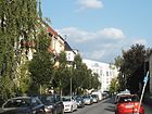
150 | should refer to the quiet and peaceful location of the street | December 1919 | The Friedenstrasse begins about 50 meters west of the Hämmerlingstrasse , crosses it and ends before the Berlin – Frankfurt (Oder) railway line . When this northern area of Köpenick was laid out, the Friedenstraße ran only between Biesdorfer Straße (later E Hämmerlingstraße) and the railway line. In 1940 it was extended westward by two pieces of land to the "Wuhlheide district". |
|
| Friedrichshagener Strasse
( Location ) |
1500 +540 (Nordschleife) | Friedrichshagen , neighboring town to the east | around 1920 | The street was laid out around 1893 on a section of a historic postal route and because of the direction Friedrichshagener Chaussee , sometimes also called Friedrichshagener Damm . It connects Bahnhofstrasse (west) with Salvador-Allende-Strasse (east). In the middle, Friedrichshagener Strasse forms a protuberance north-east of Bellevuepark for a commercial complex that was built here after 1990. Worth mentioning is a listed lime kiln built by the Paul Selchow construction company at number 6 . Furthermore, the factory buildings of the VEB Fotochemische Werke (number 9; emerged from the Vereinigte Glanzfilm AG founded in the 1920s ) and the Köpenick cable works (number 11; the former main factory of Vogel AG , which was founded in the 1910s ) have been preserved. Almost the entire monument complex is occupied by donor companies, and the Köpenick City Theater is particularly noteworthy .
Finally, the north side of Friedrichshagener Straße is bordered by Bellevuepark, which was created in place of the previous vineyard. A number of water sports clubs have settled on the side of the street facing the water, and the “Joseph Schmidt” music school can also be found here. |

|
|
Fürstenwalder Dam
( Location ) |
150 (in the district) |
Fürstenwalde , direction of the road | Apr 21, 1932 | Earlier names in the 19th century were Cöpenicker Straße and Fürstenwalder Chaussee as well as Berliner Straße and Straße 50 . The Fürstenwalder Damm begins to the east on the street Bellevuestraße / Salvador-Allende-Straße . Only plots 237 and 257a – g belong to Köpenick, for which the street forms a northward arm. Its Köpenick part is underflowed by the Neuenhagener Mühlenfließ . The dam connects the traffic from Friedrichshagen with four lanes to Bellevue- / Salvador-Allende-Straße and two-lane traffic to the opposite direction in a southern carriageway separated by the route of tram lines 60 and 61 . |

|
| Twinkle corridor
( Location ) |
440 | Christian Funkel, 1652 Schulze on the Kietz. Funkel was one of the few survivors in the Cöpenicker Kietz after the Thirty Years' War |
June 13, 1936 | The sparkling corridor was named Straße 54 when it was built in the 1920s . It runs between Asseburg path and over Dregerhoffstraße to a nameless footpath along the forest area. The term “corridor” suggests a footpath, which is not the case here. |

|
| Futranplatz
( Location ) |
100 × 60 | Alexander Futran (1879–1920), engineer and local politician ( USPD ) in Berlin, murdered by a volunteer corps in the Kapp Putsch . | July 31, 1947 | The square is between Freiheit, Lüdersstrasse and Am Katzengraben, the postal address is building number 1 on the southern edge of the square. The southern boundary of the square is also called Futranplatz. The town square is a lawn with a playground and is surrounded by trees and bushes. After its completion in 1894 it was called Friedrich-Wilhelm-Platz . The memorial stone erected there was rededicated to Futran in 1947 (photo).
On September 25, 2013, the mayor of Köpenick, Oliver Igel, and the artist Ben Wargin unveiled a new granite slab in honor of the politician Futran. It bears the inscription “1933–1938–1945 Destroyed Diversity”. |

|
|
gardenstreet
( Location ) |
670 | fenced-in area that the residents had laid out behind their homes to protect them against herds of cattle | 19th century | Gartenstrasse in the local area of Kietz runs west-southwest from Müggelheimer Strasse and joins the southern tip of Kietz Strasse after around 260 meters. From here it first turns south, then leads in a slight curve south-east along the east bank of the Dahme to Charlottenstrasse. When it was built after 1750, it was called Hinter dem Gehege . Boat building companies and water sports clubs set up shop on the east side of the street at an early stage. In 1922, a bathing establishment is indicated on parcel number 25 / 25a. The residential buildings from the second half of the 19th century (numbers 11, 22, 23, 31 and 33) were architectural monuments until the 1990s. The house number counting was changed in later years, so that the earlier historical buildings (No. 25) are now the numbers 42-48. Here is a communication and training center with a youth welfare association, the Krokodil restaurant , the outdoor swimming pool with a beautiful sandy beach, which has been in operation since 1897, and the Am Flussbad hostel in a three-storey brick building.
In addition, houses from various construction periods have been preserved in Gartenstrasse, some of which have also been renovated, which are not under monument protection due to too many structural changes. House numbers 57, 61, 63 (see picture below), 67, 69 and 71 are worth highlighting. |

|
| Gehsener Strasse
( Location ) |
810 | "Gehsen", place in East Prussia , since 1945 Jeże, part of Pisz in Poland | March 19, 1938 | Gehsener Straße runs between Kaulsdorfer Straße and Mahlsdorfer Straße in a north-west-south-east direction. The further street section is called Mittelheide. The street name was given in memory of an infantry regiment that was stationed in Köpenick at the beginning of the 20th century and that had fought a first battle near Gehsen during the First World War in 1915. At the house Gehsener Straße 103 there was a relief on the street front to Mahlsdorfer Straße from 1938 to 1945 that referred to the battle. Gehsener Straße is built on both sides with coherent, uniformly designed three-storey residential wings that date from the time the street was built and are set back almost exactly in the middle, resembling a square. Here Filehner Strasse leads in the south of Gehsener Strasse through an apartment block. At the junction of Kaulsdorfer Straße, Alte Kaulsdorfer and Gehsener Straße there is a small, triangular, nameless square with trees (lower picture). |

|
| Gelnitzstrasse
( Location ) |
270 | Michael Gelnitz (17th century), named as one of the mayors of Cöpenick in 1614 | Dec. 4, 1930 | Gelnitzstraße runs in a slight south-east curve between Thürnagelstraße and Seelenbinderstraße. It was laid out in the Dammvorstadt in the 1920s and named Street 201 around 1928 . |

|
| Genovevastrasse
( Location ) |
720 | Genoveva von Brabant , early medieval legendary figure | July 26, 1927 | When the road system was laid out, it was given the name Straße AII . Genovevastrasse, located in the Märchenviertel, leads from Mahlsdorfer Strasse as an extension of Unter den Birken southeast to Däumlingsweg along Mittelheide. To the northeast it touches the allotment garden complex (KGA) 'In the old Wolfsgarten'. |

|
| Gladiolenstrasse
( Location ) |
300 | Gladioli , colorful bulbous plants of the Iris family | before 1927 | This road was laid out around 1920 in the Kämmereiheide area. It connects Azaleenstrasse with Heimgartenstrasse in a straight line from north to south. |

|
| Glasberger Strasse
( Location ) |
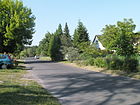
550 | 'Glasberg', village in the province of Poznan , since 1945 Głażewo, district of Międzychód in Poland | Jan. 7, 1928 | Glasberger Straße, laid out as Straße D in the 1920s , begins on the southern edge of Dammheide (north) and then runs southwards to Wongrowitzer Steig. |
|
| Glienicker Strasse
( Location ) |
900 | Glienicke , direction to the neighboring district | before 1920 | Glienicker Strasse in the Köllnische Vorstadt is an important traffic route between Grünauer Strasse (northeast) and Spindlersfelder Strasse (southwest). It ends at the district boundary to Adlershof and continues as Glienicker Weg . The residential colony Grünerlinde was laid out along the street around 1750 , the first buildings of which no longer exist. The houses that were built in their place in the second half of the 19th century were one or two-story and already architecturally designed. |

|
| Gloriastrasse
( Location ) |
250 | Gloria, special silk fabric that is woven from silk threads and worsted yarn | June 13, 1936 | Gloriastraße, Street A was laid out around 1926 , is located in Spindlersfeld. It goes from Ernst-Grube-Straße to the northwest. After branching off with the spinning path, it becomes a dead end. The name of the street takes a term from the Spindler company located here . |

|
|
Görsdorfer Strasse
( Location ) |
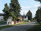
170 | Görsdorf, part of the municipality of Dahmetal in Brandenburg | Jan. 7, 1928 | Görsdorfer Strasse connects Argenauer Strasse southwards with Zum Wuhleblick. According to the development plan, it was laid out as Straße 2 at the beginning of the 1920s . |
|
|
Grünauer Strasse
( Location ) |
1840 | Grünau , direction to the neighboring district | before 1920 | The traffic route in the Köllnische Vorstadt area runs from Köllnischer Platz / Rudower Straße along the west bank of the Dahme to the Grünauer Bridge over the Teltow Canal . In the beginning, numerous laundries have settled here because of the proximity to the water. On March 8, 1935, the southern extension to the Grünau border was added to Grünauer Strasse. Most of the houses are in the northwest area and were built in the second half of the 19th century. They are largely preserved and are under monument protection . |

|
| Green Trift
( Location ) |
2130 | Trift , name for the path on which domestic cattle were herded | 1700 | The road runs on the Kietzer field and lies between Müggelheimer Damm and Lienhardweg. On the Green Trift, the cattle of the Köpenick arable citizens were driven to the pastures in front of the city forest . In the 1930s, the traffic route was also referred to as a settlement on the green Trift . At that time, the houses were still named after their owners. The educational facility Evangelische Schule Köpenick - Gymnasium has been located in the southeast area since 2006 . |

|
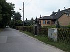
| Green Trift am Walde
( Location ) |
1170 | Green Trift , name for the path on which domestic cattle were herded |
Traditionally (18th century) |
The street lies between Mayschweg and Pritstabelstraße and continues over the latter as a dead end. On the Green Trift, the cattle of the Köpenick arable citizens were herded to the pastures in front of the Vorderheide .
The eastern side of the road is not built on with houses, but borders on forest, which is part of a nature reserve. |
|
| Green flowing corridor
( Location ) |
290 (in the district) |
'Grünfließ', place in East Prussia , since 1945 Napiwoda, part of Nidzica in Poland | Apr 10, 1931 | This path, initially footpath 303 , is between Hirschgartenstraße and Jastrower Weg in Friedrichshagen . Only the plots 1–25 on the west and south side of the street belong to Köpenick. |

|
| Grünstrasse
( Location ) |
160 | Green , lush planting between the fishing village and the castle |
Traditionally (18th century) |
Grünstrasse is the second oldest street in Köpenick after Schloßstrasse (Alt-Köpenick) and was probably first paved in the 17th century. Several residential buildings (numbers 4, 5, 6, 9, 10, 16, 21, 22, 23, 24) are listed architectural monuments. Until the middle of the 20th century, the side wings of the houses with small gardens and arbors extended to the Frauentog. With the redesign of the Köpenick bypass and the widening of the southern street on Schloßplatz, it lost its historical character. Up to the year 2000 the tram drove east here (top photo from 1990). - The street runs between Schloßplatz and Kietzer Straße.
Between two houses on this street there is a fallow area that is to be built on in 2017. As an interim use, the district office supported the art and architecture project at this location: a metal climbing rope was stretched between the house gables, which was dismantled and scrapped in December 2016. |
|
|
Güldenauer way
( Location ) |
980 | 'Güldenau', place in the province of Poznan , since 1945 Połajewo in Poland | before 1927 | The Güldenauer Weg connects the street in the forest (northeast) with the Gehsener street (southwest). With the new name in 1933, Amselstrasse (up to Kleinschewskystrasse) and D 14 (up to Gehsener Strasse) were merged. |

|
| Gutenbergstrasse
( Location ) |
390 | Johannes Gutenberg , inventor of the printing press | around 1900 | Gutenbergstrasse opens up the northeast area of the Köllnische Vorstadt. It starts off eastwards from Flemmingstraße, then turns south and ends at Oberspreestraße at Köllnischer Platz. The street name was chosen by the owner of a newspaper printer who bought the Flemming property. | |
|
Hämmerlingstrasse
( Location ) |
1460 | Bruno Hämmerling (1886–1944), worker in Köpenick and victim of National Socialism, lived on this street | Apr 24, 1948 | It was an earlier connection to the village of Biesdorf (18th century) and was therefore called Biesdorfer Straße until 1948 . The Hämmerlingstrasse is the continuation of the street Am Wuhleufer. Here at the northern end the Extended Hämmerlingstrasse crosses as a cross street . Hämmerlingstraße leads southwards in the western area of the Dammfeld location, crosses under the S-Bahn line to Erkner and ends at Annenallee in Dammvorstadt. Renovated rental houses at the Schubertstrasse / Schmale Strasse intersection bear the reference to the Koepenick civil servants' housing association, which was founded in 1908 and which probably began with the development here (lower picture). |

|
| Harnischweg
( Location ) |
140 | Christian Harnisch (1787–1864), theologian and teacher; earned special recognition in the development of the elementary school system | Nov 5, 1942 | The Harnischweg, laid out in the 1920s as Straße 154 , is a short west-east street in the local area of Spindlersfeld. It connects the Angersteinweg with the Ernst-Grube-Straße. |

|
| Heidekrugstrasse
( Location ) |
400 | Historic excursion restaurant “Heidekrug”, located on the border between Köpenick and Mahlsdorf | July 5, 1922 | The Heidekrugstraße, laid out as road D around 1900 , begins north on the Mittelheide as an extension of the Sterntalerstraße and then leads south to Waldburgweg. The street is located in Elsengrund. |

|
| Heimgartenstrasse
( Location ) |
560 | Heimgarten , outdated name for small gardens that are created for the self-sufficiency of the city dwellers | before 1930 | Heimgartenstraße forms the southern edge of the Kämmereiheide location. It runs north parallel to the Müggelschlößchenweg between Gladiolenstrasse and Dahlienstrasse. |

|
| Hirschgartenstrasse
( Location ) |
130 (in the district) |
Hirschgarten, adjoining forest | around 1913 | Hirschgartenstraße forms a cross street at the eastern end of Seelenbinderstraße. Plots 2-14 (straight) and the street are in the district. The district boundary runs on the eastern edge of the street, the plots 5-11 (odd) belong to Friedrichshagen . |

|
| Shepherd's garden
( Location ) |
130 | presumably for accommodation for the shepherds of the Köpenick cattle farmers | before 1930 | Hirtengarten is a short spur road going north from Falkendamm . |

|
| Hirtestrasse
( Location ) |
380 | Albert Hirte , banker, builder and founder of the 'Hirschgarten Colony' (1870) | around 1920 | Hirtestrasse runs in a slight south-east curve between Mahlsdorfer Strasse and Stellingdamm in the Elsengrund area. The turning loop of tram line 68 is located here (picture below). |

|
| Hoernlestrasse
( Location ) |
520 | Edwin Hoernle (1883–1952), politician and writer | May 5, 1961 | The street, laid out as street D12 , is located in the Dammfeld area and opens up the new district that was built in the early 1960s. It runs from Kaulsdorfer Strasse to Mahlsdorfer Strasse in a southeast direction. |

|
| Hohenkircher Allee
( Location ) |
180 | 'Hohenkirch', place in West Prussia , since 1920 Książki in Poland | Jan. 7, 1928 | The avenue, laid out as Straße 6 , connects the triangle Bahrendorfer Straße / Egersfelder Allee / Hohenkircher Allee in the north with Piepertswinkel (south). | |
| Hoppendorfer Strasse
( Location ) |
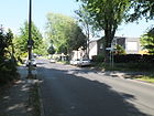
730 | 'Hoppendorf', place in West Prussia , since 1945 Hopowo, part of Somonino in Poland | Aug 16, 1928 | The traffic route begins at Druschiner Strasse and leads southwest over Kaulsdorfer Strasse and Hoppendorfer Bridge over the Wuhle to Biesdorfer Weg. Until 1969 it ended at the bridge and continued as street 26 , which led to the Wuhlheide S-Bahn station . |
|
| Hugo Wolf Steig
( Location ) |
130 | Hugo Wolf (1860–1903), Austrian-Slovenian composer | March 15, 1939 | The Steig is an access road leading from Wendenschloßstraße in the south to Dahme . When the road system was laid out in the Wendenschloß villa colony around 1893, it was called Dahmeweg after the river. |

|
|
Igelsteig
( Location ) |
150 | Hedgehogs , small mammals; probably because of the rural location, which offers good living conditions for hedgehogs | May 5, 1961 | The Igelsteig is a private road in the local area of Kietzer Feld to develop the residential area. It goes north from the street Am Kietzer Feld. |

|
|
Jaegerstrasse
( Location ) |
90 | The name refers to either (a) stationed in Koepenick BEEN company military police or street names (b) the way this for Amtshaus used |
Traditionally (18th century) |
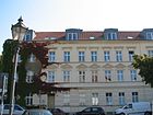
Jägerstrasse connects Kietzer Strasse with Alter Markt in a north-east direction. Several historical buildings are listed here (numbers 1/2, 4, 5). |
|
| Janitzkystrasse
( Location ) |
510 | Erich Janitzky (1900–1933), mechanical engineer and communist, victim of the Köpenick Blood Week | July 31, 1947 | The previous names of the traffic route were Ravensteiner Straße (around 1920; after the town of Ravenstein , until 1933) and Kleinstraße (after Franz Klein, a supporter of National Socialism ).
The street runs in a slight curve from Hirtestraße (west) to Schmausstraße near Essenplatz (east). Along this street there is a two-story residential development in four-family houses of the same design, as can be seen in the photo. |

|
| Joachimstrasse
( Location ) |
270 | Joachim Oetting, landowner in Köpenick and son of the Köpenick local politician and businessman Friedrich Wilhelm Oetting | before 1893 | Joachimstrasse connects Lindenstrasse (southwest) with Annenallee (northeast). |

|
| Judisgasse (*)
( Location ) |
70 | W. Judis, laundry owner | before 1929 | The alley served the W. Judis laundry as access to the water. It is the westward extension of Luisenstraße, going from the fork Kietz / Gartenstraße towards Dahme / Frauentog. It is no longer accessible to the public and is no longer listed in the official street directory. |

|
|
Karlstrasse
( Location ) |
500 | Karl, Prince of Prussia (1801-1883), a son of the Prussian King Friedrich Wilhelm III. and Queen Luise | 1877 | Karlstrasse runs in a slight north-east curve from Charlottenstrasse to Landjägerstrasse. Towards Wendenschloßstraße it forms a branch where a police station is located. |

|
| Cat pit
( Location ) |
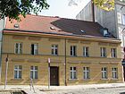
210 | Katzengraben, an artificially created watercourse from the south bank of the Spree in the old town area | May 10, 1951 | The road runs along the trench that was dug to drain the Kietzer meadows. This also created the Baumgarteninsel . Since 2001 there has been a footbridge from the northern end of this street to the other side of the Spree: the Katzengrabensteg . It leads to the Krusenick peninsula and the street of the same name. The accompanying street originally consisted of Wilhelmstrasse (from the 18th century) and Am Katzengraben (from 1927). They were combined in the renaming. |
|
| Kaulsdorfer Strasse
( Location ) |
1970 (in the district) |
Kaulsdorf , northern neighbor | Mid 19th century | The street is located between Mahlsdorfer Strasse (near the Köpenick S-Bahn station ) and the district boundary to Kaulsdorf around 70 meters north of Bischofstaler Strasse. It continues there under the same name. |

|
| Kaumanns Alley
( Location ) |
70 | Kaumann, fishing family (17th century) | Feb. 18, 1927 | The road goes west of Kietz. The short narrow alley (a water alley originally created for fire extinguishing purposes) forms a passage to the Frauentog between the properties Kietz 25 and 26. Although it is still shown as a street in the official street directory, it is not accessible to the public at any time. The Kaumann fishing family, who immigrated from Stralau, had lived on the Kietz (fishing settlement, until 1898 an independent village community) since 1670. | |
| Kiekebuschstrasse
( Location ) |
110 | Albert Kiekebusch (1870–1935), teacher in Köpenick 1890–1901 and natural scientist | Jan. 24, 1938 | The traffic route was named Kaiser-Friedrich-Straße when it was built around 1890 . The street, which was then renamed Kiekebuschstraße, was briefly (1945-1947) the name of the communist Albert Beyer , but was not officially confirmed. It connects Parrisiusstrasse in north-south direction with Seelenbinderstrasse. The monument of the former 6th and 9th community school is on plot number 6 (left side, brick building). |
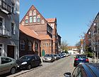
|
| Kienappelweg
( Location ) |
300 | Kienappel , Berlinisch for the cones of a pine | Nov 2, 2005 | The path goes south from Müggelheimer Damm to Grüne Trift am Walde. Its route uses a former forest road. |

|
|
Kietz
( Location ) |
270 | Kietz , a service settlement belonging to the castle |
Traditionally (18th century) |
The Slavic Kietz was first mentioned in documents in 1355 and remained a fishing village for centuries . It was not incorporated into Köpenick until 1898. Many restored fishermen's houses (single-storey plastered buildings with pitched roofs) have been preserved between Wilhelminian style buildings erected in the late 19th century . Listed monuments are the numbers 8, 10–21, 22b and 22c, 27. The houses numbers 4, 6, 18, 20, 23–25 and 28 are also listed, but are no longer in their original condition. |

|
| Kietzer Strasse
( Location ) |
180 | Kietz , a service settlement belonging to the castle | before 1922 | The Kietzer Strasse goes south from the Rosenstrasse as a dead end. To the north it leads as Kirchstrasse into the old town. In 1922 it was still connected to Müggelheimer Strasse. |

|
| Kinzerallee
( Location ) |
280 | Hugo Kinzer (1874–1929), master builder in Köpenick, architect, local politician | March 27, 1939 | The traffic route was initially called Stubenrauchstrasse after Ernst von Stubenrauch after it was laid out around 1909 . The Kinzerallee runs in a west-east direction. It goes off on both sides of Bahnhofstrasse and connects Hämmerlingstrasse with Puchanstrasse. |

|
| Kirchstrasse
( Location ) |
180 | St. Laurentius City Church | 1290 | It runs from Alt-Köpenick (northwest) southeast to Rosenstrasse. | |
| Kleingartenstrasse
( Location ) |
160 | Allotment garden , refers to the allotment garden settlement created here | after 1930 | It is located in Kämmereiheide and connects Cedernstrasse (northwest) with Dahlienstrasse (southeast). A square was named that way for a short time. |

|
| Kleinschewskystrasse
( Location ) |
1010 | Hermann Kleinschewsky, metal goods manufacturer (“cooking appliances and petroleum heating stoves”) and landowner in Köpenick, who had his land parceled out and sold for development | around 1920 | It forms a west-east connection between Kaulsdorfer and Mahlsdorfer Straße in the Dammfeld area. |

|
| Klepschweg
( Location ) |
130 | Klepsch, long-established farming family from Köpenick | Nov 23, 1933 | The Klepschweg is a crossroad of the Green Trift in its northern third. It was laid out as Street H around 1930 . In 1866 a C. Klepsch was shown in the Berlin address book as a "green dealer", and a widow G. C. Klepsch with a "Bollen, Gurken und Saamenhandlung". In the 21st century, two school buildings and a gym can be found in the eastern branch of this path. |

|
| Klingenburger Strasse
( Location ) |
140 | 'Klingenburg', place in the province of Posen , since 1919, as before 1906, Plawce, district of Środa Wielkopolska in Poland | Jan. 7, 1928 | The traffic route was laid out as Straße 7 around 1920. It connects Piepertswinkel in a west-east route with Hohenkircher Allee and is located in the Dammfeld area. | |
| Köllnischer Platz
( Location ) |
100 × 60 | Cölln , probably because of the direction to one of the two places of origin of Berlin | 1908 | The square, located in Köllnischen Vorstadt , is bordered by the Long Bridge , Oberspreestrasse and Rudower Strasse. Grünauer Strasse goes off to the south, Gutenbergstrasse leads north to the Spree-Eck. Part of the square was previously called the Rüdnischer Markt . As was customary at the time, the remaining part was written with a “C”, meaning Cöllnischer Platz .
The more triangular square serves as a parking lot, on the block on its west side a bronze plaque refers to the architects' collective for the development of the square and the surrounding streets, which received the 1986 "Architecture Prize of the Capital of the GDR". |

|
| Köpenicker Strasse
( Location ) |
720 (in the district) |
Road from Biesdorf to Köpenick | before 1838 | Köpenicker Strasse is located between Rudolf-Rühl-Allee (near the Wuhlheide S-Bahn station ) and the suburb of Biesdorf. It continues northwards to the Alt-Biesdorf street and borders the Wuhlheide Innovation Park in the district with parcel number 325 . |

|
| Köpenzeile
( Location ) |
1520 | Köpen or Köppen, long-established family in Köpenick; Martin Köpen (1607) and Jacob Köpen (1644) were Schulzen on the Kietz | June 13, 1936 | The Köpenzeile is in the Nachtheide area. It runs from Mayschweg (northwest), among other things, via Dregerhoffstraße, then swiveled slightly southwards, to the Feldblumenweg. When it was named in 1936, it was merged from Straße 62 and Straße 286 .
Noteworthy buildings are three buildings erected at different times, grouped together as the 'Free Montessori School' since the 1990s. This building complex (Köpenzeile 125) was renovated between 2010 and 2014 with funds from the European Regional Development Fund: roof, windows, facades, heating and ventilation system. The associated school type building from GDR times is also called the “pencil school” by the residents, because the gable wall facing the street is painted with giant colored pencils. |

|
| Kürissweg
( Location ) |
90 | Martin Küriß (17th century), fisherman in Köpenick | Nov 23, 1933 | The Kürißweg in the suburb of Kietzer Feld is located at the northern end of the Finkeldeweg and forms a dead end with eight plots leading eastwards . |

|
|
Landgartenweg
( Location ) |
210 | old field name Landgarten | Nov 23, 1933 | After the development plan of the route was first called road C . The Landgartenweg connects the Minkwitzweg (north) with the Dregerhoffstraße (south). It is located in the eastern area of the Wendenschloß villa colony. |

|
| Landjägerstrasse
( Location ) |
270 | Landjäger , former name for gendarmes, should specifically refer to a corresponding residential building | around 1910 | When the road system was laid out around 1800, the path was called Große Trift and thus referred to the cattle drive. The road begins on the Landjägerbrücke over the Kietzer Graben (as a continuation of Alter Markt) and runs southeast to Wendenschloßstraße. |

|
| Langerhansstrasse
( Location ) |
280 | Georg Langerhans (1870–1918), lawyer, mayor of Köpenick 1904–1918 | Nov 9, 1926 | Langerhansstraße goes northeast from Kinzerallee. After crossing Seelenbinderstraße, it forms a dead end. At first the traffic route was called Straße 13 , after the name was assigned it was written Langerhannsstraße (with double n) until 1932 . |

|
| Laurenzstrasse
( Location ) |
60 | St. Laurenzius , also namesake for the nearby church |
Traditionally (18th century) |
Laurenzstraße is located in the middle of the old town. It connects Alt-Köpenick (west) with Kirchstrasse (east) and comprises only two house numbers. The property of the St. Laurentius City Church borders on its north side . |

|
| Lienhardweg
( Location ) |
580 | Friedrich Lienhard (1865–1929), writer | March 15, 1939 | Eichhornstrasse was laid out here around 1892 . The Lienhardweg lies between Feldblumenweg (east), crosses Wendenschloßstraße and leads right up to the Dahmeufer (west). Lienhard was from 1893 to 1895 editor of the German national magazine Das Zwanzigste Jahrhundert . |

|
| Lindenhof
( Location ) |
160 | Courtyard, planted with linden trees | around 1921 | The Lindenhof street was laid out in the Mittelheide area in the Lindenhof settlement. It connects Janitzkystraße (north) (first Ravensteiner Straße ) with Stellingdamm (south) (first Dahlwitzer Straße ) in a slight curve. |

|
| Lindenstrasse
( Location ) |
920 | Linden , deciduous tree | around 1880 | Lindenstrasse is a busy street that connects the An der Wuhlheide street in the Oberschöneweide district with the dam bridge and continues as Alt-Köpenick in the old town of Köpenick. In the middle area (plot No. 33) an area between the street and the banks of the Spree is being landscaped according to a development plan published in 2012 (B. Plan XVI-13-1) and a riverside path is being created.
The building in the picture above is a listed building . It was built as a ' higher boys ' school ' (Realgymnasium) in 1909/1910 based on a design by the Köpenick city planning officer Hugo Kinzer . The complex consists of the auditorium building, the actual school building and the rector's house, which was customary at the time . In 1953 an institute for teacher training took over the building, from 1987 a pedagogical school for kindergarten teachers had its seat here. After its closure, the BEST Sabel high school took over the teaching building. Interesting and listed building in Linden Street residential buildings 38/39 and 40/41, which the post office built house number 42 with a tower on the courtyard side (since 1997 BEST-Sabel-Cooperative Education, Department of Design ), the Catholic St. Josef- Church number 43 and a villa number 44. The latter dates from 1875, was rebuilt for the first time in 1880, and again in the GDR era. At that time it served as the seat of the administration of the social insurance of the FDGB in Köpenick. The petrol station (lower picture), Minol in GDR times , Shell since 1990 , is on the northeast edge of the street just before the Wuhle on the district boundary. |

|
| Lobitzweg
( Location ) |
860 | Lobitz, long-established family on the Kietz Martin Lobitz was Schulze in 1577 , Lorenz Lobitz around 1678 castle bailiff in Köpenick |
Nov 23, 1933 | The Lobitzweg in the Wendenschloß villa colony connects Mayschweg with Dregerhoffstraße. When the plant by 1892, the way was called Street F . |

|
| Logauweg
( Location ) |
260 | Friedrich von Logau (1605–1655), Baroque poet , lawyer | March 15, 1939 | The Logauweg in the Wendenschloß villa colony branches off from the Zum Langen See road eastwards. After the confluence with Bendigstrasse, it leads as a dead end to the edge of the forest. When the road system was laid out in 1892, it was called Willibald-Alexis-Straße . |

|
| Lossowweg
( Location ) |
270 | Otto von Lossow (15th century), nobleman; around 1416 castle captain of Köpenick | Nov 23, 1933 | The Lossowweg in the Wendenschloß villa colony, laid out around 1920 as street E , connects Lobitzweg with Grüne Trift in a west-east direction. |

|
|
Ludersstrasse
( Location ) |
120 | Else Lüders (1872–1948), women's rights activist and co-founder of the DFD in 1947 | May 10, 1951 | Lüdersstrasse in the old town area connects freedom with the old market in a north-south route. The east side borders on a green area, the west side is built on with a few houses. When the street system was expanded in the 19th century, it was called Friedrichstrasse . |

|
| Luisenstrasse
( Location ) |
370 | Luise of Prussia (1808–1870), Princess of Prussia and the Netherlands | 1877 | Luisenstraße runs eastwards from the Kietz / Gartenstraße to Wendenschloßstraße (originally: Marienstraße ). The three-storey residential buildings were built as a closed complex in 1926/1927 according to plans by Heinrich Peter Kaiser on behalf of the "Gemeinnützige Baugesellschaft Berlin-Ost" and are listed. In the street, however, there are other residential buildings that are up to four floors high and rather represent individual buildings from different years. |

|
|
Mahlower Strasse
( Location ) |
370 + four times 100 each |
Mahlow , part of a municipality in Brandenburg | March 31, 1989 | The street in the Köllnische Vorstadt area runs like a comb with four arms leading westwards, a small section to the east serves as access to an allotment garden settlement. The northern arm flows into Glienicker Straße, after which the traffic route becomes Adlershofer Straße. The southern arm continues beyond Glienicker Strasse as Rudower Strasse . |

|
| Mahlsdorfer Strasse
( Location ) |
2290 | Mahlsdorf , direction | before 1893 | At first the street was called Köpenicker Allee . It connects the Hultschiner Damm in the Mahlsdorf district with Bahnhofstrasse in Köpenick. The 'Gemeinnützige Baugesellschaft Berlin-Ost' had several residential buildings built on the edge (numbers 16-25 and at the confluences of Hirtestrasse, Mittelheide and Dornröschenstrasse) according to plans by Ernst Engelmann and Emil Fangmeyer in 1926/1927 . The buildings are uniformly structured symmetrically, above the stairwells there are rectangular gables with triangular motifs. Ornaments and figurative decorations adorn the house entrances. Another residential complex, designed by Hans Kraffert on behalf of the 'Berliner Baugenossenschaft' and built around 1928, consists of a three-winged courtyard between two rows of living quarters. |

|
| Mandrella Square
( Location ) |
90 × 60 elongated roundel |
Rudolf Mandrella (1902–1943), lawyer, victim of National Socialism | July 31, 1947 | Mandrellaplatz is formed by the intersection of Seelenbinderstraße (west-east) and the Puchanstraße – Borgmannstraße street. When it was created around 1900, it was named Hohenzollernplatz . In 1937, during the Nazi era , it was renamed Kirdorfplatz . One side of the Köpenick district court lies along this square. On the square in the small triangular green area there is a memorial stele for judge Rudolf Mandrella, who was killed in the Brandenburg prison in 1943 . In the courtyard of the district court, there is the cell prison, which is accessible from Puchanstrasse and serves as a memorial for the Köpenick Blood Week (e). |

|
| Marienhütter Weg
( Location ) |
160 | Marienhütte, a former glass factory in Köpenick | Oct. 1, 2009 | Marienhütter Weg is located in the area west of Wendenschloßstraße , which was previously Marienstraße and thus probably gave the factory its name. When the route system was later expanded, the streets were given numbers, from 234 to 241. The numbers were gradually replaced by proper names.
The Marienhütter Weg, from around 1920 to 2009 Straße 240 , runs from Wendenschloßstraße westwards to the bank of the Dahme . The new naming honors the commitment of the factory owner Ludwig Wolf, who in 1869 opened a factory for the production of hollow glass on the current area of the road system and called it "Marienhütte". The road served as access to the water, on which coal and the raw material, quartz sand from Silesia , were brought in and the finished products, mainly household glass, bottles and glasses, were transported away. The Marienhütte was steadily expanded and still produced until 1939, then it was sold and largely destroyed in the Second World War. |

|
| Markstädter Strasse
( Location ) |
460 | "Markstädt", place in the province of Poznan , since 1945 Mieścisko in Poland | Jan. 7, 1928 | The street runs from the southeast between Glasberger Strasse and across Egersfelder Allee to northwest to Hoppendorfer Strasse. It was previously called Straße 16 . | |
| Mayschweg
( Location ) |
440 + 220 | Jürgen (also Gürge) Maysch (17th century), owner of a house on the Kietz; one of the Köpenick survivors of the Thirty Years War | Nov 23, 1933 | The path runs in a west-east direction between Wendenschloßstraße and Müggelheimer Damm and is interrupted twice. On the one hand it leads through as a footpath between properties and on the other hand the section between Grüne Trift and Köpenzeile is built on and the path continues offset. |

|
| Mentzelstrasse
( Location ) |
490 | Albert Mentzel (1839–1922), entrepreneur, co-owner of the Spindler dyeing and laundry company | after 1873 | Mentzelstrasse, located in Spindlersfeld , leads from Mentzelpark (northeast) to Oberspreestrasse (southwest). It runs along the former property of Albert Mentzel. Before the villa was built, the entrance was called Neuer Weg . In the 1920s the road was drawn north to the water and called the extended Mentzelstraße . The former settlement for the Spindler factories extends between this street and the parallel Färberstraße . It is considered the first workers' settlement in Berlin and comprises four apartment buildings that were ready for occupancy between 1873 and 1885. A residential building for employees (number 22) is also one of the listed architectural monuments. |
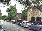
|
| Military way
( Location ) |
340 | 'Militsch', town in Lower Silesia , since 1945 Milicz in Poland | May 17, 1930 | The Militscher Weg runs in the triangle between Ottomar-Geschke-Strasse (southeast), Oberspreestrasse (north) and Spindlersfelder Strasse (west). It was laid out as Straße 22 around 1920. |

|
| Minkwitzweg
( Location ) |
270 | Minckwitz , Saxon noble family from the 12th century. | Nov 23, 1933 | The Minkwitzweg, laid out as street B in the Wendenschloß villa colony , connects the Lobitzweg with a west-east route with Grüne Trift. The naming is interpreted in connection with trade relations between the possessions of the nobles (Finsterwalde, Lübbenau) and Berlin citizens ("Lindholz"). |

|
| Mittelheide
( Location ) |
790 | Field name Mittelheide | Jan. 7, 1928 | The street (formerly also Mittelheider Straße ) lies between Mahlsdorfer and Heidekrugstraße and has three square-like extensions to the south. To the west it continues as Gehsener Strasse. To the east there is a connection to the Däumlingsweg. Around 1927 it was laid out as Straße K. The streets and buildings go back to the 'Gemeinnützige Baugesellschaft Berlin Ost mbH (Johannisthal)', which had the 'Mittelheide suburb' built here in 1928/1929 according to plans by Otto Rudolf Salvisberg . Salvisberg resorted to elements of the Elsengrund settlement for which he had already worked (see picture below). |

|
|
Möllhausenufer
( Location ) |
380 | Balduin Möllhausen (1825–1905), writer and traveler | March 15, 1939 | When it was built around 1893, it was called Kleiststrasse . House no. 2/4 is a listed building monument. The shore road north of the Langen See connects the Wendenschloßstraße at its southern end with the Wendenschloß seaside resort and ends on the road Am Langen See (already in the Müggelheim district). Two former guest houses at Möllhausenufer 27 and 29, which were built according to plans by Otto Seegert in 1911/1912, are particularly striking . They are closed off by a corner tower with a round open walkway and a copper hood . They were architectural monuments in the 1980s. |
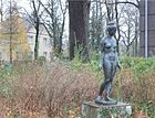
|
| Mozartstrasse
( Location ) |
460 | Mozart , musician and composer | before 1926 | Mozartstrasse is in the Dammvorstadt area. It connects Birnbaumer Strasse in a gentle curve across Hämmerlingstrasse with the Wuhle. The footpath leading over a bridge continues as Mozartstraße to Zum Wuhleblick. |

|
| Müggelbergallee
( Location ) |
560 | Müggelberge , elevation in the southern forest | June 24, 1960 | The Müggelbergallee runs from the Wendenschloß marina (west) via Wendenschloßstraße and Müggelbergplatz to the edge of the forest (east). Here it continues unnamed as a footpath in the forest and leads to the street Zum Müggelturm. When the road system was laid out around 1893, the traffic route was called Goethestrasse . From 1939 to 1960 it was called Laubingerstraße . |
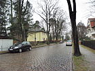
|
| Müggelbergplatz
( Location ) |
60 (round) | Müggelberge , elevation in the southern forest | June 24, 1960 | The circular Müggelbergplatz interrupts the Müggelbergallee. According to the street it was first called Goetheplatz , but from 1939 to 1960 it was called Laubingerplatz . On the green there is a memorial stone for Werner Sylten , who helped many people during the Nazi era . (lower picture) |

|
| Müggelheimer Damm
( Location ) |
5600 (in the district) |
Müggelheim , district | Aug 8, 1935 | Müggelheimer Damm, the longest street in the Köpenick district, continues Müggelheimer Straße in a south-easterly direction. The dam, first called Müggelheimer Landstrasse (around 1896), lies between Pablo-Neruda-Strasse and the district boundary at the level of Alt-Müggelheim street. |

|
| Müggelheimer Strasse
( Location ) |
800 | Müggelheim , location | before 1893 | Müggelheimer Strasse is located between the Long Bridge and Pablo-Neruda-Strasse. It continues with the name Müggelheimer Damm eastwards to Müggelheim . It developed from the Große Trift , a much-used cattle path used by Köpenick farmers. |

|
| Müggelschlößchenweg
( Location ) |
1890 | Müggelschlößchen pub on Lake Müggelsee, built in 1866 | around 1910 | The street lies between Salvador-Allende-Straße and Straße Am Müggelsee and leads a little further. The way to the east is Pablo-Neruda-Straße , which used to be part of the Müggelschlößchenweg. At its western end, a nameless foot and bike path leads south to the outflow of the Great Müggelsee . |

|
| Mühltaler Strasse
( Location ) |
660 (in the district) |
'Mühltal', place in the province of Posen , since 1945 Smukala Dolna, district of Bydgoszcz in Poland | Jan. 7, 1928 | The street south of Dammheide lies between Semliner Straße (east) and Feuersteiner Straße, with the western section already belonging to the Kaulsdorf-Süd district. First (around 1920) it was Street 17 . | |
| Neptunsweg (*)
( Location ) |
110 | Neptune , Roman god of the sea | after 1945 | The Neptunsweg is a private road to develop the water sports area Little Venice. It goes off Wendenschloßstraße to the northwest of the old town . |

|
|
New meadows
( Location ) |
490 | Neue Wiesen wetland , the historical name of the parcel after the “Neue Wiesengraben” border to the southeast between Falkendamm and the forest | after 1960 | In the extreme southeast of the Wendenschloss settlement there is a road system that is divided into two parts: Neue Wiesen I with parcels 1–6 and Neue Wiesen II with parcels 1a – 8a. The land was developed towards the end of the 1920s when a large Jewish estate had been divided up. |

|
| Niebergallstrasse
( Location ) |
470 | Ernst Niebergall (1815–1843), writer | March 15, 1939 | Niebergallstrasse runs from the Wendenschloß / Müggelbergallee yacht harbor (north) to over Peter-Gast-Weg and Hugo-Wolf-Steig to the Dahmeufer (south). When it came to the road system, it was called Wielandstrasse . At (today's) Niebergallstrasse 20, a two-story half - timbered house was built as a restaurant in 1893 , which was later given the name "Freundlichkeit". Little is known that the ' Declaration of the Defeat of Germany ' was signed by the Allied commanders Marshal Zhukov , General Eisenhower , Field Marshal Montgomery and General Tassigny in the Wendenschloss restaurant on June 5, 1945 . At the same time the Allied Control Council was founded. The building complex, together with the transversely attached ballroom, is a listed building, but has since been demolished and houses built on. The turning loop of the tram is at the junction with Peter-Gast-Weg (lower picture). | |
| Mermaid Path (*)
( Location ) |
120 | Mermaid , female water spirit | after 1945 | The Nixenweg is a private road to develop the water sports area Little Venice. It goes off Wendenschloßstraße to the northwest of the old town . |

|
|
Oberspreestrasse
( Location ) |
790 (in the district) |
Oberspree , settlement | Nov 23, 1931 | The street, from 1885 Berliner Straße , because it led to Old Berlin , is located between the Long Bridge and the Wendenheide Bridge on Spindlersfelder Straße in front of the railway line. The route was laid out in such a way that a clear view of Köpenick Castle was possible. A first section of the street, located in Berlin-Alt-Treptow , was renamed around 1920. The road continues west to Adlershof and Oberschöneweide. The former Dorotheen Lyceum (in the GDR era “Alexander von Humboldt” high school), Oberspreestrasse 173–181, is a listed building monument and was built in 1928/1929 according to a design by Max Taut . |

|
| Oettingstrasse
( Location ) |
130 | Friedrich Wilhelm Oetting (1834–1892), businessman and local politician in Köpenick | Jan. 16, 1925 | Oettingstrasse, in the Dammvorstadt area, connects Cardinalstrasse in a south-easterly direction with Joachimstrasse. It was laid out as street 3 in the settlement on the Oettingsfeld for the 'Officials Housing Association Berlin-Köpenick'. The three-storey residential buildings in open perimeter block development were built in 1922–1924 according to plans by Willy Wagenknecht and Heinrich Peter Kaiser . |

|
| Ostendorfstrasse
( Location ) |
910 | Friedrich Ostendorf (1871–1915), master builder and architecture critic | March 15, 1939 | The street is the eastern parallel street to Wendenschloßstraße and was created with the Wendenschloß villa colony. It runs between Lienhardweg (north) and Möllhausenufer (south), with Müggelbergplatz and Ekhofplatz interrupting it. A stumbling block was laid in front of the property at Ostendorfstrasse 19 for Pastor Werner Sylten . He had helped many people go into hiding during the Nazi era and was killed in the concentration camp. The district administration also erected a memorial stone in the middle of Müggelbergplatz.
In many streets of the Wendenschloß Süd residential complex, the streets are paved differently , as the picture below shows. |
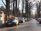
|
| Ottomar-Geschke-Strasse
( Location ) |
1020 | Ottomar Geschke (1882–1957), locksmith, politician | May 4th 1962 | The Ottomar-Geschke-Straße is the north-eastern continuation of the Dörpfeldstraße in Adlershof. After crossing Oberspreestrasse and Ahornallee in the Spindlersfeld area, it ends on a nameless access route of the 'KGA Spindlersfeld'. When naming the previously existing Karl-Spindler-Straße (around 1873) and Konstadter Weg (1922 in the address book as “Projected Street” and in the development plan for Straße 21 ). In 1964 Konstadter Platz was closed and integrated into the street. At the far end of this street, part of the former Spindlerwerk has been preserved and is a listed building. After current gutting (as of August 2013), the buildings will be converted into apartments.
There are also two care facilities here - the 'Knirpsenbude' day care center (middle picture) and a day group from the Märkisches Sozialbetreuungswerk in a brick villa (lower picture). |
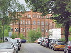
|
|
Pablo Neruda Street
( Location ) |
460 + 490 | Pablo Neruda (1904–1973), Chilean poet and writer; Nobel Prize Winner (1971) | Oct 10, 1970 | The street is between Müggelheimer Damm and Salvador-Allende-Straße. The name for the separated western area of the Müggelschlößchenweg took place with the establishment of the Allende new building district I. It also encloses the residential buildings to the north. It is noteworthy that the street was renamed during Neruda's lifetime. This street has two access arms leading northwards for the residential development in the interior area. |

|
| Parrisiusstrasse
( Location ) |
570 | Oskar Parrisius, Charlottenburg merchant and real estate agent, who acquired the land around Bahnhofstrasse and had it parceled out | around 1900 | When the road system was laid out around 1896, it is said to have been called Moltkestrasse . It runs from Bahnhofstrasse (west) to Gelnitzstrasse (east). The eastern section was previously the street 203 and in 1930 was included in the Parrisiusstraße. |

|
| Pestalozzistrasse
( Location ) |
180 | Johann Heinrich Pestalozzi (1746–1827), Swiss educator and social reformer | around 1900 | Pestalozzistraße is located in the Köllnische Vorstadt area and goes off as a cul-de-sac from Glienicker Straße to the south-east (up to the former boundary "Ackerland"). |

|
| Peter-Gast-Weg
( Location ) |
130 | Peter Gast, pseudonym of Heinrich Köselitz (1854–1918), writer and composer | March 15, 1939 | The path goes westward from Niebergallstrasse to the banks of the Dahme. It emerged as Wendenstrasse with the expansion of the road system around 1866 . Access to the river bank is no longer possible because of the existing boathouse of the Wendenschloss sailing community . (lower picture) |

|
| Plant garden place
( Location ) |
230 × 230 × 80 (pointed triangle) |
Plant garden, a historical field name that suggests plant breeding | July 13, 1934 | The site is in the area of the Dammheide / country house colony Uhlenhorst, in the vicinity of which streets were named after trees. It is both a town square and its western boundary as a street. |

|
| Plantgartenstrasse
( Location ) |
440 | Plant garden, a historical field name that suggests plant breeding | July 13, 1934 | The street lies in the area of the Dammheide / Landhauskolonie Uhlenhorst, in the area of which streets were originally named after trees. It runs from Mahlsdorfer Straße north-west and ends as a dead end on Dammheide. Until the Güldenauer Weg it was originally called Eichenallee , later on Ulmenstraße .
The area was developed in 1910–1918 based on designs by Wilhelm Liefert and Erich Peters on behalf of the Berlin Housing Cooperative in an English country house style . This resulted in numerous single houses, but only a few multi-family buildings, none of which were higher than two floors. |

|
| Beep angle
( Location ) |
280 | Beeper angle, wooded area; probably after Joachim Pieper (17th century), city treasurer in Berlin, to whom this area belonged | 1980 | The road has a winding lead. It begins at Altgrabauer Strasse in a westerly direction, meets there with Argenauer Strasse and turns here to the north, then to the northeast. When you reach Klingenburger Straße, the Piepertswinkel divides into a northern and a southern arm. The southern one connects with its initial course. The road was laid out on the Piepertswinkel forest area in the course of earlier forest roads. |

|
| April 23rd place
( Location ) |
130 × 80 | April 23, 1945, exact date on which the Red Army liberated Köpenick | June 21, 1945 | The square of April 23 was initially called Heuplatz , then it was part of the Köpenick City Park . It is bounded to the northwest by Bahnhofstrasse, to the east by the Alte Spree and southwest by Lindenstrasse. The park was renamed to commemorate the Köpenick Blood Week , and a corresponding memorial with a wooden plaque was set up. 1969 was replaced by the sandstone stele Die Faust , designed by the sculptor Walter Sutkowski . A curved relief wall made of artificial stone was inserted behind the stele (see picture). Directly on the square is the listed former transformer station, which also serves as a break for the BVG employees. |

|
| Plohm Path
( Location ) |
840 | Plehm, a long-established fishing family on the Kietz (14th century) | June 13, 1936 | The Plehmpfad runs from Flansweg (north) to over Dregerhoffstrasse (south). It was created from streets 65, 73 and footpath 267 . |
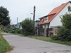
|
| Pohlestrasse
( Location ) |
310 | Paul Pohle (1883–1933), laboratory assistant in the Köpenick hospital, social democrat, victim of the Köpenick blood week | May 31, 1951 | When it was built before 1893, it was called Elisabethstrasse , from 1948 on, Rasenbleiche . Pohlestrasse connects the southern carriageway of Müggelheimer Strasse with Charlottenstrasse in a north-south direction. An unnamed footpath continues southwards. The name is reminiscent of the place of the crime, because the torture took place in a restaurant on this street. |

|
| Pritstabelstrasse
( Location ) |
1020 | Pritstabel, a long-established fishing family on the Kietz. "Pritzstabel" is also a historical name for a fisheries overseer. |
Nov 23, 1933 | It runs from Wendenschloßstraße roughly in the middle of the villa colony to Grüne Trift am Walde in a slightly arched west-east direction. She was first road D called. Shortly after the end of the Second World War, the traffic route was named Waldeck-Manasse-Straße , but this was not officially confirmed in 1948. |
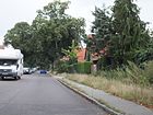
|
| Puchan Street
( Location ) |
430 | Johann Augustus Puchan (18th century), Mayor of Köpenick from 1714 to 1718 | March 27, 1939 | Puchanstrasse in Dammvorstadt runs between Mandrellaplatz (northeast) and Friedrichshagener Strasse (southwest). House number 12 is the former district court, which is a listed building (see picture). The road was laid out much earlier, as old maps from the beginning of the 20th century show. A designation could not (yet) be found. |

|
|
Rautendeleinweg
( Location ) |
260 | Rautendelein , elf-like main character in Gerhart Hauptmann's fairy tale drama The Sunken Bell | July 26, 1927 | The Rautendeleinweg, located in the Märchenviertel, begins about 100 meters southeast of Rotkäppchenstrasse as a continuation of Aschenbrödelstrasse and ends on Dornröschenstrasse (southeast). |

|
| Riebekeweg
( Location ) |
370 | Riebeke, probably a name derived from Rohrbeck; According to a document, this man was a councilor in Köpenick around 1381. |
Nov 23, 1933 | The Riebekeweg, laid out in the 1920s as Straße J , connects the Mayschweg with the Lossowweg in a straight north-south route. It is located in the Wendenschloss-Süd area. A naming of the street after Carl Adolf Riebeck (1821-1883), a mining entrepreneur from Thuringia, cannot be ruled out. |
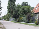
|
| Rombiner Weg
( Location ) |
110 | 'Rombin', small town in the province of Poznan , since 1945 Rąbiń , district of Krzywiń in Poland | Nov 23, 1933 | The Rombiner Weg connects Mozartstrasse in a west-east direction with Hämmerlingstrasse. It is located in the Dammvorstadt and was laid out as street 4c . |
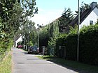
|
| Rosenstrasse
( Location ) |
140 | either after rose decorations in the windows or ironically “roses” for prostitutes |
End of 18th century | The Rosenstrasse is a connection between Alt-Köpenick and Kirchstrasse. After a southward offset and a few bends, it continues eastward to Katzengraben. The earlier names were Kliestowstraße (17th century - beginning of 18th century) and Kleine Gasse (18th century). |

|
| Rotkäppchenstrasse
( Location ) |
740 | Little Red Riding Hood , Grimm's fairy tale | July 26, 1927 | The street was laid out as street D in the Märchenviertel at the beginning of the 1920s . It runs between Genovevastrasse (northeast) and Dornröschenstrasse. Over the latter it leads as a dead end and footpath to the southwest to a staircase on the Mittelheide street. Right there is a fairy tale sculpture made of sandstone (picture below). |
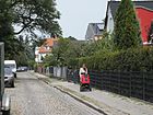
|
| Rudolf-Rühl-Allee
( Location ) |
2050 (in the district) |
Rudolf Rühl (1842–1909), 1879 City Councilor of Köpenick, 1884–1904 City Councilor and responsible for the administration of the Köpenick city forest | March 29, 2011 | The avenue was called Köpenicker Allee until 2011 . In the larger section through the Wuhlheide, it forms the suburb of Oberschöneweide . It begins in the north as a continuation of the extended Waldowallee in the district of Karlshorst , crosses the railway line to Frankfurt (Oder) at the Wuhlheide S-Bahn station and leaves the district in the south 200 meters before the road An der Wuhlheide to Oberschöneweide. |

|
| Rudower Strasse
( Location ) |
1080 | Rudow , direction | around 1891 | Rudower Strasse connects Grünauer Strasse shortly after Köllnischer Platz (northeast) in multiple swings with Glienicker Strasse in the south. Beyond it it becomes Mahlower Strasse. First it forms the northern boundary, after a 90 degree turn the western boundary of the cemetery of the Laurentius congregation , which was moved here in 1811. Between two allotment gardens, Rudower Straße forms an access square for the multi-family row houses built here. The route follows the route to Potsdam that existed in the 19th century . |

|
|
Salvador Allende Street
( Location ) |
1590 | Salvador Allende (1908–1973), Chilean politician | Nov 30, 1973 | The road runs from the Fürstenwalder Damm / Bellevuestraße (north) crossing over the Salvador-Allende bridge to Müggelheimer Damm (south). When the road system was laid out around 1910, it was called Achenbachstraße . The new street name was assigned with the establishment of the 'Allende district' (1971–1973; 1980–1983). Worth mentioning is the Köpenick hospital (Salvador-Allende-Strasse 2-8), which opened in 1914 as the Teltows district hospital . It has been sponsored by the DRK-Schwestern Berlin e. V.
In front of house number 43 , a stumbling block was laid for Georg Eppenstein , a victim of the Köpenick Blood Week . In the interior of the prefabricated residential area, Allende-Straße has a branched access system that makes orientation difficult for visitors. |

|
| Sand chute path
( Location ) |
600 | Sand chute , popularly for a place where sand is extracted | June 17, 1936 | The sand chute path, initially laid out as road 75 in the Wendenschloß villa colony, connects Pritstabelstrasse (north-northwest) with Dregerhoffstrasse. In addition, the path continues southwards for a short distance as a dead end. |

|
| Schlossplatz
( Location ) |
70 × 70 | Köpenick Castle , since 1963 arts and crafts museum |
Traditionally (17th century), with interruptions |
The square is in front of the castle island on Müggelheimer Straße. When the street was rebuilt in 1990, including widening, the character of the square was lost and the name was no longer used. The Schloßplatz lies between Alt-Köpenick , Grünstraße and Müggelheimer Straße. Until the renovation in 2000, the tram drove from here to Grünstraße. The name has been officially registered again since the 2000s. The picture below shows the bronze statue The Wild Horses by a group of artists, created and installed after 1990. The Schlossplatzbrauerei Coepenick, the smallest brewery in Germany, is located on the square. | |
| Narrow alley
( Location ) |
240 | Width of the alley | before 1927 | It connects Erlenstrasse (west) after a slight swivel with Kleingartenstrasse (northeast) in the Kämmereiheide settlement. At first, instead of the allotment garden road, there was only the forest as the boundary of the settlement. |

|
| Narrow street
( Location ) |
90 | Width of the street | before 1925 | It leads from the intersection of Schubertstraße / Am Bahndamm / Hämmerlingstraße to the northeast into a small settlement area and is said to have existed without a name as early as 1920. The traffic route is not only narrow, but also extremely short. |

|
| Schmausstrasse
( Location ) |
380 | Johann Schmaus (1879–1933) and son Anton Schmaus (1910–1934), victims of National Socialism during the Köpenick Blood Week, who lived on this street | July 31, 1947 | The Schmausstraße is the north-eastward continuation of the Stellingdamm. It runs from Essenplatz over Heidekrugstrasse to the edge of the forest. When it was built in the 1920s, it was called Alte Dahlwitzer Strasse (until 1933), then Apelstrasse . The social reformer Marie Juchacz also lived in this street, house number 83, from 1926 to 1933 , to whom a Berlin plaque commemorates (see picture). |

|
| Snow White Street
( Location ) |
410 | Snow White , Grimm's fairy tale | July 26, 1927 | The street, laid out as street F in the early 1920s , connects Rotkäppchenstraße with Sterntalerstraße in an arc in a west-east direction. |
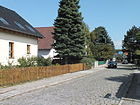
|
|
Schönecker way
( Location ) |
120 | 'Schöneck', town in West Prussia , since 1945 Skarszewy in Poland | Nov 4, 1935 | From the Wongrowitzer Steig, the path initially runs south, after a right-angled bend it leads to Filehner Straße. The traffic route in the Uhlenhorst area was called Straße B in its layout . |
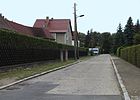
|
|
Schönerlinder Strasse
( Location ) |
170 | Schönerlinde, a colony for spinner families established here in 1752. At first it was called green linden, around 1780 Schönerlinde. In 1879 the Schönerlinde settlement was incorporated into Köpenick. |
around 1891 | Schönerlinder Strasse connects Adlershofer Strasse (northwest) with Grünauer Strasse (southeast) and is located in the Köllnische Vorstadt area. |

|
| Schrebergasse
( Location ) |
200 | Moritz Schreber (1808–1861), doctor and pioneer for the creation of small kitchen gardens for city dwellers | Feb. 7, 1958 | The alley is located in the Kämmereiheide housing estate. It connects Erlenstrasse with Birkenstrasse. At first - from around 1926 - the alley was called Schreberplatz . |

|
| Schubertstrasse
( Location ) |
460 | Franz Schubert (1797–1828), composer | around 1910 | Schubertstraße, in the Dammvorstadt area, extends Am Bahndamm from Hämmerlingstraße northwest across Birnbaumer Straße to Bachstraße. At the corner of Birnbaumer Strasse there is a historic Berlin water pump with the number 20 on the street . |

|
| Schüßlerplatz
( Location ) |
70 × 60 × 60 (triangle) |
Hugo Schüßler (1847–1908), entrepreneur and city councilor in Köpenick 1892–1908 | May 1, 1910 | The square is located in the old town and is bounded by Rosenstrasse (north), Jägerstrasse (southeast) and Kietzer Strasse (southwest). After removing dilapidated houses, it was laid out in 1905 at the instigation of Mayor Langerhans. The official name confirmation was not given until January 7, 1928 by the Berlin police chief. Nowadays people park around it. There are low trees on two sides, in the middle a round bench around a historic multi-armed candelabra invites you to linger. The course surface consists of small paving stones. |

|
| Seelenbinderstrasse
( Location ) |
1230 | Werner Seelenbinder (1904–1944), athlete and victim of National Socialism | July 31, 1947 | The street is a west-east traffic route that begins at Hämmerlingstrasse, crosses Bahnhofstrasse and ends at Hirschgartenstrasse. When the road system was laid out around 1895, it was given the name Kaiser-Wilhelm-Straße , and in 1939 it was renamed Kirdorfstraße .
Numerous residential buildings for the Köpenicker civil servants' housing association in the style of New Building (numbers 61–69, 75, 77) were built between 1926 and 1930 based on designs by Willy Wagenknecht and Heinrich Peter Kayser . The monument complex Seelenbinderstraße 91-99 (see picture above) served after its construction from 1930 to 1945 as a police school and from 1945 to 1947 as an office of the Soviet state security authority MGB , a memorial plaque commemorates the victims. After 1949 the building was used by the GDR Ministry of Defense until 1990 , and since 1991 it has been the seat of the Treptow-Köpenick tax office. The national office of the NPD is located in the Carl-Arthur-Bühring-Haus (Seelenbinderstraße 42) . |

|
| Segewaldweg
( Location ) |
430 | Segewald, councilor in Köpenick (end of the 14th century) | Nov 23, 1933 | The path is located in the area of the Wendenschloß villa colony and leads west from Wendenschloßstraße to road 236 in the direction of Dahme. When it was installed in the 19th century, it was called the access road to the glass factory , going westward from Marienstrasse (1925). |
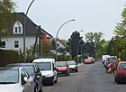
|
| Semliner Strasse
( Location ) |
550 | 'Semlin', place in West Prussia , Somonino in Poland since 1945 | Aug 16, 1928 | Straße 41 , which was laid out in the Uhlenhorst area in the 1920s, was renamed in 1928. It lies between Gehsener Straße (south) and Mühltaler Straße (north), over which it continues as an unpaved spur road . |

|
| Siegfried-Berger-Strasse
( Location ) |
440 | Siegfried Berger (1918–2002), strike leader in the Funkwerk Köpenick during the 1953 uprising | Feb. 1, 2007 | The road goes west from Wendenschloßstraße towards Dahme. The traffic route, which was laid out as Straße 244 in 1920, was officially given its new name four days after Berger's 5th anniversary of death. On the side facing Wendenschloßstraße, some of the original buildings of the Bolle-Hof have been preserved, the adjoining residential buildings use remnants of the development, as the picture shows. |

|
| Slevogtweg
( Location ) |
260 | Max Slevogt (1868–1932), painter and graphic artist | March 15, 1939 | The street, Reuterstraße when it was built around 1895 , is located in the far south of Wendenschloß. It runs in a south-north direction between Möllhausenufer and Ekhofstrasse. One of the houses stands out because of its supporting figure in the form of a female nude and is a listed building. The villa on Slevogtweg 5–7 was completed in 1914 according to plans by Kurt Schramm . |

|
| Spindlergasse
( Location ) |
50 | Johann Heinrich Spindler and Wilhelm Spindler, two master nail smiths [father and son] who live on this street , (18th and 19th centuries) | before 1894 | It leads from Katzengraben in the old town area to the banks of the Spree. Originally the narrow traffic route was a waterway for the fire brigade. |

|
|
Spindlersfelder Strasse
( Location ) |
2110 | Spindlersfeld , access road for the local area | July 16, 2002 | The north-south street was created to bypass the old town of Köpenick. It is part of the planned TVO and runs from the street An der Wuhlheide over the Wilhelm-Spindler-Brücke of the Spree to Glienicker Straße, directly east parallel to the railway line of the Berlin outer ring . The first section to Oberspreestrasse was opened on October 7, 2002, the section to Glienicker Strasse was opened on August 9, 2007. In the middle of the street runs the district boundary to Berlin-Adlershof . A street with this name already existed elsewhere, it was renamed Ernst-Grube-Straße in 1962 . |

|
| Spinning path
( Location ) |
70 | Spiders , reference to the silk weaver and colony founder Carl Spindler | June 13, 1936 | The path is in the Spindlersfeld area and starts off as a dead end northwards from Gloriastraße; it includes 10 house numbers. At installation of a colony in 1900 of Thoroughfare called road B . |
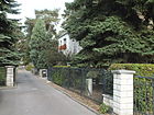
|
| Spitzerstrasse
( Location ) |
260 | Paul Spitzer (1906–1933) and Josef Spitzer (1907–1933), workers and communists who died as a result of abuse during the Koepenick Blood Week | July 31, 1947 | The Spitzerstraße connects the Müggelheimer Straße with the Luisenstraße. It is located in the Kietzer Feld and was first called Albrechtstraße from around 1870 . |

|
| Spreestrasse
( Location ) |
110 | Spree , river through Berlin and Koepenick | before 1912 | It goes south-west from Lindenstrasse and comprises only six parcels. |

|
| Stahnweg
( Location ) |
70 | Stahn, long-established fishing family around 1577; Caspar Stahn was one of the survivors of the Thirty Years War in the Kietz | Nov 23, 1933 | The Stahnweg is a short cul-de-sac in the Wendenschloß Süd area (initially also called the Cöpenick settlement ), which branches off from the Finkeldeweg eastwards. An earlier street name has not been passed down, it will have been a letter, like other streets in the settlement. |

|
| Stelling dam
( Location ) |
770 | Johannes Stelling (1877–1933), Social Democrat, 1921–1924 Prime Minister of the Free State of Mecklenburg-Schwerin; Member of the Reichstag; killed in the Köpenick blood week | July 31, 1947 | The Stellingdamm goes eastward from Mahlsdorfer Strasse and leads to Essenplatz. When the road system was laid out around 1920, it was named Dahlwitzer Strasse after its direction. Between the railway line and Mittelheide, around Dahlwitzer Strasse and Lindenhof, the 'Elsengrund settlement' was built in two phases, 1919–1921 and 1921–1928. Otto Rudolf Salvisberg supplied the development plan and the building plans for the non-profit Cöpenicker Siedlungsgesellschaft . As early as the first construction phase around 1920, the city of Berlin built the Cöpenick gas station under number 15 . (lower picture) |

|
| Sterntalerstraße
( Location ) |
640 | The Sterntaler , Grimm's fairy tale | July 26, 1927 | The lying in the fairy tale neighborhood road was built around 1920 and was first called road E . When it was named, it was spelled according to the old spelling Sternthaler Strasse . Then the name was written in two words, which according to the rules of name formation should have corresponded to a place Sternthal.
The traffic route turns slightly south-east from Rotkäppchenstraße to Mittelheide and continues as Heidekrugstraße . |

|
| Strandschloßweg
( Location ) |
1870 | Strandschloß restaurant on the Müggelsee, to which the road led | after 1939 | The Strandschloßweg begins at Müggelheimer Damm (west) and runs over Erwin-Bock-Straße behind the premises of the Köpenick hospital through the Kämmereiheide to near the Großer Müggelsee . It was converted into a street when the Allende district II was built. A short middle section of this street came to Alfred-Randt-Straße in 1981. The eponymous restaurant was destroyed during the Second World War and was not rebuilt afterwards. |

|
| Road by the forest
( Location ) |
490 | Wuhlheide forest area that is affected | after 2000 | The road in the Wuhlheide Innovation Park is a private road . It connects the Köpenicker Strasse eastward with the street Am Wuhleufer. Nameless access roads lead from it to the south. According to a street plan in the business park, letters have been assigned for the streets (A – F). An on-site inspection shows that instead of street signs, signs for the commercial buildings were attached, such as Halls 41, 42 or Houses 1, 3, 5. (As of August 2014) Access to the site is closed at night and on weekends. |

|
| Road in the forest
( Location ) |
500 | Woodland Dammheide that opens out Berlin-Kaulsdorf drags | July 5, 1922 | It is located in the Uhlenhorst colony, begins on Mahlsdorfer Straße in a north-westerly direction and ends as a dead end. Originally it only reached as far as the Güldenauer Weg. According to the development plan, it was initially street 33 . |

|
| Road to the Müggelhort
( Location ) |
2610 | Müggelhort, headland between large and small Müggelsee | after 1990 | The so-called asphalt road leads from Müggelheimer Damm (near Köpenick / Müggelheim) to the Müggelhort peninsula, which is bordered by the Müggelspree, Kleinem and Großem Müggelsee and with a 120 meter wide land connection to the Köpenicker forest. After 2008, the six-meter-wide asphalt strip of the road was provided with interrupted longitudinal markings (i.e. passable) at 2200 meters from Müggelheimer Damm . The road width that can be driven on is thus divided into a single-lane "driveway" and meter-wide footpaths and cycle paths on both sides. The road ends at a parking lot and opens up the Müggelhort settlement in the southern part via the (unofficial) Elsnerweg and the excursion restaurant (street to Müggelhort 1) with the ferry F23 and the rescue station (without address) in the northern part. The inn has existed on this headland since 1900. The connection to the inn was made at least in 1922 via the forest paths of the city forest and was later expanded as a road. Since the traffic route is also a postal address, it is obvious that “Straße zum Müggelhort” has been used for route descriptions for a long time. The properties on the street include, in addition to "Straße zum Müggelhort 1" (forest restaurant), the plots 2-36 (even) in the southern part of the settlement (south of Elsnerweg) and in the northern part of the settlement the odd numbered 3-15 and 17-27, the latter on Elsnerweg lying along. |

|
| Road to the Müggelturm
( Location ) |
2350 | Müggelturm , observation tower in the Müggelbergen | after 2000 | The road goes south from Müggelheimer Damm and leads to the parking lot at the Müggelturm in a very winding route. The street name mentioned here officially appears on city maps for the first time around the year 2000. It was probably created by combining individual earlier sections such as In den Müggelbergen or Am Teufelssee . The name is probably related to the former Spindler Tower of the laundry and dye works owner Carl Spindler (see picture). Spindler had the builder Carl Geist built a lookout tower around 1890; At the same time, the excursion restaurant was opened at the foot of the tower. |

|
|
Thürnagelstrasse
( Location ) |
240 | Christoph Daniel Thürnagel, Mayor of Köpenick 1785–1796 | Aug 16, 1928 | Thürnagelstrasse, located in Dammvorstadt, connects Borgmannstrasse (west) with Gelnitzstrasse (east). When it was built, it was called Straße 202 . |

|
|
Uhlenhorster Strasse
( Location ) |
410 | Uhlenhorst, name of the settlement in which the road was laid; The settlement name refers to the nest of owls (North German, Uhl '). |
July 5, 1922 | The Uhlenhorster street, located in the fairy tale neighborhood that combines Sleeping Beauty Road (North) with the feast Street (south) and was first road F called. When it was first mentioned in the Berlin address book in 1922, a restaurant called 'Pferdebucht' was given here. |

|
| Under the birches
( Location ) |
570 | Birch trees , European deciduous tree | 1912 | The street goes northwest from Mahlsdorfer Straße. It has two separate lanes up to the intersection with Güldenauer Weg. Then it continues in the same direction as a dead end. As a nameless footpath it continues to Deutschhofer Allee in the Berlin-Kaulsdorf district . |

|
|
Extended Hämmerlingstrasse
( Location ) |
590 | Continuation of the Hämmerlingstrasse | after 2000 | The street on the outer edge of the Wuhlheide Innovation Park is a private street only for residents. It is currently [obsolete] a cross street to Hämmerlingstraße in an east-west direction. A planned direct extension of Hämmerlingstrasse has not (yet) been carried out; it would lead through an allotment garden. |
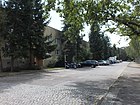
|
| Extended Köpenicker Strasse
( Location ) |
480 | Derivation of the Köpenicker Straße | after 2000 | The street goes from a bend in Köpenicker Straße to the southwest and is a private street only for residents. As a spur and access road, it runs along the outer boundary of the innovation park's commercial space to entrance E. There is no street sign (as of August 2014). |

|
| Extended Mozartstrasse
( Location ) |
460 | Relation to Mozartstrasse | after 2000 | The unpaved road runs parallel to the Wuhle as a cross street to Mozartstraße. |

|
|
Waldburgweg
( Location ) |
260 | Direction to the Waldburg restaurant at the Hirschgarten S-Bahn station, which had opened in 1903 | Aug 9, 1922 | It goes eastwards from Essenplatz and ends as a motor road on Heidekrugstraße. It then continues as an unpaved road in an easterly direction through a forest to the Hirschgarten train station . Initially, the eastern section was called Waldburgstrasse. |

|
| Forest nettle trail
( Location ) |
200 | Forest nettle , a herbaceous flowering plant | Nov 2, 2005 | The forest nettle trail forms the south-north connection between Grüne Trift am Walde and Müggelheimer Damm. On the other side, the path continues as Erwin-Bock-Straße. |

|
| Forest promenade
( Location ) |
1830 (in the district) |
Forest , plant formation consisting mainly of trees and promenade , promenade | before 1920 | The street runs mainly in the district of Berlin-Mahlsdorf ; however, it forms the district boundary. The southern edge of the street, the Dammheide and the Mittelheide belong to Köpenick. There is only a small central section here. | |
| Weinbergstrasse
( Location ) |
220 | Vineyard , on the slopes of which the parish in the 18./19. Century cultivated vines | before 1912 | The eponymous Kalkberg was removed from the middle of the 19th century during the production of sandstone blocks. Weinbergstrasse is located between Gelnitzstrasse and Seelenbinderstrasse in the Dammvorstadt. |

|
|
Wendenschloßstraße
( Location ) |
3250 | Wendenschloß , a former restaurant in the south of this street and the first villa colony at this point | Nov 9, 1926 | Wendenschloßstraße begins at Salvador-Allende-Straße (north), makes a slight curve south at the intersection with Müggelheimer Damm and leads to Möllhausenufer (south). Almost its entire length is used by the tram . The traffic route was laid out towards the end of the 19th century in three differently named sections: Marienstraße , Extended Marienstraße (center and north) and Rückertstraße . The designation date 1926 applies to the parts of Marienstraße. The southern section up to the Möllhausenufer kept the name Rückertstraße until 1939. The villa colony, which also gave it its name, was created from 1892 on behalf of the city of Köpenick by parceling out the Eichhorn. Many water sports clubs developed along this street as early as 1900 and factories and facilities such as the BVG depot (number 138) in the 1920s . After the fall of the Wall, a modern combined heat and power plant was added on parcel 176 . |

|
| Westendstrasse
( Location ) |
200 | western end of the Köllnische suburb | before 1920 | It connects what was then Berliner Straße (since 1931 Oberspreestraße) (north) with Rudower Straße (south) in the Spindlersfeld area. In plans from around 1912 it is said to have already been identified but still nameless. Listed here are the houses number 4 and number 6 from 1912/13 as well as two complete blocks of flats (numbers 8–22 and numbers 42–52) from the 1930s (to be seen on the right edge of the picture). |

|
| Wirsitzer way
( Location ) |
180 | 'Wirsitz', town in the province of Poznan , since 1945 Wyrzysk in Poland | Nov 4, 1935 | It connects Filehner Straße (west) with Güldenauer Weg (east). The path was laid out as 'Street A'. | |
| Wolfsgartenstrasse
( Location ) |
240 | Wolfsgarten , field name after the wolf pits that were once there | before 1922 | The street lies between Stellingdamm and Janitzkystraße and has 44 parcels. |
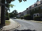
|
| Wongrowitzer Steig
( Location ) |
780 | 'Wongrowitz', town in the province of Poznan , since 1945 Wągrowiec in Poland | Dec. 4, 1930 | Laid out as Vogtlandstrasse after 1920, it lies between Kaulsdorfer and Mahlsdorfer Strasse. Plots 2–10, owned by the non-profit housing association Berlin with headquarters in the municipality of Lichtenberg around 1922 , were built on by this company. |

|
|
To the seven ravens
( Location ) |
300 | The seven ravens , Grimm's fairy tale | July 26, 1927 | It runs between Dornröschenstrasse (north) and Janitzkystrasse (south) in the Märchenviertel. The traffic route as was laid out road C . The New Apostolic Congregation Berlin-Köpenick has been located here since 1898 (house number 12, see picture). |

|
| To the Dahmeufer
( Location ) |
180 | Dahme , is located a little west in the direction of the street | Oct. 1, 2009 | The road network leading up to the Dahme was initially given a number system between 234 and 241, which is only gradually being replaced by proper names. The road 235 was named to the planned development in the 21st century.. To the Dahmeufer is in the western area of the Wendenschloßsiedlung. It goes west of the Bockmühlenweg. However, only a footpath leads directly to the bank of the river (lower picture). |

|
| To the long lake
( Location ) |
920 | Langer See , part of the course of the Dahme , to which the road leads | June 24, 1960 | When the road system was laid out in the area of the Wendenschloß villa colony, the traffic route was named Körnerstraße , and from 1939 Buchhornstraße . The road runs from Lienhardweg to Möllhausenufer in a north-south direction. |

|
| To the butterfly nest
( Location ) |
780 | 'Butterfly nest', excursion restaurant in the Köpenick city forest on the Langen See | Oct. 1, 2009 | The traffic route goes from the road to the Müggelturm to the south and leads to the restaurant on Langen See , which was opened in 1912 . Plots 1 and 2 are located directly at the restaurant, which has only been a snack bar with a beer garden since the 1990s (see picture). The restaurant houses an extensive butterfly exhibition that has been compiled in the 20th century.
The partially unpaved path existed many years before it was officially named as a forest path. |

|
| To the Wuhleblick
( Location ) |
150 | Wuhle , at the western end of the street | June 2, 2008 | The former road D18 between Kaulsdorfer Straße and Görsdorfer Straße was named in 2008. A footbridge over the eponymous river leads to Mozartstrasse on the other bank. |

|
| To the freight railway
( Location ) |
200 | Freight station Köpenick | Nov 1, 2010 | The road, laid out around 1900 as a forest road, leads northwards from Brandenburgplatz (Kaiser-Wilhelm-Straße) in a dead-end street, another branch leads north-east to the route of the Berlin – Görlitz railway line . For many years goods were transported between the cable works on Friedrichshagener Straße and the freight station by rail through this street. |

|
| To the night heather
( Location ) |
750 | Nachtheide, a historical field name | June 24, 1960 | It was laid out as 281 road at the end of the 1920s . The road leads from the east bank of the Dahme in a west-east direction to the pond on the Nachtheide, where it splits into a square. Among other things, it crosses Wendenschloßstraße , Grüne Trift and Köpenzeile. |
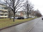
|
Former and planned streets
| Original name | from | to | renamed | Namesake and further comments |
|---|---|---|---|---|
Achenbachstrasse 
|
after 1910 | Oct 10, 1973 | → Salvador-Allende-Strasse | Adolf von Achenbach , District Administrator of the Teltow District “on the occasion of the establishment of the Cöpenick District Hospital ” |
| Albert-Beyer-Strasse | May 1, 1945 | 1948 | → Kiekebuschstrasse | Albert Beyer , resistance fighter against the Nazi regime; the designation has not been officially confirmed |
| Albrechtstrasse | after 1870 | July 31, 1947 | → Spitzerstrasse | Albrechtstrasse was probably named after the Prussian heir to the throne Albrecht . |
| Old Dahlwitzer Strasse | after 1919 | Sep 9 1933 | → Schmausstrasse | It was first renamed Apelstraße in 1933 , and in 1947 it was named after father and son Schmaus, who were victims of the Köpenick Blood Week . |
| Old Fürstenwalder Strasse | 19th century | Apr 21, 1932 | → At the Generalshof | The old Fürstenwalder road to Fürstenwalde existed since the 19th century. During the development, the street layout was changed, a part was pulled in and a part was given the name Am Generalshof. |
| At the Katzengraben | Feb. 27, 1927 | May 10, 1951 | → cat pit | Merged with the former Wilhelmstrasse in 1951 . The name suggests that domestic cats that were born too much were drowned here. |
| At the Wuhlebach | Jan. 16, 1925 | 1958 | → Kaulsdorfer Strasse | Route east parallel to the Wuhle |
| Amselstrasse | 1912 | June 9, 1933 | → Güldenauer Weg | (in the Uhlenhorst area), named after the songbird species blackbirds |
| Office | around 1721 | 19th century | canceled | Place in front of the office building |
| At the Spree | before 1918 | after 1940 | Location indicated with 'near Achenbachstrasse'; There are two restaurants here in 1926: Neu-Ahlbeck and Neu-Heringsdorf From 1931 this street was called Weg nach Neu-Heringsdorf . In addition to the restaurants, the Berlin Ladies Rowing Club is located here. And An der Spree is again included in the 1940 address book . On a historical postcard from 1918 Neu-Heringsdorf is advertised as a "giant restaurant", three interconnected one-story buildings, lots of garden tables, a multiple chain swing, a music pavilion and a steamboat landing can be seen directly on the banks of the Spree. | |
| Apelstrasse | Sep 9 1933 | July 31, 1947 | → Schmausstrasse | Previously on Alte Dahlwitzer Strasse ; Renamed in 1933 after Walter Apel, an SA man who, together with cronies, mistreated and killed the Schmaus family during the Köpenick Blood Week and then died in self-defense from a gunshot. |
| Beethovenstrasse | after 1910 | 28 Sep 1935 | → Birnbaumer Strasse | Ludwig van Beethoven , composer |
| Berlin street | 1885 | Nov 23, 1931 | → Oberspreestrasse | Direction to old Berlin |
| Biesdorfer Strasse | 18th century | Apr 24, 1948 | → Hämmerlingstrasse | Way to Biesdorf , the northern neighboring town |
| Bismarckplatz | after 1885 | Oct 10, 1936 | → Cardinal place | Otto von Bismarck (1815–1898), Prime Minister of Prussia, first Chancellor of the German Empire |
| wide street | 18th century | Mid-18th century | → Alt-Köpenick | The first Köpenicker Straße ( Schloßstraße ) was widened by order of the Elector and was given the name Schloßstraße with the new palace building. |
| Buchhornstrasse | March 15, 1939 | June 24, 1960 | → To the Long Lake | with book -lined promontory ( "Horn"). The course of the street was indicated as “between Achenbachstraße, Straße 4, Straße 8 and Graben”. |
| Buschdorfer Strasse | Jan. 7, 1928 | around 1970 | canceled | 'Buschdorf', Province of Pomerania , since 1945 Zakrzewo (Powiat Złotowski) in Poland |
| Dahlwitzer Platz | after 1919 | Sep 9 1933 | → Dining place | from 1933 to 1947 Gleuelplatz |
| Dahlwitzer Strasse | after 1919 | July 31, 1947 | → Stelling dam | Direction to Dahlwitz |
| Dahlwitz way | after 1920 | ? | ? | Direction to Dahlwitz |
| Dahmestrasse | after 1892 | March 15, 1939 | → Hugo-Wolf-Steig | Road to the Dahme River |
| Oak alley | around 1913 | July 13, 1934 | → Dammheidestraße → Pflanzgartenstraße |
Oak trees |
| Eichhornstrasse | after 1892 | March 15, 1939 | → Lienhardweg | 'Eichhorn', field name for the headland (horn or cape ) lined with oaks and formed by the winding of the Dahme . After the Eichhorn and the neighboring Buchhorn were parceled out, the Wendenschloß villa colony was created in 1892 according to a development plan by Hans Schütte. |
| Elisabethstrasse | before 1893 | Apr 20, 1948 | → Pohlestrasse | Elisabeth, Electress of Brandenburg , wife of Elector Joachim I |
| Eschenstrasse | after 1913 | July 13, 1934 | → Dammheidestrasse | Ash trees , deciduous trees, often planted as street trees |
| Falkendammer Strasse | 19th century | Oct 10, 1936 | → Falkendamm | Field name Falkenhain |
| Fontanestrasse | after 1895 | May 20, 1937 | → Bendigstrasse | Theodor Fontane (1819–1898), writer of poetic realism |
| Friedrichshagener Chaussee | before 1893 | around 1920 | → Friedrichshagener Strasse | Road to Friedrichshagen |
| Friedrichstrasse | 19th century | May 10, 1951 | → Lüdersstrasse | Frederick the Great , King of Prussia |
| Friedrich-Wilhelm-Platz | 1894 | July 31, 1947 | → Futranplatz | From 1811 laid out on a burial site of the Laurentius parish that had been closed and initially without a name ; 1874 named after Friedrich Wilhelm, Elector of Brandenburg , who was born in Cöpenick |
| Frog pond site | July 26, 1927 | around 1985 | overbuilt and repealed | Frog Prince , Grimm's fairy tale, in the fairy tale district |
| Gellertstrasse | around 1922 | around 1941 | canceled | in the Wendenschloß villa colony, running between Rückertstrasse and Dahme; only one plot specified. Probably named after the poet Christian Fürchtegott Gellert , because several streets in the area were named after German poets (Goethe, Schiller). Up until 1935, it was always noted that “the property belongs to Rückertstrasse 6”. In 1940 the street name still exists, but it bears the reference "Wendenschloßstraße 410 and 416". |
| Gleuelplatz | Sep 9 1933 | July 31, 1947 | → Dining place | Previously Dahlwitzer Platz ; named after Ronert Gleuel, an SA man who perished in the Koepenick blood week |
| goetheplatz | after 1895 | Aug 25, 1939 | → Müggelbergplatz | Johann Wolfgang von Goethe (1749–1832), poet |
| Goethestrasse | after 1895 | Aug 25, 1939 | → Müggelbergallee | Johann Wolfgang von Goethe (1749–1832), poet |
| Great drift | around 1800 | around 1910 | → Landjägerstrasse | On the Trift the cattle were driven to pasture. |
| Günther-Roß-Strasse | May 20, 1937 | July 31, 1947 | → Bendigstrasse | Günther Roß, an SA standard leader who perished during the Koepenick Blood Week; previously Fontanestrasse |
| Heinzelmännchenplatz | Jul 26, 1927 | around 1985 | overbuilt and repealed | The brownies were, according to legend Kölnerhaus spirits. The square was in the fairytale district. |
| Hay place | 18th century | June 30, 1945 | → April 23rd place | Hay , dried grass, which the Köpenickers got from this place in the 19th century. It later became the Köpenick City Park, but the historical name was retained for the time being. |
| Behind the enclosure | after 1750 | 19th century | → Gartenstrasse | Enclosure , fenced area for keeping animals |
| Hohenzollernplatz | after 1900 | March 27, 1939 | → Mandrella place | Hohenzollern , owner of Köpenick Castle |
| High way | around 1930 | Nov 23, 1933 | → Berlewitzweg | elevated location of the traffic route; Part of the Hohen Weg was renamed Berlewitzweg on November 23, 1933. The remaining section from Dregerhoffstraße to Lienhardweg kept its original name until May 5, 1961 and was then withdrawn. |
| In the Müggelberge, also at the Teufelssee | around 1920 | after 1943 | → Road to the Müggelturm | Path / road in the Müggelberge |
| Kaiser-Friedrich-Strasse | around 1890 | Jan. 24, 1938 | → Kiekebuschstrasse | Emperor Friedrich |
| Kaiserin-Auguste-Viktoria-Strasse | after 1896 | March 27, 1939 | → Puchanstrasse | Auguste Viktoria of Schleswig-Holstein-Sonderburg-Augustenburg , German Empress |
| Kaiser-Wilhelm-Strasse | after 1895 | March 27, 1939 | → Seelenbinderstrasse | there was also a publisher on Kaiser-Wilhelmstrasse (1927); both named after Kaiser Wilhelm I. |
| Karl-Spindler-Straße also Carl-Spindler-Straße |
May 17, 1904 | May 4th 1962 | → Ottomar-Geschke-Strasse | Karl Spindler (1841–1902), entrepreneur related to Spindlersfeld |
| Kirdorfplatz | March 27, 1939 | July 31, 1947 | → Mandrella place | Emil Kirdorf , industrialist and supporter of National Socialism ; previously Kaiser-Wilhelm-Platz |
| Kirdorfstrasse | March 27, 1939 | July 31, 1947 | → Seelenbinderstrasse | Emil Kirdorf , industrialist and supporter of National Socialism ; previously Kaiser-Wilhelm-Strasse |
| Small alley | 18th century | End of 18th century | → Rosenstrasse | Dimensions of the alley |
| Kleine Hege also Kleine Heege |
before 1929 | after 1988 | canceled | small space between Gartenstraße and Kietz |
| Allotment space | around 1927 | after 1943 | ? | in the settlement Kämmereiheide |
| Kleinstrasse | Sep 9 1933 | July 31, 1947 | → Janitzkystraße | Franz Klein, member of the SA storm who was shot in self-defense during the Köpenick Blood Week. Before - from around 1920 - the traffic route was called Ravensteiner Straße . |
| Kleiststrasse | after 1892 | March 15, 1939 | → Möllhausenufer | Heinrich von Kleist (1777–1811) playwright, storyteller, poet and publicist |
| Kliestowstrasse | 17th century | Beginning 18th century | → Rosenstrasse | Martin Kliestow, mayor of Köpenick around 1603 |
| Konstadter Platz | May 17, 1930 | Jan. 18, 1964 | → Ottomar-Geschke-Strasse | 'Konstadt', town in the province of Upper Silesia , Wołczyn in Poland since 1945 . Included in the street in the new development. |
| Konstadter way | May 17, 1930 | May 4th 1962 | → Ottomar-Geschke-Strasse | Konstadt, place in the province of Upper Silesia , Wołczyn in Poland since 1945 ; The path was named Straße 21 in the development plan and connected the road to Cöpenick (in Adlershof) with Oberspreestraße at Spindlersfeld train station . The path entered the newly built Ottomar-Geschke-Straße. |
| Köpenicker Allee | 15th century | before 1893 | → Mahlsdorfer Strasse | Köpenick , direction |
| Köpenicker Strasse | around 1880 | March 8, 1935 | canceled | Köpenick , direction |
| Körnerstrasse | after 1895 | March 25, 1939 | → To the Long Lake | Theodor Körner (1791–1813), writer |
| Kurfürstenallee | after 1885 | Oct 10, 1936 | → Cardinalstrasse | Brandenburg title of ruler before the royal dignity in Prussia for the Hohenzollern |
| Electoral freedom | around 1705 | around 1765 | → freedom | The elector had granted residents who had settled here tax exemption . |
| Laubingerplatz | Aug 25, 1939 | June 24, 1960 | → Müggelbergplatz | Otto Laubinger , actor and supporter of the Nazi movement |
| Laubingerstrasse | Aug 25, 1939 | June 24, 1960 | → Müggelbergallee | Otto Laubinger , actor and supporter of the Nazi movement |
| Lebendorfer Strasse | around 1906 | before 1922 | → Bellevuestrasse | 'Lebendorf', place in the province of West Prussia , since 1945 part of Gollub in Poland |
| Lessingstrasse | after 1895 | March 15, 1939 | → Ostendorfer Strasse | Gotthold Ephraim Lessing (1729–1781), poet of the German Enlightenment |
| Litzmann dam | Aug 25, 1939 | July 31, 1947 | → Alt-Köpenick | Karl-Siegmund Litzmann (1893–1945), supporter of National Socialism , General Commissioner for Estonia |
| Litzmannplatz | Aug 25, 1939 | July 31, 1947 | → Schlossplatz | Karl-Siegmund Litzmann (1893–1945), supporter of National Socialism , General Commissioner for Estonia |
| Marienstrasse | 1870 | Nov 9, 1926 | → Wendenschloßstraße | Henriette Marie of Brandenburg-Schwedt |
| Marketplace | after 1713 | 1878 | → Alt-Köpenick | before Schloßstraße , then Litzmanndamm , then Max-Betcke-Straße |
| Max-Betcke-Platz | May 1, 1945 | July 31, 1947 | → Schlossplatz | previously Marktplatz , Litzmannplatz ; Max Betcke (1868–1944), local politician and trader |
| Max-Betcke-Strasse | May 1, 1945 | July 31, 1947 | → Alt-Köpenick | previously Schloßstraße , Marktplatz , Litzmanndamm ; Max Betcke (1868–1944), local politician and trader. In 1939 it was renamed Lietzmanndamm and between 1945 and 1947 it had the local name Max-Betcke-Straße, which was not officially confirmed. |
| Moltkestrasse | after 1896 | around 1900 | → Parrisiusstrasse | Helmuth Karl Bernhard von Moltke , Prussian Field Marshal General |
| Müggelschlößchenstrasse | around 1910 | 1973 | → Pablo Neruda Street (part of) | Only the area in the Allende quarter was renamed, the larger section kept its name Müggelschlößchenstraße . |
| New way | before 1873 | after 1873 | → Mentzelstrasse | Reference to the new construction of the traffic route |
| Osteroder Eck | Aug 25, 1939 | around 1970 | repealed during the construction of the Allendviertel | , Osterode ', place in the province of East Prussia, since 1945 Ostróda in Poland |
| Lawn bleach | Apr 20, 1948 | May 31, 1951 | → Pohlestrasse | Previously, whites were bleached here on lawns near the river . |
| Ravensteinstrasse | after 1919 | Sep 9 1933 | → Janitzkystraße | Ravenstein , part of today's municipality of Dahlwitz-Hoppegarten with the Ravensteiner Mühle an der Erpe in the neighboring municipality of Hoppegarten in Brandenburg. The renaming only affected an eastern section of the street, the entire Ravensteinstraße has belonged to Mahlsdorf since then . |
| Reuterstrasse | after 1895 | March 15, 1939 | → Slevogtstrasse | Fritz Reuter (1810–1874), writer |
| Rückertstrasse | after 1892 | March 15, 1939 | as southern sector in the → Wendenschloßstraße included | Friedrich Rückert (1788–1866), writer |
| Schillerplatz | after 1892 | March 15, 1939 | → Ekhofplatz | Friedrich Schiller , writer |
| Schiller Street | after 1892 | March 15, 1939 | → Ekhofstrasse | Friedrich Schiller , writer |
| Schlossstrasse | 18th century | Aug 25, 1939 | → Alt-Köpenick | Köpenick Castle , previously also Litzmannstrasse and Max-Betcke-Strasse . The oldest street in Köpenick was originally called Breite Straße and was renamed Schloßstraße in connection with the new palace building around 1690 . |
| Schreberplatz | around 1928 | Feb. 7, 1958 | → Schrebergasse | Moritz Schreber , doctor and inventor of allotment gardens for city dwellers. |
| Spindlersfelder Strasse | 1931 | May 4th 1962 | → Ernst-Grube-Strasse |
Berlin-Spindlersfeld , location of Köpenick. It ran between Berliner Straße (later Oberspreestraße) and a projected road with the note “Spindlersfeld station and two officials' houses”. To the north of it, up to the banks of the Spree, the sports field of the Berlin gymnastics club also extended . In 1936 the street was probably extended and officially registered. In 1929, Duco AG was established here on parcels 26–38 (between Straße 58 and the private railway ) . It produced special protective lacquers based on nitrocellulose based on American patents , later artificial lacquers under the name “Ducolux”, oil lacquers and paint strippers. The whereabouts of this chemical plant is not known. After the fall of the Wall , the street name was reassigned for a bypassing the old town on a different but nearby route, see Spindlersfelder Straße .
|
| Spreegasse | Feb. 18, 1927 | Feb. 7, 1958 | canceled | Spree |
| Road to the freight yard | after 1870 | July 25, 1935 | → Elcknerplatz | Station of the Lower Silesian-Märkische Railway , direction |
| Stubenrauchstrasse | around 1909 | March 27, 1939 | → Kinzerallee |
Ernst von Stubenrauch , District Administrator of the Teltow District and 1908/1909 Police President of Berlin There was also a branch in Stubenrauchstrasse (1922, 1927). |
| Ulmenstrasse | around 1913 | July 13, 1934 | → Pflanzgartenstrasse | Elms , deciduous trees, popular for parks and street planting |
| Under the oaks | around 1913 | July 13, 1934 | → Plant garden place | Oak , a deciduous tree widespread in Germany |
| Vogtlandstrasse | after 1920 | Dec. 4, 1930 | → Wongrowitzer Steig | The name referred to the Vogtland region between Saxony and Bavaria. The first name was D29 until 1930 . |
| Waldburgstrasse | July 5, 1922 | Aug 9, 1929 | → Waldburgweg | At first the traffic route was called street E ; then he got the name of the restaurant 'Waldburg' at the Hirschgarten train station, to which it led. |
| Waldeck-Manasse-Strasse | May 1, 1945 | 1948 | → Pritstabelstrasse | Waldeck Manasse , writer and social democratic politician |
| Forest road | around 1900 | Jan. 7, 1928 | → At the Wuhlheide | on forest Wuhlheide along |
| Wendenstrasse | after 1895 | March 15, 1939 | → Peter-Gast-Weg | Wenden , another name for the Slavs who built a castle in Cöpenick |
| Wielandstrasse | after 1892 | March 15, 1939 | → Niebergallstrasse | Christoph Martin Wieland , poet |
| Wilhelmstrasse | 19th century | May 10, 1951 | → cat pit | Friedrich Wilhelm I , King of Prussia |
| Willibald-Alexis-Strasse | after 1900 | March 13, 1939 | → Logauweg | Willibald Alexis , pseudonym for Georg Wilhelm Heinrich Häring, writer (18th / 19th century) |
| Access road to the glass factory | around 1850 | Nov 23, 1933 | → Segewaldweg | Reference to the "Marienhütte" |
- Old address books also contain other numbered streets that are not mentioned in the new names listed above. A distinction was made between the areas of Cöpenick Nord (N), Amtsfeld (A) or the Cöpenick settlement (C) and the Kietzer Feld settlement (K), so there are two roads 8 and 10, for example. The numbered streets found between 1922 and 1943 are listed here, with their location in brackets:
8 (N, A), 10 (N, C), 19 (N), 23 (N), 24 (N), 28 (N), 29 (N), 142 (K), 230 (between Dahme and Wendenschloßstraße 154–168, distinctive water sports center and Berlin rowing club "Löcknitz eV" and a new factory on Wendenschloßstraße), 262 (K), 263 ( K), 265 (K), 267 (K), 272 (K), 274 (K), 275 (K), 277 (K), 281 D10 (N).
By comparing the specified courses, one or the other of these streets could perhaps be assigned as the forerunners of today's streets marked with proper names.
- In former times, Koepenick also included the Bluestauer Strasse and the Deutschhofer Allee. These were later incorporated into Berlin-Biesdorf and Berlin-Kaulsdorf → see Blätterauer Straße and Deutschhofer Allee .
Other locations in Köpenick
Allotment gardens
There are around twenty allotment gardens in the district, some of which resulted from the arbor colonies and are therefore also called colonies. The existence of the KGA included in the plan is only partially secured. Permanent allotment garden systems according to the allotment garden development plan are secured by entering them in the appropriate stage in the land use plan or by setting them in the development plan, while those listed as "fictitious permanent systems" are those that were only established or registered after the Federal Allotment Garden Act was passed.
- KGA, Am Bahndamm '(Hämmerlingstrasse / Am Bahndamm, Lage ), allotment garden areas with 32 parcels on 10,217 m² of private leased land. The gardens remained on the area between the street Am Bahndamm , the Wuhle and the residential area to the northwest on Schmalen Straße.
- KGA, An der Dahme '(Wendenschloßstraße 330/332, Lage ), unsecured complex with 48 parcels on 13,850 m² of private land. The facility occupies the area between Dahme and Wendenschlossstrasse opposite Dregerhoffstrasse. A northern part was rededicated for the newly built residential complex Wendenschloßstraße 308-324b (straight).
- 'BLW Bahnhof Köpenick' (corner of Thürnagelstrasse, Lage ) with eleven parcels on 4500 m² of railway area in the south-west of the Köpenick freight station. BLW stands for the "Bahn LandWirtschaft" association, which was founded in 1910 specifically to turn the smallest areas near railway lines into allotments.
- KGA 'Gartenfreunde Wuhlheide' (S-Bahn station Wuhlheide, Lage ), the permanent allotment garden area has 114 plots with one permanent resident on 78,700 m² of land owned by the state, access is from Rudolf-Rühl-Allee. The areas of this KGA are at least partially intended for road expansion, for the planned east tangentials along the railway line and Rudolf-Rühl-Allee. The western part of the facility (with half of the total area) is in Oberschöneweide and the northern facilities of Gartenfreunde Wuhlheide belong to Karlshorst , Lichtenberg district.
- According to the development plan and the official documents, the colony 'Fraternitas 1891' (Wendenschloßstraße) consists of the KGA, Wendenaue I '(No. 9144, Wendenschloßstraße 380–386, location ), an unsecured facility on 19,966 m² with 50 parcels, one of which has permanent residential rights . In addition, there are 9 parcels of the more northerly KGA, Wendenaue II '(No. 9145, Wendenschloßstraße 370, Lage ) on 2540 m² of the club's premises . Both belong to the sailing club Fraternitas 1891 e. V and are accessed by parallel paths (Edmund-, Andersonweg) south of the yacht yard Berlin, with the boathouse for gardening enthusiasts and sailors right on the bank of the Dahme. Then there is the SC Brise 1898 eV
- KGA, Baumgarteninsel '( location ): permanent allotment garden with 146 plots on 62,053 m² of state-owned land and 28 plots on 17,134 m² of private leased land. The status is fictitious KGA. The gardens are located exclusively on the Koepenick island of the same name between the Spree and Alter Spree north of the old town. As part of the georeferencing to be carried out by the district for the introduction of the nationwide ALKIS numbered: 38, 49, 54, 72, 95, 115, 120, 137, 151, 164, 170. The plant routes from northwest to southeast are called apple, cherry and quince routes , from northeast to southwest: pear, walnut, apricot, peach, plum route. The Baumgarteninsel allotment garden can only be reached by boat. There is access to the southeast through the Katzengrabensteg between Freiheit and Krusenick .
- KGA 'Erpetaler Weg' (Erpetaler Weg, number according to allotment garden development plan 9105) with 16 parcels, four of which are permanent residents on 11,900 m² of state-owned leased land, is located on the city limits of Hoppegarten-Waldesruh and is accessed via the Kumberger Weg in Mahlsdorf . At the end of the Second World War, there was a makeshift housing estate here, from which the permanent residents emerged.
- KGA 'Glienicker Straße' (Glienicker Straße / Vollkropfgraben, Lage ) in the Köllnische Vorstadt is on private leased land. 35 plots with permanent residents on 17,500 m² are included in the development plan as secured allotment gardens. In contrast, there are 70 plots on 34,660 m² of private land (Glienicker Straße 26) south of the street, for which another use is intended. This part of the complex lies on both sides of the Olmweg, with the garden paths Wiesen-, Amsel- and Kuckucksweg (southwest) and Olm- and Stieglitzweg (northeast). The gardens at Glienicker Straße 7 are located north of Glienicker Straße (in Adlershof as Glienicker Weg) between the railway tracks of the northeast-south and the west-turning section of the Grünauer Kreuz with the western edge on the district boundary to Adlershof (Sechser- and Jostweg) .
- KGA, Grünauer Straße 1920 '(Grünauer Straße 154 / Betonweg, Lage ), 83 parcels (No. 9111a) on 37,303 m² on state-owned land and 35 parcels (No. 9111b) on 8,350 m² on private leased land form the permanent allotment garden. The stock (fictitious KGA) has not yet been secured for a further 22 parcels (No. 9111c) on 5,648 m². Attachments a and b are located west of Grünauer Strasse at Rohrwallinsel, south of the penal institution. The plant paths are from north to south Rosen-, Nelken-, Sonnenweg (last diagonally) and parallel to Grünauer Straße the Neue Weg and in the southern part the Tulpenweg. The unsecured part of the facility at Müllerecke (9111c) with 22 parcels is located north of it directly on the Dahme (east side of Grünauer Straße) opposite the deportation custody behind the property at Grünauer Straße 87–115 and is georeferenced with the numbers 101a-c and 103a.
- KGA 'Im alten Wolfsgarten' (Mahlsdorfer / Genovevastraße, Lage ) is a permanent facility with 65 plots on 28,300 m² of state-owned leased land. Due to the circumstances, it has the status of a secured fictitious system. Seven unnamed system routes go northeast from Genovevastrasse to Mittelheide in the southeast of Mahlsdorfer Strasse.
- KGA, Little Venice I '(No. 9119, Wendenschloßstraße 76, Lage ) is a secured facility with eleven parcels on 3360 m² of private leased land and this includes the fictitious facility' Little Venice II '(09120, Wendenschloßstraße 54-60) with others ten parcels on 5,200 m² of state-owned leased land, on which two permanent residents settle. Both parts of the facility are located on the Little Venice settlement (Neptunweg and Nixenweg) in the old town of Köpenick between Wendenschloßstraße and the Spree. Plant I directly on the banks of the Spree and II east of the settlement on the sports and tennis court.
- KGA, Klondyke '(Mahlower Straße, Lage ) is a permanent allotment garden on 24,972 m² of private property with 93 parcels and twelve of them permanent residents. The facility is located north of the deportation custody (correctional facility) on the site between Mahlower and Grünauer Strasse across the Vollkropfgraben. The facility routes northeast of the moat are named from northeast to southwest: Ceresbogen, Helios-, Neptunsweg, Poseidonseck, from northwest to southeast as Ceresbogen, Eos-, Lunagang (only northeast), Nymphenwinkel, source path (only southwest). The part southeast of the Vollkropfgraben has no name.
- KGA, Müggelspree '(Wendenschloßstraße 30, Lage ) consists of three plant sections (9126a – c). 4559 with 13 parcels (9126a) on state-owned and 12,065 m² with 22 parcels, seven of which are permanent residents (under 9126c) on private leased land, are considered secured. Another seven parcels on 4165 m² of private land belong to the colony, the existence of which has not yet been secured. The facility is located directly on the banks of the Spree, north of the sports field on Wendenschloßstraße (northern section), the KGA Spreeaue follows to the east, and the Little Venice estate to the west.
- KGA, Mühlenfließ '(Friedrichshagener Straße 54-56, Lage ) on private leased land, 32 parcels of 13,196 m² are secured on plant part a and eight parcels in plant part b on 3634 m² are secured by the approved development plan . Another four parcels (part 9128c) on 1458 m² of private land are intended for a different use according to the FNP . The facility is located south of the plots 66–110 (straight) along Seelenbinderstraße on Alte Erpe (called Bellevuegraben here).
- KGA 'Neue Wiesen' (Zur Nachtheide, Lage ) is a permanent allotment garden with 38 plots on 16,550 m² of private space. The facility is located at the western end of the Zur Nachtheide road, south of the Nachtheide forest and northwest of the wetland on the Neuen Wiesengraben. The plots Neue Wiesen 4a, 18 and 27 are built on with residential houses, the southern part of the garden has been designed as a residential area for this purpose. In contrast to the streets Neue Wiesen, residents sometimes call this KGA Neue Wiesen III.
- KGA, Spreeaue '(Wendenschloßstraße 30b – c, Lage ) with 17 parcels (one of which is a permanent resident) on 6,137 m² (private land) is considered to be a secured investment. The 40-meter-wide facility listed in the allotment development plan with number 9139 is located on the south bank of the Müggelspree, west of the Salvator-Allende road bridge and the sports field here, and borders the KGA Müggelspree.
- KGA, Spree-Eck '(Gutenbergstrasse 16/17, Lage ) is a permanent facility with 2282 m² of state-owned land with 48 plots. With its location on the east bank of the Spree at the mouth of the Dahm, at the Spree-Eck, the facility is mainly used for jetties.
- KGA, Wuhlemündung '(9149, Hämmerlingstrasse 118, Lage ) is a permanent facility with five parcels on 1646 m² of state-owned land. With the location on the south bank of the Wuhle west of the Schinderbrücke, the allotment gardens face west.
- KGA 'Wuhlewiesen' (9150, Görsdorfer / Hämmerlingstraße, Lage ) is a permanent facility with 23,073 m² of state-owned land with 56 plots. With the location on the east bank of the Wuhle (mainly) south of Mozartstrasse, these gardens remain on the (projected) extended Mozartstrasse.
- KGA 'Zum Steingarten' (Salvador-Allende-Straße 50a, Lage ) is a provisionally secured complex on 4375 m² with 21 plots. It is located north of the ditch behind the houses on Salvator-Allende-Strasse 44-50 (located to the south) and 52-74 (located to the west).
Dedicated plants
The former KGA 'Köpenick-Nord' (Wuhlewiesen) (12555, Lage ) between Birnbaumer, Hämmerlingstrasse, Mozartstrasse and Wuhle has been partially canceled. It is entered in the list of residential properties with properties 1–63. It is not included in the allotment garden development plan, but has been rededicated to public building land, a small area remains.
For the KGA 'Salvador-Allende-Straße' (Salvador-Allende-Straße 42, Lage ) with 17 parcels (4 of them permanent residents) on 5,576 m² of land, a conversion into public building land has taken place in agreement with the local allotment gardeners. The site is located south of the Müggelspree and east of the residential complex Salvator-Allende-Straße 75/76 to Azaleenstraße on both sides of the official trench before its mouth.
Parks and cemeteries
- Bellevuepark ( location )
- Ernst-Grube-Park ( location )
- Cemetery of the Laurentius community in Köpenick , Rudower Straße ( location )
- Wuhlheide Innovation Park ( location )
- Luisenhain ( location )
- Maria-Jankowski-Park ( location )
- Mentzelpark ( location )
- Castle park on the castle island ( location )
- Alte Försterei Stadium ( location )
- Volkspark ( location )
- Köpenick waterworks ( location ). The waterworks is shut down.
More places, islands, structures and areas
The following locations are not streets or squares, but are listed in the official street directory and have postal significance. In particular, Köpenick includes extensive areas of the Berlin urban forest, which are not specifically named here. The information on the waters and rivers around Köpenick are described in the article Berlin-Köpenick . Commercial spaces are located in various places in the district.
- Baumgarteninsel ( Lage ) with 82,315 m² is used by allotment gardens. The Katzgraben was created as an additional section of the Spree to drain the Kietzer meadows and was widened for shipping in 1867, which resulted in this island.
- Bathing area 'Müllerecke' on the west bank of the Dahme
- Bahnhaus Wuhlheide with property 1
- Clubhouse Müggelsee ( location ), plots 1–75 (odd)
- Excursion restaurant 'Marienlust' ( location ), lots 1–25 (odd).
The former excursion restaurant, used as a discotheque from 1990, burned down completely in 1997. It has not been in operation since then.
- 'Müggelseeperle' ( location ) with properties 1/2; is expanded to a hotel.
- Regatta houses ( location ) on the Müggelsee
- Rohrwallinsel ( location ) with 9,456 m², on it are jetties and buildings for water sports enthusiasts. The bank area was renovated in 2008 and partially renewed. This island is located in the Dahme between Wendenschloß and Grünauer Vorstadt near the Müller corner, further south are Großer (zu Grünau ) and Kleiner Rohrwall (zu Schmöckwitz ), which are in the Long Lake and do not have the addition "-insel" in their names.
- 'Seeterrassen Rübezahl' ( location ), plots 1–40, the excursion restaurant at Müggelsee is [out of date] under renovation.
- Castle island ( location ) with castle (since the 1970s arts and crafts museum) and castle chapel. The island is separated from the old town of Köpenick by the moat between Frauentog and Dahme.
- Müggelhort forest restaurant: Street to Müggelhort 1
- Wendenschloß seaside resort ( location )
- Wuhlewiesen ( location ) with lots 43–46
See also
literature
- Institute for Monument Preservation (Ed.): The architectural and art monuments of the GDR. Capital Berlin-II . Henschelverlag, Berlin 1984, p. 271 ff .
Web links
- Map of Berlin 1: 5000 with district boundaries. Senate Department for Urban Development Berlin, 2012, accessed on September 13, 2012 .
- Berlin-Brandenburg Statistics Office: Directory of streets and squares in the Treptow-Köpenick district (as of February 2015); pdf
- Streets in Köpenick by Kaupert Media
- "Köpenick from A to Z": squares, places, sights on koepenick.net
Individual evidence
- ↑ Geodata information Treptow-Köpenick geodata catalog
- ↑ Andreas Abel: Senate expects 20,000 refugees . In: Weekend edition of the Berliner Morgenpost , February 28/1. March 2015, p. 15.
- ^ Website Die Linke in Treptow-Köpenick
- ↑ Institute for Monument Preservation (Ed.): The architectural and art monuments of the GDR. Capital Berlin-II . Henschelverlag, Berlin 1984, p. 289 .
- ↑ Call for tenders and details on the Alter Markt library extension in Köpenick on arcguide.de, accessed on December 15, 2012 ( Memento from May 13, 2012 in the Internet Archive )
- ↑ a b c d e f g h i j Clarification of the course by means of the FIS Broker Map display - Map of Berlin 1: 5000 (K5 color edition)
- ↑ Information on the person Maria Jankowski
- ↑ Information on the Marienhain
- ^ Berlin address book 1928 > Cöpenick> The Anemonenstrasse is included for the first time, so it was named in 1927.
- ↑ a b c According to the Berlin address book of 1892, F. W. Oetting was one of the two owners of the “Gebrüder Oetting. Drugs engros. Spec .: isinglass , glue, shellac , gelatine , borax , gum arab. and Benzoë ” .
- ↑ Monument database Berlin: Bahnhofstrasse ( page no longer available , search in web archives ) Info: The link was automatically marked as defective. Please check the link according to the instructions and then remove this notice.
- ↑ User experience : 44 penguins .
- ^ Immenheim-Land administrative district
- ↑ Institute for Monument Preservation (Ed.): The architectural and art monuments of the GDR. Capital Berlin-II . Henschelverlag, Berlin 1984, p. 291: Borgmannstrasse .
- ↑ Bukes, Alfred, Town Supervisor of Koepenick . In: Berliner Adreßbuch , 1936, Part I, p. 333.
- ↑ Berlin address book 1927 > Cöpenick> Cedernstraße listed here for the first time, but already with buildings
- ↑ Homepage abcdragonboat.de
- ↑ Berlin / Brandenburg , p. 18; In: Berliner Zeitung of Nov. 26, 2014
- ↑ Press release of the BA Treptow-Köpenick on the street naming Claus-Dieter-Sprink-Weg ; Retrieved Nov. 26, 2014.
- ↑ Daheimstrasse . In: Berliner Adreßbuch , 1937, Part VI, p. 2046.
- ^ Berlin address book 1927 > Cöpenick> Dahlienstrasse listed for the first time
- ↑ News. Koepenick . In: Berliner Zeitung , November 19, 2012, page 19
- ↑ Institute for Monument Preservation (Ed.): The architectural and art monuments of the GDR. Capital Berlin-II . Henschelverlag, Berlin 1984, p. 304: Dorotheenstrasse .
- ^ Berlin address book 1927 > Cöpenick> Erlenstrasse; runs between Heimgartenstrasse and Anemonenstrasse
- ^ Berlin address book 1922 (Cöpenick added to the address book for the first time in 1922)> Flemingstraße
- ^ Name date Fliederstraße according to the Berlin address book 1927
- ^ Berlin address book 1927 > Cöpenick> Fliederstrasse
- ↑ Institute for Monument Preservation (Ed.): The architectural and art monuments of the GDR. Capital Berlin-II . Henschelverlag, Berlin 1984, p. 289 .
- ↑ Note on Friedenstrasse in Köpenick: This street name, which was given in several parts of Berlin, almost always refers to the Peace of Frankfurt , which ended the Franco-Prussian War in 1871.
- ^ Berlin address book 1922 (Cöpenick listed for the first time)> Friedenstraße
- ^ Berlin address book 1940 > Köpenick> Friedenstraße
- ↑ Institute for Monument Preservation (Ed.): The architectural and art monuments of the GDR. Capital Berlin-II . Henschelverlag, Berlin 1984, p. 292: Friedrichshagener Strasse .
- ↑ Information from the Berliner Zeitung , September 26, 2013, p. 19 (Berlin / districts section)
- ^ Berlin address book 1922 > Cöpenick> Gartenstrasse
- ↑ Institute for Monument Preservation (Ed.): The architectural and art monuments of the GDR. Capital Berlin-II . Henschelverlag, Berlin 1984, p. 304: Gartenstrasse .
- ↑ Homepage of Cöpenicker.de
- ↑ Information from the entrance sign of the Flussbadeanstalt Gartenstrasse 46
- ↑ Gehsener street with details reserve battalion and said Battle , accessed on 25 November 2012
- ^ Berlin address book 1927 > Cöpenick> Gladiolenstrasse
- ↑ Institute for Monument Preservation (Ed.): The architectural and art monuments of the GDR. Capital Berlin-II . Henschelverlag, Berlin 1984, p. 308: Glienicker Strasse .
- ^ Berlin address book 1922 > Cöpenick> Grünauer Straße with laundries, dye works, ironworks and a (natural) ice cream factory
- ↑ Settlement on the green Trift . In: Berliner Adreßbuch , 1930, Part IV, p. 1989.
- ↑ The network in the old town has disappeared. In: Berliner Zeitung , December 28, 2016, p. 15.
- ↑ Güldenauer way for the first time in the address book 1927
- ^ Berlin address book 1922 (Köpenick is included for the first time) > Cöpenick> Gartenstrasse: right column, at the bottom: Gartenstrasse 27; Judis, L., owner and Judis, W., laundry company
- ↑ Judisgasse . In: Berliner Adreßbuch , 1929, Teil, p. 1963.
- ↑ Kiekebuschstraße 6 and Borgmannstraße 2-3, middle school and 6th and 9th Köpenick community school, school building and gym, 1902/1903
- ↑ Institute for Monument Preservation (Ed.): The architectural and art monuments of the GDR. Capital Berlin-II . Henschelverlag, Berlin 1984, p. 303: Kietz .
- ^ Berlin address book 1922 > Cöpenick> Kietzer Strasse
- ↑ H. Kleinschewsky… In: Address book for Berlin and its suburbs , 1899, Part I, p. 705.
- ↑ Berlin address book 1927 > Cöpenick> Grünauer Straße with the course sketch, here: at the very top north
- ^ History of Landjägerstrasse on kauperts.de
- ↑ Zoning plan Lindenstraße 33 (pdf) ( Memento of the original from March 4, 2016 in the Internet Archive ) Info: The archive link was inserted automatically and has not yet been checked. Please check the original and archive link according to the instructions and then remove this notice. , accessed July 19, 2015
- ↑ Monument database Berlin: Realgymnasium Lindenstrasse 1
- ↑ Institute for Monument Preservation (Ed.): The architectural and art monuments of the GDR. Capital Berlin-II . Henschelverlag, Berlin 1984, p. 304: Luisenstrasse .
- ↑ Institute for Monument Preservation (Ed.): The architectural and art monuments of the GDR. Capital Berlin-II . Henschelverlag, Berlin 1984, p. 299: Mahlsdorfer Strasse .
- ↑ Institute for Monument Preservation (Ed.): The architectural and art monuments of the GDR. Capital Berlin-II . Henschelverlag, Berlin 1984, p. 296: Mandrella Square .
- ↑ Berlin address book 1922 > Cöpenick> Verl. Mentzelstraße, between Mentzelstraße and the “Spindlersfelder Ruderverein”, the bathing establishment and the Spindler factory
- ↑ Institute for Monument Preservation (Ed.): The architectural and art monuments of the GDR. Capital Berlin-II . Henschelverlag, Berlin 1984, p. 308: Mentzelstrasse .
- ^ History of Minkwitzweg on Kauperts.de
- ↑ Institute for Monument Preservation (Ed.): The architectural and art monuments of the GDR. Capital Berlin-II . Henschelverlag, Berlin 1984, p. 299: Mittelheide .
- ↑ Institute for Monument Preservation (Ed.): The architectural and art monuments of the GDR. Capital Berlin-II . Henschelverlag, Berlin 1984, p. 306: Möllhausenufer .
- ^ Berlin address book 1926 > Cöpenick> Mozartstrasse in the garden city
- ^ Berlin address book 1943 > Köpenick> Laubinger Strasse, cf. Course with Müggelbergallee.
- ↑ Testimony of a resident supported by documents; Interviewed by user on July 30, 2014 : 44 penguins .
- ↑ Institute for Monument Preservation (Ed.): The architectural and art monuments of the GDR. Capital Berlin-II . Henschelverlag, Berlin 1984, p. 307: Niebergallstrasse .
- ↑ Thomas Loy: The forgotten conference after the end of the war: When Eisenhower and Schukow met in a restaurant in Köpenick. In: tagesspiegel.de . June 5, 2020, accessed June 5, 2020 .
- ↑ Institute for Monument Preservation (Ed.): The architectural and art monuments of the GDR. Capital Berlin-II . Henschelverlag, Berlin 1984, p. 309: Oberspreestrasse .
- ↑ Institute for Monument Preservation (Ed.): The architectural and art monuments of the GDR. Capital Berlin-II . Henschelverlag, Berlin 1984, p. 297: Oettingstrasse .
- ^ Parrisius, Oskar . In: Address book for Berlin and its suburbs , 1901, Part I, p. 1190.
- ↑ Institute for Monument Preservation (Ed.): The architectural and art monuments of the GDR. Capital Berlin-II . Henschelverlag, Berlin 1984, p. 301: Pflanzgartenstrasse .
- ↑ Berlin city map 1954 ( page no longer available , search in web archives ) Info: The link was automatically marked as defective. Please check the link according to the instructions and then remove this notice. : Hunt 326, 329
- ↑ see course Bahnhofstrasse . In: Berliner Adreßbuch , 1925, Part IV, p. 1841.
- ↑ Institute for Monument Preservation (Ed.): The architectural and art monuments of the GDR. Capital Berlin-II . Henschelverlag, Berlin 1984, p. 297: April 23rd Square .
- ↑ Explanation of the name at Kauperts.de
- ↑ a b Street renaming and renaming in Köpenick . In: Berliner Adreßbuch , 1934, without no., P. 1.
- ↑ BVV Treptow-Köpenick press release on the renaming of the street to Rudolf-Rühl-Allee , accessed on December 9, 2012
- ↑ Institute for Monument Preservation (Ed.): The architectural and art monuments of the GDR. Capital Berlin-II . Henschelverlag, Berlin 1984, p. 309 ff: Rudower Strasse .
- ↑ Institute for Monument Preservation (Ed.): The architectural and art monuments of the GDR. Capital Berlin-II . Henschelverlag, Berlin 1984, p. 305: Salvador-Allende-Strasse .
- ↑ Chronicle of the Köpenick Hospital on drk-kliniken-berlin.de ( Memento of the original from April 2, 2015 in the Internet Archive ) Info: The archive link was automatically inserted and not yet checked. Please check the original and archive link according to the instructions and then remove this notice. , accessed December 16, 2012
- ↑ Berliner Kurier from November 15, 2010
- ^ Berlin address book 1927 > Cöpenick> Schmale Gasse
- ^ Berlin address book 1927 > Cöpenick> Schreberplatz
- ↑ Monument Database Berlin: Police Service School Seelenbinderstraße 91-99
- ↑ Access road to the glass factory . In: Berliner Adreßbuch , 1925, Part IV, p. 1858.
- ↑ Institute for Monument Preservation (Ed.): The architectural and art monuments of the GDR. Capital Berlin-II . Henschelverlag, Berlin 1984, p. 307: Slevogtweg .
- ↑ Development plan XVI-10a ( Memento of the original from March 4, 2016 in the Internet Archive ) Info: The archive link was inserted automatically and has not yet been checked. Please check the original and archive link according to the instructions and then remove this notice. (PDF; 1.5 MB)
- ↑ Institute for Monument Preservation (Ed.): The architectural and art monuments of the GDR. Capital Berlin-II . Henschelverlag, Berlin 1984, p. 302: Stelling dam .
- ^ Berlin address book 1922 > Cöpenick> Dahlwitzer Strasse 15: Gasanstalt Cöpenick
- ↑ The year of the naming for the 'Strandschloßweg' deviates strongly from Kaupert's information (“before 1930”): this street does not exist in the Berlin address books (online up to 1943). In contrast, the street name is recorded on a Berlin city map from 1939: Berlin city map 1939 ( page no longer available , search in web archives ) Info: The link was automatically marked as defective. Please check the link according to the instructions and then remove this notice. In principle, original documents are to be assessed as more authentic.
- ↑ Campus map of the Wuhlheide Innovation Park ( Memento of the original from July 22, 2012 in the Internet Archive ) Info: The archive link has been inserted automatically and has not yet been checked. Please check the original and archive link according to the instructions and then remove this notice.
- ↑ The name 'Straße zum Müggelhort' is not included in the city maps (1922–1943) available online for Köpenick and in the East Berlin city map of 1988. According to the (original) description by Kauperts, the name is said to have been given as early as 1920.
- ↑ a b c FIS broker map display Map of Berlin 1: 5000 (K5 color edition) - coordinate system: Soldner-Berlin
- ^ History and historical pictures of the Müggelhort inn
- ^ Map of Berlin and the surrounding area in 12 sheets: VII Cöpenick. Scale: 1: 50,000. Date 1922. Universiteitsbibliotheek Vrije Universiteit, Amsterdam (online). Originator: Reichsamt für Landesaufnahme, see map of Berlin and the surrounding area (1922) in 12 sheets, Cöpenick
- ↑ Schropp's Great Berlin Transport Plan . Kartographisches Institut K. Schaffmann, Berlin SW 68: Müggelheim around 1947 ( page no longer available , search in web archives ) Info: The link was automatically marked as defective. Please check the link according to the instructions and then remove this notice.
- ^ Berlin address book 1943 > Köpenick> In den Müggelberge
- ^ Berlin address book 1922 > Cöpenick> Uhlenhorst
- ↑ Institute for Monument Preservation (Ed.): The architectural and art monuments of the GDR. Capital Berlin-II . Henschelverlag, Berlin 1984, p. 305 f .: Wendenschloßstraße .
- ↑ Institute for Monument Preservation (Ed.): The architectural and art monuments of the GDR. Capital Berlin-II . Henschelverlag, Berlin 1984, p. 311: Westendstrasse .
- ^ Berlin address book 1922 > Cöpenick> Wolfsgartenstrasse in the Cöpenick settlement
- ↑ Berlin address book 1922 > Cöpenick> Achenbachstraße (Köpenick 1922 online for the first time in the Berlin address book)
- ^ Berlin address book 1926 > Cöpenick> (Straße) An der Spree
- ^ Berlin address book 1932 > Köpenick> Weg nach Neu-Heringsdorf
- ↑ [1] ; Historic postcard of the giant restaurant Neu-Heringsdorf 1918
- ↑ Apelstraße on berlingeschichte.de
- ^ Berlin address book 1943 > Köpenick> Buchhornstrasse
- ↑ Luise-Berlin (berlingeschichte.de) gives the name of the district of Buschdorf von Zechin. [2] It is much more likely that the place 'Buschdorf' in the province of Pomerania served as the basis for the name, because many other formerly German places in Poland appeared on street signs in Köpenick from 1926 onwards.
- ↑ Berlin address book 1922 > Cöpenick> Dahlwitzer Weg, from 'Dahlwitzer Platz' to 'Forst'
- ↑ Berlin city map around 1927 ( page no longer available , search in web archives ) Info: The link was automatically marked as defective. Please check the link according to the instructions and then remove this notice.
- ↑ Elizabeth street on berlingeschichte.de
- ↑ Eschenstrasse on berlingeschichte.de
- ^ Berlin address book 1922 > Cöpenick> Geller (t) straße
- ↑ Hoher Weg on berlingeschichte.de
- ↑ In the Müggelberge: s. At the Teufelssee . In: Berliner Adreßbuch , 1929, Part IV, p. 1963.
- ↑ Little Hege . In: Berliner Adreßbuch , 1929, Part IV, p. 1966.
- ↑ 1943 contained in the address book; 1954 recorded in the Berlin city map [ Archived copy ( memento of the original dated December 31, 2015 in the Internet Archive ) Info: The archive link was inserted automatically and has not yet been checked. Please check the original and archive link according to the instructions and then remove this notice. ]; 1988 in Buchplan Berlin (Tourist Verlag, Berlin, book plan; page 41, street list: Kleine Heege)
- ^ Berlin address book 1927 > Cöpenick> Kleingartenplatz
- ^ Berlin address book 1943 > Köpenick> Kleingartenplatz
- ↑ Kliestowstraße on stadtgeschichte.de
- ↑ Konstadter Straße on a Berlin city map from 1938 ( page no longer available , search in web archives ) Info: The link was automatically marked as defective. Please check the link according to the instructions and then remove this notice.
- ↑ Information about Ravenstein […] in Dahlwitz-Hoppegarten ( memento of the original from June 9, 2013 in the Internet Archive ) Info: The archive link was inserted automatically and has not yet been checked. Please check the original and archive link according to the instructions and then remove this notice.
- ^ Spindlersfelder Strasse . In: Berliner Adreßbuch , 1931, Part IV, p. 2022.
- ^ Berlin address book 1940 > Köpenick with Spindlersfelder Strasse
- ↑ Gerd J. Wlasich: Schering AG in the time of National Socialism , Kalwang & Eis publishing house, 2011. Contributions to corporate culture in a Berlin group on Google Books
- ^ Berlin address book 1943 > Köpenick> Straße 230
- ↑ Allotment garden development plan 2014 ( Memento of the original from September 29, 2013 in the Internet Archive ) Info: The archive link was inserted automatically and has not yet been checked. Please check the original and archive link according to the instructions and then remove this notice. , accessed January 19, 2014.
- ^ Location of the areas of KGA
- ↑ Factual data on the allotment gardens in the Treptow-Köpenick district
- ↑ a b c d e f g h i j k allotments which, according to the FNP representation, should be preserved. Allotment garden development plan ( Memento of the original from March 19, 2013 in the Internet Archive ) Info: The archive link was inserted automatically and has not yet been checked. Please check the original and archive link according to the instructions and then remove this notice. (PDF; 465 kB)
- ↑ a b c d Address search KGA in Köpenick on the map Berlin 1: 5000, produced by the district surveying offices
- ↑ a b c d e f Allotment gardens on private areas which, according to the FNP, are intended for another use. Allotment garden development plan ( Memento of the original from March 19, 2013 in the Internet Archive ) Info: The archive link was inserted automatically and has not yet been checked. Please check the original and archive link according to the instructions and then remove this notice. (PDF; 465 kB)
- ↑ FOAG website
- ↑ a b c d e f g h i according to §§ 16 and 20a BKleingG allotment garden development plan ( memento of the original from March 19, 2013 in the Internet Archive ) Info: The archive link was inserted automatically and has not yet been checked. Please check the original and archive link according to the instructions and then remove this notice. (PDF; 465 kB)
- ↑ Senate Department for Urban Development: Baumgarteninsel ( Memento of the original from June 30, 2012 in the Internet Archive ) Info: The archive link was automatically inserted and not yet checked. Please check the original and archive link according to the instructions and then remove this notice.
- ↑ a b c d Fictional permanent allotment gardens which, according to the FNP, are to be used for another use, but where B plans have not yet been decided [out of date] , according to the allotment garden development plan .
- ↑ FIS-Broker map display map of Berlin 1: 5000 (K5 color edition)
- ↑ Köpenick from AZ
- ↑ Representation of parts of the innovation park
- ↑ Water bypass around Köpenick
- ↑ “Marienlust” excursion restaurant destroyed by fire. In: Berliner Zeitung , accessed on January 3, 2013
- ↑ Waterways and Shipping Office Berlin (PDF; 40 kB)


