List of streets and squares in Berlin-Johannisthal

The list of streets and squares in Berlin-Johannisthal describes the street system in the Berlin district of Johannisthal with the corresponding historical references. At the same time, this compilation is part of the lists of all Berlin streets and places .
overview
General

Johannisthal has 19,853 inhabitants (as of December 30, 2019) and includes the postal code area 12487. There are 83 dedicated streets and two named places in the district, eight of which are partly in the neighboring districts. The length of the roads laid out by 2013 is 38.1 kilometers. Roads planned for this purpose on Groß-Berliner Damm between the landscape park and the railway site in the northeast of the district have not been taken into account. The area of the former Johannisthal airfield bordering the Adlershof district has largely been transformed into the Johannisthal Landscape Park.
In the district there is a 2850 meter long section of the federal highway 113 with junctions 4 (Stubenrauchstraße) and 5 (Adlershof). The ASt 5 leads over the Ernst-Ruska-Ufer directly to the neighboring district of Adlershof. The ASt 4 connects to the north the main road system of the district with the Sterndamm and the Segelfliegerdamm to the traffic to Nieder- and Oberschöneweide , south to Rudow and southeast over the Eisenhutweg (to Rudower Chaussee) to Adlershof. In an east-west direction, the Südostallee as an extension of the Baumschulenstrasse / Sonnenallee intersection outside of Johannisthal brings traffic in the direction of Niederschöneweide, to the connection to the Bundesstrasse 96a and within the district to the Groß-Berliner Damm.
Many of the street names assigned to Johannisthal reflect the history of the airfield or people associated with it. Others document landscape features. The term “Fenn” in particular was used in a somewhat confusing manner: “Am Alten Fenn”, “Breites Fenn” and “Zum Alten Fenn”. A number of private roads should also be noted in the official register.
For the area of the former Johannisthal airfield , which is delimited by the railway site in the northeast, Rudower Chaussee in Adlershof in the southeast, the street at the airfield and the street at Segelfliegerdamm / Landfliegerstraße, and into which the Groß-Berliner Damm (initially not implemented) was led after 1990 a planning set up as a development area. Most of the facilities and industrial plants located here were no longer available after reunification. Several street names were specified in a name pool from 2002 for the Adlershof / Johannisthal development area, which was formed by the district for the Senate planning for the eastern part of the district and for the Adlershof part. In 2008 the Berlin Senate changed the plans for the development area and the district demanded its say. The expansion of planned roads is therefore delayed. On the western edge of the landscape park on the Segelfliegerdamm / street at the airfield , a residential estate with several new streets was built at the beginning of the 2010s ("Landscape Park Housing Estate"). The Groß-Berliner Damm was carried out to Adlershof. The former NVA site on the airfield, including parts of the Schöneweide marshalling yard, as a continuation of the commercial areas to the west, is planned for commercial settlement and will be developed with new roads. Due to the planning, some street names are not yet clearly defined in terms of location and naming. In particular, the road layout north of the landscape park at the beginning of the 2010s is not final. It is planned to use Melli-Beese-Straße as a north-south route and as a supplement to Sterndamm, but in 2013 it will only be available as a route on Groß-Berliner Damm. On the other hand, the glider dam has been renovated in this function. The settlement of companies along the Groß-Berliner Damm did not take place with the planned intensity, the planned roads on the area between the railway area, Adlershof, landscape park and Segelfliegerdamm should be laid out by the beginning of 2015.
District boundaries by streets
Johannisthal borders in the south on the Teltow Canal and thus on Rudow . At the eastern end, the district boundary bends north and runs along Hermann-Dorner-Straße, which belongs entirely to Adlershof and borders the former airfield (now a landscape park) on the Johannisthaler side . The district boundary crosses the Groß-Berliner Damm and turns east to the site of the former Schöneweide marshalling yard . It also leads to the northwest along the tracks of the Görlitzer Fernbahn . Here it encloses a protruding area in the northeast of the district between Benno-König- and Igo-Etrich-Straße , where Adlershof changes to Niederschöneweide . The border continues on the Johannisthaler industrial park north of Groß-Berliner Damm and then westwards northeast of the properties on Hagedornstrasse outside the railway site. Further to the west, the northeast side of the Ecksteinweg forms the district boundary, then it crosses the Sterndamm south of the Schöneweide train station and leads along the turning loops of the bus and tram. The border between the allotment garden "An der Südostallee" and the railway area also forms the border to Niederschöneweide. At Rixdorfer Straße, the district boundary bends to the south-west. The edge of the north-western footpath separates from here on the district against Baumschulenweg . At the intersection with Kiefholzstrasse , the border changes to the north side of Südostallee. The cemetery areas belong to Baumschulenweg, the Königsheide and Südostallee to Johannisthal. Before the Südostalleebrücke , the district boundary on the south bank of the Britzer Zweigkanal turns to the southwest to the Baumschulenbrücke and further on to the southeast side of Baumschulenstrasse. The Königsheide is enclosed by the further course of the border along the north side of the Königsheideallee ( location ). Between allotment gardens and the Königsheide waterworks, the border now runs in a south-westerly direction, crosses the A 113 and reaches the north bank of the Teltow Canal again.
Overview of streets and squares
The following table gives an overview of the streets and squares in the district as well as some related information.
- Name / location : current name of the street or square. Via the link Location , the street or the square can be displayed on various map services. The geoposition indicates the approximate center of the street length.
- Traffic routes not listed in the official street directory are marked with * .
- Former or no longer valid street names are in italics . A separate list may be available for important former streets or historical street names.
-
Length / dimensions in meters:
The length information contained in the overview are rounded overview values that were determined in Google Earth using the local scale. They are used for comparison purposes and, if official values are known, are exchanged and marked separately.
For squares, the dimensions are given in the form a × b for rectangular systems and for (approximately) triangular systems as a × b × c with a as the longest side.
If the street continues into neighboring districts, the addition ' in the district ' indicates how long the street section within the district of this article is. - Name origin : origin or reference of the name.
- Notes : further information on adjacent monuments or institutions, the history of the street and historical names.
- Image : Photo of the street or an adjacent object.
| Name / location | Length / dimensions (in meters) |
Origin of name | Date of designation | Remarks | image |
|---|---|---|---|---|---|
| Akeleiweg
( Location ) |
920 | Columbine , herbaceous plant from the buttercup family | Aug 16, 1928 | The way was laid out as street B according to the local development plan , it includes 89 house numbers. Until the district boundaries were corrected in 1938, the route belonged to the Neukölln administrative district . The Akeleiweg forms the south-eastern continuation of the Sterndamm and flows into the Eisenhutweg . |

|
| Albineaplatz
( Location ) |
80 × 70 × 50 (triangular) |
Albinea , municipality in Italy, one of the district's twin towns | June 7, 2003 | The square is cut through by the Sterndamm in a northeast-southwest direction. Its outer boundaries are Winckelmannstrasse (west), Heuberger Weg (east) and an arm of the Sterndamm in the north.
A rededicated memorial stone with the inscription “The Victims of Fascism” is located on the Kaiser-Wilhelm-Platz (see below, list of former streets and squares), which was named after that. In front of it there was a copper plaque with the names of nine murdered Johannisthal anti-fascists attached. One of them is Hans Schmidt, who was shot dead by the Wehrmacht in the Italian town for "making contact with the enemy". In Albinea a street was named after Treptow in 2006 (Via Treptow). |

|
| Allmersweg
( Location ) |
80 | Hermann Allmers (1821–1902), writer | March 20, 1929 | The Allmersweg is a dead end street that branches off from Hagedornstraße in a south-westerly direction. It was laid out as Straße 36 according to the development plan . |

|
| Old glider embankment
( Location ) |
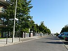
380 | Glider pilot , memory of the beginnings of aviation in Johannisthal | June 19, 2003 | This section of the road was spun off from the Segelfliegerdamm in 2003. It extends the route of Walther-Huth-Strasse westwards to Winckelmannstrasse. |
|
| At the Old Fenn
( Location ) |
210 | Fenn , Low German name for a wetland, specifically the "width Fenn" in the Königsheide is meant here |
Nov. 21, 1926, before 1914 Fenn |
With only one house, the street was first mentioned in the address directory as “Fenn” around 1914. It goes from what was then Königschaussee and belonged to the Neukölln administrative district until 1938. The street now runs in a west-east direction between Zum Alten Fenn and Oststraße and has house numbers 13-25. |

|
| At the Green Anger
( Location ) |
340 | Anger , the center of a village with meadow or pasture | around 1920 | The street runs northeast parallel to the Groß-Berliner Damm between Greifstraße (north) and Pilotenstraße (south). According to the 1930 address book, there are undeveloped land between Oststrasse and Nieberstrasse, except for the cigarette factory, whose address, however, is Groß-Berliner Damm 27–31. On the right-hand side facing Pilotenstrasse are five inhabited houses on double plots belonging to “TerrainAktGes.am Flugpl.Johannisthal = Adlershof (Berlin)”. |

|
| At the hazel bush
( Location ) |
190 | Hazel bush, shrub or tree from the birch family | Nov 9, 1926 | The street connects West and East streets, but in the middle is only a footpath through a public green area. It was built in the second construction phase of the 1924/1925 settlement project of the "non-profit housing association Berlin-Johannisthal" based on designs by Ernst Engelmann and Emil Fangmeyer . As recently as 1930 it was declared undeveloped. In 1954 it is recorded in its present form. In the current directory (as of June 2013), parcel 1 is a green area, and number 2 is a two-story building that belongs to the Montgolfier brothers' sports school to the south . |

|
| On the Rundling
( Location ) |
120 | Rundling , historical name for a small village in a round shape | Dec 13, 2005 | The private cul-de-sac with its 20 car-free properties is located in a new residential area to the west of the Johannisthal landscape park. It goes from the Walter-Huth-Straße northwards as a dead end . Through the construction of the single-family houses on plots 7-13 in the north, 1-4 (east) / 16-20 (west) in the south and the 5, 6 (east) and 14, 15 and 15a (west) a square is created that is reminiscent of the historic village shape that gave it its name. The access road is between the properties at Walther-Huth-Straße 14 and 16. |

|
| Arthur-Müller-Strasse
( Location ) |
710 | Arthur Müller (1871–1935), building contractor who played a key role in the construction and expansion of the Johannisthal airfield | Sep 11 2002 | The road goes from the road at the airfield in an elongated "U" pointing northeast and closes the new settlement area to the Johannisthal landscape park on the former airfield to the (south) west. Plots 2–60 (odd) and 1–77 (even) are located here, with numbers 61 and 63 each divided five times and built on with homes built around 2010. The route between Segelfliegerdamm and Melli-Beese-Straße was originally named as Abramowitschallee. |

|
|
Baumschulenstrasse
( Location ) |
360 (in the district) |
Tree nursery Späth of Franz Späth | 1890 | Most of the Baumschulenstraße located in the district of Baumschulenweg . Only the plots 56–60 on the east side between the Britzer connecting canal ( tree nursery bridge ) and Königsheideweg with allotments on the edge of the Königsheide are in Johannisthal. The traffic route continues south-east as Späthstraße .
The route of today's road follows the course of a forest path that led through the Kölln Heath to the “southern Spreeablage”, an intermediate storage area for wood before it was loaded onto ships. On January 29, 1842, it was officially named Ablageweg . However, because logging lost its importance in the second half of the 19th century and the path also led to the tree nursery established by Franz Späth , it was soon called the Baumschulenweg. After it was paved as a road on the initiative and with the means of the nursery owner , it was given the name that is still valid today. |

|
| Bean way
( Location ) |
150 |
Bohne , choice of name with reference to the planned Salatweg, which was instead given the name Ginkgoweg |
Dec 13, 2007 | The street between Hederichweg and Springbornstraße is built on with single-family houses. BVV determined the new name in 2007. Nevertheless, it is still included in official documents in 2013 as street 207 (Grüne Aue) or only street 207 . A takeover as Grüne Aue , which the residents wanted , was not decided, as there is already a street of the same name in Berlin-Biesdorf . |

|
| Broad way
( Location ) |
240 | Road geometry | 1921 | The Breite Weg opens up 33 plots of land in the Johannisthal settlement, which was built by a housing cooperative between 1919 and 1921 , and runs between Zum Alten Fenn and Eibenweg , from there over Oststrasse in two directions in an east-west direction. When it was first mentioned in the Berlin address book in 1922, it ran from Sterndamm over a private street and Birkenallee to Oststraße. After 1961, when the Sterndamm was built in the east, the street was shortened and became a dead end , which meant that lots 1 and 2 that had never been built on were no longer available. |

|
| Broad fen
( Location ) |
870 | Fenn , former wetland on this area | before 2009 | The Breite Fenn is a path along the Kannegraben and lies to the east in the break of the same name between Südostallee and Königsheideweg. The official street directory contains the property Breites Fenn number 1, which lies on the fracture surface on a path roughly parallel to Am Alten Fenn . |

|
|
Draesekestrasse
( Location ) |
240 | Felix Draeseke (1835–1913), composer | May 16, 1938 | The road connects Lindhorstweg (southwest) with Megedestrasse (northeast). When it was completed in 1930, the traffic route was named Laßwitzweg . In 1943, the address book shows only five of the 22 properties with single-family houses, and there are still undeveloped properties (“construction sites”) on the other side of Lindhorstweg up to Feldmark. |

|
|
Ecksteinweg
( Location ) |
140 | Ernst Eckstein (1845–1900), writer | March 20, 1929 | The Ecksteinweg was laid out as Straße 8 in the 1920s . It goes south-east from Sterndamm and forms an access road in the residential area with two side arms. Only plots 2–8 (straight) belong to the street, as the northern side of the street borders on the railway area. |

|
| Eibenweg
( Location ) |
220 | Yew trees , evergreen native trees | July 26, 1927 | The Eibenweg goes northwards from Am Alten Fenn , and after the crossing with the Breite Weg it forms a dead end to the KGA 'Am Alten Fenn'. It arose from the merging of Straße 23, which was laid out around 1920, and Birkenweg . It currently has house numbers 22-68; the count 1–21 was recorded for years as “construction sites” that were never realized. It should begin at what was then Kaiserstrasse . |

|
| Eisenhutweg
( Location ) |
1520 | Monkshood , plant from the buttercup family | Aug 16, 1928 | The street, initially a path, was created as street A according to the development plan and until 1938 belonged to the administrative district of Berlin-Neukölln . It is accessed by a bus line. The main street of regional importance with lots 1–139 (odd) and 2–86 (even) is located between Stubenrauchstrasse and the suburbs on Adlershof Hermann-Dorner-Allee . From here, the Adlershof junction of the A 113 can be reached via Ernst-Ruska-Ufer . The Eisenhutweg is separated from the motorway in the eastern section by a green area to the south, on the north side, east of the road at the airfield, there are lots 101-139 undeveloped green areas with bushes and trees that merge into the landscaped park. These green spaces are located to the west near the newly established residential estate along the road at the airfield and to the east near the landscaped park. This part of the street is marked with Post Adlershof in the address book, almost all of the properties were already built on at that time, although some were listed as gardens. |

|
| Ellernweg
( Location ) |
380 | Ellern , popular name for alder trees, which were abundant in this wetland before development | Feb. 18, 1927 | The Ellernweg, initially laid out as Straße 21 , runs between Sterndamm and Weststraße. In accordance with the development plan, road 7 was included in the route; in 1943 the path was still undeveloped. The “ Gebrüder-Montgolfier -Schule” grammar school, named after the inventor of the hot air balloon, is located at Ellernweg 20 . |

|
| Engelhardstrasse
( Location ) |
420 | Paul Engelhard (1868–1911), aviation pioneer | Feb. 18, 1915 | The road was initially created as a driveway from Schöneweide train station to the main entrance of the Johannisthal airfield ; it remained undeveloped until at least 1954. It originally branched off from the north end of the Groß-Berliner Damm (opposite Waiblinger Weg). When a fire station was built in 1961 on a former road, Engelhardstrasse became a dead end to the north . The namesake crashed on the Johannisthal airfield in 1911 . |

|
| Ernst-Ruska-Ufer
( Location ) |
500 (in the district) |
Ernst Ruska (1906–1988), physicist | Aug 26, 1998 | The Ernst-Ruska-Ufer runs along the north bank of the Teltow Canal . It extends this Adlershofer Straße in the district to junction 5 (Adlershof) of the A 113 . It was created with the expansion of the area of the former GDR Academy of Sciences to the WISTA site and forms its southern boundary in the Adlershof district. |

|
|
Fielitzstrasse
( Location ) |
510 | Alexander von Fielitz (1860–1930), composer | May 16, 1938 | The traffic route was created in 1930 by merging streets 12 and 19 to form Goldmarkstraße . It runs between Heubergerweg and Lindhorstweg in a north-south direction. |

|
| Fokkerstrasse
( Location ) |
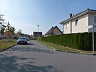
180 | Anthony Fokker (1890–1939), aircraft manufacturer, founded AHG Fokker Aeroplanbau in Johannisthal in 1912 | Sep 11 2002 | This traffic route is laid out on the site of the former airfield and in 2013 already had twelve built-up lots, 2–12a (even) and 1–7a (odd). North of the crossing Hugo-Junkers-Straße, the street encloses a green area with a parallel path. The street is located between Straße am Flugplatz and Arthur-Müller-Straße in the newly built housing estate on the western edge of the Johannisthal Landscape Park. A street planned with the name Fokkerstraße in the new building area (not yet developed in 2013) north of the landscape park around Groß-Berliner Damm has not been realized. |
|
| Friedrich-List-Strasse
( Location ) |
660 | Friedrich List (1789–1846), economist and railroad pioneer | June 9, 1961 | The street was initially called Ostmarkstraße and is located in a residential area that the "Housing Association Eisenbahnernotsiedlung" had built in the 1930s based on designs by the architect Walter Kaas . The name was changed on the Day of the Railway Worker in 1961. The Garden Friends Johannisthal administration is located at Friedrich-List-Straße 2b. The street opens up the settlement between the Schwarzen Weg on the edge of the KGA 'An der Südostallee' and the Kannegraben. The numbering of the plots begins at the southern entrance to the settlement (from Südostallee 169 and 171) with 1–7 counterclockwise and changes in irregular sequence between the southern and northern side of the street up to 39 and 45 with the driveway between Südostallee 95 and 97. The allotment garden has the address Friedrich-List-Strasse 2a. |

|
|
Gerhard-Sedlmayr-Strasse
( Location ) |
900 | Gerhard Sedlmayr (1891–1952), aviation pioneer and entrepreneur | Sep 11 2002 | The traffic route runs on the site of the former Johannisthal airfield in a U-shape from Groß-Berliner Damm, starting from property 82 and 90. The planned street continues 150 meters on the other side of Groß-Berliner Damm in the direction of the planned (northern) industrial area to the disused Schöneweide marshalling yard . The route has been prepared and, apart from commercial buildings on Groß-Berliner Damm, is still undeveloped, but real estate is already being advertised. A planned route based on the plans from around 2000 was not implemented, but the current route is not yet included in the official plans, even if various maps of Berlin have drawn a named road route. Gerhard-Sedlmeyer-Strasse for Johannisthal with street number 8929 is already included in FIS-Broker's address search, but the link to the map leads to Wilmersdorf |

|
| Ginkgoweg
( Location ) |
200 | Ginkgo , native to China and now planted worldwide | Dec 15, 2008 | The street 208 (Gartenweg) was officially named in 2008 by decision of the BVV, after the name Salatweg originally intended was not adopted. The path runs in a south-west-north-east direction between Hederichweg and Springbornstraße north-west of the KGA "Wegegrün". | |
| Gorissenstrasse
( Location ) |
270 | Ellery von Gorrissen (1886–1973), aviation pioneer | Sep 11 2002 | The traffic route is planned on the site of the former Johannisthal airfield . The official map shows the street in an east-west direction south of the sports field between Segelfliegerdamm and the landscape park; it is included in the official list under street number 8930. In 2013 there will be a newly laid out park path on the planned route at the "Westfuge des Landschaftspark". The settlement buildings planned south of the road have not been implemented. The street name is incorrectly spelled Gorissen instead of Gorrissen. |

|
| Greifstrasse
( Location ) |
130 | Martin Greif (1839–1911), writer | March 20, 1929 | Along this street, which had been laid out as street 35 according to the development plan, several residential building tracts were built on behalf of the "Stadt- und Land-Siedlungsgesellschaft (Berlin)". Greifstraße connects Hagedornstraße with the north-east lane of Groß-Berliner Damm in a north-east-south-west route, on it are plots 3–13 (odd) and 4–16 (even). The apartment buildings 3 and 5 as well as 4–16 were built in 1943 and are listed as inhabited in the address book. |

|
|
Groß-Berliner Damm
( Location ) |
2050 (in the district) |
Greater Berlin , name for the urban area of Berlin that was created in 1920 | around 1915 | The Groß-Berliner Damm, originally starting in 1916 from Bahnhofplatz , runs in a north-west-south-east direction between Waiblinger Weg and the district boundary on Adlershof Hermann-Dorner-Allee ; it continues in Adlershof to Rudower Chaussee. In 1928, this section was first called the extended Groß-Berliner Damm and consisted of a single piece of land for the Ambi-Budd Preßwerk GmbH . The extended Groß-Berliner Damm was incorporated into the Groß-Berliner Damm in 1935 and includes house numbers 119–153 (odd only). In the 1930s there were house numbers 1–57 on Groß-Berliner Damm; the even numbers were not yet assigned, but are listed in the address book as “construction sites”. The "Stadt- und Land-Siedlungsgesellschaft" and the "Familienhaus-Baugesellschaft" from Lichtenberg were active as construction companies . The cigarette factory "Abdulla & Co." had set up shop under the house number range 27–31 . "In the historically grown commercial location on Groß-Berliner Damm, today's usage structure is characterized by heterogeneous operating modes and sizes."
The newly built section of street between house number 85 and Rudower Chaussee was included in the dam on March 30, 2008. In 2013, Johannisthal includes sections 1–85 (odd) and 10–88 (even). Numbers 87–117 and 2–8 are in the intended commercial development area and have not yet been assigned (as of summer 2013). This traffic route complements the eagle frame in its meaning. |
 |
|
Haeckelstrasse
( Location ) |
220 | Ernst Haeckel (1834–1919), zoologist, philosopher | May 31, 1951 | According to the development plan, the traffic route was built around 1893 and was named Roonstrasse .
It connects Winckelmannstrasse (formerly Friedrichstrasse ) with Lindhorststrasse. In the street there is one end point of tram line 63 . Part of the street has the status of a supplementary street in the higher-level street system . |

|
| Hagedornstrasse
( Location ) |
650 | Friedrich von Hagedorn (1708–1754), poet | March 20, 1929 | According to the development plan, the traffic route was built as road 64 . It runs northeast parallel to Groß-Berliner Damm and southwest parallel to the tracks of Schöneweide station. The Hagedornstraße connects the Ecksteinweg (previously only from Waiblinger Weg and to parcel number 40) with the Landfliegerstraße. After further extensions, it comprises 97 house numbers that are assigned in the shape of a horseshoe. The residential development goes back to the activities of the “Stadt und Land Siedlungsgesellschaft” and “Terrain AG am Flugplatz Johannisthal-Adlershof” at the end of the 1920s. |

|
| Hanuschkestrasse
( Location ) |
200 | Bruno Hanuschke (1892–1922), aviation pioneer (" Old Eagle ") | Sep 11 2002 | The street on the site of the former Johannisthal airfield is built on as a west-east traffic route between Meeli-Beese-Straße with a small offset on Wrightallee and a turning hammer on a green area. It comprises plots 3–13 and 8–12. Its western section runs double-lane around a square. It is already included in the official street directory with 13 house numbers. |

|
| Haushoferstrasse
( Location ) |
360 | Max Haushofer (1840–1907), economist and writer | Dec. 4, 1930 | According to the development plan, it was laid out as Street 1 . Haushoferstraße connects Königsheideweg (north) with the intersection of Fielitzstraße / Hoevelstraße (south) and includes house numbers 1–26. |

|
| Hederichweg
( Location ) |
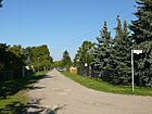
480 | Field radish , also known as Hederich, a plant from the cruciferous family | Aug 16, 1928 | In a northwest-southeast guidance, the path opens up the small house settlement between Springbornstrasse and Stubenrauchstrasse. |
|
| Heinrich-Mirbach-Strasse
( Location ) |
60 | Heinrich Mirbach (19th / 20th century), Government Councilor in the Prussian Ministry for Public Works ; had encouraged the establishment of the civil servants housing association in Berlin and thus ensured construction activities in the Johannisthal area | Oct 18, 1910 | The "Siedlung Johannisthal" was built by the Berlin civil servants' housing association, which was founded in 1900, according to plans by the architect Paul Mebes . In the square Mühlbergstrasse 16–22, Heinrich-Mirbach-Strasse 1–5, Johannes-Werner-Strasse 4–7, Vereinsstrasse 19–23 and 27–31, an ensemble of residential buildings has been preserved and is on the list of monuments.
The quiet residential street has only five house numbers and is located between the western sections of Vereinsstrasse and Mühlbergstrasse. |

|
| Herrenhausstrasse
( Location ) |
260 | Mansion , the then owner of the goods Johannisthal to 1750 in the former Friedrichstrasse built | around 1914 | The Herrenhausstraße leads from the Königsheideweg (northeast) over the Trützschlerstraße with one interruption to the Winckelmannstraße.
The eponymous building had to be removed around 1975 because it was dilapidated. |

|
| Herweghstrasse
( Location ) |
210 | Georg Herwegh (1817–1875), poet | May 24, 1951 | The road runs on the route of a historical military and trade route. In 1892 it was named Bismarckstrasse . In the area of Herweghstraße 1–3 and Winkelmannstraße 18 there are listed cattle sheds from 1884.
Herweghstraße leads from Winckelmannstraße (northeast) to Johannes-Werner-Straße (west). |

|
| Heubergerweg
( Location ) |
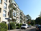
670 | Richard Heuberger (1850–1914), composer | Dec. 4, 1930 | When the street was laid out in 1892, it was named Moltkestrasse . On the occasion of some street renaming in 1930 in Johannisthal, Moltkestrasse was given its current name together with Strasse 14 .
The Hans Grade School, named after the German aviation pioneer Hans Grade, is located on Heubergerweg 37 . There are also two listed architectural monuments on Heubergerweg. |
|
| Hoevelstrasse
( Location ) |
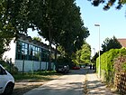
360 | Johann Friedrich Hoevel (18th century), landowner in Johannisthal | March 23, 1905 | Hoevelstrasse runs between Sterndamm (east) and Koschatweg (northwest). When it was first named, it was spelled Hövelstraße , but this was soon corrected. In 1930 the previous street 15 was included. |
|
| Hugo-Junkers-Strasse
( Location ) |
400 | Hugo Junkers (1859–1935), aircraft engineer and entrepreneur | Sep 11 2002 | The traffic route is located on the site of the former Johannisthal airfield, southwest of the landscape park. It connects to Arthur-Müller-Straße on both sides and crosses Fokkerstraße in its course. This opens up the inner plots Hugo-Junkers-Strasse 2–38 and 3–37. The name of the streets for the new settlement area was given in 2002, but the exact alignment and construction of the street did not take place until the residential development in 2009/2010. |

|
|
Igo-Etrich-Strasse
( Location ) |
300 (in the district) |
Igo Etrich (1879–1967), Austrian pilot and aircraft designer | Sep 11 2002 | The traffic route is planned as plan street A on the edge of the area of the former Schöneweide marshalling yard, north of the Groß-Berliner Damm, that has been rededicated for development. It lies between the border to Niederschöneweide (on the railway site) and the Groß-Berliner Damm. The Igo-Etrich-Straße should not be continued on the railway area. In the development plan 9-16-1 of February 25, 2011 the road to the northwest is an extension of the Adlershofer Wagner-Régeny-Strasse to the extension of the Hermann-Dorner-Allee to the northeast, whereby a projected tour on the border of Niederschöneweide (at the railway site along) to the west of Landfliegerstrasse . It is listed for the development of the area of the former railway site (41 hectares) and the south of the industrial park (30 hectares). However, the executed route is in the direction of Hermann-Dorner-Allee to the district of Niederschöneweide, with the first 30 meters from Groß-Berliner Damm belonging to Adlershof. The planned route along the railway site was named as Wagner-Regeny-Straße. It should be noted here the course of the district boundary which forms a "Johannisthaler triangle" across the Karee Igo-Etrich-, Wagner-Régeny-, Georg-Schendel-Straße, Groß-Berliner Damm to the northeast to Niederschöneweide and in the south to Adlershof. Igo-Etrich-Straße 7 for the Adlershof district is listed in the address search for FIS-Broker. On the north-west side of the road, a 50 m wide strip of green is planned, which spans the landscape park and which exists to some extent in the mid-2010s. |

|
| In the blackberry corner
( Location ) |
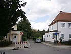
40 | corner covered with blackberries (in the sense of small alley ) | before 1995 | This traffic route was planned and designated on November 9, 1926. It was supposed to leave the Breite Weg and lead to Südostallee, but it was never built on. Therefore, the name disappeared after 1943, and only after the fall of the Wall did the administration officially re-name a short street at the northern end of Oststraße north of Breiten Weg (street number 44699), after it had previously been used. A subsequent path leads north to the property on Südostallee. |
|
|
Johannes-Sasse-Ring
( Location ) |
1060 | Johannes Sasse (1918–1944), resistance fighter against National Socialism | May 2, 2007 | The ring in the Schliemannsiedlung was formed and named in 2007 on the route of the previous streets Straße 196 (Bausemerweg) , Straße 194 , Straße 195 and Straße 197 . The originally proposed naming of the last numbered streets in the district after Hahnenfußgewächsen according to the neighboring Eisenhutweg (194: Augentrostweg, 195: Sturmhutweg, 196: Mönchskappenweg and 197: Winterlingstraße) was not implemented. In contrast, a ring road with the name Detlev-Schliemann-Ring was to be created. The current namesake was the son of the former pastor of Johannisthal. He was sentenced to death for anti-Nazi statements and degradation of military strength and executed in Halle prison in 1944.
The ring road connects to Eisenhutweg at both ends and is located near Stubenrauchstraße between Eisenhutweg and the A 113 , the south-western part of the ring runs along the motorway. The plot numbering 2-68 (consecutive) shows several missing plot numbers, some of the plots are built on with residential houses from the 2010s. |

|
| Johannes-Werner-Strasse
( Location ) |
350 | Johannes Werner (18th century), landowner , is considered to be the founder and namesake of the current district of Johannisthal | 1909 | Johannes-Werner-Straße connects Sterndamm (northwest) with Haeckelstraße (south) and comprises 23 house numbers.
In 1749 a leaseholder was sought for the royal administrative areas between Rudow , Rixdorf and Köpenick . Werner got the contract in 1753 with all associated rights and obligations. He settled ten colonist families at his own expense . So rope makers and basket weavers from Saxony and Bohemia came to the Mark Brandenburg and formed the first inhabitants of Johannisthal. It should be noted that for the spelling of the street, the "e" was not taken from Johannes, but the "Thal" from the meadows was used. |

|
|
Königsheideweg
( Location ) |
2770 (in the district) |
Course south of the Königsheide , after a meeting between the Swedish King Gustav Adolf and Elector Georg Wilhelm von Brandenburg during the Thirty Years War (1631) | Oct. 20, 1932 | The Johannisthal section of the Königsheideweg was initially called Parkstrasse . The path lies with plots 200–296 and 215–293 between Baumschulenstrasse and Sterndamm, but the road and the south side between Baumschulenstrasse and Ostweg on the western edge of the waterworks belong to the neighboring district of Baumschulenweg . 1590 meters of the road are on the southern edge of the Königsheide. Stumbling blocks were laid in front of house number 269 for three victims of National Socialism . |

|
|
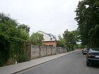
Köpenicker Strasse
( Location ) |
140 | Köpenick , direction of the street | March 6, 1905 | The spelling was C öpenicker Straße until the 1930s . The street is between Winckelmannstrasse and Segelfliegerdamm. |
|
| Koschatweg
( Location ) |
710 | Thomas Koschat (1845–1914), Austrian composer | Dec. 4, 1930 | The path was formed from the planned streets Street 16 and Street 18 . It connects Haushoferstraße with Lindhorstweg and includes house numbers 15–76 (numbers 1–14 are missing). |

|
|
Landfliegerstrasse
( Location ) |
220 | Airplanes that, unlike seaplanes, only flew over land | around 1925 | The traffic route is said to have been built around 1910, but was not given its name, which is still valid today, until around 1925.
The street lies between the former freight yard Schöneweide (northeast) and Groß-Berliner Damm (south). After that, the route continues as a glider embankment. |

|
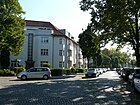
| Lindhorstweg
( Location ) |
510 + 200 | historical field name ("name for the farmland formerly located here") | Dec 15, 1930 | The Lindhorstweg was originally created as Lindhorststraße . It is located between the waterworks and Sterndamm and also gives this name to an access road going south into the new development area of Springbornstrasse. |
|
| Louis Blériot Street
( Location ) |
180 | Louis Blériot (1872–1936), French aviation pioneer | May 1, 2001 | The street is located northeast of the Groß-Berliner Damm and leads over the Sportfliegerstraße as a dead end to the district boundary with the former Schöneweide marshalling yard. It is shown with plots 4 and 5 (continuously). |

|
|
Megedestrasse
( Location ) |
310 | Johannes Richard zur Megede (1864–1906), writer | Dec. 4, 1930 | The street lies between Heubergerweg and Sterndamm. In 1943, lots 1, 3, 5 (corner of Sterndamm) with multi-family houses belonging to the “Gemeinnützige Siedlungs- und Wohnungsbaugesellschaft Berlin mbH (district east)” and numbers 9, 19; 14, 16, 20 built with single-family houses. The other plots were undeveloped in 1943 (as a construction site or “does not exist”). In the official street register there are Megedestraße 1–25 (odd) and 4–22 (even). |

|
| Melli-Beese-Strasse
( Location ) |
1290 | Melli Beese (1886-1925), pilot | Feb 15, 2005 | The road was first formed and designated as Melli-Beese-Ring on September 20, 2002 from parts of the Eisenhutweg and the road at the airfield . The ring road was named Melli-Beese-Straße in 2005 after an extension to the north. It is located between Wolfgang-Harlan-Straße and Groß-Berliner Damm, where it joins the existing Louis-Blériot-Straße. The northern part belongs to the Johannisthal / Adlershof development plan in the district and is still in the planning stage. [obsolete] The southern branch ends in 2013 at the west fugue of the landscape park with a turning hammer at the level of the Gorissenstrasse, which has not yet been laid out . |

|
| Mühlbergstrasse
( Location ) |
320 | formerly here lying windmill hill | around 1910 | Here, the “Beamten-Wohnungs-Verein eGgmbH (Berlin)” had residential buildings built for its members between Johannes-Werner-Strasse and Lindhorststrasse. |

|
|
Nieberstrasse
( Location ) |
280 | Stephan von Nieber (1855–1920), military airman, one of the founders of the Johannisthal airfield | around 1920 | The Nieberstraße runs from the Hagedornstraße (northeast) in a slightly arched manner over the Groß-Berliner Damm to Engelhardstraße (southwest). It includes 21 house numbers in zigzag numbers.
When it was first recorded in the address book (1921), it should begin at Sterndamm and extend to the Görlitzer Bahn (reverse counting). |

|
|
East Street
( Location ) |
720 | East , relative to the settlement | 1920 | To the east, the street borders the "Kleinhaussiedlung Johannisthal" which was built in the 1920s. The "Gemeinnützige Baugesellschaft Berlin-Johannisthal" had the development carried out according to plans by the architect Bruno Ahrends . The road initially ran from today's Königsheideweg to Breite Weg. The settlement with today's streets Breiter Weg, Am Alten Fenn, Eibenweg, Weststraße and Oststraße was completed by 1927. 450 small single-family houses were built in the entire area. In 1922 the Oststraße was finished and has had 75 house numbers since then. It was extended to the north beyond the Breiten Weg and has a walking connection to Im Brombeerwinkel . |

|
| Pietschkerstrasse
( Location ) |
150 | Werner Alfred Pietschker (1887–1911), aviation pioneer | after 1922 | It went from Engelhardstrasse at the corner of Groß-Berliner Damm and was not built on until the 1930s. It currently connects the Groß-Berliner Damm (east) with the Sterndamm (west). |

|
| Pilot street
( Location ) |
330 | Pilot , reference to the neighboring "aviator" streets | before 1921 | The traffic route was owned by the "Terrain-Aktiengesellschaft Groß-Berliner Damm" in the 1920s and was gradually built between the Groß-Berliner Damm and the Görlitzer Bahn . Currently (June 2013) it connects Engelhardstrasse (southwest) with Hagedornstrasse (northeast). |

|
|
Redwitzgang
( Location ) |
150 | Oskar von Redwitz (1823-1891), writer | Dec. 4, 1930 | The Redwitzgang is located between the Heuberger- and Königsheideweg. On the development plan, it is routed as street 20 . Here are houses from the 1960s (14-22 and 13-19 standing across) and apartment buildings with the address Königsheideweg from the 1930s. In 1937, apart from undeveloped land, only house 7 for the Redwitzgang is listed. |

|
| Rixdorfer Strasse
( Location ) |
340 (in the district) |
Rixdorf, former name for Neukölln ; Direction of the road | around 1900 | The Rixdorfer Straße forms part of the district boundary between Johannisthal and Baumschulenweg , whereby the road area (except for the northwestern footpath) belongs to the district. The street is between Kiefholzstrasse / Südostallee and Schnellerstrasse. Plots 1–21 (continuous) are in the district, 22 and 24 in Niederschöneweide and 26 in Baumschulenweg (building in the Baumschulenweg cemetery). |

|
| Roller bed
( Location ) |
60 × 40 | Hermann Rollett (1819–1904), Austrian poet | Dec. 4, 1930 | The Rollettplatz is a green area in the Karree Rollett- / Koschat- / Lindhorstweg / Draesekestrasse with access between the properties Rollettweg 7 and 9. The Rollettplatz itself is officially dedicated, but without its own properties. | |
| Rollettweg
( Location ) |
190 | Hermann Rollett (1819–1904), Austrian poet | Dec. 4, 1930 | The path connects Draesekestrasse (southeast) with Koschatstrasse (northwest) and comprises 17 parcels: 3–15 odd southwest and 2–14 straight northeast. The addresses of the corner properties are assigned to the neighboring streets. It was created by merging Straße 16 and Straße 18 . |

|
|
Glider Aviation Dam
( Location ) |
1190 | Gliding , referring to the location at the Johannisthal airfield | Oct 31, 1934 | Initially, the traffic route was called Flugplatzstrasse (around 1915–1928), then Sturmvogelstrasse .
The street extends between Groß-Berliner Damm and Straße am Flugplatz, continued in the north on Landfliegerstraße, in the south on Stubenrauchstraße. The sports grounds of the " SG Sportfreunde Johannisthal 1930 " and the former company grounds of the VEB Kühlautomat Berlin are located on the Segelfliegerdamm . With the change in the southern part of the street (Planstrasse West 2), the Alte Segelfliegerdamm was spun off. |
 |
| Sports aviation route
( Location ) |
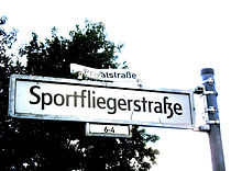
390 | Sports aviators , referring to the beginning of aviation at the Johannisthal airfield | May 1, 2001 | The road runs from Landfliegerstraße in a south-easterly direction through an industrial park and includes house numbers 3–9, numbers 1 and 2 are missing in the official directory. After the intersection with Louis-Blériot-Straße, it ends as a dead end after about 100 meters . |

|
| Springbornstrasse
( Location ) |
1020 + 200 + 200 + 150 |
Otto Springborn (1890–1944), locksmith , resistance fighter against National Socialism | May 31, 1963 | According to older city maps and address books, a traffic route in the main route of Springbornstrasse was named Buschweg and branched off from Stubenrauchstrasse.
Springbornstraße, which was renamed in 1963, takes up parts of the previous route. It bends at right angles between Lindhorstweg in the north and Stubenrauchstrasse in the east and encloses a new development area from the 1970s (plots 2–270 even and the odd 1–11 and 107, 115, 193–205, 219–229). The multi-armed Neubaustraße 401 was built for the traffic development of this residential area, which was included in Springbornstraße after the district was completed. The "Evangelical Free Church Berlin-Johannisthal" (Springbornstrasse 248a) here is noteworthy. It is located in a building from the GDR era, which was rebuilt in 2007-2010 and served as a residential area restaurant. |

|
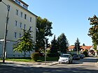
| Staudenweg
( Location ) |
90 | Perennial , herbaceous plant | July 26, 1927 | The Staudenweg connects the Oststraße with the Sterndamm and has only two lots. It was laid out as street 25 . |
|
|
Stern dam
( Location ) |
2380 (in the district) |
derived from a star-shaped square that was later canceled | around 1914 | The Sterndamm is located in the district between Stubenrauchstrasse and the district boundary south of the Schöneweide train station with lots 4–256 (even) and 7–257 (odd). It continues under the railway bridges of the Görlitzer Bahn to the B 96a (Michael-Brückner-Straße) in Niederschöneweide (plots 1 and 2).
The Treptow Museum is located at Sterndamm 102. The listed historical town hall building of Johannisthal is used. Numerous other architectural monuments can be found along the Sterndamm. |

|
| Road at the airfield
( Location ) |
1010 | Johannisthal Airport |
before 1914 ( airfield ) around 1940 Street at the airfield |
The street name used today was derived from the street name Flugplatz established in the 1910s . The road was further expanded in the following years. The Rumpler-Werke contributed to this, as did the AEG (1925). The Temmler works can be found under number 6 and “Tobis Industrie GmbH” ( Tonbild-Syndikat ) under 6a .
It was not until 1941 that the note "see street at the airfield" appears in the address book under airfield |

|
| Stubenrauchstrasse
( Location ) |
730 +100 (in the district) |
Ernst von Stubenrauch (1853–1909), District Administrator of the Teltow District | March 23, 1925 | The Stubenrauchstrasse lies with the plots 44-52a and 54-79 between the road at the airfield in the northeast and the Hermann-Gladenbeck-Brücke on the north bank of the Teltow Canal (junction Stubenrauchstrasse of the A 113 ) on the district boundary to Rudow in the southwest. A street in the north of Sterndamm was called Stubenrauchstrasse in the 1920s . This section of the road was later included in the Königsheideweg. The naming date given here refers to the Johannisthaler section between Teltow Canal and Akeleiweg. |

|
| Südostallee
( Location ) |
1750 (in the district) |
Direction and location of the traffic route | Oct. 20, 1932 | The Südostallee runs in the district between the Südostalleebrücke on the district boundary to Baumschulenweg along the northern edge of the Königsheide to Sterndamm . From 1900 onwards, a section between the entrance to Schöneweide train station and the old town center was called Kaiserstraße . The north side of the Südostallee between the Britzer connecting canal and Rixdorfer Straße ( Baumschulenweg cemetery ) is in Baumschulenweg. |

|
|
Truetzschlerstrasse
( Location ) |
350 | Carl Louis Freiherr Trütschler von Falkenstein (1824–1891), landowner in Johannisthal | 1911 | The street connects the Sterndamm (northwest) with the Segelfliegerdamm (southeast) and comprises 32 house numbers. In the 1914 address book (first recording of Johannisthal) it only had two house numbers but numerous construction sites. |

|
|
Club Street
( Location ) |
380 | Berlin civil servants housing association, which had acquired land here and had residential buildings built from 1910 | around 1910 | The street connects Lindhorstweg with Winckelmannstraße. The Berlin civil servants' housing association, organized as a cooperative, bought the entire area and had inexpensive apartment buildings built along the street. In 1914 the first buildings were completed, they included house numbers 1–13 between Lindhorstweg and Johannes-Werner-Straße.
Around 1935 the street was extended eastwards to Friedrichstraße (today Winckelmannstraße) and built on in the same way. In the meantime (as of June 2013) 34 house numbers belong to this street; the count is done in a horseshoe shape. |

|
|
Wagner-Régeny-Strasse
( Location ) |
290 In the district |
Rudolf Wagner-Régeny (1903–1969), composer | Sep 11 2002 | The street on the edge of the WISTA site is between Rudower Chaussee and Igo-Etrich-Straße in the district. The extension of the route to extend Hermann-Dorner-Allee was to be named Igo-Etrich-Straße in the Johannisthal district , but was also given the name Wagner-Régeny-Straße here. |

|
| Waiblinger way
( Location ) |
70 | Wilhelm Waiblinger (1804–1830), writer | March 20, 1929 | The path connects Ecksteinweg (northeast) and Hagedornstrasse (southwest). It extends a little further and forms a turning hammer . Originally it led to Sternplatz / Sterndamm.
The traffic route was initially listed as Straße 37 in the development plan . According to the spelling rules for street names, the Waiblinger Weg should be written in one word. The view that the name of the route could be the Wuerttemberg city of Waiblingen is doubtful, as some of the surrounding streets were also named after writers. |

|
| Forest road
( Location ) |
400 | Forest , reference to the Königsheide | around 1892 | When the name was given, the street formed the southern boundary of the Königsheide. It currently connects (with 40 house numbers) the Sterndamm with the Segelfliegerdamm in a northwest-southeast guidance. |

|
| Walther-Huth-Strasse
( Location ) |
440 | Walther Huth (1875–1964), founder of the Albatros Flugzeugwerke in Johannisthal | Sep 11 2002 | The traffic route begins at the Segelfliegerdamm in an easterly direction, crosses the Melli-Beese-Straße and ends at the landscape park. |

|
| West Street
( Location ) |
410 | West , direction | around 1920 | The street name was given in connection with the construction of the Johannisthal small house settlement. It denotes the western development boundary. |

|
| Winckelmannplatz *
( Location ) |
120 × 100 × 90 (circle segment) |
Johann Joachim Winckelmann (1717–1768), archaeologist and art historian | before 2007 | The square is a triangular green area between Winckelmannstrasse, Altes Segelfliegerdamm and Segelfliegerdamm. The square is listed under this name in some reference works, but is not officially dedicated. |

|
| Winckelmannstrasse
( Location ) |
860 | Johann Joachim Winckelmann (1717–1768), archaeologist and art historian | May 10, 1951 | From around 1750 it was called Dorfstrasse and around 1893 it was named Friedrichstrasse . Winckelmannstraße goes south from Sterndamm at Albineaplatz , ends at Stubenrauchstraße and then continues as a street at the airfield . |

|
| Wolfgang-Harlan-Strasse
( Location ) |
250 | Wolfgang Harlan (1882–1951), aircraft engineer, founder of the Harlan aircraft works in Johannisthal | Sep 11 2002 | The road goes east from Melli-Beese-Straße and ends at a green area at the landscape park. The development is not yet completed. |

|
| Wrightallee
( Location ) |
450 | Wright brothers , American aviation pioneers | Sep 11 2002 | The avenue runs between Walther-Huth-Straße (north) and Wolfgang-Harlan-Straße (south) with some access roads going eastwards. |

|
Streets in the Johannisthal-Adlershof planning area
In the Treptow-Köpenick district, the Johannisthal / Adlershof landscape park was developed in the area around the former Johannisthal airfield at the end of the 2000s . In 1995 the airfield was finally closed. Surrounding areas were designated as planning areas, with the Groß-Berliner Damm, which was made continuous after Adlershof, as the axis of an industrial area between the landscape park and the suburbs to the Oberschöneweider railway area. Various roads named after aviation pioneers were planned for development. In the middle of the 2010s (as of 2015), development in the district focused on Adlershof, and commercial development in the Johannisthal district was slow.
Only on the edge of Adlershof were Igo-Etrich- and Gerhard-Sedlmayr-Straße (as of 2015) expanded as a road route, the latter name probably applies to the Ringstraße south on Groß-Berliner-Damm. Some streets on the northwestern edge in the residential area "Wohnen am Landschaftspark" have been laid out, some with a modified route. The Melli-Beese-Ring at the north end was not implemented and therefore renamed Melli-Beese-Straße .
| Name / location | Length / dimensions (in meters) |
Origin of name | Date of designation | Remarks | image |
|---|---|---|---|---|---|
|
Abramowitschallee
( Location ) |
(planned) [obsolete] | Vsevolod Abramowitsch (1890–1913), Ukrainian-Russian flight pioneer and instructor, who crashed over Johannisthal | Sep 11 2002 | The road, which has not yet been completed, is planned on the site of the former Johannisthal airfield in the new commercial area south of the Groß-Berliner Damm. It is projected parallel to this from the Segelfliegerdamm on the northeast and northern edge of the landscape park to the Groß-Berliner Damm (near the border with Adlershof). In 2013 this area is without development and preparatory work for the roads can be seen. |

|
| Benno-Koenig-Strasse
( Location ) |
planned [out of date] | Benno König (1885–1912), pilot and flight technician at the Johannisthal airfield | Sep 11 2002 | The traffic route is being built on the former airfield site. The planned but not yet implemented road route (status 2014) is located east of Groß-Berliner Damm along the border to Adlershof in the corner of the district towards Igo-Etrich-Straße . | |
| Charles-Boutard-Strasse
( Location ) |
planned [out of date] | Charles Boutard (1884–1952), mechanic, pilot, husband of the aviator Melli Beese | Sep 11 2002 | The traffic route will be laid out on the area of the former Johannisthal airfield, which is temporarily used as a commercial site . The route runs over the Groß-Berliner Damm between Abramowitschallee and the former Schöneweide marshalling yard. |

|
| Henry Farman Street
( Location ) |
planned [out of date] | Henri Farman (1874–1958), French aviation pioneer and entrepreneur | Sep 11 2002 | The traffic route will be laid out on the site of the former Johannisthal airfield . It is planned to run across Groß-Berliner Damm parallel to Charles-Boutard-Straße between Charles-de-Carters-Straße and Igo-Etrich-Straße, but the exact route has not yet been determined in this building area north of the landscape park. | |
| Hubert-Latham-Strasse
( Location ) |
planned [out of date] | Hubert Latham (1883–1912), French aviation pioneer, was the first to cross the English Channel in a small powered airplane in 1909 and set three world records for high altitude flight in 1909/1910 | Sep 11 2002 | The traffic route will be laid out on the site of the former Schöneweide marshalling yard and the former Johannisthal airfield . The route is planned from Charles-Boutard-Strasse over Henry-Farman-Strasse from northwest to southeast and ends at Benno-König-Strasse near the district boundary to Adlershof, it lies (northeast) parallel to Groß-Berliner Damm. | |
|
Pégoud Street
( Location ) |
planned [out of date] | Adolphe Pégoud (1889–1915), French aviation pioneer | Sep 11 2002 | The traffic route is not yet recorded in the official street directory (as of June 2013). It is planned for the development area northeast of Groß-Berliner Damm and is provisionally laid out as northeast between Groß-Berliner Damm and Hubert-Latham-Straße. The planned commercial settlement is delayed because the Senate Administration withdrew the development area from planning in 2005. | |
| Pierre-de-Caters-Strasse
( Location ) |
planned [out of date] | Pierre de Caters (1875–1944), Belgian aviation pioneer | Sep 11 2002 | The traffic route is not yet included in the official street directory (as of June 2013). The projected road in the development area is parallel to the Groß-Berliner Damm in the southwest. It ends in the southeast at the district boundary to Adlershof at the landscape park and could merge into the planned Igo-Etrich-Straße . The planned commercial settlement is delayed because the Senate Administration withdrew the development area from planning in 2005. |
Former and planned streets and squares
On October 12, 1937 (due to the canal) it was decided to relocate areas from Rudow , Britz and Buckow to Johannisthal by April 1, 1938. In December 1997, the Späthsfelde settlement, which was assigned to Johannisthal in 1938, was relocated to the Baumschulenweg district. The planning of streets southeast of Lindhorstweg in the 1930s was not implemented in this way.
Parts of the former airfield Johannisthal were in planning the "development region Adlershof / Johannisthal" with WISTA the district Adlershof assigned. These area changes had an impact on street names, the routing and assignments in the street system.
| Original name | from | to | renamed | Origin of name,
annotation |
|---|---|---|---|---|
| Bahnstrasse | around 1885 | 1915 | → Inclusion in the Sterndamm | on the railway , in the position to the Niederschöneweide Johannisthal station .
Only the connecting piece between Sternplatz and Grünauer Straße was referred to as Bahnstraße . The street name Bahnstraße has not been listed in the address books since 1916. On the other hand, the same owners are named under the respective house number 3 in the years 1915 and 1916: District committee of the Teltow district with “Eisenbahn-Beamtenhaus” and “ Chausseehaus ”. |
| Birch path | 1924 | Aug 7, 1927 | → Eibenweg | Birches , genus of birch-like plants. With the formation of Greater Berlin , there were many birch paths in the urban area. |
| Bismarckstrasse | 1892 | May 24, 1951 | → Herweghstrasse | Otto von Bismarck |
| Bush path | 1942 | June 14, 1963 | → Springbornstrasse | Bush , low growing plants |
| Village street | around 1755 | around 1893 | → Friedrichstrasse |
Johannisthal village Oldest street in Johannisthal |
| Airmaster place | around 1912 | after 1932 | (canceled) | The square was on Sterndamm. The name was derived from the military rank for a pilot . Regarding the cancellation of the name, Luise-Berlin.de gives the year 1924, but the Berlin address book 1932 also contains Flugmeisterplatz and -straße. |
| Flugmeisterstrasse | around 1912 | after 1932 | (canceled) | The name was derived from the military rank for a pilot. |
| Flugplatzstrasse | around 1915 | Aug 16, 1928 | → Glider Aviation Dam |
Airfield Johannisthal Around 1920 the company "Ballonhallenbau Arthur Müller GmbH" is listed at Flugplatzstraße 2. |
| Friedrichstrasse | around 1893 | May 10, 1951 | → Winckelmannstrasse |
Frederick the Great (1712–1786), King of Prussia
The street that emerged from the Dorfstrasse was the first traffic route in the colonist village of Johannisthal in the middle of the 18th century. Here was in 19./20. Century a memorial for the namesake of the street, which is listed in the 1914 address book as a "sight". During his reign the Johannisthal complex fell. |
| Goldmarkstrasse | Dec. 4, 1930 | May 16, 1938 | → Friedrich-List-Strasse | Karl Goldmark (1830–1915), Austro - Hungarian composer |
| Herzogin-Charlotte-Platz | before 1913 | after 1933 | (canceled) | Sophie Charlotte Duchess of Braunschweig and Lüneburg (1668–1705), Queen of Prussia in 1701. The square at the sharp junction of Engelhardstrasse from Groß-Berliner Damm was still nameless in the 1961 city map and was later built over with a fire station. |
| Kaiserstrasse | around 1900 |
Oct. 20, 1932 1910 |
→ Südostallee → Königschaussee |
Kaiser , title of ruler, here derived from Kaiser Wilhelm I. Parts of the street were renamed Königschaussee around 1910 and belonged to the Berlin suburb Niederschöneweide |
| Kaiser-Wilhelm-Platz | around 1900 | Jan. 5, 1950 | → Sterndamm |
Wilhelm I (1797–1888), German Emperor, King of Prussia
The square was on Kaiser-Wilhelm-Strasse , today Albineaplatz (see above). |
| Kaiser-Wilhelm-Strasse | 1892 | Jan. 5, 1950 | → Sterndamm |
Wilhelm I (1797–1888), German Emperor, King of Prussia
It ran from Stubenrauchstrasse to Parkstrasse around 1920. |
| Kanner Street | around 1920 | around 1924 | → Südost-Allee opened up | Kanne , name of the former forestry in the Königsheide, also the name of a river ( Kannegraben ) This street name appears for the first time in 1921 as a traffic route in Johannisthal. After 1925 it disappeared again without any indication of renaming. |
| Königschaussee | around 1910 | around 1920 | → Südostallee | King , ruler title; here derived from Wilhelm I. This street went off the Bahnstraße eastwards towards Neukölln (then Rixdorf). |
| Koenigsplatz | after 1907 | Jan. 5, 1950 | → Sterndamm | King , title of ruler, here related to Wilhelm I. |
| Koschatplatz | Dec. 4, 1930 | March 31, 1964 | (canceled) |
Thomas Koschat (1845–1914), Austrian composer According to the development plan, it was initially laid out as place D. Haushofer Straße, Redwitzgang and Koschatweg formed its limits. In connection with housing construction, it was divested in 1964 . |
| Laßwitzweg | Dec. 4, 1930 | May 23, 1938 | → Draesekestrasse | Kurd Laßwitz , writer. Laßwitzweg was between Megedestrasse and Lindhorstweg . 1937 Laßwitzweg . In: Berliner Adreßbuch , 1937, Part IV, p. 2028. Of the 22 mutually numbered properties, nine are built on with single-family houses, one of which has a garden. During the time of National Socialism it was considered “undesirable” because of “radical liberal and democratic tendencies”. On May 23, 1938, Laßwitzweg was transferred to Draesekestrasse, which was named on May 16, 1938. |
| Lindhorststrasse | around 1913 | Dec 15, 1930 | → Lindhorstweg | historical field name ("name for the arable land formerly located here"). The traffic route projected as a “road” initially remained on the edge of the undeveloped southern area and was run as a “route”. |
| Moltkestrasse | 1892 | Dec. 4, 1930 | → Heubergerweg |
Helmuth Karl Bernhard von Moltke (1800–1891), "Moltke the Elder (the Elder)", Prussian Field Marshal General
In its layout, it extended from Kaiser-Wilhelm-Platz to Hoevelstrasse. |
| Nieberplatz | around 1920 | around 1925 | (canceled) |
Stephan von Nieber (1855–1920) "did a particularly good job of creating the Johannisthal airfield ." |
| North street | around 1920 | around 1921 | northern boundary of the Johannisthal small house settlement in the 1920s. This name is no longer in the address book as early as 1922, instead of which there is the → Breite Weg . | |
| Ostmarkstrasse | 1925 | June 9, 1961 | → Friedrich-List-Strasse | Ostmark , term used in the 20th century for the easternmost regions of the German Empire |
| Parkstrasse | 1892 | 1932 | → Königsheideweg | Königsheide park
The street so named initially connected the Bahnstraße with the Flugplatzstraße. In 1914 it had 20 parcels and other unnumbered construction sites. Its course was later changed to between Kaiser-Wilhelm-Straße and Sterndamm, and through further development, 26 plots of land were already identified in 1933. The house number 26 directly on the corner of Sterndamm belonged to a cinema called “Astra Film” until 1932, in the following year this is no longer shown. |
| Place B | around 1920 | Place B "am Breiten Weg" entered in the address book from 1921 onwards. In 1921, a playground belonging to the Johannisthal community is noted there. | ||
| Rixdorf-Canner-Kreischaussee | around 1902 | May 13, 1910 | → Neuköllniche Allee , a section of Südostallee | corresponding to the direction to Böhmisch-Rixdorf and Deutsch-Rixdorf and Kreisstraße . Canner is derived from Kanne , the name of the forester's house in the Königsheide. |
| Roonstrasse | around 1893 | May 31, 1951 | → Haeckelstrasse | Albrecht von Roon (1803–1879), Prussian general and minister |
| Settlement on Sterndamm | around 1920 | around 1921 | Name of a west-east street in the small house settlement Johannisthal in the 1920s Already in the following year this was the street → Am Alten Fenn . | |
| Sternplatz | around 1913 | Jan. 5, 1950 | → Sterndamm | The square was included in the course of the street. |
| Sturmvogelstrasse | Aug 16, 1928 | Oct 31, 1934 | → Glider Aviation Dam |
Petrels Numerous small and large companies that produced for aircraft and vehicle construction had settled here, including Ambi , Chrysler Company , "Deutsche Dura GmbH", automotive interiors, " Graham-Paige Automobil GmbH", " Albatros-Flugzeugwerke ", Temmler-Werke (Chemistry), Chemical Factory "Nassovia". |
| Wilhelmstrasse | 1892 | around 1912 | → Sterndamm | Wilhelm I (1797–1888), German Emperor and King of Prussia. There was a monument to the emperor on this street. |
Further locations in Johannisthal
Allotment gardens
The allotment gardens (KGA) in the district are in the north-west (on the railway site) and in the south, the latter being influenced by the construction of the motorway near the Teltow Canal . In the following allotment gardens are listed according to the information in the allotment garden development plan (KEP) and by Gartenfreunde Treptow.
- KGA 'Am Alten Fenn' (Weststraße 20, Lage , KEP 09004), the permanent allotment garden complex was founded in 1926 and is located with 9,400 m² and 20 parcels on the state's own leased property.
- BLW sub-district Schöneweide 'Am Altenalter' ( location ) is an allotment garden that was created on land owned by Deutsche Bahn AG. The areas are leased to Bahn-Landwirtschaft (BLW), with 46 parcels on 15,721 m².
- KGA 'Am Hederichweg' (Hedrichweg 29, Lage , KEP 09007), the permanent allotment garden established in 1926 with 15,910 m² and 48 parcels (one permanent resident) on state-owned and another 3652 m² with six parcels (including one permanent resident) on private leased land.
- KGA 'An der Südostallee' (Franz-Liszt-Straße 2a, Lage , KEP 09011), on 28,522 m² with 66 parcels, of which twelve are permanent residents, the KGA is located on private land. A further 10,224 m² with 28 parcels are intended for another use according to the FNP (level 1a). The allotment garden association was founded in 1920.
- KGA 'Sonnental II' ( location ), this allotment avenue was included (as a remaining area) in the KGA 'Am Alten Fenn' and incorporated.
- KGA 'Südpol' (Baumschulenstrasse 60, Lage , KEP 09079), permanent allotment garden with 15,860 m² for 38 plots. Only areas along Baumschulenstrasse are unsecured for a higher-level main road according to FNP. The area is located on the Johannisthaler area on the eastern edge of Baumschulenstraße between the Britzer connecting canal and Königsheideweg and could be partially de-dedicated if this street were widened. The 'South Pole' facility was founded in 1920.
- KGA 'Teltowkanal I' (Südostallee 42, Lage , KEP 09080), the permanently secured fictitious allotment garden established in 1923 is located between the Britzer Zweigkanal and Königsheide south of the Südostallee with 87 plots on 44,070 m² of state-owned leased land. According to the land use plan, however, a part of the area is reserved for the overarching main road planning, which is located on the southern edge of Südostallee. This street is of regional importance in the Berlin road network .
- KGA 'Waldesgrund' (Baumschulenstrasse 59, Lage , KEP 09086) with 50,931 m² for 126 plots (two of which are permanent users), which is considered to be permanently secured as a fictitious permanent allotment garden. However, according to the FNP, areas on the eastern edge of Baumschulenstrasse, which is a regional main road , are reserved for a superordinate main road. The allotment garden association was founded in 1902.
- KGA Waldfrieden I (Königsheideweg 13, Lage , KEP 09087), the facility founded in 1911 is permanently secured with 9,744 m² for 26 users on the western edge of the Königsheide on the state-owned lease area that was left when the garden center was built.
- KGA 'Wegegrün' (Stubenrauchstrasse 44, Lage , KEP 09090) is a permanent allotment garden with 35,907 m² for 85 plots on state-owned leased land. The plant was founded in 1976 and operated as KGA 'Springbornstrasse' until 1995. It is bordered by Gingkoweg, Springbornstrasse, Stubenrauchstrasse and the motorway.
Parks and other facilities
- LSG Königsheide ( location )
- Wide fen on the eastern edge of the Königsheide ( location )
- Johannisthaler Park ( location ) It was planned as place H according to the development plan . The green area lies behind the properties of Sterndamm, Wald-, Engelhard-, Pietschkerstraße. It is officially dedicated as a parking area (RBS 49906) and there is access to the 3.24 hectare area at the southeast corner of Sterndamm / Waldstrasse and through the north joint on Pietschkerstrasse west of the fire station.
- Johannisthal landscape park ( location ): the landscape park supplements the Adlershof technology park WISTA on the western (in the district) area of the former Johannisthal airfield , for which the district boundary has been changed. Environmental compensation measures for the industrial areas of the technology park were carried out on the parking area within the Treptow-Köpenick district . The 26.0 hectares have been secured as a nature reserve since September 4, 2002 . The peripheral area is declared as a landscape protection area and the core area as a nature reserve.
- Johannisthal-Königsheide waterworks , the site of the previous waterworks outside of the remaining Johannisthal intermediate pumping station ( Lage ), with 34.6 hectares, was included in the nature reserve in Berlin on September 12, 2007 . The waterworks was shut down in the 1990s due to the expensive need for renovation, especially since the southern drinking water wells had to be shut down due to the thermal power station opposite on the Teltow Canal in Rudow and the construction of the motorway. The green space created here, as it was fenced, remained largely untouched and nature was left to its own devices.
- The Berlin Wall Trail ( Lage ) runs at 2900 meters in the district along the Teltow Canal and is partly south of the motorway on the water side. The Teltow Canal Path (number 17 of the 20 green main paths , ( location )) initially runs on the south bank of the Teltow Canal, changes at the Hermann-Gladenbeck Bridge ( Stubenrauchstrasse ) to the north bank for 1730 m in the district and continues east to Adlershof.
- Teltower Dörferweg (number 15 of the 20 green main paths), from which 1580 meters lead on the eastern edge of the Johannisthal landscape park (partly bordering Adlershof territory) through the district to Groß-Berliner Damm and on to Adlershof ( location )
Other locations
- Former children's home Königsheide on Südostallee, today there are objects of child and youth welfare on the site ( location )
- Northeast industrial area, next to the railway site at the former Schöneweide depot (Görlitzer Bahn) ( location )
- WISTA site in Johannisthal, still in planning (development plan XV-54ab) and planned on Groß-Berliner Damm.
See also
Web links
- Map of Berlin 1: 5000 with district boundaries. Senate Department for Urban Development Berlin, 2012, accessed on August 31, 2012 .
- Berlin-Brandenburg Statistics Office: Directory of streets and squares in the Treptow-Köpenick district (as of February 2015); pdf
- Street directory Johannisthal von Kaupert Media
- VO Road cleaning directory of October 26, 2011 (PDF; 3.4 MB), accessed August 31, 2012
- Jura-Magazin.de: Planning area southeast of the center of Johannisthal on Groß-Berliner Damm
- Jura-Magazin.de: Urban development measure in the Johannisthal district
- Hermann Jansen: Development plan for the small settlement Berlin-Johannisthal
Individual evidence
- ↑ a b The Berlin House of Representatives approved the draft of the development plan XV-54ab on December 12, 2002.
- ↑ a b FIS broker map display map of Berlin 1: 5000 (K5 color edition) , accessed on August 31, 2012
- ↑ Document IV / 148: Designation of two new private roads in Johannisthal (March 21, 2001) ( page no longer available , search in web archives ) Info: The link was automatically marked as defective. Please check the link according to the instructions and then remove this notice.
- ↑ a b Falk-Verlag Hamburg: Urban Atlas Greater Berlin with Potsdam . 5th edition.
- ↑ Printed matter - V / 0345: Amendment of BA resolution 71/02 of July 9, 2002 “Designation of 46 private roads in the Adlershof science location”, November 28, 2002 ( Memento of the original of December 2, 2013 in the Internet Archive ) Info: Der Archive link was inserted automatically and has not yet been checked. Please check the original and archive link according to the instructions and then remove this notice.
- ↑ Urban Development Berlin: Development Areas ( Memento from September 22, 2013 in the Internet Archive )
- ↑ a b Ordinance on the establishment of the development plan 9-16-1 in the Treptow-Köpenick district, districts Johannisthal and Adlershof from December 1, 2011 (PDF; 482 kB)
- ↑ a b c Justification for the development plan 9–60 (as of February 1, 2013) ( Memento of the original from February 5, 2016 in the Internet Archive ) Info: The archive link was inserted automatically and has not yet been checked. Please check the original and archive link according to the instructions and then remove this notice. (PDF; 510 kB)
- ↑ MieterMagazin (January / February 2008): Development Areas - Stuttering Emergency Braking
- ↑ Printed matter - V / 0962: Johannisthal traffic solution (Melli-Beese-Ring) ( Memento of the original from December 3, 2013 in the Internet Archive ) Info: The archive link was automatically inserted and not yet checked. Please check the original and archive link according to the instructions and then remove this notice.
- ↑ Insertion on the black city map from 1946 on www.landkartenarchiv.de
- ↑ Printed matter - V / 0577: Designation of a place in Johannisthal (near Sterndamm 86a-88 / Heubergweg) in Albineaplatz (June 26, 2003) ( page no longer available , search in web archives ) Info: The link was automatically marked as defective. Please check the link according to the instructions and then remove this notice.
- ↑ Memorial stone and plaque on denkmalprojekt.orf
- ↑ List of renaming of the Berlin-Brandenburg Statistics Office, 2013 edition (PDF; 96 kB)
- ↑ a b Printed matter - V / 0412: Renaming of the previous section of the Segelfliegerdamm between Winckelmannstrasse and Planstrasse West 2 to "Alter Segelfliegerdamm" (February 27, 2003) ( page no longer available , search in web archives ) Info: The link was automatically defective marked. Please check the link according to the instructions and then remove this notice.
- ↑ a b c d e suburbs> Johannisthal . In: Berliner Adreßbuch , 1914, Part V, p. 80.
- ↑ The street Am Grünen Anger is listed for the first time in the Berlin address book from 1921.
- ↑ a b c d e streets in the Treptow administrative district> ..., Johannisthal, ... In: Berliner Adreßbuch , 1930, Part IV, p. 1928.
- ↑ a b c Pharus city map Berlin large edition (1954) Baumschulenweg ( page no longer available , search in web archives ) Info: The link was automatically marked as defective. Please check the link according to the instructions and then remove this notice.
- ↑ a b c d e f g h Address search in the RBS database for the map of Berlin 1: 5000 (K5 color edition), produced by the district surveying offices
- ↑ a b Printed matter - V / 1341: Naming a spur road in Johannisthal (June 23, 2005) ( page no longer available , search in web archives ) Info: The link was automatically marked as defective. Please check the link according to the instructions and then remove this notice.
- ↑ District Council Assembly Treptow-Köpenick: Printed matter - V / 1409 ( page no longer available , search in web archives ) Info: The link was automatically marked as defective. Please check the link according to the instructions and then remove this notice.
- ↑ Filing path on Luise-Berlin.de
- ↑ a b Printed matter - VI / 0485: Naming of streets 207 and 208 in Johannisthal (November 29, 2007) ( page no longer available , search in web archives ) Info: The link was automatically marked as defective. Please check the link according to the instructions and then remove this notice.
- ↑ a b suburbs> Berlin-Johannisthal . In: Berliner Adreßbuch , 1922, Part IV, p. 1627.
- ↑ An address designation in the official directory, the assignment of the linear extent of the associated route is not clear.
- ↑ see also Am Alten Fenn
- ↑ Wide Fenn in the Treptow-Köpenick district in the Berlin rent index from 2009 ( memento of the original from December 16, 2013 in the Internet Archive ) Info: The archive link was automatically inserted and not yet checked. Please check the original and archive link according to the instructions and then remove this notice. (PDF; 1.5 MB)
- ↑ a b c d e f Streets in the Treptow administrative district> Bohnsdorf, Johannisthal, Niederschöneweide . In: Berliner Adreßbuch , 1943, Part IV, p. 2072.
- ^ Homepage of the Montgolfier Brothers School
- ↑ a b c d e f g h The area on Groß-Berliner Damm in the north-east of the district between the landscape park and the railway area is part of the Adlershof science location . Roads are planned, but not yet laid out after the former industrial and commercial buildings were torn down (status in mid-2013).
- ↑ Urban development area Johannisthal / Adlershof Development balance sheet, status 2007 (PDF; 4.1 MB)
- ↑ Compare with the entry city map on berlin.de
- ^ Gerhard-Sedlmayr-Straße FIS-Broker (map of Berlin 1: 5000 (K5 color edition)) of the Berlin Senate Department for Urban Development and Environment
- ↑ The retrieval in the address search with incorrect forwarding took place on October 7, 2015
- ↑ Printed matter - VI / 0790: Name of street 208 in the Johannisthal district, between Springbornstraße and Hederichweg, in "Ginkgoweg" (July 17th, 2008) ( page no longer available , search in web archives ) Info: The link was automatically marked as defective . Please check the link according to the instructions and then remove this notice.
- ↑ Contrary to the description of Kauperts.de, this traffic route was not named as early as 1912, because the name was first included in the Berlin address book (suburbs) in 1916.
- ↑ a b suburbs> Berlin-Johannisthal . In: Berliner Adreßbuch , 1916, Part V, p. 86.
- ↑ a b Jura-Magazin: Part of the urban development area BerlinJohannisthalAdlershof for the widening and extension of the Groß-Berliner Damm (June 26, 2006) ( page no longer available , search in web archives ) Info: The link was automatically marked as defective. Please check the link according to the instructions and then remove this notice.
- ↑ Printed matter - VI / 0588: Name of the newly built street section, in the districts Johannisthal and Adlershof between Groß-Berliner Damm 85 and Rudower Chaussee, in "Groß-Berliner Damm" (February 28, 2008) ( Memento of the original from March 7, 2014 in the Internet Archive ) Info: The archive link was inserted automatically and has not yet been checked. Please check the original and archive link according to the instructions and then remove this notice.
- ↑ Johannisthal settlement, 1910–1911 by Paul Mebes
- ↑ Stables monument, 1884; Winckelmannstrasse 18 / Herweghstrasse 1–3
- ↑ Hoevel's biography and the background to the expansion of Johannisthal on Kauperts.de
- ↑ Template for the House of Representatives for the development plan (PDF; 482 kB)
- ^ Igo-Etrich-Straße FIS-Broker (map of Berlin 1: 5000 (K5 color edition)) of the Berlin Senate Department for Urban Development and Environment
- ↑ Printed matter - V / 0680: Street naming Schliemann-Siedlung (Johannisthal). April 29, 2004 ( Page no longer available , search in web archives ) Info: The link was automatically marked as defective. Please check the link according to the instructions and then remove this notice.
- ↑ Printed matter - VI / 0049: Name of the streets 194, 195, 196 and 197 between Eisenhutweg and the Autobahn in Johannisthal, which are combined to form a ring, in Johannes-Sasse-Ring. (December 14, 2006) ( Page no longer available , search in web archives ) Info: The link was automatically marked as defective. Please check the link according to the instructions and then remove this notice.
- ↑ Landfliegerstrasse . In: Berliner Adreßbuch , 1926, Part IV, p. 1866.
- ^ Monument database Berlin
- ↑ Berlin city map 1926 ( page no longer available , search in web archives ) Info: The link was automatically marked as defective. Please check the link according to the instructions and then remove this notice.
- ↑ a b c d e f suburbs> Berlin-Johannisthal . In: Berliner Adreßbuch , 1921, Part V, p. 86.
- ^ Streets in the administrative district Treptow - Johannisthal, Niederschöneweide . In: Berliner Adreßbuch , 1937, Part IV, p. 1968.
- ↑ The coordinate was selected for the street course around the residential area. ( Memento of the original from November 17, 2012 in the Internet Archive ) Info: The archive link was inserted automatically and has not yet been checked. Please check the original and archive link according to the instructions and then remove this notice.
- ↑ Berlin plan from 1954 ( page no longer available , search in web archives ) Info: The link was automatically marked as defective. Please check the link according to the instructions and then remove this notice. : Buschweg
- ^ Homepage of the Evangelical Free Church in Berlin-Johannisthal; History and more
- ↑ Homepage of the Treptow Museum ( Memento of the original dated August 12, 2013 in the Internet Archive ) Info: The archive link was inserted automatically and has not yet been checked. Please check the original and archive link according to the instructions and then remove this notice.
- ^ City map of Berlin, Stadtinfo-Verlag 2007/2008; Page 159, grid square B4
- ↑ Urban development area Adlershof / Johannisthal balance sheet (PDF; 4.1 MB)
- ↑ Hubert Latham's biography in the English Wikipedia
- ↑ 1943: Pharus Plan Berlin . Publishing house PHARUS-PLAN, Berlin N 54, Schwedter Straße 263 all rights to: Pharus-Plan-Media GbR ( page no longer available , search in web archives ) Info: The link was automatically marked as defective. Please check the link according to the instructions and then remove this notice.
- ^ Suburbs> Berlin-Johannisthal . In: Berliner Adreßbuch , 1915, Part V, p. 92.
- ↑ a b Flugmeisterplatz and Flugmeisterstrasse . In: Berliner Adreßbuch , 1932, IV, p. 1905.
- ↑ a b c d e 1926 - Sanwald Plan Berlin . Verlag Karl Sanwald / Pasing vor München ( page no longer available , search in web archives ) Info: The link was automatically marked as defective. Please check the link according to the instructions and then remove this notice.
- ↑ Friedrichstrasse in Johannisthal on Luise-Berlin.de
- ↑ Goldmarkstrasse on berlingeschichte.de
- ↑ Niederschöneweide . In: Berliner Adreßbuch , 1911, Part V, p. 330 .; see Königsschaussee on the map at the bottom left
- ↑ on the person of Laßwitz
- ↑ Nieberstrasse . In: Berliner Adreßbuch , 1925, Part IV, p. 1807 (name explanation).
- ↑ "Parkstrasse see Königsheide (r) weg" . In: Berliner Adreßbuch , 1934, p. 1888.
- ↑ Parkstrasse . In: Berliner Adreßbuch , 1932, Part IV, p. 1910.
- ↑ Parkstrasse . In: Berliner Adreßbuch , 1933, Part IV, p. 1909.
- ↑ Berlin's green oases: Senate secures allotment gardens until 2020
- ↑ Allotment gardens in Treptow-Köpenick, update 2010 ( Memento of the original from September 29, 2013 in the Internet Archive ) Info: The archive link was inserted automatically and has not yet been checked. Please check the original and archive link according to the instructions and then remove this notice. (PDF; 38 kB)
- ↑ Anniversaries of allotment gardens and associations in the district association of garden friends Berlin-Treptow e. V. ( Memento of December 10, 2008 in the Internet Archive )
- ↑ a b c d e f Fictitious permanent allotment gardens according to §§ 16 and 20a BKleingG. The fictitious permanent allotment gardens are protected as green area allotment gardens by being shown in the land use plan (FNP).
- ↑ a b Allotment areas which, according to the FNP, should be preserved.
- ↑ Allotment gardens in the Treptow-Köpenick district ( Memento of the original from September 29, 2013 in the Internet Archive ) Info: The archive link has been inserted automatically and has not yet been checked. Please check the original and archive link according to the instructions and then remove this notice. (PDF; 38 kB)
- ↑ Place H . In: Berliner Adreßbuch , 1940, Part III, p. 2074.
- ↑ RBS address search: Johannisthaler Park
- ↑ 20 green main paths - Teltow Canal Path
- ↑ 20 green main paths - Teltower Dörferweg
