List of streets and squares in Berlin-Wittenau

The list of streets in Berlin-Wittenau shows the streets in the Berlin district of Wittenau with their historical references. At the same time, this compilation is part of the lists of all Berlin streets and squares .
overview
In Wittenau there are two squares and 112 dedicated streets and paths. 13 of these streets continue into the neighboring districts. The total length of the city streets in Wittenau is 49.4 kilometers, including federal highway 96 in the district. The B 96 runs on the Oranienburger Straße through Wittenau and is supplemented by a main road system. For west-east traffic from Tegel and Waidmannslust via Lübars to Pankow and Niederschönhausen , the Waidmannsluster- / Zabel-Krüger-Damm road runs in the north of Wittenau and in the south of the district of the Gorkistraße / Alt-Wittenau / Wilhelmsruher Damm road into the Märkische Viertel and towards Pankow, this street is complemented by Gorkistraße / Am Nordgraben via Eichhorster / Dannenwalder Straße in the Märkisches Viertel or to Wilhelmsruher Heinz-Brandt-Straße. The [outdated] north bypass on the outer city ring is still in the planning phase. The north-south connection through Oranienburger Strasse as a federal road becomes more westerly through Hermsdorfer / Trift- / Holzhauser Strasse and the Eichborndamm through Borsigwalde in the direction of Spandau and the Autobahn and further east through Rödernallee with a connection to Gesundbrunnen and the Mitte district through Reinickendorf .
It is noticeable that in some residential areas the names of the streets are thematically almost uniform. These include tools, localities in the Vogelsberg district , architects or terms from the construction industry, history of Wittenau (historical field names or significant events such as a Kossaten rebellion). The construction of the north ditch in the mid-1930s interrupted the course of roads (such as Holzhauser Strasse) along its line. The Cité Foch , whose private streets are not dedicated and bear the names of French people, was created through the establishment of a separate residential area on a former industrial site for the French armed forces in Berlin from 1953 . The Jean-Jaurès-Straße is located at the Cité Foch, but existed - under a different name - before the development of the settlement.
Wittenau has 24,656 inhabitants (as of December 30, 2019) and includes the postcode areas 13435, 13437 and 13403.
After the First World War there was a need for apartments, but the following inflation, which peaked in 1923, meant that some settlement projects were not implemented. An example of this is the settlement in the Roedernallee area ( Graf Roedern-Allee ), Alt-Wittenau ( Hauptstraße ), Oranienburger Straße, mental hospital ( Dalldorf insane asylum ), Tessenowstraße ( Lindenweg ) and the development of the existing one, designed by the architect Jansen in 1919 by Heimstättengesellschaft Primus Road network. Particularly noteworthy are the streets west of Oranienburger Strasse at the end of the 1920s with buildings from the “Gemeinnützige Baugenossenschaft Wohnungssuchender eG”. The global economic crisis also disrupted the planned expansion of these areas.
After the Second World War, a residential area was built near the S-Bahn station for members of the French occupying forces and later protection forces. This residential area, named Cité Foch, consists of around 80 buildings with over 780 apartments. After the French left, the buildings were completely renovated and mainly made available to federal officials and their families. Only the street names such as Avenue Charles de Gaulle, Allee Marie Curie or Rue Montesquieu and the blue street signs still remind of the old use.
Overview of streets and squares
The following table gives an overview of the streets and squares in the district as well as some related information.
- Name / location : current name of the street or square. Via the link Location , the street or the square can be displayed on various map services. The geoposition indicates the approximate center of the street length.
- Traffic routes not listed in the official street directory are marked with * .
- Former or no longer valid street names are in italics . A separate list may be available for important former streets or historical street names.
-
Length / dimensions in meters:
The length information contained in the overview are rounded overview values that were determined in Google Earth using the local scale. They are used for comparison purposes and, if official values are known, are exchanged and marked separately.
For squares, the dimensions are given in the form a × b for rectangular systems and for (approximately) triangular systems as a × b × c with a as the longest side.
If the street continues into neighboring districts, the addition ' in the district ' indicates how long the street section within the district of this article is. - Name origin : origin or reference of the name.
- Notes : further information on adjacent monuments or institutions, the history of the street and historical names.
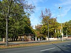
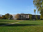
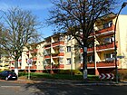
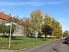
- Image : Photo of the street or an adjacent object.
| Name / location | Length / dimensions (in meters) |
Origin of name | Date of designation | Remarks | image |
|---|---|---|---|---|---|
|
Marie Curie Avenue
( Location ) |
110 | Marie Sklodowska Curie (1867–1934), a physicist of Polish origin who worked in France | 1984 | The private street in Cité Foch has no postal property and is located west of the houses Rue Diderot 1c – 1f from the turning point of Rue Diderot. It should be dedicated to the development plan XX-277 a drawn up in 2007 . The plan was revised in 2012 and is not yet completed in 2015. A street with this name is (in contrast to the neighboring streets) neither in the RBS detailed network (April 2015) nor on the FIS Broker map display of the map of Berlin 1: 5000. The dedication was not adopted in favor of Marie-Curie-Allee in Friedrichsfelde, which has almost the same name . |

|
| Pierre de Coubertin avenue
( Location ) |
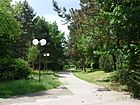
300 | Pierre de Coubertin (1863–1937), French educator, historian and sports official | 1984 | The private street in Cité Foch has no postal properties and is located south of the houses Rue Diderot 1c – 1f . The route with this name concerns the path that lies between the Münchhausen elementary school and the desecrated Ste.-Genevieve church. It should be dedicated to the development plan XX-277 a drawn up in 2007 . The plan was revised in 2012 and is not yet completed in 2015. A street with this name is (in contrast to the neighboring streets) neither in the RBS detailed network (April 2015) nor on the FIS Broker map display of the map of Berlin 1: 5000. The dedication was not adopted in favor of the Coubertin-Allee of almost the same name in the Olympic site (Westend). |
|
| Old Wittenau
( Location ) |
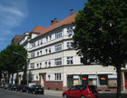
1470 | historical center of Wittenau | Jul 31, 1952 | The town of Wittenau and its streets are listed for the first time in the Berlin address book from 1910, when the traffic route was called Hauptstraße . Between 1946 and 1952 the street was called Kemnitz-Allee . The name goes back to the Reinickendorfer landowner Kemnitz, whereby the community had confused the Wittenauer and Reinickendorfer Hauptstrasse . In the Berlin road system it is recorded in the district over a length of 980 meters in category III: "Regional road connections". |
|
| At the village green
( Location ) |
220 | Anger , village center | Dec 11, 1965 | The route was previously called Straße 429 . At the village green branches off from Alt-Wittenau to the south and then turns to the east. It is the access road to property 2–36 (even) and 3–19 (odd) south of Alt-Wittenau. The cemetery and the town hall park are located south of the property. |

|
| On the green belt
( Location ) |
190 | The part of the landscape that is said to have stretched from Reinickendorf via Wittenau and Waidmannslust to the Hermsdorfer Forest was called the green belt . | Jun 9, 1933 | The branching off from Thiloweg impasse arose as Straße 140 . On October 20, 1932, it was named Schmiedegasse , but did not keep this name because it was used for a street in the tool district. |

|
| On the hill
( Location ) |
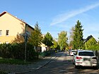
280 | Steinberg, a nearby hill | Feb. 18, 1927 | The access road branching off from Gorkistraße was created as Straße 111 . |
|
| At the Kesselpfuhl
( Location ) |
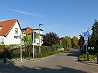
700 | a lake that has meanwhile been filled in | Feb. 18, 1927 | The traffic route was created from Straße 114 and Straße 115 in the development plan for the settlement. Plots 1–71 (odd) and 2–72 (even) belong to the street that goes south from Gorkistraße in a large curve across bei den Wörden to the east to Triftpark. The street is entered in the address book in 1928 with the addition of the settlement grassland, on plot 1 and 2 (consecutive) at the corner of Tegeler Strasse are multi-party houses belonging to the “community. Siedlungsges. Group North ”, followed by Jeschken's house and construction sites to Bei den Wörden and on the opposite side. The no longer existing Kesselpfuhl is shown on a map from 1835. The Kesselpfuhlgraben is still there, but no longer shows the historical course. |
|
| At Klauswerder
( Location ) |
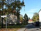
210 | historical hallway name | May 21, 1941 | The route was built in 1938 as road 207 . The name goes back to the land belonging to the Dalldorf Church, a Nicolaus Church in the Middle Ages, which was located here before 1830. |
|
| At the north ditch
( Location ) |
2970 (in the district) |
North ditch , drainage ditch | Nov 1, 1968 | The street is in the district between Gorkistraße and Roedernallee. The border to Borsigwalde runs to Eichborndamm . Between Roedernallee and through the railway underpass to Wilhelmsruh ( Heinz-Brandt-Straße ) is the district boundary on the northern edge of the street. The street width and the southern plots (number 31) belong to Reinickendorf . Am Nordgraben was first called Straße 374 , the remaining part of this street and Straße 476 were included in the new name on July 1, 1976. On November 1, 1979, the extension to Gorkistraße was added. In the Berlin road system , it is recorded in the district over a length of 1400 meters in category II: higher-level road connections, the remaining length of the road belongs to category III: regional road connections. |

|
| At the packing ditch
( Location ) |
220 (in the district) |
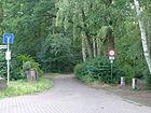
Packing trenches | Feb. 18, 1927 | The street is located in Wittenau between the Rosentreterpromenade and the district boundary south of the Achtrutenteich, to the northwest it continues in Waidmannslust as a park path in the Steinbergpark. The street is not indicated in the RBS detailed network and therefore no properties along the way. A concrete block-paved two-meter-wide dead end is marked with a sign for a ban on vehicles of all kinds and leads from the rail line crossing of the Rosentreterpromenade to the northwest to the Packereigraben (district boundary to Waidmannslust) and a dog garden. According to the development plan of the settlement, it was called Straße 113 and belonged to the "Am Steinberg" settlement. In 1927, the settlement "Am Steinberg" combined with Am Hügel , Priesterweg and Am Packereigraben is listed as streets. Am Packereigraben is listed as unnamed from Rosentreterpromenade in 1927. The eponymous packing ditch is already shown on a map from 1835. Since the 13th century, balls of wool have also been called “packing”, the corresponding goods depots “packing houses”. |
|
| At the priest's field
( Location ) |
180 | Field name ; this piece of land probably belonged to the priest | Jul 26, 1927 | The route is listed as road 112 in the development plan. It connects Am Hügel with the Rosentreterpromenade . In 1940 the “Steinberg settlement” was named for the street, lots 5, 9–19 (odd, left side) and 6–16 and 20 (even, right side) are built on and inhabited, 7 is a garden, the others are a construction site named. The road is indicated between Rosentreterpromenade via Am Hügel to Feldmark. In 1927 the settlement "Am Steinberg" is combined with Am Hügel, Priesterweg (Rosentreterpromenade - Am Hügel) and Am Packereigraben listed as streets. |

|
| At the Rathauspark
( Location ) |
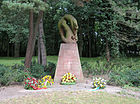
440 | is located at the Wittenauer Rathauspark | Jul 1, 1976 | The dead end and 30s zone leads at the Reinickendorf town hall from Eichborndamm to the southwest to the KGA 'Am Rathaus' where it meets the Humboldt lane along the hiking trail along the Nordgraben, which, when it was built, interrupted the continuous Holzhauser Straße . In 1961, on this route between Eichborndamm and Nordgraben, the Holzhauser Straße was called further over a bridge to the junction of Triftstraße through the Wolfsgarten settlement with road 141 . This section was renamed in 1976 along with road 141 . In the 1940 address book the town hall is named with Holzhauser Strasse 230/232 and the fire station of the city of Berlin with 228. |
|
| At the Steinbergpark
( Location ) |
630 | Steinbergpark , a public green area | Nov 12, 1997 | The street was created during the construction of a row house settlement. It is a dead end and play street in the “Neue Heimat” development and borders on the east of the KGA 'Steinberg'. Plots 4–68 (even, on the east side) and 5–87 (odd, west side) are predominantly three-storey terraced houses. At the northern end of the street, plots 89-101 and 104 are in two row house blocks across. The conclusion is the Rosentreterpromenade on the former route of the NBE over which the Wittenau part of the Steinbergpark lies. 190 meters of this traffic route have the RBS class "STRA", which describes the equipment, but are shown in the Okstra as "P" (private responsibility). |

|
| At the Triftpark
( Location ) |
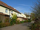
250 | Triftpark, a public park | Aug 26, 1987 | The street was created in the course of the construction of a row house settlement (yellow settlement), which was completed in 1988. This traffic route has the RBS class "STRA", which describes the equipment, but is shown in the Okstra as "P" (private responsibility). |
|
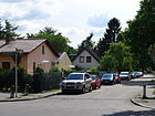
| At the Waidmannseck
( Location ) |
210 | Settlement, whose name is on the proximity to Waidmannslust is returned | March 6, 1936 | The route was created as road 136 and road 137 . It runs in an arch between Hermsdorfer and Oranienburger Straße. This traffic route has the RBS class "STRA", which describes the equipment, but is only shown as "F" in the Okstra . |
|
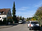
| Anvil way
( Location ) |
590 | Anvil , tool | Jul 18, 1958 | The route was created as road 113 . It is located in the settlement area between Nordbahn and Roedernallee as well as Wilhelmsruher Damm and Nordgraben. The street that runs from Fräsersteig to Wilhelmsruher Damm is in a district where the streets were named after tools. The Wittenau underground and S-Bahn stations are nearby. |
|
| Angersbach path
( Location ) |
190 | Angersbach , a place in the Vogelsbergkreis , with which the Reinickendorf district has had a partnership since 1964 | Sep 9 1960 | The route was created as road 151 . It is located in the area between Finsterwalder Strasse, Wittenauer Strasse and Oranienburger Strasse. |

|
| Avenue Charles de Gaulle
( Location ) |
830 (in the district) |
Charles de Gaulle (1890–1970), French general and statesman | Jul 11, 1956 | Avenue Charles de Gaulle is located with lots 1–35a (odd) and 2–36 in Cité Foch , a locality in the district. The connection to Nimrodstraße in Waidmannslust via the Packereigraben and the suburb border bears the same name, the adjacent properties to Nimrodstraße. To the south is the route to Place Moliere and at the corner of Rue Racine it bends for 330 meters to the northeast to join the desecrated Ste.-Geneviève church to the southeast at Hermsdorfer Strasse. The former private road was dedicated with the development plan XX-277 a . In the Cité Foch, residential houses for the French armed forces in Berlin were built on a fallow area south of the Packereigraben, initially without a cadastre , to which streets were named in 1984 . In the RBS detailed network, it is entered in the “STRA” category and the OKSTRA class “G”. The French armed forces shopping center at 9 avenue Charles-de-Gaulle, 10/14 was sold to a private investor in 1998 and has been vacant since 2006; it is to be demolished in order to build apartments. The "Collège Voltaire" was located at 33 avenue Charles de Gaulle. This French school abroad moved to Tiergarten in 2010. Since then, a pilot project has been set up for “guarding by living” based on the Dutch “Antikraak” model. |

|
|
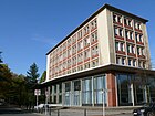
Bad-Steben-Strasse
( Location ) |
240 | Bad Steben , the Reinickendorf district has had a partnership with this place since 1988 | Apr 1, 1998 | Since 1912 the street has been named Robertstrasse after the former owner of the street land, Robert Zahn. It was created as a street K . |
|
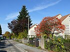
| At the Wörden
( Location ) |
550 | historical hallway name | Feb. 18, 1927 | The route was created as road 118 . “Wörden” or “Wurten” was the name given to the barely fertile lands that the Kossati were allowed to use. |
|
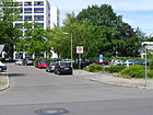
| Bernshausener Ring
( Location ) |
380 | Bernshausen , a place in the Vogelsberg district with which the Reinickendorf district has had a partnership since 1964 | Apr 1, 1967 | The route was created as road 406 . It is located in the area between Finsterwalder Strasse, Wittenauer Strasse and Oranienburger Strasse. |
|
| Blitzenroder ring
( Location ) |
440 |
Blitzenrod , district of Lauterbach ; with this town in the Vogelsbergkreis grooming Reinickendorf district since 1966 a partnership |
Nov 1, 1968 | The route was created as street 191 and street 197 . It is located in the area between Finsterwalder Strasse, Wittenauer Strasse and Oranienburger Strasse. |

|
| Blomberger way
( Location ) |
410 | Blomberg , since 1990 a twin town of the Reinickendorf district | Apr 1, 1985 | The route was built in 1982 as road 484 . It consists of two sections between Hermsdorfer Straße and Cyklopstraße that end as a dead end and are connected by a footpath. |

|
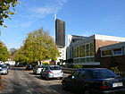
| Blunckstrasse
( Location ) |
440 | Erich Blunck (1872–1950), monument conservator and university professor | Apr 1, 1962 | The route was created as road 419 . It is located in the area between Oranienburger Strasse and Roedernallee south of the street Am Nordgraben, in which all street names have a reference to architectural history. |
|
| Brodersenstrasse
( Location ) |
480 | Albert Brodersen (1857–1930), garden architect | 69210000 | It is located in the area between Oranienburger Strasse and Roedernallee south of the street Am Nordgraben, in which all street names have a reference to architectural history. On July 18, 1958, the northwest extension of Brodersenstrasse was included in the street name that had already been assigned. |

|
|
Cyclop Street
( Location ) |
760 | The " Maschinenfabrik Cyclop owner: Mehlis & Behrens" built a new plant here in 1912. | after 1912 | The street is parallel to the railway line between Hermsdorfer and Oranienburger Straße ( Göschenplatz ). The route was created according to the development plan from Straße 81 and Straße 89 . On March 14, 1958, the parallel street from Nimrodstraße was included. This part had already been named before 1922 after its course - parallel to the northern runway. In 1987 the entire section of Cyclopstraße north of Hermsdorfer Straße was renamed Jean-Jaurès-Straße . The building of the "Maschinenfabrik Cyclop" south of Hermsdorfer Straße served the Berlin tram as the main warehouse from 1920 . In 1982 they were demolished for the extension of the “ Cité Foch ”. Here you will find the Emil Fischer School, Upper School Center for Nutrition and Food Technology and the Ernst Litfaß School, Upper School Center for Printing and Media Technology . |

|
|
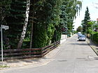
Dietrichinger way
( Location ) |
130 | Dietrichingen , place in the district of Südwestpfalz | Dec 11, 1940 | The route was created as road 196 . It connects Mausbacher Steig and Oranienburger Strasse. |
|
| Dowel path
( Location ) |
160 | Dowel , tool | Jul 18, 1958 | The route was created as road 141 . It is located in the settlement area between the route of the Nordbahn and Roedernallee as well as Wilhelmsruher Damm and Nordgraben. The access road leading from the Fräsersteig lies in a district in which the streets were named after tools. |

|
|
Eichborndamm
( Location ) |
2350 (in the district) |
Ludwig Eichborn (1819–1903), businessman | Jun 2, 1937 | The street lies between Am Nordgraben and Oranienburger Straße completely in the district. To the south it forms the suburb of Borsigwalde up to the railway bridge and continues with the plots 1–99 (odd) and 2–100 (even) southwards in Reinickendorf . In the district the route was called Charlottenburger Strasse since 1910 at the latest . In Reinickendorf, Eichbornstrasse followed, which now gave the name of the street that was initially only called as far as the street Am Nordgraben. Only on January 22, 1958, the section between Am Nordgraben and Oranienburger Strasse was renamed Eichborndamm. In the Berlin road system it is recorded in the district over a length of 2350 meters in Category II: Higher-level road connections. |

|
| Oak harvester ring
( Location ) |
240 | Eichenrod , a place in the Vogelsbergkreis with which the Reinickendorf district has had a partnership since 1964 | Apr 1, 1967 | The route was created as road 420 . It is located in the area between Finsterwalder Strasse, Wittenauer Strasse and Oranienburger Strasse. |

|
| Eichhorster way
( Location ) |
590 (in the district) |
Eichhorst , place in the district of Barnim | Aug 6, 1937 | The street with lots 48–96 (even) and 49–95 (odd) between Wittenauer and Finsterwalder Strasse is located in the district and continues southeast into the Märkisches Viertel . Between Lübarser Straße and the district boundary, the route was called Holzweg since 1910 at the latest , which suggests that it was built as a Knüppeldamm . To the northeast of the street is the Seggeluch. Before 1912 the section northwest of Lübarser Straße was already called Waidmannsluster Straße , after 1918 Waidmannsluster Weg . |

|
| Eisenhartsteig
( Location ) |
190 | Eisenhart, a war councilor in the 18th century, administered the office of Niederschönhausen around 1781 | Aug 4, 1930 | The route was previously called Straße 124 . Eisenhart had the “Seggeluch” drained. The path leads from Windhalmweg to Olbendorfer Weg. |

|
| Elsenpfuhlstrasse
( Location ) |
520 | historical hallway name | Feb. 18, 1927 | The street was created from street 133 and street 135 . The nearby Elsenpfuhl was surrounded by an alder forest. 20 meters of this traffic route have the RBS class "STRA", which describes the equipment, but are shown in the Okstra as "X" (other). |

|
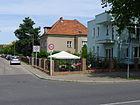
| Engelroder Weg
( Location ) |
210 |
Engelrod , part of Lauterbach , with this town the Reinickendorf district has maintained a partnership since 1966 |
Sep 9 1960 | The route was previously called Straße 159 . The street is completely in Wittenau between Schlitzer Straße and the district boundary on Finsterwalder Straße. The border with the Märkisches Viertel runs behind the eastern properties towards the Seggeluch . |
|
|
Fäustelweg
( Location ) |
120 | Fäustel , tool | Jul 18, 1958 | The route was created as road 142 . The access road leading from the Fräsersteig lies in a district in which the streets were named after tools. |

|
| Fetschow line
( Location ) |
170 | Gottlieb Michael Fetschow (1713–1792), pastor in Dalldorf | Feb. 1, 1965 | The route was created as road 428 . Fetschow was in office from August 1739 until 1783, his tomb at the village church in Wittenau specifies his life dates between August 15, 1713 and August 18, 1792. |

|
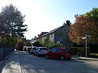
| Fire way
( Location ) |
180 | Heinrich Feuer, Dalldorfer Krugwirt | Aug 4, 1930 | The route was previously called Straße 127 . Heinrich Feuer was attested in 1652 as the head of the only Dalldorf family that had survived the Thirty Years War . Around 1590 Valtin Feuer was the owner of the Dalldorfer Krug. |
|
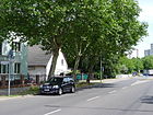
| Finsterwalder Strasse
( Location ) |
530 (in the district) |
Finsterwalde , town in the Elbe-Elster district | Apr 1, 1967 | The traffic route was created from street 123 and street 431 . It is located between Wittenauer Straße in Lübars and Wilhelmsruher Damm in the Märkisches Viertel. Property 61 on the northern edge of the street between Welzower Weg (southwest of Finsterwalder Bridge) and the bend in the street south of Eichhorster Weg belongs to Wittenau, while the street with the southern properties belongs to the Märkisches Viertel. |
|
| Flötnerweg
( Location ) |
320 | Peter Flötner (around 1490–1546) master builder, sculptor | Aug 6, 1937 | The route was previously called Straße 199 . The access road runs in an arc from Sittestrasse. |

|
|
Milling path
( Location ) |
500 | Milling cutter , tool | Jul 18, 1958 | The route was created as road 111 . In this neighborhood, the streets were named after tools. |

|
| Frischborner way
( Location ) |
160 | Frischborn , a place in the Vogelsberg district with which the Reinickendorf district has maintained a partnership since 1964 | Sep 9 1960 | The route was created as road 157 . It connects Schlitzer Strasse and Maarer Strasse. |

|
| Frommpromenade
( Location ) |
200 | Counsel Fromm was in the circle Niederbarnim active | around 1922 | The route was created as Straße 59 and was named Frommstraße around 1921 . In 1922 this street was marked on a map as the Fromm 'promenade'. It is first recorded in the address book in 1927, the location is Oranienburger Straße to Projektierte Straße and buildings 1 and 2 (continuously) are home to apartment buildings belonging to Heimstättenges. Primus mbH In the following year, houses 1–12 from Techowpromenade to Oranienburger Straße were built and inhabited. |

|
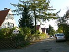
| Foxtail Path
( Location ) |
150 | Foxtail , tool | Jul 18, 1958 | The route was created as road 138 . The access road leading from the Fräsersteig lies in a district in which the streets were named after tools. |
|
|
Gorkistraße
( Location ) |
910 (in the district) |
Maxim Gorki (1868–1936), Russian writer | July 31, 1947 | In the district lies the section between Am Nordgraben and Alt-Wittenau with properties 172–216 (even) and 183–225 (odd). The street continues to the southwest in Tegel . The section in Wittenau was named Tegeler Weg even before 1903 . Before 1910 he was together with the extension to the station Tegel in Tegeler street renamed what had until 1947 inventory. In the Berlin road system , the entire length of the district is recorded in Category III: "Regional road connections". |

|
|
Göschenplatz
( Location ) |
80 × 70 × 60 (triangular) |
Georg Joachim Göschen (1752–1828), publisher and bookseller | Apr 4, 1961 | For a few years the area in front of the Wittenau train station had no name, but around 1925 the name Bahnhofplatz was determined. At the same time that Bahnhofstrasse was renamed, it was given the name of the publisher Göschen. |

|
|
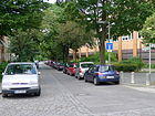
Göschenstrasse
( Location ) |
150 | Georg Joachim Göschen (1752–1828), publisher and bookseller | Apr 4, 1961 | When it was first installed before 1902, the traffic route was called Bahnhofstrasse . |
|
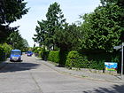
| Grebenhainer way
( Location ) |
200 | Grebenhain , a place in the Vogelsberg district with which the Reinickendorf district has maintained a partnership since 1964 | Sep 9 1960 | The route was created as road 155 . It connects Schlitzer Strasse and Maarer Strasse. |
|
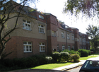
| Grassland path
( Location ) |
250 | "Settlement grassland" from the 1920s, designed by Erwin Anton Goodchild built | Aug 4, 1930 | The street in the Grünland settlement was created as street 138 and goes off as a cul-de-sac from 'In den Kaveln'. |
|
|
Hallichpromenade
( Location ) |
110 | Hallich was director of the district savings bank of the Niederbarnim district | 1912 | The route was created as street 63 between Techowpromenade and Oranienburger Straße. 50 meters of this traffic route have the RBS class "STRA", which describes the equipment, but are shown in the Okstra as "X" (other). On the triangular area between Alt-Wittenau, Oranienburger Straße and Techowpromenade, the parallel Frommpromenade and Hallichpromenade open up the development, the latter with the two houses 2/4/6 on the north side and 1-9 south. Their access is from the Techowpromenade as a dead end , the continuation is a through path to Oranienburger Straße between their houses 211 and 212, which will probably not be expanded either. |

|
| Heiligental
( Location ) |
320 | Roman Friedrich Heiligenthal (1880–1951), architect, urban planner and university professor | around 1921 | This street is named Heiligenthal in the Berlin address book from 1920 . In the city plans of 1935 and 1937 it is included as Heiligenthalstrasse . It has only been clearly identified as Heiligental since 1951 . |

|
| Henricistraße
( Location ) |
140 | Ernst Henrici (1854–1915), writer, colonial adventurer and politician | Jan. 16, 1926 | On October 20, 1932, the extension of Henricistraße, Straße 66 , was given the same name. On November 23, 1933, this part of Henricistraße was renamed Weinbrennerweg. It runs from Schmitzweg to Knauerstraße. |

|
| Herbsteiner Strasse
( Location ) |
450 | Herbstein , a place in the Vogelsberg district with which the Reinickendorf district has maintained a partnership since 1964 | Sep 9 1960 | The route was created as road 152 and leads from Eichhorster Weg to Engelroder Weg. |

|
| Hermann-Piper-Strasse
( Location ) |
320 | Hermann Piper (1846–1943), doctor and institutional pedagogue | around 1918 | The route was laid out as a street V . From 1884 to 1923, Piper was the medical director of the “idiot institute” for children with limited ability on the grounds of the Dalldorf municipal insane asylum . From 1907 to 1920 he worked as a lay judge in the Wittenau municipal administration. The founding of the public libraries in Wittenau and Borsigwalde goes back to his initiative. Only after 1967 was the incorrect spelling of his surname ("Pieper") corrected. |

|
| Hermsdorfer Strasse
( Location ) |
1260 | Connection from Wittenau to Hermsdorf | around 1907 | It is located between Alt-Wittenau and Triftstraße to Oranienburger Straße . In the Berlin road system , the entire length of the district is recorded in Category III: "Regional road connections". |

|
|
Ilbe houses way
( Location ) |
230 | Ilbeshausen , a place in the Vogelsbergkreis with which the Reinickendorf district has maintained a partnership since 1964 | Sep 9 1960 | Between 1918 and 1922, part of the route was already called An der Nordbahn . With the renaming, the extension - Straße 154 - was named. It connects Schlitzer Strasse and Maarer Strasse. |

|
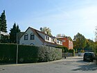
| In the hoof loft
( Location ) |
240 (in the district) |
"Hufenschlag", the entirety of the reclaimed area in the vicinity of a village | Aug 4, 1930 | The route was created as road 121 . On February 17, 2007, the eastern extension was named as well. Plots 1–17 (odd) and 2–16 (even) are in Wittenau, the street continues from the entrance to the cemetery, turning east into Reinickendorf on the former railway site with a residential area on plots 23–53c (only odd). |
|
| In the Wolfsgartenfeld
( Location ) |
240 | historical hallway name | Feb. 18, 1927 | The route was created as road 111 . Wolf Gardens is a type of wolf trap that was used in Dalldorf after the Thirty Years' War to control the increasing number of wolves. 20 meters of this traffic route have the RBS class "STRA", which describes the equipment, but are shown in the Okstra as "P" (private responsibility). |

|
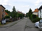
| In the caverns
( Location ) |
110 | historical hallway name | Feb. 18, 1927 | The route was created as road 119 . |
|
|
Jansenstrasse
( Location ) |
240 | Hermann Jansen , architect, urban planner and university professor, taught at the Technical University of Berlin from 1920 | around 1921 | It is located in the 30s zone between the town hall promenade and Oranienburger Straße. The residential buildings 4–20 (straight) are in an arch to the south and so with the somewhat recessed residential block 9–13 (odd) on the north side there is a space of 60 m × 80 m. The neighboring houses belong to Im Wolfsgarten, which leads to the north, and the Elsenpfuhlstrasse that crosses it . On the north side facing Oranienburger Straße there is a three-story house with a loft (21) and a residential house with a garden (23) and on the south side a two-story building with a loft extension (22a). Jansenstraße is located in the area of the Primus homestead company, which was planned in 1919. In the address book for 1923 and 1925, Jansenstrasse is listed as undeveloped on Roedernallee; this became Wilhelm-Gericke-Strasse together with Beusterstrasse . In the address book of 1927, next to this Jansenstraße, the extended Jansenstraße Oranienburger, Elsenpfuhlstraße, Im Wolfsgarten, Rathauspromenade with the houses 1–9 (consecutive) of the public benefit. Building cooperative Apartment hunters listed between Rathauspromenade and Elsenpfuhlstrasse. And in 1928 the addition “Verl.” Was dropped and plots 1–12 were developed. The previously run as Jansenstraße was named Straße 3 and in 1955 (like the surrounding area) is still undeveloped. |

|
| Jathoweg
( Location ) |
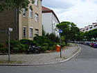
250 | Karl Jatho (1851–1913), pastor in Wittenau before the First World War | Aug 4, 1930 | The pastor Karl Jatho was removed from office in 1911 because of his free- spirited views. |
|
| Jean Jaurès Street
( Location ) |
380 (in the district) |
Jean Jaurès (1859–1914), French politician and historian | Nov 1, 1987 | In the district, the street lies between the border at Packereigraben (at the pedestrian tunnel) and Hermsdorfer Straße with its properties, with KGA Cyclopstraße on property number 2 to the east up to the railway embankment. This section was previously called Cyclopstrasse . The street of the same name to Waidmannslust, delimited by the embankment at the Waidmannslust S-Bahn station and a green area, has no properties with postal allocation. In Waidmannslust it forms the connection to Nimrodstraße and Waidmannsluster Damm. |

|
|
Trowel line
( Location ) |
480 | Trowel , tool | Jul 18, 1958 | The route was created as road 115 . It is located in the settlement area between the route of the Nordbahn and Roedernallee as well as Wilhelmsruher Damm and Nordgraben. In this neighborhood, the streets were named after tools. |

|
| Knauerstrasse
( Location ) |
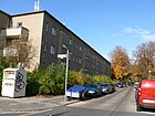
190 | Hermann Knauer (1872–1909), architect and co-owner of the Boswau & Knauer company , responsible for the theater on Nollendorffplatz | Oct. 20, 1932 | The route was created as route 65 from Thyssenstrasse to Henricistrasse and Weinbrennerweg. |
|
| Kossatenstrasse
( Location ) |
110 | Kossaten , historical name of the estate | Feb. 27, 1927 | The route was created as road 130 . The street is in the southern part of the "Siedlung Wittenau". In Dalldorf, Kossäts enforced a division of the land of full farmers . |

|
|
Country houses way
( Location ) |
170 | Landenhausen , a place in the Vogelsberg district with which the Reinickendorf district has maintained a partnership since 1964 | Sep 9 1960 | The route was created as road 156 . It is located in the area between Finsterwalder Strasse, Wittenauer Strasse and Oranienburger Strasse. It connects Schlitzer Strasse and Maarer Strasse. |

|
| Long ends
( Location ) |
440 | historical hallway name | around 1914 | At this point there were fields of extraordinary length. |

|
| Lißberger line
( Location ) |
100 | Lißberg , a place in the Vogelsbergkreis , with which the Reinickendorf district has maintained a partnership since 1964 | Sep 1 1981 | The route was created as road 193 . It is located in the area between Finsterwalder Strasse, Wittenauer Strasse and Oranienburger Strasse. |

|
| Lübarser Strasse
( Location ) |
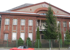
450 | Connection from Wittenau to Lübars | before 1910 | On April 1, 1967, part of Lübarser Strasse was renamed together with Wittenauer Weg in Wittenauer Strasse. Today Lübarser Strasse only runs between Eichhorster Weg and Oranienburger Strasse. Numerous industrial companies settled along this route during the founding years , and the area is still characterized by commercial and industrial areas today. |
|
|
Maarer Street
( Location ) |
910 | Maar , part of Lauterbach , this town in the Vogelsbergkreis maintains the Reinickendorf district since 1966 a partnership | Sep 9 1960 | The route was created as road 153 . It is located in the area between Finsterwalder Strasse, Wittenauer Strasse and Oranienburger Strasse. |

|
| Mauschbacher Steig
( Location ) |
460 | Mauschbach , place in the district of Südwestpfalz | Dec 11, 1940 | It runs in an arch from Oranienburger Strasse. |

|
| Michelbacher line
( Location ) |
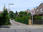
100 | Michelbach , a town in the Vogelsbergkreis with which the Reinickendorf district has maintained a partnership since 1964 | Sep 1 1981 | The route was created as road 192 . It is located in the area between Finsterwalder Strasse, Wittenauer Strasse and Oranienburger Strasse. |
|
|
Nietheweg
( Location ) |
180 | Niethe († 1784), senior bailiff and administrator of the Niederschönhausen office | Aug 4, 1930 | The route was created as road 126 . Niethe was the owner of the Hermsdorf estate between 1752 and 1774 and, in his capacity as chief bailiff, was responsible for the allocation of arable land to two Dalldorf farms, one of which was Nicolaus Treutel. |

|
|
Olbendorfer way
( Location ) |
760 | Olbendorf , place in the Austrian Burgenland | Aug 4, 1930 | The route was created as road 123 . Its extension - Strasse 211 - was named on December 11, 1940. |

|
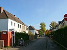
| Olbrichweg
( Location ) |
100 | Joseph Maria Olbrich (1867–1908), Austrian architect | Aug 6, 1937 | The route was named Sittestrasse in 1925 . Only the eastern branch towards Schmitzweg was renamed in 1937. |
|
| Oranienburger Strasse
( Location ) |
2070 | Connection from Wittenau to Oranienburg | before 1910 | Oranienburger Strasse, together with Roedernallee, is part of Bundesstrasse 96 . It runs from Kurt-Schumacher-Platz in the Reinickendorf district to the district boundary of Waidmannslust , where it merges into the Oraniendamm. Since 1905 at the latest it has been called the Chaussee to Hermsdorf . From Roedernallee to the north, the street is part of federal highway 96 and belongs to category II in the Berlin street system : higher-level road connections. At the northern end of Oranienburger Straße there are 40 meters of the B 96 as Oraniendamm in the district. The border between the neighboring districts is identical to the Packereigraben, which is bridged diagonally from southeast to northwest, but the name of the street is changed on the south bank east of the road. |

|
|
Pannwitzstrasse
( Location ) |
1160 | Albrecht Wilhelm von Pannwitz (1754–1825), Canon | Apr. 27, 1936 | From 1917 the route was called Haenischstraße , named after Felix Haenisch, who in 1909 was a deputy member of the board of the German weapons and ammunition factories . Pannwitz, after whom the street is named today, was district administrator in Niederbarnim from 1787 to 1825 . After purchasing the Dalldorf Kruggut in 1786, he moved from his Schönfließ estate to Dalldorf. |

|
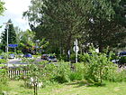
| Place Molière
( Location ) |
80 × 40 | Molière (1622–1673), French actor, theater director and playwright | 1969 | The square with lots 1–4 (consecutive) is located in Cité Foch on Avenue Charles de Gaulle and includes Rue Racine. To the south of the square is the Romain-Rolland-Gymnasium (number 4, formerly Victor Hugo elementary school), in the southeast the branch of the Münchhausen-Grundschule (number 1, formerly Saint-Exupéry preschool). The private space was dedicated with the development plan XX-277 a . In the Cité Foch, residential houses for the French armed forces in Berlin were built on a fallow area south of the Packereigraben , to which streets were named in 1984 . |
|
| Primusweg
( Location ) |
140 | Housing association “Primus”, founded in 1919 and owner of numerous Wittenau housing estates from the 1920s | Nov 1, 1978 | It was built as Street 186 . The Primusweg is a footpath between Wilhelm-Gericke-Straße and Schmitzweg. This traffic route has the RBS class "STRA", which describes the equipment, but is only shown as "F" in the Okstra . |

|
| Puchertweg
( Location ) |
100 | Ernst Puchert († after March 1699), court hunter of the Great Elector | March 6, 1936 | The route was named in Tuchertweg on August 4, 1930 . The spelling was corrected with the renaming. In 1652 Puchert received the farm that would later belong to the Witte family as a gift from the Elector. |

|
|
Town hall promenade
( Location ) |
840 | Reinickendorf town hall , completed in 1911 | Feb. 18, 1927 | The route was created as road 11 . The street is in the southern part of the "Siedlung Wittenau". The construction of the then Wittenau town hall was a widely visible sign of the economic prosperity of the rural community of Wittenau. This traffic route has the RBS class "STRA", which describes the equipment as a municipal road , but 75 meters at the southern end are designated as "FUWE" and accordingly only as "F" in the Okstra . |

|
| Rauhbankzeile
( Location ) |
170 | Rough bench , tool | Jul 18, 1958 | The route was created as road 140 . It is located in the settlement area between Nordbahntrasse and Roedernallee as well as Wilhelmsruher Damm and Nordgraben. The access road leading from the Fräsersteig lies in a district in which the streets were named after tools. |

|
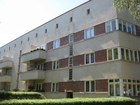
| Roedernallee
( Location ) |
1680 (in the district) |
Siegfried von Roedern (1870–1954), politician | before 1910 | The northern section of Roedernalle in Wittenau lies between Oranienburger and Thyssenstraße with the plots 56a – 156 (straight) and 157–168, but the suburbs also run along this street. This means that the properties east of the road between Lengeder Strasse and Am Nordgraben and the southern section belong to Reinickendorf . Between today's Alt-Reinickendorf and Tessenowstraße, the route was called Oranienburger Chaussee from 1905 . North of Tessenowstrasse, the route was called Reinickendorfer Strasse since 1905 . The street in the entire district is part of the federal highway 96 and belongs in the Berlin road system to category II: superordinate road connections. At the north end, the B 96 continues in Oranienburger Strasse, the requirement for a federal road requires the width and equipment of Roedernallee. |
|
| Rose promenade
( Location ) |
530 | Joachim Rosentreter, in 1711 the first tenure school in Dalldorf The Rosentreter family held the office of village school in Dalldorf for generations. |
around 1914 | The route was created as road 86 . It forms a two-lane, two-lane road with a wide median with a footpath between Gorkistraße / Alt-Wittenau and Am Packereigraben. An eastern spur road of the same name opens up houses 28–44 (straight), behind which the allotment garden complex (KGA) 'Schlehbusch' is located. The northern end of the street is planned in the full width up to the district boundary, but consists in 2012 [out of date] from an (unnamed) path southwest of the rose tread basin. |

|
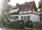
| Rotbuchenweg
( Location ) |
300 | European beech , deciduous tree | Aug 4, 1930 | The residential street between Eichborndamm and Olbendorfer Weg was created as street 125 . |
|
| Rue Diderot
( Location ) |
120 | Denis Diderot (1713–1784), French writer, philosopher, enlightener | 1969 | Rue Diderot is located with lots 1–1f and 2, 4 in Cité Foch and goes from Avenue Charles de Gaulle to the southeast to a turning point. The former private road was dedicated with the development plan XX-277 a . In the Cité Foch, residential houses for the French armed forces in Berlin were built on a fallow area south of the Packereigraben , to which streets were named in 1984 . In the RBS detailed network, it is entered in the “STRA” category and the OKSTRA class “G”. |

|
| Rue Georges Vallerey
( Location ) |
160 | Georges Vallerey (1927–1954), French swimming athlete | 1969 | The street with houses 1, 3 and 2–8 is located in the southeast of Cité Foch and goes west from Hermsdorfer Straße to a parking lot. The former private road was dedicated with the development plan XX-277 a . In the RBS detailed network, it is entered in the “STRA” category and the OKSTRA class “G”. In the Cité Foch, residential houses for the French armed forces in Berlin were built on a fallow area south of the Packereigraben , to which streets were named in 1984 . The street name given honors the swimmer Vallerey, who won the gold medal over 100 m back at the European Swimming Championships in 1947 . In the swimming competitions of the 1948 Summer Olympics , he won the bronze medal in the same discipline. The Cité Foch swimming pool is located on this street. The indoor swimming pool at 8 Rue Georges Vallerey was built in 1972 and has been closed since 2002 |

|
| Rue Lamartine
( Location ) |
90 | Alphonse de Lamartine (1790–1869), French poet, writer and politician | 1969 | The street with no assigned land connects the middle reaches of Rue Montesquieu with Avenue Charles de Gaulle and is located in Cité Foch . The former private road was dedicated with the development plan XX-277 a . In the RBS detailed network, it is entered in the “STRA” category and the OKSTRA class “G”. In the Cité Foch, residential houses for the French armed forces in Berlin were built on a fallow area south of the Packereigraben , to which streets were named in 1984 . |

|
| Rue Montesquieu
( Location ) |
490 | Montesquieu (1689–1755), French writer, philosopher and political theorist | 1969 | The street with the houses 32, 33, 34 is in the Cité Foch between the avenue Charles de Gaulle and the Jean-Jaurés-Strasse. At the west end it encloses a green area with a sports field in an arch towards Rue Racine. The former private road was dedicated with the development plan XX-277 a . In the RBS detailed network, it is entered in the “STRA” category and the OKSTRA class “G”. In the Cité Foch, residential houses for the French armed forces in Berlin were built on a fallow area south of the Packereigraben , to which streets were named in 1984 . |

|
| Rue Racine
( Location ) |
290 | Jean Racine (1639–1699), French author | 1969 | The street with the houses 1–9a and 2–4a is located in the Cité Foch between the Avenue Charles de Gaulle in a south arch to the Place Molière. The former private road was dedicated with the development plan XX-277 a . In the RBS detailed network, it is entered in the “STRA” category and the OKSTRA class “G”. On some current maps, the path of the avenue Pierre de Coubertin, which continues eastwards, is named as rue Racine. In the Cité Foch, residential houses for the French armed forces in Berlin were built on a fallow area south of the Packereigraben , to which streets were named in 1984 . |

|
|
Sangestrasse
( Location ) |
320 | Sange family, landowners | Feb. 18, 1927 | The street runs parallel to Gorkistraße and has an entrance to the “Triftpark”. The Sange family once lived in Hof Alt-Wittenau 58 and owned land between Gorkistraße and Triftstraße, over which today's Sangestraße runs. Christian Friedrich Sange († 1848) was a lay judge in the Dalldorf municipal administration and since 1835 the church mayor. |

|
| Schlitzer Street
( Location ) |
960 | Schlitz , a place in the Vogelsberg district with which the Reinickendorf district has maintained a partnership since 1964 | Sep 9 1960 | The route was created as road 150 . It is located in the area between Finsterwalder Strasse, Wittenauer Strasse and Oranienburger Strasse. |

|
| Blacksmith path
( Location ) |
260 | Smithy (workshop) | Jul 18, 1958 | The route was created as road 112 . It is located in the settlement area between Nordbahntrasse and Roedernallee as well as Wilhelmsruher Damm and Nordgraben. |

|
| Schmitzweg
( Location ) |
670 | Bruno Schmitz (1858–1916), architect | December 20, 1936 | The Schmitzweg runs in an arch between Roedernallee and Tessenowstraße. Until the renaming, this route consisted of Beusterstrasse and Schmitzstrasse as well as Strasse 185 and footpath 188 . The section, which was called Beusterstraße , was named after Heinrich Wilhelm Beuster, a rum manufacturer and distiller, as early as 1921. In 1826 Beuster was head of the city and poor welfare of Berlin and inspector of the "Schindler's orphanage". 110 meters of this traffic route have the RBS class "STRA", which describes the equipment, but are only shown as "F" in the Okstra . |

|
| Schorfheidestrasse
( Location ) |
140 in the district |
Schorfheide | Apr 1, 1967 | Schorfheidestrasse connects Am Nordgraben with Wilhelmsruher Damm. In the district, however, only the initially two-lane section from Am Nordgraben to under the bridge through the S-Bahn line , on the east side of which is the border to the Märkisches Viertel . Due to this location, it belongs to category II in the Berlin road system : higher-level road connections. The route of Schorfheidestrasse was projected as road 426 and road 121 in the “Wittenau Nordbahn” settlement in the neighboring district was included. |

|
| Sittestrasse
( Location ) |
370 | Camillo Sitte (1843–1903), Austrian architect | Jan. 16, 1925 | The eastern branch of Sittestraße was renamed Olbrichweg on August 6, 1937 , and the further southern continuation of Sittestraße to the site of the Reinickendorf freight yard followed in the early 1950s. The street is from Tessenowstraße to the south with the built-up properties 1b – 6c (continuous, west side) and 6e – 8a (continuous, east side) and to the north from Olbrichweg further with 33–48 (continuous, east side). From Flötnerweg the street is marked as a dead end (additional sign no turning possibility for trucks). At the southern end, because of the commercial area of the freight station, an arch leads to the east around the undeveloped property 6e (adjoining to the north) with the Kienhorst basin and goes into the path, which is closed with two half-barriers, to the district boundary with Reinickendorf. The street continues in the same width of 7.5 meters in the neighboring district on Thyssenstraße. In front of the barrier there is a driveway to a garage and the property at Blunckstraße 12 to the southeast. Sittestraße is included in the 1928 address book, marked by Lindenweg (Tessenowstraße) and at right angles to Schmitzstraße. The street has horseshoe numbering in the address book , with plots 1–8 (to Lindenweg) not existing, followed by single-family houses at 9–22 and on the opposite side 23–48, 27 is uninhabited and 46 is demolished. |

|
| Spatula way
( Location ) |
170 | Spatula , tool | Jul 18, 1958 | The route was created as road 139 . It is located in the settlement area between Nordbahntrasse and Roedernallee as well as Wilhelmsruher Damm and Nordgraben. The access road leading from the Fräsersteig lies in a district in which the streets were named after tools. |

|
| Gauntlet
( Location ) |
700 | Spit , historical weapon | May 21, 1940 | The route was created as road 149 . It runs parallel to the Alt-Wittenau road and forms the southern edge of the “Volkspark Wittenau”. The western end of the street is a dead end, the route within the row house settlement is a private road . The RBS class "STRA", which describes the equipment, has 330 meters of this traffic route, but is only shown as "F" in the Okstra . |

|
|
Taldorfer Weg
( Location ) |
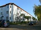
640 | Taldorf, a town in Baden-Württemberg | Jan. 23, 1931 | The route was created as road 144 , its extension, road 402 , was named on April 4, 1961 as well. It connects the Eichborndamm at the Reinickendorf town hall and Oranienburger Straße . From the latter, 330 meters are designed as a one-way street . The street is north of the green space at Nordgraben, accordingly the south side at Peter-Witte-Park is undeveloped. The north side of the two-lane street with parallel lane, wide footpath and parking pockets on the south side is built on with three-story houses in rows 1–12 (continuous) and row block 13–16 from the 1930s after Jahtostraße. The similar rows of houses on the three cross streets to the north each enclose a green inner courtyard area. In the area between Techowpromenade and Eichbuschdamm (17a – 20c), which was laid out after 1961, three-storey residential buildings from the 1960s stand across the street, the low-rise building opposite the town hall is number 236 on Eichbuschdamm. The Rathaus Reinickendorf underground station is on the south side of the park. |
|
| Techow promenade
( Location ) |
640 | Otto Techow (1848–1919), architect, "Secret Building Councilor" at the Higher Presidium of the Province of Brandenburg | before 1922 | The route was created as road 58 and the extension, road 11 , was later included, in 1927 it is still listed in the address book as a projected road. The street runs in an arch from Taldorfer Weg to Oranienburger Straße and represents the western boundary of the northern part of the "Siedlung Wittenau". In 1928 it is listed for the first time in the address book and in 1929 the left side from Frommpromenade to Hauptstraße ( Alt-Wittenau ) undeveloped, on the right-hand side (street 144) there are 2–32 new buildings and 34–40 the apartment buildings of the Primus residential property company. |

|
| Tessenowstrasse
( Location ) |
690 | Heinrich Tessenow (1876–1950), architect and professor at the Technical University of Berlin | Apr 1, 1962 | Since 1910 at the latest, this route has been called Lindenweg . The street connects Roedernallee with Oranienburger Straße. |

|
| Thiloweg
( Location ) |
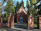
210 | Thilo, Tegel forest adviser, bought the Dalldorfer Kruggut in 1750 | Oct. 20, 1932 | The route was created as street 139 and runs south of the Wittenauer Rathauspark. This is where the “Wittenau Municipal Cemetery” is located. |
|
| Thyssenstrasse
( Location ) |
470 (in the district) |
August Thyssen (1842–1926), industrialist |
between 1918 and 1922 |
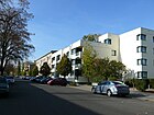
The properties Thyssenstrasse 4–28 (straight) on the northern edge of the road between Roedernallee and the Kienhorst basin at Sittestrasse 6e belong to Wittenau. On 4–26 there are three-storey residential buildings in the style of the late 1930s, 28 is an industrial park, the area of which was previously part of the Reinickendorf freight yard. From Knauerstraße to the west, the street is marked as a dead end and the rest of the area is marked with a 2.8-tonne sign for access to the railway site, although the street continues paved to Sittestraße, but the passage is through two half-barriers except for one Bicyclist width limited, but can (probably) be opened if necessary. The street itself and the (odd) plots on the south side belong to the Reinickendorf district . The district boundary runs on the northern edge of the street. |
|
| Treutelstrasse
( Location ) |
110 | Nicolaus Treutel, village blacksmith | Jul 26, 1927 | Around 1926 this route was called Trentelstrasse . The incorrect spelling of the name was corrected on July 26, 1927. In 1737/38 Treutel was one of the pioneers of the Dalldorf kossa movement, which prevailed in Dalldorf by demanding land ownership at the expense of the full farmers . The street is located in the southern part of the "Siedlung Wittenau" between the town hall promenade and Elsenpfuhlstrasse, a street parallel to Oranienburger Strasse. On the 1926 map, the entire area between Oranienburger Strasse and the Dalldorf insane asylum is still undeveloped. In the address book of 1929 the street is given, already with nine houses with horseshoe numbering of the public benefit. Bauvereinigung Wohnungssuchender eGmbH expanded with four-family houses. In the current representation, in the alternating numbered street, there are Bauhaus style- influenced two-storey residential houses in row construction on plots 3–11 (odd, north side) and 4–10 (even, south side). The corner property on the town hall promenade to the north is open space to the adjoining row house. The houses have tenant gardens and green spaces on the side facing away from the street. |

|
| Triftstrasse
( Location ) |
650 (in the district) |
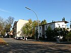
Cattle drift , path between stable and pasture | before 1910 | The Triftstraße lies between Alt-Wittenau and Am Nordgraben in the district and continues south to Borsigwalde . Before the establishment of the Borsigwalde colony, there were pastures of the Dalldorf farmers, which explains the street name. Triftstrasse has the status of a regional road link in the regional reference system . |
|
|
Ulrichsteiner way
( Location ) |
200 | Ulrichstein , a place in the Vogelsberg district with which the Reinickendorf district has maintained a partnership since 1964 | Sep 9 1960 | The route was created as road 158 west of the "Seggeluch Basin". It is located in the area between Finsterwalder Strasse, Wittenauer Strasse and Oranienburger Strasse. Ulrichsteiner Weg connects Schlitzer Straße and Maarer Straße . 50 meters of this traffic route have the RBS class "STRA", which describes the equipment, but are only shown as "F" in the Okstra . |

|
|
Wallenroder Strasse
( Location ) |
440 | Wallenrod , part of Lauterbach , this town in the Vogelsbergkreis maintains the Reinickendorf district since 1966 a partnership | Apr 1, 1967 | The route was created as road 449 west of the Märkisches Viertel . It is located in the area between Finsterwalder Strasse, Wittenauer Strasse and Oranienburger Strasse. The old district heating plant and other commercial and industrial areas are located in this cul-de-sac. |

|
| Weinbrennerweg
( Location ) |
160 | Friedrich Weinbrenner (1766–1826), architect, town planner and master builder of classicism | Nov 23, 1933 | The route was created as road 66 of the development plan of the settlement. It was laid out on October 20, 1932 as an extension of Henricistraße and was initially named as well. Almost a year later, the name was changed. The Weinbrennerweg is located between Knauerstrasse and Roedernallee in the eastern corner of the district opposite the Reinickendorf freight station (Thyssenstrasse). The three-storey houses on Weinbrennerweg in the Bauhaus style with flat roofs stand across the street, 1–9d to the north, 2–10b to the south. The row of houses is marked with additional letters, 1,3 and 2, 4 (to Knauerstraße) are parallel to the street front. The style of the residential buildings differs significantly from the surrounding residential buildings on the western streets of this quarter (Wittenau settlement) with pointed roofs. To the east the road ends at a turning hammer and continues as a footpath, cordoned off with reversible traffic posts. The eastern exit is a passage on the ground floor of the residential building Roedernallee 162a and 162b. In the 1935 address book, Weinbrennerweg belongs to Reinickendorf (East) and is owned in its current form by Graf Roedern-Allee Grundstücksges. mbH already built with four to six family houses. |

|
| Welzower Steig
( Location ) |
210 in the district |
Welzow , mining community in Brandenburg | Apr 15, 1982 | The cycle and footpath (it has a street number in the RBS: 5602) leads from Wittenauer to Königshorster Straße in the Märkisches Viertel with a total of 720 meters. It leads along the south-west bank of the Packereigraben on the Wittenauer Ufer to the district boundary at the Seegeluch basin. The two built-up plots 3 and 5 (at the sports fields in Heinzegrabenbogen) are in the Märkisches Viertel; no plots are assigned in the district. It borders the Wallenroder Straße industrial estate and the KGA 'Seggeluchbecken', it crosses the route of the former industrial railway . In the RBS detailed network it has been awarded the RBS class “FUWE” and according to OKSTRA as “F”. It belongs to the Reinickendorf hiking trail system. |

|
| Wilhelm-Gericke-Strasse
( Location ) |
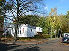
780 | Wilhelm Gericke (1838–1926), landowner and city councilor in Berlin, his son was a local representative in Wittenau | 1969 | The route was created as road 4 , its extension - road 3 - was also named on July 18, 1958. It is located between Oranienburger Straße and Roedernallee south of the north trench and partly leads over the former lands of Gericke. Not far from the street is Gericke's summer residence, the Villa Humboldthöhe . |
|
| Wilhelmsruher Damm
( Location ) |
250 | Connection from Wittenau to Wilhelmsruh | May 20, 1937 | The western section of the road lies between Oranienburger Strasse and under the railway bridge in the district. The district boundary is on the east side of the railway line and the dam continues into the Märkisches Viertel and further to Rosenthal . Plots 232–246 (even) and 231/245 (odd) belong to Wittenau. Due to the connection to the B 96 and via the Eichborndamm to the motorway network, it belongs to category II in the Berlin road system : higher-level road connections. |

|
| Windhalmweg
( Location ) |
500 | Wind stalk , genus of grass | Aug 4, 1930 | The route was created as street 129 of the "Siedlung Stadtpark". It runs east parallel to the Eichborndamm between Eisenhartsteig and Im Hufeschlag. Noted in the address book in 1935 with Post Borsigwalde and between Im Hufenschlag and Eisenhartsteig and leads via Tuchert- and Olbendorfer Weg. The left side is undeveloped, on the right side there are 2–48 (straight) single-family houses, 6 and 12 construction sites, on 20 (corner of Tuchertweg) there is a garden. Plots 2–14 (Puchertweg), 20 ist Garten, 22–32 (Olberndorfer Weg), 34–46 are currently built on the east side, three-story flat-roofed houses stand behind a lawn on the west side, with the house entrances on the other side 5–31 (odd) whereby the individual houses are grouped into blocks of two to four. The western development took place at the beginning of the 1950s, in the 1943 address book only a sports field (currently Marie-Schleim-Heim: Eichborndamm 124) between Im Hufenschlag and Puchertweg is mentioned and on the map of 1955 this side of the street is entered. |

|
| Wittenauer Strasse
( Location ) |
1090 (in the district) |
Connection from Lübars to Wittenau | Apr 1, 1967 | Wittenauer Straße takes its name from Alt-Lübars and runs for the most part in the neighboring district of Lübars . The western section between the bridge on Packereigraben and Oranienburger Straße is located in Wittenau with properties 1–123 (odd) and 4–118 (even). Until it was renamed in 1967, the part of the street in Wittenau was called Wittenauer Weg . The street had had this name since 1925 at the latest. On November 1, 1968, street 425 was also renamed Wittenauer Straße. |

|
|
Zangengasse
( Location ) |
590 | Pliers , tool | Jul 18, 1958 | The route was created as road 114 . It is located in the settlement area between Nordbahntrasse and Roedernallee as well as Wilhelmsruher Damm and Nordgraben. The street that runs from Fräsersteig to Amboßweg is in a district where the streets were named after tools. |

|
List of former or planned streets
The community of Wittenau (previously Dalldorf) was shaped by the "Urban Insane Asylum Dalldorf". Various settlement projects were set up by terrestrial societies, the names of the streets were partly locally important people whose importance or memory passed. Projected and named streets were built later, which changed the route and name. The municipality of Wittenau is listed for the first time in the Berlin address book in 1910 with the following streets: Bahnhof- , Breitenbach-, Charlottenburger , Hauptstraße , Hermsdorfer Straße, Holzweg , Innungsstraße, Lindenweg, Lübarser Straße, Mirau-, Mühlenstraße , An der Nordbahn , Oranienburger, Roedernallee, Rosenthaler Street , "sheep farm", Seidel-, Tegeler, Trift-, Wittestraße. Some of these streets have been renamed and some no longer belong to the district.
| formerly | from | to | renamed to (current) |
Origin of name | Remarks |
|---|---|---|---|---|---|
| At the northern runway | before 1910 | Sep 9 1960 | → Ilbeshäuser Weg | Northern runway , parallel to the railway line | The street is not mentioned in the Berlin address book of 1921, but is indicated by name on the map published in 1922. It was named before 1910 and is listed in the 1910 address book with the two developed plots 1 and 2 between Nordbahn and Oranienburger Straße. |
| Bahnhofplatz | before 1925 | Apr 4, 1961 | → Göschenplatz | The Wittenau station had existed since 1877 , then Dalldorf | With the road expansion, the station forecourt as such became significant. |
| Bahnhofstrasse | before 1902 | Apr 4, 1961 | → Göschenstrasse | since 1877 stop in Dalldorf | The street is already listed in the 1902 address book. The Berliner Nordeisenbahn-Gesellschaft started construction of the line near Dalldorf in spring 1872. In 1877 a stop was set up during the construction of the northern line in Dalldorf. In 1910, Nahnhofstraße leads from the train station to Feldmark. |
| Beusterstrasse | around 1921 | Dec. 1, 1936 | → Schmitzweg | Heinrich Wilhelm Beuster (19th century), entrepreneur | The Beusterstraße was named between 1920 and 1921. The street is not yet recorded in Berlin's address book from 1920, but a year later it is recorded by name. |
| Charlottenburger Strasse | before 1907 | May 20, 1937 | → Eichborndamm | Charlottenburg , destination | Recorded in the address book from 1907, it ran as an extension of Eichbornstrasse from the Eichbornstrasse S-Bahn station (today Eichborndamm) to the main street in Wittenau. On May 20, 1937, the Charlottenburger Strasse up to the confluence with Spandauer Strasse (now Holzhauser Strasse) and Eichbornstrasse were renamed Eichborndamm. At the same time, the northern remnant with Spandauer Strasse was renamed Holzhauser Strasse. |
| Chaussee to Hermsdorf | before 1900 | before 1910 | → Oranienburger Strasse | Hermsdorf , northern neighbor | The road to Hermsdorf continued from what was then Berliner Straße ( Ollenhauerstraße ) and led traffic from Tegel – Berlin and from the city of Charlottenburg to today's district of Hermsdorf. |
| Eichbornstrasse | 1875 | May 20, 1937 | → Eichborndamm | Ludwig (Louis) Eichborn (1819–1903), landowner, banker | The Eichbornstraße ran from Scharnweberstraße to the Eichborndamm S-Bahn station , as an extension of the Charlottenburger Straße to the main street in Wittenau (Alt-Wittenau). Both streets were renamed Eichborndamm in 1937. Eichborn projected the future routes of the streets on the plan of his Terrain-Gesellschaft and sold the plots to small craftsmen, workers and farmers, especially from Berlin. Eichbornstrasse was laid out as a project in 1873 and was given his name in 1875 while he was still alive. |
| Frommstrasse | around 1921 | after 1922 | → Frommpromenade | Fromm worked as a lawyer in the Niederbarnim district | Frommstrasse was named in the project plan around 1921. However, influenced by the planning environment, “Promenade” was chosen. Expansion was delayed with inflation . |
| Haenischstrasse | around 1917 | Apr. 27, 1936 | → Pannwitzstrasse | Felix Haenisch (19th / 20th century), entrepreneur | In 1909 Haenisch was a deputy member of the board of the German Arms and Munitions Factory, which had its branch in Wittenau on the former Charlottenburger Strasse. He lived (1909) at Kaiserin-Augusta-Allee 30 in Moabit. |
| Main road | before 1910 | July 31, 1952 | → Alt-Wittenau | central street of the suburb | With the expansion of the road network, the traditional name Dorfstraße was replaced by Hauptstraße. The place Wittenau with the main street - and inhabitants - is listed for the first time in the address book from 1910. |
| Wrong way | before 1907 | Aug 6, 1937 | → Eichhorster Weg | Holzweg is the old hallway name | It is already listed in the 1907 address book. In the 1910 address book, the Holzweg between Lübarser Straße and the Rosenthal district is included in horseshoe numbering , with lots 1–21 to and 22–42 from Rosenthal. Only 37, 38 are built with the Wittenau community as the owner. |
| Laufer place | around 1921 | 1936 | → disengaged | Lauf an der Pegnitz , district town in Bavaria | Laufer Platz was named around 1921 with the Heimstätten project. He is not yet included in Berlin's address book from 1920; his name is shown a year later. The square was at the end of the Heiligental street on the (original) Jansenstraße . It was de-dedicated around 1936 and was given the numbers 186 and 187. From 1936 construction work was carried out there. In July 1963 these numbered streets were then deleted. Today there is a school there. |
| Lindenweg | before 1902 | Apr 1, 1962 | → Tessenowstrasse | Linden , deciduous tree | It is already listed in the "1902 Address Book". In 1910 it is noted between Oranienburger Straße and the Reinickendorf district with lots 1–54 in horseshoe numbering, mainly as construction sites. 28 and 29 are named in the Reinickendorf district, 4, 52 and 54 are built on. The destination of the Lindenweg when it is created is the "Dalldorf insane asylum" |
| Mühlenstrasse | before 1910 | Feb. 1, 1965 | → Soltauer Strasse | to the Dalldorfer Mühle | In 1824, a windmill field is marked on a map southwest of the village center. In the 1910 address book, Mühlenstrasse is adjacent to Spandauer Strasse with the Sattelberg'schen house and the Berl property. scales and hoist works vorm. H. Bockhacker called. |
| Parallel street | before 1922 | March 14, 1958 | → Jean Jaurès Street | parallel to the north runway | This was between Nimrodstrasse and Wilhelmsruher Damm in Waidmannsluster area. On March 14, 1958, the parallel road was incorporated into Cyclopstraße . Due to the adjacent Cité Foch , the section of Cyclopstraße between Hermsdorfer Straße and Waidmannsluster Damm was given its current name on November 1, 1987. Listed for Waidmannslust in 1925 as undeveloped from Waidmannstrasse. |
| Reinickendorfer Strasse | before 1902 | around 1910 | → Roedernallee | Reinickendorf , neighboring community to the southeast | Reinickendorfer Strasse is listed in the 1902 address book. It led from the Oranienburger Chaussee in Reinickendorf to the Chaussee in Hermsdorf . |
| Robertstrasse | before 1912 | Apr 1, 1998 | → Bad-Steben-Strasse | Robert Friedrich Joachim Jahn (1853–1907), owner of a farm. | Projected as road K , it was named after the owner of the road land. In 1915 the street was listed in the address book between Spandauer and Charlottenburger Straße, except for the construction site, the fire department depot was on this street. In 1892, Jahn had sold another part of his land to the Russian community, which used this area to create the Russian Orthodox cemetery. In 1898 he sold further land to the Tegel Terraingesellschaft. He was incapacitated in 1899 because of mental illness. |
| Rosenthaler Strasse | before 1902 | May 20, 1937 | → Eichborndamm | Rosenthal , neighboring town to the east | It is already listed in the 1902 address book. The Rosenthaler and the Wittenauer Straße formed a street. The Rosenthaler Straße led from the main street in Wittenau over the Oranienburger Straße to the northern line at the Rosenthal district. In 1937 the part up to Oranienburger Strasse was renamed Holzhauser Strasse, the part east of Oranienburger Strasse was renamed Wilhelmsruher Damm. In 1958, part of Holzhauser Strasse was incorporated into Eichborndamm. |
| Rose footpath | around 1965 | around 1970 | → included | Karl Friedrich Gustav Rosentreter (1845–1896), fiefdom owner. | The path was on the Rosentreter promenade and can still be recognized as a branch to this day. Around 1970 the presumably never official rose footpath was included in the rose footpath. |
| Schmiedegasse | Oct. 20, 1932 | June 9, 1933 | → On the green belt | Forge, metalworking workshop | In 1932 the road was between Thiloweg and Feldmark. In 1934, plots 1–17 (odd) and 2–16 (even) are built on with one- and two-family houses, apart from five building sites, in 1932 there is still no entry. The route is planned as road 140. |
| Schmitzstrasse | Jan. 16, 1925 | Dec. 1, 1936 | → Schmitzweg | Bruno Schmitz (1858–1916), architect | In 1926 Schmitzstrasse is mentioned in the address book, Lemma . In: Berliner Adreßbuch , 1926, Part IV, p. 2161. between Lindenweg and Henricistraße with single-family houses 1–7 (consecutive) and going back 8–32
In 1936 Schmitzstraße , Beusterstraße , Straße 185 and Fußweg 188 were given the name Schmitzweg. |
| Spandauer Strasse | before 1905 | May 20, 1937 | → Holzhauser Strasse | indirect road to the city of Spandau | The street is named in the 1905 city map of Berlin. Spandauer Strasse led from Berliner, Bernauer and Seidelstrasse in Tegel to what was then the main street in Wittenau. In 1937 Spandauer Strasse , the northern remainder of Charlottenburger Strasse and the adjoining part of Rosentaler Strasse leading to Oranienburger Strasse were renamed Holzhauser Strasse. |
| Tegeler Strasse | before 1910 | Sep 18 1934 | → Gorkistraße | Tegel , neighboring town to the west | On a map of Berlin from 1905, the Tegeler Weg is drawn from the Tegel / Wittenau boundary (in the Wittenauer Heide) between the former Dalldorfer Weg (Tegel) and the main road (Alt-Wittenau). Before 1910 the path was raised to the street. Tegeler Strasse is shown on the map published in 1912 . In 1934 it was named after the supporter of the Nazi movement Dietrich Eckart . The entire street up to Tegel was named with this name. This street name applies to Wittenau from (district Tegel) Am Hügel to Rosentreterpromenade. As part of the denazification on July 31, 1947, the name was again changed to Gorkistraße. |
Other locations in Wittenau
Housing estates
- Blue settlement at Triftpark ( location )
- Yellow settlement at Triftpark ( location )
- Cité Foch ( location )
- Steinberg Am Priesteracker settlement ( location )
- Urban park Eichborndamm ( Lage ) and in Pannwitzstrasse ( Lage ). The settlement became the Eichborndamm in the area west of the Karl Bonhoeffer Nervenklinik, it lies in the southwest of the district and borders on the western district of Borsigwalde and in the south on Reinickendorf. The settlement is marked on both sides of the Eichborndamm when it is built, the Borsigwald part has been converted into an industrial area.
- Grünland settlement Gorkistraße ( location )
- Roter Adler Fräsersteig settlement ( location )
- Wittenau settlement Oranienburger Strasse ( location )
- 'Neue Heimat' settlement: it is located on a de-dedicated edge strip of the KGA Steinberg.
Green areas and other facilities
- Herrnholzpark: it is located around the Herrnholzbecken. Due to its location along the Packereigraben, which is the district boundary to Waidmannslust, the park is located in both districts on a strip on the ditch to the triple boundary with Lübars .
- Park Borsigaue
- Rathauspark Wittenau: succumbs in the corner of the street Am Rathauspark and the Wittenauer Friedhof.
- Sails Park
- Triftpark got its name from the Triftstraße to the east and is located in the area northwest of the Kesselpfuhlgraben on the other side of the Am Triftpark development in the corner of Gorkistraße, Alt-Wittenau and Triftstraße. In the center there is an oval sports area with a grass floor. The Triftpark covers a little over 4.6 hectares.
- Volkspark Wittenau is located between Eichborndamm and the Wittenau sports field, bounded east by Oranienburger Straße and west by Spießweg. It covers an area of almost 5.2 hectares.
- Wittenau cemetery: succumbs south of Alt-Wittenau between Am Grüngürtel, Thiloweg and Am Rathauspark and borders the Rathauspark in the east.
- Karl Bonhoeffer Psychiatric Clinic
Allotment gardens (KGA)
In the district, eleven allotment gardens are included in the allotment garden development plan, seven of which are permanently secured as fictitious allotment gardens and two as permanent allotments. The plants are a member of the Reinickendorf district association, which was founded in 1945 after the Second World War .
- KGA 'Am Nordgraben': This permanent allotment garden with 59 plots on 22,584 m² of state-owned leased land. This facility has the street number 6149. The permanent allotment garden association Kolonie Am Nordgraben eV has the address Roedernallee 56a
- KGA 'Am Rathaus Wittenau': The facility of the allotment garden association Am Rathaus Wittenau is located at Am Rathauspark 13 and has 47 parcels on 14,541 m² of state-owned leased land. This system has the street number 16139.
- KGA, Borsigaue ': This colony is located in Miraustraße 137a with 25 parcels on 8,627 m² of state-owned leased land.
- KGA 'Cyclop': At Cyclopstrasse 10/12 there are 102 parcels in this complex on 40,683 m² of state-owned leased land. This system has the street number 6240.
- KGA 'Unity': There are 102 parcels of land on the 47,362 m² leased land belonging to the state, four of which have permanent hereditary rights of use from the period after the Second World War. The KGA is registered under the postal address Oranienburger Straße 130. This system has the street number 6274.
- KGA 'Grünlandtal': Cavern 1a stands for this fictitious garden with 52 plots on 17,779 m² of leased land owned by the state that is permanently secured. This system has the street number 6400.
- KGA 'Havelmüller': At Havelmüllerweg 11a there are 128 parcels on 48,765 m² of state-owned leased land in the allotment garden that is permanently secured. This facility is part of the Humboldt Garden Association, which is largely located in Tegel. This system has the street number 6436.
- KGA, Niederbarnimer-Eisenbahn-Rosentreterpromenade ': This allotment garden is located on the former route of the Tegel-Friedrichsfelde industrial railway, the section of which to the Tegeler Hafen was closed. It is located between the KGA Steinberg and the Wittenau part of the Steinbergpark. The total area at Rosentreterpromenade 36 comprises 14,517 m² on which the railway farm is located. This route is crossed by the suburb of Tegel. This system has the street number 5962.
- KGA 'Schlehbusch': On the Rosentreterpromenade 64, this allotment garden is permanently secured with 29 plots on 9,500 m² of state-owned leased land. This system has the street number 16154.
- KGA 'Steinberg': This large allotment garden with 648 parcels of 210,939 m² of state-owned leased land is at the postal address at Gorkistraße 183. This facility has street number 6741. The facility is embedded in the green corridor that stretches from the town hall to the Tegel river valley. The association was founded in 1917.
- KGA 'Zur Pappel': 30 parcels on 13,272 m² of state-owned leased land include the permanent facility at Schlitzer Strasse 89. This facility has street number 9205.
See also
literature
- Dagmar Girra: Reinickendorf (= signpost to Berlin's street names ). 1st edition. Luisenstädtischer Bildungsverein, Berlin 1995, ISBN 3-89542-074-3 .
Web links
- Street directory Wittenau. Retrieved June 21, 2010 .
- Map of Berlin 1: 5000 with district boundaries. Senate Department for Urban Development Berlin, 2009, accessed on January 11, 2011 .
- Office for Statistics Berlin-Brandenburg: Directory of streets and places in the Reinickendorf district (as of February 2015); PDF
- Hermann Jansen: Settlement plan of the Heimstättengesellschaft Primus Wittenau, Berlin-Reinickendorf, 1922
Individual evidence
- ↑ a b c d e f g h i j k l Pharus city map Berlin large edition. 1954. Pharus-Plan-Verlag in Treuhand / Berlin N54 / Schwedter Strasse 263 ( page no longer available , search in web archives ) Info: The link was automatically marked as defective. Please check the link according to the instructions and then remove this notice.
- ↑ a b c d e f g h i j Klaus Schlickeiser: Festschrift 650 Years Wittenau 1351-2001 . Ed .: Support group for culture and education in Reinickendorf eV Berlin 2001, ISBN 3-927611-16-6 , chap. Wittenau street names , p. 50-52 .
- ↑ a b c d e f g Hermann Jansen: Settlement plan of the Heimstättengesellschaft Primus Wittenau, Berlin-Reinickendorf, 1922
- ↑ a b c d e f g h i Development plan XX-277a - Cité Foch in Berlin-Reinickendorf
- ↑ At the Kesselpfuhl . In: Berliner Adreßbuch , 1928, Part IV., P. 2220.
- ^ Map of the country initially Berlin. Verlag d.Königl.Preuß.Landes -aufnahme (1869) ( Memento of the original from December 18, 2015 in the Internet Archive ) Info: The archive link was inserted automatically and has not yet been checked. Please check the original and archive link according to the instructions and then remove this notice.
- ^ "Am Steinberg" settlement . In: Berliner Adreßbuch , 1927, Part IV, p. 2175.
- ↑ At the priest's field . In: Berliner Adreßbuch , 1940, Part IV, p. 2582.
- ^ "Am Steinberg" settlement . In: Berliner Adreßbuch , 1927, Part IV, p. 2175.
- ↑ Holzhauser Strasse . In: Berliner Adreßbuch , 1940, Part IV, p. 2582.
- ↑ a b c d Gustav Zietlow: Through times of peace and storms of war . The fate of the Dalldorf farmers. In: Walter Pauls, Wilhelm Tessendorf (ed.): The march in the home . A home book of the Berlin-Reinickendorf district. Publishing house Moritz Diesterweg, Frankfurt am Main 1937, DNB 361199457 , p. 251-303 .
- ↑ a b Sanwald Plan Berlin 1926. Verlag Karl Sanwald / Pasing before Munich ( page no longer available , search in web archives ) Info: The link was automatically marked as defective. Please check the link according to the instructions and then remove this notice.
- ↑ Fromm Promenade . In: Berliner Adreßbuch , 1927, Part IV., P. 2171.
- ↑ Fromm Promenade . In: Berliner Adreßbuch , 1928, Part IV, p. 2219.
- ^ Gerd Koischwitz: Six Villages in Swamp and Sand - History of the Reinickendorf District of Berlin . "Der Nord-Berliner" Wilhelm Möller oHG, Berlin 1984, DNB 871131145 , p. 81-92 .
- ↑ Jansenstrasse . In: Berliner Adreßbuch , 1923, Til IV., P. 1966.
- ↑ Jansenstrasse . In: Berliner Adreßbuch , 1925, Part IV., P. 2086.
- ↑ Jansenstrasse . In: Berliner Adreßbuch , 1926, Part IV., P. 158.
- ↑ Verl. Jansenstr. In: Berliner Adreßbuch , 1927, Part IV., P. 7172.
- ↑ a b City Map Berlin 1955
- ↑ a b FIS broker map display map of Berlin 1: 5000 (K5 color edition)
- ↑ City map Berlin 1955
- ↑ Pharus-Plan Berlin (1943). PHARUS-PLAN publishing house, Berlin N 54, Schwedter Straße 263 ( page no longer available , search in web archives ) Info: The link was automatically marked as defective. Please check the link according to the instructions and then remove this notice.
- ↑ City map Berlin 1955
- ↑ Sittestrasse . In: Berliner Adreßbuch , 1928, Part IV, p. 2223.
- ↑ Berlin city map 1961
- ↑ City map Berlin 1955
- ^ Techowpromenade . In: Berliner Adreßbuch , 1929, Part IV., Pp. 2243/2244.
- ↑ Sanwald-Plan Berlin 1926. Verlag Karl Sanwald / Pasing before Munich ( page no longer available , search in web archives ) Info: The link was automatically marked as defective. Please check the link according to the instructions and then remove this notice.
- ↑ Tre n telstrasse . In: Berliner Adreßbuch , 1929, Part IV., P. 2244.
- ↑ Weinbrennerweg . In: Berliner Adreßbuch , 1935, Part IV., P. 2330.
- ↑ Upgrading of public paths, squares and facilities ( Memento of the original from September 5, 2015 in the Internet Archive ) Info: The archive link has been inserted automatically and has not yet been checked. Please check the original and archive link according to the instructions and then remove this notice.
- ^ Urban park settlement . In: Berliner Adreßbuch , 1930, Part IV., P. 2271 (The streets of the Stadtpark settlement are listed as numbered streets in 1930.).
- ↑ Windhalmweg . In: Berliner Adreßbuch , 1935, Part IV., P. 2368.
- ^ Berliner Morgenpost : The first refugees move into an old people's home in Wittenau . April 26, 2013
- ↑ Windhalmweg . In: Berliner Adreßbuch , 1943, Part IV, p. 2604.
- ↑ City map Berlin 1955
- ^ Surroundings of Berlin. 1894, Verlag Bibliographisches Institut in Leipzig ( page no longer available , search in web archives ) Info: The link was automatically marked as defective. Please check the link according to the instructions and then remove this notice.
- ↑ City map Berlin 1907 (Wittenau)
- ^ Wittenau community as a suburb . In: Berliner Adreßbuch , 1910, Part V., pp. 695 ff.
- ↑ a b City Map Berlin 1955
- ↑ a b c d e Wittenau 1910 (with Borsigwalde colony) . In: Berliner Adreßbuch , 1910, Part V., pp. 695 ff.
- ↑ The rum manufacturer and distiller Beuster was from 1826 inspector of the Schindler orphanage and at the same time head of the city and poor health care of Berlin. In 1859 he owned a factory at 60 Friedrichsgracht.
- ↑ on the person of Eichborn
- ↑ parallel street . In: Berliner Adreßbuch , 1925, Part IV., P. 2082.
- ↑ a b Robertstrasse . In: Berliner Adreßbuch , 1915, Part V., p. 585.
- ↑ City map Berlin 1955. Area around the town hall Reinickendorf
- ↑ to the Rosentreter family
- ↑ On the green belt . In: Berliner Adreßbuch , 1934, Part IV., P. 2330.
- ↑ to the person Schmitz
- ↑ Spandauer Straße on the city map of Berlin from 1907
- ^ Spandauer Strasse on the Sanwald Plan Berlin 1926 . Verlag Karl Sanwald / Pasing vor München ( page no longer available , search in web archives ) Info: The link was automatically marked as defective. Please check the link according to the instructions and then remove this notice.
- ↑ Tegeler Weg on the city map of Berlin 1907
- ^ Dietrich-Eckart-Strasse . In: Berliner Adreßbuch , 1936, Part IV., P. 2424. “The odd numbers 1–169, the even numbers 2–170 go. Tegel. (for Wittenau :) District Tegel, Am Hügel * (left side) * Construction sites, 225 * (right side) * Miraustraße, Borsigwalder Weg * Friedhof, 172–182, 184: garden, passage z. Grünlandweg, 186, 188/190: Garden * Am Kesselpfuhl * 194–208 * Near the Wörden * 210–216 * Hauptstrasse ”.
- ^ Berlin Krass
- ↑ see PHARUS-PLAN BERLIN 1943, Verlag PHARUS-PLAN, Berlin N 54, Schwedter Straße 263 ( page no longer available , search in web archives ) Info: The link was automatically marked as defective. Please check the link according to the instructions and then remove this notice.
- ^ Associations of the Reinickendorf District Association
- ↑ a b c d e f Level V b: Fictitious permanent allotment gardens according to §§ 16 and 20a BKleingG. The fictitious permanent allotment gardens are additionally protected by the representation in the FNP as green areas - allotments.
- ↑ Level IIIa: Fictitious permanent allotment gardens which, according to the FNP, are to be used for another purpose. This can also include allotment garden areas <3 ha for which development plans have already been introduced to secure them as permanent allotment gardens, as they can be developed from the representations of the FNP but only become binding once they have been determined. Once the B plans have been established, the allotment gardens are permanent and classified in security level Va - permanent allotment gardens.
- ↑ Level Ib: Allotment gardens on land owned by Deutsche Bahn AG that is leased to the railroad farm. These are smaller groups of gardens that are close to railway tracks.
- ↑ a b c Level V a: Allotment garden areas that are defined as permanent allotment gardens by the B-Plan .


