List of streets and squares in Berlin-Wannsee
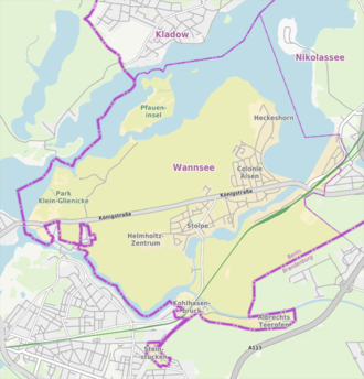
The list of streets and squares in Berlin-Wannsee describes the street system in the Berlin district of Wannsee with the corresponding historical references. At the same time, this compilation is part of the lists of all Berlin streets and places .
overview
The public road network in the entire Steglitz-Zehlendorf district (including all seven districts) covers 635.4 kilometers. This means that the district has the largest road system in the capital, ahead of Treptow-Köpenick (628.1 km) and Pankow (604.7 km).
Wannsee has 10,334 inhabitants (as of December 30, 2019) and includes the postal code area 14109. The district of Wannsee emerged from the former "villa colony Alsen", the village of Stolpe , Kohlhasenbrück and Steinstücke, which defines the road system in Wannsee. In the north is the Berlin Forest around the Schäferberg , in the west the Volkspark Klein-Glienicke with the Glienicke Castle and the Glienicke hunting lodge and the Düppeler Forest continue south of the lake chain of the Kleiner Wannsee to the Griebnitzsee . To the east is the Großer Wannsee and the border to Nikolassee is on the railway line.
Until 1972, the location of Steinstücke was shaped by the situation as a Berlin exclave on GDR territory. As a result of an area swap, Bernhard-Beyer-Straße was made possible as an access; today there are streets for Steinstücker housing estates in Potsdam .
There are 98 dedicated streets and three named squares in the Wannsee district . The most important main road as part of the federal highway 1 the Potsdamer Chaussee / King Street , on its east-west traffic is passed between Potsdam and Berlin's southwest, the destinations in the Berlin forest are reachable from Zehlendorf ago. From the B 1 there is access to the A 115 ( AVUS ) at the Zehlendorf interchange . Ten of the streets are partly outside the district in Nikolassee and Griebnitzsee . The total length of the federal, urban and residential roads (listed in the list) in the district is 56.0 kilometers.
Overview of streets and squares
The following table gives an overview of the streets and squares in the district as well as some related information.
- Name / location : current name of the street or square. Via the link Location , the street or the square can be displayed on various map services. The geoposition indicates the approximate center of the street length.
- Traffic routes not listed in the official street directory are marked with * .
- Former or no longer valid street names are in italics . A separate list may be available for important former streets or historical street names.
-
Length / dimensions in meters:
The length information contained in the overview are rounded overview values that were determined in Google Earth using the local scale. They are used for comparison purposes and, if official values are known, are exchanged and marked separately.
For squares, the dimensions are given in the form a × b for rectangular systems and for (approximately) triangular systems as a × b × c with a as the longest side.
If the street continues into neighboring districts, the addition ' in the district ' indicates how long the street section within the district of this article is. - Name origin : origin or reference of the name.
- Notes : further information on adjacent monuments or institutions, the history of the street and historical names.
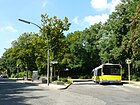
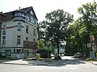
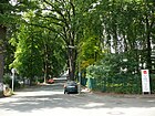
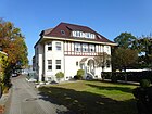
- Image : Photo of the street or an adjacent object.
| Name / location | Length / dimensions (in meters) |
Origin of name | Date of designation | Remarks | image |
|---|---|---|---|---|---|
|
Albrecht's tar stove
( Location ) |
470 + 740 | Pech furnace built in 1750 | around 1850 | The street leads to a small, isolated housing estate on the Teltow Canal in Kohlhasenbrück . Since 15./16. In the 18th century, the Albrecht family of tar burners operated a plant for the production of wood tar and wood vinegar by melting resinous wood. The street and settlement are on the outskirts of Stahnsdorf and Kleinmachnow . Access by car can be reached from the Kremnitzufer . Pedestrians can access the former motorway bridge on the disused route of the A 115 from the Düppel forest and the Teltowkanalweg. |

|
| Alsenstrasse
( Location ) |
680 | Alsen , Danish island in the Little Belt | 1888 | The street is between Chausseestrasse and Am Kleinen Wannsee. The street name was entered in 1888 by Wilhelm Conrad in the "Situation plan of the Alsen villa colony" (see also → here ) with reference to the decisive advance in the German-Danish War . This connecting road between the village of Stolpe and the Alsen villa colony was left to the municipality as a road land free of debt and free of charge by a municipal resolution of November 4, 1894 . |

|
| On the birch hill
( Location ) |
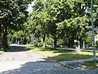
230 | Birch topped ground elevation (name probably symbolic) | June 27, 1925 | The street was laid out in 1908/1809 by the "Wilhelm-Gesellschaft Wannsee" as street 10 and in 1922 it was partially built on. It is between Ulrici and Schäferstrasse. |
|
| At the Böttcherberg
( Location ) |
140 (in the district) |
Böttcherberg, west of the road in the Berlin forest Düppel | before 1930 | The street with lots 16 (even) and 17 (odd) is located in the district of Am Waldrand (south of Königstraße) to the city limits of Potsdam- Klein Glienicke . From 1961 to 1990 the border fortifications were located here in the area of the Berlin Wall , although until 1972 there were exclaves of the Zehlendorf district in the area . In the further course of 420 meters, the city limit is on the outside of the road (the road area in Potsdam ) and only the Böttcherberg, which lies to the west, with the forest itself, belongs to Wannsee. The road connects to the south of Wannseestrasse, which is located in Potsdam. In 1930 the street with the built-up property 16 and a park between Königstraße and the district of Neubabelsberg is listed. |

|
| At the Great Wannsee
( Location ) |
2080 | at Wannsee located | Apr 8, 1933 | The quiet street with waterfront properties on the west bank of the Großer Wannsee is a one-way street from Königstraße to Zum Heckeshorn , from there on as a dead end to the former Heckeshorn Lung Clinic . The street name was entered in 1888 on the "Situation map of the villa colony Alsen " drawn up in 1883 as Große Seestrasse . After 1899, the Große Seestrasse was extended to Königstrasse and continued opposite the Kleine Seestrasse , replacing part of the Ringstrasse in the villa colony. The road connects to Königstrasse in the south. Several yacht and sailing clubs have their domicile on the lake. On the street is the Villa Thiede with the art salon of the “ Berlin Secession ” and the Liebermann Villa and the house of the Wannsee Conference . There is a copy of the Idstedt lion above the boat moorings on the Wannsee shore . |

|
| At the heath border
( Location ) |
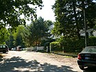
140 | adjacent to a piece of heather, meanwhile high forest | May 11, 1938 | The street is north of Königstraße as a cross street at the end of the Kornaue. It opens up on both sides as a dead end the properties Am Heidesaum 1–13 (odd) and 2–8 (even). According to construction plan was as road C traced out. |
|
| At the little Anger
( Location ) |
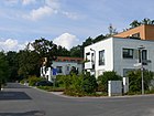
300 | Anger of the settlement | Nov 28, 2008 | The street opens up residential buildings between Don-Bosco-Steig and Max-Liebermann-Allee northeast of the New Wannsee Cemetery . The street has an extended middle section - like an anger -, the plots 5–19 (odd) face the Berliner Forst (Forstdienstacker) and the even 2–30 opposite, with the houses over 20 on a transverse road section between Wald and Max-Liebermann -Allee, the north side of which is built on with homes from the 2010s. |
|
| At the Kleiner Wannsee
( Location ) |
1620 | at Kleiner Wannsee located | Apr 8, 1933 | The quiet residential street in an excellent residential area between Königstrasse / Am Großen Wannsee and Hohenzollernstrasse has been called Kleine Seestrasse since 1888 . As early as the early 1790s, a connection path to Zehlendorf and an extended footpath to the waters were laid out. The street name was entered in 1888 by Wilhelm Conrad in the "Situation plan of the villa colony Alsen " drawn up in 1883 . In 1894 the street was taken over as common land by the municipality. After 1899, Kleine Seestrasse was extended to become Königstrasse, replacing part of the Ringstrasse . The houses on the southern edge of the street have direct access to water. This is where the Immanuel Clinic is located. |

|
| At the landing site
( Location ) |
100 | after the US helipad | after 1995 | The street in Steinstücke leads eastwards from Teltower Strasse to the railway line; no properties are assigned. The name of the street comes from the time between 1961 and 1972, when access to the Steinstücke exclave was only possible by helicopter. After the fall of the Wall, the helipad became a children's playground. The street is blocked by an oak tree, the single-family houses on the street can only be reached on foot. The footpath ends at a playground by the railway, where the monument to the former landing site is located. |

|
| At the lion gate
( Location ) |
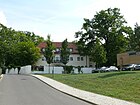
290 | Idstedt lion | 2005 | The street is the access to the residential estate built after 2005 and goes from the street to the lion to the northwest, it continues the Koblankstraße. |
|
|
At the Sandwerder
( Location ) |
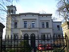
810 | Sandwerder, former name of the island Schwanenwerder | Apr 8, 1933 | It is named after the island known as Cladower Sandwerder until 1901, which at that time belonged to the Spandau office. The street was laid out around 1894 by Heimstätten AG and named after Friedrich Karl Nikolaus, Prince of Prussia (1828–1885) as Prinz-Friedrich-Karl-Straße , later it became Friedrich-Karl-Straße . The street lies between Kronprinzessinnen- and Tillmannsweg on the east side of the Großer Wannsee , the western properties extend to the lake, it is in a sought-after residential area with villas on the side of the Großer Wannsee with direct water access. The Literary Colloquium Berlin is located in a Wilhelminian-style villa at Sandwerder 5 . A section of the Havelseenweg , which is part of the E 11 European hiking trail , is on the road . |
|
| At the edge of the forest
( Location ) |
120 (in the district) |
Location on the edge of the Düppel forest | March 31, 1947 | The feed from Königstrasse is in Wannsee, and the road from Roedenbecksteig including the western properties is in Klein-Glienicke (Potsdam). The eastern plots 16–20a and 28–32 (even) belong to Wannsee. The road ends in the south at Potsdamer Wannseestrasse, but the following forest Düppel belongs to Wannsee. Most of it belongs to the Babelsberg district of Potsdam, which extends like a bridgehead into Zehlendorf. When the Wall was built in 1961 , the street was divided until 1989 and the GDR fortifications on the border between West Berlin and the GDR were in the immediate vicinity of the street . Around 1900, Friedrich-Sigismund-Strasse , named after Friedrich Sigismund, Prince of Hohenzollern (1891–1927), was laid out here. |

|
| At the game gate
( Location ) |
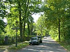
400 | Game gate, fenced-in area for game | June 27, 1925 | The road 1 was built 1908-1909 by neighbors and owners. It lies between Friedenstrasse and Martin Heydert Strasse. In the 1930 address book it is listed as undeveloped between Friedenstrasse and Stimmingstrasse . |
|
| At the orchard
( Location ) |
210 | Fruit growing previously operated here | Nov 28, 2008 | This private road, which was created with the construction of the homes here, is located eastward from Max-Liebermann-Allee and running at right angles to Löwensee. As of 2014, two wooden buildings (“plus energy houses”) were built here by Graft Gesellschaft von Architekten . |

|
| Arnold Garlic Ring
( Location ) |
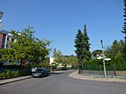
460 | Arnold Knoblauch (1879–1963), architect | Aug 15, 1968 | According to the development plan, Road 632 and Road 633 are laid out here , which were built by the municipality around 1928/29 at the expense of the residents. It is located in the south-east bend between Glienicker Strasse and Stölpchenweg. |
|
|
Bäkestrasse
( Location ) |
300 | Bäke of the river in the Teltow Canal opened | around 1919 | The street is located in the village of Kohlhasenbrück between Neue Kreisstraße and Königsweg. The road was laid out between 1918 and 1919 by the Reichsbahn (Railway Colony). In 1922 it is specified between Königsweg and Berlin-Wetzlarer Eisenbahn with nine developed and undeveloped properties. |

|
| Mountain road
( Location ) |
470 | the "Switzerland" located here are embankments from former clay pits | 1888 | In the "Situation Map of the Alsen Villa Colony " drawn up by Wilhelm Conrad in 1883, the road runs from the road to the lion over today's Hermannstraße to the road back to the lion. It was created in 1888. Today the street lies between Straße zum Löwen and Lindenstraße. |

|
| Bergstücker Strasse
( Location ) |
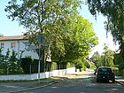
170 | Mountain pieces, colony in nearby Nowawes (today Babelsberg) | June 13, 1936 | The road 509a of the development plan was in 1890 from the village Stolpe created as a link from the village square to the water connection between Pohle- and Stolpchensee. The road branches off from Chausseestrasse to the southeast. |
|
| Bernhard-Beyer-Strasse
( Location ) |
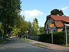
1200 | Bernhard Beyer (19th century), local politician | before 1922 | The street was created as a result of the exchange of exclaves in 1972 as a connection between Kohlhasenbrück and the former Steinstücke exclave . Only the street between its edges belongs to Wannsee, while the adjacent areas of Parforceheide (east) and the western institute premises in the Griebnitzsee district belong to Potsdam-Babelsberg . The eponymous Beyer was a lay judge in Kohlhasenbrück and deputy head of the department in Wannsee and made a living by laying new roads. The street in the regional street system of Berlin (RBS) lies between Königsweg and Steinstraße in Potsdam. The road was laid out between 1917 and 1920 by Bernhard Beyer and expanded by the community. In the address book of 1922, the street for Steinstücke between the Potsdamer Forst estate, the Sternstrasse hunting lodge and the Berlin-Wetzlarer Eisenbahn is noted with eight developed and six undeveloped properties. |
|
| Bismarckstrasse
( Location ) |
1370 | Otto von Bismarck (1815–1898), politician, Chancellor of the German Empire | 1904 | The road goes from Königstraße and runs between the railway line and the Kleiner Wannsee to the southwest. It was used by the railroad as an industrial road from 1889 to 1980. In 1904 Prince Friedrich Leopold acquired the south bank of the Kleiner Wannsee and had Bismarckstrasse built there. Plots 1–69 (odd) and 2–72 (even) belong to the street, of which in 1922 36 were named with single-family houses, 18 as gardens, one with a tennis court and two with rowing houses, but the others were still undeveloped. The actor Heinrich George lived in No. 34. |

|
| Braschzeile
( Location ) |
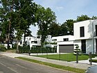
480 | Georg Brasch (1870–1933), doctor, local politician, community leader of Wannsee | Jan. 23, 1957 | The road 35 of the development plan was created 1894th It lies between Sauerbruchstrasse and Lindenstrasse. |
|
|
Charlottenstrasse
( Location ) |
200 | Sophie Charlotte (1668–1705), Queen in Prussia | around 1896 | It is between Alsen- and Chausseestrasse. The road was laid out around 1890 by the community and the residents as a connecting route and expanded and paved as a road in 1906. |

|
| Chausseestrasse
( Location ) |
810 | Chaussee , developed country road | around 1906 | The street was laid out from 1906 as a direct connection street to Berlin-Potsdamer Chaussee . It is located between Kohlhasenbrücker Strasse (Wilhelmplatz) and Königstrasse. |

|
| Colomierstrasse
( Location ) |
90 | Louis von Colomier (1809–1886), Prussian general | 1922 | The street was laid out between 1880 and 1882 by the secret councilor Conrad for the "Colonie Alsen ". The road goes east from Am Großen Wannsee to the lake. The Liebermann Villa is located on the south side of the short cul-de-sac . The bank of the Havel is only accessible via the Liebermann Villa. On the north side is the former home of the Langenscheidt family . Colomier is said to have suggested the name Alsen for the newly founded villa colony; the colony founder Wilhelm Conrad named it that way in 1872. Conrad was Colomier's brother-in-law. In the German-Danish War, the Prussian troops crossed over to the island of Alsen near Arnkiel on June 29, 1864 and brought about the final decision. |

|
| Conradstrasse
( Location ) |
530 | Wilhelm Conrad (1822–1899), banker, landowner | after 1899 | The street was the northern part of the ring road before it was named and was named after Conrad's death. The street name was entered in 1888 by Wilhelm Conrad in the "Situation Plan of the Alsen Villa Colony ", which was drawn up in 1883. After 1899 the northern part of the Ringstrasse was given the name Conradstrasse, the west-southern part the name Kleine Seestrasse and the east-southern part the name Große Seestrasse . The latter were renamed in 1933. The Conradstraße lies between Am Kleinen Wannsee and Am Großer Wannsee. |

|
|
Damsdorfer Weg
( Location ) |
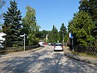
250 | Damsdorf, a desolate village near Albrechts Teerofen. | Nov 22, 1966 | The road goes north from the Sommerfieldring and turns into a forest path in the small wooded area to Königstrasse in the Düppeler Forest. It was laid out by the owners in 1910 and is laid out as road 587 in the development plan south of Königstrasse. The name was given as part of the redesign in the settlement area around the Sommerfieldring, which was previously designated as the eastern section of Ulricistraße . |
|
| Don Bosco climb
( Location ) |
260 | Johannes Bosco , Don Bosco (1815–1888), Italian priest and founder of an order | Oct. 31, 1980 | The officially dedicated, non-public street was laid out during the construction of the Don Bosco Home and the New Cemetery. With lots 2–6 and 14 (straight) it goes to the northwest from the unnamed triangular square on Bergstrasse / Lindenstrasse as a dead end street and along the northern edge of the New Cemetery . |

|
| Dorotheenstrasse
( Location ) |
100 | Dorothea Sophie (1636–1689), Electress of Brandenburg | 1922 | The street is located in the village of Kohlhasenbrück between Königsweg and Kätchenweg as a dead end . In 1905/1906 an additional road connecting the Teltow Canal to the town was laid out, creating a residential area and factories. |

|
|
Emil-Fischer-Strasse
( Location ) |
130 | Emil Fischer (1852–1919), chemist | around 1902 | The secret councilor Conrad had the street laid out in his villa colony Alsen in 1898/1899. It is located between Straße zum Löwen and Endestraße. |

|
| Endestrasse
( Location ) |
450 | Hermann Ende (1829–1907), architect and university professor | around 1908 | Endestrasse lies between Königstrasse and Bergstrasse. It was laid out after 1900 by the secret councilor Conrad . On March 15, 1966, Street 631 , the extension of Endestrasse to Bergstrasse, was included. |

|
|
Fintelmannstrasse
( Location ) |
220 | Karl Julius Theodor Fintelmann (1807–1868), Protestant theologian, first pastor at the Church of St. Peter and Paul on Nikolskoë | July 13, 1934 | The road 3 according to the development plan was laid out around 1908 by the Wilhelm-Gesellschaft Wannsee. It is located between Am Birkenhügel and Martin-Heydert-Straße. |

|
| Friedenstrasse
( Location ) |
350 | the old cemetery Wannsee is on the road | around 1906 | The street in the settlement area south of Königstraße was laid out as Kirchhofstraße as early as 1790 and, like in other Berlin districts, was euphemistically renamed, in the sense of peace as “finding last rest”. The street is between Schäferstrasse and Königstrasse. |

|
|
Glienicker Strasse
( Location ) |
820 | Heading towards Glienicke , summer residence (hunting lodge Glienicke) of Prince Karl of Prussia | around 1897 | The residential street with one and two family houses is located between Kohlhasenbrücker Straße and the barrier on the grounds of the Helmholtz Center . The golf course and Wannseestrasse follow in the further course. In the Düppel forest it takes the road to Klein Glienicke as a forest path. The road to this exclusive residential area on Stölpchensee was laid out and paved between 1890 and 1895. It was extended as an entrepreneurial road from around 1909. For 1961, a continuous road to Am Waldrand , which is only closed in the institute area, is indicated, where it then turns into Wannseestrasse. |

|
| Golf path
( Location ) |
130 + 750 | Path to the adjacent golf course | Aug 25, 1939 | The street goes westward from Friedenstraße parallel to Königstraße. It is the connection path from the former village of Stolpe to the golf course, which was laid out in the early 1920s across from the Schäferberg in the Berlin Forest. Since 1924 the "Golf- und Land-Club Wannsee" has been responsible there. |

|
| Grassoweg
( Location ) |
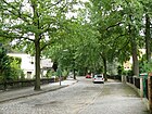
210 | Walter Grasso (1871–1946), forester | Oct 12, 1957 | The Grassoweg leads northwards from Petzower Straße as a dead end to Königstraße, to which there is no passage. The road 37 of the development plan was laid out around 1900 by the secret councilor Conrad . From 1909 to 1936 Grasso worked as forest director in the Berlin forest and was responsible for the Lanke and Wuhlheide manor forests. Due to his negative attitude towards National Socialism, he was prematurely retired and took over the management of the Berlin Forests in 1945 before he had a fatal accident. |
|
| Green way
( Location ) |
230 | Path through (green) meadows | around 1800 | This connecting route, mentioned as early as the 14th century, was once a meadow path in the former village of Stolpe and therefore takes its name from the exclusive residential area on Pohlesee. The path was a sandy path until 1920 and was only paved afterwards. The quiet residential street with one and two family houses is located between Stutterichstrasse and Alsenstrasse. |

|
| Gustav-Hartmann-Platz
( Location ) |
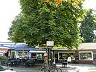
60 × 50 | Gustav Hartmann (1859–1938), haulier, Berlin original | March 6, 2000 | The previously unnamed forecourt at Wannsee station with buildings belonging to the Wannsee S-Bahn ensemble was named in 2000 in memory of the Iron Gustav. His house was at 11 Alsenstrasse , where there is now a memorial plaque. The Kronprinzessinnenweg is on the square . |
|
|
Hahn-Meitner-Platz
( Location ) |
110 × 60 × 60 (triangular) |
Otto Hahn (1879–1968), discoverer of nuclear fission, Nobel Prize winner (1944) Lise Meitner (1878–1968), Austro-Swedish nuclear physicist |
8 Sep 2008 | The square is at the western end of the public part of Glienicker Strasse at the entrance to the Hahn-Meitner-Institut . It is the bus turning point for the line from Wannsee station to the institute. |

|
| Heidestrasse
( Location ) |
130 | here was the "Heide-Park", the community forest of Stolpe | before 1910 | The route was already drawn in the "Situation map of the Alsen villa colony ", which was drawn up in 1883. The street is between Am Kleinen Wannsee and Petzower Straße . In the address book of 1910, Heidestrasse is indicated between the community forest on Potsdamer Strasse and Alsenstrasse , it crosses Beerenstrasse, Querstrasse and Blücherstrasse and is built on up to five lots. |

|
| Hemp pieces
( Location ) |
170 | Hempstücke, old hallway name | Aug 15, 1968 | The street is located south of Glienicker Straße in the area between Stölpchensee and Hahn-Meitner-Institut . It forms the northeast arch to the Arnold-Knoblauch-Ring in the southwest and leads to and from this street. |

|
| Hermannstrasse
( Location ) |
180 | Hermann Kretzschmar, entrepreneur and settler on this street | before 1906 | Hermannstrasse lies between Bergstrasse and Lindenstrasse. The street was previously part of the ring of Bergstrasse , the name of which was entered in the "Situation Plan of the Alsen Villa Colony" in 1888; the plan was drawn up in 1883 by Wilhelm Conrad . |

|
| Herwarthstrasse
( Location ) |
160 | Eberhard Herwarth von Bittenfeld (1796–1884), Prussian Field Marshal General | 1900 | The street lies between Hugo-Vogelstrasse and Bergstrasse , it was laid out around 1889/1899 by the secret councilor Conrad at the expense of the owners. |

|
| Hohenzollernstrasse
( Location ) |
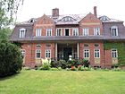
650 | House of Hohenzollern , dynasty with several lines, one of which was the German emperors | 1896 | The road runs across Königstraße to the street Am Kleinen Wannsee, over which it continues as a dead end towards the canal between Pohlesee and Kleinem Wannsee. The route was already drawn in 1883 in Conrad's "Situation Plan of the Villa Colony Alsen". The quiet residential street with one- and two-family houses leads through an exclusive residential area on the Pohlesee. The WannseeFORUM youth education facility is located directly on the bank at the southern end of the street . |
|
| Hugo-Vogel-Strasse
( Location ) |
640 | Hugo Vogel (1855–1934), painter | Aug 31, 1937 | The street lies between Königstrasse and Lindenstrasse. In 1937, the Moltkestrasse , which was laid out around 1890 and named after the Prussian Field Marshal Helmuth Karl Bernhard von Moltke (1800-1891), was renamed in order to remove the street name that had been used several times since Greater Berlin was formed. Vogel was the official portraitist of von Hindenburg and was one of the settlers of the Alsen villa colony ( later Wannsee ). |

|
|
Johannes-Niemeyer-Weg
( Location ) |
270 | Johannes Niemeyer (1889–1980), painter and architect, brother of Otto Niemeyer-Holstein | Feb 5, 1990 | The street 651 in Steinstücke was laid out by the owners around 1920. After the fall of the Berlin Wall, it was named Johannes-Niemeyer-Weg in 1990. The street goes east from Bernhard-Beyer-Straße as a dead end and opens up the plots 2–24 (even) and 5–27 (odd), which are located in the Steinstücker part east of the railway line. The street's namesake moved into a garden plot in 1928 and built many country houses in Zehlendorf, he is the brother of Otto Niemeyer-Holstein. |

|
|
Kaiserstrasse
( Location ) |
260 | Wilhelm I , German Emperor, King of Prussia | 1888 | The street name was entered in 1888 (the year the German Emperor died) by Wilhelm Conrad in the "Situation Plan of the Alsen Villa Colony". The street is between Straße zum Löwen and Conradstraße. |

|
|
Kätchenweg
( Location ) |
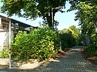
120 | Kätchen, female first name | around 1906 | The street is in the village of Kohlhasenbrück between Machnower Straße, Königs- and Dorotheenweg. The street was laid out around 1905/1906 by the owners and residents like a promenade as a footpath. In 1910 it was expanded and fortified. |
|
| Koblanckstrasse
( Location ) |
160 | Koblanck (19th / 20th century), nephew of the banker W. Conrad , who established the "Alsen Colony" | around 1893 | Koblanckstraße is located between Am Großen Wannsee and Zum Heckeshorn / Straße zum Löwen. The road was laid out between 1892 and 1893 and paved in 1894. |

|
| Kohlhasenbrücker Strasse
( Location ) |
1210 | Kohlhasenbrück , formerly an independent Zehlendorfer, since 1920 Wannsee locality | around 1906 | The small residential street on Stölpchensee runs after the Alsenbrücke through the Düppeler Forest to the Kohlhasenbrück settlement and on to Neubabelsberg in Potsdam; in the Berlin road system it is shown as a regional main street. The connecting route between Kohlhasenbrück and the old village of Stolpe was mentioned before 1589. Around 1906/1907 the road was expanded and paved by the community of Wannsee. Most of the street with the properties Kohlhasenbrücker Straße 1–59z (odd) and 4–40 (even), which leads through the Düppel forest, is undeveloped. Kohlhasenbrück, the Alsen colony and the village of Stolpe were merged to form the Wannsee community and in 1920 incorporated into the Zehlendorf administrative district of Greater Berlin. |

|
|
Koenigstrasse
( Location ) |
5920 | here on the King of Prussia related | after 1905 | The road extends Potsdamer Chaussee between the railway bridge at the Wannsee S-Bahn station and the Glienicker bridge . It is located in the course of Bundesstraße 1 and is considered the higher-level main street in the Berlin system for its entire length. On the way between Potsdam's summer and winter residence (in Berlin), the king previously used the Königsweg and after the expansion of the Chaussee it, which was renamed Königstraße in 1906. This section of the old Potsdamer Straße as a connecting road between the royal cities of Berlin and Potsdam was laid out in 1792 and is one of the oldest paved roads in Prussia. On a map from 1905, the section was still referred to as the Chaussee von Potsdam . From the city limits at the Glienicke Bridge with the adjacent Glienicke Castle Park, it leads as a wide asphalt road through the Düppeler Forest. From Otto-Erich-Straße it becomes the busy central street through the Wannsee district as a residential and business boulevard. To the east of the Wannsee bridge, a park leads south to the Kleistgrab , and to the north is the jetty at the Wannsee harbor. The “Havelseenweg”, which is also the Wall Trail , crosses at the west end and the “Wannseeweg” at the east end. In 1926 the western part is still listed as Berlin-Potsdamer Chaussee from Königstraße, via Otto-Erich-Straße, Extended Friedenstraße, Forst (Gutsiertel Klein-Glienicke), Old Castle, Glienicker Bridge (to Provizialchaussee). |

|
|
Royal road
( Location ) |
1820 (in the district) |
Route used by the Prussian kings between Berlin (winter residence) and Potsdam summer residence | after 1730 | The street (as an extended Bernhard-Beyer-Straße ) leads over the Teltow Canal and continues under this name as a footpath and road through the Düppeler Forest, partly on the city limits and along the Berlin Wall Trail , to Stahnsdorfer Damm with the district boundary to Zehlendorf. In the district, a 310 meter long section in Berlin's main road system is recorded as of regional importance. The properties Königsweg 285–315 (odd) and 298–340 (even) are located in the district, the street continues to the east in Nikolassee and Zehlendorf . It is located between the city limits in Kohlhasenbrück at the corner of Babelsberger Rudolf-Breitscheid-Strasse / Neue Kreisstrasse and Stahnsdorfer Damm. To the east of the Teltow Canal it is a forest road that also runs along the city limits in the eastern section. The western end of the street leads at the transition into Bernhard-Beyer-Straße to the railway line and ends there with corner lot 340 in the village of Kohlhasenbrück. |

|
| Kornaue
( Location ) |
110 | symbolic of a meadow tilled with grain | May 11, 1938 | The street, which is routed as “Street B” according to the development plan, is located in a residential area with two other streets, which was laid out by the owners in the mid-1930s. The street lies between the Schuchardtweg and Am Heidesaum. |

|
| Kremnitzufer
( Location ) |
1180 | Ernst Kremnitz (1859–1908), entrepreneur | June 26, 1984 | The street lies between Machnower Straße and Albrechts Teerofen on the south bank of the Teltow Canal . It was laid out and fortified between 1906 and 1907 in connection with the construction of the Teltow Canal and, as a private road, had neither a number nor a name until 1984. It is the vehicle access to the settlement and the camping site (caravan park) Albrechts Teerofen. Kremnitz was an entrepreneur in a leading position in the construction management of the Teltow Canal. On the southern side of the road there are meadows and forests, except for the "Eule Estate". |

|
| Kronprinzessinnenweg
( Location ) |
1410 (in the district) |
Crown Princess, here probably the current Princess of Prussia at the time of naming | after 1882 | The Kronprinzessinnenweg is located with lots 3–20 and 250–260 (continuously) between Königstrasse and Scabellstrasse in Wannsee. The south side of the street between Scabellstraße and the northern beginning of the train station and the entire northern section is located in Nikolassee . The oldest part of the street was laid out in 1882 by the Teltow district as a district road . In the 1901 city map of Berlin, the Kronprinzessinnenweg was marked by name parallel to today's Avus as an extension of the Königsweg from the level of Werkstattstraße (today Cordesstraße); the route changed, for example, due to the construction of the Automobilstraße. A section of the Kronprinzessinnenweg in Wannsee was renamed Tillmannsweg in 1956 , and at the same time the Bahnhofstrasse at Wannsee station was included in the Kronprinzessinnenweg. The Kronprinzessinnenweg once ran to Charlottenburg , but only remained in Wannsee and Nikolassee. |

|
| Kyllmannstrasse
( Location ) |
440 | Architect Walter Kyllmann (1837–1913) | around 1913 | The road was laid out around 1900, and the owners expanded it from 1910 to 1912. It is between Königstrasse and Herwarthstrasse. Kyllmann built several villas and houses in the villa colonies of Berlin, the street was named in the year of his death. |

|
|
Long pieces
( Location ) |
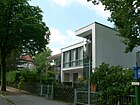
300 | corridor name located here | Nov 27, 1966 | The street is between Sommerfieldring and Otto-Erich-Straße, over which it continues as a dead end to Königstraße . The exit to Königstraße is prevented by bollards, only a footpath leads to the stop. The road was laid out and named with it as an extension of the summer field ring. The name was given as part of the redesign in the settlement area of the Sommerfieldring , which was previously designated as the eastern section of Ulricistraße . |
|
| Lindenstrasse
( Location ) |
300 | Linden , deciduous tree with importance in folk tradition | 1896 | Lindenstrasse was laid out between 1880 and 1885 in the "villa colony Alsen" and named around 1896. It lies between Braschzeile and Straße zum Löwen. For 1961 it is drawn from Neuer Friedhof, extended to the southwest across Pfaueninselchaussee, to Königstrasse. | |
|
Machnower Strasse
( Location ) |
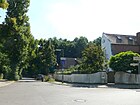
110 | Kleinmachnow , southern neighboring town, Brandenburg | 1900 | The short street with the plots 1-4 was created before 1900 by the residents of the settlement as a connecting route and expanded after 1905 by the community. The road in Kohlhasenbrück continues the Bäkestrasse to the southeast and lies between Königsweg and Kremnitzufer, it leads as a forest road to the city limits. A path leads across the city limits through the Potsdamer Parforceheide . This area at the city limits was 1961-1990 in the area of the Berlin Wall . |
|
| Painter's garden
( Location ) |
140 | the Berlin landscape painter Johannes Niemeyer (1889–1980) lived here | Feb 5, 1990 | The street is in the locality of Steinstücke and was laid out by the owners around 1920 under the name Straße 652 . It goes south from Johannes-Niemeyer-Weg as a cul-de-sac and aims without a passage on Steinstraße, where Niemeyer's residence was. The renaming of street 652 took place at the request of the population with the name painter's garden. |

|
| Martin-Heydert-Strasse
( Location ) |
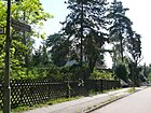
560 | Martin Ludwig Heydert (1656–1728), gardener | Apr 1, 1976 | Before Street 9 in the development plan, it was named in 1976 after Heydert, the Planteur (head gardener) in the service of the Great Elector , who laid out, for example, the Glienicker Park and the then vineyard in Glienicke. The street is located in the settlement south of Königstraße between Am Wildgatter and Glienicker Straße. |
|
| Max-Liebermann-Allee
( Location ) |
300 | Max Liebermann (1847–1935), painter, 1920–1932 President of the Berlin Academy of the Arts | Nov 28, 2008 | Liebermann lived in Wannsee, and his villa is now a museum. The street named after him is located north of the New Cemetery in the settlement that was built around the Don-Bosco-Steig in the 2000s. It is between Don-Bosco-Steig and Am Löwentor. |

|
| Möwenstrasse
( Location ) |
300 (in the district) |
Seagull , frequent swimming seabirds on Berlin's waters | July 31, 1947 | The street is between Königstrasse and Louis-Nathan-Allee (in Potsdam ), the road is in Potsdam-Babelsberg, the western side of the street with the Glienicke hunting lodge in the district. After 1933 the street was named after the lawyer and educator Wilhelm von Türk (1774-1846), who lived in Glienicke. The renaming took place with the first renaming action of the Berlin Senate after the Second World War. |

|
| Moorlakeweg
( Location ) |
590 | Moorlake tavern, Moorlakeweg No. 1 | June 1, 1992 | The Moorlakeweg is located between Nikolskoer Weg and the Moorlake excursion restaurant in the Moorlake an der Havel landscape of the same name. The road leads through the forest and consists of the driveway and parking lot for hikers and restaurant visitors. |

|
|
New county road
( Location ) |
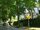
810 | Newly built in contrast to the old Kreis-Chaussee | before 1930 | The new district road connects Berlin and Potsdam . It is located in Kohlhasenbrück with plots 1-45 (odd) and 2-50 (even) between the city limits (further than Rudolf-Breitscheid-Straße in Potsdam) and 130 meters over the Böckmannbrücke ( Teltow Canal ) as an extension of Kohlhasenbrücker Straße. The Neue Kreisstraße is marked as a regional main road (RBS category III) in the Berlin road system. According to the location on the outskirts of the city, the “Teltowkanalweg” crosses here, one of the 20 green main routes in Berlin, which also leads to the Wall Trail . |
|
| Nibelungenstrasse
( Location ) |
700 (in the district) |
Nibelungen , Germanic heroic legend | around 1905 | The Nibelungenstraße is between Potsdamer Chaussee and Niko Lasseer Lohengrinstraße, it belongs to the country and the southeastern road land (1-21 ongoing) to Nikolassee . The northern edge is in the district with property 50 (to the train station ) and the car loading in Wannsee. The southern edge of the station area along the street to the KGA Wannsee outside of it is the district boundary. The road was planned in 1904/1905 by Heimstätten AG von Schlachtensee. |

|
| Nikolskoer way
( Location ) |
2050 | Blockhouse Nikolskoe (Nikolskoe = belonging to Nikolai) | before 1930 | The forest road with several parking spaces between Königstraße and Pfaueninsel leads through the forest and opens up three excursion restaurants, in contrast to the Pfaueninselchaussee , which is only approved for BVG buses, public access to several forest parking spaces up to the Pfaueninsel is possible here. The block house Nikolskoe was built by Friedrich Wilhelm III. for his daughter Charlotte and his son, the future Tsar I. Nicholas built. The Russian administrator opened a (forbidden) pub, the tradition of which the present-day restaurant goes back to. The path was established in 1875 as a connecting path between the Pfaueninsel, St. Peter and Paul Church , the forester's house and the possessions of Friedrich Wilhelm III. created. In the Berlin street directory from 1930 the name Nikolskoer Chaussee still appears. Plots 3–25 (odd) and 14–18 (even) are assigned to the street. The previous name was Provinzialchaussee Pfaueninsel-Potsdam , this led from the Königstraße through the forest to the Pfaueninsel ferry, the Peter-Paul-Kirche, the Nikolskoj restaurant, the Moorlake restaurant and at the Sacrow ferry to the Glienicker bridge . |

|
|
Otto-Erich-Strasse
( Location ) |
290 | Otto Erich Hartleben (1864–1905), playwright, poet and narrator | before 1922 | The street lies between Chausseestrasse and Königstrasse. In the 1922 address book, the street is shown with lots 1–15, eight of which are built on. |

|
|
Pardemannstrasse
( Location ) |
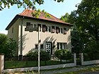
280 | Pardemann, long-established family in the village of Stolpe | June 27, 1925 | The street 3a of the development plan was named in 1925 and is between Am Birkenhügel and Peace Street, in the area south of King Street. In 1926 the street was listed as an undeveloped cross street of Friedenstraße . The old Wannsee cemetery is on the road. |
|
| Petzower Strasse
( Location ) |
470 | Formerly an independent village of Petzow , since 1929 part of Werder , Brandenburg | July 13, 1934 | The road was in 1888 by Wilhelm Conrad in the "Situations plan of the villas colony Alsen" as Park Street entered and went already (as now) from the small lake road (now at Kleiner Wannsee) to the road to Potsdam (now King Street). The reason for the renaming was probably the multiple use of the street name in the administrative district and beyond since the formation of Greater Berlin in Berlin. |

|
| Pfaueninselchaussee
( Location ) |
2710 | Pfaueninsel , Havelinsel with castle | 1925 | This access between Königstraße and the Pfaueninsel ferry station is designated as a forest road and reserved for BVG buses; other car traffic is prohibited. It was previously part of the Provinzialchaussee Pfaueninsel-Potsdam , this led from Königstrasse through the forest to the Pfaueninsel ferry, the Peter-Paul-Kirche, the Nikolskoj restaurant, the Moorlake restaurant and at the Sacrow ferry to the Glienicker bridge. This road leading to Pfaueninsel was laid out in the middle of the 19th century and fortified at the turn of the century. On a map from around 1910 it is referred to as "Inselchaussee". |

|
| Philipp-Franck-Weg
( Location ) |
180 | Philipp Franck (1860–1944), painter | July 10, 1987 | Until it was named, the street was street 643 according to the development plan. It goes from Alsenstraße to the south as a cul-de-sac towards Pohlesee. The paved road with tree-lined green strips on the sidewalks with lots 3–47 (odd) and 4–10 (even) turns westwards after 100 meters to lots 28, 33 and 35. Plots 11–27 with access to the Pohlesee are from This corner is not public and can only be reached through a blocked driveway. |

|
|
Potsdamer Chaussee
( Location ) |
290 (in the district) |
Connection route Berlin– Potsdam | after 1905 | From the railway bridge at Wannsee station to the suburb of Nikolassee on Nibelungenstraße, the Chaussee (without land) is located in the district; it continues eastwards to Nikolassee and Zehlendorf . This wide street with two lanes and a wide, greened median is part of the B 1 street and is classified as a superordinate main street in the Berlin street system. It is also the access from Wannsee to the Zehlendorf junction of the A 115 and thus offered the residents of Wannsee via the AVUS a connection to the inner ring until the opening of the wall . It was a section of the old road connecting the royal cities of Berlin and Potsdam, which was laid out in 1792, and is one of the oldest paved roads in Prussia. On a map from 1905, this section was still referred to as the Chaussee von Potsdam . |

|
|
Reichsbahnstrasse
( Location ) |
100 | Private road of the Deutsche Reichsbahn | before 1935 | The street southeast of the Wannsee train station opens up the P + R car park from Nikolasseer Nibelungenstraße, from which it branches off to the north. The street is located on the railway site, lots 1–3a belong to the street. In addition to the railway buildings on the back of the Wannsee train station , the neighboring car loading facility (formerly Wannsee freight station), the southwestern exit of the train station is also located here. In 1935 it is shown with the three civil servants 'houses 1–3 for railway officials under the name, in 1930 it is also shown under Nikolassee with three civil servants' houses for five to seven residents as an access road to the Wannsee freight yard . |

|
| Roedenbecksteig
( Location ) |
820 | Karl Rudolf Walter Roedenbeck (1859–1922), theologian, 1888 to 1922: pastor in Klein-Glienicke, Sakrow, Nikolskoje and Wannsee | March 15, 1939 | The road 560 according to construction plan was named 1939th It leads southeast from Am Waldrand (corner of the city limits to Klein-Glienicke in Potsdam) into the forest and meets the route of the extension of Glienicker Straße through the area of the Helmholtz Center and the golf course to Wannseestraße . According to the 1940 address book with summer house, shooting ranges and undeveloped land from Friedrich-Siegismund-Straße . Today plots 8, 10 and 11 are assigned to the path that leads north of the Hirschberg through the hunts 81 and 82 of the Düppel forest. The property at Roedenbecksteig 11 is assigned to the Wannsee earth station south-west of the Helmholtz Institute and is an extension of the physically existing route. Buildings 8 and 10 are located south of the intersection of the existing path with the extended Glienicker Straße, east of the Hirschberg. |

|
| Ronnebypromenade
( Location ) |
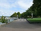
1000 | Ronneby in Sweden is a twin town of the former Zehlendorf district | after 1976 | The busy footpath is a promenade with no land and uninhabited. It is located on the south-east bank of the Großer Wannsee and leads under the Wannsee bridge of Königstraße to the north bank of the Kleiner Wannsee, a no longer named footpath leads to the Kleistgrab near Bismarckstraße . To the north of Königstraße is the Wannsee landing stage for excursion boats and the departure point for the F10 ferry line from Wannsee to Kladow to Imchenplatz. The Havelseenweg, one of Berlin's 20 green main routes , runs over the northern section . |
|
| Red Cross Street
( Location ) |
240 (in the district) |
Red Cross | before 1950 | The street itself, including the western properties, is outside the Berlin city limits (in the area of the former Postenweg) in Potsdam-Griebnitzsee between Steinstraße and Stahnsdorfer Straße, the Steinstückser properties 11-18 belong to the district. Until the fall of the Wall, this was the east-west border . In the immediate vicinity of the street there was a branch of the German Red Cross before the war, which probably led to the name. |

|
|
Sangebuchtweg
( Location ) |
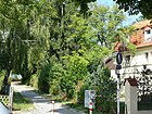
130 | Bay bay, hallway name | Nov 22, 1966 | The street is between Sommerfieldring and Chausseestrasse with lots 6 (even) and 9-21 (odd). The connection identified with the road category in the regional reference system is signposted as a footpath at both ends and secured against traffic with spear posts. The name was given in connection with the construction of the settlement on Sommerfieldring , which for 1961 is still designated as the eastern section of Ulricistraße , which was undeveloped here and interrupted by open space. |
|
| Sauerbruchstrasse
( Location ) |
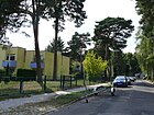
490 | Ferdinand Sauerbruch (1875–1951), surgeon | March 19, 1956 | The street, previously street 32a of the development plan, lies between Hugo-Vogel-Straße and Braschzeile . Sauerbruch was a health councilor in Berlin for a short time after the Second World War. The choice of name for the road is with facilities of the TB - Hospital Heckeshorn (now Lungenklinik Heckeshorn) related. |
|
| Scabellstrasse
( Location ) |
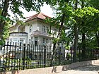
360 | Ludwig Carl Scabell (1811–1885), founder and first head of the Berlin fire department | June 18, 1976 | The road leads to the Wannsee from Kronprinzessinnenweg, a side section runs southwards towards Am Sandwerder but is only connected to it as a pedestrian path, on which the section of the "Wannseeweg", which is also the European hiking trail E11, is due to the proximity of the lake. It was previously called Robertstrasse after the community representative Robert Schreiber in Wannsee, who had the street laid out as an entrepreneur street before 1912 (probably between 1900 and 1904) . In addition to the Wannsee fire station, there are also some water sports clubs in Kleine Straße with lots 1–14a (continuously) on the Großer Wannsee . A section of the “Wannseeweg” runs through the vicinity of the lake and is part of the E11 European hiking trail . |
|
|
Schäferstrasse
( Location ) |
650 | Sheep pasture in the village of Stolpe | before 1903 | The street is between Glienickerstrasse and Chausseestrasse. It is listed for the first time in the Berlin address book in 1922, plots 1–4 and 19–26 are built on with apartment buildings. From street 10 (today: Am Birkenhügel) to Friedenstraße is still undeveloped, here in 1925 plots 14 and 15 are built on and 16 and 17 are gardens. In 1922 a (further) road was planned between 23 and 24, which was designated as Road 16 in 1925 . Today the properties at Schäferstrasse 1–39 are shown. Due to the one-way system around Wilhelmplatz and Chausseestrasse, part of Schäferstrasse is part of the regional main road system. |

|
| Schuchardtweg
( Location ) |
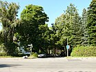
350 | Friedrich Schuchardt (1848–1910), Büdner, local politician | Aug 8, 1935 | The street with lots 1–13 (odd) and 2–20 (even) goes northwards from Königstraße as the entrance to the settlement on the Kornaue . The street was laid out before it was renamed Florastraße and named after Flora, the Roman goddess of flowering and spring. This street name was present several times during the formation of Greater Berlin in the city. In 1922 Florastraße was first shown in the address book with five developed and six undeveloped properties between Königstraße and Forst. |
|
| Schulstrasse
( Location ) |
60 | here is the Conrad School | before 1922 | It goes east from Charlottenstrasse to the Wannsee stadium and the tennis courts. In the 1922 address book it is given between Charlottenstrasse and Forst with two developed and one vacant lot as well as the children's home and school in Charlottenstrasse 10. Today houses 1–6 (continuously) belong to Schulstrasse. |

|
| Seglerweg
( Location ) |
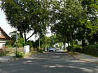
80 | Seglerhaus at Wannsee | before 1922 | The street lies between Straße zum Löwen and Am Großen Wannsee. It is the connection path to the Seglerhaus at Wannsee . The road from Große Seestrasse is listed as undeveloped in the 1922 address book for the first time. |
|
| Seylerstrasse
( Location ) |
90 | Gustav Adelbert Seyler (1846–1935), local politician, created the Zehlendorf coat of arms in 1907 | July 26, 1977 | The street, previously street 642 according to the development plan, lies between Hugo-Vogelstrasse and Kyllmannstrasse, but no longer leads to the latter, but ends in a turning hammer . |

|
| Summer field ring
( Location ) |
500 | Adolf Sommerfeld (1886–1964), building contractor | Nov 22, 1966 | The street is built with flat roof terraced houses and is a ring road from Ulricistraße to Lange Stücken. The name was given as part of the redesign of the settlement area located here on the routes from road 584 to road 588 of the development plan. In 1961, the Sommerfieldring was still designated as the eastern section of Ulricistraße , which was undeveloped and interrupted here. In 1924, Sommerfeld received the order from the League of Nations to build ten thousand houses for Greek refugees from Asia Minor. He and his company had a strong influence on the cityscape in southwest Berlin ( Onkel Toms Hütte settlement ); he had the extension of the underground line from Thielplatz to Krummen Lanke built on his own account . In 1933 Sommerfeld emigrated to Palestine and later to England , where he took the name Andrew Sommerfield, the spelling on which the street name was based. |

|
| Stahnsdorfer Damm
( Location ) |
1330 | Stahnsdorf , southern neighboring town in the Potsdam-Mittelmark district, Brandenburg | July 13, 1934 | The street lies between Potsdamer Chaussee (east of the railway bridge) and the city limits on Königsweg , it is initially south of the railway line and then turns to the southeast along the district boundary . Stahnsdorfer Damm with plots 2 and 8–12 (continuous) lies with the road in the district, on the east side lies the border to Nikolassee with plots 3–7. An undeveloped section leads to the city limits and continues as a hiking trail to the Kleinmachnow area (Euro-Parc). The beginnings of the road (since before 1912) with the name Havelweg go back to around 1890 when a connecting path was laid across the forest between Kleinmachnow and Wannsee. The name Havelweg refers to the connection between the Teltow Canal and the Havelseenzug. The road leads to the police sports club and the DEVA shooting range, a branching path to the northeast leads to the Dreilinden district forester with the Zehlendorf forest school in the Nikolassee area. The footpath and bike path of the same name through the Düppeler Forest leads to Kleinmachnow . This is where the old autobahn route (Kleinmachnower Mauerweg) and the former main line crosses. In the following area of the Europarc Dreilinden the road is passable again and leads to the Teltow Canal and the Machnower Lock . |

|
| Stahnsdorfer Strasse
( Location ) |
330 (in the district) |
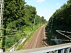
Stahnsdorf , southern neighboring town in the Potsdam-Mittelmark district, Brandenburg | 1906 | The street itself, including the northern properties, is outside the Berlin city limits (in the area of the former Steifenweg) in Potsdam-Griebnitzsee . The Steinstücks plots 131–151 belong to Wannsee, and there are 190 meters of the road between Bernhard-Beyer-Strasse (feeder to the former exclave Steinstück) and Teltower Strasse and this part of Stahnsdorfer Strasse in Wannsee. This road layout, including the railway bridge, was important at the time of the Berlin Wall since 1972 because it enabled access from Bernhard-Beyer-Weg over the railway bridge to the part of Steinstücke to the west of the railway line. During the National Socialist era, it was temporarily called Hermann-Göring-Straße . |
|
| Steinstrasse
( Location ) |
120 + 250 (in the district) |
probably related to the Steinstücke settlement | before 1950 | Steinstrasse itself, including the southern land, is located with the road outside the Berlin urban area in Potsdam-Griebnitzsee . From 1961 to 1990 it was in the area of the former column path and the border installations . The Steinstücker properties 22-32 and 44-48 (straight) between Rote-Kreuz-Straße and the (extended) Malergarten belong to the district. The road is interrupted by the railway line (34–42 are not available). In Potsdam the street is between Großbeerenstraße and August-Bebel-Straße. |

|
| Stimmingstrasse
( Location ) |
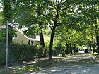
130 | Stimming, long-established Stolper host family | June 27, 1925 | The street lies between Am Wildgatter and Ulricistraße. It was laid out around 1907/1908 as Straße 11 according to the development plan. The Stimmings operated the Stolper Dorfkrug, after the construction of the Chaussee Berlin – Potsdam the new Krug was moved to this street. In the address book from 1930, the first built-up plot of land is indicated with the Middendorf villa. |
|
|
Stölpchenweg
( Location ) |
1060 | runs around the Stölpchensee | 1900 | The path leads along the west bank of the Stölpchensee between Glienicker Straße (in the north) and the path over the Hubertusbrücke to Kohlhasenbrücker Straße . The sought-after residential area with one and two-family houses that have direct access to the water on the east side is located in the south of the district between forest and water. The road ends after the Hubertusbrücke at a forest parking lot. At the southern end there is a pumping station and the Hubertusbaude, here is also the Teltow Canal Path , on which the Wall Path runs along. |

|
| Road to the lion
( Location ) |
720 | formerly led to the monument of the Flensburg Lion , which today stands on the Heckeshorn | 1888 | The one-way street to the south is between Koblanckstraße / Am Löwentor and Conradstraße. The street name was entered in 1888 by Wilhelm Conrad in the "situation plan of the villa colony Alsen". The street used to lead to the monument of the Flensburg Lion , a Danish monument commemorating the Danish victory over the Schleswig-Holsteiners . The copy of this lion was erected in 1866 in the Alsen villa colony, which was named after the Prussian victory over the Danes when they stormed the fortress . In the 1930s the lion was brought to the Heckeshorn (on the northwest bank of the Großer Wannsee), where it still stands today. |

|
| Stubenrauchstrasse
( Location ) |
130 (in the district) |
Ernst von Stubenrauch (1853–1909), lawyer, local politician and district administrator | before 1950 | The Stubenrauchstrasse leads from Griebnitzsee (Potsdam) to the Wannsee locality of Kohlhasenbrück with a connection to the Neue Kreisstrasse , whereby the branch leading to the border lies on the former strip of the Wall . The district boundary and (thus) the city boundary runs in the north-eastern section of the street in the middle of the street, with the easternmost 30 meters of the street as a connection to the Neue Kreisstraße being entirely on the Wannsee area. Plots No. 30 at the beginning of Via Tilla and 36–58 (straight) on the north side are in Kohlhasenbrück . The south-western section of the street is in Potsdam, but most of the property is in Stubenrauchstrasse. 25 on Berlin area (in a corner of Kohlhasenbrück), as well as parts of the properties No. 27 and 29. In 1885, Stubenrauch was appointed district administrator of the Teltow district, initiated the construction of the Teltow Canal and ensured the expansion of the road network. Over the city limits it leads to Rudolf-Breitscheid-Straße in Potsdam. |

|
| Stutterichstrasse
( Location ) |
160 | Wilhelm Stutterich (1830–1913), landowner in Stolpe | March 15, 1939 | The street lies between Alsenstrasse and Grüner Weg with property 7 and leads as a narrow driveway with properties 3, 4 and 6 (boat yard and rental) to the shore of Lake Pohl . In 1790 an unpaved connection path was laid here between the village of Stolpe and the Pohlesee. The expansion to the paved and public Elisabethstrasse took place around 1875, it was named after Elisabeth Ludovika von Bayern (1801–1873), Queen of Prussia, wife of Friedrich Wilhelm IV . The renaming took place due to the multiple existing streets of the same name after the formation of Greater Berlin and the duplication in the administrative district. |

|
|
Teltower Strasse
( Location ) |
380 | Teltow , southern neighboring town in the Potsdam-Mittelmark district, Brandenburg | before 1925 | The traffic-calmed street in Steinstücke is predominantly built on with single-family houses with gardens and goes off Stahnsdorfer Strasse , whose streets here belong to Potsdam. It opens up the part of Steinstücke to the west of the railway line and forms the access for all plots 1–51 (odd) and 2–34 (even) within the city limits of Potsdam, it ends in the south as a dead end . On December 26, 1993, the street 653 between Teltower Strasse and Wendehammer was included. |

|
| Tillmannsweg
( Location ) |
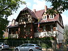
490 | Robert Tillmanns (1896–1955), politician (CDU) | Aug 20, 1956 | The street between Kronprinzessinnenweg and Am Sandwerder was renamed in 1956 on a section of Kronprinzessinnenweg. |
|
|
Ulricistrasse
( Location ) |
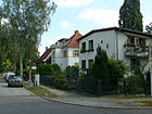
400 | Robert Oswald von Ulrici (1816–1886), German forester and civil servant | Jan. 7, 1928 | The Marienstraße was incorporating Straße 2 , renamed in 1928 as there were several streets of the same name in Berlin after the formation of Greater Berlin. Today the street lies between Sommerfieldring and Martin-Heydert-Straße, in 1961 it still led to Königstraße over an undeveloped area that is now built on with the settlement around the Sommerfieldring. In 1922, Straße 2 consisted of Brockelmann's house and undeveloped land starting from Friedenstraße. |
|
|
Via Tilia
( Location ) |
210 | Via Tilia in Latin words: Lindenstrasse. | 17 Sep 2010 | The street with 25 properties of the “Tilia Resort am Griebnitzsee” opens up an “upscale residential complex” from the 2010s in the west of Kohlhasenbrück , which also includes the adjacent properties at Stubenrauchstrasse and Neue Kreisstrasse. Via Tilia lies between the property at Stubenrauchstrasse 30 and Neue Kreisstrasse in the arch. Plots 1–14 are on the lake side and 16–25 on the concave side. To the north of the residential complex on the street is the Bäkewiesen nature reserve with the confluence of the Teltow Canal and Griebnitzsee , to which the western properties connect. |

|
|
Werner Street
( Location ) |
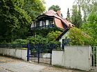
230 | Anton von Werner (1843–1915), Prussian history painter | before 1922 | Wernerstraße is located between Königstraße and Am Kleine Wannsee. The street was laid out around 1900 by the founder of the Alsen colony, Conrad , and was first recorded in 1922 with three developed properties. |
|
| Wickenhagenweg
( Location ) |
150 | Hermann JE Wickenhagen (1849–1929), sports educator. | Dec 15, 1930 | Plots 1 and 9 belong to this street between Am Kleinen Wannsee and Kleinen Wannsee. The adjacent plots 1–12g (east) and 13–13e are assigned to the street Am Kleinen Wannsee . Kaiser Wilhelm II. Summoned Wickenhagen the Ministry of Culture, where he in this office the student rowing promoted. In 1943 the street is still listed as vacant. |

|
| Wilhelmplatz
( Location ) |
70 × 20 | Wilhelm I (1797–1888), King of Prussia, German Emperor (from 1871) | before 1903 | The square, more like a stretch of road between Friedenstrasse and Kohlhasenbrücker Strasse, is bordered by Schäferstrasse in the north and Glienicker / Chausseestrasse in the south. Plots 1–5 on the west side of the square belong to the square, with the church on Stölpchensee on plot 2 . In 1943, three houses were built on Wilhelmplatz, two of which were multi-party houses. |

|
|
To the Heckeshorn
( Location ) |
780 | Heckeshorn, promontory on the west bank of the Großer Wannsee | June 27, 1925 | The street lies between Koblanckstraße and Am Großen Wannsee. The street continues from the street to the lion and with this forms the branch of the one-way street system with Am Großen Wannsee leading southwards. In 1922 the road is already indicated but leads through the forest and is undeveloped. The forest belonged to the Potsdam estate district and was outside of Wannsee. The footpath in extension of the street leads to the monument of the Flensburg Lion . The pulmonary clinic of the Emil von Behring Hospital is at the northwest end of the street . |

|
Further locations of Wannsee
Allotment colonies
Allotment gardens in the district are only three railway farms in Kohlhasenbrück between the main railway and the railway line to Babelsberg and Potsdam.
- KGA Bäkestrasse (06227, BLW sub-district Kohlhasenbrück Group Bäkestrasse, location ) with 45 parcels on 16,265 m² in Kohlhasenbrück.
- KGA Kätchenweg (06228, BLW sub-district Kohlhasenbrück Group Kätchenweg, location ) with three parcels on 899 m² of railway land.
- KGA Stammbahn (06229, BLW sub-district Kohlhasenbrück, Stammbahn Lage Group ) with 37 plots on 17,604 m² of railway land.
Parks and green spaces
- Volkspark Klein-Glienicke ( location ) with Glienicke Castle and Kanonenberg
- Kleistpark ( location ) with the Kleist grave
- Pfaueninsel Landscape Park ( location )
- Jagdschlosspark ( location ) with hunting lodge Glienicke and Wiesenteich ( location )
- Waldpark Pohlesee ( location ) on the south bank of the lake
-
Dog exercise areas
- Forst Düppel (north of the railway line) Jagen 62 to 65 ( Lage )
- Wannsee Jagen 84 ( location )
- Moorlake hunting 101 ( location )
- Nature reserves
- Bäkewiese in Kohlhasenbrück ( location )
- Great Fenn ( location )
- graveyards
- Wannsee old cemetery ( location )
- New Wannsee Cemetery ( location )
- historical forest cemetery at the Peter-Pauls-Kirche
Forest areas and hiking trails
-
Berlin forest around the Schäferberg (north of Königstrasse) ( location ) with the hiking trails here
- Brunnenweg ( Lage ), officially 930 meter long forest road
- Dachsweg ( Lage ), 980 meter long forest road
- Feuerwehrweg ( location ), footpath between Nikolskoer Weg and Kirchweg in the Düppel forest
- Hänsel-Gretel-Steig ( location ): the hiking trail stretches between Moorlaker Gestell and Pfaueninselchaussee in a west-east direction north of Schäferberg.
- Heuweg ( location ), the hiking trail lies between the riverside promenade at the rescue station opposite the Pfaueninsel and Pfaueninselchaussee, where it turns halfway south from the Havel at the corner of Rotkäppchenweg, from there a path leads to the settlement on Don-Bosco-Steig and the New Wannsee Cemetery.
- Kirchweg ( Lage ) is the forest path to the Peter-Pauls-Kirche and connects the local cemetery on Nikolkoer Weg with Königstraße opposite Friedenstraße at the Alte Friedhof Wannsee, which was the village cemetery of Stolpe .
- Moorlaker frame ( location ). A frame is a form of forest path, it lies between the Moorlaken- / Nikolskoer Weg and Pfaueninselchaussee (at the height of the Neuer Friedhof) with a length of 2690 meters.
- Postweg ( location ) is the private road from Königstrasse to the television tower on Schäferberg , which is not open to the public
- Rotkäppchenweg ( location ): the approx. 1.5 kilometer long hiking trail is located in the forest from the promenade on the Großer Tiefenhorn going south to the intersection of the road to Löwentor / Koblankstraße / Zum Heckeshorn.
- Schneewittchenweg ( Lage ) is 1060 meters long, south of Falkenberg, between Nikolskoer Weg (corner of the Volkspark's wildlife park) and the corner of Königstraße / Dachsweg. The choice of name refers, like the surrounding paths, to a Grimm fairy tale, Snow White .
- Tiefhornweg ( Lage ) is the official name (street number 04493) of the 3680 meter long forest path on the banks of the Großer Wannsee and the Havel, past the Großer and Kleiner Tiefhorn between Am Großen Wannsee / Zum Heckeshorn and the Pfaueninselchaussee. According to this position here, the order runs West Berlin leading Wall Trail and the "When sea". Officially, the entire riverside path is named after the Tiefhorn in the north, but unofficially it is called Schildhornweg, Haveluferweg, Uferpromenade, Krug-, Appelhornweg
- Promenade on which the Wannseeweg 11 and the Wall Trail are located ( location )
- Wassernixenweg ( location ), the approximately 1.5 kilometer long forest path lies far from the bank between Tiefhorn and Heuweg in the Berlin Forest.
- Excursion destinations are
- Excursion church St. Peter and Paul ( location )
- Nikolskoe ( log cabin ) ( location )
- Pfaueninsel ( location )
- South of Königstrasse: Forst Düppel ( Lage ) between Kleinem Wannsee and Teltow Canal and Griebnitzsee
- Böttcherberg ( location )
- Hirschberg ( location )
- Tannenberge, in the western area is the former "Wannsee garbage dump" ( location ). This landfill was used intensively by West Berlin before the landfill contracts with the GDR were agreed.
- Hiking trails
- Bürgermeister-Stiewe-Weg ( Lage ) continues Stahnsdorfer Damm south of the Wannsee S-Bahn depot and leads on the south side of the railway line through the Düppel forest to the Teltow Canal in Kohlhasenbrück.
- Griebnitzsee-Promenade ( location ), in the district are 3020 meters along the north bank of the Griebnitzsee, the city limits to Potsdam-Babelsberg runs through the lake . The promenade is located between the Havelbaude on Stölpchenweg and continues in Potsdam-Glienicke as Griebnitzstraße. The “Teltow Canal Path” (main path no. 17) and the E11 long-distance hiking path are also on this route . Due to the proximity of the city limits, the Berlin Wall Trail also leads along this route. This footpath is noted as a street in the Berlin system.
- Kneippweg ( Lage ) is a 650 meter long footpath in the Düppel forest (Jagen 59) between the railway line (Bürgermeister-Stiewe-Weg) and Kurfürstenweg near the city limits. Named the Kneipp fountain
- Kurfürstenweg ( location ) is a 1900 meter long hiking trail through the Düppel forest, which lies between Stahnsdorfer Damm (north of the police sports club square) and Königsweg at the corner of the city limits of Dreilinden . The connection from the Wannsee to the Teltow Canal is possible on it.
- Rehweg ( location ): the hiking trail through the Düppel forest lies between Stölpchenweg and the Griebnitzseepromenade, it leads south around the Tannenberge and the former (renovated) Wannsee landfill in the western part.
- Sieben-Raben-Weg ( location ): it is located on the south bank of the Pohlesee and between Kohlhasenbrücker Strasse and the extension of Bismarckstrasse north of the railway line . The connection to the Großer Wannsee is possible via the latter (south of the Kleiner Wannsee). To the west of Kohlhasenbrücker Strasse, a path on the east bank of Stölpchensee leads to the Hubertusbrücke on Stölpchenweg.
- Teerofenweg ( Lage ) is a hiking trail in the Düppel forest that faces south-east between Kohlhasenbrücker Strasse and the Teltow Canal, which lies beyond the city limits in Dreilinden . The name arises from the Albrechts Teerofen settlement over the Teltow Canal . The path has an underpass under the railway line and crosses the Bürgermeister-Stiewe-Weg in front of the NSG Großes Fenn in the northeast. At the intersection with the Königsweg lies the forester's grave (Siegfried Geisler). To change to the south bank of the Teltow Canal and to Albrechts Teerofen, the Teltow Canal Path leads east to the old motorway bridge , which is located in Brandenburg area and where the route of the federal motorway 115 was laid to the south in order to avoid multiple changes over the city limits during the time of the Wall .
Traffic, sports and commercial areas
-
S-Bahn line Berlin-Potsdam ( Wetzlarer Bahn )
- Wannsee S-Bahn and long-distance train station ( location )
- Wannsee S-Bahn depot
- disused route of the (former) cemetery railway Stahnsdorf ( location )
- Institute site (formerly Hahn-Meitner-Institut ) ( location )
- Golf course (west of the Hahn-Meitner-Institut) ( location )
- Wannsee Stadium ( location )
See also
- List of cultural monuments in Berlin-Wannsee
- List of cinemas in Berlin-Wannsee
- List of stumbling blocks in Berlin-Wannsee
literature
- Walter Kaupert (Ed.): Kaupert's street guide through Berlin 2010 . Kaupert Media, Berlin 2009, ISBN 3-941108-01-8 .
Web links
- Street directory Wannsee. kaupert media gmbh, accessed on December 12, 2011 .
- Office for Statistics Berlin-Brandenburg: List of streets and places in the Steglitz-Zehlendorf district (as of February 2015); pdf
- Map of Berlin 1: 5000 with district boundaries. Senate Department for Urban Development Berlin, 2012, accessed on August 25, 2012 .
Individual evidence
- ↑ a b c d e f g h i j Berlin address book 1922 → IV. Streets and houses of Berlin → Zehlendorf administrative district, p. 1282 ff
- ^ Former West Berlin exclaves on the Böttcherberg in Klein Glienicke, Potsdam. There were three small plots of land, some of which were only a few meters away from West Berlin territory, but completely enclosed by GDR territory. The exclaves were dissolved in 1972 in an exchange of territory with the GDR.
- ^ A b c Berlin address book 1930> Part IV. Streets and houses of Berlin> Zehlendorf administrative district:… Wannsee. Part IV, p. 1506 ff
- ↑ a b c d e f g Address selection for the map of Berlin 1: 5000 (K5 color edition) produced by the district surveying offices
- ↑ a b c d e 20 green main paths: Havelseenweg No. 12
- ^ A b c d e Explosive mixture - Minister Schwarz-Schilling wants to build a post office on a garbage dump in Berlin - against the advice of all experts. In: Der Spiegel
- ↑ Sometimes the red eagle flutters over pieces of stone , May 4, 1996
- ↑ on the person of Colomier
- ↑ a b c d e f g Large Berlin city map from the publisher: Richard Schwarz Nachf. (1961) ( Memento from December 28, 2015 in the Internet Archive )
- ^ Berlin address book 1910 → V. Suburbs of Berlin → Zehlendorf. V part, page 704 ff
- ↑ a b c d 20 green main paths: Wannseeweg - No. 11
- ↑ a b Berlin address book 1926 → Part IV. Streets and houses in Berlin → Zehlendorf administrative district → Steinstücke, Wannsee, Zehlendorf. P. 1474 ff
- ↑ a b c d e 20 green main routes: Teltow Canalwegweg - number 17
- ↑ Description of the route at berliner-stadtplan.com
- ↑ a b c d Berlin address book 1925 → IV. Streets and houses of Groß = Berlin → Zehlendorf administrative district → Steinstücke, Wannsee, Zehlendorf, p. 1431 ff
- ↑ Otto-Erich-Strasse . In: Berliner Adreßbuch , 1922, Part IV, p. 1284.
- ↑ a b c Berlin address book 1943> Heads of household, companies and businesses registered by the commercial court sorted by street> Administrative district Zehlendorf, p. 1430 ff
- ^ Berlin address book 1935 → Residents and companies of the city of Berlin sorted by streets and house numbers → Zehlendorf administrative district: Wannsee. P. 1361 ff
- ↑ Berlin address book 1940 → Heads of household, companies and businesses registered by the commercial court sorted by street → Zehlendorf administrative district → Zehlendorf: Wannsee . P. 1438 ff
- ↑ Pictures of the earlier Telekom earth station
- ↑ designated location of Roedenbecksteigs 11 on the FIS broker map of Berlin 1: 5000 (K5 color edition)
- ↑ View from the walled-in railway line Potsdam / Drewitz-Zehlendorf over today's Steinstrasse.
- ↑ Islet in the Red Sea - pieces of stone . In: Der Tagesspiegel , November 9, 2004
- ↑ Left calls for a tunnel under the Steinstraße embankment . In: Potsdam Latest News , November 6, 2007
- ↑ Video of a trip along the Postenweg around Steinstücke
- ↑ Website of the residential complex
- ↑ on the person of Wickenhagen
- ^ Berlin address book 1922> IV. Streets and houses of Berlin> Zehlendorf administrative district . General plan of the administrative district of Zehlendorf
- ↑ Allotment garden development plan 2010: Steglitz-Zehlendorf
- ^ Railway farming
- ↑ Allotment garden development plan Berlin: Stage I b: Allotment gardens on land owned by Deutsche Bahn AG that is leased to railway agriculture. These are smaller groups of gardens that are close to railway tracks.
- ↑ Dog exercise in the forest - what is allowed where
- ↑ Cemeteries in Steglitz-Zehlendorf (PDF; 713 kB)
- ↑ a b The 20 main green paths in Berlin
- ↑ a b RBS address information: Streets and squares of Berlin
- ↑ Excursion tips - On Förster's paths - Fairytale hill walk in the Wannsee area
- ↑ Senate Department for Urban Development: Tips for trips - On Förster's paths - A Kneipp walk through the Düppeler Forest


