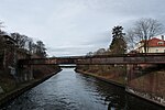
List of bridges over the Teltow Canal
The list of bridges over the Teltow Canal lists all existing and former bridges over the Teltow Canal . The 38 kilometer long, artificial federal waterway is located in the German federal states of Berlin and Brandenburg . The canal connects the Untere Havel waterway , branching off from the Potsdamer Havel with the Dahme , which belongs to the Spree-Oder waterway . It was built between 1900 and 1906.

The bridges over the canal
Construction and naming
The construction of the canal required the construction of nine railway bridges and 46 road and road bridges. There were also about ten Leinpfadbrücken that in the Treidelzeit spanned the harbor entrances and branch channels of the channel. As with the railway bridge of the Wetzlar Railway (No. 5) at Kohlhasenbrück , which was built between 1877 and 1882 , the new Teltow Canal bridges replaced some of the existing bridges, which in the former Bäkelauf in particular had led traffic routes over the river, which largely merged into the Teltow Canal.
With the exception of the Chausseestraßenbrücke Britz (Britzer Brücke, No. 41), which was built as a solid concrete bridge, all bridges were given an iron superstructure . Three different systems were used:
- Trapezoidal girders with underlying framework
- Arch support with drawstring
- Cantilever system with protruding ends.
Due to the boggy subsoil, especially in the Bäkeniederung, the concrete abutments were founded on piles up to 20 meters long. The clear height of the bridges was set to be 4 meters above the highest canal water level, their clear width was at least 20 meters.
The southern districts of Berlin through which the canal flows only became part of Greater Berlin in 1920 . Before that they were part of the Brandenburg district of Teltow , the owner of the canal. The initiator of the construction was the district administrator Ernst von Stubenrauch . One bridge was named after Stubenrauch and numerous other bridges were named after leading employees of the District Canal Commission and the Teltow Canal AG founded in 1924.
Blasted in 1945 and subsequent buildings
With one exception, all bridges were blown up by the German Wehrmacht shortly before the end of World War II during retreat battles from the Red Army . Only the Späthstrasse bridge (No. 44) in Berlin-Britz that was still in existence remained intact. The bridge, which has since become inoperative and has been detached from the Neue Späthbrücke (No. 44a), is the only historical bridge that has survived in its original form and is accordingly a listed building . The remaining bridges were successively replaced by new buildings after 1945. The towing bridges, which were also destroyed, were not replaced because the towing time of the canal ended in 1945. The towbridge over the Zehlendorfer branch canal and the middle section of the bridge over the entrance to the Berlin-Steglitz freight port , which found a new use as a pedestrian bridge as Edenkobener footbridge (No. 24), have been preserved from this time .
In the 2000s, the construction of the federal motorway 113 , which runs parallel to the canal in the eastern part , required the replacement of all bridges in this canal area to create the junctions . The new buildings were designed as modern tied arch bridges .
At the end of 2013, Deutsche Bahn announced that the railway overpass of the cemetery railway over the Teltow Canal would be demolished in a timely manner. The steel truss bridge with a span of 62 meters is no longer considered to be roadworthy.
Structure of the list
In addition to the existing and former bridges, the list summarizes pipeline bridges in a table. Only the bridges documented in the sources (literature and web links) are included. The numbering (column 1, unofficial) and kilometers (column 2) are from the Glienicker Lake between Potsdam-Babelsberg and Berlin-Wannsee to the Dahme in Grünau . The numbering follows the information on the shipping cards, with newly added bridges or replacement bridges being marked with the addition of the lowercase letter "a". Former, unnumbered bridges are listed under the capital letter "X" - with the exception of the former pipe bridge in Adlershof , which is still listed under no. 50 on shipping maps. In column 3, most of the bridges are documented in the picture. The fourth column contains the bridge names, nameless bridges in brackets and former bridges in italics . Below that are the places or Berlin districts in which they are located. The text column “Notes” gives the history and dates of the bridges and, if applicable, their former names, it also provides information about the naming. The sixth and last column links the coordinates of the structures.
List of bridges
| number | km | photography | Name of the bridge / place | Remarks | Coordinates |
|---|---|---|---|---|---|
| 1 | 00.10 |
 Park Bridge 1906 November 2009  |
Park bridge Potsdam-Babelsberg |
The Parkbrücke, sometimes also called the Parkwegbrücke zu Klein-Glienicke , is the first bridge over the "Durchstich zu Klein-Glienicke" coming from the Potsdam Havel . This short canal section connects the Glienicker Lake with the Griebnitzsee in the course of the artificial waterway to the east. | 52 ° 24 ′ 30 ″ N, 13 ° 6 ′ 4 ″ E |
| 2 | 00.25 |
 Enver Pascha Bridge 1906 |
Enver-Pascha-Bridge Potsdam-Babelsberg |
The Enver-Pascha Bridge, completed on September 3, 1901, led between Neubabelsberg and Klein-Glienicke in Potsdam-Babelsberg over the Teltow Canal. The bridge was named after Enver Pascha , a politician, general and minister of war of the Ottoman Empire . He came to Berlin in 1909 as a military attaché and lived in Klein-Glienicke for three years . The Enver Pascha Bridge was divided into a pedestrian area and a part for road traffic. During the fighting at the end of the Second World War , the bridge was blown up and - also because of the location in the border area during the time of German division - not rebuilt. Instead, a steel girder with two pipes runs over the canal at the moment (2009). | 52 ° 24 ′ 29 ″ N, 13 ° 6 ′ 12 ″ E |
| 3 | 03.55 |
 Böckmann Bridge 1906 Böckmann Bridge 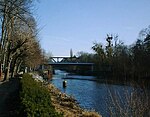 |
Böckmann Bridge Berlin-Wannsee |
The Böckmannbrücke is a road bridge that was named after the architect Wilhelm Böckmann . The bridge connects the Wannsee district of Zehlendorf with the Brandenburg state capital Potsdam as well as the districts of Steinstücke and Albrechts Teerofen . It is the first bridge over the canal in Berlin when coming from the west. The New District Road leads over the bridge. The current building was built in 1976. | 52 ° 24 ′ 0 ″ N, 13 ° 8 ′ 32 ″ E |
| 4th | 03.56 |
 S-Bahn Bridge |
(Railway bridge) Berlin-Wannsee |
The nameless bridge carries the suburban traffic of the Wannseebahn ( S-Bahn , currently line S7) over the canal at Kohlhasenbrück . | 52 ° 24 ′ 0 ″ N, 13 ° 8 ′ 33 ″ E |
| 5 | 03.64 |
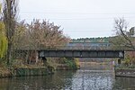 Bridge of the Wetzlar Railway |
(Railway bridge) Berlin-Wannsee |
The nameless bridge leads the long-distance traffic ( Regional Express ) of the Wetzlarer Bahn ( Kanonenbahn ) over the canal at Kohlhasenbrück . | 52 ° 23 ′ 58 "N, 13 ° 8 ′ 37" E |
| 6th | 03.78 |
 Nathan Bridge |
Nathan Bridge Berlin-Wannsee |
The Nathan Bridge leads the Königsweg over the canal and connects the Düppel forest with the Kohlhasenbrück settlement . The bridge used to be called Königswegbrücke . It bears its current name after Louis Nathan, a member of the Teltow Canal Construction Commission and a member of the Teltow District . | 52 ° 23 '56 "N, 13 ° 8' 42" E |
| X |
 Main railway bridge 1906 |
Berlin-Wannsee railway bridge |
The formerly existing railway bridge led the main line over the canal. A high embankment has been preserved from the first Prussian railway line. In a bridge from 1929, which leads Machnower Straße through the railway embankment, an annual stone was inserted from the first bridge over the Bäke. | 52 ° 23 '52 "N, 13 ° 8' 50" E | |
| X |
 Kremnitz Bridge 1906 |
Kremnitz Bridge Berlin-Wannsee / Kleinmachnow |
The Kremnitz Bridge connected Albrechts Teerofen with the Teerofenweg towards Wannsee and the Stolper Weg towards Dreilinden . After it was blown up in 1945, it was provisionally restored as a pedestrian bridge in 1948. The last rudiments of the temporary structure were removed in 1981 as part of the expansion work to reopen the canal. Like the Kremnitzufer, which still exists today, it was named after the entrepreneur and leading employee of the canal construction commission Ernst Kremnitz (1859–1908). | 52 ° 23 '48 "N, 13 ° 9' 37" E | |
| 7th | 05.45 |
 former Dreilinden motorway bridge |
(Motorway bridge) Berlin-Wannsee / Kleinmachnow |
The nameless former motorway bridge, sometimes not officially called "motorway bridge at the old checkpoint", is located between Albrechts Teerofen and Dreilinden . The highway feeder of the Reichsautobahn 51 from the AVUS to the Berliner Ring and the bridge were inaugurated in 1940. Engineer Zühlke from Niesky was the responsible site manager. The motorway is now referred to as the A 115 . It used to lead shortly behind the Zehlendorfer Kleeblatt through the Dreilinden forest and the Parforceheide . The bridge structure is a document of the division of Germany on the list of architectural monuments in Kleinmachnow in the state of Brandenburg and is used as a footpath and bike path. On the Berlin side, however, there are concerns about its use, as the bridge has long been de-dedicated as a traffic route. You enter at your own risk. The state border between Berlin and Brandenburg is exactly in the middle of the bridge. | 52 ° 23 ′ 50 ″ N, 13 ° 10 ′ 6 ″ E |
| X | 05.73 |

|
Bridge at the border crossing point Dreilinden Dreilinden / Stahnsdorf |
At this point, for example, the barricade of the former inner-German border was located in the canal. A footbridge led the GDR border guards' column route over this barrier from the Kleinmachnow side to the Stahnsdorf side of the canal. | 52 ° 23 '53 "N, 13 ° 10' 22" E |
| 8th | 06.39 |
 Bridge of the cemetery railway |
(Friedhofsbahnbrücke) Kleinmachnow / Stahnsdorf |
The unnamed bridge led the cemetery railway across the canal to the nearby south-west cemetery in Stahnsdorf . It was built together with the cemetery railway in 1913/1914. Its steel superstructure had parallel trusses with a vertical and connected intermediate truss with a span of 62 meters. The superstructure of the bridge, which had been inoperative for years, was removed in November 2018 with the help of a floating crane, the abutments initially remained. | 52 ° 23 '58 "N, 13 ° 10' 54" E |
| 9 | 06.52 |
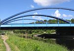 A 115 motorway bridge Construction work on the bridge. The old building is still in the background  |
(Motorway bridges) A 115 Dreilinden / Stahnsdorf |
The nameless bridges lead the federal highway 115 between Dreilinden and Stahnsdorf over the canal. They replaced the existing old motorway bridge at kilometer 05.450 near Albrechts Teerofen to the west . Today's 80 m long tied arch bridge replaced a previous building in the course of the expansion of the A 115 in the 1990s. | 52 ° 23 ′ 58 "N, 13 ° 11 ′ 3" E |
| 10 | 8.30 |
 new lock bridge in 2004 Ceremonial opening for road traffic on May 20, 2005 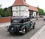 |
Lock bridge Kleinmachnow lock Kleinmachnow |
The road bridge at the bottom of the listed Kleinmachnow lock leads the Stahnsdorfer Damm over the canal and connects Kleinmachnow with Stahnsdorf . The historic bridge, built in 1904, was 77 m long and 10 m wide, 6 m of which was for the roadway and 2 m each for footpaths on both sides. According to Christian Havestadt from the construction company Havestadt & Contag, a viewing gallery should "make the details of the lock operation visible to the public [...]" . Due to the damage caused by a tanker and signs of fatigue on the abutments , the bridge was closed to vehicle traffic in 1994 and was only passable for pedestrians and cyclists. As part of the planned extension of the northern lock, a new girder bridge was built for 6.7 million euros and opened to road traffic on May 20, 2005. The length of the new bridge is 84.41 m, its passage height 5.25 m. The road gradient at the north abutment was raised by around 1.20 m, the gradient at the south abutment by around 1.50 m. | 52 ° 23 '45 "N, 13 ° 12' 29" E |
| 10a | 08.32 |
 not renovated pedestrian bridge, meanwhile removed. |
Lock bridge (pedestrian bridge) Kleinmachnow lock group Kleinmachnow |
The non-public pedestrian bridge ran directly over the lower heads of the three locks and through the historical lock structure. The section over the large lock chamber has since been removed. | 52 ° 23 '46 "N, 13 ° 12' 30" E |
| 11 | 09.64 |
 Friedensbrücke 2009 Friedensbrücke 2009 Railing part of the historic bathing bridge. In the background the Machnower See . 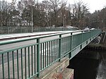  |
Friedensbrücke (Baden Baden Bridge) Kleinmachnow |
Shortly before Lake Machnower, the bridge leads the Zehlendorfer Damm over the canal. When it was completed, it was called the “bathing junction” bridge, and was built between 1904 and 1906 when the canal was built as a towing bridge with one track, which also had a carriageway and a footpath. Among other things, it was used to cross the canal by towing locomotives, as one of the locomotive sheds for servicing the electric tractors was located near the bridge. At the end of April 1945, retreating German soldiers blew up the Baden bathing bridge. After the end of the war, specialists erected a wooden construction for pedestrians over the remains of the only partially collapsed bridge, which was replaced in 1950 by a more stable emergency bridge east of the previous structure. The emergency bridge had a central pillar in the canal bed and was given the name "Friedensbrücke" by decision of the Kleinmachnow community representatives. In preparation for the reopening of the canal in 1981, a new five-meter-wide steel footbridge was built in 1977 on the pillars of the old bathing bridge. In 1994 a new girder bridge was built , which is again approved for road traffic with a load-bearing capacity of 60 tons . The Baden bathing bridge was named after the lawyer Gottfried von Badewitz (1866-1944), a deputy district administrator in the then Teltow district , who had dealt with the purchase of land, the finances and the legal provisions for the construction of the Teltow Canal. Efforts in 2006 to rename the building in bathing bridge failed. | 52 ° 23 '54 "N, 13 ° 13' 40" E |
| 12 | 10.52 |
Rammrathbrücke 1906 Replacement from 1977, as it was in 2009  |
Rammrathbrücke Teltow |
The Rammrathbrücke leads the Thomas-Müntzer-Damm / Warthestraße ( L 77 ) across the canal and connects Teltow with Kleinmachnow . The current bridge (as of 2009) was built in 1977 as a single-span girder with a span of 36.60 m and a total width of 12.50 m. “The superstructure was constructed as a steel deck bridge made of corrosion-resistant steel (weatherproof steel) KT 45-2 or KT 45-3. The main structure of the superstructure consists of two torsionally flexible main girders with an orthotropic deck. The flat-founded substructures were built using reinforced concrete. The wooden piles of the deep foundations of the old Rammrath bridge that remained in the ground were cut off around one meter below the new foundation level . ”In an appraisal by the Krebs und Kiefer engineering office in 2006, the bridge showed“ Corrosion damage to the superstructure, cracks in the roadway and sidewalk pavement, defective expansion profiles in the lane crossing construction , corroded and damaged bearings ”. The commissioning Waterways and Shipping Authority in Berlin was recommended a completely new building instead of repairs as a more economical option; the costs were estimated at around 5.55 million euros. The bridge is named after Franz Rammrath, member of the Wilmersdorfer district council member of the Teltow Canal Construction Commission. | 52 ° 24 ′ 4 "N, 13 ° 14 ′ 22" E |
| 13 | 11.20 |
 Pipeline bridge 2009 |
(Pipe bridge) Kleinmachnow / Teltow |
The steel pipeline leads to the Augustinum Kleinmachnow residential monastery , which was opened in 1997 west of the former Teltow shipyard , to the Teltow industrial area on the south bank. | 52 ° 24 ′ 16 "N, 13 ° 14 ′ 55" E |
| X | 11.40 |
 Teltow shipyard with Teltow shipyard bridge (right) and towbridge over the entrance to the construction port (left) Remaining bridge stump with rails of the towing railway 2009 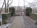 |
Teltow shipyard bridge Berlin-Zehlendorf |
The Teltow shipyard bridge was a towing railway bridge . It led the towing trains over the canal, which ran from the south bank of Teltow for maintenance to the building yard on the north bank that was set up in 1906 when the canal was built . The eponymous Teltow shipyard emerged from the building yard and the associated building port . The bridge was also used by pedestrians and cyclists. In the last days of the Second World War, it was destroyed, like almost all bridges over the canal and the operating facilities of the towing railway. During the time of the division of Germany, a temporary bridge was built a few meters west of the former bridge for the former column route of the border troops of the GDR , which was demolished in the early 1990s. Since 2002 there has been an advocacy group for the reconstruction of the Teltow shipyard bridge for better networking of the surrounding area and the adjacent Buschgraben green corridor . In the course of the construction of the Teltow harbor (marina), the reconstruction of the Teltow shipyard bridge was decided by the city council of Teltow. The project is financed by the European Fund for Regional Development (ERDF) in Brandenburg 2014–2020. The new Teltow shipyard bridge is reserved for pedestrians and cyclists. In addition, there was another towbridge over the entrance to the Teltow shipyard's construction port ( 52 ° 24 ′ 19.2 ″ N , 13 ° 14 ′ 59.7 ″ E ). | 52 ° 24 ′ 21 ″ N, 13 ° 15 ′ 10 ″ E |
| 14th | 12.72 |
 The bridge closed during the division of Germany in 1955, new Knesebeck bridge in 2009  |
Knesebeck Bridge Berlin-Zehlendorf |
The Knesebeck Bridge , which leads the Teltower Damm from the Zehlendorf location Schönow to Teltow over the canal, was built in its current form as a single-span bridge in 1990. The Teltow Canal forms the Berlin city limit to Teltow in the state of Brandenburg. The original bridge from 1906 was a truss bridge with parallel belts and a roadway below. It was torn down after the opening of the border and replaced by a permanent temporary structure. The bridge was named after Leo Wilhelm Robert Karl von dem Knesebeck , who was born in Neuruppin in 1808 and died in 1883 as a manor and district administrator. Knesebeck was also a member of the District Canal Commission. In 2007 the family unveiled a bronze plaque on the bridge in honor of Knesebeck. | 52 ° 24 ′ 15 ″ N, 13 ° 16 ′ 8 ″ E |
| X | 13.16 |
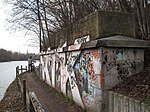 Abutment of the former bridge on the north bank of the Canal in 2009. The steeple in the background belongs to the Teltow town church St. Andreas . |
Fritz Schweitzer Bridge Berlin-Lichterfelde |
The Fritz Schweitzer Bridge , sometimes also called the Wupper Bridge, led the Wupperstrasse from Schönow to Teltow until it was blown up by the German Wehrmacht at the end of the Second World War . The remains of pillars and abutments made of red bricks have been preserved on both sides of the canal. After the failure of a first attack in the Lichterfelde area, the 1st Ukrainian Front under Marshal Konew succeeded in building the first bridge across the canal at the Fritz Schweitzer Bridge on April 24, 1945; At noon the Soviet tanks reached Zehlendorf-Süd. The bridge was named after Fritz Schweitzer, a member of the district canal commission, from the Zehlendorf community council. | 52 ° 24 ′ 18 ″ N, 13 ° 16 ′ 31 ″ E |
| 15th | 15.67 |
 Bridge in 2009 |
Eugen-Kleine-Brücke Berlin-Lichterfelde |
The single-span girder bridge from 1955 leads Wismarer Strasse over the canal. Its reinforced concrete deck rests on the upper flange of six steel solid wall girders, which are attached to the lower flanges at the level of the lower chords by riveted truss-like horizontal bracing. The bridge was named after the entrepreneur and Bergrat Eugen Kleine (* July 7, 1867, † July 31, 1928), who was buried in the Ostenfriedhof Dortmund . The bridge was at times the end point of the former tram line 71, which went into operation in 1925 ( Weißensee , Rennbahnstraße - Lichterfelde-Süd, Eugen-Kleine-Brücke). On the bridge is a memorial stone with a plaque in memory of the prisoners of the Lichterfelde subcamp of the Sachsenhausen concentration camp , which was located on Wismarer Strasse. | 52 ° 25 ′ 11 ″ N, 13 ° 18 ′ 10 ″ E |
| 16 | 16.40 |
 Bridge in 2009 |
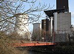
(Pipe bridge heating power station Lichterfelde) Berlin-Lichterfelde |
Nameless supply bridge of the Lichterfelde thermal power station . It is designed as a two - hut cable-stayed bridge, in which the superstructure is suspended from cables stretched at an angle by two pylons . | 52 ° 25 ′ 32 "N, 13 ° 18 ′ 26" E |
| 17th | 17.01 |
 Bridge in 2009
|
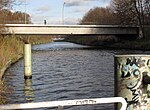
Emil Schulz Bridge Berlin-Lichterfelde |
The Emil-Schulz-Brücke leads Königsberger Strasse over the canal. The current bridge was built between 1963 and 1965 as a girder bridge in steel composite construction. It has a total length of around 65.0 m and a width between the railings of 27.61 m. The bridge structure spans a span of 47.0 m. At the end of 2007 a profitability study on the question of "repair or new construction" of the bridge was commissioned. From an economic and technical point of view, the authorities decided to repair the bridge structure. On the south side of the bridge, a towing locomotive in a glass pavilion and the bow of the “Sanssouci” barge, built in 1932, are reminiscent of the canal towing time, which ended in 1945 . The bridge bears the name of Emil Schulz, head of the district and community of Groß-Lichterfelde and member of the district canal commission. | 52 ° 25 ′ 50 ″ N, 13 ° 18 ′ 40 ″ E |
| 18th | 17.56 |
 Bäkebrücke |
Bäkebrücke Berlin-Lichterfelde |
The Bäkebrücke, which leads the Bäkestrasse across the canal, was opened on April 14, 1960. It is a riveted steel bridge with four parallel-chorded trusses. The span is 34.8 m and the width 13 m. The previous bridge was built under the name Oskar-Lange-Brücke in 1907 and destroyed in the Second World War (named after Oskar Lange [1851–1937], deputy head of the community of Lichterfelde and Berlin city council ). The bridge bears its name after the Bäkeflie , which, apart from two small remains, has risen in the Teltow Canal. | 52 ° 26 ′ 4 "N, 13 ° 18 ′ 59" E |
| 19th | 17.93 |
 Krahmersteg |
Krahmersteg Berlin-Lichterfelde |
The Krahmersteg, sometimes also spelled Kramersteg , is a pedestrian bridge over the canal. It connects the two parts of Krahmerstrasse at the Schlosspark Lichterfelde. The 61.50 m long and 8.44 m wide footbridge was built in 1959 from prestressed concrete . It consists of a single-span beam with a cantilever arm . Like the street, the footbridge bears the name of the pedagogue Adelheid Krahmer (1841–1929), 1872 founder of the Krahmer's secondary school for girls , since 1951 the Goethe secondary school . | 52 ° 26 ′ 14 "N, 13 ° 19 ′ 10" E |
| 20th | 18.87 |
 Pipe bridge in 2009 |
(Pipe bridge) Berlin-Lichterfelde |
Directly at the disused port of Steglitz, a steel construction as a pipe support leads a former district heating pipe over the canal. | 52 ° 26 ′ 39 ″ N, 13 ° 19 ′ 39 ″ E |
| 21st | 19.11 |
 Prince Regent Ludwig Bridge |
Prince Regent Ludwig Bridge Berlin-Lankwitz |
The Prinzregent-Ludwig-Brücke leads the Birkbuschstraße in Steglitz over the canal. It is a steel girder bridge and was built as a replacement in 1998/1999. It was named after the Prince Regent Ludwig . | 52 ° 26 ′ 42 "N, 13 ° 19 ′ 50" E |
| X | 19.31 |
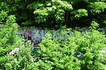 Remaining abutment of the former Kirchner Bridge on the north bank |
Kirchner Bridge Berlin-Lankwitz |
The Kirchnerbrücke was a bridge over which Nicolaistraße ran to Johanna-Stegen-Straße. It was blown up at the end of the war in 1945; American soldiers had prepared a makeshift bridge over the remains in mid-1945. | 52 ° 26 '43 "N, 13 ° 20' 1" E |
| 22nd | 19.56 |
 Hannemann Bridge 1906 |
Hannemann Bridge Berlin-Lankwitz |
The Hannemannbrücke leads the Stinde- / Leonorenstraße at Stadtpark Steglitz across the canal. It was rebuilt in its current form in 1955/56 as a steel girder bridge. The original bridge (see photo above) was a steel framework construction. It was destroyed in April 1945. The building bears the name of Adolf Hannemanns (1851–1936), treasurer of the Teltow district and long-time employee of Ernst von Stubenrauch . | 52 ° 26 '43 "N, 13 ° 20' 14" E |
| 23 | 19.73 |
 Siemens Bridge 2009 |
Siemens Bridge Berlin-Lankwitz |
The Siemens bridge is a steel girder bridge. It was built in this form in 1956/1957. It performs the Siemens road between Steglitz and Lankwitz over the canal. | 52 ° 26 ′ 42 "N, 13 ° 20 ′ 24" E |
| 24 | 20.18 |
 Edenkobener footbridge |
Edenkobener Steg Berlin-Lankwitz |
The Edenkobener Steg is a single-span riveted half-timbered construction and is a listed building. The pedestrian bridge connects Albrechtstrasse with Edenkobener Weg and the Steglitz villa colony Südende with Lankwitz . A road bridge called Karl-Lange-Brücke that used to exist at this point was destroyed in April 1945. Today's Edenkobener Steg bridged the port entrance from the Teltow Canal into the Steglitz freight port and was a towpath bridge for the towing railway. At the port facilities, bridges were built over the port entrance so that the locomotives could pull the ships past the port. After the towpath bridge was blown up in April 1945, its middle section was retained and found a new use as the Edenkobener footbridge. The footbridge is named after the climatic health resort Edenkoben on the German Wine Route . | 52 ° 26 ′ 40 "N, 13 ° 20 ′ 47" E |
| 25th | 20.42 |
 Railway bridge 2009 |
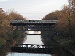
(Railway bridge) Berlin-Lankwitz |
The bridge performs the train route of the pickup path (served by line S25) via the channel. While the adjacent long-distance railway bridge (No. 25a) was completely rebuilt, the single-track suburban railway continues to use the - in the meantime refurbished - underlying supporting structure of the half-timbered construction from 1905. | 52 ° 26 ′ 38 "N, 13 ° 20 ′ 58" E |
| 25a | 20.43 |
 Railway bridge 2009 |
(Railway bridge) Berlin-Lankwitz |
The Anhalter Bahn railway runs over the bridge . The bridge, which was destroyed in the war, now consists of a completely new steel composite structure , which was erected for the first time on a double-track German DB main line as a hybrid VFT ® frame structure. “The superstructure [is] designed as a four-web open composite cross-section with a width of 10.75 m and a construction height that increases from 1.95 to 2.95 m towards the frame corners. The span is 42.6 m with a clear width of 40 m and a crossing angle of 79 gons . The bridge thus has a slimness of 22 for railway bridges. The design as a frame stiffens the superstructure and allows the high braking forces of railway bridges to be easily removed. ”The half-timbered substructure in the picture belongs to the adjacent bridge no. | 52 ° 26 ′ 38 "N, 13 ° 20 ′ 59" E |
| 26th | 20.47 |
 Bridge 2009 |
Sieversbrücke Berlin-Lankwitz |
The Sieversbrücke is a road bridge in the immediate vicinity of the port of Lankwitz. It was built in 1955 as a concrete girder bridge. The design of the bridge is also known as a cove bridge . On the bridge, Attilastraße and Kaiser-Wilhelm-Straße coming from Lankwitz meet in north-south direction. It bears the name of the government and building officer Hermann Sievers (1854–1930), managing director of the Teltow Canal Society.
Since July 2013, the bridge has been subjected to a thorough renovation that should take around two years. However, it was only released in October 2017. |
52 ° 26 ′ 40 "N, 13 ° 21 ′ 46" E |
| 27 | 21.40 |
 Bridge in 2009 |
(Railway bridge) Berlin-Tempelhof |
Bridge of the Dresdener Bahn shortly before the port of Mariendorf. The bridge lies between the S-Bahn stations Attilastraße and Marienfelde and was completed in 1906. After the bridge was blown up in May 1945, a single-track wooden structure was built as an emergency bridge , which burned down in 1947. In 1949 the easternmost and in 1954 the middle superstructure was renewed. Between 1988 and 1990 there was another renovation in the style of the old steel truss bridge. The span of the superstructures is 42 m. | 52 ° 26 '43 "N, 13 ° 20' 1" E |
| 28 | 21.44 |
 Bridge in 2009 |
Lankwitz-Mariendorfer pedestrian bridge Berlin-Tempelhof |
The pedestrian and bicycle bridge crosses the canal between the Dresden railway bridge and the former unloading port of GASAG in Berlin on the south bank of the canal. It leads a path over the waterway that runs from the S-Bahn station Attilastraße parallel to the embankment through allotment garden colonies to Lankwitzer Straße. The steel girders of the arch bridge are marked with the inscription " Königshütte ". The bridge was built between 1905 and 1906 and is a listed building. | 52 ° 26 '41 "N, 13 ° 21' 48" E |
| 29 | 21.70 |
 Teubert Bridge |
Teubert Bridge Berlin-Tempelhof |
The Teubert Bridge is a steel truss bridge with an overhead carriageway and is a listed building. It crosses the canal in the immediate vicinity of the former coal port of Berlin GASAG in Mariendorf and serves to overpass the Ringstrasse. The bridge was built in 1904–1905 and blown up at the end of the Second World War. However, it was able to be lifted after the end of the war and restored by 1948. The bridge was named after Oskar Teubert, who, as electricity director of the Brandenburg waterways, wrote several books on inland navigation and waterways and gave the name to the Oskar Teubert ship . | 52 ° 26 '46 "N, 13 ° 21' 57" E |
| 30th | 22.04 |
 Bridge in 2009 |
Techow Bridge Berlin-Tempelhof |
The Techow Bridge is a steel girder bridge. It was built in this form in 1955/1956. It leads the Gersdorfstrasse over the canal. The bridge was named after the state building officer Otto Techow , a member of the canal's construction commission. | 52 ° 26 ′ 54 ″ N, 13 ° 22 ′ 11 ″ E |
| 31 | 22.76 |
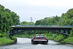 Germelmann Bridge |
Germelmann Bridge Berlin-Tempelhof |
The Germelmann Bridge is a road bridge. It was built from 1989 to 1991 as a steel arch bridge with a four-arched superstructure and an elevated hollow box system and orthotropic slab. The arches lie under the roadway. Its span is 42 m and its total length 52 m. It is 19.5 m wide. Coming from Berlin-Mariendorf , Rathausstrasse meets Alarichstrasse north of the canal in Berlin-Tempelhof on the bridge . | 52 ° 27 ′ 8 "N, 13 ° 22 ′ 41" E |
| 32 | 23.21 |
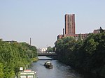 Stubenrauchbrücke shaft of underground line 6 under the eastern carriageway 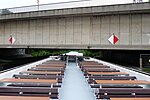 |
Stubenrauchbrücke Berlin-Tempelhof |
The Tempelhofer Stubenrauchbrücke is a beam bridge made of prestressed concrete and crosses the canal at the Tempelhof harbor and at the Ullsteinhaus . The northern part of the road bridge belongs to Tempelhofer Damm , the southern part to Mariendorfer Damm . The bridge, which was destroyed in World War II, was rebuilt in 1950. The current version dates from 1961/1964. The lanes of the 35 m wide structure are divided. Under the eastern part of the bridge on the harbor side - a double-decker bridge - there is a shaft for underground line 6 to cross the canal. In addition, part of the Ullsteinstraße underground station is integrated into the bridge . Because of the deep underground tunnel, this part of the bridge is to be raised as part of the German Unity 17 transport project. The bridge bears the name of Ernst von Stubenrauch , Teltow District Administrator and initiator of the Teltow Canal. In Berlin-Oberschöneweide over the Spree there is a second Stubenrauchbrücke named after the district administrator . | 52 ° 27 '13 "N, 13 ° 23' 4" E |
| 33 | 23.68 |
 Lorenzsteg 2007 |
(Werkbrücke) Berlin-Tempelhof |
The nameless bridge, unofficially called Werkbrücke , connects the former facilities of the C. Lorenz company and its successor Standard Elektrik Lorenz (SEL) east of the Tempelhof harbor on both sides of the canal . It mainly served the internal transport of goods and traffic. For several years now, a gate at the northern end has separated the parts of the site, which have now belonged to different owners. The steel girder bridge , built around 1920 in the form of a cove bridge, lies 11.50 m above the canal and has two lanes. Like almost all Teltow Canal bridges, the Werkbrücke, sometimes referred to as Lorenzsteg , was blown up by the Wehrmacht before the end of the war in 1945 . It was rebuilt around 1950. | 52 ° 27 '19 "N, 13 ° 23' 26" E |
| 34 | 23.96 |
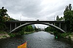 Colditz Bridge |
Colditz Bridge Berlin-Tempelhof |
The Colditz Bridge is a concrete road bridge. Colditzstrasse, which also gave it its name, runs over the bridge. The street was named after the city of Colditz in Saxony . It was built in the late 1950s after the Achenbach Bridge, which was built on this site in 1905 , was destroyed. The 12.66 m wide and 80 m long bridge (49 m span) was opened on October 20, 1958. The construction costs amounted to 520,000 DM. | 52 ° 27 '23 "N, 13 ° 23' 40" E |
| 35 | 24.38 |
 Commander Bridge |
Komturbrücke Berlin-Tempelhof |
The Komtur Bridge is a road bridge. It was built in 1976 as a steel girder bridge with hollow boxes and an orthotropic plate. On the bridge, coming from the south, Schätzelbergstrasse meets Komturstrasse coming from the north. The superior of a commandery was designated as a commander in the religious orders of knights . The bridge forms an important link between the industrial sites on the canal in Berlin-Tempelhof . | 52 ° 27 ′ 27 ″ N, 13 ° 24 ′ 0 ″ E |
| 36 | 25.18 |
 Gottlieb-Dunkel Bridge |
Gottlieb-Dunkel-Bridge Berlin-Tempelhof |
The Gottlieb-Dunkel Bridge from 1980 leads the A 100 (formerly: A 102 , junction to Gradestrasse from the Tempelhof interchange ) in several arms across the canal. The bridge of the Neukölln-Mittenwald Railway (NME) crosses the canal underneath the tall, elongated motorway bridge . The building bears the name of Tempelhof landowner and local politician Gottlieb Dark (1839-1907), the 1874-1887 voluntary community leaders of the rural community of Tempelhof was. (See also No. 38.) | 52 ° 27 '30 "N, 13 ° 24' 42" E |
| 37 | 25.21 |
 NME railway bridge with name plate and graffiti NME railway bridge and A 102 motorway bridges  |
NME railway bridge Berlin-Tempelhof |
The NME railway bridge crosses the canal below the Gottlieb-Dunkel bridge. The "Rixdorf-Mittenwalder Eisenbahn AG", which operates after the renaming of Rixdorf in Neukölln as " Neukölln-Mittenwalder Eisenbahn (NME)", built a 27-kilometer line from Mittenwalde via Brusendorf, Groß Kienitz, Selchow, Schönefeld, in 1899/1900 , Rudow, Buckow and Britz to Hermannstrasse station. On September 28, 1900 at 6:18 a.m., the first train set off from Mittenwalde to Rixdorf. On April 22, 1945 the NME bridge was blown up by the Wehrmacht . The Soviet headquarters ensured that passenger and freight traffic between Neukölln and Mittenwalde could be resumed on May 17, 1945. | 52 ° 27 '30 "N, 13 ° 24' 43" E |
| 38 | 25.23 | See the picture above for no.37 | (Motorway bridge) A 102 Berlin-Tempelhof |
Part of the Gottlieb-Dunkel-Brücke (No. 36). This arm of the bridge at the Gradestrasse junction ( A102 ) leads east of the NME railway bridge over the canal, while the arm of No. 36 spans the canal west of the NME bridge. | 52 ° 27 ′ 30 "N, 13 ° 24 ′ 44" E |
| 39 | 25.31 |
 Rixdorf-Mariendorfer Wegebrücke 1906 |
Mussehl Bridge Berlin-Tempelhof |
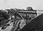
The Mussehl Bridge successively crosses the Teltow Canal and the railway line of the Neukölln-Mittenwald Railway (NME). Gottlieb-Dunkel-Straße leads over the Mussehl Bridge . The A 100 with the Gradestraße junction and the Gottlieb-Dunkel bridge runs high above the Mussehl Bridge. The first bridge was built in 1905 as a steel truss bridge under the name Rixdorf-Mariendorfer Wegebrücke (see picture). In 1947 the bridge, which had been destroyed in the war, was lifted. The current girder bridge was built between 1967 and 1970. It was named after Friedrich Mussehl (* November 23, 1855; † December 24, 1912), the head of the Tempelhof office and community and a member of the District Canal Commission. | 52 ° 27 ′ 29 "N, 13 ° 24 ′ 49" E |
| 40 | 26.26 |
 Wilhelm Borgmann Bridge |
Wilhelm Borgmann Bridge Berlin-Britz |
The Wilhelm Borgmann Bridge is a road bridge and leads the Tempelhofer Weg across the canal between the Treseburger Ufer and the Braunschweiger Ufer. A first bridge was built there in 1905 as part of the construction of the Teltow Canal. The steel girder bridge was built in 1952/1953. It was named after Wilhelm Borgmann (born September 16, 1866; † January 13, 1927), judiciary of the Teltow district , mayor of Köpenick and member of the district sewer commission. | 52 ° 27 '23 "N, 13 ° 25' 38" E |
| 41 | 26.90 |
 Chausseestrasse bridge Britz 1906 or earlier |
Britzer Bridge Berlin-Britz |
The road bridge leads the Britzer Damm (until 1950: Chausseestraße) over the canal. Since it was rebuilt in 1955/56 as a steel girder bridge, it has been called the Britzer Bridge. The previous bridge from 1906 was first called Chausseestraßenbrücke Britz and later after the statesman Moltke Friedrich-von-Moltke-Brücke . It was the only one of the historic Teltow Canal bridges that was built as a solid concrete bridge; all other bridges had an iron superstructure. It was blown up by the German Wehrmacht in a retreat in April 1945 , with eight young flak helpers losing their lives. | 52 ° 27 ′ 29 ″ N, 13 ° 26 ′ 10 ″ E |
| 42 | 27.26 |
 Rungius Bridge |
Rungius Bridge Berlin-Britz |
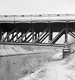
The Rungius Bridge is a road bridge. It was built as a truss bridge made of steel with an overhead roadway. The bridge was named after Heinrich Rungius (born September 27, 1833 in Luckenwalde; † May 11, 1922 in Berlin), a Protestant theologian and pastor in Rixdorf . | 52 ° 27 ′ 31 ″ N, 13 ° 26 ′ 29 ″ E |
| 43 | 27.67 |
 Bridge in 2009 View to the port of Britz Ost 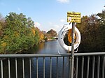 |
Buschkrug Bridge Berlin-Britz |
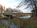
The Buschkrugbrücke is a road bridge. It was built as a concrete beam bridge . The bridge over the canal was called Schulenburgbrücke until 1950 and was named after the politician Rudolf Wilhelm Graf von der Schulenburg auf Ramstedt . On April 24, 1945, members of the SS blew up the first bridge structure. A temporary bridge was built after the war. In 1950/51 it was rebuilt in a simple construction. The bridge was given a new name on February 14, 1950, because there is also a Schulenburg bridge over the Havel in Spandau . Its new name, Buschkrugbrücke, comes from a historic inn that was mentioned as early as 1375. It is marked on a map from 1786 at the intersection of what was then Britzer Damm (later Grenzallee and Buschkrugallee). The bridge got its current appearance after extensive renovations between 1959 and 1963, when the U 7 line of the Berlin subway to Berlin-Rudow was built under the canal, exactly under the bridge. A tram drove across the bridge until 1964 . | 52 ° 27 ′ 33 "N, 13 ° 26 ′ 51" E |
| 44a | 28.80 |
 Bridge in 2009 |
New Späthbrücke Berlin-Britz |
The New Späthbrücke leads the Späthstraße between Britz and Baumschulenweg ( Späthsfelde ) over the canal. The steel tied arch bridge with a suspended bridge panel was built in 2002. The span is around 57 m. The bridge was named "New Späthbrücke" to distinguish it from the 1906 built Späthstrasse bridge . In order to connect the Späthstraße to the new A 113 , which runs parallel to the canal , the Späthstraße was relocated between Haarlemer Straße and Königsheideweg by around 700 meters to the north. Immediately following to the northeast, the “Anna-Nemitz-Brücke” leads over the motorway. The historic Späthstrasse bridge will be preserved as a listed building without being used for traffic purposes (see, also for naming, next entry). | 52 ° 27 '15 "N, 13 ° 27' 37" E |
| 44 | 29.24 |
 Bridge in 2009 Bridge in 2009  |
Späthstrasse Bridge Berlin-Britz |
The historic Späthstrasse Bridge was built as a riveted steel truss bridge with the construction of the Teltow Canal and opened in 1906. Their wingspan is 36.96 m. The 48.56 m long bridge is the only Teltow Canal bridge that was not blown up by the German Wehrmacht in 1945 and thus the only bridge over the waterway that has largely been preserved in its original state. The listed bridge led the old Späthstraße (today: "Neue Späthstraße") over the canal and connected the districts of Britz and Baumschulenweg , which were separated after the division of Berlin . After the division of the city, the connection was interrupted and the road slab was dismantled. In 1992 it was repaired again. With the construction of the A 113 it became inoperable and in 2002 it was replaced by the "New Späthbrücke" (see previous entry). Today the bridge is cordoned off by barbed wire, so it is not accessible to pedestrians either. From the west, the “Neue Späthstraße” leads to the building, there is no connection on the east side. The bridges were named after Franz Ludwig Späth , who gave the Baumschulenweg district a decisive impetus for development with the construction of the first cobbled streets, the Görlitzer Bahn stop (1891), the connection to the Ringbahn to Neukölln and the establishment of the Späth tree nursery . | 52 ° 27 ′ 4 "N, 13 ° 27 ′ 45" E |
| 45 | 30.68 |
 Bridge in 2009 |
Ernst-Keller-Bridge Berlin-Britz |
The Ernst-Keller-Brücke leads the Johannisthaler Chaussee between Britz and Baumschulenweg ( Späthsfelde ) over the canal. The steel tied arch bridge with a suspended bridge panel was built in 2004. It replaced a girder bridge built in 1993 for 2.7 million DM with a steel superstructure and orthropic plate. The replacement after only eleven years was necessary due to the new construction of the A 113 running parallel to the canal and the Johannisthaler Chaussee junction directly at the bridge. Immediately to the northeast, the “Fanny-Zobel Bridge” leads over the federal motorway. | 52 ° 26 ′ 33 "N, 13 ° 28 ′ 42" E |
| 46 | 32.34 |
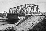 Massante Bridge 1906 Massante Bridge 2005 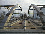 |
Massante bridge Berlin-Johannisthal / Berlin-Rudow |
The Massante Bridge is a road bridge built in 2003 at the old location at the Rudow-West harbor. It is a steel tied arch bridge with a suspended bridge panel and leads the Stubenrauchstrasse between Rudow and Johannisthal across the canal. Immediately to the east, Stubenrauchstrasse crosses the A 113 with the Herman-Gladenbeck Bridge . Friedrich Karl Massante, community leader of Rudow and member of the district canal commission, gave the bridge its name. | 52 ° 26 ′ 0 ″ N, 13 ° 29 ′ 51 ″ E |
| 47 | 34.10 |
 The bridge in 2009 pedestrian and cycle path  |
(Motorway bridge) A 113 Berlin-Rudow / Berlin-Adlershof |
The nameless bridge leads the A113 over the waterway. The federal motorway previously runs parallel to the canal to the southeast and swings on the bridge to the south in the direction of Schönefeld . The girder bridge built between 2002 and 2004 is designed as a two-span trough bridge in steel composite construction. The beams are made of steel, the deck of reinforced concrete. The total length is 149.30 m, the superstructure width 31.70 m, the bridge area 5240 m² and the field widths are between 66.50 and 82.80 m. At the level of the underside of the trough, a pedestrian and cycle path is integrated into the west side of the bridge, which lies on separate cantilever girders . The office draft was provided by the engineering office Grassl GmbH - Consulting Engineers Construction. The construction costs amounted to 12.2 million euros. | 52 ° 25 ′ 35 ″ N, 13 ° 31 ′ 13 ″ E |
| 48 | 34.14 |
Wredebrücke Berlin-Adlershof |
The Wredebrücke , also known locally as the Rudower Bridge , was a road bridge that led Rudower Chaussee (Köpenicker Straße until 1959) over the canal. This is exactly where the A 113 motorway bridge was built . The bridge was named after the banker and manufacturer Wilhelm August Julius Wrede (1822–1895), former owner of the Britz estate . | 52 ° 25 '34 "N, 13 ° 31' 12" E | |
| 49 | 34.54 |
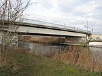 Bridge in 2009 adjacent pipeline  |
Wegedornbrücke also: Teltow Canal Bridge and (pipeline bridge ) Berlin-Adlershof |
The Wegedorn Bridge, often referred to as the Teltow Canal Bridge, leads the Wegedornstraße across the canal. The girder bridge made of prestressed concrete was built in 1989 and connects Adlershof with Altglienicke as a replacement for the defunct Wredebrücke (No. 48) . The bridge is named like the road after the buckthorn . In 2003, a new pipeline bridge with a span of 40 m was integrated into the Wegedorn bridge for 50,000 euros. The pressurized water pipe previously crossed the canal as a culvert . The consoles of the steel truss bridge are attached to the abutments of the road bridge. Your face is covered with trapezoidal sheets . | 52 ° 25 ′ 34 "N, 13 ° 31 ′ 36" E |
| 50 | 35.10 |
 The abutments of the former pipe bridge in 2009 |
Pipe bridge Berlin-Adlershof |
At Havestadtplatz there was a pipe construction over the canal. After the demolition, the pipe bridge's abutments were preserved on both banks. Havestadtplatz is located at the south exit of WISTA on Ernst-Ruska- Ufer and is reminiscent of Christian Havestadt from Havestadt & Contag , the engineering office responsible for building the Teltow Canal. | 52 ° 25 ′ 31 ″ N, 13 ° 32 ′ 31 ″ E |
| 51 | 35.78 |
 Oppenbrücke 1906 Altglienicke Bridge 2009  |
Altglienicker Bridge Berlin-Adlershof |
When the Teltow Canal was built in 1906, a steel truss bridge was built here to lead Köpenicker Strasse over the canal. This was called "Oppenbrücke", named after Hans von Oppen, the last landowner of Adlershof. At the end of the Second World War , on April 19, 1945, it was blown up. In 1949 it was lifted and repaired again and inaugurated again on October 14, 1950, now under the name Altglienicker Bridge. In 1967/68 it was repaired and reconstructed again.
In 1993 the bridge was closed due to dilapidation and has since then been inoperative and closed. It has been bypassed by the adjacent Altglienicker temporary bridge (No. 51a) since 1995. On the bridge are the rails of the former Adlershof – Altglienicke tram , which crossed the Teltow Canal here from 1909 to 1992, most recently as line 84 from Friedrichshagen, Wasserwerk to Altglienicke, Am Falkenberg. |
52 ° 25 '30 "N, 13 ° 32' 41" E |
| 51a | 35.80 |
 Altglienicker temporary bridge (in the foreground) in 2009 |
Altglienicker Bridge (USTH temporary bridge) Berlin-Adlershof |
The girder bridge was built in 1995 as a "temporary bridge (USTH)" (USTH = convertible steel high road) as a replacement for the dilapidated Altglienicker bridge (No. 51). It leads Köpenicker Straße over the canal and connects Adlershof with Altglienicke . In 2003 the temporary bridge also had to be temporarily closed because it did not have the required minimum height. Raising it by around 80 cm cost around 750,000 euros. As of 2009, there are no times when the temporary arrangement would be terminated. | 52 ° 25 '30 "N, 13 ° 32' 41" E |
| 52 | 36.45 |
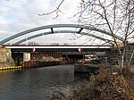 New construction of the long-distance traffic bridge, as of November 2009 |
(Railway bridge) Berlin-Adlershof |
The bridge carries the long-distance traffic of the Görlitz Railway, which went into operation in 1866, across the canal. The original steel truss bridge was built around 1906. With the complete renovation of the Baumschulenweg - Grünau section since 2007, the two adjacent railway bridges (see no. 53) were replaced by modern arched bridges . The span of the new bridges is 50 m instead of the previous 23 m, the clear height between the water surface and the bridges is 5.25 instead of 4.70 m. The construction work was carried out while the railway was largely in operation, with the trains crossing the canal on a temporary bridge right next to the eagle frame . The new bridge was opened in 2010. | 52 ° 25 ′ 33 ″ N, 13 ° 33 ′ 15 ″ E |
| 53 | 36.46 |
 S-Bahn provisional in November 2009, with bridge no. 52 behind it; View from the eagle frame |
(Railway bridge) Berlin-Adlershof |
The bridge leads the suburban tracks of the S-Bahn on the Görlitzer Bahn route across the canal. The first bridge was built in 1928 as a truss bridge with the expansion of the suburban railway to Königs Wusterhausen . Due to the renewal of the route since 2007, the old bridge was removed. The new tied arch bridge (like no. 52 above) was opened in 2010. | 52 ° 25 '33 "N, 13 ° 33' 17" E |
| 54 | 36.51 |
 Gustav Borgmann Bridge 1906 |
Stelling Janitzky Bridge Berlin-Adlershof |
The Stelling Janitzky Bridge was built in 1963 as a steel girder bridge. It leads the eagle frame ( B 96a ) over the canal. It is named after Johannes Stelling and Erich Janitzky , two victims of the National Socialist Köpenick Blood Week . In memory of the two resistance fighters, there is a plaque in the bridge railing. The previous bridge at this point was the Gustav-Borgmann-Brücke, named after Gustav Borgmann , a former mayor of Köpenick . | 52 ° 25 ′ 34 ″ N, 13 ° 33 ′ 19 ″ E |
| 55 | 37.00 |
 Bridge in 2009 |
(Railway bridge) Berlin-Adlershof |
The nameless bridge is part of the outer ring . It was built in 1984 as a steel truss bridge. The first bridge was built at this point in 1941 as a temporary measure due to the war, partly on wooden pillars, for the outer goods ring . In 1949 the bridge was renewed and replaced in 1951 by a new building for the outer ring. A massive pillar was erected in the middle of the canal - this section of the canal was closed to shipping due to the division of Germany. Due to the electrification of the railway line, this building had to be replaced by the current bridge in 1984. The remaining, now functionless river pillar of the previous bridge was only blown up in 2000 after the rehabilitation of the canal section. | 52 ° 25 '37 "N, 13 ° 33' 44" E |
| 56 | 37.72 |
 Kaiser Wilhelm Bridge 1906 |
Grünauer Bridge Berlin-Köpenick ( Köllnische Vorstadt ) |
The Grünauer Bridge is the last bridge over the canal shortly before reaching the Dahme , which is part of the Spree-Oder-Wasserstraße (SOW). With the opening of the Teltow Canal, there was a steel truss bridge at this point, which was first called Kaiser Wilhelm Bridge. This bridge was completely rebuilt as a girder bridge between 1998 and 2000. Coming from the south, Regattastraße meets Grünauer Straße, which runs north of the canal, on the bridge. | 52 ° 25 ′ 42 "N, 13 ° 34 ′ 22" E |
See also
- List of bridges in Berlin , alphabetical main list of Berlin bridges
literature
- 100 years of the Teltow Canal 1906–2006 - commemorative publication of the Federal Waterways and Shipping Administration. Wasser- und Schifffahrtsdirektion Ost (Ed.), Magdeburg 2006.
- E. Thiemann, D. Desczyk, H. Metzing: Berlin and its bridges . 1st edition. Jaron-Verlag, Berlin 2003, ISBN 3-89773-073-1
- Jan Feustel , Horst Köhler: Lifeline through swamp and sand , 100 years of the Teltow Canal . 1st edition. Hendrik Bäßler Verlag, 2006, ISBN 3-930388-36-7
- Hans-J. Uhlemann: Berlin and the Märkische waterways . transpress Verlag Berlin, various years, ISBN 3-344-00115-9
- Writings of the Association for European Inland Shipping and Waterways e. V. various years. WESKA (Western European Shipping and Harbor Calendar), Binnenschifffahrts-Verlag, Duisburg-Ruhrort, OCLC 48960431
- Folke Stender: Editing of Sportschifffahrtskarten inland 1 . Nautical Publication Verlagsgesellschaft, ISBN 3-926376-10-4 .
- W. Ciesla, H. Czesienski, W. Schlomm, K. Senzel, D. Weidner (author collective): Shipping maps of the inland waterways of the German Democratic Republic 1: 10,000, Volume 4 Publisher: Wasserstraßenaufsichtsamt der DDR, Berlin 1988 OCLC 830889996
Web links
- Overview of Berlin bridges. Senate of Berlin
- Bridges in Berlin at brueckenweb.de
- List of Berlin bridges in 1945
- Private homepage with bridges in Berlin
- Berlin bridges from A to Z on a Berlin city map
Individual evidence
- ^ Directory of the federal inland waterways serving general traffic . Federal Waterways Act (WaStrG), Annex 1 (to Section 1, Paragraph 1, No. 1 and Paragraph 5 and Section 2, Paragraph 2). See No. 57.
- ↑ a b c d e f 100 years of the Teltow Canal 1906–2006 - Festschrift of the Waterways and Shipping Administration ... , p. 51
- ↑ Jan Feustel , Horst Köhler: lifeline through swamp and sand , ... p. 33.
- ↑ a b c d e f g h 100 years of the Teltow Canal 1906–2006 - Festschrift of the Waterways and Shipping Administration ... , p. 52
- ↑ The old S-Bahn bridge over the Teltow Canal is being torn down. In: Der Tagesspiegel . September 6, 2013, accessed December 25, 2013 .
- ↑ Jan Feustel , Horst Köhler: lifeline through swamp and sand , ... p. 37.
- ↑ Kremnitzufer. In: Street name lexicon of the Luisenstädtischer Bildungsverein (near Kaupert )
- ↑ Ing.Zühlke from Niesky
- ↑ Zentralblatt der Bauverwaltung , Volume 34, No. 83 (October 17, 1914), p. 588.
- ↑ The cemetery bridge floats there. kleinmachnow.de, November 28, 2018, accessed on December 14, 2018 .
- ^ History, Kleinmachnow lock. Waterways and Shipping Office Berlin. Among other things, the Havestadt quote is taken from this source.
- ↑ Jan Feustel , Horst Köhler: lifeline through swamp and sand , ... p. 47.
- ↑ TEK100 - History, Present and Future ( Memento of the original from October 12, 2007 in the Internet Archive ) Info: The archive link was inserted automatically and has not yet been checked. Please check the original and archive link according to the instructions and then remove this notice. Information on the former bathing bridge, set up on June 2nd, 2006 on the occasion of the 100th anniversary of the Teltow Canal. Text by the home association Kleinmachnow for an information board on the bridge.
- ↑ In honor of the channel manager. To mark the 100th anniversary of the construction of the Teltow Canal, the Friedensbrücke in Kleinmachnow is to be renamed into Baden-Württemberg . In: Potsdam Latest News , June 22, 2006
- ↑ Krebs und Kiefer, Consulting Engineers for the Building Industry : Rammrath Bridge over the Teltow Canal ( Memento of the original from August 19, 2014 in the Internet Archive ) Info: The archive link was automatically inserted and not yet checked. Please check the original and archive link according to the instructions and then remove this notice. (PDF; 472 kB)
- ↑ Jan Feustel , Horst Köhler: lifeline through swamp and sand , ... pp. 57–60.
- ^ Berlin water and shipping office, Teltow Canal, history, Teltow shipyard
- ^ Zehlendorf in the course of history on www.berlin.de
- ↑ Kurt Trumpa: Zehlendorf yesterday and today . Verlag Elwert and Meurer, Berlin 1983, ISBN 3-7669-0141-9 , p. 44 (3rd revised edition; page numbers after the 2nd revised edition 1979).
- ↑ The entrepreneur Eugen Kleine in the list of honors of the Luisenstädtischer Bildungsverein
- ↑ May 11th (year 1925) in daily facts of the Luisenstädtischer Bildungsverein (at the DHM )
- ↑ Eugen-Kleine-Brücke at Ponton’s
- ^ Supply bridge for the Berlin-Lichterfelde power plant at structurae
- ↑ Jan Feustel , Horst Köhler: lifeline through swamp and sand , ... p. 71, 76
- ↑ Information about the towing locomotive in Lichterfelde
- ↑ Daily facts for April 14th (1960) in daily facts of the Luisenstädtischer Bildungsverein (at the DHM )
- ^ Name of the Oskar-Lange-Platz in Berlin-Lichterfelde on Thursday, February 15, 2007 . ( Memento of August 19, 2014 in the Internet Archive ) berlin.de, Steglitz-Zehlendorf, press release No. 039 of February 5, 2007.
- ^ Pedestrian bridges in Berlin . Senator for Building and Housing (Ed.), Berlin 1976, p. 43.
- ↑ Krahmerstrasse. In: Street name lexicon of the Luisenstädtischer Bildungsverein (near Kaupert )
- ↑ Water and Shipping Office Berlin, District Administrator Ernst von Stubenrauch
- ↑ Picture of the Siemens bridge from 1906 ( Memento of the original from July 31, 2008 in the Internet Archive ) Info: The archive link was inserted automatically and has not yet been checked. Please check the original and archive link according to the instructions and then remove this notice.
- ↑ Edenkobener footbridge & towpath bridge for towing locomotives OBJ-Doc-No .: 09065397
- ↑ 100 years of the Teltow Canal 1906–2006 - Festschrift of the Waterways and Shipping Administration ... , p. 10
- ↑ Edenkoben Way. In: Street name lexicon of the Luisenstädtischer Bildungsverein (near Kaupert )
- ↑ bsisb.de Use the menu bar to go to "Neue Anhalter Bahn".
- ↑ Route of the Anhalter Bahn over the Teltow Canal
- ↑ SCHMITT STUMPF FRÜHAUF, AND PARTNER. Ingenieurgesellschaft im Bauwesen mbH. Downloads, see information on VFT ® design.
- ↑ Victor Schmitt: Railway bridges with small and medium spans in steel composite , pp. 117, 119 ( Memento of the original from March 7, 2010 in the Internet Archive ) Info: The archive link was automatically inserted and not yet checked. Please check the original and archive link according to the instructions and then remove this notice. (PDF)
- ↑ Morgenpost article
- ↑ abendblatt-berlin.de ( page no longer available , search in web archives ) Info: The link was automatically marked as defective. Please check the link according to the instructions and then remove this notice.
- ^ The planned new Dresden railway bsisb.de
- ↑ Lankwitz-Mariendorfer pedestrian bridge OBJ-Dok-Nr .: 09055074
- ↑ Teubert Bridge OBJ-Dok-No .: 09055114
- ^ Raising of the Stubenrauchbrücke Berlin-Tempelhof. ( Memento of the original from October 27, 2007 in the Internet Archive ) Info: The archive link was inserted automatically and has not yet been checked. Please check the original and archive link according to the instructions and then remove this notice. (PDF; 142 kB) Krebs und Kiefer, planning study, 1993.
- ↑ The destroyed Lorenzsteg over the Teltow Canal in Tempelhof. German Historical Museum
- ↑ C Rep. 109 No. 221: Record of destroyed bridges . ( Memento of the original from April 30, 2016 in the Internet Archive ) Info: The archive link was inserted automatically and has not yet been checked. Please check the original and archive link according to the instructions and then remove this notice. State Archive Berlin (PDF)
- ^ Michael Thiele: The company C. Lorenz . In: Tempelhof District Office of Berlin (ed.): From iron to pralines, Tempelhof and its industry , book accompanying the exhibition, p. 117. No year, the exhibition took place in November 2000.
- ^ Berlin Chronicle of the Landesarchiv Berlin Date: October 20, 1958
- ↑ Mussehlstrasse. In: Street name lexicon of the Luisenstädtischer Bildungsverein (near Kaupert )
- ↑ 100 years of the Teltow Canal 1906–2006 - Festschrift of the Waterways and Shipping Administration ... , p. 11, 52
- ↑ Chausseestrasse . In: Street name lexicon of the Luisenstädtischer Bildungsverein
- ↑ 100 years of the Teltow Canal 1906–2006 - Festschrift of the Waterways and Shipping Administration…, map in the appendix.
- ↑ Citizens' Association Berlin-Britz ( Memento of the original from July 15, 2009 in the Internet Archive ) Info: The archive link was inserted automatically and has not yet been checked. Please check the original and archive link according to the instructions and then remove this notice. See entry on Britzer Bridge.
- ↑ Page no longer available , search in web archives: Senseless death of young flak helpers in Neukölln - Sunflower campaign recalls the tragic events of the last days of the war on the Teltow Canal . Berlin.de, Neukölln, press release from May 23, 2005
- ↑ Berlin's southern shores / city history on Neukölln canals . Berliner Geschichtswerkstatt e. V., Berlin 1988, p. 42.
- ↑ The subway under the Buschkrugbrücke ( Memento of the original from September 23, 2015 in the Internet Archive ) Info: The archive link was inserted automatically and has not yet been checked. Please check the original and archive link according to the instructions and then remove this notice.
- ↑ Monument Späthstrasse Bridge
- ↑ Ernst-Keller-Brücke (1993) at structurae
- ↑ Ernst-Keller-Brücke (1993). ( Memento of March 17, 2007 in the Internet Archive ) Senate Department for Urban Development
- ↑ Traffic restrictions due to the relocation of the Ernst-Keller-Brücke in the course of the Johannisthaler Chaussee. Senate Department for Urban Development, press box November 2003
- ↑ Friedrich Karl Massante in honor directory of Luisenstädtischer Education Association
- ↑ A113-Teltow Canal Bridge at Structurae
- ↑ Photo of the Wredebrücke ( Memento of the original dated December 3, 2015 in the Internet Archive ) Info: The archive link was inserted automatically and has not yet been checked. Please check the original and archive link according to the instructions and then remove this notice.
- ↑ History of Britz Castle with mention of Wrede ( Memento of the original from January 13, 2010 in the Internet Archive ) Info: The archive link has been inserted automatically and has not yet been checked. Please check the original and archive link according to the instructions and then remove this notice.
- ↑ Map K5 of the Berlin surveying office For example, map K5 (1: 5000) describes the Wegedorn Bridge as the Teltow Canal Bridge (call up the map in the right column and select a section). The WESKA (see literature), however, speaks of the Wegedorn Bridge.
- ↑ Wegedornstrasse. In: Street name lexicon of the Luisenstädtischer Bildungsverein (near Kaupert )
- ↑ Plass Ingenieure, reference page ( Memento of the original from June 2, 2009 in the Internet Archive ) Info: The archive link was inserted automatically and has not yet been checked. Please check the original and archive link according to the instructions and then remove this notice. New construction of a pipeline bridge.
- ↑ The Oppen Bridge on a map from the 1940s
- ↑ Oppenstrasse . In: Street name lexicon of the Luisenstädtischer Bildungsverein
- ↑ a b History of the tram in Altglienicke
- ↑ Map Altglienicker Bridge Teltow Canal
- ↑ FDP parliamentary group Berlin ( page no longer available , search in web archives ) Info: The link was automatically marked as defective. Please check the link according to the instructions and then remove this notice. Volker Thiel: Waste of tax money in Treptow-Köpenick. Small question in the Berlin House of Representatives , November 5, 2004.
- ^ Berlin Waterways and Shipping Office Altglienicker makeshift bridge.
- ↑ a b Berlin-Görlitzer Eisenbahn New construction of the bridges over the Teltow Canal
- ↑ a b The bridges of the Görlitzer Bahn . (PDF; 460 kB) S-Bahn Berlin, construction information, p. 2
- ↑ Jan Feustel , Horst Köhler: lifeline through swamp and sand , ... p. 121f.
- ^ EÜ of the BAR in the SO section / Teltow Canal in the bridge web
- ↑ Grünauer Brücke 1908. ( Page no longer available , search in web archives ) Info: The link was automatically marked as defective. Please check the link according to the instructions and then remove this notice. In: Märkische Allgemeine


