List of bridges in Berlin / M
Explanation
- (Sample bridge ) = in brackets : unnamed bridges.
- Sample bridge = in italics : former bridges. (See in detail: Structure of the lists )
| photography | Name of the bridge | District | Remarks | location |
|---|---|---|---|---|

|
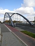
Mäckeritz Bridge | Charlottenburg-North | The Mäckeritzbrücke leads in the northern extension of the Jungfernheideweg over the Berlin-Spandau shipping canal and merges into the street An der Mäckeritzbrücke. | cards |

|
March Bridge | Charlottenburg | The landmarked Marchbrücke crosses the Landwehr Canal and connects Marchstrasse with Franklinstrasse. The stone road bridge dates from 1911/12 and is equipped with a historic tower house and a sandstone portal to the footpath on the canal. It was built according to designs by Heinrich Seeling and August Bredtschneider . | cards |
|
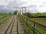
Margaret Bridge | Malchow / Wartenberg | The Margaret Bridge serves as a pedestrian overpass over the northern Berlin outer ring . The bridge was built in 1991-1992. It consists of trusses that are suspended from two pylons . | cards |
|
Marggraff Bridge | Baumschulenweg | The Marggraff Bridge leads the Köpenicker Landstrasse over the Britzer connecting canal . | cards |
| Mariannenbrücke | Rahnsdorf | The Mariannenbrücke is a pedestrian bridge in the course of the Mariannensteig, which leads over Canal I in New Venice . | cards | |

|
Marie-Elisabeth-Lüders-Steg | center | The Spree crossing, known as Marie-Elisabeth-Lüders-Steg, is a public pedestrian bridge between the new parliament buildings Marie-Elisabeth-Lüders-Haus (MEL) and Paul-Löbe-Haus (PLH) in the Mitte district . The building has not yet been given an official name, it is also called "lower bridge" by the employees of the company. It spans the Spree in a gentle arc. | cards |
| Märkische Allee bridges | Marzahn | The bridges were opened to traffic in 1979. They lead the Märkische Allee with the B 158 in the southern part over the inlets and outlets of the Prussian Ostbahn to the Biesdorfer Kreuz . The 25 meter wide road bridge has four lanes and two footpaths. It spans the two track systems with two bridge structures of 130 m (northern part over four tracks) and 40 m (over two tracks) and an intermediate base (60 × 80 m²). Since the road area of Märkische Allee belongs to Marzahn in its entirety, the railway bridges are in this district. | cards | |
| Märkische Allee road bridge | Marzahn | The 36 m long and 21 m wide road bridge, which is not officially named, connects the southern carriageway of the Alt-Friedrichsfelde road with the Märkische Allee that begins here and leads northwards . It was created in connection with the expansion of the Alt-Friedrichsfelde street and the construction of the new development areas in Marzahn. There are no footbridges next to the 16 m wide carriageway. The driveway turning in from the south including the ramp belongs to the district of Biesdorf . The bridge structure, including the road leading northwards, belongs to the Marzahn district, while the district boundary is on the eastern edge of the bridge and road. | cards | |

|
Marshal Bridge | center | The Marschallbrücke is a bridge over the Spree that connects Luisenstrasse with Wilhelmstrasse . The current construction is based on a structure from the years 1881/1882. | cards |

|
Marx-Engels Bridge | center | see Schloßbrücke (Berlin-Mitte) | |
 |
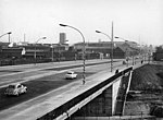
Marzahn bridges | Marzahn | The Marzahn bridges are a road bridge complex completed in 1977 along Landsberger Allee in the Berlin district of Marzahn-Hellersdorf . Three parallel pairs of bridges cross two separate track systems ( Berlin outer ring and Wriezener Bahn ) with Frank-Schweitzer-Strasse running in between and Märkische Allee , a section of Bundesstrasse 158 . The upper picture shows the entire complex, the lower one the area above Frank-Schweitzer-Strasse. | cards |
|
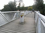
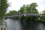
Maselake bascule bridge | Hook field | The bascule bridge is a pedestrian and cyclist bridge over the Maselake Bay . It consists of 3 fields. The middle field was constructed as a bascule bridge to ensure access to the port of Maselake Bay. | cards |
|
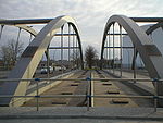
Maselake Canal Footbridge | Hook field | The pedestrian and cyclist bridge leads over the Maselake Canal . It was created in connection with the design of the 20 main green paths in Spandau in 2013. | cards |
|
Massante Bridge | Rudow | Today's Massante bridge is a road bridge at the port of Rudow-West over the Teltow Canal at kilometer 32.34 of the artificial waterway. It was built as a steel tied arch bridge with a suspended bridge panel in 2003. It leads the Stubenrauchstrasse between Rudow and Johannisthal across the canal. Immediately to the east, Stubenrauchstrasse crosses the A 113 with the Herman-Gladenbeck Bridge . Friedrich Karl Massante, community leader of Rudow and member of the district canal commission, gave the bridge its name. | cards |

|
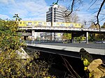
Mauerweg Bridge | Heiligensee | The bridge leads the Berlin Wall Trail over the federal highway 111 at the former transit border crossing Heiligensee. Until 1979 it spanned Tauentzienstrasse at the Europa-Center . | cards |
|
Mehring Bridge | Kreuzberg | The prestressed concrete - girder bridge carries the road train Mehringdamm / Wilhelmstrasse on the Landwehr canal and Tempelhof connects the shore with the hall Ufer. The six-lane and heavily frequented road bridge was only built between 1968 and 1974, there was no previous bridge at this point. It bears the name of the publicist and politician Franz Mehring . Between 1947 and 1974 the Hallesche-Tor-Brücke was called Mehringbrücke. | cards |
| Melanchthon Bridge | Kreuzberg | It is a former road bridge over the Landwehr Canal from the south bank to the loading island of the urban port, which is also no longer available . The bridge was blown away during the extension of the Urbank Hospital in 1957. | ||

|
Melchior Bridge | Kreuzberg | This bridge over the Luisenstadt Canal was built around 1880 and led Melchiorstrasse across the water. It connected the Engelufer with the Bethanien / Mariannenufer. At that time, the street and bridge belonged to Old Berlin and the district 138. | |

|
Messedammbrücke | West end | The Messedammbrücke leads the Messedamm over the Messegleis, the Spandauer Vorortbahn , the Ruhlebener connecting railway and the Cordesstraße. The Messedammbrücke provides access to the Messe Süd S-Bahn station . | cards |

|
Michael Bridge | Friedrichshain / center | The Michaelbrücke is a fixed Spree crossing that replaces the first bridge from the end of the 19th century. It connects the Luisenstadt in the district of Mitte with Friedrichshain . | cards |

|
Minna-Todenhagen Bridge | Oberschöneweide | The Minna-Todenhagen Bridge connects the Rummelsburger Landstrasse / Rummelsburger Strasse in Oberschöneweide with the Köpenicker Landstrasse in Niederschöneweide . It opened in December 2017. The composite steel bridge is 420 m long and, including the cycle paths and footpaths, is 28.80 m wide. | cards |

|
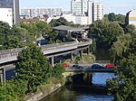
Moabit Bridge | Moabit / Hansaviertel | The Moabiter Bridge is a stone bridge that connects the districts of Hansaviertel and Moabit . The bridge forms the transition between Bartningallee and Kirchstrasse and leads over the Spree . Because of the bear sculptures that existed again up until the Second World War and since 1981, it is also known as the Bear Bridge . | cards |
|
Möckern Bridge | Kreuzberg | The Möckernbrücke in the Friedrichshain-Kreuzberg district leads Möckernstrasse between Halleschem Ufer and Tempelhofer Ufer over the Landwehr Canal ; it in turn is crossed by the viaduct of the subway. | cards |
| Modersohn Bridge | Friedrichshain | The bridge was built in 1913 and 1914 as Hohenlohebrücke by the Royal Railway Directorate in Berlin . It leads the (today's) Modersohnstraße over the multi-track Berlin Stadtbahn . In 1951 the bridge was renamed together with Hohenlohestrasse after it had survived the Second World War almost unscathed. Between 1999 and 2000 there was a temporary pedestrian bridge here. From 2000 to 2002 the new construction was carried out as a tied arch bridge with a length of 71.09 and a width of 20.36 meters. The design was done by the Berlin architect Hans-Günther Rogalla. | cards | |
| Mohren Bridge | Old Berlin | It leads over the fortress moat , along Mohrenstrasse ; the Moorish colonnades were set up on both sides as a boundary to hide the view into the sewer. | ||
|
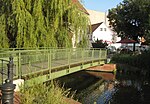
Möllentorsteg | Spandau | Foot and cycle bridge over the Mühlengraben, connects the Wröhmännerpark with the old town of Spandau . Built in 1957 as a reinforced concrete bridge and demolished and rebuilt between 2008 and 2011 due to considerable damage. The bridge is part of the Havel cycle path | cards |

|
Moltke Bridge | Moabit / Tiergarten | The Moltkebrücke is a road bridge with a load-bearing steel structure on stone pillars and crosses the Spree in the Mitte district . The bridge, veneered with red sandstone, connects the Willy-Brandt-Straße running over it with the Alt-Moabit street and thus the government and parliament district in the Spreebogen in the Tiergarten district with the Moabiter Werder and the main train station in the Moabit district . The area of the Federal Chancellery connects directly to the south-western end of the bridge . The Moltkebrücke is a listed building . | cards |
|
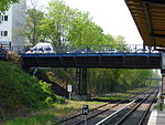
Moltkestrasse Bridge | Lichterfelde | The Moltkestraße bridge leads the Enzianstraße / Moltkestraße over the main line . From the bridge there is access to the Botanischer Garten S-Bahn station . | cards |

|
Monbijou Bridge | center | The listed Monbijoubrücke was built between 1902 and 1904 over both arms of the Spree and connects Monbijoustraße over the tip of Museum Island with Am Kupfergraben street . The northern part of the double bridge was built as a reconstruction in 2006 after years of temporary work. | cards |
 
|
Monument bridge | Schöneberg | The road bridge equipped with bollards leads Monumentenstraße over the wide routes of the north-south long-distance railway and the Anhalter Vorortbahn (S-Bahn). It lies on the border with Kreuzberg and forms an eastern exit of the Rote Insel, which is surrounded by railway tracks . The listed steel girder bridge was built in 1929/30 according to designs by Carl and Ewald Usinger. It is named after the "Monument" (= national monument ) on the Kreuzberg, which is in the focal point of the street. Due to the visible routes, the bridge is a popular meeting point for railway enthusiasts to take photos of ICE test drives or the museum trains of the technology museum , which uses an old railway hall on the bridge as a depot for municipal transport .
|
cards |

|
Moritz Bridge | Spandau | The Moritzbrücke is a massive stone arch bridge from 1893/1895 and spans the Mühlengraben, which bordered the city wall of Alt-Spandau . It leads Moritzstrasse over the ditch. The bridge and street name goes back to the Moritzkirche, which was demolished in 1920. | cards |
|
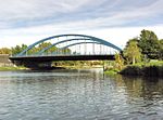
Mörsch Bridge | Charlottenburg | The Mörschbrücke is a road bridge over the Westhafen Canal and crosses the canal immediately before it flows into the Spree. The Tegeler Weg leads over the bridge . The Jakob-Kaiser-Platz , the Berlin-Jungfernheide train station and the Charlottenburg Palace Gardens are all nearby . The bridge is named after the civil engineer Emil Mörsch , a pioneer of reinforced concrete construction. | cards |
 
|
(Museum Island) (railway bridge), southern and northern part | center | The bridge leading from southwest to northeast across Museum Island carries the tracks of the Berlin Stadtbahn (S-Bahn and long-distance train). It bridges the Kupfergraben and the Spree in two parts . It is a multi-arched stone and steel structure that runs on the rampart of the former city wall. The total length is around 260 m; the part reaching over the northern arm of the Spree is 67 m long, the southern part is approx. 49 m long. The construction has a total width of around 22 m. | cards |
|
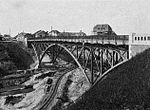
Mussehl Bridge | Tempelhof | The Mussehl Bridge crosses the Teltow Canal (kilometer 25.31) and the railway line of the Neukölln-Mittenwalder Railway (NME). Gottlieb-Dunkel-Straße leads over the Mussehl Bridge . The A 100 with the Gradestraße junction and the Gottlieb-Dunkel bridge runs high over the Mussehl Bridge. The first bridge was built in 1906 as a steel truss bridge (see picture) under the name "Rixdorf-Mariendorfer Wegebrücke". The current girder bridge was built between 1967 and 1970. It was named after Friedrich Mussehl (* November 23, 1855; † December 24, 1912), the head of the Tempelhof office and community and a member of the District Canal Commission. | cards |
| Mühlendamm Bridge | center | The Mühlendammbrücke is a stretch of road that crosses the Spree between Gertraudenstrasse and Molkenmarkt . The history of its origins is related to its location on a trade route between the Barnim and the Teltow , which crossed the Spree River at this narrow and flat point. In the 13th century, a stick dam was built in the ford to connect the places Cölln and old Berlin , where mills used water power. The dam was named Mühlendamm . Frequent changes to the crossing of the Spree were made via the other stations of the system of a weir, a lock and a development. Today's prestressed concrete bridge dates from 1968 and is part of the east-west road connection in Berlin city center. | cards | |

|
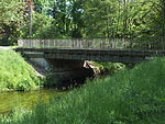
Mill bridge | Tegel | The Mühlensteg connects the Humboldt Island in the northeast with the mainland. The steel framework construction is reserved for pedestrians and cyclists. Its name is derived from the mill moat that the footbridge spans. It is about 25 meters long, about 2.30 meters wide, the middle section can be opened by means of a load arm for technical reasons, when closed the headroom at mean water is 2.20 meters. | cards |
|
Mühlenstrasse Bridge | Friedrichshagen | This bridge leads the Mühlenstraße, located in the north of the Köpenick district, over the Neuenhagener Mühlenfließ , also known as Erpe . It is about 23 meters long and 5 meters wide. | cards |
Literature and web links
Individual evidence
- ↑ Entry in the Berlin State Monument List
- ^ Information from an employee of the German Bundestag from June 2009
- ↑ Märkische-Allee-Brücken FIS broker (map of Berlin 1: 5000 (K5 color edition)) of the Berlin Senate Department for Urban Development and Environment
- ^ Connection to Märkische Allee / Alt-Friedrichsfelde FIS Broker (map of Berlin 1: 5000 (K5 color edition)) of the Berlin Senate Department for Urban Development and Environment
- ↑ Friedrich Karl Massante in honor directory of Luisenstädtischer Education Association
- ↑ a b 100 years of the Teltow Canal 1906–2006 - commemorative publication of the Federal Waterways and Shipping Administration. Wasser- und Schifffahrtsdirektion Ost, Magdeburg 2006, p. 52
- ↑ Mehring Bridge . In: District lexicon of the Luisenstädtischer Bildungsverein . However, the information about the naming between 1947 and 1974 contradicts the entry under Hallesche-Tor-Brücke in the same district lexicon.
- ↑ Details and photo of the “Fischfang” statue. ( Memento of the original from August 8, 2010 in the Internet Archive ) Info: The archive link was inserted automatically and has not yet been checked. Please check the original and archive link according to the instructions and then remove this notice. Database sculpture in Berlin ; Retrieved October 30, 2009
- ↑ Melchiorbrücke, Melchiorstrasse . In: Berliner Adreßbuch , 1907, T. III, p. 524.
- ↑ Streets and Squares . In: General housing indicator for Berlin, Charlottenburg and surroundings , 1855, part 5, p. 339.
- ↑ Entry in the Berlin State Monument List
- ↑ Monumentenstrasse. In: Street name lexicon of the Luisenstädtischer Bildungsverein (near Kaupert )
- ↑ Please get in and close the doors! Museum rail traffic on Whit Saturday (June 3) and on Railway Worker's Day (June 10) between the German Museum of Technology in Berlin and the depot for municipal transport.
- ↑ New marking directs cyclists into car traffic. Retrieved March 2, 2019 .
- ↑ Senate failure to construction of cycling infrastructure. In: Bicycle referendum. Accessed March 2, 2019 (German).
- ↑ Moritzbrücke in the bridge web
- ↑ Moritzstrasse. In: Street name lexicon of the Luisenstädtischer Bildungsverein (near Kaupert )
- ↑ Mussehlstrasse. In: Street name lexicon of the Luisenstädtischer Bildungsverein (near Kaupert )
- ↑ Hansjürgen Vahldiek: Mühlendamm and Fischerbrücke . diegeschichteberlins.de
- ↑ Dimensions of the mill bridge estimated from Google Earth. The folding mechanism and the clearance height can be seen on Structurae : structurae.de .


