List of bridges in Berlin / F
Explanation
- (Sample bridge ) = in brackets : unnamed bridges.
- Sample bridge = in italics : former bridges. (See in detail: Structure of the lists )
| photography | Name of the bridge | District | Remarks | location |
|---|---|---|---|---|

|
Fabeckstrasse Bridge | Dahlem | The Fabeckstrasse bridge leads Fabeckstrasse over the subway line U3 running in an incision . There is a lift from Fabeckstraße to the Dahlem-Dorf underground station . | cards |
|
Fahlenberg Bridge New Fahlenberg Bridge |
Müggelheim | The Neue Fahlenbergbrücke is a road bridge over the Gosen Canal at kilometer 3.41 of the artificial waterway. It leads the Gosener Landstrasse between Müggelheim and Gosen over the canal. | cards |

|
Falkenberger Bridge | Neu-Hohenschönhausen | The road bridge at the Hohenschönhausen S-Bahn station consists of three parallel bridge parts. It leads the Falkenberger Chaussee in two separate lanes over the S-Bahn station Hohenschönhausen and the track systems as well as the Wartenberger Straße running next to it. In addition, the tram lines M4 and M17 run over the middle section of the approximately 125 m long and 40 m wide bridge. | cards |

|
Fanny Sable Bridge | Baumschulenweg | The Fanny-Zobel-Bridge leads the Johannisthaler Chaussee over the city motorway A 113 . The single-span steel composite deck bridge was completed in 2004, like the neighboring Ernst Keller Bridge, which spans the Teltow Canal , which runs parallel to the motorway ( tied arch bridge in the background). The bridge is named after the DDP politician Fanny Zobel, who was expelled by the National Socialists . | cards |
 
|
Fenn Bridge | Moabit | The Fennbrücke is a road bridge over the Berlin-Spandauer Schifffahrtskanal at kilometer 10.20 of the artificial waterway. Perleberger Strasse and Fennstrasse meet on the bridge between Wedding and Tiergarten. With the construction of the Berlin-Spandau shipping canal in 1859, a wooden bascule bridge with a passage width of about 7.5 m was built here in the immediate vicinity of the northern port. It was widened in 1886 because it no longer met the requirements of the growing traffic, demolished in 1895 and replaced by a stone bridge in the same year. This was named Fennbrücke after Fennstrasse. The name refers to the swampy origin of the area. During the Second World War, the bridge (in the picture above, status 1896) was destroyed. In the years 1950 to 1952 it was rebuilt as an unadorned prestressed concrete bridge (lower picture, in the arch of the railway bridge). | cards |

|
Fennpfuhl Bridge | Fennpfuhl | The Fennpfuhlbrücke is a pedestrian bridge over the waterway between Fennpfuhl and Langpfuhl in the Berlin-Fennpfuhl district in the middle of the Fennpfuhl Park . It provides access to the district center Anton-Saefkow-Platz and the sports hall Anton-Saefkow-Platz from the east from the Weißenseer Weg area . | cards |

|
Feuerbach Bridge | Steglitz | The Feuerbachbrücke leads the Feuerbachstraße over the tracks of the main railway and Wannseebahn . An elevator can be used from the bridge to access the Feuerbachstrasse S-Bahn station . The previous building was called the Black Bridge . | cards |
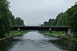
| Finkenweg Bridge | Rahnsdorf ( New Venice ) | The steel composite structure, erected in 1994, has banister decorations with stylized birds. It leads the Finkenweg over Canal VI. | cards | |
|
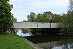
Finsterwalder Bridge | Märkisches Viertel | The bridge leads Finsterwalder Strasse over the Seggeluch basin. | cards |

|
Fischgrundbrücke | Frohnau | The Fischgrundbrücke leads the Kreuzritterstrasse / Im Fischgrund street over the Berlin Northern Railway . As early as the early 1900s there was a three-meter-wide black bridge with several leaks and defects, so in February 1909 it was proposed to replace it with a 15-meter-wide bridge. “The newly built 'Black Bridge' will be opened on Saturday [7. May 1910] released for traffic, […] ”. There was a legend about this bridge: "If you walk over this bridge and have lied, you break your leg", which is why the term bridge of lies was used. Until April 11, 1986, the bridge was called the Kreuzritterbrücke , since the Kreuzritterstrasse led to Burgfrauenstrasse. | cards |

|
Flaischlenbrücke | Karow | The Flaischlenbrücke consists of three parallel railway bridges that cross the Pankewanderweg, which is partly on Krontaler Straße, and the Panke . The southeastern one is about 17 m from the other two railway bridges and has a footpath. The bridge lengths are on average 19 m, the widths 12 m and 4.2 m. | cards |

|
Flato avenue bridge | West end | The bridge leads the Flatowallee just before the south gate of the Olympic Stadium over the tracks of the Spandau suburban railway . The 47 m long and 36 m wide reinforced concrete structure dates from 1979. It has four lanes each, a wide median and wide sidewalks. Four lamps about 15 m high illuminate the building, which is equipped with simply decorated wrought iron railings. The eastern bridgehead forms the access to the reception hall (pictured) of the Olympiastadion S-Bahn station, which is heavily frequented during major events . The previous bridge was built in 1936 as the Reichssportfeldbrücke (number 7384). After massive public pressure with corresponding parliamentary questions in the House of Representatives , Reichssportfeldstrasse was renamed Flatowallee on February 21, 1997 and the bridge was renamed Flatowallee on March 4, 1997. They were named after the Jewish gymnasts Alfred and Gustav Felix Flatow , who were murdered in the Theresienstadt concentration camp . | cards |

|
Flow bridge | Tegel | The "bridge over the Tegeler Fließ" (street number 7409) was renamed on May 10, 1990 in Fließbrücke (7475). In Tegel it leads the Karolinenstraße over the Tegeler Fließ . With a length of 18 meters, the bridge leads over the 7-meter-wide fluidized bed; it is 40 meters wide due to the two-lane road with median strips and wide sidewalks. A short distance from the river bridge, 40 meters below, is the 12-meter-wide nameless bridge on the street An der Mühle , which runs 15 meters below the mill building. To the south of the river bridge, a 39 meter wide nameless bridge leads Berliner Straße over the north ditch . The Humboldt Path (number 10 of the 20 “Green Main Paths”) in the east of the Tegeler Hafen (Tegeler See) from Gabrielenstrasse over the 15 meter long Gabrielensteg (17212) to Humboldt Island . The 15 meter long Mühlensteg (17211) leads from the Humboldt Island in the harbor area over the Südfließ to the Tegeler Hafen. To the south, the 13-meter-long Karolinensteg (17210) connects over the north ditch and the 24-meter-long Wilhelmsteg (17208) to the Tegeler Insel . From the east bank of the 32 meter long Alexandersteg (17207) leads to the pedestrian area on the south bank of the Tegeler Hafen and to the street Am Tegeler Hafen , on the west side of the Tegeler Insel the 13 meter long Georgsteg (17209) leads to the south bank. | cards |

|
Flow bridge at the swimming pool | Hermsdorf | The street Am Freibad crosses the Tegeler Fließ. | cards |

|
Artemisstrasse river bridge | Huntsmanship | The bridge leads the Artemisstraße over the Tegeler Fließ. | cards |
| Flow bridge (Erpe) | Friedrichshagen | The bridge (number in the regional reference system (RBS) 49621) leads in the LSG Erpetal a foot, bike and hiking path over the Neuenhagener Mühlenfließ . It connects the road Hinter dem Kurpark ( KGA Am Kurpark) with the garden properties north-west of the Erpe and the meadow path in the Erpetal colony. The length of this three-meter-wide bridge between the riverside paths is 17 meters, the length of the actual bridging of the five to six-wide river nine meters. | cards | |

|
Flow bridge on the embankment | Huntsmanship | The footbridge crosses the Tegeler Fließ near the embankment of the northern railway. | cards |

|
Foehrer Bridge | Moabit | The bridge runs along the Putlitzstrasse – An der Putlitzbrücke – Föhrer Strasse north of the Westhafen over the Berlin-Spandau shipping canal and connects the north bank with Friedrich-Krause-Strasse. Like the street, it bears the name of the North Frisian island of Föhr . The upper picture shows a bridge detail from 1912, the lower one the southern part of the bridge in 2010. | cards |
| Frankfurt Bridge | Biesdorf | The Frankfurter Brücke leads the Alt-Biesdorf road along the B 1 / B 5 federal road over the Wuhle . | cards | |
| Frauentogbrücke | Koepenick | The Frauentogbrücke leads the Müggelheimer Straße over the Kietzgraben. | cards | |

|
Frey Bridge | Wilhelmstadt | The Frey bridge is a steel - arch bridge over the 60-meter-wide Havel and Havelseenweg in the Spandau district Wilhelmstadt . The listed bridge from the years 1908/1909 is part of the highway ( Federal Straße 2 / 5 ) and connects Pichelsdorf with the Pichelswerder . With 50,000 cars crossing this bridge every day, it is an important link between Spandau and downtown Berlin. During an audit in 2008, the condition was identified as ailing. In 2014, the bridge was therefore closed to trucks and buses with a total weight of more than 18 tons and a speed limit of 30 km / h. In May 2014, two replacement bridges were pulled in, which were then connected to the Heerstraße roadways by approach bridges. “Because the 100-year-old Frey Bridge in Spandau is ailing, the police have blocked truck traffic there. BVG buses are also no longer allowed to use the bridge. ”The old bridge will be demolished and rebuilt. In addition to the traffic on the bridge, there are electricity, water and telecommunications lines under the bridge, which are important for the supply of Spandau. The new building is part of the German Unity Transport Project No. 17 (waterway connection Hanover-Magdeburg-Berlin). For the entire traffic construction on the bridge, 33 million euros are planned, of which the State of Berlin is contributing 5.4 million euros. Of this, nine million euros are required for the two replacement bridges and their connection. | cards |

|
Friedenauer bridge | Schöneberg | The Friedenauer Brücke leads the Saarstrasse over the main line and the A 103 city motorway . | cards |

|
Friedensweg Bridge | French Buchholz / Rosenthal | The Friedenswegbrücke is a pedestrian bridge over the north ditch . It is named after the Friedensweg, today the Anlagenweg on the Rosenthaler side, which had a connection to today's Nisbléstraße before the north ditch was created. It lies with the north end in the area of French Buchholz and with the south end in Niederschönhausen . The district boundaries within the Pankow district change over the northern trench, so the southern part of the bridge between the southern bridgehead (in Rosenthal) and the middle of the northern trench belongs to Blankenburg . The bank area is determined by the edge of the north trench, which is about 10 meters deep. Due to this location, the bridge over the 5-meter-wide north trench is 44 meters long and has a useful width of 3 meters. Over this bridge, the Humboldt-Spur (No. 16) changes from the system of 20 main hiking trails in Berlin from the south-eastern route in French Buchholz over the north ditch to the north-west route in Rosenthal. | cards |

|
Friedrich Gerlach Bridge | Schöneberg | The Friedrich-Gerlach-Brücke leads the Sachsendamm over a preliminary construction work for an extension of the city motorway A 103 to the north. The bridge is named after the civil engineer and former Schöneberg town planner Friedrich Gerlach (1856–1938). | cards |
|
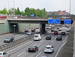
Friedrich Haak Bridge | Schöneberg | The Friedrich-Haak-Brücke leads the Reichartstraße over the city motorway A 100 . The bridge is named after the pedagogue Friedrich Haak (1879–1954). | cards |

|
Friedrichsbrücke | center | The Friedrichsbrücke crosses the Spree between old Berlin and Cölln . It connects Anna-Louisa-Karsch-Strasse with Bodestrasse. Since its first construction in 1703, the Friedrichsbrücke has been completely renovated several times and is a listed building . | cards |
|
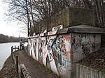
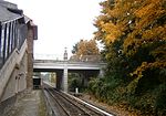
Fritz Schweitzer Bridge | Zehlendorf | The Fritz Schweitzer Bridge , sometimes also called the Wupper Bridge, led the Wupperstrasse from Schönow over the Teltow Canal to Teltow until it was blown up by the German Wehrmacht at the end of the Second World War . The remains of pillars and abutments made of red bricks have been preserved on both sides of the canal. After the failure of a first attack in the Lichterfelde area, the 1st Ukrainian Front under Marshal Konew succeeded in building the first bridge across the canal at the Fritz Schweitzer Bridge on April 24, 1945; At noon the Soviet tanks reached Zehlendorf-Süd. The bridge was named after Fritz Schweitzer, a member of the district canal commission, from the Zehlendorf community council. | cards |
|
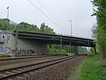
Frohnau Bridge | Frohnau | The Frohnauer Bridge runs between Ludolfingerplatz and Zeltinger Platz over the Berlin Northern Railway . The distinguishing street name signs are on the bridge, from the northern end of the platform at the Frohnau S-Bahn station there is access to the Frohnauer Bridge. The name was given in 1981, previously it was called Bahnhofsbrücke and was nameless. When the Frohnau Bridge was built in 1909, the railway tracks were lowered, the surrounding area was filled in and the road bridge was built to connect the districts built on both sides of the railway. On May 24, 1910, an entry in the Hermsdorf-Waidmannsluster and Frohnauer newspaper reads: “The construction of the large railway bridge is progressing rapidly and should be finished soon.” When the Soviet troops advanced into Berlin, the Frohnauer Bridge was also to be blown up, which succeeded , but only caused harmless damage. | cards |
|
Fürstenbrunn Bridge | West end | The Fürstenbrunner Brücke leads the Fürstenbrunner Weg over the Lehrter and Hamburger Bahn . | cards |

|
Alt-Friedrichsfelde pedestrian bridge | Friedrichsfelde | The pedestrian bridge spans Alt-Friedrichsfelde street at Robert-Uhrig-Straße . It was built in 1979 when the B 1 / B 5 in this area was expanded as an eight-lane arterial road to the east. During the renovation work on the street in the mid-1990s, the concrete beam construction with its staircases on both sides was also renewed and provided with ramps for convenient use. It is 180 m long and 3 m wide. | cards |
| Pedestrian bridge in Sevan Street District | Friedrichsfelde | The pedestrian bridge is located in the path area between Michiganstrasse (west) and the southern branch of Sewanstrasse (east). It spans the Kraatz-Tränke-Graben and is about two meters wide. The reinforced concrete structure is around ten meters long. | cards | |

|
Colmarer Steg pedestrian bridge | Zehlendorf | The Colmarer Weg pedestrian bridge is a southern extension of the Colmarer Weg over the main line . | cards |

|
Gerostige pedestrian bridge | Rudow , Altglienicke | The bridge lies between the two tunnels Rudower Höhe and Altglienicke and crosses the BAB 113. It is a steel trough construction with external solid wall girders. | cards |

|
Kastanienallee footbridge | Hellersdorf | The pedestrian bridge Kastanienallee leads in a southern extension of Kastanienallee over the subway line U5 running in the cut to the boulevard Kastanienallee. | cards |

|
Colony pedestrian bridge on the embankment | Steglitz | The pedestrian bridge is located immediately east of the railway bridge of the Dresden Railway over the Teltow Canal . A hiking trail between the Ringstrasse and Lankwitzer Strasse crosses the bridge. | cards |
| Krontaler Steg footbridge | Karow | The bridge bridges the Panke. It is a steel construction with steel main girders and steel end cross girders, on top of which is a reinforced concrete slab with mastic asphalt. | cards | |

|
Storkower Strasse footbridge | Prenzlauer Berg | Shortly after the opening of the Zentralviehhof on March 1, 1881, the Zentralviehhof train station was also opened. To reach the cattle yard from the S-Bahn station via the four tracks of the unloading station, an approximately 100-meter-long wooden pedestrian bridge was built. Pedestrians to the residential area on Eldenaer Straße had to pass the cattle farms for the rest of the way. From 1928 a 505 m long bridge was therefore built, which spanned the entire route from the train station to Eldenaer Straße. In 2002 the Berlin Senate had the pedestrian bridge shortened and renovated. The bridge is now 152.4 m long. | cards |
| Pedestrian bridge over the Landwehr Canal (provisional name) | Kreuzberg | In 2006 there was a "limited architectural competition" for a new pedestrian bridge between the investors at Potsdamer Platz and Leipziger Platz as well as the State of Berlin in the implementation of the urban development contract . The structure leading between the George C. Marshall Bridge and the Köthener Bridge over the Landwehr Canal is planned for pedestrians and cyclists with the possibility of staying directly on the bridge. The bridge between Tilla-Durieux-Park and Park am Gleisdreieck is also an important part of the north-south green corridor. The winning design comes (Advisory Ing Klähne. In civil engineering GmbH (Berlin), by an architect consortium Max Dudler and the Potsdamer landscape planners Freeroamer N. Koehler). A residents' initiative calls the new canal bridge, which costs 1.25 million euros, the “Schildbürgerbrücke” and considers the realization to be unnecessary. In 2010, the first preparatory measures for the Z-shaped bridge construction began. | ||

|
Britzer Tor footbridge | Britz | The pedestrian bridge from 2000 crosses the Britzer Damm in the course of the green corridor above the tunnel (Carl-Weder-Park) of the A 100 city motorway at the Britzer Damm junction . The name Britzer Tor was chosen because shortly after the transition from Hermannstrasse to Britzer Damm Neukölln ends and Britz begins. | cards |

|
Pedestrian bridge (1) over the Heidekampgraben | Alt-Treptow | The pedestrian bridge is located in Treptower Park, through which the northern Heidekampgraben flows. | cards |

|
Pedestrian bridge (2) over the Heidekampgraben | Alt-Treptow | The pedestrian bridge is located in Treptower Park, through which the northern Heidekampgraben flows. | cards |

|
Pedestrian bridge (3) over the Heidekampgraben | Alt-Treptow | The pedestrian bridge is located in Treptower Park, through which the northern Heidekampgraben flows. | cards |

|
Zenner footbridge | Alt-Treptow | The pedestrian bridge is on the Spree at the "Zenner" inn. It consists of rolled girders on which a reinforced concrete slab covered with mastic asphalt. | cards |
Literature and web links
Individual evidence
- ↑ To No. 12. In: Templates for the City Council of the City of Berlin, Edition 1898, No. 2, p. 6, accessed on March 7, 2020
- ↑ Michael Braun, Udo Dittfurth: The electric Wannseebahn. Time travel with the Berlin S-Bahn through Schöneberg, Steglitz and Zehlendorf . Ed .: Berlin S-Bahn Museum. Verlag GVE, Berlin 2004, ISBN 3-89218-085-7 , p. 56 .
- ↑ Eckhard Thiemann, Dieter Deszyk, Peter Horst Metzing: Berlin and its bridges . Jaron Verlag, Berlin 2003, ISBN 3-89773-073-1 , p. 141.
- ↑ a b c Klaus Pegler: Frohnau Stories Volume 2 . books.google.de, p. 115
- ↑ a b c Klaus Pegler: From the childhood days of the garden city Frohnau. Quoted from: Hermsdorf-Waidmannsluster and Frohnauer Zeitung , May 3, 1910
- ↑ Flatow Bridge In: District lexicon of Luisenstädtischer Education Association
- ↑ Christel Seiffert: Reichssportfeldstrasse is to be renamed. Citizens' initiative meets approval . In: Berliner Zeitung , August 11, 1994.
- ↑ Berlin 1: 5000 (color edition) produced by the district surveying offices (x: 16,790.2 y: 29,119)
- ↑ Föhrer Strasse. In: Street name lexicon of the Luisenstädtischer Bildungsverein (near Kaupert )
- ↑ Entry in the Berlin State Monument List
- ↑ a b Berliner Morgenpost: Sleigh ride over the Havel . May 22, 2014
- ↑ RBB: No bus traffic - until further notice , January 14, 2014
- ↑ FIS Broker map display map of Berlin 1: 5000 (K5 color edition), produced by the district surveying offices
- ↑ Address search: Friedenswegbrücke
- ↑ Coordinate determined with myGPScoordinates and smartphone in the middle of the bridge
- ↑ Architectural monument: Friedrichsbrücke
- ^ Zehlendorf in the course of history . District Office Steglitz-Zehlendorf on www.berlin.de
- ↑ Kurt Trumpa: Zehlendorf yesterday and today . Verlag Elwert and Meurer, Berlin 1983. p. 44 (3rd revised edition; page numbers after the 2nd revised edition 1979) ISBN 3-7669-0141-9 .
- ↑ A tiny bit remains of the "Long Jammer" . In: Berliner Zeitung , June 4, 2002
- ↑ Refurbishment of the pedestrian bridge, new construction of a staircase in Storkower Straße / Berlin ( Memento of the original from March 4, 2016 in the Internet Archive ) Info: The archive link was automatically inserted and not yet checked. Please check the original and archive link according to the instructions and then remove this notice.
- ↑ Senate Department for Urban Development: Berlin Mitte and Friedrichshain-Kreuzberg, pedestrian bridge over the Landwehr Canal . Realization competition open to a limited extent. Call for applications, Berlin 2006 (PDF; 2.5 MB)
- ↑ Presentation of the award-winning competition results. Retrieved August 24, 2012
- ↑ Online position on the pedestrian bridge to Dudler ( Memento of the original from December 13, 2007 in the Internet Archive ) Info: The archive link has been inserted automatically and has not yet been checked. Please check the original and archive link according to the instructions and then remove this notice. (PDF; 38 kB) accessed on November 2, 2009
- ↑ Klaus Kurpjuweit: Landwehr Canal. Berlin is building a useless bridge for millions. A new crossing for pedestrians and cyclists is being built on the Landwehr Canal for more than one million euros. The bridge is intended to connect two parks at Potsdamer Platz, but the project does not create a direct route . In: Der Tagesspiegel , May 30, 2010
- ↑ Carl-Weder-Park ( Memento of the original from September 19, 2009 in the Internet Archive ) Info: The archive link was inserted automatically and has not yet been checked. Please check the original and archive link according to the instructions and then remove this notice. Neubritz.de


