
Panke
| Panke | ||
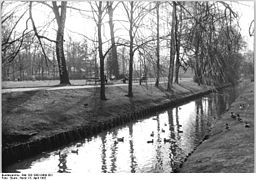
 The course of the Panke in Buch Castle Park |
||
| Data | ||
| Water code | DE : 58294 | |
| location | Brandenburg , Berlin , Germany | |
| River system | Elbe | |
| Drain over | Spree → Havel → Elbe → North Sea | |
| Headwaters | NE of Bernau 52 ° 41 ′ 25 ″ N , 13 ° 36 ′ 31 ″ E |
|
| Source height | 69 m above sea level NN | |
| muzzle |
Anterior basin coordinates: 52 ° 32 ′ 13 ″ N , 13 ° 22 ′ 3 ″ E 52 ° 32 ′ 13 ″ N , 13 ° 22 ′ 3 ″ E |
|
| Mouth height | 36 m above sea level NN | |
| Height difference | 33 m | |
| Bottom slope | 1.1 ‰ | |
| length | 29 km | |
| Catchment area | 201 km² | |
| Discharge at the Kühnemannstraße A Eo gauge : 252 km² Location: 3.8 km above the mouth |
NNQ (10/16/1999) MNQ 1986–1999 MQ 1986–1999 Mq 1986–1999 MHQ 1986–1999 HHQ (06/29/1988) |
1 l / s 63 l / s 504 l / s 2 l / (s km²) 7.18 m³ / s 12.7 m³ / s |
| Big cities | Berlin | |
| Medium-sized cities | Bernau | |
| Communities | Panke Valley | |
| Residents in the catchment area | 450,000 | |

The Panke is a small to medium-sized river that rises on the Barnim in Bernau and flows into the Spree in Berlin . It has a length of 29 kilometers, of which 20.2 kilometers are in Berlin's urban area. This makes the Panke the third longest river in the Berlin urban area after the Spree and the Havel . Above the Panke basin near the Berlin-Blankenburg train station , the Panke forms a sand- shaped lowland brook , and in its further course a small low-lying river in river and stream valleys . The catchment area is 198.3 square kilometers, about a quarter of it (46.8 square kilometers) in Berlin. The neighboring community of Panketal and in Berlin the district of Pankow are named after her.
The direction from northeast to southwest largely follows a glacial channel . During the period of Rieselfeldwirtschaft from 1870 to 1980, it was used to drain the trickled water. Since the end of the 19th century, the swirling river became the “Stinkepanke” due to the increasing population density in and around Berlin and, in connection with this, the influx of unpurified wastewater from industry and commerce. The return to nature and quality of life for local residents in the second half of the 20th century changed attitudes towards the river. The bank along the Pankewanderweg has been redesigned like a park. The restoration of meandering in some places in the upper reaches of the Panke is planned.
When the Berlin Wall was built, the inlet to the original Alte Panke or Südpanke , which flows into East Berlin and flows into the Spree at Schiffbauerdamm , was blocked off. Since then, the water of the Panke has flowed completely through the Schönhauser Graben ( Neue Panke or Nordpanke ), which branches off from the Panke in the West Berlin district of Wedding, and into the Berlin-Spandau shipping canal at the north port . The redesign and redesign of the Südpanke as part of Berlin's urban nature has been planned since around 2010 and should be completed in 2019.
etymology
The river name is of Slavic origin. It possibly goes back to the Polabian word pak , which roughly means tuft or bud . According to Reinhard E. Fischer , the "name motif [...] is the swelling of the river, like a bud". The Polabians were a Slavic people living here. Another interpretation of the river name "pankowe" refers to: swirling river. This goes back to the Slavic root word "ponikwa". Especially at times of spring and autumn floods, it gave the image of a gurgling and swirling brook with a low gradient and flat landscape. A third interpretation of the origin of the word relates to "pania", the name for flat moor. The soil situation around Bernau and in the further course in connection with the slight slope supports this interpretation.
course
In its course, the Panke follows the natural incline of an Ice Age gully from the Barnim heights to the glacial valley, in which it flows into the Spree. The direction of flow is from northeast to southwest. Using this Pankerinne, old traffic routes such as Bernauer Heerstraße led out of Berlin - safely in the flood-free bank area . Newer traffic routes are also based on this route, this applies to both the Szczecin Railway and the Federal Motorway 11 (from Berlin to Szczecin ). The Panke flows in a populated area, the free course along its old bed is clearly disturbed and, compared to the meandering course recorded by the cartographer Schmettau in the 1770s, much more straightforward. The body of water runs nine kilometers through the city of Bernau (here Eichwerder district) and, with increasing settlement density, through the community Panketal (here through the district Zepernick) and 20 kilometers through the Berlin districts of Pankow and Mitte (here through the district Gesundbrunnen). At the end of the 19th century in particular, the banks of the Panke and the water in and around Berlin were severely impaired and damaged by human use. Since the end of the 20th century, attempts have been made to restore the natural environment within reasonable economic costs. The aim for the river and bank design is the creation of nature-like recreation areas.
Headwaters

The Pankewater collects in stratified springs on a plateau of the Barnim north of the closed development of the urban area of Bernau . The Panke is an episodic body of water in the headwaters . Stratified springs can be found in several places in the Barnim Nature Park , this type of spring is typical of the Brandenburg sand. The source height is about 69 meters above sea level ( NN ).
When Schmettau took the picture in the 1770s, he found the Panke spring in an area east of Bernau. He placed the beginning of the river in an area about 1500 meters to the northeast to the "Pankeborn" (Pankequelle 1787: ▼ ) 68.5 meters above sea level. NN. Its source is on the Ogadenberg. First to the northwest the Panke (in this map) flows in an arch to Albertshofer Straße and east of the road to the bridge with Börnicker Chaussee east of Bernau. "Bernau, walled city in Niederbarnimer Kreis, on the Panke river, which rises close to the city ..." is mentioned by Helling on page 25 in his pocket book from Berlin 1830.
On the map series from 1839 the course can be found as on today's maps. The Panke spring ( ▼ ) is 580 steps or 120 rods in the "Red Lands" east-northeast of the (current) railway line. This map shows a wide swampy wetland around Bernau from the northeast to the south. On the map from 1839, the Pankeflie is not connected to the city moat of Bernau, but runs over the “TiefWiesenBusch” and the Börnicksche Dammwiesen to the Rohrwiesen south of Bernaus Anger, south of today's New Gardens .

The entire area between Albertshofer Strasse and Rüdnitzer Chaussee ("the red countries") with the railway line slopes down to a length of 600 meters by 69 meters above sea level. NN at 66.5 meters above sea level NN at the flow of the Panke under the Bernauer Pankstrasse. With the establishment of the railway line in 1842, its reconstruction around 1930 and at that time in particular with the installation of the Teufelspfuhl as a collecting basin for some of the surrounding watercourses, the situation was changed by human intervention. "The spring has now dried up, [...] It lies close to the railway embankment where this ditch ends." ( According to R. Lemke ) "The Panke does not make it easy for you at first. Anyone looking for their source in Bernau risks being quickly disappointed in this Brandenburg town. Only a wet meadow in the Pankeborn district and a pond called Teufelspfuhl are designated as a source area. "
The origin of Panke (as defined by the lying farthest from the mouth occurrence of Panke water ) is at least since the 1990s, the Panke Born ( ▼ ) It is situated at the Stettin train (train line Berlin-Stettin) and 500 meters northeast of the level crossing Pankstraße / Albertshofer Chaussee ( Kreisstraße K6002). The Pankeborn is a passage that emerges west of the railway line. There is no entry on the eastern flank of the embankment, the Pankeborn emerges from the embankment. This "Pankebeginn" marked with the sign "Pankeborn" is episodically a wet ditch. According to the older map material, the source was in the field northeast of the railway line. The entire area on both sides of the current railway line was once swampy and had stratified springs. With the double-track expansion of the Szczecin Railway between 1863 and 1866 and the later redesign of the embankment with the double-track expansion, the Panke was cut off. On more recent maps, this course, which cannot be found in the field, is often still marked. The entire source area between Albertshofer Chaussee and Rüdnitzer Chaussee (on which the railway line) is inclined over a length of 600 meters towards the flow of the Panke on Bernauer Pankstraße. The terrain height drops from 69 meters above sea level. NN at 66.5 meters above sea level NN. The ditch coming from the north-west is the best evidence of the former natural conditions.
For love, little Panke by Richard Lemke zur Pankequelle (1955): “Just go out through the Königstor, almost to the sink. And then you go into the meadows that lie beyond. If your feet get wet, you've found it. [...] It didn't want to get wet down below. I turned around unsuccessfully and drove home discouraged. The next day saw me again in Bernau. I followed a dried up ditch that could well have been a creek bed. So I finally came to the embankment of the Szczecin Railway, where the dried up ditch came to an end. The Panke had to arise here. A boy asked what I was doing here. The Panke spring, I replied obediently. I was just coming from here, he said, pointing to the dried up ditch that I had followed down to this point. 'But it is no longer there. It was filled in about 20 years ago. But there is a second source river. '"
Pankelauf
City of Bernau
For Bernau the Panke is mentioned as early as the 14th century. At that time it was a conspicuous river, raging with its spring floods. According to archival documents from the Middle Ages , the Panke flowed from the swampy edge area along Kahngasse (today's Louis-Braille-Straße) through Bernau ( ▼ ), where there was also a ford.
“The Panke begins on the Feldmark of the city of Bernau in the so-called red fields. It used to flow through the city; but because their water was very polluted, they were led outside the curtain wall between the gardens and the church moat towards midday. The 3½ mile long course of the Panke, the last tributary of the Spree, lies quite definitely in the normal direction of the Barnim watercourses "
Pankeborn is the name of a settlement area in the northeast of the city of Bernau, a street and the industrial area are named "Am Pankeborn". The Panke begins in this part of Bernau.
"That is because [...] with the new Panke, that the bed was moved when the embankment and the station were raised years ago. [...] on the Ruthenfeld or the Rote Feld, where the Bernauers fought with the Hussites in 1432. "
“The Panke spring on the Red Fields near Bernau is devoid of romance. A grassy field and a ditch in which hardly a frog can bathe. "
The Panke flows east of the industrial park to Pankstrasse and initially in the ditch on its north side. After 90 m , the Panke-Graben leads under the street Am Pankeborn and 30 m further through the bridge under the Pankstraße, which has been in existence since the middle of the 18th century. The course to the south-southeast leads straight for 160 meters through meadows to the embankment. The railway line reaches the Panke 300 meters southwest of the Pankestrasse level crossing. ( ). On the face of it, it remains unclear whether the Pankewater has now passed through the railway embankment or whether the water fills the railway trench. With the small amount of water, no direction of flow can be determined along the embankment.
![]()

Most of the maps show a passage through the railway area and, as a “blue line” for a Panke River, the route through the territory that was formerly used for military purposes in the northeast and was still closed in 2011, for which redevelopment began in 2015. The course on older maps testifies to the intervention on this part of the Panke. During the expansion of the Szczecin Railway, as mentioned above , the Teufelspfuhl was created in the 1930s as a collecting basin for several water-collecting ditches. In the north-east of this devil's breach, the former military clothing subsidiary was established, which has been used as a military area by the "western group" of the Soviet army since the 1950s . On site there is no further flowing water to the southeast of the railway line and north of the Teufelspfuhl water surface until it emerges from the Teufelspfuhl, but there is a swampy forest at the lake. The Panke first turns along the embankment. For this area next to the “Bahnhofspassagen” shopping center, a Bernau initiative is planning to use the area with the Panke. A large number of old and new groundwater measuring points in 2011 around the Teufelspfuhl speaks for the beginning implementation.
On the southern edge of the Teufelspfuhl follows the “secondary roughness” with an area of 5000 m³ in the Pankelauf, which has been renatured by the “Finowfließ” water and soil association. The floodplain is the wetland that the Panke flows through in its course below the Teufelspfuhl, the basis for a newly created Panke Park. When a flood comes, the level rises and the Panke can flood the floodplain without causing any major damage.

To the south of the old town of Bernau there are wide open spaces next to the Rohrwiesen , which supply the Panke with more water through natural springs and field drainage . In the medieval "Eichwerder" (a moist forest area) the Dranse rises southwest of the Blumberger Chaussee , which joins the Panke after 3.5 kilometers in Zepernick . After the inflow of further trenches at a height of 63.7 meters above sea level. NN flows under the Panke in a south-westerly direction, first of all the Weißenseer Straße , then the federal motorway 11 , before it forms the border to the Panketal district of Zepernick in the Bernau-Eichwerder district for a short time. After crossing under the railway line, she leaves the Bernau urban area.
Panketal community

In the area of the municipality of Panketal , the Panke only touches the district of Zepernick . First it crosses the nature reserve Faule Wiesen near Bernau, which lies between Zepernick and the Bernau district of Schönow . The Panke is a sand-shaped stream from the Schönower Dorfgraben . It turns back to the southwest and crosses 200 meters to the west, i.e. southwest of the Zepernick S-Bahn station, first Schönower Strasse , then the railway embankment. Between Schönerlinder Strasse and Strasse der Jugend there are large meadows, in the area of which the Dransebach flows into the Panke when coming from the east. After crossing the Zepernicker settlement Röntgengental, the Panke finally reaches the urban area of Berlin . Behind the embankment, the Panke flows through residential areas to the Brandenburg state border with Berlin and mainly receives rainwater discharges.
The Bernauer Heerstraße runs in the municipal area , and here in the catchment area of the Panke it had to bypass several lowlands, such as the Fenn Bay and the Upstall.
Pankow district of Berlin
book

After its transition to Berlin territory, the Panke flows into the Pankow district and first crosses the Pölnitzwiesen wetland in the Buch district and then flows through the Buch palace gardens , put into bed . With the planning [obsolete] "Panke 2015" an alluvial area is planned here, during floods the Panke can expand here, meanders offer variety on the Pankewanderweg and the water could sometimes flow quickly, sometimes slowly and be a biotope for fish and plants. If trout and brook lamprey like fast-flowing waters, there would be calmer spots for pike. After crossing the Pölnitzweg from Buch to the Buch colony, the Panke flows through the Bucher Schlosspark.

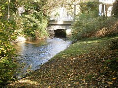
The Buch Castle Park has the status of a protected FFH area . The park was laid out in 1670 by Baron von Pölnitz on the former courtyard garden of Gut Buch, and in 1813 it was turned into an open landscape park by Otto von Voß, landlord in Buch. The Panke flowed through canals through the avenues of beech and lime trees. Fish farming was carried out in the canals. The palace park was opened to the public in 1907. In front of the Pölnitz bridge, some water from the Panke flows into a canal, the Schlossparkgraben, at a dam, which divides again after flowing into the park below the bridge. The two park ponds on the area east of the Panke will be filled from this. In front of Wiltbergstrasse, this Pankewater from the Schlossparkgraben is channeled back into the Panke via a 30 centimeter wide canal. The Panke itself flows in its bed through the western part of the park, together with the Pankewanderweg. This leads over five simple parking bridges , each made of a concrete slab four meters long by three meters wide.

In the southwest, the Panke leaves the palace gardens and passes under Wiltbergstrasse to the east of the Berlin-Buch S-Bahn station . Since 2008, the 90th bridge built over the Panke has connected two shopping centers for Buch and its hospitals and nursing homes. In the following, the Panke receives water from the Kappgraben , which now begins as a ditch further east in the area of the allotment gardens. Another branch is located south of the autobahn, which speaks for a stream that originally had its source further east and a larger catchment area. After crossing the Bundesautobahn 10 , again the Stettiner Bahn and below its junction to the “ Heidekrautbahn ”, the Panke forms the district boundary between Buch and Karow and a little further down the Pank between French-Buchholz and Karow.
Karow


The Karower Teiche nature reserve is located on Karower Flur between Panke and Bucher Straße . Above, the still small Pankelauf takes in the water of the Lietzengraben coming from the northwest , which in turn drains the Bogensee chain and the Buch carp ponds . The Lietzengraben, once a natural stream, was used as a drain for sewage fields east of federal highway 109 . Silting up in the Panke Valley, including the neighboring areas, had not formed very thick layers of peat for a long time, but it was worth mining. All four ponds were created when peat was cut from the middle of the 19th century. Two of the Karow ponds, in which carp was farmed at the beginning of the 20th century, were formed by removing sand for the adjacent Szczecin Railway. The wastewater pollution from the sewage fields led to the discontinuation of fish farming. Since the 1980s, with the end of the sewage field management in this area, the water level sank and the area was reforested. Due to the relatively remote location, flora and fauna developed and a habitat for birds was created. On the left bank of the Panke there are several allotment gardens (north of Pankgrafenstrasse: Kastanienhain , on the south side of the road: Pankeniederung .) The Rübländer Graben to the left of the Panke has the same role as the Lietzengraben on the right of the Panke .

Below the Karower ponds, the Panke crosses the Pankgrafenstraße and has its dead straight course to the southwest through meadows and fields. On the southeastern edge of Karow, it crosses under the Berlin outer ring of the railway. Shortly before that, the Buchholzer Graben flows from the right . With the construction of the Berlin outer ring in the 1950s, the trains of the Deutsche Reichsbahn were supposed to run around West Berlin on the outside . Some trenches were cut with the runoff from the sewage fields. This water was collected in the Buchholzer Graben outside the outer ring. Since the cessation of the irrigation, the amount of water has decreased significantly, and the abundance of vegetation on its banks is evidence of the nutrient richness of the sewage water.
Blankenburg

500 meters after the railway ring, the Panke is passed under the Pankow car feeder and thus reaches the Blankenburger Flur. The Pankewanderweg runs to the west and parallel to the motorway , for which there has been a pedestrian / cyclist bridge over the motorway since the mid-2010s. This bridge was created around 2012 with the establishment of the north-south path. Narrowed to the west by the Blankenburg industrial estate, the path to the south is natural through bushes and trees. The inflow of the Laake is structurally striking, the amount of water is inconspicuous. With the Bahnhofstrasse bridge, which connects the Blankenburg train station with Buchholz, the hiking trail becomes urban and the Panke widens into the Pankebecken. The long-distance cycle path leaves the Pankeweg at the level of Blankenburger Bahnhofstraße and runs a little further west through Ludwig-Quidde-Straße. From the pedestrian bridge at the Gravenstein allotment garden colony, the long-distance cycle path and the Pankeweg are again largely identical.
This basin closes off a regulation system commissioned in 1935 a good two kilometers on Blankenburger Flur. Water is drained from the Panke into the north ditch . This was created to drain the excess water from the sewage fields to the Tegeler See and to relieve the Panke in the event of a possible flood. Since the end of the irrigation, the division of the runoff from the Blankenburg Panke basin to the Panke or the Nordgraben has been regulated by the water management authority. The river continues its south-westerly course with less water. The north trench leads away from the Panke to the northwest. After the irrigation has ended, it is mainly used to regulate the water from the Panke basin.

An extensive trench system west of the Panke is managed and regulated by the State of Berlin in terms of water management. Many hectares of allotment gardens extend around Blankenburg, through which rainwater drainage ditches run in old guides (of the Rieselfeld use). This is where the Blankenburg carp ponds are located , which are affected by the Panke. On the northern bank of these ponds, the Malchower Fließgraben brings water from a whole system of ditches from Malchower See to the left of the Panke. The Schmöckpfuhlgraben , which brings the water from the grounds of the Heinersdorf freight station and the allotment gardens northeast of Heinersdorf , belongs to this system of ditches east of the Panke .
The water of the river ditch is cleaned in a soil retention filter on the jug footbridge , which removes the road dirt and the rubber abrasion from the car tires on the roads from the washed-in rainwater. Since 2007 the Panke has been protected from the "modern trickle water". It continues to flow parallel to the federal motorway 114 , crosses the end of the A 114 and the Pasewalker Straße and in a south-westerly direction arrives at the Niederschönhausen district . The empty bridge over the Panke belonged to the Tegel – Friedrichsfelde industrial railway . It should also be noted that the route of the federal autobahn (A 114, feeder north) correlates with the course of the Panke.
Niederschönhausen
_um_1840.jpg)

The bed becomes more open and closer to nature in the subsequent garden colonies and in the Niederschönhausen Palace Park of Schönhausen Palace. In 1827 Peter Joseph Lenné was commissioned to redesign the palace complex according to the wishes of the Duchess of Cumberland. King Friedrich Wilhelm III. Although reduced the expenditure for Lenné's plans, the Panke and the surrounding farm meadows were still included in the castle park. In the castle park, the Panke changes from Niederschönhausen to the Pankow district of the district of the same name, before it forms the boundary of the district. The Panke leaves the palace gardens a little south of Schönhausen Palace . Shortly after the bridge Ossietzkystraße flows into the Kreuzgraben , which begins north of the district of Niederschönhausen and flows around the old town center to the west.

The Zingergraben opens out above the Grabbeallee . This former natural stream later brought water from the Rieselfeld Blankenfelde to the Panke. During the construction of the north trench, it was cut up and flows directly into it. The remainder of the run to the Panke is no longer relevant. It drains allotment gardens and the 72 hectares of the Schönholzer Heide , only after rainfall does it lead water. The water from the Rieselfelder to the west and north of Blankenfelde reaches the Havel catchment area via the Tegeler Fließ and does not belong to the Panke catchment area.
Pankow
After leaving the castle park, the Panke flows through the original Pankower corridor. Pankow is a Slavic foundation, the Wendendorf arose on the higher Pankower Piesel . In 1806, the run was shortened with a cut from the castle park to the current Pankow public park . The Panke, located deeper in the terrain, south behind the villas of the former town , still has this straight course . With the development of Berlin into the capital of the German Empire, the number of restorations and establishments along the Panke increased. Berlin citizens and workers pulled it out of the city in the province after " jwd " ( j num w ince d Raussen) and known Panke. Spahn's Couplet Come on Karlineken, come on Karlineken, come on. We want to go to Pankow, it's wonderful there [...] proves the recreational value that “Etablissements in jwd” had for Berliners. The popular text - related to Pankow - was later adopted by several locations around Berlin.
- In the Bürgerpark
The Panke in the Bürgerpark, 1982
Through the Schönholz bridge to the park

Marking on the Pankewanderweg

East of the park bridge

Down from the parking bridge


.jpg)
.jpg)
After crossing Grabbeallee ( Bundesstrasse 96a ), the Panke flows through the Pankow public park in a machined and straightened manner . This canalization is retained by Gesundbrunnen and Wedding alternating with bricked river banks. In today's Bürgerpark, the Panke drove a water mill in the 18th century , which was converted into a paper mill in the 19th century and destroyed by flooding. In 1857, the publisher of the Berliner Börsen-Zeitung , Hermann Killisch-Horn , acquired the area and built his mansion on the Panke on the site of the mill . In the Bürgerpark, the Panke forms the district boundary to Niederschönhausen, its course in the western section belongs to Pankow.
In the Bürgerpark, the Panke changes its direction of flow from southwest to south and, at the end of the park, passes under the Am Bürgerpark street and then the parallel tracks of the Berlin Northern Railway northwest of Wollankstrasse station . The street Am Bürgerpark (formerly Bahnhofstrasse ) formed the borderline between East and West Berlin secured by the Berlin Wall for almost 30 years . The Panke flowed from here to the west of the city. The Panke tunneling of the railway embankment was already part of Berlin (West).
The area next to the Schönholz freight station to the north-west was also vacant in 1961. With the possibilities since the fall of the Berlin Wall, the children's farm Pinke-Panke (right of the Panke) and a rainwater retention basin (left of the Panke) are between the street Am Bürgerpark and the railway embankment . Floods, as it occurred in 1980, are to be temporarily stored.
Mitte district of Berlin
_um_1840_(Panke_Luisenbrunnen).jpg)
|
.jpg)
|
|
|
Urmes table sheet (1840)
|
Location of the Pank Island in Gesundbrunnen (1899)
|
In the Mitte district between the Gesundbrunnen and Wedding districts and the Mitte district, several changes and interventions in the course of the Panke have taken place since 1900. As early as 1910, the Panke was placed under Chausseestrasse 88 and the first warrior club house . The most significant change took place with the construction of the wall when the further course from West to East Berlin was separated with the removal of the culvert under Chausseestrasse. The Pankelauf in the green belt between Schulzendorfer and Liesenstrasse had already been removed from the cityscape in 1956. The changes since the Straube Plan 1910 (IV M, IV G, IV B, IV A) between Schulzendorfer Strasse and the mouth of the Spree can be followed on HistoMapBerlin. A current situation of the open and piped Pankelaufs (Südpanke) between Schulzendorfer Straße and the confluence with the Spree on Schiffbauerdamm can be understood with the help of the map.
Healthy well


When leaving Pankow, the watercourse changes past the Reinickendorf district (pumping station on the grounds of the Schönholz freight yard) to the Gesundbrunnen district , which has been part of the Mitte district since 2001 . Some side trenches of the Panke were built over or filled in, such as the Eschengraben coming from the left , which lost its connection to the Panke during the planned construction on the Esplanade that was not carried out because of the beginning of the First World War . The following Pankelauf was straightened around 1900 and has been more of a canal than a river since then. After crossing under the northern runway, the Panke flows almost exactly southwards below Kühnemannstrasse. To the left of the Panke is a rain retention basin, the Panke basin . The Eschengraben once flowed here. To the right of the Panke there has been an allotment garden colony since the 1910s. The Pankelauf runs parallel to Stockholmer Straße, which partly had to give way to the Pankegrünzug, the Panke still flows narrowly under Soldiner Straße .

The Pankeufer received a park-like design in many places in the Gesundbrunnen in the 1950s and 1980s through the establishment of the Walter-Nicklitz-Promenade and the urban development was pushed back in several areas. In honor of the City Councilor Walter Nicklitz and his services to the Pankegrünzug, this path on the Pankeufer was named after him. Stockholmer Straße, which runs parallel to the Panke, was divided in favor of the Panke. Above and below Osloer Straße and along Travemünder Straße there are green areas and park-like structures on the banks of the Panke, a few tens of meters wide. Here is a soccer field cage ("Boatengkäfig"), in which professional soccer player Kevin-Prince Boateng learned to kick. The banks were partially redesigned and given trees and meadows, all in all a watercourse remained between steel sheet piling, concrete and clinker walls. The Pankegrünzug marks the banks of the river as a natural area.
The Badstrasse bridge over the Panke is mentioned as early as 1702, as there was a fulling mill for leather production above the bridge. At this point in the area of the Gesundbrunnen district by the former mill, a major intervention in the Pankelauf took place. Once there was the Mühlgraben on both sides of the Badstrasse next to the river. After the mill had stopped operating, the western Pankelauf was filled in. The previous mill ditch was removed to the Pankebett and the Pankeinsel. The uneven distribution of land and a cut can still be seen north of Badstrasse. Instead of the mill, a new house was built in 1844. Slightly above are the factory halls of the former safe factory, in whose shed halls a sculptor's workshop has moved into the cultural work of bbk berlin GmbH . Some of the sculptures created in these halls are on the banks of the Panke.
Opposite is the former spa, the "Gesund-Brunnen" gave the district its name. According to legend, Frederick I found a glass of water that the local miller gave him very refreshing. The water was checked, it turned out to be ferrous and declared medicinal water. The first spa facilities were built in 1757 and were given the name Friedrichsbad with royal permission . After an initial decline, the Luisenbad was rebuilt in 1809 , named after the Prussian queen. The buildings still preserved from that time are to the left of the Panke below the old Pank island. This is where the library opened in 1995 at the Luisenbad with the café kitchen is located .
On the occasion of the 750th anniversary of Berlin in 1987, the creation of a meadow landscape around the Panke was planned and a mill should be built again. The plan was not carried out, only the painted, stylized water wheel on the building opposite the clinker pergola remained.

Below Badstrasse is the Panke in the deep canal between the former BVG central workshops and Gropiusstrasse; the newly established riverside path is what used to be a road. There are sloping banks on Orthstrasse. With their names, Uferstrasse and Wiesenstrasse indicate the condition 200 years ago. With the founding period , the tightly built tenements of the Red Wedding with backyards, back houses and side wings were built. In the redevelopment areas of the 1960s, the residential buildings on the banks of the Panke are again open-plan. The Wiesenburg on Kolberger Strasse, which was used as a homeless asylum for men in 1896 and subsequently an asylum for women in 1907, is part of the history of the settlement and represents the striving for more social structures. The expansion of this area after a project from 1986 was not realized, so ruins and old buildings of that time still stand on the banks of the Panke.
Down the Pankstrasse, the Panke is narrowed in the city center. In front of and behind the Ringbahnbrücke , the Pankelauf gives an impression of the 1920s between the commercial buildings, especially how the tenements had moved up to the river. The Kunkelstrasse had to give way in part to the opening for the Panke. A major change took place when the junction of the Süd- or Stadtpanke on Schönwalder Strasse was relocated downstream to Schulzendorfer Strasse . Initially, the Pankebett ran through today's city park from Schönwalder Strasse south-east to Chausseestrasse near the corner of Liesenstrasse, away from Kolberger Strasse. With the pipework from Schulzendorfer Straße, the 'old' Panke disappeared from the Gesundbrunnen district. The existing green area still bears witness to the original course and is to be expanded with the reactivation to become the Südpankepark. This Südpanke, which did not reach Wedding after the official division, is led to Chausseestrasse via the grounds of the North German Brewery (which later became the Schultheiss Brewery ) . “The Artillery Exercierplatz, between Chausseestrasse and Panke, not far from the Invalidenhaus, called the Wartfeld” is mentioned by Helling on page 14 in his pocket book from Berlin 1830 (at that time in front of the city).
Schönhauser Graben
- Schönhauser Graben and continuation as well as Panke between Spree and small Wedding

On the Schmettau map (1748)

On the Selter Plan (1811)

Panke and "New Panke" (1849)

Extension to Gr. Roach (1851)

Humboldthafen and modified canal (1860)

Derivation at the "north basin" to small Wedding (1862)

Pankekanal (2008)
_(Panke-Sch%C3%B6nhauserGraben).jpg)
.jpg)
.jpg)
.jpg)
.jpg)
.jpg)

The watercourse usually assigned to the Panke, sometimes referred to as the Nordpanke , which runs from the computer system on Schulzendorfer Strasse under Chausseestrasse, past the ice rink to the basin at the Nordhafen, is the remnant of the Schönhauser Graben . The Schönhauser Graben was planned as a waterway to Schönhauser Castle . Friedrich I had acquired this in 1691 and wanted to reach it from his other castles by ship. Instead of rumbling along dusty, sandy country roads in a carriage , two horses towed the trek barges on the waterway between the castles. The royal gondola was already running across the Spree from the city palace to Monbijou , Lietzenburg and Ruhleben . In 1704 Johann Friedrich Eosander was commissioned to dig a two-kilometer trench from the Spree to the Panke, and construction began in 1705. According to royal orders, this expansion of the Panke was combined with the expansion of the adjacent river ditches. Because of the existing bridges on the urban Panke, the new watercourse was easier to tow. The new canal began in the direction of the river above the lower tree ( Kronprinzenbrücke ) on the “city arch” of the Spree. At the beginning, the ditch was parallel to Charitéstraße for 500 meters (access to Charité and corresponds to Alexanderufer) to continue to the northwest at Sandkrug. In this way, the ditch bypassed the area northwest of Berlin, which was then occupied by community gardens and summer residences of the nobility. To the west of the Invalidenhaus and the Invalidenfriedhof led from the Spree initially 2.1 kilometers to today's north port. The run of the canal continued from there to the northeast, where it reached the Panke after 900 meters on today's Schönwalder Strasse. Wedding could be reached by ship through several locks in the lower reaches. The ditch also served as flood protection for the city center, as it offered a connection to the Spree downstream. The expansion plans for the further canalization (probably also widening) of the Panke to Niederschönhausen were not completed. Relations in the royal family had changed and therefore the king no longer wanted to travel by ship from the Spree to the queen. As a result, an artificial and navigable “river bed” was created for the lower reaches of the Panke. On the one hand, this promoted the settlement of businesses in Wedding, on the other hand, the river was fixed and embedded from this time on .
On Cabinet Order of Friedrich II. The building material was for the Invalidenhaus transported to the site over the Schönhauser ditch. Not far from the Royal Invalidenhaus, the Schönhauser Graben was crossed by the Sandkrugbrücke (in the course of the Invalidenstrasse), which was named after the Sandkrug inn located next to it. Later, the supply of the Invalides (today made invalids Park ) and the delivery of fuel and consumables to the hospital Charité over the moat, which is why Charité ditch was called. However, according to the state of the art at the time, the hospital's wastewater ran into the ditch. After the revolution of 1848 , Friedrich Wilhelm IV ordered the construction of a canal from Spandau to the Plötzensee lock as a job creation measure to counteract unemployment and the emerging post-revolutionary unrest. In the course of the expansion, the Humboldt and North Basins were built by 1859 , and the part of the Schönhauser Graben between the two ports was integrated into the Berlin-Spandau shipping canal . After the construction of the wall, the culvert under the Chausseestrasse (subway) located in the "old course" was destroyed. The forced discharge of the water of the Panke into the Schönhauser Graben (between Schulzendorfer Strasse and Nordhafen) was officially called the Panke . The old, inner-city restored lower course is officially called Südpanke .
.jpg)
After all, the term "Neue Panke" was introduced for the Schönhauser Graben (or Charitégraben) when it obviously no longer fulfilled its planned function - accessible from the Spree to Niederschönhausen - in the middle of the 19th century. The beginning of the canal, which initially led to the Charité (“Charitégraben”), began at the lower tree , down the Spree from the Kronprinzenbrücke , to the northeast. After 180 meters, the course bent in line with its purpose - supplying the Charité - to the northwest, directly along the west side of the Charité. The Unterbaumstrasse lies on the eastern bank of the lower section; the no longer existing further trench to the northwest can be found on Virchowweg on the Charité site. With the reconstruction of the canal (around 1860) to extend it as the "Hohenzollern Canal" (= Berlin-Spandau shipping canal ), the new branch of the canal was laid at the northernmost curve of the Spree. The area of the Königlichen Holzplatz (since then between Wilhelm's and Alexander's Ufer) provided space for the Humboldthafen and the continuous canal. The Hugo-Preuss-Brücke (then Alsenbrücke ) marks this beginning of the canal on the Spree; the arch at the northeast corner of the Humboldthafen contains the access point of the (first) canal section that was filled in in the 1880s. It should be noted: the run of the canal between the (west) district of Wedding and the (east) city district of Mitte prevented the Berlin Wall from being planned and used until the 2000s at least from 1961 to 1990 .
Wedding

Only after crossing under Chausseestrasse does the canalised Nordpanke reach the district of Wedding , where it ends after another 475 meters below the foothills to the Nordhafen . Below the weir on Chausseestrasse, it goes straight southwest past the ice rink to the north port. The Pankewater only flows indirectly into the Spree via the Berlin-Spandauer Schifffahrtskanal . Most of the water in the Panke could - judging by the direction of flow in the canal - reach the Havel in a more westward direction. A significant part of the water from the upper reaches of the Panke already takes its way through the north ditch to the west into the Tegeler Bucht, and thus also into the Havel.
| Südpanke | ||
 Panke in the Oranienburger suburb, cab route meter from 1884 |
||
| Data | ||
| Water code | DE : 582938 | |
| location | Original run in Berlin | |
| River system | Elbe | |
| Drain over | Spree → Havel → Elbe → North Sea | |
| Südpanke junction | Computer system Schulzendorfer Strasse 52 ° 32 ′ 23 ″ N , 13 ° 22 ′ 23 ″ E |
|
| Source height | 36 m above sea level NN | |
| Shipbuilding dam Numma Zwee | 100 meters down the river of Weidendammer bridge channel end 4 × 2 m from the sea wall over Spree mirror 52 ° 31 '18 " N , 13 ° 23' 12" O |
|
| Mouth height | 32 m above sea level NN | |
| Height difference | 4 m | |
| Bottom slope | 1.6 ‰ | |
| length | 2.5 km | |
| Drain |
MQ August 2011 |
0 l / s |
 Pipe entry for flooding the southern or city slope |
||
center
.jpg)
Only the old course of the river , known as the Südpanke , runs through the historical center of Berlin ( Friedrich-Wilhelm-Stadt ) . It begins at the point where it separates from the north face. In Gesundbrunnen this is a little below the computer system on Schulzendorfer Straße. 254 meters of Pankerohr extend to Chausseestrasse (50 meters from Liesenstrasse) to cross over to Berlin-Mitte. In the online collection of the city museum there is a photo of the Panke between Hannoversche Strasse 18 and 19 from 1904.
The underpass located here by means of a culvert under Chausseestrasse was destroyed during the construction of the wall due to the risk of escape through the culvert and the following river bed was filled in in front of the wall. Since then the south pank has been dry. In 2008 the culvert was restored. In the street width, the Chausseestrasse belongs to Wedding and ultimately also the culvert ( ▼ ). On the southern side of the street, the piping meets the building on property 87 and is 40 meters to the flow between Chausseestrasse 88 and 90 in the area of the sidewalk. The Ida-von-Arnim-Strasse (south-west of the BND property) will be piped under with a pipe length of 250 meters, partly under the property of the Bundeswehr hospital. The Panke water still flows another 150 meters in the pipe on the edge of the property of the "Park an der Panke". in which water flows again to the surface ( ▼ ). Since 2012 a city park "Park an der Panke" has been created, which the Panke flows through again in the old bed. The "open Panke" in the other sections was restored up to the confluence with the Spree. An average of 200 liters of water per second flow in it again, in times of flooding up to 1000 liters per second.
The further course of the Panke takes place through the Stadtpark to Habersaathstraße, the Schwarzen Weg at the building of the Federal Ministry opposite the Invalidenpark to the south and then again in the pipe at right angles on the northern edge of the Invalidenstraße opposite the square at the Neuer Tor to the east to the height of Hessische Straße. The Pankerohr is located under Hessische Strasse in the middle of the street, the open run begins again in a covered bridge structure under Hannoversche Strasse ( ▼ ). The trench at the edge of the building then leads to Phillippstrasse.

The BND headquarters was built on the site parallel to Chausseestrasse and Habersaathstrasse . In the 18th and 19th centuries, the left bank of the Panke formed the south-western boundary of the artillery training area . The World Youth Stadium, which was built there in the middle of the 20th century, was demolished on the occasion of the 2000 Olympic bid in favor of a large multi-purpose hall. However, their construction was canceled when Berlin was not awarded the contract for the Olympic Games. The site was available for the Federal Intelligence Service's construction projects .

To the south of the Pankebett, townhouses are being built on the new street Am Pankepark . The pumping station IV (center) of the Hobrecht Rieselsystem from 1888, which had not been used since the construction of the border fortifications, was rebuilt automatically from 2007 to 2010. An underground rain retention basin is given a green area above ground and forms a green connection to Chausseestrasse. The sewage is conducted ten meters below the subway line, that is 17 meters below the street. The Panke under Chausseestrasse has to go under the same obstacle.
In the new buildings in the area between Habersaathstrasse and Philippstrasse, the trenches to receive the Pankewater were set up as early as 2009 and have been partially filled with running water since 2013. North of the heating plant in Scharnhorststrasse, which u. a. supplies the Charité and the Natural History Museum , the open brook in front of Habersaathstrasse disappears into the pipe again. The historical course lies between the Federal Ministry of Transport, Building and Urban Development (BMVBS) and the Natural History Museum . As a compensatory measure for the cap between the Ministry and the Natural History Museum, a trench was created on the south-western side of the new building for the southern slope, which was initially dry and has been periodically filled with water since 2013.
The Pankelauf on Invalidenstrasse , at the level of Invalidenpark , was built over as early as 1836 when the iron foundry was located here . This is mentioned by Helling on page 79 in his pocket book from Berlin 1830: “Eisengießerei, Königliche, Invalidenstrasse 92, was founded in 1804 by Minister v. Speeches laid out on the site of the grinding and paper mill that was built here on the Panke in 1702. "
The covered Pankelauf at the Natural History Museum and in the Hessische Strasse took place between 1880 and 1890. After the Panke crossed Invalidenstraße in the direction of Hessische Straße and disappeared under the bridge of Hannoversche Straße, it emerges from the pipe again on the Charité premises. A built-over bridge arch, which is halfway in the building, reveals a view under Hannoversche Strasse. The newly created trench, which corresponds to the original Pankelauf, is parallel to the trench along the Ministry of Transport, right by the house. The Panke is open here but canalised, the area surrounding this trench is a park-like green area. The piping in front of Philippstrasse was carried out in the 1980s when the Charité high-rise was built.

On the area cleared in the 1990s behind the veterinary faculty of the Humboldt University , the Pankebett is open for 480 meters without water (only temporarily with rainwater). Since the mid-2010s, water from the Panke has been flowing through the Südpanke again, when the water authority at the "Schulzendorfer Straße" facility has been activated.
This stretch of flow has existed since 1997 between Charité institutes, veterinary medicine and other facilities at Humboldt University through green trees and lawns. The arch to the west, which existed as early as 1836 and which surrounded garden plots outside the city by Berliners, is remarkable. South of the Akademie der Künste , behind the workshops of the Deutsches Theater , the river comes again to the northeast with the opposite bend, before the masonry trench bends to the southeast. Ultimately the Panke disappears behind the Ukrainian embassy into the pipes of the Berlin underground. The inner-city development and the restoration efforts partly ran contrary to the interests of the users and the town planners. Further towards the mouth, a hotel was built to cover the open trench behind the Ukrainian embassy. Up until 2005 there was an open ditch on both sides of Reinhardstrasse, which had not had any water since the early 1960s (when the wall was built) because of the separation of the Chausseestrasse culvert.
muzzle


Until the end of the 19th century, the lower reaches of the Panke were navigable for smaller barges. In the 18th century, near the confluence with the Spree, it was dammed into a small lake, which was located in the park of the banker Veitel Heine Ephraim .
The last 300 meters before the mouth of the Panke begin at Reinhardtstrasse, where the historic course of the old Panke (i.e. the Südpanke) crosses under the road. As a result of the construction of the wall, no 'original' Pankewater has flowed since the 1960s. Nevertheless, the trench was seasonally filled with rainwater and collecting water. To the north of the street, the Pankelauf was still open until the turn of the millennium and to the south until the 2010s the course was visible for a few meters. When the high bunker , which was built as a Reichsbahn bunker in 1942, was converted into a private museum for the art collector Christian Boros , the Panke Canal is covered from the Charité site. To the south it crosses under Reinhardtstrasse and continues underground between the houses at Reinhardtstrasse number 17 and 18 before reaching the site of the former revue theater .
When the old market hall was completed in 1867, the Panke remained free up to the mouth. In 1879 the area was needed and covered with the conversion for Circus Renz by Ernst Jacob Renz . Since then, the last 200 meters of the actual Panke have been underground. Since 2008, the pipes for the Panke have been lying to the west along the site on which the old Friedrichstadtpalast was located until its demolition in 1985 . A hotel and residential building has been located here since 2014 (Am Zirkus 1) , the adjoining green area of which is intended to be reminiscent of the pank course - for example by paving with a wave pattern - in the same place. At the Berliner Ensemble , the pipe run breaks through the bank wall to the Spree.
.jpg)
"At the shipbuilding dam Numma Zwee, the Panke flows into the Spree."
The Panke (despite the renovation of the old course of the Stadtpanke mostly without its river water) ends in a three-meter-wide rectangular breakthrough in the bank wall at the Schiffbauerdamm ( ▼ ). Since 2006, even this “hole” has been hidden behind a sheet pile wall due to the dilapidation of the bank wall, which is supposed to keep the waves from the bank wall of the Spree. The original and sung-praised confluence of the Panke into the Spree is opposite the Friedrichstrasse train station, 90 meters below the Weidendammer bridge , 40 meters below its source level. This is where the Panke ends as a right tributary of the Spree . Most of the water from the Panke continues to flow into the Spree via the canalised arm of the former Schönhauser Graben. This means that the estuary has been at the north port at the latest since the 1960s and via a receiving water in Wedding in the Berlin-Spandau shipping canal ( ▼ ). The water from the Panke, which is diverted into the north ditch in Blankenfelde and via it to the Havel, is ignored. The north ditch in particular previously diverted sewage field water, it was also built to drain flood water around the city center.
The course of the Panke was influenced by royal interests, urban development and the history of the Berlin Wall. In the (re) united city of Berlin, the city planners feel obliged and endeavor to reverse the changes from the 1960s and to bring the Panke into the city center. The plans to (re) establish the (Süd-) Panke were made in the 1990s, but were not yet fully implemented in the mid-2010s and the mouth at Schiffbauerdamm hardly reaches any spring water or inflow from the catchment area.

Bridges over the Panke
In the course of its course, around 90 bridges cross the Panke, around three per kilometer. There are also some jetties there. Most of the crossing structures are integrated into the course of the road in such a way that they are barely noticeable and therefore not worth reporting. The first bridge, the last bridge and a listed bridge will be lifted out. The first over the still young Panke is the road bridge for the street Am Pankeborn next to the route of the Szczecin Railway at river kilometer 0.84. On the edge of the Bürgerpark Pankow there is the only listed bridge, the Pankebrücke with a group of putti and other useful buildings (Schönholzer Straße), which were built around 1923 to 1925 according to plans by Alexander Poetschke . The road bridge on Reinhardstrasse at river kilometer 29.49 is considered the last bridge over the canalised Südpanke. At the southern edge of the bridge, the pank bed is still open for ten meters.
Bridges influence the perception of the Panke in the cityscape . The bridge on Badstrasse gives the watercourse its advantage. To the north around the mill you can see the natural bank, to the south you can see the canal bed. The 50-meter-long crossing under Osloer Strasse covers the Panke, the two lanes and the wide median strip with the tram make the water almost invisible.
geology

The Panke gets its water from the Barnim. Geologically, the Panke with its catchment area lies north of the Berlin-Warsaw glacial valley, which is bounded in the south by the Teltow plateau and in the west by the Nauener Platte . The Pankerinne was created in the Vistula Ice Age . In the Ice Age valleys towards the Spree, there is a general stratification, with the uppermost sands being fine-grained to powdery sand with Talton lenses. Below there are three to six meters of gravel with stones up to a thick layer of stone. This sequence of layers of fine sand, medium sand, gravel, coarse gravel with glacial repeated in layers with a depth of 11 up to 14 meters, 16 to 21 meters and 30 meters, such is usually from 40 to 55 meters depth boulder clay . These stratifications, washouts of ground moraines, extend in the entire area of the Pankerinne as far as the till beds that originally covered the valley area. The subsoil was formed in the Saale and also in the Vistula Ice Age. The Elster Ice Age did not leave any detectable sand formations in the Berlin glacial valley. In the Tertiary and Quaternary periods , layers of loose sediments with a thickness of 100 to 150 meters had deposited in the Berlin underground . The main aquifer lies at this depth . A thick layer of clay from the ground moraine of the Vistula Ice Age blocks the groundwater in the Pankerinne from below. Clay lenses in overlying sands are the subsoil of the Pankerinne in which the river is embedded. The result of a drilling in the Panke Valley is an example .
| up to 2.0 m | coarse sand | Diluvium |
| up to 3.0 m | clayey, fine sand | |
| up to 5.0 m | Sand with gravelly trash | |
| up to 6.0 m | clay-streaked sand | |
| up to 8.0 m | gravelly sand | |
| up to 62.0 m | dark boulder clay | |
| up to 68.0 m | Lignite clay | Miocene |
| up to 69.0 m | fine mica sand | |
| up to 71.0 m | sandy brown coal | |
| up to 74.0 m | lignite | |
| up to 79.0 m | medium-grain brown coal sand | |
| up to 95.0 m | fine to medium-grain mica sand |
environment
Post-Ice Age formation of the Panke

After the Ice Age subsided, a Urpanke brought water to the glacial valley. With the warming the first plants , the pioneer societies, settled. The terrain, cut flat by the glacier , made it possible for these first settlers to form peat camps. Dead ice left by the retreat of the glacier contributed to the formation of bogs . In many places the moor layers have reached a thickness of up to 13 meters. In these moors, the meandering Panke river created small lakes. The area south of Schönwalde with the Lietzengraben may give an idea of the initial conditions.
Layered springs later formed on the plateau of the Barnim, from which the rising groundwater fed rivers, just as the Panke swells around Bernau. The current rift system in the Panke valley comes to the surface in this way. The structure of the terrain caused alternating meanders and river lakes, the typical elements of a natural river course , due to the slight gradient . The Panke and its tributaries were such meandering streams with boggy banks.
fauna and Flora

After the Ice Age subsided, the box valleys of Panke and Lietzengraben were extended to the north, birch and pine were the first plants. Despite its current location in urban areas, the Panke in the upper reaches of the Brandenburg terrain is very close to nature. There are mainly poplars and alders as well as weeping willows, birches, pedunculate oaks, hawthorns and elderberries. In 1492 Johann Cicero , the first Hohenzoller , set up a Vogelherd on the Panke in the Margraviate of Brandenburg , roughly where the former Pankows Hospital stood on Galenusstraße in 1910.
The Karow ponds, which have had nature conservation status since 1994, are part of the Barnim Nature Park . The catchment area of the Panke is criss-crossed by elongated meltwater channels of the river, with chains of lakes, wet meadows and moors. The surrounding meadows have remained natural areas due to their former use of the sewage fields and can be used again after the sewage management was discontinued. There are locations for ash maple, bird cherry, poplar and willow. The afforested forests are breeding and nesting places for numerous bird species, such as the buzzard and the pheasant . 69 bird species breed, twelve of which are on the Red List as endangered. The extensive area along the Panke is a resting place for migratory birds. There are nesting places in the meadows on the Panke. So you can see the gray heron and the mandarin duck, which comes from East Asia. Muskrats live on the banks of suitable river sections . Golden oriole , song thrush, water rail , jay and the nightingale, nuthatch and great spotted woodpecker belong to the ornith . Due to the proximity of the Buch forest, there is a habitat for red deer and wild boar near Panken. In the inner city, the parking strips along the Pankeweg are conducive to the development of the bird world and the necessary insect world as far as central Berlin. The catch of fish and their breeding in the Panke was profitable until 1900. In 1870 stickleback , perch , lead , pike , bleak and lamprey lived in the Panke . But they had to give way temporarily to human use . Anglers are now catching tench again on the rural stretches of the Panke, and carp, pike and perch in the Panke basin.
Otters and kingfishers already live on the Berlin border with Brandenburg in the wetland of the Pölnitzwiesen and Steener Bruch.
Hydrology

Water structure
The Panke does not have a typical spring stream . For the first 1200 meters to Teufelspfuhl it flows in an artificial ditch. The area around the Pankeborn is a muddy depression, a final testimony to the “bubbling” water-rich river mentioned when Bernau was founded in the 14th and 15th centuries. Nowadays the Panke is dry here in months with little precipitation . Below the Teufelspfuhl begins a route that leads around Bernau and south of Bernau through near-natural areas. The low gradient in this area and the vegetation on the banks lead to a river, at the bottom of which organic sediments collect. Below the first railway embankment crossing at the height of the Faule Wiese nature reserve up to the inflow point of the Schönower Dorfgraben , this condition remains. Furthermore, the Panke flows a little faster due to a steeper slope. The landscape is more open, the course has the character of a stream with sandy sediments . It flows through an area with simple development. The bank area has breaks and the bottom is marked by corrugation, the depth and width of the water vary. This character extends through the Pölnitzwiesen as far as Berlin. In the Buch Castle Park , the run leads through a wooded area. In the area of the district Karow the Panke then flows as a straight flow through meadows. Along the allotment gardens to the Pankow Castle and Citizens Park , the development moves closer to the river bank. The river bed is rather formed by gravelly sediments. 600 meters below Pankows in the Gesundbrunnen district, an inner-city course begins with a partially bricked-in floor. The Pankegrünzug partially renatured the bank area. Overall, the Panke from the Pankow district border has the character of a canal with a rectangular cross-section.
Water quality
The water quality was rated as severely damaged in 1997, of which a third of the course was severely damaged. In the upper reaches of the river bed and on the banks of the Panke river, the quality is “little damaged”, in Gesundbrunnen - downstream and in the urban area - it is classified as “substantially damaged”. The course is straightened and deeply deepened in the inner city, two thirds of it is gravel and the rest is concreted, 18 percent are piped. There are more than 70 bridges on the Pankelauf, along with footbridges and culverts as well as eleven weirs. A further renaturation of the Panke requires an elevation of the base and a remeandering , but in view of the building situation this is hardly possible. "The costs incurred for this would be disproportionate to the benefit for nature." ( Structure mapping 1997 )
Flow rate
If the Panke in the Buch Castle Park still has the character of a brook, it gains in water volume up to the Niederschönhausen Castle Park . Water is supplied from the sewer trenches, which can flow off via the northern trench. In the Berlin urban area, the flow speed and the water flow are constant due to this regulation. The flow rate is 23 to 25 meters per minute both in the Bürgerpark and just before Pankstrasse. This is essentially due to the water management division of the water volumes on Panke and Nordgraben. The canalization of the Panke with clinker bank walls or fascines means that it is largely uniform. According to the Berlin planning documents, the amount of water is 20 to 25 m³ per minute.
The slope of the Panke is calculated at 1.60 meters per kilometer. Some downhill stretches, especially on Brandenburg territory, alternate with long areas where there is practically no downhill gradient.
Flow rate

The water flow of the rivers in the Berlin area depends on the rainfall in the catchment area. For the Panke, the drainage water from the sewage fields was added, which reaches the Spree or via the north ditch into the Tegeler See . Since the sewage fields were closed, only marginal amounts remained. For the years 1986–1995, the mean discharge rate at Schönwalder Strasse was determined to be 0.58 m³ / s, with a range between mean low water of 0.094 m³ / s and mean high water of 3.66 m³ / s. Mathematically, this results in 18 million cubic meters of water that leave the Pankelauf every year.
| Measuring point | Catchment area of the Panke up to the measuring point |
MQ in m³ / s | MQ in m³ / h |
|---|---|---|---|
| 9.6 | 1.70 km² | 0.010 | 36 |
| 9 | 17.12 km² | 0.102 | 367 |
| 8th | 22.63 km² | 0.127 | 457 |
| 7th | 25.12 km² | 0.134 | 482 |
| 6th | 28.99 km² | 0.149 | 536 |
| 5 | 29.33 km² | 0.148 | 533 |
| 4th | 31.08 km² | 0.167 | 601 |
| 3 | 36.16 km² | 0.168 | 605 |
| 2 | 37.24 km² | 0.173 | 623 |
| 1 | 39.45 km² | 0.210 | 756 |
| 0 | 42.00 km² | 0.219 | 788 |
These measurements confirm the amount of water in the lower reaches of the Panke at the beginning of the 21st century. In the further course of the water management regulation, i.e. human intervention, influences the amount of water in the Panke.
A calculation on the Panke from 1838 resulted in the (normal) flow at the level of the paper mill, which was located in the area of the Bürgerpark Pankow , the comparison volume of 0.25 m³ / s. "Herr Hauptmann v. A few years ago [...] Neander proposed that the Panke should be used to create flowing wells. […] We have […] made some experiments on the amount of water in the Panke. From this follows the amount of water [at the mill] in 24 hours equal to 450,000 CF [...] consequently the total amount of water that the Panke delivered in 24 hours = 745,000 CF “A water amount of 754,000 cubic feet per 24 hours corresponds to 21,350 m³ per day and the m³ per second entered above are then followed by 250 liters per second.
Groundwater

The Tegeler Fließ , west of the Panke, originally branched off from the Pankerinne in the relatively flat terrain and so the boundary of the catchment area jumps far east to close to the Panke itself. The area west of this boundary drains to the Tegeler Fließ, which despite its peripheral location still has a flood plain with dams. The Panke once had this type of terrain.
In the Berlin underground, an approximately 150-meter-thick layer from the Tertiary and Quaternary periods forms the main source of drinking and service water for Berlin. The hydraulic barrier to the fifth aquifer , which carries salt water, consists of clayey sediments, so-called Rupelton, in a layer 80 meters thick. The four overlying groundwater layers of Berlin are hydraulically separated. An aquifer on the Barnimplatte is located in the Panke Valley, it is blocked by a clay layer of ground moraines from the Berlin main aquifer. The Panke layer stretches to the northwest to a few meters. The measurement of groundwater levels in Berlin began in 1870 with 29 measuring points and rose to almost 2000 by 1937. In the 2000s, around 1000 automatic stations were still in operation. They send their daily measurements to the Berlin and Brandenburg water authorities. There the data is statistically evaluated. The first and second aquifers in the Panke Valley are monitored with 40 measuring points for groundwater and six for surface water. The groundwater in the Pankerinne flows at 10 to 500 meters per year from northwest to southeast to the Warsaw- Berlin glacial valley .
“[In the Panketal (the Pankerinne) ] there are sands from the Glaciation of the Vistula and the Holocene above the clay till of the Barnim plateau, which here form an independent aquifer with an unconstrained groundwater surface. The glacial till, which is widespread in the Panke Valley, can be covered with groundwater-bearing sand. "
Flood


The amount of precipitation given for the Pankeraum is 500–670 mm per year. The mean annual amount is 645 mm per year, after subtracting evaporation, 190 mm remains. The sealed surfaces have a greater effect on the flow rate. Older reports testify to a stronger runoff through the Panke.
"[...] that waters will be big And the Pancke Vor Berlin should pour out again like last year. [Reason for the construction of the "Weidendamm", still in the name of the bridge with Friedrichstrasse]. "
In earlier times the Panke was a wild river and the discharge was larger, later it was a river with a leisurely course in most of the seasons. Destructive floods occurred in the following years:
- In 1830 the paper mill was destroyed on the site of today's public park.
- In 1888 a rear building collapsed on Schulzendorfer Strasse , during which the water flow reached 50 times the normal amount.
- In 1899 the Panke broke through the wall of the property at Chausseestrasse 80/81.
- In 1902 , 1904, 1905, 1919 there were floods after heavy rainfall.
- In 1926/1927 the winter floods were followed by a spring flood.
- The floods of June 11, 1980 and July 4, 1980 required the use of sandbag barriers to prevent flooding. In 1980 there was damage of 500,000 marks .
- Flood on the night of August 22, 2012: The Panke flooded its banks to varying degrees from the Niederschönhausen Castle Park to Schulzendorfer Straße. Large amounts of rainwater in the densely populated and appropriately sealed catchment area of the Panke quickly led to high runoff peaks and a flood wave.
The north ditch was created in the 1930s from Blankenfelde. The inflow from the sewage fields into the Panke was directed past the city and thus served as an additional drain in the event of flooding. Nowadays, regulations are already installed in the upper reaches and two rainwater retention systems have been set up at the transition from Pankow to Mitte. If necessary, all water at the water system in Blankenburg can be drained off via the north ditch. The weir system in Schulzendorfer Strasse regulates the outflow to the north port. From this system, after the expansion of the Stadtpanke, the (with its official name) Südpanke to the old confluence near Friedrichstrasse will be diverted and regulated in the inner-city area.
Over the years, several catch basins have been created for flood protection in the Berlin section of the Panke, for example between Gottschalkstrasse and Stockholmer Strasse, on Travemünder Strasse and on the S-Bahn bridges of the Ringbahn (between Pankstrasse and Richtstrasse) and the Nordbahn ( between S-Bf. Wollankstrasse and Bürgerpark).
Historical information
The Panke is neither navigable nor used for rafting. It is strengthened by some field ditches, the Lietzengraben on the right side below book, the Luch- or flow digging Schwanebeck and Lindenberg ago, on the left side above Blankenburg , and on the same shore by the Malchowschen Muller and main ditch in the spoon bridge .
| According to the considerations I have made, the water level of the Panke is: | over the Baltic Sea | meter |
| At the origin of the flow | 230 '. 6 " | 86.85 |
| At Bernau | 215 '. 6th | 81.20 |
| Between Buch and Blankenburg (a small lake) | 166 '. 1 | 62.56 |
| At the Blankenburg bridge | 156 '. 10 | 59.13 |
| "" Spoon bridge | 146 '. 4th | 55.14 |
| "" Bridge between Pankow and Nieder = Schönhausen | 131 '. 0.3 | 49.35 |
| "" "at the Louisenbrunnen | 115 '. 8.4 | 43.63 |
| "" "in the Oranienburger Vorstadt on the stone railway from Berlin to Oranienburg |
110 '. 6.8 | 41.68 |
| "" the confluence with the Spree (II, 99) | 102 '. 0.7 | 38.44 |
Cultural history
The Panke emerged from an Ice Age channel in the Barnims. The settlement along the Panke is documented by numerous Slavic excavation finds up to the Neolithic . The defeat of Jacza by Albrecht the Bear encouraged the influx of German farmers into the region. In the protection of Ascanian castles under the margraves Johann I and Otto II , settlement took place on the marsh-free elevations of the Barnims along the Panke. The Bernau settlement was built in the 11th century on a higher diluvial plate. The swamp area with the source brooks of the Panke stretched south to northeast around the city and was still inaccessible in the 14th century. Albrecht the Bear (from Ballenstedt) had further villages built in the Panke Valley as part of his colonization policy . The Wedding spot on the Panke is occupied. On May 22nd, 1251, the margrave confirmed the change of ownership of the mill on the Panke from the knight Fridericus de Chare to the nuns of the Benedictine monastery in Spandau in a document that has been preserved . Early proven trades were mills and the breweries of Bernau. Fishing and vegetable cultivation are carried out, the domain Wedding supplied wood and grain. In a situation plan concerning the canalization of the lower ("old") Panke the course and the structure of the Panke with the date 1859 is shown.
With the successful politics of the electors , the population in and around Berlin and Cölln increased in the 18th and 19th centuries . The development in Wedding, generally on the (Berlin) Pankeseite of the Spree, and the industry expanded. Finally tenements reached the inner city bank of the Panke. At the end of the 19th century the Panke was walled in. As a result of the increase in Berlin's population and the discharge of sewage field water into the Panke, the water pollution increased. This unregulated use led to the stink pank. Declining quality of life and social tensions have not been absent since the founding of the empire and especially as a result of the First World War . The idea of giving the river space again arose at the beginning of the 20th century. In the second half of the 20th century it was implemented with the Pankegrünzug. The division of Berlin was not without consequences for the Panke, the actual Pankelauf in the city center was separated and meaningless. The Pankewater flowed quickly through Wedding into the Berlin-Spandauer Schifffahrtskanal. Only with the fall of the Wall was it possible to create a hiking trail from the Spree to Bernau.

Berliners gave their river, together with the Spree, a symbolic value. This is where the anti-political pan county is founded . Well-known Berlin artists such as Heinrich Zille and Claire Waldoff use the symbolic power or write and sing about the Panke. The panke is a synonym for industrial products and it is used for company and institution names.
In the 21st century, the importance of rivers as a natural area is legally required by the water directive of the European Union . On the course of the Panke this will be implemented by the state authorities of Berlin and Brandenburg with public participation. Planning began in 2008 with the “Panke 2015” project, followed by the plan approval procedure in 2012 and in the planning period up to 2027 the water quality through hydraulic engineering measures and structural improvements with 17 million euros, the river course, water quality and the surrounding area should meet the new requirements. By 2015, three transverse structures in the Panke were converted into fish ladders with slides: the falls in the Buch Castle Park, the Niederschönhausen Castle Park and at Köberlesteig. In the area from Schönholzer Brücke to Ossietzkystraße , the bank reinforcement was renewed on both sides. “The success of both measures was checked in May 2014 by electro-fishing and sampling of macrozoobenthos (MZB). Fish and other aquatic organisms can romp around unhindered again in these places. ”The transformation of the Panke into a natural flowing water, however, stands against the opposition of opposing interests. Citizen participation dragged on for years and the protection of historical monuments is transverse. Finally, on September 30, 2019, the planning approval decision was made and the renovation and renaturation work is to begin in 2021. The plan has existed since 2003 with the planning approval decision, the construction measures are to be tendered for a total of 28 million euros.
Book text from 1830
“ Panke or Pankow , a small river, rises near Bernau in the red field, flows through the villages or past the villages of Zepernick, Buch, Franz. Buchholz, Nieder = Schönhausen and Pankow, divides into 2 arms at Nieder = Schönhausen, one of them the northern one is called the Schönhauser Graben; the southern, the real or old Panke, flows through the Oranienburger suburb, the iron foundry, enters the city at the Charité garden and falls on the Schiffbauerdamm, between No. 2 and 3 in the Spree. It has 3 bridges in the city and 13 in the suburb. The Schönh. Trench flows into the Spree at the lower tree. Although the Panke is for most of the year quite shallow, calm water, flowing only in plains, it generally swells when the water level is high, and when much snow has fallen in winter it swells immensely, causes considerable floods, and becomes raging itself . So she destroyed z. B. 2 years ago the massive bridge between Pankow and Schönhausen and several years ago made the paper mill at Luisenbade unusable. Now she is running a paper mill at Pankow again. "
literature
- Ute Langeheinecke: Wedding as a rural settlement 1720 to 1840, on the urban development of the Wedding district from 1720 to 1840 (= The Buildings and Art Monuments of Berlin , Supplement 23). Gebrüder Mann, Berlin 1992, ISBN 3-7861-1658-X (Dissertation TU Berlin 1990, 343 pages, illustrated, 2 supplements).
- Nothing stayed as it was - life on the Panke. Mitteilungsblatt zur Pankower Heimatgeschichte, special issue 2013, ed. from the Freundeskreis der Chronik Pankow e. V.
- Rolf Pfeiffer: Pankow's largest river. Rolf Pfeiffer on a river run to Berlin , Part I. In: Wochenpost , 39th year, issue 7/1987, p. 18.
- Rolf Pfeiffer: Paradise is on the Panke. Rolf Pfeiffer on a river run to Berlin , Part II. In: Wochenpost , 39th year, issue 8/1987, p. 18.
- Hartmut Wassmann: Management plan for Panke, Nordgraben and Tegeler Fließ (according to Section 36b of the Water Resources Act), preliminary study . Self-published by Büro Wassmann, Berlin 1993.
Web links
- Our pank . In: pankowerchronik , June 19, 2014.
- Along the northern nature reserves of Pankows
- Pankewanderweg
- Panke.info
- Groundwater in the Panke Valley. (PDF; 222 kB)
- Franka Griem: On the revitalization of the Panke - assessment under ecological and socio-cultural aspects . (PDF) Pictures, history of use and description of the river
- Flow description at panke.info
- Regina Kusch: Always on the Panke: From Bernau to Berlin , on Deutschlandfunk.de
- Detailed description of the renovation and renaturation plans, on uvp-verbund.de, accessed on December 8, 2019
Individual evidence
- ↑ a b c d Map of Berlin 1: 5000: Piped South Panke in Gesundbrunnen
- ↑ a b Panke 2015 (PDF; 1.4 MB) accessed July 29, 2010
- ↑ Senate Department for the Environment, Transport and Climate Protection: Wasseradern - Panke, accessed May 8, 2020
- ^ German Hydrological Yearbook Elbe Region, Part II 1999 Brandenburg State Environment Agency, p. 141, accessed on November 3, 2018, at: lugv.brandenburg.de (PDF, German).
- ↑ The longest rivers in Berlin. In: morgenpost.de. Berliner Morgenpost , June 28, 2002, accessed on December 8, 2019 .
- ↑ Panke above the distribution structure (river code: DE_RW_DEBE_58294_2) , Panke below the distribution structure (river code: DE_RW_DEBE_58294_1) Water body profiles Surface water bodies of the 2nd management plan according to the Water Framework Directive
- ↑ Inventory. (PDF; 1.9 MB) Senate Department for Urban Development and the Environment, p. 10
- ↑ Reinhard E. Fischer: The place names of the states of Brandenburg and Berlin. Volume 13 of the Brandenburg Historical Studies. Brandenburg Historical Commission, be.bra Wissenschaft, Berlin 2005, ISBN 3-937233-30-X , p. 129, ISSN 1860-2436 .
- ↑ Friedrich Wilhelm Carl von Schmettau: Maps of Prussia 1767–1787 . Reprint Potsdam 2006. Map 64 Sect. Bernau
- ↑ a b c d J.GA Ludwig Helling (ed.): Historical-statistical-topographical pocket book of Berlin and its immediate surroundings . HAW Logier, Berlin 1830. google.com/books (PDF)
- ↑ a b Prussian original measurement table sheet # 1766 Bernau, Volume VII Sheet 2 Sect. Bernau recorded and drawn in 1839 by P. L. von Roeder im Kais. Franz. Gren Rgt. (SBB N 729/1)
- ↑ a b c Richard Lemke: Dear little Panke . Kulturbuch-Verlag, Berlin 1955. Exploration of the Panke spring.
- ↑ Panke wakes up to the lively brook . In: MOZ , November 6, 2012
- ↑ Online map: Berlin city map , accessed May 31, 2010
- ↑ FIS-Broker map display: Digital topographic map 1: 10,000 Brandenburg (DTK10) accessed May 13, 2010
- ^ Heinrich Berghaus: Land book of the Mark Brandenburg and the Markgrafthum Nieder-Lausitz. Second volume, Brandenburg 1855 . Potsdam 1855, Becker, p. 127, online in the Google book search
- ↑ Pankeguide.de
- ↑ "Panke-Park" redevelopment area
- ↑ Fernsehfunk Berlin February 7, 2018 to on youtube.com published
- ^ Renaturation of the Panke . In: Television for East Brandenburg, October 17, 2017
- ↑ Bernau on OpenStreetMap
- ^ Map of Berlin 1: 5000: Panke and Schloßparkgraben in Schloßpark Buch.
- ↑ Environmental sheet 13
- ↑ Urban planning for the northeast region (PDF; 3.4 MB)
- ↑ a b c Level index (PDF; 6 kB)
- ↑ Original picture description: Berlin, Nordgraben, Brücke, Winter Zentralbild I Inauguration of the Nordgraben In order to prevent the Panke from jumping over its banks during the melting of the ice and thereby preventing damage, the Nordgraben was built to bring the waters of the Panke into the Tegeler See directs. The north ditch was inaugurated on December 18th, 1952 by the Groß-Berliner-Wasser- und Drainagewerke. Shown here: the north ditch with a bridge in Buchholz. Date December 18, 1952
- ↑ Radreise-wiki.de/Panke
- ↑ Behind the Bahnhofstrasse bumpy path, difficult to drive when it rains. Then heavily damaged asphalt up to the bike-friendly change over the motorway sides.
- ↑ Pankeweg from Gesundbrunnen to the source
- ↑ Local history museum Pankow
- ^ Map of Berlin 1: 5000 (K5 - color edition) - Panke im Bürgerpark
- ↑ stadtentwicklung.berlin.de: Mauergruenzug
- ↑ Image of the border security at the height of the Panke flow, view to the southwest to the railway embankment ( Memento from May 20, 2005 in the Internet Archive )
- ↑ Border security at the level of today's flood basin, view of the bridge Am Bürgerpark to the northwest ( Memento from May 7, 2005 in the Internet Archive )
- ↑ Official maps of the city map of Berlin on a 1: 4,000 scale between 1910 and 2013
- ^ Between Schulzendorfer and Ida-von-Arnim-Straße , through the park on the Südpanke , Habersath- to Philippstraße , through the university grounds to Schiffbauerdamm
- ↑ Lucas Vogelsang: Search for traces in Wedding: The boys from the Panke . In: tagesspiegel.de , July 27, 2012, accessed October 25, 2013
- ↑ For example, on the plan of the Königl. Residence cities BERLIN. In 1786
- ↑ Panke mill
- ↑ Gerhild HM Komander: The Wedding - on the way from red to colorful , p. 166
- ↑ a b c Selection: FIS Broker map display Map of Berlin 1: 5000 (K5 color edition)
- ^ Meyers Konversations-Lexikon . Leipzig and Vienna 1894
- ↑ This section of the canal between Humboldt- and Nordhafen belongs to the Berlin-Spandau shipping canal after further expansion
- ↑ Floor plan of Berlin . In the publishing house of the bookstore of W. Natorff et Comp. Berlin 1831
- ^ Map of Berlin: Name of the river: Südpanke
- ↑ The Panke is ugly, but has character . In: Der Tagesspiegel , August 1, 2016
- ↑ A river is revived . In: Berliner Woche , May 12, 2018
- ↑ This historic street name was reactivated after the fall of the Wall for Schumannstrasse, which bends at the west end.
- ^ Map of Berlin: Panke on Hessische / Hannoversche Strasse
- ↑ City Museum Collection Inv. IV V 65/652 . Hannoversche Str. 18/19. Photographer Georg Bartels (1843–1912): Hannoversche Str. 18/19 | "The Panke between Hannoversche Strasse No. 18 and 19 with a view to the south, in a photograph by Georg Bartels from 1904." Image dimensions H: 16.8 cm W: 23.1 cm
- ↑ Hainer Weißpflug: At Schiffbauerdamm number two the Panke flows into the Spree . In: Berlinische Monatsschrift , 4/1997, at the Luisenstädtischer Bildungsverein
- ^ Map of Berlin 1: 5000: Pankerohr between Chausseestrasse and exit
- ↑ Südpanke green corridor planning images
- ↑ Map of Berlin: Panke at Invalidenpark and across from the Am Neuen Tor square
- ↑ Map of Berlin 1: 5000 (K5 - color edition): Panke along the Hessische Strasse
- ↑ New sewage pumping station in Mitte replaces Hobrecht-Bau
- ↑ From heating plant to combined heat and power plant - Vattenfall. Retrieved February 22, 2017 .
- ↑ History at Invalidenpark ( page no longer available , search in web archives ) Info: The link was automatically marked as defective. Please check the link according to the instructions and then remove this notice.
- ↑ Veterinary medicine faculty with main courtyard, gardens and panke
- ^ Tilo Lange: Berlin, Panke on Reinhardtstrasse . 1981
- ↑ View of the north bank of the Spreeauf : between the barges, the mouth of the Panke can be seen on the quay wall. Photo around 1890.
- ^ The end of the Panke on the Spree in 1991
- ↑ Map of Berlin 1: 5000 (K5 - color edition): confluence with the Spree on Schiffbauerdamm
- ↑ Panke estuary 1738 (south!) ( Page no longer available , search in web archives ) Info: The link was automatically marked as defective. Please check the link according to the instructions and then remove this notice.
- ^ Map of Berlin: Nordpanke between Chausseestrasse and Nordhafen
- ↑ Pankebrücke in the Bürgerpark Pankow
- ↑ Berlin Environmental Atlas
- ↑ a b c P. Assmann et al .: The geological structure of the Berlin area . SenBauWohn, Berlin 1957
- ↑ Cleaning the sewage fields (PDF; 547 kB)
- ^ Arwed Steinhausen: Historical on the Panke. Circle of Friends of the Chronicle, Pankow 2008
- ↑ Rehkitz at the source of the Panke in Bernau near Berlin
- ↑ Pictures on the Panke
- ↑ Big city made of small stones. In: Anzeiger für die Berliner Norden 1936
- ↑ The Panke reservoir - old Bernau bathing establishment near Bernau
- ↑ The Senate turns crooked things . In: taz , January 2, 2010; Berlin waters; Retrieved July 31, 2010.
- ↑ a b Water structure of Wuhle, Panke and Tegeler Fließ (PDF; 839 kB)
- ↑ Findings on February 24, 2008 according to G. Haase: Observations along the Panke .
- ↑ Blüher (Brandenburg State Environment Agency, Aqua Construct Office): Will the Panke be a swirling river again. 3rd day of the Panke.
- ^ Johann Jacob Baeyer: How the gutter stones in Berlin are to be provided with running water through a pipe. Online in the Google book search, Bei Ferdinand Dümmler, Berlin 1838
- ↑ In general, the Berlin-Brandenburg region is the poorest in Germany with 550 liters of precipitation per square meter per year. About why the Spree flows backwards . idw-online.de; queried July 4, 2010
- ↑ Corridor distances in the Panke Valley ( Memento from January 22, 2015 in the Internet Archive ) (PDF)
- ↑ Berlin state report on WFD. (PDF; 1.9 MB)
- ^ Memorandum from 1694
- ↑ a b panke.info: Flood of the Panke ( Memento from July 9, 2016 in the Internet Archive )
- ↑ The Panke in Transition. (PDF; 5.4 MB)
- ↑ Land unter an der Panke ( Memento from April 20, 2013 in the Internet Archive )
- ↑ Oliver Ohmann, Kai Ritzmann: If it rains properly, there can be floods in Berlin too . In: BZ , June 3, 2016
- ^ A b Heinrich Berghaus: Land book of the Mark Brandenburg and the Markgrafthum Nieder-Lausitz. Second volume, Brandenburg 1855 . Potsdam 1855, Becker, p. 127, online in the Google book search
- ↑ The Prussian length data refer to feet ('), whereby 1 rod (°) = 3,766242 m = 10 feet ('), 1 foot = 10 inches ('')
- ↑ City Museum Collection Inv. IV R 60/824 . Draftsman Böhm: Sheet I. Situation plan regarding the canalization of the lower ("old") Panke . Lithograph, colored, paper on linen from the Topography Collection of the Stadtmuseum (Berlin)
- ↑ Planning documents: Renaturation of the Panke
- ↑ Measures: Panke 2015. ( Memento from April 20, 2013 in the Internet Archive ) stadtentwicklung.berlin.de
- ↑ Julia Weiss: The renaturation of the Panke is finally making headway. In: people.tagesspiegel.de. Der Tagesspiegel , October 16, 2019, accessed on December 8, 2019 .
- ↑ Christian Hönicke: The Panke is being rebuilt . In: Tagesspiegel , November 28, 2019