List of bridges over the Panke

The list of bridges over the river Panke shows in the following table all bridges leading over the river Panke from the source near Bernau to the confluence on the one hand in the Berlin-Spandauer Schifffahrtskanal and on the other hand along the south panke in the Spree near the Friedrichstraße / Schiffbauerdamm.
The Pankebrücken
In the Middle Ages the Panke was crossed at fords . The Bernauer Heerstraße , the medieval connection from Spandau to Stettin, was moved to Bernau in 1317. Merchants and travelers crossed the Panke at the Bernau ford against payment of a transit duty to the Bernau magistrate . Already in the mapping of the areas through which the Panke flows in the Schmettauschen map series from 1767 to 1787 (Bernau, Schönerlinde, Berlin) the bridges for paths and local roads leading over the Panke are included. As the population density increased, their number increased. Because of the steadily increasing use of the Panke area, around 90 bridges were built for the passage. On average, that's around three bridges per kilometer. Most of the crossing structures are so fitted into the course of the road that they are barely noticeable, “[…] that is not why they are worth reporting, it is the density and diversity in the predominantly urban space and its history. In Berlin alone, around 50 bridges cross the Panke. ”( To Berlin and its bridges ) The pictures of all bridges and overpasses found give an impression of their constructive diversity.
The first bridge over the Panke is a railway bridge shortly after its source, where the Pankeborn emerges at the passage of the Szczecin Railway . East of the railway line there was no more flow to be found in the 2000s. On old maps from 1839 to 1930, the Panke spring is 400 meters east-northeast from its current location on the railway embankment. The first Pankebrücke for vehicle traffic is the road bridge for the street Am Pankeborn near the route of the Szczecin Railway at river kilometer 0.84. The road bridge on Pankstrasse is only 30 meters away. In the course of the old local connection between Bernau and Albertshof, there was a transition there already 200 years ago. The oldest railway bridge for the Panke crossing was built around 1842 when the Stettiner Bahn was built. It was put into operation between 1842 and 1843 - the double-track expansion of the railway took place in 1863 between Berlin and Angermünde. In the middle of the Bürgerpark Pankow there is the only bridge under monument protection , the Pankebrücke with a group of putti and utility buildings, which were built around 1923–1925 according to plans by Alexander Poetschke. The last bridge over the canalised Südpanke is the road bridge of Reinhardstraße at river kilometer 29.49. It is not recognizable as a bridge, but on the southern edge of the bridge the Pankebett (although filled) can still be seen for ten meters through a railing. The originally last bridge near the mouth on Schiffbauerdamm lost its character in 1879 when the market hall there was redesigned into the arena of Circus Renz by relocating the open Panke into the "underworld". The new building covered a larger area than the previous market hall, during the construction of which the Panke was spared.
“The moment you began to build rails instead of canals, you must have begun to see no element of connection in rivers and canals, but rather a mere element of separation over which as many bridges as possible have to be built if it is not better to fill them up. At some point it probably dawned on people that there is life after transport and that water systems are ideal for recreation ; be it for bathing or for walking along it. "
“In the city it [ the Panke ] has 3 bridges and in the suburb 13 [...] the Pankbrücken in the Oranienburger Vorstadt are accounted for.
And finally, of the 64 [ Berlin ] bridges, […] 4 are only intended for pedestrians and these are: […] and a bridge outside the city over the Panke. […] There are 14 massive stones with a stone arch [in total, of which] over the Panke, one at the entrance to the city by the city wall, the other in Karlstrasse. […] 7) are entirely made of wood 17 [in total, including the] Pank = and Schönhausergraben = bridge. Outside the city we have 22 bridges, of which 1) are entirely from Stein [in total] 5, leading over the Panke at Schönhausen, Pankow [and 3 more] 3) entirely made of wood [in total] 13, one of which over the Spree leads, the others over the Landwehrgraben and the Panke. "
Bridges influence the perception of the Panke in the cityscape . The bridge on Badstrasse gives the watercourse its advantage. To the north around the mill you can see the natural bank, to the south you can see the canal bed. The 50 meters long crossing under Osloer Straße covers the Panke, the two lanes and the wide median strip with the tram make the water almost invisible.
The political events in and around Berlin are also reflected in their bridges; With the construction of the wall in 1961 and the deliberate destruction of the Chausseestrasse culvert , the bridges of the Südpanke lost their function as a passage over a body of water. The culvert was restored in 2008 and bridges and crossings were also required for the newly designed (soon to be flowing) Panke, some old overpasses gained meaning again, some the course was relocated and new bridges were necessary.
Topicality
In the Bernau area, the Pankelauf was fundamentally changed in the 1930s. The Panke and its source rivers once ran through today's urban area practically on the city wall. Later they were diverted south around the city. When the Szczecin Railway was expanded, the Teufelspfuhl was created as a collecting basin for several water-collecting ditches. The list corresponds to the status of an inspection in spring 2011.
Between Panke and Chausseestrasse there was once the place of excercise for the artillery ; In 1825 paths led across the Panke to the entrance of the Invalidenfriedhof . This area is currently being developed and redesigned according to the current planning status until 2015 [obsolete] . The Südpanke has no water yet. Until then, the list in this area remains provisional. The following process is final. The Südpanke in the park of the Charité area follows the historical course. The bridge can no longer be seen on Reinhardtstrasse, due to the cover behind the bunker and the Ukrainian embassy .
Structure of the list
The list includes all engineering overpasses over the Panke and the passages for the Panke, which represent an independent structure, i.e. a structure that was created independently of time or space. All pedestrian bridges are listed, also in the Buch Castle Park , on the grounds at the castle in Niederschönhausen and in the Bürgerpark .
- Type
- Bridge type, the following abbreviations are used
- EBB = railway bridge of the S-Bahn, a regional train or a freight train connection.
- FGB = footbridge or footbridge.
- StB = road bridge that is suitable for (multi-lane) vehicles.
- Pipe or, if necessary, plate = overpass or underpass (piping) of the Panke or a cover.
- District
- The details of the districts are based on the official maps. The Panke partially forms the district boundary, here the structure was assigned to the district that belongs to the river. The district boundaries are always on a bank.
- Name, location, brief description
- Official bridge names are marked in bold, all other names are derived from the description of the place and not officially or confirmed by documents, such a designation is only intended to enable the assignment of their location.
- The beginning or ending piping of the Panke is marked with the background color light yellow , even if it follows a longer section. Information on fields marked in this way can also be found in the description.
- Former bridges that no longer exist are highlighted in light red . Information on fields marked in this way can also be found in the description.
- Geoposition km
- Indication of river kilometers from the source, in two digits and accurate to (about) 10 meters. In this column, the geographic coordinates are also linked with the numerical value of the river km.
- (a) Panke, from Bernau to the split route from km 26.77.
- (N) Panke (also called Nordpanke) in the course of the Schönhauser Graben to the mouth at the Nordhafen.
- (S) Süd- or Stadtpanke (completion planned from [outdated] 2015, 2010 without water) to the historical mouth of the Panke.
List of bridges and overpasses
| photo | Type | Location | Name, location, brief description | Geoposition km |
|---|---|---|---|---|
 |
EBB | Bernau-Pankeborn | Execution of the Panke on the Szczecin Railway at the source point . According to the old maps, there was a passage there, the source is shown beyond about 400 meters east-northeast. This pipe outlet has been marked as Pankeborn since the early 1990s . | (a) 00.00 |
 |
FGB | Bernau-Pankeborn | Dirt road bridge from the horse area for riding therapy to Rüdnitzer Chaussee. For the flow, the 4 meter wide path is undercut with a pipe 1.20 meters in diameter. | (a) 00.45 |
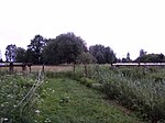 |
pipe | Bernau-Pankeborn | Feeding of heating pipes to the former industrial park. The operation on the other side of the railway line has been closed since the mid-1990s. The above-ground heating pipes are interrupted at 12 meters, so that the driveway can be used parallel to the Panke. A gas pipeline sign at this point indicates an intact gas pipeline that (probably) passes under the Panke. | (a) 00.63 |
 |
FGB | Bernau-Pankeborn | Path over the moat of the Panke. With a length of 2.5 meters and a width of almost one meter, this overpass consists of the pipe for the Pankewater and above it an embankment between the banks. | (a) 00.80 |
 |
StB | Bernau-Pankeborn | Road bridge Am Pankeborn, access to the industrial area. This bridge, about 7 meters wide, is an embankment over the pipe for the Panke trench. | (a) 00.87 |
 |
StB | Bernau-Pankeborn | The Bernauer Pankstrasse road bridge is designed as a pipe through with two gates. The Panke flows in two tubes made of clinker brick with the length of the street width of 15.5 meters. The southern exit, however, consists of two concrete parts with a rectangular cross-section. This shows that the width of the street has been expanded, and there is space above the street for a second footpath. | (a) 00.88 |
|
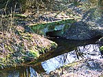
EBB | Bernau | Railway bridge of the Szczecin Railway. The railway was laid out at ground level in 1842 and required a bridge, which was previously directly at the intersection with the railway. Today's Pankeflie flows through a ditch north of the embankment towards Bernau station. The ditch leads to a rectangular inlet and then to a pipe through the railway embankment (to the Teufelspfuhl). The Panke from the north-east meets two drainage or water ditches from the north and west. The embankment has been 3 meters high (at the latest) since the renovation around 1930. The Panke does not re-emerge on the other side, but flows the next 90 meters through a pipe that emerges at the Teufelspfuhl. | (a) 01.32 |

|
pipe | Bernau | Inflow on the west side of the Teufelspfuhl. This feed pipe has a diameter of about one meter. This inlet corresponds in the direction with the pipe inlet of the trench on the other side of the embankment in position and direction of flow for the Panke. | (a) 01.42 |
 |
pipe | Bernau | Drainage on the south bank of the Teufelspfuhl in turn into a barred pipe of about half a meter in the further course of the Panke. | (a) 01.88 |
 |
pipe | Bernau | The Panke emerges 60 meters from the south bank of the Teufelsbruch. Between the drain on the Teufelspfuhl and this outlet pipe there is still a hidden "water system ". The exit and the following ditch in the area up to Börnicker Chaussee is about three to four meters deep. | (a) 01.96 |
 |
StB | Bernau | Börnicker Chaussee road bridge. The first bridge over the Panke was located here in 1767. The road only split below this bridge, north to Aarbusch and south to Börnicke. Above, the flow begins in a circular pipe through the Pankebett, which is about 4.50 meters below street level. Below the Panke emerges from a rectangular concrete cross-section, which is probably due to a street widening. The substructure of the road is piled up over these two culverts. | (a) 02.06 |
 |
FGB | Bernau | Pank crossing . Bridge for the bike and walkway between Bernau-Süd and the Bahnhofspassage as an extension of Marsstraße. | (a) 02.21 |
 |
StB | Bernau | New Gardens road bridge . The northern branch of the Pankewanderweg crosses here. | (a) 03.00 |
 |
StB | Bernau-South | Weißenseer Strasse road bridge. The bridge with a two-lane carriageway and footpath on both sides is 14 meters wide. The passage for the Panke is one and a half meters wide and forms a box for the passage. There was already a bridge over the Panke at this point in 1767. | (a) 03.29 |
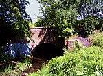 |
EBB | Bernau-South | The disused railway bridge is a concrete bridge with a semicircular passage arch. The tracks of a former works railway with a connection to the immediately neighboring Szczecin Railway are still on the bridge. | (a) 03.62 |
 |
FGB | Bernau-South | Footpath bridge, it was already there and was used for the Pankewanderweg. The continuous asphalt pavement of the Pankeradweg is poured onto the older bridge made of concrete. Right and left are the waist-high concrete walls of the fall protection. Compared to the enclosed recording, these will be secured on both sides with construction barriers in 2018. The bridge is almost five meters wide, the pank passage is about two meters wide. | (a) 03.68 |
 |
pipe | Bernau-South | Pipe of a gas pipeline. This pipe bridge is about 20 meters before the following motorway bridge . | (a) 04.37 |
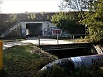 |
FGB | Bernau-South | Concrete slab for the Pankewanderweg (view from the north). A concrete slab about 3.5 meters wide and 40 meters long (in the high motorway embankment in the width of the Pankelauf) has led the Pankeweg under the motorway over the (through) river since 2000 . Until then, the hiking trail turned and ran parallel to the motorway to the nearest passage and was connected with a long “Um” path or the Pankebett had to be walked on. | (a) 04.39 |
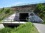 |
StB | Bernau-South | A 11 motorway bridge . The bridge (view from the south) is about 330 meters southeast of the Bernau-Friedenstal S-Bahn station. The Panke is capped for the hiking trail in the flow. | (a) 04.86 |
 |
FGB | Eichwerder | Pedestrian and cyclist bridge for the Pankewanderweg north of the extended Freiligrath-Straße. The bridge design with wooden railings and wooden decking on two T-beams corresponds to several other footbridges on the Pankewanderweg. The girders lie on concrete bridgeheads on both banks, from which inclined fieldstone abutments dissipate the forces. | (a) 05.42 |
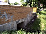 |
StB | Eichwerder | Zepernicker Chaussee road bridge. What is remarkable about the concrete bridge with its rectangular opening is the waist-high fall protection made of yellow bricks on both sides . At both ends of the bridge, this will be extended two meters on both sides with metal railings. As early as 1767 there was a bridge over the Panke next to a malt or bite mill. | (a) 05.52 |
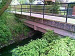 |
StB | Eichwerder | Theodor-Körner-Strasse road bridge. It is a girder bridge with a metal railing made of flat steel as a handrail and attached with several longitudinal bars as a fall protection. | (a) 05.94 |
 |
FGB | Eichwerder | Two wooden walkways lead between parts of the garden over the Panke. | (a) 05.89 |
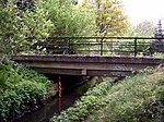 |
StB | Eichwerder | Road bridge Uhlandstraße is a girder bridge with a metal railing with shaped flat steel as a handrail and longitudinal bars as fall protection. | (a) 06.24 |
 |
StB | Eichwerder | Road bridge on Ernst-Moritz-Arndt-Strasse. It is a girder bridge with a metal railing with flat steel as a handrail and longitudinal bars as fall protection. | (a) 06.31 |
 |
EBB | Eichwerder | Railway bridge of the Szczecin Railway. This panel duct consists of a bricked "arched tunnel". This tunnel is 12 meters long (double-track railway line) and is 1.20 meters wide and a good two meters high for the flow. | (a) 06.38 |
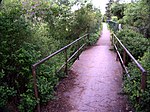 |
FGB | Zepernick | Pedestrian bridge over an unnamed path from Straße An der Panke (Bernau-Schönow) to the nature reserve Faule Wiesen and through the embankment to Elbestraße in Zepernick. This transition consists of two steel girders on which corrugated iron sheets lie. The tread is two meters wide. Two simple iron pipes on three bars serve as railings. The upper one is the handrail, the lower one the fall protection. | (a) 06.74 |
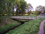 |
FGB | Zepernick | A steel bridge with a steel railing serves as a pedestrian bridge over a nameless path from the Dompromenade street to the dog training area. | (a) 07.59 |
 |
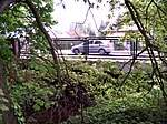
FGB | Zepernick | Pedestrian bridge for an unnamed path from the Dompromenade street to the daycare center near the Zepernick S-Bahn station. It is a wooden bridge in beam construction. | (a) 07.80 |
 |
StB | Zepernick | Road bridge Schönower Straße, rebuilt in 2001. Metal grilles and metal tubes as handrails form the railing. The girder bridge is 12.40 meters wide with two lanes and two sidewalks, 15 meters long and with a square passage for the Panke. As early as 1767 there was a bridge over the Panke, the path split behind the bridge when viewed from the village. | (a) 08.01 |
 |
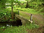
FGB | Zepernick | The Fontanestraße pedestrian bridge connects both parts of Fontanestraße. A concrete band rests on slightly curved steel girders. For the railing of the bridge, ropes are stretched below the handrail as fall protection. The current bridge was rebuilt in 2008. | (a) 08.20 |
 |
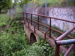
FGB | Zepernick | A handrailless pedestrian bridge leads a path that runs north and parallel to the Szczecin Railway. The Panke flows through a rectangular cross-section with a width of one and a half meters and about the same height. Two pipes with a diameter of 20 centimeters run between this bridge and the railway embankment, but they lack the character of a bridge. This bridge next to the embankment was already in place in 1839. |
(a) 08.27 |
 |
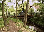
EBB | Zepernick | Railway bridge Szczecin Railway. The embankment is traversed by the Panke from northwest to southeast in a passage 22.50 meters long, almost one meter wide and almost 2 meters high. During the electrification, a new track bed was probably laid over the original embankment of the Stettiner Bahn without changing the Panke crossing. The railway bridge already existed in 1839. | (a) 08.29 |
 |
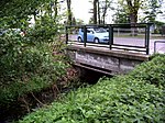
StB | Zepernick | This three meter wide wooden beam road bridge serves as a guide from road 5 to Eisenbahnstraße. She wears a planking. The railing has a wooden handrail and between some wooden posts, metal grids in the frame form a transparent fall protection. A triangular blue metal sign shows the limited load-bearing capacity of the bridge and is intended to prevent heavy vehicles from passing the 10 meter long bridge. | (a) 08.34 |
 |
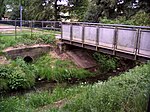
StB | Zepernick | Concrete road bridge on Schönerlinder Strasse. Width: 10.50 meters, length: 9 meters. The Panke flows through a passage with a rectangular cross-section. The bridge railing consists of three metal frames, which are covered with rectangular wire mesh. A bridge already existed here in 1839. | (a) 08.57 |
 |
FGB | Zepernick | Pedestrian bridge on Schönerlinder Strasse. A (separate) new wooden pedestrian bridge for the Pankewanderweg was built one meter down the pank down the Pankewanderweg so that it remains outside the main road. The wooden construction is 1.80 meters wide and 7 meters long, the decking and railings are also made of wood. | (a) 08.57 |
 |
StB | Zepernick | Road bridge Straße der Jugend. The bridge was renewed in 2006. A concrete girder bridge rests on several steel girders that rest on the brick abutments on both sides of the Panke. The railing with a height of 1.40 meters consists of a round tube as a handrail and the railing surfaces are secured with (transparent) plates made of meshed wire. | (a) 09.03 |
 |
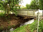
FGB | X-ray valley | Solothurnstrasse footbridge to connect both parts of the otherwise passable road. The bridge is 12 meters long, almost 1.80 meters wide and rests on two steel girders. These girders rest on sandstone abutments, which probably come from a previous bridge. The pedestrian bridge has a covering made of processed wooden planks, the bridge railing is 1.30 meters high made of perforated sheet metal with a round bar as a handrail; it is of the same design as the neighboring Unterwaldenstrasse bridge. It should be noted that the Panke runs under the surface in front of Solothurner Strasse. | (a) 09.41 |
 |
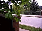
StB | X-ray valley | The bridge leads the Unterwaldenstrasse over the Panke, it only has a cantilevered footpath on one side. With a length of 12 meters including the designed bridge ramps and a width of almost 1.80 meters, the wooden planked bridge rests on two steel girders that rest on the foundation of an earlier bridge. The bridge railing is 1.30 meters high made of perforated sheet metal with a round bar as a handrail. The construction is identical to the neighboring Solothurnstrasse bridge. | (a) 09.67 |
 |
StB | X-ray valley | The Edelweißstrasse road bridge, with a two-lane carriageway and sidewalks on both sides, is 10 meters long and 8 meters wide. It is a reinforced concrete girder bridge on steel girders. | (a) 09.89 |
 |
StB | X-ray valley | The Bahnhofstrasse road bridge, with two asphalt lanes and sidewalks on both sides, is 13.1 meters wide. The reinforced concrete girder bridge spans the Panke with a length of 11.50 meters. | (a) 10.21 |
 |
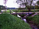
FGB | book | The footbridge on the meadow of the Steener Bruch consists of two steel girders that rest on the natural banks on both sides of the river bed, four concrete slabs are laid over the girders. The pedestrian bridge is located 170 meters south of the border from Panketal to Berlin. Judging by the kicks, the footbridge is used for agricultural purposes and for driving cattle. On the Linspankan side there are still cattle areas in 2018, the ford-like crossing like ten years ago (probably) no longer takes place: there were no prints of cattle feet on the bank. | (a) 11.03 |
 |
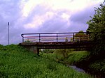
FGB | book | Pedestrian bridge street 5 . 7.4 meter long and 2.35 meter wide pedestrian bridge in the course of the street 5 of the colony Buch, Steener Bruch. It transfers the Pankewanderweg from the left to the right bank of the Panke. | (a) 11.05 |
 |
FGB | book | Sudauer Bridge . 12 meter long and 2.50 meter wide pedestrian bridge in the Buch colony, Steener Bruch. The Pankewanderweg remains here on the right bank. | (a) 11.59 |
 |
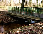
StB | book | Road bridge Pölnitzweg , brick arched passage above the Panke. A bridge for the road from Buch to the northeast already existed here in 1770. | (a) 11.75 |
 |
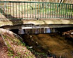
FGB | book | Schloßparkbrücke VI , pedestrian bridge (1) in the Buch Castle Park. All Panke Castle Park Bridges are made from a compact 4 m long and 3 m wide concrete slab. | (a) 11.79 |
 |
FGB | book | Schloßparkbrücke Ⅴ , pedestrian bridge (2) in the Buch Castle Park | (a) 11.87 |
 |
FGB | book | Schloßparkbrücke Ⅳ , pedestrian bridge (3) in the Buch Castle Park | (a) 11.92 |
 |
FGB | book | Schloßparkbrücke Ⅲ , pedestrian bridge (4) in the Schlosspark Buch, it leads over the Schloßparkgraben 20 meters from the end of the Schlosspark pond and is not in the direct Pankelauf, but is fed by Pankewater. The castle park bridges Ⅶ on the way from the bridge Ⅳ also lead over the castle park ponds. In the area of the former park of the dilapidated castle, which was demolished in 1964, there are the Schloßparkbrücke Ⅸ (northern pond) and Ⅹ (southern pond) on the main path from the bridge Ⅵ to the “Künstlerhof” entrance. On the west parallel path to that, number Ⅰ bridges the southern pond. The Schloßparkbrücke Ⅷ leads the way across the park over the drainage of the northern castle park pond. | (a) 12.02 |
 |
FGB | book | Schloßparkbrücke Ⅱ , pedestrian bridge (5) in the Schlosspark Buch, it is located shortly before the junction from Schoßparkgraben back to Panke, 20 meters to Wiltbergstrasse. | (a) 12.10 |
 |
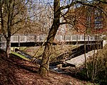
StB | book | Road bridge Wiltbergstraße (at the southern end of the castle park) over the river with overpass of the Pankewanderweg. A road connection and a bridge from the southern district of Buch to the northwest were already recorded by Schmettau around 1770. | (a) 12.16 |
 |
FGB | book | 15 meter long pedestrian bridge between the S-Bahn station and the shopping center | (a) 12.21 |
 |
FGB | book | A 12-meter-long pedestrian bridge on an unnamed path connects it with Franz-Schmidt-Straße | (a) 12.41 |
 |
StB | book | 16 meter long road bridge Walter-Friedrich-Strasse | (a) 12.62 |
 |
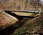
EBB | book | Railway bridge on a disused line on which the tracks are still lying, as a bridge built one behind the other and about 42 meters long. Originally (around 1870) this bridge led a track from Buch train station “to the insane asylum” and around 1900 was also connected to the south towards Berlin. This connection has not been active since 1930. | (a) 12.74 |
 |
StB | book | 19 meter long road bridge Ernst-Busch-Strasse | (a) 13.00 |
 |
StB | book | Motorway bridge A 10 (Berliner Ring) . 21.5 meters long, 27.8 meters wide, only 1.50 meters above the pank level and the pank-accompanying footpath | (a) 13.70 |
 |
FGB | book | The pedestrian bridge leads an unnamed path from Karéstraße over the river, it is 12.5 meters long and 13.5 meters wide. The construction was probably created during the construction of the A 10 , especially since a concrete road leads to the Pankeufer. The bridge is located in Buch on the southeastern bank of the river belongs to Karow (north). | (a) 13.83 |
 |
EBB | book | Railway bridge (Stettiner Bahn, RB 60), the bridge over the river is in Buch, the southern edge of the bridge leads over the district boundary to Karow (north). | (a) 13.89 |
 |
EBB | book | Pankebrücke (Karow North) . The railway bridge of the regional train RB 27 runs diagonally over Panke and Pankewanderweg. 28.5 meters long, 20 meters wide. The border between Buch and Karow is on the eastern bank of the river. | (a) 14.21 |
 |
FGB | book | Schönerlinder-Weg-Brücke is a 12-meter-long and 6-meter-wide pedestrian bridge; the access to the bridge on the eastern bank of the Panke is in Karow. The Schönerlinder Weg itself is in Buch. | (a) 14.64 |
 |
StB | French Buchholz | The Pankgrafenbrücke leads the Pankgrafenstraße in two lanes and bridges a converted ditch and the Panke. It is about 20 meters long and 15 meters wide. In 2012 the administration responsible had it completely reconstructed: the reinforced concrete slab of the structure and parts of the substructure were renewed. The roadway, sidewalks, cable guides and water pipes were also replaced. The access to the bridge on the eastern bank of the Panke is in Karow. | (a) 15.18 |
 |
FGB | French Buchholz Karow |
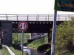
Krontaler footbridge . The bridge, built between 2006 and 2009, leads the Pankeweg to the left bank of the Karower, as the following railway bridge does not leave any space on the right. Length 10 meters, width 3.50 meters. The steel construction with steel main girders and steel end cross members was prefabricated and assembled on site. The footpath and bike path are covered with mastic asphalt, a steel railing with a height of 1.30 meters secures the transition. The abutments are rectangular, box-shaped reinforced concrete structures with a flat foundation. The bridge is only accessible for forestry and rescue vehicles. Foldable bollards protect against unauthorized journeys. The access to the bridge on the eastern bank of the Panke is in Karow. | (a) 15.68 |
 |
EBB | French Buchholz | Flaischlenbrücke-A (railway bridge). Here are three parallel but independent bridge parts. The northern route consists of two bridges and crosses the Berliner Ring over the Pankewanderweg and the Panke. The lengths are on average 19 meters, the northernmost bridge in the course of the Berlin outer ring is 5.8 meters wide and therefore only carries one pair of tracks. It is 18 meters long and leads north to the Szczecin Railway. The access to the bridge on the eastern bank of the Panke is in Karow. | (a) 15.85 |
 |
EBB | French Buchholz | Flaischlenbrücke-B (railway bridge). This railway bridge of the two parallel more northerly bridge structures crosses the Berliner Ring over the Panke and the Pankewanderweg, which runs here on the Krontaler Straße. The length is 17 meters, this middle bridge in the course of the Berlin outer ring carries two pairs of tracks with a width of 10.6 meters. The access to the bridge on the eastern bank of the Panke is in Karow. | (a) 15.86 |
 |
EBB | French Buchholz | Flaischlenbrücke-C (railway bridge). The southeastern of the three parallel bridge parts is about 17 meters away from the other two and has a sidewalk footpath. It leads the S-Bahn line S8 over the Panke and the Pankewanderweg, which is here on the Krontaler Straße carriageway . The length with the bridgeheads is almost 21 meters. It is single-track with a width of 5.36 meters, including the accompanying commute next to the rail. The access to the bridge on the eastern bank of the Panke is in Karow. | (a) 15.88 |
 |
FGB | French Buchholz | This footbridge is also called the Flaischlenbrücke and is 10 meters long and 2 meters wide. It connects the Krontaler Straße with the meadows to the west of the Panke and leads to French-Buchholz. This path and a bridge have existed since 1900. The access to the bridge on the eastern bank of the Panke is in Karow. | (a) 16.17 |
 |
StB | French Buchholz | Pankebrücke (Karow). The A 114 motorway bridge on the border with the French-Buchholz district has longitudinally staggered supporting structures, the length of the bridge parts landward of 37 meters and urban direction of 47 meters with a total width of 22.2 meters. The access to the bridge on the eastern bank of the Panke is in Karow. | (a) 16.37 |
 |
FGB | French Buchholz | The 2 meter wide Königsteinbrücke is a 99 meter long pedestrian bridge along the 74 road over the A 114 , the Panke and the Pankewanderweg. The bridge has on both sides accessible usable ramps, whereby they have a total length of 180 meters has . The height of the supports guarantees that tall vehicles can pass through on the motorway . At around this point, a bridge from Karow to French Buchholz crossed the Panke in its river valley as early as 1770. The access to the bridge on the eastern bank of the Panke is in Karow. | (a) 17.55 |
 |
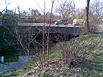
FGB | French Buchholz | The Midammensteigbrücke is another more than 100 meter long pedestrian bridge over the A 114 and the Panke, also with the two long access ramps. It creates an east-west connection between the housing estate and Ferdinand-Buisson-Straße and is two meters wide. At around this point, a bridge from Karow to French Buchholz crossed the Panke in its river valley as early as 1770. The access to the bridge on the eastern bank of the Panke is in Karow. | (a) 17.90 |
 |
StB | French Buchholz | The reinforced concrete girder bridge leads Bahnhofstrasse over the Panke, it is a total of 27 meters long and around 17 meters wide with footpaths on both sides. As early as 1770 near Schmettau, a road runs over the Panke from Blankenburg. The access to the bridge on the eastern bank of the Panke is in Karow. | (a) 18.90 |
 |
FGB | Blankenburg | Working bridge on the distribution structure to the north ditch in front of the outflow of the Panke | (a) 19.10 |
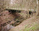 |
FGB | French Buchholz | Pedestrian bridge connects the street 42 with the allotment garden colony Blankenburg. It is a girder bridge with a steel substructure and in reinforced concrete, 18 meters long and 5 meters wide. This bridge was built between 1900 and 1910 as a railway bridge for the Tegel – Friedrichsfelde industrial line , which was opened here in 1908. On the map material of the measuring table sheet from 1932 still present as a bridge of the industrial railway. It is no longer listed as a railway bridge on the 1943 map. | (a) 19.28 |
 |
StB | French Buchholz | The Schlossparkbrücke is a reinforced concrete girder bridge, 26 meters long and 20.6 meters wide. The former road bridge in the extension of Schlossallee is provided with a side path for the Pankerad and hiking path. Its current use (after the construction of the motorway) for road traffic is the transfer of junction 4 of the A 114 to Pasewalker Straße. | (a) 20.05 |
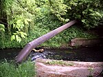 |
pipe | Heinersdorf | Pipe bridge between junction A 114 , in front of Pasewalker Straße; Length of the pipe 8 meters | (a) 20.18 |
 |
StB | French Bucholz | The Spoon Bridge leads Pasewalker Straße over a length of 35.6 meters with a clear width of 12 meters over the river. The bridge deck offers space for three lanes, a double-track tram route and a footpath. The two tram stops are directly on the bridge. The name 'Spoon Bridge' goes back to the Schlossallee (formerly) continuing towards Heinersdorf, so that Pankow citizens made their trip here. Thereupon coffee gardens settled on the Panke, in which coffee spoons were important utensils. Or rather where the citizens of Pankow got their spoons. This bridge is already listed under this name in 1825. The bridge, which was renewed in the mid-1920s, was renewed after 90 years from 2017 to 2020. | (a) 20.20 |
 |
FGB | Niederschönhausen | Dilapidated working bridge from the new residential area (formerly Pankow Hospital ) on Galenusstrasse on the left bank of the Panke to the dilapidated craftsman or heating building (of the hospital) on the right bank of the Panke. It is a simple 3.5 meter wide and about 5 meter long concrete slab over the panke flowing here in a concrete bed. | (a) 20.95 |
 |
FGB | Niederschönhausen | The Strauchwiesenbrücke is a pedestrian bridge through the allotment garden (KGA Schüßler ) at the level of Lindenberger Strasse. The superstructure is made of steel, the railing and decking are made of wood. In 2000, the bridge structure and part of the abutments were renewed, a wooden temporary bridge secured the pedestrian crossing of the Panke during the construction work. This bridge is 4 meters long and just over 2 meters wide. It lies between two fences, on the one hand the KGA (eastwards, i.e. downstream) and beforehand along the representative residential area. A wide bridge with a road is already shown here on the map from 1872. The officially assigned name of the bridge is unknown to the users of the allotment garden. | (a) 20.97 |
 |
pipe | Niederschönhausen | Pipe bridge next to the Strauchwiesenbrücke. In a separate structure, two pipes for Vattenfall Berlin's heat supply are routed across the Panke. | (a) 21.07 |
 |
FGB | Niederschönhausen | Footpath within the KGA Schüßler , which is open to general use during the day. The bridge is about 4 meters long and only one meter wide. It forms the path between the allotment garden colonies on both sides of the Panke. | (a) 21.07 |
 |
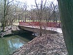
StB | Niederschönhausen | The Schlossparkbrücke III , a 5 meter long and 3.80 meter wide road bridge, connects paths on the edge of the allotment gardens on both sides of the Panke. The bridge is obviously used by the vehicles of the park gardeners and is therefore more load-bearing than is required for pedestrian traffic, but is not approved for public road traffic. A road bridge is already recorded here in 1825, but not at Schmettau around 1770. | (a) 21.17 |
 |
FGB | Niederschönhausen | The 10-meter-long and 3.5-meter-wide Schlossparkbrücke II is a pedestrian bridge between the Parkidyll colony and the KGA Parkfriede ; the Schönhausen Palace Park begins here in the direction of the river. | (a) 21.57 |
 |
FGB | Pankow | The Schlossparkbrücke I is a pedestrian bridge that is identical to the bridge II in the Schönhausen Palace Park, which here in the southern part already belongs to the Pankow district, near the Ossietzkybrücke. | (a) 21.88 |
 |
StB | Pankow | Ossietzkystraße road bridge, about 18 meters long and 18 meters wide. This bridge from Pankow to the north (Schlossstrasse) was first recorded in 1825, but not at Schmettau around 1770. | (a) 22.00 |
 |
StB | Pankow |
The Schönholzer Bridge leads the Schönholzer Straße at the fork (Noch-) Schönholzer Straße / Grabbeallee / Heinrich-Mann-Straße over the Panke. It has a width of 23.60 meters for 3 lanes, one lane for buses and trams, as well as two-sided footpaths.
For the old, listed bridge, together with other small structures (pergola, group of putti and toilet houses) built according to plans by Alexander Poetschke in the years 1923–1925, a replacement building was made in 2011. |
(a) 22.68 |
 |
FGB | Pankow | The pedestrian bridge Östlicher Parksteg in the Bürgerpark Berlin-Pankow is 3.75 meters wide and 10.50 meters long. | (a) 23.13 |
 |
FGB | Pankow | The pedestrian bridge Westlicher Parksteg in the Bürgerpark Pankow is 16 meters long and 3.80 meters wide. | (a) 23.34 |
 |
StB | Pankow | The bridge at the Bürgerpark is a road bridge in the course of the street Am Bürgerpark, 21 meters long, 15 meters wide. | (a) 23.40 |
 |
EBB | Pankow | Railway bridge of the Berlin Northern Railway . A 25-meter-wide railway bridge for two S-Bahn tracks, one track for the northern railway to the former Schönholz freight station and an unused track; The entrance arch of the bridge is smaller than the exit arch, mean length around 20 meters and a width of 24.90 meters for the masonry passage arches. The bridge was built in 1875/1876 and put into operation when the railway opened. | (a) 23.50 |
 |
StB | Healthy well | The Hugo Heimann Bridge is a road bridge on the Kühnemannstraße – Nordbahnstraße. The picture gives a view of the road bridge and the railway bridge in the background. | (a) 23.56 |
 |
FGB | Healthy well | Pedestrian bridge Gottschalkstrasse, 18.6 meters long, 2.8 meters wide. Later in panke down there is another bridge that does not lead, however, on the Panke, but the inflow to the applied here Panke basin forms a retention basin if the Panke (again most recently in 1980) leads flood. | (a) 23.82 |
 |
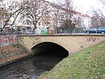
FGB | Healthy well | The Heubuder Bridge (also Heubuder Steg ) leads the Pankewanderweg across the river as a pedestrian bridge at Heubuder Straße. The structure, completed in 1995, is made up of external wooden trusses with a suspended continuous construction. The trusses carry support beams connected by hanging rods for the trough-shaped bridge structure. This consists of girders running across five fields with transversely screwed wooden planks as a walking area. Neoprene cushions form the bearings. The bridge is about 21 meters long and 4.13 meters wide. | (a) 24.23 |
 |
StB | Healthy well | The Soldiner Bridge leads Soldiner Strasse over the Panke and connects to Stockholmer Strasse, which runs parallel to the river. It is the oldest Pankebrücke in Berlin. The arch bridge was built with simple brick arched arches in 1875/76. The original railing has not been preserved. It is around 28 meters long, 19 meters wide and has a span of 7.50 meters. Like the street, it bears the name of the former capital of Neumark Soldin, now Myślibórz in Poland . | (a) 24.60 |
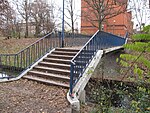 |
FGB | Healthy well | The nameless pedestrian bridge leads over the river at the end of Gotenburger Straße at the Wilhelm-Hauff-Grundschule (building in the picture). The bridge is 2.7 meters wide, 12.3 meters long and can only be crossed by stairs. | (a) 24.78 |
 |
StB | Healthy well | The Oslo road bridge leads the Oslo road at the OSZ communication, information and media technology on a width of 52 meters over the Panke. The length of the bridge arches is 15.3 meters. It was from 1906 to 1908 as an arch bridge with easy stitch arches of bricks built. Until 1938 it was called Christianiabrücke , after the former name of the Norwegian capital Oslo. Over the bridge that leads trail 5 (north-south route) of 20 green main ways ® Berlin. | (a) 24.92 |
 |
StB | Healthy well | Nameless pedestrian bridge, 15.8 meters long and 2.6 meters wide, connects Travemünder Straße with the former industrial site to the north-west. | (a) 25.64 |
 |
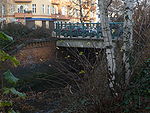
StB | Healthy well | The Badbrücke (also Badstraßenbrücke ) leads Badstraße over the Panke and has a connection to Gropiusstraße on the southeast side. The bridge is 13.3 meters long and 35.2 meters wide. A bridge for Badstrasse is first recorded in 1825, but not yet near Schmettau around 1770. It has
Commons : Badbrücke - album with pictures, videos and audio files
|
(a) 25.71 |
 |
StB | Healthy well | The Schönstedtstrasse Bridge was first built over the Panke at the beginning of the 20th century and named after the road that crosses it. To reduce the risk of flooding from the river, the Panke was widened in the area of this bridge in 1982 and today's bridge was built. This bridge is 8.5 meters long and 19.2 meters wide; in addition to the Panke, it also crosses Orthstrasse and is provided with a ribbed plate made of reinforced concrete. | (a) 25.96 |

|
StB | Healthy well | The Bornemannstrasse bridge was demolished when the left bank of the Panke was rebuilt. A small platform with a bench has been set up above the preserved abutment. | (a) 26.05 |
 |
StB | Healthy well | The Walter-Röber-Brücke leads the Wiesenstraße over the Panke to Uferstraße. Next to the 12 meter long and 20 meter wide bridge there is a memorial stone for the street fights that took place here in 1929. A bridge for Wiesenstrasse was first recorded in 1825, but was not recorded in 1770 near Schmettau.
Commons : Walter-Röber-Brücke - Album with pictures, videos and audio files
|
(a) 26.19 |
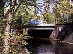 |
StB | Healthy well | Pankstrasse bridge in the course of Pankstrasse, length around 15 meters, width around 35 meters. The bridge is a simple girder bridge with two lanes, a median and two wide footpaths. A bridge for Pankstrasse is already recorded here in 1825, but not in Schmettau's map series around 1770. | (a) 26.34 |
 |
EBB | Healthy well | The railway bridge of the Berlin Ringbahn is 20 meters long and the track system is 22 meters wide. The entrances to the Gesundbrunnen Center and a small green strip to the northwest are built underneath. The stretch of bridging the Panke bed is a total of 33 meters long. However, the entrances on both sides of the bridge to the north cannot be passed through fences. The actual railway bridge was placed on the older bridge made of clinker bricks with three arches during the expansion of the circular railway line, so the concrete wall and the noise protection wall are available to the southeast. The picture is the view from the northwest (in clinker brick optics), above an earth dam carrying the railway body. Down the pank you can only see an arch and above it the concrete layer on the old bridge construction. The construction of the bridge began in 1867 and was used from 1871 with the opening of the northern ring line. | (a) 26.41 |
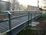 |
FGB | Wedding | The Pankewegbrücke pedestrian bridge is around 15 meters long and leads the Pankeweg from one bank to the other. | (a) 26.48 |
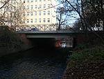 |
StB | Wedding | The Richtstrasse Bridge leads the Richtstrasse over the Panke; it is 11.8 meters long and 26 meters wide. A bridge for the Richtstrasse is first recorded in 1825, but not yet at Schmettau around 1770. | (a) 26.58 |
 |
StB | Wedding | The Schönwalder Strasse Bridge is about 15 meters long and 26 meters wide and leads the Schönwalder Strasse over the river. The first construction took place in 1883 with a wall arch substructure. The original decorative railing has been preserved. Formerly known as Dalldorfer Straße, the Panke branched out into the two points below the bridge. In 1842, Dalldorfer (today's Schönwalder) Strasse did not yet exist. | (a) 26.60 |
 |
StB | Wedding | The Schulzendorfer Strasse Bridge leads Schulzendorfer Strasse over the Panke. The bridge is 12.3 meters long and 20 meters wide. The automatic computer system is located below the bridge, underneath is the locking device with which the water is diverted into the southern slope. ( Note Südpanke [obsolete] ) In 1870 two neighboring bridges are noted in the course of Schulzendorfer Strasse, one leads over Schönhauser Graben and one a little further east over Panke. In 1842 Schulzendorfer Strasse did not yet exist. | (a) 26.77 |
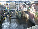 |
FGB | Wedding | Lattice walkway on the automatic computer system for the site inspection. This girder bridge belongs to the facility. | (N) 26.87 |
 |
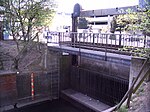
FGB | Healthy well | Pedestrian bridge in front of the Chausseestrasse weir system under the residential buildings. It is a 2.5 meter wide girder bridge covered with reinforced concrete. | (N) 27.03 |
 |
FGB | Healthy well | At the computer in front of Chausseestrasse / Müllerstrasse, a work crossing connects the two banks of the Panke. It is a girder bridge covered with a steel grid path. | (N) 27.03 |
 |
StB | Wedding | The Chausseestrasse bridge is used to cross the northern derivation of the Panke. It is 10 meters long and 31.7 meters wide. A bridge for Chausseestrasse over Schönhauser Graben was already listed in 1825. It has been |
(N) 27.56 |
 |
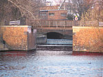
plate | Wedding | Pank cover . This 222 meter long construction directly above the canal bed of the Nordpanke enables parking and the entry and exit of visitors to the Erika-Heß-Eisstadion . | (N) 27.66 |
 |
FGB | Wedding | The Sellerbrücke is a bridge for pedestrians and cyclists, it leads the Kieler Straße to the street Am Nordhafen . | (N) 27.68 |
 |
pipe | center | Slider at the pipe inlet for the transfer and flooding of the south / city pank in the historical course of the panke. On the Schulzendorfer Straße computer system, there is a slide valve pankeab to feed the pankewater to the south pank. The planning has been completed, but the implementation has not been completed due to the ongoing construction work on Chausseestrasse. The underground run corresponds to the historical above-ground Pankelauf. | (S) 26.78 |
 |
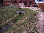
- | center | The former bridge of Chausseestrasse over the (old) Panke is already recorded for 1770 on the Schmettauschen map series at a grinding mill. With the growth in Wedding and the construction of the U6, the Panke was laid with a culvert more than seven meters below Chausseestrasse. After the Wall was built in 1961, it was deliberately destroyed. It has been restored since 2008 and prepared for the inflow of the Südpanke [out of date] 2015. | (S) 27.05 |
 |
pipe | center | Pipe exit of the south or city slope. From the water division on Schulzendorfer Strasse under the green space between Neuer Hochstrasse and Chausseestrasse to the corner of Liesenstrasse and after the undercover of Chausseestrasse, as well as under the grounds of the Bundeswehr Hospital in Berlin , the (planned) south pank emerges from the underground course. Around this point with | (S) 27.65 |
 |
pipe | center | Pipe entry north of the Am Pankepark settlement . From the 1750s until the end of the 19th century there was a Pankebrücke, which led from the Garde-Füsilier-Kaserne on Chausseestrasse to the entrance of the Invalidenfriedhof . The (prepared) south face ends in the course of the trench after a few meters. If the Pankepark is expanded as planned, the pipe entry to Habersaathstrasse would come 295 meters further east. | (S) 27.88 |
 |
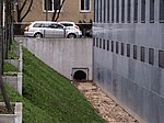
- | center | Since the 1750s there has been a Pankebrücke for the way from the area of the "Exercierplatz der Artillerie" to the disabled houses . In 1884 this is no longer recorded. | (S) 27.98 |
 |
pipe | center | Pipe outlet bridge. Habersaathstraße (formerly Kesselstraße) and an access road to the Charité heating and power station flow through the Panke underground in a pipe with a length of currently (as of 2010) 400 meters. With the planned design of the Pankeaue between Chausseestrasse behind the building complex of the Federal Intelligence Service and the urban quarter of the settlement houses on Scharnhorststrasse, this piping would be shortened to 105 meters up to here. A bridge for Habersaathstrasse is first recorded in 1825, but not at Schmettau around 1770. | (S) 28.29 |
 |
StB | center | Access bridge 1 (north) to the Ministry of Transport , component D. It is a 7-meter-long and 5-meter-wide reinforced concrete girder bridge that can be driven over, but is mainly used by pedestrians. | (S) 28.24 |
 |
StB | center | Access bridge 2 to the parking lot and the main and visitor entrance of the Ministry of Transport from the Schwarzen Weg and the Invalidenpark . It is a 7 meter long and 5 meter wide passable reinforced concrete girder bridge. | (S) 28.32 |
 |
StB | center | Access bridge 3 to the parking lot and the main and visitor entrance of the Ministry of Transport, identical in construction to access bridges 1 and 2. | (S) 28.34 |
 |
pipe | center | The pipe entry at the downstream end of the Federal Ministry of Transport does not correspond to the historical course of the Panke, although it is shown in this location in the Berlin city map from 2010. For security reasons, the building compensation measure was placed from the inside to the outside of the building. The (Süd-) Panke crosses under Invalidenstrasse and the space between Hessische and Luisenstrasse (“Place in front of the New Gate”) underground in the pipe. The Hessische Straße on the old course of the river and was laid out around 1865. A bridge for Invalidenstraße already existed in 1825. This construction of a bridge over the open river on Invalidenstraße was probably abandoned in the course of the expansion of the Berlin iron foundry and the development of Hessische Straße. | (S) 28.67 |
 |
StB | center | Overbuilt (still recognizable) historic Pankebrücke on Hannoversche Strasse. The arch underpins a girder bridge, this bridge is now under the widened footpath, today's Hannoversche Straße is 10 meters up the pank. The visible remains show a bridge length of 8 to 10 meters. Today the Südpanke flows underground through pipes west of the Federal Ministry of Transport. The bridge is first recorded in 1825, but not yet at Schmettau around 1770. | (S) 27.98 |
 |
FGB | center | Access bridge to the main entrance of the Berlin office at the Federal Ministry of Education and Research and a piped route for the transition or access on the side of the building with a width of 25.50 meters. The access is a girder bridge with a slotted base plate. | (S) 28.01 |
 |
pipe | center | After 68 meters of an environmental compensation measure, the Panke in front of Philippstrasse has been relocated back into the pipe. The (southern) Panke is under the Philippstrasse as it has been in the pipe since the beginning of the 20th century. Today Philippstrasse and the access road in the disused porter area of the Charité are under pipes. The bridge is first recorded in 1825, but not yet at Schmettau around 1770. | (S) 28.10 |
 |
pipe | center | The pipe outlet allows the (southern) Panke to flow in an open trench on the Charité premises . The adjacent service access to the rear area of the Charité buildings rests on a girder bridge above the pipe. | (S) 28.16 |
 |
FGB | center | Footpath bridge (1) on the Charité premises . With a length of 4.50 meters and a width of a little over a meter, the bridge rests on steel girders supported by two brick pillars, between which the water can flow. It connects House 7 with House 8, which houses facilities for the veterinary medicine department. Historically, this was the site of the Royal Veterinary School . | (S) 28.18 |
 |
FGB | center | Footpath bridge (2) on the Charité premises, with a width of about one meter and a length of 2.5 meters, connects House 5 and House 6 across the Panke. The bridge consists of a brick arch to the flow and a brick wall that fills the ditch slope. | (S) 28.21 |
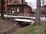 |
StB | center | Road bridge (3) on the Charité premises. This six meter long and three meter wide steel girder bridge with concrete pavement rests on two field stone abutments. The bridge has a handrail that provides fall protection on both sides of the bridge. Internally, it connects the access road with the institute buildings. | (S) 28.22 |
 |
StB | center | Road bridge (4) on the Charité premises. On a brick arch under the roadway for the water flow, a concrete roadway lies flush with the internal road. Width 4.2 meters and length 3.6 meters. | (S) 29.14 |
 |
plate | center | Beginning of the final pipework (since 2006) (350 meters in front of the mouth) on the Charité premises, south of the Akademie der Künste and east (behind the street) of the Embassy of the Republic of Ukraine in the Federal Republic of Germany. | (S) 29.33 |
 |
StB | center | The road bridge Reinhardtstraße is still there, but no longer recognizable as a bridge. This bridge was first recorded in 1825, but not yet at Schmettau around 1770. The beginning of the (inner-city) piping up to the mouth. The Pankebrücke on Reinhardtstrasse was still recognizable as a bridge until 2007. There was a ditch up the Panke and a short stretch down between the houses at Reinhardtstrasse 17 and 19. Due to the cover behind the Reichsbahnbunker Reinhardtstrasse and behind the Ukrainian embassy , the Panke disappears underground beforehand. But especially because the Panke was cut off from the “Pankewasser” with the construction of the wall and the destruction of the culvert in 1961 , the memory of this bridge is lost. | (S) 29.47 |
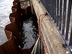 |
pipe | center | Uferstrasse Bridge This former bridge name refers to the Schiffbauerdamm, which had a bridge here since around the 1780s, but which did not exist in 1738. Before that, the Panke flowed openly into the Spree. The mouth of the Panke into the Spree on Schiffbauerdamm is the last overpass structure. Since the beginning of the 1960s and the interruption of the Chausseestrasse culvert, there has been planning for the revitalization of the south or city pank. The mouth hole is a rectangular concrete channel, 2.60 meters wide and about two meters high. Since 2005, the estuary has been hiding behind the steel sheet pile wall of the bank wall until it is renovated. | (S) 29.68 |
proof
- Gradients on the city map of Berlin Berlin.de
- Map of the Berlin surveying office, scale 1: 5000 with details of the official bridge names as well as the topographical map of Brandenburg 1: 25000 accessible via this link
- Unless otherwise stated, bridge dimensions are determined using Google Earth , sometimes also determined on site by (often calculated) step sizes.
- Inspection of the Schmettausche map series and the Prussian original measurement table sheets in the "Map Department of the State Library of Berlin " in spring 2010.
Web links
References and comments
- ↑ Location in Bernau Berliner Straße near Viehtrift: Bernau in the Middle Ages ( Memento of the original from January 4, 2014 in the Internet Archive ) Info: The archive link was inserted automatically and has not yet been checked. Please check the original and archive link according to the instructions and then remove this notice. Retrieved July 7, 2010.
- ↑ a b c d e f g h i j k l Friedrich Wilhelm Karl von Schmettau: Maps of Prussia 1767–1787 . Reprint Potsdam 2006. Map 64 Sect. Bernau and Map 78 Sect. Berlin, also SBB under L 5421-64 and -78.
- ↑ Berlin and its bridges,… . P. 139.
- ↑ The entire area between Albertshofer and Budnitzer Straße with the railway line slopes down to a length of 600 meters from 69 m to 66.5 m at the flow of the Panke under Bernauer Pankstraße.
- ^ FIS-Broker map display: Digital topographic map 1: 10,000 Brandenburg (DTK10) ; Retrieved May 13, 2010.
- ↑ Mes table sheet # 1766 Bernau, Volume VII Sheet 2 (Bernau) taken up and drawn in 1839 by PL von Roeder im Kais. Franz. Gren. Rgt.
- ↑ Prussian measuring table sheet # 1837, added in 1919, additions from 1933.
- ↑ Monument Pankebrücke in the Bürgerpark Pankow
- ↑ weddingkrass.wordpress.com ( Memento from June 20, 2010 in the Internet Archive )
- ↑ JGA Ludwig Helling (ed.): Historical-statistical-topographical pocket book of Berlin and its immediate surroundings (PDF) HAW Logier, Berlin 1830.
- ↑ Lage Rutenfeld and Pankeborn on berliner-stadtplan.com , accessed on March 8, 2011.
- ↑ a b The course to the Teufelspfuhl is like here Bernau b. Berlin. 52 ° 40'59.16 "N 13 ° 35'45.708" E also documented this way on maps in 2011, presumably because of the military area that has been closed since the 1930s.
- ↑ “The historic watercourse of the 'Alten Panke' was interrupted by the new hotel building 'Kaisergarten'. The consequence of this intervention against the basic rules of technology was an extensive renovation of the 'Alte Panke' between Steintor and Goethestrasse with a change in the historical flow direction. The cleaned rainwater is now directed over the enlarged 'pond' in the Goethepark through the piped Panke to the rain retention basin at the Steintor. "From: Urban development ( page no longer available , search in web archives ) Info: The link was automatically marked as defective. Please check the link according to the instructions and then remove this notice. Retrieved June 21, 2010.
- ↑ a b c d e f g h i j k l m n o p q Prussian measuring table sheet (# 1837) Volume VI, sheet 1, Berlin, recorded and drawn in 1825 by Mautt engineer geographer
- ↑ Special names for bridges according to FIS-Broker and other map series are interpreted as official. Such special names for bridges can be found mainly in the Berlin area, special mentions are sometimes separately documented.
- ↑ Today's city map of Bernau with the source of the Panke on the other side of the railway embankment ( memento of the original from October 26, 2011 in the Internet Archive ) Info: The archive link was inserted automatically and has not yet been checked. Please check the original and archive link according to the instructions and then remove this notice.
- ↑ On the eastern side of the railway (i.e. down the pank) there is an abandoned railway connection with a loading street. The neighboring former military site of the Soviet armed forces stationed here in the GDR is closed to the public. On the 2010 map material, the Pankefiess arches through this area to the eastern bank of the Teufelspfuhl. However, this recorded body of water and such an entry into the Teufelspfuhl on the shore of the lake cannot be determined. According to the map, the flow from the railway embankment to the entry point at Teufelspfuhl would have a length of 409 meters. The changes may have already taken place when the former military clothing office was built
- ↑ Panke Park Bernau concept ( page no longer available , search in web archives ) Info: The link was automatically marked as defective. Please check the link according to the instructions and then remove this notice.
- ↑ a b Digital Topographic Map 1: 10,000 Brandenburg (DTK10) , accessed on June 20, 2010.
- ↑ According to the map material, the Panke enters the lake 50 meters north on the east bank of the Teufelsbruch (coordinates: old Panke tributary ), but such a body of water was not found during the inspection (2010 and 2011). The only visible tributary is a pipe on the western bank of the Teufelsee.
- ^ Prussian original measuring table sheet: # 1677 Bernau, # 1837 Berlin
- ↑ Path construction ( page no longer available , search in web archives ) Info: The link was automatically marked as defective. Please check the link according to the instructions and then remove this notice.
- ^ Zepernicker Chaussee-Brücke , accessed on May 29, 2010.
- ↑ a b c Map of Eichwerder , accessed on May 14, 2010.
- ↑ Info Bernau-Eichwerder ( page no longer available , search in web archives ) Info: The link was automatically marked as defective. Please check the link according to the instructions and then remove this notice. (PDF) accessed May 14, 2010.
- ↑ a b c Mes table sheet # 1766, Volume VII, Sheet 2, Bernau. Recorded and drawn in 1939 by PL von Roeder in Kais.Franz.Gren.Rgt.
- ^ Plan of Berlin. (north) Sheet 4521 ( Memento of the original from November 9, 2015 in the Internet Archive ) Info: The archive link has been inserted automatically and has not yet been checked. Please check the original and archive link according to the instructions and then remove this notice. X = 33460, Y = 35975
- ↑ Map of Berlin 1: 5000: Location of the Bucher Schlossparkbrücken
- ↑ Refurbished. Pankgrafenbrücke can be used again. In: Berliner Morgenpost . Lichtenberg edition, weekend extra, title page
- ↑ according to SenStadt
- ↑ Table sheet added in 1901, additions 1903.
- ↑ a b table sheet # 1765. Volume VII Sheet 1 Schönerlinde. Recorded and drawn in 1839 by von Estorff Prem: Lieut: in the 13 th Inf: Regiment:
- ↑ a b c Sanwald Plan Berlin . Karl Sanwald, Pasing before Munich 1926.
- ↑ PHARUS PLAN BERLIN . Berlin N 54, Schwedter Strasse 263, 1943.
- ↑ Schropp's Great Berlin Transport Plan . Cartographic Institute K. Schaffmann, Berlin SW 68 1947.
- ↑ Page no longer available , search in web archives: Heinersdorf (PDF) accessed April 20, 2010.
- ↑ Pasewalker Strasse B109 becomes a construction site 2017-2020 In: Pankower Allgemeine Zeitung, April 21, 2017
- ↑ A new road bottleneck looms in the north of Berlin . In: Berliner Morgenpost, April 23, 2017
- ↑ Page of the building planner ( Memento of the original from June 2, 2009 in the Internet Archive ) Info: The archive link was inserted automatically and has not yet been checked. Please check the original and archive link according to the instructions and then remove this notice. Retrieved April 5, 2010.
- ↑ Prussian measuring table sheet # 1837, Volume VI, Sheet 2 Berlin. Recorded and drawn by Hildebrandt Pr.Lieut. and hammer II
- ↑ Listed Pankebrücke in the Bürgerpark Pankow
- ↑ Project description
- ^ Border barriers (border wall 75, 1980s) in the Wilhelm-Kuhr-Straße area. - Right Pankebrücke Am Bürgerpark ( Memento from May 7, 2005 in the Internet Archive ) accessed February 1, 2015.
- ↑ a b c photos-of-the-border troops-of-the-gdr-of-the-berliner-sectors-and-zone-border: pictures 20 to 30 ( memento of the original from December 8, 2012 in the Internet Archive ) Info: The archive link was inserted automatically and not yet checked. Please check the original and archive link according to the instructions and then remove this notice. , accessed December 30, 2012
- ^ Border barriers (border wall 75, 1980s) in the Wilhelm-Kuhr-Straße area. - Left: railway bridge. Center: Panke ( Memento from May 20, 2005 in the Internet Archive ) accessed July 16, 2010.
- ↑ Over bridges . Info from the Senate Administration, accessed November 19, 2009.
- ↑ Soldiner Bridge . In: District lexicon of the Luisenstädtischer Bildungsverein
- ↑ Oslo Street Bridge . In: District lexicon of the Luisenstädtischer Bildungsverein .
- ↑ Senate Department for Urban Development 20 Green Main Paths ® .
- ↑ Berlin city map, Oslo Street Bridge
- ↑ Senate Department for Urban Development North-South Path, hiking trail 5.
- ↑ BVG route network . Berliner Verkehrs Betriebe Verlag, 1939.
- ↑ Schönstedtstrasse Bridge . In: District lexicon of the Luisenstädtischer Bildungsverein
- ↑ BERLIN . FA Brockhaus' Geogr.-artist. Institution, Leipzig 1895.
- ↑ a b map of the country initially Berlin . Publishing house of the Königl.Preuss.Landes -aufnahme, 1869.
- ^ Prussian measuring table sheet Berlin. Volume VI Sheet 2 Berlin. Recorded and drawn in 1870 by Hildebrandt Prem.Lieut. and hammer II
- ↑ See ground plan of the royal royal cities of Berlin in 1789, colored copper engraving. Format: 17.0 × 24.7 cm. Retrieved March 9, 2011.
- ↑ a b See also “Droschken-Wegemesser” for Berlin, 1884
- ↑ Compare also the map of the maneuvers of the Guard Corps in autumn 1842.
- ↑ Current city map on Berlin.de
- ^ Map of the country initially Berlin . Publishing house of the Königl.Preuss.Landes -aufnahme, 1869.
- ↑ a b Old Berlin city map from 1895 ( page no longer available , search in web archives ) Info: The link was automatically marked as defective. Please check the link according to the instructions and then remove this notice. on which the open panke can be seen.
- ↑ Including the Reinhardtstrasse bridge, the last 350 meters of the Panke are piped to the Spree. The tour continues along the western foundation wall of the former Renz circus / old Friedrichstadtpalast and along the eastern foundation wall of the theater on Schiffbauerdamm to the mouth opening in the bank wall of the Spree.
- ↑ Eckhard Thiemann, Dieter Deszyk, Peter Horst Metzing: Berlin and its bridges. Jaron Verlag, Berlin 2003, ISBN 3-89773-073-1 , p. 140.
- ↑ Floor plan of the royal royal cities of Berlin . Newly made in 1789 by Carl Ludwig von Oesfeld, colored copper engraving. Scan .
- ↑ BERLIN the most magnificent u. most powerful capital . Matth. Seutter, Augsp. 1738.
- ↑ Demolition of the Royal Residences = City of BERLIN. Johann David Schleuen the Elder Ä., 1760.

