List of bridges in Berlin / B
Explanation
- (Sample bridge ) = in brackets : unnamed bridges.
- Sample bridge = in italics : former bridges.
| Name of the bridge | District | Notes and picture | location |
|---|---|---|---|
| Bachstelzenwegbrücke | Rahnsdorf | The Bachstelzenwegbrücke crosses Canal VI of the New Venice residential and weekend house area . The temporary bridge built in 1954 was replaced by a new one in 1994. | cards |
| Bath bridge | Healthy well | The Badbrücke leads the Badstraße over the Panke and has a connection to the Gropiusstraße on the southeast side. The bridge is 13.3 meters long and 35.2 meters wide. | cards |
| Badstrasse Bridge | Healthy well | seven-arched brick bridge that leads Badstrasse over numerous track systems. Length approx. 132 m (bent in the middle), width approx. 27 m | cards |
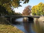
| Baerwald Bridge | Kreuzberg | The Baerwaldbrücke runs along the Baerwaldstrasse / Prinzenstrasse street at the Kreuzberg summer pool and across the Landwehr Canal west of the Urbanhafen at km 7.0 . A first wooden bascule bridge from 1850 was replaced by a stone arch bridge in 1876/78. It was called Gasanstaltsbrücke after the neighboring gas enlightenment institute until 1879 and since then has been named after the first administrative director of the municipal gas authorities, Friedrich Peter Baerwald. The structure with an arch under the road was reconstructed after damage in the Second World War in 1952 and later equipped with four two-armed candelabra made according to historical patterns. On both sides, the apexes of the arches facing the water are decorated with the coat of arms of the Berlin bear. | cards |
| Baillif Bridge | Moabit | see Moabiter Bridge | |
| Bäkebrücke | Lichterfelde | The Bäkebrücke leads the Bäkestrasse over the Teltow Canal . It opened on April 14, 1960. It is a riveted steel bridge with four parallel-chorded trusses. The span is 34.8 meters and the width is 13 meters. The previous bridge was built under the name Oskar-Lange-Brücke in 1907 and destroyed in the Second World War (named after Oskar Lange (1851–1937), deputy head of the community of Lichterfelde and Berlin city council ). The bridge bears its current name after the Bäkefluss , which up to rose on two smaller remains in the Teltow Canal. | cards |
| Bar bridge | Wilmersdorf | The bar bridge was built in 1911–1912; In 1934 a new building took place. It leads the Barstraße - the name comes from a battle in 1870 near the French town of Bar-sur-Aube - and the underground route of the U3 line across the Fennsee . The bridge's former name is Seeparkbrücke . | cards |
| Nursery Bridge | Baumschulenweg | The tree nursery bridge leads Baumschulenstraße over the Britzer connecting canal at kilometer 29.82 of the artificial waterway. | cards |
| Behmstrasse Bridge | Prenzlauer Berg | The Behmstrasse Bridge leads the Behmstrasse over the tracks of the Szczecin Railway and the Berlin Northern Railway . The average length is about 230 meters. | cards |
| Belle Alliance Bridge | Kreuzberg | see Hallesche-Tor-Brücke | |
| Bendler Bridge | Zoo | The Bendlerbrücke spans the Landwehr Canal on the Bendlerblock . The arch bridge made of reinforced concrete leads to Straßenzug Stauffenbergstraße / Kluckstraße over the canal and connects the Reichpietschufer with the Schöneberger shore. Since its new construction in 1957/58, the bridge has been named after the master mason and local politician Johann Christoph Bendler . The previous building, the Von-der-Heydt Bridge , was decorated with two sculptures by Ernst Herter . The two bronze mermaids and tritons were melted down in 1943/44 as a metal donation from the German people . | cards |
| Beussel Bridge | Moabit | The Beussel Bridge leads the Beusselstrasse over the Ringbahn . There is access to the Beusselstraße S-Bahn station from the bridge . | cards |
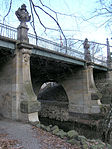
| Bismarck Bridge | Grunewald | Bismarck Bridge (formerly Sphinx Bridge , see picture above) leads Bismarckallee over the connecting ditch between Herthasee and Hubertussee . Built in 1891 as a steel beam construction, arches clad with natural stone. Jewelry in neo-baroque style with sphinxes , vases and obelisks by the sculptor Max Klein . | cards |
| Bismarcksfeld Bridge | Biesdorf | The Bismarcksfelder Brücke is a pedestrian bridge on the Bismarcksfelder Strasse over the Wuhle . | cards |
| Bismarcksteg | Huntsmanship | The footbridge crosses the Tegeler Fließ north of Fürst-Bismarck-Straße . | cards |
| Bitterfeld Bridge | Marzahn | The bridge, constructed in two separate parallel supporting structures, leads the Bitterfelder Straße , which initially branches off eastwards at Märkische Allee , over this avenue westwards and also crosses the neighboring Wriezener Bahn . It is 122.5 meters long and 11 meters (north) or 9 meters (south) wide and has footpaths and bike paths on both sides. It was initially called Industriesammelstraßenbrücke (street number 49793), the name Bitterfelder Brücke (street number 49800) took place on October 8, 1997. | cards |
| Blankenburg Laake Bridge | Blankenburg | The Blankenburger Laakebrücke leads the street Karower Damm / Blankenburger Chaussee over the river Laake . | cards |
| Blankenfelder Allee Bridge | Blankenfelde | The Blankenfelder-Allee-Brücke leads the Blankenfelder Allee over the north ditch. | cards |
| Block dam bridge | Karlshorst | The bridge near the Rummelsburg depot , built in the 1920s, was demolished in 1984 due to its dilapidation. Immediately next to it, a footbridge 3 meters wide and 96 meters long was built, which, in a slightly bent shape, leads over several pairs of railway tracks on the Lower Silesian-Märkische Railway . It connects the Blockdammweg with the Sangeallee. | cards |
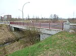
| Flower path bridge | Rosenthal | The road bridge in the area of the garden complex Einigkeit ( garden and settler community Einigkeit ), which can be driven on by car , leads a (continuous) private road near the Kräuterplatz over the north ditch . The bridge in Nordend was named as Frauenmantelweg in 2011 as part of the preparation of addresses that could be georeferenced and was previously called the garden path of the Einigkeit complex north of the Blumenweg bridge , south of it Kornblumenweg (RBS number 49720). The width of the road on the bridge between the railings is 5.5 meters, but the permitted and usable vehicle width is limited to 3.8 meters by a traffic sign and a narrowing by pulling in the railings at the bridge heads. The load capacity is signposted as 2.8 tons and the permissible maximum speed as 30 km / h. The length of the bridge (45 meters) results from the fact that the north ditch is about 9-10 meters below street level and is overgrown with bushes and trees on a slope which, due to its incline, determines the length of the road between the herb and mountain herb path. The bridge has been shown on maps since the early 1950s and was most likely built in 1928 with the creation of the north trench (as a sewer field drainer and to regulate the flood of the Panke). The first bridge (judging by its construction) has since been renovated or even rebuilt in the 1980s. | cards |
| Boca Raton Footbridge | Hook field | The Boca-Raton-Steg ( Maselake Bridge ) is a pedestrian and cyclist bridge over the Maselake Canal . From 1965 until German reunification, the bridge superstructure spanned the GDR railway line in Steinstücke , between Bernhard-Beyer-Straße and Am Landeplatz. In 2005 the bridge superstructure found its new use in the Spandau water town. | cards |
| Böckmann Bridge | Wannsee | The Böckmann Bridge is a road bridge over the Teltow Canal at kilometer 3.55 of the artificial waterway. It was built in 1976 and named after the architect Wilhelm Böckmann . The bridge connects the Wannsee district of Zehlendorf with the Brandenburg state capital Potsdam as well as the districts of Steinstücke and Albrechts Teerofen . It is the first bridge over the canal in Berlin when coming from the west. The New District Road leads over the bridge. | cards |
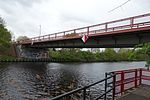
| Borsig dam bridge | Tegel | The Borsigdammbrücke is a road bridge. It leads the Borsigdamm over the entrance to the former Borsighafen of the nearby former Borsigwerke. In the 21st century, the harbor is used as a pleasure boat harbor. | cards |
| Borsigsteg | Moabit | The Borsigsteg was a pedestrian bridge over the Spree at about 11.80 km of the river. The bridge was built in 1904–1906 according to plans by the architect Bruno Möhring . Until it was destroyed in World War II , the pedestrian bridge connected Dortmunder Strasse across the Spree to Flensburger Strasse. Remains of the bridge's abutments have been preserved on both sides. | cards |
| Borussia Bridge | Nikolassee | The Borussenbrücke leads the Borussenstrasse over the AVUS . Their name is derived from the Borussia , an allegory on the inhabitants of Prussia. | cards |
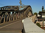
| Bad bridge | Prenzlauer Berg / Gesundbrunnen | The Bösebrücke (1916 to 1948 Hindenburgbrücke) connects the districts Gesundbrunnen and Prenzlauer Berg over the tracks of the S-Bahn and long-distance railway along Bornholmer Straße (therefore also called Bornholmer Brücke ) . The arch bridge is the first nickel steel bridge in Berlin and is a listed building . When the Berlin Wall opened on November 9, 1989, the Bornholmer Strasse border crossing was opened first, so that the first East Berliners came to West Berlin via the Bösebrücke . | cards |
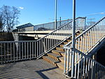
| Boulevard Kastanienallee, pedestrian bridge | Hellersdorf | The curved reinforced concrete bridge with two supports connects Hellersdorfer Straße near the Hellersdorf underground station via the tracks of underground line 5 with the Kastanienallee boulevard. The footbridge is about 45 meters long and 4.50 meters wide. | cards |
| Boxberger road bridge | Marzahn | Boxberger Strasse is led over the Marzahn-Hohenschönhauser Grenzgraben by means of a 20 m long and around 18 m wide bridge. The structure has pedestrian and bicycle paths on both sides and two central lanes. | cards |
| Braunauer Bridge | Neukölln | Predecessor of the Sun Bridge ; Road bridge over the Neukölln shipping canal .
Its name at that time was derived from Braunauer Straße , which was named after the Austrian town of Braunau . |
|
| Breitenbach Bridge | Dahlem | The structure (to be seen in the picture in the background) leads the four-lane city motorway over the street Südwestkorso-Schorlemerallee and over the Breitenbachplatz . In February 2019, a citizens' initiative at Breitenbachplatz managed to get the CDU parliamentary group in the Berlin House of Representatives to discuss a resolution to demolish the bridge. For the purpose of implementation, a feasibility study is now to be made. The square should become more attractive again. | cards |
| Brigitten Bridge | Altglienicke | The Brigittenbrücke leads the Brigittenweg over the Berlin outer ring . | cards |
| Britzer Allee Bridge | Neukölln | The Britzer-Allee-Brücke leads the Chris-Gueffroy-Allee, formerly Britzer Allee , over the Britzer connecting canal . | cards |
| Britzer Bridge | Britz | The road bridge leads the Britzer Damm (until 1950: Chausseestrasse) at kilometer 26.90 of the artificial waterway over the Teltow Canal . Since it was rebuilt in 1955/56 as a steel girder bridge, it has been called the Britzer Bridge. The previous bridge from 1906 was called Chausseestraßenbrücke Britz and was the only one of the historic Teltow Canal bridges that was built as a solid concrete bridge; all other bridges had an iron superstructure. It was blown up by the German Wehrmacht in a retreat in April 1945 , with eight young flak helpers losing their lives. | cards |
| Britzer Hafensteg | Britz | The Britzer Hafensteg is a steel truss bridge for pedestrians. It connects the industrial sites on both sides of the Neukölln shipping canal directly at the Britz-Ost port. The bridge used to connect from Lichterfelde-Süd (Giesendorf district) to the areas of Lichterfeld north of the Teltow Canal . At this point a simple road led from Giesendorf over the Bäke to Zehlendorf. The bridge was named after Eugen Kleine , an influential citizen at the time. The small bridge in its former location soon no longer met the growing traffic demands. A tram line should be run across them to Lichterfelde-Süd. A more resilient bridge had to be built and the old one demolished. An interesting solution was found for the time, however: the bridge was loaded onto a barge and, with not inconsiderable problems, brought to Britz by water and built as a pedestrian bridge over the newly created Neukölln shipping canal near the east port of Britz. At times the residents called it the Blue or Green Bridge because of its striking paintwork . | cards |
| Brommy Bridge | Friedrichshain , Kreuzberg | The Brommybrücke was a road bridge over the Spree and was located between the Schillingbrücke and the Oberbaumbrücke . As a northern extension of Eisenbahnstraße, Brommystraße led from Kreuzberg to Friedrichshain to Mühlenstraße (near Rummelsburger Platz). The bridge was built from 1907 to 1909, destroyed in 1945 during World War II and has not yet been rebuilt. On the Kreuzberg side there is the Brommy balcony on the rest of the abutment . | cards |
| Bridge on the embankment | Koepenick | The bridge leads the street Am Bahndamm next to the route of the Lower Silesian-Märkische Railway over the Wuhle . | cards |
| Bridge at the Place of Sport | Schöneberg | The pedestrian bridge crosses the tracks of the Anhalter suburban railway between the Platz des Sports and the Schöneberger Südgelände Nature Park. | cards |
| Bridge at the Bürgerpark | Niederschönhausen / Pankow | The bridge at the Bürgerpark leads the street Am Bürgerpark over the Panke . | cards |
| Bridge at the swimming pool | Hermsdorf | The street Am Freibad crosses the Tegeler Fließ on this bridge structure on the border to Lübars . | cards |
| Bridge at the Kiesteich | Falkenhagener Feld | In addition to the official designation "Brücke Am Kiesteich" (according to the FIS broker according to the local land surveying offices), the designation "Spectrum Bridge" is also common depending on the location. The bridge leads the street Am Kiesteich over the green area of the Spektewiesen. With a span of 65 meters, it spans two park paths and in between offers a passage to the Großer Spektesee from the Spektelake. The descent from the road to the green corridor is at the southern bridgehead. The 14 meter wide bridge has sidewalks, bike paths and a 7 meter wide two-lane carriageway on both sides. | cards |
| Bridge on Fürstendamm | Frohnau | The bridge on Fürstendamm spanned the Fürstendamm , planned as the entrance gate to the garden city Frohnau , which was set up on the site of the Stolpe estate in 1910 as planned. The structure was located 80 meters west of Oranienburger Chaussee at the breakthrough of a dune line (west parallel to the Chaussee). This imposing wooden construction was created in 1911 according to plans by the architect Heinrich Straumer , and it burned down in 1944. The stone northern bridge pillar (Fürstendamm 40) remained, in which there is a transformer station for Frohnau. The bridge function was the guidance of route 96 on the dunes, which is located in the east of Frohnau on the Berlin outskirts to Glienicke . The path through the wooded area on the dune connects the Zerndorfer Weg with the Rosenanger (north of Entenschnabel ). Due to the missing bridge, a descent of almost eight meters over the road is necessary. | cards |
| Bridge on Heiligentalhügel | West end | The bridge on Heiligentalhügel connects to the east of Harbigstraße and leads over the railway cut with the Spandauer Vorortbahn , Ruhlebener connecting railway and Messegleis to Jafféstraße . | cards |
| Bridge S-Bahn station Wuhlheide | Koepenick | The bridge leads the Rudolf-Rühl-Allee over the Lower Silesian-Märkische Eisenbahn , the Berlin Parkeisenbahn and the street Am Bahnhof Wuhlheide. It has two lanes and two sidewalks. The load capacity is limited to 12 t ; a new building is required, but this is only to be expected in connection with the extension of the TVO . | cards |
| Bridge Street 50 | Blankenburg | The Brücke Straße 50 leads the Straße 50 over the Laake . The road bridge has a length of 12 meters and was placed diagonally across the river, which is only one meter wide here. The bridge became necessary when the settlement houses on the roads 28, 31, 33 in Blankenburg, which adjoin to the south, were connected to the Berlin outer ring.
For pedestrians, a newer footbridge leads over the railway line. Noteworthy is a neighboring six meter wide bridge over the Laake 100 meters below. In terms of its location, this corresponds to a nonexistent street on the northern edge of the residential properties from street 31 , which leads to the west. The Laake leaves the flow area drawn on the official map for 170 meters along the boundary of the district (within the Pankow district) in a southern curve. |
cards |
| Bridges Avenue of the Cosmonauts | Marzahn | The road bridge complex, consisting of six individual parts, leads the Allee der Kosmonauten in two separate structures in a west-east direction over the Berlin outer ring and the Märkische Allee near Helene-Weigel-Platz . In the middle between the road bridge parts there is a construction of the same length for the overpass of the tram. The total length of the three bridge parts is 175 meters, the width of the lanes 9.8 meters each. The tram bridge is about 5.7 meters wide. In the western third, the bridges have direct access to the Springpfuhl S-Bahn station below (lower picture). | cards |
| Buchenhain Bridge | Biesdorf | The Buchenhainer Brücke is a pedestrian bridge over the Wuhle . It connects Buchenhainer Straße with Straße 19 in Kaulsdorf. | cards |
| Buchholz Bridge | Pankow | The bridge leads the Buchholzer Straße over the Blankenfelder Graben. | cards |
| Castle bridge | center | see Liebknechtbrücke
First named after the Burgstrasse leading to the bridge |
|
| Burggrabensteg | Spandau | The Burggrabensteg is a pedestrian bridge over the Spandau moat, the south bank of which borders Wilhelmstadt . The footbridge was built in 2013 to enable the continuous use of the right bank path of the Havel . It is located near the landing stage for river cruise ships (Spandau cruise terminal). | cards |
| Buschkrug Bridge | Britz | Today's Buschkrugbrücke is a road bridge over the Teltow Canal at kilometer 27.673 of the artificial waterway. It was built as a concrete beam bridge . The bridge over the canal was called Schulenburgbrücke until 1950 , initially named after the politician Rudolf Wilhelm Graf von der Schulenburg auf Ramstedt . In the last days of the war in 1945, the first bridge structure was destroyed. A temporary bridge was built for five years. In 1950 it was rebuilt using a simple construction method. The bridge was then renamed on February 14, 1950, because there is also a Schulenburg bridge over the Havel in Spandau . Its new name, Buschkrugbrücke, comes from a historic inn that was mentioned as early as 1375. It is marked on a map from 1786 at the intersection of what was then Britzer Damm, today's Grenzallee and today's Buschkrugallee. The bridge got its current appearance after extensive renovations between 1959 and 1963, when the U 7 line of the Berlin subway to Berlin-Rudow was built under the canal, exactly under the bridge. The tram ran over the bridge until 1964. | cards |
Literature and web links
Individual evidence
- ↑ Daily facts for April 14th (1960) in daily facts of the Luisenstädtischer Bildungsverein (at the DHM )
- ↑ Website of the Steglitzer Heimatverein, page 41 ff ( Memento of the original from March 4, 2016 in the Internet Archive ) Info: The archive link was inserted automatically and has not yet been checked. Please check the original and archive link according to the instructions and then remove this notice. ; accessed on January 20, 2016.
- ↑ lot-tissimo.com Description of the painting by Otto Antoine : View of the Von-der-Heydt Bridge in Berlin Tiergarten (oil on canvas). Today: Bendlerbrücke.
- ↑ ottoantoine.com Plate which very probably contains the painting of the Von-der-Heydt Bridge.
- ↑ Question to the House of Representatives from 2007, here this bridge is mentioned and costs (618 euros in 2005) for the removal of graffiti (PDF; 247 kB), accessed December 29, 2009.
- ↑ Printed matter - VI-1379 (September 7, 2011): Intention to designate 35 private roads in the Einigkeit complex in the Rosenthal district .
- ↑ Address search in the RBS: Blumenwegbrücke
- ↑ Pharus City Map Berlin Large Edition. Pharus-Plan-Verlag in Treuhand: Rosenthal around 1954, accessed on October 4, 2019 .
- ↑ The card is on Commons
- ↑ The demolition of the bridge is approaching . in: Berliner Zeitung , February 28, 2019, p. 10.
- ↑ Chausseestrasse . In: Street name lexicon of the Luisenstädtischer Bildungsverein
- ↑ 100 years of the Teltow Canal 1906–2006 - Festschrift of the Waterways and Shipping Administration ... , p. 51.
- ↑ Page no longer available , search in web archives: Senseless death of young flak helpers in Neukölln - Sunflower campaign recalls the tragic events of the last days of the war on the Teltow Canal . Berlin.de, Neukölln, press release, May 23, 2005.
- ↑ FIS-Broker map display map of Berlin 1: 5000 (K5 color edition)
- ↑ Klaus Pegler: Frohnau Stories Volume 2 . P. 114/115 on google books
- ↑ Silva overview plan of the city of Berlin and its 20 administrative districts: based on the law of April 27, 1920 / edit. and ed. von Willy Holz, 1925 see here B / C-12
- ↑ The location of the bridge on Fürstendamm and the path over it can be seen on the Frohnau map from 1922 .
- ^ Berlin House of Representatives. Printed matter 16/11373
- ↑ The subway under the bridge berliner-untergrundbahn.de ( Memento of the original from September 23, 2015 in the Internet Archive ) Info: The archive link was automatically inserted and not yet checked. Please check the original and archive link according to the instructions and then remove this notice.


