List of streets and squares in Berlin-Moabit

The list of streets and squares in Berlin-Moabit describes the street system in the Berlin district of Moabit with the corresponding historical references. At the same time, this compilation is part of the lists of all Berlin streets and places .
overview
Classification
Moabit is in the Stephankiez localities around Stephanplatz, Beusselkiez , Huttenkiez or Hutteninsel, as it is separated by the Martinikenfelde industrial area , the Westphalian Quarter (between Stromstraße, Alt-Moabit , Gotzkowskystraße and Spree), the Lehrter-Straße-Kiez and the Moabiter Werder divided. The Berlin-Brandenburg Statistics Office distinguishes between “21 Moabit West” (W) and “22 Moabit East” (O). Moabit West includes Huttenkiez (W 01), Beusselkiez (W 02), Westhafen (W 03), Emdener Straße (W 04), Zwinglistraße (W 05) and Elberfelder Straße (W 06). Moabit Ost includes Stephankiez (O 01), Heidestraße (O 02), Lübecker Straße (O 03), Thomasiusstraße (O 04), Zillesiedlung (O 05), Lüneburger Straße (O 06) and the Hansaviertel (O 07).
Important connections in east-west direction are
- the street Alt-Moabit with the extension in the Kaiserin-Augusta-Allee
- the Turmstrasse with the subsequent Huttenstrasse
- the Invalidenstrasse
- the Perleberger Strasse
- the Sickingenstrasse – Siemensstrasse – Quitzowstrasse and Ellen-Epstein-Strasse to relieve the Quitzowstrasse.
Important north-south connections are
- the Beusselstrasse
- Stromstrasse – Putlitzstrasse
- Rathenower Strasse
- the Lehrter Strasse .
In the Berlin Road Development Plan (StEP) the road system is classified according to its importance, with the 60 meters of the A 100 to Seestrasse in the district belonging to the higher-level road system. This includes the B 96 on Seller-, Heide- and Minna-Cauer-Strasse, continued in the Tiergarten Spreebogen (TTS) tunnel with the main carriageway and the entrances / exits Heidestrasse and Invalidenstrasse, including 190 meters of the “Lehrter underground garage” Bahnhof ", which is located in Moabit area. In addition, depending on the city center location, Alt-Moabit (2250 meters), Altonaer Straße, An der Putlitzbrücke, Beussel-, Ellen-Epstein-, Erna-Samuel-, Fennstraße, the Föhrer bridge and the Friedrich-Krause-Ufer, Heide-, Invalidenstraße, Kaiserin-Augusta-Allee, Lessing-, Levetz-, Paul-, Perleberger, See-, Siemensstraße, Spreeweg and Stromstraße are assigned to the higher-level road connections (Category II) in the Berlin system. This system is supplemented by the streets of regional importance (Category III): Alt-Moabit (partially), Gaußstraße, Gotzkowsky-, Huttenstraße, Neues Ufer, Perleberger, Rahel-Hirsch-, Rathenower, Seller-, Sickingen- and Turmstraße.
Moabit has 80,495 inhabitants (as of December 30, 2019) and includes the postcode areas 10551, 10553, 10555, 10557, 10559 and 13353.
Origin of the road system
Until the 1820s, the road network in the "Alt-Moabit" section consisted of the traditional Heerweg to Spandau ( Alt-Moabit ), Stromstraße, Brückenstraße (Kirchstraße) and Turmstraße, Heidestraße and Invalidenstraße. With the development of the "Neu-Moabit" north of the Turmstrasse, the Forest and Economic Deputation laid out the Forest, Beussel, Strom and Birkenstrasse.
In 1862 Hobrecht's development plan, Department VII for Moabit and Department VIII for New Moabit, was drawn up, which, together with the abandonment of the Royal Artillery Laboratory (1872), led to increased development and thus to the construction of a new road system. At the beginning of the First World War , the expansion of the road network was completed. In the 21st century, the Europacity will be built around the main station with additional access roads.
Many streets are named after people from the Reformation , after places in North Rhine-Westphalia ( Westphalian Quarter ), after Hanseatic cities or places in Prignitz . Newer street names are dedicated to women, which goes back to the decision of the BVV to increase the number of significant women as namesake.
Overview of streets and squares
The following table gives an overview of the streets and squares in the district as well as some related information.
- Name / location : current name of the street or square. Via the link Location , the street or the square can be displayed on various map services. The geoposition indicates the approximate center of the street length.
- Traffic routes not listed in the official street directory are marked with * .
- Former or no longer valid street names are in italics . A separate list may be available for important former streets or historical street names.
-
Length / dimensions in meters:
The length information contained in the overview are rounded overview values that were determined in Google Earth using the local scale. They are used for comparison purposes and, if official values are known, are exchanged and marked separately.
For squares, the dimensions are given in the form a × b for rectangular systems and for (approximately) triangular systems as a × b × c with a as the longest side.
If the street continues into neighboring districts, the addition ' in the district ' indicates how long the street section within the district of this article is. - Name origin : origin or reference of the name.
- Notes : further information on adjacent monuments or institutions, the history of the street and historical names.
- Image : Photo of the street or an adjacent object.
| Name / location | Length / dimensions (in meters) |
Origin of name | Date of designation | Remarks | image |
|---|---|---|---|---|---|
|
Agnes-Zahn-Harnack-Strasse
( Location ) |
140 | Agnes von Zahn-Harnack (1884–1950), civil women's rights activist and resistance fighter | May 16, 2005 | Agnes-Zahn-Harnack-Straße runs directly on the south side of the main train station . The street was named among others by decision of the BVV in order to increase the proportion of women as namesake. The narrow street is between the main train station and a hotel. |

|
| Agricolastrasse
( Location ) |
500 | Johannes Agricola (1494–1566), Protestant theologian and student of Martin Luther | December 19, 1912 | When it was rebuilt, it was called Straße 33b, Section VIII of the development plan . The quiet residential street with continuous development connects the Wikingufer with the Hansaufer in the Spreebogen area. The state picture office is located here. Housing complexes no. 13–15 from 1925 and housing complex no. 29–33a from 1926 are listed architectural monuments. |

|
| Alice-Berend-Strasse
( Location ) |
220 | Alice Berend (1875–1938), writer | Sep 7 1999 | The residential street on the south side of the ring line opens up the residential complex on the Moabiter Werder . Various commercial facilities are located in the S-Bahn arches under the railway line. There are several passages to the residential area north of the railway line. |

|
|
Old Moabit
( Location ) |
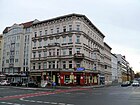
2870 | Center of Moabit | May 14, 1875 | Individual street sections were previously called Spandauer Heerweg (13th century – 1848), Moabiter Chaussee (1848–1875) and Birken-Allee (1848–1875). As an important east-west connection, Alt-Moabit leads from the Moltkebrücke to Beusselstraße and there it turns into Kaiserin-Augusta-Allee. There are several striking buildings and parks here: the Carl-von-Ossietzky-Park , the Kleine Tiergarten and the Ottopark; the “Paris – Moscow” restaurant from 1897, the Moabit remand prison from 1877, the F. W. Schütt steam mill and the former production building of the C. Bolle dairy in the area of the Focus Teleport , where the Ministry of the Interior has settled. Opposite the Kirchstrasse is the St. John's Church . The disused pumping station VIII on Gotzkowskystraße is used as an event location (Universal Hall) . |
|
| At the Putlitz Bridge
( Location ) |
220 | Putlitz Bridge , which spans the Ringbahn area | Oct 16, 1911 | The driveway to Putlitzbrücke bears this name. It then turns into Putlitzstrasse - probably from Westhafen train station. A precise delimitation cannot be determined. |

|
| Arminiusstrasse
( Location ) |
90 | Arminius (around 17 BC to around 21 AD), tribal leader of the Cherusci | Apr 14, 1936 | On April 14, 1936, the part of the street Am Arminiusplatz that remained after the construction of the Tiergarten town hall was renamed Arminiusstraße. The Arminusmarkthalle present here is a listed building monument. |

|
|
Bandelstrasse
( Location ) |
410 | Ernst von Bandel (1800–1876), sculptor and builder of the Hermann monument | Nov 29, 1876 | It was laid out as Straße 14a, Section VII of the development plan , in 1875 and named after Ernst von Bandel with reference to the nearby Arminiusstraße. The St. Laurentius Church is located at No. 39/40 . |

|
| Berlichingenstrasse
( Location ) |
500 | Götz von Berlichingen (1480–1562), Frankish imperial knight | Dec 2, 1898 | The street in the former Martinikenfelde district was laid out as Street 31, Section VI of the development plan . On the western side at the corner of Huttenstrasse is one of the largest Berlin factories, the AEG turbine factory built in 1909 according to plans by Peter Behrens . The 25 m high and 124 m long hall was extended in 1939 and is now 247 m long. Siemens still produces turbines here, which are delivered all over the world. At the northern end is the former AEG incandescent lamp factory (from 1939: Telefunken factory for electron tubes ), which currently houses an employment agency . On the eastern side of the street there are some houses in need of renovation. The cobblestone residential street is relatively quiet. There are two pedestrian passages with playgrounds to Rostocker Straße. The youth center is at the southern passage. |

|
| Bertha-Benz-Strasse
( Location ) |
130 | Bertha Benz (1894–1944), engine developer and wife of Carl Benz | May 16, 2005 | The street was created in connection with the construction of the main train station . The Lehrter city quarter is to be built here. For this purpose, an urban planning competition was held in 1994 , from which the design by Oswald Mathias Ungers emerged victorious. On this basis, a development plan was completed in summer 2006. The main property owner is the real estate company Vivico , which is also developing the northern Europacity site . |

|
| Beusselstrasse
( Location ) |
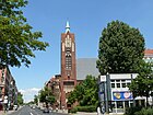
1460 | Georg Peter Christian Beussel (1774–1864), landowner and bailiff in Moabit | before 1861 | The noisy residential and commercial street with old buildings in need of renovation crosses the whole of Moabit in a north-south direction from the banks of the Spree to the Ludwig-Hoffmann-Brücke over the Westhafenkanal . It was laid out between 1818 and 1822, and in 1861 it is mentioned in the records of the streets and squares of Berlin. On May 1, 1894, the S-Bahn station named after the street opened . On November 2, 1953, the north-south connecting road between the Beusselstrasse station and the confluence of the Goerdelerdamm was officially named Beusselstrasse. In the years 1968 to 1970, other properties on the wholesale market were given the street name. The Reformation Church is located on Wiclefstraße , built between 1905 and 1907 , and the former MWT signal box is located on Siemensstraße, both of which are listed monuments. The Berlin wholesale market and access to the Westhafen area are located between the railway site and the Westhafen Canal . |
|
| Birkenstrasse
( Location ) |
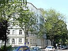
1030 | Birch , tree | 1823 | It is one of the oldest streets in Moabit and was laid out between 1822 and 1834, also to connect the former powder mill with the shooting range of the guard artillery in Jungfernheide. It has been named after the birch avenue that was there since 1823. The street is said to have been officially named in 1885. On November 28, 1977, the properties in the area of the former front gardens were also given this name. The Paech bread factory , which was demolished in 2004, was located on the property between Birkenstrasse and Stephanstrasse . The Moa Bogen service center was built here . The houses No. 17, 49 and the building ensemble No. 53-55 are listed architectural monuments. |
|
| Bochumer Strasse
( Location ) |
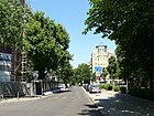
430 | Bochum , the second largest city in Westphalia | Apr 13, 1904 | It was laid out as street 30c, Section VII of the development plan . It lies between Alt-Moabit and the bank of the Bundesrat . Here is the building of the Friedrich-Werderscher Gymnasium , which has been used by the Berlin State Technical School since 1936 . The street is in the Westphalian Quarter and crosses Essener Strasse . A residential street with dense development consisting mainly of old buildings. A small square between Bochumer Strasse and the bank of the Bundesrat with benches, lawns and flowers is called Bochumer Platz, but it was not dedicated. |
|
| Bredowstrasse
( Location ) |
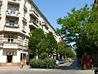
680 | Adalbert von Bredow (1814–1890), Prussian lieutenant general | Apr 4, 1895 | It was laid out in 1893/1894 as Straße 9a, Section VIII of the development plan . The traffic-calmed residential street (cobblestones) with partly good old buildings connects the Turmstrasse with the Birkenstrasse. North of Wiclefstraße there is a pedestrian passage to Bremer Straße and the adjacent Unionpark on Bremer Straße. |
|
| Bremer Strasse
( Location ) |
820 | Bremen , Hanseatic city on the Weser | Jan. 5, 1877 | It was called Straße 6, Section VIII of the development plan . It is traffic-calmed between Alt-Moabit and Quitzowstraße, parallel streets are the Emdener and Oldenburger Straße. The youth traffic school of the Mitte district is located on Bugenhagenstrasse. Houses No. 63 and 64 as well as No. 68 are listed architectural monuments. The traffic-calmed residential street has partly good old buildings and trees. Between Wiclefstrasse and Unionstrasse, a passage runs parallel to Bremer Strasse to the extensive “Unionpark” on Bremer Strasse with playgrounds and quiet areas in the middle of the densely built-up Moabit. And there is a pedestrian passage from the street to the park and a passage to Bredowstrasse . At the northern end of Bremer Strasse, on Siemensstrasse, there is a skating area. |

|
| Bugenhagenstrasse
( Location ) |
350 | Johannes Bugenhagen (1485–1558), theologian and colleague of Martin Luther | Jan. 18, 1892 | The 8, Div. VII of the development plan , was named in 1892. The street 16a, Div. VII of the development plan also acquired its current name on August 4, 1897. It runs between Stromstrasse and Bremer Strasse. The back entrance to the Arminusmarkthalle is located here . On the traffic-calmed inner-city residential street with cobblestone pavement there are mostly old and post-war buildings. It is connected to the Moabit nature trail. |

|
| Bundesratufer
( Location ) |
500 | Bundesrat , constitutional organ of the German Empire | Apr 13, 1904 | The Uferstraße was laid out as Straße 34b, Section VII of the development plan . It runs as an extension of the Hansa-Ufer on the Spree between Lewetzowstrasse and Stromstrasse. Houses No. 2 and No. 10 are listed architectural monuments. The quiet residential street has a mixed structure in an excellent residential area and an unobstructed view over the Spree to the south. It is connected to the Moabit nature trail. Included in the Berlin street planning as a municipal street, 40 meters of the street with Okstra class F, RBS class FUWE are marked as a pedestrian path. |

|
|
Calvinstrasse
( Location ) |
420 | Johannes Calvin (1509–1564), French-Swiss reformer | Nov 19, 1887 | It was laid out as street 15c, Section VII of the development plan. The quiet residential street with old and post-war buildings connects Alt-Moabit with the Helgoland shore. |

|
| Claire Waldoff Promenade
( Location ) |
290 | Claire Waldoff (1884–1957), cabaret artist, singer and actress | Oct 15, 1979 | The promenade is an access road between Invalidenstrasse and Seydlitzstrasse. The barracks of the 2nd Guard Uhlan Regiment , demolished in 1955, were located here, and a memorial stone is dedicated to them at this point. The quiet residential street belongs to the "Heinrich-Zille-Siedlung" which was built between 1976 and 1981. Since the complex was built as part of the social housing development of the Berlin Senate and people only moved in according to strict criteria, the area has developed into a social hotspot. In the complex, which has only two to four-story houses, there are many green spaces, playgrounds and car-free passageways. |

|
| Clara-Jaschke-Strasse
( Location ) |
220 | Clara Jaschke (1858–1927), one of the first Berlin women railway workers | May 16, 2005 | The street was created during the construction of the main train station . It is the extension of Bertha-Benz-Strasse to Invalidenstrasse. The entrance to the underground car park of the main train station is located here. The street was named among others by decision of the BVV in order to increase the proportion of women as namesake. |

|
|
Döberitzer Strasse
( Location ) |
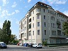
150 | Döberitz, district of Dallgow-Döberitz in the Havelland district in Brandenburg | 23 Aug 1905 | It was laid out as street 29b, Section VIII of the development plan . It is an access road starting from Heidestrasse. In the noisy little dead end there is only one residential and commercial building, right at the entrance to the Tiergarten tunnel. In the Berlin street planning it is included in the RBS class as STRA, but according to Okstra class N it is not a municipal road whose construction the state would be responsible for. |
|
| Dortmunder Strasse
( Location ) |
190 | Dortmund , city in North Rhine-Westphalia | Apr. 14, 1904 | At the plant it was called Straße 30a, Section VII of the development plan . It is a quiet residential street with new buildings and spacious old buildings with front gardens between Bundesratufer and Elberfelder Straße. Residential street. There are many cafes and pubs. |

|
| Dreysestrasse
( Location ) |
270 | Johann Nikolaus von Dreyse (1787–1867), inventor and rifle maker | May 14, 1875 | When it was built, it was called Straße 12, Section VII of the development plan . The residential street in which mainly post-war buildings are located connects the Bandel and Rathenower streets. |

|
|
Elberfelder Strasse
( Location ) |
640 | Elberfeld , until 1929 an independent city, now part of Wuppertal in North Rhine-Westphalia | Apr 13, 1904 | At first it was Straße 30, Section VII of the development plan and part of the former Borsig site and a park designed by Peter Joseph Lenné . It is a traffic-calmed residential street with cobblestone residential street between Alt-Moabit and Levetzowstraße in the Rheinisch-Westfälische Viertel with a few small specialty shops and restaurants. There are numerous listed architectural monuments here. The cleanliness of the street environment has been organized for several years by a trader together with the BSR , who was able to encourage residents to actively participate, similar to the Subbotniks in East Berlin . The problem arose because here in Berlin for the first time in 1980, during the total renovation, the strict separation between sidewalks and driveway had been abolished. The development is a mixture of spacious old buildings and social housing. |

|
| Elisabeth-Abegg-Strasse
( Location ) |
190 | Elisabeth Abegg (1882–1974), resistance fighter | Dec 20, 2004 | The road previously belonged to the grounds of the Lehrter freight yard on the Moabiter Werder , where the free loading and customs station was located. The Zollpackhof beer garden and the access to the Tiergarten fire station are located here. At the Moltkebrücke a staircase leads to the Magnus-Hirschfeld-Ufer, which runs along the Spree . The street was named among others by decision of the BVV in order to increase the proportion of women as namesake. |

|
| Ella-Trebe-Strasse
( Location ) |
210 |
Ella Trebe (1902–1943), resistance fighter |
May 16, 2005 | The street was created in connection with the construction of the main train station . It runs on the west side of the main station between Invalidenstrasse and Rachel-Hirsch-Strasse. The Lehrter city quarter is to be built here. The street was named among others by decision of the BVV in order to increase the proportion of women as namesake. |

|
| Ellen-Epstein-Strasse
( Location ) |
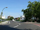
1230 | Ellen Epstein (1898–1942), pianist and victim of the Holocaust | June 19, 2009 | The traffic route is an access road for the industrial area between the railway site and Quitzowstrasse. It is intended to relieve Quitzowstrasse from truck traffic, which had already caused damage to the old buildings standing here. The road runs in an east-west direction on the former site of the Moabit freight yard . More than 32,000 Jews , including Ellen Epstein, were deported from this station to extermination camps between 1942 and 1945 . The street was named among others by decision of the BVV in order to increase the proportion of women as namesake. |
|
| Emdener Strasse
( Location ) |
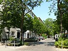
670 | Emden , city in Lower Saxony | Apr 24, 1890 | When it was built, it was called Straße 5, Section VIII of the development plan . It connects Turmstrasse with Siemensstrasse. There is a green area with a soccer field between Waldenser Straße and Wiclefstraße.
On November 8, 2013, Emdener Strasse was named “The most beautiful street in Germany 2013” from 115 applicants by the German Association of Cities . First and foremost, the neighborly commitment was honored after residents had previously planted tree grates and painted power boxes. |
|
| Emma-Herwegh-Strasse
( Location ) |
370 | Emma Herwegh (1817–1904), writer | May 16, 2005 | The road runs between Alt-Moabit and Ella-Trebe-Straße directly on the railway viaduct . There is a waiting point for BVG buses here. |

|
| Erasmus Street
( Location ) |
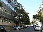
260 | Erasmus of Rotterdam (1466–1536), Dutch theologian and philologist | May 17, 1902 | It was laid out as Straße 28a, Section VI / 3 of the development plan , and connects Reuchlinstraße with Beusselstraße. The residential substance consists of old buildings and apartments of social housing and the neighborhood management is very active. |
|
| Erna-Samuel-Strasse
( Location ) |
890 | Erna Samuel (1895–1942), teacher at the Jewish girls' school on Rykestrasse and victim of Nazi politics | Aug 20, 2010 | The conveniently located road runs in an east-south-west direction on the former site of the former Moabit freight station and opens into Siemensstrasse. More than 32,000 Jews , including Erna Samuel, were deported from this station to extermination camps between 1942 and 1945 . It was opened to general traffic in May 2014 and relieves the residents of Siemensstrasse from traffic noise. A district park has been created between Siemensstrasse and Erna-Samuel-Strasse with public participation. In the Berlin road planning it is included in the RBS class as STRA and as a higher-level road connection (Category II in the road development plan), but according to Okstra class N it is not a municipal road whose construction the state would be responsible for. |

|
| Essener Strasse
( Location ) |
430 | Essen , city in North Rhine-Westphalia | Apr 13, 1904 | When it was built, it was called Straße 30, Section VII of the development plan . It is a residential street with spacious old buildings with front gardens that connects Stromstrasse with Elberfelder Strasse in the Rheinisch-Westfälische Viertel. |

|
| Europaplatz
( Location ) |
150 × 90 (triangular shape) |
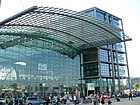
Europe , continent | May 16, 2005 | Europaplatz is called the northern forecourt of the main train station on Invalidenstrasse , with bus stops and waiting areas for taxis. The name is intended to indicate the importance of the station for the capital and to document the cosmopolitanism of Berlin. It joins existing European squares in other cities on our continent that promote cross-border thinking. |
|
| Eyke-von-Repkow-Platz
( Location ) |
90 × 30 | Eyke von Repkow ( 1180/1190 – around 1233), author of the Sachsenspiegel | Jan. 1, 1901 | This square, located on the former Jewish meadows, was previously called space 30a in the development plan . It is located between Wullenweber- and Tile-Wardenberg-Straße . It is a quiet, small place with a senior citizens' home and the nearby banks of the Spree with its green spaces. |

|
|
Feldzeugmeisterstrasse
( Location ) |
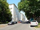
210 | Feldzeugmeister , old term for artillery commander | March 16, 1886 | Before that, it was Street 22b, Section VIII of the development plan . The west side is lined with residential buildings, while the former barracks of the 1st Guards Field Artillery Regiment are on the east side, which are now used by the 1st Riot Police . |
|
| Flemingstrasse
( Location ) |
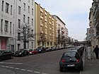
200 | Paul Fleming (1609-1640), writer | Nov 19, 1887 | When it was built, it was called Straße 15d of the development plan . It connects Paulstraße with Lüneburger Straße, whereby the passage is closed to motor vehicles. |
|
| Friedrich-Krause-Ufer
( Location ) |
1110 | Friedrich Krause (1856–1925), city planner and city elder of Berlin | Apr 29, 1926 | In 1880 it was laid out as the south bank , and in 1926 it was renamed. It leads on the south bank of the Berlin-Spandau shipping canal from Putlitzbrücke to Fennstrasse. Industriestraße is largely shaped by the Berlin-Moabit power plant . At number 24 is the factory building of the Auergesellschaft , built by Egon Eiermann in 1938 , which today serves as the immigration office . The Torfstraßensteg leads across the canal as a replacement for the Torfstraßenbrücke that was destroyed at the end of the Second World War. |

|
| Friedrich-List-Ufer
( Location ) |
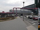
360 | Friedrich List (1789–1846), entrepreneur, diplomat and railway pioneer | Nov 23, 1933 | The Friedrich-List-Ufer was called Wilhelmsufer from 1856 to 1933 . The Uferstraße runs between the Humboldthafen and the main train station . The area south of the railway viaduct is used by the “Traumstrand Berlin” beach bar and the “Traumtheater Salome”. Until the main train station was built, there was a warehouse on the banks of the Humboldthafen. The west side of the busy street is dominated by the main train station and its utilities. On the east side is the Humboldthafen, the banks of which are still waiting for an investor. |
|
|
Gerhardtstrasse
( Location ) |
70 | Paul Gerhardt (1607–1676), theologian and hymn poet | Nov 29, 1876 | The street laid out in 1875 as street 20, section VII of the development plan , originally connected Werftstraße with Paulstraße. The part of the street between Paulstrasse and the newly laid bend at the level of property No. 16 was included on October 13, 1964. The street ends as a dead end and is the entrance to the Moabit elementary school. | |
| Gotzkowskystrasse
( Location ) |
500 | Johann Ernst Gotzkowsky (1710–1775), Berlin entrepreneur | July 19, 1877 | It was laid out as Straße 27, Section VII of the development plan , and connects the Gotzkowsky Bridge with Turmstraße. Building No. 20 from 1953 together with the commercial building from 1912 behind it, which formerly served as a production site for Adrema, is a listed ensemble of historical buildings. The building complex no. 14-17 is also a listed building monument. A shopping and residential street with many small shops, cafes and restaurants and many of the predominant old buildings have been restored. |

|
|
Hansa shore
( Location ) |
330 | Hanseatic League , medieval union of merchants and trading towns | Jan. 9, 1901 | The Hansa-Ufer leads from Wullenweberstraße to Altonaer Straße. The Uferstraße was previously designated as Straße 34a, Section VII of the development plan . On June 29, 1962, the section of road between Tile-Wardenberg- and Wullenweberstraße was drawn in, which is now a green area. |

|
| Havelberger Strasse
( Location ) |
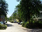
420 | Havelberg , city in the Prignitz. | May 14, 1875 | Havelberger Strasse was laid out in 1875 by the building company Am Kleiner Tiergarten as Strasse 13, Section VIII of the development plan . It is located between Perleberger Strasse and Quitzowstrasse , which are also related to Prignitz. Included in the Berlin street planning as a municipal street, but 35 meters of the street with Okstra class F, RBS class FUWE are marked as a pedestrian path. |
|
| Hedwig-Porschütz-Strasse | Hedwig Porschütz , resistance fighter against National Socialism | 17th Aug 2018 | |||
| Heidestrasse
( Location ) |
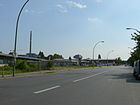
1370 | former dirt road towards Jungfernheide | 1822 | The historic dirt road to Jungfernheide was expanded into a street in the section between Invalidenstrasse and Perleberger Strasse and was given its current name in 1822. An industrial area (including Solex gasifiers) and later a large container transshipment point was built on the edges . In 2011, the 51st German-American Fair was held on the wasteland . The festival, founded in 1961, took place in the Steglitz-Zehlendorf district until 2010 . The former warehouses of the Hamburger Bahnhof at the southeast end of the area house the Friedrich Christian Flick Collection . The Berlin Senate has sold numerous areas between the main train station and Heidestrasse, which will be expanded into Europacity in the long term . In 2013, work began on widening the Heidestrasse section of Bundesstrasse 96 to 38 meters. Two lanes and 2.35 meters wide cycle lanes are created in each direction . The sidewalks will be widened to seven meters. This will be the central access road in which not only businesses, hotels, offices but also residential buildings will be built. 137 trees are planted along the road: elms and hornbeams . The road expansion is estimated at ten million euros and should be completed by 2016. The Tour Total was one of the first striking buildings . Heidestrasse is a busy, noisy street that leads north from the Tiergarten tunnel. The eastern part of the street on the Berlin-Spandauer Schifffahrtskanal becomes one of the most important development areas in Berlin. The western side consists mainly of commercial units and the fallow land of the former teachers freight yard. The structure begins to change with the settlement at Hamburger Bahnhof. More and more galleries are moving into the commercial units. At the southern end of the Heidestraße to Invalidenstraße is a dead end and only passable for cyclists and pedestrians. Included in the Berlin street planning as a municipal street, however, 50 meters of the street with Okstra class F, RBS class FUWE are marked as a pedestrian path. |
|
| Heligoland shore
( Location ) |
310 | Heligoland , German North Sea island | March 17, 1891 | The Uferstraße was first laid out as Straße 23, Section VII of the development plan . It runs along the banks of the Spree from Kirchstrasse to the S-Bahn arch. The listed Gerickesteg connects the Helgoländer-Ufer with the Holsteiner-Ufer in the Hansaviertel district . A quiet, centrally located residential street with renovated old buildings from their front houses offers a clear view over the Spree. |

|
| Huttenstrasse
( Location ) |
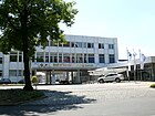
990 | Ulrich von Hutten (1488–1523), humanist and imperial knight | May 12, 1893 | At first it was Street 27, Section VI of the development plan . On May 19, 1908, Street 23, Section VI / 3 of the development plan was also given this name. As an extension of Turmstrasse, Huttenstrasse connects it with Neuer Ufer. It leads through the former heart of the Moabit industrial site in Martinickenfelde, where many AEG factories were and are still located. The most striking is the old AEG turbine factory with the turbine hall by Peter Behrens from 1909. The former factory building of the Jachmann iron foundry from 1900 is on property 41-44. On property 19 and 20 there is an administrative building with a warehouse belonging to the former Ludwig Loewe & Co. AG by Alfred Grenander from 1907. This street with moderate traffic has a high commercial share. Between Beussel- and Berlichingenstraße it is a residential street with old and new buildings and some small businesses on the ground floor. This is followed by a large Siemens commercial complex with the AEG turbine hall, a commercial yard and the BMW branch. From Wiebestrasse there is again residential development in the northern area, while in the southern area of the street commercial is predominant. At the height of Rostocker Straße there is a pedestrian passage to Erasmusstraße. The entire neighborhood is one of the social hot spots in Berlin, but it is very multicultural. The rents are affordable and the neighborhood management is active. |
|
|
Ilse-Schaeffer-Strasse
( Location ) |
60 | Ilse Schaeffer (1899–1972), resistance fighter and local politician | May 16, 2005 | The street was created in connection with the construction of the main train station . The Lehrter city quarter is to be built here. The street was named among others by decision of the BVV in order to increase the proportion of women as namesake. | |
| Ingeborg-Drewitz-Allee
( Location ) |
190 | Ingeborg Drewitz (1923–1986), writer | Sep 7 1999 | The naming ceremony took place on October 1st, 1999. The road opens up the Moabiter Werder . The new Federal Ministry of the Interior was built between the north side of the street and Alt-Moabit . The road is still in the development phase. It is equipped with two lanes on each side and a wide center island. There is a passage under the railway line to Lüneburger Straße and pedestrian passages north of the Kanzlerpark to the Spree and to the ULAP-Park. |

|
|
Invalidenstrasse
( Location ) |
1070 (in the district) |
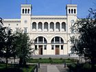
Built in the 18th century, the Invalides | around 1800 | The eastern section of the road belongs to the Mitte district . The street already existed as part of the Spandauer Heerweg in the 13th century. It is noted as Invalidenstrasse on the maps around 1800. In 1863 it was paved in the Hamburger Bahnhof section up to the main entrance of the Ulanenkaserne ( Alt-Moabit ), making it the first street in Moabit to have stone paving.
In addition to the main train station , the Berlin-Brandenburg state laboratory , the public prosecutor's office and the Hamburger Bahnhof monuments, the administration building of the Berlin-Hamburg railway company, the theater and lecture hall of the Urania company and the former Moabit cell prison , which today forms the historical park, are located here . |
|
|
Jagowstrasse
( Location ) |
330 | Matthias von Jagow (1480–1544), reformer and bishop of Brandenburg | Apr 24, 1890 | It was laid out as Straße 29, Section VII of the development plan , and connects Wullenweberstraße with Alt-Moabit . |

|
| Jean Monnet Street
( Location ) |
60 | Jean Monnet (1888–1979), French entrepreneur and the pioneer of European unification efforts | Oct. 2012 | The private road leading from Heidestrasse forms the access to Tour Total Berlin . |

|
| Joachim-Karnatz-Allee
( Location ) |
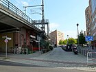
270 | Joachim Karnatz (1921–1977), mayor of the former Tiergarten district | Sep 7 1999 | The street was created in connection with the development of the Moabiter Werder on the former site of the Hamburg-Lehrter freight station. The new residential development was based on designs by various architects and dissolved the previous settlement of small companies. The street leads through the residential area with two lanes separated by a wide asphalt promenade. The “Bundesschlange” winds around this traffic route, an ensemble of buildings that was built as a place to live for the civil servants' families who moved from Bonn . The opening of the Karnatz-Allee took place on September 7, 1999, the ceremonial naming took place on October 1, 1999. Few shops or restaurants have set up. The 42 ultra-modern street lights with the name "moon lights" are a special feature here. The quiet residential street has a direct connection to the park on the Moabiter Werder on Magnus-Hirschfeld-Ufer. The striking building (Bundestag queue) was built for members of the Bundestag. The residential area is very popular and easy to reach by public transport. Here you will also find the embassies of El Salvador and Guatemala. |
|
| Jonasstrasse
( Location ) |
190 | Justus Jonas the Elder (1493–1555), reformer and helper of Martin Luther | Jan. 18, 1892 | Previously it was called Straße 8a, Section VII of the development plan . It connects Turmstrasse with Bugenhagenstrasse on the east side of the Arminius market hall (see picture). The Arminiushalle and the Tiergarten Citizens' Office are on the western side of the street. The eastern side consists of residential buildings. The delivery traffic to the market hall only disturbs in the early morning. |

|
|
Kaiserin-Augusta-Allee
( Location ) |
870 (in the district) |
Augusta von Sachsen-Weimar-Eisenach (1811–1890), German Empress | May 22, 1877 | The first names of individual road sections were Martinikenfelde (1848–1877) and Spandauer Heerweg (13th century – 1848) . After the Second World War it was temporarily called Ernst-Thälmann-Straße (also: Thälmann-Allee ). This name was not confirmed when it was officially named on July 31, 1947, so the street was renamed Kaiserin-Augusta-Allee. The part of the street in the area of the properties 114-120 (Moabit) was named on March 19, 1976 as well. Part of Kaiserin-Augusta-Allee - from Tegeler Weg to what was then Gustav-Adolf-Platz (now Mierendorffplatz) - was renamed Mierendorffstraße on March 30, 1950. The western section of the street runs in Charlottenburg . It connects the Alt-Moabit street with the Tegeler Weg. The Herlitz company was located on the area west of Reuchlinstrasse until 1985 . The part of the street in the district is characterized by large industrial and office settlements and it is a noisy thoroughfare with two lanes in each direction. There are only a few residential buildings on Wiebestrasse. The Spree promenade and a small park offer those who work here relaxation for their lunch break, but the promenade along the Spree is interrupted by an old warehouse. |

|
| Katharina-Paulus-Strasse
( Location ) |
190 | Käthe Paulus (1868–1935), professional air skipper, aerial acrobat and inventor of the collapsible parachute | May 16, 2005 | The street was rebuilt in connection with the construction of the main train station . The Lehrter city quarter is to be built here. |

|
| Kirchstrasse
( Location ) |
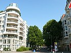
300 | Moabiter Johanniskirche | around 1835 | From the 18th century to 1835 it was called Brückenstraße after the Moabiter Bridge . After the construction of the Johanniskirche it got its current name. Houses No. 2 and 3 are listed architectural monuments, as is the Moabiter Bridge. The inner-city residential street with administration buildings and some commercial units is very busy during the day. The Tiergarten District Court and the Federal Ministry of the Interior are on the street. |
|
| Klara-Franke-Strasse
( Location ) |
370 | Klara Franke (1911–1995), neighborhood mother on Lehrter Strasse | July 1, 2016 | The street opens up the new development area "Mittenmang" in the central area east of Lehrter Straße. The association for "Neighborhood and Self-Help Moabit" praises the "Klara Franke Prize" for civic engagement and moral courage in Berlin-Moabit at irregular intervals. | |
| Klarenbachstrasse
( Location ) |
190 | Adolf Klarenbach (1495–1529), reformer | 19 Sep 1910 | It was laid out as Straße 40, Section VI / 3 of the development plan . This is where the training center of the vocational training center for the commercial-technical area is located. The short inner-city street consists of modern industrial buildings on the north side and a few residential buildings on the south side. | |
| Krefelder Strasse
( Location ) |
310 | Krefeld , city in North Rhine-Westphalia | Apr 13, 1904 | When it was built in the Rheinisch-Westphalian Quarter, it was called Straße 30d, Section VII of the development plan . It connects the bank of the Bundesrat with the Alt-Moabit road . |

|
| Kruppstrasse
( Location ) |
660 | Friedrich Krupp (1787–1826), entrepreneur | May 14, 1875 | Laid out as Straße 22, Section VIII of the development plan , it was named in 1875 after the numerous artillery barracks that existed here and after the cannon manufacturer Friedrich Krupp. The former barracks complex of the 1st Guard Field Artillery Regiment on the north side is a listed building monument. It is used today by the riot police. Buildings 17 and 18, 15 as well as 3 and 4 are also listed monuments. The parade ground of the regiments located here was located on the grounds of today's Fritz-Schloß-Park until the 1920s. In the western part of the street there are some apartment blocks (old and post-war buildings). The Tiergarten Tennis Club is located on Kruppstrasse. Otherwise, the street is characterized by the police and the judiciary. Police Directorate 3 and some criminal investigation departments can be found here. The deportation custody is also on the street.
The area was dominated militarily until the Second World War. On the former site of the powder laboratory, there are still some listed sheds of the 1st Guard Field Artillery Regiment. |

|
|
Lehrter Strasse
( Location ) |
1190 | Lehrte , city in Lower Saxony and the terminus of the Berlin-Lehrter Railway | Aug 6, 1872 | It was formerly part of Torfstrasse and was separated when the railway line was built. The southern part was given its current name after the Lehrter station went into operation . It connects Invalidenstrasse with Perleberger Strasse. The street is characterized by former barracks and the women's prison , today House 3 of the Plötzensee correctional facility . The Post Stadium and the former Moabit cell prison , which today forms the historical park , are also located here . Other listed monuments are the Royal Corps Clothing Office in Berlin, house no. 27-30 and the official cemetery next to the cell prison. The Indonesian Embassy is located at Lehrter Straße 16/17. The street has no uniform building structure, a quiet street with through traffic. On the street is the Indonesian embassy, the allotment gardens on Lehrter Straße and former barracks that have been converted into apartments. This is followed by residential complexes and access to the former freight yard. New hotels have been built and the population structure is changing. The Moabit women's prison and access to the extensive sports facilities from the Poststadion are on the western side of the street. In the northern part of the street there is mostly residential development. In the Berlin street planning, Lehrter Straße is included in the RBS class as STRA and as a municipal road at 1010 meters , although not categorized ("V"). The remaining section is not a municipal road according to Okstra class N, but has the construction requirement "STRA". These awards provide information about the required condition and responsibilities for road construction. |

|
| Lesser-Ury way
( Location ) |
290 | Lesser Ury (1861-1931), painter | Oct 15, 1979 | The Lesser-Ury-Weg is an access road for the residential complex on the site of the former barracks of the 2nd Guard Uhlan Regiment. The quiet residential street belongs to the Heinrich-Zille-Siedlung, which was built between 1976 and 1981. Thanks to the nearby main train station (shops also on Sundays), the street is well connected to local public transport. Since the complex was built as part of the social housing development of the Berlin Senate and people only moved in according to strict criteria, the area has developed into a social hotspot. There are many green spaces, playgrounds and car-free passageways in the complex, which has only two to four-story houses. |

|
| Levetzowstrasse
( Location ) |
650 | Albert von Levetzow (1827–1903), politician | Apr 4, 1895 | Before it was street 32a, Section VII of the development plan . The street was named in honor of the Levetzow family, especially the politician Albert von Levetzow. The street with median strips leads from the Gotzkowskybrücke to the Hansabrücke . The Kleist Lyceum and Film School building complex and the Ulrike von Levetzow Oberschule are listed monuments. The most striking building is the Church of the Redeemer . The Levetzowstrasse synagogue , one of the largest synagogues in Berlin, was located at Levetzowstrasse 7/8 . It was damaged in the November pogroms in 1938 and during the Second World War and demolished in 1955. From 1941 it was used as a collection camp for deportations. Since 1988 a memorial has been commemorating the deportations and the destroyed synagogues. This busy and centrally located residential street has some shopping opportunities and two lanes with a green corridor in the middle, which is planted with magnificent chestnut trees. There is a bike path in both directions. At the western end is the Miriam-Makeba-Grundschule, diagonally opposite is the Heinrich-von-Kleist-Gymnasium. |

|
| Luebecker Strasse
( Location ) |
540 | Lübeck , city in Schleswig-Holstein | Jan. 5, 1877 | When it was built, it was called Straße 13a, Section VIII of the development plan . Construction began in 1884. The residential street with a lot of old buildings connects Turmstrasse with Birkenstrasse . The former post office NW 21 is a listed building monument. Inner city. Kurt Tucholsky was born on January 9, 1890 in house number 13. |

|
| Lueneburger Strasse
( Location ) |
890 | Lüneburg , district town in Lower Saxony | May 14, 1875 | Before that it was Straße 21, Section VII of the development plan . It got its name after the nearby Lehrter Bahnhof , from which trains to Lüneburg also ran. Due to the construction of the Stadtbahn, Lüneburger Strasse was moved to the north with effect from October 3, 1878 and extended to over Spenerstrasse. It leads along the tram viaduct from the Helgoland bank to the Alt-Moabit road . The noisy residential street, partly with cobblestones, is bordered on the south side by the route of the Berlin light rail. There are various commercial facilities in the S-Bahn arches under the railway line. There are several passages under the S-Bahn to Moabiter Werder . |

|
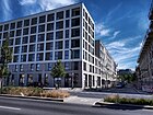
| Lydia-Rabinowitsch-Strasse | 300 | Lydia Rabinowitsch-Kempner , Russian-German microbiologist | June 16, 2017 | The new street in Europacity runs in a U-shape from Heidestrasse and back. |
|
|
Magnus-Hirschfeld-Ufer
( Location ) |
1070 | Magnus Hirschfeld (1868–1935), sexologist | May 6, 2008 | The footpath and bike path stretches along the Moabiter Werder on the north bank of the Spree between Moltkebrücke and Lutherbrücke . The inauguration took place exactly 75 years after the looting of the Institute for Sexology in the course of the book burnings by the National Socialists , which was very close. In Berlin street planning , the street is only marked as a pedestrian path in Okstra class F, RBS class FUWE . |

|
| Mathilde-Jacob-Platz
( Location ) |
40 × 40 | Mathilde Jacob (1873–1943), Rosa Luxemburg's secretary and Holocaust victim | 1995 | In 1995 the square in front of the town hall of the former Tiergarten district was named after Mathilde Jacob and in 1997 a commemorative plaque was inaugurated on the town hall . The Tiergarten town hall is a listed building monument. The only adjoining of the square, which is planted with Japanese ornamental cherries, is the Tiergarten citizens' office. |

|
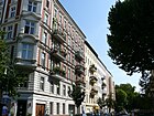
| Melanchthonstrasse
( Location ) |
300 | Philipp Melanchthon (1497–1560), theologian and reformer | Nov 19, 1877 | It was laid out as street 15b, Section VII of the development plan . The quiet residential street with cobblestones consisting of old and postwar connects as an extension of Fleming Street , the Paul Street with Calvin Street . |
|
| Minna-Cauer-Strasse
( Location ) |
350 | Minna Cauer (1841–1922), journalist and women's rights activist | 6 Sep 2005 | The road connects Invalidenstrasse with Heidestrasse. It was created in connection with the construction of the Tiergarten Spreebogen (TTS) tunnel , the northernmost entrance of which is here. |

|
|
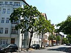
New shore
( Location ) |
870 (in the district) |
New bank created during the construction of the Charlottenburg connecting canal | Sep 14 1910 | The section between Sickingenstrasse and the railway site belongs to Charlottenburg . The building complex (house numbers 5–8) located south of Kaiserin-Augusta-Allee is a listed building. The northern part of the street is determined by industrial plants, only between Klarenbachstraße and Kaiserin-Augusta-Allee there are some old buildings. At the southern end, directly at the Spreekreuz between the Spree, Landwehr Canal and Charlottenburg connecting canal, is the building of the water police center. There is a park, sports facilities and a playground between Kaiserin-Augusta-Allee, Wiebestrasse and Neuem Ufer. A riverside path runs parallel to the road. To the north of Sickingenstrasse, the street belongs to the Charlottenburg-Wilmersdorf district. |
|
|
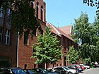
Oldenburger Strasse
( Location ) |
710 | Oldenburg , city in Lower Saxony | June 11, 1902 | The street was given its current name when it was built. As an extension of Ottostrasse, it connects Turmstrasse with Siemensstrasse. The block between Turmstrasse and Waldenserstrasse is dominated by the building complex of the Catholic St. Paulus Church with the Dominican monastery. It is one of the most important Catholic church buildings in Berlin of the late 19th century. |
|
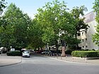
| Otto-Dix-Strasse
( Location ) |
330 | Otto Dix (1891–1969), painter and graphic artist | Oct 15, 1979 | The access road connects Rathenower Strasse and Lesser-Ury-Weg. The barracks of the 2nd Guard Uhlan Regiment, demolished in 1955, were located here . The quiet residential street belongs to the Heinrich-Zille-Siedlung, which was built between 1976 and 1981. Due to the nearby main station, the street is well connected to local public transport. Since the complex was built as part of the social housing development of the Berlin Senate and people only moved in according to strict criteria, the area has developed into a social hotspot. There are many green spaces, playgrounds and car-free passageways in the complex, which has only two to four-story houses. |
|
| Ottoplatz
( Location ) |
270 × 70 | Johann Karl Otto (1787–1865), building contractor and local politician | 1867 | The previously unnamed square was named in connection with the adjacent Ottostraße. In 1934 it was named Norkusplatz after Herbert Norkus , a supporter of National Socialism. In 1947 it was renamed back to Ottoplatz. The Ottopark is located here . |

|
| Ottostrasse
( Location ) |
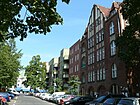
210 | Johann Karl Otto (1787–1865), building contractor and local politician | Jan. 9, 1867 | The street got its name when it was built. Her name was - just as the Ottoplatz - July 24, 1934 to July 31, 1947 Norkusstraße after stabbed in the Zwinglistraße Hitler Youth Herbert Norkus , who as a model for the book and film Hitler Quex served. The parish and parish house of the Evangelical Heilandsgemeinde in Ottostraße 16 is a listed building monument. |
|
| Otto-Weidt-Platz
( Location ) |
Otto Weidt , Righteous Among the Nations | 18th May 2018 | The square is on Heidestrasse in the emerging Europaviertel . The construction of the town square should be completed in mid-2020. | ||
|
Paulstrasse
( Location ) |
670 | Paul , male first name | Nov 11, 1868 | Before that, it was Street 17, Section VII of the development plan . The street already existed in 1861 when Moabit was incorporated into Berlin, but it still had no name. At that time the Berlin magistrate issued an order that common first names should be used for street names that were neither local nor related to a specific person. This is how Paulstrasse got its name in 1868. It runs from the Luther Bridge to the Alt-Moabit street . The forwarding building located on the site of the Moabiter Werder is a listed building monument. From 1997 to 1999 it was converted into a school, expanded and supplemented with a double sports hall and a kindergarten. This busy north-south connection with residential and commercial buildings has on the Luther Bridge from the south an access to the President's triangle on the left and to the Moabiter Werder and the Magnus-Hirschfeld-Ufer on the right. The Anne Frank Elementary School and the Moabiter Elementary School are on the street. |

|
| Perleberger Strasse
( Location ) |
1520 | Perleberg , district town in Brandenburg | May 14, 1875 | It was laid out as Straße 16, Section VIII of the development plan . It connects Stromstrasse with Fennstrasse in the Wedding district . On the north side of Perleberger Straße, apartment buildings form a closed development. The south side, on the other hand, opens up to the large areas of the former parade ground, the Moabit hospital and the Schultheiss brewery. The tenement houses on Perleberger Strasse go back to the activities of the construction company Am kleine Tiergarten . The prisoner collection point ( Gewahrsam City ) of the police is located at No. 61a on the former barracks area. Here are the messages of Tajikistan (No. 20) and Uzbekistan (No. 62). Houses 57, 62, the former Ballhaus Tiergarten, today the Uzbek embassy, and the Holy Spirit Church are listed architectural monuments. The Moabit Hospital , which was closed in 2002 and now forms the Moabit Health and Social Center, is located between Perleberger Strasse, Birkenstrasse and Turmstrasse . It is a busy inner-city street on the north side of dense residential developments, some with several backyards. There are many small businesses on the ground floor. On the south side is the Police Directorate 3, the Police Section 33 and the Embassy of Uzbekistan. Between Birkenstrasse and Feldzeugmeisterstrasse there are also residential developments on the south side. |

|
| Pritzwalker Strasse
( Location ) |
180 | Pritzwalk , city in Brandenburg | Dec 16, 1882 | It was laid out as Straße 14e, Section VIII of the development plan , in 1882 by the construction company Am kleine Tiergarten . The short, traffic-calmed street is a quiet residential street in a central location with a mixture of old buildings, post-war buildings and new buildings. There is a large green inner courtyard with a pedestrian passage to Wilsnacker Strasse. |

|
| Putlitzstrasse
( Location ) |
290 | Putlitz , noble family from Brandenburg | March 17, 1891 | Putzlitzstraße runs from the Birkenstraße junction over the Putlitzbrücke and then turns into the street An der Putlitzbrücke. There are other parts of the street on both sides of the bridge ramp. The access to Berlin Westhafen train station and the Putlitzbrücke deportation memorial are located on the bridge . The centrally located street is divided by the wide driveway of Stromstraße to Putlitzbrücke. There is a passage under Stromstrasse which connects both parts of the street. The houses have a direct view of the busy thoroughfare. The western side of the street is a one-way street in a southern direction and the eastern side of the street is a one-way street in a northern direction. |

|
|
Quitzowstrasse
( Location ) |
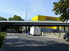
1250 | Quitzow , noble family from Brandenburg | March 17, 1891 | It was created as Straße 17, Section VIII of the development plan , and connects Siemensstraße with Perleberger Straße. In connection with the new construction of Ellen-Epstein-Straße , the confluence with Perleberger Straße was redesigned so that a warehouse could be built on the area gained. There are only commercial buildings on the north side of the street. A path led from Quitzowstrasse to the ramps of the Moabit freight station , from where more than 32,000 Jews were deported to extermination camps between 1942 and 1945 . A memorial plaque reminds of this. |
|
|
Rahel-Hirsch-Strasse
( Location ) |
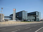
290 | Rahel Hirsch (1870–1953), first female medicine professor in Prussia | May 16, 2005 | The street was created in connection with the construction of the main train station . The Lehrter city quarter is to be built here. It runs along the banks of the Spree between the Moltkebrücke and the Friedrich-List-Ufer in front of Washingtonplatz , which is located at the main train station . |
|
| Rathenower Strasse
( Location ) |
1370 | Rathenow , district town in Brandenburg | May 4, 1875 | It was laid out as Straße 15, Section VIII of the development plan , by the construction company Am Kleines Tiergarten and connects Perleberger Straße with Alt-Moabit. Rathenowerstrasse, Invalidenstrasse and Alt-Moabit originally formed a confluence. In connection with the demolition of the barracks at this intersection in 1955, the street was connected to Paulstraße. A small street triangle still exists between Alt-Moabit and Invalidenstraße.
Listed architectural monuments are the Moabit correctional facility , the barracks of the 4th Guards Regiment on foot in nos. 9 and 10 and the residential building no. 52. Opposite the Turmstrasse is the entrance to the Fritz-Schloß-Park . |

|
| Reuchlinstrasse
( Location ) |
260 | Johannes von Reuchlin (1455–1522), philologist and humanist | 6 Sep 1899 | It was laid out as Straße 28, Section VI of the development plan , 1891–1895. As an extension of Berlichingenstrasse, it connects Huttenstrasse with Kaiserin-Augusta-Allee. |

|
| Rostocker Strasse
( Location ) |
550 | Rostock , city in Mecklenburg-Western Pomerania | March 17, 1891 | It was laid out as Straße 31a, Section VI of the development plan , and connects Huttenstraße with Sickingenstraße. The teacher's house of the 216th and 222nd community school with reading hall in No. 32 is a listed building monument. The residential street is relatively quiet, but most of the buildings are in need of renovation. The entire neighborhood is one of the social hot spots in Berlin, but it is very multicultural. There are two pedestrian passages to Berlichingenstrasse . One passage is green and has a playground, the second passage has playground equipment for young people and a football field. The Moabit City Palace with the Kurt Tucholsky Library is on Rostocker Straße. |

|
|
Salzwedeler Strasse
( Location ) |
180 | Salzwedel , district town in Saxony-Anhalt | Jan. 18, 1892 | The street was laid out as street 17c, Section VIII of the development plan . It connects Stephanstraße with Quitzowstraße and the part of Putlitzstraße next to the Putlitzbrücke, but is closed to motor vehicles. The traffic-calmed residential street mainly consists of old buildings. |

|
|
Seestrasse
( Location ) |
590 (in the district) |
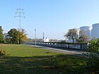
Plötzensee , direction of the street from old Berlin | around 1827 | The part opposite the Westhafen between the two sea road bridges belongs to Moabit. The eastern section of the street runs in the district of Wedding . |
|
| Seydlitzstrasse
( Location ) |
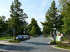
580 | Friedrich Wilhelm von Seydlitz (1721–1773), Prussian general | Aug 15, 1881 | Because of the barracks of the 2nd Guard Uhlan Regiment , this traffic route was named in memory of the cavalry general Seydlitz. Seydlitzstrasse (also written Seidlitzstrasse in some older address books ) connects Rathenower Strasse with Lehrter Strasse. The quiet inner-city residential street has cobblestones. The southern part of the street is bordered by the Heinrich-Zille-Siedlung and the buildings of the Berlin City Mission. The northern part of the street borders on the Fritz-Schloß-Park, and the Post Stadium with its extensive facilities and the former summer pool Seydlitzstraße. |
|
| Sickingenstrasse
( Location ) |
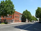
1020 | Franz von Sickingen (1481–1523), military leader | March 8, 1894 | The north side of the western end of the street is in Charlottenburg . It was laid out as Straße 7, Section VI of the development plan , and connects Gauß-Straße with Siemensstraße. It is the northernmost street in the Moabit industrial area. The residential complex Sickingenstrasse 7/8 as well as the former tram depot Moabit at Sickingenplatz , which is used today by the “ Classic Remise ” (formerly Meilenwerk ), are listed monuments. A few residential buildings are located on the busy street that leads to a purely industrial area at the western end. Because of the Beusselstrasse wholesale market, traffic starts very early. The circular railway runs behind the plots on the north side . Further east on the corner of Berlichingenstrasse is the former Telefunken factory for electron tubes , which now houses an employment agency . |
|
| Siemensstrasse
( Location ) |
750 | Werner von Siemens (1816–1892), entrepreneur | Apr 24, 1890 | Siemensstrasse, laid out as Strasse 17a, Section VIII of the development plan , connects Beusselstrasse with Quitzowstrasse. The Moabit freight yard was once located on the north side . On the south side there are residential buildings in perimeter block development . The school building at No. 20 is a listed building monument. The street, which was once heavily loaded with traffic, became a quiet residential street in 2014, which offers a clear view to the north over the railway area around the Westhafen. Car traffic now flows over the new Erna-Samuel-Strasse , which was built in 2014 on the former Moabit freight yard. In the course of the construction work, a small district park with a playground was created. The road ends as a dead end for cars on Erna-Samuel-Straße. |

|
| Solinger Strasse
( Location ) |
210 | Solingen , city in North Rhine-Westphalia | Sep 15 1906 | It was laid out as street 30 of Section VII of the development plan . The quiet, inner-city residential street with cobblestones connects Tile-Wardenberg-Strasse with Levetzowstrasse. |

|
| Spenerstrasse
( Location ) |
470 | Philipp Jakob Spener (1635–1705), theologian | Nov 19, 1887 | The quiet residential street with old and post-war buildings connects Lüneburger Straße with Alt-Moabit . Laid out as street 15a, Section VII of the development plan , |

|
| Stendaler Strasse
( Location ) |
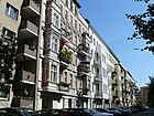
210 | Stendal , district town in Saxony-Anhalt | May 14, 1875 | The traffic-calmed residential street with a lot of old buildings and dense development connects Havelberger Strasse with Rathenower Strasse and was laid out as Strasse 13b, Section VIII of the development plan . |
|
| Stephanplatz
( Location ) |
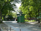
90 × 50 | Heinrich von Stephan (1831–1897), postmaster general and politician | 1889 | Stephanplatz is the heart of the Stephankiez and was laid out as Platz B I, Section VIII of the development plan , between Stephanstraße and Havelberger Straße. From 1937 to 1947 it was called Sagasserplatz after Erich Sagasser, a supporter of National Socialism. In 2000 it was completely redesigned. The public lavatory here, a so-called “ Café Achteck ”, is a listed building . |
|
| Stephanstrasse
( Location ) |
820 | Heinrich von Stephan (1831–1897), postmaster general and politician | March 12, 1889 | The traffic-calmed residential street with dense development and cobblestones has consistently good old building fabric, social housing at the Putlitz Bridge connects Putlitzstraße with Perleberger Straße. The surrounding Stephankiez is named after her. The school building in No. 2/3 and the Hedwig-Dohm-Oberschule in No. 27 are protected architectural monuments. |

|
| Stromstrasse
( Location ) |
1000 | Spree | 1827 | From the 18th century until 1827 it was called the Green Way . While this path was given its new name in 1827, the northern part between Turmstrasse and Birkenstrasse only got it later. Construction began around 1848. The most striking building is the Schultheiss brewery , which was closed in 1980 . Other architectural monuments are the residential and commercial building at no. 61, the residential and administrative building of the F. W. Schütt steam mill, the apartment buildings at Stromstrasse 87-93, Stromstrasse 8 and Stromstrasse 58. |

|
|
Thomasiusstrasse
( Location ) |
350 | Christian Thomasius (1655–1728), lawyer and philosopher | Jan. 9, 1901 | The road was laid out after the Borsig factory was demolished. It was shown in the development plan as Street 15a, Section VII . It connects the Helgoland shore with the Alt-Moabit road . Listed monuments are No. 4 and No. 5. A quiet residential street with old and post-war buildings. The eastern side of the street was largely destroyed during the war; residential buildings from the early 1950s are located here. The western side of the street with its magnificent old buildings and some Art Nouveau facades was largely preserved. The psychoanalyst and doctor Sabina Spielrain , who was shot by the National Socialists together with her daughter, lived temporarily in house No. 2 . |

|
| Thusnelda-Allee
( Location ) |
50 | Thusnelda († 17 AD), wife of the Cheruscan prince Arminius | Jan. 18, 1892 | The street is the shortest avenue in Berlin, it connects the Alt-Moabit street with the Turmstrasse. The only building is the Heilandskirche . | |
| Tile-Wardenberg-Strasse
( Location ) |
420 | Tile Wardenberg , landowner and politician in the 14th century | Jan. 9, 1901 | In the development plan , it was listed as Straße 33, Section VII . The quiet residential street with cobblestone, old buildings and post-war buildings connects the Viking bank with the Hansa bank. |

|
|
Turmstrasse
( Location ) |
1800 | two church towers that were visible from the street when the name was given | 1827 | The road was laid out in 1818 on the route of an old military road. Turmstrasse originally ran as far as Heidestrasse and was only shortened to its current size around 1846 by the construction of the parade ground east of Rathenower Strasse, but is still 1.8 kilometers long. After the end of the Second World War , the street was briefly called Ernst-Thälmann-Straße . It is the main shopping street in Moabit. The most striking buildings are the criminal court (lower photo) at the eastern end of the street, the building complex of the former Moabit hospital and the Tiergarten town hall . Further architectural monuments are house no. 4, house no. 38, house no. 76 / 76a as well as the Anne Frank elementary school and the 82nd and 90th community school and Kirschner secondary school, which are now used as adult education centers. The busy residential and shopping street with two lanes in each direction and a central island, where the criminal court is located, in which almost all major criminal cases in the city are tried. The former Moabit Hospital (Turmstrasse 21) has become the Moabit Health Center. The Tiergarten Citizens' Office on Mathilde-Jacob-Platz is a central point on the street. The Galerie Nord and the Berlin-Kolleg are also on the street. The east end is a little quieter. |

|
|
Ufnaustraße
( Location ) |
200 | Ufenau , the place where Hutten died | May 19, 1908 | Laid out as Street 23a, Section VI / 3 of the development plan , the quiet residential street connects Huttenstrasse with Sickingenstrasse . Huttenstraße influenced the naming of the residential street, which mainly consists of old buildings with a simple standard. The entire neighborhood is one of the social hot spots in Berlin, but it is multicultural. |

|
| Unionplatz
( Location ) |
180 × 100 (triangular shape) |
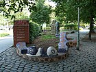
Protestant Union | March 8, 1894 | It was laid out as Platz A / I, Section VIII of the development plan , in 1879 between Siemens- , Union- and Bremer Straße. The area between Siemensstrasse and Oldenburger Strasse was drawn in on October 20, 1969. There is a sports hall and playgrounds here. To the east of Bremer Strasse is the Moabit school garden and to the south of Unionstrasse is the Unionpark with other playgrounds. |
|
| Unionstrasse
( Location ) |
240 | after the Unionplatz, which was already created | June 11, 1902 | The street was laid out as street 4a, Section VIII of the development plan , together with Unionplatz. As an extension of Birkenstrasse, it leads from Bremer Strasse to Siemensstrasse . The part between Oldenburger Strasse and Siemensstrasse is a pedestrian area. In the Berlin road planning, only 130 meters are included as a municipal road (RBS: STRA), a further 110 meters of the road are marked as pedestrian path with Okstra class F and RBS class FUWE. This classification corresponds to the required state of development. The lavatories here, called " Café Achteck ", are listed as historical monuments. The traffic-calmed residential street (cobblestones) has partly good old buildings. South of the street is the park on Bremer Straße with a passage to Wiclefstraße. The Moabit nature trail runs across the street. |

|
|
Waldenserstrasse
( Location ) |
820 | Waldenses , religious movement in the Middle Ages | March 17, 1891 | Waldenserstraße, laid out as Straße 2, Section VIII of the development plan , connects Bremer Straße with Waldstraße as an extension of Bugenhagenstraße. There are several striking buildings here: the former Berlin horse train station, which has been used as a commercial center since 1924, the single home for men at no.31, today Amsterdam House, the Carl Bolle primary school at no.20 and 21, the residential building Schweizer Hof at No. 15 and residential building No. 30. The Catholic St. Paul Primary School is located at No. 27 and next to it is the entrance to the St. Paul Church . It is a traffic-calmed residential street with partly good old buildings and trees. During the day there is a passage for pedestrians to Wiclefstraße across the grounds of the Waldenser Education Market, a non-profit company. The Amstel House Hostel is directly opposite the passage. |

|
| Forest road
( Location ) |
610 | Forest north of Turmstrasse, into which the road initially led | 1822 | The street has not been officially named.
On January 7, 1864, the approval of 270 marks for nine oil lanterns on the built-up western side was granted. In April 1904, a central promenade with two asphalt side embankments was laid out from Turmstrasse to Wiclefstrasse. As an extension of Gotzkowskystrasse, it connects Turmstrasse with Siemensstrasse. The SOS Children's Village Berlin-Moabit was opened in No. 23/24 in 2005 . Architectural monuments are No. 54 and the tenement and stable building No. 55 and 55a. It is a traffic-calmed residential street with a mixture of old and post-war buildings. The forest road is planted with walnut trees, ornamental cherries, ornamental apples and ornamental pears. The street has a wide median with benches and play areas. |

|
| Washingtonplatz
( Location ) |
150 × 110 | George Washington (1732–1799), first American President | Feb 12, 1932 | The western part of the Friedrich-Karl-Ufer between the Moltke and Hugo-Preuss-Bridge was renamed Washingtonplatz in 1932. On May 16, 2005, it became the southern forecourt of the main train station . The uninhabited and still somewhat unadorned place is very busy during the day. The way to the government district leads across the square. |

|
| Werftstrasse
( Location ) |
260 | a shipyard on the shore | June 21, 1862 | The 8, Div. VII of the development plan already existed in 1861 with the incorporation and, against a railway to the Spree . As a traffic-calmed street, it connects Alt-Moabit with Lüneburger Straße, although the passage to this is closed to motor vehicles. A traffic-calmed residential street with cobblestones and old and post-war buildings. On Lüneburger Straße there are several passages under the tram line. |

|
| Westhafenstrasse
( Location ) |
180 | Approach to the Berlin West Harbor | after 1923 | Westhafenstrasse opens up the Westhafen and runs from Beusselstrasse to An der Putlitzbrücke. Part of the street on the BEHALA property was withdrawn on June 15, 1962 and deleted from the street directory on the same day. The entire Westhafen facility is a listed building monument. In the Berlin street planning it is included in the RBS class as STRA, but according to Okstra class N it is not a municipal road whose construction the state would be responsible for. |

|
| Wiclefstrasse
( Location ) |
860 | John Wiclef (before 1320–1384), English theologian | Jan. 18, 1892 | While Street 3, Section VIII of the development plan was given this name as early as 1892, Street 1a and Street 7 of the same department were only given the name Wiclefstraße on June 7, 1896. It connects Wilhelmshavener Strasse with Beusselstrasse.
The Protestant Reformation Church and the apartment building No. 48 are listed monuments. It is a traffic-calmed, cobblestone street with trees made of Norway, mountain, ash, sugar and silver maple. During the day, there is a pedestrian passage from Wiclefstraße across the grounds from Waldenser Education Park to Waldenserstraße. To the north, a pedestrian passage in the densely built-up area leads to Unionstraße through the hidden park on Bremer Straße. The Moabit nature trail is located in the street. |

|
| Wiebestrasse
( Location ) |
600 |
Eduard Wiebe (1804-1892), architect; Adolf Wiebe (1826–1908), senior construction director and Hermann Wiebe (1818–1881), engineer |
Feb. 14, 1895 | Wiebestrasse is largely dominated by industrial buildings and leads from Sickingenstrasse to Neuer Ufer. The part between Kaiserin-Augusta-Allee and New Shore is a pedestrian path. Individual parts were initially called Straße 25 , Straße 25a and Straße 26, Section VI of the development plan . Architectural monuments are the former tram depot Moabit , which is currently used by the " Classic Remise " (formerly Meilenwerk ), the factory of Ludwig Loewe & Co. (today Ludwig-Loewe-Höfe ) and the public lavatory. The Loewe Hall in the Ludwig-Loewe-Höfe can be rented for celebrations. The “Classic Remise” is a mixture of a “living museum”, a parking garage and a service center. There are vintage and collector cars presented. In the south the road ends in a small park with a sports field. The Richard Schröter primary school is also located here. |

|
| Viking Shore
( Location ) |
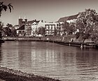
370 | Vikings , seafaring peoples in the Viking Age | Jan. 9, 1901 | When it was built, the Uferstraße was called Straße 34a, Section VII of the development plan . It leads along the banks of the Spree from the Gotzkowsky Bridge to Wullenweberstrasse. The Erlöserkirche and the Landesbildstelle are listed architectural monuments. A little-used residential street directly on the Spree with cobblestones and the Moabit nature trail and the Spreeweg . |
|
| Wilhelmshavener Strasse
( Location ) |
860 | Wilhelmshaven , city in Lower Saxony | 16 Aug 1892 | It was laid out as Straße 9, Section VIII of the development plan . On January 19, 1901, the northern continuation of Wilhelmshavener Strasse over Birkenstrasse to Quitzowstrasse was given the same name. The substation at No. 7 and the apartment building No. 47 are listed monuments. It is a mostly traffic-calmed residential street with cobblestones. |

|
| Wilsnacker Strasse
( Location ) |
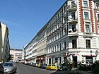
870 | Bad Wilsnack , town in Brandenburg | May 14, 1875 | The street 14b, Div. VIII of the development plan , was founded in 1874 by the construction company on the Kleiner Tiergarten created, paved in 1875 and named. The road 14c and street 14d were added to the Wilsnacker street on March 16, 1886th The street leads from Perleberger Strasse over Turmstrasse to Alt-Moabit street . The Tiergarten District Court has an entrance in No. 4 . Opposite it is the Ehrenfriedhof Wilsnacker Straße. Further architectural monuments are the tenement house No. 61, the preschool of the Royal Luisen-Gymnasium as well as the tenement house No. 41. Between Perleberger Strasse and Turmstrasse there is a quiet residential street in a central location with a mixture of old buildings, post-war buildings and new buildings. There is a large green inner courtyard with a pedestrian passage to Pritzwalker Straße. At the southern end is the "Friedhof Wilsnacker Straße for Victims of War and Tyranny" and the entrance to House B of the judicial administration building. On the corner of Turmstrasse is a large playground with a monument to Wilhelm Schwartz . |
|
| Wittstocker Strasse
( Location ) |
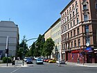
240 | Wittstock / Dosse , town in Brandenburg | Jan. 18, 1892 | It was laid out as Straße 30a, Section VI of the development plan , and connects Berlichingenstraße with Beusselstraße.
The tenement group No. 4–5 / 24–26 is a listed building monument. The residential street is relatively quiet and some of the old buildings are in great need of renovation. Part of the street is traffic-calmed. |
|
| Wullenweberstrasse
( Location ) |
360 | Jürgen Wullenweber (around 1488–1537), Mayor of Lübeck | Jan. 9, 1901 | It was laid out as street 33a, Section VII of the development plan . In 1984, a three-and-a-half meter wide strip of land on Wullenweberstrasse (sports ground side) between Hansa-Ufer and Wikingerufer was drawn in for public transport. The road connects Wikinger-Ufer and Hansa-Ufer. The Wullenwebersteg is a pedestrian bridge over the Spree. It is a quiet inner-city residential street with cobblestones from the upper floors of the houses you have a clear view over the Spree and the sports area of the Gutsmuths club. Social housing is built on the north side of the street, the area on the south side mainly belongs to the Gutsmuths sports club. The green main paths Spreeweg and Tiergartenring are on the street |
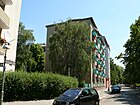
|
|
Zinzendorfstrasse
( Location ) |
190 | Nikolaus Ludwig von Zinzendorf (1700–1760), theologian | Apr 30, 1899 | It was laid out as street 35a, Section VII of the development plan . It connects the Alt-Moabit street with Levetzowstraße. A small residential street with cobblestones and mostly old buildings with good substance. The entrance to the Miriam Makeba Elementary School with a gym is on the street. |

|
| Zwinglistraße
( Location ) |
460 | Ulrich Zwingli (1484–1531), Swiss reformer | Apr 24, 1890 | It was laid out as Straße 25, Section VII of the development plan . The densely built-up inner-city residential street is traffic-calmed. The Kiez is one of the social hot spots in Berlin, but it is very multicultural. Zwinglistraße lies between Otto and Beusselstraße . Three former community schools, in the 21st century the Berlin College and the Wartburg School, are listed monuments. |

|
Other locations of Moabit
Further road sections according to the road register
In the Berlin street directory of the regional reference system, some streets are also named for which private carriers are responsible. With the classification according to Okstra class "N", there are no municipal roads and they are not categorized in the higher-level road network . The same classification as the ( already described above ) West Harbor Road (4817) also has the "Torfstraße" (no. 4515). It is still in the street register with a length of 210 meters for the district in RBS class "STRA" (building requirement). The continuation of Weddinger Torfstrasse is in a direct line on the Moabit bank of the Berlin-Spandau shipping canal . The road bridge that existed until it was destroyed in the war has been replaced by the peat road bridge (slightly offset to the west) . The Moabit street section is located in the (partially built-up) area of the Berlin immigration office and is designated as part of the Friedrich-Krause-Ufer on the map of the surveying offices . On the other hand, bridgeheads of the previous bridge are drawn in this plan, the section length of 210 meters corresponds to the route north bank of the canal to the S-Bahn route .
Furthermore, the following traffic routes are included for the district, which are designated as “ZUFA” (expansion requirement) according to RBS and according to Okstra class “N” under private responsibility.
- “Access road to the wholesale market” (5628, zip code 10553): This traffic route branches off from Beusselstrasse (between Ludwig-Hoffmann- and Beusselbrücke) and leads into the western Berlin wholesale market for a length of 950 meters . The wholesale market halls are assigned to Beusselstrasse 44 as split plots 44A-44P.
- “Access road to Westhafen” (5629, ZIP 13553): this traffic route with a (specified) length of 990 meters is located on the grounds of the Westhafen in continuation of Westhafenstraße (from An der Putlitzbrücke) to Beusselstraße. The residential street is located on the southern edge of the Westhafengländes along the S-Bahn and, in addition to the commercial properties and halls operated by the “BeHaLa”, opens up the central land registry of Berlin and the archive of the State Library .
There are no properties assigned to either street.
According to the Berlin street register, some streets (RBS: STRA) of the neighboring districts are also given for Moabit in sections of short length, but there are complications to find these sections on the official map of the district surveying offices. The differences relate to road sections on bridges and bank areas that are without property assignments.
- Altonaer Strasse (No. 100): 70 m adjacent to the Hansaviertel. To the east is the street in Tiergarten, Moabit includes the section over the Spree, on the Hansabrücke to Hansa / Bundesratufer.
- Fennstrasse (No. 1260): 60 meters in the district bordering Wedding. This corresponds to the course over the Fennbrücke (Berlin-Spandauer Schifffahrtskanal) and the connection over the Moabiter Ufer to the Friedrich-Krause-Ufer / Heidestraße junction, the continuation is Perleberger Straße, which initially leads you over the Perleberger Brücke.
- Gaußstrasse (No. 1484): Coming from Charlottenburg, a further 90 m of road to the east are named for Moabit. However, on the map of Berlin, the district boundary of Moabit is on the northern edge of the Sickingen Bridge, but including the width of the Charlottenburg connecting canal on its west side.
- Lessingstraße (No. 2757): The street is in the Hansaviertel and 90 m are named for Moabit. In this case, the Lessing Bridge belongs to the district, as the border between Hansaviertel and Moabit lies on the south bank of the Spree. The indication of 90 meters also includes the bank strip the width of the Bundesratufer.
- Sellerstraße (No. 4135): The district boundary to Wedding is on the banks of the northern harbor. Sellerstraße is located in Moabit across its entire width on the Nordhafenbrücke up to the connection with the B 96 into Heidestraße. The Moabiter section is listed with 210 m in the street list.
- Spreeweg (No. 4264): 90 m in Moabit are mentioned for this street in Tiergarten. The Spree is located in Moabit and thus the Luther Bridge also belongs to the district. For the specified 90 meters, the northern bank strip between the Presidential Triangle and Martin-Hirschfeld-Ufer would be a section of the Spreeweg before Paulstraße begins after Moabit .
- Willy-Brandt-Straße (No. 8376): This street only has property 1, the Federal Chancellery in Tiergarten. The further course lies over the Moltkebrücke and thus the Spree (-width) belonging to Moabit. The length of 130 m in Moabit mentioned in the street register results from the two street sections with separate lanes.
Allotment gardens (KGA)
The allotment gardens in Berlin, insofar as they are subject to the Federal Allotment Garden Act, are included and described in the allotment garden development plan. The plan contains four colonies in the area of the district.
- Railway Agriculture (FOAG)
- Sub-district Hamburg-Lehrter Güterbahnhof Group Lehrter Straße: This railway farm is located with 35 plots on 9604 m² of leased land of the railway. It is included in the allotment garden development plan as 1202 and is bound to the statute of the rail industry (status I b in the development plan). The association has been running the allotment gardens on this former railway site for more than 50 years.
- Sub-district Moabit Gruppe Westhafen: The KGA "Westhafen" (1203) is located with 16 parcels on 3863 m² of railway area and is subject to the regulations of the railway garden management. It is located north across from the Westhafen S-Bahn station along the S-Bahn track.
- KGA "Lehrter Strasse": The KGA "Lehrter Strasse" (allotment garden development plan 1001) with the address Lehrter Strasse 5 is located opposite Seydlitzstrasse at the arch of Lehrter Strasse and borders the site of the former "Hamburg and Lehrter Containerbahnhof", it is in the allotment garden development plan as 1001 recorded. The official cemetery was located here from 1842–1849. This permanent allotment garden with 43 plots on 11,484 m² of leased land is considered to be permanently secured in the existing structure due to its representation as green space (KGA).
- KGA "Seestraßeninsel": Recorded in the allotment garden development plan as 1002, this colony with the address Seestrasse 131 is identified as a fictitious permanent allotment garden . On the island between the Berlin-Spandauer Schiffahrtskanal and the east end of the Westhafenkanal there are eight permanently secured parcels (category Vb: shown as green space in the FNP) on 3565 m² of state-owned leased land; they share the island with the sea road and the bridge maintenance facility.
Parks
- Carl-von-Ossietzky-Park : It is located in the square south of Alt-Moabit between the houses on Spenerstrasse and Paulstrasse, with access also from Melanchthonstrasse.
- Essener Park: Is listed under this name in the street directory and is located behind Essener Straße 2–7 (continuous), Krefelder Straße 16–22 (continuous), Alt-Moabit 84–86b, Stromstraße 64–67a.
- Fritz-Schloß-Park on the former parade ground between Rathenowerstrasse and Lehrter Strasse, the park is located along Rathenower Strasse between Kruppstrasse and Seydlitzstrasse in the east through the Post Stadium to Lehrter Strasse. There is a memorial for Fritz Schloß and in memory of the uprising of June 17, 1953.
- Chancellor Park, it is located between the new building for the Federal Ministry of the Interior and the Moabiter Werder residential area on the north bank of the Spree. The non-public park is on the Chancellery bridge with the Federal Chancellery connected
- Small zoo with Ottopark: the green area with plants, trees and lawns is between Turmstrasse and Alt-Moabit. To the west of Stromstrasse is the Heilandskirche and across Thusneldaallee to the west is the Ottopark.
- Nordhafenpark, is the greened south side of the Nordhafen north-west of Heidestrasse and Sellerstrasse. The part of the park on the opposite bank belongs to Wedding.
- Park on the Moabiter Werder : The “residential house queue” is bounded by this green area between the Spree (Magnus-Hirschfeld-Ufer), Paulstraße and Joachim-Karnatz-Allee.
- Presidential triangle : The parking area between the S-Bahn-Bogen, Paulstraße and Spreeufer is the compensation area for the construction work at the Federal President's Office.
- Stadtgarten Moabit: The movement of goods on the site of the Moabit freight station opposite the former container station across Heidestrasse has long been stopped. Up until the fall of the Berlin Wall , the halls near the Invalidenstrasse border crossing were used by freight forwarders in West Berlin and have been increasingly cleared since the fall of the Wall . The site was converted into the Moabiter Stadtgarten between 2007 and 2012.
- ULAP Park : The ULAP area was used as a torture site until the end of the Nazi regime. The area (160 m × 130 m × 130 m) in the east corner between the railway line and Alt-Moabit was improved as a compensatory measure when the station was expanded.
- “Unionpark”, or “Bremer Park” because of its location, is a green area of 15,344 m² with a playground and park paths. Before the destruction of the war, the area was built on with backyards. Access is via the green plots of Unionstrasse 5 (37 meters), Bremer Strasse 48 (60 meters) and Wiclefstrasse 8 (15 meters), which are part of the park, within the neighboring residential buildings and the continuously built-up properties at Oldenburger Strasse in the west.
Other facilities and areas
- Berlin wholesale market on Beusselstrasse between the railway site and the Westhafenkanal
- Europacity development area
- “Focus Teleport service center” on Alt-Moabit street on the site of the former C. Bolle dairy
- History park on the site of the former Moabit cell prison near the main train station
- Central Station
- Hamburger Bahnhof the Museum für Gegenwart of the Nationalgalerie
- Prison Moabit
- Moabit Hospital
- Moabiter Werder
- Post Stadium
- Street of Remembrance on the banks of the Spree of the former C. Bolle dairy
- Westhafen the largest port in Berlin
See also
- List of cultural monuments in Berlin-Moabit
- List of cinemas in Berlin-Moabit
- List of stumbling blocks in Berlin-Moabit
literature
- Landesdenkmalamt Berlin (Hrsg.): Monuments in Berlin district Mitte - districts Moabit, Hansaviertel and Tiergarten . Imhoff Verlag, Petersberg 2005, ISBN 3-86568-035-6 .
Web links
- Map of Berlin 1: 5000 with district boundaries. Senate Department for Urban Development Berlin, 2012, accessed on January 11, 2013 .
- Street directory Moabit. kaupert media GmbH, accessed on January 25, 2013 .
- moabitonline website of several citizens' initiatives
Individual evidence
- ↑ Senate Department for Urban Development: Stephankiez ( Memento of the original dated August 2, 2011 in the Internet Archive ) Info: The archive link was inserted automatically and has not yet been checked. Please check the original and archive link according to the instructions and then remove this notice.
- ↑ Residential complex Agricolastraße 13, 14, 14a and 15
- ↑ Residential complex Agricolastraße 29, 29a, 30, 31, 32, 33 and 33a
- ↑ Paris – Moscow
- ↑ a b Moabit remand prison
- ↑ Steam mill FW Schütt, Alt-Moabit 91
- ↑ C. Bolle dairy
- ↑ St. Johannis churchyard
- ↑ Pumping station VIII
- ↑ Market hall X and Arminius market hall
- ↑ AEG light bulb factory
- ^ Model of the Ungers draft
- ^ Kauperts: Beusselstrasse
- ↑ a b ev. Reformation Church
- ↑ Signal box MWT
- ↑ Birkenstrasse 17
- ↑ Birkenstrasse 49
- ↑ Birkenstrasse 53-55
- ↑ Friedrich-Werdersches Gymnasium & 231st and 263rd community school
- ↑ Bremer Strasse 63 and 64
- ↑ Bremer Strasse 68
- ↑ Berlin city map: Bremer-Strasse-Berlin-Moabit
- ↑ House Lessing
- ↑ Bundesratufer 10
- ↑ a b c Peter Brock (Ed.): Berlin streets rediscovered. 33 forays through the capital. Jaron Verlag Berlin, 2003, ISBN 3-89773-114-2 , pp. 51–56: Elberfelder Strasse. The front building
- ↑ Elberfelder Strasse 8-18
- ↑ Emdener Straße in Moabit is “The most beautiful street in Germany 2013” , Tagesspiegel from November 9, 2013
- ↑ Inauguration of Erna-Samuel-Strasse in Berlin - Moabit. Berlin's official city portal, accessed on August 20, 2015 .
- ↑ Moabit power plant
- ↑ Auer AG
- ↑ berlin.de Immigration Office Berlin
- ↑ berliner-stadtplan.com: Friedrich-List-Ufer-Berlin-Moabit
- ↑ Gotzkowsky Bridge
- ↑ Industrie-Palast Spree
- ↑ Gotzkowskystrasse 14-17
- ↑ Heidestrasse is 16 meters wider. In: Berliner Zeitung , September 19, 2013, page 19
- ↑ Gericke footbridge
- ↑ Turbine hall Siemens KWU, formerly AEG
- ↑ Factory building Huttenstrasse 41–44
- ↑ Ludwig Loewe & Co. AG
- ↑ berliner-stadtplan.com: Huttenstrasse-Berlin-Moabit
- ^ State laboratory Berlin-Brandenburg
- ↑ Hamburger Bahnhof
- ↑ Administration building of the Berlin-Hamburg railway company
- ↑ Theater and lecture hall of the Urania Society
- ↑ a b Cell prison Moabit
- ↑ Mechthild Henneke: Street without a soul. In: Berliner Zeitung . March 12, 2002, accessed June 18, 2015 .
- ↑ Peter Brock (ed.): Berlin streets rediscovered. 33 forays through the capital. Jaron Verlag Berlin, 2003, ISBN 3-89773-114-2 ; Joachim-Karnatz-Allee. The architect's dream. Pp. 75-80
- ↑ berliner-stadtplan.com: Joachim-Karnatz-Allee-Berlin-Moabit
- ^ Kauperts: Kaiserin-Augusta-Allee
- ↑ Kirchstrasse 2
- ↑ Kirchstrasse 3
- ↑ Moabiter Bridge, also called Bear Bridge
- ↑ bfw locations ; Brief portrait on berlin.de
- ↑ Barracks of the 1st Guard Field Artillery Regiment
- ↑ a b Royal Corps Clothing Office in Berlin
- ↑ Barracks of the 1st Guard Field Artillery Regiment
- ↑ Barracks of the 1st Guard Field Artillery Regiment
- ↑ berliner-stadtplan.com: Kruppstrasse-Berlin-Moabit
- ↑ Post Stadium
- ↑ Lehrter Strasse 27-30
- ↑ Official cemetery
- ↑ berliner-stadtplan.com: Lehrter Strasse, Berlin-Moabit: women's prison, Fritz-Schloss-Park, Poststadion
- ↑ berliner-stadtplan.com: Lesser-Ury-Weg, Berlin-Moabit
- ↑ Kleist Lyceum monument and film school
- ↑ Monument 199th and 205th community school
- ↑ Erlöserkirche architectural monument
- ↑ Post office NW 21 and telephone office 2
- ^ Kauperts: Lüneburger Strasse
- ↑ Memorial plaques in Berlin: Mathilde Jacob. Luisenstädtischer Bildungsverein eV, accessed on August 20, 2015 .
- ↑ a b City Hall Tiergarten
- ↑ New bank 5–8
- ↑ Catholic St. Paul Church
- ↑ berliner-stadtplan.com: Otto-Dix-Strasse-Berlin-Moabit
- ↑ Berlin Street Lexicon : Norkusstraße
- ↑ Parish and parish hall of the Evangelical Savior Congregation
- ↑ Senuvk, relay landscape architects, Rev A. Steel:. Stadtumbau Berlin: Otto Weidt Square. In: stadtentwicklung.berlin.de. April 17, 2018, accessed May 19, 2020 .
- ^ Kauperts: Paulstrasse
- ↑ Freight shed Spreebord
- ↑ Berlin police are checking the closure of the prison collection point on November 6, 2012
- ↑ Residential building Perleberger Strasse 57
- ↑ Ballhaus Tiergarten
- ↑ Holy Spirit Church
- ↑ a b Moabit Hospital
- ↑ Barracks of the 4th Guards Regiment on foot and residential building for unmarried officers
- ↑ Residential house at Rathenower Strasse 52
- ↑ Teachers' residence of the 216th and 222nd community schools with reading room
- ↑ Sickingenstrasse 7/8
- ↑ a b Tram station Wiebestrasse
- ↑ berliner-stadtplan.com: Sickingenstrasse-Berlin-Moabit
- ↑ 206th and 212th community schools
- ↑ Sagasserplatz on Luise-Berlin.de
- ↑ Public lavatory
- ↑ 5th municipal secondary school and 160th and 188th community school
- ↑ 168th, 182nd and 189th community schools
- ↑ Schultheiss brewery
- ↑ Residential & commercial building Stromstrasse 61
- ↑ Steam mill FW Schütt, Stromstrasse 3
- ↑ Tenement group Stromstrasse 87–93
- ↑ Apartment building Stromstrasse 8
- ↑ Apartment building Stromstrasse 58
- ↑ Tenement house Thomasiusstrasse 4
- ↑ Tenement house Thomasiusstrasse 5
- ↑ Moabit Criminal Court
- ↑ Apartment building Turmstrasse 4
- ↑ Apartment building Turmstrasse 38
- ↑ Tenement and commercial building at Turmstrasse 76 / 76a
- ↑ Anne Frank Elementary School
- ↑ a b 82nd and 90th community school and Kirschner high school
- ↑ Unionstrasse lavatory
- ↑ Berlin horse station
- ↑ Single home for men
- ↑ 240th and 254th community schools
- ↑ Swiss court
- ↑ Tenement house Waldenserstraße 30
- ↑ Apartment building Waldstrasse 54
- ↑ Tenement house and stable building Waldstrasse 55 / 55a
- ↑ Werftstrasse . In: Berliner Adreßbuch , 1909, Part III, p. 885 .: Date and more precise information on the naming of Werftstrasse; differs from Kaupert's date (July 18, 1862). But an address book is a primary source.
- ↑ West harbor
- ↑ Apartment building Wiclefstrasse 48
- ↑ Ludwig Loewe milling and drilling machines AG
- ↑ Lounges in Hutten / Wiebestrasse
- ↑ Savior Church Moabit
- ↑ Landesbildstelle
- ↑ Bewag substation Wilhelmshavener Strasse
- ↑ Apartment building Wilhelmshavener Strasse 47
- ↑ Ehrenfriedhof Wilsnacker Strasse
- ↑ Apartment building Wilsnacker Strasse 61
- ↑ Preschool of the Royal Luisen High School
- ↑ Apartment building Wilsnacker Strasse 41
- ↑ Apartment building group Wittstocker Strasse 4–5 / 24–26
- ↑ 246th Community School
- ↑ National maps of Berlin 1: 5000: Soldner coordinates R: 21538, H: 23616
- ↑ compare: Google-Earth aerial photos: 1943 with bridge, 1953 (bridge ramps with 15 meter passage width) and 2000 (cleared bridgeheads)
- ↑ National maps of Berlin 1: 5000: Soldner coordinates R: 19720, H: 23150
- ↑ National maps of Berlin 1: 5000: Soldner coordinates R: 20326, H: 23237
- ↑ National maps of Berlin 1: 5000: Soldner coordinates R: 20496, H: 21423
- ↑ National maps of Berlin 1: 5000: Soldner coordinates R: 22056, H: 23427
- ↑ National maps of Berlin 1: 5000: Soldner coordinates R: 18849, H: 22611
- ↑ National map series Berlin 1: 5000: Soldner coordinates R: 20763, H: 21782
- ↑ National maps of Berlin 1: 5000: Soldner coordinates R: 22272, H: 23288
- ↑ National maps of Berlin 1: 5000: Soldner coordinates R: 21637, H: 21204
- ↑ National maps of Berlin 1: 5000: Soldner coordinates R: 22575, H: 21676
- ↑ Allotment gardens in the Mitte district ( Memento of the original from October 23, 2014 in the Internet Archive ) Info: The archive link has been inserted automatically and has not yet been checked. Please check the original and archive link according to the instructions and then remove this notice. (PDF)
- ↑ Text part of the allotment garden development plan from 2004 (pdf) ( Memento of the original from September 24, 2015 in the Internet Archive ) Info: The archive link has been inserted automatically and has not yet been checked. Please check the original and archive link according to the instructions and then remove this notice.
- ↑ Lehrter Straßen Initiative hands over catalog of demands. May 19, 2009, accessed March 11, 2015.
- ^ Urban redevelopment east and west: Tiergarten-Nordring / Heidestrasse: Stadtgarten-Moabit
- ↑ Tiergarten around 1932 on Westermann's plan of Berlin. Verlag Georg Westermann / Berlin W 40 / Braunschweig ( page no longer available , search in web archives ) Info: The link was automatically marked as defective. Please check the link according to the instructions and then remove this notice.


