
Westphalian quarter

The Westphalian district (also Rhine-Westphalia district or Südkiez called) in the Berlin district of Moabit is a predominantly as a residential area occupied city district . The name is derived from the street names in the district, some of which are named after cities in what is now North Rhine-Westphalia (e.g. Essener Strasse and Dortmunder Strasse ).
location

The district is bordered in the north by Alt-Moabit street , in the south by the Spree , in the west by Gotzkowskystraße and in the east by Stromstraße . In some cases the name only refers to the area north of Levetzowstrasse and east of Jagowstrasse . Opposite on the other side of the Spree are the districts of Hansaviertel and Charlottenburg .
history

The ironworks of the Borsig company , which produced here from 1849 until the relocation to Tegel in 1898, was located in the area. Borsig mainly manufactured forgings , iron bars and boiler plates for locomotive production on Chausseestrasse in order to make itself independent of the British wrought iron deliveries. After the departments of the ironworks had been relocated to the “Hedwigswunsch” steelworks in Upper Silesia , which opened in 1862 , the focus in Moabit was on locomotive construction. The plant was connected to the Ringbahn in 1875 with an in-house railway through Neu-Moabit .
The streets of the district were created during the planned development of the abandoned Borsig factory site by the Neu-Bellevue-Actiengesellschaft für Real Estate Utilization , which began parceling the plots in 1902. They were named on April 13 and 14, 1904 after cities in what was then known as the " Rheinisch-Westfälisches Industriegebiet " ( Rheinisch-Westfälisches Industriegebiet ) in western Germany around today's Ruhr area and the Federal Council in the German Empire. The property of the Borsigvilla on the corner of Alt-Moabit and Stromstraße with the park designed by Peter Joseph Lenné that extends as far as the banks of the Spree was not included in the development until 1911. Similar to the Hansaviertel , the Terraingesellschaft planned to build a middle-class residential area. The land that was ready for construction was sold to individual building contractors - often only after the building application had been submitted. When the First World War broke out , the newly built residential area was built with five-storey residential buildings except for the eastern section of Essener Strasse. In addition to the usual tenement houses, reform housing based on the cooperative concept is also represented. The "Essener Park" is the last remnant of the park on the Borsig area.
Until April 1945, the Borsigsteg connected Dortmunder Straße in the Moabit district with Flensburger Straße in the Hansaviertel.

Essenerstraße corner faceted sights

Technical school in Bochumer Strasse
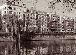
On the bank of the Bundesrat

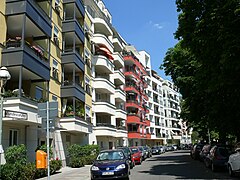
Bundesratufer / Krefelder Strasse , 2018
Bundesratufer / Bochumer Strasse , 2018
Hansa-Ufer / Tile-Wardenberg-Strasse , 2018
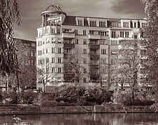
Villa Borsig seen from the factory chimney
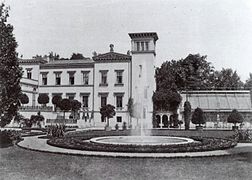
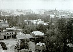
Villa Borsig before 1867
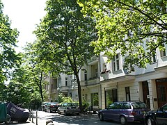
Elberfelder Strasse
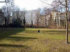
Essen Park


traffic
The district is accessible to private traffic through the streets Alt-Moabit, Levetzowstraße and Stromstraße. All other streets are designated either as a 30 km / h zone or a traffic-calmed area .
The main hub for local public transport is the Turmstrasse underground station , which is served by the U9 underground line and numerous bus lines. Bus 106 also runs on Levetzowstraße.
Web links
Individual evidence
- ↑ Pssst! These neighborhoods are still secret! QIEZ GmbH, March 16, 2012, accessed on February 6, 2015 .
- ↑ Westphalian Quarter - Google Maps. google.de, accessed on February 6, 2015 .
- ↑ Jürgen Tomisch: monuments in Berlin . District middle districts Moabit, Hansaviertel and Tiergarten. Ed .: Landesdenkmalamt Berlin. Michael Imhoff-Verlag, Petersberg 2005, ISBN 3-86568-035-6 , p. 226 .
Coordinates: 52 ° 31 ′ 21.8 ″ N , 13 ° 20 ′ 19.6 ″ E