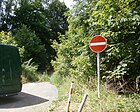
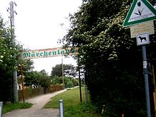
List of streets and squares in the Berlin suburb Malchow
The list of streets and squares in the Berlin suburban housing estate Malchow is a compilation of all public streets and squares listed in the Berlin street directory in the suburban housing estate Malchow , a district in the Pankow district . At the same time, this compilation is part of the lists of all Berlin streets and places .
overview
In addition to the settlement of the same name north of Darßer Strasse, the district includes an industrial area south of this street and the Märchenland colony, an allotment garden complex (KGA) north of the suburban settlement ( Lage ).
To the north of the KGA, the area next to a golf course is almost exclusively used for agriculture, which is why this area has only a few connecting roads. The paths in the KGA 'Märchenland' are not included in the official overview due to their nature as private roads .
The Malchow suburban settlement was laid out in three sections between 1936 and 1939 on both sides of Heinersdorfer Weg , today's Ortnitstrasse. The district has 1,120 inhabitants (as of December 30, 2019) and its streets are assigned to the zip code areas 13051, 13088, 13089 or 13129.
The main roads in the district include Bundesstraße 2 on Malchower Chaussee and Dorfstraße, a total of 2.8 kilometers in the extensive road system, with Blankenburger Pflasterweg 2.4 kilometers to the higher-level and another 1.4 kilometers of Darßer Straße of the regional road system. The list contains 33 dedicated streets and named places, seven of which lead to the neighboring districts. The streets listed in the district have a total length of 19.1 kilometers.
Overview of streets and squares
The following table gives an overview of the streets and squares in the district as well as some related information.
- Name / location : current name of the street or square. Via the link Location , the street or the square can be displayed on various map services. The geoposition indicates the approximate center of the street length.
- Traffic routes not listed in the official street directory are marked with * .
- Former or no longer valid street names are in italics . A separate list may be available for important former streets or historical street names.
-
Length / dimensions in meters:
The length information contained in the overview are rounded overview values that were determined in Google Earth using the local scale. They are used for comparison purposes and, if official values are known, are exchanged and marked separately.
For squares, the dimensions are given in the form a × b for rectangular systems and for (approximately) triangular systems as a × b × c with a as the longest side.
If the street continues into neighboring districts, the addition ' in the district ' indicates how long the street section within the district of this article is. - Name origin : origin or reference of the name.
- Notes : further information on adjacent monuments or institutions, the history of the street and historical names.
- Image : Photo of the street or an adjacent object.
| Name / location | Length / dimensions (in meters) |
Origin of name | Date of designation | Remarks | image |
|---|---|---|---|---|---|
|
At the ditch
( Location ) |
960 | runs along the border ditch | 1939 | The street Am Graben leads between Malchower Aue and Muspelsteig along the Märchenlandgraben, which borders the KGA 'Märchenland' to the south. Accordingly, properties with residential houses are located on the south side, opposite the green strip with the moat in the allotment garden colony 'Märchenland'. |

|
| At Heimenstein
( Location ) |
320 | Homes , legendary figure in the wake of Dietrich von Bern | Aug 25, 1939 | The street Am Heimenstein lies in the northern part of the suburban settlement between Ostaraweg and Am Graben, it then merges into the Däumlingspfad of the KGA 'Märchenland'. |

|
| At the Luchgraben
( Location ) |
1,070 | Park landscape Neue Wiesen including the crossing of Fließgraben and Laake ( Luch ) | March 1, 2002 | The street Am Luchgraben was originally a construction site access to the new development area 'Karow Nord'. It was planned for further use at the end of the 1990s as a connection along the city limits between Karow and Bundesstraße 2 and was expanded. The road has not yet been completed due to an approximately 300 meter long section on private land. Since then, the cul-de-sac has served as a parking lot access to the Barnim Nature Park . The street ends at a ledge on Lindenberger Flur before it could reach Karow. |

|
|
Blankenburg paved path
( Location ) |
1,390 (in the district) |
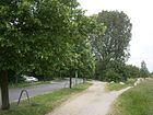
Blankenburg , part of the Berlin district of Pankow | after 1882 | The former Blankenburger Weg is the historical connection between Malchow and Blankenburg. After the city of Berlin acquired the two villages in 1882 in order to be able to create Rieselfelder on the site , the path was paved , which resulted in the current name. The road runs from Dorfstraße in Malchow to Heinersdorfer Straße in Blankenburg and has been paved with asphalt since around 2005 . |
|
|
Bundesstrasse 2
( Location ) |
2,080 (in the district) |
adopted name of trunk road B 2 | around 2010 | "Bundesstraße 2" is the officially set name of the continuation of Malchower Dorfstraße to the north and the street band is under this name between Blankenburger Pflasterweg and Am Luchgraben on the city limits of Lindenberg . In the southern section between Blankenburger Pflasterweg and KGA Neu-Malchow (opposite the property line 4-6) the street belongs to Malchow. To the north, the road land and the fields on the western side of the road belong to the outskirts of the town (to the Pankow district), but lots 4–6 (KGA), 8 (art workshop) and 10 (dog place) on the east side, including the footpath leading to Malchow in the Lichtenberg district. To the north of the railway bridge and from the adjacent river ditch , the district boundary changes to the real roadside and the eastern areas (up to Barnim Dörferweg ) including the substation (at no. 20) belong to Wartenberg (Lichtenberg district). In the corridor of the suburbs there are fields, grassland and along the road a 20 meter wide strip of trees and bushes. Addressed properties are not listed for Bundesstraße 2 in the district. With the district reform 2001 , the districts within the districts were reorganized and the Weißensee district abolished, and the "Malchower" Dorfstraße came to the district and an officially carried out naming (also with street signs, also picture in the Malchow district ). As far as the railway bridge in the Hohenschönhausen district, the street was unnamed as a village street and north of it in Weißensee from Blankenburger Pflasterweg. |

|
|
Darßer Bogen
( Location ) |
230 | Darß , part of the Fischland-Darß-Zingst peninsula in Mecklenburg-Western Pomerania | July 1, 1999 | The Darßer Bogen goes from Piesporter Straße to the east and ends as a dead end . The street was laid out to develop the industrial area south of Darßer Strasse, to which it runs parallel.
The commercial area was created in the late 1990s on the initiative of the district office and interested entrepreneurs. After completion, all those involved unveiled a memorial plaque, which was ceremoniously unveiled on the building of the Fittkau Metallbau und Kunstguss company (lower picture). |
 |
|
Darßer Strasse
( Location ) |
1,360 (in the district) |
Darß , part of the Fischland-Darß-Zingst peninsula in Mecklenburg-Western Pomerania | Jan. 18, 1990 | Darßer Straße was laid out in the late 1980s as a connection between Hohenschönhausen and Weißensee. In 1992 it was extended from Ribnitzer Strasse in Neu-Hohenschönhausen to Roelckestrasse on the border with Weissensee, also with the use of EU funds. The intention was to locate companies with larger space requirements. However, it was not until 2012 that the company "Bode Bautechnik Baumaschinen GmbH" was acquired, which will set up the new Berlin branch at Darßer Strasse 109 by the end of 2013. To this end, the company acquired an area of 7,000 square meters, on which the foundation stone was laid on April 26th . The company from Leinefelde-Worbis is relocating its previous branch from Berlin-Heinersdorf here. |

|
|
Gnome place
( Location ) |
110 × 40 | Gnomes , legendary figures who populate the forest, mountain and water | Jan. 24, 1938 | Gnomenplatz is located in the southern part of the settlement and is bordered by the Nornenweg in the north and the Haakonweg in the south. The east side in the course of the Nachtalbenweg and the west side belong directly to the square. The approximately 4.7 ares (= around 470 m²) area is undeveloped. |

|
|
Haakonweg
( Location ) |
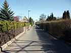
710 | Håkon IV (1204–1263), King of Norway from 1217 to 1263 | Jan. 24, 1938 | The Haakonweg forms the southern end of the suburban settlement and leads from the Muspelsteig over the Schwarzelfenweg, parallel to Darßer Straße and behind the Gnomenplatz. With the expansion of Darßer Strasse and the creation of a bus turning loop at the Schwarzelfenweg junction, the street is divided into a 290 meter long western and an approximately 420 meter long eastern section. |
|
| Helgiweg
( Location ) |
560 | Helgi, name of two characters from Nordic mythology | Jan. 24, 1938 | The Helgiweg leads from the Ostaraweg first to Ortnitstraße and from there, shifted slightly to the east, on to Haakonweg. |

|
| Hohenschönhauser Weg
( Location ) |
450 (in the district) |
Alt-Hohenschönhausen , part of the Berlin district of Lichtenberg | after 1750 | The Hohenschönhauser Weg is the historical connection between the villages of Hohenschönhausen and Malchow. It leads from the east end of Darßer Straße in a straight line to Malchower Chaussee south of the Malchower village center and can now be used as a footpath. On the western section, the border between the village and the suburbs runs partially. |

|
|
Jötunsteig
( Location ) |
790 | Jötunn , giants of Nordic mythology | Jan. 24, 1938 | The Jötunsteig is located on the eastern edge of the suburban settlement and leads from the street Am Graben emerging from the Rübezahlweg over the Ortnitstraße and ends after a right bend on the Nachtalbenweg opposite Gnomenplatz. |

|
|
Light elf walkway
( Location ) |
540 | Light elves , figures from Norse mythology | 22 Aug 1936 | The Lichtelfensteg leads in a north-south direction from the corner of Runenzeile over Ortnitstraße to Haakonweg. A 50-meter-long section leads into the allotment garden 'Health Spring' as a private road of the same name. |

|
| Lindenberger way
( Location ) |
1,400 (in the district) |
Lindenberg , part of the municipality of Ahrensfelde in Brandenburg | after 1750 | The Lindenberger Weg led from the Blankenburg village center (Karower Damm) towards Lindenberg, especially to the Lindenberger Mühle. The street is divided into a western and an eastern section by the Berlin outer ring . The section located in the district lies between the district boundary (250 meters east of the railway line) and Bundesstraße 2 . The road leads through the arable and grassland of the outskirts park and can be reached from road 33 in Blankenburg. The name is used consistently for the paved hiking and cycling path through the “Stadttrandpark Neue Wiesen” and crosses the extension of the road 52 from Karow, which is also designated as a hiking and cycling path. In addition, the eastern branch of the Kaower Feldgraben (with the direction of flow to the Laake ) is crossed. The continuation in the district to Lindenberg is no longer included in the official directory. The western part of the path (today Blankenburg) belonged to the old district of Pankow , the western (Rieselfeld) part in the district belonged to the old district of Weißensee . At the east end 250 meters before the B 2, the path divides into the original direction Lindenberg as a footpath, marked by the main road with the traffic sign 267 prohibition of entry . As a strip of asphalt to the south, there is a guided tour over the B 2 to the Wartenberg landscape park, here is a barrier and the traffic sign 250 prohibition of vehicles of all kinds . The Lindenberger Weg was important as a route through the sewage fields previously located on the outskirts of the city park . |

|
| Lindwurmweg
( Location ) |
280 | Lindworm , dragon-like animal from Norse mythology | Aug 25, 1939 | The Lindwurmweg leads from the Nachtalbenweg towards the east and ends at the development boundary of the suburban settlement near Tronjepfad. The continuation is a footpath to Ortnitstraße and on to Malchower village center. The road consists of two lanes separated by a ditch. |

|
|
Malchower Aue
( Location ) |
270 | Malchower Aue , moorland east of the Malchower village center | after 1500 | The Malchower Aue runs along the eastern edge of the Märchenland colony from the Am Graben road to the Märchenweg, a private road . |

|
| Malchower Chaussee
( Location ) |
1,120 | Malchow , part of the Lichtenberg district of Berlin | after 1800 | The Malchower Chaussee is the continuation of the Berliner Allee between Nachtalbenweg and the suburb of Malchow, where it turns into Dorfstraße . The former Weißenseer Weg was expanded into a Chaussee at the beginning of the 19th century and has been part of Reichsstraße 2 , today's B 2 , since 1932 . |

|
| Malchower Strasse
( Location ) |
180 (in the district) |
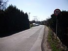
Malchow , part of the Berlin district of Lichtenberg | before 1902 | The Malchower Straße leads from the Blankenburger Straße in Heinersdorf and ends shortly after the district boundary on the Muspelsteig, where it turns into the Ortnitstraße. As the name explains, it is part of the historical connection between the towns of Malchow and Heinersdorf. |
|
| Fairy tale trail
( Location ) |
2,000 (in the district) |
Märchen is related to KGA Märchenland | after 1939 | The Märchenweg goes from Malchower Dorfstraße to the west and leaves the neighboring district of Malchow at the end of the built-up area . In the suburban settlement it is a (semi-public) six meter wide paved private road (free for residents) to the Märchenland colony . The street with this name is recorded in the street directory as 41881 and marked on the map Berlin 1: 5000, produced by the district surveying offices. At the entrance to the district, it crosses a hiking trail ( forest path ) that leads around Malchow to the west and is initially overgrown with chestnuts between arable and pasture land. After 320 meters there is the bridge over the Malchower Fließgraben and here the Humboldt-Spur crosses one of the 20 green foot, bike and hiking trails that connect the city center with the outskirts. Another 260 meters to the west is the road on the northern edge of the Märchenland facility. There are the following access roads to this: Malchower Aue , Gebr.-Grimm-Weg and Hauffallee. Via the latter, the Rübezahlweg leads to Heinersdorfer Straße , offset a little southwards across the system parking lot . In the district, the Märchenweg (in contrast to the neighboring plant paths) is marked with a white road sign and “2.8 t” and “50 km / h limit”. |

|
| Muspelsteig
( Location ) |
550 | Muspell , giant of Norse mythology | 22 Aug 1936 | The Muspelsteig begins as a continuation of an unnamed private path on the street Am Graben and runs along the border between the suburban settlement and Heinersdorf over Ortnitstraße to Haakonweg. The continuation of the same name runs as a private road within the allotment garden 'Gesundheitsquell' after a turn parallel to Haakonweg and on to Schwarzelfenweg. |

|
|
Nachtalbenweg
( Location ) |
970 | Night alb , also called "dark elves", horror-inspiring mythical creatures | Jan. 24, 1938 | The Nachtalbenweg begins as a continuation of the Andersenweg of the allotment garden 'Märchenland' on the street Am Graben and leads over the Ortnitstraße to Gnomenplatz. The extension of the street, which was laid out around 1990, continues to the district boundary to Weißensee and ends at Berliner Allee or Malchower Chaussee. The street is interrupted between Gnomenplatz and Darßer Straße. |

|
| Niflheimweg
( Location ) |
100 | Niflheim , name of the northern ice world in Norse mythology | Aug 25, 1939 | The Niflheimweg goes as a dead end westward from the Nachtalbenweg and is the feed for the surrounding background pieces. At around 100 meters in length, the Niflheimweg is the shortest street in the district. |

|
| Nornenweg
( Location ) |
150 | Norns , fate-determining women in Norse mythology | Jan. 24, 1938 | The Nornenweg begins as a narrow footpath on Helgiweg and ends at the northern edge of Gnomenplatz at the corner of Nachtalbenweg. |

|
|
Ortnitstrasse
( Location ) |
1,630 | Ortnit , hero of a Middle High German epic | Dec. 1, 1936 | Starting from Malchower Chaussee south of the Malchower village center, Ortnitstraße forms the east-west axis of the suburban settlement. The road previously known as Heinersdorfer Weg is part of the historical connection from Malchow to Heinersdorf . To the west of the Muspelsteig it turns into Malchower Straße. | |
| Osasteig
( Location ) |
150 | Osa, subsidiary form of Ase , the younger Nordic gods | Jan. 24, 1938 | The Osasteig leads in a straight line from Helgiweg to Nachtalbenweg. |

|
| Ostaraweg
( Location ) |
960 | probably after Ostara , goddess of spring in Norse mythology | 22 Aug 1936 | The Ostaraweg leads from the Muspelsteig parallel to Am Graben to the northeast edge of the settlement and ends there as a dead end . |

|
|
Piesporter Strasse
( Location ) |
340 (in the district) |
Piesport , municipality in Rhineland-Palatinate | before 1914 | From the beginning of the 20th century, Piesporter Straße originally only led from Falkenberger Straße to the northern border of Weissensee. With the construction of Darßer Straße, the continuation followed to Malchower Chaussee. |

|
|
Rune line
( Location ) |
210 | Runes , Germanic characters | 22 Aug 1936 | The rune line begins on the Muspelsteig and runs between Ostaraweg and Am Graben. The road ends at the Lichtelfensteig and turns into this with a right curve. |

|
|
Hall arch
( Location ) |
350 | Saal , municipality in Mecklenburg-Western Pomerania | 16 Sep 2003 | The Saaler Bogen is located in the extreme southeast of the district and leads in a semicircle from Darßer Straße. It serves to develop the industrial area south of Darßer Straße. |

|
| Black Elf Trail
( Location ) |
700 | Black elves , characters from Norse mythology | 22 Aug 1936 | The Schwarzelfenweg begins as a continuation of the Gebrüder-Grimm-Weg, the central street of the Märchenland colony, on the Am Graben street and leads over the Ortnitstraße to the Darßer / Roelckestraße intersection . There is a BVG bus turning loop at this intersection . |

|
|
Tronjepfad
( Location ) |
150 | Hagen von Tronje , figure from the Nibelungenlied | Aug 25, 1939 | The Tronjepfad goes north-east from the Jötunsteig (Ornitstraße junction) and ends on the Lindwurmweg in front of the eastern edge of the suburban settlement in an open field. |

|
|
Ullerplatz
( Location ) |
110 × 60 | Uller , Nordic god | 22 Aug 1936 | Ullerplatz is located in the northern part of the suburban settlement and is bordered on three sides by Schwarzelfen-, Ostara- and Ullerweg, while the northern edge is part of the square. There is a playground on the 6.7 ares (= around 670 m²) facility. |

|
| Ullerweg
( Location ) |
140 | Uller , Nordic god | Dec. 1, 1936 | The Ullerweg between Am Graben and Ostaraweg and forms the western edge of Ullerplatz here. |

|
|
Wanensteig
( Location ) |
160 | Wanen , older Nordic gods | Jan. 24, 1938 | The Wanensteig leads in a slightly curved course from the Nachtalbenweg to the Jötunsteig. |

|
Green areas in the district
Allotment gardens (KGA)
- KGA 'Gesundheitsquell' is located in the southwest corner ( location ) of the district between Muspelsteig and the district boundaries to Heinersdorf (west) and Weißensee (in the south). The facility is included in the allotment garden development plan (No. 3020) with 116 parcels on 53,150 m² of state-owned leased land at the address Malchower Straße 116. It is included in the planning with level IIIa, these are fictitious permanent allotment gardens that are to be used for another purpose according to the land use plan .
- The KGA 'Märchenland' (08980 Lage ) with a total area of 39 hectares is located in the district on the border with the Lichtenberg district (Malchow) north of Heinersdorf and south of Blankenburg. The part of the facility in the northwest corner ( location ) is in the area of Blankenburg. "Märchenland" was created in 1939 and has been continuously expanded since then. The Märchenland e. V., with tenants on 1,028 parcels of state-owned land, is the largest allotment garden in the Berlin Association of Garden Friends. It is divided into eleven departments and recognized as a "landscape protection and recreation area". As a result, it is not included in the allotment garden development plan and the tenants are not subject to the restrictions of the Federal Allotment Garden Act, but to the association statute. Since it was founded, paths in the complex have been named with fairytale names. Until the district reform of 2001, the facility belonged to the Weißensee district. The almost triangular complex borders the districts of Blankenburg (Sterntalerweg) and Heinersdorf (Frau-Elster-Weg) in the west, in the north it is bordered by the Märchenweg , in the east by Malchower Aue and in the south by Am Graben . The main system routes to the northeast are Frosch-König-Weg (northern section), Hauffallee, Königskinder- and Gebrüder-Grimm-Weg (as an extension of the Schwarzelfenweg ) and in the southeast it is a section of the Reinicke-Fuchs-Weg. The cross paths from the Märchenweg to the southwest are the Rübezahlweg (it continues the Jötunweg ), Rotkäppchen-, Schneewittchen-, Dornröschenweg, Andersenweg (as the main path it is wider and extends the Nachtalbenweg ), Isegrim-, Sieben-Raben-, Reinicke-Fuch- Path (wider as the main path and turning in the southern section). Further paths are Cinderella Path, Dwarf Nose / Däumlingsweg, Frau-Holle-, Eulenspiegel-, Drosselbartweg and in a section that turns off the Frosch-König-Weg. The Pittiplatsch and Schnatterinchenweg towards the Frau-Elster-Weg are more recent. On the north-east edge of the Rübezahlweg 13 spur roads lead off, which do not go through to the Märchenweg at the system edge, they are marked with "A" to "N".
Parks and grassland
- 'Neue Wiesen' outskirts park: In the north of the district there were still sewage fields until the 1980s. Areas belonging to the nature park in the west and south of the urban park are still used as agricultural land. The entire area (187 hectares) is bounded by Bundesstraße 2 (in the east to Wartenberg), Am Luchgraben (in the north on the city limits of Ahrensfelde) and in the west to the districts of Karow and Blankenburg, where there are further areas. The railway line of the Berlin outer ring runs in the southwest. The outskirts park was opened to the public on September 18, 1998 on the area of 86 hectares near Karow. The designs carried out in the northern (near Karow) area of the outskirts park in the then still independent district of Weißensee were compensatory measures for the development of Karow-Nord in the 1990s. The area is traversed by the Karower Feldgraben and the renatured Laake, in the west near the Karow border there is a 700 meter long park belt with a poplar forest, an artificial hill with a platform was built, and a boulder on the circular path . On the northern edge of Wartenberg, further on the road Am Luchgraben and through the poplar forest to road 70 in Karow, a section of the Barnim Dörferweg runs .
- 'Golfresort Berlin-Pankow': Between the railway line, the Blankenburger Pflasterweg and the border to Blankenburg (Ziegelstraße), golf courses were built in 2005 , divided by a river ditch and a pest ditch. The 9-hole course extends to Blankenburg. The patronage for the 18-hole course was taken over by Sepp Maier , there is a 3-hole practice course and the 6-hole short course.
- West of Malchow: Further arable land and the 'green corridor on the Fließgraben' are located north / east of the Märchenland colony. The green corridor on the Fließgraben between Malchow, Blankenburger Pflasterweg and Mörderberg is accessed by the Humboldt-Spur hiking trail .
- 'Malchower Auenpark': This field green space in the southeast corner of the district from Malchower Chaussee to Neu-Hohenschönhausen ( Lichtenberg district ) lies north of Darßer Straße.
literature
- Hans-Jürgen Mende (Ed.): Lexicon of all Berlin streets and squares. From the foundation to the present . 2nd volume. New Life / Edition Luisenstadt, Berlin 1998, ISBN 3-355-01491-5 .
Web links
- Street directory outskirts of Malchow. kaupert media gmbh, accessed on April 13, 2010 .
- Office for Statistics Berlin-Brandenburg: List of streets and places in the Pankow district (as of February 2015); pdf
Individual evidence
-
↑ Streets and paths in the KGA 'Märchenland' (alphabetically):
Aladinweg, Andersenweg, Aschenbrödelweg, Däumlingweg, Drosselbartweg, Eulenspiegelweg, Mrs. Elster-Weg, Mrs. Holle-Weg, Gebrüder-Grimm-Weg, Isegrimweg, Reineke-Fuchs-Weg, Rotkäppchenweg, Schneewittchenweg, Sieben-Raben-Weg, Sieben-Zwerge-Weg - ↑ on street maps of several years of Berlin it was called Dorfstraße , most recently as Dorfstraße in the city map published by StadtINFO Verlag from 2008 (p. 49).
- ↑ Berlin / city map, VEB Tourist Verlag, Berlin / Leipzig, 4th edition: Hohenschönhausen around 1989 ( page no longer available , search in web archives ) Info: The link was automatically marked as defective. Please check the link according to the instructions and then remove this notice.
- ↑ Starting shot for the industrial park . In: Berliner Woche , Lichtenberg-Südost edition, May 15, 2013, page 1
- ↑ Kiesling's large special map of the area around Berlin
- ↑ Pharus city map Berlin large edition: Hohenschönhausen around 1989 ( page no longer available , search in web archives ) Info: The link was automatically marked as defective. Please check the link according to the instructions and then remove this notice.
- ↑ fbinter.stadt-berlin.de: Address search Lindenberger% 20Weg
- ↑ Pharus city map Berlin large edition: Wartenberg around 1954 ( page no longer available , search in web archives ) Info: The link was automatically marked as defective. Please check the link according to the instructions and then remove this notice.
- ↑ Sign 1020-30 residents free
- ↑ Sign 262 (prohibition for vehicles over the specified) actual mass
- ↑ Sign 274 Maximum permitted speed
- ↑ Fictitious permanent allotment gardens are allotments that are to be treated like permanent allotment gardens. According to the Property Law Amendment Act that came into force on October 1, 1994 (Article 1, Property Rights Consolidation Act, PropertyRBerG), properties located in the accession area are to receive marketable and lendable rights in accordance with the Civil Code.
- ↑ Allotment garden development plan Berlin 2004, page 9 ( Memento of the original from September 24, 2015 in the Internet Archive ) Info: The archive link was automatically inserted and not yet checked. Please check the original and archive link according to the instructions and then remove this notice.
- ↑ The Berlin streets and other city objects used as addresses, such as the bodies of water, are provided with a number so that they can be found in official directories, especially in the Regional Reference System (RBS).
- ↑ Green Places in Weißensee ( Memento from April 18, 2014 in the Internet Archive )
- ^ Homepage of KGA Märchenland
- ^ Regional Association of Garden Friends Berlin
- ↑ Pictures of KGA Märchenland ( Memento from April 18, 2014 in the Internet Archive )


