List of streets and squares in Berlin-Niederschönhausen
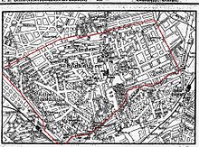
The list of streets and squares in Berlin-Niederschönhausen describes the street system in the Berlin district of Niederschönhausen with the corresponding historical references. At the same time, this compilation is part of the lists of all Berlin streets and places .
overview
Statistical
The district of Niederschönhausen has 118 dedicated streets according to the official street directory . The public road network - without dedicated routes in colonies (KGA) and private roads - is 59.3 kilometers long. With 9.8 percent, the district has a large share of the road network in the Pankow district with its 13 districts and a total length of all streets in the district of 604.7 kilometers, which puts it in third place in the German capital after Steglitz-Zehlendorf (635.4 km) and Treptow-Köpenick (628.1 km). Niederschönhausen has 31,996 inhabitants (as of December 30, 2019) and includes the postal code area 13156.
Origin of the road system
Already in 1830 the Actien-Chaussee is mentioned which goes "in front of the Schönhauser Thore to Pankow and Schönhausen". The settlement center of Niederschönhausen lies north of Schönhausen Castle along today's Dietzgenstrasse and from there to the east along Blankenburger and Buchholzer Strasse, to the west along today's Hermann-Hesse-Strasse to the street in front of Schönholz. Due to the proximity to the castle, the villa district to the west around today's Mayakowskiring developed early on . When the government of the GDR was looking for residences for the families of politicians in 1950 , a suitable area was found here. The existing buildings were claimed by the Red Army after 1945 , but cleared them in favor of the new government. The palace became the seat of GDR President Wilhelm Pieck . The families that were now settled here were in a special zone that was soon called the “little town of Pankow”. Konrad Adenauer subsequently spoke of the gentlemen “from Pankoff”, probably also because of his dialect.
The further settlement of Berlin citizens in the rural community of Niederschönhausen north of Pankow, which was independent until 1920, led to the construction of settlement houses in two directions: to the northwest along Kaiserweg (since 1951 Friedrich-Engels-Straße) to Rosenthal and the forest area of the Schönhauser spruces and the colony Schönholz (what remains is the Schönholzer Heide) along the planned Friesenstrasse to Wilhelmsruh . The surrounding streets were given names from Germanic mythology . The Schönholz colony (a locality since the 21st century) with the Klemke and Provincial Roads, which extend into Wittenau (then: Dalldorf ) and which bordered the suburb of Reinickendorf, probably led to the Germanenstraße being the main connection and the Friesenstraße to the Back road became. Settlement to Rosenthal was slower than planned after World War I and inflation . The Lutherstraße was created in 1906 and named but not until after 1931 established a development. The transition from city streets northwards to unpaved roads in the direction of the Rosenthaler border are exemplified by Treskowstrasse and Blumenthalstrasse . At the beginning of the 20th century, the "Forstviertel" in the area of the "Schönhauser Fichten" was planned to the northwest of the Bürgerpark , which influenced the naming of the streets. However, the plans did not come to fruition, so that streets west of Wahnschaffestrasse were not created and the names that had already been assigned were revoked at the beginning of the 1930s. Instead, these areas were added to the Pankow III cemetery in 1940 to create burial places for victims of air raids .
After 1950 , artists living in East Berlin moved into the existing villas around Street 201 (from October 12, 2014 Beatrice-Zweig-Straße ), and the “Erich Weinert” artists' estate was created. The street names still existing in the area after the Kingdom of Prussia were given names after anti-fascists and personalities of the German labor movement by a resolution of the Magistrate of Greater Berlin . After the politicians left in the 1970s, the area west of the palace in Mayakowskiring became free for other public GDR uses. After the fall of the Wall , the residential buildings were released for "everyone" and private individuals or private companies moved into the villas.
Some street names such as the Rosenthaler Grenzweg or the Nordendstraße refer to the affiliations in the locality Nordend , which was founded by the Colony Rosenthal (later district Wilhelmsruh ) and also belonged to the Reinickendorf administrative district during the times of Greater Berlin .
Location of the streets
The superordinate street in the district is the Bundesstraße 96a , which runs through the district in north-south direction on the street Grabbeallee – Pastor-Niemöller-Platz – Hermann-Hesse-Straße – Ossietzkyplatz-Dietzgenstraße. The addition as "B 96a" in the federal highway system is based on the fact that trunk road 96 ran through Reinickendorf , but the building of the wall in East Berlin made it necessary to bypass it. Other Category II streets in the Berlin street system (higher-level streets) are Friedrich-Engels-Strasse from Pastor-Niemöller-Platz to the northwest with access to the Märkisches Viertel , which was extensively renovated in the 2010s. To the southwest from Pastor-Niemöller-Platz, Hermann-Hesse-Strasse leads to the street in front of Schönholz and to the west into Klemkestrasse to the neighboring district of Reinickendorf . The provincial road branching off to the south and the road in front of Schönholz with the Germanic road to Rosenthal are only of regional importance (class III). Another class II main street within the district is Heinrich-Mann-Straße via Heinrich-Mann-Platz and Blankenburger Straße leading from the B 96a at Ossietzkyplatz to French Buchholz . The latter is supplemented by Buchholzer Straße via Herthaplatz (class IV). The planned northern connection between the districts of Reinickendorf and Pankow was waived due to local residents' protests and the lower than expected traffic volume. For long-term planning, “ a network connection that may be required later is kept open in the existing network as part of the FNP's area provision”.
Streets delimiting the district
The streets delimiting the district are in the north to Rosenthal (location Nordend ) the route Nordendstraße / Rosenthaler Grenzweg, whose road land belongs to the district. While the district boundary is on the northern edge of the BVG depot between these streets, Dietzgenstrasse including the Schönhauser / Schillerstrasse intersection is assigned to Nordend. At the eastern end of the Rosenthaler Grenzweg, the French border with Buchholz bends southwards between the industrial site and gardens and crosses a former route. It separates Buchholzer Strasse from the outside Schönhauser Strasse . Behind the eastern plot of land on Grumbkowstrasse, crossing Wartenbergstrasse , running east of Strasse 199 to the southwest, it still crosses Blankenburger Strasse. To the south of this, the demarcation from the neighboring district becomes complex, as the residential blocks Blankenburger Strasse 122-134b (straight) together with the built-up property 136, Pankower Strasse 17-25 and 3-11 as well as the adjacent block of houses on Schloßstrasse from the 1970s the access roads up to Hans-Jürgen-Straße belong to the district. The developed land (in particular the new residential buildings built in 2013) with the allocation to Pasewalker Straße lie along the eastern boundary of the district. The border runs about 40 meters along the west side of Pasewalker Strasse and 40 meters along the north side of Schloßallee, before crossing Schloßallee between property 25 and 25a, essentially on the north bank of the Panke up to Schlossparkbrücke III, and separating the district of Pankow. The Pankeschule with its property boundaries is located within the district. The northern edge of Galenusstraße and Am Schloßpark as well as the eastern edge of Ossietzkystraße up to the Schlossparkbrücke, the streets of which are outside of Niederschönhausen, form the further border. To the west, the Panke and from the inflow of the Kreuzgraben on the Pankenordufer form the border. The Grabbeallee in the district, the Schönholzer Straße in Pankow, lies north of the Schönholzer Bridge . In the Bürgerpark, the Panke-Lauf separates the district from Pankow and 55 meters south of the bridge at the Bürgerpark are properties 15-18 in the district. The Berlin Wall , which divides the city, also stood here until 1990 . Am Bürgerpark and Schützenstraße delimit the district with the road in the district, and the straight line to the crossing of the Provinzstraße continues the border to Reinickendorf on the northern edge of the railway site, which crosses Klemkestraße east of the railway bridge. Wilhelmsruh is reached in the extension of Straße 78 . The garden area remains in the district, the commercial area is outside, on the northern edge of the sports area northeast of the site of the memorial is the further district boundary south of the green area of the Wilhelmsruher See in the axis of the Siegrfried-Baruch-Weg, it crosses the Heegermühler Straße, and its east West branch with roads and land up to Wotanstrasse is in the district. In between, the Germanenstraße (exclusively) in the district is crossed - its continuation in Wilhelmsruh is the Schönholzer Weg . To the east of Germanenstrasse, Rosenthal is the neighboring district. The district boundary again reaches Nordendstrasse, the road area of which is on the northern edge of the district, thus closing the circuit of the district described here.
Overview of streets and squares
The following table gives an overview of the streets and squares in the district as well as some related information.
- Name / location : current name of the street or square. Via the link Location , the street or the square can be displayed on various map services. The geoposition indicates the approximate center of the street length.
- Traffic routes not listed in the official street directory are marked with * .
- Former or no longer valid street names are in italics . A separate list may be available for important former streets or historical street names.
-
Length / dimensions in meters:
The length information contained in the overview are rounded overview values that were determined in Google Earth using the local scale. They are used for comparison purposes and, if official values are known, are exchanged and marked separately.
For squares, the dimensions are given in the form a × b for rectangular systems and for (approximately) triangular systems as a × b × c with a as the longest side.
If the street continues into neighboring districts, the addition ' in the district ' indicates how long the street section within the district of this article is. - Name origin : origin or reference of the name.
- Notes : further information on adjacent monuments or institutions, the history of the street and historical names.
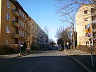
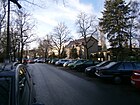
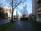
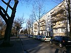
- Image : Photo of the street or an adjacent object.
| Name / location | Length / dimensions (in meters) |
Origin of name | Date of designation | Remarks | image |
|---|---|---|---|---|---|
|
Altenberger way
( Location ) |
340 | Altenberg, town in the Ore Mountains | May 16, 1938 | Altenberger Weg is an extension of road 97 between Waldstrasse and Dietzgenstrasse. It was laid out in 1926 and initially called Altenbergstrasse , possibly renamed to “ Weg ” in 1938, depending on its condition . However, since on the same day (May 16, 1938) the renaming of Auerbachstrasse in Grunewald and Auerbachstrasse in Lichtenrade took place, in which a designation after a place was introduced by adding "he" and thus the designation after a person ostracized as Jewish In the case of Altenbergstrasse, too, an original naming after such a person, for example the author Peter Altenberg , is conceivable, who would also fit better into the environment, in which no place names, but only writers' names appear.
In 1938, there are 14 built-up and ten undeveloped lots (up to No. 23) on Altenbergstraße between Wald- and Kaiser-Wilhelm-Straße ; for 1939 the lots are numbered up to 30. In 2013, the official directory shows 31 parcels for Altenberger Weg. |

|
| At the Bürgerpark
( Location ) |
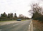
720 | Bürgerpark to the south | Nov 6, 1994 | The street runs south of Bürgerpark and Friedhof III between Wilhelm-Kuhrstrasse and Schützenstrasse, with the boundary of the district to Gesundbrunnen on the south side of the street. The road area belongs to the district. In 1905 the street was laid out as Bahnhofstraße in connection with the Schönholz station on the Berlin Nordbahn, which was built south of the street . A section of the Berlin Wall ran along this street from 1961 to 1989 . In the eastern section the road leads over the Panke . The building complex of the Pankow III cemetery with the celebration hall, cemetery administration and waiting hall is designated as a monument. The enclosure with an entrance gate that existed until the early 1960s was cleared when the border fortifications were set up after 1961. At the same time, graves “close to the border” were moved into the interior of the cemetery, so that today there is a broad strip of green on the north side of the street that is no longer affected by piety. The grave of the Pankow inventor Reinhold Burger , which is listed as a historical monument, is located in this cemetery . In the 1907 address book (the same entries still exist in 1943) there is Bahnhofstrasse between the Reinickendorf and Pankow districts, plots 1–14 belong to Reinickendorf. No. 15 is as a pumping station of the city of Berlin, No. 24 as III. Listed cemetery of the municipality of Pankow, in addition there are some undeveloped properties (usually) called construction sites. To the south between Panke and Wilhelm-Kuhr-Strasse is the Steinmetzplatz of the city of Berlin and to the north is the municipal market garden, on both sides of Wahnschaffestrasse the parks (today the Bürgerpark and cemetery). |
|
| At the Iderfenngraben
( Location ) |
1050 | Iderfenngraben at the west end of the street | Jan. 3, 1951 | The street is located in the eastern section of the street that was laid out in 1904 as Zietenstraße and in a western extension was named Normannenstraße . The latter was supposed to lead through the green area of Schönholzer Heide to Germanenstraße, citizens' protest was waived on this section and it was partially included in Zietenstraße, which was given its current name in 1951 in connection with an (anti-royal) renaming campaign by the Greater Berlin City Council . It lies between Friesenstrasse and Treskowstrasse and crosses the Iderfenngraben and the Zingergraben . The country house no.10 from 1895, the entire complex of the tenement group of house no.12 with fencing around 1910 and Friedrich-Engels-Strasse no.40 are listed as architectural monuments. In 1907 the address book for Zietenstrasse lists four residential buildings, namely between Treskowstrasse and Kaiserweg Schleux'sches and Deutsches Haus, on the opposite side Andree'sches and Neitzel'sches Haus. The extending Normannenstraße is drawn in and named in 1907, but it is still undeveloped and leads to Germanenstraße, it was listed as undeveloped in 1933 and was probably included in Zietenstraße in 1934. In the LOR directory from 2013 (however in the course between Treskowstraße and Friesenstraße) Am Iderfenngraben 1–99 (odd) and 4–98 (even). |

|
| At the orangery park
( Location ) |
260 | Construction project near the Schönhausen Orangery |
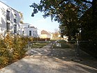
19 Sep 2011 | The quiet residential street is located at Schönhausen Palace Gardens north of Schönhausen Palace and is a private access route between Blankenburger Strasse 18a and Dietzgenstrasse 6-10. With the proximity of the previously somewhat inconspicuous castle garden, the residential complex with condominiums on plots 1–14 is one of the better residential areas. This project by a Hamburg real estate company around the Niederschönhausen Castle was laid out in 2011 with 16 apartments and six penthouses, and the orangery park designed by the court gardener Lenné is the center of the complex. “Primelofts Hamburg GmbH has applied for the designation in the power of attorney of the current owner [and] will acquire the construction site. [...] For a clear and sufficient orientation in the locality it is i. According to Section 5 (1) sentence 2 of the Berlin Roads Act, it is necessary to name the access road independently. The plots to be newly formed are to be numbered via this access road. The building project is referred to by Primelofts Hamburg GmbH as "Orangery Park Pankow - Living am Schlosspark Schönhausen". Therefore the private road is to be named "Am Orangeriepark". " |
|
| At the consulate
( Location ) |
180 | Construction project in the area of consulates in GDR times | Jan 15, 2002 | The road runs between Kuckhoffstraße along the Kreuzgraben and in an arch to the west to Waldstraße. The EDR Eastern Development and Real Estate GmbH had acquired the 12,500 square meter plot in the corner of Forest / Kuckhoffstraße for the construction project "Living at the consulate" with 24 double and row and four apartment buildings. Four foreign representations were previously on the site - including Ghana and Bolivia - and the neighboring property is occupied by the Egyptian embassy. The small private street consists of newer city villas in dense development. The street itself is closed with doors and can only be entered by the owners or with their permission. During the GDR era there were several foreign representations and residences in prefabricated construction on the site ( Denmark , Iran , Mali , Nicaragua , Sweden , Somalia , Spain , USA and Venezuela were represented here). Samples of these standardized diplomatic buildings are still standing in Waldstrasse . |

|
| At the castle park
( Location ) |
800 (in the district) |
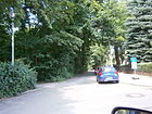
Park at Schönhausen Palace | after 1800 | Only the northern and undeveloped side of the street bordering the castle park belongs to the district, the street is in Pankow . The palace park, which dates from the years after 1664, is entered in the list of monuments as a garden monument. It is bordered by the street Am Schloßpark, Dietzgenstraße 2-6, Ossietzkystraße 44/45 and the Schloßallee / Tschaikowskystraße 3 and has been rebuilt several times (most recently after 1960). It is included in the list of monuments as "Schlosspark Niederschönhausen" with the park and the enclosure. "In winter you can see Schönhausen Palace from the Am Schlosspark street through the bare branches of the trees and bushes." |
|
| At the Zingerwiesen
( Location ) |
270 | LSG Zingerwiesen is adjacent | March 1, 2003 | The road lies along the Zingerwiesen landscape protection area at the eastern end of Walhallastraße on both sides, but only on the western section is built on with residential buildings. The Zingerwiesen is originally a flat lake that gradually silted up and developed into a fen with a peat thickness of up to 1.8 meters, which is drained through the Zingergraben in the southeasternmost Pankow conservation area. In the area of the Zingerwiesen, the Zingergraben was renovated in 2000. |

|
|
Beatrice Branch Street
( Location ) |
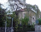
210 | Beatrice Zweig (1892–1971), painter and wife of the writer Arnold Zweig | Oct 15, 2014 | The street in 2011 , which was laid out around 1950, was part of the street network of the “Erich Weinert” artists' estate from 1950, which is now a listed building. It runs east parallel to Hermann-Hesse-Strasse between Heinrich-Mann-Strasse and Homeyer-Strasse. |
|
|
Beuthstrasse
( Location ) |
770 | Wilhelm Beuth (1781–1853), father of the Prussian trade regulations | 1899 | At first the road was the unofficial signposted field path to Buchholz . With the development plan it was called Straße 8 . It is located between Dietzgenstrasse and Buchholzer Strasse. There is a playground on Beuthstraße, the previously fallow 3600 m² area on Kreuzgraben was sown with lawn, trees were planted and playground equipment and seating was built for around 192,000 euros. |

|
| Blankenburger Strasse
( Location ) |
1700 (in the district) |
Blankenburg , neighboring town | after 1871 | Blankenburger Strasse is located between Dietzgenstrasse and Pasewalker Strasse and is part of French Buchholz from a little east of Grumbkowstrasse . This old connection route from Niederschönhausen to Blankenburg is already marked in the original measuring table from 1835. The ensemble of tenement houses 40–46 (straight) and some individual buildings erected between 1901 and 1925 are listed as architectural monuments. On the north side of the street there is mainly an industrial area, along the south side there is a residential area. The apartment blocks built at the east end of the street in the district led to changes in the local district boundary to French Buchholz ; when it was built in the 1970s, the blocks were not necessarily built along the streets. The road area ends further to the west than the access road belonging to the district, parallel to the course of the road, which leads to Hans-Jürgen-Straße , whereby the border between the districts is here between road area and parallel house driveway. Between Dietzgenstrasse and Pasewalker Strasse, the street was renewed in 2006, new lanes, sidewalks and bicycle paths were built and trees were planted to give the impression of the avenue |

|
| Blumenthalstrasse
( Location ) |
1020 | Leonhard Graf von Blumenthal (1810–1900), Prussian military | 1906 | The street was laid out in 1899 and was first called Straße 27 . It is located between Nordend and Wilhelm-Wolff-Strasse and westwards parallel to Friedrich-Engels-Strasse . According to the 1929 address book, there were still construction sites on most of the properties. In the address book from 1933 the northern part is still largely undeveloped and Feldmark is noted at the southern end at the end of the street. |

|
| Boris Pasternak Way
( Location ) |
240 | Boris Pasternak (1890–1960), Russian writer (" Doctor Schiwago ") | March 14, 1999 | Between Tschaikowskistraße and Majakowski-Ring in the former “town of Pankow” lies the street that was previously known as Straße 106 . Pasternak's son Yevgeny took part in the solemn public naming ceremony. "But the Mayakowskiring with its cross streets is not a dusty residential area of the eternal yesterday ..." In the 1932 address book, street 106 is already listed with two residential properties and has the note "Previously private road [called]". In 1943 there are two (odd) houses on plots 1–19 and four (even) houses on plots 15, 17, 2a, 4a, 4b, and plot 8-14 belongs to the master painter AJ Scheffler. These plots still exist, with 8–8e, 10, 10a, 12, 12a, 12b as well as 14a and 14b being divided and forming a residential complex in the depths of the plots on Stillen Straße. The Freie Schule Pankow is on 7/9, 16 is vacant and 18–20 is a daycare center . |

|
| Buchholzer Strasse
( Location ) |
1170 (in the district) |
Buchholz is the eastern neighbor. | after 1902 | From the end of the 19th century until around 1902 it was run as a road to French Buchholz . The street lies between Blankenburger Strasse (from which it goes off at an angle) and the district boundary to French Buchholz , which runs a little east of Grumbkowstrasse. The course of the street continues diagonally over Herthaplatz , the traffic routing runs on its south and east side. In the neighboring district it connects to Schönhauser Strasse . The Pankow VII cemetery is located on Buchholzer Straße and has several tombs under monument protection. The Pankower Realschule is located at Buchholzer Straße 3. |

|
| Buddestrasse
( Location ) |
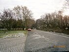
180 | Hermann von Budde (1851–1906), general and minister | 1903 | The Buddestraße is located (80 meters northeast of the district boundary ) approximately in the extension of the street Am Bürgerpark (formerly: Bahnhofstraße) between Schützenstraße and Provinzstraße. Due to its location along the former Berlin Wall , which was 100 meters deep, it was used as a post route and can hardly be recognized as a “street”. In the 2010s, however, the associated path and area limitations are still noticeable. Until 1938 the street belonged to Reinickendorf. The property at the east end of the street is already on the site of the former Schönholz freight station and belongs to the Reinickendorf district , so here is the strip of paving stones that marks the previous course of the Berlin Wall. The address book from 1943 records Buddestraße (Post Bln.-Reinickendorf O.) between the Provincial Road and the entrance to the Schönholz freight yard, property 1/2 belonged to Provincial Road 64/65, the numbers 3, 4, 5 were undeveloped and noted as a construction site, in 6 an engineer had his seat, on the opposite side 7–10 there was the storage place of a timber shop. The area, which has been freely accessible again since the fall of the Wall , is now used by a discounter as a sales hall on the northeast side of the street. When the border was straightened again in 1988, an area southwest of Buddestraße, to which parts of the properties on Buddestraße belong, became part of West Berlin . In 2018, remnants of the wall were identified in this area as part of the original Berlin Wall built after 1961 . |
|
| Büchnerweg
( Location ) |
260 | Georg Büchner (1813–1837), publicist | July 26, 1927 | The street was called Straße 57 before it was named and is located between Nordendstraße and Altenberger Weg. For the year 1929, this street is registered with construction sites on plots 1–10 between Altenbergstrasse and Nordendstrasse and on the opposite side of the street with plots 11–20. In 1943, plots 7 and 9 were built on with one-party houses. |

|
|
Charlottenstrasse
( Location ) |
800 (in the district) |
Sophie Charlotte (1668–1705), Queen in Prussia | 1899 | The road stretches across the border to Nordend from Rosenthal to road 52b, to the south it ends at Wackenbergstrasse. In 1906 it is registered with three developed properties and several construction sites. On the overview map of the suburbs in the 1910 address book, the border road to Nordend on the Niederschönhauser area east of Blankenfelder Strasse is also marked Charlottenstrasse. The primary school in Hasengrund is located at Charlottenstraße 19. |

|
| Cottastrasse
( Location ) |
470 | Heinrich von Cotta (1763–1844), forest scientist | before 1907 | It lies along the northern border of the Bürgerpark between Leonhard-Frank- and Heinrich-Mann-Straße. The street was laid out as a “forest district” that was planned in 1900 in the Schönholzer Heide (Schönhauser Fichten), but was not implemented, which is why the name was chosen. For 1910 it is listed in the address book as a cross street to Podbielskistraße, but it is still undeveloped. |

|
|
Dechertstrasse
( Location ) |
240 | Dechert, landowner in Niederschönhausen | Nov 9, 1926 | The street was previously known as Straße 23a and lies between Elisabeth-Christinen- and Karower Straße in the settlement square to Grumbkow- and Rolandstraße. In the address book from 1929 it is indicated continuously from Christinen-Elisabeth- to Grumbkowstraße, on the north side almost complete with buildings, on the south side 12-20 with construction sites. This quiet residential street with single-family houses is located in the east of the district, although it is green but somewhat detached from public transport. Dechertstraße ends as a dead end for cars, pedestrians and cyclists come through to Karower Straße. |

|
| Dehmelstrasse
( Location ) |
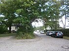
200 | Richard Dehmel (1863–1920), writer | May 31, 1951 | The road is between Uhlandstrasse and Blumenthalstraße, passing first by the Prussian army reformer from 1909 Gneisenau as Gneisenaustraße was named. On the general plan from 1910, this street is not yet defined at the western end and the surrounding streets are not yet designated. |
|
| Dietzgenstrasse
( Location ) |
1200 (in the district) |
Josef Dietzgen (1828–1888), materialist philosopher, socialist theorist | Apr 12, 1951 | Called Dorfstraße until the beginning of the 1890s , it was renamed Kaiser-Wilhelm-Straße and received its new name during the 1951 renaming campaign by the Greater Berlin City Council . The street lies between the border with Rosenthal at the junction of Schiller and Schönhauser Straße and the entrance to the palace gardens of Schönhausen Palace . The B 96a runs partly on Dietzgenstraße, but turns west at Ossietzkyplatz into Hermann-Hesse-Straße with the castle bypass. The road area from Schillerstraße belongs to the neighboring district, the two plots to the north to Niederschönhausen. The tram depot from 1900 (rebuilt in 1924 and 1950) , which is a listed building, is located on the corner of Schillerstrasse in the district. Other architectural monuments are the Evangelical Church of Peace, built between 1869 and 1871, with open spaces and parish hall on Ossietzkyplatz ( location ), for which King Friedrich Wilhelm IV. Is said to have personally designed the floor plan.
The Porsche secondary school built by Carl Fenten in 1913 on property no. 47, the building ensemble of Brose- and Holländerhaus Dietzgenstrasse 42-56 and Beuthstrasse and Platanenstrasse are also historical monuments. For the house at Dietzgenstrasse 56 / Beuthstrasse 51, Karl Friedrich Schinkel is assumed to be built before 1825 (rebuilt: 1870). Today's Max-Delbrück-Gymnasium (formerly: Friedrich-List-Gymnasium) on the corner of Kuckhoffstraße was built between 1908 and 1910 as a school and town hall and the orangery of the Niederschönhausen Castle (No. 6) is also registered as a monument. The Embassy of Mongolia is located at Dietzgenstrasse 31 . |

|
|
Oak Street
( Location ) |
830 | Oak , genus of the beech family | before 1902 | The road was laid out in 1899 and named in 1902, the choice of name being related to the crossing forest road. The street lies between Friedrich-Engelsstrasse and Dietzgenstrasse and runs parallel to Platanenstrasse, in 1910 it was led to Blumenthalstrasse. 1903 still with new construction and construction sites, in 1906 27 of the 70 properties are still listed as construction sites. The innkeeper H. Ulrich from Germanenstrasse 30 is the owner of houses 19 and 20. |

|
| Eisenblätterstrasse
( Location ) |
320 | Charlotte Eisenblätter (1903–1944), resistance fighter against the Nazi regime | May 31, 1951 | It lies between Germanen- and Wodanstraße and was laid out around 1905 as Teutonenstraße . The renaming in 1951 took place with more streets of the district by decision of the East Berlin magistrate . It is listed as Teutonenstraße in the 1910 address book between Straße 35 and Germanenstraße with the note “go. z. Post district Wilhelmsruh ”, it is built on with 20 consecutively numbered plots on plot 13, on the opposite side of the street 16, 17, 19, 20 with multi-party houses, but there are still construction sites on street 35 (since 1910 Wodanstraße). The consecutive numbering has meanwhile been replaced by a different designation of the properties: the northern properties 4–28 (straight) are between the corner properties Wodanstraße 79 and Germanenstraße 21, the southern properties 1–31 are in the same direction, with Eisenblätterstraße 1 and Wodanstraße 37– 75 form a unit. A 30s zone has been set up in the cobblestone street with unpaved sidewalks and street trees, multi-family and single-family houses alternate in the development; in addition to a few existing old buildings, there are several new residential buildings. |

|
| Elisabeth-Christinen-Strasse
( Location ) |
370 | Elisabeth Christine (1715–1797), Queen of Prussia | 1909 | The street lies between Schloßallee and Blankenburger Strasse and continues north from Strasse 39 into the industrial area. Before it was named, it was listed as street 20 in the development plan; in the overview plan of the address book from 1910 this and the surrounding streets are already drawn in, but not yet named. The expansion with multi-family houses was not yet completed in 1930. Queen Elisabeth Christine had the mulberry plant laid out in what was then Schönholz . She lived in Schönhausen Palace : “Some rooms were restored to the way they looked in the 18th century when Queen Elisabeth Christine, the wife of Frederick the Great, spent her summers at Schönhausen Palace. For example, a door that was created in 1964 was bricked up so that the original wallpaper from the time of the queen can be put back there. " |

|
| Etzelstrasse
( Location ) |
100 | Etzel , legendary King of the Huns | Jan. 16, 1925 | The road projected as road 94 of the development plan is a dead end and an access road to the adjoining residential buildings south of Walhallastrasse. According to the address book in 1933 as a dead end street, 16 properties are built on with houses, with the exception of non-numbered properties facing Platanenstrasse. Etzelstraße is not connected to the Platanenstraße due to the built-up properties. |

|
|
Field bridge
( Location ) |
60 | Field , from Old High German open, not forested land | after 1938 | The dirt road belongs to the settlement " Kleingartenkolonie Schönholz" between the Soviet memorial and the S-Bahn (Colony Schönholz) and lies south across the middle walkway and ends at the "birch grove on the former death strip ", as the wall stood here in front of the railway line . Around 1941 the footbridge was officially called Straße 82 . In the 1941 and 1943 address books, under Feldsteg, a reference is made to street 82 , under this keyword the comment “Not a month. Designation Feldsteg ”and“ Post Bln. = Reinickendorf O. ”are indicated. The location is Mittelsteg to Nordbahn with lots 1–7 and 8–14, which apart from plot 12 are built on with residential buildings. The properties up to 100 meters east of the embankment were abolished in the 1960s by the border fortifications of the Berlin Wall . Since the reorganization of the administrative districts in 1938 at the latest, the embankment along the northern line has formed the suburb of Reinickendorf, which means that the border between West Berlin's Reinickendorf and East Berlin Pankow was 100 meters wide on this strip . The wall path and a base of the "birch grove on the former death strip" mark the story. |

|
| Frickastrasse
( Location ) |
150 | Fricka , wife of Wodan | Nov 9, 1926 | The unpaved road has been laid out as road 88 according to the development plan and has been named to match Wodanstrasse, which is parallel to the west in the settlement area east of Germanenstrasse. It branches northwards at the eastern end of street 90 into the settlement area and is the access street for the properties between Wodanstraße and Nordendstraße , to which there is no connection. In 1927 it is not yet recorded in the address book and in 1933, in contrast to the developed surrounding streets, it was only recorded with two developed properties. To the east, the building potential was limited by the Zingergraben wetland (since the end of the 20th century: LSG 'Zingerwiesen'), when the Zingergraben was still a sewerage trap and was not divided by the Nordgraben. The Frickastraße is built on with newer construction houses and is bordered in the east and at the north end by the allotment gardens 'Am Anger' (formerly: KGA 'Hessen'). This KGA is largely located in Rosenthal, extends over the Tempelgraben and Nordendstrasse to Niederschönhausen. |

|
| Friedenssteg
( Location ) |
140 | Peace , conflict-free coexistence in the colony | after 1938 | The unpaved road belongs to the settlement ( allotment garden colony 'Schönholz') between the Soviet memorial and the S-Bahn , along which the wall stood. The dirt road lies south between the Genossenschaftssteg and the “birch grove on the former death strip”. Around 1941 the path was temporarily called Straße 80 . The properties up to 100 meters east of the embankment were abolished in the 1960s by the border fortifications of the Berlin Wall . Since the reorganization of the administrative districts in 1938 at the latest, the embankment along the northern line has formed the suburb of Reinickendorf, which means that the border between West Berlin's Reinickendorf and East Berlin Pankow was 100 meters wide on this strip . It is now part of the Wall Trail and an area of the "birch grove on the former death strip". In the 1941 address book (not yet 1940) the Friedenssteg is listed in full, but with the note “Amtl. Naming Straße 80 "and" Post Bln. = Reinickendorf O. "The location is with the built-up plots 1–3 and across the parcels between street 33 and Mittelsteg, and further with property 4 (parcel) and 5, 6 with houses and on the opposite page 7–10 (consecutive) between the central and platform web. |

|
| Friedrich-Engels-Strasse
( Location ) |
2260 (in the district) |
Friedrich Engels (1820–1895), materialistic philosopher together with Karl Marx | May 24, 1951 | The street is located between Pastor-Niemöller-Platz and Nordendstraße in the district and continues to Rosenthal to the main street, where it merges into Wilhelmsruher Damm in the Märkisches Viertel, which gives it its importance as the main traffic route in the higher-level road system. Due to the prehistory and its peripheral location in the 1950s until after the fall of the Wall in 1990, the street was underdeveloped, so that road renovation will be necessary in the 2010s. The name of this road connection from Pankow to northwest was Kaiserweg from 1899 , and the northern section with the continuation in Rosenthal was called Reichskanzlerdamm from 1916 . Due to this designation, it was taken into account and renamed by the magistrate when it was renamed in 1951 . On the street, the M1 tram goes to Quickborner Strasse near the Märkisches Viertel. The building ensemble at Friedrich-Engels-Strasse 49-71, including the adjoining houses on Blumenthal, Luther and Uhlandstrasse, is a listed building. The ensemble of country houses from 1901 No. 5 and No. 7 as well as the entire complex of the tenement group built around 1910 with the enclosure: House No. 40 / Am Iderfenngraben 12. House 35 is the headquarters of the Internet company alibaba.com . |

|
| Friesenstrasse
( Location ) |
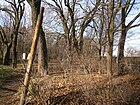
1310 | Frisians , Germanic ethnic group | around 1906 | Located between the Germanen- and Hermann-Hesse-Straße, it forms the northern boundary of the Schönholzer Heide. The eastern part of the street from Kuckhoffstraße is a footpath of the same name along the KGA “Zingertal” and “Alte Baumschule”. The Volkspark Schönholzer Heide on the southern side of the road has been awarded a garden monument. In the 1930 address book, plots 1–10 between Bismarckstrasse and Platanenstrasse are named with the "Siedlung Niederschönhausen eGmbH" as the owner, there are construction sites up to Walhallastrasse and the other side of the street is labeled "Forst". In 1907, Friesenstrasse was drawn as a continuous road between Lindenstrasse ( Grabbeallee since 1936 ) and Germanenstrasse. In 1910 it is listed as undeveloped from Lindenstrasse . In 1925 the course Am Iderfenngraben and Platanenstrasse is indicated, the land owned by the city of Berlin is administered by the "Siedlung Niederschönhausen eGmbH". In 1935 Friesenstrasse between Lindenstrasse and Platanenstrasse (via Dankelmannstrasse and Bismarckstrasse) is indicated on the left with construction sites and on the right between Kaiserin-Augusta-Strasse (Bismarckstrasse, Am Iderfenngraben, Platanenstrasse, Walhallastrasse) and Germanenstrasse. Plots 62–80 between Am Iderfenngraben and Platanenstrasse belong to the "Siedlung Niederschönhausen eGmbH". For 1938, the course between Grabbeallee (from the corner of plot 21, left side also with new buildings) and over Platanenstrasse to Germanenstrasse is listed again. The course is south along the Zingergraben . The section between Grabbeallee 21 and Bismarckstraße was spun off as Hohmeyerstraße in 1938. |
|
| Fritz-Erpenbeck-Ring
( Location ) |
260 | Fritz Erpenbeck (1897–1975), writer | Apr 7, 1982 | Before the name was given, the street was listed as Straße 100 and, according to plans from 1910, extends Zietenstraße across Treskowstraße to Waldstraße. Today's course goes as an arched one-way street from Waldstraße to Kuckhoffstraße and thus opens up the properties with residential houses in the square to Platanenstraße. See also Renate Bronnen's memories of this street. |

|
| Fritz-Reuter-Strasse
( Location ) |
500 | Fritz Reuter (1810–1874), writer of the Low German language | around 1906 | The road lies between Waldowstraße and Straße 18 , but it is only incompletely developed as a traffic road between Waldemarstraße and Waldowstraße, as the green corridor of the Kreuzgraben lies on its north side. It runs parallel between Beuthstrasse and Schillerstrasse. It runs parallel to the south of Schillerstraße and in the general plan from 1910 it is drawn from Dietzgenstraße (at that time: Kaiser-Wilhelm-Straße ) to an unrealized street two parallel streets east of Charlottenstraße. According to the 1942 address book, only two multi-family houses (15, 24) and three one / two-family houses (16, 18, 27) have been built in the street, the majority are designated as construction sites. The parcels between Waldowstraße and Charlottenstraße are now consecutively numbered and mostly. Plots 20 and 21 with 21a – 21h behind were only given homes in the 21st century. The corner plots belong to the cross streets and 7 and 29–33, they are undeveloped in the Kreuzgraben green belt. In the paved street to the west there are mainly apartment buildings, to the east there are more residential buildings. |
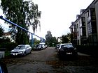
|
| Spring road
( Location ) |
120 | Spring , season | before 1896 | The street belonged to Reinickendorf until 1938 and is supplemented south of the railway line in this district by streets with names of the other seasons. It is a dead end street from the Provinzstraße to the southwest, and it opens up the area to the Berlin Northern Railway , in particular it connects to the Wall Trail . So it ended between 1961 and 1990 in front of the border facility, which was located northeast of the railway facilities . In the address book in 1941 are still between Northern Railway and provincial road the land 1-8 (ongoing) and listed (ongoing) opposite 8-16, built primarily with single and multi-party houses. At No. 1 there is an unused plot of land on the northern railway, the opposite plot 16 belongs to St. Georgen Church, 6/7 is a garden area from Provinzstrasse 75, 76. Only the corner plot on Provinzstrasse 74 / Frühlingstrasse 8 was built on, the southern plots 2–5 were in the area of the Berlin Wall and are partly behind two blocking bollards facing the Berlin Wall Trail on an overgrown bush and tree, which is known as a "birch grove on the former death strip “Should be trained. On the north side of the corner plot on Provinzstraße 73, plots 11-14, which are used for commercial purposes, follow to the west. The condition in the 2010s may be due to the lack of ownership after the end of the Berlin Wall. There are no references to plot 6/7 and 15/16 on the map of Berlin 1: 5000 |

|
|
Galenusstrasse
( Location ) |
180 (in the district, partly on one side) |
Claudius Galenus (129 or 131 – around 199, 201 or 216), Greek physician | around 1906 | In the western section between Mendel- and Klaustaler Straße, the northern side of the street at the former children's home (since 1991 Pankeschule) on Galenusstraße 64 belongs to the district. The road area and the entire eastern section of Galenusstraße are located in Pankow . To the west of Mendelstrasse lies the street Am Schlosspark . The “KGA Schüßler” in the north of the Niederschönhauser Zipfel around the school also belongs to Pankow. The street name assigns the street to the "medical district" around the former Pankow hospital. In the 1943 address book, the hospital and construction sites for Pankow are noted on the right, north side of the street. |

|
| Cooperative walkway
( Location ) |
430 | Cooperative with joint business operations | after 1961 | With the establishment of the colony after 1935, this unpaved access route was not officially designated as a cooperative route . After 1961, the name was adapted to the surrounding "footbridges". It is the main route through the settlement (" Schönholz allotment garden colony ") between the Soviet memorial and the S-Bahn line (Berlin Northern Railway), and it lies parallel to the forest and central footbridge. There are small single-family houses and gardens on the dirt road. Between 1961 and the turn of 1990, the colony was a bit remote near the Berlin Wall, and some courses and property locations were probably influenced between 1950 and 1990. |

|
| Germanenstrasse
( Location ) |
860 | Germanic tribes , number of former tribes in Central and Northern Europe | 1903 | It lies between the confluence of the Wald- / Vereinssteg of the Schönholz colony in an extension of the road in front of Schönholz and the district boundary to Wilhelmsruh. She influenced the naming with reference to Germanic in the street system east of her. The celebration hall (around 1910) and morgue (around 1895) on the repealed cemetery Pankow V (Schönholz) are protected as a monument, the Volkspark Schönholzer Heide on the street as a garden monument. |

|
| Grabbeallee
( Location ) |
1000 | Christian Dietrich Grabbe (1801–1836), poet of the Vormärz | Sep 10 1936 | Called Lindenstrasse since 1900 , the current name was given on the occasion of the 100th anniversary of Grabbe's death in 1936. Between Schönholzer Strasse and Pastor-Niemöller-Platz, it forms the bypass of Schönhausen Palace and is part of federal road 96a . The M1 tram has its route to Nordend here. Several buildings on this street are listed as historical monuments: the country houses No. 35, No. 39, No. 43, No. 63 and No. 67. There is also the Evangelical Children's Home Siloah in Grabbeallee 2–10 with the foundations from 1885 and Extensions from the 1910s and 1920s as well as the entire residential complex Grabbeallee 14–26 (straight) and Paul-Franke-Straße 1–12 from 1908 based on designs by Paul Mebes for the civil servants' housing association. The Embassy of the Republic of Togo and Grabbeallee 47 the Embassy of the Republic of the Congo are located at Grabbeallee 43. |

|
| Grumbkowstrasse
( Location ) |
1080 | Joachim Ernst von Grumbkow (1637–1690), politician and military man, owner of the Schönhausen manor . | 1909 | It was first referred to as Street 21 . It runs from Schloßallee northwards to Buchholzer Straße. In the address book of 1933, gardens, summer houses and undeveloped land in addition to 15 single-family houses are listed on the 85 properties on Grumbkowstrasse ( indicated with numbers in orientation numbering ). In the 2013 LOR directory, the properties at Grumbkowstrasse 1–86 are (consecutively) listed in horseshoe numbering , with new building blocks in the southern part, single-family and residential buildings in the north on the east side of the street and commercial buildings on the west side. |

|
| Gullweg
( Location ) |
330 | Friedrich Wilhelm Güll (1812–1879), poet of children's songs | Feb. 19, 1938 | Until the name was given, the name was Straße 16 , which was based on the route according to the development plan. The street lies between Tschaikowski- and Hermann-Hesse-Straße and runs parallel between Grabbeallee (in the east) and Zum Kreuzgraben (in the west). The street with a paved pavement partly single-lane, partly two-lane with sidewalks is designated as a 30 zone and signposted as a dead end street , to prevent through traffic - when there is a traffic jam on the B 96a - bollards were set. In 1939 the left side is undeveloped (1–27, odd), on the right there are nine residential and one summer house (10) on 2–28, in particular 10b, 10c, 12c, 12d and 10a, on the private road (towards Bismarckstrasse ) are built on 10d, 12a, 12b undeveloped. |

|
|
Heegermühler way
( Location ) |
270 (in the district) |
Heegermühle , former name of Finow | Jan. 18, 1936 | The Kepler Street (named in 1904) and the eastern part of Treskowstraße (named before 1902) were in 1936, combined for Heegermühler road although the place since 15 October 1928 already bore the name Finow. The street is between Edelweissstraße and Wodanstraße. However, the greater part is to the west of Germanenstraße in the Wilhelmsruh district . |

|
| Heinrich-Böll-Strasse
( Location ) |
460 | Heinrich Böll (1917–1985), writer | May 5, 1997 | Located between Schillerstraße and Kreuzgraben and at right angles to Dietzgenstraße, it encloses the new buildings on the area of the former KGA 'Dorfpfuhl'. There are short transverse access roads for access to and from the residential buildings. The traffic route continues over Dietzgenstrasse as Uhlandstrasse. "At Heinrich-Böll-Strasse 61 in Niederschönhausen there is [...] a second-hand shop for children's clothing, toys, books and antique items [...] from the Björn Schulz Foundation". The eastern section of the street was also called Kreuzgraben before it was renamed, but together with the westward section it ran through undeveloped land. The street name takes on the surrounding street names, such as Schiller- and Körner- or the opposite Uhlandstraße. |

|
| Heinrich-Mann-Platz
( Location ) |
120 (round) |
Heinrich Mann (1871–1950), writer | Apr 12, 1951 | The square was established as Hohenzollernplatz before 1908 and renamed Seckendorffplatz in 1937 . In 1951, on the initiative of the Magistrate of Greater Berlin, it was renamed after the famous writer. The town square is a round, tree-lined square at the intersection of Leonhard-Frank- and Heinrich-Mann-Straße. The square with its location in the Heinrich-Mann-Straße is part of the superordinate main street network of Berlin . |

|
| Heinrich-Mann-Strasse
( Location ) |
700 | Heinrich Mann (1871–1950), writer | Apr 12, 1951 | Before 1907 the street was established as Podbielskistraße in the area of the Schönhauser Fichten and in 1937 renamed Seckendorffstraße . In 1951 it was given its current name on the initiative of the Greater Berlin City Council . Located between Hermann-Hesse- and Schönholzer Strasse, it is interrupted by Heinrich-Mann-Platz. The "Erich-Weinert-Siedlung" with gardens and memorial wall with the house 42 built for Erich Weinert in 1950/1951 is included in the ensemble as a monument. The Federal Academy of the Evangelical Churches in Germany located here is noteworthy (lower picture). Due to its location as a feeder to Bundesstraße 96a, Heinrich-Mann-Straße is a superordinate main street (Category II) in the Berlin road network . The embassy of the People's Republic of China in the German Democratic Republic was on this street until the fall of the Wall. |

|
| Hermann-Hesse-Strasse
( Location ) |
1610 | Hermann Hesse (1877–1962), poet and writer | June 1, 1992 | When the street was laid out after 1899 , it was named Bismarckstraße , and in 1951 it was named Kurt-Fischer-Straße after the Minister of the Interior of Saxony (1945–1950) Kurt Fischer . In 1992 it was renamed to the current street name. Located between the street in front of Schönholz and Pastor-Niemöller-Platz, Hermann-Hesse-Strasse runs in the western part south of the Schönholzer Heide and north of the Pankow III cemetery . Until 2010, Günter Menge's hardware and tool shop was located at Hermann-Hesse-Straße 4–6. “Quantity was an exotic one, a businessman who could buy tools that construction workers and hobbyists often looked for in vain in other shops in the country.” Architectural monuments are a residential and commercial building from 1905/1906 (House 20 / Waldstrasse 88/89 ) as well as Erich Weinert settlement with gardens and memorial wall for Erich Weinert from 1950/1951 with houses 77–87 (odd). The rifle house on plot 82 from 1883 (start of construction) is also included on the list of monuments. The Volkspark Schönholzer Heide to the north of the road is included as a garden monument. 810 meters of Hermann-Hesse-Straße belong to category II in the Berlin road network as a superordinate main road, the section to Heinrich-Mann-Straße belongs to the regional main road network. |
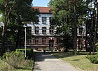
|
| Herthaplatz
( Location ) |
110 × 60 | Hertha , Nerthus as mother of the earth with Tacitus | 1899 | It lies in the course of Wackenberg- (east-west) and Buchholzer Straße (SW – NE) and is bounded by Waldemar- / Siegfriedstraße on the one hand and Waldowstraße on the other. It is a rectangular, green, decorative area with a playground and meadow, around which there are multi-family houses, old and new buildings. In the south-west corner of the square is the Pankow IV cemetery . Properties 1–11 belong to Herthaplatz, 5 and 8 do not exist. On the southeast side are the cemetery and 1 (a background piece to the cemetery), 1a, 2, 3. The east side (4 and 5 are missing) belongs to Wackenbergstrasse (30, 31, 31a). The north side is bounded by 6, 7, 9 (the 8 has probably merged into the 9) and 10 and 11 are on the west side of the square. The location as a connection between Wackenbergstrasse and Buchholzer Strasse means that 160 meters in the northwest of the square belong to the supplementary main road system (category IV), while the south-east road is not categorized as a district road. The Herthaplatz is already included in the 1910 address book with properties 1 (cemetery administration, municipality Niederschönhausen), two apartment buildings (6, 9) and undeveloped properties 2–5, 7 and 8. |

|
| Homeyerstrasse
( Location ) |
530 | Karl Gustav Homeyer (1795–1874), legal historian | Feb. 19, 1938 | Intended as Friesenstraße through the area of Schönholzer Heide (Schönhauser Fichten), after 1935 it was separated from this route as Straße 7 and named in 1938. In 1943, plots 1–11 belonged to Grabbeallee 21, and district mayor K. Bombach lived in house 30. Homeyerstraße is located south of the Zingergraben between Grabbeallee and Hermann-Hesse-Straße and was redesigned from 1950 to become the “Erich Weinert” artists' estate. Homeyerstraße is part of the Erich Weinert settlement , which is listed as a monument with gardens and memorial wall for Erich Weinert from 1950/1951 and houses 31, 37 and 39. Another architectural monument is the Arnold-Zweig-Archiv in the single-family house number 13, built around 1939. In 1943 the Hohmeyerstraße was built on eleven lots, in house 29 the Reichsverband d. German brewery and winery style. Wholesale e. V. The embassy of the United Mexican States in the GDR was on this street until the fall of the Wall . |

|
| Hundingstrasse
( Location ) |
150 | Hunding , figure of the North Germanic hero poetry | Jan. 16, 1925 | Hundingstrasse lies between Walhalla and Platanenstrasse, to the east parallel to Wodanstrasse. Before it was named as Straße 93, the street was listed after the name in the development plan. In the 1926 address book Hundingstrasse between Walhalla and Platanenstrasse is consecutively numbered on the west side of plots 1–8 with single-family houses and on the east side at the corner of Walhallastrasse with one house. Today's properties are still completely built on to the west of 1–8 and east of 9–13; the road ends on Platanenstrasse between corner plots 47 and 48. |
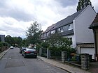
|
|
Idastrasse
( Location ) |
300 | Ida , became popular due to medieval romanticism around 1900 | 1898 | The street name is based on Idise (battle maiden in the Merseburg magic spell ) or Iduna (goddess of eternal youth). Located between Wackenbergstrasse and Blankenburger Strasse, it runs parallel to Klothilde and Siegfriedstrasse . The BVG network control center at number 20, a BEWAG building by Hans Heinrich Müller from 1928, is on the list of monuments. Idastraße is one of the first extensions in the suburb with the neighboring streets by first name. In the address book from 1903, the house of the cashier P. Fiedler with his tenants - the teacher E. Barth and the tram conductor E. Luck - is entered on plot 23. There was previously a track loop on line 46 , the asphalt pavement instead of the track can still be seen in the adjacent picture between the pavement. |

|
| Karlinekenweg
( Location ) |
280 | Karlineke , figure of a Berlin street hit | Nov 16, 2016 | The development between Wackenberg-, Grumbkow- and Blankenburger Straße required a private access road. The applicant (project developer), Hanseatische Immobilien Treuhand GmbH + Co., suggested the confirmed name. The road is south from Wackenbergstrasse and ends in two stitches near Grumkowstrasse with a pedestrian passage. The plots on the west side are addressed with 5–51, on the east side there are 42–52 (even). The properties attached to the surrounding streets are addressed to these. The postcode is 13156, the street is in the Herthaplatz planning area (03020210). |

|
|
Karower Strasse
( Location ) |
480 (in the district) |
Karow , northeastern neighbor | before 1910 | The naming of the street after the neighboring suburb of Berlin is probably based on the parallel Blankenburger Strasse (and the northern Buchholzer Strasse). In the 1912 address book, Karowstrasse is shown on the map as an extended Rolandstrasse. The street is located between Lindenberger Weg, across Elisabeth-Christinen- and Grumbkowstraße, crossing these it ends in the French Buchholz district . The initial name Karowstraße corresponds to the street name regulation that was common around 1900. In the address book from 1912, the street between Straße 19 and Elisabeth-Christinen-Straße across Grumbkowstraße is entered. The plots are already numbered, there are new buildings at 20, 21, and 23 on Grumbkowstrasse, and to the west at 24 and 30–32b there are five residential buildings. |

|
| Kleine Homeyerstrasse
( Location ) |
310 | Karl Gustav Homeyer (1795–1874), legal historian | after 1961 | The U-shaped street runs from and to Homeyerstraße and opens up the houses to Zingergraben . The naming of the access road for the background pieces was based on Homeyerstrasse. From 1950 onwards it was close to the “Erich Weinert” artists' estate. |

|
| Klemkestrasse
( Location ) |
250 (in the district) |
Fritz Klemke (1902–1932), he was murdered in the 1932 SA attack on the Felseneck colony. | Jul 31, 1947 | On November 1, 1993, the Klemkestrasse in the district was renumbered. The Klemkestrasse leads from the street in front of Schönholz to the west through the S-Bahn line of the Berlin Northern Railway to Reinickendorf . The street was interrupted by the Berlin Wall between 1961 and 1989. Called Schönholzer Strasse from 1900 to around 1904 , it was classified as Schönholzer Weg until 1937 . From May 20, 1937 to 1947 as Felseneckstraße , after the Reinickendorfer "Arbeiter-Kolonie Felseneck" attacked by the SA. In 1947 the name was changed after Fritz Klemke, who was murdered in this SA attack. |

|
| Klothildestrasse
( Location ) |
600 | Klothilde , daughter of Burgundy, second wife of Clovis I. | Nov 9, 1926 | It lies between Wackenbergstrasse and Schlossallee and parallel to the more western Siegfriedstrasse and Idastrasse. It was named as street 17 according to the number in the development plan in 1926. In the 1927 address book, however, it is not yet listed, in 1928 the location is given as Schloßallee, across the private road to Blankenburger Strasse. The Kurz'sche house of an upper district secretary and the Fäthe'sche house of a teacher are on two unnumbered plots on a street corner to the Schloßallee. In 1930 the private street was then called Rolandstraße, and a new building and the Hoffmeister house of a baker were added on the same side of the street. These houses have the numbers 20, 19, 14. In 1936 Klothildestrasse was extended to Hermannstrasse (since 1937 Wackenbergstrasse), but the connection as a road to Schloßallee has been omitted, but there is a stump over Rolandstrasse (as it is today). In consecutive numbering, eleven lots (19, 20, 35, 37, 44) are now also built on the other side of the street (1a, 3, 9, 14, 17, 18). To the southeast of the corner of Rolandstrasse are the school sports hall of the Elisabeth-Christinen-Grundschule and a daycare center (21), opposite the two- and three-storey residential buildings (16-20) and a garage complex. To the north to Blankenburger Strasse follow post-owned residential buildings (two six-house blocks, 26a-31b) to the east, the blocks on the cross streets are addressed for these, opposite is the older residential building (14) and another two (15, 15a) residential buildings, on 12 and 13 garages and a supermarket. On Wackenbergstrasse there are single and multi-party houses, some of the latest design, in loose development with street trees on some unpaved sidewalks. |

|
| Köberlesteig
( Location ) |
120 | Georg Köberle (1819–1898), writer and theater director | Feb. 19, 1938 | The path was previously known as Straße 54 . It is a southern cul-de-sac from Mayakowskiring to the south and ends in a small turning area before the Panke. It belonged to the "town of Pankow". “But the Majakowskiring with its cross streets is not a dusty residential area of the eternal yesterday…” In the address book 1943 noted as a dead end between Victoriastraße and Panke with three developed properties. The eastern plots 1 and 5 belong to the corner plot of Majakowskiring, 7 (7a) and 9 (9a) are divided as well as 13 to 15, opposite is 2, 2a divided and on 14 still 16 of these are built on. |

|
| Körnerstrasse
( Location ) |
580 | Karl Theodor Körner (1791–1813), patriotic writer | 1903 | Paved street between Rosenthaler Grenzweg and Beuthstraße, built with single and multi-family houses. The Schiller-, Fritz-Reuter- and Beuthstraße are the cross streets from north to south |

|
| Cross moat
( Location ) |
230 | Kreuzgraben , neighboring river to the Panke | Nov 9, 1926 | Before being named in the north-south facing part of the street 8 . Accessible as a dead end from Beuthstraße and with a pedestrian bridge over the Kreuzgraben to Heinrich-Böll-Straße. In the 1943 address book, the Kreuzgraben is still recorded between Beuthstrasse and Schillerstrasse, listed in the southern section with houses, construction sites and parcels, and then arable land for the northern section 11–47 (odd) and 8–48 (even) to Schillerstrasse. The northern section joined the Dorfpfuhl colony in the post-war years, and when this open space was built on at the end of the 2000s, this section was assigned to Heinrich-Böll-Straße. Since this section was not renamed, it can be assumed that it was already spun off from the Kreuzgraben street. |

|
| Cross bridge
( Location ) |
140 | Cross the main path | after 1938 | Until around 1941 it was also called Straße 81 (the fourth way from Straße 78). The dirt road with small single-family houses and gardens belongs to the settlement (Colony Schönholz) between the Soviet memorial and the S-Bahn and is parallel to the Friedenssteg between the cooperative footbridge and the embankment. First mentioned in the address book in 1941. In the 1943 address book, the Kreuzsteg was also given “Official designation Street 81” and “Post Bln. = Reinickendorf O.”. The path leads from road 33 to the platform with nine residential buildings, a summer house (4) and construction sites (1b, 3), but also lots (6, 11) on eleven numbered lots. The properties up to 100 meters east of the embankment were abolished in the 1960s by the border installations of the Berlin Wall . The embankment on the course of the northern railway has formed the suburb of Reinickendorf at the latest since the reorganization of the administrative districts in 1938, which means that the border between West Berlin Reinickendorf and East Berlin Pankow was 100 meters wide on this strip , on which the Wall Trail now runs and an area of the "birch grove on the former death strip". |

|
| Kuckhoffstrasse
( Location ) |
1510 | Adam Kuckhoff (1887–1943), writer and resistance fighter against the Nazi regime | May 31, 1951 | From 1899 Blücherstraße to the renaming initiative of the Magistrate of Greater Berlin in 1951. Located between Friesenstraße (at Volkspark Schönholz) and Dietzgenstraße, it crosses Friedrich-Engels-Straße. In the Kuckhoffstraße there is a location of the grammar school, which had been the “Friedrich-List-Gymnasium” for 95 years and which changed its name when it merged with the “Max-Born-Oberschule” in the Lessingstraße. |

|
|
Leonhard-Frank-Strasse
( Location ) |
710 | Leonhard Frank (1882–1961), writer and playwright | 4th Sep 1962 | Already before 1908 in preparation for the planned forest district (Schönhauser Fichten) it was set up as Danckelmannstrasse ( Danckelmann , forest scientist) and renamed as Wahnschaffestrasse ( Felix Wahnschaffe , geologist) in 1937 , the new name was given in 1962 on the 80th birthday of the writer Frank (one year after his death ). When Friedhof Pankow III was expanded in the 1930s, it became its side street. From the 1950s it belonged to the “Erich Weinert” artists' estate. Located between Am Bürgerpark and Homeyerstraße, Leonhard-Frank-Straße is interrupted by Heinrich-Mann-Platz. The house garden at Leonhard-Frank-Straße 31, which was laid out around 1930, is registered as a garden monument. |

|
| Lindenberger Strasse
( Location ) |
350 | Lindenberg , place north of Pankow | before 1914 | Previously known as Straße 19 , it was first mentioned in the Berlin address book in 1914. Located between Schlossallee and Blankenburger Strasse, it crosses Rolandstrasse. The quiet residential street is built with WBS-type prefabricated buildings, it has direct access to the Schlossallee and the Schönhausen Palace Park. The Elisabeth-Christinen-Grundschule and the neighboring "Schule an der Strauchwiese" with a large playground are on the corner of Rolandstrasse. |

|
| Louis-Schmidt-Strasse
( Location ) |
130 | Louis Schmidt (1836–1914), politician and master blacksmith | May 20, 2016 | This traffic route, according to the development plan up to April 2016 Straße 101 , is between Friedrich-Engelsstraße and Treskowstraße , in front of Straße 97 . Plots 2–10 (straight, south side) of the unpaved driveway ( 30 zone ) are numbered, tennis courts are located on the north side. The street has been called Straße 101 since the Kaiserweg (→ Friedrich-Engels-Straße) was built around 1926 . At the end of the 1930s it ended in the east at the Elsenbruch colony and the planned route of a road 97 was to continue. At that time, the southern area was parceled out and undeveloped, while the Borussia tennis courts are to the north. Around 1950 the plots were numbered and partially built on.
At the request of the district office on September 15, 2015, it was proposed to name the number street in Louis-Schmidt-Straße, especially since there is another street 101 in the district. In 1943 the street 101 between Kaiserweg and Verlängerte Treskowstraße is listed with an assigned residential property number 8. The proposed name giver, Louis Schmidt, was deputy mayor from 1890 and held the office of mayor. In view of his services, the municipality of Pankow decided to name a street in the west of the municipality after him during his lifetime and named it Schmidtstraße . In 1938 Schmidtstrasse was renamed Kattegattstrasse and has since been part of the Wedding district due to the district reform of 1938. |
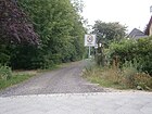
|
| Lutherstrasse
( Location ) |
170 | Martin Luther (1483–1546), reformer and theologian | 1906 | In the development plan it was listed as street 30a . It lay and lies as a four-lane street with small pavement, two sidewalks and trees between Friedrich-Engels- and Blumenthalstraße. Not yet mentioned in the address book in 1907, it was first noted in 1908 as undeveloped. Lutherstraße was listed in the address book until 1929 but remained undeveloped, a new building was only recorded in 1930 and in 1931 plots 1–4 on the left side of Kaiserweg were recorded in the address book. Pankower Heimstätten GmbH built seven three-storey six-party houses (also houses 1a, 2a, 3a). This development forms a residential complex with the five house blocks on Friedrich-Engels-, Uhland- and Blumenthalstrasse, two three-storey blocks on Friedrich-Engels-Strasse and an inner courtyard with a park on the other two-storey streets. This complex was designed by Paul Krebs in 1930 and listed as an ensemble on the list of monuments . On the south side, which was still undeveloped in 1943, buildings were added on 5 and 6 after 1990. The day care center at the east end of the street belongs to the address at Friedrich-Engels-Straße 45–47. |

|
|
Mayakowskiring
( Location ) |
970 | Vladimir Mayakovsky (1893–1930), Russian poet | May 4th 1950 | The Ringstrasse west of Schönhausen Castle was laid out around 1880 as a villa settlement and in the 1950s it was the central street in the so-called “town of Pankow” (gorodok). The ring was formed in 1950 from the northern part of Viktoriastraße, named before 1900, and the southern half-ring of Kronprinzenstraße , named before 1900 . "During the GDR era, the street was popular with Johannes R. Becher, the Ulbricht couple and the Honeckers . They all lived in the area very close to Schönhausen Palace." "Between 1970 and 1980 the villas were transformed into guest houses, Residences and embassy buildings. ”The Villa Majakowskiring 2, built in 1900 and renovated in 1981 by the GDR Council of Ministers, is registered as a monument. The single-family house from 1917 (Majakowskiring 29), rebuilt in 1950 and 1975, the single-family house from 1939 at Majakowskiring 34, and Otto Grotewohl's house in house 48 are also historical monuments. The quiet residential street has a spacious villa development. The residential buildings near Schönhausen Palace could easily be sealed off, which is why they were confiscated by the Soviet military forces in 1945. After the relocation of the military administration, the GDR leadership moved in with their entourage before they moved to a new housing estate in the forest near Wandlitz . After that, the villas were used by embassies until the fall of the Wall . Now upper middle class lives here, some with commercial use. House No. 47 houses an institute of the Polish Academy of Sciences. |

|
| Marthastrasse
( Location ) |
120 | Martha , sister of Mary of Bethany and Lazarus | 1898 | The road leads from Waldowstraße to Brosepark. This short, cobblestone street ends for cars at Brosepark. There is access to the park for pedestrians and cyclists. The street is built on with two and three-story apartment buildings. The Kreuzbund Berlin has its office in the street. As early as 1901, Marthastraße was included in the address book with numbered properties starting from Waldowstraße. Plots 1, 11, 13 are built on with residential houses, house number 13 belongs to the German auxiliary = women = association, is administered by the preacher C. Fangauf and inhabited by the retired civil servant E. Richter. The office park was expanded by 1943, plot 7 and (with the park entrance in between) 8 and 9 belong to the park, plot 5 is still undeveloped according to the address book. Later a summer house was only built on plot 5. One of the four Marthastraße in Berlin is between Heegermühler Weg and Schönholzer Weg / Germanenstraße. According to the information in the address database on the border between Niederschönhausen and Wilhelmsruh , northern property 1–7 in Wilhelmsruh and the southern 8–19 in the district. The map of Berlin 1: 5000 of the district land surveying offices places the border south of the plots 8-19 in a direct continuation of the Siegfried-Baruch-Weg, so that this Marthastraße is exclusively assigned to Wilhelmsruh. |

|
| Middle bar
( Location ) |
670 | Middle path of the Schönholz colony | after 1938 | The unpaved road belongs to the settlement (Colony Schönholz) between the Soviet memorial and the S-Bahn and is parallel to the Waldsteg access road to the south . First mentioned in the address book in 1941 is noted “Non-official designation” and “Post Bln. = Reinickendorf O.”, the course with Vereinssteg, Straße 83, Straße 82 , Kreuzsteg, Friedensteg, Laubenkolonie. For 1943 the numbered plots 1–32 and 33–55 are recorded with 32 single-family houses, 14 summer houses and construction sites (6, 16, 21, 24, 31, 47, 52) and a green area at the corner of Kreuzsteg (42, 43). In the 21st century, the central web includes lots 1–56 (consecutive), with 21 missing and several being divided, 32 also 32a and 32e. |

|
|
New bridge
( Location ) |
200 | the “youngest” crossroad of the Schönholz colony | after 1938 | Formerly street 83 with regular numbering of the crossways of the Schönholz colony from west to east. The unpaved road belongs to the settlement between the Soviet memorial and the S-Bahn and lies across the middle and forest walkway , but from the forest walkway the entrance is blocked by stone pillars. In the address book for 1939, but not for 1940, the street 83 is (for the first time) noted between Waldsteg and Nordbahn , plots 1–20 towards the Nordbahn are built on (continuously) with 17 houses and three summer houses, on the opposite right side are the Plots 22, 23, 24 built on, 22 of them facing the northern line with an apartment building. Also for 1943 is “s. Straße 83 ”under the keyword“ Neuer Steg ”. Road 83 lies between Waldsteg, over Mittelsteg and Bahnsteg / Nordbahn. On the consecutively numbered plots 1–16 (towards the railway) and 17–24, almost all of them are built with residential and summer houses. The properties up to 100 meters east of the embankment were abolished in the 1960s by the border installations of the Berlin Wall . The embankment on the course of the northern railway has formed the suburb of Reinickendorf at the latest since the reorganization of the administrative districts in 1938, which means that the border between West Berlin Reinickendorf and East Berlin Pankow was 100 meters wide on this strip , on which the Wall Trail now runs and an area of the "birch grove on the former death strip". |

|
| Nordendstrasse
( Location ) |
1700 | Nordend , district of Niederschönhausen | before 1910 | It is located between Schönhauser Straße and Wodanstraße / corner of Heegermühler Weg. Already known as the Rosenthaler Grenzweg between 1900 and 1910 , the street partly runs along the northern boundary of Rosenthal , partly it forms this and lies between Schönholzer Weg in the west and Schönhauser Straße in the east. The row house group No. 74–76a from the years 1925–1930 is a listed building monument (see picture). The Embassy of the Republic of Kazakhstan is located at Nordendstrasse 14 . To the west of Friedrich-Engels-Strasse, Nordenstrasse is a developed road with an asphalt pavement and two sidewalks, although some of these are edge strips with a parking function and there are trees on both sides. Towards the west, the road conditions deteriorate despite the asphalt surface. The northern plots with the settlement houses are in Rosenthal, south side and road area to Niederschönhausen. To the east of Friedrich-Engels-Strasse, the road is four lanes wide with two asphalt roads and unpaved verges on both sides; to the west of Blumenthalstrasse, there is a narrower unpaved road with a sand cover, limited to 2.8 t and speed limit in parts to 10 km / h. To the north is the KGA 'Am Anger' in Rosenthal, to the south in Niederschönhausen settlement houses (on the Zingergrabenbrücke), the LSG Zingerwiesen and allotments. The border to the neighboring district is in the Tempelgraben, which runs along the northern edge of the street, and some walkways lead into the garden plots. The horseshoe numbering of Nordendstrasse means that plots 6–31t (from east to west) are in Rosenthal and 32–82 (from west to east) are in the district. At the unpaved west end of the street, a passage to Germanenstraße on the northern edge of the property on Heegermühler Weg has not been created and is no longer possible due to the development of the residential complex from Rosenthal. At the east end of the Dietzgenstrasse, only a footpath leads to the north of the green area between Dietzgenstrasse and Schönhauser Strasse on the southern wall of the property at Mittelstrasse 6, so the route on the district boundary leads to the northern edge of the Nordend tram station to the (today's) Rosenthaler Grenzweg . On the 1915 map, Nordendstraße connects from Schönhauser Straße the streets Ahorn-, Birken-, Eschen- Akazien- and Eichenallee in Nordend (belonging to Rosenthal) and the straßenland also belonged to the neighboring district at that time. |

|
|
Ossietzkyplatz
( Location ) |
60 × 30 | Carl von Ossietzky (1889–1938), publicist and victim of the Nazi regime | May 25, 1948 | The square is at the meeting point of Dietzgenstrasse, Blankenburger Strasse and Hermann-Hesse-Strasse. Until 1871 it was called Kirchplatz and from 1871 to 1948 Friedensplatz at the Friedenskirche. It is not consistently recorded in the address books, probably due to the fact that it is not a postal address without land. Although it is located in the extended Ossietzkystraße, the street was obviously never named to the north past the castle. In 1871 the square was named Friedensplatz after the Friedenskirche located there, the completion of which coincided with the end of the Franco-Prussian War in 1870/71. |

|
| Ossietzkystraße
( Location ) |
340 (in the district) |
Carl von Ossietzky (1889–1938), publicist and victim of the Nazi regime | May 25, 1948 | After 1791 it was still (seen from Pankow) as a village street to Niederschönhausen , but since the end of the 19th century it was called Schloßstraße . Since 1948, it has continued Dietzgenstrasse in front of Schönhausen Palace to the south and runs from the Pankebrücke in the Pankow district. As a monument, the castle in Niederschönhausen was built in 1662 according to a design by Eosander von Göthe and Johann Friedrich Nilsson, last rebuilt 1935–1936, used in 1950 as the presidential seat of Wilhelm Pieck and later a guest house of the GDR government, including several individual objects on Ossietzkystraße 44/45 from 1949 to 1983. |
|
|
Pankower Strasse
( Location ) |
100 (in the district) |
Pankow , neighboring town | 1862 | Before, a section of road 51 in the development plan was in the area of the road. From Grumbkow, Pankower Strasse extends Rolandstrasse into the French Buchholz district to Pasewalker Strasse. The residential area in the district between Blankenburger, Grumbkowstraße, Schlossallee and west of Pasewalker Straße (in French Buchholz) was built in the 1970s, at a time when apartment blocks were being built on buildable areas and not necessarily oriented towards streets. Several access roads under this street name lead to the house entrances and the eastern border of the district is also adapted to this division of the area. On this occasion, Dohnastraße was probably built over and de-dedicated . |

|
| Pastor-Niemöller-Platz
( Location ) |
120 × 80 (oval) |
Martin Niemöller (1892–1984), theologian, resistance fighter against the Nazi regime | Jun 1, 1992 | Since 1899 Bismarckplatz , named after Reich Chancellor Bismarck , was renamed Kurt-Fischer-Platz in 1951 after the chief of the People's Police, Kurt Fischer (1949–1950). In 1992 the square was named after Pastor Niemöller. It connects Grabbeallee (part of the B 96a ) with Friedrich-Engels-Straße turning west, Hermann-Hesse-Straße runs on both sides of the square and with its northern section is then part of the B 96a. The house ensemble Pastor-Niemöller-Platz 2 / Hermann-Hesse-Straße 26 from 1908 is a monument. |

|
| Paul-Francke-Strasse
( Location ) |
260 | Paul Francke, chairman of the Berlin civil servants housing association | 1909 | The civil servants housing association had built houses here around 1900. The street leads in a U-shape to and from Grabbeallee and opens up the houses that are here north of the Panke. The entire residential complex Grabbeallee 14–26 (straight) and Paul-Franke-Straße 1–12, built in 1908 based on designs by Paul Mebes for the civil servants' housing association, is included as a monument ensemble. The street is already mentioned on the map in the 1907 address book. In the 1910 address book, the two- to four-party houses on properties 1–14 of "Officials = Housing = Association eGmbH" are specified. The spelling of the street had changed from the Berlin address book in 1916 to Paul-Franke-Straße. In 1984 the city council decided to use this naturalized spelling and officially name the street that way. With an announcement of July 28, 1993, this resolution was corrected in favor of the spelling with "ck": Paul-Francke-Straße. |
|
| Pfarrer-Lenzel-Strasse
( Location ) |
390 | Josef Lenzel (1890–1942), theologian, resistance fighter against the Nazi regime | Apr 21, 1990 | This western cul-de-sac of Waldstrasse, previously run as road 98 according to the development plan from the beginning of the 20th century, is a dead end and the access route to the residential buildings built here. On the road to the west of Waldstrasse between Uhlandstrasse and Nordendstrasse there is a Diakonie retirement home on 1–5 (odd) on the north side. The concrete road is 170 meters long up to the turning hammer, the further course is a road that leads the Pfarrer-Lenzel-Straße to the street 97 between house numbers 40 and 41. Plots 2–10 on the south side were newly built in the early 2010s. At 14 there is a residential building from the 1990s. The entire course of Straße 98 was named as Pfarrer-Lenzel-Straße , while the residential complex lies in the east up to Straße 97. |
|
| Arrow road
( Location ) |
370 | Wilhelm Pfeil (1783-1859), forest scientist | after 1905 | The name refers to the "forest district" projected around 1900 in the Schönholzer Heide (Schönhauser Fichten). Between Leonhard-Frank-Strasse and Grabbeallee, it lies to the north parallel to Heinrich-Mann-Strasse. The street is entered in the address book in 1908 as undeveloped from Lindenstrasse. And it is already marked by name on the map from 1907. However, even in 1925 the street was still vacant. For 1943 there is a shed on plot 1 (corner of Grabbeallee) and a residential building on 1a and 2, 3–8 (continuous) the sports field is on the south side, eight houses follow to Wahnschaffestraße and 15 more on the north side 16–32 with 24a, 27: does not exist; 22, 24, 31: construction sites). |
|
| Plane road
( Location ) |
1780 | Plane trees , semi-evergreen trees | around 1899 | The naming is related to the crossing forest road. Platanenstrasse lies between Friesenstrasse and Dietzgenstrasse, Kuckhoffstrasse runs parallel to the north and Eichenstrasse runs parallel to the south. This course with the same name is already drawn on the map in the address book of 1907. Lot 20/21 with the Catholic Church of St. Maria-Magdalena by Felix Sturm is a monument (see picture). Apartment building 97 is also included in the list of historical monuments. In the 1910 address book, the street is built on 70 lots with 14 multi-party and five smaller housing estates. In the 1937 address book, the church at Platanenstrasse 20 / Waldstrasse 51 is listed with Pastor J. Lenzel. For 1943, plot 20/21 with the addition Platanenstrasse 22b for the Catholic Church is named. |

|
| Provincial road
( Location ) |
250 (in the district) |
Brandenburg province in Prussia | before 1877 | The road, named on maps as early as 1877, was probably laid out by the Province of Brandenburg . It lies between the street in front of Schönholz and the district boundary and continues from the district to Reinickendorf . To the north of the railway line and the bridge at Schönholz S-Bahn station, the strip of the wall crossed the provincial road from 1961 to 1990 with a width of almost 100 meters. In the early 2010s there was still wasteland on both sides of the street. A grocery store was built on the west side at the end of the 2000s. The stretch of road in Pankow-Niederschönhausen belonged in full to Reinickendorf until the administrative district boundaries were changed in 1938. With the adjustment of the border between the districts to the north side of the railway line, the northern section of the road came to the district and was therefore in East Berlin in 1961 . |

|
|
Rolandstrasse
( Location ) |
1160 | Roland (around 736–778), paladin of Charlemagne | 1902 | Located parallel between Blankenburger Strasse and Schlossallee, it begins near the castle park and merges into Pankower Strasse in the east. It crosses Siegfried-, Klothilde-, Elisabeth-Christinen- and Grumbkowstraße. The quiet residential street is interrupted by footpaths and thus largely relieved of car traffic. Mainly prefabricated buildings of the WBS series are located on the street . There are several direct entrances to Schloßallee and Schönhausen Castle Park. The Elisabeth-Christinen-Grundschule and the neighboring "Schule an der Strauchwiese" with a large playground are on the corner of Lindenberger Straße. The street is drawn on the map from 1907 between Dohna- and Siegfriedstraße, parallel between Blankenburger Straße and Schloßallee, beyond Siegfriedstraße with a connection to Blankenburger Straße, the address book names Rolandstraße with the renter's tenement house for nine tenants on Siegfriedstraße. In 1925 the street between Schloßpark, via Siegfriedstraße, Straße 15a , Lindenberger Straße, Straße 17 , Elisabeth-Christinen-, Grumbkow- to Dohnastraße is indicated. A single-family house was built on in 18/19, and multi-family houses were built on 20, 101 and 104 (continuously), the plots on Siegfriedstrasse were built up, and there were construction sites towards the Schlosspark (plots over 104). |

|
| Rosenthaler Grenzweg
( Location ) |
1050 | borders on Nordend, formerly a location of Rosenthal | 1925 | South of the Nordendfriedhöfe, it runs from Waldemarstrasse (behind the northern tram station) to the border with French Buchholz. When named, it was on the border between the northern end of the district of Rosenthal and Niederschönhausen. The original (to the west) Rosenthaler Grenzweg was renamed Nordendstraße in 1910. The former Charlottenburger Strasse was then given this name , which, interrupted by the Nordend tram station, formed the further course of the (then already named) Nordendstrasse crossing Blankenfelder Strasse, also forming a border between the districts of Rosenthal and Niederschönhausen. On June 15, 1999, the further, previously unnamed road section of the private road to the allotment garden was included in the Rosenthaler Grenzweg. |
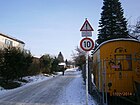
|
| Rousseauweg
( Location ) |
150 | Jean-Jacques Rousseau (1712–1778), philosopher and writer | June 4, 2002 | The private street opens up a U-shaped single-family residential complex from Kreuzgraben street . This residential complex with 16 residential buildings is located south of the green belt at Kreuzgraben, so that the Kreuzgraben road that leads from Beuthstraße is a dead end . |

|
| Rudolf-Ditzen-Weg
( Location ) |
280 | Rudolf Ditzen (1893–1947, pseudonym: Hans Fallada ), writer | Apr 9, 1994 | Since 1937 Eisenmengerweg after the writer Eisenmenger designated to the forefront of anti-Semitism holds the road was in 1951 as Majakowskiweg , matching the Majokowskiring in Pankow town named. In 1994 he was renamed after Ditzen. The path divides the Majakowskiring in the middle and continues south as an access for the houses north of the Panke, this part was previously named Majakowskiring and was included in the Rudolf-Ditzen-Weg. "Until 1994 the street was still called Mayakowskiweg, but since it was often confused with the ring, the street was simply named after the real name of the well-known writer who lived here at number 19 from 1945." |

|
| Rudolf-Majut-Strasse
( Location ) |
280 | Rudolf Majut (1887–1981), linguist, poet | Jan. 10, 2006 | Rudolf-Majut-Straße was called Straße 107 until it was renamed . It is located between Kuckhoffstrasse next to Kreuzgraben and in the arch to Dietzgenstrasse. “ Strasse 107 in Niederschönhausen was named after the literary scholar, linguist and poet Rudolf Majut. The new street sign [was] unveiled on February 9th at 10 am ”. Rudolf Majut taught at the school (now the 'Max-Delbrück-Gymnasium'), which is opposite the street named after him. The short street is built on with a block of flats from the 1920s. On the south side of the street is the residence of the Ambassador of Mongolia. The road ends at the Mongolian embassy as a dead end with a small playground. “The nomination was made at the request of the pro-List-Gymnasium e. V. and the Freundeskreis Chronik Pankow e. V., because the life and work of Rudolf Majut should be honored. " |
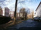
|
|
Sachsenstrasse
( Location ) |
360 | Saxony , Germanic tribe | before 1907 | Located between Germanen- and Wodanstraße, Sachsenstraße continues over the latter through Straße 90. The street was first mentioned in the Berlin address book in 1907. Of the initially planned and routed, partly laid out streets according to Germanic tribes on Germanenstraße in the north of the district, Sachsenstraße was the last to remain renamed. |

|
| Schiller Street
( Location ) |
740 | Friedrich von Schiller (1759–1805), poet and writer | 1903 | It leads from Dietzgenstraße below the Nordend tram station to the east to over Straße 18, on which the M1 tram route runs to the final stop. The entire complex of Karl Mohr's tramway settlement from 1927 to 1930 in Schillerstraße 23-37, as well as the adjacent tram depot, the closed tram depot Niederschönhausen , are included in the list of monuments. In 2003, 130 Buddy Bears were freshly painted in the BVG depot in Schillerstraße as an advertising campaign for the State of Berlin before they were auctioned worldwide. |

|
| Schlossallee
( Location ) |
1360 (in the district) |
Avenue from Schönhausen Palace | 1746 | The avenue was laid out as a connecting route from Schönhausen Palace to the Chaussee to Pasewalk, the street leading into the Uckermark . It is located between Schlosspark and Pasewalker Straße in the French Buchholz district , with the last few meters already being in that district. The Schloßallee leads from the Pasewalker Straße directly to the Schönhausen Palace and the Schönhausen Palace Gardens, the access to the palace leads around the boundary wall. The eastern part of the street is partly built with stately villas from the beginning of the 20th century. The western part ends as an avenue in Schönhausen Palace Park. |

|
| Schönhauser Strasse
( Location ) |
120 (in the district) |
Way to Schönhausen | before 1908 | The street is shown on the original Mes table sheet as a connection between Rosenthal and Niederschönhausen. Before 1921, Rosenthaler Strasse was integrated into Schönhauser Strasse - as a continuation to the Niederschönhausen area. The street lies between Dietzgenstrasse (opposite Schillerstrasse) and Nordendstrasse in the district. |
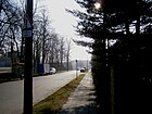
|
| Schreckbachstrasse
( Location ) |
240 | Paul Schreckenbach (1866–1922), writer | Nov 9, 1926 | Before 1926, Schreckenbachstraße was laid out as Straße 58 according to the numbering in the development plan and laid out under this name. It is located between Nordendstrasse on the edge of the district and Altenberger Weg. |

|
| Schützenstrasse
( Location ) |
120 | Sagittarius | 1904 | The street was named in reference to the rifle house of the Berlin rifle guild, built from 1882 to 1889, from which the street runs south. In 1890 the Xth Federal Shooting was held in Schönholz. Around 1943 the street was not officially referred to as "Am Schießstand". The street lies between Hermann-Hesse-Straße / Straße vor Schönholz and Buddestraße / Am Bürgerpark on the western edge of the Pankow III cemetery. Between 1961 and 1989, it was on the district boundary of Reinickendorf in the border strip of the Berlin Wall . Until the section leading to the north was included in Kurt-Fischer-Straße, Schützenstraße led to the shooting range and the Schützenhaus in Schönholzer Heide between Buddestraße and, in a second section, continuing Germanenstraße to the intersection of Friesen- / Kaiserin-Augusta-Straße ( since 1950 Tschaikowskistraße corner Hermann-Hesse-Straße) at the bridge over the Zingergraben. In the address book is the street between Schönholz and Bahnhofstraße, via Hartig-, Podbielski- to Kaiserin-Augusta-Straße and continued on Bismarckstraße. There are no buildings on the street; between Bahnhofstrasse and Hartigstrasse, it bordered the Second Municipal Cemetery , which was only later expanded, so that Hartigstrasse was de-dedicated. The section of Schützenstraße, which initially stretched as far as Friesenstraße between the Schützenhaus and the edge of the cemetery, was included in Bismarckstraße at the end of the 1930s; in the 1940 address book it is only given up to today's Hermann-Hesse-Straße. |

|
| Selma and Paul Latte Square
( Location ) |
60 m × 50 m 30 m in the district |
Paul Latte (1878–1943), Selma Latte (1878–1943) | April 13, 2016 | The previously unnamed public area in the area of Beuth-, Buchholzer, Charlottenstraße was named at the request of the members of the Stolperstein group; the request was expressly approved by the Office for Further Education and Culture, Department of Museum / District History. The nameless square is in the immediate vicinity of the historic site. This reminds of the activities of the Lattes and of the victims of a camp in the urban area. The Hachscharahlager in the middle of the district is brought into the social consciousness and the memory or history assigned to the rural area is highlighted. |

|
| Siegfried-Baruch-Weg
( Location ) |
150 In the district |
Siegfried Baruch (1901–1973), educator | July 25, 2007 | The route laid out as road 110 in the development plan was named in 2007. “The decision to rename Straße 110 in Wilhelmsruh to Siegfried-Baruch-Weg, which was decided in April [2007], is now legally effective, announced the Pankow district office. Siegfried Baruch (1901–1973) was, among other things, a teacher and educator at the Second Orphanage of the Jewish Community on Berliner Strasse. “This footpath is between Niederstrasse / Waldsteg and Heegermühler Weg. It is the boundary of the district from Niederschönhausen to Wilhelmsruh. The allocation according to the map of Berlin 1: 5000 lays the way to Wilhelmsruh, according to the database of the regional reference system is called Niederschönhausen. | |
| Siegfriedstrasse
( Location ) |
580 | Siegfried , hero of the Nibelung saga | 1902 | It lies between Wackenbergstrasse on Herthaplatz and Schloßallee, where it crosses Blankenburger and Rolandstrasse. In the location not far from the castle complex , it was also built on at an early stage. Wilhelminian style villas are still here. It should be noted that on October 24, 1908, with the opening of the Nordend / Schillerstraße tram route, a loop (Kaiser-Wilhelm-Straße -) Blankenburger Straße - Siegfriedstraße - Buchholzer Straße - Blankenburger Straße (loop ride) was established. However, it is only entered on the map from 1954 between Blankenburger Strasse and Schloßallee, the northern part, especially along the cemetery, is marked as a built-up area without a road. |

|
| Skladanowsky Street
( Location ) |
520 | Max Skladanowsky (1863–1939), film technician | May 31, 1951 | It lies between Blumenthalstrasse and Treskowstrasse and crosses Friedrich-Engels-Strasse, parallel to Wilhelm-Wolffstrasse and Kuckhoffstrasse. The street was laid out around 1899 and was called Wrangelstraße from then on , parallel between Moltke- and Blücherstraße was named after the popular Prussian general Papa Wrangel . |

|
| Stechowstrasse
( Location ) |
150 | Peter Stechow , heir and feudal mayor in Buchholz | Oct 1, 2000 | The street is an unpaved southern cul-de-sac from Wackenbergstrasse. Before the name was given in 2000, it was also called Wackenbergstraße as a side street and consisted of the route from Straße 13 . It was introduced as an independent street in 2000 and opens up the adjacent industrial park. From 1700 to 1757 Stechow was Schulze in the neighboring French town of Buchholz . |

|
|
Quiet street
( Location ) |
240 | Quiet , calm road situation | May 4th 1950 | From the end of the 19th century until 1950 the traffic route was called Friedrich-Wilhelm-Straße after Kaiser Friedrich III. It is located north of Mayakowskiring to Tschaikowskistraße. "But the Mayakowskiring with its cross streets is not a dusty residential area of the eternally yesterday ..."
In 2012, the public resistance of a senior leisure facility established in this street (house number 10) caused a sensation. The two-storey villa from 1927 was in need of renovation, but since the district office did not provide any money for it, the house should be demolished and the property sold. The council employees did not offer the seniors any other location, because there were “enough other meeting places in the area”. Around 50 victims organized an active resistance through occupation , whereupon a sign at the entrance area called “We'll all stay - Silent Street is everywhere”. After several unsuccessful efforts for financial support, the social association Volkssolidarität (VS) took over the organization of the house, but even it could not raise the sum necessary for the renovation. Even the member of the Bundestag, Klaus Mindrup , campaigned for such an institution. Finally, the district office found a plot of land near a former car repair shop (address Tschaikowskistraße 14) that is owned by the federal government and could sell it at a reduced price for social housing in Berlin. The Gesobau housing association agreed to build a new senior citizens' club on the property, and VS would be available again as the operator. In March 2018 the time had come: after months of secret negotiations , this project came about, and Gesobau signed the purchase contract. Now the construction plans follow, the securing of the financing, if necessary through the use of subsidies. Until the new building is finished, the seniors renovated everything in the previous villa themselves and had a stairlift installed. This work was completed on October 7, 2018 and, after an inauguration ceremony, the villa will once again serve as a meeting place for young and old until the completion of the new senior citizens' meeting on Tschaikowskistraße. The villa will continue to be used after 2020. As of the beginning of 2018, the Förderverein Stille Straße 10 had more than 200 members, 23 working groups have their meeting place in the building, including English language , gymnastics , chess , painting . |
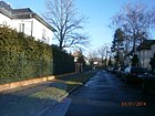
|
| Street 18
( Location ) |
230 | Number according to the B plan | after 1920 | It lies between the east end of Fritz-Reuterstrasse and Schillerstrasse with the final loop of the M1 tram ( line 46 until the end of 1999 ). The street was not mentioned in the Berlin address books until 1943. In the mid-1950s, street 18 and its cross streets were laid out in their current form, but there is fallow land and it is not built on. This cobblestone street with two unpaved sidewalks was built with residential buildings in the 1950s on plots 9–37 (odd) and 10–30 (even). At the southern end of the street on plot 37, the school sports hall for the elementary school in Hasengrund at Charlottenstraße 19 was built in 2011 . The residential complex opposite this to the south has the plot of land at Fritz-Reuter-Strasse 21-21h; Strasse 18 was not extended to the south. |
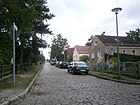
|
| Street 33
( Location ) |
160 (in the district) |
Number according to B-Plan (Reinickendorf Ost); | after 1930 | The unpaved road with a two-lane paved roadway without sidewalks and street sewerage belongs to the settlement between the Soviet memorial and the S-Bahn and is an offset extension of the cooperative footbridge (up to its connecting section to the Waldsteg) and continues unconnected in Wilhelmsruh . When it was created in the arbor colony, it still belonged on this side of the railway line to Reinickendorf Ost. The street has its original course from the Kopenhagener Straße to the Schönholz arboretum. Although there is still a cross street going off Copenhagener Strasse in Wilhelmsruh, with new residential buildings built on the north side, but the strait ends at the industrial site of the "Berlin expansion" and through the "KGA Am Bahnhof Wilhelmsruh" there is no passage or unoccupied land. In the district there are plots 21–37 (odd) and 22–36 (even) with single-family houses and gazebos. |

|
| Street 39
( Location ) |
130 | Number according to the B plan | after 1930 | Straße 39 is a cross street from Straße 41 and borders the commercial complex on Blankenburger Straße to the south. Street 39 is listed for the first time in the Berlin address book in 1937, initially only listed as a cross street with Street 41. The location between Straße 13 (since 2000 Stechowstraße) and Grumbkowstraße is noted for 1939 , and it also crosses Straße 40 (not mentioned later) . Between street 18 and street 40 are the undeveloped lots 1–11 (odd) and 2–12 (even), to street 41 there are undeveloped 13–23 (odd), opposite are 25–29 (odd) and 32, 34 with residential buildings built on (29 belongs to street 41 no. 13, 32 to street 41 no. 12). Between Straße 41 and Grumbkowstraße there are again vacant lots (31–41 and 36–42). The same information is given for 1943. The location of the street was already shortened in the 1950s and ends to the west at commercial buildings, the eastern location still ends at undeveloped land. Road 39 is an unpaved access road west of road 41 about 70 meters to the housing estate no.27, opposite is the commercial building road 41 no.11. From road 41 to the east it leads to plots 33, 35 on north and 34 , 36 on the south side and ends here at the rear of the commercial building on Grumbkowstraße. |

|
| Street 41
( Location ) |
460 | Number according to the B plan | after 1930 | The street 41 lies between the Wackenberg street and the Blankenburger street and crosses the street 39. The street that continues on the Blankenburger street belongs to that street. The eastern side is located with settlement houses on lots 4–24 (straight, including 6a, 6b, 8a, 20a), between 12 and 14 intersects street 39, the corner lots belong to Wackenbergstraße 92 and Blankenburger Straße 107. Located on the east side The commercial complex is located south of Street 39 on No. 11 (where 1-7 belong to it), to the north are the residential plots 13-23 with residential houses and the corner plot belongs to Wackenbergstrasse. It is listed for the first time in the 1937 address book. The corner properties (103/105 and 107) belong to Blankenburger Straße, to the south of Straße 39 there are four residential buildings on the left and three on the right to Hermannstraße (since 1937 Wackenbergstraße), the properties are not numbered in 1937. For 1942 the plots are given from 1–25 (odd) and 2–26 on the right. Lot 1 belongs to Blankenburger Straße 103/105 and 26 to Wackenbergstraße 96. Buildings are 13–17 (odd, south of street 39) and 2–26 (even), lot 20 did not exist in 1942, but is later (No. 20 and 20a) have been built on. Between Blankenburger Strasse and Strasse 39, 3–11 are undeveloped, and 19 and 21 towards Wackenbergstrasse. On the east side (straight plots) 6 is undeveloped (1943 as a construction site, 1939 as a pergola), on the west side there is no. 24 in 1943 still undeveloped. 1943 is listed for plot 20 "does not exist", today's plots 20 and 20a are marked as commercial areas and lie behind residential plots 16–24, they border on the commercial area of Grumbkowstrasse 65 in the east and Wackenbergstrasse 100 in the north. Street 39 crosses between street 41 nos. 12 and 14 (east side) and to the west between commercial property 11 and residential property 13. |

|
| Street 78
( Location ) |
280 | Number according to B-Plan (Reinickendorf Ost) | after 1935 | The unpaved road belongs to the Schönholz settlement (until 1938 Reinickendorf) between the Soviet Memorial and the S-Bahn and forms the western road at the transition to the Wilhelmsruh district . The odd plots 3–21a are in the district, 2, 4, 8, 10, 12, 24 belong to wilhelmsruh. In the address book for 1939 and 1943, street 78 "Post Bln. = Reinickendorf O." is recorded with the location between Laubengelände and street 33 across street 79 , on the left side with two built-up properties in front (on the railway side, to the arbor area ) and three developed plots on the street 33. On the right are two pieces of land in front of the street 79 and then seven single-family houses, a summer house, construction sites and four other houses up to the corner of street 33. The properties up to 100 meters east of the embankment were abolished in the 1960s by the border installations of the Berlin Wall . The embankment on the trajectory of the Northern Railway constitutes at least since the reorganization of the administrative regions of 1938, the district border to Reinickendorf, characterized was on this strip as state border running border between West Berlin Reinickendorf and the East Berlin Pankow in a width of 100 meters. The Wall Trail and an area of the "birch grove on the former death strip" now run here. |

|
| Street 79
( Location ) |
200 | Number according to B-Plan (Reinickendorf Ost) | after 1935 | The dirt road belongs to the settlement between the Soviet memorial and the S-Bahn and is located on the western edge of the settlement between streets 33 and 78 and across the middle walkway . In 1939 the street 79 is listed in the address book with the addition "Post Bln. = Reinickendorf O.". Their location is indicated between Straße 78 and Straße 33, there are ten buildings on the left and nine on the right. The properties up to 100 meters east of the embankment were abolished in the 1960s by the border installations of the Berlin Wall . Since the reorganization of the administrative districts in 1938 at the latest, the embankment along the northern line has formed the suburb of Reinickendorf, which means that the border between West Berlin's Reinickendorf and East Berlin Pankow was 100 meters wide on this strip . The Wall Trail and an area of the "birch grove on the former death strip" now run here. According to the Berlin map (1: 5000), the course of the former platform at the southern end is continued as street 79. This is where the undeveloped plots 24-34 (straight, southern side) between street 78 (district boundary to Wilhelmsruh) are assigned, which are here at the Built-up plots on the north side partly to the middle walkway. The area following eastward in the former wall strip is not parceled out. |

|
| Street 89
( Location ) |
130 | Number according to the B plan | after 1950 | It is indicated on various maps as the southern cul-de-sac of Nordendstrasse and thus leads into the LSG Zingerwiesen. The street 89 is registered parallel to the east of Frickastraße and the KGA Am Anger (formerly: KGA Hessen), the Nordendstraße south of the Tempelgraben along west of the Blumenthalstraße is also just an unpaved road that forms the boundary of the district. On the map 1: 5000 Berlin of the district surveying offices, the street in the LSG Zingerwiesen is entered without precise guidance and in the RBS database and the LOR list of the statistics office are plots 2, 3, 4 and 5 (consecutive ) recorded. In 1987 street 89 is listed. In the Berlin address book until 1943 it is not noted, on the map from 1954 and on the aerial photo from 1953 on Google Earth there is fallow land. The location of road 89 is shown on maps at Nordendstraße 35 to the south, there is no road sign on site in 2013, only a field path between LSG 'Zingerwiesen' and allotment gardens. |

|
| Street 90
( Location ) |
90 | Number according to the B plan | after 1950 | Straße 90 is a dead end between Wodanstraße (opposite Sachsenstraße ) and Frickastraße to the east. Plots 2–10 (4a) on the south side, which were not built on until 2010, belong to the street. The three northern plots belong to Wodan and Frickastrasse. The cul-de-sac is due to the LSG Zingerwiesen (when the settlement houses were built) only an unbuildable wetland. With the new buildings at An den Zingerwiesen, the property boundary at No. 21 is here. In the address book from 1940 and 1943 an undeveloped road 90 between Eschenallee and Taufsteinweg is recorded, today's Abajstraße in Rosenthal-Nordend (then: Niederschönhausen-Nordend). The undeveloped road 91 is listed between Fricka- and Wodanstraße. Street 90 . In: Berliner Adreßbuch , 1943. “Straße 90 ← Eschenallee → ← Taufsteinweg → (undeveloped) / Straße 91 ← Frickastraße → ← Wodanstraße → (undeveloped)”. |
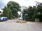
|
| Street 97
( Location ) |
400 | Number according to the B plan | after 1950 | It is an unpaved road between Treskowstraße and Waldstraße. The site of the former waterworks is located south of Strasse 97 to Uhlandstrasse. Until 1943 a street 97 was not included in the Berlin address books. Around 1954 there was the extended Treskowstraße to the east of the sports field and a path leading from it to the east. This course is still included on the map from 1989. Plots 1-18 belong to street 97 (continuously on the south side), on the north side 30, 38, 39, 40, 41 (the latter towards Treskowstraße). The Treskowstraße (which is also unpaved here) bends directly to the east into Straße 97, and the sports field has obviously been extended to the east as far as plots 38–41 and Pfarrer-Lenzel-Straße. The road goes east to Waldstraße only in the width of a footpath. |

|
| Street 103
( Location ) |
300 | Number according to the B plan | after 1910 | It lies between Wackenbergstrasse and Blankenburger Strasse to the east, parallel to Klothildestrasse. In the 1932 address book it is listed between Blankenburger and Hermannstraße (today: Wackenbergstraße) and with the Haase'schen house built on. This house mentioned in 1943 as number 18 is supplemented with five more and a summer house on road 103, 1–11 are arbor grounds and on the right side 2–18 are still unallocated parcels and on Wackenbergstraße follows the summer house (20) and then arable land. The latter (east of the street) existed until the 1960s and was later used as an industrial park. There are also residential houses on both sides of the street. According to the official plan, plot 20 extends across the width of the street, but only separates it as a narrower passage. |

|
| Street 104
( Location ) |
90 | Number according to the B plan | after 1935 | Road 104 (later in the Birkenwäldchen) is indicated on various maps for the Schönholz settlement (belonging to Reinickendorf until 1938) west of the Schönholz park between the Soviet memorial and the S-Bahn south parallel to the central bridge. The route east of road 79 is parallel to the northern line in the "birch grove on the death strip" (between Copenhagen and Klemkestrasse), where the former walled strip was between 1961 and 1990 . An unnamed street along the border between the French and Soviet sectors (West and East Berlin) is shown in the 1961 city map. The property details (left side) according to FIS-Broker are noted with 320–326 on the cross piece of street 79 , belong to the middle walkway . The area consists of the birch grove with a forest path and access from road 79. In the 1943 address book, road 104 is not listed. On the other hand, the bridge is named for this route. Otherwise a section of the Lübarser Weg runs here . |
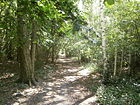
|
| Street 199
( Location ) |
170 (in the district) |
Number according to the B plan | after 1930 | As a branching road, it leads northwards from Blankenburger Straße on the border with French Buchholz . In the further course it turns east into the neighboring district. The access road to the adjacent properties is a single-lane strip of asphalt with unpaved edge strips (sidewalks) designed by the residents; it is built on with residential buildings. According to the information in the RBS database system, plots 1–17 and 29–39a belong to Niederschönhausen. As a result, the district boundary would lie on the street, both on the western properties in the section from Blankenburger Straße to Winkel (in front of the commercial property) and on the eastward section to Straße 182 further including the northern properties. However, the representation on the official map of Berlin 1: 5000, which is produced and published by the district surveying offices, is also located on the eastern plots 2a-18, whereby the north-facing section belongs fully to the district and from the east-facing section only the road to in Height 33/34 around the district, but not the properties themselves. Plots 2a – 18 |

|
| Street in front of Schönholz
( Location ) |
630 | Schönholz , location in the west of the district | around 1929 | The road connection was probably initially unnamed. The plots in the permanent numbering are already listed in the 1898 address book under the special section Schönholz without an additional street name. From 1763, linen weavers and cloth makers for silk settled on the edge of the royal mulberry plantation from Saxony and Swabia. This colony (now largely coinciding with the Schönholzer Heide Volkspark ) was named Schönholz in 1791, and there was a road connection from Schönhausen Palace. This street is located between Hermann-Hesse- / Schützenstraße and Tuchmacherweg at the disused Pankow V cemetery . The garden monument of the Volkspark Schönholzer Heide is to the east of the street . In 1943 the street in front of Schonholz continued the Germanenstraße (to the south) and is marked with "Post Bln. = Reinickendorf = Ost". This is followed by the II. Friedhof d. According to Niederschönhausen in front of the Tuchmacherweg on the east side. The plots 1–16 (consecutive) follow until 17 with the Volkspark Schloss Schönholz owned by the Schützengilde. On the west side there is the Strohschein'sche Haus, in the further arbor area, two residential buildings and construction sites to Felseneckstraße without buildings, the Provinzstraße followed by the retirement home with the address Provinzstraße 66-71, then it turns into the Bismarckstraße. From 1930 to 1938 the street in front of Schönholz is listed in the address book under the location Schönholz separately from Niederschönhausen. Until the district change, the street lies on the district border between Pankow and Reinickendorf, only the buildings (1–17) on the left (eastern) side of the street are listed and the street area belonged to today's district. As of the 1939 address book, Schönholz is no longer listed separately, the street in front of Schönholz remains unchanged. On the other hand, the course of the road on the map in the address book from 1915 is listed southeast around the Schönholz colony and along the border of the suburb Niederschönhausen with Reinickendorf to Schützenstraße as Germanenstraße , in the address book 1920 the Germanenstraße is to the south of the Wilhelmsruh district , to East Kepler- , Teutonen-, Sachsen-, Friesen-, Franken-, Normannen-, Cheruskerstraße, Schönholz, Platanenstraße and to West Kepler-, Cimbern- Keltenstraße. The course of the road in front of Schönholz is included under Schönholz, but not named. Germanenstrasse merges with the street in front of Schönholz at the southern edge of the cemetery. The Tuchmacherweg goes off between plot 1 and 2a. Until opposite the provincial road follow the plots up to 16 (continuously) behind which the shooting range is. There is a discount store at 5 and a gas station next to it. Hermann-Hesse-Straße begins at the level of Schützenstraße. The Pankow youth traffic school is located on the south side on plot 20. The discounter department store is located on plot 21, 22 is a fenced green area, followed by the villa on 23 (embassy villa of the Republic of Zambia ) to the provincial road. The four-storey apartment buildings at 25 and 26 are between Provincial and Klemkestrasse, and after Klemkestrasse there are 26a, 27, and 28 with two residential buildings and a commercial building. Finally, the "KGA Straße vor Schönholz" is located on property 29, part of which has been rededicated to 30 for the garden center. |

|
|
Treskowstrasse
( Location ) |
850 | Sigismund von Treskow (1864–1945), District Administrator of the Niederbarnim district, promoted the development of the northern and eastern suburbs of Berlin | after 1899 | It is located between Waldstrasse and Strasse 97, parallel to the western Friedrich-Engels-Strasse. The plots are numbered in horseshoe numbering from Waldstraße on the north side with 1 to the south corner with 69, although a few remained undeveloped. It is a four-lane asphalt road with sidewalks and trees that merges north of Uhlandstrasse into an unpaved, four-lane sand road with no sidewalks. The tenement house No. 1 (together with Waldstrasse 87) from 1906 ,. the houses No. 63/64 from 1905/1910 (see picture) and No. 65 (1903-1905) are architectural monuments. The name giver was the Prussian agricultural reformer and landowner Carl von Treskow , who promoted the development of the northern and eastern suburbs of Berlin. Treskowstraße is listed in the address book from 1903 onwards. Developed on Waldstrasse with John'schen Haus, between Blücherstrasse and Platanenstrasse is Krüger'sche and (opposite) Prohmann'sche Haus, further on Eichenstrasse and Uhlandstrasse, only to the west are Wrangelstrasse and Moltkestrasse the latter is noted as a new building. Ten years later (1913) the residential and apartment buildings numbered 1–67 (up to 20 tenants) were built on No. 37. In 1923 there were still 37 developed plots, in 1933 there were 40 and finally in 1943 46 developed plots, with the coal field at No. 12 for 20 years and in 1943 there are still 24 undeveloped plots, which apart from 30–36 and 38– 42 between Uhlandstrasse and Eichenstrasse are otherwise isolated between the houses. There are two stumbling blocks in front of houses 1 and 59 . |

|
| Tschaikowskistraße
( Location ) |
410 | Peter Tchaikovsky (1840-1893), Russian composer | May 4th 1950 | From 1789 as Charlottenburger Weg and renamed Kaiserin-Augusta-Straße before 1900 , the current name was given in 1950 in connection with the name changes in the small town of Pankow. It is a cross street of Grabbeallee and lies between Hermann-Hesse-Straße and Kreuzgraben in the direction of Schönhausen Palace . Tschaikowskistraße 1 is the postal address of the castle. Several houses along the street are on the list of monuments, some with their front gardens and ancillary buildings. This includes the ensemble 39–50, as well as individual houses in the entire complex. The "guest house of the GDR government [as] a four-story building was built in 1968 in the street. While high-ranking state guests such as Fidel Castro , Indira Gandhi , Willy Brandt and Michail Gorbatschow stayed at Schönhausen Palace, the employees and security staff moved to the neighboring guest house. " |

|
| Tuchmacherweg
( Location ) |
180 | Clothier that here because of the mulberry plantation were settled | Jan. 23, 1931 | Before 1929 it was initially laid out as a school route and renamed in 1931. It leads as a cul-de-sac from the road in front of Schönholz to the northeast into the Schönholzer Heide and is located on the southern edge of the Pankow V cemetery . In the address book from 1943 they must bear the words "Post Berlin = Reinickendorf = East" from the street outside Schönholz via a private road in the Schönholzer Heide leader and orientation numbering are on the left side (cemetery side) the plots 1-17 and right 2 –16 (straight) built with a total of seven houses. The plot numbering still exists, several of the plots on the cemetery side (including 12a) were only rebuilt with settlement houses in the 2000s. The corner plots 1 and 2a, 2b belong to the street in front of Schönholz. |

|
|
Uhlandstrasse
( Location ) |
1310 | Johann Ludwig Uhland (1787–1862), writer and politician | 1899 | It is located between Zingergraben and Dietzgenstraße and crosses Friedrich-Engels-Straße. The waterworks in house no. 20 is a monument. |
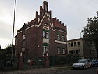
|
|
Club footbridge
( Location ) |
170 | Association , here community of settlers | after 1938 | Initially officially named as street 84 , it is the fifth way of the settlement from street 79 counting eastwards, it goes directly from the street in front of Schönholz. The unpaved road belongs to the " Schönholz allotment garden colony" between the Soviet memorial and the S-Bahn and is located south across the central bridge on the eastern edge of the settlement. In the address book of 1941 the club path with the additions “Amtl. Naming Straße 84 ”and“ Post Bln. = Reinickendorf O. ”added, plots 1 between Wald- and Mittelsteg and 2–7 between Mittelweg and Straße vor Schönholz are built on. The Verekrhsweg Vereinsteg begins between the Waldsteg 1 and 2 property, followed by the Vereinssteg 1, 1a, 2 and right 5, 6, 7 buildings on the left (north). The path leads past Mittelweg (plot 56) to the southeast on the site of the Berlin Wall, which once stood on a 100 meter wide strip to the embankment of the northern railway with its border facilities. The district boundary between Niederschönhausen and Reinickendorf is on the eastern edge of the railway embankment, after the Second World War it was the border between the western sectors and the Soviet sector , now used as the Berlin Wall Trail . |

|
|
Wackenbergstrasse
( Location ) |
1420 (in the district) |
Wackenberg , district of Saarbrücken | March 11, 1937 | Of the Nazis was Hermann street named in memory of the rallies at the Wacken Berg, came as the Saar after the vote from 1935 back to Germany. Wackenbergstrasse is located between Dietzgenstrasse and Grumbkowstrasse and continues from Strasse 199 to the French Buchholz district . The residential and commercial street is built on with single and multi-family houses, at the northwestern end the street borders on the Brosepark. In the middle area there are some unused commercial buildings from GDR times that are waiting to be demolished or embellished. The change from a residential street (in the old part) to a commercial street visibly runs from west to east, whereby in the Buchholz section the street also becomes an unpaved road. Already before 1900 streets were laid here east of the center of the suburb around Brosepark and Herthaplatz, including Hermannstraße , named after the male first name, which Hermann the Cheruscan may have influenced the choice of name for the street built around 1900. In the address book of 1903, R. Schäfer's house with a larder is entered on a piece of land between Hertha = Platz and Charlottenstrasse. |

|
| Waldemarstrasse
( Location ) |
390 | Waldemar von Brandenburg (1280-1319), Margrave | 1899 | The street lies between the Rosenthaler Grenzweg and the Herthaplatz / Buchholzer Straße with a break at the Fritz-Reuter-Straße. |

|
| Waldowstrasse
( Location ) |
740 | Wilhelm von Waldow (1856–1937), Royal Prussian State Minister, District Administrator of the Niederbarnim district | 1894 | The quiet residential street with single and multi-family houses lies between Schillerstraße and Herthaplatz, and here at the entrance to the Pankow IV cemetery. Max Skladanowsky's house at Waldowstraße 28 from 1896 to 1899 is included in the list of monuments . |

|
| Waldsteg
( Location ) |
820 | To the north the forest of the Schönholzer Heide | after 1935 | The dirt road along the Schönhauser Heide was laid out around 1938, but was only named later. In the 1940 address book, the Waldsteg is mentioned under this name as "not an official name", and the information "Post Bln. = Reinickendorf O." is included. The right-hand side is marked with the Volkspark up to the Rosenthal ( Wilhelmsruh ) district and the right-hand side with the properties 1–43 (continuously) between Straße vor Schönholz and Straße 79. The plots are built up to street 78 (1–12, including 11a), then eleven residential buildings, undeveloped construction sites (12a, 13, 17, 18, 31, 37, 38, 41) and unused plots (32– 34 and 44–51), 21–30 do not exist. There are now developed plots 1–18 (partly divided with the addition of a), 20, 21, 23 and further 35 to 50 (excluding 48, 49). Lot 60 with the KGA Am Bahnhof Wilhelmsruh belongs to Wilhelmsruh, it follows on the park side 62 ( tennis court ), 64 (to the memorial), 65 (restaurant-café picture of the historic Waldschänke in Waldsteg 20 ). The path belongs to the settlement between the Soviet memorial and the S-Bahn and lies between the road in front of Schönholz and the district boundary to Wilhelmsruh, it is the access to this settlement area whose northern boundary to the Schönholzer Heide forms it. After 1961 it led to the settlement near the Berlin Wall . The adjoining memorial to the Soviet fallen in the Volkspark Schönholzer Heide and the Volkspark Schönholzer Heide are listed as a garden monument. The street belongs to the " Schönholz allotment garden colony", which belonged to Reinickendorf until the reorganization of the administrative districts in 1938. In 1940, "Post Bln. = Reinickendorf O." was added for the adjacent 80s streets. |

|
| Forest road
( Location ) |
1100 | The remains of the royal forest here | before 1900 | The street lies between Nordend- and Hermann-Hesse-Straße, parallel to the eastern Dietzgenstraße . At Waldstrasse 83 there is an oak tree that is more than a hundred years old and was trimmed in 2003 in order to preserve the dying tree for a few more years. The Waldstraße parallel to Dietzgenstraße is named after the forest of the Schönhauser spruce trees. On the map from 1905, parts of the former forest areas on the road are still present, but the original road planning was not fully implemented. |

|
| Walhallastrasse
( Location ) |
520 | Walhalla , place of the old Norse legend | before 1912 | Between the establishment of the street in 1904 and its renaming, it was initially called Donarstraße after the Germanic god Donar . It lies between Germanenstrasse and runs over Hundingstrasse to An den Zingerwiesen. |

|
| Wilhelm-Wolff-Strasse
( Location ) |
750 | Wilhelm Wolff (1809–1864), publicist | May 31, 1951 | The street lies between Treskowstraße and Zingergraben across Friedrich-Engels-Straße. It ends in the west at Zingergraben in front of the 'KGA Zingertal'. Since 1899, Moltkestrasse was named after Helmuth Karl Bernhard von Moltke , Chief of the Great General Staff of Prussia. On the map from 1915 it is drawn between Friesenstrasse and Treskowstrasse, with a forest in the south west of Kaiserweg (since 1951 Friedrich-Engels-Strasse), the north side is undeveloped. Road 26 continues into the forest across Blumenthalstrasse. On June 4, 2002, the road 73 was partially included as a cul-de-sac and has since been the cul-de-sac in the direction of the KGA “Alte Baumschule”. The street 73 is already mentioned in the address book in 1932 as a vacant independent street, at that time branching off from the Moltkestrasse . Country house no. 8 from the years 1903–1909 is included in the list as a monument. At Wilhelm-Wolff-Straße 39, “was the only Jewish children's home in the GDR until 1953.” Since the 1990s, the “Sonnenhof Hospice for terminally ill children” has been located there. In the Nazi era in 1925, plots 1–4, 6 of the 49 consecutively numbered plots were built on (4 and 6 with multi-party houses) on the north side, while the Jewish infant home is on plot 8/9. On the south side there is an apartment building on 35 with 18 tenants on Blumenthalstrasse and east of Kaiserweg there are 46–48 with single-family houses and 49 with one apartment building. |

|
| Wodanstrasse
( Location ) |
700 | Wodan , Germanic god of the storm | before 1911 | After the development plan was laid out as street 35 , it was initially also led under this name. The street is parallel to Germanenstraße between the end of Nordendstraße and Kuckhoffstraße. |

|
| Woglindestraße
( Location ) |
100 | Woglinde from the Nibelungen saga | Feb 23, 1925 | Previously laid out as street 95 in the development plan, it was laid out and named in 1925. Woglindestraße with lots 1–10 (continuous) is a southern cul-de-sac from Walhallastraße. In the 1935 address book, ten properties are listed between Walhalla and Platanenstrasse, but a construction site is indicated on Platanenstrasse without any land numbers being given. In the meantime, Woglindestraße ends at the rear of the property at Platanenstraße 53, 52 through which the Iderfenngraben runs open. |

|
|
Zingergraben
( Location ) |
520 | Road on Zingergraben along | Nov 9, 1926 | Previously referred to as Street 69 . The road surface, which is 30 meters wide, lies on the watercourse of the Zingergraben between the unpaved part of Uhlandstrasse a little further north of Platanenstrasse at LSG Zingerwiesen and KGA 'Am Anger' and Wilhelm-Wolff-Strasse in the south, where the watercourse gives way to the Zingertal colony from running on the road. The street consists of two cobblestone streets east and west of Zingergraben, which is bridged by Platanenstraße, Am Iderfenngraben and Kuckhoffstraße. The consecutively numbered plots 18–30 on the east side and 62–65, 76–78 on the opposite side belong to the street, corner plots are mainly assigned to the cross streets. According to the address book, these properties are already built on in 1943. For the projected and routed course, see road 69 |
|
| Zollbrücker Strasse
( Location ) |
120 | Zollbrücke , part of a municipality in Märkisch-Oderland | Nov 26, 1925 | Previously referred to as Street 80 . It forms a triangle with Uhlandstrasse and Dehmelstrasse , which borders on the LSG Zingerwiesen. In the 1943 address book between Gneisenaustrasse and Uhlandstrasse, ten single-family houses have already been built on, 1 is a garden and 8–11 and on the opposite there are construction sites. The Uhlandstraße is an unpaved route at the LSG Zingerwiesen. Plots 1–6 (continuously east side) and 12–16 are currently built on, a space of 25 × 35 m² has been created on Dehmelstrasse. |
|
Planned and former streets
The numbered streets are and were partially duplicated. The reason for this is that part of today's Pankow district belonged to Reinickendorf Ost and so streets according to the Reinickendorfer development plan were planned, laid out and laid out from Niederschönhausen. The official names of the 80s streets in the arbor and allotment garden colony Schönholz were finally added to the official list with the (initially) unofficial path names (ending “-steg”), they are located west of Germanenstraße. The streets in the north of Rosenthal / Wilhelmsruh with 80s numbers in the address books were in the area of Zollbrücker Straße, which was only later precisely traced, and to the west of it. From this area, the unnamed road 89 - a southern cul-de-sac of Nordendstraße - and road 90 - remained as an extended Sachsenstraße between Wodan and beyond Frickastraße, which was previously listed as Straße 88 . For the delayed development of the structure on the northern edge of the district towards Nordend, road 97 and road 101 were also used , and road 98 was only named in 1990 . The route positions on the adjacent map from 1915 give a picture of the settlement sequence.
Niederschönhausen with Schönholz is included in the "Address book for Berlin and its suburbs 1898" under the suburbs, later as part of the administrative district of Pankow. In 1898 the following streets were identified by name: Beuthstraße, Bismarckstraße , Blankenburgerstraße, Buchholzerstraße, Friedrich Wilhelmstraße , Kaiserin Augustastraße , Kaiser Wilhelmstraße , Kronprinzenstraße , Lindenstraße , Prinz Heinrichstraße (undeveloped), a private street (going from the Kaiserin Augustastraße with the house of Painter J. Scheffel), the Rosenthaler Grenzweg (west of Kaiser Wilhelmstrasse), the Königl. Castle (managed by castellan A. Sauer and inhabited by park rangers, gardeners, castle guards and castle servants), Schloß = Allee (with 23 houses off Blankenburgerstraße), Victoriastraße , Waldstraße and Waldowstraße. In 1901 Eichenstrasse, Hermannstrasse and Idastrasse were added.
| Former street name | from | to | renamed | Notes and current name |
|---|---|---|---|---|
| Altenbergstrasse | Nov 9, 1926 | May 15, 1938 | → Altenberger Weg | The street was named after the city of Altenberg and subsequently adapted to the usual spelling rules according to Duden. This initial description can also be found for other streets, such as the name that was changed to Karower Straße, which was initially and probably also called Karowstraße. |
| Platform | after 1935 | after 1960 | canceled | The unpaved road in the “ Schönholz allotment garden colony” ran parallel to the embankment that already belongs to the Reinickendorf district. For 1943 the footbridge between Felseneckstraße and 80er Straße to Straße 79, arbor area to the district Rosenthal (Wilhelmsruh) is recorded. At the latest with the construction of the Berlin Wall , the course came in the border area between West and East Berlin and was built over appetizers and main wall and sentry., As since the late 1990 Berlin Wall used. The remote border fortifications left space for the "birch grove on the former death strip". |
| Bahnhofstrasse | after 1905 | Nov 9, 1994 | → At the Bürgerpark | It was located along the Schönholz train station on the site of the freight yard between Schützenstrasse and Spandauer Strasse in the rural community of Pankow. In 1877 the northern line was expanded and the Pankow-Nordbahn (Prinzenallee) and Schönholz stations were set up. |
| Bismarckplatz | 1899 | May 23, 1951 | Kurt-Fischer-Platz | Before 1900, the square at the intersection of Bismarckstrasse and Kaiserweg / Lindenstrasse was named after the first Chancellor Otto von Bismarck . The square at the intersection of Hermann-Hesse-Strasse and Friedrich-Engels-Strasse / Grabbeallee was named in 1951 after Kurt Fischer , the resistance fighter against the Nazi regime, the Saxon Interior Minister and head of the German Central Administration for the Interior in the SBZ . The square in the Hermann-Hesse-Straße was named Pastor-Niemöller-Platz in 1992 . |
| Bismarckstrasse | 1899 | May 23, 1951 | Kurt-Fischer-Strasse | The street between Wilhelmstrasse (now a side branch of Dietzgenstrasse to the castle) and Harligstrasse (now occupied by the cemetery ) was named after the first Reich Chancellor Otto von Bismarck and continued on Schützenstrasse. In 1951 the street was named after the resistance fighter against the Nazi regime, Saxon Interior Minister and head of the German Central Administration for the Interior in the Soviet Zone, Kurt Fischer . In 1992 the street, extended by a piece of Schützenstraße, was named Hermann-Hesse-Straße . |
| Blücherstrasse | 1899 | May 23, 1951 | → Kuckhoffstrasse | The street was laid out between Wilhelmstrasse (since 1950 Dietzgenstrasse) via Kaiserweg (since 1951 Friedrich-Engels-Strasse) to Zingergraben and named after the well-known "General Vorwärts" from the Napoleonic Wars, Gebhard Leberecht von Blücher , Prince of Wahlstatt . In 1951 it was renamed, adding the section to Friesenstrasse. |
| Charlottenburger Strasse | before 1900 | before 1915 | → Rosenthaler Grenzweg | The street lay on the northern edge of the local border and led from Blankenburger Straße to the west to the border to the suburb of Buchholz , the continuous course until then is not completed and the street is not built on. It is the northern parallel street to Schillerstraße, which was also only built on at the corner of Kaiserstraße. With the construction of the Nordend tram station, the connection to Blankenburger Strasse was interrupted. In 1925 the continuation to the west (previously: Rosenthaler Grenzweg) is already included as Nordendstraße, the Charlottenburger Straße for Niederschönhausen is no longer included. However, this street name still exists in five other Berlin districts. The (original) Rosenthaler Grenzweg disappeared in 1925. On the map from 1915 the (already named) Nordendstraße is in Nordend (municipality of Rosenthal) and the Charlottenburger has been omitted in the course. In the record for Berlin and the surrounding area in 1925, the street is recorded as Rosenthaler Grenzweg. |
| Charlottenburg Way | 1789 | before 1900 | Kaiserin-Augusta-Strasse | The way from Schönhausen Palace past Schönholz was directed to Charlottenburg Palace. The route has been named Tschaikowskistraße after the Russian composer since 1950 . |
| Cheruskerstrasse | before 1908 | after 1927 | given up | The street named after the Germanic tribal association of the Cherusci was projected between Friesenstrasse and Germanenstrasse on the then district boundary. It would have been on the northern edge of the Schönholz cemetery . Since it would have led through the northern part of the Schönholzer Heide , it was not created after a public protest. |
| Danckelmannstrasse | before 1908 | March 10, 1937 | Wahnschaffestrasse | The street was mentioned in the Berlin address book in 1908. The name was chosen after the head of the Eberswalde Forest Academy, Bernhard Danckelmann (forest scientist) , because the street belonged to the “forest district” projected in the Schönholzer Heide around the turn of the century. 1910 still undeveloped. In 1937 it was renamed after the geologist Wahnschaffe , who had made a name for himself through geological mapping of the north German plains and ice age research. The further renaming from 1951 as Leonhard-Frank-Straße was adapted to the nearby Erich-Weinert-Siedlung . |
| Dohnastrasse | after 1908 | after 1961 | overbuilt | The street to the east parallel to Grumbkowstraße between Blankenburger and Pankower Straße was mentioned in the Berlin address book in 1910 and built over after 1961. Dohnastrasse is still entered on the 1954 city map. It was named after Sophie Theodore Countess von Dohna , who took her seat on Gut Niederschönhausen in 1664 and had the area around the Panke drained. After his death the estate was sold to Grumbkow. The name of this street on the eastern edge of the district as a local personality was chosen to match the side streets. In the 1930 address book the street between Schloßallee and Blankenburger Strasse is indicated as crossing Rolandstrasse. Plots 29, 31, 36, 37 are built on with residential buildings in horseshoe numbering from Schlossallee on the right. |
| Donarstrasse | after 1904 | before 1912 | → Walhallastraße | With the alignment, the road going off the Germanenstraße was (probably) initially named after the Germanic god of thunder Donar , matching the surrounding roads on the border with Rosenthal. It is not listed in the address book of 1907, the location of the street is shown on the map (without a name). Still undeveloped in 1915, it was already called Walhallastraße and is located between Germanenstraße and Wodanstraße to Zingergraben and immediately merges into Eichenstraße. The Walhallastraße was shortened later and ends in front of the LSG Zingerwiesen. |
| Village street | after 1790 | around 1892 | Kaiser-Wilhelm-Strasse | This oldest and central street in the village of Niederschönhausen, also known as the main street , had a connection to Schönhausen Palace to the south . With the increasing urban character of the development, it was named Kaiser-Wilhelm-Straße after the resident German Kaiser . In 1951 the name was changed to Dietzgenstrasse |
| Village road to Niederschönhausen |
after 1600 | around 1892 | Schlossstrasse | The connection between the villages of Pankow and Niederschönhausen led past Schönhausen Castle ; this name was common south of the castle. At the end of the 19th century, this connection past the castle became the Schloßstraße all the way to Niederschönhausen. In May 1948 the name was given as Ossietzkystraße from Pankow, north of the Pankebrücke in the Pankow district, the name was continuously assigned. |
| Eisenmengerweg | Dec 3, 1937 | Nov 6, 1951 | Mayakovsky way | Mittelstraße in today's Majakowskiring (formerly: Kronprinzen- / Victoriastraße) already existed as Prinz-Heinrich-Straße and was named in 1937 after the Hebrew and pioneer of modern anti-Semitism Johann Andreas Eisenmenger . Then came the renaming after the Nazi era as Majakowskiweg . The after the real name of the writer in 1994 Hans Fallada as Rudolf Ditzen Lane was named, who had found his grave in Pankow. |
| Felseneckstrasse | May 20, 1937 | July 31, 1947 | → Klemkestrasse | The Schönholzer Weg was named after the Felseneck colony in Reinickendorf during the Nazi era. In mid-1932, an SA storm troop attacked the Reinickendorf colony Felseneck , which was predominantly settled by workers. During this attack, the communist Fritz Klemke was shot. The unhealthy murder resulted in the victim being honored in 1947 by naming the street after him. |
| Frankenstrasse | before 1908 | after 1927 | given up | The street, named after the Germanic tribe of the Franks, was planned between Friesenstrasse and Germanenstrasse on the then district boundary. Since it would have led through the northern part of the Schönholzer Heide , it was not created after a public protest. In the 1910 address book, it is mentioned as undeveloped across Street 35 . |
| Friedrich-Wilhelm-Strasse | after 1895 | May 3, 1950 | → Quiet street | The connection from Kronprinzenstrasse to Kaiserin-Augusta-Strasse , which runs parallel to Schloßstrasse, was named after Emperor Friedrich III. named. In 1950, the insignificant street, which was built on with town villas, was renamed , renouncing the Hohenzollern tradition . |
| Genossenschaftsweg | around 1935 | after 1961 | → Cooperative walkway | The name of the central path of the cooperative settlement " Kleingartenkolonie Schönholz", which was built on Reinickendorfer area in the late 1920s , was adapted to the surrounding access path in the street name as a 'bridge' . |
| Georgstrasse | before 1900 | after 1903 | → Buddestrasse | Georgstraße was laid out on the edge of Reinickendorf Ost during the settlement around Provinzstraße and was named after the elector Georg Wilhelm, who ruled Brandenburg in 1619 . Soon the name of the short street between the Provincial Road and the entrance to the freight yard was named after the head of the Railway Department of the General Staff Hermann Budde , who was Minister of State and Minister for Public Works and Director General of the German Arms and Munitions Factory in Berlin. For 1910, the only building on plot 8 is a factory building for the Maschinen- und Mühlenbaugesellsch. mbH recorded by engineer Bollenbach in Reinickendorf Ost. |
| Gneisenaustrasse | before 1910 | May 30, 1951 | → Dehmelstrasse | The street is listed on the map in the address book in 1909 and named after August Neidhardt von Gneisenau . In the 1911 address book it is also included in the address section, but not built on. It was newly created. It lies parallel to other streets named after the Prussian military between Blumenthalstraße and the (then) unnamed western parallel street (1915: Straße 33 , since 1926 Zingergraben ) |
| Hartigstrasse | before 1908 | after 1931 | canceled | The street was intended for the projected forest district and laid out between Schützenstraße and Danckelmann- / Cottastraße. It was named after the forest scientist Georg Ludwig Hartig , who set up the forestry chair in Eberswalde at Berlin University . When this planned villa project was not implemented, the street remained undeveloped. Before that, the cemetery on the northern edge was bordered by Hartigstrasse. After the abolition of Hartigstrasse, the area remained as municipal property but was not yet used as a cemetery. Around 1940 this was extended to the north via Reussstraße to Podbielskistraße . A main path in the cemetery reminds of the location of Hartigstrasse. Hartigstrasse is still in the address book in 1931, but no longer in 1932. |
| Hohenzollernplatz | before 1908 | March 10, 1937 | Seckendorffplatz | The square was not named in 1907 but was already planned as the central square for the planned forest district, a round decorative square at the intersection of Danckelmannstrasse and Podbielskistrasse. The importance of the square in the planning was given by the naming after the Hohenzollern , the ruling family of the Prussian kings and German emperors. In the 1908 address book it is listed for the suburb of Niederschönhausen with the note "geh.z.Postbez.Pankow". It is built on with the Bock'schen house and all around there are construction sites. In 1937 it was renamed after the forest scientist Seckendorff , although it was based on other people, such as the President of the Reich Court of Justice Seckendorff-Gutend . The renaming of the square took place together with the road leading through it. The square was named after the writer Heinrich Mann in 1951 at the Erich-Weinert-Siedlung together with the crossing street → Heinrich-Mann-Platz . |
| Kaiserin-Augusta-Strasse | around 1893 | May 3, 1950 | → Tschaikowskistraße | The from the castle (which the imperial family belonged) to the west road leading was after Augusta of Saxe-Weimar-Eisenach wife Emperor I. William named. In 1897 it is listed between Schloßpark and Bismarckstrasse across Lindenstrasse . |
| Kaiserweg | after 1900 | May 24, 1951 | → Friedrich-Engels-Strasse | The street parallel to Treskowstraße in the direction of the villa colony Rosenthal-Nordend leads from Bismarckplatz to the northeast over Uhlandstraße and was named after the German Emperor. Parallel to Treskowstraße it leads from Bismarckplatz to the northeast via Moltke-, Wrangel-, Blücher-, Zieten-, Platanen-, Eichen- and also via Uhlandstraße. out. In 1905, lots 6, 65, 66 near Moltkestrasse were built on (continuously), the other lots belonging to Terrain-Gesellschaft Niederschönhausen mbH were undeveloped. In particular, the course to the north is initially open, but continues to the north end. |
| Kaiser-Wilhelm-Strasse | around 1893 | April 11, 1951 | → Dietzgenstrasse | The from the castle (which the imperial family belonged) to the north (the city center) leading street was named after the Emperor I. Wilhelm named. In the 1897 address book it is for the suburb of Niederschönhausen vom Königl. Schloß over Blankenburger Strasse and Beuthstrasse to Bismarckstrasse noted. |
| Keplerstrasse | around 1904 | Jan. 28, 1936 | → Heegermühler Weg | In the address book for 1905, Kepplerstraße, recorded between Rosenthaler Feldmark and Germanenstraße, is built on with two apartment buildings, but according to the map it is routed beyond these. It is still missing in the 1903 address book. The initial spelling of the street named after the astronomer Johannes Kepler (probably) goes back to the alternative name spelling. |
| Kronprinzenstrasse | before 1900 | May 4th 1950 | → Mayakowskiring (northern section) |
When the street was named, Wilhelm of Prussia was the Crown Prince as the successor to the German Emperor around 1900 . It is located in 1903 with six villas built between Schloßpark / Schloßstraße via Friedrich-Wilhelm- and Prinz-Heinrich-Straße to Victoriastraße, as the northern section of the ring. |
| Kurt-Fischer-Platz | May 24, 1951 | Aug 26, 1992 | → Pastor-Niemöller-Platz | Bismarckplatz , which existed four times in Berlin , was renamed by the (East) Berlin magistrate in an extensive naming campaign after the resistance fighter against the Nazi regime Kurt Fischer , who was chief of the German People's Police from 1949 until his death in 1950 . In 1992 the square was named after the theologian and resistance fighter against National Socialism, Martin Niemöller , who died in 1984 . |
| Kurt-Fischer-Strasse | May 24, 1951 | Aug 26, 1992 | → Hermann-Hesse-Strasse | The one in Berlin fifteen times
Alphabetical list of streets and squares in Berlin called Bismarckstraße was renamed by the (East) Berlin magistrate in an extensive naming campaign after the resistance fighter against the Nazi regime Kurt Fischer , who was a communist (SED member) in Saxony and the GDR government was active. The part of the Schützenstraße south of Hohmeyer- / Tschaikowskistraße used as the main street was included in the renaming. In 1992 this Niederschönhausen main street, which leads south-west into the "poet's quarter", was named after the writer Hermann Hesse . |
| Lindenstrasse | before 1900 | Sep 10 1936 | → Grabbeallee | The connection (probably) with linden trees between the new parts of Pankow on Florastraße and Niederschönhausen in the west of Schönhausen Palace flows into Kreuzstraße in the south. According to the 1898 address book, it is located between Schönholzer Heide and Bismarckstraße, with mostly multi-party houses built on most of the properties (especially towards Bismarckstraße). |
| Mayakovsky way | May 6, 1951 | Nov 9, 1994 | → Rudolf-Ditzen-Weg | The Prinz-Heinrich-Straße as the middle connection within the villa ring near the castle was named in 1951 together with the Mayakowskiring as a route after the Russian poet Mayakowski . In 1994 this short connecting road was renamed. |
| Moltkestrasse | 1899 | May 31, 1951 | → Wilhelm-Wolff-Strasse | The street named after the Prussian Field Marshal Moltke is the southernmost of the “Generalsstraßen” and was laid out between Friesenstraße and over the Kaiserweg to Treskowstraße. Ultimately, however, it was only laid out as far as Zingergraben and in 1943 it was almost completely built on, Treskowstraße, Kaiserweg, Blumenthalstraße, Zingergraben. The renaming in May 1951 took place in a naming action of the magistrate in which (also) streets were given new names after the Prussian military, and through the formation of Greater Berlin this street name was used twelve times in the city. |
| Normannenstrasse | before 1908 | before 1934 | Zietenstrasse (partly) | The street, named after the Germanic tribe of the Normans , was planned between Wodanstraße and Germanenstraße on the boundary of the district at that time. Since it would have led through the northern part of the Schönholzer Heide, it was not created after a public protest. The section east of Friesenstrasse together with Strasse 34a was added to Zietenstrasse (since 1951 Am Iderfenngraben ). |
| Podbielskistraße | before 1907 | March 11, 1937 | Seckendorffstrasse | The street between Schützenstrasse and Lindenstrasse, across Hohenzollernplatz, was named after the first curator of the Artillery and Engineering School in Berlin, Theophil von Podbielski . In this location, it was intended for the “forest district” to be built with town villas in the area of the “Schönhauser Fichten” in the south-west of the district. The forest district was not expanded in the planned form, so it was renamed in the Nazi era in 1937. And in 1951 with the renaming of the city council of Greater Berlin , the street near the Erich-Weinert-Siedlung was named Heinrich-Mann-Straße after the writer . In 1932, the Schönholz retirement home of the city of Berlin is named at Podbielskistraße 29–34 on Hohenzollernplatz and a garden at 35. In the 21st century, this is the home of the Evangelical Senior Citizens' Center and the Schönholzer Heide Foundation. At the corner of Cottastraße there are parks and a refreshment hall to which the Panke and the Pankow district adjoin. |
| Reussstrasse | before 1908 | after 1931 | canceled | The street was parallel to Podbielskistraße (today: Heinrich-Mann-Straße) between Bismarckstraße (today: Hermann-Hesse-Straße) and Danckelmannstraße . It remained undeveloped when the villa project in the forest district in the Schönhauser Fichten area was not implemented, so Hartigstrasse and Reussstrasse were abandoned and deedicated. The undeveloped Reussstrasse is still in the address book in 1931, but no longer in 1932. The area to the north across Hartigstrasse and Reussstrasse, which was later used for the municipal cemetery in Pankow, was initially handed over to the municipal operating company “Natur”. The use as a cemetery only emerges from the address book, while the southern Hartigstrasse is in the main path of the cemetery, the northern part was laid out as a park cemetery with a sloping oval path system. Reussstraße took its name from that of the Prussian forest master Karl August von Reuss (1793–1874). |
| Schlossstrasse | after 1850 | May 25, 1948 | → Ossietzkystraße | The southern approach to the castle , which led from the south from Pankow to Schloß Schönhausen , was initially a village road to Niederschönhausen and was soon referred to as Schloßstraße and lay north of the Panke in the Niederschönhausen district. In 1951, by resolution of the municipal authorities, this part was renamed from Pankow. |
| Schönholzer Weg | around 1904 | May 20, 1937 | Felseneckstrasse | The route from Reinickendorf to Schönholz was on Reinickendorfer Flur until 1938. The Schönholzer Weg was (1935) in Reinickendorf Ost between Copenhagen / Residenzstrasse through the "Schützenviertel" to the Nordbahn bridge to Germanenstrasse, where the district border with Pankow was. During the Nazi era, the street was named Klemkestrasse after the raid on the Felseneck workers' colony and then in 1947 after the victim in 1932 . |
| way to school | before 1929 | February 4, 1931 | → Tuchmacherweg | The way to school was initially unofficially named after the school on the road to Schönholz. This was jokingly called the "Knight Academy" after the first schoolmaster Johann Friedrich Ritter. Tuchmacherweg was the first official name of this path leading to the southern edge of the Schönholzer Friedhof in the Schönholzer Heide. In 1930 the way to school is listed separately under Schönholz in the address book with the note "Post Berlin = Reinickendorf = Ost" in orientation numbering, also in 1931. On the left (cemetery side), lots 1 and 3 of the street in front of Schönholz are built on and 5-17 (odd ) as construction sites, on the south side 2 belongs to the street in front of Schönholz 2a, but 8, 10, 12, 16 up to the district of Niederschönhausen are built on with residential buildings. A path on the property designated as a private path leads to the street in front of Schönholz 2. |
| Seckendorffplatz | March 11, 1937 | April 21, 1951 | → Heinrich-Mann-Platz | During the Nazi era , the central Hohenzollernplatz projected for the forest district was named after the military Friedrich Heinrich von Seckendorff along with the road leading through it . In 1951, with a renaming campaign by the Berlin magistrate with reference to the nearby Erich-Weinert-Siedlung, the name was changed to Heinrich Mann . |
| Seckendorffstrasse | March 11, 1937 | April 21, 1951 | → Heinrich-Mann-Strasse | During the Nazi era , the one intended for the “Forstviertel” was named Podbielskistraße after the military Friedrich Heinrich von Seckendorff . In 1951, with a renaming campaign by the Berlin magistrate, the name was changed to Heinrich Mann . |
| Street 4 | before 1925 | July 26, 1927 | given up | The street 4 is included in the 1925 address book between Wald- and Kaiser-Wilhelm-Straße. Plots 6, 9 and 10 are built on on the left side towards Waldstrasse. The right undeveloped side with lots 13–23 leads between 14 and 15 to street 57 and between 19 and 20 to street 58 . In 1927, the unbuilt road 3 from Nordendstrasse to the south is also recorded in the address book . For 1915 a street 2 is parallel to Nordendstraße, which at that time belongs to Rosenthal-Nordend between Eichenallee and Schönhauser Straße. |
| Street 7 | before 1928 | Feb. 19, 1938 | → Homeyerstrasse | The part of Friesenstrasse southeast of Bismarckstrasse to Grabeallee south of Zingergraben was spun off as Strasse 7 and named in 1938. At that time there was a colony of arbors on the northern right-hand side of the road (2-40). As street 7 it is already listed in the address book in 1928 undeveloped and starting from Bismarckstraße . |
| Street 8 | after 1905 | Nov 9, 1926 | → Cross moat | In the address book 1905, 1907 and 1910 Street 8 is recorded across Beuthstraße with two developed properties. The 1915 map shows the route between Schillerstrasse and Beuthstrasse. |
| Street 16 | after 1935 | Feb 9, 1938 | → Güllweg | The street 16 is in the address book 1938 between Kaiserin-Augusta and Bismarckstraße on the left (1–27) vacant and on the right with nine houses (including a summer house) on the plots 2–28. |
| Street 23 | after 1907 | after 1912 | → Karower Strasse | In the 1910 address book it is listed between Street 19 and Dohnastraße in horseshoe numbering, plots 1–23 on the left side are undeveloped, and on the right side there are six residential buildings. In 1907 it is still missing in the address book, unnamed routes are included on the map. It is no longer mentioned in 1912. |
| Street 83 | before 1925 | Changed route | On the map in the 1915 address book it is drawn between Platanenstrasse and Blücherstrasse / Strasse 36 west of the Zingergraben. The road 83 is not included in the address section. The route of this street also extends from Friesenstraße to over the boundary to Rosenthal. In 1912 it is still unnamed in the route from 1915. From a comparison of the old and today's maps, the road 83 does not follow as planned. The street is numbered according to the development plan of Niederschönhausen and is not identical to the street 83 assigned to Reinickendorf Ost (1938 when the district was exchanged) | |
| Street 35 | after 1905 | before 1911 | → Wodanstrasse | In the 1910 address book between them between Frankenstrasse and Sachsenstrasse with two new buildings. and in 1912 the name Wodanstrasse was already included. |
| Street 57 | before 1925 | July 26, 1927 | → Büchnerweg | The street 57 is in the address book 1925 between street 4 and Nordendstraße without built-up land but already routed and parceled out with the plots 1–10 and 11–20. She is also named in the 1927 address book. |
| Street 58 | after 1935 | Nov 9, 1926 | → Schreckenbachstrasse | The street 58 is included in the address book 1925 between street 4 and Nordendstraße with four developed properties. She is also named in the 1927 address book. |
| Street 69 | after 1935 | Nov 9, 1926 | → Zingergraben | The street 69 is described in detail in the 1926 address book and provides a reference point for the project of the proposed settlement on the street between Bismarckstrasse and Nordendstrasse. The location of the plots is in the sequence Bismarck- / Kaiserin-Augusta-Strasse, on it construction sites at 1–11, Blumenthalstrasse and Platz G, 12–17 construction sites, 18 and 19 buildings, Moltkestrasse, 20–22 building sites, 23 buildings, Blücherstrasse , 24–27 construction sites, Zietenstrasse, 28 and 29 developed, Platanenstrasse, 30 construction site, Gneisenaustraße, 31–37 construction sites, Uhlandstrasse, 38 and 39 construction sites, Zingergraben, 40 and 41 construction sites, street 82 , 42–44 construction sites, Nordendstrasse. On the right-hand side of Nordendstraße southwards follow construction sites in horseshoe numbering at 45, Straße 84 , 46–52, Straße 90 , 53–56, Straße 91, 57–61, Platanenstraße, 62–64, Straße 63 , 65-69, Straße 64 , 69–76, Straße 65 , 77 and 78 built up, 79–85 (construction sites), Platz G , 86–96, Bismarck- / Kaiserin-Augusta-Straße. In the 1927 address book, the name Am Zingergraben is already available. A comparison with today's map shows that the sections north of Uhlandstrasse and south over Moltkestrasse (today: Wilhelm-Wolff-Strasse) merged into the old tree nursery allotment garden and in the north into the LSG Zingerwiesen. |
| Street 88 | after 1910 | Nov 9, 1926 | → Frickastrasse | It is still in the 1927 address book between Sachsenstrasse and Keplerstrasse to the Wilhelmsruh district with the developed plots 2, 3 and 4. |
| Teutonenstrasse | 1903 | May 31, 1951 | → Eisenblätterstrasse | The street, like the other cross streets of the Germanenstraße, was named after a Germanic people, the Teutons . The Germanenstraße between Schönholz and Rosenthal was the access to the settlement of the forest areas, the Teutonenstraße was between this and the Wodanstraße. In 1905 there were already three residential buildings on Germanenstrasse in the address book. 1925 are numbered 1 and 26 on Wodanstrasse, plots 1 and 23 with single-family houses and 13, 16-20 with apartment buildings. The name was then named after the resistance fighter against the Nazi regime Charlotte Eisenblätter during the renaming of the city council . |
| Viktoriastrasse | before 1898 | May 4th 1950 | → Mayakowskiring | The street is already recorded in the address book from 1898, it goes off from the palace park and is built on the six numbered and assigned lots. The name was given in honor of Empress Victoria , the wife of Frederick III. elected. Together with Kronprinzenstrasse to the north, the street forms an oval 410-meter-long and 120-meter-wide ring, which was then named Mayakowskiring in 1950 when the "town" became the GDR government residence . |
| Wahnschaffestrasse | March 10, 1937 | Aug 10, 1962 | → Leonhard-Frank-Strasse | The street named after the geologist Felix Wahnschaffe lies between Bahnhofstraße (today: Am Bürgerpark ) and Friesenstraße (today: Hohmeyerstraße ) in 1937 and is still named after the forester Danckelmann . At this point in time, there are three residential buildings and three new buildings on the 38 numbered properties. 1–3 is a park on Bahnhofstrasse, between Bahnhofstrasse and Cottastrasse there is a forest and a municipal playground. Later the Niederschönhausen cemetery will be extended to the left side of the street between Bahnhofstrasse and Hohenzollernplatz. In 1962, on the first anniversary of Leonhard Frank's death, Wahnschaffestrasse was named after him, without changing the course of the street, which, however, now ended in the south at the Berlin Wall . |
| Wettiner place | after 1908 | after 1932 | given up | The square was at the southern end of Danckelmannstrasse (today: Leonhard-Frank-Strasse) facing Bahnhofstrasse. Cottastraße joins here from the east. It was one of the jewels in the “forest district” planned as a villa project, but it was not implemented on the part of the Schönhauser spruce trees near the town. Today the site is partly on the eastern edge of the Pankow III cemetery and the playground on the southern Bürgerpark. It is a green and recreational area north of the street Am Bürgerpark , which gained importance for Reinickendorfer after the fall of the Wall and the removal of the Berlin Wall . It was named after the Wettins, a Saxon-Thuringian nobility family ( Albertines and Ernestines ). |
| Wrangelstrasse | 1899 | May 31, 1951 | → Skladanowskystrasse | The street is already recorded in the address book early on, in the order of Generalsstraßen Moltke-, Wrangel-, Blücher-, Zietenstraße between Treskow- and Blumenthalstraße, across the Kaiserweg and westwards to the Schönhölzer Heide. In 1905 four four-family houses were already listed for Wrangelstrasse: Noack'sches, Pohle'sches, Gleißer'sches and the Goetz'sche Haus. In 1915 there are twelve housing estates and tenement houses. The renaming during the magistrate's action of 1951 also took place because the streets of the same name existed in more built-up areas, but in part also to remove the Prussian-military naming. It was named after the Prussian general Friedrich Heinrich Ernst Graf von Wrangel, who was popular in Berlin as "Papa Wrangel". |
| Zietenstrasse | before 1904 | May 31, 1951 | → At the Iderfenngraben | The Zietenstraße is named after the Prussian hussar general Hans Joachim von Zieten (Ziethen), who was successful in the Second Silesian and in the Seven Years War , and was located north of Moltke, Wrangel and Blücherstraße (which was followed by Gneisenaustrasse ). In 1905, the two properties at the corner of Kaiserweg were built on, otherwise this northern street is still undeveloped. In 1925 there were seven residential buildings for one party and six apartment buildings on the 37 numbered lots between Straße 83 and Treskowstraße. |
Further locations of Niederschönhausen
Allotment gardens
The gardens previously called colonies are officially called allotment gardens (KGA).
- Laubenkolonistenverein "Alte Baumschule", (Hermann-Hesse Straße 70, Lage ), a permanent allotment garden established in 1913 with 35 plots on 7,790 m² of state-owned and 279 permanently secured plots on 121,112 m² on private leased land. In the allotment garden development plan as 03037 it is bordered on the northern edge of the Schönholzer Heide south of the Zingergraben . When the wall was built, the complex was affected by the loss of tenants. Due to the building of a school, the John Hartfield Archive and the adjacent tennis courts on Kurt-Fischer-Strasse (today: Hermann-Hesse-Strasse ), space was lost.
- KGA "Am Bahnhof Wilhelmsruh", KGEP 03040 (Waldsteg 60, Lage ) is located on both sides of the no longer existing road 33, west of road 78 at the north-western end of the Schönholz settlement and the local border to Wilhelmsruh with 27 parcels of an area of 10,027 m² of private land. These are unsecured allotments, the land of which is earmarked for other uses according to the zoning plan. Referred to as 03040 in the allotment garden development plan, the district boundary to Wilhelmsruh was laid on the west side of the KGA. The missing southern end of the complex was in the area of the former wall strip, an area that today belongs to Wilhelmsruh.
- KGA “Kirschplantage” (RBS: 08909), Waldemarstrasse 66. The 30 parcels on 8,193 m² of state-owned leased area are intended for another use according to the zoning plan. The facility is located in the immediate vicinity of the Rosenthal allotment gardens along road 52a, but south of the district boundary. In the allotment development plan as 03077.
- KGA "Pankeglück" (Im Schlosspark 37, Lage ) is a permanent allotment garden with 14 plots on 6,042 m² of state-owned leased land. In the allotment development plan as KGEP 03091.
- KGA "Parkfriede" ( location ) it is located on the Pankebogen in the Castle Park Niederschönhausen between Castle Park Bridge II and III west of the KGA Pankeglück. On August 22, 2003 the KGA Am Schlosspark 31 was renamed "Parkfriede" (RBS: 09088). This KGA is not shown separately in the allotment garden development plan. The name is Gartengemeinschaft Parkfriede eV Berlin-Pankow and has 91 plots on 31,858 m². With the garden paths (from east to west, across the Panke) blackbird, dahlia, finch, privet, tulip and rose paths. The allotment garden was founded in 1915 as a garden community and is located within the Castle Park Niederschönhausen. The property has been jointly owned by the members since 1931.
- KGA "Zingertal" (Friesenstrasse 54, Lage ), a highly secured facility according to the zoning plan with 94 plots on 47,300 m² of private leasehold. In the allotment development plan as 03114.
- KGA "Gartenbau Nordend" (Charlottenstrasse 31G) ( location ), the complex with 50 parcels on 26,017 m² of private land is only temporarily secured according to the zoning plan, since a different use is planned here. In the allotment garden development plan as 03065.
- KGA "Straße vor Schönholz" (Straße vor Schönholz 29 Lage ), the complex with 32 parcels on 5,703 m² of private land is planned for development with residential houses after 2015 according to the residential urban development plan. In addition, there are 21 parcels on 11,008 m² of state-owned leased land, which is also designated for other use in accordance with the zoning plan. In the allotment garden development plan as 03109.
Abandoned garden areas
Allotment gardens are protected as urban green spaces and anchored in the land use plan if they are in a suitable location. At the request of the residents, some allotment garden areas were not classified according to the Federal Allotment Garden Act and thus released for development as a residential area or, due to their location, usable for expanding commercial areas. Sometimes areas have also been de-dedicated and sold to real estate companies.
- KGA "Einsame Eiche" ( location ), the allotment gardens Buchholzer Straße 67 (44177) was renamed KGA Einsame Eiche (RBS street code: 09449) on November 12, 2007, but is no longer designated as an allotment area.
- KGA "Hessen" (Nordendstraße 33, Lage ), is located on the northern suburbs southwest of Nordendstraße and Straße 89 and is no longer designated as an allotment garden, but is partly built on as residential properties on Nordendstraße. Another part has merged into the "KGA Am Anger", the larger part of which is located in Rosenthal .
Parks, other open spaces and cemeteries
- Niederschönhausen Palace Park at Schönhausen Palace ( location ). Monument: Castle Niederschönhausen from 1662 after the design by Eosander von Göthe and Johann Friedrich Nilsson , last rebuilt 1935–1936, 1950 presidential seat and later guest house of the GDR government
- Schlossgarten ( location ) the area west of Ossietzky- / Dietzgenstrasse at the castle.
- Bürgerpark ( location ) between Wilhelm-Kuhr-, Cotta-, Heinrich-Mann-, Kreuz- and Schönholzer Straße. Garden monument: The entire park from 1854 based on designs by Wilhelm Perring and Erwin Stein and supplemented in 1964 is listed, with the castellans house , gate and pavilion (around 1855, builder Hermann Killisch-Horn ), as well as the dairy from 1868.
- Volkspark Schönholzer Heide ( Lage ) is a garden monument delimited by the street in front of Schönholz, Friesen-, Germanen-, Hermann-Hesse-Straße and Waldsteg. The park dates from 1753 and was rebuilt in the 1920s (as an amusement park) and again in the 1930s (as a forced labor camp).
- Memorial to the Soviet fallen in the Volkspark Schönholzer Heide ( Lage ): the memorial with obelisk is designated as a garden monument, 1947–1949
- Zingerwiesen landscape protection area ( location ). The LSG-26 (Zingerwiesen landscape protection area), 10.53 hectares, protection basis is the ordinance for the protection of the Zingerwiesen landscape in the Pankow district of Berlin. The LSG "Zingerwiesen" is located on a silted up shallow lake that has become a fen. There are 50 species of birds here, as well as great tits and marsh warbler.
- Park at the Church of St. Maria Magdalena ( location ): Monument: Plot 20/21 Catholic Church of St. Maria Magdalena by Felix Sturm
- State-owned cemetery Pankow III ( Lage ) with the monument of the entire complex consisting of the celebration hall, cemetery administration and waiting hall for mourners bordered by Hermann-Hesse-, Heinrich-Mann- and Leonhard-Frank-Straße and Am Bürgerpark, as well as local graves of honor of the State of Berlin.
- State-owned cemetery Pankow V (closed in 2007) ( location ), the 5th municipal cemetery (Niederschönhausen) in Germanenstraße was created for the colonists of the former mulberry plantation in Schönholz. The monument are the celebration hall (around 1910) and the morgue (around 1895)
- State-owned cemetery Pankow VI (closed and canceled from 2021) with the remaining forever dedicated war cemetery in the Volkspark Schönholzer Heide ( Lage )
See also
- List of cultural monuments in Berlin-Niederschönhausen
- List of stumbling blocks in Berlin-Niederschönhausen
literature
- Ines Rautenberg: Street names in Berlin-Pankow. Origin and history. Kulturamt Pankow and Friends of the Chronicle Pankow, Berlin 1999.
- Hans-Michael Schulze: The Pankow “little town”: A historical tour . Ch. Links Verlag, Berlin 2010.
Web links
- Map of Berlin 1: 5000 with district boundaries. Senate Department for Urban Development Berlin, 2009, accessed on January 11, 2011 .
- Street directory Niederschönhausen. kaupert media GmbH, accessed on December 5, 2011 . This source also contains streets that are not listed in the official directory.
- Office for Statistics Berlin-Brandenburg: List of streets and places in the Pankow district (as of February 2015); pdf
- List of monuments Pankow (pdf; 2.2 MB) . Retrieved January 9, 2012.
- 100-year-old nursery - the area surrounding the garden
Individual evidence
- ^ Pankow civil engineering department
- ↑ JGA Ludwig Helling (ed.): Historical-statistical-topographical pocket book of Berlin and its immediate surroundings. HAW Logier, Berlin 1830. Online at books.google.com, accessed on June 12, 2013.
- ↑ The small town of Pankow ( Memento of the original from November 9, 2013 in the Internet Archive ) Info: The archive link has been inserted automatically and has not yet been checked. Please check the original and archive link according to the instructions and then remove this notice.
- ↑ pankeguide.de/staedtchen
- ↑ Konrad Adenauer and the "Gentlemen from Pankoff" ( Memento of the original from December 15, 2013 in the Internet Archive ) Info: The archive link was inserted automatically and has not yet been checked. Please check the original and archive link according to the instructions and then remove this notice.
- ↑ a b c Streets and border location of Nordend on the city map of Berlin 1907
- ↑ a b Former north bypass (Reinickendorf / Pankow) planning 29/95
- ^ A b c d Pankow administrative district> Niederschönhausen with Schönholz . In: Berliner Adreßbuch , 1938, Part IV, p. 2335.
- ^ A b c d e Pankow administrative district> Niederschönhausen with Schönholz . In: Berliner Adreßbuch , 1939, part IV page = page 2390.
- ↑ a b c d e f g h i j k map in the address book of 1907, Part V, p. 246
- ↑ Overall system
- ↑ Am Bürgerpark 24, Reinhold Burger at Pankow III cemetery
- ^ A b c d e Berlin address book 1907> V. Suburbs of Berlin> Niederschönhausen with Schönholz
- ↑ Country house from 1895–1900
- ↑ a b Friedrich-Engels-Strasse 40, Am Iderfenngraben 12
- ↑ a b c d e Berlin address book 1933> Part IV. Inhabitants and companies by street> Pankow administrative district> Niederschönhausen with Schönholz
- ^ Berlin address book 1934> Part IV. Inhabitants and companies by street> Pankow administrative district> Niederschönhausen with Schönholz
- ↑ Printed matter - VI-1338: Designation of a private access route in the district of Niederschönhausen in "Am Orangeriepark"
- ↑ New apartments at the orangery of the Niederschönhausen Castle
- ↑ From the text of the submission for information by BVV Pankow
- ↑ BVV Pankow: Drucksache - IV-0301/01 (naming a private road in the area of the housing project at the consulate in the district of Niederschönhausen)
- ↑ New interest in the old embassy district . In: Berliner Zeitung , October 26, 2000
- ^ At the consulate, Berlin-Niederschönhausen
- ↑ a b Garden monument in the Schlosspark Niederschönhausen
- ↑ Penthouse with park view. In: Berliner Zeitung , March 14, 2009
- ↑ a b c d e f Location of LSG 26 - Zingerwiesen
- ↑ Along the Zingergraben green corridor (Berlin-Pankow)
- ^ Press release of the BA Pankow on the naming of the street 201, printed in the Berliner Zeitung of October 10, 2014, page 19.
- ↑ a b c d Monument ensemble Straße 201, houses 1–12, Heinrich-Mann-Straße 42, Hermann-Hesse-Straße 77–87 (odd), Homeyerstraße 31, 37 and 39
- ↑ A play course for children. In: Berliner Zeitung , July 3, 2004
- ↑ Blankenburger Strasse 40, 42, 44 and 46
- ↑ Blankenburger Strasse 40 from 1911
- ↑ Blankenburger Strasse 42 from 1906
- ↑ Blankenburger Strasse 44 from 1910
- ↑ Blankenburger Strasse 46 from 1905
- ↑ Half of the warehouse is burned out. In: Berliner Zeitung , January 17, 2013, accessed on June 15, 2013
- ↑ a b c d e f g h i j k l Address search in the RBS on the map of Berlin 1: 5000 (K5 color edition), produced by the district surveying offices
- ^ Trees for Blankenburger Strasse. In: Berliner Zeitung , February 27, 2006
- ^ A b c Berlin address book 1929> Part IV. Streets and houses of Berlin> Pankow administrative district> Niederschönhausen with Schönholz
- ↑ a b c d e The town . In: Berliner Zeitung , October 6, 2010, accessed on June 15, 2013
- ^ A b c Berlin address book 1932> Part IV. Inhabitants and companies to Straß ...> Pankow administrative district> Niederschönhausen with Schönholz
- ↑ Tomb of Max Skladanowsky
- ↑ Carl von Ossietzky grave
- ↑ Robert Uhrig's graveWilhelm Dieckmann burial site
- ↑ Ernst Rehfeld grave site
- ↑ Realschulen are merged. In: Berliner Zeitung , April 28, 2008
- ↑ Entry on Buddestraße at kauperts.de
- ^ Wall find in Pankow: Landesdenkmalamt Berlin initiates protection. , Press release of the Berlin Senate of February 5, 2018, online .
- ↑ a b c d e f g h i j Berlin address book 1943> Head of Households etc.> Administrative District Pankow> Niederschönhausen with Schönholz
- ↑ a b Berlin address book 1906> V. Suburbs of Berlin> Nieder = Schönhausen with Schönholz
- ↑ a b c d e f g Berlin address book 1910> V. Suburbs of Berlin> Niederschönhausen with Schönholz
- ↑ Complete system for the Niederschönhausen road station & North road station
- ↑ Church Dietzgenstrasse 19–21, Osietzkyplatz
- ↑ Sights in Pankow. Retrieved April 12, 2020 . on berlin.de
- ↑ Berlin's old village churches - Niederschönhausen
- ↑ School Dietzgenstrasse 47
- ↑ Brosehaus & Holländerhaus & Scholars' Home
- ↑ Schweizerhaus & Scholars' Home
- ↑ Dietzgenstrasse 41 - high school
- ↑ Orangery in Dietzgenstrasse 6
- ^ Embassy of Mongolia on www.berlin.de
- ^ GDR chic and Prussian glamor. In: Berliner Zeitung , September 2, 2009, accessed on June 15, 2013.
- ↑ a b c d e f g h i j Draft of a landscape protection area ordinance
- ↑ a b c Berlin address book 1941> Part IV. Head of Households, etc.> Pankow Administrative District> Niederschönhausen with Schönholz
- ^ Berlin address book 1916> V. Suburbs of Berlin> Berlin = Niederschönhausen with Schönholz
- ↑ Settlement of the Berliner Bauverein, design by Paul Krebs from 1930
- ↑ Ensemble from 1901
- ↑ Country house by Alfred Breslauer
- ↑ Landhaus Friedrich-Engels-Strasse 7
- ↑ The Internet Bazaar. In: Berliner Zeitung , January 3, 2009
- ↑ a b c d e f Garden monument Volkspark Schönholzer Heide
- ↑ a b Berlin address book 1930> Part IV. Streets and houses of Berlin> Pankow administrative district
- ↑ a b Berlin address book 1935> residents and companies of the city of Berlin> Pankow administrative district> Niederschönhausen with Schönholz urn : nbn: de: kobv: 109-1-2140031 .
- ↑ Renate Bronnen about her life as an Austrian in the GDR and her friendship with Ernst Busch ( memento of the original from February 19, 2014 in the Internet Archive ) Info: The archive link was inserted automatically and has not yet been checked. Please check the original and archive link according to the instructions and then remove this notice.
- ^ Fritz-Reuter-Strasse . In: Berliner Adreßbuch , 1942. “← Kaiser-Wilhelm-Straße →, building sites, ← Kreuzgraben →, building sites, ← Waldowstraße →, building sites, ← Waldemarstraße →, building sites, ← Körnerstraße →, building sites, 15 (eight-party house), 16 (a Pensioner, a printer) and opposite 27 (single-family house of an inspector of justice) ← Charlottenstrasse →, construction sites, 18 (single-family house, the carpenter O.Voigt), 19–23: construction sites (at the end of the street), opposite 24 (four-party house) ”.
- ↑ Aerial view over the wall with the corner house in the foreground. State Archive Baden-Württemberg Department State Archive Freiburg, W 134 No. 116472 in the German Digital Library
- ↑ a b c d e f g FIS broker map display map of Berlin 1: 5000 (K5 color edition), produced by the district surveying offices
- ↑ Galenusstrasse . In: Berliner Adreßbuch , 1943. "Left: ← Elmstrasse → 1–5 E [igentowner] City of Berlin, District Office Pankow (three residents) / Right: ← Prenzlauer Chaussee → Construction sites, 60 Pankower Hospital […], construction sites ← Am Schlosspark → ".
- ↑ a b Mortuary and celebration hall at cemetery V
- ↑ Country house and coach house, 1880–1885
- ↑ Country house and coach house, 1875–1880
- ↑ House around 1870
- ↑ Tenement house, early 1890s
- ↑ Country house with front garden, late 1880s
- ↑ Grabbeallee: Protestant children's home
- ↑ a b Housing complex Grabbeallee / Paul-Francke-Straße, Mebesanlage
- ↑ botschaft-togo.de/
- ↑ berlin.kauperts.de Grumbkowstrasse
- ↑ Björn Schulz Foundation opens Treasure Island. In: Berliner Zeitung , March 2, 2007
- ↑ a b c d e f g h i Pharus city map Berlin large edition: Niederschönhausen around 1954 ( Memento of the original from December 4, 2015 in the Internet Archive ) Info: The archive link was inserted automatically and has not yet been checked. Please check the original and archive link according to the instructions and then remove this notice.
- ↑ Berlin / city map, VEB Tourist Verlag, Berlin / Leipzig, 1987 / 4th edition: Niederschönhausen around 1989 ( page no longer available , search in web archives ) Info: The link was automatically marked as defective. Please check the link according to the instructions and then remove this notice.
- ↑ The master closes the shop. In: Berliner Zeitung , February 26, 2010, accessed on June 15, 2013
- ↑ Hermann-Hesse-Strasse 20 and Waldstrasse 88/89
- ↑ Schützenhaus, Hermann-Hesse-Strasse 82
- ^ Berlin address book 1910> V. Suburbs of Berlin> Niederschönhausen with Schönholz
- ↑ Homeyerstraße 13: Arnold-Zweig-Archiv
- ^ Berlin address book 1926> Part IV. Streets and houses in Berlin> Pankow administrative district
- ↑ Idastraße 20
- ↑ A bed in the power plant. In: Berliner Zeitung , September 11, 2003
- ↑ a b Berlin address book 1903> V. Suburbs of Berlin> 13. Nieder = Schönhausen with Schönholz
- ↑ Text of the eponymous street hawker: Come Karlineken, Come Karlineken, come We want to go to Pankow, it's wonderful there. Pankow, Pankow, Pankow ...
- ↑ "The naming of the street is necessary in order to number the newly emerging adjacent properties and thus to guarantee a unique address. This designation must therefore be carried out in accordance with Section 5 (1) sentence 2 of the Berlin Roads Act (BerlStrG), as it is necessary to ensure sufficient orientation. "
- ↑ The query of the other road and green space offices in Berlin and the Office for Statistics Berlin-Brandenburg showed that there are no identical designations and that the same or identical street names are not available in Berlin.
- ↑ http://fbinter.stadt-berlin.de/fb/index.jsp?loginkey=zoomStart&mapId=k5_farben@senstadt&bbox=392619,5827266,393537,5827707 Location of the Karlinekenweg in the area
- ^ Berlin address book 1912> V. Suburbs of Berlin> Niederschönhausen with Schönholz
- ↑ a b Felseneckstrasse
- ↑ Pictures on the Berlin Wall at Klemkestrasse ( Memento of the original from December 26, 2013 in the Internet Archive ) Info: The archive link was inserted automatically and has not yet been checked. Please check the original and archive link according to the instructions and then remove this notice.
- ↑ Köberlesteig . In: Berliner Adreßbuch , 1943. "(dead end) ← Victoriastraße → - left side (odd): 1–13 building sites / right side (even): 2–6 building sites, 8–12 three houses, 14 building sites, ← Panke →" .
- ↑ New school year, new name, new director . In: Berliner Zeitung , June 29, 2006
- ↑ Leonhard-Frank-Straße 31 Entry in the Berlin State Monument List
- ^ Berlin address book 1914> V. Suburbs of Berlin> Berlin = Niederschönhausen with Schönholz
- ↑ BVV Pankow of January 27, 2016: Printed matter VII-1080: Naming of the number street Straße 101 in the district of Niederschönhausen (decision)
- ↑ The street is named after master blacksmith. In: Berliner Zeitung , May 12, 2016, p. 15.
- ↑ Printed matter VII-1020: Intention to designate the number street Straße 101 in the district of Niederschönhausen
- ↑ District Council Assembly Pankow: Printed matter VII-1080: naming the number street street 101 in the district of Niederschönhausen
- ↑ Louis Schmidt (March 3, 1836– May 15, 1914): In 1862 he took over the forge property (Schönholzer Strasse 14 / Wilhelm-Kuhr-Strasse 1) from his family and continued the trade there until 1895. From the mid-1860s, Schmidt took an active part in public and political life. In 1870 he was elected to the municipal assembly when Pankow developed from a village with 1,700 inhabitants by 1906 to a town with 26,220 inhabitants. When Richard Gottschalk was elected mayor of Pankow in 1890, Louis Schmidt was promoted to deputy mayor. He also held the office of community mayor. After finishing his professional career, Schmidt continued his personal commitment to the development of Niederschönhausen. He was buried in the 1st community cemetery in Pankow on the edge of the Bürgerpark. The other members of the Schmidt family rest here, with the exception of his father.
- ↑ 09030231
- ↑ 1000 meters with a past. In: Berliner Zeitung , September 24, 2008
- ↑ Mayakowskiring 2
- ↑ Mayakowskiring 29
- ↑ Mayakowskiring 34
- ↑ Majakowskiring 48, single-family house and villa garden from 1938, rebuilt 1950–1952
- ^ Majakowskiring-Berlin-Niederschoenhausen and History-Schloss-Schoenhausen
- ↑ Marthastrasse-Berlin-Niederschoenhausen-Brosepark-Kreuzbund-Berlin
- ^ A b c d Berlin address book 1940> Head of Households etc.> Administrative District Pankow> Niederschönhausen with Schönholz
- ↑ Complete system of the row house group by Heinrich Möller
- ↑ botschaft-kasachstan.de
- ↑ Berlin history: Kirchplatz
- ↑ a b Berlin / city map . VEB Tourist Verlag, Berlin / Leipzig 1987, 4th edition ( page no longer available , search in web archives ) Info: The link was automatically marked as defective. Please check the link according to the instructions and then remove this notice.
- ↑ a b Niederschönhausen Castle in Ossietzkystraße
- ↑ Ossietzkystraße 44: gate buildings, conference building, guest house, casino, farm yard, boiler house, apartment house, gate system, fence, garage, guard building
- ↑ Pastor-Niemöller-Platz residential and commercial building
- ↑ Elisabeth Diakoniewerk Niederschönhausen ( Memento of the original from December 16, 2013 in the Internet Archive ) Info: The archive link was automatically inserted and not yet checked. Please check the original and archive link according to the instructions and then remove this notice.
- ↑ a b c d Berlin address book 1925> IV. Streets and houses of Groß = Berlin> Pankow administrative district
- ↑ a b Church of St. Maria Magdalena from 1929
- ↑ Apartment building from 1903
- ^ Berlin address book for 1937, Part IV, page 2315
- ↑ Cartographic representation of the sector boundary as well as the “anti-fascist protective wall” in the area of the provincial road ( memento of the original from December 26, 2013 in the Internet Archive ) Info: The archive link was automatically inserted and not yet checked. Please check the original and archive link according to the instructions and then remove this notice.
- ↑ Picture of the cleared building of the wall across the Provinzstraße, in the background the corner plot of the Provinzstraße / Frühlingstraße.
- ↑ Printed matter V-0076: Designation of a private road in Rousseauweg
- ↑ Alt-Berlin.info: Streets with Roed-Rude
- ↑ Kauperts.de Rudolf Majut Street-13156 Berlin
- ↑ a b BVV Pankow: Template for information according to printed matter - V-1113 ( page no longer available , search in web archives ) Info: The link was automatically marked as defective. Please check the link according to the instructions and then remove this notice.
- ↑ Another number less in the street scene. In: Berliner Zeitung , January 20, 2006
- ^ Website of the M. Delbrück-Gymnasium
- ↑ Settlement of tram drivers / non-profit homesteads
- ↑ The treasury of Pankow. In: Berliner Zeitung , March 27, 2003
- ↑ Buddy Bears for the World. In: Berliner Zeitung , May 21, 2003
- ↑ a b c d e f g h i Map in the address book 1915: Niederschönhausen
- ↑ Paul Latte was born on October 2, 1878 in Bromberg (Province of Posen), his wife Selma was born on June 21, 1878 in Moschin (Province of Posen). Latte was a bottle dealer in Berlin-Pankow at Buchholzer Str. 23–31 and at the beginning of 1934 made part of its factory premises available to the youth care department of the Berlin Jewish Community for a training workshop for young Jewish people. It was a relocation site, a hachshara camp with training workshops. Paul and Selma Latte were deported to Theresienstadt on January 13, 1943 with another 98 people. He died there on January 24, 1943, Selma Latte on July 16, 1943. See the description in the printed matter
- ↑ Berlin 1: 5000 - location Selma- and Paul-Latte-Platz
- ↑ Pankow honors Jewish teachers with a street. In: Berliner Zeitung , August 2, 2007
- ↑ Great Berlin Tram (GBS) from 1902
- ↑ In Focus , Magazin 3-2018, Ed. VS Berlin; P. 8: Stille Straße meeting place finally renovated and handicapped accessible .
- ↑ Pensioners' club with a future . In: Berliner Zeitung , April 4, 2018.
- ↑ a b c see the historical photo from 1953 on Google Earth
- ↑ Bernd Wähner: New sports hall initially only for school sports . In: Berliner Woche , May 2, 2013 ( Memento of the original from December 20, 2013 in the Internet Archive ) Info: The archive link was inserted automatically and has not yet been checked. Please check the original and archive link according to the instructions and then remove this notice.
- ↑ Laying of the foundation stone for a new two-field sports hall in Niederschönhausen on July 26, 2011
- ↑ a b c Street 78, 79 and 104 . In: Berliner Adreßbuch , 1943, part IV, p. 2425. “Straße 78 (Post Bln. = Reinickedf.), Left side: ← arbor area → 2 residential buildings ← road 79 → 5 residential buildings, construction sites / right side: 2 residential buildings ← road 79 → 7 residential buildings, summer house, construction site, 3 residential buildings ← Street 33 → - Street 79 (Post Bln. = Reinickedf.), Left side: ← Street 78 → a residential building, construction site, 9 residential buildings / right side: a residential building (No. 15), construction site, a residential building (No. 13a), summer house, 7 residential houses ← Street 33 → ← Street 79 →, but street 104 is missing between 103 and 105 ”.
- ↑ a b c d Comparison to the historical situation: Map of Berlin 1955 on blocksignal.de , as well as city map Berlin 1961 on blocksignal.de
- ↑ Niederschönhausen around 1986 on a city map of Berlin . VEB Tourist Verlag, Berlin / Leipzig 1987, 4th edition ( page no longer available , search in web archives ) Info: The link was automatically marked as defective. Please check the link according to the instructions and then remove this notice.
- ↑ Berlin city map . VEB Tourist Verlag, Berlin / Leipzig 1987, 4th edition ( page no longer available , search in web archives ) Info: The link was automatically marked as defective. Please check the link according to the instructions and then remove this notice.
- ^ Pharus plan Berlin. Pharus-Verlag, Berlin N 54, Schwedter Straße 263: Reinickendorf around 1943 ( page no longer available , search in web archives ) Info: The link was automatically marked as defective. Please check the link according to the instructions and then remove this notice.
- ↑ City map on berlin.de with search 13158, street 79
- ↑ a b platform . In: Berliner Adreßbuch , 1943, p. 2411. “Bahnsteg (non-official name) (Post Bln. = Reinickendf.O.) ← Felseneckstr. → Left side: railway area. Right side: 1 (residential building) ← Strasse 84 → 2–14 ← Strasse 83 → 15,15a ← Strasse 82 → 16–19 ← Strasse 81 → 20–32, parcels ← Strasse 79 → parcels ← Gemarkg. Rosenthal → “.
- ↑ Tenement Treskowstrasse 1
- ↑ Residential building Treskowstrasse 654
- ^ Residence for Queen and President . In: Berliner Zeitung , December 18, 2009, accessed on June 15, 2013
- ^ Petit Palais and Prussia Residence . In: Berliner Zeitung , January 30, 2010, accessed June 15, 2013
- ↑ Tschaikowskistraße 39, 41, 43, 44 and 50, residential houses with front garden fencing and shed as an ensemble
- ↑ Tschaikowskistraße 39 House with front garden enclosure, 1890–1895
- ↑ Tschaikowskistraße 41 and 43 former restaurant Schloss Schönhausen, coach house and front garden enclosure from 1890 and 1905
- ↑ Tschaikowskistraße 44: residential building, front garden with enclosure, fountain and coach house from 1897
- ↑ Tschaikowskistraße 50, residential building with front garden enclosure, around 1895
- ↑ The guest house of the GDR government is falling into disrepair - although it is a memorial. In: Berliner Zeitung , April 4, 2009
- ↑ Uhlandstrasse 20 waterworks
- ↑ Waldowstraße 28 - Max Skladanowsky house
- ↑ a b Memorial to the Soviet fallen in the Schönholzer Heide park, memorial and obelisk
- ↑ Last rescue for an old oak. In: Berliner Zeitung , April 9, 2003
- ^ Waldstrasse-Berlin-Niederschoenhausen-Schloss-Schoenhausen-Brosepark
- ^ BVV Pankow: Printed matter - V-0080 - naming the street 73 (OT Niederschönhausen) in Wilhelm-Wolff-Straße
- ↑ Wilhelm-Wolff-Strasse 8
- ↑ A little paradise. In: Berliner Zeitung , September 2, 2005
- ↑ Zingergraben . In: Berliner Adreßbuch , 1943. “← Bismarckstrasse →, ← Kaiserin-Augusta-Strasse →, 1–11 building sites, ← Blumenthalstrasse →, ← Platz G →, 12–17 building sites, 18 built-up, ← Moltkestrasse →, 19–23 built-up , Building sites, ← Blücherstraße →, 25–27 built up, garden, ← Zietenstraße →, 28, 29 built up, ← Platanenstraße →, 30 built up, ← Gneisenaustraße →, 31–37 building sites, ← Zollbrücker Straße →, ← Uhlandstraße →, 38, 39 construction sites, ← Der Zingergraben →, 40, 41 construction sites, ← Strasse 82 →, 42–44 construction sites // ← Nordendstrasse → // 45 construction site, ← Strasse 84 →, 46–52, ← Strasse 90 →, 53–56 construction sites , ← Straße 91 →, 57–61 building sites, ← Platanenstraße →, 62–64 built-up, ← Am Iderfenngraben →, allotment garden colony and arbor area, ← Wodanstraße →, 77, 78 built-up, 79–85 building sites, ← Platz G →, 86– 96 construction sites, ← Bismarckstrasse / Kaiserin-Augusta-Strasse → “.
- ↑ a b c d address book for Berlin and its suburbs 1898> V. suburbs> 17. Nieder = Schönhausen with Schönholz
- ↑ For the condition from 1905 to 1910 see also the city map of Berlin 1907 on blocksignal.de
- ^ Location map in the address book from 1907
- ↑ Explanation on Felseneckstraße in the Berlin street dictionary of the Luisenstädtischer Bildungsverein
- ↑ Note on Georgstrasse
- ↑ a b Address book for Berlin and its suburbs 1897> V. Suburbs> 16. Nieder = Schönhausen
- ↑ a b c d Berlin address book 1905> V. Suburbs of Berlin> Nieder = Schönhausen with Schönholz
- ^ Berlin address book 1943> Alphabetical index of streets and squares in Berlin
- ↑ Richard Hess: Reuss, Karl August von . In: Allgemeine Deutsche Biographie (ADB). Volume 28, Duncker & Humblot, Leipzig 1889, p. 311 f.
- ↑ Ostthüringer Zeitung : At eight, Carl von Reuss created his first forest: Großebersdorf honors his son . (July 11, 2012)
- ^ Berlin address book 1935> Residents and companies of the city of Berlin> Reinickendorf administrative district> Reinickendorf> M- Z
- ↑ Map of Berlin 1955 on blocksignal.de
- ^ Berlin address book 1915> V. Suburbs of Berlin> Berlin = Niederschönhausen with Schönholz
- ↑ Laubenpieper celebrate their anniversary. In: Berliner Zeitung , August 13, 2003
- ↑ On the history of the Laubenkolonistenverein
- ↑ Gartengemeinschaft Parkfriede ( Memento of the original from December 15, 2013 in the Internet Archive ) Info: The archive link has been inserted automatically and has not yet been checked. Please check the original and archive link according to the instructions and then remove this notice.
- ↑ Green places in Pankow: Brosepark ( Memento from December 18, 2014 in the Internet Archive )
- ↑ Schönhausen Palace and Park
- ↑ Bürgerpark, Wilhelm-Kuhr-Strasse 9
- ↑ Along the Zingergraben green belt
- ↑ Ordinance on the protection of the Zingerwiesen landscape in the Pankow district of Berlin of January 7, 1998 (GVBl. P. 6), amended by an ordinance of July 30, 1999 (GVBl. P. 484)
- ^ Laubenkolonistenverein Alte Baumschule e. V. - 100 years of garden history ( Memento of the original from December 20, 2013 in the Internet Archive ) Info: The archive link was inserted automatically and has not yet been checked. Please check the original and archive link according to the instructions and then remove this notice.
- ↑ Complete system of the celebration hall, cemetery administration and waiting hall
Remarks
- ↑ a b c d e f g h i j In the address books, parceled, undeveloped properties that are assigned to an owner in the land register are referred to as construction sites.
- ↑ a b c d e f g h i j k l m n o p q r s t u At the beginning the district / district boundary to the administrative district Reinickendorf ran further east and the area with the roads east of the railway line only came with regulations at the district boundaries 1938 to Pankow. Compare the adjacent road map from 1915 and the list of streets in the address book from 1938
- ↑ a b c In the address book, plots of land are designated as parcels that have not yet been owned (i.e. have not been assigned), but have already been parceled out.
- ↑ Niederschönhausen is not yet included in the Berlin address book of 1897 among the suburbs of Berlin.
- ↑ a b Level V b: Fictitious permanent allotment gardens in accordance with Sections 16 and 20a of the Federal Allotment Garden Act. The fictitious permanent allotment gardens are additionally protected by the representation in the FNP as green areas - allotments.
- ↑ a b Level IV: Allotment garden areas which, according to the presentation of the land use plan, are to be retained.
- ↑ a b c Level I a: Allotment gardens on private areas which, according to the FNP, are intended for another use. A termination is possible at any time in compliance with the allotment garden regulations
- ↑ a b Level III a: Fictional permanent allotment gardens, which after. Allotment garden areas under three hectares for which development plans have already been initiated to secure them as permanent allotments can become permanent facilities once the development plans are established.


