List of streets and squares in Berlin-Halensee

The list of streets and squares in Berlin-Halensee describes the street system in the Berlin district of Halensee with the corresponding historical references. At the same time, this compilation is part of the lists of all Berlin streets and places . The history of the Halensee district is not dealt with separately here.
overview
Halensee is the smallest district in the Berlin district of Charlottenburg-Wilmersdorf and has 15,627 inhabitants (as of December 30, 2019). The district includes the zip code areas 10709 and 10711 and is bounded by the city motorway to the west, by the Stadtbahn and Damaschkestrasse to the north and by Lehniner Platz and Cicerostrasse to the east. There are 30 dedicated streets and three named squares in the district, eight streets also belong to the neighboring districts. The total length of the roads listed is 11.6 kilometers, of which a total of 4460 meters belong to the main road system. Due to the district location, these 40% are comparatively significant in Berlin's main road system .
The southern part of the Kurfürstendamm junction of the A 100 (exit to Kurfürstendamm, traffic level −1), Schwarzbacher Strasse and 1,210 meters of the lanes of Kurfürstendamm are recorded in the Berlin road register as the higher-level road connection. The local main roads (category III, such as district roads ) are 1160 meters from Paulsborner and Westfälischer Straße , supplemented by 1610 meters from Joachim-Friedrich- and Seesener Straße , which are annotated in category IV of the Berlin road network . The other Halenseer city streets are not categorized and assigned to the road construction of the district in the RBS class “STRA” (equipment requirements) and in the OKSTRA class “G” as a municipal road. Exceptions to this are 45 meters of Bornimer Straße as a footpath (RBS: “FUWE”, Okstra: “X”) and Am Güterbahnhof Halensee (RBS: STRA, Okstra: “N”), for which a private provider is responsible.
Overview of streets and squares
The following table gives an overview of the streets and squares in the district as well as some related information.
- Name / location : current name of the street or square. Via the link Location , the street or the square can be displayed on various map services. The geoposition indicates the approximate center of the street length.
- Traffic routes not listed in the official street directory are marked with * .
- Former or no longer valid street names are in italics . A separate list may be available for important former streets or historical street names.
-
Length / dimensions in meters:
The length information contained in the overview are rounded overview values that were determined in Google Earth using the local scale. They are used for comparison purposes and, if official values are known, are exchanged and marked separately.
For squares, the dimensions are given in the form a × b for rectangular systems and for (approximately) triangular systems as a × b × c with a as the longest side.
If the street continues into neighboring districts, the addition ' in the district ' indicates how long the street section within the district of this article is. - Name origin : origin or reference of the name.
- Notes : further information on adjacent monuments or institutions, the history of the street and historical names.
- Image : Photo of the street or an adjacent object.
| Name / location | Length / dimensions (in meters) |
Origin of name | Date of designation | Remarks | image |
|---|---|---|---|---|---|
|
Agathe-Lasch-Platz
( Location ) |
30 × 30
(Triangular shape) |
Agathe Lasch (1879–1942), Germanist and first female professor at the University of Hamburg | Oct 1, 2004 | Place between Kurfürstendamm , Johann-Georg- and Joachim-Friedrich-Straße. |

|
| At the Halensee freight yard
( Location ) |
150 | to the former Halensee freight yard on the Ringbahn | before 1970 | The private road goes from Schwarzbacher Strasse to the site of the former Halensee freight yard. After nearly a year of construction, opened on 20 December 2013, a Bauhaus - hardware store, which is now the last fallow on Kurfürstendamm was closed. The Gewerbestrasse lies between the A 100 and the Ringbahn . It ends as a dead end behind the Paulsborn Bridge . The loading station for the cemetery railway to Stahnsdorf was located here . For pedestrians there are stairs to the bridge and to Paulsborner Straße . |

|
|
Bornimer Strasse
( Location ) |
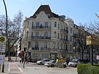
200 | Bornim , district of Potsdam | Jan. 8, 1892 | The street runs from Kurfürstendamm to Kronprinzendamm. Hugo Tietz's house number 20 from 1904 for August Aschinger is a listed building. |
|
| Bornstedter Strasse
( Location ) |
250 | Bornstedt , district of Potsdam | Feb. 1906 | The previous name was Bornstädter Strasse between March 16, 1888 and February 1906 . The Grunewald cemetery north of the railway line is a listed garden monument. House number 1 from 1895, which is now a hotel, is a listed building monument. Only the south side of the street is built on. Its western end is on the A 100 , the north side is bounded by a railway line. There are some spacious old buildings on the street. On the narrow green strip between the railway and the road are some gardens of the railroad farms. A footbridge leads to the only access to the Grunewald cemetery. The Inner Parkring lies with a section on Bornstedter Strasse. | |
|
Carionweg
( Location ) |
25th | Johann Carion (1499–1537), astrologer, mathematician and historian | Jan. 12, 1932 | The previous name was Larionweg in 1931 and was the result of a typographical error that was corrected in 1932. |

|
| Cicerostrasse
( Location ) |
1000 | Johann Cicero (1455–1499), Elector of Brandenburg | Jan. 8, 1892 | The previous name was Street 41 from 1885 . The east side of the street and the street area belong to Wilmersdorf . There are numerous commercial enterprises and offices in the southern part. | |
|
Damaschkestrasse
( Location ) |
500
(in the district) |
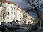
Adolf Damaschke (1865–1935), educator and leader of the land reform movement in the German Empire | March 30, 1950 | The previous name was Küstriner Straße from 1908 to 1950 . The northeast side and another short part of the street as well as the street area belong to Charlottenburg . |
|
|
Georg-Wilhelm-Strasse
( Location ) |
300 | Georg Wilhelm (1595–1640), Elector and Margrave of Brandenburg and Duke of Prussia | Jan. 8, 1892 | The street was formed from Street 2a and Street 3 from 1885 . The polar explorer and geologist Alfred Wegener lived in number 20 . In front of house number 5 there are two stumbling blocks in memory of Natalie Breslauer and Alexander Carsch. |

|
|
Halberstädter Strasse
( Location ) |
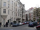
330 | Halberstadt , district town in Saxony-Anhalt | Jan. 24, 1905 | From 1900 onwards, it was called Straße 15 when it was built . It leads from Joachim-Friedrich-Straße to Seesener Straße.
The physicist Adolf Miethe lived in house number 7 from 1910 to 1925 . |
|
| Halenseestrasse
( Location ) |
550
(in the district) |
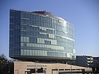
to the nearby Halensee | June 26, 1936 | The previous name was street G 92 . It was created after the Lunapark located here was demolished in 1935. The street is separated into an eastern and a western part by the city motorway . The west side of the road and the road land are in Grunewald . Part of the road runs north in the Westend district . The Artemis brothel has been located here since 2005 .
Paul Baumgarten's settlement on Rathenauplatz from 1936 is a listed building, as is Richard Brademann's switchgear from 1928. |
|
| Heilbronner Strasse
( Location ) |
300
(in the district) |
Heilbronn , city in Baden-Württemberg | Oct 6, 1905 | The previous name was Ansbacher Strasse between 1901 and 1905 . A short part of the street runs in Charlottenburg . The sculptor Hans Hubert Dietzsch lived in house number 12 around 1910 .
The street is characterized by several supermarkets and car repair shops. |
|
| Hektorstrasse
( Location ) |
220 | Joachim II. Hector (1505–1571), Elector of Brandenburg and Duke of Prussia | Jan. 8, 1892 | The previous name was Street 6 . As one of the few side streets of Kurfürstendamm , all the front gardens have been preserved in the street . In front of house numbers 2, 3, 9-10, 13, 17, 18 and 20 there are a total of several stumbling blocks . | |
|
Henriettenplatz
( Location ) |
50 × 20 | Luise Henriette von Oranien (1627–1667), Electress of Brandenburg and first wife of the Great Elector | Jan. 8, 1892 | The Henriettenplatz is divided into a northern and a southern part by the Kurfürstendamm . The square was redesigned in 1987 for the 750th anniversary of Berlin as part of an urban planning competition. Colonnades were built on the south side and a bronze obelisk by Heinz Mack on the north side and the Medusa fountain by Anne and Patrick Poirier on the south side . |

|
|
Hochmeisterplatz
( Location ) |
205 × 100 | Grand Master , highest office in the Teutonic Order | Jan. 8, 1892 | The previous name was Buchwaldplatz before 1876 and 1885 . After the Berlin magistrate bought neighboring areas (50 marks per square meter) in 1929, the garden architect Erwin Barth redesigned the square in 1930; In 1936 Richard Thieme carried out further expansion work.
Until it was demolished in 2017, the most striking building was the former Halensee 2 post office from 1933, designed by Willy Hoffmann . |

|
|
Hohenzollerndamm
( Location ) |
100
(in the district) |
after the Hohenzollern , the family that made up the Prussian kings and German emperors until 1918 | Aug 1, 1906 | Renaming of Preußische Strasse to Hohenzollerndamm on August 1, 1906. Renaming of part of Nachodstrasse between Hohenzollernplatz and Kaiserallee (today Bundesallee ) on July 25, 1908.
Part of the street is in Schmargendorf , this has been named for longer than the part of the street in Wilmersdorf. Only plots 47a and 48 ( Hohenzollerndamm train station ) are in Halensee. Both buildings are listed monuments. |

|
|
Joachim-Friedrich-Strasse
( Location ) |
890 | Joachim Friedrich von Brandenburg (1546–1608), Elector of Brandenburg | Jan. 8, 1892 | At their facility it was called Straße 5 . The building of today's Halensee primary school is a monument. At house number 54 a plaque commemorates the actor Albert Bassermann , who lived here from 1930 to 1933.
The Berliner Stadtmission (City Station) and number 4, the French Reformed Church, are also located here . There are several stumbling blocks in front of house numbers 24, 42, 49, 54 and 55 . |

|
| Johann-Georg-Strasse
( Location ) |
260 | Johann Georg (1525–1598), Elector of Brandenburg | Jan. 8, 1892 | From 1885 on, it was called Straße 13 at the site . At number 20 there is a memorial plaque to commemorate the writer Salomo Friedlaender , who lived here from 1913 until his emigration in 1934. There are several stumbling blocks in front of house numbers 15 and 20 . |

|
| Johann-Sigismund-Strasse
( Location ) |
220 | Johann Sigismund (1572–1620), Elector of Brandenburg | Jan. 8, 1892 | When it was built, it was called Straße 4a , from 1888 to 1892 Sigismundstraße . House number 2/3 is a listed building . |

|
|
Karlsruher Strasse
( Location ) |
420 | Karlsruhe , city in Baden-Württemberg | Oct 6, 1905 | From 1885 on, it was called Straße 20b when it was built . The name was chosen to commemorate the suppression of the Baden Revolution by Prussian troops .
At house number 13, a plaque commemorates the politician and resistance fighter against National Socialism Hermann Brill , who lived here from 1934 until his arrest in 1938. |

|
| Katharinenstrasse
( Location ) |
360 | Katharina von Brandenburg-Küstrin , wife of Elector Joachim Friedrich | Jan. 8, 1892 | From 1885 onwards, it was called Straße 20a . At number 5 there is a memorial plaque for the writer Else Lasker-Schüler , who lived from 1909 to 1911, and to the publisher and composer Herwarth Walden , who lived here from 1909 to 1912. |

|
| Kronprinzendamm
( Location ) |
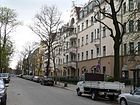
250 | Wilhelm of Prussia (1882–1951), Crown Prince | Jan. 8, 1892 | The Kronprinzendamm got its name on the occasion of the tenth birthday of Crown Prince Wilhelm. Before it was named, it was called Straße G 9 from 1885 . Houses 1, 2 and 3 from 1895 are among the protected architectural monuments.
The painter Philipp Franck lived in number 11 around 1905 . In front of house number 11 there are several stumbling blocks in memory of the Kron family. |
|
|
Kurfürstendamm
( Location ) |
1100
(in the district) |
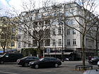
Elector , title of ruler of the Mark Brandenburg | around 1830 | Parts of the street run through Charlottenburg and Wilmersdorf . The VW-Porsche-Haus, which was rebuilt in 1956, is a listed building monument. The south side between Nestorstrasse and Joachim-Friedrich-Strasse is dominated by the Kurfürstendamm-Center, which was built from 1971 to 1973 and has numerous shops. Police section 25, which has been housed here since the building was built in 1970, was the last police section on Kurfürstendamm to be closed in mid-2013 and moved to Bismarckstraße 111. A plaque in front of house number 141 commemorates the attack on Rudi Dutschke that took place here on April 11, 1968.
The northern area as well as the section between Joachim-Friedrich-Straße is characterized by many restaurants and shops. Some houses still have the traditional front gardens that have disappeared on other sections of Kurfürstendamm. There are several stumbling blocks in front of house numbers 100, 101, 114, 133, 146 and 150 . |
|
|
Lützenstrasse
( Location ) |
150 | Lützen , site of a battle in the Thirty Years War in Saxony-Anhalt | 1892 | When it was built in 1885, it was called Straße 1 . It connects the Ringbahnstraße with the Georg-Wilhelm-Straße. | |
|
Markgraf-Albrecht-Strasse
( Location ) |
160 | Albrecht I (around 1100–1170), founder of the Mark Brandenburg | Jul 10, 1908 | The previous name was Street 32 . At house number 10/11 a plaque commemorates the former synagogue "Temple of Peace" , which was set on fire on November 9, 1938 by the National Socialists . There are several stumbling blocks in front of house numbers 2, 3, 4, 5, 6, 8, 12, 14, 15 . |

|
|
Nedlitzer Strasse
( Location ) |
110 | Nedlitz , district of Potsdam | May 17, 1930 | The street runs between Kronprinzendamm and Bornimer Straße. From 1909 onwards it was called Straße G 24 . |

|
| Nestorstrasse
( Location ) |
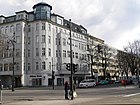
1020 | Joachim I. Nestor (1484–1535), Elector of Brandenburg | July 10, 1908 | At the plant it was called Straße 7 . In 1892 the northern section of street 7 was named Nestorstraße and the southern section was named Schlesische Straße . On June 18, 1911, Schlesische Strasse was added to Nestorstrasse. The Albertus Magnus Church from 1962 is a listed architectural monument.
In the southern part there are numerous car dealerships and German pension insurance institutions . A memorial plaque for Vladimir Nabokov , who lived here from 1927 to 1937, is attached to house 29 . In front of house number 45 there is a stumbling block in memory of Hedwig Gerson. |
|
|
Paulsborner Strasse
( Location ) |
580
(in the district) |
Paulsborn , farmstead laid out in 1800 and later forester's house on the Grunewaldsee | March 16, 1888 | Parts of the street are in Grunewald , Schmargendorf and Wilmersdorf . The bachelor house from 1931 number 17-20 by Bruno Buch is a protected architectural monument as an ensemble of buildings.
At house number 81 there is a memorial plaque for the conductor and composer Robert Stolz , who lived here from 1929 to 1935. In front of house number 19 there is a stumbling block in memory of Hedwig Saul. |

|
|
Ringbahnstrasse
( Location ) |
290 | after the parallel circular track | March 16, 1888 | The whole length of the street leading through several suburbs from the main street in Schöneberg to Halensee was named Ringbahnstraße. In 1911 the street was divided. Only the northwestern part between Lützenstraße and Kurfürstendamm kept the name. The other parts were renamed Detmolder, Rudolstädter, Seesener and Wexstraße. The Schöneberg section has been part of Wexstrasse since 1911. |

|
|
Schwarzbacher Strasse
( Location ) |
250
(in the district) |
Schwarzbach , spa in Silesia , today: Czarne, district of Jelenia Góra in Poland | Nov 19, 1958 | The street was created in connection with the construction of the city motorway , where it was separated from Friedrichsruher Straße. The section from Kurfürstendamm to Schwarzbacher Brücke belongs to Halensee . |

|
| Schweidnitzer Strasse
( Location ) |
200 | Schweidnitz , city in Silesia , today: Świdnica in Poland | 1905 | The street leads from Westfälische Strasse to Paulsborner Strasse. From 1900 onwards, it was called Straße 2 at the site . |

|
| Seesener Strasse
( Location ) |
400 | Seesen , town in the Goslar district in Lower Saxony | Dec 22, 1911 | It leads from Hohenzollerndamm to Henriettenplatz . The inner courtyard of number 20 is listed. The section between Paulsborner Straße and Nestorstraße is dominated by car dealerships.
Maria Terwiel, a resistance fighter against National Socialism, lived in number 16 until 1940 . In front of house numbers 18 and 28 there are stumbling blocks in memory of Elsbeth and Rose Meirowsky and Ernst Behrend. |

|
| Stuhlmannweg
( Location ) |
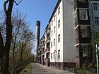
140 | Friedrich Stuhlmann (1410–1483), Bishop of Lebus | Oct 23, 1931 | The Stuhlmannweg runs along the S-Bahn from Nestorstraße over Carionweg. |
|
| Storkwinkel
( Location ) |
270 | Friedrich Stork (1846–1897), Wilmersdorfer local politician | March 21, 1960 | Due to the construction of the city motorway , the street Storkwinkel was formed in 1960 from Hobrechtstraße and sections of Humboldtstraße and Kunz-Buntschuh-Straße.
At the corner of Schwarzbacher Strasse, a memorial commemorates the aviation pioneer Melli Beese . |

|
|
Westfälische Strasse
( Location ) |
620
(in the district) |
Westphalia , former Prussian province | 1905 | Previous names were Die Kuhtrift (before 1876–1888) and Westphälische Straße (1888–1905). Part of the street is in Wilmersdorf . It is the main shopping street in Halensee, where a street festival takes place every year. The houses number 37 and 45 are listed buildings, as is the Hochmeisterkirche from 1910 by Otto Schnock .
At number 64 there is a memorial plaque for Margarethe Sommer and Otto Ostrowski , the Lord Mayor of Berlin (1946–1947), who ran a medical supply store here, in which they hid a Jewish family. In front of house number 31 there is a stumbling block in memory of Rudolf Leseritz. |
Former streets
The following table gives an overview of the streets and squares in the district as well as some related information.
- Name / location : current name of the street or square. Via the link Location , the street or the square can be displayed on various map services. The geoposition indicates the approximate center of the street length.
- Traffic routes not listed in the official street directory are marked with * .
- Former or no longer valid street names are in italics . A separate list may be available for important former streets or historical street names.
-
Length / dimensions in meters:
The length information contained in the overview are rounded overview values that were determined in Google Earth using the local scale. They are used for comparison purposes and, if official values are known, are exchanged and marked separately.
For squares, the dimensions are given in the form a × b for rectangular systems and for (approximately) triangular systems as a × b × c with a as the longest side.
If the street continues into neighboring districts, the addition ' in the district ' indicates how long the street section within the district of this article is. - Name origin : origin or reference of the name.
- Notes : further information on adjacent monuments or institutions, the history of the street and historical names.
- Image : Photo of the street or an adjacent object.
| Name / location | Length / dimensions (in meters) |
Origin of name | Date of designation | Remarks |
|---|---|---|---|---|
|
Storkzeile
( Location ) |
70 | Friedrich Stork (1846–1897), Wilmersdorfer local politician | May 17, 1930 | The namesake Stork was a secret secretary in the Reich Chancellery and from 1892 until his death head of the Wilmersdorf office and community. The Storkzeile (formerly: Straße 5 ) went from the Paulsborner Straße opposite the Schweidnitzer and ran into the triangle Nestor- / Paulsborner / Seesener Straße. It was repealed in 1960. |
Other places in Halensee
Allotment gardens (colonies)
The allotment gardens in the district are near Westkreuz, along the east side of the Ringbahn and belong to the Charlottenburg subdistrict. In the allotment garden development plan, these railroad allotments are listed under security level Ib. The Halenseer Gardens are noted on the map with the address opposite Rönnestraße 28. According to the location, the three railway farms (BLW) are located between the long-distance and S-Bahn tracks Charlottenburg – Grunewald, as well as between the Ringbahn and S-Bahn line Halensee – Charlottenburg. The names of the three systems are different in the sub-district, the development plan (KGA) and the detailed network of the regional map system (KGA ELW, railway agriculture).
- KGA ELW Rönnestrasse: Listed under number 4207 as KGA 'Oberer Wasserturm' ( location ) in the allotment garden development plan with 42 plots on 12,491 m² of railway land. It is located in the northeast corner between the tram and the branch to Halensee station. 46 parcels of the sub-district are recorded.
- KGA ELW water tower: Listed under number 4205 as KGA 'Halensee Water Tower' in the allotment garden development plan ( location ) with 40 parcels on 12,573 m² of railway land. It is located south of the long-distance railway line in the angle between the Ringbahn and the branch to Halensee station. 33 parcels of the sub-district are noted.
- KGA ELW exhibition: Listed under number 4211 as KGA 'large exhibition' ( location ) in the allotment garden development plan with 47 plots on 14,533 m² railway land. It lies between the suburbs and north of the long-distance Charlottenburg – Grunewald railway line and some areas (plots 37-40). North-east angle between the tram and the branch to Halensee station. 40 parcels of the sub-district are noted.
- Colony Lützenstraße: It is marked on the map of the FIS broker as "KGA ELW Lützenstraße" ( location ) and is located behind the buildings at Heilbronner Straße 21-24 up to the railway body on 2,082 m². It is not noted separately in the KGA plan and (probably) organisationally belongs to the FOAG 'exhibition'.
Other areas
- In the district there are 220 meters of the Autobahn 100 . With the key number 99093 at the junction Kurfürstendamm (southern part) the "exit to Kurfürstendamm" according to StEP II is led as a higher-level road connection.
- Grunewald cemetery: It is accessible from Bornstedter Straße through the southeast arch at Westkreuz . In the Berlin cemetery plan as the state-owned Grunewald cemetery (5008) with the postal address Bornstedter Strasse 11, it is included as a village cemetery with an area of 11,508 m². It is recorded in the list of monuments as a garden and architectural monument.
- Melli-Beese-Anlage is a small park on the corner of Storkwinkel and Schwarzenbacher Straße and borders the city motorway , which is already here in Grunewald and Schmargendorf.
- Hochmeisterplatz : On the eastern edge of the Wilmersdorf district (Cicerostraße), this green / park area is 16,494 m² with a playground and a central lawn. To the west the park borders on Nestorstrasse .
See also
literature
- Hans-Jürgen Mende, Kurt Wernicke: Berlin district lexicon, Charlottenburg-Wilmersdorf . Spiess-Verlag, 2004, ISBN 3-7759-0479-4 .
Web links
- Map of Berlin 1: 5000 with district boundaries. Senate Department for Urban Development Berlin, 2009, accessed on April 15, 2011 .
- Street directory Halensee. kaupert media gmbh, accessed on October 30, 2010 .
- Berlin-Brandenburg Statistics Office: Directory of streets and squares in the Charlottenburg-Wilmersdorf district (as of February 2015); pdf
- 113. Neighborhood walk on May 14, 2011 - From Henriettenplatz to Kurfürstendamm 100th District Office Charlottenburg-Wilmersdorf, 2011, accessed on July 10, 2011 .
- Lexicon: Charlottenburg-Wilmersdorf from A to Z - streets
Individual evidence
- ↑ Tenement building Bornimer Strasse 20
- ↑ Grunewald cemetery
- ↑ Rental and commercial building Bornstedter Strasse 1
- ↑ Wilmersdorfer Blätter. Volume VIII (1905), number 2, p. 31.
- ↑ Residential complex Halenseestrasse 1, 1a, 2, 3, 4, 5, 6, 7, 8, 9, 10
- ↑ Rear derailleur
- ↑ The Hochmeisterplatz, which has become expensive . In: Deutsche Allgemeine Zeitung , April 25, 1929.
- ↑ Wilmersdorfer Blätter. Vol. IX (1906), number 4, p. 133.
- ↑ a b c Wilmersdorfer Blätter. XI. Volume (1908), number 6, p. 174.
- ↑ Apartment building Hohenzollerndamm 47a
- ↑ Entry in the Berlin State Monument List
- ↑ Friedrich-List-Oberschule & Halensee-Grundschule and former 2nd community school in Wilmersdorf
- ↑ Apartment building Johann-Sigismund-Straße 2/3
- ↑ Residential and commercial building Kronprinzendamm 1, 2 and 3
- ↑ VW Porsche House
- ↑ Albertus Magnus Church
- ↑ Bachelor house
- ^ Kauperts: Ringbahnstrasse
- ↑ Inner courtyard of the tenement building Seesener Strasse 20
- ↑ Apartment building at Westfälische Strasse 37
- ↑ Apartment building at Westfälische Strasse 45
- ↑ Hochmeisterkirche
- ^ Berlin with sector boundaries 1960. Publisher: Richard Schwarz Nachf. ( Page no longer available , search in web archives ) Info: The link was automatically marked as defective. Please check the link according to the instructions and then remove this notice.
- ↑ History of the Westend sub-district ( Memento of the original from August 21, 2014 in the Internet Archive ) Info: The archive link was inserted automatically and has not yet been checked. Please check the original and archive link according to the instructions and then remove this notice.
- ↑ Text part of the small garden development plan as PDF ( memento of the original from September 24, 2015 in the Internet Archive ) Info: The archive link was automatically inserted and not yet checked. Please check the original and archive link according to the instructions and then remove this notice.
- ↑ Site plan of the FOAG at Westkreuz
- ↑ Map display Map of Berlin 1: 5000 - Soldner: R = 17125, H = 19436
- ↑ Map display Map of Berlin 1: 5000 - Soldner: R = 17014, H = 19186
- ↑ Map display Map of Berlin 1: 5000 - Soldner: R = 16958, H = 19298
- ↑ Map display map of Berlin 1: 5000 - Soldner: R = 17289, H = 19359
- ↑ Entry in the Berlin State Monument List


