List of streets and squares in Berlin-Siemensstadt

The list of streets and squares in Berlin-Siemensstadt describes the street system in the Berlin district of Siemensstadt with the corresponding historical references. At the same time, this compilation is part of the lists of all Berlin streets and places .
overview
General
Siemensstadt has 12,831 inhabitants (as of December 30, 2019) and includes the postcode areas 13599, 13627 and 13629. The following list contains 49 dedicated streets and two named places, some of which belong to neighboring districts. According to the street lengths determined for the list, there are 22.2 kilometers of street in the district. Characteristic for the district are the (non-public) factory roads on commercial and industrial sites, which are determined by work processes, for example the continuation of the Haselhorster Großer Spreering on the site of the Reuter-West thermal power station. When opening up as commercial space, renewed streets are necessary, such as the Wohlrabedamm in the “Thelen Technopark”.
The streets ( Bernauer Strasse ) –Gartenfelder Strasse– Paulsternstrasse (partly belonging to the neighboring district), Nonnendammallee –Siemensdamm– Saatwinkler Damm are 4450 meters high and belong to the higher-ranking main streets of Berlin , which ensure the connection to the A 111 and the connection between districts. At 2260 meters, the Rohrdamm is the main road of regional importance between the Spree ( Rohrdammbrücke ) in the south and the Hohenzollern Canal (Saatwinkler Damm) in the north. The main streets in the district are finally supplemented by Motardstrasse and Otternbuchtstrasse , which open up the industrial area in the south.
Development of the road network and principles of naming
Since the 1850s, the streets in the district have their origins in the (historical) road system (especially the Nonnendamm ) and were supplemented by the settlement of the Siemens works on the Nonnenwiesen (Hühner-Werder) and the emerging factory settlements. For the development of the street system in the district it was of certain importance that the area adjacent to the east belonged to the independent city of Charlottenburg, while part of the area belonged to the urban district of Spandau. In the address book from 1911, the district can still be found as "Colony Nonnendamm" in the urban district of Spandau. Street names with the endings “… damm” or “… climb” refer to the previously damp environment. The streets open up the extensive industrial and factory complexes in the south and west and green residential areas in the northeast. In the south, the Spree (mostly on the south bank) borders the district.
In order to cope with the rapidly increasing volume of traffic with industrialization and to make things easier for the employees, the company had existing roads converted to roads at its own expense and built new ones. The streets opened up further factory buildings and prepared residential buildings. In 1901 Siemens expanded the existing Wernerwerkdamm as an access route , followed in 1903 by the first new street with the 30-meter-wide Ohmstraße and in 1904/1905 (in this sequence) Hefnersteig , Reisstraße , Wehneltsteig , Quellweg , Voltastraße , Bödickersteig , Grammestraße , Wattstraße and Rohrdamm . From 1909 further streets were added around the Jugendweg up to the Hohenzollern Canal (begun in 1848) . In 1905 Siemens fortified the Nonnendamm in the Spandau area , which the former owners of this area - the "virginal" nuns of the Spandau Benedictine convent St. Marien - had built since 1239 in order to get to their lands in Moabit, Charlottenburg, Wedding ( hence the naming Jungfernheide, Jungfernheideweg, Jungfernsteig, Nonnendamm, Nonnendammallee). The street name endings “… damm”, “… weg”, “… climb” refer to the formerly impassable area. Until the construction of Nonnendammallee (from 1906) and Siemensdamm (from 1913) in widths of 49 meters, the "supra-regional" road connection between Siemensstadt and neighboring towns was created. Märkische Bodengesellschaft, which was commissioned by Siemens, developed the area provided by the company and began building the first apartment blocks between Ohmstrasse, Hefnersteig and Reisstrasse in the autumn of 1904 with independent architects and master builders. On April 1, 1905, the first tenement houses on Ohmstrasse were ready for occupancy - barely ten years later the still intact natural landscape to the north had also disappeared apart from a few remains.
District boundary
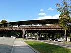
In the east, the district boundary to Charlottenburg-Nord runs on Nonnendamm . On Nikolaus-Groß-Weg (without the road land) to Siemensdamm (including road land), the border runs along the disused Siemensbahn, on the west side of the Jungfernheideweg and the Mäckeritz bridge it is on the north bank of the Berlin-Spandau shipping canal , formerly known as the Hohenzollern Canal , where the Tegel district is adjacent. In front of Saatwinkler Steg, the border deviates from here to Haselhorst to the south, runs along the middle of the old Berlin-Spandau shipping canal and includes the Gartenfeld district. From the Gartenfelder Brücke , the Gartenfelder and Paulsternstraße close on the east edge (the street area is in the neighboring district) to (excluding) Nonnendammallee and (in the corner) including Boltonstraße to Großer Spreering (a works street) and further in the middle of the Alte Spree. Where it meets the Spree is Spandau and the border line is until the change between the Spandau district and Charlottenburg-Wilmersdorf as a district boundary in the middle of the river and as a district boundary then again on the south bank of the Spree, so that here the Spree belongs to the Siemensstadt district. The border between Spandau and Charlottenburg was changed in 1938 from the southern route from Siemensdamm at the (former) Wernerwerk station on Mäckeritzstrasse, Quellweg, Jungfernheidesteig to the route northeast of the railroad between Siemensdamm and Jungfernheideweg.
Overview of streets and squares
The following table gives an overview of the streets and squares in the district as well as some related information.
- Name / location : current name of the street or square. Via the link Location , the street or the square can be displayed on various map services. The geoposition indicates the approximate center of the street length.
- Traffic routes not listed in the official street directory are marked with * .
- Former or no longer valid street names are in italics . A separate list may be available for important former streets or historical street names.
-
Length / dimensions in meters:
The length information contained in the overview are rounded overview values that were determined in Google Earth using the local scale. They are used for comparison purposes and, if official values are known, are exchanged and marked separately.
For squares, the dimensions are given in the form a × b for rectangular systems and for (approximately) triangular systems as a × b × c with a as the longest side.
If the street continues into neighboring districts, the addition ' in the district ' indicates how long the street section within the district of this article is. - Name origin : origin or reference of the name.
- Notes : further information on adjacent monuments or institutions, the history of the street and historical names.
- Image : Photo of the street or an adjacent object.
| Name / location | Length / dimensions (in meters) |
Origin of name | Date of designation | Remarks | image |
|---|---|---|---|---|---|
|
At the deciduous forest
( Location ) |
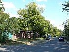
100 | deciduous forest area of the Jungfernheide | June 1, 1968 | The street goes from the street Im Heidewinkel as a dead end . The house number sequence follows the principle of orientation numbering and covers the range 1–12. |

|
|
Bödikersteig
( Location ) |
150 | Tonio Bödiker (1843–1907), Prussian civil servant and CEO of Siemens & Halske AG | April 16, 1909 | The street, laid out as street 2a in the colony Nonnendamm according to the development plan in 1905, was named after a resolution of the Spandau magistrate. In the address book from 1912, the Bödikersteig is named with the plots 1–11, with a new building being recorded at no. In 1918 all eleven lots were built on. The Bödikersteig connects Wernerwerkdamm and Nonnendammallee. |

|
| Boltonstrasse
( Location ) |
290 (in the district) |
Werner von Bolton (1868–1912), chemist and employee at Siemens & Halske AG | Oct 15, 2003 | The street lies between Nonnendammallee and Otternbuchtstraße and is a busy industrial feeder, especially for the Reuter and Reuter-West thermal power stations . Before it was named, it was the western section of Motardstrasse. The property 11 on the north side and the road area are in the district. Lot 15 on the south side of the road from Großer Spreering including its roadside is in Haselhorst . |

|
| Buolstrasse
( Location ) |
140 | Heinrich von Buol (1880–1945), CEO of Siemens & Halske AG | March 17, 1955 | Buolstrasse starts from Rohrdamm and is a dead end on the other side of Janischweg . The road in the Rohrdamm-West settlement was laid out in 1953 on a forest area of the Jungfernheide that existed here at the time, which was partially cleared after the Second World War . |

|
|
Dihlmannstrasse
( Location ) |
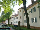
530 | Carl Dihlmann (1857–1920), engineer and board member of Siemens-Schuckertwerke | Jan. 16, 1923 | The quiet residential street with multi-family houses in the listed Siemens estate lies between Im Heidewinkel and Rohrdamm and is a one-way street in this direction . It was laid out as Road F in 1922 . On the south side, the narrow street borders directly on Wilhelm-von-Siemens-Park. The street name honors the entrepreneur and engineer Carl Dihlmann, who played a key role in the planning and construction of large power plants. |

|
|
Gartenfelder Strasse
( Location ) |
910 (in the district) |
Gartenfeld , a former estate, in the direction of which the road ran | Oct 14, 1910 | The road runs from the Tegeler Brücke over the Berlin-Spandauer Schiffahrtskanal to Daumstrasse in Haselhorst . In the district it is located between the two canal bridges and south of the Gartenfelder Bridge with the eastern property area. The western section and the road area south of the Old Canal belong to Haselhorst . The house number sequence follows the principle of orientation numbering and includes the parcels 1–37a and 41–59b (odd) in the district. On October 14, 1910, the Spandau magistrate decided to rename the part of Berliner Chaussee that ran from Nonnendamm through the fiscal area of the military in Haselhorst to the then urban district boundary as Gartenfelder Straße. After the formation of the municipality of Berlin, the part of Bernauer Strasse to the north between the old Berlin-Spandau shipping canal and the new district border was incorporated into Gartenfelder Strasse on June 23, 1924. |

|
| Goebelstrasse
( Location ) |
290 (in the district) |
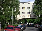
Heinrich Göbel (1818–1893), American precision mechanic and inventor | Dec 15, 1930 | The traffic route emerged from Straße 4 and Straße 85 in the Siemensstadt housing estate , which were laid out according to the development plan .
The street lies between Jungfernheideweg and Lenther Steig, over the latter it continues to the Siemensstadion . It is a quiet residential street with apartment buildings. The house number sequence follows the principle of orientation numbering and includes the parcels 117–151 (odd) and 120–150 (even) in the district. The eastern section of the street is in Charlottenburg-Nord . In the street are the St. Joseph Church and the Eduard Willis House, a former rest home for girls from Siemens. |
|
| Grammestrasse
( Location ) |
260 | Zénobe Gramme (1826–1901), Belgian electrical engineer and inventor | 17 Sep 1938 | The street, laid out as street 1a according to the 1905 development plan in the then newly built housing estate Nonnendamm , ran between Nonnendamm and a projected street with the Kühne'schen house and construction sites. It was between Strasse 1 and Brunnenstrasse . The traffic route was named Hertzstraße on October 14, 1910 . It is listed under this name in the 1918 address book for Siemensstadt between Siemensstrasse and Nonnendammallee with plots 1–15 built on with multi-family houses. Since Hertz was Jewish , the street was renamed during the Nazi era in 1938 and was given the name Grammestrasse. The Nazis were probably not aware that Gramme also came from a Jewish family. Grammestrasse lies between Wernerwerkdamm and Jugendweg. The house number sequence follows the principle of horseshoe numbering . | |
|
Neck crest
( Location ) |
90 | Johann Georg Halske (1814–1890), co-founder of Siemens & Halske AG | Sep 20 1914 | The street lies between Grammestrasse and Quellweg. It was laid out in 1906 in the then newly built Nonnendamm housing estate. The address book for 1918 lists four apartment buildings and two construction sites between Hertzstrasse and Brunnenstrasse . The first solid construction residential buildings were built in the settlement as early as 1908. |

|
| Harriesstrasse
( Location ) |
250 | Carl Dietrich Harries (1866–1923), chemist and manager at Siemens & Halske AG | Aug 18, 1926 | The road laid out in the year it was named lies between Rieppelstraße and Rohrdamm. The house number sequence follows the principle of orientation numbering . The quiet residential street with multi-family houses is located in the listed Siemens estate. There are large inner courtyards with communal areas that are freely accessible, some residents also have their own garden. Across from the confluence with Rapsstrasse, Harriesstrasse widens to a small square on which the Genoveva fountain stands. |

|
| Hefnersteig
( Location ) |
170 | Friedrich von Hefner-Alteneck (1845–1904), electrical engineering designer and inventor | 1904 | The construction of the first residential buildings in Siemensstadt began on this street at the end of 1903. It is listed in the address book 1911 <name = "adressbuch1911" /> under "Suburbs - Nonnendamm Colony" between Siemensstrasse and Nonnendamm and eleven apartment buildings with their residents - factory workers, craftsmen and foremen - are given for the 13 properties. The street lies between Wernerwerk- and Siemensdamm. |

|
|
In the oak ground
( Location ) |
290 | oak-covered forest area of the Jungfernheide | Jan. 30, 1933 | The traffic route in the listed Siemens residential estate is a connecting route between Dihlmannstrasse and Im Heidewinkel. It's the only street in Berlin that doesn't belong to anyone. The house number sequence follows the principle of orientation numbering with lots 4–38 (even) and 5–41 (odd). The choice of name is confirmed by old oak trees standing in the middle of the path. In Eichengrund is not always suitable for motor vehicle traffic. According to the RBS (regional reference system), Im Eichengrund has the street number 2156 and belongs to the RBS class STRA (maintenance belongs to the road authority), the StEP class V (other), the Okstra class F (footpath, therefore not a municipal road) and is Passable in both directions. The official length is 294.97 m. |

|
| In the Heidewinkel
( Location ) |
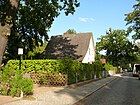
360 + 200 | Location on the edge of the Jungfernheide | Jan. 30, 1933 | The tree-lined two-lane road with a sidewalk on both sides is T-shaped between Dihlmannstrasse and Rieppelstrasse. The house number sequence follows the principle of orientation numbering with the plots 2–38c (even) and 3–37 (odd). The small, quiet residential street is paved with cobblestones and built on with one- and two-family houses. In the listed Siemens residential estate, it is part of a one-way street system . |
|
|
Janischweg
( Location ) |
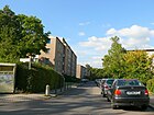
400 | Karl Janisch (1870–1946), mechanical engineer, government master builder and industry manager | March 29, 1955 | The street is between Straße am Schaltwerk and Buolstraße. It was laid out from 1953 in the newly built Rohrdamm-West settlement on a forest area of the Jungfernheide that was still partially cleared after the Second World War . The properties Janischweg 2–16 (even) and 3–27 (odd) follow the principle of orientation numbering and are built on with four and six- story apartment buildings that are parallel to the street on the west side and diagonally on the east side. |
|
| Youth place
( Location ) |
80 × 60 (triangular shape) |
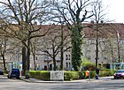
Johanna von Siemens Children's Home | July 31, 1947 | The small triangular square with a fountain in the middle is on the Quellweg , from the west the Jugendweg opens and the northeast flank covers the Mäckeritzstraße. The square is surrounded by old buildings and a Scharoun building on Mäckeritzstrasse, benches, a small playground and sculptures characterize the tree-lined square. Laid out as place B according to the development plan and called a school place in everyday life , it was named Bornmüllerplatz on August 25, 1939 . After the war, the square was renamed again. From 1919 to 1936 there was a converted wooden barrack on Jugendplatz , which served as a place of worship for the Catholic community of Siemensstadt until the Christophorus Church was completed in 1935.
On the edge of the square, directly on Jugendweg , is the only public toilet in Siemensstadt; According to the parlance of street cleaning in Berlin , it is an “aboveground full facility with washing facilities”. |
|
| Youth path
( Location ) |
420 | Johanna von Siemens Children's Home | July 31, 1947 | The Jugendweg is a three-lane paved road with trees and footpaths on both sides and is located between Rohrdamm and Mäckeritzstraße and on Jugendplatz. The street was laid out in 1909 and initially named Schulstraße after the first Siemensstadt school located next to it . The address book from 1911 lists Schulstrasse between Rohrdamm and Brunnenstrasse with the church and school. Two new buildings (which still belonged to the construction business) and construction sites are indicated on the other side of the street between a projected road and the Rohrdamm. In 1918 Schulstrasse, now built on parcels 1–9a, ran between Rohrdamm and the Charlottenburg district via Kapellensteig, Hertzstrasse and Brunnenstrasse . On the opposite side of the street at house numbers 10-14 is the children's home of the Diakonie on land owned by Siemens-Schuckert Akt.G. and Siemens & Halske Akt.G. noted, the school on plot 15/16 and the church on plot 17 on Rohrdamm. The children's home still exists today and is operated by the CJD .
On August 25, 1939, this street was named Bornmüllerstraße . When street names were evaluated and changed in the context of denazification in 1947 , the name was chosen with reference to the children's home on this street as a youth path. |

|
| Jungfernheideweg
( Location ) |
1370 (in the district) |
adjacent to the Jungfernheide | Jan. 23, 1931 | The Jungfernheideweg runs between Siemensdamm and Saatwinkler Damm. To the north of the Siemensbahn is the street area, the eastern side of the street belongs to Charlottenburg-Nord . The house number sequence follows the principle of orientation numbering with plots 1–79 (odd) and 4–14 (even) in the district. Between Saatwinkler Damm and Heckerdamm, the path leads through Volkspark Jungfernheide and to the south there is a quiet residential street with little car traffic, built on with apartment buildings from the late 1920s. Until it was built in 1929 as part of the construction of the Siemensstadt housing estate, the road was a partially paved path that led as Road 80 into Jungfernheide. The as yet undeveloped extension through Volkspark Jungfernheide to Saatwinkler Damm was known by locals as Onkel-Franz-Weg before 1931 . The name Jungfernheide goes back to the monastery of the Benedictine nuns in Spandau and their chaste way of life. Until 1938, the area, which was crossed by the almost six meter wide Jungfernheideweg, belonged entirely to Charlottenburg. With the administrative reform at that time, the entire road area and the built-up area, except for the western sidewalk between Saatwinkler Damm and the overpass of the Siemensbahn, partially went to Spandau and Charlottenburg-Wilmersdorf , so it does not belong to the district.
From 1930 to 1960, the architect and town planner Hans Scharoun lived in house No. 4 (third floor) , who designed the two components to the west and east of the front street section and partly on Mäckeritzstraße as part of the large housing estate. |

|
| Jungfernsteig | 60 | Relation to the Jungfernheide | 1911 | The road was laid out in 1909 in the former forest area of Jungfernheide. The Jungfernsteig is listed for the first time in the address book from 1912 under "Kolonie Nonnendamm" between Rohrdamm and Kapellensteig, the apartment buildings (15 tenants) on plots 1 and 2 are also noted as Nonnendamm 100 and 99. Opposite there was a new building (number 3), a construction site (number 4) and a block of apartments (number 5) in the same year. Further developments have not taken place until today. |

|
| Kapellensteig | 100 | Wichernkapelle, at the northern end of the street | December 29, 1910 | The street was laid out in 1909 with the construction of what was then Spandau's community school (currently Robert-Reinick-Grundschule; Jugendweg 15/16) and was named after the half-timbered chapel of the Protestant community Siemensstadt built between 1908 and 1932 at the northern end opposite the school . In the address book from 1912 is the Kapellensteig from Nonnendamm with new building, construction site, Voss'schem Haus on Schulstrasse, on the other side with Rodemann'sches Haus, Rudat'sches Haus (Nonnendamm 99) on Jungfernsteig as well as construction site and a new building by the Charlottenburg building cooperative contain. The Kapellensteig includes plots 1–6 and is located between Nonnendammallee and Jugendweg. |

|
|
Köttgenstrasse
( Location ) |
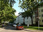
140 | Carl Köttgen (1871–1951), engineer, CEO of Siemens & Halske AG | July 12, 1954 | The Köttgenstrasse lies between Rohrdamm and Janischweg and comprises the plots 1–11. The residential buildings on this street are oriented differently: the four-storey block Köttgenstraße 1–3 faces south west of a green area along Rohrdamm, block 4–7 in the traditional location on the south side of Köttgenstraße and block 8–11 northwards away from the street . With the blocks of houses on Rohrdamm and Buolstrasse, a green area is created as an inner courtyard. It was laid out in 1953 in the Rohrdamm-West settlement on a forest area of the Jungfernheide section that was still partially cleared after the Second World War in the cold post-war winters at the end of the 1940s. |
|
| Kroppenstedtweg
( Location ) |
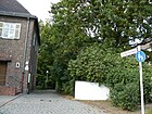
300 | Heinrich Kroppenstedt (1884–1958), pastor and member of the Confessing Church during the Nazi era | Oct 30, 1966 | The Kroppenstedtweg is a footpath through Wilhelm-von-Siemens-Park and is located between Schuckertdamm and Dihlmannstraße, it is officially classified as a street . The road was laid out in 1926 through the formerly impassable terrain of the "permanent forest". At the corner of Schuckertdamm 338 is the only assigned property no. 5, which, together with the houses Schuckertdamm 336-340a, belongs to the Christophorus parish hall . |
|
|
Lenther Steig
( Location ) |
370 | Lenthe , since 1971 part of the city of Gehrden , Hanover region | Nov 23, 1931 | The Steig, originally Straße 3 and Straße 90 in the development plan, connected Schulstraße and the branch line to Gartenfeld with the children's home and the workers' home.
Both road sections were paved together in 1928 on the occasion of the construction of the "Siemens Clubhouse". The street name was chosen after the Obergut in Lenthe, where Werner von Siemens, the son of the landlord Christian Ferdinand Siemens, had spent part of his childhood. The Lenther Steig is a quiet, listed residential street with apartment buildings. At the corner of Goebelstrasse is the Eduard-Willis-Haus (formerly a rest home for girls from Siemenswerke) and at the southern end is the former Siemens children's home. |

|
|
Mäckeritzstrasse
( Location ) |
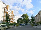
230 | Mäckeritzgraben, a moat that used to drain the wet meadows | 1910 | The road lies between Jungfernheideweg and Jugendplatz (source / youth path) and was laid out in 1910. In the 1918 address book for Siemensstadt between Schulstrasse and Nonnendammallee (district Charlottenburg) with five apartment buildings, it is the “Charlottenburger Baugenoss. eGmbH "listed. Until 1938 the district border (Spandau / Charlottenburg) ran parallel to Mäckeritzstraße. The house number sequence follows the principle of orientation numbering with plots 1–11 (odd) and 6–22 (even). The buildings to the southeast on Mäckeritzstrasse belong to the courtyard of honor at Nonnendammallee 92/93 of the Nonnendamm settlement, which was continued here from 1909. The opposite side of the street belongs to the Siemensstadt housing estate with a row by Hans Scharoun from 1929/1930. "Mäckeritz" can be derived from the earlier language for moist meadows or from Mäcker for small herbs. The street name was originally used further north. |
|
| Motardstrasse
( Location ) |
1260 | Alfred Motard , owner of Motard & Co.'s stearin factory in Sternfeld | 1907 | The street lies between Rohrdamm and Otternbuchtstraße. It was laid out in 1906 to develop what was then the automobile plant, the dynamo plant and the iron foundry of the Siemens company.
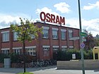
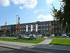
The asylum seekers' home is located near Otternbuchtstrasse on lots 101-103 (bottom picture). The house number sequence follows the principle of orientation numbering with Motardstrasse 35, 63, 79, 101, 101a, 103 (odd) and 54, 74, 90–98 (even). At the west end, the road turns to the southwest to Otternbuchtstrasse, the previous route to the northwest is exposed and was named on the other side of Otternbuchtstrasse in Boltonstrasse . On the triangular area created in this way (Motardstraße 94/98) there is a parking lot for employees. On the south side of Motardstrasse between Rohrdamm, Spree, Faulem Spree and Sternfelder Strasse is the site of the Jungfernheide waterworks, which was closed in 2002. South of Motardstrasse, the first drive- in cinema was set up in West Berlin in 1965 , and it operated until the 1980s. In the address book of 1911, Motardstrasse between Reisstrasse, Voltastrasse and Brunnenstrasse, Rohrdamm, Siemens-Schuckertwerke, Sternfeld district is listed with construction sites, in 1918 the Dynamowerk (between Rohrdamm and Sternfeld district) and the waterworks (belongs to Rohrdamm) are named. For 1927, the Motardstrasse between Rohrdamm and the Sternfeld district with the waterworks, the dynamo works, the iron foundry and the Siemens & Halske warehouse are listed. In 1943 Motardstrasse (left side = south) with Rohrdamm, 1–21 and 23–27 Jungfernheide waterworks, 29–35 storage spaces, 37 TH to Berlin (mechanical engineering during construction), 39–59 waterworks, 63–79 administration building of the company. A. Motard & Co. and “White Villa”, 81–125 factory premises of “Osram GmbH Komm.Ges.”, Otternbuchtstrasse, 147–157 Motard'sches Haus to Nonnendammallee. On the right-hand side (north) were: 2–52 (to Nonnendammallee) the Dynamowerk, 54–92 the iron foundry, (planned) Grenzstraße , parcel 94–102 Villa Motard and 104–126 owned by Osram, Otternbuchtstraße, 128– 146 Schützenhaus, 148–156 Gardens to Nonnendammallee. |

|
|
Natalissteig
( Location ) |
220 | Hugo Natalis (1860–1924), member of the board and commercial director of Siemens-Schuckertwerke | Nov 1931 | The street lies between Goebelstraße and Schuckertdamm. The house number sequence follows the principle of orientation numbering . The private road 5 of the development plan was fortified from 1930 in the "Siedlung Heimat" and was briefly named Frischensteig . The narrow residential street with multi-family houses is located in the listed Siemens estate, on the corner of Goebelstraße is the Catholic St. Josephs Church. |

|
| Nikolaus-Groß-Weg
( Location ) |
270 (in the district) |
Nikolaus Groß (1898–1945), trade unionist and resistance fighter against the Nazi regime | June 30, 1966 | Nikolaus-Groß-Weg is located between Siemens- and Nonnendamm , property no. 1 “Siemens Plant for Transmission Systems” belongs to the district. The road area and the eastern side of the road belong to Charlottenburg-Nord , the road was laid out as a residential road in 1960 for the main fire station there . It opens up allotment gardens and company premises in Charlottenburg. |

|
|
Nonnendamm
( Location ) |
100 (in the district) |
refers to the nuns of the Benedictine convent in Spandau founded in 1239 | before 1300 | The eastern section of Nonnendamm runs in Charlottenburg-Nord and Charlottenburg over the lock island between the old and new locks . Most (950 meters) of the western section of the nuns dam, the transition Nonnendammallee / Siemensdamm ran until its declassification on 1 November 1960, the Siemens -Werksgelände, originally on the border between the city of Charlottenburg and Spandau. Nonnendamm was the name of the section south of the Nonnenwiesen. Since the 13th century there was a connection route between Berlin and Spandau , the part of the traffic route (diocese and long-distance trade route) between Magdeburg and the pilgrimage site Gnesen. At Paulstern this road ran past the White Sand Mountains and on the southern edge of the Jungfernheide between the Nonnenwiesen and the Hühner-Werder. The name of the (Charlottenburg) Nonnendamm led to the expansion of the unpaved road from 1906 to connect the Siemens factories from Spandau to Nonnendammallee . In the 1911 address book, Nonnendamm is in the "Kolonie Nonnendamm" from the Sternfeld district (Siemens = Schuckert = Werke) via Rohrdamm, Straße 1 , Straße 1a , Brunnenstraße , Straße 2a , Voltastraße, Märkischer Steig , Reisstraße, Hefnersteig, Ohmstraße, Siemensstraße , District Charlottenburg and back Brunnenstrasse , projected street , Rohrdamm, district Haselhorst listed. In 1905 Spandau fortified a section of Nonnendamm, Straße 45 , with a 5.5 m wide cobblestone ceiling, some of which is still present in the eastern area. In 1906 Siemens provided the section running through the property, Straße 43 (from 1925 Holtzdamm , from 1961 Popitzweg ), with a concrete roadway. Until 1925, the Nonnendamm ran diagonally across the grounds of the Wernerwerk high-rise building and led to Siemensdamm (the renamed section of Nonnendammallee) at Ohmstrasse. It was not until 1938 that the district boundaries between Spandau and Charlottenburg were changed. On November 1, 1960, the section of Nonnendamm up to Nikolaus-Groß-Weg , which ran in the district on the Siemens factory premises, was de-dedicated . In the district, only the 100 meters west of Nikolaus-Groß-Weg with the buildings on plots 37, 39 and opposite remained. 40. On the map from 1932, the (entire) Nonnendamm from the Wernerwerk train station is shown following Siemensstrasse on the border of the administrative districts of Charlottenburg and Spandau along the Spree; at that time the Westhafenkanal did not yet exist. The same situation exists in 1954, as the canal has not yet been fully completed. |

|
|
Nonnendammallee
( Location ) |
1640 (in the district) |
Nuns of the Benedictine convent in Spandau founded in 1239 | Apr 2, 1914 | The street lies between Daumstrasse and Jungfernheideweg, in the district between Paulsternstrasse and Jungfernheideweg, to the west it continues in Haselhorst and to the east the avenue continues within the district in Siemensdamm. The house number sequence follows the principle of horseshoe numbering , in the district there are Nonnendammallee 41, 42, 44–72 and 80–121 (consecutive). Before it was expanded as an avenue in 1914, it was Nonnendamm , which had been the connecting route between Berlin and Spandau and part of the old trade route between Magdeburg and Poland since the Middle Ages .
The main thoroughfare from Charlottenburg to Spandau is wide and has four lanes in each direction. It can only be crossed by pedestrians at the traffic lights due to the heavy traffic. At the eastern end there are some residential buildings with small shops, and industrial buildings follow from Rohrdamm to the west. The company "Siemens" with its numerous subsidiaries is the most important resident of the street. In the address book of 1918 Nonnendammallee (compare Nonnendamm 1911) is noted as follows: 1–59 belongs to the post district Spandau, Grenzstrasse , sewage treatment plant, Dynamowerke, Rohrdamm, 80–81a, Wattstrasse, 82 and 82a, Hertzstrasse , 83, Brunnenstrasse , 84 and 84a, Bödikersteig, 85 and 85a, Voltastraße, 86, Märkischer Steig, 87 and 87a, Reisstraße, 88 and 88a, Hefnersteig, Ohmstraße, district Charlottenburg, Mäckeritzstraße, 89–92f, 93–93b, Brunnenstraße, 94–96 (also Halskesteig ), Hertzstraße , 97, Wattstraße, 98, Kapellenweg, 99 and 100 (also Jungfernsteig), 101–110 (Siemens-Schuckert-Werke), 111 (owner of the municipality of Spandau), Grenzstraße , 112–175 belongs to the Post District Spandau. Until the construction of Nonnendammallee, a section of Nonnendamm, from 1906, and the construction of Siemensdamm from 1913, the connection between Siemensstadt, as well as Siemens and Berlin, was Nonnendamm . In 1905 Spandau paved road 45 (a section of Nonnendamm) with a 5.5 m wide cobblestone pavement, some of which is still present in the eastern area to this day. On April 2, 1914, the Spandau police administration sent a letter to the magistrate that Nonnendamm was already being referred to as Nonnendamm- Allee after its expansion in what was then Spandau . In 1906 Siemens provided road 43 ( Holtzdamm , today Popitzweg ) on its premises with a concrete roadway. Until 1925, the Nonnendamm ran diagonally across the grounds of the Wernerwerk high-rise and flowed into the Siemensdamm at Ohmstrasse. The Siemens freight railway was located on Nonnendammallee, and its track beds and installed overhead lines for the systems of the electrically operated railway were renewed in 1985/1986 shortly before the switch to diesel operation. |

|
|
Ohmstrasse
( Location ) |
160 | Georg Simon Ohm (1789–1854), physicist and discoverer of Ohm's law | 1903 | The street lies between Wernerwerk- and Siemensdamm. It is one of the first streets in the district, as it was laid out in 1903 in a width of 30 meters (still 25 meters today) before the first houses in the Nonnendamm settlement were built (from 1905). The street is built on the western side (house no. 4-9 continuously) with residential buildings and some shops, and opposite is the factory complex of the Wernerwerk high-rise belonging to Siemens. On the ground floor of the building at 7 Ohmstrasse, which was completed at the beginning of 1905, was the classroom in which school lessons began in Siemensstadt. |

|
| Otternbuchtstrasse
( Location ) |
910 | Otternbucht, former bulge of the Spree | May 13, 1929 | The road was in 1866 as unpaved Separationsweg created in the meadows nuns to open up the first land.
It is located between Nonnendammallee and Motardstrasse with lots 10–22 (straight) and 11, 29, 35, 37. It continues on Motardstrasse to the south as a dead end to the Reuter thermal power station, where it turns east. At this end it opens up the “KGA Spreewiesen”. From 1900 it was called the Black Way . Today's street name refers to a bulge in the Spree that existed until 1885, which was filled in around 1930 and is still called Ottern Bay after otters who used to live here . At the corner Nonnendammallee were the ballrooms Sternfeld and on the 1965 are still free to Eckgelände Motardstraße stood until the mid-1980s, the first drive-in theater in West Berlin . |

|
|
Paulsternstrasse
( Location ) |
650 | Gasthaus Paulstern ("Zum Güldenen Stern") owned by Paul Stern | May 13, 1929 | The street lies between Nonnendammallee and Gartenfelder Straße, with the street area and the western side of the street belonging to Haselhorst . The name "Paulstern" was transferred to the entire area south of Nonnendammallee, where the Reuter and Reuter-West power plants are today. The house number sequence with the plots 16–34 in the district follows the principle of orientation numbering . This five to six meter wide path, known from 1900 onwards as the Schwarzer Weg , was laid out in the early 1970s as a 36 meter wide traffic-ready connecting route with pedestrian and bicycle paths between Nonnendammallee and Gartenfelder Strasse and expanded to relieve Haselhorst of through traffic. In 1984 opened located at the intersection Paulstern- / Otter Bay Street and Nonnendammallee station Paulsternstraße the underground line U7 to Rathaus Spandau. The Haselhorst fire brigade base has been located in the district at Paulsternstrasse 34 since 1996. In 1985/1986 the track beds and overhead lines for the systems of the electrically operated Siemens freight railway on Paulsternstraße were renewed, which was converted to diesel operation shortly afterwards. |

|
| Popitzweg
( Location ) |
240 (in the district) |
Johannes Popitz (1884–1945), lawyer, politician and resistance fighter against the Nazi regime | Dec 13, 1961 | The Popitzweg runs between Heilmannring and Jungfernheideweg, east of the disused Siemensbahn to Gartenfeld, it is in Charlottenburg-Nord . The house number sequence follows the principle of orientation numbering. Popitzweg 15–21 (odd) and 16–22 (even) belong to the district.
In the development plan, the route was laid out as road 43 and lay across the district border, the Charlottenburg section was named on July 4, 1957 and the section in the district (Spandau district) followed in 1961. The route of this road was in Charlottenburg between the southern one until 1938 Plötzensee and the intersection Siemensdamm / Nonnendamm / Nonnendammallee. On June 27, 1925, the path was named Holtzweg . In October 1963, it was devised with further stretches because it was overbuilt and changed. The only remaining part of this (north) route between the Siemens works and Berlin is Popitzweg. |

|
|
Source path
( Location ) |
840 | nearby mineral spring "Fürstenbrunn" (on the Ruhwaldweg) | Sep 9 1931 | The source path is between Schuckertdamm and Wernerwerkdamm. The southern continuation leading over the Siemens factory premises to the Rohrdamm was dismantled in 1972. The house number sequence follows the principle of orientation numbering . After the road was laid out, it was named Brunnenweg in 1904 because it led to the Fürstenbrunn spring. In 1931, with the same reference, the name was changed to Quellweg in order to reduce the multiple names of Berlin streets . In the middle and south of the street there are buildings from the Nonnendamm settlement built in 1904 . The eastern buildings between Jugendweg and Nonnendammallee originate from the large block development around the “Ehrenhof” of this settlement that was built in 1911. The northern section of the street to Goebelstraße is on the edge of the "Heimat" settlement, which was built in 1930. Opposite the confluence of Mäckeritzstrasse Am Quellweg is the Siemens children's home, which is run by the CJD as an educational institution. A regular weekly market has been held on the Quellweg since 1923. The Catholic St.Joseph Church is located on the corner of Goebelstraße. A mineral water factory was built for the Fürstenbrunn mineral water source in 1889. |

|
|
Rapeseed road
( Location ) |
360 | August Raps (1865–1920), physicist and board member of Siemens & Halske AG | Jan. 16, 1923 | The street in the former "Siemens factory settlement" lies between Dihlmannstrasse and Harriesstrasse and was laid out in 1922 as Strasse 1 (2) according to the development plan . A year later she got her name
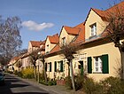
The quiet residential street is narrow and largely flanked by two-storey single-family houses in row construction. In the middle of the street there is a small market square with what used to be several shops, which emphasizes the inner courtyard character of the settlement. Between Rapsstrasse and the houses on Rohrdamm there are green spaces with sculptures by the sculptor Wilhelm von Winterfeld (* 1898). The house number sequence follows the principle of orientation numbering with Rapsstrasse 2–74 (even) and 3–73 (odd). On Harriesstrasse, Rapsstrasse leads through a residential building with a gate opening. |
|
| Rice road
( Location ) |
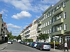
170 | Philipp Reis (1834–1874), physicist and inventor of the telephone | 1903 | The Reisstrasse lies between Siemens- and Wernerwerkdamm. The street was named after Reis in the first planning documents in 1903 and was laid out in 1904 in the Nonnendamm settlement. It ran over the Wernerwerkdamm, past the Siemens telecommunications plant at the time, to the Rohrdamm. With the demolition of the telecommunications plant in 1981, the section south of the Wernerwerkdamm, which led across the plant premises, was closed to public transport and rededicated. From October 1, 1908, the Spandau – Nonnendamm electric tram drove from the old town of Spandau along Nonnendammallee to Reisstrasse, and from 1911 to 1918 also through Reisstrasse to Rohrdammbrücke . Several small retail and service shops still exist on Reisstrasse today. |
|
| Rieppelstrasse
( Location ) |
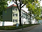
390 | Anton von Rieppel (1852–1926), building officer, structural engineer, supervisory board member at Siemens | May 13, 1929 | The street is between Dihlmannstrasse and Harriesstrasse. The house number sequence follows the principle of orientation numbering with properties 1 to 25 (odd) and Rieppelstrasse 2–30 . It was laid out as Street B in 1922 .
The quiet residential street is built on with multi-family houses with freely accessible large inner courtyards as communal areas, plus some residential gardens. The houses are distinguished by reliefs of different fairytale motifs above the house entrances. The figurative decorative elements come from the sculptors Otto Hitzberger (1878–1964) and Kunz Schmid (* 1904). |
|
| Dam
( Location ) |
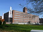
2170 | The pressure pipes of the water pipeline from the Tegel waterworks to the Jungfernheide waterworks run under the road | 1904 | The Rohrdamm , which was expanded from 1904 between the Rohrdammbrücke over the Spree and the Saatwinkler Damm in a north-south direction through the district, is a moderately busy street between Nonnendammallee and Saatwinkler Damm with listed multi-family houses from the Siemens estate and large commercial buildings. The houses have large inner courtyards from which there are passages for pedestrians to the street. The house number sequence follows the principle of horseshoe numbering with lots 7–95 (consecutive). The Siemens head office is on the corner of Nonnendammallee, followed by the entrance to the Siemens switchgear. In addition to the commercial and residential buildings, there are sports facilities, a school and the allotment garden “Gartenfreunde Siemens” in the street. The section south of Nonnendammallee to the Rohrdammbrücke lies mainly between the Siemens premises and the Berlin waterworks. In the mid-1950s, there were still two S-Bahn stations on Rohrdamm on lines that are now closed: S-Bahn station Siemensstadt to Gartenfeld and S-Bahn station Siemensstadt-Fürstenbrunn across the Spree on Rohrdammsteg on Fürstenbrunner Straße. The width of the northern pedestrian section of the Rohrdamm, which is covered with green spaces and trees, was planned in the 1913 concept when the route of a high-speed railway to the north of what was then the city of Spandau was planned, later construction work ensured the removal of the drainage ditches . The terms Rohrdamm der Berliner Wasserwerke and water dam for short were also in use. The residential buildings of the Rohrdamm and Rohrdamm West settlements are located in the northern section on both sides of the Rohrdamm. A 16-storey residential building on this street is the highest residential building in the district. Further north, spanning the Rohrdamm, is the Siemensstadt S-Bahn station, which was decommissioned in 1980, and the Rohrdamm underground station at the intersection of Rohrdamm and Nonnendammallee . |
|
|
Saatwinkler Dam
( Location ) |
1530 (in the district) |
Saatwinkel, settler colony founded in the 18th century on the western edge of the Jungfernheide (location of Tegel since the end of the 20th century ) | 1925 | The Siemensstadt section of Saatwinkler Damm leads from Jungfernheideweg along the Hohenzollern Canal to Gartenfelder Straße. The eastern section of Saatwinkler Damm is in the district of Charlottenburg-Nord and the western section of Gartenfelder Straße is in Haselhorst . In the years 1860 to 1864 the Saatwinkler Chaussee was expanded as a paved connecting road from Moabit and Plötzensee to Saatwinkel. The street was previously an "ancient arterial road and Kremserstrasse [...], which under the high roof of its densely lined beeches and linden trees is probably one of the most beautiful streets in Berlin". Saatwinkler Damm runs parallel to the Berlin-Spandauer Schifffahrtskanal . This canal road was named in Spandau in 1925, in what was then the city of Charlottenburg as early as 1918, after the entire course of the street was previously also called Am Hohenzollern Canal , but for the section in the district also Berliner Chaussee . The Siemensstadt section was renovated in 2004/2005. |

|
| Schuckertdamm
( Location ) |
730 | Sigmund Schuckert (1846–1895), founder of the electrical company Schuckert & Co. | Nov 23, 1931 | The Schuckertdamm lies between Jungfernheideweg and Rohrdamm, in Charlottenburg-Nord the route continues as Heckerdamm . The house number sequence follows the principle of orientation numbering. The street goes back to the Königsdamm , verifiable before 1777 , which was created by order of King Friedrich Wilhelm I in the 18th century when the Mäckeritzwiesen were drained and which was given its name. In 1931 the section in the district was named Schuckertdamm. In the address book from 1943 the Schuckertdamm (northern side) between Jungfernheideweg and Lenther Steig / Sportplatz, the southern side between Schuckertplatz and Rohrdamm is indicated, for the plots 283-303 reference is made to the Königsdamm in Charlottenburg. With the arrangement of the three-storey plastered buildings with numerous small wall reliefs at the house entrances and the high hipped roofs, the Schuckertdamm behind the basket arch overbuilding (to the west) on Schuckertplatz looks like a small town. The sgraffito work on the facades was done by the painter Hans Uhl (* 1897). In 1965 the street corner Jungfernheideweg received its first high-rise residential building. The quiet residential street is in the listed Siemens estate. Worth mentioning is the Christophoruskirche of the Protestant parish Spandau (lower pictures). |

|
| Schuckertplatz
( Location ) |
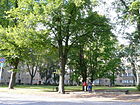
60 × 60 | Sigmund Schuckert (1846–1895), founder of the electrical company Schuckert & Co. | Nov 23, 1931 | The square is on Schuckertdamm at the confluence of the source path. The Schuckertplatz was created with the construction of the "Heimat Siedlung" with the Schuckertdamm. Before the building for the Heimat settlement was built, smaller circuses took up residence here several times a year . In the south are the residential buildings on Schuckertdamm, on the north side the square is surrounded in a wide circle with a block of flats that corresponds to the source path, to the west there is a passage through this. The square is assigned the house numbers 1–9 of the western block as a postal address, the houses on the east side 49–57 belong to the Jungfernheideweg. Since the street area already belongs to Charlottenburg-Nord, the Schuckertdamm is continued here by the Heckerdamm. According to the address book from 1943, houses 1–9 belong to Schuckertplatz. |
|
| Schwiegersteig
( Location ) |
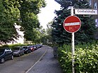
190 | Heinrich Schwieger (1846–1911), railway engineer | Nov 23, 1931 | The narrow residential street with multi-family houses in the listed Siemens estate is between Goebelstraße and Schuckertdamm. It was laid out in 1931 under the name Straße 4 . The house number sequence in the Heimat housing estate follows the principle of orientation numbering with Schwiegersteig 1–27 and 2–28 . |
|
| Siemensdamm
( Location ) |
770 (in the district) |
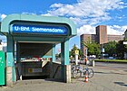
Werner von Siemens (1816–1892), physicist and entrepreneur; Founder of a company based here | July 14, 1914 | Siemensdamm runs as an eastern continuation of Nonnendammallee from Jungfernheideweg to Jakob-Kaiser-Platz . The section east of the Nikolaus-Groß-Weg is in Charlottenburg-Nord . The original planning name was Straße 45 . From 1913 to 1915, with the financial participation of Siemens, the first expansion to set up a transport connection with Charlottenburg and Berlin took place. By 1930, the road was built to be 49 meters wide. In Albert Speer's plans Siemensdamm and Nonnendammallee were in III. City ring included. In the course of the new traffic planning, Charlottenburg parts were changed in 1952/1953 starting from Jakob-Kaiser-Platz and their guidance was pivoted and the new east-west connecting road was named Siemensdamm, in the Spandau area the curve into the confluence became in 1955/1956 Nonnendammallee straightened and part of Nonnendammallee included in Siemensdamm. Originally, the street names were adapted to the Weichbild boundary and the northern lane of Siemensdamm led to Mäckeritzstrasse, the southern lane of Nonnendammallee to Ohmstrasse. On May 19, 1956, Siemensdamm was pulled up to the intersection of Reisstrasse and Jungfernheideweg. |
|
| Sternfelder Strasse
( Location ) |
330 | Sternfeld, meadow on the Spree | around 1912 | Sternfelder Strasse branches off from Motardstrasse to the south. It led to the Faulen Spree and connected the Siemens-Schuckert factory there. The Motard factory and the Motard villas were located near the later street. From 1941 the area belonged entirely to the (factory) premises of the Siemens company. For 1943, the properties of the Motard company, family houses, the boathouse of the Siemens Motor-Yacht Club on the Faulen Spree and the waterworks on the east side are named here. The street was rededicated for public transport on August 9, 1962 (officially with the street number 04323). It leads between the former Jungfernheide waterworks and the coal dumps to the eastern edge of the KGA Spreewiesen and brings the car access for the parcels located here. The name is derived from the official name adopted in 1874 for the area of the Nonnenwiesen and Spreewiesen on the Ruhleben peninsula. |

|
| Road at the rear derailleur
( Location ) |
460 | Switchgear of the Siemens group, which is on the road | Feb 13, 1995 | The road lies between Rohrdamm and Janischweg, over which it continues as a dead end. The spur road leads to the facilities of the Siemens switchgear, the KGA "New and Old Parade Grounds" and was laid out from 1953 in the Rohrdamm-West settlement on a forest area of the Jungfernheide ("permanent forest") that was partially cleared after the Second World War . The road is on the western part of the southern road . Until the end of the 1920s, this was the southern boundary of the permanent forest between Rohrdamm and the northern end of the border road . Due to its location on the switchgear, it was popularly known as Fabrikstrasse . On March 29, 1955, it was given the name Bingelstrasse . For politically motivated reasons, the street got a new name in 1995. |

|
|
Voltastrasse
( Location ) |
140 | Alessandro Volta (1745–1827), Italian physicist | 1901 | The street lies between Wernerwerkdamm and Nonnendammallee . The street name can already be found on the development plan before the street was laid out in 1905 in the " Nonnendamm Colony ". In the address book of 1911 it is between Siemensstrasse and Nonnendamm on plots 1–5 with apartment buildings belonging to “Märkische Bodengesellschaft mbH”, a new building on 6 and opposite on 7-12 plots listed as construction sites. It was laid out around 1905 further south via Motardstraße to Rohrdamm, this section went when the Siemens u. Halske AG on the factory premises. Plots 1–12 (consecutive) belong to Voltastraße, the houses on the east side have front gardens, the street is lined with trees and the inner courtyards of the properties on the neighboring streets are also green. The Siemens clock tower of the Messgerätewerk stands in the line of sight of Voltastrasse. |

|
|
Wattstrasse
( Location ) |
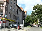
250 | James Watt (1736–1819), Scottish inventor of the steam engine | Oct 14, 1910 | The traffic route was laid out in 1904 in the Nonnendamm settlement between Nonnendamm and Siemensstrasse as road 1 (1). It received its name in 1910 and is listed in the 1911 address book with a developed plot of land belonging to the Charlottenburg building cooperative with 46 parties and a construction site.
In 1918, four apartment buildings belonging to Märkische Bodengesellschaft mbH were listed between Siemensstrasse and Nonnendammallee, and two houses and two construction sites for plots 5–8 on the west side up to Schulstrasse . On the opposite side of the street north of Nonnendammallee (9–12) there are four apartment buildings and south 13, 13a, 14, 14a are four apartment buildings belonging to the “Charlottenburger Baugenossenschaft EGmbH”. This numbering 1–14a (consecutive) continues. The street connects Wernerwerkdamm and Jugendweg. |
|
| Wehneltsteig
( Location ) |
150 | Arthur Wehnelt (1871–1944), physicist and inventor | Sep 9 1931 | The private road is between Wernerwerkdamm and Nonnendammallee . The uphill path was laid out around 1905 as the Märkischer Steig in the Nonnendamm colony. The renaming in 1931 was based on the parallel streets, which are also named after the inventors of electrical engineering, while retaining the name "-steig". For 1911 he is on the property Märkischer Steig 1–5 on the west side with multi-party houses, four of which belong to the "Märkische Bodengesellschaft mbH", on the east side 8-13 five multi-party houses are built except for property 8, also owned by Märkische Bodengesellschaft mbH “From 1907 until the completion of the elementary school on the later Jugendweg in 1909, the first Siemensstadt school was located in Wehneltsteig 8. In 1907 a prayer room was set up in which an assistant pastor from Spandau held services. During the 1936 Summer Olympics, one of the 12 public "television rooms" of the Reichs-Rundfunk-Gesellschaft in Berlin was located in No. 12 of the Wehneltsteige, on the corner of Wernerwerkdamm, where viewers could watch live reports from the competition venues free of charge . " |

|
| Wernerwerkdamm
( Location ) |
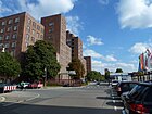
500 | "Wernerwerk" of the Siemens group | July 31, 1947 | Wernerwerkdamm lies between Rohrdamm and Ohmstrasse, on the north side of the street there are apartment buildings, the south side borders on the “Thelen Technopark” and it ends in the east as a dead end in this park. The house number sequence follows the principle of horseshoe numbering with lots 2–16 and 25–36 (consecutive). The street was laid out in 1866 to develop the properties in this area and was named Siemensstraße in 1901 . On 25 August 1939, she was named Schwiebertweg . As part of the elimination of Nazi ideas , it was named after the adjacent factory in 1947. |
|
| Wohlrabedamm
( Location ) |
930 | Jürgen Wohlrabe (1936–1995), Berlin CDU politician and film producer | Apr 24, 2012 | The Wohlrabedamm runs in an L-shape between Rohr- and Siemensdamm with lots 4–34 (consecutive) in horseshoe numbering . The street was rebuilt between 2010 and 2012 and opens up the Thelen Technopark , which is located on the former Siemens factory premises. The road leads through the Thelen Technopark and was opened to traffic in 2012, which made it possible for communication technology companies to settle on the previously closed premises of the Siemens works. A footpath leads along the Siemens branch canal to the Spree and there are two pedestrian passages to Wernerwerkdamm . |

|
List of renamed, planned-only, and abandoned streets
In the 1911 address book for “Kolonie Nonnendamm” in the Spandau district, the following streets can be found, which still exist today under the same name: Hefnersteig, Motardstraße, Nonnendamm, Ohmstraße, Reisstraße, Rohrdamm. The streets listed below, however, have been changed in the course of history.
| Surname | when named | when renamed or canceled | Origin of name | current name | Remarks |
|---|---|---|---|---|---|
| Berliner Chaussee | handed down | 1925 | Direction to Berlin | → Saatwinkler Dam | Temporary name of a section of the trunk road on Spandauer, i.e. Siemensstadt site. |
| Berthold-Schwarz-Strasse | Oct 14, 1910 | Berthold Schwarz , Franciscan monk and inventor of gunpowder | → to Haselhorst | In the address book of 1943 in Siemensstadt, starting from Gartenfelder Straße and undeveloped. After the expansion of the Haselhorst colony, it was spun off into the later district of Berlin-Haselhorst . | |
| Bingelstrasse | March 29, 1955 | Rudolf Bingel (1882–1945), engineer and CEO at Siemens-Schuckert-Werke | → Road at the rear derailleur | The former Südliche Straße was named in 1955 in honor of the Siemens engineer who died in the Soviet internment camp in Landsberg, where he was taken by the Soviet troops in May 1945. Since it became known in the 1990s that he was a member of the "Freundeskreis Reichsführer SS" and committee chairman of the "Fördergemeinschaft der deutschen Industrie" from 1942 onwards, his previous public appreciation was withdrawn and Bingelstrasse was renamed. | |
| Bornmüllerplatz , Bornmüllerstraße | Aug 25, 1939 | Gottfried Bornmüller (1902–1935), supporter of the Nazi movement, who died as an active National Socialist of injuries sustained in physical political conflicts | → Jugendplatz and → Jugendweg | The former Schulplatz and Schulstrasse were renamed during the Nazi era . In 1947, as part of the removal of Nazi ideas, the square and street were safely redesignated. | |
| Brunnenstrasse | 1904 | Sep 9 1931 | Well, source | → Source path | The road between Nonnendamm , via Siemensstrasse and Rohrdamm, led as an extension to a mineral spring of the mineral water factory built in 1889. In 1931 this street was renamed while retaining the eponymous Fürstenbrunn source in order to reduce multiple names of Berlin streets since 1920 with the formation of Greater Berlin . |
| Fabrikstrasse | March 29, 1955 | 1995 | Factory , factory premises in the district | → Road at the rear derailleur | Fabrikstraße was the unofficial name for Südliche Straße at the end of which the switchgear was built before it was officially dedicated and named in 1995. |
| Frischensteig | 1930 | Nov 23, 1931 | Carl Ludwig Frischen (1830–1890) | → Natalissteig | Created as a private road in the Heimat settlement, it was given a proper name in early 1930. Eventually it was renamed during the Nazi era. |
| Border road | around 1908 | 1961 | Border between Siemensstadt and Haselhorst | → disengaged and revoked | The traffic route existed until 1961. Original development plans had provided for a road that was to lead from Motardstrasse via Nonnendammallee to the forest belt of the permanent forest in the north and was provisionally laid out around 1908 with a section on Nonnendammallee. A few meters remain for access to the switchgear and the large Siemens vehicle parking space on Nonnendammallee. The dog kennels for the security of the Siemens plants were once located here from 1923. Until the 1950s, over 40 giant schnauzers were temporarily housed, which were cared for and also trained here. In 1930 (and in address books from the 1930s), Grenzstrasse with a civil servants' residence on Nonnendammallee, the gas station (1911 to 1947 gas distribution station with two containers for the intermediate storage of the city gas delivered from Spandau), and the tram depot on property 1 (1909 to Destroyed in 1944, until 1955 the tram's terminus at Grenzstraße) and a storage area for Siemens Beton- und Monierbau AG (Siemensstadt department) on property 2. From 1942 to the beginning of 1945 there was a barrack camp on the area behind the switchgear which housed Eastern European women who were deported to Germany and who were doing forced labor for the Siemens company . |
| Hertzstrasse | Dec 14, 1910 | Heinrich Hertz (1857-1894), physicist | → Grammestrasse | The traffic route was laid out in 1905 in the Nonnendamm colony. Since Hertz was referred to as a “ half-Jew ” during the Nazi era , the street was given a different name in 1938, although the fact that the Belgian electrical engineer Zénobe Théophile Gramme (1826–1901) also came from a Jewish family was ignored . | |
| Holtzdamm or Holtzweg | 4th July 1957 | Dec 13, 1961 | Wilhelm Holtz (1836–1913), physicist, developer of an influenza machine | → Popitzweg (in parts) | The dam was a largely part of Charlottenburg, in particular the large Siemensstadt housing estate, which was intended as the northern connecting road between Siemensstadt and Charlottenburg. In the district it led to the intersection of Mäckeritzstrasse / Nonnendammallee / Siemens- / Nonnendamm. In the year it was named, the factory facilities were extensively expanded and the route only connected the Tegeler Weg via Keplerstrasse with the Westhafen Canal. The rest of the original alignment came to Charlottenburg after 1957, but have largely disappeared in the meantime. |
| King dam | before 1777 | King Friedrich Wilhelm I. | → Schuckertdamm (in parts) | The dam was built before 1777 by royal order to drain the Mäckeritzwiesen. At first it was called Weg nach Spandau and was later named after the king and client. The Königsdamm led from the city of Charlottenburg (Plötzensee) through the Jungfernheide along to Gartenfelder Straße via today's district. As a result of the development that began in the 1920s, the old street was canceled in many places. | |
| Märkischer Steig | around 1911 | 1931 | Märkische Bodengesellschaft | → Wehneltsteig | The traffic route was laid out in the Nonnendamm housing estate on the grounds of the Märkische Bodengesellschaft and named after them. Siemens was the cost bearer. |
| Uncle Franz way | before 1931 | Jan. 23, 1931 | ? | → Jungfernheideweg | The name was a popular name for the not yet developed extension of the → Jungfernheideweg through what was then the Jungfernheide park to Saatwinkler Damm. |
| Schuckertstrasse | around 1920 | Sigmund Schuckert (1846–1895), electrical engineer and founder of Schuckert & Co. | canceled | It existed on the site of the Schuckertwerke and was connected to the Nonnendamm between Schwiebertweg and Unterer Spree . In the 1943 address book, Schuckertstrasse is listed as Industriestrasse to the branch canal and the Siemensbahn. It did not play a role for public transport and was canceled with the changed factory plans. | |
| Schulstrasse , Schulplatz | around 1911 | School building in the Siemensstadt workers' settlement | → Jugendweg , → Jugendplatz |
It was named after the Siemensstadt school built on this street at the beginning of the 20th century. The traffic route is designated for 1911 between Rohrdamm and Brunnenstrasse with the church, the 11th Spandau community school, as well as two new buildings and construction sites. | |
| Black way | around 1900 | July 31, 1947 | mostly gravel paved path | → Otternbuchtstrasse | That was an unofficial name for Otternbuchtstraße and its extension → Paulsternstraße . On the other hand, the path-like connection between the Jungfernheideweg and the Quellweg, parallel to the route section of the S-Bahn, is still unofficially called the Schwarzer Weg . Before the construction of the Siemensbahn (1927/1929) and the large Siemensstadt housing estate in 1929/1930, the 120 meter long and four meter wide path was a strip of sand with park benches through the Jungfernheide forest belt that existed at the time. |
| Schwiebertweg | 1939 | July 31, 1947 | Friedrich Schwiebert (1904–1935), SA man who worked for Siemens and died as a result of an injury sustained in 1933 in an armed conflict between SA members and workers. | → Wernerwerk dam . | The former Siemensstraße was renamed for political reasons in 1939, after the Second World War the district administration gave it a new name. |
| Siemensstrasse | 1901 | July 31, 1947 | Werner von Siemens , manufacturer | → Wernerwerkdamm | The traffic route was laid out in 1866 for the structural development of the properties in this area, but had no name. Probably because of its proximity to the parallel Siemensdamm , it was renamed Schwiebertweg in 1939 and the name was further renamed in 1947 as part of the elimination of Nazi ideas . |
| Southern street | Until the end of the 1920s it formed the southern boundary of the area of the permanent forest between the Rohrdamm and the Grenzstraße and was located south of the Königsdamm. | Bingelstrasse | The traffic route received its first name without official confirmation, it was also called the southern route or because of its location at the switchgear factory street . | ||
| Water dam | The pressure pipes of the water company run here. | → Rohrdamm | The first name was an unofficial term. |
Other locations
Parks
- Wilhelm-von-Siemens-Park (RBS 08173), location
It is located in the Karree Rohrdamm, Dihlmannstraße, Jungfernheideweg and behind the property of the Schuckertdamm. The park in the middle of the settlement is named after the founder of Siemensstadt, the entrepreneur Wilhelm von Siemens.
Allotment gardens
The garden colonies in the Saatwinkler Damm district are considered permanent allotment gardens, only the KGA 'Spreewiesen', which is surrounded by commercial areas, is unsecured.
| Colony name | Location / address | Parcels | surface | Remarks |
|---|---|---|---|---|
| Siemensstadt settlement association | Saatwinkler Damm 100 ( location ) | 57 | 35,450 m² | This permanent allotment garden colony is included in the allotment garden development plan with 5061 and in the regional system with road code 6697. The allotment gardens are permanently secured on state-owned leased land. |
| Allotment garden association Am Rohrdamm (5039a) | Saatwinkler dam / Rohrdamm ( location ) | 145 | 78,569 m² | The KGA has three sections. The northern section is a fictitious permanent colony located in the south of Saatwinkler Damm between Rohrdamm in the east and Buchenweg as a boundary to the weekend settlement Gartenfreunde Siemensstadt. This area is supplemented by a 90 m wide and 250 m long strip south of Stadionweg between the sports fields and Buchenweg. This area is permanently secured with level Vb on state-owned leased land as a fictitious facility. |
| Allotment garden association Am Rohrdamm (5039b) | Saatwinkler dam / Rohrdamm ( location ) | 18th | 9,448 m² | A section of the allotment garden between Rohr- and Saatwinkler Damm (with the exception of the Rohrdamm settlement and the Siemensstadt sports and leisure center) is on private leased land (Siemens company). However, due to the entry in the FNP it is still highly secured in level IV. This part is located in a 20-meter-wide strip along the disused Siemensbahn up to the road at the switchgear . |
| Allotment garden association Am Rohrdamm (5039c) | Saatwinkler dam / Rohrdamm ( location ) | 16 | 8,621 m² | A third section of the entire complex with these 16 parcels on land remains from a KGA that was founded before 1970. This part is permanently secured as a level Va permanent allotment garden. |
| KGA Spreewiesen | Otternbuchtstrasse 10 ( location ) | 135 | 76,128 m² | The garden colony is located west of the former Jungfernheide waterworks and north of the retention basin of the sewage treatment plant. It can be reached via the eastern end of Otternbuchtstraße. The facility is on private leased land and is considered unsecured. In the official road system it is listed as RBS 6729. To the north of the gardens is the coal dump, on the east side of which there is a driveway to the gardens from Motardstrasse via Sternfelder Strasse and an unnamed extension. The main path of the KGA is inclined, which is due to a loss of parcel. The colony paths lie across it: Drossel-, Tauben-, Meisen-, Rosenweg, Birkengasse, Pine-, Astern-, Pine-, Astern-, Nelkenweg. To the south in the direction of the retention basin (towards the Spree) are the Fliedersteig, Tulpen-, Lily-of-the-Valley and Amselweg. |
Weekend settlements
The Federal Allotment Garden Act sets some restrictions for allotment gardeners in a facility. At the request of the settlers, allotment garden associations are then converted into housing estates. This enables construction work and permanent residence in accordance with Berlin legal principles; in the Spandau district such settler communities are listed as weekend settlements.
- Weekend resort, Stiller and Niebus': it is ( position ) in the angle between the camp at the junction of the old Berlin-Spandau navigation canal opposite Saatwinkler boulevard and the Sirius Business Park. In the street directory (RBS) this settlement is listed under 16124 and is located on about 0.75 hectares of private land.
- The weekend settlement 'Gartenfreunde Siemensstadt' is located in the triangle ( location ) east of the KGA 'Am Rohrdamm' on Buchenweg and the Siemensbahn (Saatwinkler damm 299), with a 170 m long strip on Saatwinkler Damm, 20 meters wide, belonging to the KGA. The system has the road code 6299 in the regional system (RBS), the approximately 140 parcels are accessed through garden paths between Saatwinkler Damm and the railway line: beech, walnut, larch, fir path.
- Allotment garden areas are also located in the southwest of the disused S-Bahn line; these are not listed in the allotment garden development plan but are listed as "KGA" in the official documents. This colony is a parceled industrial land reserve owned by Siemens, which, according to the contract, can be terminated within three months if (operational) needs arise. The KGA 'Alter Exerzierplatz' (RBS 6293) with the address Straße am Schaltwerk 16 ( Lage ) and the KGA 'Neuer Exerzierplatz' (RBS 6307, Paulsternstraße 26-30, Lage ) are located on the site of a previously existing parade ground the colony name results. The garden areas that existed in 2014 are located between Gartenfelder Straße / Paulsternstraße with the road to Haselhorst and the railway facilities. In the north-west is the residential area Gartenfelder Strasse 43-59b and the church at 53a was built with the loss of lots. On the map from 1961 and as early as 1946, allotment gardens northwest of Südliche and Grenzstraße are drawn. To the south of it there was a tree nursery and a cemetery in the 1960s; this area was built over by Siemens with the switchgear and other areas. So today this colony area is bounded by Mittelweg (a garden path) in the south. In addition, the Paulsternstrasse fire station is located on the former garden site. As of 2014, the KGA 'Alter Exerzierplatz' is located with the colony paths: Kirschen-, Roseneck-, Pfirsisch-, Wickenweg (north of Haselhorster Weg) and to the south: Pear, carnation, cherry, lilac, peach, Wickenweg , Hare jump. Haselhorster Weg, in continuation of Gartenfelder Strasse from Haselhorst, forms the route on the northern edge and through the facility over the course of the railway towards Diehlmannstrasse (the sloping property boundaries are recognizable). It has an area of 45,131 m². The KGA Neuer Exercierplatz still left 2,675 m² south of the fire station (Paulsternstraße 34) after Siemens built the plots on Paulsternstraße 26–32 (straight) with staggered factory buildings right up to the railway line in the 2010s. The garden edge path that borders on this is now called Neuer Mittelweg.
See also
Web links
- Map of Berlin 1: 5000 with district boundaries. Senate Department for Urban Development Berlin, 2009, accessed on January 11, 2013 .
- The lexicon of Siemensstadt
- Street directory Siemensstadt. kaupert media gmbh, accessed on August 12, 2012 .
- Office for Statistics Berlin-Brandenburg: List of streets and squares in the Spandau district (as of February 2015); pdf
Individual evidence
- ↑ a b c d e Clarification of the situation after an address search in FIS broker on the map 1: 5000 of Berlin, produced by the district surveying offices of Berlin
- ↑ a b c d e f g h Colony Nonnendamm . In: Berliner Adreßbuch , 1911, V., p. 349 ff.
- ^ History of Berlin: Siemensstadt
- ↑ a b c Westermann's plan of Berlin 1926: Siemensstadt ( page no longer available , search in web archives ) Info: The link was automatically marked as defective. Please check the link according to the instructions and then remove this notice.
- ↑ a b Pharusplan Berlin 1943, 1:25 000, Siemensstadt ( page no longer available , search in web archives ) Info: The link was automatically marked as defective. Please check the link according to the instructions and then remove this notice.
- ↑ a b c Colony Nonnendamm> Streets . In: Berliner Adreßbuch , 1912, V., p. 372 ff.
- ↑ Nonnendamm Colony . In: Berliner Adreßbuch , 1918, V., p. 820.
- ↑ a b c d Rohrdamm settlement (Rohrdamm-West settlement) ( Memento of the original from October 16, 2014 in the Internet Archive ) Info: The archive link was automatically inserted and not yet checked. Please check the original and archive link according to the instructions and then remove this notice.
- ↑ Gartenfelder Brücke - Gartenfelder Straße ( Memento of the original from October 19, 2013 in the Internet Archive ) Info: The archive link was automatically inserted and not yet checked. Please check the original and archive link according to the instructions and then remove this notice.
- ↑ Siemensstadt: Goebelplatz und -straße ( Memento of the original from September 30, 2013 in the Internet Archive ) Info: The archive link was inserted automatically and has not yet been checked. Please check the original and archive link according to the instructions and then remove this notice.
- ↑ a b c d e f Siemensstadt . In: Berliner Adreßbuch , 1918, V., p. 820.
- ↑ neck riser; according to Kauperts
- ↑ Siemens city - Harriesstrasse
- ^ Rainer W. During: The story of an abandoned street in Spandau. In: Der Tagesspiegel , April 2, 2017
- ↑ a b on Bornmüller at berlingeschichte.de
- ↑ siemens.de: Jugendweg, Jugendplatz ( Memento of the original from October 4, 2013 in the Internet Archive ) Info: The archive link was inserted automatically and has not yet been checked. Please check the original and archive link according to the instructions and then remove this notice.
- ^ Jungfernheideweg in Berlin-Siemensstadt
- ↑ Jungfernheideweg (at siemens.de/siemens-stadt) ( Memento of the original from October 5, 2013 in the Internet Archive ) Info: The archive link has been inserted automatically and has not yet been checked. Please check the original and archive link according to the instructions and then remove this notice.
- ^ A b c Spandau administrative district>… Siemensstadt . In: Berliner Adreßbuch , 1930, IV, p. 1345.
- ^ Lenther-Steig in Berlin-Siemensstadt
- ↑ a b Pharus Plan Berlin (large edition with suburbs) from 1921 (Siemensstadt) ( page no longer available , search in web archives ) Info: The link was automatically marked as defective. Please check the link according to the instructions and then remove this notice.
- ^ A b Spandau administrative district>… Siemensstadt . In: Berliner Adreßbuch , 1927, IV, p. 1339.
- ↑ A Lexicon of Siemensstadt in Berlin - Motardstrasse ( Memento of the original from December 4, 2013 in the Internet Archive ) Info: The archive link was inserted automatically and has not yet been checked. Please check the original and archive link according to the instructions and then remove this notice.
- ^ A b c d e Spandau administrative district>… Siemensstadt . In: Berliner Adreßbuch , 1943, IV, p. 1185.
- ↑ a b c d e f g h i j k Sanwald Plan Berlin 1926, Charlottenburg ( page no longer available , search in web archives ) Info: The link was automatically marked as defective. Please check the link according to the instructions and then remove this notice.
- ^ Westermann's plan of Berlin. Georg Westermann / Berlin W 40 / Braunschweig: Charlottenburg around 1932 ( page no longer available , search in web archives ) Info: The link was automatically marked as defective. Please check the link according to the instructions and then remove this notice.
- ↑ Pharus City Map Berlin Large Edition. Pharus-Plan-Verlag in Treuhand / Berlin N54 / Schwedter Straße 263: Charlottenburg around 1954 ( page no longer available , search in web archives ) Info: The link was automatically marked as defective. Please check the link according to the instructions and then remove this notice.
- ^ Nonnendammallee in Berlin-Siemensstadt
- ↑ a b A Lexicon of Siemensstadt in Berlin - Paulstern (Sternfeld) ( Memento of the original from October 4, 2013 in the Internet Archive ) Info: The archive link was inserted automatically and has not yet been checked. Please check the original and archive link according to the instructions and then remove this notice.
- ↑ a b c d Pharus city map Berlin large edition 1954: Siemensstadt ( page no longer available , search in web archives ) Info: The link was automatically marked as defective. Please check the link according to the instructions and then remove this notice.
- ↑ The source path in the lexicon of Siemensstadt ( memento of the original from January 11, 2014 in the Internet Archive ) Info: The archive link was inserted automatically and has not yet been checked. Please check the original and archive link according to the instructions and then remove this notice.
- ↑ Die Reisstrasse in the Lexicon of Siemensstadt ( Memento of the original from December 4, 2013 in the Internet Archive ) Info: The archive link was inserted automatically and has not yet been checked. Please check the original and archive link according to the instructions and then remove this notice.
- ↑ History of Saatwinkel ( Memento of the original from March 11, 2014 in the Internet Archive ) Info: The archive link was inserted automatically and has not yet been checked. Please check the original and archive link according to the instructions and then remove this notice.
- ↑ A Lexicon of Siemensstadt in Berlin - Saatwinkler Damm ( Memento of the original from October 6, 2013 in the Internet Archive ) Info: The archive link was inserted automatically and has not yet been checked. Please check the original and archive link according to the instructions and then remove this notice.
- ↑ A Lexicon of Siemensstadt in Berlin - Siemensdamm ( Memento of the original from December 4, 2013 in the Internet Archive ) Info: The archive link was inserted automatically and has not yet been checked. Please check the original and archive link according to the instructions and then remove this notice.
- ↑ The Siemensdamm in the Lexikon der Siemensstadt ( Memento of the original from December 4, 2013 in the Internet Archive ) Info: The archive link was automatically inserted and not yet checked. Please check the original and archive link according to the instructions and then remove this notice.
- ↑ A Lexicon of Siemensstadt in Berlin - Voltastraße ( Memento of the original from January 11, 2014 in the Internet Archive ) Info: The archive link was inserted automatically and has not yet been checked. Please check the original and archive link according to the instructions and then remove this notice.
- ↑ a b A lexicon of Siemensstadt in Berlin - Wehneltsteig ( memento of the original from October 4, 2013 in the Internet Archive ) Info: The archive link has been inserted automatically and has not yet been checked. Please check the original and archive link according to the instructions and then remove this notice.
- ↑ a b A lexicon of Siemensstadt in Berlin - Grenzstrasse ( memento of the original from January 11, 2014 in the Internet Archive ) Info: The archive link has been inserted automatically and has not yet been checked. Please check the original and archive link according to the instructions and then remove this notice.
- ↑ Sanwald Plan of Berlin 1926 (cartographic processing August Schneider, Munich) ( page no longer available , search in web archives ) Info: The link was automatically marked as defective. Please check the link according to the instructions and then remove this notice.
- ↑ A Lexicon of Siemensstadt in Berlin - Popitzweg ( Memento of the original from October 6, 2013 in the Internet Archive ) Info: The archive link was inserted automatically and has not yet been checked. Please check the original and archive link according to the instructions and then remove this notice.
- ↑ The Siemensstadt: Schuckertdamm, Schuckertplatz, Schuckertstraße ( Memento of the original from October 6, 2013 in the Internet Archive ) Info: The archive link was inserted automatically and has not yet been checked. Please check the original and archive link according to the instructions and then remove this notice.
- ↑ Allotment gardens in Siemensstadt ( Memento of the original from December 4, 2013 in the Internet Archive ) Info: The archive link was automatically inserted and not yet checked. Please check the original and archive link according to the instructions and then remove this notice.
- ↑ a b Level Vb: Fictitious permanent allotment gardens according to §§ 16 and 20a of the Federal Allotment Garden Act. The 'fictitious' permanent allotment gardens are additionally protected by being shown in the zoning plan as green areas - allotments.
- ↑ Allotment Garden Development Plan Berlin: 4. Allotment Garden Law Bases, page 9 ( Memento of the original from March 19, 2013 in the Internet Archive ) Info: The archive link has been inserted automatically and has not yet been checked. Please check the original and archive link according to the instructions and then remove this notice. (PDF; 465 kB)
- ↑ Level IV: Allotment garden areas which, according to the FNP, should be preserved.
- ↑ Level V a: allotment garden areas that are defined as permanent allotment gardens by the development plan.
- ↑ Level I a: Allotment gardens on private areas that are intended for another use according to the representations of the land use plan. A termination is possible at any time in compliance with the allotment garden regulations.
- ↑ Overview plan of the administrative district Spandau with neighboring districts . In: Berliner Adreßbuch , 1922, IV., P. 1148.
- ↑ Street map from 1961 . VEB map publisher Berlin C2
- ↑ City map of Berlin. Verlag Richard Schwarz, Landkartenhandlung u. Geogr. Verlag, Berlin W.35: Spandau 1946 ( page no longer available , search in web archives ) Info: The link was automatically marked as defective. Please check the link according to the instructions and then remove this notice.
