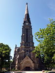
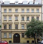
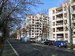
List of streets and squares in Berlin-Gesundbrunnen

The list of streets and squares in Berlin-Gesundbrunnen describes the street system in the Berlin district of Gesundbrunnen with the corresponding historical references. At the same time, this compilation is part of the lists of all Berlin streets and places .
overview
Location
An early cartographic mention of the Gesundbrunnen is a plan copied several times from 1757, which describes the ownership structure before the well was built. Agriculture, the establishment of a mill and the use of the spring in the immediate vicinity were among the first attempts at development. The Heilquelle, as a Luisenbad excursion destination for Berliners, led to the development of Badstrasse as a bourgeois boulevard with numerous public gardens, restaurants and theaters at the turn of the 18th and 19th centuries . Since the middle of the 19th century, industrialization and population growth have turned the rural Gesundbrunnen into a densely built-up industrial and working-class district. After the division of Germany, Gesundbrunnen and its transfer station became a transshipment point between East and West until 1961, characterized by rows of shops, exchange offices and border cinemas. In 2000, the Wedding District Assembly decided that there would be a district called Gesundbrunnen in the new Mitte district. This district is larger than the historic Gesundbrunnen and also includes parts of the former Oranienburger and Rosenthaler suburbs . The area lies within the boundaries of the former district of Wedding zu Reinickendorf , Pankow , Prenzlauer Berg and Mitte as well as east of Reinickendorfer Straße, Weddingplatz and Chausseestraße.
Gesundbrunnen has 95,175 inhabitants (as of December 30, 2019) and includes the postcode areas 13347, 13353, 13355, 13357, 13359 and 13409.
Road situation
According to the official street list, there are three squares and 82 streets in the district. This list includes four meters of Bergstraße , 40 meters of Bellermann- , 40 meters of Demminer , 60 meters of Kunkel- , 40 meters of Lortzing- , 50 meters of Orth- and 30 meters of Ruppiner Straße ( according to RBS ) as footpaths classified. To the main road system are as a parent roads bath , fountain , Bernauer , Bornholm , Oslo road , Pank- , Residenz , Sweden Street , Prince Avenue and Wollankstraße . These traffic routes in the state are through regional (district) road connections Drontheimer , Exerzierstrasse , Koloniestrasse and Schulstrasse and the supplementary roads Behmstrasse, Böttgerstrasse, Gartenstrasse, Gleimstrasse, Gustav-Meyer-Allee, Hochstrasse, Hussitenstrasse, Liesenstrasse, Neue Hochstrasse, Reginhardstrasse, Rügener Strasse , Scheringstrasse, Schönwalder Strasse and Wiesenstrasse. The squares in the district have different ( OKSTRA ) categorizations: the garden square with its lanes is categorized as a municipal road, while the Hanne-Sobek-Platz with an "N" is not subject to the district. In contrast, Vinetaplatz counts as a pedestrian area ("F"). Federal roads that were taken care of by the State of Berlin and then handed over to the district road authority are not located in the district.
The development of the road system in the district is based on the creation of traffic routes along the settlement area from Berlin. Changes to the borders to Pankow or the corrections of the district border changes from 1938 had an effect. Ultimately, the division of Berlin, the construction of the wall and the development after the fall of the Wall influenced the use and expansion or renovation of the traffic routes in the district. The following list includes 116 streets and squares, 17 of which continue across the suburbs.
Overview of streets and squares
The following table gives an overview of the streets and squares in the district as well as some related information.
- Name / location : current name of the street or square. Via the link Location , the street or the square can be displayed on various map services. The geoposition indicates the approximate center of the street length.
- Traffic routes not listed in the official street directory are marked with * .
- Former or no longer valid street names are in italics . A separate list may be available for important former streets or historical street names.
-
Length / dimensions in meters:
The length information contained in the overview are rounded overview values that were determined in Google Earth using the local scale. They are used for comparison purposes and, if official values are known, are exchanged and marked separately.
For squares, the dimensions are given in the form a × b for rectangular systems and for (approximately) triangular systems as a × b × c with a as the longest side.
If the street continues into neighboring districts, the addition ' in the district ' indicates how long the street section within the district of this article is. - Name origin : origin or reference of the name.
- Notes : further information on adjacent monuments or institutions, the history of the street and historical names.
- Image : Photo of the street or an adjacent object.
| Name / location | Length / dimensions (in meters) |
Origin of name | Date of designation | Remarks | image |
|---|---|---|---|---|---|
|
Ackerstrasse
( Location ) |
860 (in the district) |
Fields of the Berlin Feldmark through which the street ran | Feb. 18, 1801 | Part of the street runs in Mitte . The first names were around 1752 to 1801 Second row in the New Voigtland and Third row in the New Voigtland . A colony was established here from 1752 to 1770 through the immigration of craftsmen from the Vogtland . At the instigation of Frederick II, a road was therefore laid through the fields of the Berlin Feldmark, which is probably where its name comes from. The street runs from Linienstraße at Koppenplatz via Torstraße, Invalidenstraße to Bernauer Straße, where it reaches Gesundbrunnen, to Scheringstraße, where it ends as a dead end. This connection was closed in the early 1970s. |
|
|
Badstrasse
( Location ) |
950 | Healing Spring, 1799 in honor of Queen Luise (1776 to 1810) Luisenbad was called | Middle of the 18th century | The previous name between 1722 and the middle of the 18th century was Brunnenweg . At the end of the 19th century there were no more healing springs in the street, but the Great Berlin Horse Railway had built a train station (house number 41a). The owner of larger areas (parcels 42–49) was the landowner Wollank, who had extensive construction here. And the Adler beer brewery had settled on property number 67 .
Extensive renovation work took place on both sides of Badstrasse in the 1970s and 1980s, with blocks of flats being gutted and part of the old buildings being preserved, or old buildings being torn down and replaced by new buildings. At the end of the Second World War in 1945 during the Battle of Berlin, Schulstrasse, Seestrasse and Badstrasse formed the main battle line for days, almost all buildings were destroyed or badly damaged. |

|
| Bärbel Bohley Ring
( Location ) |
620 | Bärbel Bohley , civil rights activist and painter , co-founder of the New Forum in the GDR . | July 1, 2016 | The street opens up that in the new development area on Gleimstraße. | |
| Bastianstrasse
( Location ) |
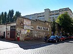
290 | Adolf Bastian (1826–1905), ethnologist and founding director of the Museum of Ethnology in Berlin | Sep 15 1906 | The first name was Street 58b, Section X / 2 of the development plan. It runs from Badstrasse to Böttgerstrasse. Commercial buildings dominate the building block between Böttgerstrasse and Badstrasse. Only the strip of land on Pankstrasse and on the parallel Bastianstrasse is built on with five-storey tenement houses. The rectifier plant for underground line 8 is located at Bastianstraße 6. |
|
| Behmstrasse
( Location ) |
720 (in the district) |
Heinrich Wilhelm Behm (1708–1780), pharmacist, builder of the 'Luisenbad' | March 8, 1894 | The first name was Straße 8, Section XI of the development plan. Part of the street runs in Prenzlauer Berg . The Behmstrasse Bridge, neglected after the construction of the Berlin Wall and replaced by a new building in 1994, connects the two parts and crosses an extensive track system of the railroad and the S-Bahn. The section in Prenzlauer Berg was called from 1960 to 1993 Helmut-Just-Straße after Helmut Just , an East Berlin People's Police who was shot in 1952 on the sector border with West Berlin . The road has been fully passable again since 2002. |

|
| Bellermannstrasse
( Location ) |
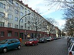
830 | Christian Friedrich Bellermann (1793–1863), theologian and author | Jan. 23, 1865 | Bellermann was a pastor at St. Paul's Church in Gesundbrunnen from 1835 to 1858. The street in the garden city Atlantic leads from Prinzenallee via Behmstraße to Swinemünder Brücke and Straße. At the Behmstraße it ends as a dead end in a turning hammer. |
|
| Mountain road
( Location ) |
200 (in the district) |
Location on a small mountain | Feb. 18, 1801 | The first name was the fourth row in the New Voigtland (around 1752-1801). The part in Gesundbrunnen lies between Bernauer Strasse and Gartenstrasse. The greater part is on the other side of Bernauer Strasse in the Mitte district . |

|
|
Bernauer Street
( Location ) |
1380 | Bernau , city in Brandenburg | May 29, 1862 | The first names were Street 50 and Street 80, Section IX of the development plan. On July 4, 1904, the extension that leads from Bergstrasse to Gartenstrasse was also named Bernauer Strasse. It forms the border between the districts of Mitte and Gesundbrunnen , where the Berlin Wall used to run. |

|
| Biesentaler Strasse
( Location ) |
210 | Direction to Biesenthal , town in the Barnim district in Brandenburg | Oct 15, 1873 | The first name was Straße 84, Section X / 2 of the development plan. It runs from Prinzenallee to Wriezener Straße. The street has several well-preserved Wilhelminian-style houses that are listed monuments (No. 2, 3, 4, 8, 10, 11, 19). |

|
| Blochplatz
( Location ) |
160 × 80 (triangle shape) |
Marcus Élieser Bloch (1723–1799), naturalist ( ichthyology ) and doctor | June 1, 1910 | Blochplatz is bordered by Badstrasse , Hochstrasse and Böttgerstrasse. Under the square is a civil defense system from the Second World War that was reactivated during the Cold War , with an entrance on Badstrasse. |

|
|
Boettgerstrasse
( Location ) |
390 | Johann Friedrich Böttger (1682–1719), alchemist, porcelain manufacturer | 23 Aug 1905 | The first name was Street 62b, Section XI of the development plan. On May 16, 1938, the extension of Böttgerstrasse, Blochstrasse, was also given its current name. It leads from Badstrasse to Pankstrasse and Thurneysserstrasse. The Diesterweg-Gymnasium is located at Böttgerstraße 2 . |

|
| Bornemannstrasse
( Location ) |
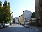
210 | Johann Wilhelm Bornemann (1766–1851), head of the Prussian state lottery and poet | May 12, 1910 | The first name was street 60c , section X / 2 of the development plan. The street leads from Uferstraße to Gottschedstraße, where the former Rotaprint factory was located, which is now an artist center. |
|
| Bornholmer Strasse
( Location ) |
390 (in the district) |
Bornholm , Danish island | 22 Aug 1903 | The first name was Straße 1, Section XI of the development plan. Bornholmer Straße connects the districts of Prenzlauer Berg and Gesundbrunnen. Most of it is in Prenzlauer Berg. Bornholmer Strasse is part of the open road ring around Berlin city center, which begins in Neukölln as the A 100 and leads to Friedrichshain. The opening of the Wall began on November 9, 1989 at the former border crossing on Bornholmer Strasse . |

|
|
Fountain square
( Location ) |
200 × 130 | formerly a health well that existed here | June 7, 1896 | The first name was place K, section X / 2 of the development plan. On January 1, 1963, the square was named again. Brunnenplatz is on Pankstrasse, Schönstedtstrasse and Thurneysserstrasse. The district court of Wedding is located here . |

|
|
Brunnenstrasse
( Location ) |
1250 (in the district) |
Gesundbrunnen formerly located at Badstrasse 39 , to which the street leads | Feb. 18, 1801 | The former street from Rosenthal begins at the former Rosenthaler Tor and turns into Badstraße at Gesundbrunnen train station . It was laid out in 1752 by order of Frederick II from Rosenthaler Tor to Bad Gesundbrunnen and is an important north-south connection through the city center of Berlin. Part of the street runs in Mitte . In addition to the Humboldthain , the former factory halls of the AEG, of which the official gate on Brunnenstrasse is still preserved, are the most striking buildings. Up until the wall was built, this was a center of border trade for visitors from the east, who got everything that was lacking in the GDR and East Berlin. There were also a number of border cinemas for audiences from the east in and around Brunnenstrasse . |

|
|
Buttmannstrasse
( Location ) |
230 | Philipp Buttmann (1809–1901), theologian | Apr 2, 1891 | Buttmann was the second pastor at St. Paul's Church in Gesundbrunnen. The street connects Badstrasse with Thurneysserstrasse. When it was built, it was called Street No. 66 a, Section X / 2 of the development plan. |

|
|
Chausseestrasse
( Location ) |
270 (in the district) |
Chaussee , an artificial road, previously a common name for a country road built with an asphalt, concrete or stone paving layer | around 1800 | The previous names were Ruppiner Heerweg (15th century to around 1750), Oranienburger Landstrasse (17th century to around 1800) and Ruppiner Strasse (around 1750 to around 1800). Part of the street runs through the districts of Mitte and Wedding . |

|
|
Demminer Strasse
( Location ) |
400 | Demmin , Hanseatic city in Mecklenburg-Western Pomerania | Oct 8, 1874 | Demminer Straße leads from Brunnenstraße to Wolliner Straße and is interrupted by the green corridor of Swinemünder Straße. The first name was Straße 37, Section XI of the development plan. In the block between Brunnenstrasse and Putbusser Strasse there is a large hardware store, next to it the Vineta elementary school and the Olof-Palme-Zentrum, a house for children and adolescents that also serves as a neighborhood meeting place. The school building from 1885 by Hermann Blankenstein is a listed monument. |

|
| Drontheimer Strasse
( Location ) |
460 | older German spelling of the Norwegian city of Trondheim | Sep 1 1897 | It already existed as a sand road in the 18th century . It was named after the visit of the Swedish King Oskar II in Berlin, who was King of Sweden from 1872 and King of Norway from 1872 to 1905. In this street there are examples from the first development around the turn of the 19th and 20th centuries (see picture). Elsewhere, residential buildings had to be demolished and the business park was created (numbers 28-38), next to it (numbers 39/40) are the DRK clinics in Berlin-Mitte. |

|
|
Ellerbeker Strasse
( Location ) |
90 | Ellerbek , district of the Schleswig-Holstein state capital Kiel | July 6, 1927 | When Ellerbeker Strasse was named after a district of Kiel, one probably stayed in the historical context of Glücksburger and Sonderburger Strasse, which was named in 1911. |

|
| Eulerstrasse
( Location ) |
340 | Leonhard Euler (1707–1783), Swiss mathematician and physicist | June 1, 1910 | The first name was Street 10b, Section XI of the development plan. |

|
| Parade Street
( Location ) |
390 | Formerly located here artillery parade ground | 1827 | When the Weddinger fields were separated, the street was given its name in 1827. The street was already marked by name on a map by Lampe from 1827. On December 8, 1934, a section of Exerzierstrasse, between Seestrasse and Schulstrasse, was renamed Persische Strasse . |

|
|
Feldstrasse
( Location ) |
280 | The road used to lead over the fields of the Weddinger Feldmark. | Sep 2 1859 | The southern part is interrupted by the center on the garden square . The northern part connects Ackerstrasse with Hussitenstrasse. |

|
| Fischhauser way
( Location ) |
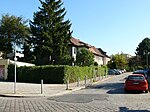
50 | Fischhausen (today: Primorsk ), until 1939 the district town of the district of the same name in the province of East Prussia , today located in the Russian Oblast Kaliningrad . | Apr 14, 1936 | The first name was street 80b of the zoning plan. |
|
| Fordoner Strasse
( Location ) |
70 | Fordon , town in the former province of Poznan ; today a district of Bydgoszcz in the Kuyavian-Pomeranian Voivodeship , Poland | Aug 9, 1929 | The first name was Street 69 of the zoning plan. |

|
| Freienwalder Strasse
( Location ) |
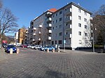
340 | Bad Freienwalde (Oder) , town in the Märkisch-Oderland district in Brandenburg | March 10, 1873 | The first name was Straße 83, Section X / 2 of the development plan. |
|
|
Garden place
( Location ) |
150 × 120 | Foreign gardening families who were settled here on the orders of King Friedrich II after 1770 | Nov 3, 1861 | The square served as a place of execution for the Berlin High Court from 1749 to 1840 and was therefore called Galgenplatz or Teufelslustgarten . When it was renamed, part of the clay path was included . The Sebastian Church was built on the square in 1890 . | |
| gardenstreet
( Location ) |
900 (in the district) |
Foreign gardening families who were settled here on the orders of King Friedrich II after 1770 | Nov 3, 1861 | Like the Ackerstrasse, the Bergstrasse, the Brunnenstrasse and the Invalidenstrasse, the street was laid out around 1752. From the middle of the 18th century until 1801 it was called the Hamburger Landwehr . In 1801, residents asked the police directorate for the official naming of the streets in the Rosenthaler Vorstadt , which was also given. On April 6, 1833, the extension of Gartenstrasse was also named Gartenstrasse. Part of the street is in Mitte . The street leads along the park at the Nordbahnhof , which is located on the former site of the Nordbahnhof and was officially opened on May 14, 2009. |

|
| Court Street
( Location ) |
640 (in the district) |
Hochgericht , which was located there in the 19th century | 1827 | Part of the street is in the Wedding district . |

|
| Gleimstrasse
( Location ) |
350 (in the district) |
Johann Wilhelm Ludwig Gleim (1719–1803), poet | Jan. 18, 1892 | The first name was Street 19, Section XI of the development plan. Initially, it only ran in today's Gesundbrunnen district from Swinemünder Straße to the S-Bahn . On October 4, 1902, the extension in Prenzlauer Berg to Schönhauser Allee was named that way. The Gleim tunnel, completed in 1911, is located along the Gleimstrasse . Part of the street is in the Prenzlauer Berg district . |

|
| Glücksburger Strasse
( Location ) |
100 | Glücksburg , town in Schleswig-Holstein | Oct 16, 1911 | The first name was Street 10b, Section XI of the development plan. |

|
| Gotenburger Strasse
( Location ) |
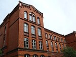
180 | Gothenburg (obsolete Gothenburg ), city in the Swedish province of Västra Götalands län and the historical provinces of Västergötland and Bohuslän | Feb 12, 1898 | The first name was Street 68a, Section X / 2 of the development plan. Its old spelling was Gothenburger Strasse . |
|
| Gottschalkstrasse
( Location ) |
310 | Richard Gottschalk (1846–1908) Pankow local politician | around 1896 | Until the border change of the then Berlin administrative districts on April 1, 1938, the street was in Pankow area. |

|
| Gottschedstrasse
( Location ) |
590 | Johann Christoph Gottsched (1700–1766), scholar and writer | Sep 15 1906 | The first name was street 64a, section X / 2 of the development plan. The buildings of the former printing press manufacturer Rotaprint are located here . | |
| Graunstrasse
( Location ) |
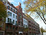
560 | Carl Heinrich Graun (1704–1759), composer and singer | March 8, 1894 | The first name was Straße 36a, Section XI of the development plan. |
|
| Border road
( Location ) |
500 | The street formed the border between Feldmark, which belongs to Berlin, and the Vorwerk Wedding . | around 1827 | The street is already marked by name on the map from 1827. |

|
| Gropiusstrasse
( Location ) |
190 | Martin Gropius (1824–1880), architect of historicism , great-uncle of Walter Gropius | Apr 2, 1891 | The first name was Strasse 66, Section X / 2 of the development plan. |

|
| Grüntaler Strasse
( Location ) |
460 | Grüntal , part of the municipality of Sydower Fließ in the Barnim district , Brandenburg | 26 Sep 1895 | The first names were Straße 75, Section X / 2 of the development plan, Communicationsweg on the Stettiner Bahn (around 1842–1865) and Völkerstraße (1873–1910). |

|
| Gustav-Meyer-Allee
( Location ) |
600 | Johann Heinrich Gustav Meyer (1816–1877), garden artist | March 8, 1894 | The first name was Straße 91, Section IX of the development plan. The company buildings of the former AEG are located between Gustav-Meyer-Allee, Brunnenstraße, Voltastraße and Hussitenstraße . In large parts of these, technology companies and parts of the TU Berlin have settled. The avenue touches the Volkspark Humboldthain . |

|
|
Hanne Sobek Square
( Location ) |
130 × 70 | Johannes 'Hanne' Sobek (1900–1989), national soccer player, coach at Hertha BSC | June 20, 2006 | On August 16, 2006, the forecourt of Gesundbrunnen station was named after Sobek. Here on the Swinemünde Bridge was the stadium at Gesundbrunnen , called 'Plumpe' by Berliners, the former home ground of Hertha BSC . |

|
| Hansastrasse
( Location ) |
200 | Hansa , historical association of Low German merchants | after 1906 | The street leads from Residenzstraße to Reginhardstraße . It got its name before 1907. On the 1907 city map, Hansastrasse is drawn in the border between Reinickendorf and Berlin plan section X-2, parallel to Christianiastrasse between Seestrasse and Residenzstrasse. It was first recorded in the address book in 1907 and two apartment buildings (3 and 15) are already inhabited, along with new buildings (4, 5, 12–17) and property 6–11 as a construction site. In addition, a plot of land 18 on Residenzstrasse is listed, which later no longer exists. In the 1910 address book in the suburb of Reinickendorf it is already well-developed and listed in horseshoe numbering . |

|
| Heidebrinker Strasse
( Location ) |
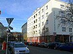
220 | Heidebrink , a seaside resort in the former Pomeranian Province , today Dziwnów Powiat Kamieński , in the West Pomeranian Voivodeship , Poland | July 6, 1927 | The first name was street 10f of the zoning plan. |
|
| Heinz-Galinski-Strasse
( Location ) |
300 | Heinz Galinski (1912–1992), President of the Central Council of Jews in Germany , victim of the Nazi regime. | Nov 27, 1998 | The part of Schulstrasse between Osloer and Exerzierstrasse was named on the occasion of Heinz Galinski's 86th birthday. The main entrance to the Jewish Hospital is located here |

|
| Heubuder Strasse
( Location ) |
80 | Hay shop, district of Gdansk | Aug 9, 1929 | The first name was street 69f of the zoning plan. |

|
| Elevated road
( Location ) |
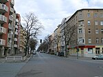
970 | due to their elevated position | Apr 6, 1833 | The name was chosen either because of the elevated location or as an equivalent to the court street on which the high court was located.
It was newly laid out in 1827 when the weddings were parceled out to a width of five rods <that is about 19 meters>. It was already marked by name on the map from 1827. In 1833 the name was probably officially confirmed. |
|
| Holzstrasse
( Location ) |
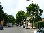
450 | Presumably after the paper mill that worked there until 1839, but which did not yet use wood as a raw material | around 1888 | Since the street is in the immediate vicinity of Paper Street, it is assumed that the name was given in connection with the paper mill that was still working there until 1839. At that time, however, wood was not used as a raw material for paper production.
The first section of the road, beginning on the provincial road, was named between 1887 and 1889. The Berlin address book from 1889 shows the street in Reinickendorf . |
|
| Hussite Street
( Location ) |
880 | Hussites , followers of the Bohemian reformer Jan Hus | Feb 16, 1883 | The first names of individual sections were Straße 81 , Straße 86 and Straße 89, Section IX of the development plan. The current name is related to Bernauer Straße, which was named in 1862. The city of Bernau successfully resisted the siege by the Hussites in 1432. |

|
|
Iranian street
( Location ) |
360 (in the district) |
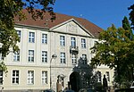
Iran , state in the Middle East | 27 Sep 1935 | The previous name was Persian Street from 1934 to 1935 . Until 1935, today's Iran was called Persia . Part of the street runs as a footpath in the Wedding district in front of the former children's hospital and was redeveloped as a street in the 1960s . |
|
|
Jasmunder Street
( Location ) |
320 | Jasmund , peninsula in the northeast of Rügen | Apr 4, 1895 | The first name was Street 86b, Section IX of the development plan. |

|
| Jülicher Strasse
( Location ) |
530 | Jülich , middle city in the Düren district , North Rhine-Westphalia | June 1, 1910 | The first name was Street 5a, Section IX of the development plan.
In this area there are streets whose geographical names indicate the increase in land for the Electorate of Brandenburg . |

|
|
Kattegatstrasse
( Location ) |
330 | Kattegat , sea area between Jutland ( Denmark ) and the Swedish west coast | 23 Sep 1938 | The previous name was Schmidtstrasse from 1895 to 1938 . |

|
| Klever Strasse
( Location ) |
200 | Kleve , middle district town in the district of Kleve , North Rhine-Westphalia | May 12, 1905 | The first name was Street 10a, Section IX of the development plan. |

|
|
Kösliner Strasse
( Location ) |
170 | Köslin , today Koszalin, town in Pomerania , in the West Pomeranian Voivodeship , Poland | July 15, 1875 | The first name was Street 65a, Section X / 2 of the development plan. The spelling after the name was given was Cösliner Straße . Known as "Red Wedding" during the Weimar Republic , bloody clashes between the police and demonstrators began on May 1, 1929 . In the clashes around Kösliner Strasse that lasted several days, 19 workers were killed and 250 injured. A memorial stone on the corner of Wiesenstrasse and Uferstrasse commemorates this. |

|
| Kolberger Strasse
( Location ) |
290 | Kolberg, today Kolobrzeg , town in Pomerania , in the West Pomeranian Voivodeship , Poland | June 28, 1875 | The previous name was Street 58a, Section X of the development plan. |

|
|
Koloniestrasse
( Location ) |
1340 | Colonies established in the vicinity of the city of Berlin in the 18th century | around 1800 | The street name refers to the colonization that began in the area around what was then Berlin in the 18th century. Settlements were planned on the outskirts of the city. The New Voigtland colony was established in today's Wedding district from 1752 , and the first settlement of a colonist in the colony behind the Luisenbad can be traced between 1782 and 1784. |

|
|
Kühnemannstrasse
( Location ) |
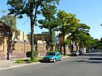
760 | Fritz Kühnemann (1840–1917), entrepreneur | before 1921 | The street was named between 1918 and 1921 and was located between Wilhelm-Kuhr- and Koloniestraße. On February 19, 1938, the extension to the Provincial Road, Straße 1 , was also given this name. The street forms the border to Reinickendorf , which includes the northern properties. |
|
| Kunkelstrasse
( Location ) |
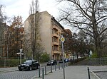
310 | Johannes Kunckel , (around 1630–1703), alchemist and successful glassmaker | May 3, 1895 | The first name was Street 57b, Section X / 2 of the development plan. |
|
|
Laböer Strasse
( Location ) |
100 | Laboe , municipality in the Plön district in Schleswig-Holstein | July 26, 1927 | The first name was street 10c of the zoning plan. |

|
| Lichtburgring
( Location ) |
180 | Lichtburg , traditional cinema in Gesundbrunnen | July 1, 2016 | The road in the new development area on Gleimstraße connects Gleimstraße with Bärbel-Bohley-Ring | |
|
Liesenstrasse ( location ) |
460 | Owner of the land Carl Adolf Friedrich Liesen (1785–1854) | 1833 | The street forms the border between Mitte and Gesundbrunnen, the largest part is in Gesundbrunnen. |

|
| Lortzingstrasse
( Location ) |
530 | Albert Lortzing (1801–1851), composer, librettist, actor, singer and conductor. | May 3, 1895 | The first name was Straße 87, Section XI of the development plan. |

|
|
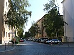
Martin-Opitz-Strasse
( Location ) |
370 | Martin Opitz von Boberfeld (1597–1639), founder of the Silesian School of Poetry and an important German poet of the Baroque era . | Aug 16, 1906 | The first name was Street 60b, Section X / 2 of the development plan. |
|
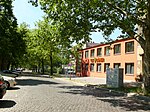
| Max-Urich-Strasse
( Location ) |
160 | Max Urich (1899–1968) gunsmith, SPD district chairman in Wedding, resistance fighter against National Socialism | May 1, 1984 | The previous name was Hermsdorfer Straße (1886-1984). |
|
|
Mönkeberger Strasse
( Location ) |
250 | Mönkeberg , municipality in the Plön district in Schleswig-Holstein | July 26, 1927 | The previous name was Street 2a of the zoning plan. |

|
|
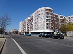
Müllerstrasse
( Location ) |
120 (in the district) |
25 mills that used to be located here, mainly around today's Weddingplatz | 1827 | Only the land between Pankebrücke and Sellerstraße belong to Gesundbrunnen. The road area and the parts to the south belong to the district of Wedding . The previous name was Straße nach Oranienburg . |
|
|
* Nauener Platz
( Location ) |
160 × 100 × 160 irregular (north) triangle (south) |
Nauen , town in the Havelland district in Brandenburg | June 1, 1910 | The town square is bordered by Reinickendorfer Strasse and Schulstrasse. It is not officially dedicated (*). |

|
| New elevated road
( Location ) |
590 | due to their elevated position | March 7, 1845 | The road was created in 1833 when the weddings were parceled out. To distinguish it from the already named Hochstraße, it was given the name Neue Hochstraße as its extension . |

|
| Nordbahnstrasse
( Location ) |
400 | Berlin Northern Railway , Berlin – Neubrandenburg – Stralsund railway line | around 1888 | The road was laid out on the property of the rentier Gustav Joachim ( Waidmannslust ), who owned the land between Wollankstrasse and Panke. He was a building contractor and acquired the area in 1892. This street is already included in the Berlin address book from 1889. On December 3, 1896, Nordbahnstrasse was given a trial lighting system by equipping the old lanterns with Auer gas incandescent light. These were also the first gas lamps in Pankow , to which the street belonged until April 1, 1938. |

|
|
Orthstrasse
( Location ) |
370 | August Orth (1828–1901), architect | 23 Aug 1902 | The first name was Straße 63, Section X / 2 of the development plan. |

|
|
Osloer Strasse
( Location ) |
1740 | Oslo , capital of Norway | Nov 4, 1938 | The part in front of Luise-Schröder-Platz belongs to the Wedding district . Osloer Straße is part of the open road ring around downtown Berlin, which runs as the A 100 from Neukölln to Friedrichshain . |

|
|
Pankstrasse
( Location ) |
1060 | Panke , tributary of the Spree , between Bernau and Berlin | 1827 | The route of the road was already drawn on a map from 1722. It was part of the way to Oranienburg that crossed the Panke at the Vorwerk Wedding. In 1827, when Wedding was subdivided, the street was named after the Panke. The street is marked by name on the map from 1827. On January 1, 1986, the part of Pankstrasse with house numbers 1-8 was included in Reinickendorfer Strasse. |

|
| Paper road
( Location ) |
140 | paper mill formerly present here | around 1888 | A paper mill is shown on a map from 1770 on the site of today's paper route. It was built around 1730 and worked as a paper mill until 1839. In 1846 a flour mill was built there. It is believed that the Dutch, the Wood and the Paper Route, which are located nearby, were named in connection with the paper mill and its production. |

|
| Prinzenallee
( Location ) |
1100 | Prince , title of nobility | before 1857 | Princes once took this route from the rabbit and chicken garden in Wedding to Niederschönhausen Castle. The rabbit garden was south of today's Prinzenallee; Today Bellermann-, Stettiner- and Grüntaler Straße run across the terrain. Around 1712 Friedrich I had the game reserve laid out for the Crown Prince (later Friedrich Wilhelm I ) as a 'hunting plaisier' and released pheasants, partridges, hares and rabbits there. However, the enclosure only existed for a few years. In 1753, the Berlin citizen Johann Paul Fischer applied for the land because he wanted to create a mulberry plantation on it. |

|
| Provincial road
( Location ) |
1260 | Prussian Province of Brandenburg | before 1876 | It is believed that the street was named after the owner, the province of Brandenburg. |

|
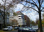
| Putbusser Strasse
( Location ) |
680 | Putbus , town on Rügen in Mecklenburg-Western Pomerania | Apr 2, 1891 | The first name was Straße 30, Section XI of the development plan. The name is related to Prince Wilhelm Malte zu Putbus (1833–1907), son of Count Carl Friedrich Heinrich von Wylich and Lottum . As an inheritance, the prince came into the possession of those at Putbus in 1860. He was one of the shareholders in the construction of the northern runway. |
|
|
Ramlerstrasse
( Location ) |
550 | Karl Wilhelm Ramler (1725–1798), called 'Der deutsche Horace', poet and philosopher | March 18, 1893 | The first name was Street 18a, Section X / 2 of the development plan. Ramler was friends with Ludwig Gleim , after whom Gleimstrasse is named. |

|
|
Ravenéstrasse
( Location ) |
220 | Louis Friedrich Jacob Ravené, (1823–1879) entrepreneur | May 3, 1895 | The first name was Street 57a, Section X / 2 of the development plan. The Ravené family had been involved in the iron trade with a focus on Prussia since 1775 . |

|
| Reginhardstrasse
( Location ) |
430 | Reginhard, male first name from which the name Reinickendorf is said to have originated | Nov 15, 1957 | The previous names were Saßnitzstrasse (around 1901–1957), Isarstrasse (around 1901–1957). Parts of the Seestrasse, Isarstrasse and Saßnitzstrasse from Oskarplatz (today: Louise-Schroeder-Platz) to Emmentaler Strasse were renamed Reginhardstrasse in 1957 as a single street. The part between Luise-Schröder-Platz and Ritterlandweg is in Gesundbrunnen. The majority is in the Reinickendorf district . |

|
| Reinickendorfer Strasse
( Location ) |
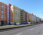
1950 | Reinickendorf , district and part of Berlin | around 1861 | The previous name was Weg nach Oranienburg (1700 to around 1861). The entire length of Reinickendorfer Straße forms the border between Gesundbrunnen and Wedding. The road area belongs to Wedding, while the properties to the east belong to Gesundbrunnen. On January 1, 1986, part of Pankstrasse (numbers 1-8) was incorporated into Reinickendorfer Strasse. Reinickendorfer Straße is part of the B 96 . |
|
| Residenzstrasse
( Location ) |
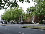
260 | Residence, seat of government of a secular ruler | The previous name was Reinickendorfer Chaussee (before 1874 to before 1877). The majority is in Reinickendorf . The street is named because it led to the royal residence in Berlin. |
|
|
| Ritterlandweg
( Location ) |
390 | a knight's seat on the Schäfersee | 17 Sep 1938 | The previous name was Justusstrasse (before 1877 to 1938). The Ritterlandweg forms the border to Reinickendorf between Reginhardstrasse and Drontheimer Strasse. The road led across the site of the former manor. |

|
|
Rügener Strasse
( Location ) |
310 | Rügen , largest German island in the Baltic Sea | Apr 10, 1867 | The first name was Straße 31, Section XI of the development plan. |

|
| Ruppiner Strasse
( Location ) |
340 | Ruppiner Land , historical landscape in Brandenburg | June 15, 1862 | Ruppiner Strasse runs over Bernauer Strasse in the Mitte district to Granseestrasse. It is divided by the green areas of Vinetaplatz and is traffic-calmed . |

|
|
Scheringstrasse
( Location ) |
270 | Ernst Christian Friedrich Schering (1824–1889), pharmacist and industrialist, founder of Schering AG | March 8, 1894 | The first name was Straße 88, Section IX of the development plan. |

|
|
Schönstedtstrasse
( Location ) |
230 | Karl Heinrich Schönstedt ( von Schönstedt since 1911 ; 1833-1924), judge and from 1894 to 1905 Prussian Minister of Justice | Jun 11, 1902 | The first name was Street 60a, Section X / 2 of the development plan. The single home in Berlin-Wedding was located here until it was closed in 1945 . The building is now part of the Wedding District Court and is responsible for European payment orders. |

|
|
Schönwalder Strasse
( Location ) |
380 | Schönwalde , part of the community Wandlitz in the district of Barnim in Brandenburg | June 1, 1910 | The previous names were Extended Fennstrasse (around 1827–1873) and Dalldorfer Strasse (1873–1910). The road connects Fennstrasse in the west with the intersection of Hochstrasse / Neue Hochstrasse in the east. |

|
| Schulstrasse
( Location ) |
400 (in the district) |
Community school, which was built in Wedding in 1821 | around 1827 | Part of the street is in the Wedding district ; it was rebuilt when the Wedding lands were parceled out in 1827. Schulstrasse was already marked by name on the map from 1827. In 1890 it was partly paved , because until then it was a dirt road that led to Pankow. The section from Exerzierstrasse to Osloer Strasse was renamed Heinz-Galinski-Strasse on November 27, 1998. At the end of the Second World War in 1945 during the Battle of Berlin, Schulstrasse, Seestrasse and Badstrasse formed the main battle line for days, with almost all buildings being destroyed or badly damaged. |

|
| Schulzendorfer Strasse
( Location ) |
340 | Schulzendorf location in the district of Berlin-Heiligensee in the Reinickendorf district | April 20, 1874 | The first name was Straße 56, Section X / 2 of the development plan. |

|
| Schwedenstrasse
( Location ) |
360 | Sweden , country in Northern Europe | Sep 2 1851 | The previous name was Woll-Strasse (1827-1851). |

|
|
Soldiner Strasse
( Location ) |
1100 | Soldin (today: Myslibórz), district town in the former province of Brandenburg in the West Pomeranian Voivodeship , Poland | March 10, 1873 | The first name was Straße 80, Section X / 2 of the development plan. |

|
| Sonderburger Strasse
( Location ) |
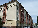
270 | Sønderborg (German: Sonderburg), city in today's region of Syddanmark in Denmark on the Flensburg Fjord . Until 1920 the district seat of the Sonderburg district in North Schleswig . | Oct 16, 1911 | The first name was Street 5b, Section XI of the development plan. |
|
| Spanheimstrasse
( Location ) |
170 | Ezechiel Spanheim (1629–1710), diplomat, lawyer and theologian, brother of the church historian Friedrich Spanheim . | June 1, 1910 | The first name was Straße 10e, Section XI of the development plan. |

|
| Steegerstrasse
( Location ) |
780 | Fritz Steeger (1844–1915), entrepreneur, landowner | around 1900 | The street runs in a wide arc from Wollankstraße to Grüntaler Straße around the cemeteries there. It initially led as a dead end from Wollankstrasse, but was then extended to Gesundbrunnen. Accordingly, houses from the imperial era have been preserved in the northern part and buildings from the 1920s and 1930s further south. |

|
| Sternstrasse
( Location ) |
190 | star-shaped intersection created by Kattegatstrasse and Sternstrasse | around 1900 | In 1897, at the instigation of the building contractor Gustav Joachim (Waidmannslust), the street was laid out and cobbled. It belonged to Pankow until April 1, 1938 . |

|
| Stettiner Strasse
( Location ) |
580 | Szczecin , capital of the former Pomeranian Province , now Szczecin, capital of the West Pomeranian Voivodeship , Poland | Feb 9, 1861 | The first name was Strasse 74, Section X / 2 of the development plan. It was only laid out in 1861 and was so named because of its proximity to the Berlin-Szczecin Railway. |

|
| Stockholm Street
( Location ) |
580 | Stockholm , capital of Sweden | June 7, 1896 | The first name was Street 69, Section X / 2 of the development plan. |

|
| Stralsunder Strasse
( Location ) |
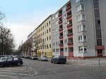
490 | Stralsund , Hanseatic city in Mecklenburg-Western Pomerania on the Baltic Sea | Feb 15, 1863 | The first names of previous sections were Straße 45 and Straße 46, Section XI of the development plan. |
|
| Strelitzer Strasse
( Location ) |
180 (in the district) |
Strelitz-Alt , also known colloquially as 'Alt-Strelitz' or 'Altstrelitz', was an old Mecklenburg country town that was incorporated into Neustrelitz as a district in 1931 and has since been called 'Strelitz Alt'. | May 29, 1862 | The first name was Street 72, Section IX of the development plan. Part of the street is in the Mitte district . |

|
|
Swinemünder Strasse
( Location ) |
1240 (in the district) |
Swinoujscie , in Polish 'Swinoujscie', place on the island of Usedom in the West Pomeranian Voivodeship , Poland | Oct 8, 1874 | The street can only be used up to Rügener Straße. In the remaining part of the road area has been converted into green areas. The street was combined from the first street numbered streets 33, 40, 41, 48, 49, 52 and 68, Section XI of the development plan. Part of the street is in the Mitte district . |

|
|
Theodor-Heuss-Weg
( Location ) |
240 | Theodor Heuss (1884–1963) first Federal President of the Federal Republic of Germany . | around 1954 | The street opens up to the Ernst Reuter housing estate, which was built in the 1950s . | |
| Thurneysserstrasse
( Location ) |
230 | Leonhard Thurneysser (1531–1595 or 1596), scholar and miracle doctor at the court of the Brandenburg Elector Johann Georg | March 17, 1891 | The first name was Street 62a, Section XI / 2 of the development plan. The singer Manuela (bourgeois Doris Wegener, † 2001) was born in house no. 3 in 1943 . |

|
| Travemünder Strasse
( Location ) |
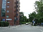
350 | Travemünde , district of Lübeck in Schleswig-Holstein | June 28, 1907 | The first name was Straße 66a, Section X / 2 of the development plan. |
|
| Tromsoe Street
( Location ) |
400 | Tromsø , capital of the Norwegian province of Troms | Dec 11, 1940 | The first name was street 69c of the zoning plan. It got its name during the German occupation of Norway by the Wehrmacht (June 1940 to May 1945). |

|
|
Embankment
( Location ) |
620 | Bank of the Panke , along which the road runs | 1827 | When the Weddinger lands were parceled out , the road was rebuilt. |

|
| Usedomer Strasse
( Location ) |
580 | Usedom , island in the Baltic Sea in front of the Szczecin Lagoon | March 16, 1886 | The extension of Usedomer Straße, which was called Am Viehhof from 1877 to 1886 , was also given this name on April 10, 1886. |

|
|
Vineta Square
( Location ) |
180 × 100 | Vineta , is the name of a fabulous city on the southern Baltic coast | Oct 8, 1874 | The first name was place E, section XI of the development plan. |

|
| Voltastrasse
( Location ) |
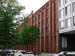
570 | Alessandro Volta (1745–1827), Italian physicist. | June 7, 1896 | The first name was Street 86a, Section IX of the development plan. |
|
|
Wattstrasse
( Location ) |
330 | James Watt (1736–1819), Scottish inventor who significantly improved the steam engine | Sep 1 1897 | The first name was Street 86c, Section IX of the development plan. |

|
| Weddingstrasse
( Location ) |
80 | Weddinger Vorwerk | after 1827 | Weddingstrasse was laid out between the Vorwerk farmstead and the garden of the Vorwerk in 1817 at the instigation of the Berlin magistrate . |

|
| Meadow road
( Location ) |
620 | Gardens and meadows of the Vorwerk Wedding | 1827 | When Wedding was subdivided, the street was rebuilt. The street is already marked by name on the map from 1827. |

|
| Wilhelm-Kuhr-Strasse
( Location ) |
250 (in the district) |
Wilhelm Kuhr (1865–1914), lawyer and local politician | 1915 | Part of the street runs in Pankow . |

|
| Wilhelm-Zermin-Weg
( Location ) |
60 | Wilhelm Zermin (1882–1973), entrepreneur and managing director of the Vaterländischer Bauverein | Feb 11, 1983 | The first name was street 103/1 of the zoning plan. |

|
| Wolgaster Strasse
( Location ) |
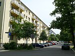
70 | Wolgast , town in the district of Vorpommern-Greifswald , Mecklenburg-Western Pomerania | June 9, 1874 | The first name was Straße 38, Section XI of the development plan. |
|
| Wollankstrasse
( Location ) |
270 (in the district) |
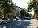
Friedrich Adolph Wollank (1833–1877), lawyer, landowner and local politician | around 1882 | The previous names were Prinzenweg (around 1703 to before 1877) and Prinzenstrasse (before 1877 to around 1882). Part of the street runs in Pankow . |
|
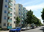
| Wolliner Strasse
( Location ) |
340 (in the district) |
Wollin , place on the island Wolin (also Wollin) in the West Pomeranian Voivodeship , Poland | Dec 6, 1874 | The first names were Straße 42 and Straße 42a, Section XI of the development plan. Part of the street is in the Mitte district . |
|
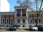
| Wriezener Strasse
( Location ) |
420 | Wriezen , town in the Brandenburg district of Märkisch-Oderland | March 10, 1873 | The first name was Street 81, Section X / 2 of the development plan. |
|
|
Zechliner Strasse
( Location ) |
160 | Village and spots Zechlin , districts of the Brandenburg town of Rheinsberg in the Ostprignitz-Ruppin district | May 3, 1895 | The first name was Street 80a, Section X / 2 of the development plan. |

|
| Zingster Street
( Location ) |
90 | Zingst , Ostseebad on the Fischland-Darß-Zingst peninsula in Mecklenburg-Western Pomerania | July 6, 1927 | The first name was street 10g . |

|
Other locations in Gesundbrunnen
Housing estates
- Ernst Reuter settlement
- Atlantic garden city
- Soldiner Kiez
- Brunnenviertel
- KGA "Sandkrug": The Sandkrug colony is not included in the allotment garden development plan, as the settler community decided that it was not an allotment garden colony under the Federal Allotment Garden Act, but rather as owner gardens . It has its own number in the official street register: 6666. The settlement "KGA Sandkrug I" (52 ° 33'11 "N, 13 ° 23'41" E) is located in the north-west bend at the north cross of the S-Bahn between Gesundbrunnen and station Bornholmer Strasse on Bornholmer Strasse . The settlement is bordered by the railway line, Sonderburger / Mönkeberger / Ellerbeker Straße and the sports fields and school on Behmstraße. The continuation of the gardens north of Bornholmer Strasse ( Bösebrücke ) as 'Kolonie Sandkrug 2' extends into the KGA 'Wiesengrund'. In the colony, the garden paths are addressed and named as properties. South of Mönkeberger Straße are Paulstraße (Mönkeberger Straße 1), Ernststraße (No. 7), Fritzstraße (No. 9) in KGA 'Sandkrug I'. In the northern part of Bornholmer Strasse are Auguststrasse (Mönkeberger Strasse 2) and Georgstrasse (No. 8), while Schulstrasse (Ellerbeker Strasse 12) opens up the gardens north of the Rudolf-Wisell primary school. The main route is Parkstraße (Sonderburger Straße 18), from which Maxstraße branches off to the northeast in the direction of Bornholmer Straße, at right angles from this to south-east the Krumme Straße and from this cross Karlstraße. In the south of the facility, Otto-Miethke-Weg opens up properties to the east as far as the railway site and the suburbs (district border center to Pankow). Department II is separated from Grünen and Wiener Weg to form KGA 'Wiesengrund', and the Rosenweg is the access to the parcels. The area was originally planned with the continuously projected neighboring streets. The school was called the 43rd and 48th elementary school, from 1938 1st and 2nd elementary school, in the post-war period the area was occupied by the allotment garden association Sandkrug, already with the Sandkrug II colony. Due to the border location after 1961 opposite the Berlin Wall (via the divided railway line ) the colony area remained unchanged. The settler community Sandkrug I is located south of Bornholmer Strasse. All roads through the settlement end as a dead end, the facility for non-settlers can only be entered on Bornholmer or Sonderburger Strasse.
Allotment gardens (colonies)
According to the area and number of parcels, a quarter of the allotment gardens in the Mitte district are located in the district . Allotment gardens in Berlin are listed in the allotment garden development plan (KGEP) and as a postal address in the regional reference system (RBS) with a street number. Most of the existing facilities in the district are not protected by showing them as grassland (allotments) in the land use plan (FNP).
- Colony 'Eintracht an der Panke' (Soldiner Straße 46–51, KGEP: 1004, RBS: 16206, Lage ): The allotment garden is noted in the development plan with 23 plots on 3462 m² as a fictitious permanent complex, plus five plots on private land from 1462 m², which are also secured by the entry in the FNP. The KGA is located south of Soldiner Strasse west of the Panke.
- Colony 'Holzweg' (Koloniestraße 99, KGEP: 1007, RBS: 6459, location ): This permanent allotment garden is located with 42 plots on 12,582 m² of state-owned leased land. This KGA is located next to KGA Sommerglück on Holzstraße.
- Colony 'Grüntal' (Grüntaler Straße 58, KGEP: 1006, RBS: 6403, location ): 14 parcels of this permanent allotment garden are located on 3296 m² of land. The facility is located on the eastern edge of the district on the northern line north of the Bornholmer Strasse S-Bahn station.
- The 'Nordkap' colony (Heinz-Galinski-Straße, KGEP: 1011, RBS: 6590, Lage ) is a secured garden with 36 plots on 7771 m² of land south of Osloer Straße on the grounds of the Jewish hospital until 2020 and could be used in the expansion of the city ring as an extension of the Seestrasse for the road expansion.
- Colony 'Panke' (Koloniestraße 48–56, KGEP: 1013, RBS: 6600, location ): 153 parcels are recorded on 40,867 m² of land as a permanent development in the development plan, but 27 parcels on private land (6638 m²) also belong to the in Level Ia are considered unsecured in the portfolio, as there is no representation in the FNP. The facility is located between Koloniestrasse and Panke, north of Heubuder Strasse.
- Colony 'Pankegrund' (Fischhauser Weg, KGEP: 1014, RBS: 6601, Lage ) is a permanent allotment garden with 33 plots on 10,756 m² of state-owned leased land. This KGA is located between the residential buildings on Koloniestrasse and the Panke, north of the KGA Panke as far as the Gustav-Boess sports facility (Kühnemannstrasse) in the northeast of the district
- Colony, Saint George '(Reinickendorferstrasse 59a KGEP: 1200, RBS: 6671, location ) with 12 plots on 3000 sqm of private land an unsecured gardens south of the Oslo road in the grounds of the nursing home and would be the expansion of the city loop extension of the lake road for the road expansion is due.
- Colony 'Scherbeeck 1902' (Kühnemannstrasse, KGEP: 1019, RBS: 6673, location ): The facility is located with 31 plots on 8945 m² of land and with 16 plots on 4799 m² of private land. Due to the entry in the land use plan as grassland (allotment gardens), the gardens on the state land are secured as fictitious permanent facilities in the stock. For the other parcels, the form of ownership only provides a temporary safeguard until 2020, as long as no development plan secures the existence of the facility as a KGA. The KGA on the northern edge of the district lies behind the residential buildings on Papierstrasse (9-18) and Provinzstrasse and Kühnemannstrasse, which are already in Reinickendorf.
- Colony 'Sommerglück' (Koloniestraße, KGEP: 1020, RBS: 6702, location ): 37 parcels are located on 11,674 m² of state-owned leased land, which in the zoning plan are intended for use other than garden land, since there is also no development plan, the facility is only available until 2020 protected. This KGA is located next to KGA 'Holzweg' on Koloniestraße at the dead end of Papierstraße.
- Colony 'Steegerstraße' (Steegerstraße, KGEP: 1027, RBS: 6737, Lage ) this allotment garden on the strip between the street and the Nordbahn is located with 13 plots on 5287 m² of private land and is not secured in the existing area.
- Colony 'Wiesengrund (-Nord)' (Grüntaler Straße 46, KGEP: 1025, RBS: 6833, Lage ): This allotment garden has 82 plots. The facility with 24,844 m² of state-owned leased land is shown in the FNP for a different use and is therefore only secured temporarily (until 2020). The facility is located north of the Bösebrücke on the eastern edge of the district.
- Colony 'Wilhelm-Kuhr (-Straße)' (Kattegatstraße, KGEP: 1026, RBS: 6843, Lage ) is a small allotment garden with eight parcels only temporarily (until 2020) secured on 1855 m² of state-owned land, which according to the zoning plan for one other application is shown. The facility is located on the southeast corner of Wilhelm-Kuhr- to Kattegatstraße opposite the Andersenschule.
Parks and other facilities
- Volkspark Humboldthain
- Former AEG site with the Innovations-Zentrum Berlin Management GmbH (IZBM) and the Berlin Innovations- und Gründerzentrum (BIG)
- Green areas on the Panke
- Fountain square
- Dorotheenstädtischer Friedhof II
See also
- List of cultural monuments in Berlin-Gesundbrunnen
- List of cinemas in Berlin-Gesundbrunnen
- List of stumbling blocks in Berlin-Gesundbrunnen
literature
- Landesdenkmalamt Berlin (Ed.): Monuments in Berlin Mitte district - Wedding and Gesundbrunnen districts . Michael Imhoff Verlag, Petersberg 2004, ISBN 3-937251-26-X .
Web links
- Map of Berlin 1: 5000 with district boundaries. Senate Department for Urban Development Berlin, 2009, accessed on May 27, 2010 .
- Street directory Gesundbrunnen. kaupert media gmbh, accessed on October 30, 2010 .
- Berlin-Brandenburg Statistics Office: List of streets and squares in the Mitte district (as of February 2015); pdf
Individual evidence
- ↑ Badstrasse . In: Berliner Adreßbuch , 1889, Part II, p. 27.
- ↑ a b c Chronicle of Wedding. 1920-1945
- ↑ LDL Berlin: rectifier plant on subway line 8
- ↑ Peter Brock (ed.): Berlin streets rediscovered. 33 forays through the capital. Jaron Verlag Berlin, 2003, ISBN 3-89773-114-2 , pp. 21-26: Behmstrasse. Great view
- ↑ Tour 3 - Subway, Bunker, Cold War. (No longer available online.) Berliner Unterwelten e. V., January 2, 2014, archived from the original on January 4, 2014 ; Retrieved January 3, 2014 . Info: The archive link was inserted automatically and has not yet been checked. Please check the original and archive link according to the instructions and then remove this notice.
- ^ Pfefferwerk Stadtkultur GmbH Olof Palme Center
- ↑ Entry in the Berlin State Monument List
- ^ Kauperts: Drontheimer Strasse
- ^ Homepage of the DRK clinics on Drontheimer Strasse
- ^ Kauperts: Exzerzierstrasse
- ↑ Garden square with an explanation of the name . In: Address book for Berlin and its suburbs , 1901, Part III, p. 195.
- ^ Kauperts: Gartenstrasse
- ↑ Park opened at Nordbahnhof. In: Der Tagesspiegel , May 14, 2009.
- ^ Kauperts: Gleimstrasse
- ↑ Official city map of Berlin: Pages 4333 and 4334 from the years 1930 to 1960 ( Memento of the original from November 16, 2016 in the Internet Archive ) Info: The archive link was inserted automatically and has not yet been checked. Please check the original and archive link according to the instructions and then remove this notice. , X = 22640, Y = 25770
- ↑ Large transport plan for Berlin and its suburbs . As a supplement to the address book for Berlin and its suburbs in 1907
- ↑ Hansastrasse . In: Berliner Adreßbuch , 1910, Teil V., p. 357. "? Residenzstraße ?, 1: Kohlenplatz, 2: Talghandlung, 3–6: Multi-party apartment building,? Seestrasse ?, 7–10: Construction sites, 11–17: Multi-party apartment building, "Residenzstrasse".
- ↑ The originally adjoining section of Seestrasse was separated from the district boundaries by Oskar-Platz after the road layout was changed from Seestrasse to Osloer Strasse in the 1930s and was named Reginhardstrasse between 1956 and 1959.
- ^ Kauperts: Hochstrasse
- ^ Kauperts: Holzstrasse
- ↑ Reinickendorf> Holzstrasse . In: Berliner Adreßbuch , 1889, Appendix, p. 90.
- ^ Kauperts: Jülicher Strasse
- ^ Kauperts: Koloniestrasse
- ^ Kauperts: Kühnemannstrasse
- ^ Kauperts: New elevated road
- ^ Reinickendorf> Nordbahnstrasse . In: Berliner Adreßbuch , 1889, Appendix, p. 90.
- ^ Kauperts: Nordbahnstrasse
- ^ Kauperts: Pankstrasse
- ^ Kauperts: paper route
- ↑ Kauperts: Prinzenallee
- ^ Kauperts: Putbusser Strasse
- ^ Kauperts: Schulstrasse
- ^ Kauperts: Sternstrasse
- ^ Kauperts: Stettiner Strasse
- ↑ Whoever trusts God and steals boards has a beautiful arbor . In: Berliner Stadtzeitung, 06/2003.
- ↑ KGA Sandkrug FIS-Broker (map of Berlin 1: 5000 (K5 color edition)) of the Senate Department for Urban Development and Environment Berlin
- ↑ Pharus city map online: Point of Interest : Sandkrug von 1925 eV in Wedding, Sonderburger Straße 10
- ^ Wedding district association of allotment gardeners
- ↑ Allotment garden development plan: inventory in the Mitte district ( memento of the original from October 23, 2014 in the Internet Archive ) Info: The archive link has been inserted automatically and has not yet been checked. Please check the original and archive link according to the instructions and then remove this notice.
- ↑ Address search of KGA in the district of Wedding
- ↑ a b According to the Federal Allotment Garden Act , “fictitious permanent allotment gardens” are other allotment gardens if the municipality is the owner of the land and the lease contracts are to be treated like contracts for permanent allotment gardens.
- ↑ a b Level Vb: Fictitious permanent allotment gardens * according to §§ 16 and 20 a BKleingG. The fictitious permanent allotment gardens are additionally protected by the representation in the FNP as green areas - allotments.
- ↑ Level IV: allotment garden areas which, according to the FNP, should be preserved. For allotment gardens on private land, procedures for binding planning law security are required or in some cases are already being processed.
- ↑ a b c d Permanently secured allotment gardens • Level V a: Allotment garden areas that are defined as permanent allotment gardens by the development plan.
- ↑ Level III a: Fictitious permanent allotment gardens which, according to the FNP, are to be used for another purpose.
- ↑ a b c Level I a: Allotment gardens on private areas which, according to the FNP, are intended for another use. A termination is possible at any time in compliance with the allotment garden regulations.
- ↑ a b c d Level III a: Fictitious permanent allotment gardens that, according to the FNP, are to be used for another purpose.
Remarks
- ↑ The information in the address books can only reflect the status of the previous year due to the preparation for printing.
- ↑ In Berlin address books, plots of land registered in the cadastre without owners are listed as parcels. If the owner is found, the construction site is indicated, regardless of whether construction is already underway. As soon as the property is built on, new construction is registered or the owner (E :), if necessary a manager (V.) and the registered residents.
