List of streets and squares in Berlin-Adlershof

The list of streets and squares in Berlin-Adlershof describes the street system in the Berlin district of Adlershof with the corresponding historical references. At the same time, this list is part of the overall project Berlin Streets and Squares .
overview
Adlershof has 19,934 inhabitants (as of December 30, 2019) and includes the postcode areas 12439 and 12489.
"Adlershoff" was founded in 1753/1754 as part of the Frederician settlement policy. In January 1753, the Oberamtmann Puhlmann received the right to the mulberry plantation on the eagle frame , and on December 8, 1753 a cabinet order was issued for the building of the eagle frame. A hereditary interest property with a colony was created on previously Köpenick terrain . This is where the first streets were located, and since 1837 the Adlershof-Süßer Grund estate and since 1879 the Adlershof community.
The streets of the district are clearly divided into the north-eastern area with residential buildings in the old Adlershof. This includes the Kleinhaus settlement area in the west in the direction of Niederschöneweide and the Wendenheide settlement in the north. Due to the housing shortage in the First World War, residential buildings were to be built by the municipality of Adlershof around Volkswohl- und Genossenschaftsstraße and Eigenheimstraße . Construction began in 1919 and stopped when it was incorporated into Berlin in 1920. The Gagfah continued to build it in 1932 , so there were changes to the routes.
University, commercial and government buildings are located south of the Adlergestell. Due to previous uses, the Johannisthal-Adlershof development area was redesigned: to the WISTA site north of Rudower Chaussee and the science location and media city south of it. The newer naming of streets followed the redesign that began after the fall of the Wall in the area of the science location between Adlershof and Johannisthal . The traffic routes between commercial areas are mostly designed as private roads of the development company. The district boundaries and thus the road situation were adjusted in this area.
District locations and main streets
Starting in the north, the district is bounded clockwise as follows: Oberspreestraße, Ostritzer Straße, S47 railway line, the Berlin outer ring , south bank of the Teltow Canal , Hermann-Dörner-Allee, Georg-Schendel-Straße, embankment of the Görlitzer Bahn , Adlergestell , Area of the main workshop in Berlin-Schöneweide , west side of the Köllnische Heide .
The eagle frame as part of the federal highway 96a and one of the most important entry and exit roads in Berlin, together with the parallel railway line of the Görlitzer Bahn, divides Adlershof into two parts:
- old district Adlershof northeast of the railway line
- new district of Adlershof with the science and business location Adlershof ( WISTA ).
In the old part of the village, Dörpfeldstrasse is also the historic center of Adlershof as a shopping street with a market square. The second important traffic route is the Glienicker Weg as a connection to the Köpenick district .
The Rudower Straße created as villages connection early on, opening up the new district as Rudower Chaussee and provides a portion of the Wegedornstraße the connection to the Ernst Ruska shore ago. The Ernst-Ruska-Ufer leads from the Adlershof junction of the A 113 along the Teltow Canal to Köpenicker Strasse , which in turn merges into Glienicker Weg . In the district, Adlergestell, Ernst-Ruska-Ufer, Glienicker Weg, 520 meters from Köpenicker Straße and Oberspreestraße belong to the higher-level road connections of the Berlin road network. This road system connects Am Studio , Groß-Berliner Damm , Hermann-Dorner-Allee , Köpenicker Straße (section to Altglienicke), Rudower Chaussee and Wegedornstraße as local main streets (Category III). Anna-Seghers- , Dörpfeld- , Nipkow- , Radicke- and Wassermann -Straße , as well as in the new economic and industrial area Karl-Ziegler- and Max-Born-Straße were added as main streets as access roads to the residential quarters in the district north of the Adlergestells .
The newly created extension of the Groß-Berliner Damm connects Adlershof with Johannisthal and Niederschöneweide . The state of Berlin invested 23 million euros in the construction of the new road in the newly developed area of the science and technology park (development of commercial areas, new construction of drinking water pipes, rainwater and wastewater sewerage).
The streets of Adlershof in the local locations differ in age and condition according to previous use. The place of residence is in the northeast of the eagle frame, it is divided by the Dörpfeldstrasse in Adlershof-Nord mainly with settlement roads and Adlershof Süd, here are the oldest (around 1880) built roads. The new Adlershof commercial and residential area WISTA is located in the southeast of the Adlergestell . Here, but also in the east of the locality, the industrialization of the place arose, especially the airfield north of Rudower Chaussee, used in the GDR for the guard regiment, with re-used barracks. South of Rudower Chaussee there was an academy site at this time, the existing streets were named by spin-off companies and some of the remaining (now) renovated buildings were used. On the strip of land of the former Adlershof television studio between the railway line “to the left of the train station” and the street Am Studio (formerly Agastraße ), the “media city” is being built with (for structural reasons ) access roads of no more than 300 meters.
Street names
The first streets were laid out and named after the reorganization of the manor district into a municipality around 1880. In the historic district of Adlershof, the oldest street names refer to local landowners and personalities of the empire. In the 1920s, in connection with cooperative buildings, streets were built that are in the context of a sense of community, such as the cooperative street and the settlement in front of the Köllnische Heide. From 1930 streets were given names after locations in Lower Silesia and locations of battles during the First World War . In May 1951, many streets with a monarchist , militarist and National Socialist background were renamed after resistance fighters or historical figures of the Peasants' War. Some of the renaming was caused by the ambiguity of the street names resulting from the formation of Greater Berlin, whereby the names of the former suburbs were initially changed.
One of the oldest Radickestrasse (named by Rittmeister Oppen after his in-laws, the distillery owners ) was named in 1960 after the writer and KPD member Peter-Kast-Strasse, who lived in Adlershof . After the political change in 1992, it was the only one to get its original name back. In the new business location Adlershof , the streets were named after natural scientists and local resistance fighters. The WISTA development area on Rudower Chaussee was expanded by the settlement of industry, science (location of the Humboldt University) and media, and new and additional streets were necessarily created.
Overview of streets and squares
The following table gives an overview of the streets and squares in the district as well as some related information.
- Name / location : current name of the street or square. Via the link Location , the street or the square can be displayed on various map services. The geoposition indicates the approximate center of the street length.
- Traffic routes not listed in the official street directory are marked with * .
- Former or no longer valid street names are in italics . A separate list may be available for important former streets or historical street names.
-
Length / dimensions in meters:
The length information contained in the overview are rounded overview values that were determined in Google Earth using the local scale. They are used for comparison purposes and, if official values are known, are exchanged and marked separately.
For squares, the dimensions are given in the form a × b for rectangular systems and for (approximately) triangular systems as a × b × c with a as the longest side.
If the street continues into neighboring districts, the addition ' in the district ' indicates how long the street section within the district of this article is. - Name origin : origin or reference of the name.
- Notes : further information on adjacent monuments or institutions, the history of the street and historical names.
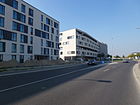
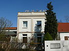
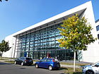
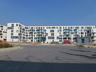
- Image : Photo of the street or an adjacent object.
| Name / location | Length / dimensions (in meters) |
Origin of name | Date of designation | Remarks | image |
|---|---|---|---|---|---|
|
Abram-Joffe-Strasse
( Location ) |
410 | Abram Joffe (1880–1960), Russian-Soviet physicist | Jan. 16, 2002 | The private road is located in the Adlershof science location . The street sign was unveiled on June 24, 2001. It leads from Max-Born-Strasse to Groß-Berliner Damm . The Lise Meitner House of the Institute for Physics and the Walther Nernst House of the Humboldt University are located here . Residential buildings are planned on the north side of the road to the northeast corner of the WISTA site, which was not used by commercial buildings until the mid-2010s, near the landscape park. |

|
| Abtstrasse
( Location ) |
150 | Franz Abt (1819–1885), composer | around 1910 | It is located between Adlergestell, or rather, Liberation Square and Anna-Seghers-Straße . The residential buildings on lots 1–9 (odd) are on the north side, 2–8 (even) on the south side. The houses on the corner of Anna-Seghers-Straße belong to this. Some residential buildings are listed in the Berlin list of monuments. In the 1922 address book the location is indicated with Adlergestell / Süßer Grund / Moltkestrasse / Adlergestell with a residential building on plot 1 (18 residents) and construction sites. |

|
|
Eagle frame
( Location ) |
2070 (in the district) |
Frame, forestry aisle | around 1700 | At 12.1 kilometers, the eagle frame is one of the longest streets in Berlin, with 2070 meters of the B 96a in the district . It is located with plots 73–786 in the districts of Niederschöneweide , Adlershof, Grünau , and Schmöckwitz . The section of the eagle frame between Schappachstrasse and Alt-Schmöckwitz was included in the eagle frame by a municipal decision in 1958. Plots 147-363 (odd, not all numbers) on the northeast side belong to the district. The railway line usually runs on the opposite side, with the exception of Am Adlergestell 250, 254 northwest of the corner of Rudower Chaussee, in front of the S-Bahn station .
The composer Rudolf Wagner-Régeny lived in house number 253 from 1950 to 1969 . The block-like residential development between Adlergestell 233-255 and the adjacent streets was built between 1926 and 1930 according to plans by Willy Mühlau and was considered a monument from the 1980s. The same applies to the residential buildings Adlergestell 267 / 267a and 269 / 269a, the designs of which were made by Ludwig Hilbersheimer and were completed in 1927. The way of the Prussian king to the hunting lodge Königs Wusterhausen is said to have been lined with eagles sitting on pillars. |

|
| Albert-Einstein-Strasse
( Location ) |
880 | Albert Einstein (1879–1955), physicist and Nobel Prize winner | Aug 26, 1998 | The first name was Einsteinstrasse . It is located in the Adlershof science area and runs from Ernst-Ruska-Ufer to Straße Am Studio . On December 1, 2003 it was opened to public transport. The BESSY II electron storage ring is located here . The Leibniz Institute for Analytical Sciences , Berlin Department, is located in house number 9 . |

|
| Alexander von Humboldt Way
( Location ) |
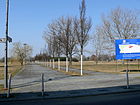
470 | Alexander von Humboldt (1769–1859), natural scientist and explorer | Feb 11, 2002 | The street is on the WISTA site between Hermann-Dorner-Allee and Abram-Joffe-Straße . 170 meters are shown as a municipal road in the Berlin street directory. Another 300 meters are marked in the RBS class as a street but according to the OKSTRA category as "N" and lead through green areas with solar fields. 110 meters of the road (RBS: STRA) are assigned to OKSTRA class N. |
|
| Altheider Strasse
( Location ) |
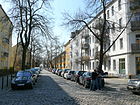
300 | Bad Altheide, town in the province of Lower Silesia , since 1945 Polanica-Zdrój in Poland | March 20, 1929 | The street was established in 1889 as the extended Feldherrnstraße from Feldherrnstraße to Adlergestell parallel to Dörpfeldstraße (then Bismarckstraße ). It connects the eagle frame with Florian-Geyer-Straße . The writer Berta Waterstradt lived in this street for several years . In 1922, the extended Feldherrnstrasse exists . At the time of the renaming in 1929, there was residential building 1/5 between Adlergestell and Thelenstrasse , followed by apartment buildings 15–31 across Moltkestrasse on the left, and 2–32 (straight) on the right. Construction sites are 16–28 on the right and 7–13 on the left, plots 1–25 (odd) and 2–4 are owned by General Manager F. Bodenstaedt. |
|
| On the eagle frame
( Location ) |
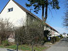
100 | related to the position of the eagle frame | after 1932 | The five-meter-wide access road branches off from the Adlergestell and opens up a residential area with the 29 residential houses Adlergestell 225a – 231c (odd). The western plots are with a front garden on the driveway, the eastern plots indirectly via a footpath. Before 1922 the street was set up as a harvest dam . In the 1922 address book, an undeveloped street leading off from Volkswohlfahrtstrasse is under the latter name . At the north end there is a turning hammer at the stab road, the connection to Anna-Seghers-Straße is prevented by their property 72-78. |
|
| At the studio
( Location ) |
980 | Adlershof media location, historically started with the Adlershof studio of the German TV broadcaster (DFF) | Sep 1 2005 | The street was laid out in the 1960s as Agastraße between the grounds of the State Broadcasting Committee (TV center of the GDR) and the Heinrich Hertz Institute ( Academy of Sciences of the GDR ). With the change in the television structure, the name was changed in 2005. The street lies between Rudower Chaussee and Köpenicker Straße. There are several studio buildings on the north side. The location of the company Solon SE was closed in 2014. |

|
| Anna-Seghers-Strasse
( Location ) |
1600 | Anna Seghers (1900–1983), writer | May 31, 1984 | The street is between Florian-Geyer-Straße (between 44 and 46, past Vimystraße ) and Otto-Franke-Straße . Plots 27, 35, 43 and 51–161 (odd, north side) and 56–150 (even) belong to the street. The section east of Silberbergstrasse was laid out in 1889 as Moltkestrasse and added to the west by Volkswohlstrasse around 1920 . In the 1930 address book, Moltkestrasse is included in Volkswohlstrasse. The writer Anna Seghers lived at Volkswohlstrasse 81 from 1955 until her death in 1983. The Anna Seghers Memorial is now located here. The Anna-Seghers-Straße ensemble is a listed architectural monument. A section of the Teltower Dörferweg lies on the road . |

|
| Arndtplatz
( Location ) |
50 (diameter) |
Ernst Moritz Arndt (1769–1860), poet, author of patriotic writings in the Wars of Liberation | after 1890 | The Arndtplatz forms the intersection of Arndtstrasse and Büchnerweg. Arndtplatz is listed in the Berlin street directory, properties are not assigned. Listed in the address book in 1922 as undeveloped on Arndtstrasse. |

|
| Arndtstrasse
( Location ) |
410 + 70 | Ernst Moritz Arndt (1769–1860), poet, author of patriotic writings in the Wars of Liberation | after 1890 | It is located east of Dörpfeldstrasse to Otto-Franke-Strasse and is interrupted by Arndtplatz. Houses No. 8, No. 12 and the Evangelical Church of the Transfiguration are listed architectural monuments. The properties 1–51 (odd) and 2–54 (even) belong to Arndtstrasse in the count from Dörpfeldstrasse to the southeast. The Evangelical Church Adlershof is at Arndtstraße 11/15 . The Christ the King Church is located behind property 12/14 (Nipkowstrasse). |

|
| On the octagon
( Location ) |
300 | The Johannisthal airfield was in the shape of an octagon - the “Am Oktogon” campus is located on the airfield area |
2002 naming around 2002 |
The footpath leads through the WISTA site and lies between Karl-Ziegler-Strasse at the corner of Wilhelm-Hoff-Strasse and Hermann-Dorner-Allee at the corner of Katharina-Boll-Dornberger-Strasse . The route is intended as a pedestrian promenade. The campus is an office and hall complex with a modernized shed roof hall , an adjoining office wing and 13 new buildings that were built according to the wishes of the tenants. The route is not included in the Berlin street directory under this name. The footpath leads from the commercial complex to the edge of the landscape park. Residential buildings are planned in the northeast corner of the WISTA site, which was not used by commercial buildings until the mid-2010s. The northern section of Auf dem Oktogon forms the project boundary, so that green space remains to the northwest on Adlershofer Flur. |

|
|
Bärdorfer line
( Location ) |
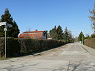
410 | Bärdorf , town in the province of Lower Silesia , since 1945 Niedzwiedz, Dolnoslaskie Voivodeship in Poland | May 17, 1930 | Road 14 was laid out according to the development plan . It connects the Bohrauer path and the Wünschelburger gang. In the 1931 address book, the street in this location is listed on the right-hand side with plots 2–58 (even, construction sites) and on the opposite side with 1–57 (odd); in 1931 there were already 17, 35, 27 and 43 buildings. |
|
| Barbara-McClintock-Strasse
( Location ) |
410 | Barbara McClintock (1902–1992), American botanist and geneticist | Sep 11 2002 | The street is on the WISTA site between Hermann-Dorner-Allee and Johann-Hittorf-Straße . Plots 6, 10 and 11 have so far (as of 2015) been built on with commercial buildings, the building on 11 belongs to the "Campus Am Oktogon". |

|
| Bendemannstrasse
( Location ) |
280 | Friedrich Bendemann (1874–1923), engineer and designer | Sep 11 2002 | The road runs from North-Willys-Straße to Wegedornstraße on the WISTA site. To the south of the road there is a sewage treatment plant . The opposite northern road to Rudower Chaussee remains undeveloped for the time being (as of 2015), lots are not named. The project planning according to the development plan XV-58a was carried out as plan road south 7 . |

|
| Bernstadter Weg
( Location ) |
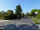
460 | Bernstadt, town in the Province of Lower Silesia , since 1945 Bierutów in Poland | May 17, 1930 | The Bernstadter Weg was laid out as road 11 according to the development plan and named with the surrounding road in 1930. It is located in the northern tip of the district (settlement Wendenheide) between Oberspree and the district boundary on Ostritzer Straße . To the street belong from the suburbs border first to the east over the Friedlander Straße to the corner lot 27 at the railway and further south the plots 1-57 (odd) and 2-58 (even). On the south side in front of Friedlander Straße 2 and 4, east of property 12, there are buildings (interrupted in the sequence of numbers, continuous from 22). |
|
| Berta-Waterstradt-Strasse
( Location ) |
130 | Berta Waterstradt (1907–1990), radio play and film author | Jun 1, 1995 | The first name according to the development plan was Straße 50 . The short access road starts from Nipkowstrasse . The choice of name goes back to the increase in the proportion of women in street names, Berta Waterstadt lived in Adlershof (Altheider Straße) for a long time and died in 1990, the grave is located in the Jewish cemetery in Berlin-Weißensee. |

|
| Birch path
( Location ) |
650 (in the district) |
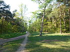
Birch , tree genus | 19th century | The former sports field Birkenwäldchen in the Köllnische Heide has the address Birkenweg 1. The path through the heather runs between Hartriegelstraße in Niederschöneweide and the Adlershof cemetery . On the way through the Köllnische Heide to the road Zur Holzoper lies a section of the Teltower Dörferweg . In addition to three birch streets and a birch avenue in the Treptow-Köpenick district, there is another birch path in the Bohnsdorf district . Birkenweg is a 190 meter footpath in the street directory under 49009. The Birkenweg is an old path through the Kölln Heath from the forest road to Schöneweide. |
|
| Bohrauer path
( Location ) |
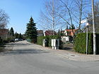
270 | Market Bohrau, village in the province of Lower Silesia , since 1945 Borów in Poland | May 17, 1930 | The access road in the "Wendenheide housing estate" (in the north of the district) was created as road 13 . It lies parallel to Oberspreestraße between Friedlander Straße and Freystadter Weg . According to the address book of 1931, plots 1–31 (odd, north side) are built on with single-family houses, apart from three construction sites. On the opposite side 2–30 (even) only number 20 is built on and inhabited. The streets surrounding the settlement are named after locations in Lower Silesia. |
|
| Boveristraße
( Location ) |
130 | Theodor Boveri (1862–1915), zoologist and anatomist | Jan. 1, 1998 | The private road was known before its official designation Schwarzschildstraße . It is located in the WISTA (on the premises of the HUB building ) and runs between Brook-Taylor-Strasse and Carl-Scheele / Max-Born-Strasse. Land is not assigned to the street. |

|
| Brook-Taylor Street
( Location ) |
310 | Brook Taylor (1685–1731), English mathematician (Taylor formula, 'Taylor series') | Aug 26, 1998 | Before its official name, the street in WISTA was provisionally called Taylorstrasse . It is located between Rudower Chaussee and Boveri- / Kroneckerstraße as a public street with the HUB central library on the northeast side. The traffic train is narrowed by the building of the wind tunnel and from there it is signposted as a footpath to Abram-Joffé-Straße. This traffic area is delimited on both sides by HUB premises with posts. Property 1 (aerodynamic wind farm) and university buildings 2–6 (straight) and commercial buildings 10 and 12 on the southwest side belong to the street. |

|
| Büchnerweg
( Location ) |
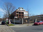
590 + 340 | Georg Büchner (1813–1837), writer | May 10, 1951 | From 1889 to 1951 the route between Zinsgutstrasse and Adlergestell was called Auguste-Viktoria-Strasse . In 1951 the East Berlin magistrate renamed it with a variety of other streets that were named after royal themes and namesake. |
|
|
Carl-Scheele-Strasse
( Location ) |
470 | Carl Wilhelm Scheele (1742–1786), German-Swedish chemist | Aug 26, 1998 | When the site was converted into a private street, the street in the WISTA was initially called Scheelestraße , and when the street was dedicated it was given its new name. The center for photonics and optical technologies is located in building number 16. The street lies in a northerly curve to the south of Ludwig-Boltzmann-Straße is supplemented by the lens, a green and park area. Accordingly, there are plots 6-16 (straight) on the north side of the street. On the list of monuments is Carl-Scheele-Straße 6–16 (even) academies for research needs based on the design by Alfred Kraus, research facility from 1960 to 1965. |

|
|
Dörpfeldstrasse
( Location ) |
1370 | Wilhelm Dörpfeld (1853–1940), archaeologist | May 24, 1951 | It is located between Adlergestell and Ottomar-Geschke-Straße and is the main shopping street in Adlershof with small shops for daily needs. Two tram lines run through the street. The Dorfstraße existed within the municipality and was integrated into the Cöpenicker Straße in 1884 and named as Bismarckstraße in 1886 with the arrival of Berliners . Ultimately in 1951 the magistrate of East Berlin renamed street names in an action of demilitarization and de-royalization , especially since the formation of Greater Berlin several times in the city . The community school built in 1890/92 is in Dörpfeldstrasse 54/56. The building, which has now been renovated, is the Adlershof cultural center and is a listed building. The market fountain, inaugurated in 1912, is an architectural monument. The market square on the street is a center in the old part of Adlershof. The tram runs through Dörpfeldstrasse on a single track with two-way traffic. |

|
|
Eigenheimgasse
( Location ) |
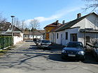
50 | Own home, local form of residential property | June 30, 19251927/6891 / | The access road in the Kleinhaussiedlung on Adlergestell was already known as Eigenheimstrasse before 1922 . A short, quiet residential street with one-story single-family homes. Eigenheimstrasse between Volkswohlstrasse and Forst is included in the 1922 address book , on the right with construction sites and on the left with the residential buildings 2–8 owned by the City of Berlin. Not yet in the 1925 address book but from 1926 it is then noted on the left with 2–8 as Eigenheim “gasse”. Nothing has changed in terms of the allocation of the property or the location between Hus- and Anna-Seghers-Straße; the properties on the opposite side are assigned to Anna-Seghers-Straße. |
|
| Erich-Thilo-Strasse
( Location ) |
200 | Erich Thilo (1898–1977), chemist | Sep 11 2002 | The street on the WISTA site is between Zum Großer Windkanal and Rudower Chaussee . South of the Rumplerzeile (Querstraße) is the Wolfgang Köhler Institute for Psychology at the Humboldt University at Rudower Straße 18. There is a hotel on property 3, behind which buildings 1 and 3 are a little further north of the Rumplerzeile. The forum and an open space with a sports field are located on the southeast side . |

|
| Ernst-Augustin-Strasse
( Location ) |
310 | Ernst Augustin (1902–1961), designer, radio and television pioneer | Sep 11 2002 | The street is located in the Media City (Medienstadt) in the area of the Adlershof / Johannisthal development area. The street on the former DFF site with lots 1–15 (odd, excluding 3 and 13) and 12 (corner of Am Studio) is between Am Studio and the railway site, up to the tram route. In the street is the "Adlershof Fundus" of "Fernssehen der DDR" (DFF). |

|
| Ernst-Lau-Strasse
( Location ) |
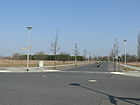
310 | Ernst Lau (1893–1978), optician, inventor of varifocal glasses | Sep 11 2002 | It runs from James-Franck-Strasse to Karl-Ziegler-Strasse on the WISTA site. With the location facing the landscape park, there is still free commercial space facing Hermann-Dorner-Allee in 2015. The property on the corner of James-Franck-Straße and a building on Barbara-McClintock-Straße that is assigned to this is developed. |
|
| Ernst-Ruska-Ufer
( Location ) |
1780 (in the district) |
Ernst Ruska (1906–1988), electrical engineer, inventor of the electron microscope | Aug 26, 1998 | The road on the Teltow Canal leads from Köpenicker Strasse to the A 113 motorway entrance and has been newly laid out. The section west of Hermann-Dorner-Allee is in Johannisthal . Due to this location, the street is classified as Category II (superordinate road links) in the Berlin road network . Between Albert-Einstein-Strasse and Volmerstrasse is the " Landeskalibrierlinie ", a facility for calibrating electro-optical distance measuring devices (EDM). The Wegedornstraße crosses with the Teltow Canal Bridge and the connection to Altglienicke. With the "development plan XV-51j" in the triangle north of the road between Albert-Einstein- and Magnusstraße, BESSY II of the HZB was granted the building rights for technology and research-oriented commercial and service companies. Projected in the development plan XV-51k as plan road south 1 (canal side road). Due to the inclined position of the adjoining streets towards the Teltow Canal against the building plans to the north triangular areas (XV-51g, XV-51j). |

|
|
Florian-Geyer-Strasse
( Location ) |
620 | Florian Geyer (~ 1490–1525), Imperial Knight , leader in the Peasants' War | May 31, 1951 | This consists of multi-storey apartment blocks in the southern area and ends in a settlement of small terraced houses with gardens. It was laid out around 1892 with the expansion of the Adlershof area as Sedanstrasse . The continuation to the west was created as an allotment garden path with the construction of the small house settlement. Both parts were (before 1925–1933) and Arrasstrasse (1933–1951). It leads from Vogelbeerstrasse to Dörpfeldstrasse. The residential building groups numbers 70-78 and 86-94 and the factory building of the wire and cable works C. J. Vogel, VEB Kabelwerk Adlershof (plant II) in the GDR era , are listed monuments. | |
| Forum
( Location ) |
200 × 100 | Forum , town square | Jan. 29, 2003 | The square (Rudower Chaussee 24) serves as a meeting point on the WISTA site. It is located on Rudower Chaussee between Newton and Erich-Thilo-Strasse. The “Forum Adlershof” visitor and event center is located on the square. “The Adlershof Forum links the public street space on Rudower Chaussee with the Humboldt University campus behind it in the science city of Adlershof. The square is a district square, like the entrance area to the Humboldt University campus. " |

|
| Franz-Ehrlich-Strasse
( Location ) |
200 | Franz Ehrlich (1907–1984), architect and designer | Sep 11 2002 | The street from Rudower Chaussee to Ernst-Augustin-Straße is in the media city of Adlershof . An oak grove was laid out on the north side facing the tram route. Parallel to Rudower Chaussee, Moriz-Seeler-Straße goes to the southwest as a cul-de-sac. |

|
| Freystadter way
( Location ) |
760 | Freystadt, town in the Province of Lower Silesia , since 1945 Kożuchów in Poland | May 17, 1930 | According to the development plan of the Wendeheide settlement, it was Straße 15 . It leads from Oberspreestrasse to Dörpfeldstrasse, built on with residential buildings. The street is paved with a parking lane and two sidewalks and turns into the Wünschelberger Gang at the southern end. A footpath leads to Dörpfeldstrasse. The backs of the eastern plots 5 and 11-85 (odd) border on the railway line on which the district boundary lies. Houses 77–85 and opposite 84 and 86 (from 4–86, straight) can be reached via the footpath. |

|
| Friedenstrasse
( Location ) |
220 | probably after the Peace of Frankfurt in 1871 | 1892 | The road leads from Dörpfeldstrasse to Radickestrasse. A tiny cinema had been located in a back building on the corner of Friedenstrasse and Radickestrasse since the 1940s. Here, in addition to normal cinema-goers, school classes were often guests because colored instructional films were shown. DEFA children's films and Russian fairy tale films were welcomed . When the cinema was no longer able to work profitably, it was closed and for many years served as a studio and fund for television broadcasting in the GDR . After the fall of the Wall , two women bought the slipper cinema in 1994 with the existing inventory and reopened it under the name 'Casablanca'. In 2001 the Casablanca changed hands. Since then, guests have been able to watch film reruns, special screenings or take part in readings in a very cozy atmosphere. The facility has 100 seats. |

|
| Friedlander Strasse
( Location ) |
1260 | Friedland, town in the Province of Lower Silesia , since 1945 Mieroszów in Poland | May 17, 1930 | According to the original development plan, the traffic route was called Straße 10 and partly belonged to Waldstraße. It runs between Freystadter Weg and Bernstadter Weg in the Wendenheide settlement in the northern tip of the district. The road running in north-south direction opens up a colony of villas in its north area, after a slight curve to the south-west it touches a housing estate from the 1930s. The Adlershof cemetery, which was laid out around 1890 and expanded several times to the northeast, has its entrance in Friedlander Straße. Here you will find a celebration hall in Romanesque style, several hereditary burials from the Wilhelminian era and the 'memorial for the fallen fighters against the Kapp Putsch ' with statues by Hans Kies . |

|
| Friedrich-Wöhler-Strasse
( Location ) |
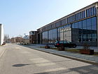
100 | Friedrich Wöhler (1800–1882), chemist | Aug 26, 1998 | The street in WISTA connects Schwarzschildstrasse with James-Franck-Strasse . The commercial building 1 is on the south side (in the complex with Schwarzschildstrasse 14), on the north side is house 2, so that the land on the street is built on. |
|
|
Gellertstrasse
( Location ) |
230 | Christian Fürchtegott Gellert (1715–1769), poet, moral philosopher | 1910 | It connects Radickestrasse with Dörpfeldstrasse and is one of the routed streets on the official site. According to the 1922 address book, the location is still undeveloped from Bismarckstrasse, parallel between Roonstrasse and Moltkestrasse . |

|
| Community street
( Location ) |
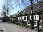
390 | Community , social, interconnected group | 1920 | The street names in this residential area were based on aspects of the common good . Mainly streets were chosen in which building cooperatives built settlements. On the street there are mostly semi-detached houses with gardens. According to the 1922 address book, the houses (partly of the small house settlement) belong to the area of the city of Berlin that has been rededicated from the forest. The street is indicated for 1921 on lots 1–39 (odd, right) and 2–46 (even, right) from Volkswohlstraße via Kleingartenweg to Genossenschaftsstraße and is built on with single-family houses. The community road leads from Helbigstrasse to Anna-Seghers-Strasse . The timber house settlement here is a listed building monument. |
|
| Cooperative Street
( Location ) |
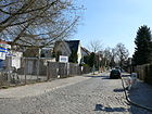
600 | Berlin building cooperative that had semi-detached houses built here | before 1889 | It runs from Vogelbeerstrasse over the communal road to Dörpfeldstrasse. In the west of the Adlershof town center, the establishment of a settlement with various types of settlement houses began around 1919 on common land on the southern edge of the forest. With the integration of Adlershof into Greater Berlin in the Treptow administrative district and the inflation period, planning was delayed. In the 1922 address book, the Genossenschaftsstrasse is listed in horseshoe numbering 1–30 (consecutive) from the market square on Bismarckstrasse via Extended Feldherrn - and Extended Waldstrasse to construction sites on Community Street (plot 15) and back. For 1935, the plots are numbered in ascending order towards Bismarckstrasse . Construction sites are listed on the left 1–33 of street 47 (odd) and right 2–30 from Longwystraße to the (crossing) community street , west of the community street are the built-up plots 35–65 (odd to the market place) and 38–68 (straight on the Bismarckstrasse). The settlement built by the Berliner Baugenossenschaft is a listed building monument. |
|
| Georg-Schendel-Strasse
( Location ) |
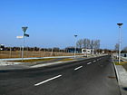
320 | Georg Schendel (1885–1911), aviation pioneer | Sep 11 2002 | The street on the former airfield Johannisthal on the border to Johannisthal leads from Groß-Berliner Damm to Wagner-Régeny-Straße . The street is in the WISTA area. There is building permission through the legally binding development plan XV-9-16. There are commercial buildings on plot 2 and 4 on the north side of the street. Up until the 1940s, the access track of the railway to the airfield was located at the level of plot 4. |
|
|
Glienicker way
( Location ) |
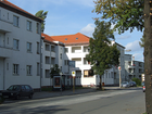
1060 | Altglienicke , a neighboring district in the Treptow-Köpenick district | handed down | The road is part of the old local connection from Altglienicke to Köpenick. As an extension of Köpenicker Straße, it leads from Adlergestell to the suburb of Köpenick and continues there as Glienicker Straße.
This road connection was expanded to four lanes between 2010 and November 2012 and could be put into operation from spring 2013. The redesign cost 22 million euros including the renewal of a railway bridge and a number of lines. The factory building of the Bärensiegel-Spirituosenfabrik , which has been vacant for several years, is a listed architectural monument. |
|
| Gottfried Leibniz Street
( Location ) |
140 | Gottfried Wilhelm Leibniz (1646–1716), universal scholar | Aug 26, 1998 | Before it was officially named, Leibnizstrasse had already been laid out south of Rudower Chaussee in order to accommodate buildings for the first founding companies from the former GDR Academy of Sciences . The street in WISTA was opened to public traffic on December 1, 2003. It connects Rudower Chaussee with Albert-Einstein-Straße. The route originally run as Leibnitzstraße does not coincide with the WISTA private road Gottfried-Leibniz-Straße. |

|
|
Groß-Berliner Damm
( Location ) |
820 (in the district) |
refers to the special purpose association for Greater Berlin that was established in 1912 | 69150630 | The road initially ran from the Sterndamm in Johannisthal to the Johannisthal airfield . In connection with the development of WISTA , the road was extended on December 20, 2006 from Segelfliegerdamm to Rudower Chaussee. The newly built section of street between house number 85 and Rudower Chaussee was incorporated into Groß-Berliner Damm on March 30, 2008. Residential buildings are planned on the southwest side of the street at the northeast corner of the district on the WISTA site near the landscape park, which was not used by commercial buildings until the mid-2010s. |

|
| Gustav-Kirchhoff-Strasse
( Location ) |
130 | Gustav Kirchhoff (1824–1887), physicist | Aug 26, 1998 | Before it was officially named, it was called Kirchhoffstrasse . The street in WISTA was opened to public traffic on December 1, 2003. It connects Albert-Einstein-Strasse with Max-Planck-Strasse. The Ferdinand Braun Institute, Leibniz Institute for High Frequency Technology is located in No. 4 . | |
|
Hackenbergstrasse
( Location ) |
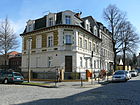
290 | Hugo Hackenberg (1849–1922), landowner | around 1890 | The road runs from Dörpfeldstrasse to Friedlander Strasse . The Köpenick master baker Hackenberg had made his property in Adlershof available for the road built around 1890. The Adlershof cemetery , which was laid out around 1890 and expanded several times to the northeast, has the entrance to Friedlander and the corner of Hackenbergstrasse. At first there was only the small area with a chapel at the northern end of the Hackenberg corner (former) Waldstrasse. |
|
| Handjerystrasse
( Location ) |
680 | Nicolaus Prinz Handjery (1836–1900), Prussian politician | before 1899 | It connects the Dörpfeldstrasse to the southeast with the Glienicker Weg . There is another Handjerystraße in Friedenau . The street has large cobblestones as a pavement and to the east the newer development with residential houses. In the 1922 address book, the numbering on Bismarckstrasse begins with 1, and the construction site of the Evangelical Church is noted on 3. The consecutive numbering of the properties ends at Glienicker Weg with 14 and going back with 15. From Auguste-Victoria-Straße there are undeveloped properties, and there are a total of 12 apartment buildings on Bismarckstraße. Handjerystraße was changed from horseshoe to orientation numbering. From Dörpfeldstrasse, plots 1–61 (odd, mainly residential buildings) are on the northeast side and 2–48 (even, residential buildings) on the south side. The commercial space between Otto-Franke-Straße and Glienicker Weg is assigned to the latter. The New Apostolic Church Community in Adlershof is located at Handjerystraße 27. |

|
| Hans-Schmidt-Strasse
( Location ) |
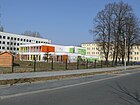
320 | Hans Schmidt (1914–1944), Johannisthal social democrat and resistance fighter | Sep 1 2003 | The private road leads from Groß-Berliner Damm to Wagner-Régeny-Straße. Offices of the district administration and the music school are located on the street. Plots 2-18 (straight, north side) on Pfarrer-Goosmann-Straße belong to the street . The barracks of the MfS guard regiment previously stationed here are partially used for this. 110 meters of the road (RBS: STRA) are assigned to OKSTRA class N. |
|
| Havestadtplatz
( Location ) |
600 × 20 | Christian Havestadt (1852–1908), civil engineer | Sep 11 2002 | The square in WISTA was initially part of Liebigstrasse . According to the development plan XV-51k bounded by Planstrasse Süd 10 and 19, a square was created at the intersection of the canal-accompanying road (Planstrasse Süd 1, then Ernst-Ruska-Ufer). It was opened to public transport on December 1, 2003. The square is on Ernst-Ruska-Ufer, from the northwest Magnusstrasse joins Richard-Willstätter-Strasse from the northeast . |

|
| Helbigstrasse
( Location ) |
420 | Louis Helbig (1832–1899), master carpenter, co-founder of the Berlin building cooperative | Jan. 16, 1889 | The street runs parallel to Genossenschaftsstraße from Dörpfeldstraße to the community street. In the development plans before 1889, Hoffmannstrasse was initially designated as Helbigstrasse . With a resolution of January 16, 1889, however, the planned road between the forest and the field path (road III) was named Helbigstrasse, while at the same time the road originally intended as Helbigstrasse was named in Hoffmannstrasse. Helbig was the first to parcel out his land in Adlershof in order to build on them with small, inexpensive houses. Together with Karl Schrader and the architect Gabriel Wohlgemuth, he founded the Berlin building cooperative bbg on May 16, 1886. The first houses were built on Helbigstrasse and Genossenschaftsstrasse. |

|
| Hermann-Dorner-Allee
( Location ) |
1460 | Hermann Dorner (1882–1963), aircraft designer | Sep 11 2002 | The street lies between Groß-Berliner-Damm and Ernst-Ruska-Ufer and forms the border to Johannisthal and the landscape park, it surrounds the WISTA site in Adlershof. The stretch of road from Ernst-Ruska-Ufer to Rudower Chaussee was completed in 2006. On September 2, 2008, the part between Rudower Chaussee and Groß-Berliner Damm was opened to traffic. Hermann-Dorner-Allee separates the Adlershof science location from the Adlershof landscape park. The road towards the science location has yet to be developed. On the north side there is a place for beach volleyball and a skate track on the grounds of the landscape park. The Teltower Dörferweg runs along a section of the road . The new, higher-level street Hermann-Dorner-Allee connects the commercial areas on Groß-Berliner Damm with Ernst-Ruska-Ufer and the Adlershof motorway junction and at the same time relieves the residential areas on Segelfliegerdamm and Sterndamm from through traffic. |

|
| Hoffmannstrasse
( Location ) |
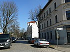
410 | Victor Aimé Hoffmann, landowner | Jan. 16, 1889 | The road leads from Hackenbergstrasse to Waldstrasse. In connection with the plan of the mayor Hans von Oppen to turn Adlershof into a villa suburb, Hoffmann pursued the goal of creating a park 'Little Venice' with canals, grottos and water art on his property. His plans failed. Before 1889, the street was shown in the development plan as Helbigstraße . By resolution of January 16, 1889, it was named Hoffmannstrasse, and at the same time the planned road between the forest and the field path (road III) was named Helbigstrasse. The regulation and paving of Hoffmannstrasse took place in 1901. |
|
| Hollstrasse
( Location ) |
200 | Elias Holl (1573–1646), master builder of the German Renaissance | May 31, 1951 | It leads from Vogelbeerstraße to Genossenschaftsstraße . The street lies in the area of the communal forest, which was redesigned for cooperative buildings in 1919, in the west on Adlergestell. After delays in the implementation of the planning, the route of road 55 of the development plan existed. When it was named Lorettostraße in 1936 , it was given to surrounding streets to places contested during the First World War . The undeveloped area at that time was opened up by them. In 1951 the street name was demilitarized to Hollstraße by the magistrate of East Berlin . |

|
| Husstrasse
( Location ) |
230 | Jan Hus (around 1369–1415), Czech reformer | May 31, 1951 | The street in the small house settlement leads from Adlergestell to Vogelbeerstraße . The previous name from 1933 to 1951 was Winterbergzeile after a World War I battle site. The renaming in 1951 by the magistrate of East Berlin took place in connection with the change of street names, which had monarchist , militarist and National Socialist origins. |

|
|
James-Franck-Strasse
( Location ) |
290 | James Franck (1882–1964), German-American physicist, Nobel Prize winner | Sep 11 2002 | It is the westernmost connection between Hermann-Dorner-Straße (north facing) and Rudower Chaussee and is on the other hand parallel to the former. The section between Rudower Chaussee and Johann-Hittorf-Straße was completed in 2006. On September 2, 2008, the part between Johann-Hittorf-Straße and Hermann-Dorner-Allee was also released. |

|
| Johann-Hittorf-Strasse
( Location ) |
590 | Johann Wilhelm Hittorf (1824–1914), physicist and chemist | Aug 26, 1998 | The street in WISTA leads from James-Franck-Strasse to Karl-Ziegler- / Max-Born-Strasse. Plots 4–8 (straight) are built on with commercial buildings. On plot 8 there is a building for the “Center for Photovoltaics and Renewable Energies”. The research buildings on the south side of the street are counted from Max-Born-Straße (2–2c). The footpath Am Oktogon continues to Hermann-Dorner-Allee and further into the landscape park . |

|
| Justus-von-Liebig-Strasse
( Location ) |
520 | Justus von Liebig (1803–1873), chemist | Aug 26, 1998 | The street in WISTA leads from Am Studio to Magnusstrasse . As one of the first streets on the site of the former academy site, it was initially called Liebigstrasse and was opened to public traffic on December 1, 2003. Plots 3–11 (odd) and 4, 6 belong to the street. The street is built on with new commercial and farm buildings, at No. 3 there is still an institute building with a brick facade that has been taken over. |

|
|
Karl-Otto-Reinsch-Strasse
( Location ) |
180 | Karl-Otto Reinsch, 1898–1910 first full-time mayor of Adlershof | Sep 11 2002 | The footpath connects Hans-Schmidt-Strasse with Merlitzstrasse and a wider route leads to Rudower Chaussee. In the Berlin street directory, the route is shown as a side street (RBS: STRA) without associated land, but assigned to OKSTRA class N. The surrounding areas of the WISTA site are undeveloped except for the south-west area with the farm building at Rudower Strasse 12 (as of 2015). |

|
| Karl-Ziegler-Strasse
( Location ) |
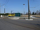
460 | Karl Ziegler (1898–1973), chemist, Nobel Prize winner | Sep 11 2002 | As an extension of Max-Born-Strasse, it connects Hermann-Dorner-Allee with Johann-Hittorf-Strasse. This is where the turning loop of tram lines 60 and 61 is located, as well as a collection of several solar panels called a “solar park” . The street is added to lots 3, 5, 10, 18. The street lies in the development area of the Adlershof science location and is still being developed. It borders directly on the Adlershof landscape park . The student village was built on the east side of the road to the northeast corner of the WISTA site, which was not used by commercial buildings until the mid-2010s, near the landscape park. |
|
| Katharina-Boll-Dornberger-Strasse
( Location ) |
580 | Katharina Boll-Dornberger (1909–1981), Austrian-German physicist | Sep 11 2002 | The street runs from Hermann-Dorner-Allee to the large wind tunnel . The street is still under development, in the southern part there are institute buildings of the Humboldt University Berlin . 440 meters of the road (RBS: STRA) are assigned to OKSTRA class N. Residential buildings are planned in the northeast corner of the WISTA site, which was not used by commercial buildings until the mid-2010s, near the landscape park. |

|
| Calico dough
( Location ) |
730 | Calico printing company founded in Oberspree in 1834 | around 1903 | The Kattunsteig is a historic route through the Kölln Heath from Adlershof to Schöneweide. The path was called Kattunweg parallel (in a different spelling) or around 1915 at times . In Oberspree (near the laundry in Spindlersfeld ) there was a calico printing plant to which the path led before the railway line Schöneweide – Spindlersfeld (1891) was laid. After the First World War , the Oberspree weapons works were located there. The path leads through the wooded area of the Cöllnische Heide from Adlershof to Niederschöneweide (towards Oberspree). It is north of the Vogelbeerstraße through the wooded area. The Kattunsteig is included in the Berlin street directory under 49020 with the RBS class FUWE ( OKSTRA as "F"). |

|
| Kekuléstrasse
( Location ) |
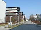
320 | August Kekulé (1829-1896), chemist | Aug 26, 1998 | The road in WISTA was already preserved in an existing route under the name of Kekuléstraße when it passed from the academy site to the science location. The first founding buildings were built here. The road was opened to public traffic on December 1, 2003. It leads from Gottfried-Leibniz-Straße to Rutherfordstraße with lots 2, 4, 5, 7. The Fraunhofer Institute for Computer Architecture and Software Technology is located in Building 7. The institute building of the HUB (Mathematics and Computer Science) on the northwest part of the street belongs to the address on Rudower Chaussee, behind the farm buildings 2 and 4 is the not officially dedicated "Akademieplatz" on Rudower Chaussee. The Institute for Silicon and Photovoltaics is located in Research Building No. 5 (along Magnusstrasse). 70 meters of the street (RBS: STRA) are assigned to OKSTRA class N. |
|
| Konrad-Zuse-Strasse
( Location ) |
240 | Konrad Zuse , inventor and entrepreneur ( Z3 ) | Jan. 28, 2014 | The road (RBS: STRA) is (as of 2015) assigned to
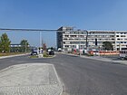
OKSTRA class N. It lies parallel to the south of Hermann-Dorner-Allee between the Berliner Damm on Katharina-Boll-Dornberger-Strasse and the north end of Newtonstrasse (corner of Am Oktagon). Residential buildings are being built in the northeast corner of the WISTA site near the landscape park, which was not used by commercial buildings until the mid-2010s. The planned street of the development plan XV-55-1 was decided by the district office 231-14 ("benhung_konrad-zuse-strasse", submitted by SenStadtUm ) on January 28, 2014 as a private street (of the Adlershof Projekt GmbH) for the planned residential area "Wohnen am Campus “dedicated. |
|
| Köpenicker Strasse
( Location ) |
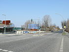
510 | Berlin-Köpenick , neighboring district | before 1890 | This old street layout is the actual connection from Köpenick to Altglienicke. It is an extension of the Glienicker Weg between Adlergestell and the (accepting) Ernst-Ruska-Ufer before which the street turns to the new Altglienicker Bridge . The road running on the bridge (over the Teltow Canal) belongs to the district, whereas the larger part of the road belongs to Altglienicke . The street name has not been clear since the city was founded in 1920 : there are further "Köpenicker Streets" in Biesdorf and Köpenick (41619), Johannisthal (41620), Rudow (02516) and in Mitte and Kreuzberg (16236), plus "Köpenicker Allee" ( 41615) in Karlshorst and the "Köpenicker Chaussee" (41616) in Karlshorst and Rummelsburg , furthermore the "Köpenicker Landstrasse" (41617) through Baumschulenweg , Niederschöneweide and Plänterwald . In the district itself there is only one building used as a residential building on the property at Köpenicker Straße 1 in the angle between an open space used for solar systems to the railway and a former industrial railway line to the corner of Am Studio . |
|
| Kroneckerstrasse
( Location ) |
100 | Leopold Kronecker (1823–1891), mathematician | Sep 11 2002 | It is designated as a municipal road. It guides the access traffic from Brook-Taylor-Strasse to Newtonstrasse between the central library and the “Great Wind Tunnel” of Humboldt University . The two-lane street has a parking lane and sidewalks on both sides. Plots are not assigned to the street, the wind tunnel is located directly on the northern edge of the sidewalk. |

|
|
Lohnauer Steig
( Location ) |
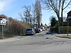
400 | Lohnau, a town in the province of Upper Silesia , since 1945 Łany in Poland | May 17, 1930 | It lies between Friedlander Strasse and Selchowstrasse . It was called Straße 17 according to the development plan and is located on the southern edge of the Wendenheide settlement towards the old location and parallel to Waldstraße . |
|
| Lotte-Loebinger-Strasse
( Location ) |
100 | Lotte Loebinger (1905–1999), actress | Sep 11 2002 | The private street on the studio premises is a junction of the street Am Studio in the extension of Wilhelm-Ostwald-Straße . At the request of the PDS on April 24, 2001, street 78 in Lotte-Loebinger-Strasse was named with further numbered streets in the district. The street was named after the daughter of a Jewish Protestant family of doctors who were temporarily married to Herbert Wehner . After returning from Moscow, she lived in East Berlin and played for DEFA . |

|
| Ludwig-Boltzmann-Strasse
( Location ) |
330 | Ludwig Boltzmann (1844–1906), Austrian physicist | Aug 26, 1998 | It connects Max-Born-Strasse with Schwarzschildstrasse . Air Liquide Deutschland GmbH's customer service center in Berlin is located in the commercial building at Ludwig-Boltzmann-Strasse 3 . The street lies in a southerly curve around the "Linse", this green and park area is supplemented to the north by Carl-Scheele-Straße . Accordingly, plot 3 (odd) is on the south side of the street to Rudower Chaussee. In Dahlem , Boltzmannstrasse also reminds of the physicist. |

|
|
Magnusstrasse
( Location ) |
570 | Gustav Magnus (1802–1870), physicist and chemist | Aug 26, 1998 | Before it was named, it had the unofficial name Magnusstraße and was opened to public traffic on December 1, 2003. This is where the Wilhelm Conrad Röntgen campus of the Helmholtz Center Berlin for Materials and Energy is located . In the south, Magnusstrasse forms the north-eastern flank of a triangle with Albert-Einstein-Strasse and Ernst-Ruska-Ufer on which BESSY II stands. |

|
| Marketplace
( Location ) |
60 × 40 | Marketplace | 1891 | The market square is located in the center of the original Adlershof community on Dörpfeldstrasse. The name is the official name (41907) of this town square. It is located on Dörpfeldstrasse between Hackenbergstrasse and Genossenschaftsstrasse, Helbigstrasse ends at the square from the northwest. |

|
| Max-Born-Strasse
( Location ) |
320 | Max Born (1882–1970), physicist, Nobel Prize winner | Aug 26, 1998 | The street is between Rudower Chaussee and Johann-Hittorf- / Abram-Joffe-Straße. Beyond Abram-Joffe-Strasse, the street continues from Karl-Ziegler-Strasse. Plots 2–2c and 4 with research buildings are on the street. The HUB buildings on the east side of the street do not belong to the street. The Max Born Institute for Nonlinear Optics and Short Pulse Spectroscopy had an impact on the street name. Its buildings 2–2c stretch along Josef-Hittorf-Straße. The Leibniz Institute for Crystal Growth is located in Building 4 . |

|
| Max-Planck-Strasse
( Location ) |
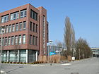
260 | Max Planck (1858–1947), physicist, Nobel Prize winner | Aug 26, 1998 | The street connects Magnusstrasse with Vollmerstrasse. After the turn of the early 1990s, during the transition from academy grounds for science location was between Einstein and Liebigstraße the Planckstraße been named. There were previous buildings that were used by spin-offs. This private road was renovated, dedicated and opened to public traffic on December 1, 2003. New commercial and research buildings were built on plots 2–6 and 3–7. The building at the southwest end houses the Physikalisch-Technische Bundesanstalt, but is addressed as Magnusstraße 9. |
|
| Merlitzstrasse
( Location ) |
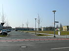
320 | Paul and Robert Merlitz (19th / 20th century), founders of the men's gymnastics club Adlershof | Sep 11 2002 | The 20 meter wide street layout (two parking lanes, two sidewalks) in the area of the WISTA connects the Groß-Berliner Damm with the Wagner-Régeny-Straße parallel next to the Rudower Chaussee. Merlitzstrasse 16, where the Adlershof sports hall is located, is built on. The properties facing the railway line are still unused as of the mid-2010s. |
|
| Moissistraße
( Location ) |
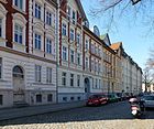
320 | Alexander Moissi (1879–1935), Austrian actor | March 22, 1951 | The street was laid out around 1880 in the eastern location between Radecke and Oppenstraße as an oak avenue and was named Roonstraße in 1889 . According to the development plan from 1889 from Radickestraße to Straße V (Glienicker Weg), factories were built on Oppenstraße on this section. In 1951, Roonstrasse was demilitarized with a new street name. |
|
| Moriz-Seeler-Strasse
( Location ) |
150 | Moriz Seeler (1896–1942), director, Holocaust victim | Sep 11 2002 | The access road from Franz-Ehrlich-Strasse is located in the media city in the area of the Adlershof / Johannisthal development area north of the street Am Studio. Plots 1–7 (odd) on the northwest side belong to the street and are still built on with buildings from the time of the DFF, in particular the low-rise Moriz-Seeler-Straße 7 ("Franz-Ehrlich-Haus") received its tower section as a characteristic at the beginning of the "Adlershof television studio" served. It was the former radio tower whose adjoining editorial building of the current camera was called the “sheepfold”. |

|
|
Neltestrasse
( Location ) |
410 | Otto Nelte (1898–1941), metal worker, resistance fighter | March 8, 1957 | The road leads from the Adlergestell over the Vogelbeerstraße to the Köllnische Heide. It was laid out as Straße 51 to develop the residential buildings of the cooperative complex and initially remained unnamed on the western edge of the settlement as an extension of the Kattunsteig. It was probably still undeveloped in 1943 and is not in the address book. Along the cobbled street are the houses 2–20 and 26 (even, east side) from the 1950s and on the west side 1–47 (odd) to the KGA “Am Adlergestell” in model buildings from the 1960s, partly across the street. |

|
| Newton Street
( Location ) |
510 | Isaac Newton (1643–1727), English naturalist | Aug 26, 1998 | The street on the WISTA site runs from Hermann-Dorner-Allee to Rudower Chaussee and is still being developed. The preserved systems of the German Research Institute for Aviation ( spin tower , engine test bench and large wind tunnel ) are listed architectural monuments. 140 meters of the road (RBS: STRA) are assigned to OKSTRA class N. Residential buildings are planned in the northeast corner of the WISTA site, which was not used by commercial buildings until the mid-2010s, near the landscape park. |

|
| Nipkowstrasse
( Location ) |
740 | Paul Nipkow (1860–1940), inventor and technician | Apr 12, 1951 | Engelmannstrasse was laid out around 1875 and renamed Kaiser-Wilhelm-Strasse in 1884 . In 1951, as part of the de-royalization of street names by the East Berlin magistrate, they were named after Nipkow. It leads from Dörpfeldstrasse to Glienicker Weg. The listed Catholic Christ the King Church is located here, built in 1928/1929 according to plans by the architect Carl Kühn . |

|
| North Willys Street
( Location ) |
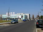
180 | John North Willys (1873–1935), American automobile pioneer | Sep 11 2002 | The road runs from Rudower Chaussee to Ernst-Ruska-Ufer. The street itself is devoid of land. On the west side of Hermann-Dorner-Allee there is an Audi center with open space and a car tower that can be seen on the adjoining autobahn . |
|
|
Oberspreestrasse
( Location ) |
1150 (in the district) |
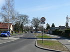
Oberspree settlement | 69200630 | The road was originally part of the historic land route from Berlin to Köpenick and now provides a connection from Niederschöneweide to the old town of Köpenick. The section of Berliner Straße in Niederschöneweide between what was then Sedanstraße and the railway line / district border to Köpenick was named Oberspreestraße around 1920, the subsequent section in Köpenick was incorporated into Oberspreestraße on November 23, 1931. Adlershof only includes the section from the district boundary to Niederschöneweide, approximately at the level of the Silbergrasweg there to the Wendenheide bridge . |
|
| Ostritzer Strasse
( Location ) |
270 (in the district) |
Ostritz , city in Saxony | March 1, 1996 | It leads from Oberspreestrasse to Bruno-Bürgel-Weg in Niederschöneweide and forms the border to this district. Road land and the undeveloped west side (Bundeswehr agency) are in the neighboring district. The houses 11-17 and 29-41 (odd) belong to Adlershof. The gardens of the houses on Friedlander Strasse extend through the plots in between . |

|
| Otto-Franke-Strasse
( Location ) |
960 | Otto Franke (1877–1953), politician ( KPD ), resistance fighter | Aug 24, 1962 | It leads from the Zinsgutstraße to the Adlergestell. The street course was laid out in 1887 as Oppenstrasse in the southeast of the town. During the Nazi era there was a forced labor camp in the street (Oppenstraße 76/78). Commercial space is preferred near the Adlergestell, while residential buildings are located north of Moissistraße. On the west side there are old buildings, the east side was built on later. |

|
|
Pastor Goosmann Strasse
( Location ) |
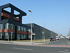
320 | Max Goosmann (1899–1971), pastor at the Evangelical Church of the Transfiguration | Sep 11 2002 | As an extension of Abraham-Joffe-Strasse, the street on the WISTA site connects Groß-Berliner-Damm with Wagner-Régeny-Strasse. Offices of the district administration and the music school are on the south side on the square facing Hans-Schmidt-Strasse. The barracks of the MfS guard regiment previously stationed here are partially used for this. |
|
| Pfingstberggasse
( Location ) |
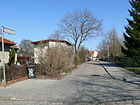
240 | Pfingstberg, battle site in the German Peasants' War near Ingolstadt in Lower Franconia . Florian Geyer had his castle there. | March 1, 1996 | The small street with properties 1 (residential building), 2 (daycare center), 6, 10 (Schle) leads from Florian-Geyer-Straße to Genossenschaftsstraße . In the street there is a day care center for the Protestant parish of Adlershof and the youth welfare service on the south side. On the north side are the garden entrances for the residential buildings on the community street. The exit to Genossenschaftsstraße leads south-east around their plots 38–44. |
|
| Liberation Square
( Location ) |
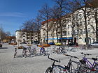
70 × 20 | The square commemorates the liberation from National Socialism by the Red Army . | 1948 | Soviet troops are said to have united on the square in April 1945. It is opposite the Adlershof S-Bahn station between Adlergestell and Abtstrasse. The square was reconstructed in 2011/2012. In the Berlin street directory as place and "G" was added. The area on Abtstrasse and the eagle frame was included in the street directory before it was named in the 1950s as Süßer Grund 1922_6589, as a residual area of the office remained here. |
|
|
Radickestrasse
( Location ) |
950 | Julius August Fritz Radicke (1809–1870), landowner | before 1880 | It leads along through Adlershof-Süd from Zinsgutstrasse to Adlergestell. The road was initially laid out as a private road and around 1880 was a barely built, sandy road. Hans von Oppen named the street after his in-laws, landowners and distillery owners. Around 1880 the existing Adlershof routes were preferably named after landowners. The residential buildings were added between 1898 and 1912. The first aviation school was set up on the road in 1912 and the first secular school in Prussia in 1920. From 1960 to 1991 it was called Peter-Kast-Straße . On January 1, 1992, it got its original name back. The liquor manufacturer Radicke acquired the Adlershof estate 'Süßengrund' on July 24, 1867. The street is one of the oldest streets in Adlershof. The Anna Seghers School (in the GDR era, the Heinz Kapelle and Marschall I. S. Konew secondary schools ), built in 1898 as the 2nd community school (for girls) by Adlershof, and the Adlergestell / Radickestrasse residential complex are listed monuments. The street is one of the oldest streets in Adlershof.
In a back building Radickestraße 46 corner Friedenstraße been held since the 1940s a Pantoffelkino , in the vernacular also flea box called. It was revived in 1994 and has been active in the neighborhood as 'Casablanca' ever since. (→ Friedenstrasse ). |

|
| Richard-Willstätter-Strasse
( Location ) |
550 | Richard Willstätter (1872–1942), chemist, Nobel Prize winner | Aug 26, 1998 | The street is on the WISTA site in the southeast. It leads from Am Studio to Magnusstraße . It was opened to public transport on December 1, 2003. Richard-Willstätter-Straße 11 is where the BAM , Adlershof branch is located . |

|
| Rudower Chaussee
( Location ) |
1720 | Rudow , part of the Berlin district of Neukölln | before 1893 | The road follows a path that was laid out in the 18th century and connected Köpenick and Adlershof with Rudow. Rudower Chaussee was already mentioned in the address book from 1893/1894. It runs from the Adlershof S-Bahn station via the WISTA site to Hermann-Dorner-Allee and continues as Eisenhutweg in the Johannisthal district . The original direct route of Rudower Chaussee to the neighboring town west around "Das Bruchland" was influenced by the construction of the Teltow Canal and the necessary bridge. With the Eisenhutweg By resolution of November 20, 1959, the part of the Koepenicker Straße, which was mainly located in Rudower, was included in the Rudower Chaussee (from the former Wredebrücke over the Teltow Canal to Rudower Straße). After 1973 the Rudower Chaussee was shortened, the section included in 1959 was repealed and the course to the west formed directly into the Eisenhutweg. Previously located apart between the academy grounds and the guard regiment , it became a central street with the science and business location . With the route between Adlergestell and the motorway junction via Hermann-Dorner-Allee and Ernst-Ruska-Ufer, Rudower Chaussee is run as a regional main road in the Berlin road network ( Category III ). Due to its central location in the "new" part of Adlershof , the street was given tram tracks in the middle position, on which lines 60 and 61 were extended from the S-Bahn station to the terminus in Karl-Ziegler-Straße. |

|
| Rumplerzeile | Edmund Rumpler (1872–1940), Austrian-German aircraft and automobile designer | before 1.2.2011 | |||
| Rutherford Street
( Location ) |
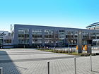
160 + 100 | Ernest Rutherford (1871–1937), New Zealand physicist, Nobel Prize winner | June 26, 1998 | When the academy site was transitioned to a new use as a science location, the existing buildings were used by spin-offs. At first, existing streets were led to these and named, including the unofficial Rutherfordstrasse. After the renovation and design, the section between Kekulé- and Albert-Einstein-Straße was opened to public traffic on December 1, 2003. The dedicated, developed street is located with lots 1 and 2 between Albert-Einstein- and Kekuléstraße. A drive through the five-storey building Rutherfordstrasse 1 leads to Rudower Chaussee. At the north end, a turning road leads around the research center to Wegedornstrasse . The German Aerospace Center Berlin is located at Rutherfordstrasse 2 . |
|
|
Schneckenburgerstrasse
( Location ) |
70 | Max Schneckenburger (1819–1849), poet | 1910 | The short street connects Anna-Seghers-Straße with Gellertstraße . There is a playground in Schneckenburger / Gellertstraße. In the 1922 address book it is listed from Moltkestrasse , but not built on. |

|
| Schwarzschildstrasse
( Location ) |
380 | Karl Schwarzschild (1873-1916), astrophysicist | Aug 26, 1998 | The private street on the WISTA site was given the unofficial name Schwarzschildstraße even before it was dedicated. It leads from Rudower Chaussee to Johann-Hittorf-Straße. The "Helmholtz Center Berlin for Materials and Energy" is located at 3 Schwarzschildstrasse. The commercial and research buildings 1, 3 and 13 on the east side, as well as 2–14, which also house Humboldt University facilities, belong to the street . Of the latter are 2, 8-14 on the street, but 4 and 6 on James-Franck-Straße . Schwarzschildstrasse leads south over Rudower Chaussee and over Bendemannstrasse to the sewage treatment plant. |

|
| Seidenbaustraße
( Location ) |
110 | To commemorate the silk construction attempted in this area in the 18th century | Aug 16, 1928 | The street was laid out in 1910 as Lilienthalstraße and was recorded as vacant in the 1922 address book from the eagle frame. It leads from the Adlergestell to Anna-Seghers-Straße. In 1751, the Kurmärkische War and Domainkammer found the area, known as the 'Süße Grund', to be suitable for a mulberry plantation . Applicants for the site were obliged to plant mulberry trees there. Seidenbaustraße is mentioned in the address book for 1929. Starting from Adlergestell 1–11 (consecutive), the plots with multi-family houses facing Moltkestrasse / Adlergestell |

|
| Selchowstrasse
( Location ) |
480 | Werner von Selchow (1806-1884), Prussian Minister of Agriculture or August Selchow (1829-1892) landowner | Jan. 16, 1889 | The street lies between Hackenbergstraße and Lohnauer Steig in the northeast of the town. It lies parallel between Dörpfeldstrasse and Stienitzseestrasse . Around 1880 it was laid out according to its location as Mittelstrasse before it was given its name on January 16, 1889. It is one of the oldest streets in Adlershof and was located between Kurstraße and Dorfstraße . It runs parallel to Dörpfeldstrasse from Hackenbergstrasse to Waldstrasse. The fire station (house number 4) has stood here since the 1920s and looks like a villa. In the ground floor area there are four arched car entrances side by side. |

|
| Silberberger Strasse
( Location ) |
310 | Silberberg, village in the province of Lower Silesia , since 1945 Srebrna Góra in Poland | March 20, 1929 | The section of Waldstraße between Adlergestell and Genossenschaftsstraße was spun off and was named Silberberger Straße in 1929. It leads from the Adlergestell to Florian-Geyer-Straße. The residential complex built in 1953/1954 and the Anna Seghers memorial are listed monuments. |

|
| Steinbachstrasse
( Location ) |
390 | Erwin von Steinbach (around 1244–1318), stonemason and master builder | May 31, 1951 | The street in the settlement 'Am Adlergestell' leads partly as a one-way street from Vogelbeerstraße to Adlergestell . From 1933 to 1951 it was called Argonnenweg . The plots 1–141 (alternating, as at the beginning for the Argonnenweg) are built with two-storey single-family row houses (small housing estate). The street is single-lane (3 meters) with a one-sided sidewalk and small front gardens, the houses have a small garden to the rear that connects to the properties on Husstraße (east side), to the west with a width of 12 meters to the neighboring properties. |

|
| Stienitzseestrasse
( Location ) |
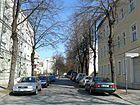
440 | Stienitzsee , lake in Brandenburg | May 31, 1951 | It leads from Hackenbergstrasse to Waldstrasse. The route was laid out as a Kurstraße after 1870 and was named Feldherrnstraße in 1889 . The development of the Genossenschaftsstrasse and Helbigstrasse from the market square to the west divided the Feldherrnstrasse and the extended Feldherrnstrasse. The southern part - Extended Feldherrnstrasse - between Adlergestell and Genossenschaftsstrasse was renamed Altheider Strasse in 1929. In 1951, as part of the designations by the East Berlin magistrate, Feldherrnstrasse followed because of the militaristic origin of its name. |
|
| Sweet reason
( Location ) |
450 | Sweet reason, old field name for the meadows formerly located here | May 9, 2000 | The already existing path was previously called the Black Path . Until 1948, the later Liberation Square bore the name 'Süßer Grund' . The path leads from Dörpfeldstraße to Büchnerweg . The five-meter-wide paved road with no sidewalk is marked as a traffic-calmed area and is included in Berlin's street directory as a municipal road. In addition to older houses and the rear of the property (north) there are some newly built homes. Plots 18–36 (straight) belong to the street, with 32–36 lying across the course of the street via a separate entrance.
A Büdner colony existed in this area under the name of Süßergrund since the middle of the 18th century . The inheritance and interest contract between the royal lantern commissioner Sievicke and the Kurmärkischen war and domain chamber of April 14, 1754 can be seen as the founding act of Adlershof. With him, the foundation stone was laid for what would later become the Adlershof-Süszengrundt estate , from which the Adlershof district emerged in 1879. |

|
|
Thelenstrasse
( Location ) |
100 | Robert Thelen (1884–1968), aviation pioneer | 1910 | Thelenstrasse connects Altheider Strasse with Silberberger Strasse . It was designated as Neue Straße B on the development plan from 1907 . The street opens up the three-storey blocks of houses on both sides to Anna-Seghers-Straße and the Adlergestell. In 1922, the six houses in a row on both sides (1–12, consecutive) owned by Bodenstedt (W35, Corneliusstrasse) are inhabited by six families. In 1910, Robert Thelen was the first to fly over the Adlershof community from the Johannisthal airfield. The street was part of Berlin's main building area VI - Adlershof, where numerous apartments were newly built or repaired. The picture shows a view of Thelenstrasse on June 5, 1950. |

|
| Thomas-Müntzer-Strasse
( Location ) |
230 | Thomas Müntzer (1489–1525), revolutionary in the peasant war | May 31, 1951 | As an extension of Florian-Geyer-Straße, it leads over Dörpfeldstraße to Radickestraße. In 1891 the street in the western part of the village was built on Metzer Straße . The traffic-calmed cobblestone street with sidewalks is predominantly built with old buildings (partly from the Wilhelminian era) and partly renovated on the facade. The plots have been renumbered opposite Metzer Straße, now numbered alternately from Dörpfeldstraße with 5–23 (odd, north side) and 2, 6–18 (even). |

|
|
Vimystrasse
( Location ) |
390 | Vimy , commune in France, site of the Battle of Vimy in 1917 | Nov 23, 1933 | It leads from Neltestrasse to Anna-Seghers-Strasse. It was laid out as Straße 54 as a planned street for the Adlershof community planned for 1919 for those looking for accommodation after the First World War . The development took place after inflation and the Great Depression at the beginning of the 1930s. The road is located in an area where several roads to battlefields of the First World War had been named. In 1951, the surrounding streets were renamed with a militaristic reference, with the exception of Vimystraße. The developed plots 2–8c (row double houses) and 18, 20 (straight, double house on the corner of Anna-Seghers-Straße) belong to the street. The plots on the two cross streets belong to these. 1935 are in the address book from street 51 on Argonnenweg (left side) 1–17 (odd, except new building No. 9 undeveloped) and on the right side to Volkswohlstraße 2–16 (undeveloped, except new building 10), as well as the Gagfah semi-detached house Listed on 18/20. |

|
| Rowanberry Road
( Location ) |
740 | Rowan , deciduous tree of the genus whitebeam | May 31, 1951 | It leads from Neltestrasse to Genossenschaftsstrasse . The planned street in the community settlement planned in 1919 was street 52 . The building of houses was delayed because the building up due to inflation and the assumption of the community finances through the formation of Greater Berlin passed into the administrative districts. With the resumption of the modified project in the early 1930s was between road 51 over Argonnenweg , Winterberg series , Arrasstraße , road 55 to the Cooperative street Longwystraße been created. The plots 3–23 (odd) on the north side belong to Vogelbeerstraße, which are in three blocks along a little distance from the street. On the south side are the residential buildings with gardens of the small house settlement on Querstraße. |

|
| Volmerstrasse
( Location ) |
830 | Max Volmer (1885–1965), chemist | Aug 26, 1998 | The road on the WISTA site was created on a route on the academy site in the area of the chemical institutes as Volmerstrasse . After the renovation and equipment, it was opened to public transport on December 1, 2003. Volmerstraße leads from Rudower Chaussee to Wilhelm-Ostwald-Straße with the exit to Ernst-Ruska-Ufer. The Society for the Promotion of Applied Computer Science has its headquarters at Vollmerstrasse 3, and the Yeast Industry Research Institute at No. 7b / 9a . |

|
|
Wagner-Régeny-Strasse
( Location ) |
330 | Rudolf Wagner-Régeny (1903–1969), composer | Sep 11 2002 | The street on the edge of the WISTA site is between Rudower Chasse and Georg-Schwendel-Strasse near the suburbs. Only property 8 on the corner of Pfarrer-Gossmann- Straße belongs to the street , the other areas on the south side are undeveloped (as of 2015). The opposite (northern) side of the road to the railway site remains undeveloped according to the plan. The building of the Institute for Product Quality is on plot 8. The street name was submitted to the district office in April 2001 at the request of the PDS parliamentary group. It had been submitted as a replacement name for the intended designation of numbered streets. The suggestion was to name the Spreetal settlement in Altglienicke streets completely after deserving artists who lived or worked in Treptow. Instead, the name was used on the WISTA site. The planned extension of the Wagner-Regeny-Strasse to extend Hermann-Dorner-Allee was named Igo-Etrich-Strasse in the Johannisthal district . |

|
| Forest road
( Location ) |
390 | Wendenheide forest area as the foothills of the Köllnische Heide | around 1885 | The forest road originally ran on the south and east edge of the Köllnische Heide in an arc from the eagle frame to the former Bismarck road . In 1929 the section from Adlergestell to Genossenschaftsstraße was renamed Silberberger Straße . A second (northern) section, from Genossenschaftsstraße to the remaining west-east section of Waldstraße, was incorporated into Friedlander Straße in 1930 . Since then, Waldstrasse (originally on the northern edge of the town) has been located between Dörpfeldstrasse and Friedlander Strasse at the level of the Adlershof municipal cemetery in the center of the district. |

|
| Walther-Nernst-Strasse
( Location ) |
130 | Walther Nernst (1864–1941), physicist and chemist, Nobel Prize winner | June 25, 1998 | The road on the WISTA site was created on an existing route on the academy site under the temporary name Nernststrasse . The buildings located here were initially used by spin-off companies. It was opened to public traffic on December 1, 2003 and leads from Albert-Einstein-Straße to Rudower Chaussee . With plots 1–5, three commercial / commercial buildings are assigned to the street, the south side belongs to the parallel Volmerstraße . |
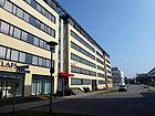
|
| Wassermannstrasse
( Location ) |
1000 | August von Wassermann (1866–1925), immunologist , possibly also Jakob Wassermann (1873–1934), writer | May 24, 1951 | Acacia avenue was laid out in this route around 1880 , which was renamed Kronprinzenstrasse in 1889 and finally (anti-royalist) in 1951 again. The street runs right through the village from Friedlander Straße to Glienicker Weg . The land count (47–135, odd and 50–134) begins with 47 (east side) and 50 (west side) on Friedlander Strasse, the smaller numbers would lead to the cemetery. The repeated enlargement of the pious cemetery to the northeast prevented the road from being extended into the forest. |

|
| Weerthstrasse
( Location ) |
110 | Georg Weerth (1822–1856), writer | May 31, 1951 | Weerthstraße is parallel to Abtstraße between Adlergestell ( Liberation Square ) and Anna-Seghers-Straße with the houses 2–10 (straight) and 3–7. Posadowskystraße was laid out around 1910 on the district of Süßer Grund . This is where the town's registry office was located in the 1920s . |

|
| Wegedornstrasse
( Location ) |
250 (in the district) |
Buckthorn , also buckthorn, genus of the buckthorn family | Dec 15, 1930 | It leads from Rudower Chaussee to Ernst-Ruska-Ufer and on over the Wegedornbrücke to Altglienicke , where most of the road is located. Due to the feed function, the road is included in the Berlin system as a local road connection. The four-lane road with a green verge and separated sidewalks and cycle paths was redesigned in connection with the traffic development in the south of the WISTA site and the construction of the Ernst-Ruska-Ufer including the Teltow Canal Bridge. A property payment starts with 28 (even) and 29 (odd) in the neighboring district, in Adlershof there are no properties assigned to the street. On the west side there is undeveloped green space and the farm building of the sewage treatment plant, the buildings opposite are on the neighboring streets. |
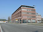
|
| Wilhelm-Hoff-Strasse
( Location ) |
400 | Wilhelm Hoff (1883–1945), flight technician | Sep 11 2002 | The street on the WISTA site runs from Karl-Ziegler-Strasse to Groß-Berliner Damm . Residential buildings are planned in the northeast corner of the WISTA site, which was not used by commercial buildings until the mid-2010s, near the landscape park. |
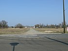
|
| Wilhelm-Ostwald-Strasse
( Location ) |
230 | Wilhelm Ostwald (1853–1932), chemist, Nobel Prize winner | Aug 26, 1998 | The street leads from Am Studio to Volmerstraße . After 1990, the road was first used on the route of an internal road of the previous academy site to reach companies of the academy spin-offs under the name Ostwaldstrasse . With the renovation and standard-compliant equipment of the street on the WISTA site, it was opened to public traffic on December 1, 2003. The street includes commercial and commercial buildings on plots 1–7 on the southeast side and tennis courts (Berlin Tennis Club WISTA) on No. 4. |

|
| Willi-Schwabe-Strasse
( Location ) |
110 | Willi Schwabe (1915–1991), actor and television presenter | Sep 11 2002 | The street is in the Media City on the WISTA site. It starts from Ernst-Augustin-Strasse . At the request of the PDS of April 24, 2001, the street 72 in Willi-Schwabe-Straße was named with further numbered streets in the district. |
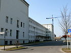
|
| Wunschelburger course
( Location ) |
190 | Wünschelburg, town in the Province of Lower Silesia , Radków in Poland since 1945 | May 17, 1930 | According to the development plan, it was laid out as street 16 in the Wendenheide housing estate . The road connects Lohnauer Steig and Freystadter Weg . From the latter it leads the vehicle traffic. |
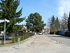
|
|
Zinsgutstrasse
( Location ) |
670 | Interest , estate depending on a landlord | March 19, 1938 | The previous name between 1888 and 1938 was Kaiser-Friedrich-Straße . The renaming also took place because with the formation of Greater Berlin there were several Kaiser-Friedrich-Strasse in the entire city and ambiguities should be eliminated. For the story, see also Süßer Grund . The Zinsgutstrasse lies between Dörpfeldstrasse and Glienicker Weg on the northern edge of the Adlershof location. It closes the streets west of Dörpfeldstrasse to the north. The allotment garden colony "Lange Gurke" is located on the street (southeast side) facing the railway line. The street is built on the south side (right) on plots 2–76 (straight) and opposite (1–75) with residential buildings, including condominiums. The areas below the Fritz-Lesch-Stadion are built on with blocks of flats from the 1960s, the addressing is mainly subdivided with lowercase letters. At the west end, houses 77–87a are assigned to Dörpfeldstrasse. |

|
| To the big wind tunnel
( Location ) |
240 | Large wind tunnel , technical monument as part of the aerodynamic park | Sep 11 2002 | The road connects as an extension of Hans-Schmidt-Straße on the grounds of WISTA the Newtonstraße with the Grand-Berliner Damm. Plots 1, 3 (southeast) and 2–6 (straight) are on the street. The latter are three barracks of the former MfS guard regiment standing in the square northwest of the street . The district office is housed in building 4. In mid-2010, WISTA Adlershof handed over “Kaserne 1” to the university for the large wind tunnel 6 . The building had undergone various interim uses in recent years and was prepared for these purposes - only without any major overhaul. It is named after the wind tunnel built between 1932 and 1934 on behalf of the German Research Institute for Aviation (DLV). At that time it was built from 8 cm thick, centrally reinforced concrete. The average diameter is approx. 10 m and the individual lengths and the spans of the tubes are up to 40 m. Historical static documents no longer exist. Since the wind tunnel is very popular for filming and no information is available regarding permissible traffic loads, the structure was statically verified and permissible traffic loads determined. |
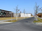
|
| To the spiral tower
( Location ) |
90 | Trudelturm , technical monument as part of the aerodynamic park | Feb 9, 2005 | The connecting route is on the WISTA site as a private road to the pedestrian area on Brook-Taylor-Strasse, which runs through the. It leads past the engine test bench to the spin tower. This street is interrupted by the aerodynamic park from Zum Großer Windkanal and leads directly from Max-Born-Straße to the Trudelturm. Properties are not assigned to this street, but it is included in the Berlin street directory under 9229 as a municipal street. |

|
| To the wooden opera
( Location ) |
400 | Wooden opera, traditional name of the former clubhouse of the workers gymnastics club Adlershof | Nov 1, 2011 | Of the co-operative road outgoing private road opens a new settlement area that has been set on the plot cooperative road. 1 In 1927, the ATV (Workers' Gymnastics Association) Adlershof built a sports field and a wooden barracks that served as a club house (known as the “wooden opera”). The sports field was closed in 1997. The name 'wooden opera' probably refers to cultural events that took place in the sports center. The street was dedicated at the meeting of the Treptow-Köpenick district office on 23 August 2011 with resolution no. 632/11 on the designation of a private street in the Adlershof district . |
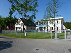
|
Former streets
According to the address book from 1922, the streets Am Kanal, Adlerhorst, Amselhorst and Drosselsteg on the other side of the Teltow Canal in the corner of the Grünauer Kreuz belonged to the Adlershof corridor under Post Grünau. With the district reform of 1938 these came to the district of Grünau. The address “Flugplatz”, which was also listed for Johannisthal in 1935, is referred to the southern area to the left of the station and the northern area to the right of the station for Adlershof. The area on Rudower Chaussee is owned by the city of Berlin. 1935 Rudower Chaussee is listed (continuously) up to No. 7 as demolition and 8–15 for the magistrate, 31–41 for the Reichsbauamt from the train station to the Altglienicke district. On the opposite side next to undeveloped land, buildings belonging to the Reichsbahn's treasury, industrial areas. Between property 124c and 125 there is a "path" to the east before the counting in front of the railway, eagle frame ends on this side. 1922 is the description of the Rudower Chaussee Adlergestell / Bahnhof to the district of Rudow. For the north side the entry “Flugplatz (belongs to Johannisthal)” and 150–176 (barracks), on the south side 1 (construction site), on property 2 inhabited by railway workers (owner: Bruck'sche Erben) and property 3 the restaurant “Birkenwäldchen ".
| Surname | Origin of name | when named | until when valid | possibly today's name | Remarks |
|---|---|---|---|---|---|
| Agastrasse | Autogen-Gasaccumulatoren AG (Aga), a factory for technical gases previously located here | before 1966 | Sep 1 2005 | → At the studio | The street was laid out at the end of the 1950s between the studio grounds of the German television station and the AdW and was then given this name. An official name assignment is not verifiable. |
| Avenue from Coepenick to Glinicke | Berlin-Köpenick , Altglienicke direction | handed down | before 1890 | → Köpenicker Strasse | It was the old local connection from the town of Cöpenick to the village of Altglienicke. When Adlershof was a municipality in the Teltow district, the state of development also changed. |
| Argonnenweg | Argonne , landscape in north-eastern France, theater of war in the First World War | Nov 23, 1933 | May 31, 1951 | → Steinbachstrasse | The street in the settlement 'Am Adlergestell' was a numbered private street before it was named . It was located on the area of the former community forest in the Köllnische Heide, which was created in 1919 for housing developments by the Adlershof community, the development of which was only implemented in the 1930s. It is mentioned for the first time in the address book in 1935 with the properties 1–141 (alternating, orientation numbering) owned by Gagfah . In addition to some new buildings, inhabited single-family houses are recorded. The theme of the Battle of Argonne was the reason for the renaming in 1951. |
| Arrasstrasse | Arras , theater of war in the First World War in north-eastern France | Nov 23, 1933 | May 31, 1951 | → Florian-Geyer-Strasse | The naming of the street, Straße 53 , Kleingartenweg and Sedanstraße, took place in November 1933 in connection with the names of battle sites during the First World War. The Arrasstraße is in the address book in 1935 between Longwy- to Bismarck route specified, left the land 1-111 (odd) and right 2-112 (even). In the smaller numbered lots of the city of Berlin around the community street there are mostly single-family houses, to the east to Bismarckstrasse there are multi-family houses. In the post-war period , the name was changed as part of the demilitarization in 1951 by the magistrate of East Berlin. |
| Auguste-Viktoria-Strasse | Auguste Viktoria , wife of Wilhelm II. Last German Empress and Queen of Prussia | 1889 | May 10, 1951 | → Büchnerweg | The road initially led from the Adlergestell to the Buxenstein and Lieberoth factory and was then expanded to Kaiser-Friedrich-Straße (Zinsgutstraße). In the address book in 1931 are for the left side of Kaiser-Friedrich-Strasse , Street A , Crown Prince , - Handjerystraße , Arndt place Arndt, Kaiser Wilhelm - Roon - Volkswohl road the land 1-191 (odd, built 15 houses) . On the right side 2–100 (straight, eleven partly multi-family houses) from Kaiser-Friedrich-Strasse, over Handjery-Arnsdtstrasse, Arndtplatz, Kaiser-Wilhelm-Strasse , passage to Bismarckstrasse , Roon -, Volkswohlstrasse , Adlergestell. Most of the properties are designated as construction sites. Auguste-Viktoria-Strasse . In: Berliner Adreßbuch , 1931, p. 1945. |
| Bismarckstrasse | Otto von Bismarck (1815–1898), Chancellor of the German Empire | July 29, 1886 | May 24, 1951 | → Dörpfeldstrasse | The road was initially the Dorfstraße , and was laid out on an Heerweg leading from Frankfurt (Oder) and Köpenick to Saxony. The village street as the main street of belonging to the circle Teltow rural community Adlershof was with the increasing urbanization of Adlershof and the influx of Berliners in 1886 after Chancellor Bismarck named. In 1951, in the course of changes in street names with monarchist and militarist origins, the magistrate in East Berlin named it Dörpfeldstrasse. |
| Cöpenicker Strasse | Berlin-Köpenick , direction | Dec 13, 1884 | 17 Aug 1886 |
→ Dörpfeldstrasse (since 1951) |
The Dorfstrasse from Adlershof was named as the connection route to Köpenick in Cöpenicker Strasse , a small section in the north-west area was still called Chaussee nach Cöpenick until around 1935 . Here was the customs house of the community. Between 1886 and 1951, the traffic route inside and outside the town was called Bismarckstraße . |
| Village street | traditional name for the main street of a village | handed down | Dec 13, 1884 |
→ Dörpfeldstrasse (since 1951) |
The Dorfstrasse was created with the expansion of the colony and the Adlershof estate. The Dorfstrasse as the main street of the rural community of Adlershof, which belongs to the Teltow district, was named after the Reich Chancellor Bismarck with the increasing urbanization of Adlershof and the influx of Berliners . In doing so, the entire traffic route was also included outside the local area up to the city limits of Köpenick. |
| Oak alley | Oaks , deciduous trees (see also acacia avenue) | after 1880 | Jan. 16, 1889 | → Moissistraße | The street was laid out around 1880 in the eastern location between Radeckestrasse and Oppenstrasse as an oak avenue and renamed Roonstrasse in 1889 . According to the development plan from 1889 from Radickestraße to Straße V (Glienicker Weg), factories were built on Oppenstraße on this section. In 1879 the estate was dissolved, Adlershof was given the status of an urban municipality, and the place on Adlergestell / Dorfstrasse was given a breakpoint . In Adlershof's residential area west of Bismarckstrasse , some streets were planned as avenues in the direction of Grünauer Parforceheide, from which, for example, the street names Eichen- and Akazienallee resulted. |
| Home street | Home ownership, form of residential property | around 1920 | 1926 | → Eigenheimgasse | The road was laid out in the 1919 planned community settlement for those in need of the First World War. Since the planned expansion was transferred from the rural community of the Teltowkreis to the new city due to the change in the planning and financial level with the formation of Greater Berlin , the settlement construction was interrupted and the route was probably downgraded to the "Gasse". In the 1922 address book, vacant lots are listed on the left and 2–8 (straight) four “private homes” of the city of Berlin are listed on the right, including for the community doctor and the community secretary. |
| Engelmannstrasse | Engelmann family, the namesake of the street has not yet been determined exactly. The architect Ernst Engelmann is possible. |
1875 | Dec 13, 1884 | → Nipkowstrasse | The street was laid out around 1875 and referred to as Engelmannstraße in the development plans . According to the development plan of 1889, it ran from Bismarckstrasse to Glienicker Weg. The namesake of the street has not yet been determined exactly. The architect Ernst Engelmann is possible, as the naming was initially influenced by Rittmeister Oppen. |
| Harvest dam | Relation to the yields (harvest) of the allotment gardens of the small house settlement | before 1922 | after 1935 | → On the eagle frame | The street was created with the community settlement planned in 1919. In the location between Adlergestell and Volkswohlstrasse, it is undeveloped in both 1922 and 1935 and is likely to have been renamed when the settlement houses were built in the mid-1930s. This applies equally well to the 1922 by harvesting dam outgoing Siedlungsweg to. |
| Feldherrnstrasse | Generals , military leaders of the Franco-German War 1870/71 | 1889 | May 31, 1951 | → Stienitzseestrasse | The road, laid out in the 1880s, originally ran west of the current Dörpfeldstraße from Waldstraße to Adlergestell. It was divided by the development of the area around Genossenschaftsstrasse and Helbigstrasse and the construction of new streets. The northern part ran between Waldstrasse and Hackenbergstrasse, the southern part between Adlergestell and Genossenschaftsstrasse. The southern part was renamed Altheider Strasse in 1929. The renaming of the remaining Feldherrnstrasse to Stienitzseestrasse took place in 1951. In the 1922 address book, the road running from plot 1 on Hackenbergstrasse is listed in horseshoe numbering to Kronprinzenstrasse followed by construction sites 9-14 to Waldstrasse . On the opposite side, eleven lots of the 15–31 are built with multi-family houses. |
| Kaiser-Friedrich-Strasse | Friedrich III. (1831–1888), German Emperor and King of Prussia | 25 Sep 1888 | March 19, 1938 | → Zinsgutstrasse | Kaiser-Friedrich-Strasse in Adlershof originally ran from what was then Bismarckstrasse to the border of the Weiland property and was later extended to Glienicker Weg. In the empire , newly laid streets were named after people from the ruling family. The development of Adlershof began after 1880 with the rail connection and the formation of the Teltow community from the manor district on the eastern side of Dorfstrasse . |
| Kaiser-Wilhelm-Strasse | Wilhelm I (1797–1888), first German Emperor and King of Prussia | Dec 13, 1884 | Apr 12, 1951 | → Nipkowstrasse | In the empire , newly laid streets were named after people from the ruling family. The development of Adlershof began between 1870 and 1880 with the rail connection and the formation of the Teltow community from the manor district on the eastern side of Dorfstrasse . The renaming took place in 1951 in order to eliminate street names of monarchist, militaristic and National Socialist origin. |
| Kleingartenweg | Allotment gardens of the settlement houses | around 1922 | Nov 23, 1933 | → Florian-Geyer-Strasse | The name of the path referred to the neighboring allotment gardens that were created when the part of the Köllnische Heide near the eagle frame was transformed into the small house settlement. Kleingartenweg was included in 1933 together with Straße 53 of the development plan and Sedanstraße leading to Bismarckstraße in Arrasstraße . In the 1922 address book the street is noted as a continuation of Sedanstraße across the community road to the forest. On the right side, plots 1–19 (odd) and left 2–20 (even) are built on with settler houses that are owned by the city of Berlin, the Adlershof community and the Greater Berlin Housing Association. |
| Kronprinzenstrasse | Crown Prince , term in monarchies for the eldest son of an emperor or king | Jan. 16, 1889 | May 24, 1951 | → Wassermannstrasse | Around 1880 the Akazienallee (see Eichenallee ) was laid out in the north of the town, which was renamed Kronprinzenstrasse in 1889 and finally (anti-royalist) in 1951 again. However, the length of the road is little developed. According to the address book from 1922, Kronprinzenstraße is between Waldstraße (1,2 undeveloped), via Hoffmann-, Feldherrn-, Selchow-, Bismarckstraße, Radicke-, Auguste-Viktoria-, Oppenstraße, Glienicker Weg with 1–24 and backwards with 25– 49 numbered (consecutively). Of these properties, 33 are still undeveloped, and some of the existing residential buildings are inhabited by 14 tenants. Connected plots on Bismarckstrasse and Radickestrasse have not yet been completed. |
| Kurstrasse | Kurmark , territory of the Holy Roman Empire, on which the electoral dignity of the Margraves of Brandenburg was based | after 1870 | March 20, 1929 | → Altheider Strasse | The name is probably derived from the electoral dignity and refers to the Brandenburg electors. Local references and the Prussian history of the empire are linked to this. The first change of name to Feldherrnstraße took place as the southern section . |
| Lilienthalstrasse | Otto Lilienthal (1848–1896), German aviation pioneer | 1910 | Aug 16, 1928 | → Seidenbaustraße | Because of its proximity to the Johannisthal airfield, the street was named after the aviation pioneer Lilienthal. In the 1922 address book, Lilienthalstrasse is recorded as vacant, starting from the Adlergestell. The Seidenbaustraße is already mentioned in the address book in this route for 1929. At this point in time from the Adlergestell 1–11 the plots (continuously) with multi-family houses to Moltkestrasse / Adlergestell. |
| Avenue of lime trees | Linden , tree genus Tilia in the linden family | 1880 | Jan. 16, 1889 | → canceled | According to the development plan, the street ran from Radickestrasse to Strasse IV . The latter was a street planned between Adlergestell and Moissistraße, which was later not realized. For the reasons for choosing a name, see Eichenallee . |
| Longwystrasse | Longwy , town in the Meurthe-et-Moselle department, theater of war in the First World War | Nov 23, 1933 | May 31, 1951 | → Vogelbeerstrasse | The planned street in the community settlement planned in 1919 was called Straße 52 . The building of houses was delayed because the building up due to inflation and the assumption of the community finances through the formation of Greater Berlin passed into the administrative districts. With the resumption of the modified project in the early 1930s was between road 51 over Argonnenweg , Winterberg series , Arrasstraße , road 55 to the Cooperative street Longwystraße been created. Plots 1–17 (odd, north side) are specified as forest and 2–18 (even) on the south side as undeveloped (construction sites). In 1933 it was named in a district with street names after fighting in the First World War and renamed in 1951 by the magistrate of East Berlin in the course of changing street names with monarchist or militaristic origins. |
| Lorettostrasse | Loretto , mountain ridge in northern France, site of the Loretto Battle | Jan. 18, 1936 | May 31, 1951 | → Hollstrasse | According to the development plan, it was laid out and laid out as road 55 as early as 1920 , but the settlement road was also named in 1936 with the development. The street was in a neighborhood where streets were named after fighting in World War I and was renamed in 1951 with changes in street names of monarchist and militaristic origins. In 1937, Lorettostraße is listed in the address book from Longwystraße to Genossenschaftsstraße with the housing estates 1–33 (odd) and 2–32 (even). There is a green area on plot 19/21. 1937/6082 |
| Metz Street | Metz , city in France. As the capital of Lorraine, Metz was part of the German Empire from 1871 to 1918. | July 18, 1891 | May 31, 1951 | → Thomas-Müntzer-Strasse | It is one of the first streets laid out in Adlershof since 1880. The development began east of the Bismarck - to Radickestrasse . It was named in memory of the battles for Metz, which were victorious for the German troops in the Franco-Prussian War of 1870/71 . The street was renamed in the wake of changes in street names that were monarchist or militaristic in origin. In the 1922 address book, the houses are listed in horseshoe numbering and eight of the 18 properties have not yet been built on. |
| Moltkestrasse | Helmuth Karl Bernhard von Moltke (1800–1891), "Moltke the Elder (the Elder)", Prussian Field Marshal General | Jan. 16, 1889 | 26 Sep 1929 | → Anna-Seghers-Strasse from 1984 | In the development plan, Moltkestraße led from Radickestraße to the initially planned street IV (between Adlergestell and Moissistraße). In 1929 she was incorporated into Volkswohlstrasse . In the 1922 address book is Moltkestrasse (south side) from Volkswohl- via Extended Forest-, Extended Feldherrn-, Lilienthal-, Bismarck-, Abt-, Poladowsky- to Radickestrasse with construction sites and further with the built-up properties 1–11 (continuously) via Auguste -Victoria- and Oppenstraße to Glienicker Weg. On the north side going backwards 12–19 (continuous), of which 17, 18, 19 were built on. Continue from Radickestraße with construction sites via Schneckenburger, Bismarck-, Verlangerte Feldherrn-, Extended Waldstraße to the forest. The street was incorporated into Volkswohlstraße in 1929. |
|
Oppenstrasse
Oppenplatz |
Hans Ludwig Waldemar Oppen von Huldenberg (1837–1901), landowner, local politician, last landowner at Adlershof | 1887 | Aug 24, 1962 | → Otto-Franke-Strasse | The street course was laid out in 1887 as Oppenstrasse on the southeast edge of the village. In the 1922 address book, Oppenstrasse is shown between Adlergestell and Kaiser-Friedrich-Strasse with lots 1–45 and 46–65 going backwards. In particular, there are construction sites on the road. On the west side of Roonstraße (52–58) there are multi-family houses, on the south side there is a galvanizing plant (3–5), the Adlershof felt factory (6/7) and a residential building (No. 16 on the passage to Glienicker Weg). In the 1943 address book, Oppenstrasse is listed with alternating numbers, 1–105 (odd) and 2–104 (even) from Zinsgutstrasse to Adlergestell. Built with multi-family houses and still a few construction sites. Oppenplatz existed on Oppenstrasse . |
| Peter-Kast-Strasse | Peter Kast (formerly Preißner, Carl) (1894–1959), metal worker, writer | June 24, 1960 | Jan. 1, 1992 | → Radickestrasse | Radickestrasse is one of the oldest streets and is located in Adlershof-Süd. In 1960 it is named after Kast, who died in 1959 and who lived with his family in Adlershof. He was editor of Die Rote Fahne and a member of the International Brigades during the Spanish Civil War . In the GDR he worked as a freelance journalist and writer, including for DEFA films. The street got its old name back in 1992. |
| Posadowskystrasse | Arthur von Posadowsky-Wehner (1845–1932), politician | around 1910 | May 31, 1951 | → Weerthstrasse | Posadowskystraße was laid out around 1910 on the district of Süßer Grund . From the 1920s to 1940s, house 1 was the location of the town's registry office . Around 1920, plots 1 ( see also Adlergestell 28), 4 (corner of Moltkestrasse ) and 6 (see also Süßer Grund 1) were built with multi-part houses. There was also horseshoe numbering . In the 1943 address book, the street on the left (odd) Süßer Grund and on the right (even) Adlergestell to Volkswohlstraße is recorded. Plot 1 (left) does not exist, residential building 3/5 is connected to Süßer Grund 1 and on the right side No. 2 with eagle frame 263. Plots 4–8 are still undeveloped. The renaming in 1951 by the magistrate of East Berlin took place in connection with the role of Posadowsky-Wehner as Secretary of State during the socialist laws in the 1890s. |
| Roonstrasse | Albrecht von Roon (1803–1879), Prussian general and minister | Jan. 16, 1889 | May 31, 1951 | → Moissistraße | According to the development plan of 1889, the street, laid out as an oak avenue , was planned from Radickestraße to Straße V (later Glienicker Weg). In 1922, Roonstrasse was included in the address book with residential buildings numbered 1–11 to Oppenstrasse and back 12–18, 8, 9, 17a and 18 were built up with multi-family houses, Roonstrasse 16 is the school, 17 the storage area of a construction business. The Roonstrasse was renamed in the course of the changes of street names, which were of monarchist or militaristic origin, by the magistrate of East Berlin. |
| Black way | Schwarzer Weg is usually a used, mostly unnamed traffic route | handed down | May 1, 2000 | → Sweet reason | The route was not provided with a road sign, but was listed in current street directories. With the new construction of settlement houses on the route, the name of the former official area on Adlergestell (since the end of the 1940s place of liberation ) was taken up again as a characteristic name for Adlershof. |
| Sedanstrasse | Sedan , city in northern France, theater of war during the First World War | around 1892 | Nov 23, 1933 | → Florian-Geyer-Strasse | The Sedanstraße was laid out around 1892 in the south of the development area of the rural community Adlershof between the central Bismarckstraße and the Waldstraße. 1933 were Straße 53 , the small garden path and Sedanstraße related to names of places of slaughter of the First World War in Arrasstraße renamed. One reason for the renaming was probably the large number of Sedan streets with the formation of Greater Berlin . In 1951, it was finally named as part of the demilitarization by the magistrate of East Berlin. |
| Extended Feldherrnstrasse | Generals , military leaders of the Franco-German War 1870/71 | 1889 | 1929 | → Altheider Strasse | The commander road was built in the 1880s and was west of the Dörpfeldstraße (then Bismarck street) between Forest Street and Adlergestell. By setting up an open space, the continuous course was disturbed and the southern section was given the name Extended Feldherrnstrasse . In 1922, according to the address book, there were construction sites between Adlergestell, Thelenstrasse , Moltkestrasse , Sedanstrasse , property 11 was only built on at the corner of Sedanstrasse with an apartment building. The name was changed in 1929 to Altheider Straße. |
| Volkswohlstrasse | Popular welfare, synonym for common sense | around 1920 | May 31, 1984 | → Anna-Seghers-Strasse | The naming corresponded to the striving in the Weimar Republic to attach greater importance to social elements. Initially the street was shorter, it ended at about the same level as Silberberger Straße, which was laid out in 1929. Volkswohlstrasse is listed in the 1922 address book. On the right-hand side in the extension of Moltkestrasse on Erntedamm with the single-family houses (owner: City of Berlin) 1–21 across the community street. On the left side are the single-family houses 2–22 across Eigenheimstrasse between Moltkestrasse and Forst. The street was merged with Moltkestrasse in 1929. |
| Winter mountain range | Winterberg is a battle site of the First World War, northwest of Reims (France), western end of the contested Chemin des Dames ridge | Nov 23, 1933 | May 31, 1951 | → Husstrasse | Before it was named, the path was a private path in the Am Adlergestell settlement. The street is named after a World War I battlefield in a settlement area with similar street names. In 1951 the name was changed in connection with the change of other street names with monarchist , militarist and Nazi origins. |
Other locations of Adlershof
Allotment gardens
The allotment garden facilities (KGA) according to the Federal Allotment Garden Act are underlined in their importance by the allotment garden development plan (KEP) as an essential part of urban greenery. The update of the KEP provides information about the security of the KGAn up to 2020.
- KGA, Am Adlergestell '(09003, Am Adlergestell 181, Lage ) is a fictitious permanent allotment garden with 161 plots on 66,162 m² of state-owned leased land. There are five permanent residents in the complex.
- KGA, Ehrliche Arbeit '(09019, Büchnerweg / Moissistraße, Lage ) owns 20 parcels on 5,117 m² of state-owned leased land. The facility is only temporarily secured because the area is intended for a school extension.
- KGA, Progress' (09028, Am Adlergestell 153, Lage ), this facility is secured for six plots on 2455 m² of state-owned leased land as permanent and for 30 plots on 12,772 m² of private leased land only temporarily.
- KGA, Lange Gurke '(09054, Zinsgutstraße 49c, Lage ) is a permanently secured allotment garden for 37 plots on 17,100 m² of state-owned leased land.
- KGA, Teltowkanal III '(09081, Köpenicker Straße 69, Lage ) is located on 83,738 m² of state-owned leased land with 155 parcels, 35 of which are permanent residents, as permanent allotment gardens.
- KGA, Wendenheide '(09091, Friedlander Straße 81, Lage ) is only a conditionally secured facility and owns 15,933 m² of state-owned land with 43 plots and a further 23 plots on 15,343 m² of private leased land.
Housing estates
Because of the restrictions of the Federal Allotment Garden Act, since the 1990s, some allotment garden associations have decided to dedicate the former colony or parts of it as a settlement, so that the areas have been turned into building land and, if necessary, the garden paths formerly listed at the address of the complex have been dedicated to official or private roads . In addition, there have been residential areas that have existed for a long time, some of which are organized by associations or cooperatives.
- On the eagle frame ( location )
- Wendenheide settlement ( location )
- Settlement of community street I ("Holzhaussiedlung") ( location )
- Genossenschaftsstrasse I housing estate ( location )
- Housing complex Zinsgutstrasse ( location )
Parks, business locations
- State-owned cemetery Adlershof (cemetery development plan 5056, location ), with an area of 12.12 hectares, of which 4.21 hectares are not subject to piety ; they are supposed to forest or green areas rezoned be.
- Köllnische Heide , location
- Commercial areas
- Aerodynamic park
- Science and business location Adlershof
- Berlin chemistry , location
- Adlershof media location (site of the former DFF and part of the Adlershof freight yard)
- Adlershof cemetery (Friedlander Straße 156) with the memorial for the fallen fighters against the Kapp Putsch by Hans Kies as a garden monument.
Kies, Hans Details selection
See also
literature
- Institute for Monument Preservation (Ed.): The architectural and art monuments of the GDR. Capital Berlin-II . Henschelverlag, Berlin 1984, p. 203 ff .
- Rudi Hinte: Adlershof; Part II from 1920 . From the colonist village of Sueszen Grundt to the center for science, economy and media. Media office Ebner, Berlin 2003.
Web links
- Map of Berlin 1: 5000 with district boundaries. Senate Department for Urban Development Berlin, 2009, accessed on January 11, 2011 .
- Street directory Adlershof. kaupert media GmbH, accessed on February 25, 2011 .
- Office for Statistics Berlin-Brandenburg: Directory of streets and squares in the Treptow-Köpenick district (PDF, as of February 2015)
- Start-up center - Adlershof technology center. WISTA-MANAGEMENT GMBH, accessed on March 22, 2012 .
- berlin.de: Adlershof has a hodgepodge of housing developments
Individual evidence
- ↑ berlin.kauperts.de: Adlershof district
- ↑ a b c d e Adlershofer newspaper: Pictures from then and now (PDF) November 2011, accessed on June 24, 2015
- ↑ Printed matter - V / 0221: Name of 46 private roads in the business location Adlershof, BAAG premises
- ↑ Printed matter VI / 1677 - amendment of the BA resolution 71/02 of July 9th, 2002 to designate private roads in the development area of the business and science location Adlershof
- ↑ adlershof.de: Orientierungsplan-adlershof.pdf (PDF)
- ↑ a b c New streets for Berlin Adlershof - Hermann-Dorner-Allee and James-Franck-Straße opened Press release of the district office of September 4, 2008, accessed on June 26, 2015
- ↑ on the condition of this area in the 1980s
- ↑ a b c d District Office confirms internal designations in WISTA - In Adlershof streets bear names of scientists . In: Berliner Zeitung , July 24, 1998, accessed June 22, 2015
- ↑ on this the development plans XV-51a – k and XV-58a
- ↑ Printed matter - V / 0019: Designation of a private street in the Adlershof science location in "Abram-Joffe-Straße"
- ↑ a b c d e f g h adlershof.de: Living on campus (PDF)
- ↑ Abtstrasse . In: Berlin address book , 1922.
- ↑ The architectural and art monuments… . Pp. 403/404
- ↑ a b c Adlershof yesterday and today. 1754-2004. Aphaia Verlag Berlin, ISBN 3-926677-42-2 ; P. 31: Memory keeps people alive
- ↑ a b Altheider Strasse . In: Berliner Adreßbuch , 1930, Part IV, p. 1916.
- ↑ Harvest Dam . In: Berlin address book , 1922.
- ↑ Printed matter - V / 1244 Renaming of Agastraße in the Adlershof district between Rudower Chaussee and Köpenicker Straße to "Am Studio"
- ↑ a b Anna-Seghers-Straße 81, residential complex, 1953/1954 design office of the German Academy of Sciences in Berlin, with Anna Seghers memorial (apartment of Anna Seghers 1955–1983)
- ↑ Ensemble Anna-Seghers-Strasse
- ↑ Monument Arndtstrasse 8, Villa, 1886 by Robert Buntzel
- ↑ Architectural monument at Arndtstrasse 12, villa, 1886 by Robert Buntzel
- ↑ Monument Arndtstrasse 11–15, Ev. Transfiguration Church with forecourt, built 1899–1900 by Building Councilor Klutmann with Robert Leibnitz
- ↑ City map of Berlin, sheet 4021 ( Memento of the original dated November 9, 2015 in the Internet Archive ) Info: The archive link was inserted automatically and has not yet been checked. Please check the original and archive link according to the instructions and then remove this notice. : the southern edge of the airfield was on the edge of the newly laid out streets: Johann-Hittorf-, Abram-Joffe- and Pfarrer-Goosmann-Straße.
- ^ Adlershof current October 2002: All roads lead to Adlershof. New roads for the development area (PDF) page 3; Retrieved July 1, 2014, retrieved February 1, 2016.
- ↑ a b c d Clarification of the situation on a map of Berlin 1: 5000 (K5 color edition), produced by the district surveying offices
- ↑ Am Oktogon - Campus for Commerce and Technology , accessed on July 1, 2014.
- ^ "Am Oktogon" - campus for trade and technology
- ↑ Bärdorfer line . In: Berliner Adreßbuch , 1931, p. 1945.
- ↑ adlershof.de: Orientierungsplan_Legende.pdf (PDF)
- ↑ a b c d e f g city map of Berlin 1907: Kattunsteig and Birkenweg
- ↑ a b On the location of Birkenweg and Kattunsteig between Adlershof and Oberspree on the map of Berlin and the surrounding area in 1932
- ^ Theodor Heinrich B. is the namesake; confirmed in an email from the Treptow-Köpenick Civil Engineering Office dated July 2013 to "44Pinguine"
- ↑ Center for Photonics and Optical Technologies on adlershof.de
- ↑ LDL Berlin: Academies for research needs
- ↑ Dörpfeldstrasse 54/56, 1st Adlershof Community School, 1890–92 by Robert Buntzel
- ↑ Dörpfeldstrasse, Marktbrunnen, 1912 by Alfred Krause
- ↑ Things remain tight in Dörpfeldstrasse ( memento of the original from December 15, 2015 in the Internet Archive ) Info: The archive link was inserted automatically and has not yet been checked. Please check the original and archive link according to the instructions and then remove this notice. in Berliner Abendblatt , January 18, 2014, queried June 28, 2015
- ↑ Eigenheimstrasse . In: Berliner Adreßbuch , 1922, p. 1619.
- ↑ Eigenheimgasse . In: Berliner Adreßbuch , 1926, p. 1855.
- ↑ Development plan XV-58a and XV-51k
- ↑ Senate Department for Urban Development and the Environment: State calibration facility
- ↑ a b c d City Map Berlin 1907: Adlershof
- ↑ Florian-Geyer-Straße 70–78, 86–94, residential building groups of the Berliner Baugenossenschaft, 1897–1899 from the construction department of the Berliner Baugenossenschaft
- ↑ Florian-Geyer-Straße 109, administration building, 1907 by Albert Pförtner; Production building, built around 1921–1922 by Hermann Liebenow and Schmidt-Werden
- ↑ Printed matter - V / 0345: Change of BA resolution 71/02 of July 9th, 2002 "Designation of 46 private roads in the Adlershof science location", BAAG site and designation of a newly built private space in the BAAG site, Johannisthal district, in "Forum "
- ↑ adlershof.de: Grand opening of the "Forum Adlershof"
- ↑ betckejarosch.de ( page no longer available , search in web archives ) Info: The link was automatically marked as defective. Please check the link according to the instructions and then remove this notice.
- ^ Margot Gruner-Winzig: My little cinema , p. 6 32/33. In: Adlershof yesterday and today. 1714-2004. , ISBN 3-926677-42-2 .
- ↑ Friedlander Straße 156, memorial for the fallen fighters against the Kapp Putsch in the municipal cemetery
- ↑ Gellertstrasse . In: Berliner Adreßbuch , 1922, p. 1619.
- ↑ Gemeinschaftstrasse 13–39, 20–48, Holzhaussiedlung, 1919 by the Christoph & Unmack company
- ↑ Genossenschaftsstrasse . In: Berliner Adreßbuch , 1922, p. 1619.
- ↑ Genossenschaftsstrasse . In: Berliner Adreßbuch , 1935, p. 1880.
- ↑ a b Genossenschaftsstrasse 37–68, housing estate of the Berlin building cooperative, 1886–1892 by Gabriel Wohlgemuth, with garden land
- ↑ News. Adlershof ; Berliner Zeitung , November 19, 2012, p. 19.
- ↑ Eagle frame 327, bear seal, factory, 1904–1906 by Max Jacob Glienicker Weg 125–127
- ^ The street name Groß-Berliner Damm was first listed in the Berlin address book in 1916. Kauperts / the Luisenstädtische Verein, on the other hand, state that the year the name was set was around 1912.
- ↑ Printed matter - VI / 0588 naming of the newly built street section, in the districts Johannisthal and Adlershof between Groß-Berliner Damm 85 and Rudower Chaussee, in "Groß-Berliner Damm"
- ↑ Handjerystrasse . In: Berliner Adreßbuch , 1922, p. 1620.
- ↑ Printed matter - V / 0561: Name of the private road in the Adlershof development area between Groß-Berliner Damm and allotment gardens in "Hans-Schmidt-Straße"
- ↑ Kauperts: Helbig Road
- ↑ Berliner Baugenossenschaft: On the history of the bbg
- ^ Kauperts: Hoffmannstrasse
- ↑ adlershof.de: opening-des-center-for-photovoltaics-and-renewable-energies / , November 8, 2013, accessed on June 26, 2015
- ↑ “The district councilors of Treptow-Köpenick had campaigned for the computer pioneer to be honored. In the Mitte district, a street naming failed because streets there are only named after deserving women. ”In: Berliner Woche : Remembrance of Computer Pioneers , accessed on June 26, 2015
- ↑ a b Adlershof on a city map of Berlin 1907
- ↑ Printed matter - IV / 236: Designation of numbered streets
- ↑ Marketplace on the Pharus Plan Berlin from 1943 ( page no longer available , search in web archives ) Info: The link was automatically marked as defective. Please check the link according to the instructions and then remove this notice.
- ↑ Straße 51 on the Pharus map from 1943 ( page no longer available , search in web archives ) Info: The link was automatically marked as defective. Please check the link according to the instructions and then remove this notice.
- ↑ German Research Institute for Aviation (DVL)
- ↑ Christ the King Church
- ^ Kauperts: Oberspreestrasse
- ↑ Oppen road map to Berlin in 1907
- ^ Expansion of the DVL in the 1930s (German Research Institute for Aviation in Berlin Adlershof) (PDF) page 60, use of forced labor and concentration camp prisoners. Retrieved June 26, 2015
- ↑ Friedhof Adlershof cemetery
- ↑ Map in the address book . In: Berlin address book , 1922.
- ↑ a b Adlershof around 1954 on Pharus city map Berlin large edition . Pharus-Plan-Verlag in Treuhand / Berlin N54 / Schwedter Strasse 263 ( page no longer available , search in web archives ) Info: The link was automatically marked as defective. Please check the link according to the instructions and then remove this notice.
- ^ A b Adlershofer Zeitung: Peter Kast was born 120 years ago. (PDF) No. 251, March 2015, accessed on June 30, 2015.
- ^ Kauperts: Radickestrasse
- ↑ Architectural monument 2nd community school and secondary school Adlershof
- ↑ Monument complex complete system Adlergestell / Radickestrasse
- ↑ Ways to the BAM - Adlershof branch ( memento of the original from September 23, 2015 in the Internet Archive ) Info: The archive link was inserted automatically and has not yet been checked. Please check the original and archive link according to the instructions and then remove this notice. (PDF).
- ↑ Berlin city map 1907
- ↑ Berlin / city map VEB Tourist Verlag, Berlin / Leipzig, 1987. 4th edition ( page no longer available , search in web archives ) Info: The link was automatically marked as defective. Please check the link according to the instructions and then remove this notice.
- ↑ www.berlin.de: playground
- ^ Kauperts: Seidenbaustraße
- ↑ a b Explanation of the cultivation for silk production in Adlershof
- ^ Kauperts: Stienitzseestrasse
- ↑ Kauperts: Sweet reason
- ↑ Address search Thomas-Müntzer-Straße , queried June 28, 2015
- ↑ Vimystrasse . In: Berliner Adreßbuch , 1935, p. 1885.
- ↑ a b Longwystraße . In: Berliner Adreßbuch , 1935, p. 1883.
- ^ GFaI: Homepage of the GFaI
- ↑ vh-berlin.org
- ↑ Berliner Woche : the-institut-for-product-quality-moves-to-adlershof , amount from Rald Drescher on May 9, 2014, accessed on June 21, 2015
- ↑ Institute for Product Quality
- ↑ Printed matter - IV / 236: Designation of numbered streets
- ↑ Kronprinzenstrasse . In: Berliner Adreßbuch , 1943, p. 2049. “Köllnische Heide / Linke Seite: 1-45 do not exist. Right side :: 2–46 do not exist. * Friedlander Str. * 48 belongs to Friedlander Str. 139 ”.
- ↑ see: Adlershof around 1943 ( page no longer available , search in web archives ) Info: The link was automatically marked as defective. Please check the link according to the instructions and then remove this notice. and city map 1955
- ^ Adlershof> Authorities, institutions, associations . In: Berliner Adreßbuch , 1920, V.
- ↑ Development plan XV-58a and XV-51h
- ↑ Printed matter - IV / 236: Designation of numbered streets
- ↑ Further information on the Adlershof interest property
- ↑ RBB-online : We're finished. September 3, 2014, accessed on June 30, 2015
- ↑ Expansion of a barracks building
- ↑ Printed matter - V / 1142 Designation of a private road in the Adlershof development area, between Max-Born-Strasse and Brook-Taylor-Strasse, in "Zum Trudelturm"
- ↑ Printed matter - VI / 1923 Subject: Designation of a private street in the Adlershof district on the property at Genossenschaftsstrasse 1, 12489 Berlin in Zur Holzoper
- ↑ After the play on the "Black Earth" it went to the "Wood Opera" (PDF) In: Adlershofer Zeitung, February 2006, pp. 8–9.
- ↑ for example (Post Grünau) . In: Berliner Adreßbuch , 1935, pp. 1880 to 1886.
- ↑ City map Berlin 1961 - Adlershof
- ↑ Berlin city map . VEB Tourist Verlag, Berlin / Leipzig, 1987 / 4th edition ( page no longer available , search in web archives ) Info: The link was automatically marked as defective. Please check the link according to the instructions and then remove this notice.
- ↑ Argonnenweg . In: Berliner Adreßbuch , 1935, p. 1876.
- ↑ 1943: Adlershof on PHARUS-PLAN BERLIN ( page no longer available , search in web archives ) Info: The link was automatically marked as defective. Please check the link according to the instructions and then remove this notice.
- ↑ Arrasstrasse . In: Berliner Adreßbuch , 1935, p. 1817 (Kleingartenweg and Sedanstraße are still listed individually in the 1934 address book.).
- ↑ Pharus City Map Berlin Large Edition . Pharus-Plan-Verlag in Treuhand / Berlin N54 / Schwedter Strasse: Adlershof around 1954 263 ( page no longer available , search in web archives ) Info: The link was automatically marked as defective. Please check the link according to the instructions and then remove this notice.
- ^ Pharus plan Berlin . Pharus-Plan publishing house, Berlin N 54, Schwedter Straße 263: Adlershof 1943 ( page no longer available , search in web archives ) Info: The link was automatically marked as defective. Please check the link according to the instructions and then remove this notice.
- ^ Adlershof> Chaussee to Cöpenick . In: Berliner Adreßbuch , 1920, V, p. 5.
- ↑ Berlin city map 1907
- ↑ a b Feldherrnstrasse . In: Berliner Adreßbuch , 1922, Part IV, p. 1619.
- ↑ Kleingartenweg . In: Berliner Adreßbuch , 1922, p. 1621.
- ↑ Kronprinzenstrasse . In: Berliner Adreßbuch , 1922, p. 1621.
- ↑ berlingeschichte.de: on the Kurmark origin of Adlershof
- ↑ a b Adlershof 1943 on PHARUS-PLAN BERLIN ( page no longer available , search in web archives ) Info: The link was automatically marked as defective. Please check the link according to the instructions and then remove this notice.
- ↑ Lorettostraße . In: Berliner Adreßbuch , 1937, p. 1951.
- ↑ Moltkestrasse . In: Berlin address book , 1922.
- ↑ Moltkestrasse . In: Berliner Adreßbuch , 1930. “At the time of printing with Volkswohlstr. united and named as such. ".
- ↑ on the person of Oppen
- ↑ Oppen road map to Berlin in 1907
- ↑ Oppenstrasse . In: Berliner Adreßbuch , 1922, p. 1621.
- ↑ Openstrasse . In: Berliner Adreßbuch , 1943, p. 2051.
- ^ Adlershof> Authorities, institutions, associations . In: Berliner Adreßbuch , 1920, V.
- ^ Adlershof office . In: Berliner Adreßbuch , 1922. "Posadowskystraße 1: Treptow District Office, Adlershof Office".
- ↑ Posadowskystrasse . In: Berliner Adreßbuch , 1922, p. 1622.
- ↑ Posadowskystrasse . In: Berliner Adreßbuch , 1943, p. 2051.
- ^ Roonstrasse . In: Berliner Adreßbuch , 1922, p. 1622.
- ↑ Volkswohlstrasse . In: Berliner Adreßbuch , 1930, p. 1623 (united with Moltkestr. At the time of printing and named as Volkswohlfahrtstr.).
- ↑ Allotment garden holdings ( Memento of the original dated September 29, 2013 in the Internet Archive ) Info: The archive link was inserted automatically and has not yet been checked. Please check the original and archive link according to the instructions and then remove this notice. (PDF).
- ^ Allotment garden development plan Berlin, update 2010
- ↑ In 2004, the Berlin Senate decided on an allotment garden development plan, which was updated on January 12, 2010 and made binding.
- ↑ a b c d Level Vb: Fictitious permanent allotment gardens according to §§ 16 and 20a BKleingG. The fictitious permanent allotment gardens are additionally protected by being shown in the zoning plan as green areas - allotments
- ↑ a b c Level III: Fictitious permanent allotment gardens * that are to be used for another purpose according to the representations of the land use plan.
- ↑ Level Ia: Allotment gardens on private areas that are intended for another use according to the representations of the land use plan. A termination is possible at any time in compliance with the allotment garden regulations.
- ^ Cemetery development plan, Annex 12: Planning processing status December 2005 Treptow-Köpenick district (PDF; 790 kB)
- ↑ Memorial complex for the fallen fighters against the Kapp Putsch in the municipal cemetery
