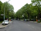
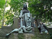
List of streets and squares in Berlin-Zehlendorf

The list of streets and squares in Berlin-Zehlendorf describes the street system in the Berlin district of Zehlendorf with the corresponding historical references. At the same time, this compilation is part of the lists of all Berlin streets and places .
overview
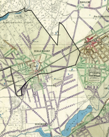
The district of Zehlendorf has 60,538 inhabitants (as of December 30, 2019) and includes the postcode areas 14163, 14165, 14167 and 14169. There are 290 dedicated streets and paths in the district, one of which has the status of a federal road. In addition, there are nine named city squares on these streets. Some 26 streets also cross the boundaries of the district. The total length of federal, urban and residential roads in the district is 146.0 kilometers out of a total of 635.4 kilometers of public road network in the entire Steglitz-Zehlendorf district . In seven districts, Zehlendorf has the largest share of the largest district road network in Berlin with 23 percent.
The district borders in the south with the city limits of Berlin on the state of Brandenburg ( Kleinmachnow ). From Berlepschstraße the district borders on Nikolassee . The boundary of the district initially runs south of the former main line between Düppel station (outside) and Zehlendorf Süd station and turns here northwestwards, running on the west side of Clauerstraße and Lindenthaler Allee . Furthermore, the Potsdamer Chaussee to the west and the Spanische Allee and Breisgauer Straße (both to Nikolassee) form the edge of the district. As an extension of Breisgauer Straße, the Schlachtensee is divided and the district boundary runs on the east side of the Wannseebahn , so the AVUS ( federal motorway 115 ) also belongs to Nikolassee. On the Hüttenweg belonging to the district, the neighboring district changes to Grunewald , at the same time the district border to Charlottenburg-Wilmersdorf . Following the Onkel-Tom-Straße to the Fenngraben is the border to Dahlem , further 280 meters eastwards through forest to the corner of Dachsheide. Follow the Holzungsweg to the southeast and along the Waltraudstrasse, Sundgauer Strasse and Schützallee belonging to the district. At the intersection of Thielallee / Unter den Eichen (both outside of Zehlendorf) you will reach Lichterfelde and the Dahlemer Weg / Wupperstraße (both in the Zehlendorf district) cross the border. The edge of the district follows on the south side of the Beeskow and the east side of the Teltower Damm. The district is now bordered on the Berlin city limits with Teltow ( district of Potsdam-Mittelmark ) from the Teltow Canal, here are the Wall Trail , the Teltow Canal Trail (No. 17) and the Teltower Dörferweg (No. 15). After about 1.5 kilometers west on the Teltow Canal , the city limits now bend to the municipality of Kleinmachnow to the north along the Buschgraben, the main traffic connection Machnower Strasse - Zehlendorfer Strasse (in Teltow) crosses here. From the corner of Ludwigsfelder / Neuruppiner Strasse , the city limits finally run westwards to Neuruppiner / Berlepschstrasse.
The main roads in the district are Bundesstraße 1 on the Berliner Straße - Potsdamer Straße - Potsdamer Chaussee in an east-west direction between Steglitz and the center of Berlin and Potsdam , as well as the Zehlendorf motorway junction . The North-South traffic takes over the Clayallee (to Charlottenburg ) with the continuation south of the Zehlendorfer center to the south over Teltower Damm (to Teltow ) and the Machnower Straße (to Kleinmachnow ). This north-south street is supplemented by the Dahlemer Weg / Wupperstraße, which connect to the Teltower Damm via the Beeskowdamm, and on the other hand the Goerzallee, with its industrial areas in the south, an important road connection, especially as the wall was built in the south got. Seehofstrasse and Mühlenstrasse complement the main roads south of the B 1, to the north these are Argentinische Allee - Lindenthaler Allee and Onkel-Tom-Strasse, the latter especially as a route to junction 2 (Hüttenweg) of the AVUS and thus the city motorway .
Overview of streets and squares
The following table gives an overview of the streets and squares in the district as well as some related information.
- Name / location : current name of the street or square. Via the link Location , the street or the square can be displayed on various map services. The geoposition indicates the approximate center of the street length.
- Traffic routes not listed in the official street directory are marked with * .
- Former or no longer valid street names are in italics . A separate list may be available for important former streets or historical street names.
-
Length / dimensions in meters:
The length information contained in the overview are rounded overview values that were determined in Google Earth using the local scale. They are used for comparison purposes and, if official values are known, are exchanged and marked separately.
For squares, the dimensions are given in the form a × b for rectangular systems and for (approximately) triangular systems as a × b × c with a as the longest side.
If the street continues into neighboring districts, the addition ' in the district ' indicates how long the street section within the district of this article is. - Name origin : origin or reference of the name.
- Notes : further information on adjacent monuments or institutions, the history of the street and historical names.
- Image : Photo of the street or an adjacent object.
| Name / location | Length / dimensions (in meters) |
Origin of name | Date of designation | Remarks | image |
|---|---|---|---|---|---|
|
Adolfstrasse
( Location ) |
450 | Adolf , male first name | before 1906 | The street was laid out around 1900 by Zehlendorf-Kleinmachnow AG and was recorded in the Berlin address book in 1906. It lies between Leuchtenburgstrasse and Hoffbauerpfad. |

|
| Ahornstrasse
( Location ) |
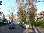
400 | Maple , tree species | around 1889 | The road was laid out in 1885/1886 and probably planted with maple trees. It lies between Potsdamer and Beuckestrasse. |
|
| Ahrenshooper line
( Location ) |
890 | Ahrenshoop , Baltic seaside resort | July 13, 1934 | The street between Salzachstrasse and Niklasstrasse was called Friedrich-Wilhelm-Strasse from 1895 to 1934 . |

|
| Albertinenstrasse
( Location ) |
350 | Albertinerinnen , members of the named after the Saxon Crown Prince Albert Albert Association | around 1895 | The road was laid out from 1895 and consisted of only two houses, was extended in 1908. It is between Machnower Straße (Buschgrabenweg) and Seibtweg. |

|
| Alfred-Grenander-Platz
( Location ) |
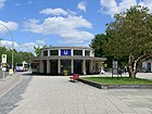
60 × 50 | Alfred Grenander (1863–1931), Swedish architect | Nov 14, 2008 | It is the forecourt, named in 2008, at the Krumme Lanke underground station . The reception building was designed by Alfred Grenander , there is a monument to the architect on the square. |
|
| Alsbacher way
( Location ) |
80 | Alsbach , Hessian city near Darmstadt | July 31, 1947 | The street is a dead end from the Wasserkäfersteig and was laid out by Zehlendorfer West AG and was street 501 before it was named . Between 1938 and 1947 it was called Treuepfad in the SS comradeship settlement . |

|
| Altkanzlerstrasse
( Location ) |
140 | first Chancellor of the German Empire , Otto von Bismarck (1815–1898) | Sep 14 1927 | The street 300 was laid out between 1925 and 1927 by Zehlendorf-West AG. It is between Wilskistraße and Argentinische Allee. Only half of it, the section of Altkanzlerstrasse between Sven-Hedin-Strasse and Alsenstrasse, was renamed Plüschowstrasse in 1931. |

|
| Alt-Schönow
( Location ) |
230 | Schönow , village center of the former village in the Teltow district, now in Zehlendorf | March 15, 1939 | Until 1939 the street was called Dorfstraße and was renamed after the formation of Greater Berlin because of the common name. It is a dead end street from Teltower Damm (south of Beeskowdamm) to the west. |

|
| At the birch bend
( Location ) |
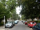
170 | Birkenknick, Zehlendorfer field name | Aug 4, 1930 | It is located between Teltower Damm via Laehr'schen Jagdweg and Heinrich-Laehr-Park. |
|
| At the fish valley
( Location ) |
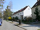
810 | Valley of the Zehlendorf field mark | Sep 14 1927 | Laid out as Straße 326 by Zehlendorf-Grunewald AG around 1925, it is between Wilski- and Onkel-Tom-Straße. It lies west to north along the green belt. |
|
| At the fox fun
( Location ) |
150 | Fox fun, hallway designation, hunter's language for a place where foxes pass | Aug 4, 1930 | It is located between Hochsitzweg and Am Hegewinkel in the area south of the Grunewald. Laid out as street D around 1928/1929 by Zehlendorf-Grunewald AG, it is located in the so-called "Jägerviertel". |

|
| At the Hegewinkel
( Location ) |
420 (in the district) |
Hegewinkel , field name for a wilderness area (hunter's language) | Aug 4, 1930 | The street is located with lots 2–124 (even) and 105–121 (odd) between Riemeisterstraße (via a footpath) and Holzungsweg (excluded) in the district and continues eastwards to Dahlem . Before Street F was laid out around 1928/1929 by Zehlendorf-Grunewald AG and is located in the “Jägerviertel”. |

|
| At the Heidehof
( Location ) |
303 | Heidehof , manor of the Düppel manor (Neuzehlendorf) | around 1930 | The road between Bergengruenstrasse and Niklasstrasse was laid out and developed as Leopoldstrasse around 1925 . |

|
| Am Lappjagen
( Location ) |
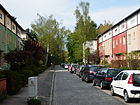
160 | In the lob hunt , the game is narrowed on three sides by rags and pressed on the non-lobed side | Aug 4, 1930 | The street A was laid out by Zehlendorf-Grunewald AG around 1928/1929 and renamed in 1930 in the "Jägerviertel" with a term from the hunter's language. The road lies between Hochsitzweg and Holzungsweg (Am Hegewinkel). |
|
| At the deer change
( Location ) |
200 | Deer change , term from the hunter's language for the roe deer | Aug 4, 1930 | The street is between Teltower Damm and Heinrich-Laehr-Park, from Laehr'schen Jagdweg as a dead end eastwards, as a footpath to Wupperstraße. |

|
| At the Schlachtensee
( Location ) |
1250 (in the district) |
Schlachtensee , local forest lake in the Grunewald | May 15, 1930 | The street, previously Straße 618 , north of the railway line with lots 2-60 (straight) is in the district between Breisgauer Straße and Mexikoplatz. It continues to the west in Nikolassee . On April 8, 1933, Seestrasse was also included in Am Schlachtensee. |

|
| At the Schweizerhof
( Location ) |
360 | Schweizerhof, former sanatorium for the mentally ill | around 1890 | The street 208 and street 215 of the development plan were named with the development. The street is between Jänicke and Prinz-Handjery-Straße. The sanatorium for the mentally ill "Schweizerhof", created by Heinrich Laehr in 1854, was previously the farm of the merchant Krause. |

|
| On the quadruplet
( Location ) |
330 | Vierling is a local pond with the same name as a firearm | Nov 3, 1938 | The street continues from Argentinische Allee and on Starkenburger Straße as a dead end to the northeast. It was laid out in the mid-1930s by Zehlendorf-West AG as street 507 of the development plan. The name of the street was chosen for the SS comradeship settlement in Zehlendorf when the SS newspaper “ Das Schwarze Korps ” called for it in August 1938, along with 15 others . In 1947 it was not renamed like 13 other of these street names. |

|
| At the Vierstückpfuhl
( Location ) |
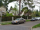
200 | Vierstückpfuhl, old hallway name | Oct. 30, 1926 | The street lies between Seehofstrasse and Stubenrauchstrasse. |
|
| At the White Footbridge
( Location ) |
80 | White footbridge, in contrast to the black path . | after 1840 | The construction of the street was carried out around 1840 by the civil servants housing association. It goes south from Berlepschstrasse as a dead end. |

|
| At the Wieselbau
( Location ) |
150 | Wieselbau, dwelling cave of the weasel | Aug 4, 1930 | The road E of the development plan was created by the Zehlendorf-Grunewald AG 1929/1930 and built and is located in the "hunter quarter" between Hochsitzweg and Am Hegewinkel. |

|
| Andréezeile
( Location ) |
940 | Salomon August Andrée (1854–1897), Swedish engineer and polar explorer | Sep 9 1931 | The street lies between Teltower Damm and Nieritzweg. The Zehlendorf-Kleinmachnow AG and the community laid out road 55 in the development plan around 1910 as a connecting road between Potsdamer Chaussee and Teltower Damm. Expansion of the road began in 1925. In 1966, parts of Andréestrasse were renamed Clauertstrasse, Ludwigsfelderstrasse and Sachtlebenstrasse, as well as Hans-Böhm -zeile. |

|
| Anhaltinerstrasse
( Location ) |
930 | The Anhalt line linking Berlin at the time of appointment to the Duchy of Anhalt , a member state of the German Empire. The street runs along the Wannseebahn , so it cannot be named after the Anhalter Bahn that runs through Lichterfelde-Ost, but only after the Anhaltiners , who were a dynasty like the Hohenzollern or Hohenlohe , after whom the neighboring Hohenzollernstraße or the former Hohenlohestraße, today Urselweg, was named. | around 1900 | The road between Martin-Buber- and Königstraße was laid out by the owners between 1890 and 1904 at Zehlendorf station on the site of the railway. Until at least 1961 it was shown on maps as "Anhaltiner Straße" in separate letters. |

|
| Argentine Avenue
( Location ) |
1850 (in the district) |
Argentina , state in South America | Jan. 26, 1934 | The western part of the street from Mexikoplatz to Fischerhüttenstraße was laid out as Grunewaldallee around 1885 . When the U3 underground line was built in 1929, the eastern part was still forested. In 1932 the street was extended from Krumme Lanke underground station along the underground to Oskar-Helene-Heim underground station and renamed in 1934. In the district are the plots 1–221 (odd) and 2–212 (even), the other plots are east of the suburb on Holzungsweg and belong to Dahlem . |

|
| Capercaillies
( Location ) |
200 | Courtship here is the pairing prelude to the capercaillie | Sep 14 1927 | The street lies between Wilskistraße and Am Fischtal, on the easternmost parallel to other streets with names of bird pairings. It was laid out around 1927 as road 323 according to the Zehlendorf-Grunewald AG development plan. |

|
|
Berry Street
( Location ) |
1120 | Bering, local landowner. | around 1878 | An earlier Feldmarkweg was generally called the Beerendscher Weg . The street is between Busseallee and Mexikoplatz. |

|
| Beeskow dam
( Location ) |
430 (in the district) |
Beeskow (actually Besckow), landowning family in Schönow | Oct 24, 1922 | The street with the northern plots 4-20 (straight) lies between Teltower Damm and Wupperstraße in the district. The plots south belong to Lichterfelde . The dam was laid out as road 1 of the development plan between 1898 and 1900 by the municipality of Zehlendorf as a connecting road. |

|
| Bergengruenstrasse
( Location ) |
1140 | Werner Bergengruen (1892–1964), German-Baltic writer | 16 Sep 1972 | The street lies between Salzachstraße and as a dead end beyond Am Heidehof. The street was laid out before 1896 as Adalbertstraße and renamed Lagardestraße in 1937 . |

|
| Bergmannstrasse
( Location ) |
220 | William Bergmann (19th century), printer owner and local politician | 1890 | The street lies on the community forest between Busseallee and Fischerhüttenstraße. As a community leader, Bergmann had several streets laid out, so he was honored by naming one on his site. He submitted the project to the municipality on August 28, 1889, the resolution of the municipal representatives is from September 5, 1889 and construction work was completed on August 22, 1890. |

|
| Berlepschstrasse
( Location ) |
2380 | Hans Hermann Freiherr von Berlepsch (1843–1926), politician and minister of state | after 1920 | The street is between Machnower Straße and Benschallee (city limits). It was created around 1900 by the community parallel to the (new) rail link. On May 21, 1941, Strasse 562 and on November 6, 1962, Strasse 605 were included. At the end of the street on the border with Kleinmachnow there is a memorial for Karl-Heinz Kube , who was shot there by border troops of the GDR while attempting to escape in 1966 . |

|
| Berlin street
( Location ) |
1730 (in the district) |
Road to Berlin | before 1878 | Berliner Straße is located between Clayallee / Teltower Damm and Dahlemer Weg. Plots 95-99 on the north side east of Schützallee are in Dahlem . The street lies in the course of Potsdamer Straße and Unter den Eichen of the former Reichsstraße 1 , today Bundesstraße 1 . |

|
| Bertholdstrasse
( Location ) |
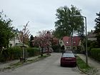
130 | Eugen Berthold, the first pharmacist in Zehlendorf, opened the Adler pharmacy in 1894 and was a community representative in Zehlendorf from 1902 to 1905. | March 14, 1958 | The street lies between Mühlenstrasse and Hochbaumstrasse. Bertholdstrasse, which was first built in 1926, was closed in 1957 and rebuilt a year later about 40 meters further west. |
|
| Beuckestrasse
( Location ) |
510 | Karl Beucke (1860–1915), educator | Aug 8, 1935 | The street lies between Martin-Buberstrasse and Düppelstrasse. It was created around 1891/1892 by the community at the expense of the residents and owners as Burggrafenstrasse . Beucke had converted the secondary school in Zehlendorf into an upper secondary school and fell on the Russian front in World War I. The naming took place on the 20th anniversary of death. |

|
| Biesalskistraße
( Location ) |
560 | Konrad Biesalski (1868–1930), orthopedist, father of modern cripple welfare | Nov 3, 1938 | It lies between Irmgardstrasse and Clayallee, but does not lead through them, but as a dead end for motor vehicle traffic from Katharinenstrasse. |

|
| Biesestrasse
( Location ) |
200 | Ferdinand Biese (1825–1896), sexton in Zehlendorf, in 1895 he was appointed the first rector of the community school | Jan. 16, 1925 | The street is between Schrockstraße and Gimpelsteig. It was laid out as Straße 1 by the civil servants' housing association . |

|
| Bischweilerstrasse
( Location ) |
270 | Bischweiler , city in northern Alsace, France | Jan. 29, 1937 | It was laid out around 1900 as street 302a in the Zehlendorf-West AG development plan. The street curves from the Possweg. |

|
| Bismarckstrasse
( Location ) |
250 | Otto von Bismarck (1815–1898), politician, Reich Chancellor | around 1900 | The street is between Machnower and Dallwitzstraße. |

|
| Blücherstrasse
( Location ) |
140 | Gebhard Leberecht von Blücher (1742–1819), Prussian Field Marshal General | around 1893 | The street lies between Busseallee and Glockenstraße and was laid out between 1892 and 1893 by Zehlendorf-West AG. |

|
| Blumenthalstrasse
( Location ) |
180 | Leonhard von Blumenthal (1810–1900), Field Marshal General | around 1904 | It is between Beerenstrasse and Sven-Hedin-Strasse. The construction work for the street was carried out by Zehlendorf-West AG and began in 1903. |

|
| Bogenstrasse
( Location ) |
160 | running in an arc | around 1889 | The street goes from Gartenstraße and was laid out by the owners between 1884 and 1894. |

|
| Bogota Street
( Location ) |
390 | Bogotá , capital of Colombia | July 29, 1938 | The street lies between Am Schlachtensee and Klopstockstraße, parallel to Limastraße. |

|
| Bolchener Strasse
( Location ) |
330 | Bolchen , town in Lorraine, France | May 21, 1941 | It is located between Sundgauer and Brettnacher Straße. The road 554 of the development plan was created from 1899 to 1900 by the owners and the community. On April 1, 1963, the extension of Bolchener Strasse between Brettnacher and Sundgauer Strasse was also named Bolchener Strasse. Because of the surrounding street names, it is called the Lorraine Quarter. |

|
| Breisgauer Strasse
( Location ) |
870 (in the district) |
Breisgau , landscape on the Upper Rhine in Baden-Wuerttemberg | July 31, 1947 | Between Guernicaplatz and Am Schlachtensee lies the road that forms the border with Nikolassee and only the eastern plots 1-53 are in the district. The street was laid out as Viktoriastraße around 1896 and was renamed Stöckerzeile from 1937 to 1947 . |

|
| Breitensteinweg
( Location ) |
530 | Breitenstein, former castle in Alsace, France | May 21, 1941 | The street lies between Andreezeile and Lupsteiner Weg and was laid out in the early 1930s as street 572 in the Zehlendorf-Kleinmachnow AG development plan. The street was named in 1941 after the occupation of France by Hitler's Germany and the renewed annexation of Alsace and Lorraine . |

|
| Brettnacher Strasse
( Location ) |
550 | Brettnach , place in Lorraine, France | May 21, 1941 | The road is between Sundgauer Straße and Dahlemer Weg, but it ends as a driveway before Dahlemer Weg and only runs through here as a footpath. The street in the Lorraine Quarter was named in 1941 after the occupation of France by Hitler's Germany and the renewed annexation of Alsace and Lorraine . |

|
| Brittendorfer way
( Location ) |
70 | Brittendorf , place in Lorraine, northeast of Metz, France | May 21, 1941 | The street leads from the Brettnacher Straße as a dead end, it is in the Lothringer Viertel. It was laid out as road 556 of the development plan between 1889 and 1900 by the municipality and the owners. |

|
| Bülowstrasse
( Location ) |
760 | Friedrich Wilhelm Bülow von Dennewitz (1755–1816), Prussian military | around 1904 | Zehlendorf-West AG began building the street around 1903; it is located between Argentinischer Allee and Fürstenstraße. | |
| Bürstadter way
( Location ) |
80 | Bürstadt , Hessian city on Bergstrasse | July 31, 1947 | The street lies between Alsbacher and Hirschhorner Weg in the Hessian Quarter. Previously laid out as street 502 of the development plan, was given the name Sigstraße as part of the naming campaign of the SS newspaper for the SS comradeship settlement in Zehlendorf and was renamed again by notification on July 31, 1947 in the ordinance sheet for Greater Berlin. |

|
| Buschgrabenweg
( Location ) |
210 | nearby bush ditch | May 13, 1929 | The street is between Machnower and Ludwigsfelder Straße. It was laid out in the early 1920s as Straße 52 of Zehlendorf-Kleinmachnow AG. |

|
| Busseallee
( Location ) |
660 | Carl Hermann Busse (1872–1918), poet | Jan. 23, 1931 | The road between Potsdamer and Fischerhüttenstraße was submitted by the entrepreneur Bergmann with a project for the area between Glocken-, Fischerhütten- and Potsdamer Straße. In 1889 the construction of the housing estate and roads were approved. It was initially called Heidestrasse until 1931 . The lyricist Busse lived in this Zehlendorfer Strasse. |

|
| Cassinohof
( Location ) |
250 | Cassino , Italian twin town of Zehlendorf since 1969 | 20th June 2014 | The path opens up a new building area between Urselweg and the railway line. |

|
|
Camphausenstrasse
( Location ) |
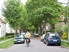
460 | Otto von Camphausen (1812–1896), Prussian Finance Minister | around 1898 | The street lies between Berlepschstraße and Gimpelsteig and was laid out on the premises of the institution in 1893 by the "Association for the Education of Morally Neglected Children" and extended in 1899. |
|
| Charlottenburger Strasse
( Location ) |
330 | Charlottenburg , then an independent neighboring community | before 1878 | The street is between Berliner and Winfriedstrasse. Its location parallel to Clayallee leads to Charlottenburg . |

|
| Class line
( Location ) |
940 | Gerhard Clas (1861–1933), gardening owner and community leader in Zehlendorf | July 13, 1934 | Auguststrasse, laid out around 1896, and Wilhelmstrasse , laid out before 1878, were renamed Claszeile in 1934 as part of the removal of double names in Greater Berlin . This is between Gimpelsteig and Nieritzweg. |

|
| Clauertstrasse
( Location ) |
790 (in the district) |
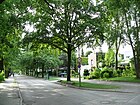
Hans Clauert (1510–1566), actor, "Märkischer Eulenspiegel" | June 1, 1966 | The district boundary to Nikolassee is on the southern edge of Clauertstrasse. In the district is the street and the north side (plots 2-78) between Lindenthaler Allee and Berlepschstraße, and south of the disused S-Bahn line also the south side (plots 1-7, odd). The northern section of the Andréezeile between Berlepschstrasse and Lindenthaler Allee was renamed Clauertstrasse in 1966 (400th anniversary of death). |
|
|
Clayallee
( Location ) |
1269 (in the district) |
Lucius D. Clay (1898–1978), American general | June 1, 1949 | In the district there is only the section between Potsdamer and Sundgauer Straße (lots 237–357 and 244–356). To the north, the 4.7 km long avenue continues through Dahlem to Schmargendorf . In a right-hand bend, in which it leads a few meters through Grunewald , it turns into Hohenzollerndamm. In 1949, Kronprinzenallee was named Clayallee. The street was laid out as a main street from 1878 to 1934 and also before 1912 until the renaming in 1934 was Cecilienstraße and also before 1912 it was Kronprinzenallee until 1949. |

|
| Colmar way
( Location ) |
230 | Colmar , capital of the Haut-Rhin department , France | March 1, 1994 | The path is between Berliner Straße ( B 1 ) and the railway line as a passable footpath and cycle path in front of the associated properties. Robert-W.-Kempner-Strasse south of the railway line can be reached via the cycle path and pedestrian bridge . Plots 2–16 (even) and 15–21 (odd) belong to Colmarer Weg. In 1994 the access route to the houses at Berliner Strasse 76a – h in Colmarer Weg was named. |

|
|
Dahlemer way
( Location ) |
3280 (only west side) |
Dahlem , then neighboring town (at the time of naming) | around 1892 | The road was laid out around 1892 as a connection between the village of Dahlem and Gut Schönow in Teltow . In 1949, a section north of Berliner Strasse that had since come to Dahlem was renamed Thielallee. In the south to the Beeskowdamm the last section, which existed at least until 1943, was canceled, now the Dahlemer Weg merges into the Wupperstraße. The Dahlemer Weg, which used to be entirely in Zehlendorf, now forms the border with Lichterfelde , with the street and the western (even numbered) properties belonging to Zehlendorf. On the western (Zehlendorfer) side of the street there is a freight track of the Goerzbahn . |
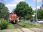
|
| Dallwitzstrasse
( Location ) |
190 | Johann von Dallwitz (1855–1919), Prussian Minister of the Interior, governor of Alsace-Lorraine | after 1878 | The street lies between Berlepschstrasse and Radtkestrasse. The street was laid out between 1870 and 1878 by the civil servants' housing association. |

|
| Deister path
( Location ) |
170 | Deister , ridge of the Weserbergland | July 13, 1934 | The private road 5 has been created in the settlement of "nonprofit AG for employee-homes" in "Bergland quarter" by the owners and the Zehlendorf-Grunewald AG 1933/1934. The path branches off from Eschershauser Weg to the north and continues in the direction of Quermatenweg as a steep path. |
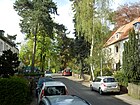
|
| Dubrowplatz
( Location ) |
150 × 60 | Wilhelm Dubrow (1823–1907), farm owner, mayor and mayor in Zehlendorf | after 1894 | The course is on Dubrowstrasse between Ilsensteinstrasse and Eiderstedter Weg. The square was laid out with the road between 1892 and 1894 by the municipality and Heimstätten AG at the expense of the residents. In 1939 it was renamed Schemannplatz and renamed again in 1947. |

|
| Dubrowstrasse
( Location ) |
940 (in the district) |
Wilhelm Dubrow (1823–1907), farm owner, mayor and mayor in Zehlendorf | July 31, 1947 | The street lies between Matterhornstraße and the suburbs on Breisgauer Straße, it continues westward to Nikolassee to Spanische Allee. Georgenstrasse was laid out in the street before 1905 and Elisabethstrasse after 1894 . On March 15, 1939, both streets were merged and named in Schemannzeile , this name after a racial theorist was renamed in 1947. |

|
| Düppelstrasse
( Location ) |
440 | Düppel , site of war in the German-Danish War of 1864 | before 1878 | The street lies between Potsdamer and Anhaltinerstraße |

|
|
Ebersteinweg
( Location ) |
130 | Eberstein, former castle in Alsace , France | May 21, 1941 | The road between Breitenstein- and Windsteiner Weg was laid out in the mid-1930s as road 576 by Zehlendorf-Kleinmachnow AG. It was named in 1941 after the occupation of France and the renewed annexation of Alsace and Lorraine . |

|
| Echtermeyerstrasse
( Location ) |
160 | Heinrich Echtermeyer (1865–1942), architect, municipal and town planning officer in Zehlendorf | March 19, 1956 | The street is a dead end north of Mühlenstrasse, a footpath connects it to Killstetter Strasse. The street 91 , which was laid out by the owners in the mid-1930s , was to be named Behnkestrasse in 1936 at the request of the residents ; this was rejected. The name was not given until 1956. |

|
| Edithstrasse
( Location ) |
210 | Edith , female name | before 1914 | The street is between Biesalski and Waltraudstraße. It was laid out in 1910 and fortified in 1912 by Zehlendorf-Grunewald AG. |

|
| Harrow path
( Location ) |
390 | Egge , low mountain range of the Lower Saxony mountains | July 13, 1934 | The residential street is between Eschershauser and Quermatenweg. The private road 4 was created mid-1920s in the settlement of the Charitable AG for employee-homes. |
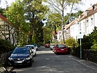
|
| Eiderstedter way
( Location ) |
750 | Eiderstedt , North Sea Peninsula in North Friesland (Schleswig-Holstein) | July 31, 1947 | The street lies between Matterhornstrasse and Niklasstrasse. It was laid out as Heinrichstrasse before 1896 and was named Dühringstrasse between 1937 and 1947 . |

|
| Eilertstrasse
( Location ) |
380 | Christoph Eilert (died 1680), theologian in Güterfelde | March 20, 1929 | Before, as Straße 77 and Straße 79 in the development plan, it was laid out in two construction phases between 1920 and 1921 by Zehlendorf-Kleinmachnow AG and only paved in 1927/1928. The street lies between Hoffbauerpfad and Machnower Straße. |
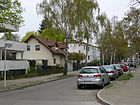
|
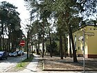
| Kingfisher Trail
( Location ) |
320 | Kingfisher , family of the whackers | Sep 14 1927 | The road lies between Am Fischtal and Wilskistraße. As street 324 of the development plan, it was laid out in 1909/1910 on behalf of the owners of Sommerfeld AG. |
|
| Eitel-Fritz-Strasse
( Location ) |
510 | Eitel Fritz (1883–1942), Prussian prince, major general | around 1896 | It lies between Matterhorn and Niklasstrasse and was laid out together with Eitel-Fritz-Platz between 1895 and 1899 by Heimstätten AG and was still called Prinz-Eitel-Fritz-Strasse in the Wilski overview plan from 1912. |

|
| Elvirasteig
( Location ) |
1090 | Elvira , feminine given name | July 31, 1947 | The street lies between Matterhornstrasse and Fischerhüttenstrasse. Around 1900 the street was laid out as Zietenstraße by Heimstätten AG in 1891 and was named Hans-Knirsch-Weg after a German national politician from Austria between 1938 and 1947 . |

|
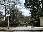
| Erdmann-Graeser-Weg
( Location ) |
250 | Erdmann Graeser (1870–1937), writer and popular chronicler | Sep 1 1976 | The route lies between Argentinischer Allee and Goethestrasse, it is the extension of Schillerstrasse in the "Writers' Quarter". It leads on a bridge through the forest lake. |
|
| Ernst Lemmer Ring
( Location ) |
410 | Ernst Lemmer (1898–1970), politician | Nov 15, 1976 | It goes from and to Seibtweg in an arch and surrounds Schmückertstraße. Before that it was listed as street 648 of the development plan. |

|
| Ersteiner Strasse
( Location ) |
320 | Erstein , Alsatian city, France | Jan. 29, 1937 | It is located between Forbacher and Schlettstadter Straße. The street, previously street 127 , was laid out in 1930 by the "Commission for the division of the Dahlem domain" and in 1937/1938 it was expanded as an entrepreneur street by the Holländische Mühle Zehlendorf Grundstücksgesellschaft mbH |

|
| Eschershauser Weg
( Location ) |
340 | Eschershausen , a small town in Lower Saxony near Holzminden | Apr 21, 1932 | Before 309 , it was laid out and expanded by Sommerfeld AG between 1929 and 1931. The street is between Onkel-Tom-Straße and Ithweg. |

|
|
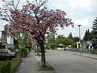
Fercher Street
( Location ) |
250 | Ferch , municipality on Schwielowsee, Brandenburg | Nov 6, 1962 | The street lies between Neuruppiner and Berlepschstraße. Before Straße 608 , it was laid out by Zehlendorf-Kleinmachnow AG at the end of the 1930s. The street is located in the Potsdam district, where streets were named after nearby places after the Wall was built. |
|
| Fischer-Dieskau-Weg
( Location ) |
270 | Albert Fischer-Dieskau (1865–1937), classical philologist, founder of the Zehlendorfer high school | Aug 28, 1959 | The street lies between Potsdamer and Königstraße, which was previously laid out by the owners as Straße 22 of the development plan at the end of the 1930s. The first name was on August 28, 1959, on December 2, 1964 the street was de-designated, but was later given back the name. |

|
| Fischerhüttenstrasse
( Location ) |
2140 | Hut built for fishermen on the Schlachtensee around 1723 , later used as a pub | Apr 8, 1933 | The street lies between Potsdamer Straße and Elvirasteig and goes into the forest in the Fischerhüttenweg above which was named around 1930. As an extension of the existing Fischerhüttenweg, Alsenstrasse , which was laid out around 1900, was included in 1933. |

|
| Flachsweg
( Location ) |
200 | Flax , fiber and oil plant | July 31, 1947 | The street lies between Terrassenstraße and Am Schlachtensee ( dead end ) and was named Parlerstraße in 1939 and renamed more neutral in 1947 after the Second World War . |

|
| Forbacher Strasse
( Location ) |
310 | Forbach , Lorraine town in the Moselle department, France | Aug 1, 1928 | It is located between Sundgauer Straße and Schützallee and was named in the train from Straße 79 and Straße 127a . The road was built by the owners in two construction phases. The right-angled extension of Forbacher Strasse to Sundgauer Strasse was included on January 29, 1937. |

|
| Forest road
( Location ) |
930 | Connection path to the forest lake in the forest | 1892 | It is located between Potsdamer Straße and Argentinischer Allee and was expanded from 1891 to 1893 by residents and owners with Zehlendorf-West AG as a paved road on the connecting route from Berlin-Potsdamer Chaussee to Waldsee that was built in the early 19th century , after this forest path was undeveloped and not paved. |

|
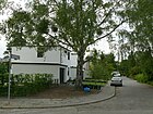
| Fretzdorfer Weg
( Location ) |
80 | Fretzdorf , municipality, today in the Ostprignitz-Ruppin district, Brandenburg | Nov 6, 1962 | The street branches off from Neuruppiner Straße and was previously called Straße 615 . In connection with the construction of the Wall in 1961, this "Potsdam Quarter" was named after places from the neighboring Potsdam district. |
|
| Freyensteinweg
( Location ) |
60 | Freyenstein , now part of the town of Wittstock / Dosse , Brandenburg | Nov 6, 1962 | The street branches off from Neuruppiner Straße. The street 618 of the development plan was named in 1962 in connection with the construction of the wall in 1961 after places from the neighboring district of Potsdam . |

|
| Fürstenstrasse
( Location ) |
610 | Prince , high title of nobility | around 1903 | It is located between Sven-Hedin- and Potsdamer Straße. In 1903, Zehlendorf-West AG laid out the ur part of Beerenstrasse and expanded it. In 1911/1912 a second section was built up to Sven-Hedin-Straße. |

|
|
gardenstreet
( Location ) |
460 | Gardens behind the properties on Teltower Damm | before 1878 | It is located between Teltower Damm at the Zehlendorf train station and Berliner Straße. On a site plan from 1819, the eastern boundary of the village's land is at this point. The road was paved in 1889 on behalf of the municipality. In 1900 it was performed between Berliner and Hauptstrasse across Bogenstrasse with lots 1–7 and seven construction sites assigned to Hauptstrasse 5–15. |

|
| Genshagener Strasse
( Location ) |
80 | Genshagen , southern neighboring town | May 29, 1968 | The street branches off from Neuruppiner Straße to the north and was previously called Straße 627 . |

|
| Gerhardsdorfer Strasse
( Location ) |
80 | Gerhardsdorf , a former village in the Zehlendorf exclave of the Mark desert | May 29, 1968 | The street goes north from Neuruppiner Straße and was previously called Straße 629 . The neighboring streets are also named after neighboring towns to the south, whereby the Mark desert was outside the Berlin Wall at the time it was named as an exclave of Zehlendorf in GDR territory . |

|
| Gertraudstrasse
( Location ) |
300 | Gertraud , feminine given name | around 1897 | It lies between Machnower and Dallwitzstrasse and was laid out between 1890 and 1893 by the civil servants' housing association and residents. |

|
| Gilgestrasse
( Location ) |
280 | Gilge , developed estuary of the Memel (East Prussia) | July 31, 1947 | The street goes as a dead end from Niklasstraße southwards to Potsdamer Chaussee and only goes through it as a footpath. The street was laid out around 1900 as Dessauer Straße by Zehlendorf-West AG and Prince Henckel von Donnersmarck as an entrepreneur street. In 1927 it was renamed as Böckelweg and in 1947 the name was replaced after the anti-Semitic politician. The Prussian Prime Minister Otto Braun lived in No. 3 from 1920 to 1933 , who is commemorated by a memorial stone. |

|
| Gimpelsteig
( Location ) |
420 | Bullfinch , songbird, often kept as a cage bird | July 31, 1947 | The road between Machnower and Biesestraße was laid out between 1838 and 1840 as an unpaved connection path and from 1893 onwards was expanded by the Association for the Education of Morally Neglected Children and named Dorotheenstraße around 1896 . Between 1937 and 1947 it was called Badurastraße . The HELIOS Emil von Behring Clinic is located here . |

|
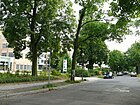
| Gorse heather
( Location ) |
30 (in the district) |
Gorse heather, nearby forest | Feb 26, 1991 | The Ginsterheide, previously Straße 569 , is a paved street and lies between the houses 145 and 147 of Neuruppiner Straße and the city limits to Kleinmachnow , it runs for the most part in the neighboring town and crosses Wolfswerder Straße there, on whose territory the Berlin Wall until 1990 the otherworldly properties narrowed. |
|
| Glockenstrasse
( Location ) |
450 | Gustav Collier's bell foundry in numbers 2 and 3 | before 1878 | The road between Beerenstrasse and Sven-Hedin-Strasse was laid out in two sections by Zehlendorf-West AG. On July 3, 1893, Kaiser Wilhelm II was present in the foundry when a bell was cast for the royal seat of Berlin. |

|
| Goethestrasse
( Location ) |
870 | Johann Wolfgang von Goethe (1749–1832), poet, natural scientist, politician | around 1900 | The road between Elvirasteig and Fischerhüttenstraße was laid out around 1899 by the residents and owners together with Zehlendorf-West AG in two construction phases, initially the expansion from Fischerhüttenstraße to Limastraße and then to the street on Schlachtensee. It is located in the "writers' quarter". |

|
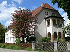
| Border path
( Location ) |
230 | District boundary between Schönow and Zehlendorf | around 1882 | It lies between Schrockstrasse and Camphausenstrasse. The street was laid out around 1856 by the civil servants' housing association and paved around 1880. |
|
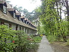
| Grumbacher way
( Location ) |
70 | Grumbach , Rhineland-Palatinate town near Kusel | July 31, 1947 | The street 544 was named Fadingerweg in 1937 and received its current name in 1947. It goes west of the Salemer Steig in an area with street names to Palatinate places. |
|
|
Gütergotzer Strasse
( Location ) |
330 | Gütergotz , neighboring town to the south | June 1, 1966 | The road 626 has been created by the owners in the early 1920s. It lies between Ludwigsfelder and Berlepschstrasse. The eponymous place is called Güterfelde today, the church in Zehlendorf was a branch church of the church district Gütergotz. |

|
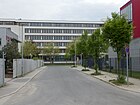
| Gustav-Krone-Strasse
( Location ) |
100 + 100 | Gustav Krone (1895–1971), founder of KRONE AG | May 10, 1997 | The road goes north from Beeskowdamm and runs parallel to it as an industrial road. This is where KRONE AG was once located. |
|
| Gutzmannstrasse
( Location ) |
380 | Hermann Gutzmann (1865–1922 in Berlin), physician and founder of phoniatry | May 13, 1929 | The street lies between Leo-Baeckstrasse and Machnower Strasse and was laid out in the early 1920s by Zehlendorf-Kleinmachnow AG on the course of Strasse 57 and Strasse 59 . In 1930 it is still undeveloped. |

|
|
Hamerlingweg
( Location ) |
340 | Robert Hamerling (1830–1889), Austrian poet and writer | March 20, 1929 | The road 22 of the development plan was created in 1920 and had 1,930 five developed land eight building sites and two plots of land with summer cottages. It is located between Jänickestrasse and Dahlemer Weg |

|
| Hammerstrasse
( Location ) |
820 | Friedrich Hammer (1855–1912), community representative in Zehlendorf and member of the Prussian House of Representatives for Potsdam | 1926 | Before Road 26 of the development plan was laid out by residents and owners in two construction phases before 1920. It is between Hochbaumstrasse and Hamerlingweg. |

|
| Hampstead Street
( Location ) |
1240 | Hampstead , part of London and twin town of Zehlendorf | Oct 22, 1963 | The street lies between Sundgauer Straße and Teltower Damm, the section along the railway line leads to Teltower Damm, but continues from the turning hammer only as a footpath and bike path. 1933 was in Zehlendorf Bahnhofstrasse and the Lichterfelder road and Zehlendorfer street in Steglitz in Finckensteinallee renamed. In 1963, Zehlendorf was renamed after the twin town, while the name Finckensteinallee was retained in the Steglitz area. |

|
| Hans Boehm line
( Location ) |
410 | Hans Adolf August Hugo Böhm (1899–1962), theologian in Zehlendorf, resistance fighter against the Nazi regime | June 1, 1966 | The Hans-Böhm-line lies between Nieritzweg and Walterhöferstraße, to which the passage is closed. Before 1966 it was part of the (still existing) Andréezeile across the Nieritzweg. |

|
| Hartmannsweilerweg
( Location ) |
760 | Hartmannsweiler , place in Upper Rhine, France | Oct 10, 1936 | The street is between Fischerhüttenstrasse and Wilskistrasse. In the First World War , the Hartmannsweilerkopf was hotly contested with the start of the trench warfare. | |
| Hedwig-und-Georg-Flatow-Platz
( Location ) |
70 × 60 × 40 | Georg Flatow (1889–1944), labor lawyer | Oct 12, 2014 | The previously unnamed place at the end of the Rhumeweg to Lindenthaler Allee was marked with the name of the Flatow couple in April 2014 by BVV Steglitz-Zehlendorf (resolution no. 588) according to the specifications for street naming . The couple Hedwig and Georg Flatow lived from 1929 on in Niklasstraße, which forms the third side of the square. Flatow was a lawyer and developed the legal basis for works constitutions . His wife Hedwig was actively involved in the Montessori movement. They both came from Jewish families and were murdered in Auschwitz concentration camp in 1944 . The naming of the place took place on October 12, 2014 with the participation of representatives of the BVV and the district office as well as Dirk Jordan as initiator of the naming. |

|
| Hegauer way
( Location ) |
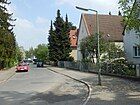
540 | Hegau , landscape northwest of Lake Constance | 28 Sep 1935 | The street lies between Singener and Radolfzeller Weg, over which it continues to the railway line. According to the development plan for Straße 525 , it was named Hegauer Straße in 1898 from the railway site to Idsteiner Straße in 1935, the part laid out in 1919 in the extension as Straße 635 in the second construction phase by the Sommerfeld Society and the owners was later also included. At the eastern end is a BSR - recycling . |
|
| homeland
( Location ) |
730 | Non-profit building and settlement AG Heimat, which built here | Jan. 7, 1928 | The street lies between Nieritzweg and Leo-Baeck-Straße, further than a dead end . From 1913, the area between Teltower Damm and Leuchtenburgstrasse was expanded as a settlement area by Zehlendorf-Kleinmachnow AG, and roads were laid out in the early 1920s. The first part up to Laehrstrasse, Strasse 206 , was named in 1928 and the part to Nieritzweg, Strasse 207a , on March 15, 1939 in Heimat. |

|
| Heinrich-Albertz-Platz
( Location ) |
90 × 50 (semicircle) |
Heinrich Albertz (1915–1993), Governing Mayor, resistance fighter against the Nazi regime | May 11, 2004 | With the Protestant church, it is a semicircular square where Matterhornstrasse leads past and to which Schopenhauerstrasse and Ilsensteinweg lead, the latter ending at the square and the previous one with a connection to Matterhornstrasse. The naming ceremony on May 18, 2004 took place on the eleventh anniversary of Heinrich Albertz's death. |

|
| Heppenheimer way
( Location ) |
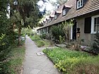
320 | Heppenheim , Hessian city on the Odenwald | July 31, 1947 | The street in the "Hessian Quarter" lies between Ottmachauer and Salemer Steig . In 1938 it was named as an official route . |
|
| Herbergerweg
( Location ) |
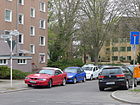
190 | Christoph Herberger (17th century) was the elector's clerk in the Mühlenhof office and published the Zehlendorf village rules in 1665 | July 20, 1965 | is a dead end to the side of Mühlenstraße, with the name it was spun off from this. |
|
| Hermannstrasse
( Location ) |
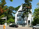
490 | Hermann, the Cheruscan (17/16 BC – 21 AD), tribal leader and victor in the Varus Battle | around 1892 | The road lies between Fischerhüttenstraße and Forst, it goes over the Quermatenweg as a dead end. |
|
| Hertastrasse
( Location ) |
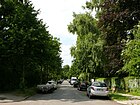
190 | Herta , Germanic goddess named by Tacitus , mother of the earth | 1906 | The street was laid out in 1905/1906 by Zehlendorf-Grunewald AG and is located between Schützallee and Katharinenstraße. |
|
| Hilssteig
( Location ) |
260 | Hils , low mountain range of the Lower Saxony highlands | July 13, 1934 | Located between Eschershauser and Quermatenweg, it was before the naming of Privatstrasse 2 by the non-profit AG for salaried employees' homes that was created in the mountain district. |

|
| Himmelsteig
( Location ) |
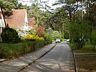
190 | Himmelsteig , transferred for the highest honor | Nov 3, 1938 | The residential street from Ottmachauer Steig to Im Kinderland ( dead end ) was called Straße 538 before it was named and was laid out by Zehlendorf-West AG in the early 1930s. The name was chosen along with 15 others from the suggestions that the SS newspaper “Das Schwarze Korps” received in response to its appeal in August 1938. In 1947, however, no renaming was deemed necessary as in other cases. |
|
| Hirschhorn way
( Location ) |
370 | Hirschhorn , South Hessian spa town, Bergstrasse | July 31, 1947 | The street between Quermatenweg and Wasserkäfersteig was named Staffelweg (also Staffel ) in 1938 and renamed in 1947 because of the thematic reference. Because of the surrounding street names, it belongs to the "Hessian Quarter". |

|
| Hochbaumstrasse
( Location ) |
320 in the district |
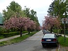
Karl Louis Eduard Hochbaum (1848–1916), pharmacist, community representative in Zehlendorf | March 20, 1929 | The street is in the district with the plots 65–85 (odd) and 68–84 (even) between Mühlenstraße and Dahlemer Weg and continues to Lichterfelde . The exit on Dahlemer Weg is interrupted. Street 87 and Street 143 in Zehlendorf and the section in Steglitz named Altdorfer Strasse in 1924 were given the name across the district border . |
|
| Hochsitzweg
( Location ) |
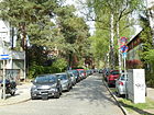
470 | High seat , hobby term for the position to hunt and observe game | Aug 4, 1930 | The street in the Jägerviertel between Stewardstrasse and Riemeisterstrasse, previously Strasse 318 , was laid out by Sommerfeld AG in the early 1920s. |
|
| Big game trail
( Location ) |
170 | Big game , hunted for the game belonging to the "high hunt" | Aug 4, 1930 | Before street B was named, it was laid out by Sommerfeld AG in the early 1920s and is located in the so-called “Jägerviertel” between Hochsitzweg and Am Hegewinkel. |

|
| Hocksteinweg
( Location ) |
260 | Hockstein, former castle in Alsace , France | May 21, 1941 | The road between Breitensteinweg and Ramsteinweg was laid out in the mid-1930s as road 557 by Zehlendorf-Kleinmachnow AG. It was named in 1941 after the occupation of France and the renewed annexation of Alsace and Lorraine . |

|
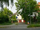
| Hoffbauer path
( Location ) |
510 | Karl Gustav Hoffbauer (1796–1878), pastor in Alt-Zehlendorf from 1842 | March 20, 1929 | The road between Urbanstraße and Sachtlebenstraße was laid out in two sections by Zehlendorf-Kleinmachnow AG from 1925 onwards, as part of Straße 53 , Straße 61 and Straße 80 . |
|
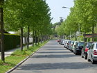
| Hohentwielsteig
( Location ) |
700 | Hohentwiel , Berg im Hegau near Lake Constance, Singens local mountain | Aug 4, 1977 | The street between Hegauer Weg and Potsdamer Chaussee, before the name Straße 636 , was laid out in the early 1920s by the residents and owners. On September 2, 1994, the street 661 between Potsdamer Chaussee and Königsweg was included. |
|
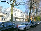
| Hohenzollernstrasse
( Location ) |
470 | Hohenzollern , ruling family, especially the imperial family | around 1892 | The street was laid out by the residents and owners around 1891/1892 and is located between Martin-Buber- and Düppelstraße . |
|
| Holstweg
( Location ) |
340 | Axel Holst (1896–1935), Swedish sport rider, was crushed by his horse at a horse show in Berlin and died from it | May 11, 1938 | The street was laid out as Straße 540 by the owners in the early 1920s . It lies between Oertzen - and Königsweg. |

|
| Holzungsweg
( Location ) |
480 (in the district) |
Logging , forest transport route | Aug 4, 1930 | The Holzungsweg forms the border to the Dahlem district where the road belongs. The odd-numbered plots 1-67 on the west side are in the district. The paved path with grass pavements on both sides and tree cover lies between the Dachsheide in the Grunewald and the Argentinische Allee, and from Hochsitzweg only as a footpath and bike path. A forest path continues to the north on which the district boundary continues. Before Straße 321 , it was laid out in the late 1920s by Sommerfeld AG in the “Jägerviertel”. |

|
|
Idsteiner Strasse
( Location ) |
500 | Idstein , Hessian city in the Taunus north of Wiesbaden | 28 Sep 1935 | It is located between Königsweg and Ludwigsfelder Strasse, although it is designated as a pedestrian and cycle path between Berlepschstrasse and Ludwigsfelder Strasse and as a dead end from Hegauer to Königsweg . The road 511a was created mid-1920s by neighbors and owners. |

|
| Ilsensteinweg
( Location ) |
860 | Ilsenstein , granite rock formation in the Harz Mountains, Saxony-Anhalt | July 31, 1947 | The street lies between Matterhornstrasse and Niklasstrasse, over which it continues as a dead end. Albrechtstrasse was laid out on this street around 1899 , and in 1937, along with other streets in Hoensbroechstrasse, it was named after an anti-Catholic journalist; in 1947 it was given its current name. |

|
| In the frame
( Location ) |
290 | Frame , aisle to separate the forests (hunting) | 27 Sep 1927 | In the course of street 325 and street 325a of the development plan, the street was laid out in several construction phases from January 1927 by Sommerfeld AG. It is between Auerhahnbalz and Onkel-Tom-Straße |

|
| In the pine bottom
( Location ) |
180 | Pine groves , (here probably) lower than the surroundings | around 1925 | The street, which is a dead end west of Onkel-Tom-Straße, was laid out as a private street by Sommerfeld AG around 1925. |

|
| In the Kinderland
( Location ) |
140 | wanted wealth of children | Nov 5, 1938 | The road 534 was laid out in the mid-1920s by Zehlendorf-West AG and the owners. It goes from the Himmelsteig as a dead end and partially extends it. The street name and 15 others go back to the call of the SS newspaper "Das Schwarze Korps" in August 1938 to send in suitable suggestions for the streets of the SS comradeship settlement in Zehlendorf. 13 less ideology-neutral names were renamed and announced on July 31, 1947 in the Ordinance Gazette for Greater Berlin. |

|
| In the Mühlenfelde
( Location ) |
320 | former Zehlendorfer mill | Oct. 30, 1926 | It lies between Mühlenstrasse and Hampsteadstrasse and was created around 1897 as a connection between the mill and Zehlendorf. |

|
| In Schönower Park
( Location ) |
200 | Location north of Schönower Park | Oct 24, 1922 | Before street 46 of the development plan, it was laid out as a private street by residents and owners. It is a dead end street west of Prinz-Handjery-Straße. At the time of the naming, the newly laid street led from Prinz-Handjery-Straße to Teltower Straße (today: Teltower Damm). The Schönower Park emerged from the northern part of the Heinrich-Laehr-Park, a complex created around 1906 around the Schweizerhof nerve sanatorium. |

|
| Irmgardstrasse
( Location ) |
680 | Irmgard , female name | around 1912 | It is located between Sophie-Charlotte- and Waltraudstraße. The road was laid out between 1911 and 1912 by Zehlendorf-Grunewald AG. From the Sophie-Charlottenstraße there were properties of the civil servants' building association on the left. |

|
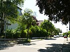
| Isenheimer way
( Location ) |
100 | Isenheim , Alsatian municipality, today the Association of Région de Guebwiller, France | May 11, 1938 | The street goes from Schützallee and was, previously street 123 of the development plan, laid out by the residents and owners at the end of the 1930s. |
|
| Ithweg
( Location ) |
290 | Ith , mountain ridge in the northern Weserbergland, Lower Saxony | July 31, 1934 | The street lies between Eschershauser and Quermatenweg, also known as the “Berglandviertel”. It was expanded in 1934/1935 by Sommerfeld AG as an entrepreneur street in the course of street 315 . |

|
|
Jaehnstrasse
( Location ) |
190 | Max Jaehn, from 1905 director of the Terrain-Gesellschaft Zehlendorf-West AG, from 1906 community representative in Zehlendorf | Feb. 18, 1927 | The street between Sven-Hedin-Strasse and Karl-Hofer-Strasse was laid out as street A by the owners and Zehlendorfer-West AG from 1925. Partly also in the spelling Jähnstrasse. |

|
|
Jägerstieg
( Location ) |
30 (in the district) |
The hunter's stairs | Feb 26, 1991 | Jägerstieg lies between houses 205 and 207 (access) on Neuruppiner Strasse and the city limits of Kleinmachnow , it runs for the most part in the neighboring town and crosses Wolfswerder Strasse there, where the Berlin Wall narrowed the land on the other side until 1990. The Jägerstieg in Kleinmachnow was laid out in the early 1930s and later extended beyond the local border to the railway line in Zehlendorf. After the wall was built, this section in Zehlendorf became Straße 620 , the objection to this designation was withdrawn and the designation became legally binding. |

|
|
Janickestrasse
( Location ) |
970 | August Jänicke (1841–1912), master mason (Beucke school, Pauluskirche), from 1894 to 1912 community representative in Zehlendorf | Oct. 30, 1926 | The street lies between Hampsteadstraße and Dahlemer Weg, previously street 19 of the development plan. Starting around 1899, it was laid out in several sections by the owners and residents and from 1921 onwards it was expanded and fortified by the community. In 1930 there were still some construction sites on the road between Lichterfelder Straße via Seehofstraße, Schweizerhof, Waldmüllerstraße to Straße 12a and followed by the extended Jänickestraße to Dahlemer Weg. |

|
| Joachimstrasse
( Location ) |
160 | Prince Joachim of Prussia (1890–1920), sixth son of Kaiser Wilhelm II. | around 1905 | The road between Bergengruenstrasse and Ahrenshooper line. It was laid out by Heimstätten AG between 1899 and 1900. In 1910, a plot of land on the street between Adalbert- and Friedrich-Wilhelm-Straße was developed and marked “Post Schlachtensee”. |

|
| Johannesstrasse
( Location ) |
360 | John the Baptist | around 1892 | Originally Johann i sstrasse it is between Gimpel climbing and Leo Baeck road. |

|
| Jugenheimer way
( Location ) |
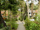
310 | Jugenheim , Hessian community (today a district) near Darmstadt | July 31, 1947 | The street between Ottmachauer and Salemer Steig belongs to the Hessian Quarter and was named Ahnenzeile in 1938 . |
|
| Juttastrasse
( Location ) |
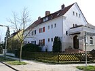
200 | Jutta , female first name | before 1914 | The street between Biesalski and Waltraudstraße was laid out by the owners around 1900 and expanded in 1912 by Zehlendorf-Grunewald AG. In the Berlin address book from 1914 it is mentioned as the cross street of Elfriedenstrasse, in 1930 plots 1–19 (odd) and 2–18 (even) were built on, 13 and 17 do not exist and No. 1 belongs to Irmgardstrasse 20. |
|
|
Karl-Hofer-Strasse
( Location ) |
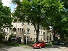
780 | Karl Hofer (1878–1955), painter, 1947 President of the Academy of Arts | Aug 1, 1969 | It is between Fischerhüttenstrasse and Roonstrasse. The first part of the street was laid out in 1889 between Fischerhüttenstraße and Jaehnstraße by the Abrahamschen heirs and was called Flensburger Straße until 1969. The further expansion took place from 1901 together with Zehlendorf-West AG. |
|
| Karl-Schmidt-Rottluff-Weg
( Location ) |
280 | Karl Schmidt-Rottluff (1884–1976), painter, graphic artist and sculptor | Oct 8, 1984 | The street lies between Schützallee and Berliner Straße and was laid out by the owners in the early 1950s, until 1984 a private street , the name was given by resolution of the district council on August 21, 1984 (request of the Senate). |

|
| Karolinenstrasse
( Location ) |
170 | Marie Elisabeth Karoline Viktoria (1815–1885), Princess of Hesse-Darmstadt | around 1893 | The street was laid out around 1893 by the association for the upbringing of morally neglected children. It lies between Schrockstrasse and Camphausenstrasse. |

|
| Katharinenstrasse
( Location ) |
620 | Katharina , female name | after 1905 | The street between Milinowskistraße and Clayallee was laid out in 1905 by Zehlendorf-Grunewald AG. |

|
| Kaunstraße
( Location ) |
540 | Hugo Kaun (1863–1932), composer and conductor | March 11, 1937 | The road was laid out and expanded in 1899/1900 by Zehlendorf-West AG. It is located between Lindenthaler Allee and as a dead end on Niklasstraße. |

|
| Kilstetter Strasse
( Location ) |
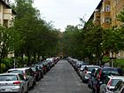
600 | Kilstett , Alsatian municipality in the Rhine plain, France | May 21, 1941 | The street in the Alsatian quarter to and from Hampsteadstraße was previously called Straße 553 . The street was named in 1941 after the occupation of France by Hitler's Germany and the renewed annexation of Alsace and Lorraine . It was built and fortified by the owners and the municipality in two construction phases around 1915 and 1920. |
|
| Church view
( Location ) |
200 | View to the Schlachtenseer church | Oct 24, 1922 | The street X of the development plan was laid out around 1900 as a footpath by the residents and owners. In 1910 it was fortified and in 1922 the street between Salzachstrasse and Matterhornstrasse was named. |

|
| Kirchstrasse
( Location ) |
160 | Located directly in front of the Zehlendorf Pauluskirche | around 1903 | The road between Teltower Damm and Martin-Buber-Straße was laid out by the residents around 1885 as a footpath and connecting path, and when residential buildings were built around 1891 it was expanded and paved at the community's expense.
Immediately after the end of the Second World War, a provisional new church leadership of the Evangelical Church for Berlin and Brandenburg was formed from supporters of the Confessing Church, which was persecuted by the Nazi regime, under the chairmanship of Bishop Otto Dibelius . |
|
| Kleinaustraße | 570 | Konrad Wilhelm Julius Robert Kleinau (1846–1921), architect, builder | July 13, 1934 | Paulstrasse and Klarastrasse , which were laid out before 1905, were renamed in 1934. The street is between Berliner and Mörchinger Straße. |

|
| Kleinmachnower Weg
( Location ) |
1080 | Kleinmachnow , neighboring municipality to the southwest | around 1920 | The road westward from Teltower Damm as an extension of Beeskowdamm towards the city limits was laid out as a footpath in 1919/1920 and paved in the mid-1950s. It runs between allotment gardens and the Schönower cemetery is adjacent. |

|
| Kleiststrasse
( Location ) |
500 | Heinrich von Kleist (1777–1811), playwright, storyteller, poet and publicist | 1900 | The street in the writers' quarter between Limastrasse and Fischerhüttenstrasse was laid out by Zehlendorf-West AG between 1897 and 1900. |

|
| Klistostrasse
( Location ) |
550 | Vincentius Klistow (died around 1574), theologian in the Zehlendorf church area | March 20, 1929 | The road 54 and road 81 were applied 1910-1913 of the Zehlendorf-Kleinmachnow AG and 1921 attached at the 1929 designated road is between Gutzmannstraße and Nieritzweg. |

|
| Klopstockstrasse
( Location ) |
890 | Friedrich Gottlieb Klopstock (1724–1803), poet | around 1900 | The street between Fischerhüttenstrasse and Schlickweg in the “Writers' Quarter” was laid out around 1899/1900 by Zehlendorf-West AG and the owners. |

|
| Knesebeckstrasse
( Location ) |
450 | Leo Wilhelm Robert Karl von dem Knesebeck (1808–1883), manor owner and district administrator of Teltow | around 1900 | The street was laid between 1894 and 1897 between Prinz-Handjery- and Stubenrauchstraße. Before 1925, at least in the planning stage, it was extended to Mühlenstrasse, initially undeveloped under the plan names Strasse 14 and Strasse 81 . The extension was also named Knesebeckstraße around 1929. |

|
|
Koenigstrasse
( Location ) |
860 | King , here reference to King of Prussia | before 1878 | The street lies between Martin-Buberstrasse and Anhaltinerstrasse. It is the fortified continuation of the Königsweg leading from Wannsee and Nikolassee through the Grunewald . |

|
|
Royal road
( Location ) |
1050 (in the district) |
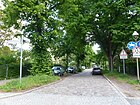
King , here the way of the Prussian king | after 1730 | Königsweg is located with lots 1–69 (odd) and 4–82 (even) between Clauertstraße (district boundary) and the railway bridge in the district, east of the railway bridge continues as Königstraße in the center of Zehlendorf . The path continues westward in Nikolassee and then in Wannsee. |
|
|
Kösterstrasse
( Location ) |
240 | Hugo Köster (1859–1943), first salaried community leader for Zehlendorf, 1920 to 1924 first district mayor | Apr. 26, 1960 | The road between Berlepschstrasse and Seibtweg was laid out in 1905 as Miquelstrasse by the owners and residents and expanded and paved around 1906. |

|
| Kramstaweg
( Location ) |
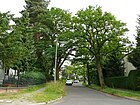
370 | Hans Emil Gottlob von Kramsta (1850–1913), military and racing rider, died in a military accident | May 11, 1938 | The road lies between Oertzenweg and Ravenweg. It was laid out for the owners as a footpath, street 542 of the development plan in the early 1930s and paved as a street around 1935. |
|
| Kunzendorfstrasse
( Location ) |
320 | Paul JC Kunzendorf (1853–1923), writer, journalist, community representative from 1900 to 1906, local writer | Jan. 16, 1925 | Located between Teltower Damm and Biesestraße, previously Straße 20 , it was laid out by the civil servants' housing association, expanded in 1914/1915 and paved by the owners. |

|
| Kyritzer way
( Location ) |
70 | Kyritz , town near Neuruppin , Brandenburg | Nov 6, 1962 | The previous street 614 goes from Neuruppiner Straße, it was laid out in the early 1930s by Zehlendorf-Kleinmachnow AG. When the surrounding streets were named, shortly after the wall was built in 1961, they were named after places in the GDR from the neighboring district of Potsdam . |

|
|
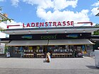
Shopping street
( Location ) |
180 | Shops at the subway station | 1930 | The street on Onkel-Tom-Straße is on both sides of the Onkel Toms Hütte underground station, which was built in 1929 with the extension of the underground line from Thielplatz. Initially, the street was a private road on the BVG premises, with the construction of the adjacent shops it became public . |

|
| Ladiusstrasse
( Location ) |
320 | Johann Andreas Ladius (died 1763), 1711 to 1738 pastor in Gütergotz (Zehlendorfer Kirchsprengel) | Aug 31, 1937 | The street lies between Vesterzeile and Breitensteinweg, previously street 78 of the development plan. |

|
| Laehr'scher Jagdweg
( Location ) |
540 | Heinrich Laehr (1820–1905), physician at the Schweizerhof mental hospital | Aug 4, 1930 | The road lies between Am Birkenknick and Am Rehwechsel (here as a dead end ). Before that, as Straße 583 , it was laid out around 1928 by the non-profit building and settlement company "Heimat". On May 21, 1941, a short section of the Dahlemer Weg ending here was included as a southern extension over the Am Rehwechsel road. |

|
| Laehrstrasse
( Location ) |
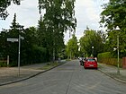
480 | Heinrich Laehr (1820–1905), physician at the Schweizerhof mental hospital | Feb. 18, 1927 | The street lies between Leuchtenburgstraße and Türksteinweg (further as a dead end ) and was laid out as street 205 by Zehlendorf-Kleinmachnow AG between 1910 and 1913 . |
|
| Leester way
( Location ) |
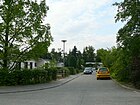
70 | Leest , place northwest of Potsdam, today part of Töplitz | Nov 6, 1962 | The street, which was laid out as Straße 616 in the early 1960s, branches off from Neuruppiner Straße as a dead end . Like the other streets named on the same day in this area, in connection with the construction of the Wall in 1961, this residential area in the south-west corner of the district was named after places from the neighboring GDR district of Potsdam. |
|
| Leo-Baeck-Strasse
( Location ) |
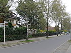
950 | Leo Baeck (1873–1956), rabbi , fighter against the Nazi regime | Nov 8, 1961 | The road between Claszeile and Jänickestrasse was laid out as Teichstrasse before 1878 , with the extended Teichstrasse being included in 1926 . |
|
| Leuchtenburgstrasse
( Location ) |
580 | Leuchtenburg , castle in Seitenroda, Thuringia | July 13, 1934 | Laid out as a park road around 1896, when it was named it ran along the west side of today's Schweizerhofpark. Renamed in 1934 in the course of the isolation of accumulated names from Greater Berlin street names , it is located between Leo-Baeck-Strasse and Nieritzweg. |

|
| Limastrasse
( Location ) |
740 | Lima , capital of Peru | Jan. 26, 1935 | It is located between Mexikoplatz and Elvirasteig in the writers' quarter and was laid out between 1899 and 1901 by Zehlendorf-West AG and the owners as Lessingstrasse . The renaming took place because there was a street of the same name in several districts due to the formation of Greater Berlin. |

|
| Lindenfelser Weg
( Location ) |
220 | Lindenfels , Hessian town on Bergstrasse | July 31, 1947 | It is located between Argentinische Allee and Quermatenweg in the Hessian Quarter. Previously laid out as street 504 by Zehlendorf-West AG, it was named Brautpfad in 1938 as a result of the SS newspaper “Das Schwarze Korps” calling for suitable suggestions for street names for the SS comradeship settlement in Zehlendorf in August 1938. |

|
| Lindenthaler Allee
( Location ) |
340 (in the district) |
Lindenthal , place near Leipzig (today district), Saxony. | Jul 31, 1947 | The Lindenthaler Allee is located with the plots 1–35 (odd) and 2–72 (even) between Clauertstrasse (district boundary) and Mexikoplatz in the district. The southern section and the west side between Clauerstraße and Potsdamer Chaussee are in Nikolassee . The street, initially planted with linden trees, was laid out as Lindenallee between 1892 and 1895 by Zehlendorf-West AG and was renamed Theodor-Fritsch-Allee in 1934, a publicist with racially justified hatred of Jews. Because of this, it received its current name when it was renamed anti-Nazi in 1947. The UFA film " Three from the gas station " was shot at the STAR gas station in Lindenthaler Allee. The Mexikoplatz S-Bahn station was called “Lindenthaler Allee” between 1959 and 1987. |

|
| Loebellstrasse
( Location ) |
220 | Friedrich Wilhelm von Loebell (1855–1931), politician, Prussian interior minister | Jan. 30, 1933 | The street lies between Berlepschstraße and Seibtweg, previously laid out as Straße 2 in 1910 by the residents and owners, it was paved and expanded in the mid-1920s. |

|
| Lucie-Strewe-Platz
( Location ) |
100 × 100 × 50 | Lucie Strewe (1887–1981), saved several Berlin Jews from persecution and murder by the National Socialists | 18th May 2018 | The previously unnamed triangular square at the confluence of Busseallee on Fischerhüttenstrasse was named in 2018. It is about 50 meters before Sven-Hedin-Straße (Sven-Hedin-Platz). It was named after Lucie Strewe. She was honored by the Berlin Senate on April 18, 1966 as an "unsung heroine". and last lived at Fischerhüttenstrasse 56a. |

|
| Ludwigsfelder Strasse
( Location ) |
830 | Ludwigsfelde , city south of Berlin (Teltow-Fläming district) | June 1, 1966 | South of Neuruppiner Strasse at property 21, the corner of the city limits meets the street that lies between Berlepsch Strasse and Machnower Strasse. It has the rank of a main street. In 1966, parts of the Andréezeile were renamed Hans-Böhm -zeile, Clauert-, Ludwigsfelder- and Sachtlebenstraße. |

|
| Lupsteiner way
( Location ) |
1120 | Lupstein , rural community in Lower Alsace, France | Jan. 29, 1957 | The street between Sachtlebenstrasse and Andreezeile, previously Strasse 580 , was laid out in the early 1920s by Zehlendorf-Kleinmachnow AG. The extension of the road was included on April 1, 1963. |

|
|
Machnower Strasse
( Location ) |
1750 | Road to Machnow , place in the district of Potsdam-Mittelmark, state of Brandenburg | before 1878 | The street lies between Teltower Damm (south of the S-Bahn station Zehlendorf) and the city limits and goes as Zehlendorfer Damm into the center of Kleinmachnow. Created around 1800 as a country road between Kleinmachnow and Zehlendorf, it was expanded and fortified by Zehlendorf-Kleinmachnow AG from 1899 to 1901. |

|
| Marga-Meusel-Platz
( Location ) |
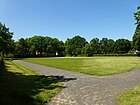
120 × 100 | Marga Meusel (1897–1953), social welfare worker and member of the Confessing Church | Aug 30, 2011 | The previously unnamed square between Karl-Hofer-Strasse, Beerenstrasse, Blumenthalstrasse and Sven-Hedin-Strasse was named on August 30, 2011 by representatives of the Steglitz-Zehlendorf district office of Berlin at a naming ceremony. |
|
| Markgrafenstrasse
( Location ) |
170 | Ruler of the Margraviate of Brandenburg | before 1892 | The street is located between Königstrasse and Hohenzollernstrasse. |

|
| Martin-Buber-Strasse
( Location ) |
560 | Martin Buber (1878–1965), Austrian-Israeli Jewish religious philosopher, victim of the Nazi regime | June 13, 1966 | The street lies between Anhaltiner Strasse and Potsdamer Strasse, it was laid out around 1886 by the municipality and the owners and was called Kaiserstrasse until 1966 . | |
| Matterhornstrasse
( Location ) |
1080 (in the district) |
Matterhorn , summit of the Valais Alps, Switzerland. | Jan. 31, 1947 | Matterhornstrasse is located with plots 1–53 and 2–58 between Lindenthaler Allee and Breisgauer Strasse in the district, westward it continues in Nikolassee . The street was laid out as Waldemarstraße before 1905 , in 1939 the southern section with Gertrudstraße was renamed Palmzeile , the northern section with Heimstättenstraße was renamed Schemmstraße ( NSDAP ) and in 1947 the name was changed after the Alpine summit. |

|
| Melker Street
( Location ) |
260 | Melk , Lower Austrian district capital | March 20, 1929 | The street lies between Jänickestraße and Dahlemer Weg and is a dead end from the start . It was laid out in 1920 by the non-profit building and settlement company “Heimat” as Straße 21 . |

|
| Menzer way
( Location ) |
100 | Menz , a town on the Strelitzer Seenplatte, today part of Stechlin, Brandenburg | Nov 6, 1962 | Before street 611 of the development plan, it goes off from Berlepschstraße. It is one of the streets that were given names of places in the GDR district of Potsdam after the Wall was built in 1961 . |

|
|
Mexico Square
( Location ) |
140 × 80 semicircular |
Mexico , state and its capital in Central America | 23 Sep 1959 | The previously nameless Mexikoplatz forms a semicircle whose diameter lies on the railway line with the station building. The Argentinische / Lindenthaler Allee crosses the square, from the east the Bülowstrasse and the Beerenstrasse open, from the west at the Schlachtensee and the Limastrasse. The local S-Bahn station was originally called Zehlendorf Beerenstraße , from 1911 Zehlendorf West and from 1959 Lindenthaler Allee , was silent between 1980 and 1985 and was named after the square in 1987. |

|
| Michendorfer Strasse
( Location ) |
290 | Michendorf , municipality south of Potsdam | Nov 6, 1962 | The street between Neuruppiner and Berlepschstraße was laid out as street 607 of the development plan and, like the surrounding streets, was named after a place in the Potsdam district of the GDR after the Wall was built in 1961 . |

|
| Milinowskistrasse
( Location ) |
630 | Hermann Milinowski (died after 1910), head of office in Zehlendorf and from April 1910 in the rural community of Nikolassee | around 1907 | The street was laid out in 1904/1905 by Zehlendorf-Grunewald AG and is located between Pasewaldt- and Sophie-Charlotte-Straße. |

|
| Mittelstrasse
( Location ) |
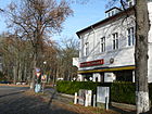
220 | Location in the middle between the parallel streets | before 1878 | The street lies between Potsdamer and Königstraße and parallel to the simultaneously created Düppelstraße and Neue Straße. |
|
|
Mörchinger Strasse
( Location ) |
1150 (in the district) |
Mörchingen , city in Lorraine, battleground in World War I , France. | Sep 9 1931 | In the district lies the part of Mörchinger Straße between Kleinaustraße and Dahlemer Weg (district boundary), the road continues eastwards to Lichterfelde and is primarily within the Federal Institute for Materials Research and Testing (BAM). Before Street 132 , on March 15, 1939, the extension, Street 415 , was included. |

|
|
Mühlenstrasse
( Location ) |
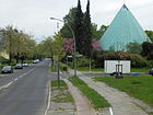
1400 | Zehlendorfer windmill | before 1878 | The street lies between Teltower Damm (formerly Hauptstraße) and Dahlemer Weg, here was a hill with the Zehlendorfer windmill. In 1957 the millstone was on the opposite side of the road from the hill. The intersection with Prinz-Handjery-Straße is 48.2 meters higher than the rest of the street with 43 to 44 meters. |
|
| Nentershäuser Platz |
60 × 60 × 60 (triangle) |
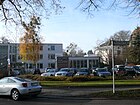
Nentershausen , Hessian municipality in the Hersfeld-Rotenburg district, partner municipality of Steglitz (since 1966) | Aug 14, 2006 | The square is along Martin-Buberstrasse and the turning-in Beuckestrasse. The triangle square on Hohenzollernstrasse with the Schiller-Linde, so called on other maps, is only signposted as "Hohenzollerstrasse". Only Nentershäuserplatz 1, Gottfried Benn Library, is shown as the property. At the initiative of the district council of Steglitz-Zehlendorf, an application was made on November 7, 2005 and the unnamed place at the confluence of Beucke- / Martin-Buber-Strasse was renamed because of the existing partnership until September 22, 2006. |
|
| New street
( Location ) |
500 | newly laid road | around 1889 | The street was laid out around 1885 by the Kochann heirs, it is located between Potsdamer and Anhaltiner Strasse, parallel to Düppelstrasse and Mittelstrasse to the west and the eastern Ahornstrasse, but is the longest of the parallel streets. |

|
| Neuruppiner Strasse
( Location ) |
1280 | Neuruppin , Brandenburg city north of Berlin (Ostprignitz-Ruppin) | Nov 6, 1962 | The street lies between Berlepsch- and Ludwigsfelder Straße along the city limits, which runs south behind the houses of the street. During the time of the Berlin Wall, it was located directly behind the property from 1961 to 1989 and ran through the property there on the Kleinmachnow side. At the west end (Berlepschstraße) there is still the turning ring on the West Berlin side (now a bus turning point), today a connection to Karl-Marx-Allee (Kleinmachnow) / Bengschallee ( Nikolassee ) and Adam-Kuckhoff-Platz in Kleinmachnow opens the interim wall area, a parking area. One year after the Wall was built, the streets here were named after places in the GDR district of Potsdam , which borders Zehlendorf behind the Wall . |
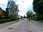
|
| Nienkemperstrasse
( Location ) |
770 | Fritz Nienkemper (1847–1922), publicist, 1894–1908 mayor of Zehlendorf | Oct. 30, 1926 | The road lies between Hochbaumstrasse and Waldmüllerstrasse. It was previously at 25 Street in the independent Schönow . |

|
| Nieritzweg
( Location ) |
980 | Karl Gustav Nieritz (1795–1876), folk and youth writer | July 13, 1934 | The street lies between Teltower Damm and Sachtlebenstrasse. First, a footpath and field path were created by the residents. Before 1878 the street was named Buschstraße . At the decision of the municipality, the application of the residents of Schönow to pave the way was approved. Work began in 1901. |
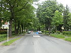
|
| Niklasstrasse
( Location ) |
1250 | Niklas (around 270 – around 350), Bishop of Myra, saint | 1905 | The street is between Potsdamer Chaussee and Spanischer Allee. The name “Niklas See” came up in the 17th century, the road to Nikolassee was laid out as a footpath and field path in the 19th century and expanded in 1906/1907 by Zehlendorf-West AG. Between 1935 and 1947 it was called Chamberlainstrasse . |

|
|
Oertzenweg
( Location ) |
590 | Ulrich von Oertzen (1840–1923), district administrator and member of the German Reichstag, personality in horse racing and thoroughbred breeding | May 11, 1938 | Before it was named Straße 539 , it lies between Lindenthaler Allee and Woliehenstraße and continues from the latter at the “Alten Gutshof Düppel” as a dead end . |

|
| Uncle Tom Street
( Location ) |
3720 (in the district) |
Onkel-Toms-Hütte , a tourist restaurant on this street, built in 1885, demolished in 1979, named after the novel Onkel Toms Hütte from 1853. | Apr 8, 1933 | Onkel-Tom-Straße is between Hüttenweg (with the Grunewald extension into Koenigsallee) and Potsdamer Straße. On the northern section through the Grunewald between Hüttenweg and the bridge over the Fenngraben , the district boundary is on the eastern edge of the road. At the intersection with Argentinische Straße, it is named for the Onkel Toms Hütte underground station and the Onkel-Tom-Siedlung. The road had existed for a long time as a connecting route through the Grunewald to Spandau, was expanded before 1878 and was then called Spandauer Straße . |

|
| Ottmachauer Steig
( Location ) |
620 | Ottmachau , Upper Silesian town near Opole, Poland | July 31, 1947 | The street between Quermatenweg and Starkenburger Straße was laid out between 1915 and 1920 by Zehlendorf-West AG as street 537 of the development plan. Between 1938 and 1947 the street was named after the Austrian National Socialist Franz Holzweber. |
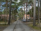
|
|
Pasewaldtstrasse
( Location ) |
200 | Eduard Julius Pasewaldt (1827–1891), landowner, local politician | around 1896 | The street is between Onkel-Tom-Straße to Scharfestraße. It was laid out in 1891 by Zehlendorf-Grunewald AG and expanded until 1904. |

|
| Peetziger way
( Location ) |
70 | Peetzig, district of Greiffenberg , Brandenburg | Nov 6, 1962 | The previous road 617 is on the road Neuruppiner and was the year after the construction of the wall named in 1961 as the other streets in the settlement area for a place behind the wall. |

|
| Pfarrlandstrasse
( Location ) |
380 | Land belonging to the parish | Oct. 30, 1926 | The street between Nieritzweg and Andréezeile was laid out in the mid-1920s by Zehlendorf-Kleinmachnow AG as street 73 and named in 1926. |

|
| Plaßstrasse
( Location ) |
270 | Louis Adolf Friedrich Plaß (1864–1921), theologian, director of the “Am Urban” nursing home in Zehlendorf. | Oct. 30, 1926 | The street laid out as Straße 75 by Zehlendorf-Klein Machnow AG around 1920 is a dead end street south of Nieritzweg. It leads as a three-lane road with sidewalks on both sides to Werner-Sylten-Weg, a sidewalk and footpath. |

|
| Plüschowstrasse
( Location ) |
430 | Gunther Plüschow (1886–1931), naval officer, aviation pioneer in Tierra del Fuego | Sep 9 1931 | The street leads northwards from Fischerhüttenstraße as a 30s zone and a dead end west from the Onkel-Tom-Straße cemetery as a driveway to Sven-Hedin-Straße, from which it is cordoned off. To the north, the street continues as a paved street on the Ernst-Reuther-Sportfeld (club area) parallel to Hartmannsweiler Weg. A section of Altkanzlerstrasse between Sven-Hedin-Strasse and Alsenstrasse was renamed Plüschowstrasse in 1931. Today there are three schools on the area in between. |

|
| Possweg
( Location ) |
590 | Reinhold Poss (1897–1933), aviation pioneer, sports and fighter pilot | Apr 4, 1934 | The street is angled between Hartmannsweilerweg and Argentinische Allee and was called Straße 301 before it was named . On January 29, 1937, the street 302 was included. In front of Argentinische Allee, it crosses the open underground line over the Poßwegbrücke. |

|
| Potsdamer Chaussee
( Location ) |
1211 (in the district) |
Potsdam , neighboring town in the southwest, today the capital of Brandenburg | after 1905 | Potsdamer Chaussee is located with plots 6–23 and 101 (continuously) between Spanische Allee and the S-Bahn bridge in the district. The south side of the street between Lindenthaler and Lisbonallee as well as the westward connecting section is in Nikolassee . The eastern section of the south side consists of a park-like green area parallel to Oertzenweg, on which the residential buildings are located. The Chaussee turns into Potsdamer Strasse at the S-Bahn bridge to the center of Zehlendorf. The Chaussee was a section of the old Potsdamer Straße , the connecting road between the royal cities of Berlin and Potsdam, laid out in 1792, it is the oldest paved road in Prussia. On a map from 1905 (in the independent rural community of Zehlendorf) this section was still referred to as the Chaussee von Potsdam . |

|
| Potsdamer Strasse
( Location ) |
1360 | Potsdam , neighboring town in the southwest, today the capital of Brandenburg | before 1878 | The street is between Clayallee and the railway bridge on the S1 line . It is the section of the old connecting road between the Prussian royal cities of Berlin and Potsdam between Berliner Strasse and Potsdamer Chaussee. The old village church is located on the corner of Potsdamer Strasse and Clayallee . Near Fischerhüttenstrasse there is a Prussian milestone on the median with the indication “2 miles to Berlin” (this corresponds to around 15 kilometers to Dönhoffplatz ). |

|
| Prinz-Handjery-Strasse
( Location ) |
1100 | Nicolaus Prinz Handjery (1836–1900) was a Prussian politician. | around 1889 | The road was laid out around 1870 and expanded in 1894. It lies between Hampstead and Leo-Baeck-Strasse. |

|
| Priort way
( Location ) |
70 | Priort , place near Nauen, Brandenburg | Nov 6, 1962 | The side street of Neuruppiner Straße, previously Straße 619 , was named like the surrounding streets after the place in the GDR district of Potsdam , which had been behind the Wall since 1961 . |
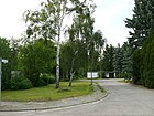
|
| Provost Sweet Milk Way
( Location ) |
180 | Johann Peter Süßmilch (1707–1767), post carrier in Zehlendorf, provost and senior consistorial councilor in St. Petri | Sep 24 1985 | The path is a common walking and cycling path (sign 240) between Clayallee and Onkel-Tom-Straße north of the village church. |

|
|
Quermatenweg
( Location ) |
1550 | Maten , old hallway name | Sep 14 1927 | The street is between Fischerhüttenstrasse and Onkel-Tom-Strasse. The street 311 was laid out in 1913 by Sommerfeld AG and in 1927 a section was named, on July 13, 1934 the remaining section was included. |

|
| Cross street
( Location ) |
160 | Location to existing roads | before 1896 | The road, which was newly laid out before 1896, lay “across” the former Alsenstrasse and Heidestrasse and connected the two. The street is between Fischerhüttenstraße and Busseallee. |

|
|
Radolfzell way
( Location ) |
120 | Radolfzell on Lake Constance , town near Konstanz, Baden-Wuerttemberg | May 28, 1984 | Before that, road 660 was laid out as a private road and in 1984 it was incorporated into public road land, it goes south from Hegauer Weg. |
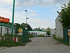
|
| Radtkestrasse
( Location ) |
230 | Theodor Radtke (20th century), director and board member of the civil servants' housing association | 1924 | The street was laid out in 1920 by the civil servants' housing association and is located between Albertinen and Berlepschstrasse. |

|
| Ramsteinweg
( Location ) |
540 | Ramstein , castle ruins near Scherwiller in the Bas-Rhin department, France | May 21, 1941 | The road between Breitensteinweg and Hocksteinweg (further as a dead end ) was laid out in the mid-1930s as road 575 by Zehlendorf-Kleinmachnow AG. It was named in 1941 after the occupation of France and the renewed annexation of Alsace and Lorraine . |

|
| Rappoltsweilerstrasse
( Location ) |
230 | Ribeauvillé (Rappoltsweiler), wine town in Alsace, France | Aug 16, 1928 | The street lies between Clayallee and Sundgauer Straße, previously Straße 31 , on May 11, 1938, Straße 119 was included. |
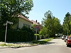
|
| Rauweilersteig
( Location ) |
120 | Rauweiler , municipality in Lorraine, France | March 1, 1970 | The street with lots 5–15 (odd) is located between Fischerhüttenstraße and Poßweg on the southeast side of the Krumme Lanke underground station ; access from Poßweg is a signposted footpath. |

|
| Ravenweg
( Location ) |
350 | Raimar Hermann Achim von Raven (1882–1914), fell at Sedan as first lieutenant in the Reserve Uhlan Regiment No. 5 in the first days | May 11, 1938 | The road between Königsweg and Oertzenweg was previously road 541 in the development plan. |
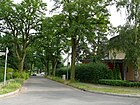
|
| Rehbrücker Weg
( Location ) |
90 | Rehbrücke , district of Nuthetal near Potsdam | Nov 6, 1962 | Before street 609 of the development plan, it goes south from Berlepschstraße. The names of the streets here took place in the year after the building of the wall after locations in the GDR district of Potsdam , which in turn bordered the Berlin district of Zehlendorf . |

|
| Heron pickle
( Location ) |
240 | Heron pickling , heron hunting with trained birds of prey | 27 Sep 1927 | The street lies between Am Fischtal and Im Gestell, previously street 327a of the development plan. |
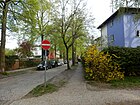
|
| Rendtorffstrasse
( Location ) |
150 | Heinrich Rendtorff (1814–1868), theologian, 1855–1861 pastor in Gütergotz (which also included Zehlendorf, today Güterfelde) | Aug 31, 1937 | The road 76 was laid out in the early 1930s by Zehlendorf-Kleinmachnow AG, it lies between Teltower Damm and Ritterhufen. |

|
| Rhumeweg
( Location ) |
520 | Rhume , right tributary of the Leine | July 31, 1947 | The street lies between Matterhornstrasse and Lindenthaler Allee, does not go through to the latter and is therefore a dead end from Niklasstrasse . Between 1937 and 1947 it was called Kossinnastraße. |

|
| Ribeckweg
( Location ) |
270 | Tobias Ribeck (born after 1580), theologian, pastor in the Gütergotz district, to which Zehlendorf also belonged | March 20, 1929 | The street lies between Nieritzweg and Adolfstraße and was laid out around 1925 as Straße 64 by Zehlendorf-Kleinmachnow AG. |

|
| Rubbed way
( Location ) |
70 | Rieben , place in the Nuthe-Nieplitz Nature Park near Beelitz, Brandenburg | Nov 6, 1962 | The street is a dead end from Neuruppiner Straße. The street 613 of the development plan was named like the surrounding ones after a place in the district of Potsdam , which had been separated from the Berlin district of Zehlendorf by the wall since 1961 . |

|
| Riemeisterstrasse
( Location ) |
1840 | Riedmeister , the administrator of the village of Zehlendorf from the Lenin Monastery, nearby Riemeisterfenn | 1889 | The street is between Onkel-Tom-Straße and Clayallee . The Herz-Jesu-Kirche is located on the corner of Schmarjestrasse . The street is mentioned in the address book from 1889 and the name was probably derived from the nearby Riemeisterfenn, which was still a lake until 1911. | |
| Rilke Path
( Location ) |
180 | Rainer Maria Rilke (1875–1926), Austrian writer | Jan. 7, 1928 | The street 20 was created around 1920 by the non-profit building and settlement AG "Heimat". It goes from the Jänickestrasse as a dead end to the east and goes through to the Dahlemer Weg as a footpath over the industrial railway. |
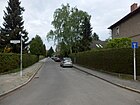
|
| Ringelsteinweg
( Location ) |
150 | Ringelstein, castle ruins west of Strasbourg (Lower Rhine), France | Aug 7, 1996 | The street is a dead end from the Breitensteinweg. In 1996, it was named after castle ruins in Alsace to match the surrounding streets . |
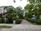
|
| Knight's hooves
( Location ) |
520 | Knight's hooves, old field name, hooves of the Schönow manor | Oct. 30, 1926 | The road 74 was laid out on the grounds of the Schönow manor in the mid-1920s by Zehlendorf-Kleinmachnow AG. It lies between Nieritzweg and Andréezeile. |

|
| Robert-von-Ostertag-Strasse
( Location ) |
380 | Robert von Ostertag (1864–1940), veterinarian | Dec 6, 1999 | The street is a cul-de-sac from Clauertstraße to Königsweg , in front of the naming as Straße 518 . This is where the Düppel correctional facility for open execution is located. |

|
| Robert-W.-Kempner-Strasse
( Location ) |
240 | Robert Kempner (1899–1993), German-Jewish lawyer and attorney | July 22, 2003 | The road goes westward from Dahlemer Weg. Before the street 621 , also known as Kühlhausstraße , it was named on the tenth anniversary of Kempner's death on August 27, 2003. |

|
| Rombsweg
( Location ) |
120 | Hans Rombs (17th century), one of the eleven Zehlendorfer Hüfner who survived the Thirty Years War | July 12, 1934 | The street lies between Karolinenstraße and Gimpelsteig. The street was laid out and named as Kleine Dorotheenstraße before 1912 and renamed in 1934. |

|
| Rondellstrasse
( Location ) |
160 | Previously this roundabout | around 1896 | The street is between Beerenstrasse and Waldstrasse, from which it continues as a dead end street for 50 meters to the turning area, followed by a footpath through the community forest to Potsdamer Strasse. It was laid out and expanded by the owners as an entrepreneur street around 1850. The earlier spelling of the street was Rondelstraße . |
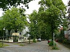
|
| Roonstrasse
( Location ) |
370 | Albrecht von Roon (1803–1879), Prussian general and minister | 1906 | The road between Fürstenstrasse and Bülowstrasse was laid out around 1900 by Zehlendorf-West Terrain AG. |
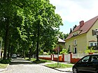
|
| Rotherstieg
( Location ) |
100 | Christian von Rother (1778–1849), Prussian state banker | before 1914 | The street lies between Camphausenstrasse and Dallwitzstrasse. |

|
|
Rötheweg
( Location ) |
330 | Gustav Roethe (1859–1926), Germanic Medievalist | before 1905 | The street is between Elvirasteig and Terrassenstraße. |

|
|
Sachtlebenstrasse
( Location ) |
1400 | Johann Andreas Sachtleben (1754–1830), was a pastor in Gütergotz (today: Güterfelde) from 1781–1830, to which the branch church Zehlendorf belonged | March 20, 1929 | This street is located between Machnower Straße and Lupsteiner Weg, over which it continues as a dead end . Laid out as Straße 56 according to the development plan, Straße 582 was incorporated into Sachtlebenstraße on July 11, 1957, and part of Andréezeile on June 1, 1966. |

|
| Salemer Steig
( Location ) |
340 | Salem , Baden community on Lake Constance, formerly Reichstift | Nov 3, 1938 | This street is between Starkenburger Straße and Zwingenberger Weg. On July 31, 1947, Pleichingestrasse was included as an extension of the Salemer Steig. |

|
| Salzachstrasse
( Location ) |
930 | Salzach , right tributary of the Inn | July 30, 1947 | The street was laid out as Alexanderstraße around 1896 and renamed Gobineaustraße in 1939 ; in the course of denazification , the current name was given in 1947. It lies between Matterhornstrasse and Kirchblick, as a dead end beyond. |

|
| Sandmeyerplatz
( Location ) |
50 × 50 | Wilhelm Sandmeyer (1863–1944), doctor, built a sanatorium for diabetics in Zehlendorf in 1907 | 22 Aug 1952 | The square is on Claszeile and Gutzmannstrasse. |

|
| Sentence grain way
( Location ) |
70 | Satzkorn , municipality near Potsdam (now a district), Brandenburg. | Nov 6, 1962 | The street is a short dead end and access road from Berlepschstraße. After Zehlendorf was separated from the surrounding area by the construction of the Wall in 1961, the following year, like the surrounding settlement streets in this south-west corner of the district, street 612 was named after a place from the GDR district of Potsdam . |

|
| Schadestrasse
( Location ) |
340 | Ernst Ferdinand Schäde (1772–1861), educator, Zehlendorf's first home chronicle | Jan. 16, 1925 | Laid out as street 19, it lies between Teltower Damm and Biesestrasse. |

|
| Scharfestrasse
( Location ) |
360 | Sidonie Scharfe (1834–1909), Zehlendorfer landowner, donated land for the Protestant St. Paulus Church with the rectory | 1896 | The street lies between Clayallee and Onkel-Tom-Straße on the founder's property; her father had acquired the Lehnschulzengut Zehlendorf in 1836. |
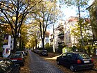
|
| Schiller Street
( Location ) |
440 | Friedrich Schiller (1759–1805), writer | before 1905 | The street between Goethestrasse and Elvirasteig is located in the writers' quarter with streets with the same theme. |
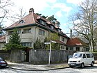
|
| Slack street
( Location ) |
360 | Schlawe , West Pomeranian town on the banks of the Wieprza (Wipper) river, Poland | July 31, 1947 | The street lies between Starkenburger Straße and Ottmachauer Steig. The previous road 536 of the development plan in 1938 in the SS -Kameradschaftssiedlung renamed Planettastraße and 1947 with the denazification again rückbenannt. |

|
| Schlettstadter Strasse
( Location ) |
990 | Sélestat (Schlettstadt), city around Lower Alsace, France | Jan. 29, 1937 | The street, laid out in the early 1930s as street 120 of the development plan, lies between Clayallee and Schützallee. |

|
| Schlickweg
( Location ) |
190 | Count Stefan von Schlick (1487–1526), founder of the Bohemian silver mining. | March 15, 1939 | The road lies between Am Schlachtensee and Terrassenstraße. It had been laid out as Brunnenstrasse by Heimstätten AG between 1870 and 1880 when the site was being developed before 1906 . |

|
| Schmarjestrasse
( Location ) |
440 | Walther Schmarje (1872–1921), sculptor | March 15, 1939 | The street between Onkel-Tomstrasse and Riemeisterstrasse was laid out around 1900 by Zehlendorf-Grunewald AG as Elsestrasse . |

|
|
Schmückertstrasse
( Location ) |
160 | Heinrich Schmückert (1790–1862), General Post Director of the Kingdom of Prussia | Nov 15, 1976 | Previously laid out as road 649 according to the development plan, it branches off from Seibtweg. |

|
|
Schönower Strasse
( Location ) |
230 | Schönow , former estate, today the location of Zehlendorf | 1889 | The street lies between Teltower Damm and Machnower Straße and was originally the connecting route between the village of Schönow and the rural community of Zehlendorf. |
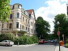
|
| Schopenhauerstrasse
( Location ) |
300 (in the district) |
Arthur Schopenhauer (1788–1860), philosopher | Jan. 29, 1937 | Schopenhauerstraße is located between Breisgauer Straße and Ilsensteinweg at Heinrich-Albertz-Platz with lots 5–15 (odd) and 6–14 (even) in the district. To the west, the road continues over Spanische Allee to Nikolassee . In 1937, Kronprinzessinnenstraße , which was laid out before 1912, was renamed Schopenhauerstraße, including the Nikolasseer Sudetenstraße laid out before 1905 . |

|
| Schopfheimer Strasse
( Location ) |
240 | Schopfheim , town near Loerrach in the southern Black Forest, Baden-Wuerttemberg | 28 Sep 1935 | The street 513 was laid out at the beginning of the 1920s by the civil servants housing association. It lies between Berlepschstrasse and Ludwigsfelder Strasse. |

|
| Schreberstrasse
( Location ) |
300 | Moritz Schreber (1808–1861), orthopedist and pedagogue, namesake of the allotment gardens and the German Schreberjugend | Oct. 30, 1926 | Before street 90 of the development plan, it is between Hampstead and Mühlenstraße. |

|
| Schrockstrasse
( Location ) |
510 | Karl Schrock (19th / 20th century), Rector in Zehlendorf | Aug 4, 1933 | Karlstrasse , which was laid out before 1878, and the extended Karlstrasse were renamed Schrockstrasse in 1933. This is between Gimpelsteig and Berlepschstraße. |

|
|
Schützallee
( Location ) |
1800 (in the district) |
Franz Schütz (1857–1933), landowner, director of Zehlendorfer Grunewald-Terrain AG. | March 29, 1929 | The street was laid out as Schützstraße before 1927 and renamed in 1929, with street 118 being included. The Schützallee belongs (with the lane) to the district and is located between Onkel-Tom- and Berliner Straße. The plots 70-136 (straight) on the northern edge of the street between Sundgauer and Berliner Strasse are in Dahlem . |

|
| Schweitzerstrasse
( Location ) |
590 | Johann Wilhelm Friedrich Schweitzer (1847–1916), from 1889 to 1902 community representative and member of the community council in Zehlendorf | 1912 | The street is between Scharfestrasse and Sophie-Charlotte-Strasse. |

|
| Sderotplatz
( Location ) |
80 × 80 × 40 triangular |
Sderot , city in southern Israel in the western part of the Negev desert, twin town of Zehlendorf | Nov 14, 2008 | Sdrotplatz is a triangular, previously nameless square that is located south (next to) Potsdamer Straße. Martin-Buber-Straße joins on the east side and Königstraße ends at a turning hammer from the west . |

|
| Seehofstrasse
( Location ) |
1840 (in the district) |
Seehof , at the time it was named an estate on Teltower Feldmark and today part of Teltow, it is located on the Berlin city limits | 1896 | Seehofstrasse is located between Berliner Strasse and Dahlemer Weg in the district and continues in Lichterfelde to Ostestrasse. In Zehlendorf the street was named around 1896, at first it only extended from Berliner Straße to Mühlenstraße. In Steglitz it was previously called Straße 9 and from 1919 Straße 161 in the development plan. The extension from Dahlemer Weg to Osteweg in Lichterfelde was laid out between 1929 and 1937. |
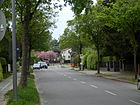
|
| Seibtweg
( Location ) |
270 | Georg Seibt (1874–1934), high-frequency technician and entrepreneur | July 13, 1934 | The street is between Albertinenstraße and Ernst-Lemmer-Ring, it goes as a road and then as a footpath to Idsteiner Straße , which is itself a pedestrian and cycle path. It was laid out around 1900 as street 3 by the civil servants' housing association. In 1922 it was named as Hans-Bredow-Straße, whose namesake Hans Bredow was banned from working in 1933 and the street was named after Seibt, another radio pioneer . |
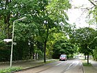
|
| Selmaplatz
( Location ) |
70 × 50 trapezoidal |
Selma , female name | July 31, 1947 | The square is located on Argentinische Allee and Teschener Weg. The place was in the SS comradeship settlement in Zehlendorf and was named as the Fuehrer's place in 1938 , in 1947 it was renamed to its current name during denazification . |

|
| Seven ends way
( Location ) |
740 | Seven ends, old hallway name | Sep 14 1927 | The footpath and cycle path (signposted as such) is located between Onkel-Tom-Straße and Argentinischer Allee on the eastern edge of the Ernst-Reuter-Sportfeld. In the street statistics 2012 he is listed with the plots 30–46 (even).
A forest path existed here even before 1907, which already bore its current name on a city map from 1925 . It was then expanded and laid out as Straße 305 in the Zehlendorf-West AG development plan in the 1920s. Until 1933 it was undeveloped. |

|
| Siepesteig
( Location ) |
250 | nearby Siepeteich and previously the Siepegraben was located here | March 20, 1961 | The street built with row houses is U-shaped on Sachtlebenstrasse, but only has a driveway at the southern entrance . The street was laid out by Zehlendorf-Kleinmachnow AG, as street 604 in the development plan. |

|
| Singing way
( Location ) |
300 | Singing , town in Hegau, Baden-Wuerttemberg. | 28 Sep 1935 | Before road 514 of the development plan, it is a dead end between Hegauer and Königsweg, which is passable here but has no connection on either side. |
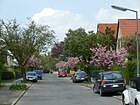
|
| Slatdorpweg
( Location ) |
410 | Slatdorp, verifiable settlement on the Schlachtensee | May 1, 1970 | The footpath along the S-Bahn between Lindenthaler Allee (Mexikoplatz) and Salzachstraße is undeveloped, no plots are assigned, the northeast side is the railway site. |

|
| Sophie-Charlotte-Strasse
( Location ) |
960 | Sophie Charlotte (1668–1705), Queen in Prussia | 1907 | The street is between Onkel-Tom-Straße and Clayallee . |
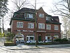
|
| Spanish Avenue
( Location ) |
470 (in the district) |
Spain , state in Europe | June 5, 1939 | Spanische Allee is in Nikolassee and only the northeastern plots 1–41 (odd) belong to the district. In 1939 the Wannseestrasse , which was laid out around 1906, and the part of the Stöckerzeile as an extension of the Wannseestrasse were renamed after the arrival of the German Condor Legion, returning from the Spanish Civil War . |

|
| Ski jump path
( Location ) |
450 | former ski jump at Onkel-Toms-Hütte | Aug 4, 1930 | The road was laid out by the Sommerfeld Society in the mid-1920s as road 317 of the development plan. It is between Holzungsweg and Riemeisterstraße. |

|
| Sputendorfer Strasse
( Location ) |
70 | Sputendorf, place near Großbeeren , Brandenburg | May 29, 1968 | The street 628 in front of the naming is a dead end from Neuruppiner Straße. |

|
| Starkenburger Strasse
( Location ) |
310 | Starkenburg , former Hessian province | July 31, 1947 | The street between Am Vierling and Ottmachauer Steig belongs to the Hessian Quarter, until 1937 the Hessian province of Starkenburg existed, with the streets renamed in 1947. It was laid out in the mid-1920s by Zehlendorf-West AG as Straße 124 and in 1938 it was named König-Heinrich-Straße in the SS comradeship settlement . |

|
| Stubenrauchstrasse
( Location ) |
850 | Ernst von Stubenrauch (1853–1909), lawyer, local politician and district administrator | 1892 | The street is between Hampsteadstraße and Am Schweizerhof. |

|
| Süntelsteig
( Location ) |
240 | Süntel , mountain range in the Weser Uplands | July 13, 1934 | The private street 3 in the settlement of the Charitable AG for employee-homes was named in 1934 and lies between Escher Hauser and Quermatenweg. |

|
| Sundgauer Strasse
( Location ) |
1840 (in the district) |
Sundgau , hill country in Upper Rhine, France | Feb 12, 1932 | Sundgauer Straße is located between Clayallee and Dahlemer Weg. In the northern section between Clayallee and Schützallee, the northeast side of the street belongs to Dahlem . Before it was named, it was street 408 in the development plan. On December 19, 1934, the section from the Wannseebahn to Finckensteinallee was included. Further extensions to Dahlemer Weg were named in 1961 and 1973 in Sundgauer Straße. |

|
| Sven Hedin Square
( Location ) |
80 × 80 | Sven Hedin (1865–1952), Swedish geographer, explorer and travel writer, supporter of the Nazi movement | Jan. 29, 1937 | The course is on Sven-Hedin-Strasse on Fischerhüttenstrasse. |

|
| Sven-Hedin-Strasse
( Location ) |
1580 | Sven Hedin (1865–1952), Swedish geographer, explorer and travel writer | Sep 14 1927 | This main street is between Argentinische Allee and Onkel-Tom-Straße and is extended by Schützallee. |

|
|
Taubchenstrasse
( Location ) |
250 | Pigeons , here probably as pigeon breeding | before 1929 | The street was laid out by Zehlendorf-West AG in the early 1920s and lies between Hermannstraße and Wasserkäfersteig. |

|
| Teltower Dam
( Location ) |
3540 (in the district) |
Teltow , southern neighboring city, Brandenburg | July 13, 1934 | The Teltower Damm is located between the center of Zehlendorf on Potsdamer / Berliner Straße and the Knesebeck Bridge , the city limits to Teltow in the Schönow area. The plots 279–293 and 301–315 (odd) on the east side south of Beeskowdamm belong to Lichterfelde . Before 1878 the name of the connection between Zehlendorf and Teltow was Teltower Straße , with the fortification before 1912 the name was changed to Teltower Chaussee . In 1934 this was merged with the main street in the section south of Berliner Straße, which also existed in the Zehlendorf town center before 1878, to form Teltower Damm. In 1991 the part of the street Am Gutshof in Schönow located on Teltower Damm was also named Teltower Damm. The John F. Kennedy School is located at No. 87-93 . |

|
| Terrace street
( Location ) |
700 | Terrace on the eastern part of the Schlachtensee | before 1905 | The road between Elvirasteig and Am Schlachtensee existed before 1905. In 1938, as an extension of Terrassenstraße, road 530 was renamed Donnhäuserstraße . In 1947, the old name was given as part of the withdrawal of Nazi street names . The street name already existed in popular parlance before it was officially awarded. |

|
| Teschener Weg
( Location ) |
400 | Teschen , Czech-Polish twin town on both sides of the Olsa | July 31, 1947 | The street between Argentinische Allee and Zwingenberger Weg. The street was laid out as street 121 by Zehlendorf-West AG at the end of the 1920s . The street was in the SS comradeship settlement in Zehlendorf and was renamed Julius-Schreck-Straße in 1938, along with 14 other streets there. As part of the denazification process , it was given its current name in 1947. |

|
| Thürstrasse
( Location ) |
170 | Georg Thür (1846–1924), entrepreneur, board member of the civil servants' housing association | 1914 | The street was laid out by the civil servants' housing association between 1910 and 1913 and named after the board member. It is located between Berlepschstrasse and Dallwitzstrasse. |

|
| Driven hunt path
( Location ) |
150 | Driven hunt , a hunter's name for a type of hunt | Aug 4, 1930 | The street in the Jägerviertel was laid out as street C in the mid-1920s by the Sommerfeld-Gesellschaft and Allgemeine Güterbau AG . It lies between Hochsitzweg and Am Hegewinkel. |

|
| Türksteinweg
( Location ) |
480 | Türkstein , a ruined castle in the Vosges (Lorraine), France | May 21, 1941 | The path lies between Teltower Damm and Heinrich-Laehr-Park and bends at a right angle approximately northwards to Leo-Baeck-Weg along the park. The road 12a and road 212a of the development plan was in 1941 after the occupation of France by Nazi Germany and the renewed annexation of Alsace and Lorraine named. |
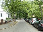
|
|
Uhldinger Strasse
( Location ) |
130 | Uhldingen , municipality in the Lake Constance district, Baden-Württemberg | 28 Sep 1935 | The street lies between Berlepschstrasse and Schopfheimer Strasse, east parallel to Ludwigsfelder Strasse. |

|
| Urbanstrasse
( Location ) |
240 | former educational institution "Urban" | 1902 | The street was laid out in the middle of the 19th century by the association for the education of morally neglected children. It goes off as a dead end on both sides of Gutzmannstrasse . |

|
| Urselweg
( Location ) |
590 | Ursel , female name | July 31, 1947 | The street is along the S-Bahn line between Lindenthaler Allee and Niklasstraße, here as a dead end and footpath . In 1937, the Seydlitzstraße, which was laid out before 1906, and part of Hohenlohestraße were renamed Anackerstraße on this street , which was then renamed in 1947 . The Hohenlohestraße was created in 1900 by the Zehlendorf-West AG, owners and the railroad company, a part was in the 1937 Anackerweg involved and the section between Potsdamer Chaussee and Seydlitzstraße accounted due to change in the development plan and has been deleted. |

|
|
Veronikasteig
( Location ) |
190 | Veronika , female name | July 31, 1947 | The street lies between Lindenthaler Allee and Ruhmeweg. The street was laid out in 1901/1902 by Zehlendorf-West AG and renamed as Margaretenstraße and in 1939 as Glogauzeile, and in 1947 it was renamed again to its current name. |

|
| Vesterzeile
( Location ) |
170 | Johann Vester (deceased to 1584), 1574-1584 pastor in Gütergotz (Güterfelde) of the Zehlendorf a branch church was | Aug 31, 1937 | The street lies between Rendtorffstrasse and Ladiusstrasse, a dead end on both sides . It was laid out as Straße 77 in the early 1930s . |

|
| Viernheimer way
( Location ) |
220 | Viernheim , Hessian town on the Bergstrasse | July 31, 1947 | The street lies between Ottmachauer and Salemer Steig. Before Straße 533 of the development plan, it was given the name Mütterstraße in 1938 as a result of the call by the SS newspaper “Schwarzes Corps” to submit proposals for the surrounding residential streets of the SS comradeship . |

|
| Vopelius Path
( Location ) |
210 | Richard Vopelius (1843–1911), glassworks owner | July 13, 1934 | The street was laid out as Annastraße before 1906 and is located between Berliner and Mörchinger Straße. |
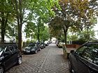
|
|
Forest ranger path
( Location ) |
520 | Forest ranger , assistant to a forester for the care and maintenance of the forest | Sep 11 1927 | The street in the Fischtalgrund settlement was laid out in the early 1920s by the Sommerfeld Society as street 327 and street 327c of the development plan. It is between Am Fischtal and Wilskistraße. |

|
|
Waldmüllerstrasse
( Location ) |
520 | Ferdinand Georg Waldmüller (1793–1865), Austrian painter | Jan. 7, 1928 | The street previously laid out as street 24 in the development plan was renamed in 1928 and is located between Jänicke and Hammerstraße. |

|
| Forest road
( Location ) |
200 | Location at the community forest | 1905 | The road lies between the forest road and the Rondell road on the northern edge of the community forest. |

|
|
Walterhöferstrasse
( Location ) |
310 | Georg Walterhöfer (1880–1928), doctor at the Rudolf Virchow Hospital | Aug 9, 1929 | The street was laid out as Moltkestraße around 1914 and was renamed on the first anniversary of the doctor's death at the University Polyclinic for Internal Medicine in Berlin, including Straße 51 . It lies between Machnower and Sachtlebenstrasse. The lung clinic of the HELIOS clinic is located on the street. |

|
| Waltraudstrasse
( Location ) |
630 (in the district) |
Waltraud , feminine given name | 1912 | Waltraudstrasse is located in the district with lots 2–38 on the west side. The district boundary to Dahlem is on the eastern edge of the street with the odd numbered properties there in the neighboring district. The road was laid out around 1900 by Zehlendorf-Grunewald AG. |
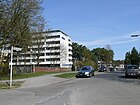
|
|
Wasserkäfersteig
( Location ) |
310 | Water beetles (Hydrophilidae), also called piston water beetles or water lovers | July 31, 1947 | The street, previously street 312 in the development plan, lies between Quermaten and over Hirschhorner Weg. In 1941 it was named in Stehrweg after a supporter of the Nazi movement and in 1947 it was given its current name as part of the denazification process . The Berlin Document Center was located here . |

|
| Werderstrasse
( Location ) |
320 | August von Werder (1808–1887), Prussian general | before 1906 | The street is a dead end from Beerenstraße, parallel to the eastern forest and the western Fürstenstraße. |

|
| Werner-Sylten-Weg
( Location ) |
230 | Werner Sylten (1893–1942), theologian, resistance fighter against the Nazi regime | Oct 16, 1963 | The cycle path and sidewalk are between Ritterhufen and Teltower Damm and are secured against driving by railings, the Plaßstraße ends at it. |

|
| Wildbergweg
( Location ) |
80 | Wildberg , until 1997 an independent community near Neuruppin, Brandenburg | Nov 6, 1962 | The street goes from Berlepschweg. Previously laid out as Street 610 , in connection with the construction of the Wall in 1961, this residential area in the southwest corner of the district was named after locations from the neighboring GDR district of Potsdam . |

|
| Wilskistrasse
( Location ) |
1590 | Ernst Wilski (1850–1929), architect and councilor in Zehlendorf | July 13, 1934 | The street laid out in the early 1920s was called Schlieffenstraße from 1927 to 1934 , and lies between Waltraudstraße and Poßweg. On this street corner is Uncle Tom Street , the Ernst-Moritz-Arndt Church . |

|
| Windsteiner Weg
( Location ) |
660 | Windstein , castle ruins and place in Lower Alsace, north of Reichshoffen, France | May 21, 1941 | The street is between Andréezeile and Sachtlebenstrasse. The road previously known as 573 was named after the occupation of France by Hitler's Germany and the renewed annexation of Alsace and Lorraine along with the surrounding road to Alsatian places. |

|
| Winfriedstrasse
( Location ) |
460 | Winfried, male first name | 1914 | The street was laid out as a private street by the owners between 1840 and 1845 and named Grunewaldstraße . Around 1919/1920, the municipality took over the road area called Winfriedstrasse, which is located between Berliner Strasse and Riemeisterstrasse. It connects Clayallee with Berliner Straße. The "Seniorenwohnanlage Rosenhof" is located on a separate part. |

|
| Wolzogstrasse
( Location ) |
550 | Wolzog (1848–1938), writer and editor | Aug 31, 1937 | The street was laid out as Derfflingerstraße before 1905. The name was changed in 1937, the street lies on both sides of Potsdamer Chaussee between Ursel- and Oertzenweg and also leads across the grounds of the old Düppel estate to the horse clinic of the Free University. |

|
| Wupperstrasse
( Location ) |
680 (in the district) |
Wupper , right tributary of the Rhine | Oct 24, 1922 | Plots 18–24 (straight) and the road between the connection from Dahlemer Weg to Beeskowdamm are in the district. The opposite plots on the eastern edge of the street and the extension to the industrial and commercial area south of Beeskowdamm belong to Lichterfelde . The street was laid out as street 11 of the development plan of Schönow . |

|
|
Zaberner Strasse
( Location ) |
70 | Zabern , town in Lower Alsace on the edge of the Vosges, France | May 11, 1938 | The cul-de-sac goes south from Schützallee, before the naming it was street 122 of the development plan. |

|
| Zinnowweg
( Location ) |
150 | Zinnow, long-established Zehlendorf farming family | 1920 | The road was laid out in the early 1920s as a private road for the Zinnowwaldsiedlung located here. It lies between Fischerhüttenstrasse and Sven-Hedin-Strasse and leads as a footpath to Argentinische Allee. |

|
| Zinsweilerweg
( Location ) |
280 | Zinsweiler , a small town in Lower Alsace, northwest of Haguenau, France | Jan. 29, 1937 | The street 306 was laid out in 1915 by the Sommerfeld Society as an entrepreneur street. It is between Poßweg and Wilskistraße. |
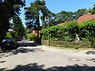
|
| Zwingenberger way
( Location ) |
140 | Zwingenberg , Hessian town on Bergstrasse | July 31, 1947 | The street between Ottmachauer and Salemer Steig was called Niedersachsenweg from 1938 to 1947 . |

|
Former and planned streets
The current district boundaries between Nikolassee and Zehlendorf were not defined at the beginning of the 20th century in such a way that Zehlendorf West AG would not have carried out projects as far as Nikolassee, which makes the assignment somewhat more difficult. Between 1937 and 1947 renaming was carried out after a competition for the SS settlement, which are specially marked below.
| Original name | from | to | renamed | annotation |
|---|---|---|---|---|
| Adalbertstrasse | before 1896 | Aug 31, 1937 | → Lagardestrasse | Adalbert von Prussia (1811–1873), Prince of Prussia. Before street 2 of the development plan. |
| Ancestral line | Nov 3, 1938 | July 31, 1947 | → Jugenheimer Weg | In the blood and soil of the Nazi era who played ancestor worship a role. First it was the street 532 , it was laid out around 1920 by the Zehlendorf-West AG and was a private street. |
| Albrechtstrasse | around 1899 | Aug 31, 1937 | → Hoensbroechstrasse | Friedrich Ludwig Leopold von Albrecht (1797–1873), politician. The road was laid out by Heimstätten AG between 1892 and 1899. |
| Alexanderstrasse | around 1896 | March 15, 1939 | → Gobineaustraße | Alexander II (1818–1881), Emperor of Russia. The road was laid out around 1874 during the construction of the Wannseebahn by Heimstätten AG and the railway company. |
| Alsenstrasse | before 1878 | Apr 8, 1933 | → Fischerhüttenstrasse | The name came after the transition of the Prussian troops in the German-Danish War on June 29, 1864 near Arnkiel on the Danish island of Alsen in the Little Belt , which was decisive for the war. |
| At the manor | June 13, 1905 | Oct 24, 1922 | → Teltower Damm | Schönow manor . Before street 9 . The part of the street Am Gutshof located on Teltower Damm was renamed Teltower Damm in 1991, a section to Wupperstraße was included in the industrial site and deleted. |
| Anackerstrasse | Aug 31, 1937 | July 31, 1947 | → Urselweg | Heinrich Anacker (1901–1971), Swiss-German writer, supporter of the Nazi movement. In 1937, Seydlitzstrasse and Hohenlohestrasse were renamed Anackerstrasse. |
| Annastrasse | before 1905 | July 13, 1934 | → Vopelius Path | Anna , female first name, also a Catholic saint. |
| Auguststrasse | before 1878 | July 13, 1934 | → Class line | August , male first name and surname of rulers. The Auguststraße and the Wilhelmstrasse were renamed Claszeile 1934th |
| Badurastrasse | Sep 18 1934 | July 31, 1947 | → Gimpelsteig | The street was previously called Dorotheenstraße. It was laid out between 1838 and 1840 as an unpaved connecting route and from 1893 onwards the Association for the Education of Morally Neglected Children expanded it. No documents or assignments have yet been found for Badura as a person. |
| Bahnhofstrasse | before 1878 | June 9, 1933 | → Hampsteadstrasse | The street was named because it ran parallel to the Berlin-Potsdam-Magdeburg railway directly to the Zehlendorf train station . |
| Bertholdstrasse | Oct. 30, 1926 | June 6, 1957 | canceled | A previously existing Bertholdstrasse was closed in 1957. In 1958 another street in Zehlendorf was named → Bertholdstraße . The location of both streets is not identical. Berthold was the first pharmacist in Zehlendorf. |
| Böckelweg | Aug 31, 1937 | July 31, 1947 | → Gilgestrasse | Otto Böckel (1859–1923), folk song researcher and anti-Semitic politician. |
| Boelckestrasse | 1927 | Oct 10, 1936 | → Hartmannsweilerweg | Oswald Boelcke (1891–1916), fighter pilot in the First World War. The road was laid out between 1925 and 1926 by Sommerfield AG. Before it was named, it was Street 301 in the development plan. |
| Bridal path | Nov 3, 1938 | July 31, 1947 | → Lindenfelser Weg | The street previously named 504 was laid out by Zehlendorf-West AG. Bride path was one of the winning names in the competition of the SS newspaper "Das Schwarze Korps" for the SS comradeship settlement. |
| Brunnenstrasse | before 1905 | March 15, 1939 | → Schlickweg | The street was laid out by Heimstätten AG between 1870 and 1880 when the site was being developed and named after the wells drilled here . |
| Burggrafenstrasse | around 1896 | Aug 8, 1935 | → Beuckestrasse | Burgrave , the office grown out of the Burgvogt. The road was laid out in 1891/1892 by the municipality at the expense of the residents and owners. |
| Bush road | before 1878 | July 13, 1934 | → Nieritzweg | At first it was probably surrounded by bushes . Initially laid out as a footpath and field path, the municipality decided to fortify the path at the request of the residents of Schönow. Work began in 1901. |
| Cecilienplatz | before 1925 | around 1934 | canceled | Cecilie Auguste Marie (1886–1954), Crown Princess. Cecilienplatz was at the crossing Cecilienstraße / Schützenstraße. It was probably lifted in 1934 when Cecilienstraße was widened and renamed Kronprinzenstraße. |
| Cecilienstraße | before 1912 | Sep 18 1934 | → Clayallee | Cecilie Auguste Marie (1886–1954), Crown Princess. In 1934, Cecilienstraße and Hauptstraße in Zehlendorf were included as a southern extension of the already existing Kronprinzenallee . The street was laid out in the course of today's Teltower Damm / Clayallee in the first half of the 19th century, in 1906/1907 the final expansion and paving of the street took place by the communities and the residents. |
| Chamberlain Street | Nov 4, 1935 | July 31, 1947 | → Niklasstrasse | Houston Stewart Chamberlain (1855-1927), philosopher. The street was called Niklasstraße since 1905 and was renamed in 1935 and renamed again in 1947. |
| Derfflingerstrasse | before 1906 | Aug 31, 1937 | → Wolzogstrasse | Georg von Derfflinger (1606–1695), field marshal of the Elector of Brandenburg and governor of Pomerania. |
| Dessauer Strasse | before 1906 | Aug 31, 1937 | → Gilgestrasse | Dessau , today a city in Saxony-Anhalt. The street was laid out around 1900 by Zehlendorf-West AG and Prince Henckel von Donnersmarck as a company street. |
| Official way | Nov 3, 1938 | July 31, 1947 | → Heppenheimer Weg | Official way, one of the winners in the competition of the SS newspaper “Das Schwarze Korps” for the SS comradeship settlement . |
| Donnhäuserstraße | May 11, 1938 | July 31, 1947 | → Terrace street | Peter Donnhäuser (1900–1933), teacher, was convicted in 1933 in connection with the popular sports trial and died in prison. The road 530 and the Terrace Road in 1938 to Donnhäuserstraße. |
| Village street | before 1922 | March 15, 1939 | → Alt-Schönow | Village center of Schönow , generally referred to as Dorfaue before it was named. |
| Dorotheenstrasse | before 1878 | Sep 18 1934 | → Badurastrasse | Dorothea (1636–1689), Electress of Brandenburg. The road was laid out between 1838 and 1840 as an unpaved connection path and from 1893 onwards the Association for the Education of Morally Neglected Children expanded it. |
| Dühringzeile | Aug 31, 1937 | Jul 31, 1947 | → Eiderstedter Weg | Eugen Dühring (1833–1921), philosopher, economist and anti-Semitic author. The street was called Heinrichstraße since before 1896 |
| Eitel-Fritz-Platz | before 1905 | after 1930 | canceled | Eitel Wilhelm Friedrich Christian Karl (1883–1942), Prince of Prussia. The square was laid out together with Eitel-Fritz-Straße between 1895 and 1899 by Heimstätten AG. It was lifted after 1930, but the extension at the intersection of Eitel-Fritz-Straße / Georgenstraße (today Dubrowstraße) remained. |
| Elfriedestrasse | before 1912 | Nov 3, 1938 | → Biesalskistraße | Elfriede , female first name. The street was laid out as street 328 of the development plan between 1895 and 1897 in two construction phases by Zehlendorf-Grunewald AG. |
| Elisabethstrasse | after 1894 | March 15, 1939 | → Schemannzeile → Guntersblumer Weg |
Elisabeth Ludovika (1801–1873), Princess of Bavaria, wife of Friedrich Wilhelm IV, Queen of Prussia. Part of the road was laid out between 1894 and 1899 by the owners and Zehlendorf-West AG. Part of Elisabethstrasse and Georgenstrasse were renamed Schemannzeile in 1939. |
| Elsestrasse | around 1906 | March 15, 1939 | → Schmarjestrasse | Else , female name. The road was laid out around 1900 by Zehlendorf-Grunewald AG. |
| Fadingerweg | Nov 15, 1938 | July 31, 1947 | → Grumbacher Weg | Stefan Fadinger (around 1585–1626), farmer, hat maker and captain of the rebellious peasants in the Upper Austrian Peasants' War. Before street 544 of the development plan. |
| Finckensteinallee | June 9, 1933 | Oct 22, 1963 | → Hampsteadstrasse | Karl Wilhelm Reichsgraf Finck von Finckenstein (1714–1800), politician. Bahnhofstrasse and Lichterfelder Strasse in Zehlendorf and Zehlendorfer Strasse in Steglitz were renamed Finckensteinallee in 1933. The Zehlendorfer part was named Hampsteadstraße in 1963, the Steglitzer part is still called Finckensteinallee. |
| Flensburger Strasse | around 1892 | Aug 1, 1969 | → Karl-Hofer-Strasse | Flensburg , today an independent city in the state of Schleswig-Holstein. The first part of the street was laid in 1889 between Fischerhüttenstrasse and Jaehnstrasse by the Abrahamschen heirs. The further expansion then took place from 1901 together with Zehlendorf-West AG. |
| Friedrichstrasse | around 1889 | after 1950 | canceled | Friedrich , male first name and ruler name. Friedrichstrasse opened after 1950 on the site of today's Behring Hospital. |
| Friedrich-Wilhelm-Strasse | after 1895 | July 13, 1934 | → Ahrenshooper line | Friedrich Wilhelm Viktor August Ernst (1882–1951), Crown Prince. The street was laid out in early 1895 by Heimstätten AG. |
| Driver's seat | Nov 3, 1938 | July 31, 1947 | → Selmaplatz | Führer ( Adolf Hitler ) |
| Georgenstrasse | before 1905 | March 15, 1939 | → Schemannzeile | Georg , male first name. Part of the street was laid out in 1892/1893 by Heimstätten AG. In 1939, when it was renamed Schemannzeile, part of Elisabethstrasse in Nikolassee was included. |
| Glagau line | March 15, 1939 | July 31, 1947 | → Veronikasteig | Otto Glagau (1834-1892 in Berlin) was a German journalist and writer in the German Empire with anti-Semitic views. According to the 1943 address book, the street is between Theodor-Fritsch-Allee and Kossinastraße (today: Lindenthaler Allee and Rhumeweg). |
| Gobineaustraße | March 15, 1939 | July 31, 1947 | → Salzachstrasse | Joseph Arthur de Gobineau (1816–1882), French diplomat and writer, maintained the superiority of the " Aryan race". |
| Grunewaldallee | around 1885 | Jan. 26, 1934 | → Argentinian avenue | The Grunewald has been a popular excursion and recreation area for the Berlin population since the 19th century, and there was a military training area on the southern edge. |
| Grunewaldstrasse | before 1878 | before 1914 | → Winfriedstrasse | Grunewald . The road was laid out by the owners as a private road between 1840 and 1845 and the municipality took over the road land in 1919/1920. |
| Hans-Bredow-Strasse | May 12, 1922 | July 13, 1934 | → Seibtweg | Hans Bredow (1879–1959), engineer, victim of the Nazi regime. It was set up as street 3 and created around 1900 by civil servants housing association. |
| Hans-Knirsch-Weg | May 11, 1938 | July 31, 1947 | → Elvirasteig | Hans Knirsch (1877–1933), politician, supporter of the Nazi regime. The street was laid out as Zietenstraße around 1900. |
| Main road | before 1878 | Sep 18 1934 | → Teltower Damm → #Clayallee |
The important road from Zehlendorf to Dahlem and Teltow was laid out between 1820 and 1849 by the municipality of Zehlendorf and the city of Teltow. The main street led from the Zehlendorf train station to Winfriedstraße and was later added to the Zehlendorf district boundary as an extended main street. The section of the main street between the Zehlendorf station and Berliner Straße was renamed in 1934 together with the Teltower Straße and the Teltower Chaussee in Teltower Damm, the section north of the Berliner Straße in Kronprinzenallee (today: Clayallee ). |
| Heidestrasse | around 1890 | Jan. 17, 1931 | → Busseallee | In 1889, the entrepreneur Bergmann submitted a project for the construction of the housing estate in the heath between Glocken-, Fischerhütten- and Potsdamer Strasse, which was approved in 1889. This first street was completed in 1890 and named in late 1890 / early 1891. |
| Heimstättenstrasse | around 1890 | March 20, 1939 | → Schemmstrasse | Heimstätten AG (named in the sense of Heim ) and the railway company built this road in two construction phases between 1890 and 1893 after the Wannsee Railway was built. The part from the old Wannseestrasse to the old Augustastrasse was named Heimstättenstrasse around 1890 , the second part from Augustastrasse to the old Seestrasse was named Waldemarstrasse around 1893 . In 1939 the northern Waldemarstrasse was renamed to the Heimstättenstrasse in Schemmstrasse , the ( Nikolasseer ) southern section of the Gertrudstrasse in Palmzeile. |
| Heinrichstrasse | before 1896 | Aug 31, 1937 | → Düring line | Heinrich , male first and ruler name, possibly named after Albert Wilhelm Heinrich (1862–1929), Prince of Prussia. |
| Herderstrasse | before 1905 | July 29, 1938 | → Bogotastrasse | Johann Gottfried von Herder (1744–1803), theologian, philosopher, writer. |
| Hoensbroechstrasse | Aug 31, 1937 | July 31, 1947 | → Ilsensteinweg | Paul Graf von Hoensbroech (1852–1923), anti-Catholic publicist and writer. The street was laid out around 1899 as Albrechtstraße . |
| Hohenlohestrasse | before 1906 | Aug 31, 1937 | → Anackerstrasse | Hohenlohe , Franconian dynasty. The road was laid out around 1900 by Zehlendorf-West AG, the owners and the railway company. In 1937 part of Hohenlohestrasse and Seydlitzstrasse were renamed Anackerstrasse . The remainder of Hohenlohestrasse between Potsdamer Chaussee and Seydlitzstrasse ceased to exist due to changes in the development plan and was deleted. |
| Holzweberstrasse | Nov 3, 1938 | July 31, 1947 | → Ottmachauer Steig | Franz Holzweber (1904–1934), supporter of the Nazi movement. Before. It was laid out between 1915 and 1920 as road 537 of the development plan by Zehlendorf-West AG. |
| Julius-Schreck-Strasse | Nov 3, 1938 | July 31, 1947 | → Teschener Weg | Julius Schreck (1898–1936), actor, supporter of the Nazi movement. The road 121 of the development plan was created in the late 1920s by the Zehlendorf-West AG. |
| Kaiserstrasse | around 1866 | June 13, 1966 | → Martin-Buber-Strasse | Kaiser , secular title of ruler, here probably the German Kaiser . The road was laid out around 1886 by the municipality and the owners. |
| Karlstrasse | before 1878 | Apr 8, 1933 | → Schrockstrasse | Friedrich Karl Alexander (1801–1883), Prince of Prussia. Karlstrasse and Extended Karlstrasse were renamed Schrockstrasse in 1933. |
| Klarastrasse | before 1895 | July 13, 1934 | → Kleinaustraße | Klara , female name. The road, which was a private road until 1996, was laid out around 1893 and paved in 1895. It is listed in the Wilski overview plan from 1912, but only since 1925 Berlin street directory. In 1934 it was renamed from Paulstraße to Kleinaustraße. |
| Little Dorotheenstrasse | before 1912 | July 13, 1934 | → Rombsweg | Possibly Dorothea Sophie (1636–1689), Electress of Brandenburg |
| Koenig-Heinrich-Strasse | Nov 15, 1938 | July 31, 1947 | → Starkenburger Strasse | Heinrich I (around 875–936), Duke of Saxony, East Frankish-German king. It was laid out in the mid-1920s as Straße 124 in the development plan by Zehlendorf-West AG. |
| Kossinnastrasse | April 16, 1937 | July 31, 1947 | → Rhumeweg | Gustaf Kossinna (1858–1931), historian. His views were based on "völkisch" ideas and could be misused by Nazi ideologues. |
| Kronprinzessinnenstrasse | before 1905 | Jan. 29, 1937 | → Schopenhauerstrasse | Crown Princess , eldest daughter of the ruler. The Kronprinzessinnenstraße and Sudetenstraße were renamed Schopenhauerstraße 1937th |
| Lagardestrasse | Aug 31, 1937 | 16 Sep 1972 | → Bergengruenstrasse | Paul de Lagarde (1827–1891), cultural philosopher and orientalist. Many of his inadequately understood thoughts, especially about Judaism , played a major role under National Socialism. Laid out as Adalbertstrasse before 1896 . |
| Leopoldstrasse | around 1925 | around 1930 | → At the Heidehof | Joachim Karl Wilhelm Friedrich Leopold (1865–1931), Prince of Prussia. |
| Lessingstrasse | before 1905 | Jan. 26, 1935 | → Limastraße | Gotthold Ephraim Lessing (1729–1781), writer. The street was laid out between 1899 and 1901 by Zehlendorf-West AG and the owners in the "Writers' Quarter". |
| Avenue of lime trees | after 1895 | Dec. 1, 1934 | → Theodor-Fritsch-Allee | Linden , deciduous tree on avenues. The road was planted with linden trees between 1892 and 1895 by Zehlendorf-West AG. Between 1938 and 1947 it was called Theodor-Fritsch-Allee, then Lindenthaler Allee. |
| Margaretenstrasse | after 1902 | March 15, 1939 | → Glagau line | Margarete , female first name. The road was laid out in 1901/1902 by Zehlendorf-West AG. |
| Miquelstrasse | 1905 | Apr. 26, 1960 | → Kösterstrasse | Johannes von Miquel (1828–1901), politician. The street was laid out by the owners and residents until 1905. The fortification and expansion took place around 1906. |
| Moltkestrasse | around 1914 | Sep 9 1929 | → Walterhöferstrasse | Helmuth Karl Bernhard von Moltke (1800-1891), German Field Marshal General. |
| Mütterstrasse | Nov 3, 1938 | July 31, 1947 | → Viernheimer Weg | Mothers road , one of the winners names in prize competitions, the SS companionship settlement. |
| Niedersachsenweg | Nov 15, 1938 | July 31, 1947 | → Zwingenberger Weg | Lower Saxony , today a federal state. A winner's name for the SS-Kameradschaftssiedlung. |
| Parkstrasse | around 1896 | July 13, 1934 | → Leuchtenburgstrasse | When it was named, the street ran directly along the west side of today's Schweizerhof Park. |
| Parlerstrasse | March 15, 1939 | July 31, 1947 | → Flat path | It was previously named Street 531 in the development plan on the occasion of the annexation of Czechoslovakia and Hitler's entry into Prague with an appearance on the Hradschin under the local bust on March 15, 1939. |
| Paulstrasse | before 1905 | July 13, 1934 | → Kleinaustraße | Paul , male first name. The Paul Street , together with the Klarastraße renamed in 1934 in small Austraße. |
| Planettastraße | Nov 3, 1938 | July 31, 1947 | → Schlawer Strasse | Otto Planetta (1899–1934), Austrian member of the Nazi movement. |
| Pleichingerstrasse | Nov 3, 1938 | July 31, 1947 | → Salemer Steig | Pleichinger was one of Hitler's first fighters in Munich. The street was established as street 535 of the development plan. The street name was selected from 15 other suggestions from more than 1,800 suggestions that the SS newspaper “Das Schwarze Korps” received in response to its call in August 1938 to send in suitable street name proposals for the SS comradeship settlement in Zehlendorf. 13 of them as well as the Führerplatz and the Julius-Schreck-Straße were renamed, as announced on July 31, 1947 in the Ordinance Gazette for Greater Berlin . |
| Prinz-Friedrich-Karl-Strasse | around 1892 | Sep 14 1927 | → Sven-Hedin-Strasse | Friedrich Karl Nikolaus (1828–1885), Prince of Prussia. |
| Schemmstrasse | March 15, 1939 | July 31, 1947 | → Matterhornstrasse | Hans Schemm (1891–1935), NSDAP Gauleiter of the Bavarian Ostmark and "Reichswalter" of the National Socialist Teachers' Association (NSLB). In 1939 Heimstättenstraße was renamed Schemmstraße with part of Waldemarstraße. |
| Schemannplatz | March 15, 1939 | July 31, 1947 | → Dubrowplatz | Ludwig Schemann (1852–1938 in Freiburg i. Br.) Was a translator and racial theorist. Dubrowplatz was renamed Schemannplatz in 1939 and got its original name back in 1947. |
| Schemannzeile | March 15, 1939 | July 31, 1947 | → Dubrowstrasse | Ludwig Schemann (1852–1938 in Freiburg i. Br.) Was a translator and racial theorist. Georgenstrasse and part of Elisabethstrasse were renamed Schemannzeile in 1939. |
| Seydlitzstrasse | before 1906 | Aug 31, 1937 | → Urselweg | Friedrich Wilhelm Freiherr von Seydlitz-Kurtzbach (1721–1773), Prussian military. The Seydlitzstraße was renamed in 1937 together with part of the Hohenlohestraße in Anackerstraße . |
| Stöckerzeile | Aug 31, 1937 | July 31, 1947 | → Breisgauer Strasse | Adolf Stöcker (1835–1909), clergyman and politician, introduced anti-Semitism into German politics. The street partly belongs to Nikolassee |
| Loyalty path | Nov 3, 1937 | July 31, 1947 | → Alsbacher Weg | Loyalty as a National Socialist catchphrase was selected in a competition for the SS newspaper “Das Schwarze Korps” with 15 other out of 1,800 suggestions for the SS camaraderie in Zehlendorf. |
| Viktoriastrasse | around 1896 | Aug 31, 1937 | → Stöcker line | The Viktoriastraße lay on the border between Nikolassee and Zehlendorf. The section of Viktoriastrasse between Hubertusstrasse (today: Tewsstrasse) and Potsdamer Chaussee was included as an extension of Nikolasseer Wannseestrasse (since 1939: Spanische Allee). The northern part of the Schlachtensee became the Stöckerzeile in 1937 and is now Breisgauer Straße . |
| Theodor-Fritsch-Allee | Dec. 1, 1934 | July 31, 1947 | → Lindenthaler Allee | Theodor Fritsch (1852–1933), publicist and publisher of anti-Semitic writings. The street has been called Lindenallee since 1906. |
| Zietenstrasse | around 1900 | May 11, 1938 | → Elvirasteig | Hans Joachim von Zieten (1699–1786), Prussian hussar general in the service of Friedrich II. The street was laid out in 1891 by Heimstätten AG. |
Other locations in Zehlendorf
Allotment gardens
- Colony Alt-Schönow ( Lage ), Kleinmachnower Weg, 226 parcels, 109,005 m², founded in 1938, fictitious permanent allotment gardens according to §§ 16 and 20a BKleingG on state-owned grounds.
- Permanent allotment gardens on Wupperstrasse ( location ), 86 plots, total leasehold area 31,729 m², fictitious permanent allotment gardens on state-owned land.
- BLW colony - sub-district of Lichterfelde-West Group Zehlendorf-Süd (KGA Zehlendorf) ( location ), railway farming south of the tracks at Zehlendorf station.
- Allotment garden association Grünstreifen ( Lage ), Mühlenstraße, 129 parcels, 54,704 m², founded in 1922, fictitious permanent allotment gardens according to §§ 16 and 20 a BKleingG on state-owned premises.
- Allotment gardens in Hoppe ( Lage ), Königsweg, 69 plots, 25,066 m², fictitious permanent allotment gardens.
- Colony Idsteiner Straße ( location ), founded in 1972, 58 parcels, 20,108 m², defined as permanent allotment gardens by the development plan.
- Permanent allotment garden Sachtleben ( location ), permanent allotment garden Sachtleben e. V., 43,566 m² leased area, 139 parcels, defined as permanent allotments by the development plan.
- Permanent allotment garden Teltowblick ( location ), Kleinmachnower Weg, 110 plots, lease area 40,381 m², fictitious permanent allotment gardens on state-owned grounds.
Parks and green spaces
- Fischtalpark ( location )
- Community grove ( location )
- Heinrich-Laehr-Park ( location ), named after Heinrich Laehr , a facility created around 1906 around the Schweizerhof nerve sanatorium
- Marga-Meusel-Park ( location ), named after Marga Meusel
- Paul-Ernst-Park ( location )
- Paul-Mebes-Park ( location ), named after Paul Mebes
- Schönower Park ( location ), it was created from the northern part of Heinrich Laehr Park
- Schweizerhofpark ( location )
- Wolfsschluchtpark ( location ) located on Elvirasteig
- Onkel-Tom-Strasse cemetery ( location )
- Schönow cemetery ( location ) on Teltower Damm / Kleinmachnower Straße.
Traffic areas
- former S-Bahn station Zehlendorf Süd on the old main line ( location )
- S-Bahn line S1
- Subway line U3
Other places and open spaces

- Old fisherman's hut ( location )
- Birkenallee ( location )
- Fischerhüttenweg ( location )
- Gut Düppel ( location )
- Dog run in the entire Zehlendorf part of the Grunewald east of the AVUS

- Site of the former Teltow shipyard on the Teltow Canal ( location )
- JVA Düppel ( location )
- Buschgrabengrundweg pumping station ( location )
- The Berlin hiking trails
- Wannseeweg - Hauptweg 11
- Teltower Dörferweg - Hauptweg 15
- Teltow Canal Path - Hauptweg 17
- Berlin Wall Trail
See also
- List of cultural monuments in Berlin-Zehlendorf
- List of cinemas in Berlin-Zehlendorf
- List of stumbling blocks in Berlin-Zehlendorf
literature
- Walter Kaupert (Ed.): Kaupert's street guide through Berlin 2010 . Kaupert Media, Berlin 2009, ISBN 3-941108-01-8 .
Web links
- Street directory Zehlendorf. kaupert media gmbh, accessed on November 2, 2012 .
- Office for Statistics Berlin-Brandenburg: List of streets and places in the Steglitz-Zehlendorf district (as of February 2015); pdf
- Map of Berlin 1: 5000 with district boundaries. Senate Department for Urban Development Berlin, 2012, accessed on August 25, 2012 .
- Hermann Jansen (1869–1945) Expert opinion on the project of the Berlin-Zehlendorf district office to designate an additional road from Zehlendorf via Dahlem towards Berlin-Mitte (1934)
Individual evidence
- ↑ a b c d e f Hermann Jansen: Fischtalgrund settlement plan, Berlin-Zehlendorf, 1921
- ↑ a b c d e Hermann Jansen: Traffic management at Zehlendorf-West train station (1932)
- ↑ To the Besckow family
- ↑ bsz-spv.de twinning association Steglitz-Zehlendorf
- ↑ stadtentwicklung.berlin.de ( Memento of the original from November 14, 2014 in the Internet Archive ) Info: The archive link was automatically inserted and not yet checked. Please check the original and archive link according to the instructions and then remove this notice. Official Journal for Berlin, State Administration Office Berlin
- ↑ a b On the person of Dubrow
- ↑ On the person of Eilert
- ↑ a b Zehlendorfer Heimatbrief September 2012 ( memento of the original dated November 30, 2015 in the Internet Archive ) Info: The archive link was inserted automatically and has not yet been checked. Please check the original and archive link according to the instructions and then remove this notice. (PDF; 248 kB) Site plan from 1819 (on page 4)
- ↑ a b main street . In: Address book for Berlin and its suburbs , 1900, suburbs: 29. Zehlendorf with Schlachtensee entry no. 3, p. 275.
- ↑ a b c d e f Clarification of the situation on the map of Berlin 1: 5000 produced by the district surveying office (K5 color edition)
- ↑ a b c d e f Alsenstrasse . In: Berliner Adreßbuch , 1930, streets in the administrative district of Zehlendorf, Zehlendorf entry no. 2, p. 1511.
- ↑ About the person Hammer
- ↑ On the person of Böhm
- ↑ ba-steglitz-zehlendorf: printed matter - 0840 / IV
- ↑ Dirk Jordan: Georg and Hedwig Flatow. In: www.meinschlachtensee.de. 2014, accessed on May 3, 2020 (German).
- ↑ Press release from the Steglitz-Zehlendorf district office
- ↑ Irmgardstrasse . In: Berliner Adreßbuch , 1926, Steinstücke, Wannsee, Zehlendorf Entry No. 13, p. 1486.
- ↑ Jähnstrasse . In: Berliner Adreßbuch , 1930, administrative district Zehlendorf> Zehlendorf, p. 1520.
- ↑ Joachimstrasse . In: Berliner Adreßbuch , 1910, Part V (suburbs), Zehlendorf Entry No. 7, p. 705.
- ↑ Johannesstrasse . In: Address book for Berlin and its suburbs , 1901, suburbs: 29. Zehlendorf with Schlachtensee entry no. 3, p. 290.
- ↑ Juttastrasse . In: Berliner Adreßbuch , 1914, suburbs, Zehlendorf with Schlachtensee entry No. 10, p. 902.
- ↑ Berlin Chronicle, online version, ed. from the Berlin State Archives. (Events of May 7, 1945) ; Retrieved Nov. 22, 2014.
- ↑ Kleinaustraße. In: Kaupert's street guide through Berlin. Retrieved July 24, 2020 .
- ↑ On the person of Kunzendorf
- ↑ Place is named after the "silent heroine" Lucie Strewe . In: Berliner Woche , May 11, 2018, accessed May 3, 2020.
- ^ Place in Berlin-Zehlendorf is named after Lucie Strewe . Lucie Strewe Foundation, June 14, 2017, accessed May 3, 2020.
- ↑ Dirk Jordan: Silent heroines in Schlachtensee. In: www.meinschlachtensee.de. private, 2018, accessed on May 3, 2020 (German).
- ↑ kauperts.de - Lucie-Strewe-Platz
- ↑ Naming ceremony of the Marga-Meusel-Platz in Zehlendorf on August 30th, 2011 ( Memento of the original of December 2nd, 2013 in the Internet Archive ) Info: The archive link was automatically inserted and not yet checked. Please check the original and archive link according to the instructions and then remove this notice. District Office Steglitz-Zehlendorf
- ↑ Sights - N - ( Memento of the original from June 5, 2012 in the Internet Archive ) Info: The archive link was inserted automatically and has not yet been checked. Please check the original and archive link according to the instructions and then remove this notice.
- ↑ On the person of Pasewaldt
- ↑ On the person sweet milk
- ↑ On the person of Rendtorff
- ↑ To the Scharfe family
- ^ About Schlick
- ↑ City map from 1907 on www.blocksignal.de
- ↑ Siebenendenweg . In: Berliner Adreßbuch , 1934, administrative district Zehlendorf> Zehlendorf> J- Z, p. 1398.
- ↑ To the Zinnow family
- ↑ a b c d e f g h i j k l m n o p q r s t u v w x y z The street name was named with 15 others when the SS newspaper “Das Schwarze Korps” called for the SS comradeship settlement selected in Zehlendorf. According to the ordinance sheet for Greater Berlin, 13 of them and two more were renamed on July 31, 1947.
- ^ Berlingeschichte.de: Street directory Zehlendorf
- ↑ Renaming of streets during the Nazi era
- ↑ Renaming Zehlendorf . In: Berliner Adreßbuch , 1943, Zehlendorf administrative district> Zehlendorf, p. 1435.
- ↑ kauperts.de: Bertholdstrasse
- ↑ kauperts.de: Cecilienstraße
- ↑ kauperts.de: Dienstweg
- ↑ berlingeschichte.de: Fadingerstrasse
- ↑ Kauperts.de: driver's position
- ↑ berlingeschichte.de: Grunewaldallee
- ^ Kauperts.de: Hans-Bredow-Strasse
- ↑ kauperts-de: main street
- ↑ On the person of Holzweber
- ↑ “A model estate of 35 residential buildings with 120 apartments was built in Berlin-Zehlendorf according to the most modern principles. The model estate will be accessible to all parties interested in construction and settlement. View into a sunny and airy street of the model estate with its pretty front gardens in Berlin-Zehlendorf. "( Original text from the Federal Archives )
- ↑ a b c d e f g Berlin-Stadtgrün KleingartenStock_06.pdf ( Memento of the original from September 29, 2013 in the Internet Archive ) Info: The archive link was inserted automatically and has not yet been checked. Please check the original and archive link according to the instructions and then remove this notice.
- ↑ a b c d e f Allotment gardens of the Zehlendorf district association ( Memento of the original from December 1, 2012 in the Internet Archive ) Info: The archive link was inserted automatically and has not yet been checked. Please check the original and archive link according to the instructions and then remove this notice.
- ^ Allotment garden association Grünstreifen e. V.
- ↑ Dog exercise areas in the Berlin forest / maps - Grunewald
- ↑ Green main paths with coordinates
- ↑ 20 main green paths
- ↑ Virtual hiking map
- ↑ Coordinates for the Wannseeweg
- ↑ Coordinates for the Teltower Dörferweg (Download kmz file) ( Memento from September 1, 2013 in the Internet Archive )
- ↑ Coordinates for the Teltow Canal Path
