
Clayallee
| Clayallee | |
|---|---|
|
|
|
 |
|
| Clayallee at the transition to Schmargendorf | |
| Basic data | |
| place | Berlin |
| District |
Grunewald , Schmargendorf , Dahlem Zehlendorf |
| Created | before 1878 |
| Newly designed | 1949 |
| Hist. Names |
Hauptstrasse (1878–1934), Cecilienstraße (before 1912–1934) , Kronprinzenallee (1912–1949) |
| Connecting roads |
Hohenzollerndamm (north) , Teltower Damm (south) |
| Cross streets |
(Selection) Pücklerstrasse , Königin-Luise-Strasse , Hüttenweg , Argentinische Allee , Saargemünder Strasse , Garystrasse , Schützallee , Potsdamer Strasse , Berliner Strasse |
| Places |
Roseneck , Trumanplaza |
| Buildings | Allied Museum |
| use | |
| User groups | Pedestrian traffic , bicycle traffic , car traffic , public transport |
| Technical specifications | |
| Street length | 4560 meters |
The Clayallee runs in a north-south direction through the Berlin districts of Grunewald , Schmargendorf , Dahlem and Zehlendorf to the Zehlendorfer Eiche .
history
Zehlendorf was an anger village oriented in north-south direction . What is now the southern part of Clayallee opened up the northern half of Zehlendorf, as a plan from 1819 shows.
Between 1820 and 1849 Clayallee was laid out as a main street, which reached north to Winfriedstraße and was later extended as an extended main street to the Zehlendorf district boundary. Even before 1882, this part was named Hauptstrasse .
On a map from 1907, the extended main street was renamed Cecilienstraße . A gate, slightly south of today 's Oskar-Helene-Heim underground station , separated the street from its extension through the Grunewald . The latter was named Kronprinzenallee in 1912 . On September 18, 1934, the section of Hauptstrasse north of Berliner Strasse and Cecilienstrasse were also renamed Kronprinzenallee . With that the street had reached its present size. According to the district boundaries at that time, it led exclusively through Zehlendorf and Dahlem.
The construction of the subway in 1929 was followed by settlement of the surrounding area. In 1930 a tram was built north of Königin-Luise-Straße through Kronprinzenallee . After the Second World War , the line was not put back into operation, but trams coming from Königin-Luise-Strasse continued to turn here until this line was also closed in 1959.
On June 1, 1949, Kronprinzenallee was renamed Clayallee in honor of the US military governor of the American zone of occupation in Germany, General Lucius D. Clay , the "father" of the Berlin Airlift . It is next to the Pacelliallee one of the few roads in West Berlin after - at the time of designation - surviving person named.
traffic
The predominantly six-lane street is part of the connection between Berlin City-West and the Zehlendorf center. In the Grunewald district, Clayallee begins at the intersection with Bernadottestraße as an extension of Hohenzollerndamm . In Dahlem it partly borders directly on the Grunewald forest .
Several bus routes traveled sections of this 4560 meter long main road , also the at the Oskar-Helene-Heim of U3 is that crosses under the Clayallee at right angles here. Clayallee ends at the intersection with Bundesstraße 1 and continues as Teltower Damm out of town towards Teltow .
Attractions
Between Pücklerstrasse and Käuzchensteig , in Bussardsteig, there is the Brücke Museum Berlin with paintings by the Brücke group of artists .

Up until the beginning of the 1990s, along Clayallee there were numerous facilities and housing estates of the US armed forces , which were stationed in Berlin as allies of the Second World War . The US headquarters were located in the buildings of the former Luftgau Command III, built between 1936 and 1938, until 1994 . The Allied Museum is now located in the former US Outpost cinema and the former Nicholson Memorial Library . The eye-catcher is a British transport aircraft from the Berlin Airlift , which is on display in the open-air area between the building sections.
Located between the Allied Museum and Hüttenweg is the memorial that the Americans - represented by the former US President George H. W. Bush - gave to the citizens of the Federal Republic of Germany in 1998 in memory of the fall of the Berlin Wall . It is a sculpture by the American Veryl Goodnight entitled The Day The Wall Came Down and shows five wild jumping horses jumping over the rubble of the Berlin Wall.
There is a monument with the bust of Friedrich Wilhelm von Steuben on Clayallee near Hüttenweg .
The German-American Folk Festival took place fifty times each year between 1961 and 2010 on the grounds of Trumanplaza on Clayallee before it had to move to Moabit due to the development of the area .

Expansion of Clayallee, 1952

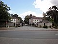
Restaurant Roseneck on Clayallee
McDonald’s on Clayallee
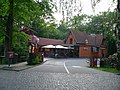
Entrance to the former US headquarters


Web links
- Clayallee. In: Street name lexicon of the Luisenstädtischer Bildungsverein (near Kaupert )
Individual evidence
- ↑ Zehlendorfer Heimatbrief September 2012 ( Memento of the original dated November 30, 2015 in the Internet Archive ) Info: The archive link was automatically inserted and not yet checked. Please check the original and archive link according to the instructions and then remove this notice. (PDF; 248 kB) Site plan from 1819 (on page 4)
- ↑ a b main street . In: Street name lexicon of the Luisenstädtischer Bildungsverein
- ↑ City map from 1907 on blocksignal.de
- ↑ City map from 1921 ( page no longer available , search in web archives ) Info: The link was automatically marked as defective. Please check the link according to the instructions and then remove this notice. on alt-berlin.info
- ↑ Memorial plaque on the monument
- ↑ Heimatverein Zehlendorf: Zehlendorf in the course of history. (No longer available online.) Archived from the original on August 16, 2010 ; Retrieved March 5, 2011 . Info: The archive link was inserted automatically and has not yet been checked. Please check the original and archive link according to the instructions and then remove this notice.
Coordinates: 52 ° 27 ′ 21 ″ N , 13 ° 16 ′ 24 ″ E