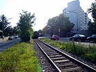
List of streets and squares in Berlin-Rudow

The list of streets and squares in Berlin-Rudow describes the street system in the Berlin district of Rudow with the corresponding historical references. At the same time, this compilation is part of the lists of all Berlin streets and places .
overview

(locations according to today's name)
North: Neuköllner Straße (with Chausseehaus) going further north: Chaussee to Buckow
Southeast: Waltersdorfer Chaussee
Northeast: Köpenicker Straße
South (Rudower Spider):
Groß-Ziethener Chaussee from there Klein- Ziethener Weg
Waßmannsdorfer Chaussee
Schönefelder Strasse
The district of Rudow has 42,631 inhabitants (as of December 30, 2019) and includes the postcode areas 12353, 12355 and 12357. In the district of Rudow there are 206 dedicated streets with a total length (all streets) of 71.2 kilometers. In addition, there are 24 dedicated spaces in the district and ten of the streets listed are (at least partially) with the same name in the neighboring districts.
The Rudow road system from the 2010s was developed around the core of the former Angerdorf , although it was not yet fully developed in the district around 1920 (see the road section in Rudow around 1920 ). The outskirts character of the district with residential streets and garden city developments is also recognizable by the fact that the majority of the streets are designated as "Weg" or even street names such as "Andreas-Hermes-Siedlung" or "Pfarrsiedlung" are used. The names of 1928 and 1938 give named streets on Rudow's district around Stubenrauchstrasse and in the south, which subsequently emerged as residential streets with single-family houses. The expansion of the settlement areas took place step by step, but was halted as a result of the Second World War , leaving areas that were divided or built over differently and led to some changes in the street layout but also to densification due to the construction of further streets. With the construction of the Berlin Wall , Rudow moved to the southern outskirts where after 1945 there was still room for residential development. It was built in the 1960s to the mid-1970s, mainly on Buckower Flur and in the north of Rudower, the large housing estate Gropiusstadt as an independent district. In Rudow, in enclosed West Berlin, there was space for streets with settlements in the garden city style with multi-family houses, such as the parish settlement in the mid-1980s. Defects from Gropiusstadt brought architectural ideas that in Rudow in the mid-1990s for the 19 streets of the garden city with street names after significant women and thus referred to as “women's quarter”.
The development of the streets and the themes of the street names can be found in the planning rooms (PR) of the district.
- 35 Flower District: The streets between Teltow Canal and Neuköllner Strasse have been named after ornamental and medicinal plants since 1928. The most recent change resulted from the demolition of the Rudow thermal power station on the Teltow Canal, which created new roads in this settlement area after the land use plan was changed in 2010. The planning area is delimited by Stubenrauchstrasse, the street names for ornamental and useful plants were already coined beforehand and thus continues in the Alt-Rudow planning area.
- 36 Zittauer Straße: The streets south to the city limits and Groß-Ziethener Chaussee were laid out from 1938 and named after municipalities and cities in Saxony . North to Neuköllner Straße and limited to the west by Gropiusstadt, streets have been named after occupational titles since 1938 and this was also retained for the settlement and residential streets that were added later.
- 37 Alt-Rudow: The streets north of Alt-Rudow (western area before the division into planning areas) have also been named after ornamental and useful plants since 1928. Since the 1970s, the streets between Köpenicker Straße and Neudecker Weg have been named and laid out with local reference.
- 38 Waßmannsdorfer Chaussee: Since 1938 the streets to the southern outskirts have mostly been given names of chicken breeds and names derived from them, such as Gockel- or Hennenweg. In the eastern area north of the women's quarter, names from the Polish areas of Neumark began to be assigned in 1940 .
- 39 Frauenviertel: The streets in the garden city of Rudow were named in 1996 after politicians and women of public importance.
- 40 Waltersdorfer Chaussee Ost: South of Neudecker Weg to Altglienicke , the road was expanded relatively late. For example, streets that lead across Waltersdorfer Chaussee were named in 1938 after Polish cities that previously belonged to Prussia. North-east to the Mozartring, which was built in the 2010s, there are streets named after composers. Favored by the peripheral location on the Berlin border , garden city settlements such as on the street "Pfarrsiedlung" were still possible here since the mid-1980s.
Overview of streets and squares
The following table gives an overview of the streets and squares in the district as well as some related information.
- Name / location : current name of the street or square. Via the link Location , the street or the square can be displayed on various map services. The geoposition indicates the approximate center of the street length.
- Traffic routes not listed in the official street directory are marked with * .
- Former or no longer valid street names are in italics . A separate list may be available for important former streets or historical street names.
-
Length / dimensions in meters:
The length information contained in the overview are rounded overview values that were determined in Google Earth using the local scale. They are used for comparison purposes and, if official values are known, are exchanged and marked separately.
For squares, the dimensions are given in the form a × b for rectangular systems and for (approximately) triangular systems as a × b × c with a as the longest side.
If the street continues into neighboring districts, the addition ' in the district ' indicates how long the street section within the district of this article is. - Name origin : origin or reference of the name.
- Notes : further information on adjacent monuments or institutions, the history of the street and historical names.
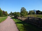
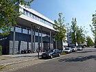
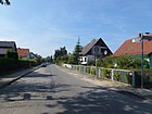
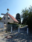
- Image : Photo of the street or an adjacent object.
| Name / location | Length / dimensions (in meters) |
Origin of name | Date of designation | Remarks | image |
|---|---|---|---|---|---|
|
Alfred Rojek Way
( Location ) |
190 | Alfred Rojek (1897–1975), politician | Aug 15, 1989 | Set up as spur road 10 S of the development plan, it goes off to the west of the Im Bauernbusch road. |

|
| Altrader way
( Location ) |
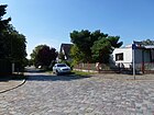
150 | Altraden , town in the Kuyavian-Pomeranian Voivodeship (Poland) | March 19, 1938 | Established as street 192 of the development plan, lies between Deutschtaler Straße and Waltersdorfer Chaussee (as a dead end street). Short residential street with single-family houses on the southern outskirts. |
|
| Old Rudow
( Location ) |
1000 | Center of the village of Rudow | Dec. 1, 1973 | Established as road 109 of the development plan, it is the northeast part of the village road of the Angerdorf . The street lies between the junction from Neuköllner Strasse (in the west) and Neuköllner Strasse on the "Rudower Spider" in the east. Part of Neuköllner Strasse was also renamed Alt-Rudow in 1973.
Architectural monuments: Alt Rudow 55, house 32, house 54, house 59 and school in Rudow |

|
| At the Espenpfuhl
( Location ) |
1400 | Aspen pool , adjacent pond | March 19, 1938 | Established as street 166 of the development plan, it lies between Gerhard-Winkler-Weg and Am Klarpfuhl. On February 1, 1966, the extension was included. |

|
| At the Großer Rohrpfuhl
( Location ) |
230 | to the nearby Rohrpfuhl | Oct. 1, 2001 | The street curves to the west from and to Waßmannsdorfer Straße. |

|
| At the Hanffgraben
( Location ) |
130 | after Michael Hanff (1619–1678), electoral pleasure gardener , farm owner. | March 15, 1971 | Established as street 135 of the development plan, it lies between Alt-Rudow and Neuköllner Straße over the previous village green . |

|
| At the Klarpfuhl
( Location ) |
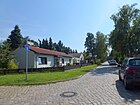
410 | after the nearby Klarpfuhl | March 19, 1938 | Laid out as street 193 and street 243 of the development plan, the short residential street with single-family houses is located between Timmendorfer Weg and the city limits. On February 1, 1966, street 246 was included. It is located at the Rudow-Altglienicke Landscape Park. |
|
| At the edge of the forest in Rudow
( Location ) |
510 | after the location on the edge of the forest | July 1, 2004 | Before road 200 , it lies between Groß-Ziethener Chaussee and Welsumerpfad parallel to the Wall Trail in the “Waldrandsiedlung”. |

|
| Ampferweg
( Location ) |
130 | Dock , meadow and vegetable plant | Aug 16, 1928 | Established as street 11 of the development plan, it lies between Mohnweg and Neuköllner Straße, to which it has no exit, but a turning area . |

|
| At the night bay
( Location ) |
170 | Night bay , hallway name | Jan. 1, 1974 | Established as road 174 of the development plan, it branches off to the east of the cycle path. |

|
| At the Rudower Höhe
( Location ) |
120 | Rudower Höhe , local recreation area on the previous rubble mountain | April 1, 1995 | Established as street 609 of the development plan, it lies between Neudecker and Glashütter Weg and opens up a country house settlement with a garden city character. |

|
| At the Werderlake
( Location ) |
110 | Werderlake, old Rudow floor name | July 1, 1986 | Established as street 607 of the development plan, it is located between Neudecker and Glashütter Weg. |

|
| Andreas Hermes Settlement
( Location ) |
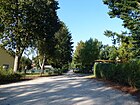
160 | Andreas Hermes (1878–1964), political scientist and politician | Nov 15, 1970 | The street with this name leads with lots 2–9 (continuous) as a dead end from Klein-Ziethener Weg going south to the settlement of the same name. |
|
| Angelikaweg
( Location ) |
140 (in the district) |
Angelica , umbellifer and medicinal plant | Aug 28, 1928 | Set up as street 8 of the development plan, it lies between Glockenblumenweg and Thistelfinkweg, it continues as a footpath to Rudower Straße. |

|
| Arabisweg
( Location ) |
180 | Arabis , cruciferous plant | May 11, 1938 | Established as road 203 of the development plan, it lies between Kanalstrasse and Mimosenweg. |

|
| Arthur-Friedrich-Weg
( Location ) |
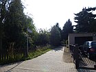
20th | Arthur Friedrich was chairman of the settler community from 1938–1955. During this time he did a lot for the settler community; so he has z. B. participated in the planning and construction of the clubhouse. | The short cul-de-sac leads from Am Rudower Waldrand to the Wall Trail. |
|
|
| Arnikaweg
( Location ) |
690 (in the district) |
Arnica , medicinal plant | Aug 28, 1928 | Established as street 106 of the development plan, it is located between Petunienweg and Neuköllner Straße. The road area belongs to the district, between the northern properties of the Distelweg and Neuköllner Straße are the properties on the west side in Buckow . |

|
| Aschersleben path
( Location ) |
610 | Aschersleben , city in Saxony-Anhalt | March 19, 1938 | Established as street 120 of the development plan, it lies between Zwickauer Damm and Groß-Ziethener Chaussee. |

|
| August-Froehlich-Strasse
( Location ) |
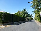
450 | August Froehlich (1891–1942), theologian, victim of the Nazi regime | Oct 26, 1985 | Established as street 563 of the development plan, it is located between Köpenicker Straße and Neudecker Weg. |
|
|
Backerstrasse
( Location ) |
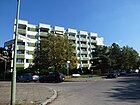
130 | Baker , craft occupation | Feb. 1, 1998 | Established as Strasse 146 , it is located between Groß-Ziethener Chaussee and Druckerkehre in a district with streets named after craft trades. A short street with two new six-story apartment buildings on the odd side. |
|
| Bartschiner Strasse
( Location ) |
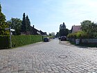
530 | Bartschin , place in Kujawy-Pomerania (Poland) | Feb 21, 1940 | Set up as road 147 of the development plan, it lies between Eichenauer Weg and as a dead end across Neuhofer Straße. The quiet residential street is mostly built with single-family houses. The west side is undeveloped and borders the meadows on the Meskengraben. |
|
| Mugwort way
( Location ) |
760 | Mugwort , medicinal and aromatic plants | Aug 28, 1928 | Established as street 103 of the development plan, it is located between Johannisthaler Chaussee and Schneeballenweg, a concrete street with footpaths and the character of a settlement with single and multi-storey houses, some of which have been replaced by new buildings. |

|
| Beizerweg
( Location ) |
250 | Beizer , job title | March 19, 1938 | Established as street 142 of the development plan, it is located on Bildhauer- und Korbmacherweg. A concrete street with footpaths and mostly built with single-family houses. |

|
| Benatzkyweg
( Location ) |
310 | Ralph Benatzky (1884–1957), composer and playwright. | Sep 18 1987 | The part of the Glashütter Weg between Selgenauer Weg and Lettberger Straße was renamed Benatzkyweg in 1987 and lies between Selgenauer Weg and Lettberger Straße. The paved road with footpaths and partially front gardens is built on with single and multi-family housing estates and turns into footpaths through park-like grassland on both sides. |

|
| Benedicta Teresia Way
( Location ) |
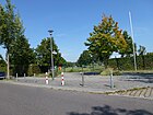
210 | Edith Stein (religious name: Teresia Benedicta a Cruce, OCD, 1891–1942), educator, victim of the Nazi regime | Nov 1, 1996 | The street is in the garden city of Rudow, which was completed in 1996. The non-public road between Elfriede-Kuhr-Straße and Helene-Jung-Platz leads across the Hannah-Arendt-Gymnasium. |
|
| Sculptor's Path
( Location ) |
640 | Sculptor , artistic profession | March 19, 1938 | Set up as road 128 of the development plan, the paved residential road with footpaths on both sides lies between Alt-Rudow and Bitterfelder Weg. |

|
| Bitterfeld way
( Location ) |
570 | Bitterfeld , district of Bitterfeld-Wolfen in Saxony-Anhalt | March 19, 1938 | Set up as Straße 128 , it lies between the Bildhauer- and Lößnitzer Weg. A paved residential street, partly with a footpath, partly with a tree-lined green border |

|
| Bocksbartweg
( Location ) |
160 | Goat beard , useful and forage plant | Aug 28, 1928 | Established as street 58 of the development plan, it is located between Prierosser Straße and Kalmusweg. A concrete street with ten residential buildings with pavement slabs. |

|
| Bornaer Strasse
( Location ) |
190 | Borna , city in Saxony | March 19, 1938 | Established as street 125 of the development plan, it is located between Zittauer Straße and Meißner Weg in a quarter named after Saxon medium-sized towns as a paved street with parking bays, footpaths on both sides and 15 residential properties. |

|
| Buchbinderweg
( Location ) |
550 | Bookbinders , craftsmen | March 19, 1938 | Set up as street 3 of the development plan on July 1, 1998, part of street 146 to the Rudower Fliess was included. It is located in a quarter named after craft trades between the Sculptor's Path and the Seilerweg; a footpath across grassland leads to the Teltower Dörferweg . |

|
| Boxwood path
( Location ) |
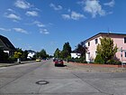
1130 | Boxwood , evergreen shrub and hedge plant | Aug 16, 1928 | As a road 68 which was set on August 9, 1929 Road 9 and include the extension thereof on 1 February 1966th It lies between Krokusstrasse and Köpenicker Strasse |
|
|
Dankmarsteig
( Location ) |
190 (in the district) |
Dankmar, male first name | Aug 24, 1936 | Set up as Straße 143 , only plots 1–9 are located in the district and border the Mozartring. The part in Alt-Glienicke lies beyond the tunnel of the A 113 , whereby the district boundary changes over this strip on the north side of the road. |

|
| Deutschtaler Strasse
( Location ) |
1960 | Deutschtal , place in the Powiat Gnieźnieński in the Greater Poland Voivodeship | March 19, 1938 | Set up as street 115 of the development plan, the quiet, partly paved residential street, mainly built with single-family houses, is located between Neudecker Weg and Am Klarpfuhl. It is closed to car traffic between the small protected landscape areas on Espenpfuhl and Röthepfuhl and designed as a footpath. |

|
|
Döbelner Weg
( Location ) |
270 | Döbeln , city in Saxony | March 19, 1938 | Established as street 185 of the development plan, it lies between Groß-Ziethener Chaussee and street 188. A narrow asphalted residential street with residential buildings is closed to public traffic. |

|
| Dorothea-Stutkowski-Weg
( Location ) |
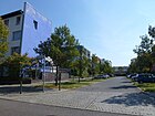
80 | Dorothea Stutkowski (1908–1985), theologian, resistance fighter against the Nazi regime | Nov 1, 1996 | The street leading south from Ursulinenstraße provides access to the four adjacent apartment blocks, with parking bays and front gardens on both sides. |
|
| Dreherweg
( Location ) |
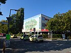
130 | Lathe operator , job in the metalworking industry | March 19, 1938 | Established as street 27 of the development plan, it is located between Neuköllner and Sattlerstraße. The concrete residential street with footpaths delimits a small settlement on the south side. |
|
| Printer return
( Location ) |
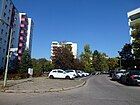
100 | Printer , profession | Nov 15, 1970 | The road 556 of the development plan is a dead end with turning area . It goes north from Bäckerstrasse and opens up adjacent apartment blocks. The name was given to match the surrounding streets according to craft trades. |
|
|
Ivy path
( Location ) |
550 (in the district) |
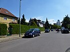
Ivy , creepers and creepers | Aug 16, 1928 | The street DI of the development plan lies between Neuköllner Strasse and Fritz-Erler-Allee. The plots 1–12f and 2–22 including the street are in the district. The western properties in the southern part belong to Gropiusstadt. The concrete road is built on with single and multi-family houses. |
|
| Ehrenpreisweg
( Location ) |
750 | Speedwell , tea and medicinal plant | Aug 16, 1928 | Established as street 3 of the development plan, it is located between Stubenrauchstraße and Alt-Rudow. The tree-lined residential street, partly with multi-family houses, has a green strip the width of the street in the southern part. |

|
| Eibischstrasse
( Location ) |
190 | Marshmallow , to the mallow family | Aug 16, 1928 | Set up as road 111 according to the development plan, it lies between the box tree path and the cornflower ring, a concrete road with single-family houses. |

|
| Eichenauer Weg
( Location ) |
680 | Eichenau , Upper Silesian town, (now) part of Katowice (Poland) | March 19, 1938 | Established as street 118 of the development plan, it is located between Deutschtaler Straße and Groß-Ziethener Chaussee. Narrow paved residential street with mostly single-family houses, but also apartment buildings from the 1930s. |

|
| Eilenburger way
( Location ) |
280 | Eilenburg , city in Saxony | March 19, 1938 | Established as street 204 of the development plan, the settlement street is located between Groß-Ziethener Chaussee and Zittauer Straße. |

|
| Elfriede-Kuhr-Strasse
( Location ) |
670 | Elfriede Kuhr (1891–1966), doctor, local politician | Nov 1, 1996 | The quiet residential street, built with blocks of flats from the 1990s, is located between Knollstrasse am Nordpark and Hiltrud-Dudek-Weg am Südpark. The Hanna-Ahrend-Gymnasium is located here. |

|
| Elisabeth-Selbert-Strasse
( Location ) |
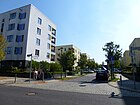
320 | Elisabeth Selbert (1896–1986), lawyer, politician | Nov 1, 1996 | The quiet residential street was built on with row houses in the 1990s. It is located between Nordpark (Ursulinenstrasse) and Käte-Frankenthal-Weg at the Südpark. |
|
| Elly-Heuss-Knapp-Strasse
( Location ) |
450 | Elly Heuss-Knapp (1881–1952), teacher, politician | Nov 1, 1996 | The street lies between Ursulinenstraße and Hildtrud-Dudek-Weg and thus between North and South Park. The street with parking bays, footpaths and front gardens consists of four-story new buildings. |

|
| Alder break ring
( Location ) |
480 | nearby Erlenbruch | Sep 1 1996 | It is located with the plots 4-50 and 21-53 northeast of and to the road 618. The neighboring Erlenbruch is traversed by the Rudower Fliess. The street, including the cul-de-sac of the same name, is part of the "settlement on Bahnhofstrasse". |

|
| Owl Way
( Location ) |
70 | Owls , an order of birds | Jul 29, 2011 | The new road laid out for a residential estate is located between the sea eagle and osprey trail on the Kalte Grund-Pfuhl. The road was constructed and laid out according to the development plan XIV-274aa ("Waßmannsdorfer Dreieck"). |

|
| Exiner Street
( Location ) |
500 | Exin , place in the former province of Poznan, Kujawsko-Pomorskie Voivodeship (Poland) | Feb 12, 1940 | Established as road 119 of the development plan, it is located between Eichenauer and Ostburger Weg. In an area with streets that are named after places in the former Prussian province of Posen. |

|
|
Fennel trail
( Location ) |
1090 | Fennel , tea and spice plant | Aug 16, 1928 | The path is located in the streets of streets 5 and 6 as well as streets 101 and 104 of the development plan, and street 35 was also included on March 29, 1939 , so it is between Johannisthaler Chaussee and Distelfinkweg, but the southwestern part between Glocken- and Diestelfinkenweg belongs to it Buckow . The northern 350 meters east of the Ernst-Keller-Brücke form the southern shore path on the Teltow Canal as a narrow residential street with parking bays for residents. In the further course of the property plots delimit a two-lane residential street with sidewalks in the LOR planning area 35 ("flower district"). |

|
| Thimble path
( Location ) |
140 | Foxglove , medicinal plant | Nov 15, 1970 | Set up as road 216 of the development plan, it goes off as a cul-de-sac with a turning hammer to the west of Sage Path. |

|
| Osprey Trail
( Location ) |
270 | Osprey , bird of prey | Jul 29, 2011 | The road that was newly laid out in the 2010s for a residential estate goes from Waßmannsdorfer Chaussee to the southeast and lies on the Kalte Grund-Pfuhl. The road was constructed and laid out according to the development plan XIV-274aa ("Waßmannsdorfer Dreieck"). |

|
| Fleischerstrasse
( Location ) |
800 | Butcher , craft occupation | March 19, 1938 | Established as street 130 of the development plan, the settlement street is between Zwickauer Damm and Buchbinderweg, at the eastern end it goes into a dead end from Korbmacherweg and then continues as a footpath. This means that there is a connection to Bäckerstraße via the Rudower Fließgraben. The street has several side paths to connect the single-family houses of the lower-tier plots to the road. At the eastern end there are apartment buildings. |

|
| Hallway
( Location ) |
990 | Corridor , agricultural land | Aug 16, 1928 | Before street 17, 17b and 17c in the development plan, street 7c was included on March 27, 1939. It is located between Minzeweg and Neuköllner Straße in the “flower district” built on with single-family and small multi-family houses. |

|
| Formerweg
( Location ) |
280 | Former , job title | March 19, 1938 | Set up as road 131 , the asphalt road with residential buildings and sidewalks lies between Uhrmacherweg and Bildhauerweg. |

|
| Frauenschuhweg
( Location ) |
150 | Lady's slipper , orchid | Nov 1, 1968 | Set up as street 220 , the path is between Männertreu- and Seidelbastweg in the planning area “Flower Quarter”. |

|
| Goodbye
( Location ) |
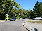
280 | Good , farmer's place with hooves | Jan. 1, 1974 | Set up as Straße 175 and Platz D of the development plan, it is located between Im Bauernbusch and “KGA Neues Heim”. |
|
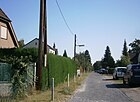
| Freitaler Strasse
( Location ) |
440 | Freital , city near Dresden (Saxony) | March 19, 1938 | Established as street 127 of the development plan is the residential street Pirnaer Straße and Lößnitzer Weg. |
|
| Friederike-Nadig-Strasse
( Location ) |
320 | Frieda Nadig (1897–1970), welfare worker, politician | Nov 1, 1996 | The quiet residential street was built on with row houses in the 1990s. It lies between Ursulinenstrasse and Käte-Frankenthal-Weg and connects the north and south parks. |

|
| Fritz-Erler-Allee
( Location ) |
610 (in the district) |
Fritz Erler (1913–1967), politician, resistance fighter against the Nazi regime | Feb 22, 1968 | Only the plots 155–197 (odd) with residential buildings between Efeuweg and Neuköllner Chaussee are located in the district. Set up as road 484 in the Neukölln district and laid out with two lanes with a median along with the large housing estate Gropiusstadt , it also leads through Buckow . |

|
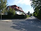
| Fuchsienweg
( Location ) |
580 | Fuchsia , ornamental plant | Aug 16, 1928 | Set up as Straße 107 , it is located between Flurweg and Stubenrauchstraße. |
|
|
Poultry dough
( Location ) |
980 | Poultry , generic term for all domestic and farm birds | March 19, 1938 | Before street 148 of the development plan. The concrete settlement road leads over the Rudow river ditch and lies between Groß-Ziethener and Waßmannsdorfer Chaussee. |

|
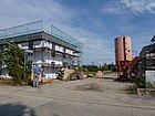
| Geißbartweg
( Location ) |
140 | Goat's beard , aruncus, perennials with white, dioeciously distributed flowers in large inflorescences. Rose family | Oct 8, 2010 | Settlement road ( private road ) laid out on a former industrial site between Minzeweg and the Uferweg on the Teltow Canal , there is a turning hammer here. |
|
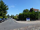
| Gerhard-Winkler-Weg
( Location ) |
130 | Gerhard Winkler (1906–1977), composer and pianist | Sep 18 1987 | In 1987 the part of the Glashütter Weg was renamed from Deutschtaler Straße and Am Espenpfuhl, the route is still here south of Kattenpfuhl. |
|
| Gertrud-Dorka-Weg
( Location ) |
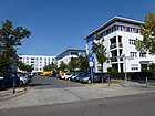
80 | Gertrud Dorka (1893–1976), educator, archaeologist | Nov 1, 1996 | The path in the “Frauenviertel” is a dead end street north of Jeanette-Wolff-Straße and offers access to the adjacent apartment blocks |
|
| Gisbertzweg
( Location ) |
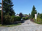
260 | Wilhelm Gisbertz (1886–1963), politician, honorary chairman of the German Settlers Association | Jul 1, 1972 | Set up as private road 548 of the development plan, it lies between Knollstrasse and Nikolaus-Ehlen-Weg, with plots 2–6 being accessed via a dead end street. |
|
| Glashütte way
( Location ) |
380 | conceivable: Glashütte , watchmaking town in Saxony. Since the path was named at exactly the same time as Altrader Weg, Deutschhofer Straße, Lettberger Straße, Timmendorfer Weg and others, the name is much closer to a place of the same name in the areas ceded in 1919, such as Glashütte (Szklarka Trcielska) . | March 19, 1938 | Established as street 162 of the development plan, the route lay between today's Rudower Spider and the district boundary (corner of An der Rudower Höhe / Niederschlemaer Weg). There was no development due to green spaces, on September 18, 1987, the name was changed between Deutschtaler Straße and Am Espenpfuhl to Gerhard-Winkler-Weg and between Lettberger Straße and Selgenauer Weg it was spun off into Benatzkyweg. The way between An der Rudower Höhe and a turning hammer at the end of a cul-de-sac in An der Werderlake is considerably shortened. Adjacent to the south is the Priesterpfuhl and the Rudower Höhe. |

|
| Bellflower Path
( Location ) |
1570 (in the district) |
Bluebells , ornamental plant | Aug 16, 1928 | It is located between Johannisthaler Chaussee and Stubenrauchstrasse, however, in the western part, the plots 2–36 (straight) south of the street in Buckow . Established as street 5 of the development plan. |

|
| Gockelweg
( Location ) |
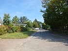
520 | Gockel, popularly for the rooster , adapted to the surrounding streets according to chicken breeds | June 1, 1967 | Established as road 527 of the development plan, on November 15, 1970, the extension was included in the cul-de-sac from Rhodeländerweg. The path leads into an industrial area and is located in the southern corner of the district behind the property, the Rudower Dörferblick borders. A settlement area was created between 2013 and 2014 between Rhodeländerweg and Waßmannsdorfer Chaussee. |
|
| Goldlackweg
( Location ) |
210 | Gold lacquer , ornamental plant | Aug 16, 1928 | Settlement street between Flur- and Levkojenweg in the planning area Blumenviertel, set up as street 17a . |

|
| Goldrautenweg
( Location ) |
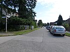
230 | Golden diamonds , genus of plants used in naturopathy | May 13, 1929 | Set up as street 14 , the settlement street is located between Löwenzahnweg and Stubenrauchstraße in the planning area Blumenviertel |
|
| Greifenberger Strasse
( Location ) |
650 | Greifenberg , district town in the former province of Pomerania (Poland) | Nov 15, 1970 | Before street 215 of the zoning plan, it lies between Neuhofer and Knollstraße and meets the Nordpark here . |

|
| Grossenhainer way
( Location ) |
170 | Grossenhain , middle town in Saxony | March 19, 1938 | Established as street 126 of the development plan is located between Zittauer Straße and Lauchstädter Weg. |

|
| Groß-Ziethener Chaussee
( Location ) |
1720 | Großziethen , neighboring town (Brandenburg) | after 1930 | The actual route between Rudow and Großziethen was named between 1930 and 1932 and on July 1, 1963 Bahnhofstrasse in Rudow was included. The Chaussee lies between Rudower Spinne (Neuköllner Straße) and the city limits. |

|
| Gürtlerweg
( Location ) |
590 | Gürtler , craft occupation | March 19, 1938 | Established as street 136 of the development plan, it is located between Zwickauer Damm and Bildhauerweg. |

|
|
Hafenstrasse
( Location ) |
180 | Harbor on the Teltow Canal | before 1911 | The street was established as street F of the zoning plan. The street lies between Kanalstraße and Teltowkanal, which has an extension at this point, which was still undeveloped in 1922. An industrial area was planned in Rudow along the Teltow Canal, which opened in 1906, the ports of Rudow West and Rudow East are on the edge. |

|
| Helene-Jung-Platz
( Location ) |
60 × 60 | Helene Jung (1896–1976), educator, local politician | Nov 1, 1996 | The square is off Waltersdorfer Chaussee and is on Ursulinenstrasse. The Benedicta-Teresia-Weg crosses the square as a footpath. |

|
| Helene-Nathan-Weg
( Location ) |
80 | Helene Nathan (1885–1940), librarian, victim of the Nazi regime | Nov 1, 1996 | It goes from Jeanette-Wolff-Straße to the north and opens up the surrounding apartment blocks. |

|
| Helene-Weber-Strasse
( Location ) |
320 | Helene Weber (1881–1962), politician | Nov 1, 1996 | The street lies between Ursulinenstraße and Ottilie-Baader-Platz in the Frauenviertel. |

|
| Helene-Wessel-Strasse
( Location ) |
120 | Helene Wessel (1898–1969), social worker, politician | Nov 1, 1996 | The street is a cul-de-sac north of Lieselotte-Berger-Straße. |

|
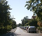
| Hennensteig
( Location ) |
500 | Hen, female domestic chicken , in addition to Gockelweg | Jan. 24, 1938 | Set up as street 169 , it lies between Groß-Ziethener Chaussee and Erlenbruch, from Welsumerpfad as a dead end in the green area as a footpath. |
|
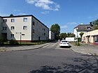
| Herzblattweg
( Location ) |
250 | Heart leaf , saxifrage, also as a medicinal plant | Aug 16, 1928 | Established as street 114 of the development plan, it is located between Margueritenring and Köpenicker Straße. |
|
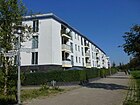
| Hiltrud-Dudek-way
( Location ) |
530 | Hiltrud Dudek (religious name: Maria Hiltrud, 1903–1991), religious sister, educator | Nov 1, 1996 | Apartment houses were built on the street in the 1990s. It lies in the arch between Waltersdorfer Chaussee and Ottilie-Baader-Platz, the south side of the street delimits the Südpark. |
|
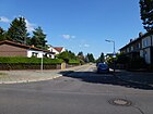
| Hofjagdweg
( Location ) |
290 | Rudow was considered the preferred hunting ground of the sovereigns | Jan. 1, 1974 | Set up as Straße 176 , it goes as a dead end eastwards from Im Bauernbusch and ends at KGA Neues Heim. |
|
| Hop path
( Location ) |
470 | Hops , genus of the hemp family | Aug 16, 1928 | Set up as roads BI and CI , the path is between Efeuweg and the district boundary to Gropiusstadt on Fritz-Erler-Allee |

|
|
Igelkolbensteig
( Location ) |
90 | Hedgehog cob , marsh plant | Nov 15, 1970 | When the Rudow thermal power station was demolished, the land use plan for residential development was changed here. No longer listed in the official LOR directory. |

|
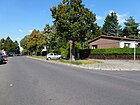
| In the farmer's bush
( Location ) |
410 | Bauernbusch, old Rudow field name | Jan. 1, 1974 | Before Straße 11s of the development plan, it is between Köpenicker Straße and Neudecker Weg. |
|
|
Jeanette-Wolff-Strasse
( Location ) |
450 | Jeanette Wolff (1888–1976) politician, resistance fighter against the Nazi regime | Nov 1, 1996 | The quiet residential street is built on with apartment blocks from the 1990s. It lies between Ottilie-Baader-Platz and the edge street of Waltersdorfer Chaussee. |

|
| Johannisthaler Chaussee
( Location ) |
780 (in the district) |
Johannisthal , neighboring village of Rudow | before 1911 | In the district lies the road land and the southern plots 113-169 (odd) between Ernst-Kleiber-Brücke and Glockenblumenweg. Until 1920 the street in Buckow and Rudow was called Johannisthaler Chaussee, between Buckower Bahnhofstraße (today: Wildmeisterdamm) and Rudower Straße in Rudow. In 1929 the extension in Treptow (Johannisthal) and on June 1, 1975 also the part of the Wildmeisterdamm up to Buckower Damm was included, so it has since also been in the districts of Baumschulenweg (north) and Buckow, Gropiusstadt and Britz to the south . |

|
|
Kálman path
( Location ) |
300 | Emmerich Kálmán (1882–1953), Hungarian composer | Aug 15, 1972 | Established as street 467 of the development plan, it lies between Lettberger Straße and a dead end to KGA Rudower Höhe. |

|
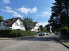
| Kalmusweg
( Location ) |
140 | Calamus is a species of swamp plant | Aug 16, 1928 | It is located between Ehrenpreisstraße and Kappenstraße, previously Straße 57 . |
|
| Canal Street
( Location ) |
1550 | in the commercial area on the Teltow Canal | before 1911 | Previously street G of the development plan and already marked by name in the city map from 1911, probably named after the completion of the port facility. It is between Stubenrauchstrasse and Köpenicker Strasse. In 1922, construction sites were indicated on the property. The Werner machine works is registered as a monument as a whole. The RWE wood-fired thermal power station at the east end of the street to Köpenicker Strasse, which is located on the Teltow Canal and serves to supply Gropiusstadt, represents modern technology . |

|
| Kapaunenstrasse
( Location ) |
970 | Capon , castrated rooster | Jan. 24, 1928 | Prior to street 158 of the development plan, the extending street 460 was included on May 1, 1967 , it lies between Lockenhuhn- and Rhodeländerweg. |

|
| Cap Street
( Location ) |
220 | The origin of “caps” is unclear, the naming could have been based on a local personality | before 1921 | The street is located between Prierosser Straße and Alt-Rudow and in the address book of Berlin from 1918 it is not yet listed on the map from 1920 but is indicated by name. In 1922 there were construction sites on the property between Neuköllner Straße and Straße 59 and Straße 57. |

|
|
Käte-Frankenthal-Weg
( Location ) |
350 | Käte Frankenthal (1889–1976), doctor, victim of the Nazi regime | Nov 1, 1996 | The quiet residential street is built on with multi-family houses from the 1990s. It lies between Schönefelder Strasse and Ottilie-Baader-Platz and borders the Südpark to the north. |

|
| Kerbelweg
( Location ) |
250 | Chervil , aromatic plant | Aug 16, 1928 | Before street 19 of the development plan, it is located between Krokusstraße and Stubenrauchstraße, to which a blocked-off footpath from Wendehammer leads across the street. |

|
| Kiefwiesensteig
( Location ) |
80 | Kiefwiesen, old field name | Nov 15, 1970 | The short connection between Wischmattenweg and Köpenicker Strasse, without any land, was previously set up as footpath 202 . The footpath provides access to four adjoining homes but is not passable. | |
| Kleestrasse
( Location ) |
280 | Clover , forage plant | Aug 16, 1928 | Set up as Straße 24 , it is located between Ehrenpreis- and Meldweg. |

|
| Klein-Ziethener Weg
( Location ) |
450 | Kleinziethen (formerly: Klein-Ziethen), district of Großziethen (Brandenburg) | Jan. 24, 1938 | Established as road 155 of the development plan, the northern part of Klein-Ziethener Weg was renamed Rhodeländerweg on May 1, 1967. It lies between the Rhodeländerweg and the city limits and is delimited between Rudower Fließ and Andreas-Hermes-Siedlung with a connection via the Berlin Wall Trail to Großziethen, here as Rudower Chaussee. |

|
| Klettenweg
( Location ) |
500 | Burdock , composites | Aug 16, 1928 | Established as road 69 of the development plan, it lies between the Rhabarberweg and Larkerspornweg. |

|
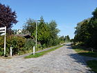
| Knollstrasse
( Location ) |
480 | Ernst Gustav Knoll (1889–1965), lawyer, promoter of the settlement system | June 1, 1975 | Before street 148 of the development plan, it is located between Schönefelder Straße and Waltersdorfer Chaussee, to the latter by a footpath south of Krummer Katzenpfuhl. The south side of the street is the north park, the north side is built with residential buildings. |
|
|
Köpenicker Strasse
( Location ) |
1710 | Connection road to Köpenick , (1911) independent town of Cöpenick | before 1911 | Established as street M of the development plan, it is marked in the city map from 1911 as Coepenieker Straße , as part of the road connection from Rudow to Köpenick via Adlershof . In 1938 the street name up to the Wredebrücke ( Altglienicke ) is given. The street is between Alt-Rudow and August-Fröhlich-Straße, then northeast in the direction of the Treptow-Köpenick district (Alt-Glienicke district), continuing in the district as a cul-de-sac in an industrial area that borders the 113 federal motorway .
Architectural monuments: Rudow village church, old sexton and school building, factory building at No. 26. |

|
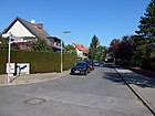
| Korbmacherweg
( Location ) |
80 | Basket maker , craftsman | Nov 1, 1990 | Before street 144 of the development plan, it is between Fleischerstraße and Beizerweg, to the west two properties to the east is a daycare center on an asphalt road with sidewalks. |
|
| Cornflower ring
( Location ) |
880 | Cornflower , blue flower and field weed | Aug 16, 1928 | Set up as road 110 of the development plan, road 474 was included on April 7, 1965 after it was named in 1928 . The ring is located between Ehrenpreisweg and Krokusstraße north of Alt-Rudow. |

|
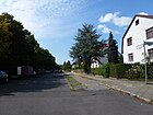
| Kornradenstrasse
( Location ) |
630 | Corn wheel , carnation, weeds | Aug 16, 1928 | Before street 10 of the development plan, the section between Kornblumenring and Buchsbaumstraße, which deviated from the development of the building, was renamed Margueritenring on July 1, 1965. It lies between Stubenrauchstrasse and Krokusstrasse. |
|
| Crocus Street
( Location ) |
1200 | Crocuses , spring bloomers | Aug 16, 1928 | Bismarckstraße was included on March 29, 1939 as Straße 8 of the development plan . The Krokusstraße lies between Stubenrauchstraße and Alt-Rudow.
Architectural monuments: Krokusstraße 80. |

|
| Kückenweg
( Location ) |
280 | Chick , young chicken, in addition to Gockelweg, Henn climbing and Kapaunstraße | Jan. 24, 1938 | Established as street 160 of the development plan, it is located between Waßmannsdorfer Chaussee and Putenweg. The path is in an area where the street names are related to the domestic chicken. 'Kücken' is the common spelling in Austria, as opposed to the German spelling 'Küken'. |

|
| Künnekeweg
( Location ) |
340 | Eduard Künneke (1885–1953), composer | June 1, 1972 | Set up as street 239 of the development plan, the spelling Künnecke published in 1972 was corrected on August 8, 1972 in Künneke. It is located between Lettberger Straße and the permanent allotment garden Rudower Höhe with access to the Rudower Höhe, a rubble mountain that has been transformed into a park . |

|
|
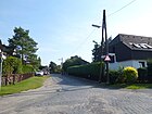
Salmon Chicken Trail
( Location ) |
310 | Salmon chicken, breed of chicken | Jan. 24, 1938 | Established as road 170 of the development plan, the path lies between Zwerghuhnweg and Welsumerpfad. |
|
| Lakenfelderweg
( Location ) |
270 | Sheet fields , breed of chicken | Jan. 24, 1938 | Established as Straße 154 , it lies between the poultry path and the guinea fowl path. |

|
| Landhausweg
( Location ) |
440 | Country house , relation to the surrounding settlement | Feb. 27, 2009 | It is located between Bildhauerweg and Buchbinderweg and is a closed private road and accessible from Bildhauerweg as a dead-end street, listed in the LOR directory with properties 1-49 (odd) and 2-52 (even) under street number 09948. |

|
| Langschanweg
( Location ) |
350 | German Langschan , chicken breed | Jan. 24, 1938 | Set up as road 159 , the path is angled and curved between Putenweg and Kückenweg and opens up the properties between Putenweg and Kapaunenweg. |

|
| Lauchstädter Weg
( Location ) |
720 | Bad Lauchstädt , city in Saxony-Anhalt | March 19, 1938 | Established as Straße 122 , it lies between Zwickauer Damm and Groß-Ziethener Chaussee. |

|
| Leghornweg
( Location ) |
180 | Leghorn , breed of chicken | March 1, 1965 | Established as road 247 , it lies between the Putenweg and Rhodeländerweg |

|
| Lettberger Strasse
( Location ) |
1030 | Lettberg, Polish Lednogóra , place in Greater Poland Voivodeship (Poland) | March 19, 1938 | Established as street 177 of the development plan, the residential street is mainly built up with single-family houses and is located between Neudecker and Schönbergweg. The Rudow Equestrian Club has its premises at the southern end. The road leads into the premises of the Ewald Fischer tree nurseries. |

|
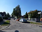
| Levkoienweg
( Location ) |
240 | Levkoie , ornamental plant | Aug 16, 1928 | Created as street 15 of the development plan, it is located between Glockenblumenstrasse and Windenweg. |
|
| Lieselotte-Berger-Platz
( Location ) |
140 × 70 | Lieselotte Berger (1920–1989), politician | Nov 1, 1996 | The square, surrounded by blocks of flats, is located on Lieselotte-Berger-Straße and is bordered by Elfriede-Kuhr-Straße and Elly-Heuss-Knapp-Straße. A weekly market takes place on the square. |

|
| Lieselotte-Berger-Strasse
( Location ) |
1030 | Lieselotte Berger (1920–1989), politician | Nov 1, 1996 | The quiet residential street is built on with apartment blocks from the 1990s, it is located between Waltersdorfer Chaussee and Schönefelder Straße and is the main thoroughfare in the Frauenviertel. |

|
| Lockenhuhnweg
( Location ) |
280 | Curly chicken, breed of chicken | Jan. 24, 1938 | As Straße 152 of the development plan is the path between Rhodeländerweg and Waßmannsdorfer Chaussee. |

|
|
Löheweg
( Location ) |
90 | Wilhelm Löhe (1808–1872), Evangelical Lutheran theologian with writings on the profile of the Lutheran Church | Aug 3, 1966 | Set up as a private road 248, it is a residential street between Söderblomweg and Matthäusweg in a 20-meter zone near (parallel) the city limits and belongs to the “settlement on Zwickauer Damm”. |

|
|
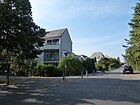
Loessnitzer way
( Location ) |
530 | Lößnitz , City (Saxony) | March 19, 1938 | Before road 141 of the development plan, it lies between Zwickauer Damm and Groß-Ziethener Chaussee. |
|
|
Dandelion path
( Location ) |
540 | Dandelions , composites | Aug 28, 1928 | The path between Fuchsien- and Mohnweg was created together from Street 13 and Street 13a of the development plan when it was named . |

|
| Lupine Path
( Location ) |
150 | Lupine , useful and fodder plant | Aug 16, 1928 | Before street 585, it goes southwest as a dead end from the Kornblumenring and as a footpath and cycle path to Prierosser Straße between its older buildings. |

|
|
Mackebenweg
( Location ) |
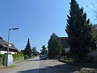
330 | Theo Mackeben (1897–1953), composer. | Jun 1, 1975 | Set up as street 585 of the development plan, the quiet residential street is mostly built on with single-family houses and borders directly on the Rudow-Altglienicke landscape park and the Rudower Höhe. It is located between Kálmánweg and Schönbergweg. |
|
|
Male loyalty route
( Location ) |
370 | Faithful to men , bluebell family | Nov 1, 1968 | Set up as road 221 of the development plan, it is located between Frauenschuhweg and Sauerdornweg as a dead end street, continuing to a turning hammer on the former site of the Rudow thermal power station . |

|
| Marguerite ring
( Location ) |
1000 | Marguerite , meadow flower, daisy family | Aug 16, 1928 | Established as Straße 112 of the development plan, on July 1, 1965 Straße 475 , part of Kornradenstraße was included in Margueritenring. It is not an actual ring like the surrounding cornflower ring and lies between the speedwell and box tree path. |

|
| Marianne-Hapig-Weg
( Location ) |
200 | Marianne Hapig (1894–1973), social welfare worker , resistance fighter against the Nazi regime | Nov 1, 1996 | The path is inclined over the Lieselotte-Berger- and Jeanette-Wolff-Straße between Lieselotte-Berger- and Ottilie-Baader-Platz. |

|
|
Maßliebweg
( Location ) |
230 | Dimensionally , daisies | Aug 16, 1928 | Set up as street AI in the development plan, it is located between Hopfen- and Ifeuweg. |

|
| Mathilde Vaerting Way
( Location ) |
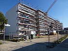
150 | Mathilde Vaerting (1884–1977), psychologist and educator | Nov 1, 1996 | The street was built on with multi-family houses in the 2010s and is located between Jeanette-Wolff-Straße and Hiltrud-Dudek-Weg. |
|
| Matthäusweg
( Location ) |
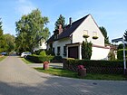
350 | Matthew , disciple of Jesus | Dec 29, 1964 | Established as street 250 of the development plan, it lies between Meißner Weg and the city limits, in the western part as a residential street of the "Am Zwickauer Damm settlement". |
|
| Meissner way
( Location ) |
1050 | Meißen , district town in Saxony | March 19, 1938 | Previously set up as street 121 in the development plan, the northern section was incorporated into Wutzkyallee on October 1, 1967. It is located between Matthäusweg and Groß-Ziethener Chaussee. |

|
| Reporting path
( Location ) |
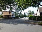
200 | Melde , goosefoot | Aug 16, 1928 | Before street 25 of the development plan, it is between Ehrenpreisweg and Kleestrasse. |
|
| Melissenweg
( Location ) |
70 | Melissa , medicinal plant | Feb. 1, 1987 | Established as road 584 , the private road lies between Mint and Trollblumenweg, but is not included in the official directory. Rather, the Melissenweg is a direct continuation of the Igelkolbenweg, which in turn is not listed in the LOR directory. When the Rudow thermal power station was demolished, the zoning plan for residential development was changed here. |

|
| Millöckerweg
( Location ) |
180 | Carl Millöcker (1842–1899), Austrian operetta composer | Aug 15, 1972 | It lies between Kálmán- and Künnekeweg and was previously part of road 486 of the development plan. |

|
| Mimosa path
( Location ) |
470 | Mimosa , plant family | Aug 16, 1928 | Set up as Street H , it is located between Kanalstrasse and Köpenicker Strasse. |

|
| Minorkaweg
( Location ) |
220 | Minorka , breed of chicken | Jan. 24, 1938 | Before road 153 of the development plan, it lies between Perlhuhnweg and Geflügelsteig. |

|
| Mint Path
( Location ) |
1150 | Mint , medicinal and aromatic plants | Nov 1, 1968 | Set up as road 222 , it lies between Iris and Frauenschuhweg. When the Rudow thermal power station was demolished, the zoning plan was changed to residential development. |

|
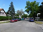
| Mistletoe Path
( Location ) |
270 | Mistletoe , sandalwood | Aug 16, 1928 | Before street 70 of the development plan, it lies between Kanalstrasse and Buchsbaumweg. |
|
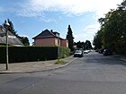
| Poppy path
( Location ) |
570 | Poppy , cultivated plant and plant family | Aug 16, 1928 | Before streets 12 and 12a of the development plan, it is between Flurweg and Stubenrauchstraße. |
|
| Mozart ring
( Location ) |
460 | Wolfgang Amadeus Mozart (1756–1791), Austrian composer | March 14, 1997 | The quiet residential street with single-family houses borders directly on the Rudow-Altglienicke landscape park and the Rudower Höhe, but also on the 113 federal motorway. The ring is between Schönbergweg and the fenced-off Dankmarsteig. An area not suitable for residential buildings was dedicated to the weekend settlement. |

|
|
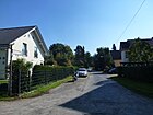
Nackthalsweg
( Location ) |
90 | Bareback chicken, breed of chicken | Jan. 24, 1938 | Set up as Straße 151 , it lies between Lakenfelderweg and Erlenbruch on the Rudower Fließ. |
|
| Narrow way
( Location ) |
130 | Narkau, town in the province of West Prussia, since 1945 Narkowy , (Poland) | March 19, 1938 | Small residential street with single-family houses on the north side. The south side borders on two landscape protection areas, the Röthepfuhl and the Espenpfuhl. It is located between Waltersdorfer Chaussee and Deutschtaler Straße, previously Straße 189 in the development plan. |

|
| Neudecker way
( Location ) |
1620 | Neudeck, town in the province of Upper Silesia, Świerklaniec in Poland since 1945 | March 19, 1938 | Before road 168 according to the development plan, it lies between the district boundary ( Altglienicke Rudower Straße) and the Rudower Spider (Waltersdorfer Chaussee, Groß-Ziethener Chaussee and Neuköllner Straße).
In 2013/2014 in particular, the clay school in this street became known to the public. Because a new building is being built here for around 40 million euros , the first dig was of course. The companies and archaeologists commissioned by the Monument Authority found historical relics that date from the Bronze Age , through the Roman Empire, to the Nazi era . The entire 9,000 square meter area is now being extensively examined, the finds documented and parts of it presented to the public. Before, the existence of a forced labor camp during the Nazi era was brought to light, and the students also take part in its research. As a result of this work, the planned new building is likely to be postponed to 2018. |

|
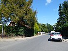
| Neuhofer Strasse
( Location ) |
1540 | Neuhof, place in the former province of Poznan (Kościan District), since 1945 part of Krzywiń ( Greater Poland Voivodeship , Poland) | March 19, 1938 | Before Straße 117 of the development plan, it is between Lettberger Straße and Waßmannsdorfer Chaussee outside of Eichenauer Straße to the east in the second (partial) ring around Alt-Rudow on both sides of Waltersdorfer Chaussee. |
|
| Neuköllner Strasse
( Location ) |
2070 (in the district) |
Connection road to Neukölln (Rixdorf) | Nov 20, 1919 | Named Kaiser-Wilhelm-Strasse before 1911 . On December 1, 1973 part of Neuköllner Strasse was named Alt-Rudow Street and its extension was named Neuköllner Strasse. Neuköllner Straße is part of Bundesstraße 179 and forms the bypass road for Alt-Rudow and is located in the district between Arnikaweg and the Rudower Spider. Plots 264–278 (even) belong to Gropiusstadt . |

|
| Niederschlemaer Weg
( Location ) |
100 | Niederschlema, district of Bad Schlema in Saxony | Sep 1 1973 | Before street 167 of the development plan, it is between Glashütter Weg and Rudower Höhe . |

|
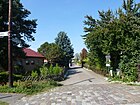
| Nikolaus-Ehlen-Weg
( Location ) |
190 | Nikolaus Ehlen (1886–1965), pioneer of self-help housing developments | Nov 15, 1972 | Before private road 547 of the development plan, the path is between Schönefelder Strasse and Knollstrasse. |
|
|
Orchid path
( Location ) |
1490 | Orchid , genus of plants | May 11, 1938 | Established as road 156 , the path lies between the Iris and Petunia Path. |

|
| Ostburger way
( Location ) |
1160 | Ostburg, Polish Wonorze , place in Kuyavian-Pomeranian Voivodeship , Poland , formerly Posen Province | March 19, 1938 | Before street 116 of the development plan, it is between Lettberger and Greifenberger Straße across Waltersdorfer Chaussee. The 'Kirchhof Rudow' of the Evangelical Church Community Berlin-Rudow and the grounds of the Rudow Riding Club are located here. |

|
| Ottilie-Baader-Platz
( Location ) |
50 diameter semicircular |
Ottilie Baader (1847–1925), politician | Nov 1, 1996 | At this place in the garden city of Rudow [obsolete] houses are still being built. The square is bordered to the north by the southern park of Käte-Frankenthal- and Helene-Weber-Strasse, on the north edge of the Hiltrud-Dudek-Weg and from the north the Jeanette-Wolff-Strasse. |

|
|
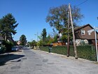
Guinea fowl route
( Location ) |
210 | Guinea fowl , pedigree poultry | Jan. 24, 1938 | Before street 14 of the development plan, it is between Groß-Ziethener Chaussee and Lakenfelderweg. |
|
| Petrusweg
( Location ) |
90 | Peter († around 67), apostle | Dec 29, 1964 | Before street 249 it is between Matthäus- and Söderblomweg. A residential street to the "Siedlung Am Zwickauer Damm". |

|
| Petunia path
( Location ) |
1590 | Petunia , ornamental plant | Aug 16, 1928 | Before street 102 of the development plan, it is between Johannisthaler Chaussee and Stubenrauchstrasse. |

|
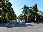
| Pastor Hess Way
( Location ) |
440 | Heinz Heß (1910–1975), pastor in the local Protestant community | Nov 1, 1987 | Part of the street 7s was named in 1987, the street is between Im Bauernbusch and Selgenauer Weg. In the western part it is a dead end at the level of KGA Rudower Schweiz, the access is via the Zinnwalder Steig at the eastern end of the street are two-storey terraced houses facing Alfred-Rojek-Weg. |
|
| Parish settlement
( Location ) |
510 | old field name Pfarracker | Feb. 1, 1986 | Set up as private road 606 , the road encloses a country house settlement of 49 three-storey prefabricated houses with garden area for large families, which leads in the ring from and to Lettberger Straße. The "Pfarrlandsiedlung" has green spaces, trees and parking bays on the street, which, in contrast to a " living machine " like in Gropiusstadt, were designed as a garden city. The estate designed by architect Rainer Oefelein extends to Neudecker Weg. |

|
| Peacock bend
( Location ) |
140 | Peacocks , group of pheasant birds | Nov 15, 1970 | Set up as road 558 , it is a dead end west of the Rhodeländerweg. It is an access road to the Andreas-Hermes-Siedlung. |

|
| Pirnaer Strasse
( Location ) |
370 | Pirna , middle town on the Elbe (Saxony) | March 19, 1938 | Before street 123 of the development plan, it is between Bitterfelder Weg and Groß-Ziethener Chaussee. |

|
| Prierosser Strasse
( Location ) |
840 | Prieros , municipality in Brandenburg | Feb 14, 1950 | Built before 1912 as Bendastraße , Straße 59 up to Kornradenstraße was included on September 23, 1938 . The Prierosser Straße is located between Kornradenstraße and Köpenicker Straße, where it continues as a dead end for 130 meters .
Architectural monuments: restaurant, Rudow hunting lodge, No. 50 farm workers' house. |

|
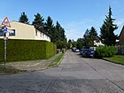
| Primrose Trail
( Location ) |
230 | Primrose , ornamental and potted plant | Aug 16, 1928 | Set up as street 16 , it lies between Mohnweg and Windenweg, between Mohnweg and Neuköllner Straße as a park path. |
|
| Turkey way
( Location ) |
1200 | Turkey, female domestic turkey (pedigree poultry), in addition to turkey path | Jan. 24, 1938 | Before street 157 of the development plan, the extension of street 461 was included on April 1, 1967 . The road lies between Lockenhuhnweg and Waßmannsdorfer Chaussee, here without an exit from Kapaunenstraße as a dead end. |

|
|
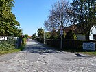
Radeberger way
( Location ) |
120 | Radeberg , small town in Saxony | March 19, 1938 | Set up as Straße 187 , it is located between Döbelner Weg and Pirnaer Straße. |
|
| Cycle path
( Location ) |
180 | Radewiesen, field name (cleared for the meadows) | Jan. 1, 1974 | As street 173 of the development plan, it is located between Köpenicker Straße and Freilutweg. |

|
| Raduhner Strasse
( Location ) |
630 | Radun , a town in the Neumark , former Arnswalde district , would be conceivable ; more probable abeer: Raduhn, Polish Raduń in the former Berent district in West Prussia | Feb 21, 1940 | Established as street 214 of the development plan, it is located in a district whose streets have been named after places in the former Prussian provinces of Posen and West Prussia since 1940. The street lies between Neuhofer and Knollstraße. |

|
| Ranunkelweg
( Location ) |
300 | Ranunculus , wild and ornamental plants | Aug 16, 1928 | The path between Rhubarbstrasse and Wegerichstrasse was formed from Strasse 74 and Strasse 21 according to the development plan . |

|
| Rhubarb Trail
( Location ) |
360 | Rhubarb , vegetable and ornamental plant | May 11, 1938 | As road 178 of the development plan, the path is between Klettenweg and Ranunkelweg. |

|
| Rhodeländerweg
( Location ) |
1890 | Rhodian , chicken breed | May 1, 1967 | Established as road 462 of the development plan, including a large part of the Klein-Ziethener Weg, it is located between Groß-Ziethener and Waßmannsdorfer Chaussee. The northern part of the Gockelweg was included in the street. |

|
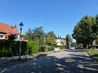
| Larkspur Trail
( Location ) |
250 | Delphinium , buttercup | Aug 16, 1928 | Before road 67 of the development plan, the path is between Mimosa and Boxwood Path. |
|
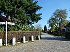
| Rochlitz way
( Location ) |
120 | Rochlitz , town near Mittweida (Saxony) | March 19, 1938 | Established as street 186 of the development plan, it is located between Pirnaer Straße and Döbelner Weg. |
|
|
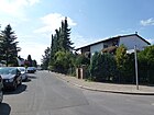
Sage way
( Location ) |
320 | Sage , ornamental, medicinal and aromatic plant. | Aug 16, 1928 | Set up as street 10a , it is located between Kanalstrasse and Buchsbaumweg. |
|
| Sattlerstrasse
( Location ) |
520 | Saddler , craft occupation | March 19, 1938 | Established as street 137 of the development plan, it is located between Zwickauer Damm and Bildhauerweg. The part laid out with Sattlerstraße and built over with the Clay-Oberschule lost its name and on November 1, 1987 the connection to Buchbinderweg was named Seilerweg. |

|
| Sauerdornweg
( Location ) |
130 | Sea buckthorn , a medicinal and poisonous plant | Nov 1, 1968 | Set up as road 219 of the development plan, the concrete settlement road lies between Minzeweg and Uferweg on the Teltow Canal . |

|
| Schirpitzer way
( Location ) |
1510 | Schirpitz , place in the former province of West Prussia (Poland) | March 19, 1938 | Set up as street 164 of the development plan, it is located between Benatzky- and Ostburger Weg. To the north, plots 1-7 (odd) and the allotment garden colony Neuhofer Strasse, south of plots 2-76 (even), a private road continues on Ostburger Weg, although the plots belong to Ostburger Weg. |

|
| Schleffiner Strasse
( Location ) |
210 | Schleffin, Baltic resort of the former province of Pomerania, since 1945 Śliwin (Poland) | Nov 15, 1970 | Set up as street 213 of the development plan, it is curved between Schönefelder and Neuhofer Straße. |

|
| Schlotterkammsteig
( Location ) |
Schlotterkamm old breed of chicken from the Bergisches Land | 23 Aug 2013 | The path was created in 2013 in connection with the construction of the settlement on Gockelweg. |

|
|
| Snowball path
( Location ) |
380 | Snowball , ornamental plant | Aug 16, 1928 | Set up as street 105 , it lies between the Orchid and Bellflower Path. |

|
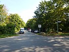
| Grouse Trail
( Location ) |
480 | Ptarmigan , grouse | Dec. 1, 1983 | Established as road 588 of the development plan, the connecting path between Waßmannsdorfer Chaussee and continuing to road 181 opens up several allotment gardens. |
|
| Schönbergweg
( Location ) |
160 | Arnold Schönberg (1874–1951), Austrian composer, emigrant before the Nazi regime | June 1, 1975 | Before street 568 of the development plan, it lies between Lettberger Straße and Mackebenweg and connects to the Mozartring. The quiet residential street is mostly built up with single-family houses and is directly adjacent to the Rudow-Altglienicke Landscape Park and the Rudower Höhe. |

|
|
Schönefelder Strasse
( Location ) |
1770 | Schönefeld , neighboring town in Brandenburg | before 1912 | The street was named before 1912, from 1916 to around 1924 the street was called Schönfelder Chaussee . It lies between the Rudower Spider (Waltersdorfer Chaussee) and the city limits. The street is mostly built with single-family houses and the meadows at Meskengraben, the Nordpark and the Südpark border directly on this street. |

|
| Typesetter's Path
( Location ) |
430 | Typesetter , job title in printing | March 19, 1938 | Established as street 132 of the development plan, it lies between Zwickauer Damm and Bildhauerweg |

|
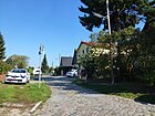
| Schrimmer way
( Location ) |
150 | Schrimm an der Warthe , district town in the former province of Posen (Poland) | March 19, 1938 | Set up as Straße 190 , it is located between Deutschtaler Straße and Waltersdorfer Chaussee, to which there is no drivable connection. |
|
| Iris Trail
( Location ) |
420 | Bearded iris , also iris, ornamental plants | May 11, 1938 | The road between Fennel- and Petunienweg was laid out from road 217 and road 156 , which were established according to the development plan . |

|
| Sebnitzer way
( Location ) |
110 | Sebnitz , former district town in Saxony | March 19, 1938 | Before street 139 of the development plan, it goes from Zittauer Straße. |

|
| Sea eagle trail
( Location ) |
230 | White-tailed eagles , a species of raptor | Jul 29, 2011 | The road that was newly laid out for a residential area goes from Waßmannsdorfer Chaussee to the southeast and lies on the Kalte Grund-Pfuhl. The road was constructed and laid out according to the development plan XIV-274aa ("Waßmannsdorfer Dreieck"). |

|
| Seidelbastweg
( Location ) |
1470 | Daphne , ornamental shrub | May 24, 1958 | Set up as road 7 , it is a two-lane paved road with parking bays and a lawn banquet with trees between Iris Lane and Stubenrauchstrasse. There is an industrial area with tank farms on Stubenrauchstrasse. |

|
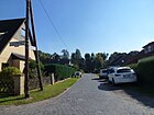
| Silk Grouse Trail
( Location ) |
90 | Silk hen , breed of chicken | Jan. 24, 1938 | Set up as Straße 150 , it is a spur road east of Lakenfelderweg to Erlenbruch on Rudower Fließ. |
|
| Seilerweg
( Location ) |
110 | Seiler , job title, manufacturer of ropes and cordage | Jan. 1, 1987 | Before the construction of the clay secondary school, this street was part of Sattlerstrasse (in the section between Buchbinderweg and “Rudow expansion limit”). The path is a spur road to the west of Buchbinderweg , a three-meter-wide asphalt road with lawn strips instead of sidewalks, which ends with a sloping carriageway on the school property with properties 2–10 (straight) on the north and 3–5 ( odd) on the south side towards the school. |

|
| Selaccurate way
( Location ) |
950 | Selgenau, town in the former province of Poznan, since 1945 Zelgniewo (Poland) | March 19, 1938 | Established as street 163 in the building plan, the connection to Köpenicker Straße, part of Straße 7s , was included on June 15, 1976, and on September 18, 1987 the part of the path separated by the development was renamed Will-Meisel-Weg. |

|
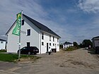
| Silberdistelweg
( Location ) |
140 | Silver thistle , medicinal plant | Oct 8, 2010 | Settlement road ( private road ) laid out on a former industrial site between Minzeweg and the Uferweg on the Teltow Canal , there is a turning hammer here. When the Rudow thermal power station was demolished, the zoning plan for residential development was changed here. |
|
|
Söderblomweg
( Location ) |
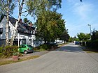
220 | Nathan Söderblom (1866–1931), Swedish Lutheran theologian and Archbishop of Uppsala, 1930 Nobel Peace Prize | Dec 29, 1964 | Established as street 233 of the development plan, it lies between street 229 and the city limits, it is a residential street to the "Siedlung Am Zwickauer Damm". |
|
| Sternliebweg
( Location ) |
140 | Sternlieb , medicinal plant | Oct 8, 2010 | Settlement road ( private road ) laid out on a former industrial site between Minzeweg and the Uferweg on the Teltow Canal , there is a turning hammer here. When the Rudow thermal power station was demolished, the zoning plan for residential development was changed here. |

|
| Street 3a
( Location ) |
150 | as yet unnamed street, officially designated according to the development plan. | The road goes off the Seidelbastweg as a cul-de-sac. It forms the entrance to the Unitank tank farm. |

|
|
| Street 148
( Location ) |
210 | as yet unnamed street, officially designated according to the development plan | after 1983 | The street is not listed in the LOR directory, a pure pedestrian path at the Pferdeplatz, in the south of the (so far largely undeveloped) "settlement on the Waßmanndorfer Chaussee" crossing around the Lolopfuhl and the Meskengraben. |

|
| Street 179
( Location ) |
520 | as yet unnamed street, officially designated according to the development plan | after 1983 | A small residential street with single-family houses that can only be used by residents. The street is not listed in the LOR directory. In addition, it is crossed by the road 180 (length 50 meters), which leads to the "Colony on Waßmannsdorfer Chaussee". |

|
| Street 181
( Location ) |
570 | as yet unnamed street, officially designated according to the development plan | after 1983 | A small residential street with single-family houses between the Grouse Trail and the Berlin Wall Trail , which can only be used by residents. The street belongs to the "settlement on Schönefelder Straße", in the LOR directory it is listed with 90 properties 1–90 (consecutively). |

|
| Street 182
( Location ) |
440 | as yet unnamed street, officially designated according to the development plan | after 1983 | A small residential street with single-family houses between streets 183 and 184, which can only be used by residents. The street belongs to the "settlement on Schönefelder Straße", in the LOR directory it is listed with 90 properties 1–90 (consecutively). The road runs parallel to the Teltower Dörferweg . |

|
| Street 183
( Location ) |
190 | as yet unnamed street, officially designated according to the development plan | after 1983 | A short residential street with single-family houses between Straße 181 and Schönefelder Straße, which can only be used by residents. It is the entrance to the "settlement on Schönefelder Straße", in the LOR directory it is listed with 90 properties 1–90 (consecutive). |

|
| Street 184
( Location ) |
130 | as yet unnamed street, officially designated according to the development plan | after 1983 | A short residential street with single-family houses between Straße 181 and Schönefelder Chaussee, which can only be used by residents. The street belongs to the "settlement on Schönefelder Straße", in the LOR directory it is listed with 90 properties 1–90 (consecutively). |

|
| Street 188
( Location ) |
120 | as yet unnamed street, officially designated according to the development plan | around 1938 | It is located between Pirnaer Straße and Döbelner Weg. | {
|
| Street 199
( Location ) |
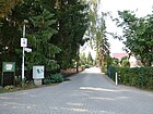
380 | as yet unnamed street, officially designated according to the development plan | around 1938 | It lies between Zwerghuhnweg and Welsumerpfad in the settlement on the edge of the forest in Rudow. |
|
| Street 223
( Location ) |
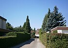
430 | as yet unnamed street, officially designated according to the development plan | around 1938 | It is located between Straße 225 and Lößnitzer Weg in the postal settlement near the city limits. |
|
| Street 224
( Location ) |
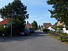
160 | as yet unnamed street, officially designated according to the development plan | around 1938 | It is located between streets 223 and 228 in the postal settlement near the city limits. |
|
| Street 225
( Location ) |
200 | as yet unnamed street, officially designated according to the development plan | around 1938 | It is located between streets 223 and 224 in the postal settlement near the city limits. |

|
| Street 228
( Location ) |
220 | as yet unnamed street, officially designated according to the development plan | around 1938 | It is located between Straße 223 and Lößnitzer Weg in the postal settlement near the city limits. |

|
| Street 229
( Location ) |
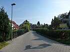
460 | as yet unnamed street, officially designated according to the development plan | around 1938 | It is located between Zwickauer Damm and Söderblomweg in the settlement on Zwickauer Damm near the city limits. |
|
| Street 230
( Location ) |
140 | as yet unnamed street, officially designated according to the development plan | around 1938 | It is located south of the street 232 in the settlement on Zwickauer Damm near the city limits. |

|
| Street 231
( Location ) |
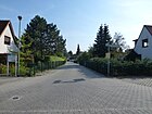
630 | as yet unnamed street, officially designated according to the development plan | around 1938 | It is located between Zwickauer Damm and Söderblomweg, parallel to the city limits and Berlin Wall Trail in the settlement on Zwickauer Damm near the city limits. |
|
| Street 232
( Location ) |
200 | as yet unnamed street, officially designated according to the development plan | around 1938 | It is located between streets 229 and 231 in the settlement on Zwickauer Damm near the city limits. |

|
| Street 574
( Location ) |
180 | as yet unnamed street, officially designated according to the development plan | around 1938 | The street, going south from Ostburger Weg, with residential houses from the 1970s, ends directly at the Rudow-Altglienicke Landscape Park . |

|
| Road 577
( Location ) |
100 | as yet unnamed street, officially designated according to the development plan | June 1, 1975 | It lies between Schönefelder and Greifenberger Straße, but in the eastern part it is only a footpath and a connecting path. |

|
| Street 604
( Location ) |
590 | as yet unnamed street, officially designated according to the development plan | June 1, 1975 | It lies between Schönefelder and Knollstrasse and is the main route of the "Wilhelm Dähne settlement" in the southern part. |

|
| Street 618
( Location ) |
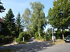
340 | as yet unnamed street, officially designated according to the development plan | May 1, 1967 | The street south with residential houses from the 1970s in the north with residential houses on the east side borders directly on the Erlenbruch and goes north from the Rhodeländerweg. |
|
| Stubenrauchstrasse
( Location ) |
1380 (in the district) |
Ernst von Stubenrauch (1853–1909), lawyer and local politician | around 1910 | The street lies between Neuköllner Straße and Massantebrücke (on the north bank of the Teltow Canal). The rest of the street with lots 44–52a (continuous) and returning 54–79 (continuous) runs in Johannisthal . Initially, the section in Rudow up to the Teltow Canal was named, on March 23, 1925 the section following north to Johannisthal (at that time still part of the Neukölln administrative district, Rudow district) was officially included, which was usually already referred to as Stubenrauchstraße. The Stubenrauchstraße lies in the course of the Johannisthaler Landstraße (see above map 1894 ). A section southwest of Neuköllner Strasse was renamed Zwickauer Damm together with Strasse 138 on March 27, 1939, and on May 31, 1963, Strasse 51 was incorporated into Stubenrauchstrasse. |

|
|
Timmendorfer way
( Location ) |
250 | Timmendorf , Upper Silesian town near Opole (Poland) | March 19, 1938 | Short residential street with single-family houses on the southern outskirts. Before street 191 of the development plan, in which street 244 was included on February 1, 1966 , it lies between Waltersdorfer Chaussee and Am Espenpfuhl. |

|
| Torgelowweg
( Location ) |
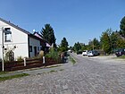
360 | Torgelow , middle town in Mecklenburg-Western Pomerania | June 1, 1975 | Established as street 578 of the development plan, it lies between street 577 and Knollstraße, it leads to the north park. The unusual spelling of a geographical street name refers to the town of Torgelow, according to information from the civil engineering office. |
|
| Globeflower Path
( Location ) |
540 | Globe flower , meadow flower | March 1, 1965 | Set up as street 221 of the development plan, it lies between Iris and Melissenweg, it ends with a turning hammer, whereby the street is slightly offset to the Teltow Canal by the plots 46-56 on the newly dedicated area of the cleared Rudow thermal power station . The road climbs slightly from west (35.0 meters above sea level ) to east (35.9 meters above sea level). |

|
| Turkey Walk
( Location ) |
350 | Turkey, male turkey (pedigree poultry), in addition to turkey way | Jan. 24, 1938 | Before street U of the development plan, it lies between Rhodeländerweg and Waßmannsdorfer Chaussee, to which there is no drivable connection (railing, ditch, green strip) and thus designed as a spur road from Kapaunenstraße . It is a single-lane asphalt roadway with a sidewalk-wide strip of grass on both sides. |

|
|
Uhrmacherweg
( Location ) |
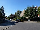
630 | Watchmaker , craft trade | March 19, 1938 | Laid out as street 129 of the development plan, it is located between Neuköllnerstrasse and Fleischerstrasse. |
|
| Ursulinenstrasse
( Location ) |
660 | Ursulines , Catholic women's order | Nov 1, 1996 | The quiet residential street, built on the south side with multi-family houses and terraced houses, borders the north park on the north side. It is located between Schönefelder Straße and Waltersdorfer Chaussee. |

|
|
Waltersdorfer Chaussee
( Location ) |
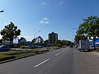
2010 | Waltersdorf , part of the neighboring community Schönefeld in Brandenburg | around 1920 | The wide and busy arterial road between Alt-Rudow and the city limits is mainly built up with single-family houses and in the area of the garden city Rudow with multi-family houses from the 1990s. There are several small nature reserves with ice age pools (Röthepfuhl, Klarpfuhl, Krummer Katzenpfuhl). South of the Berlin city limits, the street of the same name continues to Schönefeld. There was a border crossing to Schönefeld Airport here until the fall of the Wall . |
|
|
Waßmannsdorfer Chaussee
( Location ) |
2100 | Waßmannsdorf , neighboring town and part of the community Schönefeld (Brandenburg) | after 1935 | The street from Waßmannsdorf was officially named Waßmannsdorfer Straße around 1914 and was renamed Waßmannsdorfer Chaussee after 1935 (so recorded in the 1938 plan). It lies between Groß-Ziethener Chaussee and the city limits. On July 1, 1976 (to wall hours ) of the (new) section of land 10 northwest to wholesale Ziethener road was named and the old leadership to Rudower spider (Neuköllner / Schönefelder road) by notice of 21 November 1975 deconsecrated . The two-lane asphalt road with the character of an avenue (with trees on both sides) ended at the Berlin Wall next to the Rudower Dörferblick until 1990 . |

|
| Wegerichstrasse
( Location ) |
270 | Plantain , meadow plant | Aug 16, 1928 | Previously set up as street 109 and street 20 of the development plan, it is located between Kornblumenring and Stubenrauchstraße, but only 60 meters walk to the latter from the turning hammer of the spur road from Rankelweg. |

|
| Welsumer path
( Location ) |
580 | Welsumer , breed of chicken | Jan. 24, 1938 | Set up as Straße 171 , it lies between the Geflügelsteig and the city limits and meets the Berlin Wall Trail here . |
|
| Toolmaker path
( Location ) |
100 | Toolmaker , job title in the metal sector | May 1, 1986 | Set up as street 143 , it goes southeast of Bildhauerweg with lots 1–5 (odd) and 4–14 (even), which lead diagonally into the previously existing property structure. |

|
| Will Meisel Way
( Location ) |
250 | Will Meisel (1897–1967), dancer and composer | Sep 18 1987 | Established as road 581 of the development plan, it was laid out with the inclusion of a part of the Selgenauer Weg separated by overbuilding. It goes off the Ostburger Weg opposite road 574 and then turns to the northwest, ending at an agriculturally used green area. |

|
| Winch path
( Location ) |
1030 | Bindweed , climbing plant (bindweed) | Aug 16, 1928 | Laid out on streets 18 and 18a of the development plan, it is located at an obtuse angle between Angelikaweg and Kleestraße, it crosses Stubenrauchstraße, but is not connected as a road on the eastern branch. |

|
| Wischmattenweg
( Location ) |
280 | Wiping mat , meaning meadow to be mowed | May 11, 1938 | Set up as road 201 in the development plan, it lies between Kanalstrasse and Arabisweg, with a right-angled bend on Kiefwiesensteig. |
|
| Wutzkyallee
( Location ) |
90 (in the district) |
Emil Wutzky (1871–1963), trade unionist and cooperative, social democratic politician | May 20, 1966 | Plots 99-101 (odd) and 100-102 (even) are between the suburbs and the Matthäusweg / Zittauer Straße street in Rudow, while the larger part of the street beyond the bridge over the industrial railway track (to the Kanalstraße industrial estate) belongs to Gropiusstadt . On October 1, 1967, part of the Meißner Weg was incorporated into Wutzkyallee. |

|
|
Zellerweg
( Location ) |
180 | Carl Zeller (1842–1898), composer | Nov 1, 1972 | Established as road 469 of the development plan, it lies between Künneke- and Kálmánweg, parallel to Ziehrer- and Millöckerweg. |
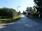
|
| Ziehrerweg
( Location ) |
180 | Carl Ziehrer (1843–1922), Austrian composer | Aug 15, 1973 | Established as street 470 of the development plan, it lies between Künneke- and Kálmánweg, parallel to Zeller- and Millöckerweg and the eastern properties border on KGA Rudower Höhe.
It is noteworthy that there are three streets together here, named after composers whose first name is Carl. |

|
| Zinnwalder Steig
( Location ) |
130 | Zinnwald-Georgenfeld , mountain town in the Ore Mountains (Saxony) | June 1, 1974 | Established as street 165 of the development plan, it is an asphalted residential street built with private homes, sidewalks on both sides and a hard shoulder between Selgenauer and Pfarrer-Heß-Weg. |

|
| Zittauer Strasse
( Location ) |
1230 | Zittau , middle town in Saxony | March 19, 1938 | Established as street 124 of the development plan, it is located between Wutzkyallee / Meißner Weg and Groß-Ziethener Chaussee. It is named for the planning room on both sides. |

|
| Zwergasternweg
( Location ) |
140 | Dwarf asters , genus of plants from the daisy family | Oct 8, 2010 | Settlement road ( private road ) laid out on a former industrial site between Minzeweg and the Uferweg on the Teltow Canal with lots 1–16 continuously. There is a turning hammer towards the canal. When the Rudow thermal power station was demolished, the zoning plan for residential development was changed here. |

|
| Bantam Trail
( Location ) |
380 | Bantam , small chickens (pedigree poultry) | Jan. 24, 1938 | Established as road 198 of the development plan, it lies between Geflügelsteig and Am Rudower Waldrand |
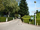
|
| Zwickau dam
( Location ) |
1620 (in the district) |
Zwickau , large city in Saxony | March 19, 1938 | Established as street 138 of the development plan, the south-western part of Stubenrauchstrasse up to Neuköllner Strasse was included in the naming. The dam lies between Neuköllner Strasse and the city limits, whereby the road from road 231 to the city limit is a dead end . To the north of Zittauer Strasse, it has been developed as a four-lane superordinate road. A track of the Neukölln-Mittenwald railway runs along the median . The western development between Neuköllner Strasse and Fleischerstrasse (plots 6–24 [straight]) belongs to Gropiusstadt , the street itself to Rudow. |

|
Streets in Rudow around 1920
In the address books of 1920, 1921 and 1922 the following streets can be found for the municipality or the district of Rudow. In 1920 with the formation of Greater Berlin , Rudow came to the German capital as part of the Neukölln administrative district. In contrast to the situation in the picture above , the district is traversed by the Teltow Canal and with the administrative reform in Prussia in 1938, the areas north of the Teltow Canal were handed over to the Treptow district for administrative purposes. It should also be noted that Rudow is not listed as a suburb in the 1910 address book. Rudow first appeared in the Berlin address books in 1914. While others have suburbs to carry a "Berlin =" "According to Cabinet Order" Rudow is under R entered.
- Bahnhofstrasse between Neuköllner Strasse and Groß-Ziethen, after the Rudow station opened in 1900 , crossed by the Neukölln-Mittenwalde Kleinbahn (→ Groß-Ziethener Chaussee ).
- Bendastraße between Bismarckstraße and Cöpenicker Straße, it is named after Robert von Benda (1816–1899), national liberal politician and manor owner in Rudow (→ Prierosser Straße ).
- Bismarckstrasse between Neuköllner and Bendastrasse. On the map from 1911 it is shown between Kaiser-Wilhelm- and Bendastrasse. In 1920 the extension in the arch to Stubenrauchstrasse, previously street no. 8 , is included and the name was deleted between 1925 and 1928. In 1928 street no. 8 was named → Krokusstraße and on March 29, 1939 the last part of Bismarckstraße was included in Krokusstraße. It was named after Otto von Bismarck-Schönhausen (1815–1898), Prime Minister of Prussia, first Chancellor of the German Empire.
- The Cöpenicker Straße is built on, it leads from the Neuköllner and the immediately adjacent Kaiser-Wilhelm-Straße (Neuköllner Straße) to Straße 7S and on the Alt-Glienicke district to Kanalstraße. The Cöpenicker Straße (since the 1930s in the changed spelling → Köpenicker Straße ) is the connection route from Rudow through Adlershof to Köpenick, also the picture above . In 1914, the properties Rudow 73 to Rudow 90 and, among other things, the fire department depot and the community cemetery are located on this street.
- → Canal street between Stubenrauchstrasse and Cöpenicker Strasse and the undeveloped Hafenstrasse on the Teltow Canal that branches off from it are already listed and probably also laid out. In 1914 there were four construction sites, a storage area and three houses, including a site for the asphalt factory and a chemical factory. In 1920 the development of the street did not develop further.
- Kaiser-Wilhelm-Straße between the Buckow district via Stubenrauchstraße, Bahnhofstraße, Waßmannsdorfer Straße, Waltersdorfer and Schönefelder Chaussee, the northern side street is Cöpenicker Straße. On 20 November 1919 she received after the events of November Revolution the name → Neuköllnerstrasse . Emperor Wilhelm II (1859–1941) from the Hohenzollern dynasty , who has been in office since 1888, can be used as the namesake . Neuköllner Straße, which has been listed since the address book of 1921, starts from the Buckow district with 20 properties and the southern side streets: Bahnhofstraße , Waßmannsdorfer , Waltersdorfer Straße and Schönefelder Chaussee and to the north are Stubenrauchstraße, Kappenstraße, Bismarckstraße and Cöpenicker Straße . Plots 1–43 are entered in the 1914 address book, but from the Buckow district to Stubenrauchstrasse and to the Groß-Ziethener ditch construction sites without a property number.
- The → Kappenstrasse already recorded runs from Neuköllner Strasse to Strasse 57 and Strasse 59 and is marked with two apartment buildings and several construction sites, which are not numbered in the properties. Not yet in the 1914 address book and in 1920 (Rudow in the Teltow district) it is listed as Street 60 with two apartment buildings and three construction sites and in the 1921 address book it is named as Kappenstraße.
- The Britz – Johannisthal district road between the Johannisthal district and the Königsheide am Wasserwerk and the tree nursery runs through Rudow, before the area north of the Teltow Canal was moved to the Treptow administrative district in 1938 as part of an administrative reform. Apart from the waterworks site and the Späth'schen tree nursery , nothing has been entered between the Buckow and Johannisthal districts since the address book from 1914 to 1922.
- The Schönefelder Chaussee is the road to Schönefeld . Between 1916 and 1924 it was run as a road, in the address books of the 1920s no cross streets are named; the street is vacant → Schönefelder Straße . In the 1914 address book, a windmill is noted next to construction sites.
- Street 7S going east from Cöpenicker Straße to Platz CS lies in the course of the western part of today's → Selgenauer Weg and turns into Pfarrer-Heß-Weg
- Street 8 between Benda and Stubenrauchstrasse.
- The road to Johannisthal between the Teltow Canal and the Johannisthal district belongs to Rudow around 1920 and became part of the Treptow administrative district during the administrative reform in 1938. In 1914 the road to “Flugplatz Johannisthal = Adlershof” is noted.
- Stubenrauchstraße between Teltowkanal and Neuköllner Straße with Straße 8 (today: Krokusweg) and Kanalstraße as eastern side streets. In 1914, according to the address book, there were several plots of land with construction sites and in particular the "pumping station for the rural communities Niederschöneweide, etc." which was probably beyond in today's Johannisthal district .
- Waltersdorfer Straße between Neuköllner Straße and the Waltersdorf district, with Bahnhofstraße and Schönefelder Chaussee as side streets; it is only mentioned as a cross street in the address books of 1914 and 1920, but not listed itself. In 1922 there were already four houses listed, → Waltersdorfer Chaussee .
- Waßmannsdorfer Straße between Neuköllner Straße and the Schönefeld district, side streets on different sides are Bahnhofstraße and Schönefelder Chaussee. In 1935 it was then "elevated" to → Waßmannsdorfer Chaussee . Since (before) 1914 there has been a Glätzner house (probably) with a gardening business and construction sites, the plots are not numbered.
Further locations in Rudow
Allotment gardens
| Surname | Location with zip code | Size in m² |
Number of parcels |
Form of ownership | Remarks |
|---|---|---|---|---|---|
| KGA An der Kleinbahn |
Schneehuhnweg 2 (12355)
( Location ) |
58,269 | 174 | national | Founded in July 1971, next to the embankment of the Neukölln-Mittenwald railway line , which was closed in 1951 , permanently secured as fictional allotment gardens ( FNP : green area) |
| KGA Eternal Home |
Rhodeland Path (12355)
( Location ) |
71.005 | 166 | national | as fictional permanent allotment gardens ( FNP : green area) permanently secured |
| KGA Waßmannsdorfer Fliederheim |
Lockenhuhnweg 25 (12355)
( Location ) |
19,810 | 61 | national | next to the parking area of the Meskenwiesen, permanently secured as fictitious permanent allotment gardens ( FNP : green area) |
| KGA green strip |
Buchsbaumweg 44a (12357)
( Location ) |
22,508 | 69 | national | as fictional permanent allotment gardens ( FNP : green area) permanently secured |
| Luise Dähne settlement |
Waßmannsdorfer Chaussee / flower dust path (12355)
( Location ) |
28.163 | 13 | Private | Next door is the residential development Seeadler- / Fischadlerweg from 2011 |
| KGA new home |
Köpenicker Strasse 47 (12355)
( Location ) |
25,789 | 67 | national | as fictional permanent allotment gardens ( FNP : green area) permanently secured |
| KGA Neuhofer Strasse |
Neuhofer Strasse 1/2 (12355)
( Location ) |
88,943 | 173 | national | reserved as residential space |
| KGA plane tree view |
Schneehuhnweg 2 (12355)
( Location ) |
163.410 | 448 | national | as fictional permanent allotment gardens ( FNP : green area) permanently secured |
| KGA Rudower Höhe |
Künneckeweg 20 (12355)
( Location ) |
40.168 | 105 | national | as fictional permanent allotment gardens ( FNP : green area) permanently secured |
| Rudower Höhe weekend settlement |
Kalman- / Mackebenweg (12355)
( Location ) |
45,069 | Private | as fictional permanent allotment gardens ( FNP : green area) permanently secured | |
| KGA Rudower Switzerland |
Köpenicker Strasse 115 (12355)
( Location ) |
25,510 | 65 | national | as fictional permanent allotment gardens ( FNP : green area) permanently secured |
| KGA Steingrube Weimars Ruh |
Schönefelder Strasse 150 (12355)
( Location ) |
29,754 | 70 | national | as fictional permanent allotment gardens ( FNP : green area) permanently secured |
| KGA Waßmannsdorfer Chaussee |
Waßmannsdorfer Chaussee 75 (12355)
( Location ) |
12,166 | 38 | national | as fictional permanent allotment gardens ( FNP : green area) permanently secured |
| Wilhelm Dähne settlement |
Strasse 57 / Privatstrasse 504 (12355)
( Location ) |
28746 | Private | ||
| KGA Zittauer Strasse |
Zittauer Strasse 72 / 73-82 / 83 (12355)
( Location ) |
50,177 | 85 | national | 6,765 m² of this is reserved as residential space , otherwise permanently secured as fictitious permanent allotment gardens ( FNP : green space) |
Parks and green spaces

- Rudower Höhe ( location ), 70 meter high artificial mountain of rubble
- Rudower Dörferblick ( location )
- Rudow grove
- Rudow-Altglienicke Landscape Park ( location )
- Nordpark ( location ), to the north the women's quarter
- Südpark ( location ), located between the women's quarter and the city limits
- Kirchhof Rudow ( location )
- State-owned cemetery Rudow ( location )
- The fifteen Rudower Pfuhle were possibly connected to the "Rudower Talrinne".
- Rudower Fließ with the Erlenbruch ( location )
- Meskenwiesen with Meskengraben and Pfuhl ( location )
- Kattenpfuhl ( location )
- Priest's pit ( location )
- Espenpfuhl ( location )
- Großer ( Lage ) and Kleiner Rohrpfuhl ( Lage )
- Röthepfuhl ( location )
- Krummer Katzenpfuhl ( location )
- Lolopfuhl ( location )
- Klarpfuhl ( location )
- Kalte-Grund-Pfuhl ( location )
- Blacksmith pond ( location )
- Teltower Dörferweg
- Teltow Canal Path
- Berlin Wall Trail along the district boundary to Baumschulenweg (480 m), Johannisthal (2960 m), Adlershof (70 m), Altglienicke (2780 m) and the city limits to Schönefeld in Brandenburg (5470 m)
Commercial and traffic areas
- Teltow Canal (between Ernst-Keller-Brücke and motorway bridge)
- “Gewerbegebiet Kanalstrasse” ( location ) along the Teltow Canal, located between Stubenrauchstrasse and Neudecker Weg.
- From the federal highway 113 is the overpass ( location ) over the Teltow Canal (at the port Rudow-Ost) and a triangular area (50 meters, 1500 m²) above the "Autobahn tunnel Rudower Höhe" south of the Dankmarsteig on Rudower Flur. The district boundary was otherwise corrected to the course of the A 113 and the motorway is in the Altglienicke district . The course of the Wall Trail was adapted to the possibilities of the site, the original course of the (former) column and customs trail was lost when the motorway was built.
- Formerly the Rudow thermal power station , here the zoning plan was changed and new ways for residential development were created.
See also
- List of cultural monuments in Berlin-Rudow
- List of natural monuments in the Neukölln district
- List of landscape protection areas in Berlin
Web links
- Street directory Rudow. kaupert media gmbh, accessed on October 30, 2010 .
- Map of Berlin 1: 5000 with district boundaries. Senate Department for Urban Development Berlin, 2011, accessed on July 13, 2012 .
- Office for Statistics Berlin-Brandenburg: Directory of streets and places in the district of Nei-Kölln (as of September 2011) (PDF; 334 kB)
- Hermann Jansen: Competition Greater Berlin 1910. Settlement, Rudow. (From: Competition Greater Berlin 1910. The award-winning designs with explanatory reports, 1911)
Individual evidence
- ↑ Rudow Gartenstadt - to give names to the streets
- ↑ Address directory LOR 08.pdf ( Memento of the original from December 5, 2013 in the Internet Archive ) Info: The archive link was inserted automatically and has not yet been checked. Please check the original and archive link according to the instructions and then remove this notice.
- ↑ On the person of Alfred Rojek
- ↑ a b c d e f Zoning plan Neukölln XIV 19 for the Rudower Spider from 1970 (PDF; 1.3 MB) ( Memento of the original from September 9, 2014 in the Internet Archive ) Info: The archive link was inserted automatically and has not yet been checked. Please check the original and archive link according to the instructions and then remove this notice. Retrieved July 11, 2012
- ↑ The Rudower Spider in Berlin-Neukölln
- ↑ House 1776/1800
- ↑ Büdnerhaus around 1820
- ↑ Residential and commercial building in 1932
- ↑ Old pitcher with restaurant and stall
- ↑ House number: 60 - Old School from 1888-1890
- ↑ Housing Rudower Höhe ( page no longer available , search in web archives ) Info: The link was automatically marked as defective. Please check the link according to the instructions and then remove this notice. Retrieved July 10, 2012
- ↑ Development plan XIV 18 ( page no longer available , search in web archives ) Info: The link was automatically marked as defective. Please check the link according to the instructions and then remove this notice. (PDF; 1.3 MB)
- ↑ a b c d Reasons for development plan XIV 19 ( page no longer available , search in web archives ) Info: The link was automatically marked as defective. Please check the link according to the instructions and then remove this notice. (PDF; 807 kB)
- ↑ Hannah-Arendt-Gymnasium , accessed on October 5, 2014.
- ↑ a b c District Office Neukölln: Development plan XIV 274 Interpretation - Explanation (PDF) ( Page no longer available , search in web archives ) Info: The link was automatically marked as defective. Please check the link according to the instructions and then remove this notice. Retrieved July 11, 2012
- ↑ a b c d e f g Land use plan - change, Minzeweg - former Rudow power station. (PDF; 765 kB) Senate Department for Urban Development (Berlin), October 8, 2008, accessed on September 26, 2011 .
- ↑ a b c d e f g Fixed development plan 8-28 ( Memento of the original from April 13, 2013 in the Internet Archive ) Info: The archive link has been inserted automatically and has not yet been checked. Please check the original and archive link according to the instructions and then remove this notice. “The planning goal, based on the surrounding development, is the development of small-scale residential use in an attractive location on the Teltow Canal. [...] in the area of the former supply system, the bank area of the Teltow Canal [...] as well as to connect to existing public open spaces as a green corridor. "
- ↑ On the person of Gisbertz
- ↑ a b c d Hafenstrasse . In: Berliner Adreßbuch , 1922, Neukölln> Rudow, p. 1614 (entry no. 2).
- ↑ On the person of Helene Jung
- ↑ a b c d e f g h Address directory for the living-world-oriented spaces in Neukölln
- ↑ Kanalstrasse 55, complete machine factory Werner, 1913-1917 and 1926-1927
- ↑ a b c Map of Berlin 1: 5000 with district boundaries. Senate Department for Urban Development Berlin, 2011, accessed on July 13, 2012 .
- ↑ On the person of Knoll
- ↑ Rudow village church - dating: around 1400, 1804 and 1909
- ↑ Köpenicker Straße 187: Old sexton and school building from 1857-1858
- ↑ Eternit factory: industrial plant and factory from 1929, reconstruction in 1955
- ↑ Krokusstraße 81: residential and Büdner house from 1827
- ^ Landowner Association Buckow-Ost: June 29, 2008 Details of the Minzeweg building plan
- ↑ Development plan XIV-217 - Mozartring / former radar station ( Memento of the original from September 10, 2014 in the Internet Archive ) Info: The archive link has been inserted automatically and has not yet been checked. Please check the original and archive link according to the instructions and then remove this notice. (PDF; 392 kB)
- ↑ Katharina Ludwig: Clay school in Berlin-Rudow with history In: Der Tagesspiegel from October 14, 2014, accessed on October 18, 2014.
- ↑ Archaeological finds are being examined . In: Berliner Zeitung of October 15, 2014, page 16.
- ↑ Subsidized housing: Pfarrlandsiedlung ( page no longer available , search in web archives ) Info: The link was automatically marked as defective. Please check the link according to the instructions and then remove this notice.
- ↑ Prierosser Straße 32 and 34, restaurant from 1848
- ↑ Jagdschloß Rudow, Prierosser Straße 48, dated 1660
- ↑ Farm workers' house in Prierosser Strasse 50 from 1751/1800
- ↑ Address directory_LOR_08.pdf: Keyword Stubenrauchstraße ( memento of the original from December 5, 2013 in the Internet Archive ) Info: The archive link was inserted automatically and has not yet been checked. Please check the original and archive link according to the instructions and then remove this notice. Status: January 2012, accessed on July 16, 2012
- ↑ Early public participation for the development plan on Waßmannsdorfer Chaussee in the Rudow district
- ↑ Rudow . In: Berliner Adreßbuch , 1920, V. Suburbs of Berlin> Plötzensee; Rudow, p. 845.
- ↑ Rudow . In: Berliner Adreßbuch , 1921, V. Suburbs of Berlin> Plötzensee; Rudow, p. 837.
- ↑ a b c Rudow . In: Berliner Adreßbuch , 1914, V. Suburbs of Berlin> Rudow, p. 891.
- ↑ Kauperts.de: s389.htm
- ↑ www.stadtentwicklung.berlin.de/umwelt: KEP Textteil_2004.pdf ( Memento of the original from March 19, 2013 in the Internet Archive ) Info: The archive link was inserted automatically and has not yet been checked. Please check the original and archive link according to the instructions and then remove this notice.
- ↑ Interesting facts about KGA
- ↑ a b c d e f g h i j k l fictitiously means, according to the Federal Allotment Garden Act, that also facilities in the category “other allotment gardens” with contracts before the enactment of this law are still treated as permanent allotment gardens on the state's own land. Allotment garden development plan, text part, page 8 ( Memento of the original from September 24, 2015 in the Internet Archive ) Info: The archive link was inserted automatically and has not yet been checked. Please check the original and archive link according to the instructions and then remove this notice.
- ↑ Wall path Schöneweide-Schönefeld ( Memento of the original from June 30, 2012 in the Internet Archive ) Info: The archive link was inserted automatically and has not yet been checked. Please check the original and archive link according to the instructions and then remove this notice.


