List of streets in Berlin-Wartenberg

The list of streets in Berlin-Wartenberg is an overview of the streets in the Berlin district of Wartenberg in the Lichtenberg district . At the same time, this compilation is part of the lists of all Berlin streets and places .
overview
With the exception of local and regional connections, the roads can be assigned to four settlements. These are the village center along the Dorfstraße running in an east-west direction, the Wartenberg settlement built from 1928 along the Birkholzer Weg, the Falkenhöhe settlement built from 1932 in the east and the Margaretenhöhe settlement built from 1933 in the northwest of the district. The streets in Margaretenhöhe have been named after Nordic women's names since they were renamed in 1999, the paths in Falkenhöhe after tree species, while the streets within the Wartenberg settlement still bear their plan numbers from the time they were built at the beginning of the 1930s. The address book of 1922 only lists the Dorfstrasse (with 34 parcels, numbering in horseshoe form from / to Weißenseer Chaussee in the Malchow district ), the Wartenberg estate and the Wartenberger Strasse. The first streets with plan numbers were shown in the address book in 1938. In terms of postage, Wartenberg belonged to Falkenberg at this time .
A total of 35 streets run wholly or partly in the Wartenberg area (status 2014). The longest of these are the approximately two-kilometer-long Lindenberger Straße and the 1.8-kilometer-long Birkholzer Weg, both of which run north from the village center. The shortest streets, each around 130 meters long, are Helmine and Ricardastraße in the Margaretenhöhe housing estate and Am Kletterplatz street in the Wartenberger Luch housing estate north of the village center.
Wartenberg has 2,548 inhabitants (as of December 30, 2019) and includes the postcode areas 13051 and 13059.
Overview of the streets
The following table gives an overview of the existing streets in the district and some related information.
- Name / location : current name of the street. The street can be displayed on various map services via the Location link . The geoposition indicates the approximate center of the street length.
- Traffic routes not listed in the official street directory are marked with * .
- Former or no longer valid street names are in italics . A separate list may be available for important former streets or historical street names.
-
Length / dimensions in meters:
The length information contained in the overview are rounded overview values that were determined in Google Earth using the local scale. They are used for comparison purposes and, if official values are known, are exchanged and marked separately.
If the street continues into neighboring districts, the addition ' in the district ' indicates how long the street section within the district of this article is. - Name origin : origin or reference of the name.
- Notes : further information on adjacent monuments or institutions, the history of the street and historical names.
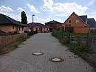
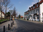
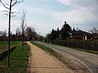
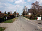
- Image : Photo of the street or an adjacent object.
| Name / location | Length / dimensions (in meters) |
Origin of name | Date of designation | Remarks | image |
|---|---|---|---|---|---|
|
Ahornweg
( Location ) |
650 | Maples , genus of plants | after 1935 | The Ahornweg, which runs in north-south direction, is located in the west of the Falkenhöhe settlement. As part of the Falkenhöhe allotment garden in 1932, it was private property until the fall of the Wall and therefore not designated as a public road. |

|
| Acacia path
( Location ) |
680 | Acacia , genus of plants | after 1935 | The Akazienweg, which runs in north-south direction, is located in the east of the Falkenhöhe settlement. As part of the Falkenhöhe allotment garden in 1932, it was private property until the fall of the Wall and therefore not designated as a public road. |

|
| At the Margaretenhöhe
( Location ) |
995 | Margaretenhöhe settlement | Apr 16, 1999 | The street An der Margaretenhöhe leads north from Wartenberger Weg and is the access road to the Margaretenhöhe settlement of the same name. This was built from 1933 as an allotment garden, and in 1948 it was renamed Margarenhöhe. The street was known as Street 5 before it was renamed . |

|
| At the cooperative ring
( Location ) |
340 | reminiscent of the former LPG | Nov 7, 2009 | In addition to the streets Am Kletterplatz, Am Schilf and Am Wartenberger Luch, the street Am Genossenschaftsring ensures the development of the residential area Wartenberger Luch, which will be under construction from 2009. It goes off in a semicircle from the street Am Wartenberger Luch towards the south. |

|
| At the manor
( Location ) |
520 | Wartenberg manor | 29 Sep 2003 | The access route, after the Wartenberg Manor, which existed here between 1460 and 1882, was first called Gut Wartenberg , from around 1939 the former Gut Wartenberg . The area and the five buildings (mansion, farm building) were owned by the city of Berlin and were used in different ways. From around 1935 (1936 for the first time in the address book), for example, Deulakraft GmbH produced agricultural machinery in the buildings . At the edge of the village street, still on the estate, there was also a road house , which was later demolished. Between the 1950s and the 1980s, the HU Berlin had a branch here. After 1990 a branch of the FHTW Berlin took the building into use. A new housing estate was built on the area from 2002, and some of the existing buildings were converted into residential buildings. |

|
| At the climbing area
( Location ) |
130 | adjoining children's playground | Nov 7, 2009 | The street Am Kletterplatz and the neighboring streets Am Wartenberger Luch, Am Genossenschaftsring and Am Schilf ensure the development of the Wartenberger Luch residential area, which will be under construction from 2009. It starts from the street Am Wartenberger Luch in a southerly direction, then turns to the east and ends at the street Am Genossenschaftsring. |

|
| On the reeds
( Location ) |
150 | Reed , also called reed, type of sweet grass | Nov 7, 2009 | The street Am Schilf is located in the residential area Wartenberger Luch, the name relates to the adjacent nature reserve Falkenberg-Wartenberger Luch. The street begins as an extension of the street Am Wartenberger Luch and runs in a southerly, then in a westerly direction and finally ends at the street Am Genossenschaftsring. |

|
| At the Wartenberger Luch
( Location ) |
240 | Wartenberger Luch, part of the Falkenberg-Wartenberger Luch nature reserve | Nov 7, 2009 | The street Am Wartenberger Luch, like the connected streets Am Kletterplatz, Am Genossenschaftsring and Am Schilf, ensures the development of the residential area Wartenberger Luch, which will be under construction from 2009. It goes east from Lindenberger Straße and ends at Straße Am Schilf. |

|
| Astridstrasse
( Location ) |
600 | Astrid , female first name | Apr 16, 1999 | Astridstraße leads within the Margaretenhöhe settlement from Florentinestraße to the south and ends in front of Margaretenbrücke, a pedestrian bridge over the outer ring. The connection established in 1933 was previously known as Straße 1 . |

|
|
Birkholz way
( Location ) |
1890 | Birkholz, part of the city of Bernau near Berlin in Brandenburg | handed down (around 1300) | The Birkholzer Weg branches off from Lindenberger Straße and leads in a north-easterly direction to Neu-Lindenberg and on to Birkholz. From 1928 the Wartenberg settlement was built on both sides of the street. After the city limits, the street turns into Birkholzer Allee, until 1945 in the Niederbarnim district . |

|
| Bundesstrasse 2
( Location ) |
1660 (in the district) (west side) |
adopted name of trunk road B 2 | after 2010 | Bundesstraße 2 is the officially set name of the continuation of Malchower Dorfstraße , it is under the name Bundesstraße 2 between Blankenburger Pflasterweg and Am Luchgraben on the city limits of Lindenberg . The Wartenberg section consists of the west side of the road north of the pest ditch at the bridge of the Berlin outer ring , the road area is in the Pankow district (suburb of town). The previously unnamed or “Dorfstrasse” (from Malchow) designated street line became georeferenceable in the course of the nationwide necessity . Thus the Malchow substation received the address Bundesstrasse 2 # 20. |

|
|
Village street
( Location ) |
730 | Location in the Wartenberg village center | handed down (around 1300) | Dorfstrasse is the oldest street in the district. It leads from Ernst-Barlach-Straße to Prendener Straße and ends at the district boundary to Neu-Hohenschönhausen. Within the village green , the northern lane is used for through traffic, the southern one is intended for development. Until 1945, the Wartenberg village church with the attached cemetery was on the Anger . The village school stood on property 21. There was also a mill on plot 28, surrounded by arable land and arboretum. |

|
|
Ellistrasse
( Location ) |
210 | Elli , female first name | Apr 16, 1999 | The Ellistraße of the Margaretenhöhe settlement, laid out in 1933, leads in a north-south direction from Florentine to Sigrunstrasse. It was previously referred to as 6 Street . |

|
| Ernst-Barlach-Strasse
( Location ) |
90 (in the district) |
Ernst Barlach (1870–1938), sculptor, writer and draftsman | Aug 31, 1992 | Ernst-Barlach-Straße begins at the confluence with Fennpfuhlweg as an extension of Dorfstraße and runs west of the district boundary through Neu-Hohenschönhausen. Until 1992 it was called Fritz-Große-Straße , before that until 1985 it was called Malchower Weg, according to its direction. |

|
|
Fennpfuhlweg
( Location ) |
460 | Fennpfuhl, drained water in Wartenberg | after 1986 | The Fennpfuhlweg leads in an arch from Dorfstraße to Lindenberger Straße. |

|
| Florentine Street
( Location ) |
600 | Florentine , feminine given name | Apr 16, 1999 | Florentinestrasse, which runs in an east-west direction, forms the border between the Margaretenhöhe residential estate and the allotment gardens of the same name to the north. Previously it was known as Straße 7 . |

|
|
Genossenschaftsweg
( Location ) |
280 | former nearby LPG ‚1. Mai ', which existed in Wartenberg from 1953 to 1991 | Apr 5, 1963 | The cooperative path leads from Dorfstraße to Fennpfuhlweg. |

|
| Green Trift
( Location ) |
1360 (in the district) |
Trift , path used by cattle between pasture land and stable | unknown | The Green Trift is a road that runs largely through undeveloped land and runs in an east-west direction from Lindenberger Strasse over the Falkenhöhe settlement to the Berlin animal shelter on Hausvaterweg. The eastern section is in the Falkenberg district . |

|
|
Main way
( Location ) |
1140 (in the district) |
Main route of the KGA 'Falkenhöhe 1932' | after 1935 | The main route is the central north-south axis of the Falkenhöhe settlement and leads from road 3 to Falkenberger Chaussee , the last 100 meters being in the Neu-Hohenschönhauser area. As part of the KGA Falkenhöhe 1932, the road was up to the turning point not noted private grounds and therefore on city maps. |

|
| Helminestrasse
( Location ) |
130 | Helmine , female name | Apr 16, 1999 | Helminestrasse is located in the Margaretenhöhe settlement and leads from Sigrunstrasse to the southern edge of the settlement. The street laid out in 1933 was previously referred to as street 4 . |

|
|
Lindenberger Strasse
( Location ) |
2040 | Lindenberg , part of the municipality of Ahrensfelde in Brandenburg | before 1925 | First it was called Chaussee nach Lindenberg , then Lindenberger Chaussee . In 1936 no house numbers were set and the street was only built on one side. The houses were named after the owners, such as the Münchehofische house of the nursery owner Münchehofe. Lindenberger Straße leads north from Dorfstraße and ends at the city limits, where it continues within Lindenberg as Wartenberger Straße. Alongside a few houses, there are mainly farms on the street. The northern part of the street, later called Lindenberger Weg , leads through undeveloped land. |

|
| Lindenweg
( Location ) |
670 | Linden , genus of plants | after 1935 | The Lindenweg, which runs in a north-south direction, is located in the central part of the Falkenhöhe settlement. As part of the 'allotment garden Falkenhöhe 1932' it was private property until the fall of the Wall and therefore not designated as a public street. |

|
|
Ricardastrasse
( Location ) |
130 | Ricarda , feminine given name | Apr 16, 1999 | Ricardastraße leads within the Margaretenhöhe settlement from Sigrunstraße to the southern edge of the settlement. The connection established in 1933 was previously known as Straße 3 . |

|
|
Sigrunstrasse
( Location ) |
230 | Sigrun , female name | Apr 16, 1999 | Sigrunstraße leads within the Margaretenhöhe settlement from Astridstraße to An der Margaretenhöhe street. The connection established in 1933 was previously known as Straße 2 . |

|
|
Street 1
( Location ) |
460 | original development plan | after 1928 | Street 1 begins on Lindenberger Straße and ends in the south of the Wartenberg settlement on Birkholzer Weg. |

|
|
Street 2
( Location ) |
810 | original development plan | after 1928 | Road 2 leads from Lindenberger Strasse to the north of the Wartenberg settlement and ends at Birkholzer Weg. |

|
|
Street 3
( Location ) |
750 | original development plan | after 1928 | Street 3 forms the southern end of the Wartenberg settlement. It leads from Birkholzer Weg to the west and forms on its eastern section the border of the allotment gardens 'Falkenhöhe 1932' and 'Falkenhöhe-Nord', at the end of which it ends. |

|
|
Street 4
( Location ) |
820 | original development plan | after 1928 | Road 4 forms the western boundary of the Wartenberg settlement in the southern part. It leads from street 3 via Birkholzer Weg to street 2. |

|
|
Street 5
( Location ) |
1110 | original development plan | after 1928 | Road 5 runs east parallel to road 4 from road 3 over Birkholzer Weg and road 2 to Lindenberg . At the city limits it turns into the Ringstrasse. Between Straße 2 and the Berlin city limits, it forms the western end of the northern part of the Wartenberg housing estate. |

|
|
Street 6
( Location ) |
1110 | original development plan | after 1928 | Street 6 runs east parallel to street 5 from street 3 over Birkholzer Weg and street 2 to the Berlin city limits and ends there as a dead end. According to the information in the address book in 1938, it was planned to name this traffic route Goethestrasse . |

|
|
Street 7
( Location ) |
530 | original development plan | after 1928 | Street 7 runs east parallel to street 6 from Birkholzer Weg over street 2 and ends at the Berlin city limits as a dead end. |

|
|
Street 8
( Location ) |
370 | original development plan | after 1928 | The street 8 runs east parallel to street 7 from Birkholzer Weg over the street 2 to Lindenberg and merges into the Florastraße at the Berlin city limits. |

|
|
Street 9
( Location ) |
250 | original development plan | after 1928 | The street 9 is located in the extreme northeast of the settlement Wartenberg and leads northwest in an arch from the Birkholzer Weg. The street 9 is shown in the address book for the first time in 1943. And there were no buildings along this traffic route. |

|
| Street 10
( Location ) |
300 | original development plan | after 1928 | Streets 10 and 11 up to 1943 are not shown in the address book. The street 10 leads from the Lindenberger street to the west and ends after a few hundred meters. The road was mainly used as an entrance to LPG '1. May'. |

|
| Street 11
( Location ) |
360 | original development plan | after 1928 | Streets 10 and 11 up to 1943 are not shown in the address book. Straße 11 leads in an arch from Lindenberger Straße to Straße 11. |

|
|
Wartenberger way
( Location ) |
160 (in the district) |
Wartenberg , direction from Wartenberg to Malchow | handed down (around 1300) | The Wartenberger Weg is part of the historical connection between Wartenberg and Malchow. It leads from Malchower Dorfstraße to Egon-Erwin-Kisch-Straße and there it changes into Ernst-Barlach-Straße. After the Neu-Hohenschönhausen district was re-established in 2002, only a short section of the road remained in the Wartenberg district. |

|
Former streets
- Klarashöh : Cross street of Friedrichstrasse
-
Elsastraße : with 81 parcels from Birkholzer Straße to the farmland ;
This street name is shown for the first time in the address book in 1936. However, since a complete development has already taken place, the traffic route is more likely to have been built at the beginning of the 1930s. - Dirt road : one cross street of street 4
- Friedrichstrasse : with 85 parcels running between Birkholzer Strasse and Klarashöh
-
Fritz-Große-Straße : honored the communist politician Fritz Große .
The name existed between 1985 and 1992 for Ernst-Barlach-Straße . - Gutsweg : a cross street from Dorfstraße
- Richardstraße : going from Birkholzer Straße to the Klarashöh colony
- Way to Blankenburg : a cross street of Dorfstraße
- Weißenseer Chaussee : a cross street of Dorfstraße
Allotment garden
- 'Falkenhöhe Nord' (Birkholzer Weg 112)
See also
literature
- Anke Huschner: Hohenschönhausen . In: Wolfgang Ribbe (Ed.): History of the Berlin administrative districts . tape 15 . Stapp Verlag, 1995, ISBN 3-86134-532-3 .
- Hans-Jürgen Mende (Ed.): Lexicon of all Berlin streets and squares. From the foundation to the present . 2nd volume. New Life / Edition Luisenstadt, Berlin 1998, ISBN 3-355-01491-5 .
- Walter Püschel : Walks in Hohenschönhausen . Haude & Spener, Berlin 1995, ISBN 3-7759-0398-4 .
Web links
- Office for Statistics Berlin-Brandenburg: List of streets and squares in the Lichtenberg district (February 2015) (PDF; 325 kB)
- Streets in Wartenberg. kaupert media gmbh, accessed on April 9, 2010 .
Individual evidence
- ↑ a b Wartenberg . In: Berliner Adreßbuch , 1922, Part IV, p. 1763.
- ↑ a b Wartenberg . In: Berliner Adreßbuch , 1938, Part IV, p. 2276.
- ↑ Chronicle Wartenberg on www.berlin.de
- ↑ a b c d Wartenberg . In: Berliner Adreßbuch , 1943, Part IV, p. 2347.
- ↑ Berlin / city map, VEB Tourist Verlag, Berlin / Leipzig, 4th edition: Hohenschönhausen around 1989 ( page no longer available , search in web archives ) Info: The link was automatically marked as defective. Please check the link according to the instructions and then remove this notice.
- ↑ on street maps of several years of Berlin it was called Dorfstraße , most recently as Dorfstraße in the city map published by StadtINFO Verlag from 2008 (p. 49).
- ↑ a b c d e f Wartenberg . In: Berliner Adreßbuch , 1936, Part IV, p. 2212.
- ↑ a b c Wartenberg . In: Berliner Adreßbuch , 1925, Part IV, p. 1954.
