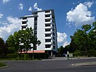
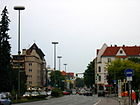
List of streets and squares in Berlin-Mariendorf

The list of streets and squares in Berlin-Mariendorf is an overview of the streets and squares historically or currently available in the Berlin district of Mariendorf in the Tempelhof-Schöneberg district . At the same time, this compilation is one of the lists of all Berlin streets and squares .
overview
Mariendorf has 53,094 inhabitants (as of December 30, 2019) and includes the postcode areas 12105, 12107 and 12109. According to the official street directory, the district has 145 dedicated streets with a total length of 67.5 kilometers, with routes in colonies and private roads being ignored. The total area in the Tempelhof-Schöneberg district - in all six districts - is 5,305 hectares , including traffic area 1,038 hectares and of which road traffic 837 hectares. (As of December 31, 2016).
The federal highways B 96 ( Sassnitz - Zittau ) and B 101 (Berlin - Aue ) run through the district . The Teltower Kreis-Chaussee leading to Großbeeren (until 1920) (from 1932 as main road 101 ) branches off from the B 96 (Tempelhof - Lichtenrade) in Mariendorf. The B 96 on Mariendorfer Damm leads south over Alt-Mariendorf and north over Friedenstrasse . The Gradestraße motorway junction leads over the A 102 to the city motorway and is located in the extreme northeast of Mariendorf.
The sequence of names of the streets gives an impression of the settlement sequence in the district. In addition to the historic town center around Alt-Mariendorf , country roads and local connections as well as the two roads in town already existed around 1900. The first naming on June 10, 1907 led to the area, sometimes referred to as the “Fürstenviertel”, north of the old settlement (west of Mariendorfer Damm) to the newly created Teltow Canal . The street names are assigned from north to south (from the Margrave , Elector , King , Kaiser to Prinzenstrasse ) in line with the development of the Brandenburg and Prussian rulers' titles. In addition to loyalty to the emperor, rural names (such as meadow, field and field paths ) were also eliminated.
The Teltow Canal brought about the settlement of industry and commerce from Tempelhof and Rixdorf (since 1912: Neukölln ). In addition to the names of the streets after industrialists in the industrial and commercial area along Ringstrasse and Lankwitzer Strasse on May 23, 1925, Monopolstrasse should also be mentioned. The monopoly settlement that arose here from 1922 to 1924 was intended to encourage the settlement of workers for the new companies after the period of inflation .
On August 4, 1930, an extensive campaign followed with street naming after Alpine peaks . Particularly noteworthy are the Säntisstrasse and the Tauernallee , they open up the area east of Mariendorfer Damm and south of Britzer Strasse . In 1931 further names followed north of Britzer Straße, here to places in Turkey and then - east of Rixdorfer Straße - Roman personalities served as namesake. Further north to Ullsteinstrasse , allotment gardens were created with their own path names that are not considered roads. In the entire eastern settlement area (in relation to the Mariendorfer Damm) there are predominantly single-family houses , but also multi-family houses in the case of building densification . Later naming of the former plan number street is based on the themes of the district . To the west of the longitudinal Chausseestrasse at the old town center, local politicians and personalities from Mariendorf were mainly used as templates for the street names.
During the Nazi dictatorship in 1935, the street named after the German-Jewish publisher's founder Leopold Ullstein was renamed Zastrowstraße, although it was given its original name back in 1949. After the western campaign and the occupation of France in 1940, streets around Westphalweg were named after places in Alsace (including in the Aachen area).
The Föttinger zeile, which was set up in 1977 on the Daimlerstrasse street after the construction of new buildings, is also evidence of the times, as was common in the 1970s.
In the Lesachtal and the Lienzer path the youngest roads are from 1999, from which an open area east of the Mariendorfer Damm is built with houses. Here the reference to time lies in the choice of the Austrian Lesach Valley as the "Landscape of the Year 1992".
Overview of streets and squares
The following table gives an overview of the streets and squares in the district as well as some related information.
- Name / location : current name of the street or square. Via the link Location , the street or the square can be displayed on various map services. The geoposition indicates the approximate center of the street length.
- Traffic routes not listed in the official street directory are marked with * .
- Former or no longer valid street names are in italics . A separate list may be available for important former streets or historical street names.
-
Length / dimensions in meters:
The length information contained in the overview are rounded overview values that were determined in Google Earth using the local scale. They are used for comparison purposes and, if official values are known, are exchanged and marked separately.
For squares, the dimensions are given in the form a × b for rectangular systems and for (approximately) triangular systems as a × b × c with a as the longest side.
If the street continues into neighboring districts, the addition ' in the district ' indicates how long the street section within the district of this article is. - Name origin : origin or reference of the name.
- Notes : further information on adjacent monuments or institutions, the history of the street and historical names.
- Image : Photo of the street or an adjacent object.
| Name / location | Length / dimensions (in meters) |
Origin of name | Date of designation | Remarks | image |
|---|---|---|---|---|---|
|
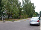
Albulaweg
( Location ) |
450 | Albula Pass , Alpine Pass in Switzerland | Aug 30, 1930 | The way was established as road 144 according to the development plan. It lies between Tauernallee and Ankogelweg. |
|
| Allgäu way
( Location ) |
160 | Allgäu , landscape of the Alpine foothills | Nov 1, 1953 | Established as Straße 210 , the path is between Grüntenstraße and Floningweg. |

|
| Almweg
( Location ) |
80 | Alm , high mountain pasture | Feb. 1, 1992 | Set up as road 486 , the Almweg is a cul-de-sac north of the Hochkalterweg. |

|
| Old Mariendorf gasworks
( Location ) |
890 | former private road | Nov 15, 2015 | Connection between Ringstrasse and Lankwitzer Strasse. |

|
|
Alt-Mariendorf
( Location ) |
950 | the old village center of Mariendorf | Aug 31, 1949 | The original village street of the Angerdorf is the northward branch of the B 101 leading westwards and is supplemented in an easterly direction by Friedenstrasse. It is a two-lane thoroughfare designed as a one-way street. Alt-Mariendorf is located on both sides of the Mariendorfer Damm between Britzer / Rixdorfer / Reißeckstraße and Großbeeren- / Rathausstraße. The village location Alt-Mariendorf / Friedenstraße / Mariendorfer Damm is listed as an ensemble in the list of monuments. |

|
| At the heather cemetery
( Location ) |
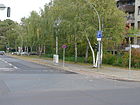
170 | Heidefriedhof Tempelhof | Aug 1, 1965 | The street is between Alt-Mariendorf and Reißeckstraße. The Heidefriedhof is at the southern end; it was set up in 1952 for hygienic reasons for the war victims who were buried in 1944/1945, mainly former members of the Wehrmacht in the surrounding health facilities. |
|
| At the Hellespont
( Location ) |
270 | Hellespont , ancient name of the Dardanelles between the Marmara and Aegean seas | Feb. 1, 1968 | Established as road 414 , it is a cul-de-sac south of Dardanellenweg. |

|
| Andlauer Weg
( Location ) |
110 | Andlau , wine-growing town in Alsace (France) | Dec 11, 1940 | Established as Straße 280 , the path is between Westphalweg and Prühßstraße. |

|
|
Aeneas Street
( Location ) |
190 | Aeneas , Trojan hero | Aug 21, 1931 | Laid out as street 274 , it lies between Eisenacher and Didostraße. |

|
| Ankogelweg
( Location ) |
1050 | Ankogel , summit of the Hohe Tauern | Aug 4, 1930 | The streets established as streets 145 and 155 have been combined. The path lies between Quarzweg and Mariendorfer Damm . The area of the combined baths Mariendorf belongs to the district, but the school to the east on property 97 belongs to Buckow . |

|
|
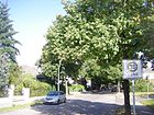
Birnhornweg
( Location ) |
770 | Birnhorn , mountain in the Salzburg Limestone Alps | Aug 4, 1930 | Established as Straße 127 , the path is between Mariendorfer Damm and Daimlerstraße. The street is built on with single-family houses. |
|
| Flower path
( Location ) |
280 | nurseries ( flowers ) that existed here | after 1909 | Between 1902 and 1910, listed in the 1908 address book, the route was called Blumenstrasse . It is located between Ringstrasse and Gersdorfstrasse as an extension of Königstrasse as an exception in the 'Fürstenviertel'. |

|
|
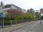
Bösensteinweg
( Location ) |
200 | Bösenstein , mountain in Austria (Niedere Tauern) | Aug 4, 1930 | Laid out as road 134a , the path is between Grimmingweg and Säntisstraße. |
|
| Bosphorus Strait
( Location ) |
230 | Bosphorus , strait of the sea between Europe and Asia | Aug 21, 1931 | It lies between the Marmara Trail and the Golden Horn. On February 13, 1957, the section beyond the Golden Horn was added. |

|
| Britzer Strasse
( Location ) |
1040 | Britz , neighboring town to the east | Apr. 14, 1904 | The connection to the neighboring village, known as Britzer Weg since the 19th century, was elevated to a “street” with the fortification. The busy connecting street is built on with apartment blocks and single-family houses, with parks and allotments. |

|
| Brussaer way
( Location ) |
340 | Brussa , provincial capital in northwestern Turkey | Apr 20, 1937 | Set up as Straße 217 , the path is between Imbrosweg and Britzer Straße, to which there is no exit. |

|
| Buchsteinweg
( Location ) |
390 | Buchstein , two mountains in the Ennstal Alps (Austria) | Aug 4, 1930 | Established as road 126 , the path is between Titlisweg and a dead end to Säntisstraße, to which a footpath leads. |

|
|
Cantorsteig
( Location ) |
140 | Georg Cantor (1845–1918), mathematician | Aug 21, 1931 | Laid out as road 7 , the path lies between Königstrasse and Kaiserstrasse. |
 
|
| Catostrasse
( Location ) |
160 | Cato (234–149 BC), Roman politician and writer | Aug 4, 1930 | Established as street 235 , it lies between Liviusstraße and Horazweg (both as a dead end street). |

|
|
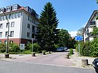
Dachsteinweg
( Location ) |
230 | Dachstein , limestone plateau in the Northern Limestone Alps (Austria) | Aug 4, 1930 | Established as road 164 , the path lies between Klausenpass and Tauernallee. |
|
| Daimlerstrasse
( Location ) |
640 north side only |
Gottlieb Daimler (1834–1900), engineer and entrepreneur | March 23, 1925 | Established as Straße 130 , it is located between Säntisstraße and Großbeerenstraße. In 1929 it led to Säntisstraße and in 1938 it was extended to Kettinger Straße. With the construction of adjacent residential buildings, Daimlerstrasse between Grimmingweg and Kettinger Strasse was renamed Föttingerzeile on July 1, 1977. The district boundary is along the northern edge of the road on the property boundary between Titlisweg and Säntisstraße. |

|
| Dardanellenweg
( Location ) |
820 | Dardanelles , strait between the Sea of Marmara and the Aegean Sea | Aug 21, 1931 | Set up in the course of Straße 229 , the path is between Rixdorfer and Plautusstraße, the existing section of Straße 229 continues to Britz. The streets Westphal-, Dirschel- and Dardanellenweg used to be a continuous street. |

|
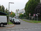
| Dederingstrasse
( Location ) |
440 | Dedering, a farming family from Mariendorf in the 18th century | Aug 4, 1930 | Established as Straße 79 , it is located between Lankwitzer and Kitzingstraße. |
|
| Didostraße
( Location ) |
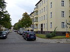
220 | Dido , Phoenician princess was in Carthage by Aeneas added | Aug 21, 1931 | Established as Straße 275 , it is located between Eisenacher Straße and Dirschelweg. |
|
| Dirschelweg
( Location ) |
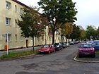
100 | Andreas Dirschel (1702–1761), Mariendorfer pastor from 1743 to 1761 | Nov 1, 1953 | It is between Rixdorfer Straße and Didostraße. The Westphalweg between Rixdorfer Straße and Didostraße was renamed Dirschelweg in 1953. |
|
|
Einödshoferweg
( Location ) |
110 | Julius Einödshofer (1863–1930), composer and conductor | Aug 21, 1931 | The path is between Eisenacher Straße and Teikeweg. |

|
| Eisenacher Strasse
( Location ) |
1120 | Eisenach , city in Thuringia | June 10, 1907 | Before 1905 , the street was called Feldstrasse , and when Kurfürstenstrasse was named, its (eastern) branch between Mariendorfer Damm and Rixdorfer Strasse was named after the ducal residence, conference and congress town at the time. Here is the entrance to the Evangelical Cemetery "Zum Heiligen Kreuz", which is owned by the Kreuzberg church of the same name . |

|
|
Faulhornweg
( Location ) |
240 | Faulhorn , mountain in the Bernese Alps (Switzerland) | Aug 4, 1930 | Established as road 151 , the path is a dead end north of the Albulaweg. |

|
| Finkenweg
( Location ) |
230 | Finches , family of songbirds | Jan. 22, 1924 | The path is between Monopolstraße and Mariendorfer Damm, without an exit there. The houses 1–4 belong to the listed monopoly settlement . |

|
| Floningweg
( Location ) |
780 | Floning , mountain in Styria (Austria) | Aug 4, 1930 | Established as road 177 and 161 , the path lies between the Allgäuer and Pilatusweg. |

|
| Fluchthornweg
( Location ) |
240 | Fluchthorn , mountain of the Silvretta group (on the border between Switzerland and North Tyrol) | Aug 4, 1930 | Established as Straße 133 , the path is between Mariendorfer Damm and Göllweg. |

|
| Ford dam
( Location ) |
930 | Henry Ford (1863–1947), engineer and entrepreneur | Feb 13, 1957 | Laid out as Marienfelder Strasse before 1910 , the dam lies between Alt-Mariendorf and Opelweg. |

|
|
Föttingerzeile
( Location ) |
370 (in the district) without south side |
Hermann Föttinger (1877–1945), engineer | July 1, 1977 | The original course of Daimlerstrasse was influenced by the residential developments at that time and the section between Kettinger Strasse and Grimmingweg was renamed. The southern properties are in Marienfelde (western part) and Lichtenrade (eastern part). The street belongs to Mariendorf and borders a residential area. |

|
| Freibergstrasse
( Location ) |
420 | Freiberg is one in the 16./19. Mariendorf family established in the 19th century | Sep 1 1962 | Established as Straße 14 , it is located between Fritz-Werner- and Körtingstraße. |

|
| Friedenstrasse
( Location ) |
500 | Mariendorf cemetery | before 1905 | The street lies between Großbeerenstraße and Mariendorfer Damm. It leads the B 101 as a one-way street from Großbeerenstraße to B 96 . The public lavatory, the Café Achteck , stood in the Ringbahnstrasse in Tempelhof from 1910 and was set up here in 1999 after a restoration. |

|
| Fritz-Werner-Strasse
( Location ) |
1240 (in the district) |
Fritz Werner (1865–1939), engineer and entrepreneur | March 23, 1925 | Established as Straße 72 , it lies between Friedenstraße and the suburbs on Untertürkheimer Straße. In Marienfelde the street leads to Daimlerstraße. |

|
| Furka Street
( Location ) |
880 | Furka , Swiss Alpine Pass | Aug 4, 1930 | Established as street 149 , it lies between Tauernallee and Wildspitzweg. The course of the road between Hochkalterweg and Hundsteinweg is interrupted by the Wimbach promenade as a footpath. She crosses the "Daheim" settlement. |

|
|
Gajusstrasse
( Location ) |
170 | Gaius (117-180 n. Chr.), Roman lawyer | Aug 4, 1930 | Established as street 234 , it is a southern cul-de-sac from Horazweg. |

|
| Gallipoliweg
( Location ) |
140 | Gallipoli , peninsula between the Dardanelles and the Gulf of Sares in the European part of Turkey | Aug 21, 1931 | Established as road 221 , the path is a dead end road north of the Bosporus road, in the vicinity of which other roads are named after the geographical names of Turkey. |

|
| Gersdorfstrasse
( Location ) |
660 (in the district) |
Named after the ponds 'Runder Gersdorf' and 'Langer Gersdorf' that were located here | Aug 8, 1935 | The train, officially named Schöneberger Strasse after 1902, was renamed between Attilastrasse and Ringstrasse between 1935, and is part of the district up to the south bank of the Teltow Canal . The eponymous puddles were removed when the canal was built. Houses built in the 1930s and after the Second World War with quiet courtyards are located on this tree-lined street with commuter traffic. |

|
| Glärnischweg
( Location ) |
140 | Glärnisch , mountain in the northern Glarus Alps (Switzerland) | Aug 4, 1930 | Established as Straße 157 , the path is between Königsstuhlweg and Mariendorfer Damm. |

|
|
Göllweg
( Location ) |
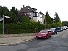
540 | Hoher Göll , mountain in the Berchtesgaden Alps | Aug 24, 1936 | The road lies between Mariendorfer Damm and Grimmingweg in an area around Säntisstraße with roads to Alpine peaks. |
|
| Golden Horn
( Location ) |
310 | Golden Horn , port bay of Istanbul | Feb 13, 1957 | The road lies between Dardanellenweg and Britzer Straße, to which there is no passage from Imbrosweg. |

|
|
Gottlieb-Dunkel-Strasse
( Location ) |
80 (in the district, only east side) |
Gottlieb Dunkel (1839–1907), Tempelhof farm owner and local politician | May 3, 1906 | The street is between Eschersheimer and Gradestraße, only the eastern property on Gradestraße with the New St. Michael Cemetery belongs to the district. |

|
| Gradestrasse
( Location ) |
580 (in the district) |
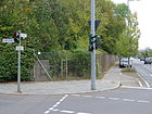
Hans Grade (1879–1946), engineer and aviation pioneer | Aug 1, 1981 | The Gradestraße was in the early 20th century Britz ( Neukölln set up). In 1981 the street 454 ( Mariendorf zu Tempelhof ) was also named Gradestrasse and on December 1, 1983 the Britz extension was also included. Gradestraße is located in the district between Gottlieb-Dunkel- / Rixdorfer Straße and the district boundary on the eastern approach to ASt 23 Gradestraße of the federal motorway 102 . |
|
| Greinerstrasse
( Location ) |
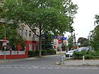
390 | Franz Ferdinand Greiner (1808–1855), glass blower and inventor, developed the first industrially manufactured German thermometer together with Wilhelm Berkes. | Dec 11, 1940 | Set up as Straße 80 , it is between Lankwitzer and Kitzingstraße. The access road into the industrial area has residential development only on the corner of Lankwitzer Strasse. |
|
| Grimmingweg
( Location ) |
440 (in the district) |
Grimming , mountain in Styria (Austria) | Aug 4, 1930 | Established as Straße 132 , the path is between Säntisstraße and Richard-Tauber-Damm, here as a dead end from the Föttingerzeile. |

|
| Großbeerenstrasse
( Location ) |
1420 (in the district) |
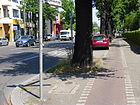
Großbeeren , southern neighboring town, municipality in the district of Teltow-Fläming (Brandenburg) | before 1905 | With this name the Großbeerenstraße appears for the first time in the 1905 address book in Mariendorf-Südende. It lies between Rathausstrasse and the district boundary to Marienfelde and continues in this district . The Kreis-Chaussee of the Teltow district, which has been running here since the 19th century as an army and trade route from Berlin via Marienfelde to Großbeeren, was taken over when the long-distance roads were created. A section of the B 101 is now located here . |
|
| Grüntenstrasse
( Location ) |
1030 | Grünten , summit on the northern edge of the Allgäu Alps | Nov 1, 1953 | Established as road 208 , the part of Wildspitzweg parallel to Nebelhornweg was named in 1953. On September 1, 1973, the (transverse) road 464 to Arlbergstrasse and on September 1, 1976 the further section to Britzer Strasse was included in Grüntenstrasse. It is a residential street with single and multi-family houses from the 1960s and 1970s. |

|
|
Hausstockweg
( Location ) |
550 | Hausstock , mountain in the Glarus Alps (Switzerland) | Aug 4, 1930 | Established as road 172 , the path between Hundsteinweg and Floningweg is a one-way street to Floningweg. |

|
| Heukuppenweg
( Location ) |
210 | Heukuppe , highest peak of the Raxalpe (Austria) | Aug 4, 1930 | Established as street 175 , the street lies between Wendelsteinweg and Hausstockweg. |

|
| Heusingerstrasse
( Location ) |
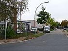
200 | Edmund Heusinger von Waldegg (1817–1886), engineer and railway pioneer | Nov 1, 1953 | Established as Straße 82 , it is between Porschestraße and Großbeerenstraße. |
|
| Hirzerweg
( Location ) |
1200 tw. only interrupted east side |
Hirzer , summit of the Sarntal Alps in South Tyrol (Italy) | Aug 4, 1930 | The road borders the Mariendorf trotting track to the west and lies between Kruckenbergstrasse and Daimlerstrasse. It is interrupted by a footpath of the same name between Unterthürkheimer and Titlisstrasse, which leads between the Fritz Werner factory and the trotting track. Along this street, the western properties already belong to Marienfelde, the western edge of the road forms the district boundary. |

|
| Hochfeilerweg
( Location ) |
580 | Hochfeiler , summit of the Zillertal Alps (border North Tyrol - South Tyrol) | Aug 4, 1930 | The street set up as street 156 and 158 lies between Pilatusweg and Furkastraße. |

|
| Hochgallweg
( Location ) |
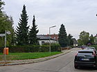
340 | Hochgall , mountain of the Rieserferner group in the Hohe Tauern (South Tyrol) | Aug 4, 1930 | Established as road 173 , the path lies between Röthspitzenweg and Hoeftweg. |
|
| Hochkalterweg
( Location ) |
470 | Hochkalter , mountain peaks of the Bavarian Berchtesgaden Alps | Aug 4, 1930 | Established as street 166 , the path lies between Furkastraße and Muttlerweg, which connects via a cross section. |

|
| Hoeftweg
( Location ) |
210 | Carl Georg Christian Hoeft (1841–1897), local politician | Nov 1, 1953 | Before part of Rixdorfer Straße, the part separated by the Heidefriedhof was renamed Hoeftweg, so the path lies between Wendelsteinweg and Hundsteinweg. The farm owner Hoeft was the community leader in Mariendorf from 1870 to 1875. |

|
| Hollabergweg
( Location ) |
190 (in the district) |
Hollaberg , mountain in the Bavarian Forest | Aug 4, 1930 | Established as Straße 112 , the extension - previously Straße 7 - was included on January 24, 1938, so the path lies between Titlis- and Birnhornweg. With the interruption, however, Hollabergweg continues beyond Daimlerstrasse in Marienfelde. |

|
| Horace Way
( Location ) |
350 | Horace (65–8 BC), Roman poet | Aug 4, 1930 | Established as Straße 249 , the path lies between Liviusstraße and Plautusstraße. |

|
| Hundsteinweg
( Location ) |
1140 | Hundstein , mountain in the Salzburg Slate Alps (Austria) | Aug 4, 1930 | Established as road 169 , the extension of the road between Floningweg and Mariendorfer Damm was included on May 4, 1970 . The path lies between Mariendorfer Damm at the corner of Hochgallweg and Layuberhornweg, it goes as a cul-de-sac south of the Allianz Stadium to the entrance to Britzer Garten near the district boundary. |

|
|
Ifen path
( Location ) |
90 | Hoher Ifen , summit of the Allgäu Alps, Kleinwalsertal (Austria) | Nov 1, 1953 | Set up as road 135 , the path branches off as a cul-de-sac west of Mariendorfer Damm. |

|
| Illzacher way
( Location ) |
210 | Illzach , place on the Ill in Upper Alsace (France) | Dec 11, 1940 | Established as Straße 287 , the path is between Westphalweg and Prühßstraße. |

|
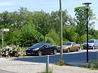
| In the Lesach Valley
( Location ) |
400 | Lesachtal , narrow valley of the upper Gail (Austria) | Feb. 1, 1999 | The street arches from and to Tauernallee and thus opens up the adjoining apartment buildings. In 1991 the Lesach Valley was named the most environmentally friendly valley in Europe at a tourism fair in Stuttgart and in 1995 it was voted “Landscape of the Year” in Austria. |
|
| Imbrosweg
( Location ) |
1090 | Imbros , Aegean island in the Turkish province of Çanakkale | Aug 21, 1931 | Established as street 214 , the path is between Rixdorfer Straße and Dardanellenweg, in the vicinity of which other streets are named after the geographical names of Turkey. |

|
|
Kaiserstrasse
( Location ) |
930 | Emperor , highest secular ruler title | around 1908 | It runs between the Ringstrasse and Mariendorfer Damm . Kaiserstraße is located (at its southernmost point) parallel to Markgrafenstraße, Kurfürstenstraße and Königsstraße. The name should refer to the (then) ruling German Kaiser. The Martin Luther Memorial Church (built: 1933–1935), the Maria Frieden church (built: 1969) and the Eckener grammar school (built: 1907) are located here. The Mariendorf Town Hall, built in 1904, was also located there, but was destroyed by an air raid on the night of August 23-24, 1943 during the Second World War . |

|
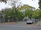
| Kitzingstrasse
( Location ) |
490 | Kitzing, Mariendorf peasant family in the 18th century. | Aug 4, 1930 | Established as Straße 83 , it lies between Großbeerenstraße and Greinerstraße. |
|
| Klausen Pass
( Location ) |
420 | Klausenpass , pass in the Glarus Alps (Switzerland) | Aug 4, 1930 | Established as road 165 , the pass lies between Tauernallee and Furkastraße. |

|
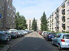
| Kochstrasse
( Location ) |
170 | Johann Jacob Koch (Chochius) († 1751), Berlin baker and local politician | before 1905 | The road runs as a cul-de-sac from Königstraße to the north. Koch owned a dairy on Tempelhofer Mühlenberg, which he made available free of charge as building land. As a reward, he received the construction sites at Kochstrasse 21 and 65 and Friedrichstrasse 209 from the king. |
|
|
Koenigstrasse
( Location ) |
230 | King , the highest bearer of monarchical dignity after the emperor. | June 10, 1907 | From 1900 to 1907 it was called Ackerstrasse . It connects Gersdorfstrasse and Mariendorfer Damm . Its location between parallel to the southern Kaiserstrasse and the northern Margrave and Kurfürstenstrasse and corresponds to the development of the rulers' titles in Prussian history. It is a narrow inner-city residential street with old and post-war buildings and some villas with large gardens. |

|
|
Königstuhlweg
( Location ) |
860 | Großer Königstuhl , mountain in the Nockberge National Park (Austria) | Aug 4, 1930 | First street 159 of the development plan, the path is between Pilatusweg and Glärnischweg. |

|
|
Körtingstrasse
( Location ) |
410 | Ernst Körting (1842–1921), engineer and entrepreneur | Aug 21, 1931 | Set up as Straße 98 , it lies between Mariendorfer Damm and Großbeerenstraße. |

|
| Kollostrasse
( Location ) |
970 | Walter Kollo (1878–1940), composer | Nov 1, 1953 | Established as Straße 282 , it is located between Eisenacher Straße and Westphalweg. |

|
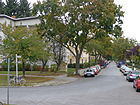
| Kosleckweg
( Location ) |
220 | Julius Kosleck (1825–1905), musician | Aug 21, 1931 | The street was laid out and named Lutherstrasse around 1908 . It lies between Eisenacher Strasse and Westphalweg. |
|
| Kruckenbergstrasse
( Location ) |
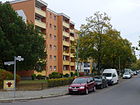
600 | Franz Kruckenberg (1882–1965), engineer and inventor ("rail zeppelin") | Aug 1, 1975 | Established as Straße 422 , it lies between Mariendorfer Damm and Fritz-Werner-Straße. |
|
| Kurfürstenstrasse
( Location ) |
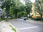
950 | Electors , were allowed to choose the king and emperor | June 10, 1907 | Before 1905 it was run as a Feldstrasse and extended as an extended Feldstrasse by 1907. It lies between Ringstrasse and Eisenacher Strasse and crosses Mariendorfer Damm . The order of the parallel streets between the Markgrafenstrasse and the Kaiserstrasse corresponds to the development of the rulers' titles in Brandenburg and Prussia. It is a quiet, narrow residential street with old and post-war buildings. There are footpaths to the Teltow Canal through allotment gardens . |
|
| Küterstrasse
( Location ) |
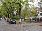
170 | Friedrich Küter (1879–1945), businessman, resistance fighter against the Nazi regime | Nov 1, 1953 | Established as street 59 , it is located between Prinzenstrasse and Kaiserstrasse. |
|
|
Lankwitzer Strasse
( Location ) |
860 | Connection to the western neighboring town of Lankwitz . | before 1905 | The road lies between the suburbs at the Lankwitzer Bridge over the railway line and Großbeerenstraße. It is a busy commercial street with residential buildings only between Greinerstrasse and Dederingstrasse. The northern part of the street borders on the former Mariendorf gasworks . |

|
| Lauberhornweg
( Location ) |
210 | Lauberhorn , mountain in the Bernese Alps (Switzerland) | Jan. 2, 1996 | It is located between Hundsteinweg and a turning area, from which a footpath leads into the (parallel) Weißkugelweg. |

|
| Lauxweg
( Location ) |
190 | Carl Laux (1873–1953), landowner, member of the Reichstag | Nov 23, 1931 | Established as Straße 86 , the path branches off from Wilhelm-Pasewaldt-Straße as a southern cul-de-sac. |

|
| Lerchenweg
( Location ) |
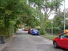
390 | Lark , songbird | Jan. 16, 1925 | It is located between Eisenacher Straße and continues on Finkenweg as a dead end. The path is parallel to Monopolstrasse to the west and delimits the monopoly settlement from the apartment buildings on Mariendorfer Damm. |
|
| Lienz path
( Location ) |
100 | Lienz , district capital of East Tyrol (Austria) | Feb. 1, 1999 | It lies to the east behind the Tauernallee properties and the expected building area west of Im Lesachtal. |

|
| Liviusstrasse
( Location ) |
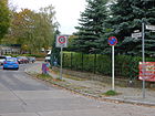
290 | Titus Livius (around 59 BC - around 17 AD), Roman historian at the time of Augustus. | Aug 4, 1930 | Established as street 230 , it is between Skutaristraße and Horazweg. |
|
|
Machon Street
( Location ) |
520 | Friedrich Machon (1840–1918), businessman and local politician | Aug 21, 1931 | Laid out as Zimmerstrasse before 1905 , it was renamed Schwerinstrasse around 1907 . It is between Markgrafenstrasse and Kaiserstrasse. Around 1911 Machon was a council member and deputy mayor in Mariendorf. |

|
| Marconistrasse
( Location ) |
180 | Guglielmo Marconi (1874–1937), Italian radio pioneer and company founder | Feb 13, 1957 | Set up as street 8 , it goes westwards from Forddamm as a spur street. |

|
|
Mariendorfer Damm
( Location ) |
3990 (in the district) |
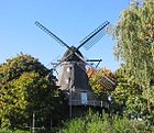
The historical trade route through Mariendorf | Aug 31, 1949 | The Mariendorfer Damm is the historic connecting road between Berlin and Zossen and is part of the B 96 . The trade route once ran in a different route between the former villages of Tempelhof and Mariendorf. In 1949, Chausseestrasse and Lichtenrader Chaussee ( Lichtenrade and Buckow ) were merged and renamed Mariendorfer Damm. The dam lies between the Stubenrauchbrücke (Teltow Canal) and the intersection with the Buckower / Marienfelder Chaussee, here in the Lichtenrader Damm continuing to the city limits. In Mariendorf, the longest section is between Ullsteinstrasse and the district boundary at the level of the Ifen path. In the southern area it is a wide suburban street with lots of traffic, mostly with residential buildings and a few commercial units, in the north a shopping street with old and new buildings. |
|
| Markgrafenstrasse
( Location ) |
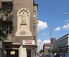
410 | Margrave , administrator of a border area (Mark) | June 10, 1907 | Called Wiesenweg since the 19th century , the street lies between Rathausstrasse and Mariendorfer Damm. The order of the parallel streets to the south to Kaiserstraße corresponds to the development of the ruler titles in Brandenburg history. |
|
| Marmara Trail
( Location ) |
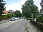
440 | Marmara , Inland Sea of the Mediterranean (Turkey) | Aug 21, 1931 | Established as road 222 , it lies between Smyrnaer Weg and as a cul-de-sac across the Bosporusstrasse. |
|
| Monopoly street
( Location ) |
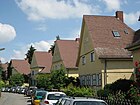
700 | Reich monopoly administration prompted the local settlement | Jan. 22, 1924 | The road between Ullsteinstrasse and Eisenacher Strasse is the main street of the Monopol settlement . The settlement was built from 1920 to 1922 and was commissioned by the Reich Ministry of Finance, which was responsible for the Reich liquor monopoly, to create living space for factory workers brought to the region. The quiet residential street mainly consists of semi-detached houses and single-family houses. The narrow street is reserved for residents, there is a footpath to Mariendorfer Damm. |
|
| Monschau way
( Location ) |
270 | Monschau , place in the district of Aachen (North Rhine-Westphalia) | Dec 11, 1940 | Established as street 294 , the path is between Markgrafenstrasse and Kurfürstenstrasse. |

|
| Morsbronn way
( Location ) |
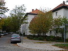
380 | Morsbronn , town in Lower Rhine (France) | Dec 11, 1940 | Established as road 284 , the extension of the route was included on August 1, 1975. It lies between Prühßstrasse over Westphalweg as a dead end street up to the height of Teikeweg. A footpath leads to Eisenacher Strasse. |
|
| Muttlerweg
( Location ) |
100 | Muttler , mountain in Graubünden (Switzerland / Austria) | Feb. 1, 1992 | Established as road 485 , the path is between Hochkalterweg and Tauernallee. |

|
|
Nebelhornweg
( Location ) |
300 | Nebelhorn , mountain in the Allgäu Alps (Bavaria) | Nov 1, 1953 | In the settlement with roads named after Alpine peaks, the path between Wildspitzweg and Grüntenstraße is located. It is a quiet residential street mostly built with single-family houses. |

|
|
Olpererweg
( Location ) |
130 | Olperer , mountain peak in the Zillertal Alps (Austria) | Aug 1, 1975 | Established as Straße 203 , the path is between Rotkopfweg and Schareckstraße. He is a traffic-calmed narrow residential street with single-family houses. |

|
| Opelweg
( Location ) |
160 | Adam Opel (1837–1895), mechanical engineer and entrepreneur. | March 1, 1989 | Established as road 419 , the path is between Forddamm and Großbeerenstraße, between Propperweg and Großbeerenstraße it is just a footpath and bike path. |

|
|
Pilatusweg
( Location ) |
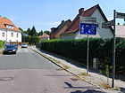
460 | Pilatus , Bergstock on Lake Lucerne (Switzerland) | Aug 4, 1930 | Established as road 160 , the path is between Mariendorfer Damm and Furkastraße, from Königsstuhlweg only as a dead end and then as a footpath. |
|
| Plautusstrasse
( Location ) |
210 | Plautus (around 254 – around 184 BC), Roman comedy poet | Aug 4, 1930 | Established as street 233 , it lies between Dardanellenweg and Horazweg, further than a dead end. It is a quiet residential street with mostly single-family houses. |

|
| Pohligstrasse
( Location ) |
20th | Julius Pohlig (1842–1916), engineer and entrepreneur | May 20, 1937 | Established as Road 286 , it is east of Forddamm. The short street ends at the entrance to KGA Neuland. |

|
| Popperstrasse
( Location ) |
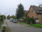
260 | Josef Popper-Lynkeus (1838–1921), inventor and writer | May 20, 1937 | Established as Straße 285 , it lies between Opelweg and (at an angle to) Forddamm. |
|
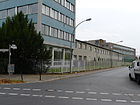
| Porschestrasse
( Location ) |
480 | Ferdinand Porsche (1875–1951), inventor and entrepreneur | Nov 1, 1953 | Set up as Straße 78 , it is located between Kitzing- and Lankwitzer Straße. |
|
| Prinzenstrasse
( Location ) |
390 | Prince , title of the non-ruling members of sovereign royal houses | June 28, 1907 | The street lies between Rathausstraße and Mariendorfer Damm. It runs parallel to the other streets of the Fürstenviertel, which from north to south to Kaiserstraße corresponds to the development of the Prussian rulers' titles. |

|
| Prühßstrasse
( Location ) |
580 | Karl Prühß (1875–1914), local politician. | Sep 1 1927 | The mountain road and Albrechtstraße were in 1927 combined to Prühßstraße. It is located between the Ringstrasse and Andlauer Weg and borders the Volkspark east of the Mariendorfer Damm.
From 1912 to 1914 Prühß was mayor and mayor of Mariendorf. He fell in World War I and is buried in the community cemetery. The traffic route is a quiet residential street with cobblestones. On the Ringstrasse there are prefabricated buildings from the 1960s and to the east to old buildings. The house with number 26, planned and built by R. Wiechert in 1888 and August Lau in 1898, is a listed building . |

|
|
Quartz way
( Location ) |
50 | Quartz , mineral | Aug 8, 1935 | Laid out as road 142 in Mariendorf, the path was integrated on August 8, 1960 and the Buckower Quarzweg ( Neukölln district ) connected to Tauernallee. |

|
|
Rätikonweg
( Location ) |
1420 | Rätikon , high mountain group in the northern Limestone Alps (Liechtenstein, Austria, Switzerland) | Aug 4, 1930 | Established as Straße 128 , the path is between Titlisweg and Säntisstraße. |

|
| Rathausstrasse
( Location ) |
470 | Location of the town hall from 1903 until the bomb damage in 1943 | June 10, 1907 | The eponymous town hall was built from 1903 to 1905 and destroyed by an air raid during the night of 23 to 24 August 1943 during World War II. The street lies between the Germelmann Bridge on the Teltow Canal and Kaiserstraße. The Martin Luther Memorial Church , which was built by Curt Steinberg in 1935 , is also located here. |

|
| Raucheckweg
( Location ) |
120 | Raucheck , summit in the Salzburg Limestone Alps (Austria) | Aug 4, 1930 | Set up as Straße 131 , the path is between Grimmingweg and Mariendorfer Damm, to which it only leads as an access path to the house entrances. |

|
| Reisseckstrasse
( Location ) |
510 | Reißeck , mountain group of the Hohe Tauern (Austria) | Sep 1 1968 | The Reißeckstraße was created by extending the Friedenstraße, it lies between Mariendorfer Damm and the intersection of Alt-Mariendorf, Britzer and Rixdorfer Straße. |

|
| Reulestrasse
( Location ) |
380 | Hans Reule , farmer in Mariendorf around 1652 | Aug 4, 1930 | Set up as Straße 8 , it is located between Schützenstraße and Rathausstraße. |

|
| Richard-Tauber-Dam
( Location ) |
160 (in the district) only north side |
Richard Tauber (1891–1948), Austrian tenor | Apr 1, 1975 | Partly in the course of the road 430 , it lies between Säntisstraße and Buckower Chaussee. Only plots 3–17 with new residential buildings north of the road to Säntisstraße belong to Mariendorf, with the district boundary itself being a straight extension of the former course of Daimlerstraße, so that only 80 meters of the northern edge of the road border on Mariendorf. |

|
| Richterstrasse
( Location ) |
370 | August Ferdinand Richter (1822–1903), theologian and politician | June 5, 1912 | The street lies between Mariendorfer Damm and Prinzenstraße. It is a quiet residential street with old buildings, some new buildings and a rental house from the 1970s. The Richterteich is on the road. Richter was a member of the Prussian House of Representatives and was buried in Mariendorf. |

|
| Riegerzeile
( Location ) |
380 | Franz Karl Hermann Rieger (1872–1959), pastor in Mariendorf from 1908 | Jan. 1, 1963 | Set up as Straße 2 , the line is a spur road south of Kaiserstraße west of the Martin Luther Memorial Church . On the street there is an ensemble of prefabricated buildings from the 1960s with pedestrian passages to Ringstrasse, Gersdorfstrasse and Rathausstrasse. |

|
| Ring road
( Location ) |
1140 (in the district) |
ring- shaped road | before 1905 | The Ringchaussee was laid out before 1900 and was named Ringstrasse around 1905. It runs between Attila and Rathausstraße, in the district it is from the Teltow Canal. The street separates the industrial area around the former Mariendorf gasworks from the residential area on the north side of the street with some old buildings and mostly apartment blocks from the 1970s. |

|
| Rixdorfer Strasse
( Location ) |
1600 | Rixdorf , renamed Neukölln in 1912, northeastern neighboring town, to the border of which the road leads | around 1900 | The old country route to Rixdorf has been called Rixdorfer Weg since at least 1887 and was named as a road when it was fortified around 1900. The street lies between Alt-Mariendorf and Gradestrasse. Tram 15 ran here until 1966.
After 1926, but before 1943, the street was extended to the southwest to what is now Mariendorfer Damm. With the creation of the Heidefriedhof, the extension was soon canceled, a separated part was named on November 1, 1953 in Hoeftweg. |

|
|
Röthspitzenweg
( Location ) |
210 | Röthspitze , summit of the Hohen Tauern (Austria) | Aug 4, 1930 | Established as road 174 , the path lies between Wendelsteinweg and Hausstockweg. |

|
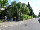
| Rotkopfweg
( Location ) |
330 | Rotkopf , mountain in the Zillertal Alps (Austria) | 2nd June 1969 | Set up as Straße 205 , the quiet residential street with single-family houses is located between Britzer Straße and Straße 483. In addition, there is a dead end street along the Rotkopfpfuhl into the “Park on the Britzer Straße”. |
|
|
Säntisstrasse
( Location ) |
510 (in the district) |
Säntis , a mountain in Eastern Switzerland | Aug 4, 1930 | The street 150 (until 1925 as Schwarzer Weg ) west of the Chausseestrasse received this name in 1930. The street continues the Tauernallee west of the Mariendorfer Damm up to the district boundary on the Daimlerstrasse. The eagle mill in this street is one of the largest mills in the Mark Brandenburg and has been on this site since 1888. Previously it was probably in the Schlesisches Busch in Treptow . |

|
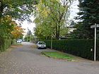
| Schareckstrasse
( Location ) |
170 | Schareck , Berg near Bad Gastein (Austria) | Aug 1, 1975 | Set up as Straße 206 , it is between Olperer Weg and Straße 483. It is a traffic-calmed, narrow residential street with single-family houses on the east side and a training area for horses opposite. |
|
| Schützenstrasse
( Location ) |
280 | earlier shooting positions | June 10, 1907 | It is located between Kurfürstenstrasse and Kaiserstrasse and is a quiet and narrow inner-city residential street with old and post-war buildings. |

|
| Schwalbenweg
( Location ) |
120 | Swallow , passerine bird | Jan. 22, 1924 | It lies between Lerchenweg and Monopolstraße on the edge of the monopoly settlement . |

|
| Schwarzkogelweg
( Location ) |
210 | Schwarzkogel , mountain in the Ötztal Alps (Austria) | Aug 4, 1930 | Established as road 176 , the path is between Wendelsteinweg and Hausstockweg. |

|
| Seelbuschring
( Location ) |
320 | Seelbusch, old field name in Mariendorf | July 21, 1960 | Established as Straße 409 , the ring lies between Gersdorfstraße and Kurfürstenstraße. |

|
| Selbhornweg
( Location ) |
140 | Selbhorn , mountain in the Stone Sea (Austria) | Aug 4, 1930 | Established as Straße 180 , the path lies between Furkastraße and Floningweg. |

|
| Skadar Street
( Location ) |
280 | Skutari , district of Istanbul (Turkey) | Aug 21, 1931 | It is located between Eisenacher Straße and Dardanellenweg in an area with other streets according to the geographical names of Turkey. The streets 204 and 231 established according to the development plan were named Skutaristraße in 1931; it ran from today's Rixdorfer Straße to Wildspitzweg. In 1953 the southern section was named Nebelhornweg, in 1957 the middle section was named Goldenes Horn. |

|
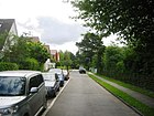
| Smyrna Way
( Location ) |
100 | Smyrna , former name of Izmir (Turkey) | April 16, 1937 | Established as road 215 , the path between Brussaer and Marmaraweg lies in an area with other roads named after the geographical names of Turkey. |
|
| Splügenweg
( Location ) |
140 | Splügen Pass , Alpine Pass in the Graubünden Alps (Switzerland) | Aug 4, 1930 | Established as street 162 , the path is between Watzmannweg and Hochkalterweg. |

|
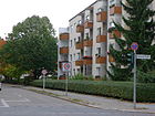
| Steinhellenweg
( Location ) |
270 | Stone light, old hallway name in Mariendorf | Jul 21, 1960 | Established as Straße 403 , the path is between Eisenacher Straße and Wolfsburger Weg. |
|
| Street 7
( Location ) |
130 | Numbering in the development plan | before 1910 | It is a dead end street north of Prinzenstraße and leads to the Catholic Church Maria Frieden as a quiet residential street with apartment buildings. |

|
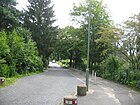
| Street 229
( Location ) |
80 (in the district) |
Numbering in the development plan | before 1930 | It is located between Dardanellenweg and Plautusstraße. |
|
| Road 483
( Location ) |
130 | Numbering in the development plan | before 1930 | It lies between Schareckstrasse and Rotkopfweg. A short, pedestrianized street with no residents. |

|
| Strelitzstrasse
( Location ) |
200 | Strelitz , as Mecklenburg-Strelitz a line and a duchy (from 1815 Grand Duchy) of Mecklenburg | June 10, 1907 | It is located between Machonstraße and Mariendorfer Damm. It is arranged in the order between the parallel streets to the southern Kaiserstraße. |

|
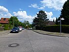
| Sulzbergweg
( Location ) |
250 | Sulzberg , (several) mountains in the Alps. | Aug 4, 1930 | Established as Straße 187 , the path is a quiet residential street with mostly single-family houses between Furkastraße and Floningweg. |
|
|
Tacitus Street
( Location ) |
150 | Publius Cornelius Tacitus (around 58 AD - around 120), Roman historian and senator. | Aug 4, 1930 | Established as street 227 , it branches off from Plautusstraße to the east as a cul-de-sac. It is a quiet residential street with single-family houses. |

|
| Tauernallee
( Location ) |
760 | Tauern , mountain range and several pass crossings in the Alpine chain (Austria) | before 1930 | Set up as Straße 150 , it lies between Mariendorfer Damm and Muttlerweg, and is designed as a main street up to Quarzweg . |

|
| Teikeweg
( Location ) |
260 | Carl Teike (1864–1922), military musician and composer | Nov 1, 1953 | Established as Straße 283 , the path is between Kollostraße and Morsbronner Weg, to which it is only a footpath from Einödshoferweg. |

|
| Titlisweg
( Location ) |
430 (in the district) |
Titlis , mountain of the Uri Alps (Switzerland) | Aug 4, 1930 | Established as Straße 125 , the path runs between Mariendorfer Damm and Daimlerstraße. The district boundary is between Daimlerstrasse and Hirzerweg on the street, the southwest corner of Daimlerstrasse including the road area belongs entirely to Mariendorf. |

|
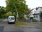
| Tödiweg
( Location ) |
400 | Tödi , mountain range in the Glarus Alps (Switzerland) | Aug 4, 1930 | Set up as Straße 129 , the path, built on with single-family houses, lies between Titlisweg and Daimlerstraße. |
|
|
Ullsteinstrasse
( Location ) |
2190 partly without north side |
Leopold Ullstein (1826–1899), founder of the publishing house | July 12, 1927 | It runs between Teltow Canal and Rixdorfer Straße, the district boundary to Tempelhof is mostly on the northern edge of the road. Between the Teltow Canal and Rathausstrasse it is a dead end north of the Blau-Weiß tennis courts. The Mariendorf seaside resort existed here from 1876 to 1950 .
Before 1902, the Grenzweg ran from the Marienhöhe in the street and was interrupted by the construction of the Teltow Canal. The Mariendorfer part was named Burggrafenstrasse in 1928 (based on the southern streets after rulers' titles). On May 3, 1935, because of Ullstein's Jewish origins, the name was changed to Zastrowstrasse , and February 21, 1949. To the west of Mariendorfer Damm, Ullsteinstrasse is a quiet residential street with new and post-war buildings, to the east (Mariendorfer Strasse) there are businesses and then allotment gardens. |

|
| Untertürkheimer Strasse
( Location ) |
440 north side only |
Untertürkheim , since 1905 part of Stuttgart (Baden-Württemberg) | March 23, 1925 | Established as Straße 93 , it runs between Fritz-Werner-Straße and Hirzerweg. The district boundary is on the road up to Hirzerweg, to the west the width of the road belongs to Mariendorf without the subsequent road crossing. |

|
| Upstallweg
( Location ) |
100 | Upstall , assembly point for the villagers' cattle | July 21, 1960 | Set up as road 420 , the path is a dead end north of Alt-Mariendorf and borders the Richterteich. The path is a quiet residential street with social housing. |

|
|
Wankstrasse
( Location ) |
200 | Wank , Berg near Garmisch-Partenkirchen (Bavaria) | Nov 1, 1953 | Set up as street 209 , it lies between Sulzbergweg and Grüntenstraße and is a quiet residential street mostly with single-family houses. |

|
| Watzmannweg
( Location ) |
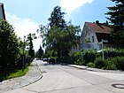
400 | Watzmann , mountain range of the Berchtesgaden Alps (Bavaria) | Aug 4, 1930 | Established as road 163 , the path lies between Klausenpass and Tauernallee. |
|
| Weißkugelweg
( Location ) |
100 | Weißkugel , mountain peak in the Ötztal Alps (Italy / Austria) | Jan. 1, 1977 | The quiet residential street with single-family houses was set up as street 201 and is located between Wildspitzweg and a dead-end street across Lauberhornweg. |

|
| Wendelsteinweg
( Location ) |
760 | Wendelstein , mountain peak of the Schlierseer Mountains (Bavaria) | Aug 4, 1930 | Established as Straße 178 , the extending Straße 193 was included on July 20, 1960 . The path is between Floningweg and Hoeftweg, south of the Heidefriedhof . |

|
| Westphalweg
( Location ) |
680 | Wilhelm Hugo Westphal (1859–1925), local politician, Mariendorfer community leader | Aug 21, 1931 | The path lies between Kosleckweg and Mariendorfer Damm, with a section between Rixdorfer Straße and Didostraße being renamed Dirschelweg on November 1, 1953.
Westphal was the first full-time head of the rural community of Mariendorf from 1900 to 1911. |

|
| Wildspitzweg
( Location ) |
440 (in the district) |
Wildspitze , highest peak in the Ötztal Alps in Tyrol (Austria) | Dec. 1, 1983 | Established as road 266a , the path lies between Sulzbergweg and the district boundary, and continues in neighboring Britz to Am Irissee. It is a quiet residential street mainly built with single-family houses, to the south the Allianz Stadium with sports and tennis courts. On the north side there are undeveloped meadow areas in private ownership. |

|
| Wilhelm-Pasewaldt-Strasse
( Location ) |
300 | Wilhelm Pasewaldt (1812-1893), Mariendorfer landowner and mayor | before 1911 | The street lies between Großbeeren- and Fritz-Werner-Straße. |

|
| Wilhelm-von-Siemens-Strasse
( Location ) |
760 | Wilhelm von Siemens (1855–1919), engineer and entrepreneur | March 23, 1925 | Set up as Straße 94 , it runs through an industrial area between Großbeerenstraße and Hirzerweg, ending in the east to the Trabrennbahn , where the Marienfelde fire station of the Berlin fire department is located. |

|
| Wolfsburg way
( Location ) |
500 | Wolfsburg , independent city (Lower Saxony) | Feb 13, 1957 | Set up as Straße 404 , the path is between Rixdorfer Straße and Steinhellenweg. |

|
|
Zangenbergweg
( Location ) |
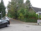
120 | Zangenberg , mountain in South Tyrol (Italy) | Aug 4, 1930 | Set up as road 134b , the path is between Göllweg and Föttingerzeile. |
|
Planned and former streets
| Surname | from | to | named in | Namesake and notes |
|---|---|---|---|---|
| Ackerstrasse | before 1900 | June 10, 1907 | → Koenigstrasse | The road originally led to arable land. |
| Albrechtstrasse | before 1914 | Sep 1 1927 | → Prühßstrasse | Friedrich Heinrich Albrecht, Prince of Prussia (1809–1872), Prussian general. Albrechtstrasse was named between November 1910 and June 1914. The route is not marked in the 1905 city map. |
| Mountain road | before 1900 | Sep 1 1927 | → Prühßstrasse | The road led to a hill. |
| Flower Street | after 1902 | around 1908 | → Flower path | After nurseries located here. |
| Britzer way | 19th century | Apr. 14, 1904 | → Britzer Strasse | Connection path to the neighboring municipality of Britz |
| Britzer Weg from Marienfelde |
after 1907 | Aug 4, 1930 | → Säntisstrasse | Connection path from Marienfelde to the neighboring municipality of Britz |
| Burggrafenstrasse | 1908 | July 12, 1927 | → Ullsteinstrasse | Burgrave, initially office of the castle administrator |
| Chausseestrasse | before 1901 | Aug 31, 1949 | → Mariendorfer Damm | Chaussee der Handels- und Heerstraße, since the 20th century B 96 , which led in Mariendorf to Lichtenrade (partly in Buckow). |
| Village street | 13th century | Aug 31, 1949 | → Alt-Mariendorf | The village and neighboring villages were founded by the Knights of the Templar Order. |
| Feldstrasse (east) | before 1905 | June 10, 1907 | → Eisenacher Strasse | The road led to the Mariendorfer fields. |
| Feldstrasse (west) | before 1905 | June 11, 1907 | → Kurfürstenstrasse | The road led to the Mariendorfer fields. |
| Grenzweg | before 1902 | until 1908 | → Burggrafenstrasse | The course was interrupted when the Teltow Canal was built. |
| Lutherstrasse | around 1908 | Aug 21, 1931 | → Kosleckweg | Martin Luther (1483–1546), reformer |
| Marienfelder Strasse | before 1911 | Feb 13, 1957 | → Forddamm | Connection path to the neighboring village |
| Schöneberger Strasse | after 1902 | Aug 8, 1935 | → Gersdorfstrasse | The road is the connection route to Schöneberg (through Tempelhof). |
| Schwerinstrasse | around 1907 | Aug 21, 1931 | → Machon Street | Curd Christoph Graf von Schwerin (1684–1757), Prussian general |
| Extended field road | before 1900 | June 10, 1907 | → Kurfürstenstrasse | The field road was extended and not renamed. |
| Meadow path | 19th century | June 10, 1907 | → Markgrafenstrasse | |
| Zastrowstrasse | May 3, 1935 | Feb 21, 1949 | → Ullsteinstrasse | Around 1360 there was a man named Zastrow Commander of the Order of St. John in Tempelhof. |
| Zimmerstrasse | before 1905 | around 1907 | Schwerinstrasse | A specific name reference to Zimmer is not known. In 1931 it was renamed → Machonstraße . |
There are also a large number of streets initially numbered in the development plans of the rural community of Mariendorf , and after 1920 the plans for the 13th administrative district ( Tempelhof ). These names can be found in the list of current streets, and some streets are still only distinguished by map numbers (as of 2014).
Further locations in Mariendorf
Allotment gardens
The following allotment gardens (KGA; often also referred to as colonies) are located in the district on the north-eastern boundary of the district and are scattered around. The paths in the facilities are mostly private paths and not public paths.
| Surname | ZIP code and location | address | Area in hectares |
Number of parcels |
Form of ownership | Remarks |
|---|---|---|---|---|---|---|
| KGA afterglow | 12109 ( location ) | Ullsteinstrasse 1-51 | 9.1 | 219 | national | |
| KGA Alpental | 12109 ( location ) | Gradestrasse 135-161 | 4.7 | 95 | national | Two permanent residents |
| KGA BLW Am Bahnndamm | 12107 ( location ) | 30 meter strip next to the S-Bahn line |
0.67 | 20th | Railway property | Mariendorfer part: south of the Teltow Canal .
The access to the port of Lankwitz was once planned on this site. |
| KGA Am Türkenpfuhl | 12109 ( location ) | Street 229 / Dardanellenweg | 0.8 | 28 | national | |
| KGA at the racetrack | 12107 ( location ) | Kruckenbergstrasse / Hirzerweg 46–58 | 2.5 | 71 | national | |
| KGA Barnet | 12107 ( location ) | Grüntenstrasse 26-28 | 0.4 | 10 | national | The London district of Barnet is twin town of the Tempelhof-Schöneberg district . |
| KGA Charenton le Pont | 12109 ( location ) | Britzer Strasse 17-23 | 0.6 | 16 | national | Charenton-le-Pont is twin town of the Tempelhof-Schöneberg district. |
| KGA agreement | 12105 ( location ) | Kurfürstenstrasse 88–92 | 1.6 | 48 | national | |
| KGA after work | 12109 ( location ) | Rixdorfer Strasse 42-48 | 4.8 | 120 | national | |
| KGA happy harmony | 12109 ( location ) | Ullsteinstrasse 53-63 | 5.4 | 131 | national | |
| KGA Gerdsmeyer | 12107 ( location ) | Körtingstrasse / Hirzerweg | 3.6 | 100 | national | |
| KGA Kaisergarten | 12105 ( location ) | Kaiserstrasse 22-24 / Küterstrasse | 0.5 | 16 | national | |
| KGA shamrock | 12109 ( location ) | Rixdorfer Strasse 41-49 | 5.8 | 130 | national | |
| KGA Marienglück | 12109 ( location ) | Rixdorfer Strasse 41-49 | 7.2 | 173 | Private | |
| KGA dawn | 12109 ( location ) | Eisenacher Strasse 53–55 / Wolfsburger Weg | 2.9 | 80 | national | |
| KGA Neu-Helgoland | 12109 ( location ) | Britzer Strasse 24-30 | 1.3 | 32 | national | |
| KGA new territory | 12107 ( location ) | Fritz-Werner-Strasse | 1.7 | 51 | Private | |
| KGA sand desert | 12107 ( location ) | Dederingstrasse 18-24 / Greinerstrasse 17 | 1.1 | 32 | national | |
| KGA Schätzelberge | 12109 ( location ) | Ullsteinstrasse / Steinhellenweg | 3.6 | 87 | national | |
| KGA south bank | 12105 ( location ) | Ringstrasse 11-15 | 0.4 | 15th | national | |
| KGA Union | 12105, ( location ) | Kurfürstenstrasse 83 | 1.4 | 43 | national | |
| KGA Unter-Us | 12105 ( location ) | Kurfürstenstrasse 84–86 | 2.2 | 60 | national | |
| KGA Wartburg | 12109, ( location ) | Eisenacher Strasse 32/33 | 0.9 | 27 | national | |
| KGA Wild West | 12105 ( location ) | Richterstrasse 38 | 0.5 | 17th | national | |
| KGA Wildspitz | 12107 ( location ) | Wildspitzweg 17a | 1.0 | 26th | Private |
Parks and green spaces

- Volkspark Mariendorf ( location )
- Park on Britzer Strasse, in the west the DRK home ( location )
- Residential park at the Martin Luther Memorial Church ( location ) with prefabricated buildings from the 1960s
- Britzer Garten (at the west entrance) ( location )
- Cemeteries and graveyards
-
Heidefriedhof ( location )
- Gänsepfuhl ( location )
- Holy Cross Cemetery ( location )
- Trinity Cemetery ( location )
- Kirchhof Mariendorf II ( location )
- Kirchhof Mariendorf III ( location )
- Christ Cemetery ( location )
- New St. Michael Cemetery ( location )
-
Heidefriedhof ( location )
- More ponds and ponds
Other locations
-
Trabrennbahn Mariendorf ( location )
- Rennbahn pond ( location )
- Ankogelweg indoor and outdoor pool ( location )
- Allianz-Stadion (Dr.-Hans-Hess-Stadion) ( location )
- Hafen Mariendorf (12105, location ) with an area of 60 × 140 square meters.
- Industrial and fallow land
- Dresden Railway ( location ): The railway body lies between the Teltow Canal (south bank) and the Trachenbergring (at the height) on Mariendorfer Flur and forms the border to Lankwitz over a two-kilometer length with the west side of the railway embankment ; it is crossed by the Lankwitzer Bridge. There are no train stations in this area, but two train stations have an important development function for the western Mariendorf: The Attilastraße S-Bahn station was called Mariendorf from 1895 to 1992 and is now in the Tempelhof district, the Marienfelde S-Bahn station belongs to the Marienfelde district. A new station in between with the name Kamenzer Damm is planned for the long term at the Lankwitzer Bridge.
See also
Web links
- Lexicon AZ of the streets and squares of Luise-Berlin bei Kaupert - however with numerous incorrectly assigned streets and areas
- List of street renaming in Berlin until 2007, Office for Statistics ( Memento from March 7, 2010 in the Internet Archive )
- Map of Berlin 1: 5000 with district boundaries. Senate Department for Urban Development Berlin, 2012, accessed on June 4, 2012 .
- Office for Statistics Berlin-Brandenburg: Directory of streets and squares in the Tempelhof-Schöneberg district (as of February 2015); pdf
Individual evidence
- ↑ Numbers and facts
- ↑ Ensemble of the Mariendorf settlement core
- ↑ Heidefriedhof at the Senate Administration
- ↑ berliner-stadtplan.com: Britzer-Strasse-Volkspark-Mariendorf
- ↑ berliner-stadtplan.com/: reference to the community
- ↑ Erected 1922–1923 by the civil service building company of the Reich Monopoly Administration
- ↑ Further information on the Freiberg family.
- ↑ berliner-stadtplan.com/: Gersdorfstrasse
- ↑ on the person of Gottlieb Dunkel
- ↑ berliner-stadtplan.com: Greinerstrasse
- ↑ berliner-stadtplan.com: Königstrasse
- ↑ berliner-stadtplan.com: Kurfürstenstrasse
- ↑ berliner-stadtplan.com: Lankwitzer-Strasse
- ↑ berliner-stadtplan.com: Nebelhornweg
- ↑ Photos of Rixdorfer Strasse around 1966 with tram 15, see Tram Forum ( memento from January 6, 2013 in the web archive archive.today ), 2nd to 5th picture from above
- ↑ City map from 1943 on www.alt-berlin.info
- ↑ Marienfelde fire station at www.berliner-feuerwehr.de
- ↑ Mariendorf was shown in the Berlin address book for the first time in 1905. Mariendorf with south end . In: Berliner Adreßbuch , 1905, V, p. 192.
- ↑ Senate for Urban Development Berlin: Allotment gardens in the district ( Memento of the original from September 29, 2013 in the Internet Archive ) Info: The archive link was inserted automatically and has not yet been checked. Please check the original and archive link according to the instructions and then remove this notice. (PDF; 28 kB)
- ↑ North-South Railway: Attilastraße ( Memento from February 10, 2013 in the web archive archive.today )
- ↑ a b City partnerships of Tempelhof-Schöneberg
- ↑ Volkspark Mariendorf
- ↑ Mariendorf summer pool
- ↑ DRK Clinics Berlin Care and Housing Mariendorf
- ^ Combined swimming pool Mariendorf


