Grünten
| Grünten
Übelhorn (main summit) , Guardian of the Allgäu (nickname)
|
||
|---|---|---|
|
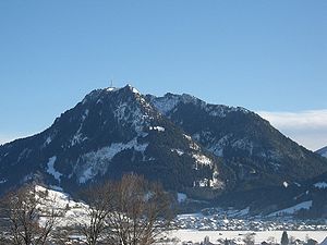
View from the west to Grünten with Burgberg in the Allgäu |
||
| height | 1737.9 m above sea level NHN | |
| location | near Burgberg in the Allgäu ; District of Oberallgäu , Bavaria ( Germany ) | |
| Mountains | Allgäu Alps | |
| Dominance | 9.6 km → Iseler | |
| Notch height | 611 m ↓ P. 1077 in the Schwellbachtal | |
| Coordinates | 47 ° 33 '18 " N , 10 ° 19' 13" E | |
|
|
||
| Type | Ridges | |
| particularities | - Grüntenblick house - Grüntenblick Cottage - Gebirgsjäger monument - transmitter Gruenten - cableway Gruenten - Grüntenlifte ( ski resort ) - Starzlachklamm (southern foot) |
|

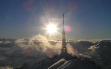
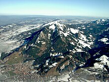

The Grünten is 1737.9 m above sea level. NHN high ridge of the Allgäu Alps . It is located near Burgberg im Allgäu in the Bavarian district of Oberallgäu .
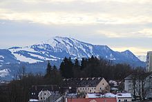
Due to its striking location right on the edge of the Alps, the Grünten is nicknamed the Guardian of the Allgäu . Its main peak is called the Übelhorn . On the summit region there is a mountain hunter monument and the Grünten transmitter , the tower of which is visible from afar. The Grüntenhaus and Grüntenhütte stand on the mountain slopes . The Grünten cable car goes up . There is also the ski resort of Grüntenlifte . The Starzlachklamm lies at the southern foot .
geography
location
The Grünten rises as one of the northernmost mountains of the Allgäu Alps on the border of the municipalities of Burgberg im Allgäu , whose core town is on the south-west foot , and Rettenberg , whose core town spreads out on the north foot. Its summit is about 5.5 km northeast of Sonthofen . To the west extends the valley of the Iller , into which the Ostrach flows at Sonthofen , and to the south that of the Starzlach (with the Starzlachklamm ), which flows into the Ostrach at the Burgberg district of Erzflöss .
Natural allocation
The Grünten belongs in the natural spatial main unit group Northern Limestone-West Alps (No. 95) and in the main unit Vorarlberg-Allgäu Quintner- und Schrattenkalkgewölbe (950) to the natural area Grünten (950.0). To the north, the landscape leads over into the subunit Rettenberger Tal (024.1) and to the northeast into the subunit Rottachbergkämme (024.0), which belong to the main unit group Nagelfluhhöhen and sinks between Lake Constance and Wertach (02) to the main unit Rottachberg (024). In the southeast, the sub-unit of mountains around the Wertacher Hörnle (941.1) joins, which belongs in the main unit group Flyschalpen (94) to the main unit Ostallgäuer Flyschalpen (941). To the southwest to west, the landscape descends into the natural area Illeraue from Oberstdorf-Sonthofen (901.00), which in the main unit group basins and valley floors between the main groups of the Alps (90) and in the main unit Oberstdorf basin (901) to the sub-unit Oberstdorfer Illertal (901.0 ) counts.
Mountain height and mountain peaks
The Grünten is 1737.9 m high as part of the summit of the Übelhorn in the northeast . Upstream of it is the Gigglstein ( 1497 m ) with the Herzlesstein ( 1390 m ) in the northeast . Its southwest tip is the Hochwartspitze ( 1670 m ). This continues in the southwest with the Siechenkopf ( Siechenberg ; 1572 m ) and, subsequently, the Burgberger Hörnle ( 1493 m ) and the Kreutzelspitz ( 1446 m ).
history
Ascents
In contrast to most of the other mountains in the Allgäu Alps, the Grünten was climbed by locals and guests as early as the Middle Ages. At the beginning of the 16th century, the mountain is said to have been conquered by Emperor Maximilian I. A particularly original green tour has been handed down from the Augsburg prince-bishop Clemens Wenzeslaus . In 1773, with the help of 56 local farmers, he was carried to the summit in an upholstered chair.
Mining
Iron ore was mined on the Grünten from 1471 until the late 19th century . However, the tunnels were no longer accessible until 2006 due to the risk of collapse. Since then, several guided tours have been opened for inspection. At Burgberg in the Allgäu there is the ore mine adventure world , a museum village on the subject of mining.
Origin of the ore veins
In the southern slopes of the Grünten there are rich and powerful ore veins - but not of the best quality. These ores have been deposited in a large sea over the course of millions of years. After the continental and African tectonic plates pushed against each other, the Alps unfolded over the course of many millions of years. Because of this folding, ore veins came to light and lying from top to bottom in the mountain it was possible to find and mine them.
history
The mines were first mentioned in writing in 1471. Miners from Schwaz in Tyrol found ore veins on the Grünten and began to mine them. Emperor Friedrich III. (HRR) granted the Count of Montfort the mining rights. The area on the Grünten belonged to the bishops of Augsburg . This gave eternal quarrels. In 1563 the bishop granted his subjects the right to dig for ore at their own risk and expense. This could have been the beginning of the scarce activity. From 1802 the church possessions became state. This also made the freelance miners state. From this point on, ore mining on the Grünten began to revive.
Effects of mining
Large quantities of wood were required to melt the iron ore. Approx. 100 tons of wood were required to produce one ton of fusible iron. For this reason there was soon a lack of wood in the whole of the Allgäu; therefore the Grünten is also called Grünten, which used to mean "Glatzkopf" (Grind) in the dialect. At times even the collection of wood was regulated, and only monocultures with fast-growing wood were grown.
The processing of iron was a major economic factor in the Allgäu at that time. At that time, Burgberg had many nail, horseshoe and shoe nail smithies. This economic factor collapsed rapidly after the railroad was completed in 1853 and better iron was imported from other areas. As a result, 250 Burgbergers emigrated with their families.
Life of the miners
The miners' work was very difficult. They wore special clothing, had to work 7 hours a day, and had Sundays off. Many miners were injured in explosions. Most of them had small farms at home that were run by their wives and children. They were also the first to have a kind of health insurance fund: the Burgberg Health Support Association. They paid 1 pfennig into a cash register, from which the old and sick were taken care of.
Smelter
In 1607 a smelting works was built near Sonthofen, where the Starzlach joins the Ostrach. A forge is said to have existed here since 1532. In 1680, approx. 15,500 quintals of ore from the Grünten were processed in the iron and steel works in Sonthofen. The other furnaces on the Starzlach were closed because the smelting works in Sonthofen were working with newer melting techniques and needed less charcoal. Around 1840 the ironworks employed 100 workers, 30 wood and coal workers and 25 carters, which meant that 700 people were fed. That was a lot at the time. The melting furnace was blown out completely in 1863, since smelting ore was no longer profitable. The ore on the Grünten was by far not as good and more brittle than the ore that was imported due to a very high sulfur content. However, the management of the Grüntenwerk relied on the foundry beforehand, which then experienced an upswing. This existed until 1974. In 1927, the iron and steel works, which the locals call just "Schmitte" today, was renamed BHS ( Bayerische Berg-, Hütten- und Salzwerke AG , Sonthofen branch).
From 1863 the company produced high quality cast articles. From 1888 they were already producing construction machines, turbines, cranes and the like. From 1904 electrical systems were added. During the First World War, the ironworks was included in the arms production. From 1926 onwards, the iron and steel works were hit hard by the economic crisis. From 1928 on, reparations debts were made for free. The wave of layoffs began in 1930, and the management tried very hard to keep the workers. Until 1928 there was always a big party at Barbara , which the iron and steel works paid for. This had to be stopped because there was no more money to finance it. Electric motors were manufactured from 1932 to 1934. From 1934 onwards the economy picked up again and it was discontinued. That was when the first gearboxes were built. From 1934 on there was a summer party again instead of Barbara. From 1943 onwards, operations came to a standstill. In 1944, manufacturing started again, and in 1950 the big boom came with gear machines. In 1958, a separate department for large gear manufacturing was established. BHS was sold to SKW Trostberg in 1991 , and Sonthofer Getriebebau was sold on, like the other areas of mechanical and plant engineering. The transmission area was then transferred to Voith Turbo BHS Getriebe GmbH and the other business areas have been operating as BHS-Sonthofen GmbH since then . Both companies are still active.
history
In 1936 the ore was examined again and found to be too bad to mine. In 1946/47 the tunnels were blown up for safety reasons. In 1989 amateur historians began to dig and formed an interest group. Over the years, volunteers joined in and the Theresiengrube, Neue Annagrube, Wassergrube (Christopherusgrube) and Martinsgrube were examined and "dug out". From 1995, small selected groups were allowed into the Theresiengrube. In 1998 an association "Historic Mining Allgäu" was founded and the mining rights were taken over by the Bavarian Free State. Burgberg has owned the rights since then. All attempts to promote this touristically failed until 2003. At that time there was cross-border funding from the European pot.
Development of the ore mine adventure world
The decisive idea was to build a museum village, independent of the hard-to-reach mines. Then everything went very fast. From May 2005 the construction of this village started. In the meantime, the "Alte Annagrube" was also discovered and integrated for the public. The necessary fuses and lighting were installed and in July 2006 the adventure world was opened.
The museum's basic equipment was planned and implemented by museum professionals. The procurement and preparation of the various exhibits was done by volunteers. The abandoned smithy from Rubi, which was made available to the museum village free of charge, was a stroke of luck. In July 2008 an old nail smithy could be set up, because around 1800 Burgberg had 15 nail smithies.
In order to make the adventure world even more attractive, an "underground climbing course" in connection with an ore mine as an attraction is being considered and is being planned. In 2008 the ore mines had around 25,000 visitors.
nature
fauna
The last wolf was shot on the Grünten in 1827. Since then, the animal has been considered extinct in the entire Allgäu Alpine region.
Protected areas
Parts of the protected landscape area of the Grünten area, the Great Forest, the German Alpine Road and the Wertach Valley ( CDDA no. 395727; designated 1972; 76.1868 km² in size) are located on the Grünten, and parts of the mountain including its summit region have the fauna and flora Habitat area Grünten (FFH no. 8427-301; 1.46 km²).
Infrastructure
Buildings in the summit region
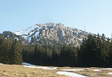
The image on the summit region of the Grünten is defined by two striking structures: On the Übelhorn ( 1,737.9 m ) stands the memorial for fallen mountain hunters , built in 1924 according to plans and under the direction of Bruno Biehler ; the summit cross is nearby . On the Hochwartspitze ( 1670 m ), which is around 280 m southwest of it, is the 94.5 m high tower of the Grünten ( BR ) transmitter, built in 1951 ; the mountain station of the Grünten cable car is also located there . The Grüntenhaus, which opened in 1854 ( 1535 m ), stands about 390 m southwest of the transmission tower on an area of the southwest flank of the Grünten near the summit ; it was the first hotel to be built in the Allgäu Alps, laying the foundation stone for the tourist development of the Allgäu. The Grüntenhütte ( 1477 m ) is around 1.1 km northeast of the Übelhorn summit .
Cable car and lifts
On the Grünten from Rettenberger district leads Altach coming the cable car Grünten . It is 2597 m long and overcomes 951 m difference in altitude. After a dispute over the operation of the cable car between the BR and the municipality of Rettenberg, the Grüntenlift has only been used as a material lift and for BR employees since 2014.
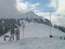
There is also the Grüntenlifte ski area (valley station 900 m ; mountain station 1700 m ). However, due to the operator's bankruptcy , they have not been in operation since the 2017/18 winter season. The systems were sold to BergWelt GmbH & Co. KG by the Kemptner insolvency administrator Florian Zistler. Operations will resume on December 21, 2019. The investor's plan for summer operation is controversial.
Ascent
The ascent to Grünten (Übelhorn) is possible from Burgberg, Rettenberg and Rettenberg- Kranzegg , for example . The shortest route leads from the Alpe Kammeregg (parking lot) to the Grüntenhütte (one and a half to two hours) and from there over the east ridge with iron ladder, which was last secured by wire rope, to the summit with the mountain hunter monument (45 minutes). This path is also easily manageable in snow - preferably before or after the ski season - and it is mostly groomed at least as far as the Grüntenhütte. The ascent of the upstream Burgberger Hörnle over a narrow ridge requires a head for heights. Ski tourers like to choose the Grünten as a small half-day tour, with the ascent almost exclusively via former ski slopes. On the Grünten, managed mountain inns and huts invite you to stop.
The summit cross of the Grünten bears the inscription:
“ Consecrated
to
Our Lady of the Mountains , Our Lady of the Mountains.
Dedicated to
the failed mountaineers in the Allgäu.
Donated
by Dr. Peter Nowotny,
Rettenberg, 1998 "
view
From the summit of the Grünten one has a comprehensive view of the Allgäu landscape. In addition, if the visibility is good, the view extends to Switzerland in the west, to the Zugspitze in the east and from the Unterallgäu district in the north to the high Alps in the south.
Others
An Allgäu folk saying goes: “If the Grünten wears a hat, the weather will be fine tomorrow. If the Grünten wears a sword, there will be rain the next morning. "The version is also known:" If the Grünten wears a hat, the weather is good, if he wears a cap, there is a puddle. "
The Grünten is the scene of the annual "Grüntenstafette", a relay competition with six participants per team with running and cycling routes.
Individual evidence
- ↑ a b c d Map services of the Federal Agency for Nature Conservation ( information )
- ^ Alfred Weitnauer: Bei uns im Allgäu , 5th edition, Kempten 1965, p. 18
- ↑ ore mine adventure world on the Grünten. Retrieved July 30, 2010 .
- ↑ Dieter Seibert: Allgäu Alps and Ammergauer Alps - alpin , Bergverlag Rother Munich 2004, 16th edition, p. 24
- ^ Klaus Kiesel: Tourism: Grüntenseilbahn: Off for public transport. In: das allgäu online - all-in.de. Allgäuer Zeitungsverlag, May 22, 2014, accessed on December 23, 2018 .
- ↑ Michael Munkler: Grüntenlifte are now for sale after bankruptcy. In: Augsburger Allgemeine - augsburger-allgemeine.de. Verlag der Augsburger Allgemeine, March 12, 2018, accessed on December 23, 2018 .
- ↑ Grünten lifts in Kranzegg - Rettenberg, Allgäu / Alpsee-Grünten. In: alpsee-gruenten.de. Alpsee-Grünten Tourismus, accessed on December 23, 2018 .
- ↑ Grüntenlifte sold to BergWelt: The operator plans . b4bschwaben.de. Accessed January 21, 2020.
- ↑ Tourism: A “mountain world” is to be created on the Grünten. Retrieved December 16, 2019 .
- ↑ AllgäuHIT-Baumann and Häuslinger GbR: Ski operation on the Grünten im Allgäu announced - relief for other mountain railways in the region | Radio AllgäuHIT. Retrieved December 16, 2019 .
- ↑ Discussions: Supporters and opponents of the Grünten Bergwelt at the round table: No compromise found yet. Retrieved December 16, 2019 .
