Iller
The Iller is a right tributary of the Danube . Her Latin name was Hilaria or Hilara . The name is of Celtic origin and comes from the word ilara for 'in a hurry'; later the Latin term hilaris , which can be translated as 'cheerful, friendly', was used for interpretation. In the Latin Vita of St. Magnus , the name is interpreted in such a way that it is called friendly, precisely because, as a wild mountain river, it is not. For better legibility, the river name is sometimes written in atlases and on street signs Jller .
The 147 kilometer long river arises from the Breitach , Stillach and Trettach streams at the source of the Iller near Oberstdorf in the Oberallgäu district . It flows into the Danube near Ulm . Measured against its catchment area of 2152 km², the discharge of the mountain river is large. Its water flow of 70.9 m³ / s clearly exceeds that of the Danube, which only brings 53 m³ / s to the confluence and could thus be considered hydrologically as a tributary of the Iller; With this water flow, the Iller ranks seventh in the list of rivers in Bavaria and fifth in Baden-Württemberg. From the late 3rd century to around 488 AD it was part of the Roman defense system Danube-Iller-Rhein-Limes . Even in Roman times it sailed the Iller from Kempten, then Cambodunum , with rafts . For the majority of its course until shortly before Ulm, the body of water formed the border between the dioceses of Constance and Augsburg , which is significant under canon law, until the dissolution of the Diocese of Constance in 1821 .
course
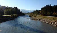
The source of the Iller is near Oberstdorf in the upper Allgäu , where the Iller arises from the confluence of the Trettach (right upper course), Stillach (middle upper course) and Breitach (left upper course). The Breitach arises in the Austrian Kleinwalsertal , the other two source rivers arise in Bavarian territory. On its way north, the Iller first crosses the Allgäu and passes the cities of Sonthofen , Immenstadt and Kempten . In the second half of its course, it flows through Upper Swabia , where it roughly forms the state border between Baden-Württemberg and Bavaria , before it flows into the Danube, which comes from the west, southwest of the Ulm city center.
Tributaries of the Iller
The tributaries of the Iller in their order (south to north), divided into left and right tributaries:
|
left
|
right
|
The consecration was up to the transfer of its lowest section in 2003, also a left tributary of the river Iller. Now it flows directly into the Danube.
Valley sections
The natural spatial structure of the Institute for Regional Studies distinguishes several natural spatial units of very different types in the course of the Iller from the Alps to the Alpine foothills :
- With Illertal (formerly also basin and valley floors in the eastern part of the Vorarlberg-Allgäu Alps ; main unit 901), the edge-alpine Oberstdorf basin (former main unit 012) reaching to Rauhenzell near Oberstdorf together with the narrower upper and secondary valleys Small Walsertal (901.1), Stillachtal (901.2 ), Trettachtal (901.3), valley of the Gunzesrieder Ach (901.4) and Ostrachtal (901.5) combined.
- It is followed by a short (Molasse) breakthrough valley that separates the hill country of Akams (22.4) from the Rottachberg (24.0) to the east .
- From now on the Iller flows through the Iller-Jungmoränenland (035):
- As far as Rottach , the river runs in the southeastern edge through the Lower Sonthofen depression (35.04).
- This is followed by a breakthrough through marginal moraines at the junction of the Drumlin hill country of Kempten-Waltenhofen (35.03) and the slab of Moosbach (35.13).
- In Martin cell starting the narrow Kempter Illertal (035.04) with the city of Kempten (Allgäu) . In the so-called breakthrough Iller in Kempten also located George Island .
- Around the lower course of the river from Krugzell lies the Untere Illertal (044), which opens into terraces, with Memmingen as the central location, which narrows again shortly before the mouth at Neu-Ulm .
Energy generation
The river is used heavily to generate energy. Three of the four large German energy supply companies operate a total of thirteen run-of-river power plants on barrages and side canals of the Iller. On the upper reaches, Bayerische Elektrizitätswerke GmbH (a subsidiary of Lechwerke AG (LEW), which in turn belongs to around 90% of RWE Energy ) operates five power plants between Altusried and Lautrach with a maximum output of 31 MW . The Allgäu overland plant operates four run-of-river power plants in Kempten . Down the river follow the five Illerkraftwerke of EnBW Energie Baden-Württemberg AG between Aitrach and Dettingen with an output of 47 MW. After all, there are three power plants owned by the majority of E.ON Wasserkraft GmbH, Unteren Iller AG, on the Illerkanal between Altenstadt and Illertissen . Another hydropower plant is being planned near Bellenberg .
In the following list, the hydropower plants on the Iller are incomplete:
Cities and villages on the IllerThe following locations are located on the Iller, in brackets, if applicable, the height of the regular Iller level / congestion destination above sea level:
ü Kernort lies well above the Iller.
e Kernort is a little away from the Iller.
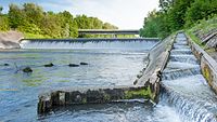
Straightening and renovationAfter constantly recurring damage to the bank and the costs of securing it, the kingdoms of Bavaria and Württemberg decided to “correct” the Iller in 1859; this straightening was completed in 1893. The course of the river from Memmingen to Ulm was shortened from 67.15 km to 56.6 km by means of several loop punctures, the gradient increased from 1.77 ‰ to 2.15 ‰. After that, the Iller dug in more deeply , at the level of Regglisweiler by around three and a half meters since 1926. The groundwater level sank and the Iller floodplains fell dry. For this reason and in order to give the river a natural appearance again, work began in 1996 to build thresholds and ramps into it and to reset its banks. Tourism and sport
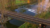
OthersBefore the Illerkanal was built in 1917, the body of water was an unrestrained and unpredictable mountain river. After heavy thunderstorms and two days of heavy rain on June 13 and 14, 1910, several floods occurred in the entire upper area of the Iller. On June 14, 1910, the floods tore the Iller Bridge at Egelsee near Memmingen with them. Parts of the dam between Illertissen and Dietenheim also burst. On Friday, June 16, 1910 at around 11 p.m., the masses of water brought the mighty wooden bridge between the two villages to collapse. Then soldiers of the Royal Württemberg Pioneer Battalion No. 13 from Ulm were called to help. When Iller disaster in 1957, 15 drowned during an exercise conscript soldiers of the Bundeswehr in the Iller, as a sergeant in the 2nd Company of the Airborne Police Battalion 19 from the Prince Franz barracks in Kempten his subordinates ordered unsecured to cross the river. At the Fischen railway bridge on the Immenstadt – Oberstdorf route over the Obere Iller, there were repeated blockages on the central pillar during flooding , which led to flooding. This problem is to be solved by a new pillarless bridge, the construction of which was carried out in autumn 2011. The Iller is the first tributary of the Danube that was important for rafting . See main article Rafting on the Iller . At the end of the 19th century, the section of the river Iller north of Memmingen, where it flows in a wide bed, was deepened and thus made navigable. The Iller is crossed by three historical bridges in Kempten: the König-Ludwig-Brücke , the only one of its kind in Germany, and the Upper Illerbrücken , the largest stamped concrete bridges in the world. All three bridges cross the deep gorge in the south of Kempten, were used at least temporarily for rail traffic and are close together. MemorandumThe motto for the Bavarian tributaries of the Danube begins with the Iller: “Iller, Lech, Isar, Inn literature
Web links
Commons : Iller - Collection of Images
Wiktionary: Iller - explanations of meanings, word origins, synonyms, translations
Individual evidence
|


