
Dietenheim
| coat of arms | Germany map | |
|---|---|---|

|
Coordinates: 48 ° 13 ' N , 10 ° 4' E |
|
| Basic data | ||
| State : | Baden-Württemberg | |
| Administrative region : | Tübingen | |
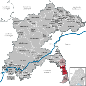
| County : | Alb-Danube district | |
| Height : | 513 m above sea level NHN | |
| Area : | 18.76 km 2 | |
| Residents: | 6715 (December 31, 2018) | |
| Population density : | 358 inhabitants per km 2 | |
| Postal code : | 89165 | |
| Area code : | 07347 | |
| License plate : | UL | |
| Community key : | 08 4 25 028 | |
City administration address : |
Königstrasse 63 89165 Dietenheim |
|
| Website : | ||
| Mayor : | Christopher Eh | |
| Location of the town of Dietenheim in the Alb-Donau district | ||
  |
||


Dietenheim is a town on the south-eastern edge of the Alb-Donau district in Baden-Württemberg .
geography
Dietenheim is halfway between Ulm and Memmingen an der Iller .
Expansion of the municipal area
Since the state border between Baden-Württemberg and Bavaria does not follow the current course of the Iller, but lies somewhat to the west of it, at the point where the river was at the beginning of the 19th century, Dietenheim and Regglisweiler will soon have this as they grow eastward Limit reached. This leads to the peculiarity that the sports facilities in Regglisweiler, a short stretch of Landesstraße 260 in Regglisweiler, the sports facilities in Dietenheim and some houses on the eastern outskirts of Dietenheim (on Grenzweg street ) are already in Bavaria.
Neighboring communities
The city borders in the south on Balzheim , in the west on Wain and Schwendi , both in the district of Biberach , in the north on Illerrieden and in the east on the Bavarian town of Illertissen , whereby behind the state border there is initially a strip that belongs to the community-free area "Auwald" before the actual area of the city of Illertissen begins.
City structure
In addition to the eponymous Dietenheim, the district of Regglisweiler , which comprises around a third of the total population, belongs to the city . The former Schlossgut Brandenburg (see also Brandenburg rulership ), today a church institution, is also on the city mark. Here, in 1816, the Württemberg separatists, led by a group from Rottenacker, attempted to found a radical pietist settlement. When the King of Württemberg refused permission, the separatists emigrated to Ohio and founded the Zoar settlement there. The group was formed in 1800 at the suggestion of the maid Barbara Grubenmann from Teufen in the Swiss canton of Appenzell Ausserrhoden , who was staying in Rottenacker.
history
prehistory
The first traces of human settlement in the Dietenheim area can be found from the Neolithic , an archaeological epoch that, in contrast to the previous Mesolithic, is associated with sedentarism and agriculture . On the former road to Weihungszell , a pierced serpentine hammer knob ax was found near the so-called “Stumpengraben” in 1908 (length 12.9 cm). Also belonging to the Neolithic is an ax made from green stone ( recovered from burial mound 1 in 1934) from the necropolis ( actually from the Hallstatt period ) located southwest of the Gerthof (see below ).
The extent to which the region around Dietenheim was used during the Bronze Age is unknown. The Iron Age is represented by two burial mounds near the Kreuthöfe (about one kilometer from Regglisweiler ) and the former burial mound field at Gerthof mentioned above. The ground monuments , which have meanwhile been completely leveled, still counted 19 burial mounds in "2 groups - from 8 to 23 m in diameter and up to 1 m in height" in 1897. Already in 1900 all the hills seemed to have been ransacked. Subsequent excavations yielded a rather small number of finds, but these dated the necropolis to the Hallstatt period. The form of burial was consistently cremation . Comparable Iron Age burial sites are in the Illertal, for example near Kirchberg an der Iller or especially in the area around Tannheim (Württemberg) .
Antiquity
From Roman times , a coin from the time of Marc Aurel (between 161 and 180 Roman emperors ) has been found northwest of Dietenheim. An associated settlement is not known, but north of Unterbalzheim a former Roman estate with remains of a hypocaust complex is known.With the establishment of the Danube-Iller-Rhein-Limes , probably in the 3rd century AD, the area around today's Dietenheim probably fell again outside the imperial borders of Rome. There is historical evidence in this context of Roman border guards on the Iller and Danube , such as B. the cohors III Herculea Pannoniorum in Caelius Mons ( Kellmünz ) or the cohors V Valeria Frigum in Pinianis , an unknown fort near the mouth of the Iller .
middle Ages
A rampart from Regglisweiler ("Teufelsgraben") and two ramparts on the Altenberg near Dietenheim probably date from the Middle Ages . Unfortunately, damage has only recently been caused by robbery excavations .


In 973 Dietenheim was mentioned for the first time as Töttinheim in a document from the Reichenau monastery. As early as 1280, Dietenheim received town charter from Count Hartmann and Otto von Brandenburg, after it had become an imperial property in an agreement with King Rudolf von Habsburg , with simultaneous lending to the counts - hence its coat of arms with a Habsburg shield and imperial eagle . The city passed from Count Hartmann and Brandenburg to Burchart von Ellerbach in 1313.
Rule of the Fuggers
In 1446 the Ulm patrician Heinrich Krafft ( Ludwig's brother ) bought the rule, which fell to Hans von Rechberg in 1481 and to Count Anton Fugger in 1539 . The city remained under their rule until mediatization in 1806.
In the Thirty Years' War Teodone to have been burned down. French troops occupied the city in 1796 and 1800.
Württemberg time
In 1806 the city fell to the Kingdom of Bavaria , but in 1810 it was added to the Kingdom of Württemberg , which downgraded the former city to a third class municipality and added the Landvogtei on the Danube in the Oberamt Wiblingen . In 1818 the Oberamt Wiblingen and thus also Dietenheim came to the newly created Danube District . The Oberamt Wiblingen was renamed Oberamt Laupheim in 1845 . In the 1830s, Johann Gottlieb Freiherr von Süßkind from Augsburg bought the Dietenheim estate, from which it was inherited by the Barons von Herman auf Wain .
In 1938, Dietenheim came to the Ulm district as part of a regional reform in Württemberg during the Nazi era .
post war period
In 1945 Dietenheim came as part of the district of Ulm into the American zone of occupation and thus belonged to the newly founded state of Württemberg-Baden , which was incorporated into the current state of Baden-Württemberg in 1952.
In 1953 the place was given city rights again. The formerly independent Regglisweiler voted in a vote for a merger with Dietenheim. The incorporation took place on January 1, 1972. During the district reform carried out in 1973 , Dietenheim was incorporated into the Alb-Danube district .
Religions
history

The formerly purely Catholic parish has the parish church of St. Martinus , built in 1589 by Philipp Eduard, Oktavian and Raimund Fugger and later rebuilt or expanded, and the parish church of St. Johannes Baptista in Regglisweiler, built in 1841. In the Regglisweiler district is the Brandenburg Monastery , a monastery of the community of the Immaculate Sisters of the Seraphic Apostolate , which operates several social institutions in the region.
Due to the influx of numerous refugees after the Second World War , a Protestant church was built in 1955.
There is also a New Apostolic Congregation and a Turkish-Islamic Cultural Association. V.
Denomination statistics
According to the 2011 census , more than half of the population still belonged to the Catholic Church; In 2011, 17.2% of the population were Protestant , 55.9% Roman Catholic and 26.9% were non-denominational , belonged to another religious community or did not provide any information. The number of Protestants and Catholics has fallen since then. Currently (as of December 31, 2019) of the population, 1,044 (15.4%) are Protestant, 3,302 (48.7%) Roman Catholic and 2,438 (35.9%) are non-denominational or belong to another religious community.
politics
Administrative association
Dietenheim is the seat of the community administration association Dietenheim , to which, in addition to the city of Dietenheim, the communities of Balzheim and Illerrieden belong.
Municipal council
The municipal council in Dietenheim has 18 members. The municipal council consists of the elected voluntary councilors and the mayor as chairman. The mayor is entitled to vote in the municipal council. The local elections on May 26, 2019 led to the following result:
| Party / list | Share of votes | Seats | 2014 |
| CDU / citizen list | 45.1% | 8th | 47.1%, 9 seats |
| Independent / SPD | 54.9% | 10 | 52.9%, 10 seats |
| voter turnout | 56.2% | 48.1% | |
coat of arms
Blazon: split, in front a silver bar in red, behind in silver a half, red armored black eagle at the gap
mayor
The mayor is elected for an eight-year term. The term of office of Sigisbert Straub ( CDU ) ended on June 1, 2012. Christopher Eh has been the new mayor since June 16, 2012.
Economy and Infrastructure
- Otto brothers spinning mill since 1901
- Etimex Primary Packaging GmbH
traffic
Dietenheim is located at junction 124 (“Illertissen”) of the federal motorway 7, which runs in a north-south direction .
There is also a rail connection to Ulm and Memmingen in the neighboring Bavarian town of Illertissen.
media
The Illertal-Bote , which is a regional edition of the Südwest-Presse , appears in Dietenheim .
societies
In 1313 a vigilante group was established , which was formed again after its dissolution during the Third Reich in 1949 and paraded together with the marching band on festive occasions. Although they belong to Baden-Württemberg, they wear the uniform of the Royal Bavarian Grenadiers, in view of their long membership of the Fuggers.
The city of Dietenheim's volunteer fire brigade has existed since 1872 , and since 1972 it is also the base fire brigade for the Illertal. The Dietenheim volunteer fire brigade is divided into the Dietenheim and Regglisweiler emergency departments. In 1970 the youth fire brigade was founded. After a 15-month construction period, the new fire station in Industriestrasse was put into operation on July 23, 2010.
The Dietenheim gymnastics club has existed since 1872.
In 1901 the Liederkranz Dietenheim was created, in 1905 the TSV Regglisweiler was founded. In 1973 the Ranzenburger fools guild was founded.
Dietenheim was the home of FC Auwald, the (so far) worst football club in Germany. A 0:33 is reported as the highest defeat. The team took last place in the C-Class Danube for twelve years; She couldn't relegate because it was the lowest division. FC Auwald stopped playing in 1974.
sons and daughters of the town
- Martin Brenner (1548–1616), Catholic prince-bishop of the diocese of Seckau from 1585 to 1615
- Franz Xaver Forchner (1717–1751), baroque painter
- Chrysostomus Forchner (1721–1791), baroque painter
- Jakob Speth (1820–1856), church painter
- Hugo Hodrus (1875–1925), administrative lawyer, chief magistrate in Riedlingen
- Wilhelm Leger (1894–1964), Mayor of Biberach an der Riß (born in Regglisweiler, which was still an independent suburb at the time)
- Anton Herre (1910–1993), auxiliary bishop in the Rottenburg-Stuttgart diocese
Personalities
- Pirmin Holzschuh (* 1968 in Illertissen), priest monk, prior of the Stiepel monastery. He grew up on the Kreuthöfe near Dietenheim.

Tower with five points

Kirchstrasse

graveyard

Fuggerhaus


literature
- Kurt Bittel , Wolfgang Kimmig , Siegwalt Schiek (ed.): The Celts in Baden-Württemberg . Stuttgart 1981, p. 483 ff.
- Wolfgang Czysz , Karlheinz Dietz , Thomas Fischer , Hans-Jörg Kellner (Hrsg.): The Romans in Bavaria . Stuttgart 1995, p. 365.
- The city and district of Ulm. Official district description. Edited by the Baden-Württemberg State Archives Administration in conjunction with the City of Ulm and the District of Ulm (1972) p. 38 f.
- Find reports from Baden-Württemberg . Volume 2. Schweizerbart'sche Verlagbuchhandlung. Stuttgart 1975, p. 219.
- Find reports Swabia VIII . 1900, p. 13 f.
- Find reports from Swabia NF 1 . 1922, p. 25 f.
- Hartwig Zürn : The prehistoric and early historical site monuments and the medieval castle sites in the districts of Göppingen and Ulm . Publ. State Office for monument protection Stuttgart A 6, Stuttgart 1961, p. 20 f.
- http://423930.forumromanum.com/member/forum/entry_ubb.user_423930.1181191151.1107341090.1107341090.1.raubgrabung_an_roemerschanze_zerstoerung_besonderem_kulturdenkmal-history_coburg.html
Web links
Individual evidence
- ↑ State Statistical Office Baden-Württemberg - Population by nationality and gender on December 31, 2018 (CSV file) ( help on this ).
- ↑ http://www.dietenheim.de/servlet/PB/menu/1216695_l1/index.html
- ^ Eberhard Fritz: Radical Pietism in Württemberg. Religious ideals in conflict with social realities (sources and research on Württemberg church history, volume 18). Epfendorf 2003. pp. 197-200.
- ^ Find reports from Schwaben NF 1 (1922) p. 25 f.
- ↑ a b The city and district of Ulm. Official district description. Edited by the Baden-Württemberg State Archives Administration in conjunction with the City of Ulm and the District of Ulm (1972) p. 38 f.
- ↑ a b c Find reports Schwaben VIII (1900) p. 13 f.
- ↑ a b H. Zürn, The prehistoric and early historical site monuments and the medieval castle sites in the districts of Göppingen and Ulm. Publ. State Office for monument protection Stuttgart A 6 (Stuttgart 1961) p. 20 f.
- ↑ K. Bittel, W. Kimmig, S. Schiek (Ed.), Die Kelten in Baden-Württemberg (Stuttgart 1981) p. 483 ff.
- ↑ Find reports from Baden-Württemberg Volume 2. Schweizerbart'sche Verlagbuchhandlung. (Stuttgart 1975) p. 219.
- ^ W. Czysz, K. Dietz, T. Fischer, HJ Kellner (eds.), Die Römer in Bayern (Stuttgart 1995) p. 365.
- ↑ http://423930.forumromanum.com/member/forum/entry_ubb.user_423930.1181191151.1107341090.1107341090.1.raubgrabung_an_roemerschanze_zerstoerung_besonderem_kulturdenkmal-history_coburg.html
- ↑ Alwin Sing: Historical mountain home. In: General information on Bergheim. Archived from the original on October 20, 2008 ; Retrieved June 25, 2008 .
- ^ Federal Statistical Office (ed.): Historical municipality directory for the Federal Republic of Germany. Name, border and key number changes in municipalities, counties and administrative districts from May 27, 1970 to December 31, 1982 . W. Kohlhammer, Stuttgart / Mainz 1983, ISBN 3-17-003263-1 , p. 457 .
- ^ City of Dietenheim Religion , 2011 census
- ↑ City of Dietenheim annual statistics 2019 Church / religious affiliation Inhabitants Main and secondary residence S8 , accessed on April 13, 2020
- ↑ State Statistical Office Baden-Württemberg, result of the municipal council elections 2019 - City of Dietenheim
- ↑ https://www.dietenheim.de/,Lde/startseite/unsere+stadt/wappen.html

Allmendingen | Altheim | Altheim (Alb) | Amstetten | Asselfingen | Ballendorf | Balzheim | Beimerstetten | Berghulen | Bernstadt | Blue beers | Bluestone | Börslingen | Breitingen | Dietenheim | Dornstadt | Ehingen (Danube) | Emeringen | Emerkingen | Erbach | Griesingen | Grundsheim | Hausen am Bussen | Heraldstatt | Holzkirch | Hüttisheim | Illerkirchberg | Illerrieden | Laichingen | Langenau | Lauterach | Lonsee | Merklingen | Munderkingen | Neenstetten | Nellingen | Nerenstetten | Oberdischingen | Obermarchtal | Upper Stadium | Öllingen | Öpfingen | Rammingen | Rechtenstein | Rottenacker | Schelblades | Lace-ups | Setzingen | Staig | Untermarchtal | Lower Stadium | Unterwachingen | Weidenstetten | Westerheim | Westerstetten