
Grundsheim
| coat of arms | Germany map | |
|---|---|---|

|
Coordinates: 48 ° 11 ' N , 9 ° 40' E |
|
| Basic data | ||
| State : | Baden-Württemberg | |
| Administrative region : | Tübingen | |
| County : | Alb-Danube district | |
| Height : | 532 m above sea level NHN | |
| Area : | 3.7 km 2 | |
| Residents: | 221 (December 31, 2018) | |
| Population density : | 60 inhabitants per km 2 | |
| Postal code : | 89613 | |
| Area code : | 07357 | |
| License plate : | UL | |
| Community key : | 08 4 25 052 | |
| Address of the municipal administration: |
Kirchweg 1 89613 Grundsheim |
|
| Website : | ||
| Mayor : | Uwe Handgrätinger | |
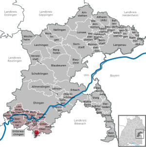
| Location of the community Grundsheim in the Alb-Donau district | ||
  |
||

Grundsheim is a municipality in the Alb-Donau district in Baden-Württemberg ( Germany ). She belongs to the administrative community Munderkingen .
geography
Grundsheim is about 15 kilometers south of Ehingen (Danube) .
Neighboring communities
The community is bordered by Oberstadion to the north and east , Attenweiler to the south and Uttenweiler to the west , both in the Biberach district .
history
The place was first mentioned in 1083 as Grundelheim . In 1789 the lordship of Grundsheim was sold to Prince Karl von Thurn und Taxis , and in 1806 the place fell to Württemberg .
The district of Riedlingen was added to the municipality in 1809, which from 1938 belonged to the district of Ehingen . In 1971 she joined the Munderkingen administrative association , and has been part of the Alb-Donau district since 1973 .
In the state elections in Baden-Württemberg in 2011 , the CDU achieved its highest result nationwide with 81.9 percent. In 1976, 99.2 percent of those eligible to vote voted for the CDU, and at that time 100% of the second votes.
Religions
The place has had its own parish since 1275 . Grundsheim is still predominantly Catholic today; today's St. Martin's Church was built in the 1720s .
Web links
Individual evidence
- ↑ State Statistical Office Baden-Württemberg - Population by nationality and gender on December 31, 2018 (CSV file) ( help on this ).
- ^ Report from a CDU stronghold in the Ländle-Das Schwarze Paradies, April 14, 2011
- ↑ cf. The black Näscht-Ganz Baden-Württemberg loves the green. Really? A small community in the Alb-Donau district is resisting. A visit to the place where 81.9 percent voted for the CDU , freitag.de, April 5, 2011 .
- ↑ Election result ( Memento of the original from December 25, 2015 in the Internet Archive ) Info: The archive link was inserted automatically and has not yet been checked. Please check the original and archive link according to the instructions and then remove this notice. , State Statistical Office of Baden-Württemberg

Allmendingen | Altheim | Altheim (Alb) | Amstetten | Asselfingen | Ballendorf | Balzheim | Beimerstetten | Berghulen | Bernstadt | Blue beers | Bluestone | Börslingen | Breitingen | Dietenheim | Dornstadt | Ehingen (Danube) | Emeringen | Emerkingen | Erbach | Griesingen | Grundsheim | Hausen am Bussen | Heraldstatt | Holzkirch | Hüttisheim | Illerkirchberg | Illerrieden | Laichingen | Langenau | Lauterach | Lonsee | Merklingen | Munderkingen | Neenstetten | Nellingen | Nerenstetten | Oberdischingen | Obermarchtal | Upper Stadium | Öllingen | Öpfingen | Rammingen | Rechtenstein | Rottenacker | Schelblades | Lace-ups | Setzingen | Staig | Untermarchtal | Lower Stadium | Unterwachingen | Weidenstetten | Westerheim | Westerstetten