Ballendorf
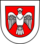
| coat of arms | Germany map | |
|---|---|---|

|
Coordinates: 48 ° 33 ' N , 10 ° 5' E |
|
| Basic data | ||
| State : | Baden-Württemberg | |
| Administrative region : | Tübingen | |
| County : | Alb-Danube district | |
| Height : | 545 m above sea level NHN | |
| Area : | 14.21 km 2 | |
| Residents: | 646 (December 31, 2018) | |
| Population density : | 45 inhabitants per km 2 | |
| Postal code : | 89177 | |
| Area code : | 07340 | |
| License plate : | UL | |
| Community key : | 08 4 25 013 | |
| Address of the municipal administration: |
Mehrstetter Strasse 13 89177 Ballendorf |
|
| Website : | ||
| Mayoress : | Renate Bobsin | |
| Location of the municipality of Ballendorf in the Alb-Donau district | ||
Ballendorf with its suburb of Mehrstetten is a municipality in the Alb-Donau district in Baden-Württemberg .
The community belongs to the community administration association Langenau with seat in Langenau .
geography
Geographical location
Ballendorf lies between the " Hungerbrunnen " near Altheim and the Lone Valley on the Swabian Alb . The place is located in a hollow at the beginning of the Mönchtal , which is open to the Lone , and is almost entirely surrounded by forest.
Neighboring communities
The community borders in the north on the district Heuchlingen of the community Gerstetten in the district of Heidenheim , in the east on Setzingen , in the south on Nerenstetten and in the west on Börslingen and Altheim (Alb) .
history
The place was first mentioned in a document in 1143. During the time of the tribal duchies , the place was in the Duchy of Swabia . In addition to plague and cholera , Ballendorf was hit by a catastrophically poor harvest in 1817, which led to a large number of Ballendorf residents emigrating to America . In the later years of the 18th and 19th centuries, the male Ballendorf residents were known for their love of drinking and fighting. At that time the rumor persisted until the beginning of the 20th century that a Ballendorfer always carried a sharpened and dirty knife with him.
politics
Municipal council
The municipal council in Ballendorf has 8 members. The local elections on May 25, 2014 led to the following official final result. The municipal council consists of the elected voluntary councilors and the mayor as chairperson. The mayor is entitled to vote in the municipal council.
| Parties and constituencies |
% 2014 |
Seats 2014 |
% 2009 |
Seats 2009 |
|
|
| UW | Independent voters | 51.6 | 4th | not known | not known | |
| FW | Free voters | 48.4 | 4th | not known | not known | |
| total | 100.0 | 8th | 100.0 | 8th | ||
| voter turnout | 71.0% | 75.2% | ||||
Attractions
The Protestant parish church of St. Martin was first mentioned in a document in 1295. It is located on the Kirchberg in the old town center of Ballendorf and is surrounded by the old cemetery and fortifications. In times of war it served the residents as a fortified church until the 16th century .
Web links
- Ballendorf at LEO-BW
Individual evidence
- ↑ State Statistical Office Baden-Württemberg - Population by nationality and gender on December 31, 2018 (CSV file) ( help on this ).
- ^ Municipalities and mayors in the Alb-Donau district


