
Börslingen
| coat of arms | Germany map | |
|---|---|---|

|
Coordinates: 48 ° 32 ' N , 10 ° 4' E |
|
| Basic data | ||
| State : | Baden-Württemberg | |
| Administrative region : | Tübingen | |
| County : | Alb-Danube district | |
| Height : | 560 m above sea level NHN | |
| Area : | 6.29 km 2 | |
| Residents: | 164 (December 31, 2018) | |
| Population density : | 26 inhabitants per km 2 | |
| Postal code : | 89177 | |
| Area code : | 07340 | |
| License plate : | UL | |
| Community key : | 08 4 25 022 | |
| LOCODE : | DE B33 | |
| Address of the municipal administration: |
Hauptstrasse 25 89177 Börslingen |
|
| Mayor : | Heinrich Wolf | |
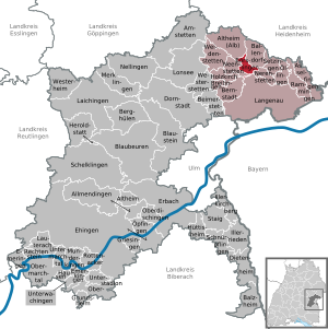
| Location of the municipality of Börslingen in the Alb-Donau district | ||
  |
||

Börslingen is a municipality in the Alb-Donau district and with around 180 inhabitants one of the smallest independent municipalities in Baden-Württemberg .
The community belongs to the community administration association Langenau with seat in Langenau .
location
Börslingen is located at 561 m above sea level on the Lower Alb , a plateau north of the Lone Valley and about 15 kilometers north of Ulm .
The district borders in the north on Altheim (Alb) , in the east on Ballendorf and Nerenstetten , in the south on the city of Langenau and in the west on Neenstetten .
history
After successful site inspections by a volunteer employee of the State Office for the Preservation of Monuments in Baden-Württemberg , an excavation team from the University of Tübingen under the direction of Harald Floss was able to examine a new Paleolithic site in the parish of the community . In the course of two excavations, which took place in autumn 2011 and in spring 2012, several concentrations of settlements were uncovered, which yielded several thousand finds, mainly stone tools. The site was first visited at the time of the Neanderthals . This makes Börslingen in the Swabian Alb area one of the oldest sites in human history. The site was probably also visited during the Aurignacia , i.e. the same time almost 40,000 years ago when the famous Vogelherd figures and the lion man from the barn were created. The square owes its importance primarily to the occurrence of so-called chert stones , which were extracted by prehistoric people at this point and from which they made their tools and weapon points. The special importance of the excavations results from the fact that Börslingen is the first safe site of the Paleolithic in this area after a total of more than 150 years of research , which is not in caves but in open land on the plateau of the Swabian Alb.
coat of arms
The Börslinger coat of arms shows in a split shield on the left a silver church flag in red , on the right in silver a red double-walled purse with pegs and hanging blue nests .
economy
The village is structured agriculturally . In 2003 there were seven full-time farms and a few part-time farmers who together farmed around 440 hectares. Dairy farming is predominant. There is also an industrial engraving company and an inn in the village.
Attractions
The center of the village is the Evangelical Church of St. Bernard. An old row of winter linden trees accompanies the path to the Lone Valley in the south .

Saint Bernhard Church in Börslingen

Row of winter linden trees near Börslingen

A Stone Age open-air station near Börslingen, as it was archaeologically explored and excavated in 2013


Individual evidence
- ↑ State Statistical Office Baden-Württemberg - Population by nationality and gender on December 31, 2018 (CSV file) ( help on this ).
Web links
- Börslingen at LEO-BW

Allmendingen | Altheim | Altheim (Alb) | Amstetten | Asselfingen | Ballendorf | Balzheim | Beimerstetten | Berghulen | Bernstadt | Blue beers | Bluestone | Börslingen | Breitingen | Dietenheim | Dornstadt | Ehingen (Danube) | Emeringen | Emerkingen | Erbach | Griesingen | Grundsheim | Hausen am Bussen | Heraldstatt | Holzkirch | Hüttisheim | Illerkirchberg | Illerrieden | Laichingen | Langenau | Lauterach | Lonsee | Merklingen | Munderkingen | Neenstetten | Nellingen | Nerenstetten | Oberdischingen | Obermarchtal | Upper Stadium | Öllingen | Öpfingen | Rammingen | Rechtenstein | Rottenacker | Schelblades | Lace-ups | Setzingen | Staig | Untermarchtal | Lower Stadium | Unterwachingen | Weidenstetten | Westerheim | Westerstetten