
Attenweiler
| coat of arms | Germany map | |
|---|---|---|

|
Coordinates: 48 ° 8 ' N , 9 ° 42' E |
|
| Basic data | ||
| State : | Baden-Württemberg | |
| Administrative region : | Tübingen | |
| County : | Biberach | |
| Height : | 596 m above sea level NHN | |
| Area : | 27.2 km 2 | |
| Residents: | 1934 (Dec. 31, 2018) | |
| Population density : | 71 inhabitants per km 2 | |
| Postal code : | 88448 | |
| Area code : | 07357 | |
| License plate : | BC | |
| Community key : | 08 4 26 011 | |
| LOCODE : | DE A45 | |
| Address of the municipal administration: |
Bachstrasse 7 88448 Attenweiler |
|
| Website : | ||
| Mayoress : | Monika Brobeil (independent) | |
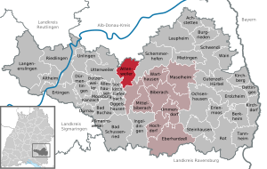
| Location of the community of Attenweiler in the district of Biberach | ||
  |
||

Attenweiler is a municipality in the district of Biberach in Baden-Württemberg .
geography
location
Attenweiler is around ten kilometers northwest of Biberach in a flat hilly Altmoränenlandschaft in which the terminal moraine of Rißeiszeit in tertiary merges hills.
Community structure
The community is divided into three districts:
- Attenweiler with Gutershofen , Hausen ob Rusenberg , Rusenberg and Schammach
- Oggelsbeuren with Aigendorf , Ellighofen , Riedenhof and Willenhofen
- Rupertshofen with Vogelhof
history
Community merger
The current community was formed on January 1, 1975 by the union of the communities Attenweiler, Oggelsbeuren and Rupertshofen .
History of Attenweiler

The place Attenweiler was first mentioned in 1254 as the seat of local nobility. The lords of Atinwilare are recorded from 1254 to 1296. Between 1347 and 1531, the Heilig-Geist-Spital in Biberach an der Riss gradually acquired almost all of the village. As in the equal imperial city of Biberach, services of both denominations were celebrated in Attenweiler from 1548. In the course of mediatization in 1803 with Biberach to the Counts of Sternberg-Manderscheid, in 1835 they sold the property to the Kingdom of Württemberg .
Until the end of the Thirty Years' War (1618–1648), today's district of Rusenberg belonged to the Catholic Jakob Schenk von Stauffenberg , who sold it to the Franciscan monastery in Oggelsbeuren in 1656 because he had moved to Riississen due to an inheritance .
History of Oggelsbeuren

The village of Oggelsbeuren, north of Attenweiler, was first mentioned in 1275 as Oggelspurren , and from the 16th century it was also often called Oberspeiren . The church and parish were incorporated into Buchau Abbey before 1363 . The place was owned by the Counts of Grüningen-Landau , from the beginning of the 14th century part of the Warthausen rulership and with this from 1331 in the possession of the House of Habsburg . Until 1446 the place divided the changing pledges of Warthausen. From 1446 the Lords of Stein were enfeoffed with the place. Presumably they placed the place under the knighthood of Danube under the imperial knighthood in the 16th century . In 1695 the place came into the possession of the Buchau monastery, with the secularization in 1803 to the princes of Thurn and Taxis . State sovereignty fell to the Kingdom of Württemberg in 1806, which administered the place from 1810 as part of the Riedlingen District Office. Until 1849 Oggelsbeuren was also under the civil administration of the Thurn and Taxis.
History of Rupertshofen

Grave finds prove an Alemannic settlement in the early Middle Ages. Rupertshofen has shared the history of Oggelsbeuren as part of the Warthausen rule since the Middle Ages . The Rupertshofen parish was founded in 1788, previously it was a branch of the Oggelsbeuren parish. Since 1811 Rupertshofen had its own mayor's shop . The Vogelhof hamlet was a meeting place for beggars, crooks and traveling people in the 18th century.
Religions
In the community there are the Catholic parishes of St. Blasius in Attenweiler, St. Johannes Baptist in Oggelsbeuren and St. Vitus in Rupertshofen, which belong to the Biberach deanery of the Rottenburg-Stuttgart diocese .
The Evangelical Church Community Attenweiler belongs to the Biberach church district of the Evangelical State Church in Württemberg . In addition to the political community of Attenweiler, it includes Uttenweiler with Sauggart and Ahlen, the districts of Aßmannshardt and Alberweiler of the community of Schemmerhofen and the district of Moosbeuren of the community of Oberstadion . The Evangelical Church Community has a total of 1,050 members (status: autumn 2004).
City council and mayor
The community council in Attenweiler has 12 members. It consists of the voluntary councilors and the mayor as chairwoman. The mayor is entitled to vote in the municipal council. In the local elections on May 26, 2019, the local council was elected by majority vote. Majority voting takes place if no or only one nomination has been submitted. The applicants with the highest number of votes are then elected. The turnout was 67.1% (2014: 58.9%).
Mayor Monika Brobeil was confirmed for a second term in the first ballot in July 2015.
economy
The community is characterized by agriculture and handicrafts.
Culture and sights
Buildings in Attenweiler
- Church of St. Blaise , built in 1722
- Evangelical church , built in 1843 in classicism style , renovated in 1975
- Former rectory built in 1732 in the Baroque style

Buildings in Oggelsbeuren
- Former Oggelsbeuren monastery : Franciscan convent founded in 1378 . In 1656 the monastery bought the Rusenberg estate from Jakob Schenk von Stauffenberg, who lived in Risstissen . In 1787 the monastery was closed; second settlement in 1854 by a Franciscan convent, which moved to Sießen monastery in 1859 ; from 1860 home of the "Pius care". Part of the buildings of the baroque new building from 1714 have been preserved; after a fire in 1953, the buildings were restored.
- Parish church of St. Johann Baptist , built in 1849 instead of a previous medieval building, renovated in 1974
- Chapel in Aigendorf, built in 1870 instead of an older chapel
Buildings in Rupertshofen
- Parish church of St. Vitus , built in 1810, tower from 1863, renovated in 1977
literature
- Kurt Diemer: Lecture 750 years of Attenweiler . In: Local history sheets for the Biberach district. 27th year 2004, issue 2, pp. 83-86.
- Paul Hespeler: Attenweiler. Two denominations and one village . Attenweiler community, Attenweiler 1993, ISBN 3-924489-67-X .
- Reinhold Mildenberger: Under imperial eagle and crook. Highlights of the village and church history of Attenweiler . Evangelical parish, Attenweiler 1986.
Web links
Individual evidence
- ↑ State Statistical Office Baden-Württemberg - Population by nationality and gender on December 31, 2018 (CSV file) ( help on this ).
- ^ Federal Statistical Office (ed.): Historical municipality directory for the Federal Republic of Germany. Name, border and key number changes in municipalities, counties and administrative districts from May 27, 1970 to December 31, 1982 . W. Kohlhammer, Stuttgart / Mainz 1983, ISBN 3-17-003263-1 , p. 545 .
- ↑ Preliminary results of the 2019 municipal council elections at the State Statistical Office
- ↑ https://www.staatsanzeiger.de/staatsanzeiger/wahlen/buergermeisterwahlen/attenweiler/

Achstetten | Alleshausen | Allmannsweiler | Altheim | Attenweiler | Bad Buchau | Bad Schussenried | Berkheim | Betzenweiler | Biberach an der Riss | Castles | Dettingen on the Iller | Dürmentingen | Dürnau | Eberhardzell | Erlenmoos | Erolzheim | Ertingen | Gutenzell-Hürbel | Hochdorf | Ingoldingen | Kanzach | Kirchberg an der Iller | Kirchdorf an der Iller | Langenenslingen | Laupheim | Maselheim | Mietingen | Mittelbiberach | Moosburg | Ochsenhausen | Oggelshausen | Riedlingen | Red on the red | Schemmerhofen | Schwendi | Seekirch | Steinhausen an der Rottum | Tannheim | Tiefenbach | Ummendorf | Unlingen | Uttenweiler | Wain | Warthausen