
Legau
| coat of arms | Germany map | |
|---|---|---|

|
Coordinates: 47 ° 51 ' N , 10 ° 8' E |
|
| Basic data | ||
| State : | Bavaria | |
| Administrative region : | Swabia | |
| County : | Unterallgäu | |
| Management Community : | Illerwinkel | |
| Height : | 667 m above sea level NHN | |
| Area : | 36.36 km 2 | |
| Residents: | 3290 (Dec. 31, 2019) | |
| Population density : | 90 inhabitants per km 2 | |
| Postal code : | 87764 | |
| Primaries : | 08330, 08394 | |
| License plate : | MN | |
| Community key : | 09 7 78 165 | |
| LOCODE : | DE LLU | |
| Market structure: | 51 parts of the community | |
Market administration address : |
Marktplatz 1 87764 Legau |
|
| Website : | ||
| Mayor : | Franz Abele ( CSU ) | |
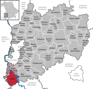
| Location of the Legau market in the Unterallgäu district | ||
  |
||

.jpg)


Legau is a market in the Swabian district of Unterallgäu and the seat of the administrative community Illerwinkel .
geography
location
Legau is located between the Iller, about 15 km south of Memmingen and 20 km north of Kempten in the Danube-Iller region in Central Swabia on the approximately 36 square kilometers large Legau plateau .
Expansion of the municipal area
The municipality consists of the districts Legau and Maria Steinbach.
Legau has 51 officially named parts of the municipality (the type of settlement is given in brackets ):
|
|
|
history
Until the church is planted
The name Legau comes from the word Gau and the prefix for hill. In the 11th century the name comes as Legöi , later as Legow . Loosely translated, this would mean district near the hills .
Several small stone age finds, which can be seen in the Memminger Museum, indicate a very early settlement of the Legau plateau. The oldest hamlet names such as Hofstatt, Strimo, Weno, Witzenberg and Felben probably go back to the Celtic times. Various coins from Roman times have also been found. The best known dates back to 337 and can be viewed in the Maximilian Museum. In 748 Legau was allocated to the Nibelgau under Franconian rule . Legau was first mentioned in a document in 766 in a letter of purchase from the St. Gallen Monastery , according to which various goods, farms, hubs and forests in the Legau area were bought by St. Gallen.
The community changed hands several times in the 14th and 15th centuries. In 1448 Legau was acquired with the Ehrensberg-Hohentann rule by Prince Abbot Pilgrim von Kempten for 3000 guilders . Legau remained a monastery fiefdom until the beginning of secularization and was assigned to the Bailiwick (from 1642 care office ) Hohentann. In 1455, Emperor Friedrich III. the community the market right . In 1483 she received a village court and in 1485 was given the ban on blood . On the Galgenberg , northwest of Legau, there is a memorial stone. As early as 1491 there were peasant unrest in the market. This ended in a comparison between the abbot and the peasant, which was signed in Memmingen. During the Peasants' War in 1525, Thomas Scherer from Legau was a captain at the head of the Legauer or Altusrieder heap. He was executed after the peasants were defeated. In the Thirty Years' War was raging plague in Legau. Between September and December 1628, 32 men, 46 women and 44 children died who were buried in the plague cemetery near Lehenbühl. In 1632 the Swedes came to Legau. During the war, the Abbey Kemptic area was divided into seven nursing offices. This began a drastic desertification in Legau , which would last until the middle of the 19th century. On February 14, 1704, during the War of the Spanish Succession , French and imperial hussars fought between Legau and Raggen (Württemberg), in which 16 French fell and 130 were captured.
With the beginning of secularization , Legau gained its independence from the Princely Monastery of Kempten and became Bavarian on January 1, 1806 . In 1818, with the second parish edict, the political community was established.
Rail connection
The connection to the railway to Memmingen was inaugurated on June 23, 1904. The Legauer Bahnhof formed the end of the line as a dead end. This was shut down on May 28, 1972 and almost completely dismantled by 1975.
Incorporations
On January 1, 1978, as part of the municipal reform, the previously independent municipality of Maria Steinbach (renamed December 28, 1954, former name: Steinbach) was incorporated into Legau. The place is known for its important Marian pilgrimage from the 18th century.
Population development
- 1961: 2850 inhabitants
- 1970: 2955 inhabitants
- 1987: 2894 inhabitants
- 1991: 2885 inhabitants
- 1995: 2933 inhabitants
- 2000: 3033 inhabitants
- 2005: 3102 inhabitants
- 2010: 3107 inhabitants
- 2015: 3207 inhabitants
Between 1988 and 2018 the community grew from 2,854 to 3,273 by 419 inhabitants or 14.7%.
politics
Municipal council
The local election on March 15, 2020 resulted in the following distribution of seats and votes:
- CSU-Free electorate: 5 seats (34.5%)
- Free voters Legau: 6 seats (35.9%)
- UW Maria Steinbach: 3 seats (19.0%)
- Greens / ÖDP / active citizens: 2 seats (10.7%)
Compared to the election of March 16, 2014, the CSU-Free electorate lost four seats, the Free Voters gained two more seats, as did Greens / ÖDP / Active, who recently moved into the municipal council.
mayor
Franz Abele (* 1967; CSU ) has been mayor since January 1, 2007 . He was elected for another six years on March 15, 2020 with 71.7% of the vote in a competitor.
coat of arms
The coat of arms was awarded on January 26, 1838 by King Ludwig I of Bavaria.
Blazon : "In the black damascus field a golden bundle of rods with an ax as a symbol of judgment."
The previous history of the award of the current historical coat of arms for the Legau market and the later heraldic evaluation of the fascis with partly different rendering of the coat of arms in the specialist literature may be an indication of a perhaps not entirely happy choice of the coat of arms symbolism. Three different proposals for the current coat of arms alone were unsatisfactory, so that the Reichsheroldsamt finally replaced them with their own and thus final fourth draft. All those involved were probably no longer aware that the Legau market certainly had its own municipal seal before 1559. Both in the earlier and in the current coat of arms, however, symbolic reference is made to the ancient former court of Legau with the village court from 1483 and the ban on blood from 1485, which was used by Emperor Friedrich III. was awarded. The colors black and gold refer to the coat of arms of the nobles von Hohenthann, who once ruled Legau.
Klemens Stadler and Friedrich Zollhoefer stated in the book “Wappen der Schwäbischen Gemeinde”, page 180 above, that the coat of arms of the Legau market “would have been better for the city of Rome than a Swabian market town”.
Attractions

.jpg)
Legau is on the Upper Swabian Baroque Road .
- Pilgrimage church Maria Schnee
- Pilgrimage Church of Maria Steinbach
- Parish Church of St. Gordian and Epimachus in Legau
- Baroque nativity scene in the Legau parish church
- Environmental station Unterallgäu
- Illersteg Legau, suspension bridge with observation tower (24.4 m high pylon with platform at 22.25 m height)
Economy and Infrastructure
In 2017 there were 1116 jobs subject to social security contributions in the municipality. Of the resident population, 1,325 people were in employment that was subject to compulsory insurance. This means that the number of out-commuters was 209 more than that of in-commuters. 35 residents were unemployed. In 2016 there were 104 farms.
- Wind power plant - 87764 Legau: Since 1999 a wind power plant has been operated about 1.5 km east (approx. 118 °) by a participation community of Legau. Investment approx. 1.1 million DM. Hub height 78 m, rotor diameter 44 m, nominal power 600 kW at 43 km / h wind speed. Electrical yield: approx. 750,000 kWh / a. CO 2 savings / year: 750 T kWh from wind result in 12 t CO 2 ; (from the manufacture of the WKA: 16 g CO 2 each kWhel generated later, calculated over a service life of 25 years); 750 T kWhel from lignite result in 877 t CO 2 with a coal KW with η = 35%; Saving 877-12 = 865 t CO 2 / year; this is the amount emitted by approx. 884 VW Lupos, 3.5 L petrol / 100 km, at 12,000 km, which is a common route size / year.
- Illerkraftwerk Maria Steinbach of Lechwerke Augsburg with 25 million kilowatt hours of regular generation per year
- Since 2016 there has been a fish ladder around the KW, against the direction of the river, which is intended to enable the fish to climb on a slight incline.
Well-known companies
- The globally and ecologically produced food manufacturer Rapunzel Naturkost GmbH is based in Legau .
education
The following institutions existed in 2018:
- Day care center garden: two with 161 approved places and 131 supervised children
- Primary schools: two with 11 classes, 14 teachers and 204 students
Personalities
- Joseph Echteler (1853–1908), sculptor
- Gotthard Haug (* 1958), manager
- Klaus Roggors (* 1956), musician, composer
Web links
- Official website of the Legau market
- Entry on Legau's coat of arms in the database of the House of Bavarian History
- Legau: Official statistics of the LfStat (PDF file; 1 MB)
Individual evidence
- ↑ "Data 2" sheet, Statistical Report A1200C 202041 Population of the municipalities, districts and administrative districts 1st quarter 2020 (population based on the 2011 census) ( help ).
- ^ Municipality of Legau in the local database of the Bayerische Landesbibliothek Online . Bayerische Staatsbibliothek, accessed on August 15, 2019 .. 52 districts there, as Engelharz is incorrectly listed twice.
- ↑ Upper Swabian place and field names , Julius Miedel , Verlag Th. Otto, Memmingen, 1906, page 8
- ↑ Memmingen - Legau railway line. Accessed May 2009 .
- ^ Wilhelm Volkert (ed.): Handbook of Bavarian offices, communities and courts 1799–1980 . CH Beck, Munich 1983, ISBN 3-406-09669-7 , p. 521 .
- ↑ a b c Federal Statistical Office (ed.): Historical municipality directory for the Federal Republic of Germany. Name, border and key number changes in municipalities, counties and administrative districts from May 27, 1970 to December 31, 1982 . W. Kohlhammer, Stuttgart / Mainz 1983, ISBN 3-17-003263-1 , p. 782 .
- ↑ Second votes, according to the source www.wahlen.bayern.de, accessed on March 4, 2018
- ↑ http://www.wahlen.bayern.de/kommunalwahlen/
- ↑ Baroque nativity scene in the parish church in Legau. Retrieved December 27, 2017 .
- ↑ Reference information sheet / project: Illersteg Legau on stahlbau-wegscheid.de
Legau | Aigholz | Ampo | Offshore wood | Benggen | Betttrichs | Bihls | Well mowing | Strollers | Ehrensberg | Angel resin | Duck moss | Felben | Fluhmühle | Dig | Greiters | Greut | Grub | Haid | Hofstatt | Hohmanns | Hub | Hummels | Kaltbronn | Cat moss | Kraivogels | Lausers | Lausers am Moos | Lehenbühl | Hole | May | Man Schwenden | Maria Steinbach | Moss | Neidegg | Neumühle | Oberau | Oberlandholz | Oberwaldegg | Oberwitzenberg | Roßschenkels | Sack | Strass | Strings | Strimo | Unterau | Underland wood | Unterwaldegg | Unterwitzenberg | Voglers | Weno

Amberg |
Apple trach |
Babenhausen |
Bad Grönenbach |
Bad Wörishofen |
Benningen |
Boars |
Boos |
Breitenbrunn |
Buxheim |
Dirlewang |
Egg an der Günz |
Eppishausen |
Erkheim |
Ettringen |
Fellheim |
Hawangen |
Heimertingen |
Holzgünz |
Kammlach |
Kettershausen |
Kirchhaslach |
Kirchheim in Swabia |
Kronburg |
Laughter |
Arbors |
Lautrach |
Legau |
Market Rettenbach |
Market forest |
Memmingerberg |
Mindelheim |
Niederrieden |
Oberrieden |
Oberschönegg |
Ottobeuren |
Pfaffenhausen |
Pleas |
Rammingen |
Salgae |
Sontheim |
Stetten |
Trunkelsberg |
Türkheim |
Tussenhausen |
Ungerhausen |
Unteregg |
Westerheim |
Wiedergeltingen |
Winter peace |
Wolfertschwenden |
Woringen
Municipality-free area in the district of Unterallgäu
Ungerhauser Wald