
Trunkelsberg
| coat of arms | Germany map | |
|---|---|---|

|
Coordinates: 48 ° 0 ' N , 10 ° 13' E |
|
| Basic data | ||
| State : | Bavaria | |
| Administrative region : | Swabia | |
| County : | Unterallgäu | |
| Management Community : | Memmingerberg | |
| Height : | 625 m above sea level NHN | |
| Area : | 1.94 km 2 | |
| Residents: | 1707 (Dec. 31, 2019) | |
| Population density : | 880 inhabitants per km 2 | |
| Postal code : | 87779 | |
| Area code : | 08331 | |
| License plate : | MN | |
| Community key : | 09 7 78 202 | |
| Community structure: | 2 parts of the community | |
| Association administration address: | Benninger Str. 3 87766 Memmingerberg |
|
| Website : | ||
| Mayor : | Roman Albrecht ( Greens ) | |
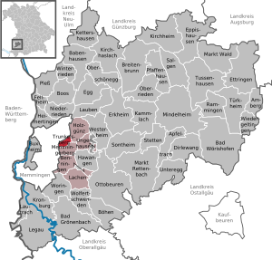
| Location of the municipality of Trunkelsberg in the Unterallgäu district | ||
  |
||

Trunkelsberg is a municipality in the Swabian district of Unterallgäu and a member of the Memmingerberg administrative community .
geography
Trunkelsberg is located directly on the city limits of Memmingen in the Donau-Iller region in Upper Swabia .
The municipal area consists only of the Trunkelsberg district . The municipality has two officially named parts of the municipality (the type of settlement is indicated in brackets ):
history

Until the church is planted
Trunkelsberg, along with Amendingen and Ungerhausen , was probably part of the founding equipment of the Ottobeuren monastery at the end of the 8th and beginning of the 9th century. In 972 Otto I. claimed these three villages again as royal property. In the course of time Trunkelsberg became the property of the Eisenburg rule . In 1455, Heinrich VI. von Eisenburg part of the rule, including Trunkelsberg, to the Memmingen patrician family Sättelin.
The place remained in the family's possession until 1645 and must then have passed into the possession of the Wachter, salt merchants from Memmingen, who had the castle built in 1647. Then Trunkelsberg was long owned by the Neubronner von und zu Eisenburg auf Trunkelsberg family until 1718, with the high and low jurisdiction remaining with the family until 1729. In 1729 the Trunkelsberg Castle with two farms, two Sölden and the jurisdiction passed into the possession of Elias Christoph Heuss . The Heuss acquired the title of nobility in 1738. Since then, the castle has remained in the possession of the Heuss-Blößt rulers. The place Trunkelsberg came with the Rhine Federation Act 1806 to the Kingdom of Bavaria . In 1818 the political municipality was established.
Religions
In Trunkelsberg there is the Roman Catholic St. Stanislaus Kostka Church, a branch of the Roman Catholic parish of St. Ulrich in Amendingen . The village does not have its own pastor.
The evangelical inhabitants of the community belong to the Evangelical Lutheran parish in Memmingerberg . Protestant services also take place regularly in the Catholic village church.
Population development
- 1961: 753 inhabitants
- 1970: 911 inhabitants
- 1987: 1400 inhabitants
- 1991: 1562 inhabitants
- 1995: 1671 inhabitants
- 2000: 1792 inhabitants
- 2005: 1784 inhabitants
- 2010: 1760 inhabitants
- 2015: 1683 inhabitants
Trunkelsberg is the most densely populated municipality in the Unterallgäu district. Between 1988 and 2018 the municipality grew from 1,454 to 1,698 by 244 inhabitants or 16.8%.
politics
mayor
Mayor has been Roman Albrecht (* 1958) ( Greens ) since May 2014 .
Municipal council
The distribution of seats in the 2014 municipal council elections was as follows:
- Greens: 5 seats
- Voter Association Unity: 7 seats
coat of arms
The coat of arms was approved by the government of Swabia on April 3, 1975.
Blazon : “Split by silver and red; in front a red saddle, behind a golden column with a cross and foundation. "
Decisive for the earlier local history was the now extinct Memmingen patrician family Sättelin, who owned the place from the middle of the 15th century until 1645 and carried the "talking" coat of arms of a saddle. The front half of the municipal coat of arms refers to this. Because of its legal and art-historical importance, the so-called Friedsaul standing in the corridor to the west of the town, which once marked the high-jurisdiction border of the imperial city of Memmingen, is represented in the coat of arms.
The design comes from the monastery archivist and district home administrator P. Aegidius Kolb and the design of the coat of arms was done by Kronach Karl Haas.
Culture and sights
Sights in Trunkelsberg are the Catholic Church of St. Stanislaus Kostka , the former Trunkelsberg Castle and the former workers' houses of the Künersberger Manufactur . The Unterallgäuhalle at the eastern entrance to the town is available for events.
Economy and Infrastructure
Economy including agriculture and forestry

In 1998, according to official statistics, there were no employees in the manufacturing sector and no employees in the trade and transport sector at the place of work. In other economic areas, 25 people were employed at the place of work subject to social security contributions. There were a total of 626 employees at the place of residence subject to social security contributions. There were no companies in the manufacturing or construction industries. In addition, there were seven agricultural holdings in 1999 with an agricultural area of 92 ha, of which 35 ha were arable land and 57 ha were permanent green space.
education
There is a kindergarten with 75 kindergarten places and 59 supervised children (status: 1999), as well as a small elementary school with a first and second grade, which is located in the community building.
Web links
- Entry on the Trunkelsberg coat of arms in the database of the House of Bavarian History
- Official online presentation of the community
- Trunkelsberg: Official statistics of the LfStat (PDF file; 1 MB)
Individual evidence
- ↑ "Data 2" sheet, Statistical Report A1200C 202041 Population of the municipalities, districts and administrative districts 1st quarter 2020 (population based on the 2011 census) ( help ).
- ^ Community Trunkelsberg in the local database of the Bavarian State Library Online . Bavarian State Library, accessed on August 15, 2019.
- ^ Philipp Jakob Karrer : Memminger Chronik , Memmingen 1805, p. 346 f.
- ↑ Second votes, according to the source www.wahlen.bayern.de, accessed on March 4, 2018
- ↑ Local elections in Bavaria on March 16, 2014 - results in Swabia , accessed on November 18, 2017.

Amberg |
Apple trach |
Babenhausen |
Bad Grönenbach |
Bad Wörishofen |
Benningen |
Boars |
Boos |
Breitenbrunn |
Buxheim |
Dirlewang |
Egg an der Günz |
Eppishausen |
Erkheim |
Ettringen |
Fellheim |
Hawangen |
Heimertingen |
Holzgünz |
Kammlach |
Kettershausen |
Kirchhaslach |
Kirchheim in Swabia |
Kronburg |
Laughter |
Arbors |
Lautrach |
Legau |
Market Rettenbach |
Market forest |
Memmingerberg |
Mindelheim |
Niederrieden |
Oberrieden |
Oberschönegg |
Ottobeuren |
Pfaffenhausen |
Pleas |
Rammingen |
Salgae |
Sontheim |
Stetten |
Trunkelsberg |
Türkheim |
Tussenhausen |
Ungerhausen |
Unteregg |
Westerheim |
Wiedergeltingen |
Winter peace |
Wolfertschwenden |
Woringen
Municipality-free area in the district of Unterallgäu
Ungerhauser Wald