
Salgae
| coat of arms | Germany map | |
|---|---|---|

|
Coordinates: 48 ° 8 ' N , 10 ° 29' E |
|
| Basic data | ||
| State : | Bavaria | |
| Administrative region : | Swabia | |
| County : | Unterallgäu | |
| Management Community : | Pfaffenhausen | |
| Height : | 558 m above sea level NHN | |
| Area : | 23.3 km 2 | |
| Residents: | 1441 (Dec. 31, 2019) | |
| Population density : | 62 inhabitants per km 2 | |
| Postcodes : | 87775, 87757 | |
| Area code : | 08265 | |
| License plate : | MN | |
| Community key : | 09 7 78 190 | |
| LOCODE : | DE 5SA | |
| Community structure: | 5 parts of the community | |
| Association administration address: | Main street 34 87772 Pfaffenhausen |
|
| Website : | ||
| Mayor : | Roland Hämmerle (independent) | |
| Location of the municipality of Salgen in the Unterallgäu district | ||
  |
||

Salgen is a municipality in the Swabian district of Unterallgäu and a member of the Pfaffenhausen administrative community .
geography
Salgen is located about 35 kilometers northeast of Memmingen in the Donau-Iller region in Central Swabia .
Expansion of the municipal area

The municipality consists of the districts Salgen, Bronnen and Hausen.
The municipality has 5 officially named municipal parts (the type of settlement is given in brackets ):
- Bronnen ( Kirchdorf )
- Bronnerlehe ( hamlet )
- Hausen ( parish village )
- Salgen (parish village)
- Simonsberg (hamlet)
The settlements of Buch, Fehrenbach, Rinolzried, Rohen, Sachsenau and Schattenhausen have gone.
history
Until the church is planted
Before 1800, Salgen was the seat of an upper and lower court and belonged to the rule of Mindelheim , which was part of the Electorate of Bavaria . In the course of the administrative reforms in Bavaria , today's municipality was created with the municipal edict of 1818 .
Incorporations
On May 1, 1978, the previously independent communities of Bronnen and Hausen were incorporated.
Population development
- 1961: 1120 inhabitants
- 1970: 1135 inhabitants
- 1987: 1227 inhabitants
- 1991: 1325 inhabitants
- 1995: 1398 inhabitants
- 2000: 1479 inhabitants
- 2005: 1443 inhabitants
- 2010: 1409 inhabitants
- 2015: 1448 inhabitants
Between 1988 and 2018 the municipality grew from 1,221 to 1,467 by 246 inhabitants or by 20.2%.

Chapel in Bronnen
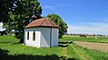
Oberfeld chapel near Hausen

Farmhouse in Hausen

Church in Hausen

Church in Salgen


politics
mayor
Max Miller (* 1921; Free Voters Salgen, Hausen, Bronnen) was mayor for 45 years, from 1945 to 1948 and from 1966 to 2008. At the time of leaving, he was 86 years old and the longest serving mayor in Bavaria. Miller died on December 31, 2016.
Miller's successor was Johann Egger from May 1, 2008 to April 30, 2020 (Mrs. Voters Association / Bürgerl. Block).
Mayor has been Roland Hämmerle since May 1, 2020. He was nominated as a joint applicant by the Free Voters' Group Salgen, Voters' Association Hausen and Free Voters' Community Bronnen and was elected with 98.9% of the votes.
Municipal council
The election on March 15, 2020 had the following result:
- Free group of voters Salgen: 5 seats (43.2%)
- Voter association Hausen: 4 seats (32.5%)
- Free community of voters Bronnen: 3 seats (24.3%)
Compared to the 2014 to 2020 term of office, the Hausen electoral association won a seat at the expense of the Salgen Free Voting Group, which was previously represented by 6 local councils.
tax income
In 2014, the municipal tax revenue was EUR 1,102,000, of which EUR 415,000 was business tax revenue (net).
coat of arms
The coat of arms was approved by the government of Swabia on July 31, 1979.
Blazon : "Above a blue corrugated shield base, inside a four-petalled golden rosette, a black lion standing on an upwardly curved red bar, looking out."
The black lion, standing on the red, upwardly curved bar, is facing the coat of arms of the Lords of Mindelberg, whose domain has included the area of today's municipality of Salgen since the 14th century. The blue corrugated shield base reminds of the location of the community in the boggy Mindeltal (Salger Moos), the golden rosette is taken from the cloister coat of arms of the Ottobeuren monastery, for which ownership in Salgen can be proven as early as the 11th century.
The coat of arms was designed by the heraldist Max Reinhart from Passau.
flag
The flag was approved by decision of the government of Swabia on September 17, 1980.
The flag is red and yellow striped with the municipal coat of arms.
Architectural monuments
Economy and Infrastructure
Economy including agriculture and forestry
In 1998 there were no employees subject to social security contributions in the manufacturing sector 133 and in the trade and transport sector. There were a total of 479 employees at the place of residence subject to social insurance contributions. There were three companies in the manufacturing sector. In addition, in 1999 there were 76 farms with an agricultural area of 1939 hectares, of which 767 hectares were arable land and 1,173 hectares were permanent green space.
education
In 1999 there was the following facility: a kindergarten with 50 kindergarten places.
Web links
- Internet presence of the municipality of Salgen
- Entry on the Salgen coat of arms in the database of the House of Bavarian History
- Salgen: Official statistics of the LfStat (PDF file; 1 MB)
Individual evidence
- ↑ "Data 2" sheet, Statistical Report A1200C 202041 Population of the municipalities, districts and administrative districts 1st quarter 2020 (population based on the 2011 census) ( help ).
- ^ Community Salgen in the local database of the Bavarian State Library Online . Bavarian State Library, accessed on August 15, 2019.
- ↑ a b c Federal Statistical Office (ed.): Historical municipality directory for the Federal Republic of Germany. Name, border and key number changes in municipalities, counties and administrative districts from May 27, 1970 to December 31, 1982 . W. Kohlhammer, Stuttgart / Mainz 1983, ISBN 3-17-003263-1 , p. 783 .
- ↑ Second votes, according to the source www.wahlen.bayern.de, accessed on March 4, 2018
- ^ Süddeutsche Zeitung of February 20, 2008, accessed on November 5, 2011
- ↑ Mindelheimer Zeitung on the death of Miller , accessed on January 3, 2017

Amberg |
Apple trach |
Babenhausen |
Bad Grönenbach |
Bad Wörishofen |
Benningen |
Boars |
Boos |
Breitenbrunn |
Buxheim |
Dirlewang |
Egg an der Günz |
Eppishausen |
Erkheim |
Ettringen |
Fellheim |
Hawangen |
Heimertingen |
Holzgünz |
Kammlach |
Kettershausen |
Kirchhaslach |
Kirchheim in Swabia |
Kronburg |
Laughter |
Arbors |
Lautrach |
Legau |
Market Rettenbach |
Market forest |
Memmingerberg |
Mindelheim |
Niederrieden |
Oberrieden |
Oberschönegg |
Ottobeuren |
Pfaffenhausen |
Pleas |
Rammingen |
Salgae |
Sontheim |
Stetten |
Trunkelsberg |
Türkheim |
Tussenhausen |
Ungerhausen |
Unteregg |
Westerheim |
Wiedergeltingen |
Winter peace |
Wolfertschwenden |
Woringen
Municipality-free area in the district of Unterallgäu
Ungerhauser Wald