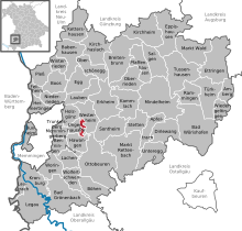
Ungerhauser Forest
Coordinates: 48 ° 0 ′ 0 ″ N , 10 ° 17 ′ 0 ″ E
The Ungerhauser Forest is a 3.26 km² community-free area in the Unterallgäu district in Bavarian Swabia . It is mostly forested and uninhabited.
Neighboring communities
| Community Westerheim |
||
| Community Ungerhausen |

|
Community Westerheim |
| Hawangen municipality |
Community Ungerhausen |
use
The area is mainly used for forestry.
Soil monuments
In the Ungerhauser Wald there is a medieval castle stable, which is listed under the file number D-7-8027-0013 in the soil monument list of the Bavarian State Office for Monument Preservation.
See also
Individual evidence
- ↑ Ungerhauser Wald archaeological monuments , as of August 13, 2016
Web links
Commons : Ungerhauser Wald - Collection of images, videos and audio files
- Expansion of the community-free area in OpenStreetMap (accessed on December 1, 2017)

