
Hawangen
| coat of arms | Germany map | |
|---|---|---|

|
Coordinates: 47 ° 58 ' N , 10 ° 16' E |
|
| Basic data | ||
| State : | Bavaria | |
| Administrative region : | Swabia | |
| County : | Unterallgäu | |
| Management Community : | Ottobeuren | |
| Height : | 637 m above sea level NHN | |
| Area : | 14.51 km 2 | |
| Residents: | 1315 (Dec. 31, 2019) | |
| Population density : | 91 inhabitants per km 2 | |
| Postal code : | 87749 | |
| Area code : | 08332 | |
| License plate : | MN | |
| Community key : | 09 7 78 149 | |
| Community structure: | 2 parts of the community | |
| Association administration address: | Marktplatz 6 87724 Ottobeuren |
|
| Website : | ||
| Mayor : | Ulrich Ommer ( CSU ) | |
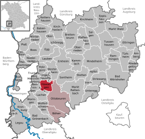
| Location of the community of Hawangen in the Unterallgäu district | ||
  |
||


Hawangen is a municipality in the Swabian district of Unterallgäu .
geography
Hawangen is about five kilometers to the east, halfway between Memmingen and Ottobeuren , in the Danube-Iller region in Upper Swabia .
Expansion of the municipal area
The community area consists of part of the district Hawangen (the other part of the district belongs to the community Benningen ).
The municipality owns the parish village Hawangen and part of the hamlet Moosbach (the other part Moos Bach belongs to the municipality laughter ).
history
Until the church is planted
Hawangen belonged to the early possession of the Ottobeuren Imperial Abbey, founded in 764 . With the Reichsdeputationshauptschluss of 1803, the place came to Bavaria. In the course of the administrative reforms in the Kingdom of Bavaria , today's municipality was created with the municipal edict of 1818 .
Administrative community
In 1975 Hawangen was assigned to the newly founded administrative association Ottobeuren as part of the regional reform .
Religions
The Roman Catholic parish church of St. Stephan in Hawangen dates from the 15th century .
Population development
- 1961: 980 inhabitants
- 1970: 1050 inhabitants
- 1987: 1019 inhabitants
- 1991: 1059 inhabitants
- 1995: 1194 inhabitants
- 2000: 1222 inhabitants
- 2005: 1239 inhabitants
- 2010: 1248 inhabitants
- 2015: 1350 inhabitants
Between 1988 and 2018 the municipality grew from 1,030 to 1,324 by 294 inhabitants or by 28.5%.
politics
The community is a member of the Ottobeuren administrative community .
mayor
Ulrich Ommer (CSU) has been mayor since 2019. Martin Heinz (* 1950) (CSU / Independent Voters) was the predecessor since 1984.
Municipal council
The result of the municipal council election on March 15, 2020 was as follows:
- CSU / Independent voters: 7 seats (55.38%)
- Free citizen list : 5 seats (44.62%).
Compared to the 2014 to 2020 term of office, the CSU lost one seat to the Free Citizens List.
coat of arms
|
|
Blazon : "Divided by gold and black, above two diagonally crossed black palm branches, below a golden miter with an applied rosette."
The community area was part of the initial equipment of the Benedictine monastery Ottobeuren, founded in 764. Since no other historical relationships of significance for the municipality can be proven, the colors gold and black of the Ottobeurer coat of arms were chosen as the basic colors for the municipal coat of arms. The two palm branches are the attributes of St. Stephan, who is the patron of the parish church in Hawangen. The miter shown in the lower half of the shield shows the typical Ottobeurer coat of arms rosette. The design of the coat of arms comes from the monastery archivist and district home administrator Aegidius Kolb and the design was done by Max Reinhart from Passau. The coat of arms was approved by the government of Swabia on September 9, 1982. |
flag
The flag is striped yellow-black-yellow with the municipal coat of arms.
Architectural monuments
Soil monuments


Economy and Infrastructure

Economy including agriculture and forestry
In 1998 there were four in agriculture and forestry, 345 in manufacturing and eight in trade and transport at the place of work. In other economic sectors 42 people were employed at the place of work subject to social security contributions. There were a total of 437 employees at the place of residence subject to social security contributions. There were seven companies in manufacturing and two in construction. In addition, in 1999 there were 40 farms with an agriculturally used area of 1091 hectares, 456 hectares of which were arable land and 635 hectares of permanent green area.
education
In 1999 the following institutions existed:
- Kindergarten: 75 kindergarten places with 61 supervised children
- Hawangen primary school
Personalities
- Josef "Sepp" Dietrich (1892–1966), Commander of the Leibstandarte SS Adolf Hitler , Colonel General of the Waffen SS and convicted war criminal
- Karl Schlögel (* 1948), cultural historian and cultural geographer
- Gabriele Strehle (* 1951), fashion designer
- Hans Hundegger (* 1954), entrepreneur
- Rainer Bendel (* 1964), Catholic theologian, church historian and university professor
- Frank Oehler (* 1964), cook and restaurateur ( Die Kochprofis )
Web links
- Local government
- Hawangen: Official statistics of the LfStat (PDF; 1 MB)
- The village chronicle: [1] divided into 3 documents - see website at the bottom
Individual evidence
- ↑ "Data 2" sheet, Statistical Report A1200C 202041 Population of the municipalities, districts and administrative districts 1st quarter 2020 (population based on the 2011 census) ( help ).
- ^ Municipality of Hawangen in the local database of the Bavarian State Library Online . Bayerische Staatsbibliothek, accessed on August 17, 2019.
- ↑ Serious changes ( page can no longer be accessed , search in web archives ) Info: The link was automatically marked as defective. Please check the link according to the instructions and then remove this notice. , Memminger Zeitung
- ↑ Second votes, according to the source www.wahlen.bayern.de, accessed on March 4, 2018
- ↑ http://www.wahlen.bayern.de/kommunalwahlen/
- ^ Entry on the coat of arms of Hawangen in the database of the House of Bavarian History

Amberg |
Apple trach |
Babenhausen |
Bad Grönenbach |
Bad Wörishofen |
Benningen |
Boars |
Boos |
Breitenbrunn |
Buxheim |
Dirlewang |
Egg an der Günz |
Eppishausen |
Erkheim |
Ettringen |
Fellheim |
Hawangen |
Heimertingen |
Holzgünz |
Kammlach |
Kettershausen |
Kirchhaslach |
Kirchheim in Swabia |
Kronburg |
Laughter |
Arbors |
Lautrach |
Legau |
Market Rettenbach |
Market forest |
Memmingerberg |
Mindelheim |
Niederrieden |
Oberrieden |
Oberschönegg |
Ottobeuren |
Pfaffenhausen |
Pleas |
Rammingen |
Salgae |
Sontheim |
Stetten |
Trunkelsberg |
Türkheim |
Tussenhausen |
Ungerhausen |
Unteregg |
Westerheim |
Wiedergeltingen |
Winter peace |
Wolfertschwenden |
Woringen
Municipality-free area in the district of Unterallgäu
Ungerhauser Wald