
Fellheim
| coat of arms | Germany map | |
|---|---|---|

|
Coordinates: 48 ° 4 ' N , 10 ° 9' E |
|
| Basic data | ||
| State : | Bavaria | |
| Administrative region : | Swabia | |
| County : | Unterallgäu | |
| Management Community : | Boos | |
| Height : | 566 m above sea level NHN | |
| Area : | 5.08 km 2 | |
| Residents: | 1152 (Dec. 31, 2019) | |
| Population density : | 227 inhabitants per km 2 | |
| Postal code : | 87748 | |
| Area code : | 08335 | |
| License plate : | MN | |
| Community key : | 09 7 78 139 | |
| LOCODE : | DE FHM | |
| Address of the municipal administration: |
87748 Fellheim | |
| Website : | ||
| Mayor : | Reinhard Schaupp (without nomination) | |
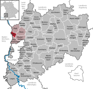
| Location of the community Fellheim in the Unterallgäu district | ||
  |
||

Fellheim is a municipality in the Swabian district of Unterallgäu , Bavaria .
geography
The village is located ten kilometers north of Memmingen in the Donau-Iller region in Upper Swabia . The municipal area consists only of the Fellheim district .
history
Until the church is planted
The community lies on the former line of fortifications of the Danube-Iller-Rhine-Limes , on the right side of the Iller between Kellmünz an der Iller and Memmingen . After several changes of ownership, Fellheim belonged to Barons Reichlin von Meldegg on January 25, 1555, when the fiefdom was handed over from the Prince of Kempten . The Reichlin von Meldegg family originally came from near Hohenems in what is now Vorarlberg. Fellheim was the seat of the rule of the same name. Two years later, construction of the castle began. In 1620 the Freiherrschaft received the right to exercise the blood ban. During the Thirty Years' War the village was plundered and completely devastated by Sweden and imperial troops. In the years 1636 to 1643 no person lived in the place anymore. A single farmer returned home from the war. The fields remained uncultivated during that time. The local lord, who had fled to Switzerland, returned to Fellheim in 1643. In order to increase the number of inhabitants, Baron Phillip Bernhard von Reichlin-Meldegg settled five Jewish families in Fellheim in 1670.
With the Rheinbund act 1806 the place came to Bavaria . In the course of the administrative reforms in Bavaria, today's municipality was created with the municipal edict of 1818 .
Jewish community
The Jewish community existed until 1943 and made up the majority of the local population. In the townscape, south of the castle, the Jewish ensemble can still be seen today, which consisted of a synagogue , cemetery , school , residential and commercial buildings.
Pilgrimage to the Holy Cross in Pless
The atonement foot pilgrimage to the Holy Cross of Pless is an atonement foot pilgrimage that dates back to 1665 and was reintroduced in 1973, starting in the parish church of the Sacred Heart of Jesus in Fellheim, to an allegedly miraculous cross in the Kreuzkapelle in the district of Pless in the district three kilometers away Unterallgäu. The pilgrimage takes place every second Monday from May to October in the evening before sunset. Up to 3000 pilgrims from the Illertal and the surrounding area take part in it.
Fellheim Synagogue
Jacob Bär was a rabbi in Laupheim from 1745 to 1765 . It is reported that he previously held office in the Jewish community of Fellheim . The synagogue , a three-story building fifteen meters long and ten meters wide, was built in the Baroque style in 1786 and extensively renovated in 1860. In the course of the November pogroms , the building was devastated on November 10, 1938 by residents of the neighboring community of Boos and SS troops from Memmingen . During the Second World War, aircraft parts were stored in the building. Plans developed after the war to rebuild the synagogue as a Jewish place of worship for the Jews living in Memmingen and the surrounding area were never realized. The suggestion to redesign the building as a Catholic church or town hall was also rejected. In 1950 the building was sold and converted into a residential building. Since 2007 the former synagogue has been owned by the Fellheim community again; it has been dismantled and renovated since 2013. In October 2015, the former synagogue was used as a community center opened.
Population development
- 1961: 848 inhabitants
- 1970: 860 inhabitants
- 1987: 772 inhabitants
- 1991: 917 inhabitants
- 1995: 1067 inhabitants
- 2000: 1210 inhabitants
- 2005: 1220 inhabitants
- 2010: 1151 inhabitants
- 2015: 1119 inhabitants
Between 1988 and 2018, the community grew from 815 to 1148 by 333 inhabitants or 40.9%.
politics
The community is a member of the Boos administrative community .
mayor
Mayor is Reinhard Schaupp. In the Bavarian local elections in March 2020, he succeeded Alfred Groezinger with 93.9% of the vote. This in turn became the successor to Karl Schregle in 2008. In 2002, he was the successor to Bernhard Kling ( employee voter group ).
Municipal council
In the local elections on March 15, 2020 , only the nomination of the Fellheim list, which received all twelve seats, was available. Also in the previous term of office from 2014 to 2020, the Fellheim list had submitted the only list of applicants and received all twelve mandates.
coat of arms
The coat of arms was approved on April 15, 1948 by decision of the Bavarian State Ministry of the Interior.
Blazon : “Split by red and silver; in front St. John of Nepomuk with a star nimbus, behind a green willow tree. "
The municipal coat of arms is rich in symbolic relationships to the place. The colors red and silver are reminiscent of the barons Reichlin von Meldegg, who were the landlords of Fellheim for almost 400 years; St. John of Nepomuk is the local patron. The willow tree refers to the old expression "Felwe" for willow and thus creates the reference to the place name. The coat of arms of the municipality is also interesting in terms of contemporary history. It was designed just three years after the end of the war and before the currency reform and was probably one of the first coats of arms approved by the Free State of Bavaria.
The design of the coat of arms comes from Memminger Walter Braun and the design was done by Emil Werz from Munich.
flag
The flag is white and red striped with the municipal coat of arms.
Architectural monuments
- Former Reichlin-Meldegg Castle
- Former synagogue
- Former Jewish cemetery
- Existence of houses in the former Jewish settlement
- Heart of Jesus Church, 1958
- Fellheim station
Economy and Infrastructure

Economy including agriculture and forestry
In 1998 there were no workers in the manufacturing sector and 77 in the trade and transport sector at the place of work. In other economic areas, 76 people were employed at the place of work subject to social security contributions. There were a total of 333 employees at the place of residence subject to social insurance contributions. There were none in the manufacturing sector and three in the construction sector. In addition, in 1999 there were 18 farms with an agricultural area of 359 hectares, of which 152 hectares were arable land and 207 hectares were permanent green space. In 2012 the community had many out- commuters who worked in Memmingen or in neighboring Kirchdorf an der Iller for the Liebherr hydraulic excavator company. The largest local employer was the Johanneshof Schloss Fellheim private nursing home.
traffic
Fellheim owned a train station on the Neu-Ulm – Kempten railway line . However, this was shut down. However, a reopening is planned for the regional S-Bahn Donau-Iller .
education
In the village of Fellheim there is a kindergarten with 50 places.
tourism
Fellheim is located on the Iller cycle path , a long-distance connection for cyclists between Ulm and Oberstdorf .
Personalities
- Sebastian Reichlin von Meldegg, received the fiefdom letter from the prince abbey of Kempten on January 25, 1555 and established the rule of Reichlin von Meldegg, which lasted about 300 years
- Joseph Rosenthal (1805–1885), bookseller
- Ludwig Rosenthal (1840–1928), bookseller
- Jacques Rosenthal (1854–1937), bookseller
- Hans-Joachim Weirather (* 1959), District Administrator of the Unterallgäu district (since 2006)
literature
- Fellheim an der Iller. An illustrated tour through the former Jewish town center Fellheim , ed. History, Customs and Chronicle Working Group in cooperation with the Office for Rural Development and the Fellheim Municipality (2007)
Web links
- Fellheim community
- Fellheim: Official statistics of the LfStat (PDF; 1 MB)
Individual evidence
- ↑ "Data 2" sheet, Statistical Report A1200C 202041 Population of the municipalities, districts and administrative districts 1st quarter 2020 (population based on the 2011 census) ( help ).
- ↑ https://www.freistaat.bayern/dokumente/behoerde/00219654554
- ^ Fellheim local council. Administrative community Boos , accessed on July 1, 2020 .
- ^ A b Alemannia Judaica: Fellheim (Unterallgäu district) Jewish history / prayer hall / synagogue , accessed on May 22, 2015
- ^ Community center in a former synagogue: Fellheim recalls its 300-year Jewish history ( memento from October 26, 2015 in the Internet Archive ), Bayerischer Rundfunk , October 25, 2015
- ↑ BayernPortal> Fellheim. Bavarian State Ministry for Digital , accessed on July 1, 2020 .
- ↑ Second votes, according to the source www.wahlen.bayern.de, accessed on March 4, 2018
- ^ Entry on the coat of arms of Fellheim in the database of the House of Bavarian History
- ↑ SMA / Intraplan: Regio-S-Bahn Donau-Iller results of the main study (PDF; 2.4 MB), November 27, 2012, accessed on November 19, 2013

Amberg |
Apple trach |
Babenhausen |
Bad Grönenbach |
Bad Wörishofen |
Benningen |
Boars |
Boos |
Breitenbrunn |
Buxheim |
Dirlewang |
Egg an der Günz |
Eppishausen |
Erkheim |
Ettringen |
Fellheim |
Hawangen |
Heimertingen |
Holzgünz |
Kammlach |
Kettershausen |
Kirchhaslach |
Kirchheim in Swabia |
Kronburg |
Laughter |
Arbors |
Lautrach |
Legau |
Market Rettenbach |
Market forest |
Memmingerberg |
Mindelheim |
Niederrieden |
Oberrieden |
Oberschönegg |
Ottobeuren |
Pfaffenhausen |
Pleas |
Rammingen |
Salgae |
Sontheim |
Stetten |
Trunkelsberg |
Türkheim |
Tussenhausen |
Ungerhausen |
Unteregg |
Westerheim |
Wiedergeltingen |
Winter peace |
Wolfertschwenden |
Woringen
Municipality-free area in the district of Unterallgäu
Ungerhauser Wald