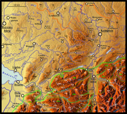
Nagelfluhkette

The Nagelfluh chain is used to denote the three parallel Allgäu Nagelfluh strata ridges in the Alps in the Oberallgäu district, Bavaria, as well as in Vorarlberg, which are made up of rocks from the Nagelfluh , i.e. geologically young conglomerates that are mostly weathered with steep walls:
- the Prodel-Kojen -schichtkamm in the north (up to 1491 m, at the Immenstädter Horn in the east 1489 m), divided into two segments by the breakthrough of the Weißach
- the high ridge chain in the middle (up to 1834 m)
- the Siplingerkopf layer ridge in the south (at the Siplinger Kopf 1746 m)
The Nagelfluhkette Nature Park comprises all three chains, the Nagelfluhkette nature reserve only the German part of the Hochgratkette. Further north there are three more subalpine Nagelfluh chains, which are not advertised under this name (see Nagelfluh heights and valleys between Lake Constance and Wertach ).
Nagelfluhkette in Eastern Switzerland
The Allgäu chains are continued southwest of the Alpine Rhine Valley, in northeastern Switzerland, each segmented by the Urnäsch valley :
- the chain of Hochhamm (1275 m), Hundwiler Höhi (1306 m) and Gäbris (up to 1250 m), segmented by the valleys of Urnäsch and Sitter
- the chain over Hochalp (1529 m) and Kronberg (1663 m), segmented by the Urnäsch
Overall, they are somewhat less pronounced than chains.
To the west of these layer ridges, in the west of the Toggenburg , there is a ridge line from Nagelfluhbergen from the Tweralpspitz (1331 m) over the Schnebelhorn (1292 m) to the Hörnli (1133 m), which runs in a north-northwest direction, i.e. almost perpendicular to the aforementioned chains. However, it is less strongly formed as a "chain", as many, sometimes longer ridge branches of the same rock branch off from the main ridge, some of which reach ridge height ( Höchhand : 1314 m). In the south it continues beyond the Rickenpass to the Speer , the highest Nagelfluhberg in Europe.
Web links
- Geological map and topographic map of north-eastern Switzerland with the Gäbris chain (green), the Kronberg chain (red) and the Tweralpspitz chain (yellow): Height profiles can be created after clicking the lines.