Weißach (Bregenz Ach)
| Weissach | ||
|
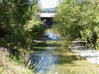
Weißach at the Gschwendmühlbrücke near the state border |
||
| Data | ||
| Water code | DE : 2146, AT : 811144 | |
| location | Germany | |
| River system | Rhine | |
| Drain over | Bregenz Ach → Rhine → North Sea | |
| source | on Dreherberg ( 1430 m above sea level ) 47 ° 32 ′ 3 ″ N , 10 ° 9 ′ 37 ″ E |
|
| Source height | approx. 1360 m above sea level NN | |
| muzzle | between Langenegg and Doren in the Bregenz Ach Coordinates: 47 ° 28 ′ 30 " N , 9 ° 51 ′ 16" E 47 ° 28 ′ 30 " N , 9 ° 51 ′ 16" E |
|
| Mouth height | 465 m above sea level A. | |
| Height difference | approx. 895 m | |
| Bottom slope | approx. 27 ‰ | |
| length | 33.5 km (20.6 km in Germany, 0.6 km as a border river, 12.2 km in Austria) | |
| Catchment area | 216.49 km² (124.94 km² in Germany, 91.55 km² in Austria) | |
| Left tributaries | Bolgenach | |
| Right tributaries | Eibelebach | |
The Weißach is a 32.6 kilometer long, right-hand and eastern tributary of the Bregenz Ach in the German and Austrian Alps .
geography
course
The river rises west of Immenstadt in the Oberallgäu district . From its source, which rises south-west of the Immenstädter Horn , the Weißach flows north of the Nagelfluhkette in a south-west direction, and then changes from the Imberg ridge to the north-west run to Oberstaufen . Then the Weißach moves to the southwest, crosses the border between Germany and Austria at Aach and flows into the Bregenz Ach between Langenegg and Doren .
East of Steibis in the district of Aach im Allgäu , and south of Buchenegg , Markt Oberstaufen, the river plunges down the Buchenegger waterfalls .
Honorary valley
The upper Weißach valley between the source and the bend to the southwest (Hochgratbahn) is also called Ehrenschwanger Tal , after the name of a hunting lodge in this once very remote valley.
Tributaries
The Bolgenach, the largest tributary of the Weißach, flows between Doren and Krumbach.
Incomplete list of tributaries, from source to mouth:
- Sedererbach (left)
- Speichertobelbach (left)
- Horbach (left)
- Lanzenbach (left)
- Kartenbach (right)
- Mittelbach (right) at the Buchenegger waterfalls
- Buchenegger Graben (right)
- Angerbach (left)
- Eibelebach (right) on the Bavarian-Vorarlberg state border
- Littenbach (left) on the Bavarian-Vorarlberg state border
- Jagdbach (left)
- Bolgenach (left)
- Kreierbach (right)
- Glatzbach (Weißach) (left)
Fish stocks
The resident fish species are brown trout and Mühlkoppe . In the lower reaches there are low stocks of grayling , rainbow trout and brook trout due to earlier stocking .
Hydropower plants
In the hamlet of Krebs, the river is dammed up into a lake , and the water is discharged from the pressure pipe of a hydropower plant with a height difference of over 30 meters. This and a smaller power plant on the Eibelebach of the Weißachtal-Kraft-Werke supply around 1000 people with electricity.
Individual evidence
- ↑ a b List of brook and river areas in Bavaria - Hochrhein river area, page 2 of the Bavarian State Office for the Environment, as of 2016 (PDF; 470 KB)
