
Spear (mountain)
| spear | ||
|---|---|---|
 View of Speer from the northeast |
||
| height | 1950.5 m above sea level M. | |
| location |
|
|
| Mountains | Appenzell Alps | |
| Dominance | 7.8 km → Leistchamm | |
| Notch height | 534 m ↓ Behind Höhi | |
| Coordinates | 727650 / 227458 | |
|
||
| rock | conglomerate | |
| particularities | Europe's highest Nagelfluh mountain | |

The Speer ( 1950.5 m above sea level ) is Europe's highest Nagelfluh mountain . It is located in the Swiss canton of St. Gallen , north of the Walensee in the municipal area of Ebnat-Kappel , Nesslau , Amden , Kaltbrunn and Schänis . The Speer is part of the Appenzell Alps . Its distinctive shape of a spearhead is visible from afar. In many municipalities there are spear roads with a view of the spear.
It can be climbed as a day tour from the Toggenburg and from the Linth Plain. Various marked mountain trails ( grade T3 ) lead to the Speer, whereby the demanding one over the northern edge (via ferrata with wire ropes, etc.) is a worthwhile alternative to the normal route over the southern slope.
Secondary peaks and foothills are: to the east: Grappehorn (1740 m), Flügenspitz (1739 m), I de Schwarze Chöpf (1747 m), Speermürli (1744 m), Bremacher Höchi (1641 m); to the north: Chli Speer (1713 m), Wannenberg (1643 m), Tüfentaler Berg (1525 m), Schorhüttenberg (1443 m); to the west: Schafberg (1789 m), Chüemettler (1702 m), Gleiterspitz (1531 m), Chrüzchopf (1776 m), Federispitz (1864 m).
gallery
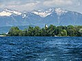
View from Lake Zurich, Ufenau in the foreground

summit

View from the southwest

South side of the summit

The spear from the northeast (left the Schwarzi Chöpf mountain range)

Speer, Chüemettler and Federispitze , view of St. Gallenkappel (northwest of the Speer)


Web links
- Speer tour reports and photos