Hundwiler Höhi
| Hundwiler Höhi | ||
|---|---|---|
|
Hundwiler Höhi from the south |
||
| height | 1305.7 m above sea level M. | |
| location | Border canton Appenzell Ausserrhoden / canton Appenzell Innerrhoden , Switzerland | |
| Dominance | 4.6 km → Creating water | |
| Notch height | 406 m ↓ Gonten golf course | |
| Coordinates | 743 180 / 245 054 | |
|
|
||
|
Panorama from the Hundwiler Höhi towards Appenzell in the valley (in the shade) in the east to the Säntis in the south |
||
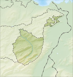
The Hundwiler Höhi (also Hundwiler Höhe , Hundwilerhöhe , local dialect Hundwiler Höchi ) is a mountain south of Hundwil in the Appenzell hinterland in Switzerland . It is located at 1306 m above sea level. M. on the canton border between Canton Appenzell Ausserrhoden and Canton Appenzell Innerrhoden and can be reached on foot or by mountain bike . From Hundwil, Gonten , Zürchersmühle ( Urnäsch ) you can get to the summit in around two hours ; by bike it is around 50 minutes (steep gravel path). There is a wind turbine and a boundary stone on the summit.
From the top of the mountain , where the Hundwiler Höhe mountain restaurant, run from 1971 until her death by Marlies Schoch (1940-2016, also municipal and cantonal councilor), offers a beautiful panorama over the Alpstein and Lake Constance . Since then, Mirlinda Fazliu has been the landlady at Hundwiler Höhi. The guest house has had an annex building of almost the same size (for staff and storage) since 1994, which was one of the first solar houses in the area, with solar panels, photovoltaics, etc.

Web links
- Hundwiler Höhi Website of the mountain restaurant
- Interactive 360-degree panorama from the Hundwiler Höhe


