Gaboris
| Gaboris | ||
|---|---|---|
|
from the Sondereggersweid in the southwest |
||
| height | 1246.8 m above sea level M. | |
| location | Canton of Appenzell Ausserrhoden , Switzerland | |
| Mountains | Swiss foothills | |
| Dominance | 6.75 km → Fäneren | |
| Notch height | 363 m ↓ Eggerestand | |
| Coordinates | 753 126 / 249501 | |
|
|
||
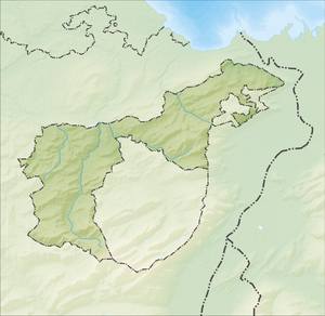
The Gäbris is the most northerly Swiss foothills of the Alps , rising over 1,200 meters. It is 1246.8 m above sea level. M. high and is located above Gais in the canton of Appenzell Ausserrhoden . It towers over the countless points of the scattered Appenzell hills, which can easily reach 1100 meters, but often remain nameless.
The next higher point is the Fäneren , a good 4 ¾ km south on the northern edge of the Alpstein massif.

Historic aerial photo of Walter Mittelholzer's mountain restaurant , approx. 1918–1937
The Gäbris can be easily reached on foot from Gais and Trogen . There is a restaurant on the Gäbris.
Web links
Commons : Gäbris - collection of images, videos and audio files
Individual evidence
- ↑ height according to National map of Switzerland; Gais, sheet no.1095


