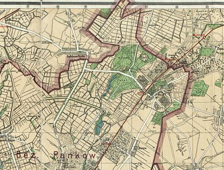
List of streets and places in Berlin-Buch
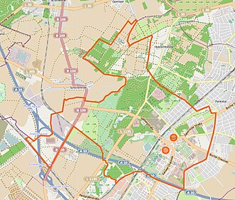
The list of streets and squares in Berlin-Buch describes the street system in the Berlin district of Buch with the corresponding historical references. At the same time, this compilation is part of the lists of all Berlin streets and places .
overview
Buch has 16,868 inhabitants (as of December 31, 2019) and includes the postcode area 13125. According to the official street directory, there are 49 dedicated streets in the district where residents live (as of December 30, 2019). The total length of these roads in Buch is 36.0 kilometers. That is six percent of the entire Pankow road network. The relatively small proportion of the entire Pankow road network is due to the location on the outskirts and areas with forest and open land. The public road network in the entire Pankow district (including all 13 districts) is 604.7 kilometers long. In addition to the Steglitz-Zehlendorf district (635.4 km) and the Treptow-Köpenick district (628.1 km), the district thus has one of the largest road networks in the German capital.
The town center is around the castle, manor and church, today's Alt-Buch. At the end of the 19th century the settlement "Kolonie Neu-Buch" (Bucher Siedlung) was built west of the railway line and can be reached via the Pölnitzweg . Here the settlement plan was initially set up with numbered streets, most of which were named in 1925. Some of these streets were given names that were represented several times in the urban area of Greater Berlin . In 1938, as in other districts, the capital, which was included in the state of Prussia, was renamed. The establishment of the insane asylum and a poor hospital for Berlin and the formation of further clinics were also important for the development of the road system. The built-up areas were expanded and additional residential areas had to be built. Around 1920, a settlement area east of the Stener Bruch to Zepernicker Straße with streets 1 to 7 was created as a “book colony”, some of which were named in 1927 after East Prussian areas.
From 1970, with the GDR housing program, on the increasingly less-used agricultural land south of the old town center and north of the A10 motorway ring road, new type buildings of the WBS 70 series for doctors and medical staff from the Bucher clinics were built around the urgent need in several residential complexes WK I to WK VI To meet the need for contemporary housing. The existing road grid west of Karower Chaussee suggests that the construction plan between Chaussee and Panke along the Stettiner Bahn was not completed.
The Berlin motorway outer ring runs through Buch, the junctions are outside the district. According to the Berlin Road Development Plan (StEP), 7,290 meters of the main carriageway of the A 10 and 1,340 meters of the Pankow motorway feeder are part of the large-scale road system. From the district, the Wiltbergstrasse forms the connection to the Schönerlinder Strasse junction and the Hobrechtsfelder Chaussee to the Bucher Strasse driveway in French Buchholz.
Overview of streets and squares
The following table gives an overview of the streets and squares in the district as well as some related information.
- Name / location : current name of the street or square. Via the link Location , the street or the square can be displayed on various map services. The geoposition indicates the approximate center of the street length.
- Traffic routes not listed in the official street directory are marked with * .
- Former or no longer valid street names are in italics . A separate list may be available for important former streets or historical street names.
-
Length / dimensions in meters:
The length information contained in the overview are rounded overview values that were determined in Google Earth using the local scale. They are used for comparison purposes and, if official values are known, are exchanged and marked separately.
For squares, the dimensions are given in the form a × b for rectangular systems and for (approximately) triangular systems as a × b × c with a as the longest side.
If the street continues into neighboring districts, the addition ' in the district ' indicates how long the street section within the district of this article is. - Name origin : origin or reference of the name.
- Notes : further information on adjacent monuments or institutions, the history of the street and historical names.
- Image : Photo of the street or an adjacent object.
| Name / location | Length / dimensions (in meters) |
Origin of name | Date of designation | Remarks | image |
|---|---|---|---|---|---|
|
Old book
( Location ) |
650 | old village center | May 11, 1938 | The village center of Buch lies between Wiltbergstrasse and the junction of Zepernicker Strasse, Schwanebecker Chaussee and Am Stener Berg. The renaming took place as part of an action by Greater Berlin to remove ambiguities after the merger in 1920. The traditional name up to 1900 was Dorfstraße , with the growth of the place and the colonies until 1925 it was called the main street and then due to the geometry as Bucher Aue.
From the development of the street village is z. B. the Schloßkrug from 1823 at the corner of Karower Straße. |

|
| At the Posseberg
( Location ) |
1015 | Posseberg, local elevation | January 13, 2003 | The street in the Pankow-Nord industrial park starts from Schönerlinder Strasse. The Berlin animal crematorium is located on the northern section. |

|
| At the sand house
( Location ) |
1040 | the sand houses were demolished in the mid-1960s | Jan. 23, 1931 | The street lies between Wiltbergstraße and Hobrechtsfelder Chaussee. Sand extraction systems once stood here at the edge of the forest, which gave the road its name. With its location behind the former hospital, it is only access to the adjoining apartment block. In the Berlin street list it is under 40134 it is not categorized in the street development plan (= V) with the RBS class STRA 250 meters as OKSTRA class F are only expanded for pedestrian traffic. |

|
| At the Stener Berg
( Location ) |
1110 | Stener Berg , adjacent elevation | Nov 26, 1925 | The Triftweg on which the cattle were led to the pastures is already indicated on the measuring table sheet from 1871 . The street is from the Schwanebecker Chaussee, Alt-Buch and Zepernicker Straße junction to the city limits. The local Stener Berg is 83 m above sea level. NN and the gravel has been mined since 1900. |

|
| At the Vorwerk
( Location ) |
640 | Vorwerk Lindenhof | Jan. 13, 2004 | The street in the Pankow-Nord industrial park is between Schönerlinder Strasse and Industriestrasse in Schönerlinde. The preserved houses belonged to the Vorwerk Lindenhof of the manor district of Buch. The street is registered in the Berlin directory as 9101 with the RBS class STRA , it is not categorized in the StEP and 230 meters according to the OKSTRA class are not listed as a municipal street according to the building specifications. |

|
| Arkenberger Dam
( Location ) |
100 | Arkenberg | March 10, 2001 | The road starts in the Pankow-Nord industrial park from Am Posseberg. The Arkenberge are 62 m above sea level. NN an elevation in the northwest of Pankow. The landfill of the same name in the district was created after 1945 when the debris of the war was deposited . The street is located at the Pankow motorway triangle between the A 114 and the Berlin motorway ring . Neighboring residents are a logistics center and the Pankow wind power plant . This wind turbine was the first in Berlin and was put into operation in 2008 by the company "Neue Energie Berlin". The street is registered in the Berlin directory as 8752 with the RBS class STRA , it is not categorized in the StEP and 230 meters according to the OKSTRA class are not listed as a municipal street according to the building specifications. |

|
|
Bielckenweg
( Location ) |
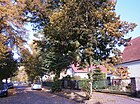
310 | Field name "Aufn Bielcken" | May 11, 1938 | In 1925 the path was set up as Walderseestrasse . With the merger of the municipality of Greater Berlin , it was given a different name to reduce the number of multiple answers. The parcel was listed in the field register from spring 1725 in the 3rd or lake field of the three- field economy . The path lies between Viereckweg and Hörstenweg in the former colony of Buch |
|
| Bruno-Apitz-Strasse
( Location ) |
250 | Bruno Apitz (1900–1979), writer, resistance fighter against the Nazi regime | Apr 29, 1985 | It begins on Wolfgang-Heinz-Straße as a continuation of Friedrich-Richter-Straße to the north and runs in an arch. The continuation is known as Groscurthstrasse. The street layout results from the construction in the "residential complex". |

|
| Brunswickenweg
( Location ) |
380 | Field name "Aufn Brunswiecken" | May 11, 1938 | Established as Helmholtzstrasse since 1925 , it was one of the streets named several times in Greater Berlin. It is located between Viereckweg and Hörstenweg in the Buch colony. The parcel “Auf Brunswiecken” in the “1st or Carow field” is recorded in the Bucher field register drawn up in 1725. |

|
|
On the way
( Location ) |
380 | Field name "Aufn Dran Stücken" | May 11, 1938 | Established in 1925 as Humboldtstrasse in the Buch colony between Viereckweg and Hörstenweg, it was one of the streets that have been named several times in Greater Berlin. The parcel "Aufn Dran Stücken" in the "1st or Carow field" is recorded in the Bucher field register drawn up in 1725. |

|
|
Ernst-Busch-Strasse
( Location ) |
590 | Ernst Busch (1900–1980), singer, resistance fighter against the Nazi regime | Apr 29, 1985 | It goes in an arch to the west of Wolfgang-Heinz-Straße and is (not yet) built on with residential buildings. The open spaces and the surrounding buildings stand for the unfinished expansion of the "residential complex". The street is registered in the Berlin directory as 43973 with the RBS class STRA it is not categorized in the StEP . According to OKSTRA class N, 440 meters are not included as a municipal road according to the building specifications. |

|
| Ernst-Ludwig-Heim-Strasse
( Location ) |
280 | Ernst Ludwig Heim (1747–1834), Berlin doctor | Aug 28, 1974 | It is located between Karower Chaussee and Robert-Rössle-Straße. The street is registered in the Berlin directory as 43781 with the RBS class STRA , however, it is not categorized in the StEP and 40 meters is part of the official street as an access, but according to the OKSTRA class not as a municipal street according to the building specifications. |

|
| Eupener Strasse
( Location ) |
810 | Eupen , central place in the German-speaking part of Belgium | Jan. 16, 1925 | The street runs in the (former) Buch colony between Pölnitzweg and Uhlenweg and was listed as street 12 in the settlement plan . It limits the NSG Mittelbruch in the east . |

|
|
Franz-Schmidt-Strasse
( Location ) |
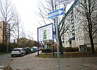
350 | Franz Schmidt (1885–1944), male nurse and resistance fighter against National Socialism | Aug 31, 1977 | It is located between Groscurthstrasse and Walter-Friedrich-Strasse. The western continuation is a road that leads under the Szczecin Railway to the Moorlinse . |
|
| Friedrich-Richter-Strasse
( Location ) |
350 | Friedrich Richter (actually Rosenthal , 1894–1984), actor, victim of the Nazi regime | Apr 29, 1985 | It runs in the residential area west of Karower Damm in two streets in a north-west-south-east direction from Wolfgang-Heinz-Straße and in the eastern branch between Max-Burghardt- and Bruno-Apitz-Straße. |

|
|
Georg-Benjamin-Strasse
( Location ) |
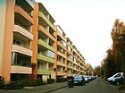
540 | Georg Benjamin (1895–1942), doctor, resistance fighter against the Nazi regime | Aug 28, 1974 | It is located in the residential complex east of Karower Chaussee in the arch between Karower Chaussee and Lindenberger Weg. |
|
| Grudge Street
( Location ) |
160 | August Groll, innkeeper in Buch | Nov 26, 1925 | Set up as Straße 15 in the Buch colony west of the Stettiner Bahn , it is located between Malmedyer Straße and Uhlenweg. |

|
| Groscurthstrasse
( Location ) |
740 | Georg Groscurth (1904–1944), doctor, resistance fighter against the Nazi regime | Aug 31, 1977 | It is between Walter-Friedrich- and Wolfgang-Heinz-Straße. In the residential complex west of Karower Chaussee, it represents the (planned) boundary of the residential area to the Chaussee. |

|
|
Hobrechtsfelder Chaussee
( Location ) |
3300 (in the district) |
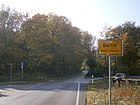
Hobrechtsfelde , former Berlin Rieselgut; direction | before 1929 | The Chaussee lies between the district and city limits. It is the extension of Bucher Strasse from French Buchholz and continues beyond the city limits as Hobrechtsfelder Dorfstrasse in Brandenburg. In the south at the Hobrechtsfelder Brücke it runs over the Berliner Ring and also has access to the B 109 and the Pankow motorway feeder , connection point Bucher Straße. |
|
| Hörstenweg
( Location ) |
1265 | Field name "Auf die Hörsten" | May 11, 1938 | Laid out as Gutenbergstrasse in the Buch colony in 1925 , it was renamed Greater Berlin in 1938 because of its multiple names, including the southeastern part of the former Luisenstrasse up to Schönower Strasse. The field name "auf die Hörsten" comes from the Buch field register from 1725. The path is between Pölnitz- and Röbell- / Viereckweg. |

|
|
Karower Chaussee
( Location ) |
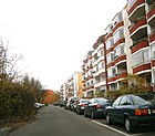
1710 | Karow , southern neighboring town; direction | after 1750 | This connection route was part of the Heerstrasse from Prenzlauer Tor in Berlin. This street was expanded as Chaussee around 1750 and called Karower Chaussee. It initially ran from the (old) district of Weissensee to the Karow district. This section was named Bucher Chaussee on August 1, 1998 with the establishment of Karow-Nord in the neighboring district. The street section in the district is thus between Bucher Chaussee (district boundary) and Wiltbergstrasse / Lindenberger Weg. The Chaussee separates the residential complex to the west and east, while the apartment blocks are east of the street on a parallel street of the same name, partly also interspersed in the hinterland. |
|
| Karower Strasse
( Location ) |
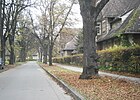
300 | Karow , southern neighbor | around 1933 | Until 1933 the Karower Weg led south from Buch. Since then it has been the northern extension of Karower Chaussee. Today's main road is slightly different from Karower Chaussee to Zepernick and Bernau via Wiltbergstraße to Alt-Karow. A branch of the road runs east to the old entrance of the Buch hospital (today the Helios Clinic and Rheumatism Clinic). |
|
|
Lindenberger way
( Location ) |
880 (in the district) |
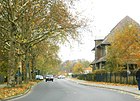
Lindenberg , neighboring town | before 1871 | The route lies between the Wiltbergstrasse / Karower Chaussee junction to the southeast to the city limits. In the original measuring table from 1871, a connection route between Buch and Lindenberg through the Buch fields is already recorded. |
|
|
Malmedyer Street
( Location ) |
430 | Malmedy , Belgian city | Jan. 16, 1925 | Set up as Straße 16 in the development plan in the Buch colony , it is located between Eupener Straße and Röbellweg. |

|
| Max-Burghardt-Strasse
( Location ) |
150 | Max Burghardt (1893–1977), actor, director and resistance fighter against the Nazi regime | Apr 29, 1985 | It is located between Karower Chaussee and Wolfgang-Heinz-Straße in the residential complex west of Karower Chaussee. The road has remained undeveloped and is parallel to the motorway ring . The street is registered in the Berlin directory as 43971 with the RBS class STRA , but not categorized in the StEP . The street that can be seen 150 meters is indicated on the street plan as 300 meters as an official street, which according to OKSTRA class N is not included according to the building specifications of a municipal street . |

|
| Mewesstrasse
( Location ) |
450 | August Mewes (1857–1929), mayor in Buch | 1920 | It is located in the former colony of Buch between the Röntgen Valley and Hörstenweg. Mewesstraße (north of Pölnitzweg) runs under the Stettiner Bahn and connects Buch with Neu-Buch. |

|
|
Nadrauer Strasse
( Location ) |
180 | Nadrauen , Gau in East Prussia , today in the Kaliningrad Oblast (Russian enclave) | Feb. 18, 1927 | It was laid out as street 2 . It is located west of Zepernicker Straße between Sudauer and Schalauer Straße on the Stener Bruch. |

|
|
Pölnitzweg
( Location ) |
1880 | Georg Bernhard Baron of Poellnitz (later Pölnitz , 1617–1676) local general and politician | May 11, 1938 | It emerged from the traditional Mühlenweg and the part east of the Szczecin Railway called Parkstraße before 1925 and is the main path from the old village center to the Buch colony. It lies between Alt-Buch and Hobrechtsfelder Chaussee. Here you can see the catholic church Mater Dolorosa in the picture above . |

|
|
Röbellweg
( Location ) |
1600 | Hans von Röbel (also Röbell , † 1563), local landowner | May 11, 1938 | As early as 1871, Schönower Strasse ran to the northern neighboring town of Schönow. The path lies between Wiltbergstrasse and Hörstenweg and runs as a dead end to the city limits. In 1958–1960 apartments were built in Röbellweg for the 7,000 skilled workers employed at the Buch Clinic at the time. |

|
| Robert-Rössle-Strasse
( Location ) |
500 | Robert Rössle (1876–1956), physician | Aug 28, 1974 | From 1961 to 1974 a covered road called Pappelweg ran here . The street is between Karower Chaussee and Wolfgang-Heinz-Straße to Ernst-Ludwig-Heim-Straße in the residential complex east of Karower Chaussee. The street is registered in the Berlin directory as 43695 with the RBS class STRA not categorized in the StEP . 70 meters are also part of the official road, but as a bypass to OKSTRA class N, not included as a municipal road according to the building specifications. |

|
| X-ray valley path
( Location ) |
1100 (in the district) |
Röntgen valley , adjacent settlement, today part of Panketal (Zepernick) | May 11, 1938 | Named Von-Treskow-Straße around 1900 , it runs east of the Stettiner Bahn from Pölnitzweg to Brückenstraße on the city limits. To the south of Pölnitzweg, a footpath of the same name leads from the Buch S-Bahn station, Wiltbergstraße, to the west of the castle park. Registered in the Berlin street directory as number 42453, it has the RBS class STRA, its importance is not categorized for the StEP and the expansion has the OKSTRA class F , which marks the path for pedestrian use. |

|
|
Schalauer Strasse
( Location ) |
240 | Schalauen , Gau in East Prussia ; today partly in Lithuania and in the Russian Oblast Kaliningrad | Feb. 18, 1927 | It was initially laid out as Straße 3 and lies between Zepernicker Straße and Sudauer Straße. |

|
| Schmetstorpweg
( Location ) |
120 | Schmetstorp, Bucher landowner; a family member is documented around 1375 for vassal and knight services | May 11, 1938 | Laid out around 1900 as Bismarckstrasse , it was renamed in 1938 with other major Berlin streets. It runs between Röbellweg and Viereckweg. |

|
| Schönerlinder Strasse
( Location ) |
1140 (in the district) |
Schönerlinde , a neighboring street village to the northwest | after 1824 | The Schönerlinder Straße is the connecting route between French Buchholz and Schönerlinde and was expanded after 1824 as part of the Provinzial-Chaussee Berlin– Prenzlau . It is located west of the Buch forest and the Lindenhof Rieselfelder. On February 14, 1964, the part of the street in the Buch district was added to Schönerlinder Strasse. It connects via Schönerlinder Chaussee to Wiltbergstrasse to Buch. The street is registered in the Berlin directory as 42611 with the RBS class STRA but not categorized in the StEP . However, according to OKSTRA class N, 200 meters of the official street length are not included as a municipal street according to the building specifications. |

|
| Schönerlinder Chaussee
( Location ) |
1250 | Schönerlinde , a neighboring street village to the northwest | after 1850 | It is the old connection route from Buch to Schönerlinde. On May 11, 1938, the eastern part was renamed Wiltbergstrasse after crossing the Seegraben. It is therefore between Schönerlinder Strasse and the extension through Wiltbergstrasse. |

|
| Schwanebecker Chaussee
( Location ) |
870 | Schwanebeck , northeastern neighbor | after 1871 | The road arose from the fortification of the Schwanebecker Weg , which has long connected the villages of Buch and Schwanebeck. On the street are the Pankow XII cemetery , the Helios Clinic Berlin-Buch and the Berlin-Buch thermal power station . |

|
| Settlement road
( Location ) |
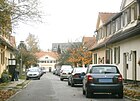
240 | laid out as a warrior settlement | before 1925 | It runs through the urban housing estate for war invalids and doctors, built between 1919 and 1921, south of Lindenberger Weg as an extension of Karower Straße. It is already listed by name in the “Proof for Berlin and the Surrounding Area 1925”. |
|
| Street 4
( Location ) |
350 | Alpenberge colony, municipality of Panketal | Oct 18, 2017 | It lies south of Am Stener Berg up to the city limits, not officially listed as Alpenberger Straße , it continues Rigistraße from Schwanebeck to Berlin-Buch. The street was laid out before 1920 and the land on the numbered street “Straße 4” was increasingly being built on. Road 4 formed a branch in the north and south, the
could be mistaken for an intersection. These engravings were given the name "Alpenberger Straße" and the association with the street became obvious. With the allocation of individual street names for georeferenceable addresses, the name was allocated in 2017 at the suggestion of a resident of street 4. Alpenberger Straße was named after the colony of Alpenberge (Schwanebeck) from 1925 to 1952. The naming was incomprehensible and was given up again by those responsible from the time of the GDR. Evidence was provided by the resident until the 2000s that “Alpenberger Straße” and “Straße 4” could be found at the same time. |

|
| Street 5
( Location ) |
310 | Numbering according to the settlement plan | around 1920 | It is located between Zepernicker Straße and Panke in the "Buch Kolonie". |

|
| Street 6
( Location ) |
250 | Numbering according to the settlement plan | around 1920 | It is between Straße 5 and Stener Bruch. |

|
| Street 7
( Location ) |
250 | Numbering according to the settlement plan | around 1920 | It is between Straße 5 and Stener Bruch. |

|
| Sudauer Strasse
( Location ) |
500 | Sudauen , Gau in East Prussia , today in parts to Lithuania and Poland | Feb. 18, 1927 | Initially set up as Straße 1 according to the plan , it is between Zepernicker Straße and Straße 5. The street is in the Berlin directory as 43261 with the RBS class STRA , it is entered in the StEP , but not categorized. 50 meters of access are part of the official road, but according to OKSTRA class N, they are not included as a municipal road according to the building specifications. |

|
|
Theodor-Brugsch-Strasse
( Location ) |
550 | Theodor Brugsch (1878–1963), Berlin doctor | Aug 28, 1974 | The route runs in the residential area east of Karower Chaussee and Georg-Benjamin-Straße. | |
|
Uhlenweg
( Location ) |
400 | Field name "Aufn Uhlen Stücken" | May 11, 1938 | Established around 1900 as Moltkestrasse , it is located between Viereckweg and Eupener Strasse. In the Bucher field register from 1725, the field name is recorded in the "3rd or lake field". |

|
|
Square way
( Location ) |
1030 | Adam Otto von Viereck (1684–1758), landowner in Buch, Minister of State | May 11, 1938 | Established around 1900 as Kaiser-Friedrich-Strasse and Luisenstrasse . It lies between Pölnitzweg in an arch over Röbellweg and Hörstenweg. |

|
|
Walter-Friedrich-Strasse
( Location ) |
760 | Walter Friedrich (1883–1968), biophysicist, worked in Berlin and Buch | March 31, 1977 | The street leads from Wiltbergstraße and at right angles to Großcurthstraße. It is located in the residential complex west of Karower Chaussee. It belongs to the northern residential complex west of Karower Chaussee. |

|
| Wiltbergstrasse
( Location ) |
2680 | Betkin Ritter von Wiltberg (14th century), owner of the knight's seat book | May 11, 1938 | Named around 1925 as Lindenhofstrasse from Alt-Buch to Vorwerk Lindenhof. It is located between Karower Chaussee and Lindenberger Weg across Hobrechtsfelder Chaussee to Seegraben, followed by Schönerlinder Chaussee. The Wiltbergs were among the servants of Count von Lindow-Ruppin as early as 1314 , and in 1335 Betkin von Wiltberg was called the Knight of Wiltberg. The street is registered in the Berlin directory as 43581 with the RBS class STRA and is not categorized in the StEP , in addition, 140 meters are part of the official street, but according to the OKSTRA class N, not listed as a municipal street according to the building specifications. |

|
| Wolfgang-Heinz-Strasse
( Location ) |
630 | Wolfgang Heinz (1900–1984), actor | Apr 29, 1985 | It is located in the arch between Friedrich-Richter-Straße and Karower Chaussee in the projected but unfinished residential area (WK). The street is registered in the Berlin directory as 43972 with the RBS class STRA , but not categorized in the StEP and 120 meters of the official street are not listed according to OKSTRA class N according to the building specifications of a “municipal street ”. |

|
|
Zepernicker Strasse
( Location ) |
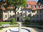
1450 | Zepernick , northern neighbor | around 1871 | The old connection route is shown on the Urmes table sheet. It is located between the Alt-Buch / Schwanebecker Chaussee / Am Stener Berg junction and the city limits of Panketal, OT Zepernick. |
|
Planned and former streets
At the end of the 19th century, the "Colony (New) Buch" was created west of the railway line. As elsewhere, the streets were named after famous personalities. As a result of the formation of Greater Berlin, there were several streets of the same name in the city, so in the "settlement of Buch" several streets with clear streets, preferably with local personalities, were named. In May 1938, as part of the restructuring of the Berlin administration, the name was changed to Buch.
| old name | from | to | renamed to | Remarks |
|---|---|---|---|---|
| Bismarckstrasse | after 1898 | May 11, 1938 | → Schmetstorpweg | Reich Chancellor Bismarck (1815–1898). |
| Bucher Aue | Nov 26, 1925 | May 11, 1938 | → Old book | With the expansion of the hospitals, Buch was enlarged and the area opposite the estate was built on, which also created streets. |
| Village street | before 1899 | May 11, 1938 | → main street | The Dorfstraße was the street in the village (today: Alt-Buch) where the settlement was built. With the renaming, the meaning in the name was emphasized. Today Alt-Buch is in the main traffic to the north, the castle church and artist courtyard (formerly Gut Buch) remained from the village. |
| Gutenbergstrasse | before 1924 | May 11, 1938 | → Hörstenweg | The street named after Johannes Gutenberg (1400–1468), inventor of European letterpress printing with movable metal letters, had to be changed in name. |
| Main road | around 1900 | May 11, 1938 | → Old book | With the expansion of the street system, the town center became the “main” street. When Greater Berlin was formed , there were several main streets and village streets in Berlin. Most of them were renamed by adding an old name to a district name. |
| Helmholtzstrasse | before 1925 | May 11, 1938 | → Brunswickenweg | The street in the former Neu-Buch settlement, named after Helmholtz (1821-1894), physiologist and physicist (as the “Reich Chancellor of Physics”), was renamed in 1938. |
| Humboldtstrasse | before 1924 | May 11, 1938 | → Dranweg | The street in the Neu-Buch settlement at that time was named after Humboldt , (1769-1859), naturalist and explorer, and renamed with other frequent streets. |
| Kaiser-Friedrich-Strasse | around 1900 | May 11, 1938 | → Viereckweg (partly) | The street named after the current Kaiser Friedrich in the (then) Neu-Buch was given the new name in 1938. |
| Karower way | after 1750 | around 1933 | → Karower Strasse | Karow is the southern neighboring town and here was the direct route from Buch to Karow, with the fortification the renaming took place. |
| Lindenhofstrasse | Nov 26, 1925 | May 11, 1938 | → Wiltbergstrasse | The street led west to the Vorwerk Lindenhof of Gut Buch and in 1938 was named after other Bucher streets after regional personalities. |
| Luisenstrasse | around 1900 | May 11, 1938 | → Hörstenweg → Viereckweg (partly) |
The eponymous Queen Luise (1776–1810) was the wife of King Friedrich Wilhelm III. In 1938, the northwestern part of Luisenstrasse up to Schönower Strasse was renamed Viereckweg, and the southeastern part was renamed Hörstenweg. |
| Moltkestrasse | around 1900 | May 11, 1938 | → Uhlenweg | In the Neu-Buch settlement, the street was named after the Prussian field marshal Moltke (1800-1891). |
| Poplar Path | after 1962 | Aug 28, 1974 | → Robert-Rössle-Strasse | Poplar , an avenue tree. With the plans for the new building in Buch, a path that had previously run here was named. |
| Schönower Strasse | after 1871 | May 11, 1938 | → Röbellweg | Schönow is a neighboring place in the northeast of Buch, the way led to the place (which today belongs to Bernau). |
| Street 1 | before 1919 | Feb. 18, 1927 | → Sudauer Strasse | The street was numbered with the "Colony Buch". |
| Street 2 | before 1920 | Feb. 18, 1927 | → Nadrauer Strasse | The street was numbered with the "Colony Buch". |
| Street 3 | before 1920 | Feb. 18, 1927 | → Schalauer Strasse | The street was numbered with the "Colony Buch". |
| Street 12 | around 1900 | Jan. 16, 1925 | → Eupener Strasse | The street was numbered with the Neu-Buch settlement. |
| Street 15 | around 1900 | Nov 26, 1925 | → Grollstrasse | The street was numbered with the Neu-Buch settlement. |
| Street 16 | around 1900 | Jan. 16, 1925 | → Malmedyer Street | The street was numbered with the local settlement Neu-Buch and named when the surrounding streets were renamed. |
| Von-Treskow-Strasse | around 1900 | May 11, 1938 | → X-ray valley path | Julius von Treskow (1818-1894), Prussian manor owner and politician, gave his name to several streets in Greater Berlin. |
| Walderseestrasse | around 1900 | May 11, 1938 | → Bielckenweg | Alfred Graf von Waldersee (1832–1904), Prussian Field Marshal General, gave the street in the Neu-Buch settlement its name. |
More locations from Buch
Allotment colonies
- KGA 'An der Autobahn' (Karower Chaussee 235, Lage ), permanent allotment garden with 61 plots on 30,475 m² of state-owned leased land, except for the A 10 expansion .
- KGA 'Fleißiges Lieschen' (Karower Chaussee 239, Lage ), allotment garden with 20 plots on 13,516 m² of state-owned leased land, except for the expansion of the A 10.
- KGA 'Gartengemeinschaft Buch' (Karower Chaussee 237, Lage ), a permanent allotment garden with 12 plots on 6,096 m² of state-owned leased land, excluding the expansion of the A 10.
- KGA 'Pankeland' (Zepernicker Straße 72, Lage ), with 24 parcels on 12,336 m².
- KGA 'Steintal' (Karower Chaussee 231, Lage ), permanent allotment garden with 99 parcels on 43,144 m² of state-owned leased land, with areas reserved for the expansion of the A 10.
Parks and other open spaces
- Schlosspark Buch ( location )
- Cemeteries in book
- Cemetery Pankow XII , former poor and clinic cemetery of the city of Berlin. ( Location )
- Castle church cemetery, disused cemetery. At its time, this cemetery was only permitted for residents of the rural community of Buch. ( Location )
- Pankow XI cemetery , closed. ( Location ) The cemetery on Viereckweg was laid out around 1900 for the residents of the "Neu-Buch settlement".
-
Bucher Forst ( location ), the areas west of the Lietzengraben are reforested sewage fields.
- NSG Bogensee chain with the Buch carp ponds. ( Location )
- NSG Lietzengrabenniederung ( location )
- former Rieselfeldergebiet Buch am Zig-Zag-Graben ( location )
- Bucher clinics
- NSG Mittelbruch ( location )
- Stener Bruch ( location )
See also
literature
- Ines Rautenberg: Street names in Berlin-Pankow. Origin and history. Kulturamt Pankow and Friends of the Chronicle Pankow, Berlin 1999.
Web links
- Map of Berlin 1: 5000 with district boundaries. Senate Department for Urban Development Berlin, 2009, accessed on January 11, 2011 .
- Street directory Pankow. kaupert media GmbH, accessed on December 5, 2011 .
- Office for Statistics Berlin-Brandenburg: List of streets and places in the Pankow district (as of February 2015); pdf
- List of monuments Pankow (pdf; 2.2 MB) Retrieved January 9, 2012
- WK I to WK VI - Farewell to real socialism.
- Master plan book Morphology_a3.pdf
Individual evidence
- ^ Pankow civil engineering department
- ↑ a b Urban planning concepts - model book (PDF; 7.1 MB)
- ↑ The second wind turbine is turning on the outskirts of Berlin . In: Berliner Zeitung of Nov. 20, 2014.
- ↑ Along the northern nature reserve of Pankows
- ↑ Printed matter - VIII-0314 Subject: Designation of the number street Straße 4 in the district of Pankow in the district of Buch in "Alpenberger Straße"
- ↑ In Berlin there are several number streets 4, one of them in the district of Pankow in the district of Heinersdorf. This repeatedly led to considerable errors, e.g. B. when finding the street and delivering the mail. A name in “Alpenberger Straße” removes this from the way.
- ↑ In Berlin there are several number streets 4, one of them in the district of Pankow in the district of Heinersdorf. This repeatedly led to considerable errors, e.g. B. when finding the street and delivering the mail. A name in “Alpenberger Straße” removes this from the way.
- ↑ Printed matter - VIII-0314: Name of the number street Straße 4 in the district Pankow in the district Buch in "Alpenberger Straße"
- ↑ Refurbishment plan 2011 (PDF file; 987 kB)
- ↑ Berlin address book for the year 1938> Heads of household, companies and businesses registered by the commercial court sorted by street> Pankow administrative district: Buch district
- ↑ Berlin address book for the year 1939> IV. Head of Households, companies and commercial enterprises registered by the commercial court sorted by streets> Pankow administrative district: Buch district
- ↑ a b c Fictitious permanent allotment gardens according to §§ 16 and 20a BKleingG . The fictitious permanent allotment gardens are additionally protected by the representation in the FNP as green areas - allotments.
- ↑ Allotment garden development plan Berlin (pdf; 465 kB) ( Memento of the original from March 19, 2013 in the Internet Archive ) Info: The archive link was inserted automatically and has not yet been checked. Please check the original and archive link according to the instructions and then remove this notice.
- ↑ Level IV: allotment garden areas which, according to the FNP, should be preserved.
- ↑ Berlin-Buch Clinic
- ↑ The historical clinic buildings in Buch ( Memento of the original from May 31, 2010 in the Internet Archive ) Info: The archive link was automatically inserted and not yet checked. Please check the original and archive link according to the instructions and then remove this notice.
