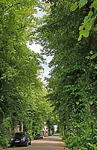
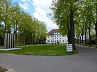
List of streets and squares in Berlin-Schmöckwitz

This list of streets and squares in Berlin-Schmöckwitz is a compilation of all streets and squares listed in the Berlin street directory in the Berlin district of Schmöckwitz in the Treptow-Köpenick district . At the same time, this compilation is part of the lists of all Berlin streets and places .
overview
The streets can essentially be assigned to five settlements, which are separated from each other by the Berlin forests . In addition to the village center, these are the Karolinenhof settlements in the north on the Langen See , Rauchfangswerder in the extreme south on the Zeuthener See , Schmöckwitzwerder in the east on the Krossinsee and the Schmöckwitz settlement north of Eichwalde on the Görlitzer Bahn . The district has 63 dedicated streets, six of which continue in the neighboring districts and five squares. The total length of the streets in the district is 30.9 kilometers.
Schmöckwitz has 4,424 inhabitants (as of December 30, 2019) and includes the postcode area 12527.
Overview of streets and squares
The following table gives an overview of the streets and squares in the district as well as some related information.
- Name / location : current name of the street or square. Via the link Location , the street or the square can be displayed on various map services. The geoposition indicates the approximate center of the street length.
- Traffic routes not listed in the official street directory are marked with * .
- Former or no longer valid street names are in italics . A separate list may be available for important former streets or historical street names.
-
Length / dimensions in meters:
The length information contained in the overview are rounded overview values that were determined in Google Earth using the local scale. They are used for comparison purposes and, if official values are known, are exchanged and marked separately.
For squares, the dimensions are given in the form a × b for rectangular systems and for (approximately) triangular systems as a × b × c with a as the longest side.
If the street continues into neighboring districts, the addition ' in the district ' indicates how long the street section within the district of this article is. - Name origin : origin or reference of the name.
- Notes : further information on adjacent monuments or institutions, the history of the street and historical names.
- Image : Photo of the street or an adjacent object.
| Name / location | Length / dimensions (in meters) |
Origin of name | Date of designation | Remarks | image |
|---|---|---|---|---|---|
|
Eagle frame
( Location ) |
Frame : The king's path to the Königs Wusterhausen hunting lodge , which is said to have been lined with eagles sitting on pillars | around 1700 | At 12.1 kilometers, the eagle frame is one of the longest streets in Berlin. In Schmöckwitz, the eagle frame belongs to the road to Werneuchen , which functions as the L 301 in Brandenburg . Plots 615 to 789 belong to the district. The current section of the eagle frame between Schappachstrasse and Alt-Schmöckwitz (formerly: Berliner Strasse ) was incorporated into the street by a resolution of the municipal authorities in 1958 . The eagle frame leads from Michael-Brückner-Straße to Wernsdorfer Straße. |

|
|
| Alt-Schmöckwitz
( Location ) |
380 | according to their location in the village center of Schmöckwitz | 23 Sep 1938 | The street was created by merging Kaiser-Wilhelm-Platz and Strandweg in 1938 and forms the center of Schmöckwitz. Here is the village church Schmöckwitz from 1799 as well as the final stop with the turning loop of the Schmöckwitz – Grünauer Uferbahn . It runs as an extension of the eagle frame around the village green and has a branch in an easterly direction to Wernsdorfer Straße. |

|
| Old cycling route
( Location ) |
440 (in the district) |
Vorwerk Radeland, original settlement of the Eichwalde community in Brandenburg and Schmöckwitz settlement in Berlin | handed down | This route, which is not included in the official directory, already existed in earlier centuries (first listed in the Berlin address books of the 1920s). There was no development. In today's maps it leads in a straight line in a north-west-south-east direction from the Adlergestell through the Berlin Forest and the Schmöckwitz settlement to Waldstrasse in Eichwalde . Here it bears the name Grünauer Straße. The naming on both sides shows that this was a traffic connection between the neighboring towns. |

|
| On the Oder-Spree Canal
( Location ) |
630 | Oder-Spree-Kanal , canal in Berlin and Brandenburg | 4th July 2005 | The road north of the Oder-Spree Canal was created by merging Road 790 and Road 791 . It opens up a housing estate and can only be reached via the Brandenburg area. |

|
| At Seddinsee
( Location ) |
440 | Seddinsee , lake in Berlin | 23 Sep 1938 | The road leads from Weiselpfad to Wernsdorfer Straße. From before 1866 to 1938 it was called Seestraße and was probably renamed because the names were identical to avoid confusion. The boat stands of the Seddin Sailing Club are located here. |

|
| Argoallee
( Location ) |
440 | SC Argo 1909 , street based sailing club | 1930 | The street was created as street A of the development plan for Rauchfangwerder and was named after the sailing club Segelclub Argo e. V., who was able to move back into the clubhouse built in the 1920s in 1990. |

|
|
Booty way
( Location ) |
210 | Prey, technical term for the beehive | 23 Sep 1938 | The Beutenweg runs from Adlergestell to Am Seddinsee. From before 1866 to 1938 it was called Mittelstrasse . The name Beutenweg 'recalls (like the beekeepers path and the Weisel path) because the Schmöckwitzer Fischer also had the right to levy of honey to the landlord and to the Köpenicker Castle in margravial Heath beekeeping to operate. |

|
| Biebersdorfer Weg
( Location ) |
450 | Biebersdorf (Njacyna), part of the municipality of Märkische Heide in Brandenburg | Apr 10, 1931 | The street in the village of Karolinenhof runs from Lübbenauer Weg to Rohrwallallee. At their facility it was called Straße 774 . |

|
| Böhmallee
( Location ) |
120 | Johannes Böhm (1857–1938), paleontologist and geologist | 1930 | The short street between Schmöckwitzer Damm and Moßkopfring probably got its name because Böhm, who was the builder in 1909 on what is now Moßkopfring 26, acquired the first parcel in the street. |

|
|
Ebelallee
( Location ) |
120 | Ebel, family formerly based in Rauchfangswerder | 1930 | The cul-de-sac leads from the Moßkopfring to the Zeuthener See. It was named after the Ebel family, who lived in Rauchfangswerder from 1894 onwards. The farmer's son Karl Friedrich Ebel married into the resident Waldow family in 1894. On September 7, 1909, most of the family's land was taken over by his wife Auguste Ebel, née Waldow, sold to a brokerage firm. From 1910 this was parceled out and sold to interested parties. |

|
| Eichwalder Aue
( Location ) |
410 | Eichwalde , municipality in Brandenburg | Jul 26, 1927 | The street leading from Miersdorfer Straße to Wendel-Hipler-Weg was created as street 716 of the development plan. It can only be reached via the Brandenburg area. |

|
| Elstergrund
( Location ) |
230 | Elster , species from the family of corvids | Jan. 22, 1924 | The road lies between Erlengrund and Fliederweg. It is shown as undeveloped in the 1928 address book; in 1943 the right side was already built on. |

|
| Alder Ground
( Location ) |
370 | Alder break , permanently wet, swampy forest | Feb. 18, 1927 | The dead end from the forest road ends with a turning hammer at the edge of the forest. This was created as street 5 and was probably named after an alder quarry that was formerly located here. |

|
|
Ferry Avenue
( Location ) |
580 | After the ferry from Rauchfangwerder to Zeuthen, which operated here from 1897 to 1952 | 1928 | The street in Rauchfangwerder leads from Schmöckwitzer Damm to Seddinsee. It was built as Street B according to the development plan for Rauchfangwerder . The Berliner Segler eV association has been located here since 1914. V. |

|
| Fehrower Steig
( Location ) |
90 | Fehrow (Lower Sorbian Prjawoz), municipality in Brandenburg | Apr 10, 1931 | The short street between Peitzer Weg and Rohrwallallee was created as street 769 of the development plan. |

|
| Spruce ground
( Location ) |
340 | Spruce , a genus of plants in the pine family | Feb. 18, 1927 | The cul-de-sac from Waldstraße was created as street 1 of the development plan |

|
| Finkengasse
( Location ) |
130 | Finches , a species-rich family from the order of the passerine birds | Feb. 18, 1927 | The cul-de-sac from Waldstraße was created as street 10 of the development plan. In the 1928 address book it is still shown as undeveloped. |

|
| Lilac way
( Location ) |
310 | Lilac , genus of plants from the olive family (Oleaceae) | Feb. 18, 1927 | The residential street that leaves Grünauer Weg ends as a drivable street in a turning area before the Elstergrund converges. From there a drivable path leads to the Erlengrund. |

|
|
Godbersenstrasse
( Location ) |
930 | Nicolaus August Rudolf Godbersen (1841–1915), forest manager | around 1907 | The undeveloped road through the Berlin Forest connects Zeuthener Strasse with the Grenzstrasse in Eichwalde . It got its name after the forester Godbersen, who negotiated the imperial order in 1896/1897 about the realization of a "very high promise" to the chairman of the Berlin regatta club, Büxenstein, to free the fiscal embankment along the Grünau rowing regatta route from other uses and - on the basis of a rent to be paid by the regatta club - to keep it open solely for the settlement of sports clubs. |

|
| Grünauer way
( Location ) |
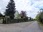
340 | Grünau , part of the Treptow-Koepenick district of Berlin | around 1930 | The Grünauer Weg is part of an old connection from Eichwalde to Grünau . It starts as Grünauer Straße in Eichwalde, then turns into Grünauer Weg in the Schmöckwitz area, which ends as a dead end at the edge of the forest, but continues as a forest path - Alter Radelander Weg - to Adlergestell. |
|
|
Hedge path
( Location ) |
170 | Hedge , linear growth (single or multiple rows) of dense, strongly branched shrubs | Feb. 18, 1927 | The cul-de-sac from Waldstraße was created as road 11 of the development plan. Their name refers to the hedges created between the lots. |

|
| Shepherd Flow
( Location ) |
130 | Hirtenfließ, probably the former name of the nearby Plumpengraben | Feb. 18, 1927 | The cul-de-sac from Waldstraße was created as road 9 of the development plan. |

|
|
Beekeeping Path
( Location ) |
490 | Beekeeper , deals with the keeping and breeding of honey bees and the production of honey and other bee products | 23 Sep 1938 | The beekeeping path leads from Adlergestell to Seddinsee and ends there as a dead end. From 1866 to 1938 it was called Wendenstrasse and was probably renamed Altglienicke because of the risk of confusion with Wendenstrasse. The name reminds (like that of the Beutenweg and Weiselpfad) that the Schmöckwitz fishermen had the right to keep beekeeping in exchange for giving honey to the landlord and Köpenick Castle in the margravial heath. The boat stands of the Schmöckwitz railway sports club are located here. |

|
|
Jackyallee
( Location ) |
150 | Jacky, family who lived on the Rauchfangswerder from the 18th century | 1933 | The short street on the Rauchfangswerder leads from the Fährallee to the Zeuthener See . It was built as street E according to the development plan . |

|
|
Karolinenhofweg
( Location ) |
820 | Karolinenhof , villa colony and location in Schmöckwitz | Apr 10, 1931 | The street was built from 1894 when the Karolinenhof villa colony was built by the banker Albert Schappach. It was initially called Karolinenhofstraße and was renamed Karolinenhofweg in 1931, including street 757 . It leads from Rehfeldtstraße via Vetschauer Allee and Lübbenauer Weg and ends there as a dead end. |

|
|
Crow's nest
( Location ) |
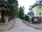
70 | Crows , a genus in the corvidae family | before 1925 | The short spur road leading from Waldstraße ends in a turning head and is already recorded in the address book from 1928 with a built-up property. |
|
| Krimnitzer way
( Location ) |
430 | Krimnitz , (Lower Sorbian Kśimnice), part of the city of Lübbenau / Spreewald | Apr 10, 1931 | The path was created as road 782 and leads from Vetschauer Allee to almost the Dahme bank. |

|
| Krugauer Steig
( Location ) |
360 | Krugau , (Lower Sorbian Dubrawa), part of the municipality of Märkische Heide | Apr 10, 1931 | The road leads from Vetschauer Allee via Rohrwallallee to Langen See. It was created by merging Straße 765 and Straße 767 . |

|
|
Lindenstrasse
( Location ) |
850 (in the district) |
Linden , genus of plants in the subfamily of the linden family (Tilioideae) within the mallow family | around 1920 | Lindenstrasse leads from Godbersenstrasse to Friendensstrasse in Eichwalde . Only numbers 6 to 39 on the eastern side up to the level of Tschaikowskistraße in Eichwalde belong to the district. |

|
| Lübbenauer way
( Location ) |
850 | Lübbenau / Spreewald (since January 1, 1998, previously Lübbenau), (Lubnjow / Błota in Lower Sorbian), city in Brandenburg | Apr 10, 1931 | The street in the village of Karolinenhof runs on both sides of Vetschauer Allee from Langen See via Platz 764 to Karolinenhofweg, where it ends as a dead end. It was created in 1931 by merging streets 760, 771, 772 and 773 . Many streets in the Karolinenhof are named after places in the Spreewald. |

|
|
Mariannenstrasse
( Location ) |
670 | Marianne, female name | before 1930 | It connects the Grenzstraße with the Zeuthener Straße and forms the border to Eichwalde . Only the northern vacant lots belong to Berlin. |

|
| Miersdorfer Strasse
( Location ) |
310 | Miersdorf , district of Zeuthen, Dahme-Spreewald district | July 26, 1927 | The road leads from the Waldstraße over the Eichwalder Aue to the Berlin Forest and ends there as a dead end. |

|
| Moss head ring
( Location ) |
700 | Georg Moßkopf († 1938), master glazier, resident | 1930 | Moßkopf founded the Rauchfangswerder-Süd landowner association in 1910, as its chairman, in 1911, it merged with the association of the same name for Rauchfangswerder-Nord and then headed the entire association until 1934. Moßkopf, who lived in the upmarket west of Berlin and bought a plot of land on the street himself (at that time: No. 51), accompanied the parceling and settlement of Rauchfangswerder-Süd and was instrumental in ensuring that Rauchfangswerder was connected to the Berlin electricity network in 1921. The road has a U-shaped course, it leads from the Böhmalle around the southern tip of Rauchfangswerder and ends at the edge of the forest. It is the southernmost street in Berlin. |

|
|
Nuscheweg
( Location ) |
700 | Albert Nusche, from 1863 to 1893 mayor of Schmöckwitz | Apr 10, 1931 | The Nuscheweg runs on both sides of the Zum Seeblick street. It was created by merging streets J and 793 . |

|
|
Peitzer way
( Location ) |
720 | Peitz (Picnjo in Lower Sorbian), town in the Spree-Neisse district | Apr 10, 1931 | The Peitzer Weg in the Karolinenhof leads from the north end of the Rohrwallalle to its south end. The previous name was 766 Street . |

|
| 764th place
( Location ) |
20 × 20 | still existing designation of the development plan | unknown | The triangular square is bordered by Vetschauer Allee, Lübbenauer Weg and Biebersdorfer Weg. |

|
| 768th place
( Location ) |
20 × 20 | still existing designation of the development plan | unknown | The place 768 consists of the road junction of the Fehrower Steig in the Rohrwallallee. |

|
| 770th place
( Location ) |
20 × 20 | still existing designation of the development plan | unknown | The 770 square consists of the confluence of the Lübbenauer Weg and Rohrwallallee. |

|
| 777th place
( Location ) |
20 × 20 | still existing designation of the development plan | unknown | The place 777 consists of the road junction of the Biebersdorfer Weg in the Rohrwallallee. |

|
| Pretschener Weg
( Location ) |
490 | Pretschen (Mrocna in Lower Sorbian), village in the Dahme-Spreewald district | Apr 10, 1931 | The street in the Karolinenhof settlement runs from Biebersdorfer Weg to Krimnitzer Weg. The previous name was 780 Street . |

|
| Bicyclist way
( Location ) |
330 | Raddusch (Lower Sorbian Raduš), place in the Spreewald and is part of the town of Vetschau in the Oberspreewald-Lausitz district | Apr 10, 1931 | The street in Karolinenhof was built as street 756 . It leads from Vetschauer Allee to Ragower Weg and ends as a dead end. |

|
|
Ragower way
( Location ) |
230 | Ragow (Rogow in Lower Sorbian), part of the city of Lübbenau / Spreewald in the Oberspreewald-Lausitz district. | Apr 10, 1931 | The street in the Karolinenhof leads from Lübbenauer Weg to Radduscher Weg. It was laid out as road 758 of the development plan. |

|
| Rainweg
( Location ) |
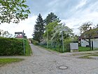
410 | Rain , term for the edge of a field | Jan. 22, 1924 | The road between Waldstrasse and Grünauer Weg was created as road 2 of the development plan. The name of the street probably refers to the border between the Köpenick district of Schmöckwitz and the municipality of Eichwalde, which no longer belongs to Berlin, to which the street leads. A reference to the field areas of the former Radeland Vorwerk, which was on Eichwald territory, is also possible. |
|
| Rehfeldtstrasse
( Location ) |
300 | Paul Rehfeldt (1848–1905), innkeeper, local politician | around 1920 | The street in the Karolinenhof leads from Schappachstraße to the sports promenade. The innkeeper Rehfeldt was one of the founders of the Karolinenhof villa colony and a long-time representative of the Schmöckwitz community. |

|
| Rohrwallallee
( Location ) |
1420 | Großer Rohrwall and Kleiner Rohrwall, islands in the Long Lake in front of the Karolinenhof colony | Apr 10, 1931 | The Rohrwallallee leads along the Long Lake from Schappachstrasse via Sielower Weg to Krimnitzer Weg. From 1929 to 1931 it was called Hindenburgstrasse . It was created in 1931 by merging Straße 778 and Hindenburgstraße . |

|
|
Schappachstrasse
( Location ) |
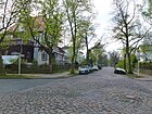
890 | Ernst Emil Albert Schappach (1848–1915), banker, founder of the Karolinenhof colony | around 1895 | In 1894, the Berlin banker Schappach bought the former farm north of the village of Schmöckwitz, which the colonist Kersten had laid out in 1782 on an area of about 72 hectares in the Köpenick official forest and named Karolinenhof after his wife's first name. He founded the Terraingesellschaft Carolinenhof, which parceled out the area and then created a villa colony from 1885. Schappach himself built the first house in the colony in 1895 (Schappachstrasse 16). He was buried in Kreuzberg at Cemetery I of the Jerusalem and New Churches (Protestant), Zossener Straße (hereditary burial). |
|
| Schmöckwitz dam
( Location ) |
3540 | Schmöckwitz , part of the Treptow-Köpenick district | 1928 | The street leads from Wernsdorfer Straße to the southern end of Rauchfangswerder. It was built as street G in the development plan from 1901. Since the settlement of Bockswerder (today Rauchfangswerder-Nord) in the middle of the 18th century, the only land connection for the inhabitants. Half-sided in the 19th century, only paved on both sides in 1964 and asphalted after 1970. A campus of the Japanese Teikyō University is located on the shores of Lake Zeuthen . |

|
| Schmöckwitzwerder South
( Location ) |
470 | Schmöckwitzwerder, location in Schmöckwitz on Lake Wernsdorfer | unknown | The street in the local area of Schmöckwitzwerder branches off from Wernsdorfer Straße and opens up the allotment gardens 'Naturfreunde Köpenick'. It ends on the shore of the Krossinsee. |

|
| Black way
( Location ) |
4510 (1540 + 2970) |
to the Black Mountains (37.2 m), over which the path leads | after 1937 | The path leads north of Wernsdorfer Straße through the Berlin forests to the Oder-Spree Canal and south of Wernsdorfer Straße to Rauchfangswerder, where it meets the Schmöckwitzer Damm at the beginning of the development. The name of the path probably refers to the Black Mountains over which the path leads. Until the bridge over the Oder-Spree Canal was blown up in April 1945, it was the connection between Schmöckwitz and Gosen . |

|
| Seddin promenade
( Location ) |
1520 | Seddinsee , lake on the south-eastern city limits of Berlin | before 1929 | The footpath leads from Wernsdorfer Straße along the banks of the Seddinsee and further along the Oder-Spree Canal . A junction leads to the Schwarzer Weg, via which the boathouses at the southern end of the Seddinsee can be reached. | |
| Settlers Corner
( Location ) |
160 | Road runs at an obtuse angle | Feb. 18, 1927 | The cul-de-sac branches off from Waldstraße and was laid out as street 8 of the development plan. |

|
| Sielower way
( Location ) |
330 | Sielow (Žylow in Lower Sorbian), part of the city of Cottbus in Brandenburg | Apr 10, 1931 | The Sielower Weg is located in the Karolinenhof between Vetschauer Straße and Rohrwallallee. The previous name was 781 Street . |

|
| Sports promenade
( Location ) |
540 (in the district) |
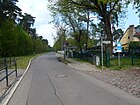
corresponding to the importance of Grünau as a center of water sports | March 23, 1925 | The sports promenade turns into Vetschauer Allee and runs along the banks of the Long Lake. The Schmöckwitz – Grünauer Uferbahn operates on this route . The club house of the Rowing Association Rotation Berlin e. V. |
|
| Street D.
( Location ) |
110 | according to the development plan of Rauchfangswerder still existing name | after 1901 | Street D in Rauchfangswerder is a cul-de-sac from Argoallee and ends at Lake Zeuthen . |

|
| Striesower Weg
( Location ) |
330 | Striesow (Lower Sorbian Strjazow), part of the municipality of Dissen-Striesow in Brandenburg | Apr 10, 1931 | The route laid out as road 759 in the Karolinenhof settlement leads from Lübbenauer Weg to Radduscher Weg. |

|
|
Treppendorfer way
( Location ) |
400 | Treppendorf (Rańchow in Lower Sorbian), part of the city of Lübben (Spreewald) in Brandenburg | Apr 10, 1931 | The Treppendorfer Weg in the Karolinenhof settlement connects Schappachstrasse and Lübbenauer Weg. It was created as street 761 of the development plan. |

|
|
Vetschauer Allee
( Location ) |
1340 | Vetschau / Spreewald (Lower Sorbian Wětošow), small town in the Oberspreewald-Lausitz district | Apr 10, 1931 | The Vetschauer Alle is the main traffic connection in the Karolinenhof. As an extension of the sports promenade, it leads to the Adlergestell. The tracks of the Schmöckwitz – Grünauer Uferbahn run in the middle of the street . It was built in 1906 when the villa colony was built as Stubenrauchstrasse . In 1931 the Stubenrauchstrasse and the street 763 were named in Vetschauer Allee. |

|
| Viebahnstrasse
( Location ) |
100 | Friedrich Karl Hermann Georg von Viebahn (1840–1915), general and evangelist | July 26, 1927 | The short cul-de-sac starts from the Eichwalder Aue and ends at the Berlin Forest. It was built as Straße 717 and is located on the former site of the non-profit association of Christian settlements, of which Viebahn was one of the sponsors. |

|
|
Forest road
( Location ) |
1770 (in the district) |
Forest , location in the nearby Berlin Forest | unknown | The Waldstraße runs from the Grenzstraße in Eichwalde to August-Bebel-Straße. Its south side faces the Brandenburg area and forms the border between Berlin and Brandenburg from the Grenzstraße to the Triftgraben . Only the northern plots (72–246, straight) belong to the district. From March 23, 1934 until after 1956 it was called Dreyerallee after Willi Dreyer, a member of the Reich who died in the French penitentiary of St. Martin de Ré. |

|
| Queen path
( Location ) |
190 | Weisel, queen bee | 23 Sep 1938 | The Weiselpfad leads from the Imkerweg to the boathouses on the northeast side of the Schmöckwitz marina. From around 1900 to 1938 it was called Gartenstrasse . Before the development of this area there was a garden area, after which the street was named. |

|
| Wendel-Hipler-Weg
( Location ) |
340 | Wendel Hipler (1465–1526), farmer leader | May 31, 1951 | The road goes from the forest road and leads to the Eichwalder Aue, where it ends as a dead end. From July 26, 1927 to May 31, 1951 it was called Michaelisweg , after the Prussian statesman Georg Michaelis . The street lies on the site of the former non-profit association of Christian settlements, of which Michaelis was one of the sponsors. At the plant it was called Straße 715 . |

|
| Wernsdorfer Strasse
( Location ) |
3500 | Wernsdorf , part of the city of Königs Wusterhausen in Brandenburg | Aug 15, 1958 | The Wernsdorfer Straße leads as a continuation of the eagle frame through the Schmöckwitzer Werder, the location east of the Dahme , and merges at the city limits into the Landstraße 30, which continues to Erkner . The street has been named since 1958 when the western part of the then Berliner Straße (today: Adlergestell ) was merged to the Schmöckwitzer Bridge and the Wernsdorfer Landstraße . A northern branch leads to the Oder-Spree Canal and opens up the area of the Berlin-Schmöckwitz Academy located here. |

|
| Windwallstrasse
( Location ) |
290 | Windwall, the name of the corridor between Kleiner Krampe and Seddinsee | Jan. 29, 1937 | The road runs via Zum Seeblick parallel to the lake shore to the boathouse of the Grünau motor water sports club. From around 1900 to 1937, she was named Schopenhauerstraße in plant road H . |

|
|
Zaucher way
( Location ) |
460 | Zauche , plateau in the southeast of Brandenburg | Apr 10, 1931 | The street in the Karolinenhof settlement leads from Biebersdorfer Weg to Krimnitzer Weg. Before street 779 of the development plan. |

|
| Zerkwitzer way
( Location ) |
270 | Zerkwitz (Lower Sorbian Cerkwica), part of the city of Lübbenau / Spreewald in Brandenburg | Apr 10, 1931 | The path in the Karolinenhof settlement lies on both sides of Vetschauer Allee between Treppendorfer Weg and Peitzer Weg. It was created as street 762 of the development plan. |

|
| Zeuthen path
( Location ) |
160 | Zeuthen , municipality in Brandenburg | 17 Sep 1938 | The road connects the Moßkopfring running in the arch. From after 1900 to 1938 it was called Georg-Meyer-Allee , after the Prussian politician Georg Meyer . It was already known as Zeuthener Weg from 1937, but the name was not officially renamed until September 17, 1938. This point in time suggests that the endeavor to find part or all of the street was named after the private scholar Nicolai Zeuthen (founder of the Rauchfangswerder-Nord landowner association ) in Zeuthenweg should be officially opposed, as the intended namesake was probably Jewish. |

|
| To the Gosen mountains
( Location ) |
490 | Gosener Berge , mountain range in the municipality of Gosen-Neu Zittau in Brandenburg | Apr 6, 2005 | The street north of the Oder-Spree Canal was previously unnamed. It opens up a housing estate and can only be reached via the Brandenburg area. It opens up the housing estate in the street Am Oder-Spree-Kanal. |

|
| To the lake view
( Location ) |
280 | Connection to the Long Lake | Feb. 14, 1976 | The road leads in a north-easterly direction to the Long Lake and ends there as a dead end . From before 1923 to 1937 it was called Fontanestrasse . In the Berlin address book of 1923, in which Schmöckwitz appears for the first time, it is listed with three houses. The name from 1937 to 1976 was Goulbierstrasse , named after the Köpenick district councilor and city councilor of the German National People's Party . |

|
Former streets
| Surname | Origin of name | when named | until when valid | possibly today's name | Remarks |
|---|---|---|---|---|---|
| Berlin street | Berlin , direction | around 1870 | Aug 15, 1958 |
→ Adlergestell → Wernsdorfer Straße |
It originally ran from Schappachstrasse to Schmöckwitz Bridge. The part between Schappachstrasse and Alt-Schmöckwitz became part of the eagle frame in 1958, between Alt-Schmöckwitz and the Schmöckwitzer Bridge came to Wernsdorfer Strasse, which was renamed Wernsdorfer Landstrasse on the same day . |
| Dreyerallee | Willi Dreyer, a member of the Reich who died in 1924 in the French penitentiary of St. Martin de Ré | March 23, 1934 | 1956 | → Forest road | According to the 1943 address book, Willi Dreyer was “a fighter for Germany's freedom and awakening who died in French captivity”. The background is no longer known. His body was transferred to Berlin in April 1924 and buried with the participation of the Reichswehr and patriotic associations. |
| Fontanestrasse | Theodor Fontane , writer | before 1928 | Jan. 29, 1937 | → Goulbierstrasse | Fontanestrasse was named Goulbierstrasse in 1937 after the Köpenick district councilor and city councilor of the German National People's Party . It wasn't until 1976 that it got its original name again. |
| gardenstreet | after the gardens that used to be here | around 1900 | 23 Sep 1938 | → Queen path | |
| Georg-Meyer-Allee | Georg Meyer (1841–1900), lawyer, university professor and member of the Reichstag | after 1900 | 23 Sep 1938 | → Zeuthener Weg | It got its new name as part of a major renaming campaign. |
| Goulbierstrasse | Théodore François Édouard Goulbier (1873–1935), goldsmith, Köpenick city councilor of the German National People's Party | Jan. 29, 1937 | Jan. 14, 1976 | → To the lake view | |
| Hindenburgstrasse | Paul von Hindenburg (1847–1934), German military and politician | 1929 | Apr 10, 1931 | → Rohrwallallee | To avoid confusion with the street of the same name in other districts, e.g. B. in Berlin-Lankwitz . |
| Kaiser-Wilhelm-Platz | Wilhelm I (1797–1888), first German Emperor | after 1871 | 23 Sep 1938 | → Alt-Schmöckwitz | The Kaiser-Wilhelm-Platz was awarded the Coastal summarized the street Alt-Schmöckwitz. The village center of many former villages in Berlin, often called Dorfstrasse or Hauptstrasse, was given the prefix "Alt" to the place name. This happened on the one hand to reduce the many street names of the same name and on the other hand as a reference to the historical places. |
| Karolinenhofstrasse | Karolinenhof villa colony | after 1894 | Apr 10, 1931 | → Karolinenhofweg | In 1931 the street 757 and the Karolinenhofstraße were renamed to Karolinenhofweg. All smaller streets here have the ending “Weg” and the two larger “Allee”. The Schappachstraße , named after the founder of the colony, is the only "road" in the district. |
| Michaelisweg | Georg Michaelis (1857–1936), German lawyer and politician | Jul 26, 1927 | May 31, 1951 | → Wendel-Hipler-Weg | Michaelis, an old Prussian conservative civil servant with a pietistic social sentiment, was a leading representative of the Christian community movement, a church reform movement that had continued the tradition of pietism and the awakening movement within the Protestant regional churches since the middle of the 19th century and developed a practical lay piety for the Goal. He was a member of the General Synod and the Church Council of the Old Prussian Union, the Christian Association of Young Men and the German Christian Student Association (which he has led since 1913).
The street lies on the site of the former non-profit association of Christian settlements, of which Michaelis was one of the sponsors. A street named after a churchman was undesirable in the GDR. |
| Mittelstrasse | Location in the colony | after 1866 | 23 Sep 1938 | → Loot path | The renaming served to reduce the number of streets with the same name in Berlin. |
| Schopenhauerstrasse | Arthur Schopenhauer (1788–1860), philosopher | Jan. 22, 1924 | Jan. 29, 1937 | → Windwallstrasse | Before road H . The renaming took place at the same time as that of Fontanestrasse. |
| Seestrasse | Location on Seddinsee | after 1866 | 23 Sep 1938 | → At Seddinsee | To avoid confusion with the street of the same name in other districts, e.g. B. in Rahnsdorf . It was also called "Am See" at the same time. |
| Beach path | before 1871 | 23 Sep 1938 | → Alt-Schmöckwitz | The Strandweg , located on the shores of Lake Zeuthen , was merged with Kaiser-Wilhelm-Platz in Alt-Schmöckwitz. | |
| Stubenrauchstrasse | Ernst von Stubenrauch (1853–1909), District Administrator of the Teltow District | 1906 | Apr 10, 1931 | → Vetschauer Strasse | Since there are numerous Stubenrauchstrasse in Berlin, e.g. B. Friedenau , Johannisthal or Lichterfelde , the renaming served to reduce the many streets with the same name in Berlin. |
| Wendenstrasse | after 1866 | 23 Sep 1938 | → Beekeeping Path | To avoid confusion with the street of the same name in other districts, e.g. B. in Koepenick . | |
| Meadow road | around 1900 | after 1931 | overbuilt | Across from Godbersenstrasse from Berliner Strasse. Listed as undeveloped in the address book until 1931. |
Further locations in Berlin-Schmöckwitz
- Krossinsee campsite
- Small pipe wall
Allotment gardens
- KGA 'Richtershorn', named after Ferdinand Gustav Richter (1843-1918), landowner and local politician in Grünau, who owned the land, and after its location on a headland (Horn)
- KGA, for recreation ', the Naturfreunde Köpenick
See also
literature
- Hans-Jürgen Mende (Ed.): Lexicon of all Berlin streets and squares. From the foundation to the present . 2nd volume. New Life / Edition Luisenstadt, Berlin 1998, ISBN 3-355-01491-5 .
Web links
- Streets in Schmöckwitz. kaupert media gmbh, accessed on April 11, 2010 .
- Map of Berlin 1: 5000 with district boundaries. Senate Department for Urban Development Berlin, 2009, accessed on July 13, 2011 .
- Berlin-Brandenburg Statistics Office: Directory of streets and squares in the Treptow-Köpenick district (as of February 2015); pdf
Individual evidence
- ^ Sailing Club Seddin e. V. ( Memento of the original from December 24, 2013 in the Internet Archive ) Info: The archive link was automatically inserted and not yet checked. Please check the original and archive link according to the instructions and then remove this notice.
- ↑ Sailing Club Argo e. V. ( Memento of the original from June 10, 2013 in the Internet Archive ) Info: The archive link was inserted automatically and has not yet been checked. Please check the original and archive link according to the instructions and then remove this notice.
- ↑ Ebelallee Kauperts.de
- ^ Berlin address book from 1928
- ^ Association of Berliner Segler eV
- ^ Berlin address book from 1928
- ^ Godbersenstrasse Kauperts.de
- ↑ Imkerweg Kauperts.de
- ↑ ESV Schmöckwitz e. V.
- ↑ Moßkopfring Kauperts.de
- ^ Rainweg Kauperts.de
- ↑ Schappachstrasse Kauperts.de
- ↑ Schmöckwitzer Damm Kauperts.de
- ^ Rowing Association Rotation Berlin eV
- ↑ Schmöckwitz marina
- ↑ Akademie Berlin-Schmöckwitz ( Memento of the original dated December 3, 2013 in the Internet Archive ) Info: The archive link was inserted automatically and has not yet been checked. Please check the original and archive link according to the instructions and then remove this notice.
- ↑ MC Grünau e. V.
- ^ Zeuthener Weg Kauperts.de
- ^ Berlin address book from 1923
- ^ Berlin address book from 1943
- ^ Funeral of Willi Dreyer Wikimedia Commons


