List of streets and squares in Berlin-Müggelheim

The list of streets and squares in Berlin-Müggelheim describes the street system in the Berlin district of Müggelheim with the corresponding historical references. At the same time, this compilation is part of the lists of all Berlin streets and places .
Overview and principles of street naming
Müggelheim has 6,798 inhabitants (as of December 30, 2019) and includes the postcode area 12559. There are 108 dedicated streets in the district, only the Müggelheimer Damm extends into the neighboring districts. The total length of all these settlement roads and paths is 47.4 kilometers.
The location between Müggelspree and Dahme meant that most of the streets and paths lead off the main road between Köpenick and Spreenhagen: Müggelheimer Damm , Alt-Müggelheim , Gosener Damm and Gosener Landstraße .
The urban development around the village meadow is reflected in the road system. The colonist settlement was laid out in 1747 for 20 Protestant farming families from the Palatinate around an elongated meadow , the village meadow. It was hardly expanded until the end of the 19th century. In 1890, the ten kilometer long Chaussee from Köpenick to Forsthaus Fahlenberg (today: Müggelheimer Damm - Alt-Müggelheim - Gosener Damm - Gosener Landstrasse to around New Fahlenbergbrücke ) was expanded, which is still the only access road to this day.
The subdivision of the Müggelheimer Land began at the beginning of the 20th century. The expansion of the place in the Teltow district to the north and south did not take place until the 1920s and during the Second World War . In the Berlin address book from 1922, under the administrative district of Cöpenick for Müggelheim, only three streets are named: Dorfstraße (from Chaussee to Cöpenick, way to Krampenburg to Rahnsdorfer Weg), Gartenstraße (starting from Rahnsdorfer Weg), Rahnsdorfer Weg (undeveloped from village to Spreewiesen) and Spreewiesen from the Rahnsdorf district via road 35 (here Restaurant Spreewiese) to the village. Many streets in the district were named in the 1930s and 1940s after places and localities in the Palatinate (in the historical area of the Duchy of Palatinate-Zweibrücken ), prompted by the establishment of Müggelheim by 20 Palatinate colonist families from Odernheim and Meisenbach. The streets, named after 1950, were preferably named after the names of landmarks or locally known personalities. The dynamics of the area can be found in the last renaming of the 2000s. Many of the sandy paths were supplemented by an asphalt strip at least three meters wide. A conservation ordinance for Alt-Müggelheim was set up for the Anger von Müggelheim. The naming of the numbered streets in the 2000s was made according to the wishes of residents and in the “efforts of the district office to gradually give the still existing numbered streets with proper street names. [... It is] in the public interest to improve the orientation for residents, visitors and other road users. ”However, individual name requests failed, as in the reunified Berlin, according to the Senate, no street names that had already been assigned may be repeated.
Overview of streets and squares
The following table gives an overview of the streets and squares in the district as well as some related information.
- Name / location : current name of the street or square. Via the link Location , the street or the square can be displayed on various map services. The geoposition indicates the approximate center of the street length.
- Traffic routes not listed in the official street directory are marked with * .
- Former or no longer valid street names are in italics . A separate list may be available for important former streets or historical street names.
-
Length / dimensions in meters:
The length information contained in the overview are rounded overview values that were determined in Google Earth using the local scale. They are used for comparison purposes and, if official values are known, are exchanged and marked separately.
For squares, the dimensions are given in the form a × b for rectangular systems and for (approximately) triangular systems as a × b × c with a as the longest side.
If the street continues into neighboring districts, the addition ' in the district ' indicates how long the street section within the district of this article is. - Name origin : origin or reference of the name.
- Notes : further information on adjacent monuments or institutions, the history of the street and historical names.
- Image : Photo of the street or an adjacent object.
| Name / location | Length / dimensions (in meters) |
Origin of name | Date of designation | Remarks | image |
|---|---|---|---|---|---|
|
Abtweiler Street
( Location ) |
140 | Abtweiler , municipality in Rhineland-Palatinate , Meisenheim association | Aug 16, 1928 | The street branches off from Gersweiler Aue at the corner of Staudernheimer Straße to the southeast and crosses Meisenheimer Straße before it turns into a footpath to Krummen Laake at Berlin's Jagen 180 forest . The street lies in an area in which other streets bear Palatine names; before it was named, it was routed as street 689 . For 1930 the street is listed as Staudernheimer Straße, Gersweiler Aue and Meisenheimer Straße with a house of the locksmith Reimer, for 1943 there are three houses and a summer house. Plots 1–11 as well as 2 and 4 belong to the street, as an asphalt strip that turns to Meisenheimer Straße, 60 meters of the street, and it continues as an unpaved road ( dead end ), with forest on the straight (southwest) side stands. |

|
| Alsenzer way
( Location ) |
720 | Alsenz , municipality in Rhineland-Palatinate | Jan. 29, 1937 | The road lies between Müggelheimer Damm and Enkenbacher Weg and is routed as road 619 according to the development plan . The settlement in Müggelheim was founded in 1747 by colonists from the Palatinate, which is why streets are named after places in Rhineland-Palatinate. The Alsenzer Weg is listed in 1943 on the numbered 72 plots in orientation numbering in the direction of counting from Müggelheimer Damm. |

|
| Alt-Müggelheim
( Location ) |
320 | Anger of the colonist settlement Müggelheim | March 8, 1935 | The road lies on both sides in the direction of the lanes from the settlement center and the church between Hirseländer Weg and Krampenburger / Geinsheimer Weg. As the main street of the district, it continues north in the direction of Köpenick in Müggelheimer Damm and south to the city limits in Gosener Damm. The street is categorized in the Berlin street system as a higher-level road connection. The spindle-shaped road between Müggelheimer Damm and Gosener Damm, reminiscent of medieval village villages, surrounds the church and the former village school. The historical street names Dorfaue and Dorfstrasse were renamed after the incorporation to Greater Berlin in 1935 in the typical district for Berlin with the prefix "Alt-". In 1935 the Dorfaue and the part of the Dorfstrasse from the Alten Krug to the Krampenburger Weg were renamed Alt-Müggelheim, the part of the Dorfstrasse leading to the southeast was named Gosener Damm. For 1943, on the 20 properties in irregular numbering, houses, some of which are inhabited by several parties, the church (22), the school (21) and the Müggelheim local office (10) are listed. In the current official register, plots 1–22 are listed (continuously). Until the 1920s, the Dorfstrasse was an unpaved sand path around the church from the early days of the Palatinate colonists with green areas in the untravelled areas. In 2006 the street in the center of Müggelheim was renovated. |

|
| At the farmer's grove
( Location ) |
410 | Forest area that belonged to the original settlers | Jan. 11, 2010 | The street Am Bauernwäldchen was called street 686 until it was named according to the development plan . It is located between Becherbacher Straße and Geinsheimer Weg, northeast of Gosener Damm. In the 1943 address book, nine residential buildings and four summer houses are shown without property numbering. “The name in Am Bauernwäldchen refers to the location on a pines-covered farmland belonging to the colonists, which bears the field name 'The Suction Gardens'.” The current directory names the properties Am Bauernwäldchen 1–39 (odd) and 4–40 (even ). |

|
| At the farmer's lake
( Location ) |
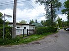
310 | Bauersee, remnant of a tributary of the Spree; named at the request of local residents | Sep 24 2009 | The street 34 was partially named in 2008 (in the public section), it lies with the plots 1–14 (consecutive) on both sides of the street Zur Fähre. It is a small, quiet residential street with a village character. The Bauersee in Müggelheim is the remnant of a tributary of the Spree, which branched off the Spreelauf at the level of the Spreewiesen settlement and returns to the river east of the Kleiner Müggelsee via the Parine trickle. The "Insel am Bauersee", which is surrounded by the Bauersee and the Spree, is no longer an island due to the partial siltation. The farmer's lake is surrounded by marshy terrain, wet meadows and deciduous forest. The street 34 is indicated in the address book 1943 with a house in the projected settlement of street 50 , over street 35, street 36, street 37, street 38, street 39, street 40, street 41, street 42 and street 43 to the Spree. In the meantime the development has disappeared, between the course of road 38 and road 41 and east of this forest there is undeveloped grassland in the settlement area on the south bank of the Müggelspree. The public part of the street was named, the private area of street 34 remained untouched as long as the owners did not apply for a designation. |
|
| At the Kaniswall
( Location ) |
1150 | Kaniswall, elevation around a small wooded sand hill in the Gosener meadows | 5th June 2012 | The Am Kaniswall path is a connection to the Kaniswall open-air laboratory in the Berlin Forest, which is continued by the Spreenhagen Office. It leads along the western side of the Kanis- and Streitwall forest area and is partly in Müggelheim. It continues to the southeast in Neu-Zittau (Spreenhagen office) with a connection via the Kappweg through the Kaufwiesen to Berliner Straße outside the Berlin city area, and the north connection also leads to the Gosener Wiesen outside the city area. The Kaniswall was formed during the last Ice Age around 18,000 years ago in the Berlin glacial valley and is the southernmost branch of the Barnim. Theodor Fontane has handed down the origin of the name Kaniswall that a fisherman named Kahnis lived here with his family in the 19th century. It remains to be seen whether the fisherman from Kahniswall actually existed and whether the flower colonist family lived on Kaniswall. |

|
| On the Müggelberg
( Location ) |
530 | Müggelberge , mountain range in the southeast of Berlin | June 13, 1936 | Am Müggelberg is the westernmost street in the southern Müggelheim settlement area near the border with the Köpenick district and is on the eastern edge of the Müggelberge. It is located between Grünstadter Weg and Philipp-Jacob-Rauch-Straße . Until the time it was named, it was listed as Straße 601 of the Müggelheim development plan. The street 601 is not yet listed in the 1930 address book, but there are other 600 streets. In the 1935 address book it is listed between 605 and Feldmark with four residential buildings on unnumbered properties. For the road, the sites Am Müggelberg 20–78 (even) and 21–75 (even) are currently listed in the official documents, so the sites smaller than 20 to the north through the Köpenick municipal forest to Müggelheimer Damm do not exist. |

|
| On the steep slope
( Location ) |
140 | steep terrain drop of ten meters to the Großer Krampe | Nov 5, 1942 | The path in the southeast of the district on the Große Krampe runs southeast from Horchheimer Weg as a narrow asphalt strip with unpaved edge strips, and on the steep slope a staircase overcomes the descent to the Rinnstaler Steig. Another part of the path branches off to the right as a dead end. Plots 1–19 (odd) as well as 4, 6 and 18, 20 are currently listed in the official list. The path is listed in the 1943 address book between Horchheimer Weg and Rinntaler Steig. The road belongs to the Große Krampe settlement, in 1923 it was still a forest with a strip of banks under the name Heiga. In the 1935 address book still listed as a parceled Heiga site. The soil formation was changed by sand mining for mortar and the land was settled after the mining ended. | |
| At the wild bush
( Location ) |
290 | Wild bush, adjacent forest | July 1, 2008 | The previous name was 655 Street . The road lies between Tongrubenweg and Hirseländer Weg , the northeast side of the road borders on the wooded area "Die Apfelstücke". The built-up side of the street faces unused farmland with a former gravel pit. In the forest, bushes, bushes and trees have settled and multiplied in an uncontrolled manner, and the undergrowth is sometimes so dense that passage is not possible. The street 655 is already mentioned in the 1943 address book with eight residential houses and two summer houses in today's guide, and the information forest on the undeveloped side is also given. |

|
| At the sky meadow
( Location ) |
340 | Himmelswiese, parceled farmland lying here | Feb 5, 2008 | The private road 696 was renamed to road 696 on July 4, 1991 and received its new name in 2008. It lies between the Tongrubenweg and the Hirseländer Weg in the north of the district, separated from the Kleiner Müggelsee by a piece of forest and the Hirseländer colony. The path is not far from a former parceled farmland, the Himmelswiese, a large part of which has been fenced off since the 1930s. Today it belongs to the “Sport and Recreation Association Kleiner Müggelsee e. V. ". For many years there were only tents on the site, later small summer arbors were built. In 1943 the road 696 with eight residential houses and two summer houses is named in its current location, on the right side is the forest, the road ends at the forest. Today's plots are An der Himmelswiese 1–31 (odd) and 2–40 (even). |

|
| At the Krummen Lake
( Location ) |
420 | Krumme Laake , lake east of Müggelheim | June 24, 1960 | It runs as a dead end from the Duchrother over the Glottertaler Straße to the northeast, parallel to the forest behind the eastern properties and ends at NSG Krumme Lake . It opens up the properties at Krummen Lake 1–51 (odd) and 4–52 (even) in the northern settlement area of the district. The name of the lake is derived from its shape. Lake (also Laake and Lanke ) is the name of a forest lake with no inflow or outflow that slowly silts up, or a swamp. |

|
| Annweilerweg
( Location ) |
270 | Annweiler , town in Rhineland-Palatinate | March 8, 1935 | The street lies between Hirseländer Weg and Odernheimer Straße in the settlement area north of the town center and parallel between Kirsteiner and Norheimer Weg. In 1935, the access road was named after Müggelheim's development plan, Straße 640, like other streets in Müggelheim after places in the Palatinate, in memory of the 20 Palatinate families who founded this colonist town in 1747. |

|
| Appelbacher way
( Location ) |
560 | Appelbach , river in Rhineland-Palatinate | Dec. 4, 1930 | The road, which is routed as road 617 , was named in 1930 after the right tributary of the Nahe, although this location was chosen in the Palatinate because Müggelheim was founded in 1747 by colonists from the Palatinate. It is located between Berghauser and Philipp-Jacob-Rauch-Straße. For 1935 there are six residential houses and a summer house on this street, the location of which is indicated with forest, Ludwigshöhenweg, projected street and field mark. The properties Appelbacher Weg 1–57 (odd) and 2–54 (even) are listed in the current address directory. The street belongs to the settlement area from the southwest of the town center. |

|
|
Becherbacher Strasse
( Location ) |
410 | Becherbach , municipality in Rhineland-Palatinate | Aug 16, 1928 | The street lies between Odernheimer Straße and Gersweileraue / Gersweiler Straße (dead end). It is a two-lane asphalt driveway with a wide unpaved verge on the north side and a sidewalk with road trees on the opposite side. The road 680 of the development plan was named after a Palatinate municipality (located near Meisenheim according to the road location) and belongs to the settlement area northeast of the town center and the Gosener Damm. The Müggelheim sports field is located on the north side of the street. |

|
| Berghauser Strasse
( Location ) |
620 | Berghausen, part of the municipality of Römerberg in Rhineland-Palatinate | Jan. 29, 1937 | The road lies between Appelbacher and Eppenbrunner Weg, as a cul-de-sac beyond this in the south-western settlement area. The naming of the routed road 613 according to the development plan from the end of the 1920s took place in 1937 after a Palatinate municipality, as with the surrounding streets. |

|
| Birkweilerstrasse
( Location ) |
200 | Birkweiler , municipality in Rhineland-Palatinate | May 13, 1929 | The street is located between Odernheimer and Heisterbachstraße in the route of the access to properties provided as street 682 according to the development plan. In 1935 the address book lists two residential buildings and two new buildings. It is the next parallel north of Alt-Müggelheim. |

|
|
Darstein's way
( Location ) |
520 | Darstein , municipality in Rhineland-Palatinate , in the district of Südwestpfalz | June 13, 1936 | The street, first street 693 , between Gosener Damm and Geinsheimer Weg is a concrete street with unpaved edge strips and without drainage canals and is the easternmost street of the settlement north of the local main street. The expansion of the road followed a path in 1936 that until then had not been officially designated as the Postlandweg . In 2007 it became known that the name was named after this Palatinate place, since the 106 voters of the Darstein community had voted for the NSDAP in the 1930 Reichstag election (Darstein became an "honorary member of the NSDAP"). In the neighboring town of Hauenstein , almost everyone voted against Hitler. |

|
| Duchrother Strasse
( Location ) |
830 | Duchroth , municipality in Rhineland-Palatinate | March 8, 1935 | A part of the street laid out after 1919 was initially called Gartenstraße and was named in 1935 with the addition of the route from Straße 670 according to the development plan in Duchrother Straße. Further streets in Müggelheim are named after places in the vicinity of Duchroth, these naming specifications are related to the origin of the 20 Müggelheim colonist families from the Palatinate. The street, which lies further from the center to the northeast in the settlement, lies between Hirseländer Weg and Staudernheimer Straße and branches off from Odernheimer Straße on both sides. |

|
|
Elmsteiner way
( Location ) |
260 | Elmstein , municipality in Rhineland-Palatinate | Oct 18, 1937 | The street is located in the east of the settlement area south of the town center between Enkenbacher and Hornbacher Weg. It was laid out in 1937 on the route of road 612 of the development plan from the end of the 1920s, due to the tradition of the Müggelheim colonist families from the Palatinate, the streets are usually named after places in the Palatinate. Of the 28 properties, six inhabited and two uninhabited houses are listed in the 1943 address book, 17 and 21 are named as non-existent, the other properties are listed as construction sites. |

|
| Enkenbacher way
( Location ) |
1300 | Enkenbach , part of the municipality of Enkenbach-Alsenborn in Rhineland-Palatinate | Nov 5, 1942 | The street is located between Philipp-Jacob-Rauch-Straße and Krampenburger Weg in the settlement area southwest of the town center, with a north-east curve at Ludwigshöher Weg. At the time the street was named, the Palatinate community of Enkenbach was still independent. The street was determined in 1942 in the course of the planned and probably already partially laid street 603, street 610 and street 611 . In the 1943 address book, Enkenbacher Straße is written out between Feldmark, Feldweg, Ludwigshöheweg, Berghauser, Sobernheimer Straße and Alsenzer Weg. According to the address book, there are 27 plots of land built with residential buildings and some summer houses, but there are construction sites as well as unsold plots and farmland on the road. The plots were not numbered in 1943. Plots 15–33, 43–147 (odd) and 22–34, 44–148 (even) are currently built on, with some of the plots being omitted and some shared (a and b) plots below. |

|
| Eppenbrunn way
( Location ) |
620 | Eppenbrunn , municipality in Rhineland-Palatinate | Oct 18, 1937 | The Eppenbrunner Weg consists of an asphalt strip as a roadway with unpaved edge strips on the southwest edge of the southern settlement area towards the Köpenick municipal forest. It is located between Sobernheimer and Berghauser Straße. Over the latter he continues as a dead end street and then turns into an unpaved road and west of the settlement houses a footpath into the forest. According to the development plan, road 623 was laid out along this route . |

|
| Erlenbacher Steig
( Location ) |
250 | Erlenbach near Dahn , municipality in Rhineland-Palatinate | Nov 5, 1942 | The Erlenbacher Weg lies between Hallgarter and Rinntaler Steig. In this location it forms the edge of the settlement area in the south of the district between the slope on the bank of the Große Krampe, at the east end of the path at 34.1 m above sea level. NN , crosses the Münchweiler Steig at 35.7 m above sea level. NN and flows into the curve of the Rinntaler Steig before the Hochheimer Weg at a height of 44.0 m above sea level. NN, with a good ten meter slope on 250 meters of road length. In 1943 the climb was taken off from the Rinntaler Steig, but it is still undeveloped. The road belongs to the Große Krampe settlement, in 1923 it was still a forest with a strip of banks under the name Heiga . In the 1935 address book, everything is listed as Heiga land parceled out. The soil formation changed due to the extraction of sand for mortar extraction. The land was settled after the mining ended. |

|
|
Geinsheimer way
( Location ) |
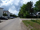
780 | Geinsheim , district of Neustadt an der Weinstrasse in Rhineland-Palatinate | May 13, 1929 | The Geinsheimer Weg lies between Alt-Müggelheim (east end of the village meadow) and Darsteiner Weg in the settlement northeast of the town center. The road 684 , which was laid out in the development plan, was named after a place in the Palatinate as early as 1929 and was set up as an unpaved sandy path to access the property. In the 1928 address book, street 684 was already laid out and indicated with two houses from Dorfstraße. An unpaved cul-de-sac continues over the Darsteiner Weg to the edge of the forest, while the concrete driveway with its wide marginal strips turns into the Darsteiner Weg here. As a result of the connection to the Dorfaue, the street was already built on in 1935 with seven residential buildings, but in the course of the Dorfstrasse, Heisterbacher Strasse, Strasse 698 , Gersweiler, Meisenheimer Strasse, there are also adjacent forest and farmland. |
|
| Gersweileraue
( Location ) |
150 × 150 × 50 (triangular green area) |
Gersweiler, part of the municipality of Finkenbach-Gersweiler in Rhineland-Palatinate | May 13, 1929 | First street 688 of the Müggelheim development plan from the 1920s, this place - an area with trees, bushes and intersecting sand paths - is between Becherbacher Straße and Abtweiler Straße, in the south the Gersweiler Straße opens, in the north the Staudernheimer Straße. According to the list of the statistics office, the properties Gersweileraue 2–14 (even) and 3–13 (odd) belong to it. In 1935 there were already eight developed plots and three construction sites as well as four parceled plots on the Gersweiler Aue. |

|
| Gersweilerstrasse
( Location ) |
250 | Gersweiler, part of the municipality of Finkenbach-Gersweiler in Rhineland-Palatinate | May 13, 1929 | Geisweiler Strasse is located between Geinsheimer Weg and Becherbacher Strasse in the settlement area east of the town center, where it is now paved but without street drainage. The parcels of Gersweilerstraße 1–25 (odd) and 2–26 (even) are on the street. In 1935 6, 8, 10, 14, 16, 22 and 26 were already built on, and there were construction sites on the left. |

|
| Glottertaler Strasse
( Location ) |
380 | Glottertal , municipality in Baden-Württemberg | Aug 16, 1928 | The street is between Odernheimer Straße and Zur krummen Laake , in the route of Straße 669 . For 1935 four houses on unnumbered lots and summer houses are named. The road led to the forest, partly through it. |

|
| Gosener dam
( Location ) |
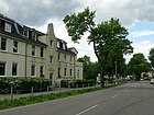
630 | Gosen, part of the municipality of Gosen-Neu Zittau in Brandenburg | March 8, 1935 | Until 1935, the street belonged to Dorfstraße as the eastern exit to Gosen. At the center of the village, the Gosener Damm connects to Alt-Müggelheim to the west and to the Gosener Landstrasse to the east. It is located between Geinsheimer / Krampenburger Weg (edge of the village meadow) and Darsteiner Weg on the eastern edge of the populated area. At the edge of the forest, the Gosener Damm curves to the east, straight ahead is the forest / footpath called the winter path to the north bank of the Große Krampe. The street is categorized as a higher-level road connection in the Berlin road system and was renovated in 2003. |
|
| Gosener Landstrasse
( Location ) |
3210 | Gosen, part of the municipality of Gosen-Neu Zittau in Brandenburg | before 1920 | The road is the old eastward connection from Müggelheim to Gosen, through Forst (currently: Stadtforst Köpenick). The street continues the Gosener Damm to the city limits. The traffic route comprises the properties Gosener Landstrasse 1 and 101 (odd) and 104 (even). The transition from Gosener Damm to Landstrasse is shown at the corner of Winterweg at the transition from the settlement area to the Köpenicker Stadtforst. The Müggelheim forest cemetery , which was opened in 1956, is located on property 1 ; in 2004 its area was 20,800 m². In 1997 it was declared a garden monument due to its park-like character, combined with the surrounding forest. Lot 101 is the Fahlenberg district forest ranger, and number 104 consists of a house and a few bungalows off the road on the south side, called Zimmermanns Lodge, which can be reached via a 2.50 meter wide, 300 meter long asphalt path. The highway is categorized in the Berlin road system as a higher-level road connection. The Gosener Landstrasse bridges the Gosener Canal on the " Neue Fahlenbergbrücke ", which replaced the "Alte Fahlenbergbrücke" on the new route, which was demolished due to dilapidation, and the Gosener Graben over the (officially) nameless trench bridge called the (unofficially) Fahlenbergbrücke. 40 meters before the city limits of Gosen, there is the Gosener Brücke (official name) over the river “Der große Strom”, which drains from the Gosener Wiesen to Seddinsee . |

|
| Grünstadt way
( Location ) |
770 | Grünstadt , city in Rhineland-Palatinate | Jan. 29, 1937 | The Grünstadter Weg in the southeast of the district is between Am Müggelberg and Sobernheimer Straße on the route of the 609 road . At the Ludwigshöheweg intersection , on the right, is a friendly, two-story, cream-colored house with a red tile roof, in which Gerhart Hauptmann's body stayed for a few days in the summer of 1946. |

|
|
Hallgarter Steig
( Location ) |
650 | Hallgarten , municipality in Rhineland-Palatinate | Nov 5, 1942 | The Hallgarter Steig is located between Krampenburger Weg and Erlenbacher Steig, the northern section goes steeply downwards towards the Großer Krampe, and in the southern section it is parallel to the banks of the Große Krampe and continues into the forest as a hiking trail. The northern section from Krampenburger Weg down has a gradient of eleven meters (46.9 to 45.3 m above sea level) over a length of 170 meters, the first 150 meters parallel to the bank (here there are also houses facing the bank) are again two metres. From the arch around property 39 directly along the bank slope, the path runs almost horizontally for 300 meters. The road belongs to the Große Krampe settlement, in 1923 it was still a forest with a strip of banks under the name Heiga. In the 1935 address book the parceled out Heiga site is listed, with this abbreviation for “Heim und Gartensiedlung settlement area”, or “Heiga” for short. The soil formation was altered by sand mining for mortar, and the land was terminated and settled after the mining ended. It was named in 1942 in connection with the creation of makeshift homes for bombed Berliners. and is listed in the 1943 address book as unbuilt. |

|
| Heisterbachstrasse
( Location ) |
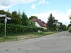
510 | Heisterbach , monastery in North Rhine-Westphalia | May 13, 1929 | The route of the road 683 was named shortly after the development plan was drawn up. It is located near the village meadow in the settlement area northeast of the town center between Geinsheimer Weg and Becherbacher Straße and ends in front of the green area "The Suction Gardens". To the east of the street is the “Die Kramper Stücken” corridor area. |
|
| Behind the dune
( Location ) |
280 | through Müggelheim there is an inland dune | Aug 1, 2008 | The section of road 659 between Hirseländer Weg and Odernheimer Straße was named in 2008. The remaining part is a private road (private road 659), which is an unpaved road between the Berlin urban forest in the north (towards the Kleiner Müggelsee) and the southern KGA Hirseländer. |

|
| Hirseländerweg
( Location ) |
1850 | Hirseland , old field name | May 13, 1929 | The Hirseländerweg is located between Alt-Müggelheim / Müggelheimer Damm and Hinter der Düne, but is interrupted by a wooded area up to Norheimer / Müggellandstraße and is only available as a road in the wooded area “The broad pieces” between Kirsteiner and Kallbacher Straße. Starting from Müggelheimer Damm, lots 1–12 and 37–55 are located on a dead end between Kirstein and Norheimer Strasse, No. 80–176 are in the northern section between Hinter der Düne and across Kallbacher Strasse. |

|
| Horchheimer way
( Location ) |
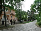
320 | Horchheim , district of Koblenz in Rhineland-Palatinate , or Horchheim , district of Worms in Rhineland-Palatinate | Nov 5, 1942 | The road belongs to the Große Krampe settlement, in 1923 still forest with a strip of shore under the name Heiga (home and garden settlement on the site of the former Tabbertschen mortar factory). In the 1935 address book, the settlement area is still listed as a parceled Heiga site. The soil formation changed due to the removal of sand for mortar, after which residential houses were built on the street. |
|
| Hornbacher way
( Location ) |
620 | Hornbach , town in Rhineland-Palatinate | Dec. 4, 1930 | The route of the 615 road was named in 1930 in an area in which other roads bear Palatine names. It is located south of the town center between Ludwigshöheweg and Sobernheimer Straße, across the east-west course in the middle of the settlement area. The eastern part of the street lies between the housing estate on the site of the former Blumenfeld makeshift housing estate in the north and the KGA Müggelheim II in the south. The entire length of the road is a six-meter-wide asphalt track with a four-meter-wide unpaved northern and narrow southern verge. |

|
|
Johann-Jacob-Baeyer-Strasse
( Location ) |
140 | Johann Jacob Baeyer (1794–1885), geodesist , founder of the European degree measurement | Nov 5, 1994 | Johann-Jacob-Baeyer-Straße was named on the occasion of the 200th birthday of the general and geodesist Baeyer, who was born in Müggelheim as a farmer's son. A memorial stone was erected for him on October 6, 1962 on the village green. This is a cast bronze globe with a 10-degree network of longitudes and latitudes as a symbol for his work. The street is a dead end south of the Müggelheimer Damm (between Ludwigshöheweg and Alsenzer Straße). Before it was named, the properties on the road to Müggelheimer Damm belonged to No. 256a to 262e. |

|
|
Kallbacher Strasse
( Location ) |
480 | Callbach , municipality in Rhineland-Palatinate | Aug 16, 1928 | The street lies between Zum Kiesgrund and Odernheimer Straße. The route 648 in the development plan of the Müggelheim settlement areas was named early on after a place in the Palatinate. Between the two world wars, C was replaced by K in numerous German place names (see e.g. Koblenz , Kassel , Küstrin , Köpenick ), so that a change in spelling was apparently also expected for Callbach and was anticipated here. Plots 1–47 (odd) and 2–44 (even) belong to the street, with individual lots being canceled and others being divided. It is located in the north-eastern settlement area behind "The broad pieces", these were arable land used for agriculture in 1953 and are now a (probably uncultivated) forest, so this intermediate area remained (unsold) farmland when the settlement was planned. The Kallbacher Straße crosses the Hirseländer Weg, Steinbrechgang, and Zur Drachenbergwiese open up the properties to the south-west of “Die broad pieces”. Located between Thalstrasse and Odernheimer Strasse in 1943 , there are 17 housing estates, nine summer houses and non-existent, undeveloped and unsold plots on 44 numbered sites. The comparative figures from 1935 name twelve settlement houses, some summer houses, plus construction sites (undeveloped land), parcels (unsold areas) and also forest areas on Odernheimer Strasse; the plots are not yet numbered. |

|
| Kirsteinstrasse
( Location ) |
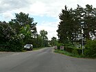
470 | Hans Kirstein (1891–1942), resistance fighter against National Socialism | June 24, 1960 | The Kirsteinstrasse with the plots 1-67 and 4-66 in orientation numbering lies between Müggellandstrasse and Odernheimer Strasse and continues the course of Müggellandstrasse. It crosses the Hirseländer Weg, to the west the road is built on on both sides, in the eastern section the north side borders on the wooded area "The broad pieces". The street 632 was named in 1960 after Hans Kirstein, who came from a Jewish family and who lived in Müggelheim, Tongrubenweg 76. He fell victim to the fascist extermination campaign decided at the Wannsee Conference in 1942 . He was arrested on October 9, 1942 and murdered in the Auschwitz extermination camp on December 13, 1942. A memorial stone in front of his former house reminds of him, there is no stumbling block. |
|
| Fathomed line
( Location ) |
270 | Fathom , old dimensions for wood | Apr 20, 1948 | The street goes from Glottertaler Straße to the northeast, plots 1–31 and 6–30 are located on it in orientation numbering. The road 667 of the development plan was created in 1936, leading to a wooded area. The roadway is an asphalt strip that was drawn during sewer work on Müggelheimer Strasse around 2000 as well as elsewhere in the district. The road ends at the forest in a turning forest path. In 1943 there were eleven settlement houses and five summer houses (on road 667 ) on the as yet unnumbered properties between Glottertaler Straße, Privatweg and Forst. Today's plots 18, 18a, 20, 20a, 22 and the ones to the east of it on Zur krummen Laake are accessed through a private road closed with a gate in the fence field and not accessible to the public (hinterland plots). |

|
| Krampenburger way
( Location ) |
770 | Krampenburg restaurant in the Köpenick city forest | Aug 16, 1928 | The street, first street 626 according to the development plan , lies south between Alt-Müggelheim and Horchheimer Weg. It leads in the direction of the Krampenburg restaurant, which has not been in operation since the 1990s and is located on a headland between the Große Krampe and the Langen See.
The street belongs to the settlement of Große Krampe, where in 1923 there was still a forest with a strip of shore called Heiga. In the 1935 address book still listed as a parceled Heiga site. The local soil formation changed due to the extraction of sand for mortar, after which residential houses were built here. In the northern section, land was bought from the Müggelheim farmers in order to build a makeshift housing estate for bombed-out Berliners with workers from concentration camps. |

|
|
Lettweilerstrasse
( Location ) |
450 | Lettweiler , municipality in Rhineland-Palatinate | Aug 16, 1928 | Routed as road 660 , this access route between Hinter der Düne and Raumbacher Strasse was named in 1928 after the community southeast of Odernheim, which today belongs to the Meisenheim community. The Palatinate colonist families moved from the Odernheim and Meisenheim area in 1747 and received settlement privileges for 90 acres of land from Friedrich II . The road belongs to the northern settlement area not far from the Kleiner Müggelsee. |

|
| Ludwigshöheweg
( Location ) |
810 | Settler Franz Ludwig (1888–1951) or building plans for the "Ludwigshöhe" (with reference to the Villa Ludwigshöhe from 1852) | May 13, 1929 | The street lies between Müggelheimer Damm and Grünstadter Weg, in the east of the southern settlements. For 1935, the run from Müggelheimer Chaussee , Appelbacher, Hornbacher Weg (both eastwards) to the forest is designated, on the Chaussee and Appelbacher Weg there are still arable land with the Kiel house. The Burgermeisterhaus follow to the south, on the opposite side the Börger house and several summer houses facing the forest. In 1943 there are six more houses in the address book and farmland along the Appelbacher Weg. In the course of the course (1943) the Enkenbacher (previously: Straße 603 ) and Grünstadter Weg exist , the Straße 605 (to the west to Am Müggelberg with three properties, today: Pfalz-Zweibrücker Weg) is laid out, and next to the Börgerschen house to the farmland on the Müggelheimer Damm a dirt road leads away from Ludwigshöheweg. From 1996, on the northern part of Ludwigshöheweg (west) to Phillipp-Jacob-Rauch-Strasse, the "Ludwigshöhe residential park" with 20 three-storey six-party houses was built on the western edge of the populated part of Müggelheim, with funding for a low-energy housing estate. A daycare center for 100 places and multi-storey buildings with 344 apartments were to be built on the five hectares on the east side of Ludwigshöheweg. Since the previously granted building permits have expired and the area is in the settlement zone II of the ordinance of the state development plan for Schönefeld Airport , it will no longer be built on because of the aircraft noise . The name obviously refers to the location Ludwigshöhe, an origin of this name is not completely clear. Between Müggelheimer Damm, Ludwigshöheweg, Appelbacher and Alsenzer Weg, there is an open, little built-up area that bears the name Ludwigshöhe, partly seen as a locality. On the one hand, the Villa Ludwigshöhe or the community Ludwigshöhe , a local community in the Mainz-Bingen district in Rhineland-Palatinate , is accepted as a template . Franz Ludwig from Neukölln could have had an influence . In 1927 he was the first to start building his own home on the south-western edge of Müggelheim. The house built in 1930 (Appelbacher Weg 34) was moved into around 1936. Franz Ludwig's wife Minna is said to have run a white laundry. In the 1935 address book, the house of the printer F. Ludwig in Appelbacher Weg is noted as the third property from Ludwigshöheweg. In 1930 the Ludwigshöheweg existed between Feldmark an der Chaussee via road 615 (Appelbacher Weg) to the forest with the house of the driver H. Schleese at the corner of road 615 , but the Ludwigsche house was not yet in the address book. |

|
|
Meisenheimer Strasse
( Location ) |
730 | Meisenheim , town in Rhineland-Palatinate | Aug 16, 1928 | Meisenheimer Strasse is located between Gosener Damm and Abtweiler Strasse, lots 1–59 (odd) and 2–50 (even) on the parcel “The Vineyards”. The asphalt strip of the driveway that has been laid out since the canalization turns into Abtsweiler Straße, the unpaved road further on opens up the adjacent property on Abtweiler Straße. From plot 50, the street already borders on the eastern side of the forest area of the Berlin urban forest Köpenick (Jagen 180). According to the development plan, the traffic route was road 692 ; Meisenheimer Strasse is also in the route from Strasse 690 . In 1928 the street 692 already had two houses between Dorfstrasse and Forst and further buildings on the western side of the street. In 1927 the street 692 is not listed. |

|
| Mittelbrunner Steig
( Location ) |
320 | Mittelbrunn , municipality in Rhineland-Palatinate | Nov 5, 1942 | The Mittelbrunner Steig is located between Sobernheimer Straße and Krampenburger Weg as a paved road with two sidewalks with street trees, from Krambenburger Weg it leads as a dead end with a narrow asphalt carriageway without a sidewalk to the riverside path on the Große Krampe with a 12 meter gradient over 200 meters in length. There are berths for boats on the bank. To the south of the slope there are residential properties, on the north side there is a colony of arbors on property 17. According to the development plan, the path is on the route from road 627 and footpath 627a . The street belongs to the "Siedlung Große Krampe", which was designated as Heiga (home and garden settlement) in 1923. The soil formation changed due to the extraction of sand for the Tabbert mortar factory, after which residential buildings emerged on the area. In particular, plots for bombed-out Berliners were sought in the outskirts of Berlin, including Müggelheim. The area of the makeshift home settlement was nearby. In 1943 the address book names five residential buildings for Müggelheimer Steig west of Krampenburger Weg, and construction sites are noted for the sloping stretch of the road. |

|
| Müggelheimer Damm
( Location ) |
160 (in the district) |
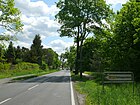
Direction to Müggelheim from Köpenick | Aug 8, 1935 | The street is located in the larger western section to Köpenick between Pablo-Neruda-Straße to the district boundary (190 meters before Ludwigshöheweg). In the district, this road continues to the east from the split on the Dorfaue as Alt-Müggelheim . The street is categorized in the Berlin street system as a higher-level road connection. Before the current name in 1935, the name Müggelheimer Landstrasse , partly also Müggelheimer Chaussee , had been in effect since the 1890s (after the direction from Köpenick) . The road from Köpenick to Müggelheim was renovated in 2010 and was upgraded by the establishment of a discount store. |
|
| Müggellandstrasse
( Location ) |
520 | Land of the Müggelberge and Müggelsee | Aug 1, 2003 | The street was built from 1936 according to the development plan as street 635 between Müggelheimer Damm and Hirseländer Weg . It turns into Norheimer Strasse, there is an arch at the junction with Kirsteinstrasse. The original 20 colonist families who immigrated from the Palatinate because of religious problems received from Friedrich II. (Old Fritz) an inheritance for 90 acres of land. The inhabitants of Müggelheim refer to the surrounding forest and lake area themselves as Müggelland. The naming in 2003 took place after extensive discussion and the request of the citizens to name numbered streets. This was followed by the district office for public roads in 2008 in an extensive campaign. Around 2000, at the request of the citizens on the local commercial area (4–16, 9, 11, 21) with a bike and sidewalk and a two-lane asphalt road and street lighting as a western approach to the northern settlements of the district with EU funding, it was partially expanded leads them through forest areas on unused farmland. On the northern section, the carriageway is laid out as an asphalt strip with no significant edge strips during the construction and renovation of the sewer system in Müggelheim after 2000, especially since the south side connects to unused forest areas and in the north there are preferably bungalows whose properties (except 55) do not belong to Müggellandstrasse. “The justification for Müggellandstrasse sounds a bit strange. This area here would be called Müggelland and the road to be renamed would therefore lead from Müggelheimer Damm into Müggelland, argues the committee. The term would often be used by the Müggelheimers for the Müggelheim area. […] Nevertheless, the renaming of the streets was decided and now only need to be implemented. " |

|
| Münchweilersteig
( Location ) |
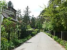
80 | Glan-Münchweiler , municipality in Rhineland-Palatinate | Nov 5, 1942 | The path is between Erlenbacher and Hallgarter Steig, horizontally on the slope to the Großer Krampe. The street belongs to the "Siedlung Große Krampe", which was named Heiga (home and garden settlement) in 1923. After the sand was extracted by the Tabbert mortar factory, residential buildings were built on the land. In 1942, as part of the creation of living space for bombed-out urban areas, settlement areas in Müggelheim (like other Berlin districts) were laid out and built on, probably also on this path.
According to Kauperts.de, the naming is also possible for other locations. |
|
|
Neuhelgoland way
( Location ) |
530 | Restaurant Neu-Helgoland at the Kleiner Müggelsee | Feb 13, 2001 | The path continues as a narrow asphalt road through the forest along Odernheimer Straße and leads directly to the long-standing excursion restaurant on the Müggelspree. The restaurant has its own postal address Neuhelgoland 1. The properties Neuhelgoländer Weg 1–7 (odd) and 2–8 (odd) belong to the path. The northern section with these properties and the restaurant belongs to the Spreeweg / Berliner Urstromtal, the green main path No. 1 in the system of Berlin hiking trails . The path leads through the Köpenick forest and is often parked on both sides in summer (preferably near restaurants), so that because of the narrow street width, conflicts occasionally arise. |

|
| Norheimer Strasse
( Location ) |
580 | Norheim , municipality in Rhineland-Palatinate | Aug 1, 2003 | The first name was Straße 639 according to the numbering in the development plan for Müggelheim from the end of the 1920s. The street was probably only laid out in the 1940s and named in 2003 at the urging of the citizens. The street lies between Odernheimer and Hirseländer Straße and continues the barely developed northern section of Müggellandstraße to the east. The street name was chosen based on the winemaking tradition of the Müggelsee colonists after the oldest documented wine village on the Nahe. |

|
|
Odernheimer Strasse
( Location ) |
v1810 | Odernheim am Glan , municipality in Rhineland-Palatinate | Aug 16, 1928 | The road lies between Alt-Müggelheim and Hinter der Düne . It runs as the main road from the middle of the village meadow (Alt-Müggelheim) to the northeast through the northern settlement area and is the historical local connection from Müggelheim to the fishing village of Rahnsdorf across the Müggelspree. In the Berlin road network , it is the only one of the Müggelheimer streets to have category IV, supplementary street. It is still listed in the 1925 address book as Rahnsdorfer Weg with two inhabited properties between Dorfstraße and Spreewiesen . Sometimes the name Schwarzer Weg was also used. In the development plan for Müggelheim, the route is recorded as road 664 . In 1928 it was laid out as Odernheimer Straße for the settlement plans. The name goes back to the place of origin of the original settlers of the colonist village Müggelheim from the Duchy of Pfalz-Zweibrücken . This street in the center of Müggelheim was renovated in 2006 when the sewer system in the district was built. On Odernheimer Straße there is a medical center, the local office of the Treptow-Köpenick district, the elementary school and the sports field on the corner of Becherbacher Weg in the area of the "suction gardens". In the 1928 address book Odernheimer Strasse between Dorfstrasse and Spreewiesen (area of 30er Strasse) is noted, on one side of the street there are construction sites and the Wolf house of the shareholder (here owner) F. Wolf, the house of fitter W. Kuhtz and that of warehouse keeper M. Beyer, farmland opposite and the Pröchtel house of the merchant W. Pröchtel. |

|
|
Pelzlakeweg
( Location ) |
120 | Pelzlake, former shallow standing water ( lake ) between Müggelheim and Dämeritzsee | May 13, 1929 | The street goes from Staudernheimer Straße to the northwest into the area of the "suction gardens". To the west of Staudernheimer Weg, the plots are staggered deep, so there are several outgoing access roads, of which the Pelzlakeweg is the only one named. The name of the street 674, which was laid out in 1929, also differs from the almost continuous pattern in the 1930s of naming streets after places in the Palatinate from the area around Odernheim (the origin of the original colonists). The Pelzlake is a little known, silted up former fen east of the Krummen Lake, between Müggelheim and the Dämeritzsee. It is afforested with deciduous trees and interspersed with clearings and wild fields. In the address book of 1930, the Trägerersche house of the master tailor F. Träger is mentioned in the already listed Pelzlakeweg. |

|
| Pfalz-Zweibrücker way
( Location ) |
290 | Pfalz-Zweibrücken , former duchy in the Palatinate | July 1, 2008 | The first name was 605 Street . The road lies across the district boundary of Köpenick (behind the west side of Am Müggelberg ) between Am Müggelberg and Ludwigshöheweg, south of the Ludwigshöhe residential complex. "The reason for the naming is [...] to gradually provide the existing numbered streets with proper street names. The name is intended to remember the origins of the founders of Müggelheim, who came from the Protestant Duchy of Pfalz-Zweibrücken around 1747 and were allowed to settle as colonists in the Cöpenick district. The naming is in the public interest to improve the orientation for residents, visitors and other road users. ”The street itself is not yet listed in the address book in 1935, but mentioned as a cross street from street 603 , and in 1943 are on the left side from Ludwigshöheweg to Am Müggelberg called the Belitzsche (a mechanic), Noacksche (a business clerk) and the Müllerian house (an instrument maker). |

|
| Philipp-Jacob-Rauch-Strasse
( Location ) |
400 | Philipp Jacob Rauch (18th century), Müggelheim's first village mayor | Feb 3, 1997 | The street is located in the Ludwigshöhe residential complex and is built on with low-energy houses. It lies between Ludwigshöheweg and Am Müggelberg. The street was laid out and expanded when the Ludwigshöhe residential park was built on the west side in the north of Ludwigshöheweg and Philipp-Jacob-Rauch-Straße in the mid-1990s. The namesake for the Rauch street was one of the 17 colonists from the Duchy of Zweibrücken (Palatinate) who immigrated from Odernheim am Glan and who received an inheritance from Frederick II on June 1, 1747 in the area of the Köpenickschen Werder. The date is considered to be the founding date of Müggelheim. Rauch became the first village mayor in the village, he was appointed by the king on June 1, 1747 and was given 15 acres of land for his office . In 1728 Rauch married Elisabeth Catharina Imschweiler. He held the office of village mayor until 1748, and was succeeded by Jacob Baeyer, the grandfather of the geodesist Johann Jacob Baeyer . Philipp Jacob Rauch died at the age of 75 on December 21, 1775 in Müggelheim. |

|
|
Raumbacher Strasse
( Location ) |
380 | Raumbach , municipality in Rhineland-Palatinate | Aug 16, 1928 | Raumbacher Straße was laid out and named in 1928 on the route from Straße 662 of the settlement plan for Müggelheim. It is located between Hirseländer Weg and Odernheimer Straße in the larger parceled out settlement area in the northeast. As the original settlement street, like the Duchrother, Rehborner, Kallbacher streets that run parallel to it, the street is relatively wide and has unpaved, but wide marginal strips (no sidewalks). |

|
| Rehborner Strasse
( Location ) |
340 | Rehborn , municipality in Rhineland-Palatinate | Aug 16, 1928 | The street lies between Hirseländer Weg (opposite Zur Bürgerheide) and Odernheimer Straße in the settlement area north of the town center. It is routed as street 650 and was named as early as 1928 after a place in the Palatinate in memory of the original settlers and founders of the colonist village Müggelheim on the Köpenicker Werder. The eponymous place (in the 21st century Bad Kreuznach district) is not far from Meisenheim. The road ends at Odernheimer Strasse in front of the "Saugärten" forest, which once belonged to the Müggelheim field as arable land. |

|
| Reichweilerweg
( Location ) |
160 | Reichweiler , municipality in Rhineland-Palatinate | Nov 5, 1942 | The Reichweilerweg is between Sobernheimer Straße and Krampenburger Weg. Plots 1–17 and 2–18 are laid out in orientation numbering. The street in the south-east of the Müggelheimer settlements was laid out as street 629 in the development plan and is recorded in the address book in 1940, but not built on. The naming in 1942 was based on the stipulation that the temporary housing estate for bombed-out citizens of Berlin's inner city should be created in Müggelheim and that building land should be obtained. But in the 1943 address book, the path on the edge of the makeshift housing estate is still vacant. |

|
| Rinntaler Steig
( Location ) |
160 | Rinnthal , municipality in Rhineland-Palatinate | Nov 5, 1942 | Plots 2–28 (even) and 3, 9, 11 17–23 (odd) belong to the street. The street lies in the arch between the southern end of the Horchheimer Weg and the eastern end of Am Steilhang, with plots 20, 21, 22, 22a and 23 lying on a forecourt on the other side of Am Steilhang. For plots 24, 26, 28, a side street goes on plot 16 as access to the Hallgarter Steig on the steep bank of the Großer Krampe, from which the Münchweiler Steig also goes off. The arched section has a gradient of nine meters over a length of 200 meters, the 80 meters to the Hallgarter Steig drop by one meter to the bank. Plots 2, 4, 6 are located on Hochheimer Weg, from which the Erlenbacher Steig is located, which falls ten meters to the Hallgarter Steig. The road belongs to the Große Krampe settlement, where there was forest in 1923 and the Heiga (home and garden settlement) with a strip of shore. In the 1935 address book this is still summarized as the parceled “Heiga site”. The soil formation was changed here by sand mining for the Tabbert mortar factory on the banks of the Krampe, and the land was parceled out and settled after the end of the mining. |

|
| Rodenbacher Gang
( Location ) |
150 | Rodenbach , municipality in Rhineland-Palatinate | Nov 5, 1942 | The Rodenbacher Gang, previously Privatweg 629a , is located between Reichweilerweg and Mittelbrunner Steig, parallel to Sobernheimer Straße and Krampenburger Weg and opens up the properties between these two in the south-east of the southern Müggelheim area above the Große Krampe settlement and closer than the Müggelheim forest settlement. Plots 4–14 (even) and 3–15 (odd) are supplemented by the corner plots Reichweilerweg 8 and 12 and Mittelbrunner Steig 7. The “corridor” in the street name corresponds to the width of six meters in the northern and four meters in the southern part; The asphalt pavement that was generally applied during the canalization of Müggelheim around 2000 enables unpaved edge strips in the northern part to the property boundary, which are then missing on the Mittelbrunner Steig. The name was changed in 1942 as part of the measures to help bombed out residents of the city center. 1943 construction sites for the Rodenbacher Gang are named in the address book. |

|
| Rodestrasse
( Location ) |
270 | Fritz Rode (1885–1940), resistance fighter against National Socialism | June 24, 1960 | The street branches off from Glottertaler Straße in a north-easterly direction . Plots 1–29 and 6–30 are located on it in orientation numbering. The road 666 of the development plan was created in 1936, leading to a wooded area. The roadway is an asphalt strip that was drawn during sewer work on Müggelheimer Strasse around 2000, as well as in the district elsewhere. The road ends at the forest in a forest path. The namesake for the street, Fritz Rode, lived in the Müggelheim "Kolonie Leopold" (today: Rodestrasse 41). During the National Socialist era, Rode participated in the technical production of the illegal Köpenick KPD sub-district newspaper “ Voice of the Working People ”. This was printed and distributed in 150 to 200 copies per month until September 1936. The Gestapo arrested Fritz Rode on September 16, 1936 , and in November 1937 the Berlin Superior Court sentenced him to three and a half years in prison. After serving his prison sentence, he was sent to the Sachsenhausen concentration camp and murdered on August 9, 1940. |

|
|
Schönhorster Strasse
( Location ) |
1780 | Schönhorst settlement, location of Müggelheim on the Müggelspree | Feb 13, 2001 | The street is between Hinter der Düne / Odernheimer Straße / Neuhelgoländer Weg and Lindenstraße in the Schönhorst settlement. The properties at Schönhorster Strasse 15-77 (ongoing) are located on the street that was previously officially unnamed. The paved road mostly leads through the forest in the direction of the Schönhorst settlement. The street belongs to the Spreeweg / Berliner Urstromtal, the green main path No. 1 in the system of Berlin hiking trails. |

|
| Seddiner way
( Location ) |
470 | Seddinsee and Seddinberg, southeast of Müggelheim | before 1932 | The street is a dead end (no turning possibility for trucks) to the west from Staudernheimer Straße and is parallel to Duchrother Straße and Pelzlakeweg. It ends at the northern edge of the parcel The Suction Gardens. The following plots at the edge of the forest belong to Duchrother Straße (long plots) and then to the Wollgrasweg . The Seddinsee in the Köpenicker Forest is east of Schmöckwitz, the Seddinberg was used as a sand pit, as the water transport via the Seddinsee, the Dahme and the Spree led to the city center at a reasonable price. First recorded in the address book in 1932 with two developed properties, followed in the address books for 1934, 1936, 1938 and 1940, the Seddiner Weg between Staudernheimer Straße and Forst, each with six developed, inhabited properties and the indication of parcels for the rest of the route, in some cases also the information Construction site and new building without this being repeated in more recent address books, the same entry in 1943. The choice of name for this street (as for Pelzlakeweg) differs from the other street names assigned at the end of the 1920s and in the 1930s after locations in the Pfalz-Zweibrücken area in memory of the founders of the colonist village of Müggelheim. The current official list includes the properties Seddiner Weg 1–9 (odd) and 4–10 (even). |

|
| Schönhorst settlement (Bergstrasse)
( Location ) |
150 | Mountain here stands for the flat ascent of the traffic route | Apr 16, 2005 | The street name Bergstrasse , which is used several times in Berlin , became clear through the assignment of the name of the settlement. The Bergstrasse branches off in the north of the Spreestrasse to the east opposite the Wiesenstrasse and connects to the Feldstrasse. It develops plots 1-50 (ongoing). |

|
| Schönhorst settlement (Feldstrasse)
( Location ) |
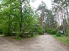
170 | Field, symbolically adjacent to the arable land | Apr 17, 2005 | The street name Feldstrasse, which is used several times in Berlin, became clear through the assignment of the name of the settlement. The field road goes eastward from the Lindenstrasse and has a section to the north, without connection to the Spree and ends in the forest. In the official list, the plots 1–50 (consecutive) are named, but only 1, 3–13, 16 and 50 (consecutive) are available and developed. |
|
| Schönhorst settlement (Lindenstrasse)
( Location ) |
250 | Linden , deciduous tree | Apr 18, 2005 | The street name Lindenstrasse, which is used several times in Berlin, became clear through the assignment of the name of the settlement. Lindenstrasse lies between Schönhorster Strasse and Bergstrasse and leads as a path to Walloch with plots 1–50 (continuous) and opens up the settlement east of Spreestrasse running parallel to it. |

|
| Schönhorst settlement (Spreestraße)
( Location ) |
580 | lying near the Spree | Apr 14, 2005 | The street name Spreestraße, which is used several times in Berlin, became clear through the assignment of the name of the settlement. Spreestrasse lies between Schönhorster Strasse and the banks of the Spree with lots 1–31 (odd) and 2–34 (even) and opens up parallel running west of Lindenstrasse to the settlement. The road leads to the Spreeheim on the banks of the Spree. |

|
| Schönhorst settlement (Wiesenstraße)
( Location ) |
430 | lying on the meadows | Apr 19, 2005 | The street name Wiesenstrasse, which is used several times in Berlin, became clear through the assignment of the name of the settlement. The Wiesenstraße goes off in the north of the Spreestraße from this to the west opposite the Bergstraße. It opens up plots 1–5 (odd) and 2–10 (even) up to the KGA Schönhorst. |

|
| Siefersheimer Strasse
( Location ) |
100 | Siefersheim , municipality in Rhineland-Palatinate , today in the district of Alzey-Worms | Aug 16, 1928 | The street is a dead end from Heisterbacher Straße and ends in front of the Müggelheim elementary school. Routed as road 681 , it was named at an early stage, like other roads in Müggelheim, after places from the Palatinate, in memory of the origins of the 20 colonist families in 1747, who came from the Palatinate, with the eponymous municipality located between Appelbach and Wiesbach. |

|
| Sobernheimer Strasse
( Location ) |
930 | Bad Sobernheim , town in Rhineland-Palatinate | Aug 16, 1928 | The street lies between Alt-Müggelheim and Eppenbrunner Weg. As a southern continuation of Odernheimer Straße it opens up the settlement area south of the center, in the development plan Straße 622 . The route to Krambenburg is recorded in the 1928 address book . The Krampenburg had been a restaurant for excursions since 1906 at the southernmost point of Müggelheim between Großer Krampe and Dahme (Langer See). 1930 on Sobernheimer Straße between Dorfstraße and Forst, an inhabited property on 33 (already numbered properties) belonging to pension recipient Bayer and police chief sergeant E. Jäck and construction sites are listed in the address book. The area to the east in the southern part of the road belongs to the "Grosse Krampe" settlement. In 1923 there was a forest with a strip of banks under the name Heiga (home and garden settlement). In the 1935 address book, this is listed as a parceled Heiga site. The soil formation was changed by sand mining by the Tabbert mortar factory and the site was traced and settled after the end of the mining. When choosing the street name, Palatine place names were used in order to preserve the memory of the original settlers and founders of the colonist village of Müggelheim, who received inheritance certificates for 20 acres of land on the Köpenicker Werder from Friedrich II . |

|
| Staudernheimer Strasse
( Location ) |
480 | Staudernheim , municipality in Rhineland-Palatinate | Aug 16, 1928 | The street lies between Gersweiler Aue and Duchrother Straße. As street 672 of the Müggelheim development (settlement) plan, it was named as early as 1928 in memory of the original founders of the colonist village of Müggelheim after a place that, in the broader sense, lies in the Palatinate area . |

|
| Quarry tunnel
( Location ) |
90 | Saxifrage , genus of plants | Feb 28, 2008 | The first name in the 1930s was Street 646 . “The designation is necessary in the public interest to improve orientation for residents, visitors and other road users. [...] as well as the efforts of the district office to gradually give the still existing numbered streets proper street names. [... The choice of name] in "Steinbrechgang" corresponds to the location in an unused field with typical flora. " |

|
| Street 34
( Location ) |
120 | Project number according to the development plan | after 1935 | The eastern section of the road was renamed in 2008 on both sides of the road to the ferry in Am Bauersee . The route of road 34 is partially built over by land and still consists of a section west of road 36 with land 20 and 21. It is also the access for road 36 and road 37. In the 1939 address book it is marked “Post Bln. = Rahnsdorf ”listed as a cross and access road to Straße 50, Straße 35, Straße 36, Straße 37, Straße 38, Straße 39, Straße 40, Straße 41, Straße 42, Straße 43 with an apartment building on the Spree . According to this list, the Spreewiesen settlement was planned to be more extensive in the address book than it is today; it was probably not expanded or implemented after the outbreak of war in 1940. The postal assignment across the Spree to Rahnsdorf should also be noted, instead of through the forest to Müggelheim as it is today. |

|
| Street 36
( Location ) |
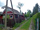
280 | Project number according to the development plan | after 1935 | This street between Zur Fähre and the Müggelspree with lots 1–23 (odd) and 10–14 (even) is not officially called Eichkaterweg. It is located in the Spreewiesen settlement and is connected to the newly named Zur Fähre road in the south and Am Bauersee in the middle. In the address book from 1939 it is listed between Straße 34 and Müggelspree with a built-up property and has the note "Post Bln. = Rahnsdorf". |
|
| Street 37
( Location ) |
240 | Project number according to the development plan | after 1935 | Straße 37 is one of the 30 streets that were laid out and laid out for a settlement in the Spreewiesen. It will be made accessible in the middle of the street from street 34. In the 1939 address book it is listed between Müggelspree and Straße 34 with the comment "Post Bln. = Rahnsdorf". Eight plots are built on with residential houses and several with summer houses, plus a boathouse. Plots 1–23 (odd) and 2–24 (even) are currently mentioned in the official list. |

|
| Street 38
( Location ) |
270 | Project number according to the development plan | after 1935 | The street is not officially referred to as An den Schwarzerlen. The street is not yet in the 1935 address book, but entered for 1939 with the note "Post Bln. = Rahnsdorf". In 1939 it was built on four lots with residential buildings and one with a summer house between Straße 34 and Müggelspree. In the current official list, the properties street 38 No. 2–24 (even) and 3–25 (odd) belong to the Spreewiesen settlement. |

|
| Street 41
( Location ) |
170 | Numbering according to the development plan | after 1935 | The road is not officially referred to as a Lurchweg . The road goes as an unpaved access road from Schönhorster Straße to the north as an access to the “Spreewiesen settlement”. The ways of the KGA to develop the garden plots do not officially belong to the street 41. The street is not yet in the address book in 1935, but in 1939 it was entered with the note "Post Bln. = Rahnsdorf". In 1939 it was built on two pieces of land between Straße 34 and Spree with residential houses. In the current official list, the properties at Street 41 No. 1–46 are listed (consecutively). The street is the east of the 30s streets of a settlement projected in the 1930s, which was to be connected by road 34. Probably because of the following war years, it was not fully implemented; the 1943 address book shows the same state of development as in 1939. To street 41 belong the plots 1-15 between street 41 (east side) and Lupenwehr (branch of the Müggelspree), 2 (on the Müggelspree) and 42-46 (straight) on the western edge of the settlement, as well as 41, 43, 50, the latter are undeveloped. |

|
| Street 659
( Location ) |
520 | Numbering according to the development plan | before 1930 | The road is an unpaved road between the Berlin urban forest in the north (towards the Kleiner Müggelsee) and the southern KGA Hirseländer. An eastern section of road 659 was named Behind the Dune in 2008. The street is listed in the address book from 1930 as undeveloped under this name, starting from Hirseländer Weg. |

|
| Road to Krampenburg
( Location ) |
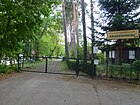
1950 | Peninsula and Krampenburg restaurant in the Köpenick city forest | Jan. 18, 2005 | The street lies between Sobernheimer Straße and Krampenburg and was given this official name in 2005. The street had unofficially had this name for a long time and is the entrance to the “Kuhle Wampe” campsite. It led to the Krampenburg restaurant, which was opened in 1906 and operated until around 1977, on the peninsula of the same name. The Krampenburg was an excursion restaurant at the southern end of the Werder between Großer Krampe and Langem See. Opened in 1906, it had a large hall for 3,000 guests and a convenient location for excursion boats. In 1918 the hall burned down and the owner had a fatal accident in the last year of the war . From the end of the 1920s a colony of arbours was built around it, the camp "Kuhle Wampe" was located here. The restaurant and the colony were particularly popular in the post-war period at the end of the 1940s and 1950s. However, the restaurant has not been in operation since 1976. |
|
|
Tongrubenweg
( Location ) |
770 + 210 | Path to the clay pit that existed until the end of the 19th century | June 17, 1936 | The street is on the western border to the neighboring district of Köpenick between Kirsteinstraße and An der Himmelswiese , here the KGA Hirseländer area follows north to the Kleiner Müggelsee. It is interrupted in its route between Am Wildbusch ( road 655 ) and Zum Rehwinkel by the forest area "Die Apfelstücke", whereby from the north via Zum Rehwinkel the asphalt strip opens up the property as a driveway to an unpaved forest area and a footpath continues in the southern section . On the northern section there are plots 2–20 (even, west) and 1–21 (odd, east side), on the southern section of the street Am Wildbusch to Kirsteinstraße there are 52–62 (odd) and 55–61 (even) across a strip of forest , through which the usual asphalt strip leads as a driveway (63, 65 and 64, 66), followed by 68-88 (even) and 67-93 (odd), and again the driveway leads through the forest (west of plot 92, east without numbers) "The broad pieces" and finally with a connection to Kirsteinstrasse 94-132 and 121-133. The asphalt pavement was laid in the context of the canalization on almost all streets and a “durable temporary solution 4.50 meters wide” was created, for which the residents did not have to pay a contribution. Such a street design was created in 2002 for the street 695, street 696 , Tongrubenweg, Grünstadter Weg and Eppenbrunner Weg. The plots are listed in the address book as early as 1939, with 1–53 and 2–50, 92–110 in the forest and 93–123 arable land. 40 plots are built on and inhabited with summer houses and single-family houses, partly on double plots, but also on shared plots (a and b), however several unassigned plots (i.e. without owners) are still listed as parcels. |

|
|
Way a
( Location ) |
220 | consecutively named garden path name | after 1990 | Path A is a private path with lots 1–19 (odd) 8–24 (even) and is located in the residential area south of Alt-Müggelheim between Hornbacher Weg and path E. Path A is recorded in the official property list and is located in the (former) makeshift housing estate in Blumenfeld . Route A is not included in the RBS detailed network. |

|
| Way B
( Location ) |
210 | consecutively named garden path name | after 1990 | Path B is a private path and lies with lots 1–19 (odd) and 2–18 (even) in the settlement area between Hornbacher Weg and path E. Path B is recorded in the official property list and is in the (former) makeshift housing estate Field of flowers . Route B is not included in the RBS detailed network. |

|
| Way C
( Location ) |
210 | consecutively named garden path name | after 1990 | The officially registered path C is a private path and lies with the plots 1–21 (odd) and 2–22 (even) in the settlement area between Hornbacher Weg and path E. It is located in the housing estate on the area of the (former) temporary home settlement of Blumenfeld . Route C is included in the RBS detailed network (44627) and the RBS class “VWEG”, however, has the OKSTRA class “G” (for municipal road). |

|
| Way D
( Location ) |
190 | consecutively named garden path name | after 1990 | Path D is a private path and is located with plots 1–19 (odd) and 2–20 (even) in the settlement area between Hornbacher Weg and path E. Path D is recorded in the official property list and is located on the area of the housing estate the (former) makeshift housing estate in Blumenfeld . Route D is not included in the RBS detailed network. |

|
| Ways
( Location ) |
190 | consecutively named garden path name | after 1990 | Path E is a private path and is located with lots 3–23 (odd) and 4–26 (even) in the settlement area between Sobernheimer Straße and path A. Path E in the housing estate of the (former) temporary housing estate Blumenfeld is in the official list of properties recorded. Route E is not included in the RBS detailed network. |

|
| Way F
( Location ) |
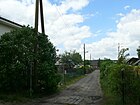
120 | consecutively named garden path name | after 1990 | Path F is a private path and is located with lots 5–15 (odd) and 4, 6 in the residential area between Sobernheimer Straße and Krampenburger Weg. Path F is recorded in the official property list and is located in the housing estate on the area of the Vogelwiese makeshift housing estate . Route F is not included in the RBS detailed network. |
|
| Way G
( Location ) |
190 | consecutively named garden path name | after 1990 | The officially listed path G is a private path and is located in the settlement area between Krampenburger Weg and path A. It connects the housing estate on the area of the (former) temporary housing estate Vogelwiese and Blumenfeld. Plots 3–31 (odd) and 6, 8, 10 and 20–32 (even) are assigned to path G, interrupted in the numbering by corner plots at the crossings. Route G is included in the RBS detailed network (44631) and the RBS class “VWEG”, however, has the OKSTRA class “G” (for municipal road). |

|
| Way H
( Location ) |
150 | consecutively named garden path name | after 1990 | Path H is a private path and is located with lots 3–17 (odd) in the residential area between Sobernheimer Straße and Krampenburger Weg, parallel between Path G and Reichweilerweg. The plots on the straight side belong to Reichweilerweg. Path H is recorded in the official property list and is located in the housing estate on the site of the former Vogelwiese temporary home . Route H is not included in the RBS detailed network. |

|
| Way J
( Location ) |
50 | consecutively named garden path name | after 1990 | Path J is a private path and is located with lots 1–9 (odd) in the residential area between Sobernheimer Straße and path O. Path I (alternative J) is recorded in the official property list and is located in the housing estate at KGA Müggelheim II. Route J is not included in the RBS detailed network. | |
| Way K
( Location ) |
70 | consecutively named garden path name | after 1990 | The path K is a private path and lies with the plots 3, 5 and 4 in the settlement area between paths I and L. The path K is recorded in the official property list and is located in the housing estate at KGA Müggelheim II. In the RBS detailed network is Path K not included. |

|
| Way L
( Location ) |
90 | consecutively named garden path name | after 1990 | Path L is a private path and is located with lots 1–13 (odd) and 2–12 (even) in the residential area between Path O and Sobernheimer Straße. Route L is recorded in the official property list and is located in the housing estate at KGA Müggelheim II. Route L is not included in the RBS detailed network. | |
| Way M
( Location ) |
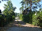
160 | consecutively named garden path name | after 1990 | The officially listed path M is a private path and is located in the settlement area south of the town center between Sobernheimer Straße and Krampenburger Weg. It belongs to the forest settlement and runs unstructured parallel to Enkenbacher Weg and Mittelbrunner Steig through the assigned plots 3–15 (odd), with the opposite (even) plots belonging to Benkenbacher Weg. The path belongs to the Große Krampe settlement, where in 1923 there was still a forest with a strip of shore under the name Heiga. In the 1935 address book still listed as a parceled Heiga site. The soil formation was altered by sand mining for mortar, and the land was terminated and settled after the mining ended. Route M is included in the RBS detailed network (44637) and has the RBS class “STRA” and the OKSTRA class “N” (for non-municipal routes ). |
|
| Way N
( Location ) |
160 | consecutively named garden path name | after 1990 | The officially listed path N is a private path and is located in the forest settlement of Müggelheim between Sobernheimer Straße and Krampenburger Weg and borders directly on the forest on the southwest side. Plots 3–17 (odd) are to the northeast. Route N is included in the RBS detailed network (44628) and the RBS class “STRA” has however the OKSTRA class “F” (for pedestrian walkways). |

|
| Way O
( Location ) |
80 | consecutively named garden path name | after 1990 | The way O is a private way and with the plots 2, 4, 6 (straight) in the settlement area south of the town center between way I and L. The way O is recorded in the official property list, it borders directly on the KGA Müggelheim II. |

|
| Way P
( Location ) |
270 | consecutively named garden path name | after 1990 | The officially listed path P is a private path and lies between Geinsheimer Weg and Gosener Damm with lots 1–27 (odd) and 2–30 (even) in the settlement area north of the town center. Route P is included in the RBS detailed network (44640) and has the RBS class “STRA” and the OKSTRA class “G” (for municipal road). |

|
| Way Q
( Location ) |
190 | consecutively named garden path name | after 1990 | The officially listed path Q is a private road and lies with the plots 2–22 (straight) in the Weinberge settlement area parallel to Meisenheimer Straße (west still as a spur road) between Gosener Damm and via Zur Große Krampe on the eastern edge of Müggelheim. Route Q is included in the RBS detailed network (44641) and has the RBS class “STRA” and the OKSTRA class “G” (for municipal road). |
|
| Way R
( Location ) |
170 | consecutively named garden path name | after 1990 | The officially listed path R is a private path and is located with plots 3-11 (odd) and 4-16 (even) in the Weinberge settlement area on the eastern edge of the settlement area in Haken between Meisenheimer Strasse and Zur Große Krampe. Route R is included in the RBS detailed network (44642) and has the RBS class “STRA” and the OKSTRA class “G” (for municipal road). | |
| Way S
( Location ) |
140 | consecutively named garden path name | after 1990 | The officially listed path S is a private path and lies with plots 3–13 and 2–14 in the Weinberge settlement area parallel to Darsteiner Weg between Gosener Damm and Zur Große Krampe. Route P is included in the RBS detailed network (44643) and has the RBS class “STRA” and the OKSTRA class “G” (for municipal road). | |
| Way T
( Location ) |
170 | consecutively named garden path name | after 1990 | The officially listed path T is a private path and, with lots 3–15 (odd), lies parallel to Meisenheimer Weg, to which the lots on the other side of the path belong, in the Weinberge settlement area between Geinsheimer Weg and via path U. Route T is included in the RBS detailed network (44644) and has the RBS class “STRA”, 100 meters are entered in the OKSTRA class “G” (for municipal road), but the remaining section of the route is in the OKSTRA class “N ". |

|
| Way u
( Location ) |
230 | consecutively named garden path name | after 1990 | The officially listed path U is a private path and is located with plots 3-19 (odd) in the Weinberge settlement area from Geinsheimer Weg to the southwest and at right angles with a connection to Meisenheimer Straße. The plots on the northern side (straight) belong to route T. Route U is included in the RBS detailed network (44645) and has the RBS class "STRA", 190 meters are in the OKSTRA class "G" (for municipal road) entered, but the remaining 30-meter-long section of the route is in OKSTRA class "N". |
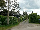
|
| Wiesbacher way
( Location ) |
220 | Wiesbach , municipality in Rhineland-Palatinate | Nov 5, 1942 | The street, initially laid out as street 637 according to the development plan, was laid out in 1942 south of the town center in the makeshift home settlement of Blumenfeld and, as is customary in the area, named after a place in the Palatinate. It is located between Sobernheimer Straße and Krampenburger Weg. The road is an asphalt strip with road drainage as a lane and unpaved verges in front of the property, which are probably used primarily for parking the vehicles. At the corner of Sobernheimer Strasse and Wiesbacher Weg was the concentration camp subcamp for the prisoners who built the temporary home settlement. |
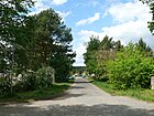
|
| Wolfsteiner way
( Location ) |
250 | Wolfstein , town in Rhineland-Palatinate | Feb 5, 2008 | The street lies between Enkenbacher and Hornbacher Weg in the southwest of the town center, until 2008 when it was renamed Wolfsteiner Weg under the name Straße 611 parallel to Ludwigshöhe and Elmsteinerweg, it was the last numbered street in the area. “The reason [was] to gradually give existing numbered streets proper street names. The naming of street 611 after the town of Wolfstein / Pfalz - seat of the Verbandsgemeinde Wolfstein - is based on the naming of numbered streets in this area after Palatinate localities and is intended to remind of the origins of Palatinate families who founded Müggelheim around 1747. The designation is necessary in the public interest to improve orientation for residents, visitors and other road users. " |
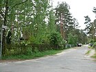
|
| Cottongrass path
( Location ) |
70 | Cotton grass , a genus of plants in the local area | Sep 1 2008 | The Wollgrasweg was called Straße 670a until it was renamed . It goes from Duchrother Straße to the southwest as a dead end street , leads as a short, unpaved, wide path to the wooded area "The Suction Gardens" and opens up the five properties Wollgrasweg 3, 5 and 4–8 (straight) and continues as a non-public forest path into the adjacent forest . The designation improves the orientation for residents, visitors and other road users. The choice of name “Wollgrasweg” refers to the location near the Krumme Lake nature reserve. The name of the street is intended to remind us that the cotton grass in the swamp arms of the Krummen Lake bloomed profusely before the groundwater level subsided. " |
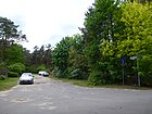
|
|
To the Müggelheim meadows
( Location ) |
700 | Müggelheim meadows | Feb 19, 2001 | The drivable and paved forest path, partly with asphalt pavement, leads from Müggelheim's bus turning point to the Müggelheimer Wiesen nature reserve and therefore bears his name. It is located (paved) between Odernheimer Straße and “Zur Fähre” and continues to close to Schönhorster Weg, mostly through the Berlin Forest. The path that continues allows access to the "Spreewiesen settlement" via road 41 . The path follows the course of the green main path no. 1 ("Spreeweg / Berliner Urstromtal") in the system of Berlin hiking trails and the European cycle path R1 . |

|
| To the gravel ground
( Location ) |
190 | former gravel pit | Aug 1, 2008 | The street goes off on both sides at the western end of Kallbacher Straße. At its southern end, a road leads through the wooded area “The broad pieces” to the clay pit path, at the northern end the forest path leads through a remaining part of the area “The apple tree pieces” to Zur Bürgerheide . The street Zum Kiesgrund was called Street 652 until it was renamed . A renumbering of the plots was not necessary, there was no street of the same name in Berlin. “The naming of the street 652 in 'Zum Kiesgrund' refers to the area. This road leads past the flat land on the edge of a former gravel and clay pit, the brine of which was not filled in, but parceled out and houses built on. ”On the south side are plots 2, 4, 8 and 40 (straight) and Kallbacher Streets 1 and 2. 1–41 are on the northern side of the street, but 17–37 are located on a northern side street that allows access to the properties in the area. Street 652 is missing in the 1943 address book , but it is included on the map in 1987. |

|
| To the Rehwinkel
( Location ) |
390 | Pine trees with lots of wildlife | Oct 1, 2008 | The private road 695 was renamed to road 695 on July 4, 1991 and was named Zum Rehwinkel in 2008 instead of the number. The road lies between Tongrubenweg and Hirseländerweg. It was renamed in an effort to eliminate numbered streets. “The name […] refers to the location near an old, very beautiful stand of pine trees, in the area of which there are a lot of wild animals. The designation is necessary in the public interest to improve orientation for residents, visitors and other road users. " |

|
| To the Bürgerheide
( Location ) |
390 | Bürgerheide, part of the Köpenick city forest | Feb 28, 2008 | The street Zur Bürgerheide was called street 653 until it was renamed , it lies between Hirseländer Weg and across Tongrubenweg. A subsequent, non-public path along the border with Köpenick , which bends northwards, was not included in the renaming. “The naming of the street 653 in Zur Bürgerheide refers to the area. The forest area to be reached in a north-westerly direction via this road is regionally known as Köpenicker Bürgerheide. [...] There are no renumbering. ”On the north side of the street, rising to the northwest, there are lots 4–34, the opposite side of the street is a wooded area that belongs to“ The Apple Tree Pieces ”. In 1953 the street was almost undeveloped. According to the address book from 1943, there were two residential buildings here: Langersche and Wullsche Haus. |

|
| To the Drachenwiese
( Location ) |
120 | formerly cultivated field on "The Broad Pieces" | March 1, 2007 | The street Zur Drachenwiese was first called street 647 , it is a cul-de-sac with the properties Zur Drachenwiese 1-7 (odd) and 4-8 (even) from Kallbacher Straße to the southwest to the forest area. “The naming of street 647 […] refers to the area. 'The broad pieces', on which the children fly kites, are directly adjacent. ”The street 647 is in the address book 1935 in its current location with two inhabited houses and parcels (unsold properties) and in 1943 with four houses and at least three summer houses and Parcels listed between Kallbacher Straße and Feldmark. The formerly cultivated field at "Die Breite Stücke" is overgrown with bushy trees and lean meadow flowers. The former fields are the last undeveloped areas and are now forests and important as a passage for game. |

|
| To the ferry
( Location ) |
490 | leads to the pier for the ferry across the Müggelspree | July 1, 2007 | The first name was Street 35 . The road goes from Zu den Müggelheimer Wiesen to the landing stage of the ferry line F 23 , which goes over the Müggelspree to Rahnsdorf. Road 35 is already mentioned in the address book in 1935 between Forst and Spree, it was laid out in the early 1930s (unpaved sand road). There are four residential buildings, summer houses and the Spreewiese restaurant owned by restaurateur R. Schreiber, and two residential buildings are added in 1943. The southern end of the street touches the European cycle route R1 and the Grünen Hauptweg 01 (Spreeweg / Berliner Urstromtal). |

|
| To the big Krampe
( Location ) |
290 | Big Krampe , Bay of Dahme | Sep 1 2008 | The first name was Street 691 . The street Zur Große Krampe, 1–27 and 2–22 in orientation numbering , lies between Darsteiner Weg and Weg P and crosses over Meisenheimer Strasse. The section west of Meisenheimer Strasse is a dead end street , which is blocked by the carport at the single-family house on Weg P 12 and the bungalow on property 16. The road surface is the asphalt strip, which was laid on almost all roads after the canalization around 2000 and offers a "durable temporary solution in a width of 4.50 meters". "The reason for the naming is [...] to gradually provide the existing numbered streets with proper street names. The designation [...] refers to the location not far from a neighboring lake of the Lange See, the Große Krampe [... and serves] to improve orientation for residents, visitors and other road users [...]. " |

|
Former street names in the district
In the Berlin address book of 1922, Dorfstrasse (with 43 pieces of land), Gartenstrasse (with a built-up plot of land), the undeveloped Rahnsdorfer Weg from the village to the Spreewiesen and the Spreewiesen are named, the latter being the address of the restaurant of the same name between the village and the municipal boundary and street 35 as a cross street to it. The Dorfstraße is extended westward from the Chaussee to Cöpenick, and the Rahnsdorfer Weg and the path to Krampenburg, which in the local part was named → Sobernheimer Straße , go out.
- Dorfaue , Dorfstraße : These names probably originated with the settlement in 1747. On March 8, 1935, the Dorfstraße was named in several districts and locations by prefixing the syllable Alt- zum Ort, since in 1920 when Greater Berlin was formed, some street names were in the new city piled. The Dorfaue / Dorfstraße was renamed → Alt-Müggelheim . The section of the village road between the floodplain and the “village” border was named appropriately for the direction towards the neighboring town of Gosen, the → Gosener Damm .
- Gartenstrasse : The street named after 1919 with reference to the gardens created here was renamed → Duchrother Strasse on March 8, 1935 . Duchroth , a municipality in the Palatinate (today part of the Bad Kreuznach district), gave the name appropriate to the surrounding streets and to the origins of the first settlers from Pfalz-Zweibrücken .
- Müggelheimer Landstrasse : The Müggelheimer Landstrasse from Berlin to Müggelheim, which was expanded and named around 1896, became → Müggelheimer Damm in the administrative district of Köpenick by resolution of August 8, 1935 .
Other locations in Müggelheim
Allotment gardens
“For allotment gardens, the provisions of the Federal Allotment Garden Act (BKleingG) of February 28, 1983 ( Federal Law Gazette I p. 210) last amended by Article 11 of the law of September 19, 2006 (Federal Law Gazette I p. 2146). Since the administration of the state's own allotment gardens is carried out by the district authorities, the Senate has issued administrative regulations that guarantee uniform regulations for allotment gardeners on state-owned areas. "
In Müggelheim several allotment gardens have already been converted into permanently habitable settlement areas, which are no longer subject to the allotment garden law, but the building law. Accordingly, the (private) paths within the gardens were converted into dedicated streets.
- KGA Am Walloch: Insel am Walloch ( location ), 2,240 m² facility with 20 plots of private leased land, which according to the KEP should be preserved.
- KGA Müggelheim I: Ludwigshöheweg / Straße 605 ( Lage ), allotment garden colony on private leased land, which is intended for other use according to the FNP , 23,600 m², 65 plots.
- KGA Müggelheim II: Sobernheimer Straße / Hornbacher Weg ( location ) permanent allotment garden on private leased land, designated as green space according to FNP, 34,367 m², 89 plots. On August 19, 1965, the "Müggelheim II" colony was founded on the farmers' fields and developed into a garden landscape with many arbors.
- KGA Spreewiesen: Spreewiesen / Straße 41 ( location ), 16,501 m² complex with 30 parcels of private leased land which, according to the KEP, should be preserved and which are managed as a fictitious permanent complex according to the development plan.
- KGA Waldsiedlung Müggelheim: Krampenburger / Sobernheimer Straße ( location ), facility on 8,422 m² with 26 plots of private leased land, which according to the KEP should be preserved and which are managed as a fictitious permanent facility according to the development plan.
Forest areas, parks
- Müggelheim forest cemetery, state-owned cemetery at Gosener Landstrasse 1 / Im Jagen 172 ( location ), 20,012 m².
- Berlin urban forest, north and in the local area ( location )
- Berliner Stadtforst, south of the town ( location )
- Fischerheide ( Lage ), the southern tip of the forest between Großer Krampe and Dahme
- Seddinberg, next to it a sand pit ( location )
- Pig corner ( location ), tip on the north bank of the Seddinsee
- Wind corner ( location ) west of the Kleine Krampe on the district boundary to Seddinsee in Schmöckwitz.
- Windwall ( location ) east of the Kleine Krampe with the district boundary to Seddinsee in Schmöckwitz.
- Nature reserve Gosener Wiesen in the east of the district between the Great Canal and the city limits, together with the Seddinsee an NSG since 1995 with 402.2 hectares.
- Bullenbuschwiese ( location )
- The wooden cables ( location )
- Espenwerder ( location )
- Grasehorst, as hunting 154A ( location )
- Schmöckwitzer Bruch ( Lage ), south of the Müggelheimer Landstrasse to Seddinsee
- Schmöckwitzer Bruchwiesen ( location ), northeast of the Müggelheimer Landstrasse
- Streitwall ( location )
- Kaniswall ( location ) with an outdoor laboratory of the Treptow-Köpenick district office, Am Kaniswall
- Beiers Luch ( location ) Forest at the Seddinsee nature reserve
- Krumme Lake (lake: location ) and Pelzlake (moor area: ( location )) have been secured as a nature reserve with a size of 329.3 hectares since 1995 .
- Kuhle Wampe with the campsite near the Krampenburg ( Lage ), the location of the film of the same name
- Neu-Helgoland ( location ): eponymous traditional restaurant on the Müggelspree
- The Spreeweg / Berliner Urstromtal (Grüner Hauptweg 01), partly identical to the R1 cycle path, runs between Rahnsdorf and Köpenick through the north of the district near the Müggelspree south of the Müggelheimer Wiesen.
See also
Web links
- Map of Berlin 1: 5000 with district boundaries. Senate Department for Urban Development Berlin, 2009, accessed on July 13, 2011 .
- Berlin-Brandenburg Statistics Office: Directory of streets and squares in the Treptow-Köpenick district (as of February 2015); pdf
- Street directory Müggelheim from Kaupert Media
- District Office Treptow-Köpenick: City Planning Office (development plans)
- Whether Palatine or resistance fighter - the history of street names (Part I). In: Müggelheimer Bote , August 1999
Individual evidence
- ↑ Communications from cultural studies research. Humboldt University of Berlin, 1978. Preview at books.google.de , p. 136
- ↑ a b c The dispute over the Darsteiner Weg. In: Müggelheimer Bote , December 2007
- ↑ a b administrative district Cöpenick Müggelheim . In: Berliner Adreßbuch , 1922, Part IV, p. 1687.
- ↑ a b c d e f g h i j k l m n o p Street renaming in full swing . In: Müggelheimer Bote , September 2008
- ↑ The ambulance wandered around: the road is not signposted
- ↑ Document VI / 0597 ( Memento of the original dated April 16, 2014 in the Internet Archive ) Info: The archive link was inserted automatically and has not yet been checked. Please check the original and archive link according to the instructions and then remove this notice.
- ↑ a b c d Odyssey of a street renaming
- ↑ a b administrative district Cöpenick> Müggelheim . In: Berliner Adreßbuch , 1930, Part IV, p. 2007.
- ↑ a b c d e Berlin address book 1930 - Köpenick administrative district - Müggelheim
- ↑ Address Search on the map Berlin 1: 5000, made by the district's survey offices
- ↑ Müggelheim's shop dying continues. In: Müggelheimer Bote , February 2001
- ↑ a b mueggelheimer-bote.de: Feared of severe traffic delays due to construction work. (November 2006)
- ↑ a b Printed matter - name of the public road section of Straße 34 in Müggelheim, from the landscape protection area at the Bauersee up to and including the plot numbers 11 / 11a and 12, in Am Bauersee ( Memento of the original from April 16, 2014 in the Internet Archive ) Info: The archive link was used automatically and not yet checked. Please check the original and archive link according to the instructions and then remove this notice.
- ↑ a b c d e f g h i j k l m n o p q r s t u v w x y z FIS broker map display map of Berlin 1: 5000 (K5 color edition) , accessed September 3, 2012
- ↑ Printed matter - VII / 0149 Name of the private road located in the Müggelheim district on a plot of land in the Berlin Forsten (access to the Kaniswall school site) in Am Kaniswall ( memento of the original from April 16, 2014 in the Internet Archive ) Info: The archive link was automatically inserted and not yet checked. Please check the original and archive link according to the instructions and then remove this notice.
- ↑ Dangerous road section reopened for traffic. In: Müggelheimer Bote , September 2003
- ↑ a b c d e f g h i j Müggelheimer Bote , September 2013 ( Memento of the original from December 12, 2013 in the Internet Archive ) Info: The archive link was inserted automatically and has not yet been checked. Please check the original and archive link according to the instructions and then remove this notice.
- ↑ Printed matter - VI / 0604 naming the street 696, in the Müggelheim district between Tongrubenweg and Hirseländer Weg, in An der Himmelswiese ( page no longer available , search in web archives ) Info: The link was automatically marked as defective. Please check the link according to the instructions and then remove this notice.
- ↑ a b c Berlin address book 1935 - Köpenick administrative district: Müggelheim
- ↑ The starting shot for the new sports field will be given this year . In: Müggelheimer Bote , October 1999
- ↑ a b c d e f g In the Berlin address books, parceled plots of land that have been given to owners but are still undeveloped are referred to as construction sites.
- ↑ Address search on the map Berlin 1: 5000 (fis-broker)
- ↑ a b Friedhof Müggelheim ( Memento from April 16, 2014 in the Internet Archive )
- ↑ Mulberry leaf: Should the aged poet live here? (Karl-Heinz Otte, November 10th, 2012)
- ↑ Spring hike in Müggelheim
- ↑ a b c d e f g h i j k Concentration camp inmates built makeshift homes. Exhibition in the village club illuminates the history of the settlements. In: Müggelheimer Bote , July 2008
- ↑ a b c d e f g h i j k l m n o p q r s t u v w Berlin / city map, VEB Tourist Verlag, Berlin / Leipzig, 1987 / 4th edition: Müggelheim around 1989 ( page no longer available , Search in web archives ) Info: The link was automatically marked as defective. Please check the link according to the instructions and then remove this notice.
- ↑ This Horchheim is considerably closer to the area from which the other Müggelheim street names are taken
- ↑ Tracking down the street name. Part III. In: Müggelheimer Bote , November 1999
- ↑ Hans Kirstein memorial plaque
- ↑ Plans for an old restaurant property in progress. In: Müggelheimer Bote , February 2003
- ↑ Ludwigshöheweg becomes a model for road construction in Berlin. In: Müggelheimer Bote , July 1999
- ↑ a b July 2007: Balance after ten years of the Ludwigshöhe residential park
- ↑ Ecological building: model project in Müggelheim
- ^ > Müggelheim, Rahnsdorf with Rahnsdorfer Mühle> Strasse 692 . In: Berliner Adreßbuch , 1928, Part III.
- ^ Berlin address book 1927: Müggelheim
- ↑ Work on Müggelheimer Damm is making good progress . In: Müggelheimer Bote , July 2010
- ↑ Local supply center with discounter planned at Straße 635 . In: Müggelheimer Bote , November 2001
- ↑ Businesspeople angry: Expansion of road 635 is important. In: Müggelheimer Bote , November 1999
- ↑ Stop dispute at Str. 635. In: Müggelheimer Bote , February 2001
- ↑ Development plan XVI-6 B ("Müggelheimer Damm") for the properties Müggellandstrasse 8/10 (partially), 12/16 and 26, the parcels 293 and 335 (partially), parcel 515, hall 203 and the Müggellandstrasse between Müggelheimer Damm and Kirsteinstrasse ( Memento from May 7, 2014 in the Internet Archive )
- ↑ a b New names for two old streets. In: Müggelheimer Bote , March 2006
- ↑ after the tour guide of a Müggelheim senior group: Müggelheim senior citizens on the trail of immigrants (September 2011)
- ↑ a b c d 20 green main paths: Description of the Spreeweg / Berliner Urstromtal
- ↑ berliner-stadtplan.com: Neuhelgolaender Weg in Berlin-Mueggelheim
- ↑ compare the field names "The Vineyards"
- ↑ Berlin address book 1925> Cöpenick administrative district> Grünau, Hessenwinkel, Hirschgarten, Müggelheim etc.
- ↑ Nature conservation versus sport: Trouble about sports field renovation. In: Müggelheimer Bote , December 1999
- ↑ Agreement with nature associations: Sports field is coming - but smaller. In: Müggelheimer Bote , August 2000
- ↑ a b Berlin address book 1928: Müggelheim in the administrative district of Cöpenick
- ↑ Pelzlakeweg - a small but lovable street. ( Memento of the original from April 16, 2014 in the Internet Archive ) Info: The archive link was inserted automatically and has not yet been checked. Please check the original and archive link according to the instructions and then remove this notice. In: Müggelheimer Bote , December 2009
- ↑ Printed matter - VI / 0599 - naming the street 605 ( Memento of the original from April 16, 2014 in the Internet Archive ) Info: The archive link was inserted automatically and has not yet been checked. Please check the original and archive link according to the instructions and then remove this notice.
- ↑ a b compare the aerial photo from 1953 on Google Earth
- ^ Berlin address book 1940> Müggelheim, Oberschöneweide, Rahnsdorf with Rahnsdorfer mill
- ↑ Memorial plaques: Fritz Rode
- ↑ May 2005: Spreeheim Schönhörst - a secluded idyll without a future?
- ↑ Marketing of the Spreeheim in preparation
- ↑ From the school yard to the playground. In: Müggelheimer Bote , October 2000
- ↑ a b The rise and fall of the former Krampenburg restaurant. In: Müggelheimer Bote , March 2003
- ↑ Printed matter - VI / 0600 - naming of the street 646, in the district of Müggelheim between Kallbacher Straße and the wide pieces, in Steinbrechgang ( Memento of the original from April 16, 2014 in the Internet Archive ) Info: The archive link was automatically inserted and not yet checked . Please check the original and archive link according to the instructions and then remove this notice.
- ↑ a b c Berlin address book for 1939 - Köpenick administrative district: Müggelheim
- ^ Streets in Müggelheim . In: Berliner Adreßbuch , 1939. "Garden properties do not belong to the officially dedicated street 41".
- ↑ New asphalt pavement for Müggelheimer and Gosener Damm soon?
- ↑ BVV Köpenick: Printed matter - VI / 0605 - naming the street 611 in the Müggelheim district ( Memento of the original from December 13, 2013 in the Internet Archive ) Info: The archive link was inserted automatically and has not yet been checked. Please check the original and archive link according to the instructions and then remove this notice.
- ↑ Page no longer available , search in web archives: District Office Treptow-Köpenick: Submission No. 154/08 for resolution on February 5, 2008 .
- ↑ Printed matter - VI / 0602 naming of street 652, in the district of Müggelheim between a non-public area parallel to street 653 and a non-public path on the broad pieces, in Zum Kiesgrund ( Memento of the original from April 16, 2014 in the Internet Archive ) Info: The archive link was inserted automatically and has not yet been checked. Please check the original and archive link according to the instructions and then remove this notice.
- ↑ BVV Köpenick: Printed matter - VI / 0593 ( Memento of the original from April 16, 2014 in the Internet Archive ) Info: The archive link was inserted automatically and has not yet been checked. Please check the original and archive link according to the instructions and then remove this notice.
- ↑ Printed matter - VI / 0603 naming the street 653 , located in the district Müggelheim between Hirseländer Weg and Berlin Stadtwald, in Zur Bürgerheide ( page no longer available , search in web archives ) Info: The link was automatically marked as defective. Please check the link according to the instructions and then remove this notice.
- ↑ Printed matter - VI / 0601 - naming of the street 647, in the district Müggelheim between Kallbacher Straße and the broad pieces, in Zur Drachenwiese ( Memento of the original from April 16, 2014 in the Internet Archive ) Info: The archive link was inserted automatically and not yet checked. Please check the original and archive link according to the instructions and then remove this notice.
- ↑ BVV Köpenick: Printed matter - VI / 0019 - Name of street 35 in the Müggelheim district ( page no longer available , search in web archives ) Info: The link was automatically marked as defective. Please check the link according to the instructions and then remove this notice.
- ↑ Printed matter - V / 1528 ( page no longer available , search in web archives ) Info: The link was automatically marked as defective. Please check the link according to the instructions and then remove this notice.
- ↑ BVV Köpenick: Printed matter - VI / 0594 naming the street 691, in the Müggelheim district ( page no longer available , search in web archives ) Info: The link was automatically marked as defective. Please check the link according to the instructions and then remove this notice.
- ↑ Berlin allotment gardens facts and figures, May 4, 2012
- ↑ Berlin allotment garden development plan
- ↑ www.mueggelheimer-bote: Colony "Müggelheim II" celebrated its 35th birthday with a big party. September 2000
- ↑ Experts and environmental group visited the Krumme Lake (November 2011)
Remarks
- ↑ The Münchweilersteig is named after kauperts.de (1) Münchweiler an der Alsenz (today part of the Winnweiler community, Donnersbergkreis), (2) Münchweiler an der Rodalb (today part of the Rodalben community, Southwest Palatinate district), (3) Münchweiler am Glan: officially Glan-Münchweiler (district of Kusel) since 1885 . All three places are near Kaiserslautern. All three are foundations of the Hornbach monastery, and a street is also named after Hornbach. kauperts.de: Muenchweilersteig-12559-Berlin . On the other hand, a more precise allocation may not have been made when the name was chosen in 1942.
- ↑ In the war year 1943, for me the world here in Müggelheim was still peaceful, even heavenly. Blossoming trees, gardens, forests and fields lay in the summer sun. Sand to play with and no school lessons. Every day I went to the village to get milk. I walked barefoot down the sandy Krampenburger Weg to the large meadow on the left, where so many colorful, small flowers were always blooming. I crossed this in the direction of Sobernheimer Strasse and the village. No tree, no house, and I had a wide view over the fields to the Müggelberge. Then I walked down Sobernheimer Strasse for a while until I was in the village. Here in the shade of the chestnut trees I went to the farmer Hembt. In the cool milk room, my milk jug was filled with a liter of milk. ( Tracking down the street names. Part III. ) In: Müggelheimer Bote , November 1999


